| № |
Site
[
view Upper Vaal sites in Google Earth
]
|
Plot all data |
Date |
MPN, or cfu / 100mL
|
Turb.
NTU |
pH |
Temp.
oC |
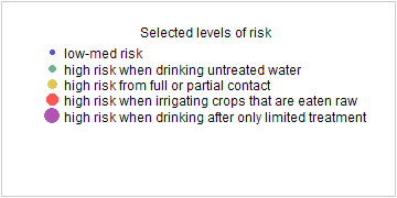
Risk based on E. coli if recorded, otherwise on faecal coliforms |
| E. coli |
faecal coliforms |
drinking-
no treatment |
drinking-
limited treatment |
full or
partial
contact |
irrigation-
crops eaten raw |
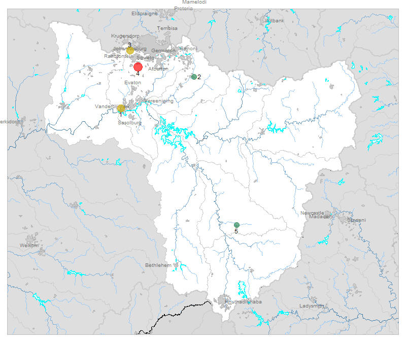
| 1 | 90616 [2-month plot]
Rietspruit at Kaalplaats (Rw RV2) |

|
2020-03-17 |
3100 |
3100 |
- |
7.5 |
- |
HIGH |
Med |
HIGH |
Med |
| 2 | 90697 [2-month plot]
(B8) Nigel R51 Road Bridge to Balfour |

|
2020-03-17 |
81 |
81 |
- |
8.1 |
- |
HIGH |
low |
low |
low |
| 3 | 90725 [2-month plot]
Klip River at R41 Witpoortjie U/S Durban Deep Mine |

|
2020-03-10 |
2100 |
2100 |
3 |
7.7 |
- |
HIGH |
Med |
HIGH |
Med |
| 4 | 90727 [2-month plot]
At Golden Highway Olifantsvlei van Wyk on Kliprivier |

|
2020-03-10 |
10000 |
78000 |
3 |
7.5 |
- |
HIGH |
Med |
HIGH |
HIGH |
| 5 | 189147 [2-month plot]
Warden 150 M upstream of Dam Wall on Cornelisrivier |

|
2020-03-17 |
59 |
59 |
50 |
7.6 |
- |
HIGH |
low |
low |
low |


