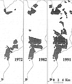
Figure 2 The changes in residential land cover in the eastern Rietspruit catchment, as determined from Landsat satellite images.
More recent colour figures are available for land cover in 1972, 1982 and 1991.