Acocks veld types of South Africa
acocks
Institute for Water Quality Studies metadata.
Summary created by Elna with catalog.aml on 1999-04-01 - 14:31:13
File owner: elise, last modified: 1 Apr (less than 1yr ago)
Map extent:
| -814132W | . | 957597E |
| -2319988S | - | 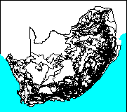 | - | -2319988S |
| -3887338S | . | . | . | -3887338S |
| -814132W | . | 957597E |
Projection information (see end of this page for details)
Projection ALBERS
latitude of projection's origin 0 0 0.000
Units METERS Spheroid CLARKE1880
Scale
1500000
Date
1982
Description
Acocks veld types of South Africa
Owner
National Botanical Institute
Owner_address
Private Bag X101
PRETORIA
0001
Owner_contact
Dr MC Rutherford, National Botanical Institute
Owner_country
South Africa
Owner_phone
(021) 804 3200
Owner_fax
(021) 804 3211
Owner_email
xxx@xxx.xxx.gov.za
Disclaimer
Copyright_message
State Copyright
Copyright_warning
State data - not in the public domain
Copies of digital data may not be given to third parties
History
Logo
 ../images/nbg
Annotation items, 1kbyte:
19 Mar 1994, elise:
Polygon items, 75kbyte:
19 Mar 1994, elise:
8 data fields
| ITEM | EXAMPLES | WIDTH | TYPE | REDEFINED? | INDEXED? |
|---|
| AREA | 152476832 | 4.3 | floatpnt | | |
| PERIMETER | 6791335.5 | 4.3 | floatpnt | | |
| ACOCKS# | 1 | 4.0 | binary | | |
| ACOCKS-ID | 38 | 4.0 | binary | | |
| VELD_TYPE | 18 | 4.0 | binary | | (Indexed) |
| DESCRIPTION | 'MIXED BUSHVELD' | 100 | character | | |
| KM2 | 152.48 | 10.2 | numeric | | |
| KM | 112.99 | 10.2 | numeric | | |
Map specifications:
  Description of SINGLE precision coverage /spek/waterm/wmdata/general/acocks

                                FEATURE CLASSES

                                    Number of  Attribute     Spatial
Feature Class          Subclass     Features   data (bytes)  Index?   Topology?
-------------          --------     ---------  ------------  -------  ---------
ARCS                                     1389
POLYGONS                                  549       140      Yes      Yes
NODES                                    1017
ANNOTATIONS             (blank)             0

                               SECONDARY FEATURES

Arc Segments                            93631
Polygon Labels                            548

                                   TOLERANCES

Fuzzy   =                 0.694 V          Dangle  =                 0.000 N

                               COVERAGE BOUNDARY

Xmin =              -733599.125            Xmax =               877063.688
Ymin =             -3806804.500            Ymax =             -2400521.250

                                     STATUS

The coverage has not been Edited since the last BUILD or CLEAN.

                          COORDINATE SYSTEM DESCRIPTION

Projection               ALBERS
Units                    METERS             Spheroid             CLARKE1880
Parameters:
1st standard parallel                                  -18  0  0.000
2nd standard parallel                                  -32  0  0.000
central meridian                                        24  0  0.000
latitude of projection's origin                          0  0  0.000
false easting (meters)                                       0.00000
false northing (meters)                                      0.00000