| 130442E | . | 853468E | ||
| -2356272S | - | | - | -2356272S |
| -3044347S | . | . | . | -3044347S |
| 130442E | . | 853468E |
Projection information (see end of this page for details)
Projection ALBERS
latitude of projection's origin 0 0 0.000
Units METERS Spheroid CLARKE1866
Scale
50000
Date
1994
Description
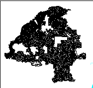
South African farm boundaries - former Transvaal
Owner
Chief Directorate of Surveys and Land Information
Owner_address
Department of Land Affairs
Private Bag
MOWBRAY
7705
Owner_contact
Thomas Krieg
Owner_country
South Africa
Owner_phone
(021) 685 4070 x 143
Owner_fax
(021) 689 1351
Owner_email
xxx@xxx.xxx.gov.za
Disclaimer
Copyright_message
State Copyright
Copyright_warning
State data - not in the public domain
Copies of digital data may not be given to third parties
History
1994 - Digital data supplied to Department of Water and Sanitation

  Logo
 ../images/s&li
Arc items, 1549kbyte:
13 Sep 1994, elise:
10 data fields
ITEM EXAMPLES WIDTH TYPE REDEFINED? INDEXED? FNODE# 0 4.0 binary TNODE# 0 4.0 binary LPOLY# 0 4.0 binary RPOLY# 0 4.0 binary LENGTH 0.2490471303463 4.3 floatpnt FARM_BOUND# 1 4.0 binary FARM_BOUND-ID 1 4.0 binary NAME 0000JS0000 40 character CLASS PLASE 40 character Z 0 4.0 binary
Map specifications:
Description of SINGLE precision coverage /spek/waterm/wmdata/general/farm_bound

                                FEATURE CLASSES

                                    Number of  Attribute     Spatial
Feature Class          Subclass     Features   data (bytes)  Index?   Topology?
-------------          --------     ---------  ------------  -------  ---------
ARCS                                    14164       112

                               SECONDARY FEATURES

Tics                                        4
Arc Segments                           199145

                                   TOLERANCES

Fuzzy   =                65.730 N          Dangle  =                 0.000 N

                               COVERAGE BOUNDARY

Xmin =               163306.922            Xmax =               820603.375
Ymin =             -3011482.500            Ymax =             -2389137.000

                                     STATUS

The coverage has not been Edited since the last BUILD or CLEAN.

                          COORDINATE SYSTEM DESCRIPTION

Projection               ALBERS
Units                    METERS             Spheroid             CLARKE1866
Parameters:
1st standard parallel                                  -18  0  0.000
2nd standard parallel                                  -32  0  0.000
central meridian                                        24  0  0.000
latitude of projection's origin                          0  0  0.000
false easting (meters)                                       0.00000
false northing (meters)                                      0.00000