Catchments of South Africa - quaternary
hca_quater
Institute for Water Quality Studies metadata.
Summary created by Elna with catalog.aml on 1999-04-01 - 14:34:42
File owner: elna, last modified: 1 Apr (less than 1yr ago)
Map extent:
| -812452W | . | 957182E |
| -2319445S | - | 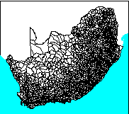 | - | -2319445S |
| -3887253S | . | . | . | -3887253S |
| -812452W | . | 957182E |
Projection information (see end of this page for details)
Projection ALBERS
latitude of projection's origin 0 0 0.000
Units METERS Spheroid CLARKE1880
Scale
1000000
Date
1990
Description
Catchments of South Africa - quaternary
Owner
Water Research Commission
Owner_address
Water Research Commission
PO Box 824
PRETORIA
0001
Owner_contact
Hugo Maaren
Owner_country
South Africa
Owner_phone
(012) 330 0340
Owner_fax
(012)
Owner_email
hugo@wrc.ccwr.ac.za
Disclaimer
No responsibility for the accuracy of the data is accepted.
Copyright_message
Raw data from a variety of State and private sources
Copyright_warning
Data products may only be used for water research.
History
1996 - Water Research Commission report number 298/1/94

       (DC Midgley, WV Pitman & BJ Middleton, Surface Water Resources of

        South Africa 1990 - User's Manual - ISBN 1 86845 143 7)

1996 - CATNUM dropped, separate coverages for tertiary, secondary,

       primary catchments created - Mike Silberbauer.

Some of the fields included as attributes:

CMAP  Mean annual precipitation in mm

MAR   Mean annual runoff in mm

MAR4Q Mean annual runoff in million cubic metres

MARnQ Mean annual runoff in million cubic metres at the n-ary level


Related lookup table: hca_q_mnth.lut

Mean monthly runoff in mm, from WR90:

COLUMN   ITEM NAME        WIDTH OUTPUT  TYPE N.DEC  ALTERNATE NAME     INDEXED?

    1  QUATERNARY             4     4     C      -                        -

    5  Q_JAN                  4    12     F      2                        -

    9  Q_FEB                  4    12     F      2                        -

   13  Q_MAR                  4    12     F      2                        -

   17  Q_APR                  4    12     F      2                        -

   21  Q_MAY                  4    12     F      2                        -

   25  Q_JUN                  4    12     F      2                        -

   29  Q_JUL                  4    12     F      2                        -

   33  Q_AUG                  4    12     F      2                        -

   37  Q_SEP                  4    12     F      2                        -

   41  Q_OCT                  4    12     F      2                        -

   45  Q_NOV                  4    12     F      2                        -

   49  Q_DEC                  4    12     F      2                        -


  Logo
 /hri/db/clip/wrc
Annotation items, 4kbyte:
12 Mar (less than 1yr ago), elna:
Polygon items, 190kbyte:
12 Mar (less than 1yr ago), elna:
23 data fields
| ITEM | EXAMPLES | WIDTH | TYPE | REDEFINED? | INDEXED? |
|---|
| AREA | 1764610048 | 4.3 | floatpnt | | |
| PERIMETER | 7036865 | 4.3 | floatpnt | | |
| HCA_QUATER# | 1 | 4.0 | binary | | |
| HCA_QUATER-ID | 1 | 4.0 | binary | | |
| QUATERNARY | A71L | 4 | character | | |
| CATID | 1 | 4.0 | binary | | |
| CMAP | 287.84 | 8.2 | numeric | | |
| MAR | 1.9 | 6.1 | numeric | | |
| CURVE | 6 | 3.0 | integer | | |
| HYDROZ | X | 1 | character | | |
| MAR4Q | 3.35 | 10.2 | numeric | | |
| TERTIARY | A71 | 3 | character | | |
| TERT-ID | 1 | 4.0 | binary | | |
| MAR3Q | 53.56 | 10.2 | numeric | | |
| SCND-ID | 1 | 4.0 | binary | | |
| SECONDARY | A7 | 2 | character | | |
| MAR2Q | 71.9 | 10.2 | numeric | | |
| PRIM-ID | 1 | 4.0 | binary | | |
| PRIMARY | A | 1 | character | | |
| MAR1Q | 2386.34 | 10.2 | numeric | | |
| QAT_LETTER | L | 1 | character | (ReDefined) | |
| TER_LETTER | 1 | 1 | character | (ReDefined) | |
| SEC_LETTER | 7 | 1 | character | (ReDefined) | |
Map specifications:
Description of SINGLE precision coverage /spek/waterm/wmdata/general/hca_quater

                                FEATURE CLASSES

                                    Number of  Attribute     Spatial
Feature Class          Subclass     Features   data (bytes)  Index?   Topology?
-------------          --------     ---------  ------------  -------  ---------
ARCS                                     6092
POLYGONS                                 1947       100               Yes
NODES                                    4147
ANNOTATIONS             (blank)            25

                               SECONDARY FEATURES

Tics                                      124
Arc Segments                           394128
Polygon Labels                           1946

                                   TOLERANCES

Fuzzy   =                 0.766 V          Dangle  =                 0.000 N

                               COVERAGE BOUNDARY

Xmin =              -732014.125            Xmax =               876744.312
Ymin =             -3806815.250            Ymax =             -2399882.500

                                     STATUS

The coverage has not been Edited since the last BUILD or CLEAN.

                          COORDINATE SYSTEM DESCRIPTION

Projection               ALBERS
Units                    METERS             Spheroid             CLARKE1880
Parameters:
1st standard parallel                                  -18  0  0.000
2nd standard parallel                                  -32  0  0.000
central meridian                                        24  0  0.000
latitude of projection's origin                          0  0  0.000
false easting (meters)                                       0.00000
false northing (meters)                                      0.00000