Catchments of South Africa - tertiary
hca_tertiary
Institute for Water Quality Studies metadata.
Summary created by Elna with catalog.aml on 1999-04-01 - 14:35:20
File owner: elna, last modified: 1 Apr (less than 1yr ago)
Map extent:
| -812452W | . | 957182E |
| -2319445S | - | 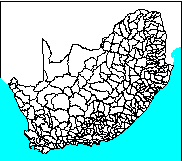 | - | -2319445S |
| -3887253S | . | . | . | -3887253S |
| -812452W | . | 957182E |
Projection information (see end of this page for details)
Projection ALBERS
latitude of projection's origin 0 0 0.000
Units METERS Spheroid CLARKE1880
Scale
1000000
Date
1990
Description
Catchments of South Africa - tertiary
Owner
Water Research Commission
Owner_address
Water Research Commission
PO Box 824
PRETORIA
0001
Owner_contact
Hugo Maaren
Owner_country
South Africa
Owner_phone
(012) 330 0340
Owner_fax
(012)
Owner_email
hugo@wrc.ccwr.ac.za
Disclaimer
No responsibility for the accuracy of the data is accepted.
Copyright_message
Raw data from a variety of State and private sources
Copyright_warning
Data products may only be used for water research.
History
1996 - Water Research Commission report number 298/1/94

       (DC Midgley, WV Pitman & BJ Middleton, Surface Water Resources of

        South Africa 1990 - User's Manual - ISBN 1 86845 143 7)

1996 - CATNUM dropped from hca_4, separate coverage for tertiary

       catchments created - Mike Silberbauer.

See quaternary coverage for attribute details.

  Logo
 /hri/db/clip/wrc
Annotation items, 4kbyte:
12 Mar (less than 1yr ago), elna:
Polygon items, 17kbyte:
12 Mar (less than 1yr ago), elna:
14 data fields
| ITEM | EXAMPLES | WIDTH | TYPE | REDEFINED? | INDEXED? |
|---|
| AREA | 12306194432 | 4.3 | floatpnt | | |
| PERIMETER | 7036865 | 4.3 | floatpnt | | |
| HCA_TERTIARY# | 1 | 4.0 | binary | | |
| HCA_TERTIARY-ID | 1 | 4.0 | binary | | |
| TERTIARY | A71 | 3 | character | | |
| TERT-ID | 1 | 4.0 | binary | | |
| MAR3Q | 53.56 | 10.2 | numeric | | |
| SCND-ID | 1 | 4.0 | binary | | |
| SECONDARY | A7 | 2 | character | | |
| MAR2Q | 71.9 | 10.2 | numeric | | |
| PRIM-ID | 1 | 4.0 | binary | | |
| PRIMARY | A | 1 | character | | |
| MAR1Q | 2386.34 | 10.2 | numeric | | |
| TER_DIGIT | 1 | 1 | character | (ReDefined) | |
Map specifications:
Description of SINGLE precision coverage /spek/waterm/wmdata/general/hca_tertia

                                FEATURE CLASSES

                                    Number of  Attribute     Spatial
Feature Class          Subclass     Features   data (bytes)  Index?   Topology?
-------------          --------     ---------  ------------  -------  ---------
ARCS                                      948
POLYGONS                                  279        64               Yes
NODES                                    4145
ANNOTATIONS             (blank)            25

                               SECONDARY FEATURES

Tics                                      124
Arc Segments                           204052
Polygon Labels                            278

                                   TOLERANCES

Fuzzy   =                 0.766 V          Dangle  =                 0.000 N

                               COVERAGE BOUNDARY

Xmin =              -732014.125            Xmax =               876744.312
Ymin =             -3806815.250            Ymax =             -2399882.500

                                     STATUS

The coverage has not been Edited since the last BUILD or CLEAN.

                          COORDINATE SYSTEM DESCRIPTION

Projection               ALBERS
Units                    METERS             Spheroid             CLARKE1880
Parameters:
1st standard parallel                                  -18  0  0.000
2nd standard parallel                                  -32  0  0.000
central meridian                                        24  0  0.000
latitude of projection's origin                          0  0  0.000
false easting (meters)                                       0.00000
false northing (meters)                                      0.00000