Cities and towns of South Africa
pppoint
Institute for Water Quality Studies metadata.
Summary created by Elna with catalog.aml on 1999-04-01 - 14:53:34
File owner: michael, last modified: 1 Apr (less than 1yr ago)
Map extent:
| -1468496W | . | 1866520E |
| -1449702S | - | 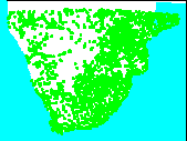 | - | -1449702S |
| -3957822S | . | . | . | -3957822S |
| -1468496W | . | 1866520E |
Projection information (see end of this page for details)
Projection ALBERS
latitude of projection's origin 0 0 0.000
Units METERS Spheroid CLARKE1866
Scale
1000000
Date
1992?
Description
Cities and towns of South Africa
Owner
Environmental Systems Research Institute, Inc. (ESRI)
Owner_address
380 New York Street,
REDLANDS
California
92372 USA
Owner_contact
Contracts Manager
Owner_country
United States of America
Owner_phone
1-909-793-2853
Owner_fax
1-909-793-????
Owner_email
esri.com
Disclaimer
The database is provided "as-is", without warranty of any kind,
either express or implied, including, but not limited to, the implied
warranties of merchantability and fitness for a particular purpose,
with respect to the database and related materials.
Copyright_message
The licensee shall not sell, rent, lease, sublicense, lend, assign, time-share,
or transfer, in whole or in part, or provide unlicensed Third Parties access
to the Database, Related Materials, any updates or Licensee's rights
under this Agreement.
The Licensee shall not reverse engineer, decompile, or disassemble in an
attempt to duplicate the proprietary and copyright-protected ESRI
ARC/INFO format.
Copyright_warning
ESRI retains exclusive ownership of the copy of the Database and Related
Materials.
History
1994-Digital Chart of the World: southern Africa extracted S of 15deg S.

1999-Cities and towns selected from DCW using ArcPlot and method in ch6 of Arc6

     librarian user's guide - extracted to new file

  Logo
 $WMSYS/ptool/template/esri_logo
Annotation items, 230kbyte:
25 Feb (less than 1yr ago), michael:
Point items, 137kbyte:
25 Feb (less than 1yr ago), michael:
7 data fields
| ITEM | EXAMPLES | WIDTH | TYPE | REDEFINED? | INDEXED? |
|---|
| AREA | 0 | 4.3 | floatpnt | | |
| PERIMETER | 0 | 4.3 | floatpnt | | |
| PPPOINT# | 1 | 4.0 | binary | | |
| PPPOINT-ID | 999 | 4.0 | binary | | |
| PPPTTYPE | 1 | 2.0 | integer | | |
| PPPTNAME | Uanhomba | 40 | character | | |
| PPPTFLAG | 9 | 2.0 | integer | | |
Map specifications:
  Description of SINGLE precision coverage /spek/waterm/wmdata/general/pppoint

                                FEATURE CLASSES

                                    Number of  Attribute     Spatial
Feature Class          Subclass     Features   data (bytes)  Index?   Topology?
-------------          --------     ---------  ------------  -------  ---------
POINTS                                   2336        60
ANNOTATIONS             (blank)          1417

                               SECONDARY FEATURES

Tics                                       84

                                   TOLERANCES

Fuzzy   =               303.183 N          Dangle  =                 0.000 N

                               COVERAGE BOUNDARY

Xmin =             -1316904.500            Xmax =              1714928.125
Ymin =             -3806230.000            Ymax =             -1601293.500

                                     STATUS

The coverage has not been Edited since the last BUILD or CLEAN.

                          COORDINATE SYSTEM DESCRIPTION

Projection               ALBERS
Units                    METERS             Spheroid             CLARKE1866
Parameters:
1st standard parallel                                  -18  0  0.000
2nd standard parallel                                  -32  0  0.000
central meridian                                        24  0  0.000
latitude of projection's origin                          0  0  0.000
false easting (meters)                                       0.00000
false northing (meters)                                      0.00000