| 14.334E | . | 34.944E | ||
| -20.062S | - | | - | -20.062S |
| -35.765S | . | . | . | -35.765S |
| 14.334E | . | 34.944E |
Projection information (see end of this page for details)
Scale
500000?
Date
1994
Description
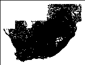
Roads of South Africa
Owner
Chief Directorate of Surveys and Land Information
Owner_address
Department of Land Affairs
Private Bag
MOWBRAY
7705
Owner_contact
Thomas Krieg
Owner_country
South Africa
Owner_phone
(021) 685 4070 x 143
Owner_fax
(021) 689 1351
Owner_email
xxx@xxx.xxx.gov.za
Disclaimer
Copyright_message
State Copyright
Copyright_warning
State data - not in the public domain
Copies of digital data may not be given to third parties
History
1994 - Digital data supplied to Department of Water and Sanitation

includes CLASS =

1  Other                18613

2  Secondary             6303

3  Main                   915

4  Nat_Route              166

5  Freeway                 60

  Logo
![]() $WMSYS/ptool/template/s_li_logo
$WMSYS/ptool/template/s_li_logo
Arc items, 2850kbyte:
10 Jan 1996, elise:
10 data fields
ITEM EXAMPLES WIDTH TYPE REDEFINED? INDEXED? FNODE# 24347 4.0 binary TNODE# 23975 4.0 binary LPOLY# 0 4.0 binary RPOLY# 0 4.0 binary LENGTH 0.3325923085212 4.3 floatpnt ROADS# 1 4.0 binary ROADS-ID 1 4.0 binary NAME ##012:18619 40 character CLASS Other 40 character Z 0 4.0 binary
Map specifications:
   Description of SINGLE precision coverage /spek/waterm/wmdata/general/roads

                                FEATURE CLASSES

                                    Number of  Attribute     Spatial
Feature Class          Subclass     Features   data (bytes)  Index?   Topology?
-------------          --------     ---------  ------------  -------  ---------
ARCS                                    26057       112
NODES                                   46724

                               SECONDARY FEATURES

Tics                                        4
Arc Segments                           573267

                                   TOLERANCES

Fuzzy   =                 0.002 N          Dangle  =                 0.000 N

                               COVERAGE BOUNDARY

Xmin =                   15.271            Xmax =                   34.007
Ymin =                  -34.828            Ymax =                  -20.999

                                     STATUS

The coverage has not been Edited since the last BUILD or CLEAN.

                          NO COORDINATE SYSTEM DEFINED