Some South African towns - a coarse coverage for temporary use only.
sa_towns
Institute for Water Quality Studies metadata.
Summary created by Elna with catalog.aml on 1999-04-01 - 14:56:32
File owner: elise, last modified: 1 Apr (less than 1yr ago)
Map extent:
| -763144W | . | 859821E |
| -2352350S | - | 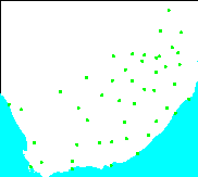 | - | -2352350S |
| -3804585S | . | . | . | -3804585S |
| -763144W | . | 859821E |
Projection information (see end of this page for details)
Projection ALBERS
latitude of projection's origin 0 0 0.000
Units METERS Spheroid CLARKE1880
Scale
50000?
Date
1993?
Description
Some South African towns - a coarse coverage for temporary use only.
Owner
Department of Water and Sanitation
Owner_address
ISUS, Residensie Building
Department of Water and Sanitation
Private Bag X313
PRETORIA
0001
Owner_contact
Chief Engineer of Strategic Planning
Owner_country
South Africa
Owner_phone
(021) 299 9111
Owner_fax
(021) 323 2123
Owner_email
xxx@dwaf.pwv.gov.za
Disclaimer
Towns digitised for temporary use - not accurate.
Copyright_message
State Copyright
Copyright_warning
State data - not in the public domain
Copies of digital data may not be given to third parties without permission
History
Some South African towns digitised by ISUS, DWAF.

  Logo
 ../images/s&li
Annotation items, 1kbyte:
12 Dec 1994, elise:
Point items, 2kbyte:
19 May 1998, elise:
5 data fields
| ITEM | EXAMPLES | WIDTH | TYPE | REDEFINED? | INDEXED? |
|---|
| AREA | 0 | 4.3 | floatpnt | | |
| PERIMETER | 0 | 4.3 | floatpnt | | |
| SA_TOWNS# | 1 | 4.0 | binary | | |
| SA_TOWNS-ID | 4 | 4.0 | binary | | |
| NAME | Messina | 20 | character | | |
Map specifications:
 Description of SINGLE precision coverage /spek/waterm/wmdata/general/sa_towns

                                FEATURE CLASSES

                                    Number of  Attribute     Spatial
Feature Class          Subclass     Features   data (bytes)  Index?   Topology?
-------------          --------     ---------  ------------  -------  ---------
POINTS                                     46        36
ANNOTATIONS             (blank)             0

                               SECONDARY FEATURES

Tics                                       64

                                   TOLERANCES

Fuzzy   =               211.145 N          Dangle  =                 0.000 N

                               COVERAGE BOUNDARY

Xmin =              -689372.438            Xmax =               786049.500
Ymin =             -3730813.500            Ymax =             -2426120.750

                                     STATUS

The coverage has edit masks, use BUILD or CLEAN to restore topology

                          COORDINATE SYSTEM DESCRIPTION

Projection               ALBERS
Units                    METERS             Spheroid             CLARKE1880
Parameters:
1st standard parallel                                  -18  0  0.000
2nd standard parallel                                  -32  0  0.000
central meridian                                        24  0  0.000
latitude of projection's origin                          0  0  0.000
false easting (meters)                                       0.00000
false northing (meters)                                      0.00000