7. INFORMATION REQUIREMENTS
In the assessment of information requirements two different levels will be considered, namely
7.1 Information Required To Set Up a Catchment Management Strategy
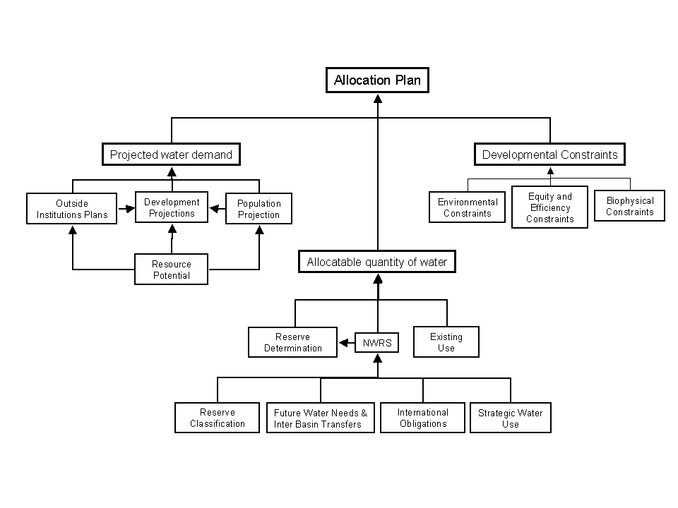
The central focus of any CMS developed by a CMA is the water allocation plan. In order to develop a CMS, and consequently the water allocation plan, the CMA must first determine the allocatable quantity of water available in the WMA. The allocatable quantity of water could perhaps be defined as the amount of water available for use within a particular catchment or area at a certain level of risk. It is also necessary within the allocation plan to take into account the future water demand and constraints that may limit development. Therefore, when formulating the allocation plan, water managers need information on
Figure 4 Considerations and information requirements needed for the development of a catchment allocation plan
To determine the allocatable quantity of water within a particular area, the CMA must first take into account criteria set out in the NWRS. Hence, before any water can be allocated to specific users the CMA must set aside specific quantities of water to fulfil the reserve quantity and quality requirements, international obligations, water users of strategic importance and future water needs and inter basin transfers set out in the NWRS. Once these have been taken into account, it is necessary to determine the actual level of water use in the catchment by different water users. In this regard an initiative is currently underway whereby all water users must register their water use.
For any CMA to institute a practical allocation plan it is necessary for the paper water to correspond to real water. This means that not only is accurate information on current water use required but that the modelling of such systems needs to reflect the reality in terms of both the temporal and spatial scale that water use is operated at and decisions are made.
The reserve is perhaps the most fundamental aspect of allocatable water determination. The reserve determination has implications for both the sustainability criteria and equity criteria in the NWA (1998) and, hence, deserves special mention in this analysis.
The reserve is defined as the quantity and quality of water required for basic human needs, as well as the quantity and quality of water required to sustain the aquatic ecosystem. The basic human needs reserve provides for the essential needs of individuals served by the water resource and includes water for drinking, for food preparation and for personal hygiene (NWA, 1998). The basic human needs reserve is essentially a function of the population and could be determined on an annual basis in the course estimate required for the implementation of the NWRS.
The ecological reserve is essentially the quantity and quality of water required to ensure that rivers, estuaries, wetlands and aquifers are sustained in a predetermined condition (Hughes, 1999). The predetermined condition is referred to as the Environmental Management Class (EMC) and is associated with the amount that the required condition varies from the natural or pristine condition. There are four main classes (A to D), where A refers to a condition that is mostly natural, while D refers to a condition that is highly modified where there is large loss of natural habitat, biota and ecosystem functioning (Hughes, 1999). It is essentially the responsibility of DWAF, with stakeholder participation, through the authority of the Minister of Water and Sanitation to determine EMC for a specific water body.
While it is the responsibility of DWAF to classify the resource according to its EMC the estimation of the reserve at a national level is an enormous task and, hence, a simplified version needs to be instituted for the NWRS. Owing to the coarse level of information required in the NWRS it would be acceptable to determine the water quality and quantity requirements (Environmental Flow Requirements) at an annual level. The onus would then fall on the CMAs as part of the CMS to perform a more detailed investigation of the environmental flow requirements, which conform, to the estimates and classification determined in the NWRS.
While the basic human need remains relatively constant, the environmental reserve fluctuates on a daily basis in some cases on a sub daily basis. In order to implement the reserve at a catchment and sub-catchment level the CMA will need water quantity and quality information on at least a daily basis from both its modelling and monitoring systems.
Allocatable quantity of water is often determined by means of systems yield, which is the amount of water that a catchment system is able to supply at a certain risk of failure. In terms of water availability in modelling the system the CMA may need more detailed information than just the systems yield as it may be critical to determine water availability at different points in the catchment. Hence, information is required for both individual and potential users as well as the system as a whole.
In order to develop a CMS and its associated allocation plan the CMA needs information on projected water demands in different sectors of the economy. Water demands are influenced by population and development trends, which are in turn influenced by socio-economic factors acting within and on the WMA. The demand projections are also influenced by the institutional arrangements in the WMA.
In assessing potential projected water demands it is important for the CMA to take into account outside institutional developments and it is hence necessary for the CMA to foster co-operative governance relationships with other government departments and parastatal organisations. Consultation with stakeholders is also essential in determining developmental plans.
Demographic information is needed to assess population trends. Population trends affect both the basic human needs reserve as well as developmental water demands within a WMA.
Socio-economic factors influence industrial, commercial and agricultural development in a WMA. These factors, combined with population dynamics, influence the quantity and distribution of water demand. Resource potential is on of the major overriding factors that will limit population growth and development in South Africa. Hence, information on the resource potential is critical in determining the water demand in a particular WMA.
Developmental constraints are aspects that will restrict development in certain areas. These consist of environmental constraints that include conservation areas such as game parks as well as areas of high biodiversity. In such cases the loss of such areas could cause irreversible damage within the catchment area and significantly impact the sustainability.
The resource potential is another major constraint, where in the case of agriculture and forestry the biophysical potential of the area has a major impact on the types of crops that can be grown in particular areas. Resource potential is also limiting in other primary activities such as mining where the distribution of mineral deposits is a major limiting factor.
Other constraints that may inhibit development are infra-structural constraints such as access to efficient transport routes. Distance can also be a major constraint where distance from markets or mills can significantly increase transport costs and impacting on the economic viability of specific enterprises.
The equity, efficiency and sustainability criteria set out in the NWA (1998) can place major constraints on development. In terms of equity certain developments may only take place once the discrimination of the past has been redressed. The efficient, beneficial use of water is another factor that needs to be considered in undertaking a project or proposed development and can have a major impact on development if a water use is considered inefficient.
7.2 Information Required To Assess Individual License Applications
In terms of individual licenses the CMA needs to assess the following main criteria before it can issue a license:
Each of these criteria is dealt with in more detail in the following sections.
The CMA water manager reviewing the various license applications needs to assess if the water license in question is in line with the both the NWRS and the CMS. Before issuing water use licenses the CMS and the NWRS should have been developed and the necessary information will be passed down to water resource managers assessing the licenses.
The CMS, which must be in compliance with the NWRS, should allow the manager to assess the license in terms of the following criteria set out in Section 27 of the NWA (1998), namely
The information required to assess the licenses in terms of these criteria is therefore the same as those needed to develop the CMS, which has been discussed in Section 7.1 of this document.
In addressing this question two aspects in Section 27 of the NWA (1998) are addressed which are
To assess the equity criteria, in terms of redressing the results of past racial and gender discrimination, information on the existing status quo in terms of catchment water use is needed. This aspect is already being addressed through the water registration process where all water users are being registered with the WARMS system. This aspect should also be provided for in the CMS to some extent, as certain developmental plans will already incorporate the redressing of past racial discrimination. The information requirements for this type of decision consist of socio-economic information as well as hydrological information in terms of actual and projected water use.
The efficient, beneficial use of water in the public interest incorporates both the efficiency and sustainability criteria. In order to determine efficient water use both hydrological and economic information are required. Efficiencies can then be determined in terms of the economic return per unit of water used. Feed forwards and feedbacks in the economy need to be taken into account when assessing the economic returns and also lead to a better assessment of the beneficial use of water.
Beneficial use of water has not only an economic implication, but social and environmental implications too. The water use needs to be sustainable so as not to reduce the water resource carrying capacity and reduce the resource potential thereby having a negative impact in the long term on society. Social impacts of water use also need to be considered in terms of jobs created and benefit to communities as a whole. Social, economic and environmental information are required to assess the efficient and beneficial use of water.
The impact information required by the water manager in a CMA is outlined in two different aspects of Section 27 of NWA, namely
Modelling is thus required to provide social, economic, hydrological and environmental information to estimate the impact of a particular development might have. The modelling could consist of a suite of models that can take into consideration both hydrological impacts in terms of both quantity and quality, as well as social, economic and environmental impacts. The scale of information required would need to reflect the operations and decision framework of the development being considered and will need to be at least on a daily scale in terms of hydrology to get a accurate assessment of the water quantity and quality impacts. The next section addresses the modelling requirements for a DSS to support the CMS of a CMA.
7.3 Modelling Requirements
Our philosophy in tackling this document is not how the current set of modelling tools and methodologies can service the needs of the NWA (1998), but rather a more rounded perspective of what tools and methodologies need to be put into place in order to service the water resource use and management community in implementing the NWA.
Models are usually structured collections of physical laws and empirical observations written in mathematical terminology and combined in such a way as to produce a set of results based on a set of known and / or assumed conditions. In hydrology, such models are applied as real world decision tools in the planning, design and operation of hydrologically related systems and structures.
In the context of the DSS design being reviewed in this document the information requirements for both the development of the CMS and the actual assessment of license applications are the driving force behind the modelling requirements. Owing to the high level of stakeholder participation required by the NWA (1998) there are several generic model requirements needed to foster communication and understanding in the stakeholder community. These factors thus need to be discussed over and above the more technical modelling requirements needed to provide information for the CMS and licensing applications.
7.3.1 Generic modelling requirements needed to foster stakeholder interaction
Models are useful in generating information about the water resource systems so that options can be considered and decisions taken to manage the resource and resolve conflict. In the NWA (1998) there is a strong emphasis on stakeholder participation and indeed a CMA is comprised of members representing different stakeholder groups. The process of developing allocation plans and allocating water to different individuals has become not only a scientific but also a social process. This aspect places new demands on models and tools used in the decision making process. Information generated from models now needs to gain the trust of the stakeholder community in order to be accepted in decision making.
Information generated from the modelling process will need to be credible, trusted, and promote shared understanding (Dent, 1999). "This in turn could promote transparency in the modelling and decision making process leading to the acceptance of decision and a shared understanding of their consequences" (Dent, 1999).
The processes, which yield this type of information, need to be replicable and consistent, offering regular, affordable and meaningful communication among stakeholders and their representatives. The processes should be open and transparent enabling implicit assumptions and mental models to be made more explicit. Processes and models used need to overcome the barriers to communication between stakeholders, which arise from geographic, disciplinary and institutional / organisational separation. While these are the generic requirements that all modelling tools need to fulfil, the next section will concentrate on more specific modelling requirements of a DSS required to fulfil the objectives of the SEA in helping CMAs develop and implement a CMS.
7.3.2 Modelling requirements in the DSS designed to support the CMA
To set up an allocation plan several different levels of information are required. While the majority of the information required is in the form of raw data, such as landuse, water use, demographic information and biodiversity data (as described in Section 7.5), some information needs to be generated with the use of models, particularly in the case where planning projections are needed to expand beyond the catchments or WMAs current status.
While the discussion in this document is on a complete system concentrating on incorporating SEA principals and practice into CMAs the focus of this research is on the hydrological and economic components and while modelling requirements in terms of other aspects such as social and environmental will be mentioned the main focus will concentrate on hydrological and economic modelling.
The initial focus on developing a CMS and associated allocation plans is to determine the allocatable quantity of water. In order to perform this function it is necessary to determine
A complete allocation plan, however, must include projections on water demands into the future and prediction on how these demands are influenced by physical, environmental and social constraints. In the following sections a description of the modelling requirements needed to determine the allocatable quantity of water will be presented followed by those requirements needed to provide for future water demand projections.
The modelling requirements in terms of estimating the reserve are rather rigorous as the detail of the information required is high. While the information passed down from the NWRS in terms of reserve classification need not be rigorously defined, the information needed to implement the reserve needs to be far more detailed. For the purpose of implementing and determining the reserve water quality and quantity information is required on at least a daily basis and at a sub Quaternary Catchment scale. It is also necessary to estimate both the water quantity and quality from present conditions as well as those that would have occurred under relatively pristine conditions (Acocks? Veld Types or naturalised flows).
Models are also required to perform in a data poor environment where lack of streamflow data at gauging weirs is a major constraint in terms of model verification. This means that calibration modelling is not a viable alternative due to lack of gauging stations, while physically based process rainfall runoff modelling is able to provide both more reliable inputs at ungauged sites and for pristine conditions. Modelling needs to be able to incorporate operational hydrology to simulate the operating conditions in the catchment and will help in developing a strategy to implement and maintain the reserve.
The hydrological modelling requirements to assess the reserve can be summarised as follows:
Other modelling requirements that fall outside the hydrological estimates will include models on ecological variables.
7.3.4 Current status of water use in the catchment
The NWRS sets aside certain quantities of useable water for specific needs such international obligations, strategic water user, future water needs and interbasin transfers. The development of the NWRS requires broad level information, which is currently being provided by the WSAM. This model provides estimates on a yearly basis, which for the purposes of a CMA are too broad and need to be used as guidelines in developing and implementing the CMS.
Before allocation plans can begin it is necessary to model the catchment at current level of development and determine from this the actual quantity of water currently being used in the WMA. The current water use and the information provided from the NWRS will allow the CMA to determine the actual quantity of allocatable water left in the catchment. If, as has occurred in some catchments in South Africa, the allocatable quantity of water is less than the actual water use, the catchment is considered stressed and water supply needs to be augmented or the water demand need to be adjusted in order to bring it in line with the supply.
In modelling the actual quantity of water being used in the catchment cognisance needs to be taken of land and water use activities that impact the water resource. The model / models must also be able to account for the operational framework within the WMA, which incorporates all the water supply and demand systems within the catchment and how they are managed. In the past the estimates of actual quantity of water used were established using calibration models and statistical relationships derived from experimental results. The systems were modelled on monthly basis using system optimisation models, which could generate large sequences of stochastic results.
While these modelling techniques give a reasonable estimate of water use in a catchment or WMA, with the advent of the NWA (1998) and the requirements of the reserve to be operated at a daily scale as well as the more rigorous requirements on users to use water beneficially and efficiently, the information and associated modelling requirements have become more detailed.
Physical process based modelling systems are able to simulate current and past landuse, able to produce naturalised and denaturalised flows directly. In estimating the operational hydrology it is also necessary to simulate water use and management at the level of operational decisions, which is often less than a monthly time step where decisions are made on a daily to weekly basis. Physical process based modelling also has the advantage of representing the system more explicitly while the assumptions and results from empirical modelling are not explicit leading to lack of transparency and decreased bargaining power.
The modelling requirements to determine current land and water use can be summarised as follows:
7.3.5 Modelling projected water demands and developmental constraints
As has already been mentioned, the modelling of projected water demands requires demographic information, outside institutional plans, and developmental projections, which are inhibited by resource potential or have a direct impact on the resource potential. Developmental constraints include environmental constraints such as biodiversity value and conservation areas, biophysical constraints such as carrying capacity and production potential and social constraints such as equity considerations.
Development projections and demographic information can be obtained with simple population growth rate projection models which are superimposed over demographic trends in terms of rural urban migration patterns. Certain indicators could be used in collating population variables with water demands and industrial developments. In assessing outside institutional plans it is possible to identify specific areas of development and model the hydrological consequences. Hence, information on projected water demands can be determined from actual known consequences such as planned developments as well as projections connected with population growth and associated developments. All these factors are, however, limited by certain constraints and the resource potential.
Resource potential is essentially the potential that a natural resource has in supporting a specific type of activity. Resource potential in terms of agriculture is essentially a combination of different factors such as climate, altitude, slope and soils. Simple crop modelling could be combined with geographical information systems (GIS) to give estimates of biophysical landuse potentials. Yields from certain potential crops and livestock carrying capacity could also be modelled, which when combined with economic information will provide estimates of economic returns. Resource potential in terms of mining is a directly dependant on mineral deposit distributions, while certain industries may be constrained by lack of raw material in the near vicinity. These can all be mapped and determined combining simple modelling with GIS capabilities.
Constraints on the system, such as conservation areas and local zoning in terms of town planning, can once again be mapped using a GIS. Constraints, which may influence the economic viability of certain operations, such as distance from markets, and infrastructure can again be estimated using simplified algorithms combined with GIS data. Biodiversity values can also be calculated using a combination of indicators with different algorithms and GIS to map out areas of high and low biodiversity potential.
The hydrological impacts associated with the different water demand projections and landuse changes can be modelled using physical conceptual process based modelling systems where the system is not represented as empirical relationships but is represented explicitly as a set of physically based processes. The physically based hydrological modelling approach allows more flexibility in terms of planned scenarios as it can account for the unique and novel situations that arise. It is also necessary to incorporate operational systems modelling into the planning framework as it allows the modeller to assess the potential impacts of new and proposed schemes. Using the above approach future scenarios can be identified and built up and the interrelated hydrological, economic, social and environmental consequences can be identified.
In summary the modelling requirements associated with determining water demand projections are
7.3.6 Modelling required for the assessment of individual license applications
In terms of assessing any license application it is necessary to account for the factors outlined in Section 27 of the NWA (1998). In addition, the application is required to be in line with the CMS and the NWRS and, therefore, the modelling requirements need to be at least as rigorous as those required to develop the CMS and NWRS. In terms of individual license application it is necessary to estimate the hydrological, economic, social and environmental consequences of issuing or not issuing a specific license. It is only once all these factors have been taken into account that the license can be issued.
To estimate the environmental consequences of the issuing or refusing of a particular license it is necessary to estimate the associated impacts on the reserve in both terms of water quantity and quality. In such cases, depending on the type of development, whether it is a water use or a land use, which is being changed, it is necessary to model these impacts in terms of the operational framework on the system as whole. In the case of landuse change a physical process based model is needed, as calibration and empirical statistical modelling cannot account for novel situations that occur as the result of testing different scenarios. It is also necessary to include modelling that is able to handle operational hydrology. This could include system optimisation models and other modelling systems that can more explicitly account for the operation of a system by specifically determining operating rules.
Impacts on other users can also be estimated by combining physically processed based models with operational modelling. The socio-economic impacts are, however, a little more difficult to estimate and require resource potential estimates and viability constraints in terms of transport and environmental, to be combined with hydrological modelling. The hydrological modelling in terms of the operational hydrology which includes all the impacts of structures and associated operating rules, needs to provide not only the impact of different land and water use options on the system as a whole but also needs to represent the impact on other individual users within the system.
The modelling requirements in terms of hydrological modelling for the assessing individual license application could be summarised as follows:
Modelling requirements in terms of social and economic modelling could be summarised as follows:
In the sections to follow several different models (both local and international) are analysed in terms of their ability to satisfy the above criteria. A brief discussion of the present approach used in water resources management in South Africa and some of the perceived shortcomings in this approach is initially provided. This is followed by a description of different hydrological water quantity models and the identification of their suitability in terms of the factors mentioned in the initial parts of the Section 7.3 and perceived shortcomings in each case. A summary table describing model suitability in terms of certain criteria specifically mentioned for this project will conclude the modelling section.
The discussion will begin with a review the current modelling methodologies used in water resource assessment.
In the past in South Africa a "horses for courses" approach has been adopted in water resource management and practice. The belief being that specific water management and implementation tasks require information at specific levels of complexity, such tasks should then be supported by methods and models of a level of complexity and with data requirements that are at the appropriate level of the information required (Gorgens, 1999).
This philosophy has led to the use a multiple model approach where each specific model is designed to accomplish a certain task. The result is that when performing a water situation assessment a large array of different models are used with each performing a specific task. These models are then fed into each other using a series linking approach. A series linking approach takes the output from one model once it has completed running and feeds it into another model to execute some other function. The modelling methodology described in stepwise sequence below is a generalisation of the methodology used by many water situation assessment studies and is similar to the methodology currently being adopted on the Breede River. The methodology usually incorporates the following sequence with a set of different models being used.
While the multileveled, multidisciplinary, multi-model modelling approach does offer many advantages in choosing the level of detail which modelling can follow there has been some concern levelled at this particular approach in the international community. Mesarovic et al. (2000) express concern with following an integrated modelling approach which consists of developing models in different disciplines and linking them together without due regard to how much is known about the linkages. It could be suggested that an integrated model is only as good as its sub models. However, the problem of such an integrated modelling approach described above is not only with the models used but also lies in the linkages between the different sub models and their integration into the main overall model. Mesarovic et al. (2000) suggest that the while phenomenon within disciplines can be models with a degree of confidence, linking disciplinary models is highly conjectural. The series modelling approach in many ways ignores the linkages and can compromise the validity of results.
Added to this concern is the detail required in the implementation of the NWA (1998). Monthly modelling approach adopted by the Pitman ? WRYM combinations may not offer the solutions required. While finer scale modelling may be too complicated for many of the tasks required, the upward aggregation of variables from, say, daily to monthly, is a more accurate technique than that of disaggregating monthly to daily flows where many inaccuracies can be introduced.
Some concern has been levelled at the use of finer resolution models for exercises that require less information such as scoping or broad level assessments. Data limitations are often seen as constraints that inhibit model accuracies, and reduce the accuracy of upward aggregation. While, these concerns are extremely valid they ignore the recent advances in technology, which in the fields of remote sensing technology, geographic information systems and database development, are increasing the accuracy and validity of data, needed to feed many finer resolution process physical based models.
While, data needed for calibration models (in particular streamflow measurements) are inhibiting the use of coarse resolution calibration models, data needed to drive physical process based models such as landuse and soils information are becoming increasingly more accessible and accurate, making the use of physical process based methodologies increasing more attractive.
Calibration and statistical methods such as those described above are also becoming less attractive as they tend to be black box approaches, which do not make the assumptions explicit. The result is that, in general, such modelling efforts are less likely to have credibility in the stakeholder community who may not be able to understand the results produced. Whereas physically based process models have more complicated algorithms and are generally more time consuming to set up, the inputs and outputs are generally easier to understand as they represent real world quantities. Calibration models and statistical methods are, in general, situation specific and the results are non transferable to other areas or novel situations. This means that the testing of different scenarios and extending deriving estimates at ungauged sites can result in large inaccuracies with the use of calibration and statistical methods. In the next section of this chapter a more detailed perspective of different local and international models is provided.
This review of models is not intended to be exhaustive but concentrates on the main hydrological water quantity models currently available and in use in South Africa.
The Water Situation Assessment Model (WSAM), initially known as the Water Balance Model (WBM), was commissioned for development by the Directorate of Water Resource Planning of the Department of Water and Sanitation. The model development started towards the end of 1997, with the conceptual phase, which focused mainly on the development of model algorithms (Watson et al., 1999).
A direct implication of the NWA (1998) for overall resource planning, requires the establishment of a National Water Resource Strategy (NWRS), which must be taken into account by each CMA in their future formulation of catchment management plans (Wolff-Piggott et al., 1999). It is in this context that WSAM was developed to fulfil the need for a long term planning tool that is able to provide information on the balance between supply and demand for given user defined scenarios at different area based levels (Watson et al., 1999). WSAM is now almost complete and this tool should support decision-making behind the development of the NWRS by integrating available information on present and projected water requirements, as well as availability, to indicate surplus and deficits on a per-catchment basis across the country (Wolff-Piggott et al., 1999).
In the application of WSAM, the developers own words should be headed. WSAM was designed from the onset as a broad planning tool only. It was never the intention to compete with complex models of water resource systems. WSAM?s main function will always be to identify areas of water deficit before they occur and to test various options with relative ease, so that more promising options can be identified for further analysis.
WSAM is a broad level strategic model, where the processes are described on an annual basis and the algorithms are empirically derived using various statistical and calibration techniques. The water quantity assessments made using the model are too coarse to be used for individual licensing assessment and allocations plans set up by a CMA. Added to the coarse nature of the assessments are some concerns that could be raised with the method of gross yield accounting, which assumes a static description of the gross yield curves derived for each Quaternary Catchment in the South Africa.
In the words of the authors "gross yield is determined as a percentage of MAR using catchment specific storage-draft-frequency characteristics" (Schultz et al., 1999). This definition is based on the fact that a yield from a reservoir (or system of reservoirs) depends primarily upon the magnitude and degree of variability of the inflow stream, the storage capacity of the reservoir and the desired level of assurance of supply" (Watson et al., 2000). Again this is reiterated in the statement "the gross yield is sensitive to the variability and amount of flow as well as the size of the dam" (Schultz et al., 1999). As the gross yield curves are dependant on the magnitude and degree of variability, the assumption that the curves will not change, when structures or land uses that influence the variability such as dams and forestry are introduced into the catchment area, is highly questionable.
Added to this is the empirical nature of the methods derived. Although the model assumptions are made reasonably explicit, it could still be considered black box. It may, therefore, lack the credibility needed for it to be used as a tool by both water resource managers and stakeholders alike. The model does, however, offer many advantages in terms of broad assessment and its speed in processing makes it a reasonable tool to be used in a workshop environment. It should not be used as a tool for more intricate assessments such as the development of allocation plans and the assessment of individual licenses.
The WRSM90 model was developed to facilitate the completion of the surface water resources of South Africa 1990 study (Middelton et al., 1993). The WRSM90 monthly model is a PC based model, which uses the monthly Pitman model (Pitman, 1973, as cited in Jewitt and Görgens, 2000) as its main rainfall / runoff producing function. The WRSM90 model also incorporates a number of routines that enable, on a monthly basis, the simulation of
The model is supported by a range of GUIs and has been linked to a GIS database containing hydro-meteorological data and landuse information. The model does allow the user to configure multi-catchments multi-reservoir flow systems as well as the varying some of the landuse impacts over time.
The SHELL modelling package was developed by Ninham Shand and is essentially an extension of the WRSM90 model and allows for easier calibration of the model (Berg et al., 1991). SHELL also uses the Pitman monthly model as its main rainfall / runoff model and can also simulate the same set of impacts listed in the WRSM90 model via the incorporation of several other routines. The SHELL modelling system does, however, include more components that are able to simulate a larger range of time varying human and landuse impacts. Some of the more notable additional components include
The SHELL and WRYM models use the Pitman monthly model as their base flow generator. The Pitman monthly model is a calibration model and the results are not transferable to novel situations such as those produced at ungauged sites and in scenario generation. The models also use statistically derived quantities for modelling the use by alien vegetation and SFRAs. The models which are calibration and statistical are highly dependant on the modellers input variables, making the assumptions non explicit and it is essentially a black box modelling approach. This may result in lack of credibility and buy in from stakeholders, as there is a lack of consistency and transparency in the modelling.
Both these tools are relatively easily set up by the various model users. The estimates derived could be used for the broader planning issues in a catchment, and to gain an overall idea of the water resource situation. They may, however, not be adequate for the development of water allocation plans and the assessment of individual license applications.
There are two main network simulation models, which are commonly used in water resource analysis in South Africa are
There are other models available in the world that perform similar functions, however, not many have been used in South Africa. In this section the MIKE BASIN network simulation model will be included, as it has been used in the modelling of the Umgeni Catchment system.
WRYM was designed to assess the long-term yield capabilities of a system for a given operating policy. The WRYM is a general, multi-purpose, multi-reservoir simulation program, which can be used to analyse a system at a constant development level where the systems demands remain constant throughout the simulation period. The WRYM has been set up as a current state model to incorporate the following processes:
The WRYM model is capable of simulating a wide range of operating policies governing the allocation of water in a multi-purpose, multi-reservoir system. The WRYM model allows the user to define operating policies governing the allocation of water by altering the penalty structure associated with channels and reservoirs in the data sets used to run the model. The WRYM is based on the assumption that a flow network can represent a water resource system. The network can be analysed for each time period and solved using an efficient network solver (subset of linear programming techniques) with the careful selection of penalty structures. The network solver will solve a particular network problem using a minimum cost approach, where appropriate costs (penalty structures) are allocated to channels and reservoirs in such a manner as to define the relative "value" of water in each storage zone. The penalty structure is also selected to dictate the most attractive route (i.e. minimum penalty) for transferring the water from the storage zones to the demand centres.
The WRPM is more complex than the WRYM and was designed to carry out more detailed operating runs. The model is capable of modelling dynamic demands (increase over time) as well as changing system configurations. It can be used as a planning tool to assess the likely implementation dates of new schemes or resources and also as an operating tool to assist in the month-to-month operation of a system. It is based on the same optimisation techniques as the WRYM and uses penalty structures to route water through the system.
In lieu of the relatively short streamflow records available and the long critical periods associated with many reservoirs in South Africa, it was considered necessary to incorporate the capability of generating monthly stochastic streamflow sequences into the network simulation models WRYM and WRPM used in South Africa. The algorithms used in the GENMAC monthly stochastic streamflow simulation have been incorporated into both the WRYM and WRPM models. The routines used in the stochastic modelling of streamflow where originally developed by Pegram (1986) and when incorporated into the models can generate monthly stochastic streamflow simultaneously at up to 50 different inflow sites. The basic statistical properties of the historical streamflow sequences are maintained and the statistical cross correlations are preserved in the stochastic streamflow generation process (McKenzie and van Rooyen, 1997).
Both the WRYM and WRPM use monthly input although the WRPM can handle and use weekly data. The modelling technique used in both models is based on the penalty structure concept where the user attributes certain penalties (streamflow quantities or dam levels with a derived, usually arbitrary, relative cost associated with them) to different water users and dams in the system. The water is then routed through the system in terms of a least penalty concept. As the models are highly dependent on user defined penalty structures, which need to be defined relative to each other to describe the system operation properly, the models are extremely dependant on the users interpretation of the system. This means that the structure defined in the system can vary depending on the user and means that two different modellers could obtain extremely different results. This system leads to lack of transparency, consistency and credibility with the stakeholders.
The monthly estimates may be too coarse for those required by the CMA to develop the CMS and assess individual license applications. As the model requires monthly denaturalised or naturalised flow to generate the stochastic flow sequences a large amount of pre processing needs to be performed. The model results also require a large amount of post processing and are not in an easily translatable format (usually in the form of yield reliability curves). This again leads to lack of transparency.
Some concern has been raised about methods of testing the total system yield for failure. It is possible in the current structure of testing the model to have a failure in terms of individual demand while the system or sub system does not fail. This is due to the fact that the WRYM model works of a single main yield channel. It is hence possible that under particular circumstances the subsystem yield is satisfied while and individual demand linked to the main channel can fail (De Smidt et al., 1993). This can lead to problems in the equity criteria and requires large amounts of post processing analysis as individual water availability is not tested automatically.
The WRYM and WRPM models are DOS based systems, which are difficult to configure and set up. An attempt has been made to improve the setup with a more user friendly interface known as SAWRAM for the WRYM. The assumptions made in setting the model up are highly subjective in terms of the penalty structures. The high amount of pre and post processing also make the model tedious to run and results difficult for stakeholder to accept.
MIKE BASIN is a network model, which provides a mathematical representation of the river basin encompassing the configuration of the main rivers and their tributaries, the hydrology of the basin in space and time as well as existing and potential major schemes and their various demands of water. Rivers and their main tributaries are represented by a network of branches and nodes; the branches represent individual stream sections while the nodes represent confluences, diversions, locations where certain water activities may occur, or important locations where model results are required (MIKE-BASIN, 2001). The model operates on the basis of a digitised river network generated directly on the computer screen in ArcView GIS.
Time series data of catchment constitute the basic input to the model, while additional input files define reservoir characteristics and operation rules of each reservoir, meteorological time series, and data pertinent to each water supply or irrigation scheme such as diversion requirements and return flows.
Model output comprises information on the performance of each individual reservoir and associated hydropower units, as well as other schemes with water demands, such as irrigation. For the entire simulation period, the magnitude can thus be illustrated. Moreover, time series of river flow at all nodes are simulated enabling the user to determine the combined impact of selected schemes on river flows. All results can be visualized in various formats, including animation.
The MIKE BASIN model also needs generated pre process flows to run. The time step used can vary from daily to monthly depending on the type of simulation required. The operating rules are explicitly defined attaching certain operating conditions to reservoir levels or river levels and not through the penalty structure system of the WRYM and WRPM. Stochastic flow generation operations are available and have been derived for South African conditions (Kjeldsen, 2001, personal comm.). The model setup is relatively easy with the GIS linked system with GUI. User-friendly GUIs make pre and post processing far quicker and user friendly. The explicitly defined operating rules make the system more transparent the WRYM and WRPM. The speed of processing also makes this system an attractive alternative. However, the purchasing costs are extremely high and could prove prohibitively expensive.
The ACRU modelling system (Schulze, 1995), established at the University of Natal, is a deterministically based, physical-conceptual model revolving around a daily time step water budget. Internal state variables (e.g. soil moisture), model components (e.g. interception) as well as end-product model output (e.g. streamflow or sediment yield) have been widely verified under different hydrological regimes in Africa, Europe and the Americas.
This is an integrated multi-purpose modelling system which can be applied to design hydrology, crop yield modelling, reservoir yield simulation, irrigation water demand/supply, water resources assessment, planning optimum water resource utilisation and resolving conflict demands on water resources. At present the ACRU model has the ability to model sediment yield from a catchment with new developments, however, new routines should include options for phosphorus, nitrate and operational hydrology modelling (Network simulation).
Daily climate data is used in ACRU; however, more cyclic, less sensitive variables such as temperature or reference potential evaporation can be entered on a monthly level if daily values are not available. Fourier Analysis transforms these monthly inputs to daily inputs. The soil water and runoff regimes in the model are structured to be highly sensitive to land cover / use change. A database of inputs to ACRU at a Quaternary Catchment scale is already in place, which can be used to run the model. This structure that has been set up enables experienced users to run the model relatively quickly by changing input information in the database.
The model has been designed to be a multi-level model with a hierarchy of alternatives possible in many of its routines depending on the level of input data available. The ACRU model is physically processed base, with inputs being defined explicitly in terms of land and water use information. The information is hence transparent and allows for stakeholder understanding, interaction and query. The parameters are locally developed and are suited to South African conditions. The new water quality and systems operation components being introduced into the model allow for more flexibility. The system does not however include the stochastic runoff generation and many of the components still need to be developed.
HSPF is a model which consists of a set of modules arranged in a hierarchical structure, which permit the continuous simulation of a comprehensive range of hydrological and water quality processes (Bicknell et al., 1997).
HSPF is a multifunctional model, which incorporates a set of modules designed around features of the following models (Bicknell et al., 1997):
HSPF is more than a mere translation of the above models, as many of the modules have had extensions and modifications made to the algorithms in the course of accommodating them into the HSPF design framework. The modules are arranged in a hierarchical structure that enables the user to select the required modules to perform the simulations required.
The HSPF model is designed around a time series data management system. The sound data management component is designed to extract input data from the data management system and write output to the data management system with a minimum of user input. This system is designed to free modellers from becoming entangled in data manipulation, which would result in more time been spent on simulation work.
One of the major strengths of the model is its ability to simulate both water quantity and water quality providing a more integrated perspective of the catchment as a whole. The water quantity simulations include the ability to simulate both catchment hydrology and operational hydrology within a system. The model also has the ability to simulate water quality components on the land surface, in the river channel and in reservoirs, which it treats as simple mixed reactors. This integrated approach along with the data management facilities make the HSPF modelling system an extremely powerful tool, which could be used in water resources management.
The HSPF model is a parameter optimisation or calibration model in that it requires the model to be run repetitively to find the optimum value of its model parameters (Jewitt and Görgens, 2000). The model is able produce systems yield and other operational hydrological information such as water availability through the use of conditional special actions, which control user and reservoir operating rules. The calibration approach, however, means that the model cannot be used for scenario generation.
The model is extremely flexible and can operate with different time intervals ranging from seconds to years. It could be used with other process based models such as the ACRU model to produce a system that could handle most of the requirements of the DSS that have already been described. The problem is that many of the parameters are not suited or derived for local conditions and a large amount of translation of South African data is required to transform it into parameters suitable for use in the model. The time requirement to perform this transformation could prove to be prohibitive and the South African users would be tied in with USA needs and priorities in terms of further development.
The VTI (Variable Time Interval Model) (Hughes and Sami, 1994, as cited in Jewitt and Görgens, 2000) is an extended version of the single flood event model (OSE2) (Hughes, 1984; Hughes, 1989, as cited in Jewitt and Görgens, 2000), which has been adapted into a continuous time series model.
The model uses a variety of parameters. Some of these parameters have physical meaning, others are estimated from physical indices and some are completely empirical. The complexity of the model algorithms has been limited to prevent the models information requirements becoming too limiting. This model allows for simulation at a variable time interval according to user selected rainfall thresholds. The model is operated from within the HYMAS software package, which offers several support facilities for results analysis.
VTI uses a semi-distributed approach as opposed to a grid square or slope element. The model components are thus based on simulating the integrated response over sub-area, rather than at a representative point. As a result many of the functions are of a distribution type, where probability distributions represent the internal sub-area variation in hydrological processes. Two basic runoff generation methods are available; the one is dependent on rainfall intensity and the infiltration characteristics of the catchment soils, while the other depends on the dynamic moisture status of the catchment or sub-areas. A third runoff generation function allows for the simulation of groundwater baseflow.
No water quality constituents are simulated by the model, nor are any river channel transport processes. Only basic hydrological routing capabilities are offered. The VTI model has been reported as difficult to apply in cases where there is insufficient information on catchment physical characteristics. It has also been described as very empirical and difficult to calibrate when the processes involved are not well understood.
The Precipitation-Runoff Modelling System (PRMS) is a modular-design, deterministic, distributed-parameter modelling system developed to evaluate the impacts of various combinations of precipitation, climate and land use on streamflow, sediment yields and general basin hydrology. Basin response to normal and extreme rainfall and snowmelt can be simulated to evaluate changes in water balance relationships, flow regimes, flood peaks and volumes, soil-water relationships, sediment yields and ground water recharge. There is also a provision for parameter optimisation and sensitivity analysis within selected model parameters where both individual and joint effects on model output are evaluated. PRMS offers a flexible framework for continued model-system enhancement and hydrologic modelling research and development (USGS, 2001)
This is a useful physical process based hydrological model. There is, however, extremely little local expertise in the running of the model. The parameters are of a USA standard and would need to be transformed and tested in South Africa.
The Soil and Water Assessment Tool (SWAT) is river basin, or watershed, scale model developed for application in large, complex rural basins. SWAT is a continuous daily time-step model, which simulates the impacts of alternative land use management practices on surface and ground water, sediment and agricultural chemical yields in ungauged watersheds, over long periods of time. The model is capable of simulating hydrology, pesticide transport by runoff, percolate, and soil evaporation. In addition, SWAT allows for the simulation of nutrient cycling, erosion and sediment transport. Large river basins are subdivided into homogenous parts and each part is then analysed individually as well as its interaction with the whole.
The SWAT interface extracts spatially distributed parameters of elevation, land use, soil types and ground water table. The interface creates a number of input files for the basin and subbasins, including the subbasin routing structure file. Input consists of files, information from databases and information from a GIS interface. More specific information can be entered singly, for each area of the watershed as a whole. The SWAT-GIS linkage incorporates advanced visualization tools capable of statistical analysis of output data (Soil and Water Assessment Tool, 2001).
SWAT requires specific information about weather, soil properties and topography, vegetation and land management practices occurring in the watershed. The physical processes associated with water movement, sediment movement, crop growth, nutrient cycling and the like are directly modelled by SWAT using this input data. The benefits of this approach are that the relative impact of alternative impact data on water quality or other areas of interest can be quantified even in watersheds with no monitoring data (Arnold et al. 1993)
SWAT uses readily available inputs, is computationally efficient and enables users to study long-term impacts. A number of output files are generated by SWAT. The type of data stored in the file can group these files. Other than the standard output file, the files produced during a model run are formatted as spreadsheets to facilitate importation of the data into spreadsheet software.
The SWAT model is ideal for assessing land and water use impacts. It is a processed based model and requires easily understood input. The model was developed in the USA and there is some question as to its applicability to South African conditions. The model has been used by the CSIR to perform landuse impacts in South Africa. The model does not include operational hydrology and would need to be linked to a network simulation model to obtain yield and water availability estimates. It could be linked with models such as HSPF and MIKE BASINS to perform these components.
SAPWAT is a planning and management tool, which relies heavily on an extensive South African climate and crop database (SA Waterbulletin, 2000). One of the primary objectives of the SAPWAT development programme was to provide for the specific circumstances and requirements of emerging irrigation farmers and community gardens. The impact of irrigation practices and strategies on water budgets was an additional force driving the development of this model.
This model is general in its applicability, while it is able to simulate a variety of different management practices and irrigation methods. In addition, the effect of soil water management options such as deficit irrigation can be evaluated. SAPWAT also facilitates consultation and interaction with farmers and advisors.
SAPWAT is easy to apply from an operational point of view and demands minimum computer expertise (SA Waterbulletin, 2000). Moreover, this tool can be used in a variety of applications. SAPWAT principles have been recognised by the DWAF and incorporated in the irrigation inputs into the national water balance model. This model has also been indicated by the DWAF as the method for determining the annual irrigation requirement. "SAPWAT in the absence of general metering, enables all water use for irrigation to be quantified equally thereby ensuring a cost recovery in a fair and systematic manner" (SA Waterbulletin, 2000). The strength of SAPWAT lies in an extensive database that saves the user an enormous amount of time and effort. Furthermore, this model is designed to accommodate updated historic weather data to the present should the user require it. Although SAPWAT is not a real-time scheduling model it can be a valuable complement to instrumented soil water content methods.
The SAPWAT model is used to determine irrigated areas required demands and hence specify the allocations required by different users. It is not an overall catchment model and the model cannot estimate the impacts of a water use on other users within the catchment. If used with individual licensing applications it should be used in combination with other models that are able to determine impacts on specific users and the catchment as a whole.
7.3.9 Selection of hydrological model to use in DSS
In reviewing the different water quantity models available (Table 1) it was concluded that the new ACRU model, which is currently under development, fulfils the majority of the criteria required by the DSS. These include that is a physically based, daily time step model. Because the model is physically based it can test scenarios and be transferred to ungauged situations will reasonable confidence. The model is particularly suitable for land use impact studies. The daily resolution allows for IFRs which are assessed on a daily basis. The model needs to reflect the management level within the system where water users and water supply operators make decisions on daily to weekly time steps. The daily time step allows for the assessment of water quality issues, which can fluctuate on a daily and even sub-daily time step.
The new operational hydrological components currently being developed in the model allow for the assessment of different water use and water supply impacts. The model should be able to test the water availability yielded from the system as a whole as well as the water availability for individual users. The model has been developed under South African conditions and a pre-populated database exists for use with the Quaternary Catchments.
There have some questions raised in terms of the approach of using ACRU as the base hydrological model in the DSS. These questions are given in italics and responses to the questions follow each question:
Table 1 Summary table of the attributes of models used by DWAF
|
Model |
Calibration or physically based |
Operational hydrology |
Water quantity modelling |
System yield |
Individual water availability |
Water quality modelling |
Finest temporal scale |
Spatial scale |
Trans-parency and credibility |
Applicable to SA conditions |
User friendly |
Model under develop-ment |
|
WSAM |
Calibration |
Limited |
Yes |
No |
No |
No |
Annual |
Catchment |
Low |
Yes |
Yes |
Yes |
|
WRSM90 |
Calibration |
No |
Yes |
No |
No |
No |
Monthly |
Catchment |
Low |
Yes |
Yes |
No |
|
WRYM |
Calibration |
Yes |
Yes |
Yes |
No |
Limited |
Monthly |
System |
Low |
Yes |
No |
No |
|
WRPM |
Calibration |
Yes |
Yes |
Yes |
No |
Limited |
Monthly |
System |
Low |
Yes |
No |
No |
|
MIKE-BASIN |
Calibration |
Yes |
Yes |
Yes |
? |
No |
Daily |
Catchment |
Low |
Some recent develop-ments |
Yes |
Yes |
|
ACRU |
Physically based |
UD |
Yes |
UD |
UD |
Limited |
Daily |
Catchment |
High |
Yes |
No |
Yes |
|
HSPF |
Calibration |
Yes |
Yes |
Yes |
? |
Yes |
Sub-daily |
Catchment |
Medium |
No |
No |
Yes |
|
VTI |
Calibration |
No |
Yes |
No |
No |
No |
Sub-daily |
Low |
Yes |
No |
||
|
PRMS |
Physically based |
No |
Yes |
No |
No |
No |
Monthly |
Catchment |
No |
|||
|
SWAT |
Physically based |
No |
Yes |
Limited |
Daily |
Catchment |
High |
No |
Yes |
|||
|
SAPWAT |
Calibration |
No |
Yes |
Farm level |
Yes |
Yes |
UD = Under development
The ACRU model was developed using an algorithm that was developed using small catchments of less than 50 km2 (SCS). Can it be applied to larger catchment areas the size of the Quaternary Catchments?
The ACRU model is data intensive in terms of land use, soils, rainfall and other biophysical data. Does this not make the model extremely complex and hard to run requiring a large amount of set up time?
Is the data necessary to run the ACRU model available?
Which variables is the ACRU model most sensitive to? How much will slightly inaccurate information affect the model simulation results in terms of land use and soils?
How well does ACRU perform on first time estimates at a Quaternary Catchment scale?
Can the results from ACRU be used to produce stochastic runoff sequences of monthly flows to increase the existing record lengths?
Can this technique be replicated in other catchments and generic issues be addressed by incorporating this in with a database and a DSS?
This DSS will primarily be applied to water quantity issues, however, there needs to be the potential in future to address water quality issues as well. Therefore, in this section some water quality considerations are addressed.
Management of resource quality requires management of water quantity, water quality and habitat. Although water quantity and quality are interlinked and interdependent the complexity of the environment as well as the necessity in many cases to manage the water quality and quantity aspects independently in a catchment usually require these aspects to be addressed separately
7.4.1 Background in terms of the National Water Act (1998)
The NWA (1998) under Section 1 defines resource quality as the quality of all the aspects of the water resource including
Of particular concern in terms of water quality under Section 21 of the NWA are
In Section 137 of the NWA (1998) it is specified that monitoring systems must be established to assess, among other matters
Management of water quality issues occurs at a local scale and therefore water quality management plans, decisions and actions are generally at a sub-catchment scale. However, the decisions made have implications for downstream users (and upstream impactors). Therefore, alignment between sub-catchments within a WMA (and possibly between WMAs) is required.
Possible water quality problems include
In terms of domestic water supply there are various short and long term health impacts of deteriorating water quality. Aesthetic impacts include changes in odour, taste and colour. Economic impacts include increased treatment costs, scaling, corrosion or deposition of sediments in distribution systems.
In industrial plants water quality concerns include damage to equipment, problems in the manufacturing process as well as impairment of product quality. Agricultural industries could experience decreased crop yield, impaired crop quality, impaired soil suitability and / or damage to irrigation equipment owing to decreased water quality. Livestock farmers also rely on a certain water quality for efficient operations.
The Constitution of South Africa regards a healthy environment as a basic human right. In order to provide a healthy aquatic environment water quality managers and politicians needs water quality data and information to base water management actions and decisions on. To secure the availability of such data and information the National Water Act requires that the Minister, as soon as practicable to do so, establish national water quality monitoring systems.
7.4.2 Data required for addressing water quality issues
To address these aspects of water quality information is required on
Information on both point and non-point sources of pollution in a catchment is required. Point source pollution refers single source pollution, for example, from water works, industrial plants, sewage treatment sites or pipe outflows. Non-point source pollution refers to pollution that emanates from land use types, areas and activities that result in conveyance of pollutants is a manner other than through a discrete source. Non-point source pollution can result in diffuse and intermittent pollution over a widespread area. Alternatively it may be concentrated and associated with localized high activity areas such as mines, feedlots and landfills.
For water quality assessment in a catchment, information is required both on the desired water quality levels as well as the present condition of the quality of water in a catchment.
Water quality information in a catchment is available from a number of sources. The Department of Water and Sanitation (DWAF) operates the most comprehensive water quality monitoring programme in South Africa. DWAF is, in terms of the NWA, responsible for the coordination, organization, control and further development of national water resource quality monitoring programmes. Monitoring, recording, assessing and disseminating information on water resources is critically important for achieving the objectives of the NWA (Section 137).
A number of national water resource quality monitoring programmes are already in place. The national chemical water quality programme has been operational for many years. A national biomonitoring programme is currently being implemented.
Much of the responsibility for reporting on surface water quality in South Africa rests with the Institute for Water Quality Studies (IWQS) of DWAF. The water quality samples analysed at IWQS are obtained from about 1750 surface monitoring stations around South Africa, at gauging weirs (1200), lakes (450), springs (50), water purification works (35) and canals (15).
Many stations are monitored at two-weekly intervals, but some are only monitored intermittently and others are intensively monitored for short periods during specific investigations. The main chemical analysis is for major inorganic ions, while a few samples are tested for trace metals and organic compounds. Results are stored locally on a Laboratory Information Management System (LIMS) and at DWAF head office on part of its mainframe Hydrological Information System (HIS). About 40 000 borehole sample analyses are stored in a separate database.
The framework for monitoring and assessment of water resources at DWAF includes:
Other potential sources of water quality information in South Africa include water service providers such as water boards e.g. Umgeni Water, local authorities, metropolitan councils as well as research institutions, however, the key sources of water quality data and information need to be established for the catchment under investigation (DWAF, 2000; DWAF, 2001b; DWAF, 2001c) .
7.4.3 Modelling water quality issues
Information on the soils and general rainfall intensity of a catchment would allow modelling of sediment loads for example. Information on agricultural, industrial and mining water use is required to establish the amount of phosphorus and nitrate loading to model nutrient contents, for example, which have regional impacts.
Assessment techniques range from complex water quality process models for non-conservative variables, to simple mass balance models for conservative substances. Simple heuristic models based on previous studies may also prove to be valuable tools. In general, these assessment techniques should not focus on processes that lead to pollution, but rather on the impacts of pollution loads on water quality.
Configured and calibrated water quality predictive tools/ models can serve to
The temporal and spatial scales of water quality modelling need to be addressed. Ideally water quality status should be modelled on a daily basis owing to daily changes in water temperature and therefore water quality. In terms of spatial scales, modelling is best carried out at a catchment or sub-catchment scale. Sub-catchment scale modelling is required where instream flow requirements (IFR) need to be met and therefore modelling streamflows and water quality up until these IFR points is needed.
Catchment wide point and non-point source assessment techniques are also important in the formulation of source management objectives, as they indicate which sources are contributing to current pollution loads. These models may be quantitative or qualitative, and contribute to assessing the feasibility of pollution load reductions.
Streamflow modification associated with land use change is also a type of non-point source pollution, which can adversely affect the physical and biological integrity of surface waters. The management of non-point sources is complicated by the dispersed and variable nature of the impacts, being primarily driven by rainfall events. The potential lag between polluting activity and effect also complicates non-point source management. These characteristics obscure the impacts from different sources and restrict the opportunities for their measurement. Therefore, non-point source contributions can generally not be monitored directly, but have to be inferred by experience-based interpretation, mass balances against measured point source loadings, or simulation modelling. However, the importance of non-point source management in South Africa is increasing as point sources are better controlled and catchments are developed.
Regulations exist to control the quality of discharge from point source pollution outlets. However, the cumulative effect of pollution from point sources has resulted in degradation of the water quality in many South African rivers to the point of decreased fitness-of-use for specific water users. Consequently, the assessment of contaminant load contributions to streamflow and other water bodies originating from point sources is a prerequisite for understanding of water quality patterns and problems in catchments.
Other modelling issues include the importation of salts through inter-basin transfers and the need to predict the implications of future developments in a catchment on catchment water quality.
There are conflicting demands on the water source of a catchment to both supply water users with a desired level of water quality as well as to use the water source as a method of disposing of waste. It is necessary for stakeholders to express their water quality requirements in terms of "the impact of water quality on their livelihoods". These requirements are then compared to the present water quality status.
7.4.4 Models presently used for water quality modelling
The models used in South Africa for water quality modelling can be divided into five types, viz. simple process models, detailed process models, system analysis models, daily reservoir hydrodynamics models and sub-daily river hydrodynamics models. Brief descriptions of some of the models that fall under these categories are provided.
Hydrosalinity Model (WQT) ? monthly
This is a coarse-scaled model for salinity production and transport in large multi-use catchments, specially designed to be driven by the same natural flows that drive the Water Resources Yield Model (WRYM) and Water Resources Planning Model (WRPM) system analysis models. WQT is used to determine salinity parameters, which are then input to the WRPM model for multiple stochastic optimisation runs in large river systems.
IMPAQ (Impoundment/river Management and Planning Assessment tool for water Quality simulations) ? monthly
This is a medium-to-fine-scaled model for salinity, sediment and phosphate production and transport in large multi-use catchments, specially designed to be driven by the same natural flows that drive the WRYM and WRPM system analysis models outlined in (iii) below. It has a washoff routine that uses SCS Curve Numbers to allow any mix of land-uses to affect sediment and phosphate production, which are derived from a combination of loading functions, potency factors and the USLE approach. Non-conservative processes are allowed to play a role in a channel transport module and a simple mixed reactor reservoir module. IMPAQ is used in conjunction with WRYM to generate very long sequences of monthly loads/concentrations of selected constituents in large river systems.
ACRU ? daily
This is a fine-scaled model for sediment and phosphate production from individual small catchments with a limited range of agricultural land-uses. It is driven by daily rainfall and uses soil-moisture budgeting according to a discretisation based on soil texture classes and agricultural practices. It is recommended to investigate localised impacts of land-use and their related management options.
NACL ? daily
This is a medium-scaled model for salinity production and transport in large multi-use catchments. It is built around the relatively black-box daily Pitman rainfall-runoff model, it allows urban washoff as well as operation of reservoirs, wetlands, and coarse irrigation activities. It is recommended as background support for WQT applications where certain parts of a multi-use catchment require more detailed treatment, or to assess salinity management options.
DISA - daily
This is a fine-scaled model for salinity production and transport through formalised irrigation schemes and allows operation of supply reservoirs, river channel transport, diversion devices, primary and secondary canals, balancing dams, artificial drainage, groundwater variability and a wide range of irrigation practices. It is driven by daily rainfall and uses soil-moisture budgeting according to a discretisation based on soil texture classes, location on the landscape, and agricultural practices. It is recommended as support for any of the other models to assess irrigation impacts of large or multi-offtake irrigation schemes, or to examine management options for salinity control.
HSPF (Hydrological Simulation Program Fortran) - Sub-hourly to daily
This is a medium-to-coarse-scaled model for production and transport of salinity, temperature, sediment and a range of non-conservative constituents in medium-to-large multi-use catchments. Its water quality chemical simulation components are comprehensive and it uses relatively black-box rainfall-runoff functions, different forms of hydrological channel routing and treats reservoirs as simple mixed reactors. It may be used to assess water quality outcomes of management and operational options in medium-to-large catchments.
Detailed process models incorporate sophisticated processes, such as adsorption-desorption, decay and plant uptake, into the simulation of contaminant movement and transformation in soil and water. These contaminant processes are integrated with relatively complex hydrological and sediment models.
The following two models are used to optimise the allocation of water on a monthly basis throughout a large multi-use river system, according to a penalty structure, for a given time horizon of water demands and allowing stochastic variation.
WRYM
This model is used to calculate the long-term yield from a specific flow series, to examine operating rules or to develop yield-reliability curves.
WRPM
WRPM allows various sub-systems to support each other during deficit periods and is used as a planning tool to explore augmentation or restriction strategies.
The following models have seen operational use in South Africa:
CE-QUAL-W2
A 2-D finite difference model that incorporates all primary hydrodynamic processes as well as a range of conservative and non-conservative water quality processes.
DYRESM
A 1-D finite difference model using LaGrangian principles to simulate all energy and kinetic exchanges as well as salinity processes.
Three one dimensional models have seen operational use in South Africa: MIKE11, ISIS and DUFLOW. All three models are based on a finite difference application of the full St Venant?s flow equations to a series of cross-sections of the river channel and flood-plain. A range of conservative and non-conservative water quality routines are incorporated in all three models.
Following an analysis of water quality three cases could occur
Results from water quality modelling can be displayed using a GIS thereby showing both the types of problems that occur in a certain area as well as the location of the water quality issues.
Alternatively a time series of results or exceedence diagram to illustrate the acceptability of the water quality can be displayed.
7.4.5 SWOT analysis of water quality modelling and monitoring in a WMA
7.5 Data Requirements for the SEA-DSS
The data requirements to establish the CMS and for individual license applications include
The data may take the form of
This data may be linked to
This following list of data requirements is a non-exhaustive list of the types of data required to assist in planning, design or systems operations by the CMA.
7.5.1 Invariant data requirements
Invariant data implies data, which remains constant over time. Minimum invariant data requirements include
7.5.2 Variant data requirements
In addition to invariant data there is also the need for data, which does vary over time such as land use information. Therefore data is required on the location and nature of
in the WMA concerned is required.
Land use and water use data is required for the CMS depending on the land use in the individual catchments being managed. If irrigation demand and supply routines are activated in a catchment then data is further required on
If dams are present in the catchment then data is needed on
If water is abstracted from the dam information is required on
If an inter or intra-catchment transfer is in place then additional data required would include
The amount of water that can potentially be pumped from the river, if off channel storage is available, depends on the
Data required on SFRAs would include
Non-SFRAs would require month-by-month inputs on
7.5.3 Ecological data requirements
Ecological data requirements include
7.5.4 Economic data requirements
To make economic decisions data is also required on
Data is required on historical, present and projected water demand distribution in the catchments.
There have been a number of developments in southern Africa over the past few decades that have contributed to the need for a more collaborative approach to some aspects of hydrological and water resource data analysis.
The amount of observed data has reached a level where efficient information management is critical to realising the full effective value of the data. This also implies that efficient methods of summarising and analysing these data are required. Large quantities of data are housed in different state departments and other institutions in inconsistent data formats. Even in DWAF itself there is at present no consistent standardised data formats between the different sectors involved in data storage and management. Consistent data formats and suitable protocols and standards would go a long way to fostering cooperative governance and enhance the communications between different state departments.
There have been some developments in the availability of hydrological and water resource modelling tools. There is now a diverse set of applicable models in practical use and the application of models is no longer confined to the groups that developed them. However, while most have built-in results analysis procedures, there has been little standardisation of approach with respect to the methods used to display and analyse the simulation results.
The recent proliferation of models simulating a number of different processes is a mixed blessing as is not only means that the user has to spend a large amount of time choosing between different models but must expend considerable effort amassing and manipulating huge quantities of data the model may require. If the user wants to perform an analysis of more than one process two or more models need to be coupled together, while the underlying assumptions may be somewhat incompatible, more frequently the data structures are so different that coupling requires extensive data conversion work. Extensive modelling data requirements coupled with inconsistencies in data storage within and between different organisation and state departments means that a large amount of a modellers time is spent, when performing catchment studies, on data management, collection and processing.
Hughes (2000) stated that in a workshop he attended in 1997 a number of differing viewpoints on the database format to use emerged on the possibilities of cooperating in the development of data management software. Some attendees favoured formats that are used with existing software such as Watershed Data Management System (WDMS), for example, while others argued strongly for a true 'database' type format such as Oracle, Paradox, Informix or dBase (Hughes, 2000).
It was, however, agreed that certain attribute information, such as the source and type of the data should be linked to the data themselves and that the software developed should allow for a variety of different formats. In technical terms this means that a library of data access routines (attribute builders and display software) has to be written, all of which pass the required information back to the main analysis and display routines. A user may then specify the database source type (or types), after which the data storage method is transparent and the software takes care of the rest (Hughes 2000).
It was concluded that if some basic principles are agreed to and established early in the design process, the allowance for different database types will be reduced to the ability of a software engineer to write the necessary library routines (Hughes 2000). The nature of the database access will be largely controlled by what the analysis and display software requires to be able to operate efficiently and in a user friendly way.
Thus there is a definite need for a common database, which can be accessed by multiple models. Input for the models and output from the models should be written in a common format, which can be accessed by different models as shown in Figures 5 and 6.
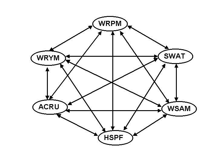
Figure 5 A complex approach to database management
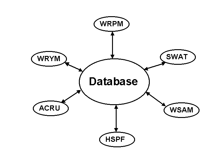
Figure 6 A simple approach to database management
Görgens (1999) identifies the need for an integrated catchment modelling and information system. A number of models are interfaced with a common database, which is in turn linked with time series and GIS viewing facilities. A system of this nature will, according to Görgens (1999), allow for varying levels of input depending on the complexity of the problem. Examples of some systems that have been developed along these lines include HYMAS, ICIS, IMPAQ, BASINS and NWBM. These systems appear to have strengths in the visualisation software however, often are restrictive owing to their resolution or preference for a single modelling system.
If the system in Figure 5 were used then methods would have to be devised to convert the output from one model to input to the next for each of the models used. However, if the system set out in Figure 6 is used then only one method of input and output extraction from a common database is required. As can be seen from the two diagrams the efficiency in data manipulation using a common database is much enhanced, as data manipulation only needs to take place between the database and the models, which reduces the amount of effort spent on data manipulation.
Linking models in series is the most common type of model linkage. It involves taking output from the one model and using it as input to another model. The implication of this is that all calculations by the one model need to be complete before commencing the next model?s run. The usual requirement for linking models in series is the conversion of output from the first model from its unique format to the unique input format of the other model using a data transformation program. A time manager and a set of files that is accessible can facilitate communication by the models by all models.
Problems that can arise from this method of model linkages is that time resolution of the models may differ and therefore in some instances aggregated of information may be required. This type of link does not allow feedback between the models; however, communication through the input/ output files makes this type of loosely coupled models very flexible.
Linking models in parallel usually involves using output from one component as input to the next in the same time step and therefore has the facility to accommodate feedback between models. This generally involves restructuring the models to read the same database and compiling them in one executable program.
In both instances a common database is required to facilitate the use of multiple models.
7.6.1 Temporal and spatial scale considerations
Time is continuous, however, data is usually discrete in that it is recorded at distinct intervals in which intervening information of a specific type is disregarded or assumed to be unimportant. These intervals are not necessarily equidistant and discrete time can therefore be seen as an intermittent process.
The spatial scales of the data stored in the database may vary and may range from a fine scale such as a grid in a GIS system to a catchment scale. The gridded information may be aggregated to the spatial scale used in the database.
7.6.2 Database requirements for the DSS
The database required by the decision support system
A present there is no system that is able to link spatial data with time series data and a viewing platform in GIS. The database behind ArcView for example is a dBase file format to store and link data. This requires the data storage in a flat file format that allows for a large amount of redundancy and is not easily queried. A relational database has the ability to reduce redundancy and allow for easier query options to be developed. The ARC/INFO and ArcView systems are being developed to incorporate relational database facilities, these are, however, not available at present. It was therefore decided to review several different existing database applications that have been developed locally and internationally to assess how they have dealt with the problem of linking time series, attribute and spatial data together. It was also believed that substantial time and effort might be saved if and existing database could be used.
When assessing the option of using an existing database system it is necessary to weigh up
Several different systems were discussed with different organisations in the water sector ranging from the CCWR to DWAF. The CCWR recommended the use of the BASINS system for data management. The BASINS system fulfilled the criteria stated above. It stores both simulated and raw data and links both spatial, attribute and time series data together. It runs using the ArcView GIS, which is linked to the WDM Water Data Management system.
While using an existing BASINS system in this project seems like the ideal solution there are a several problems with the Water Data Management (WDM) system which may prove limiting (Pike, personal comm,. 2001).
The problem basically comes down to a trade off between two different options.
Neither option is particularly suitable, as both would require prohibitively large investments in terms of both time and resources. It was therefore decided that the option of choosing a database structure that had been locally developed and was in general use would be the most appropriate option. In this regard DWAF was approached to gain an idea of the types of systems they are using and how these systems could be adapted to a working version of a database that could link to the models that were required in the DSS. It was believed that by "piggybacking" on the protocols and standards developed in DWAF the setup time for the database would be decreased and a functioning system would be in place in the least amount of time. It was also thought that by using a system that conformed with the standards of DWAF the system would be generally better accepted by DWAF and would be used more readily in actual applications especially in terms of the SEA process that the DSS supports. It was also believed that the most recent technology in terms of database systems should be used, as that would limit the possibility of the system becoming outdated and redundant.
In several meetings and discussions with different persons in different departments in DWAF it became clear that there is no real consensus on the database structure to be used in DWAF itself. There are several sections in DWAF involved with data manipulation and management however there is no standard method of storage or manipulation and most of the different sectors use their own data storage formats and database packages. In DWAF the integrator has been given the task of standardising all the different data formats and incorporating them into a common database and data storage format. It also became clear when speaking with various role players in DWAF that none had a system that stored both simulated and observed data and that DWAF was mainly concerned with the collection and storage of observed data.
Several of the current databases used in DWAF at the moment are named below. This is not an exhaustive list as other sectors in DWAF may have another systems.
The integrator has set up a database architecture that needs to be conformed to in terms of database design and development. The data standards within the database architecture are not however explicitly defined. The Informix database system while being used by the integrator is not necessarily standard throughout DWAF. There also apparently seems to be some debate as to which is the best database package to use, in terms of Informix or Oracle.
It is clear from the discussions with DWAF and other organisations that the database issue needs to be given a lot more thought. It has been suggested that the consultants review some of the current databases used in DWAF at present and particularly the Regis system that is been used by the geohydrology section. It is, however, clear that the consultants must use the ArcView GIS for the spatial data storage component and link this to a relational database. At this stage several, options have been suggested in terms of which database to use and link to the ArcView system. The most promising link looks to be that which has been adopted by the Regis system which links an Oracle database to the ArcView GIS. It is hence this approach that is most likely to be suggested by the consultants in the design but is subject to further investigation.