Untitled Page
DWS Home Page  
 

GROUNDWATER LEVEL MONITORING SITES IN SOUTH AFRICAN WETLANDS


right menu
bullet
Ms. Jacqueline Jay
  E-mail: jayj@dws.gov.za
   
Untitled Page

Groundwater Home

Groundwater Offices

Data Management


Documents

Forms

Groundwater Dictionary

Contacts

Links

FAQs


This map illustrates the Department’s number of actively monitored groundwater level Geosites that occur within or near South Africa's inland and coastal wetlands - as registered on NGA. Geosite Types are differentiated by symbols.

click for larger view (Sep 2019)


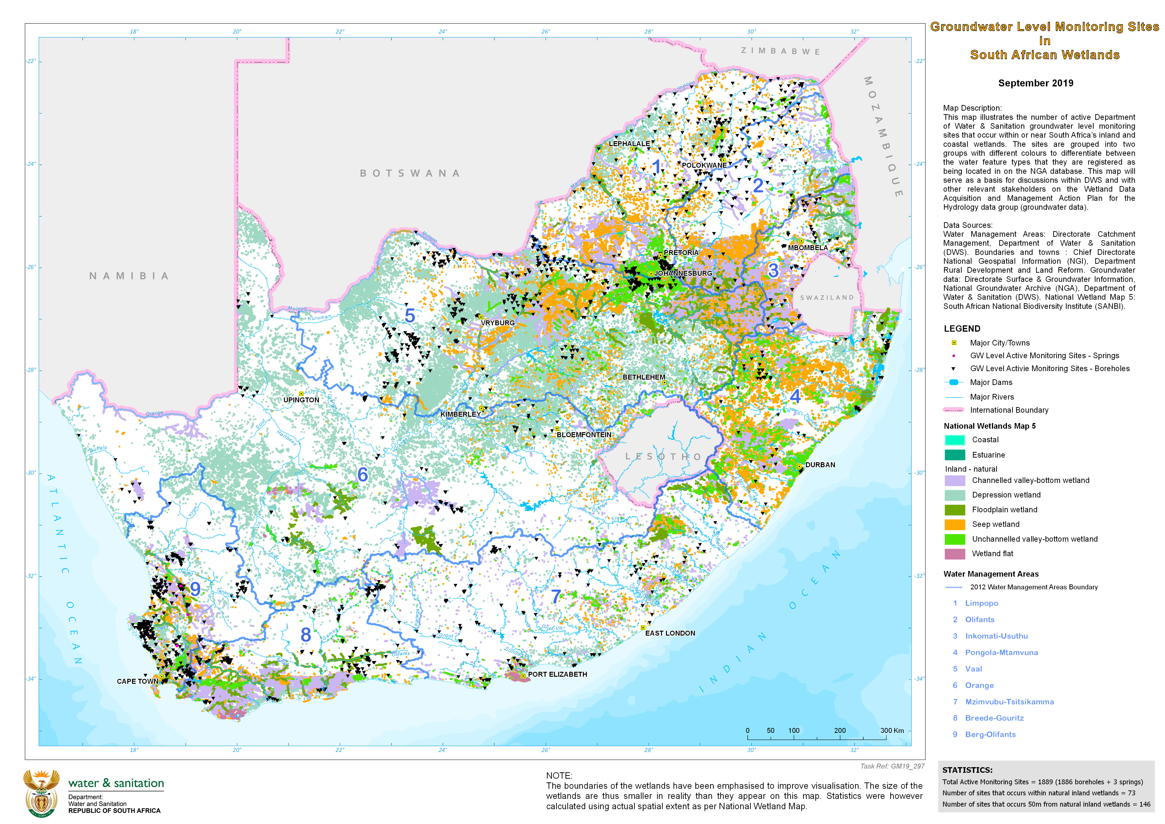
Last updated: 19/11/2019

Untitled Document
This site is best viewed with Internet Explorer 10 (or newer) and Mozilla Firefox 32.0 (or newer) at 1024x768 screen resolution.Click here to download Internet Explorer 11 or click here to download Firefox 32.
DWS Sitemap
If you experience any challenges regarding this site, please contact the Webmaster .