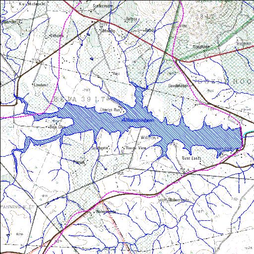
A9R001Q01
Rivs: Doringspruit Luvuvhu
23o06'14.4"S 30o05'45.8"E
(-23.104007, 30.096062)
Map 2330AA
6597m wide x 3226m high
Cape Datum.
Surveys and Mapping.
Data from file
/iwqs3/tmp/dams/tmp/wla500-geo
| Albasini (reservoir) | ||
|---|---|---|
|
|
|
|
|
Albasini A9R001Q01 Rivs: Doringspruit Luvuvhu |
||
|
Locality: 23o06'14.4"S 30o05'45.8"E (-23.104007, 30.096062) Map 2330AA 6597m wide x 3226m high Cape Datum. |
||
|
Surveys and Mapping. Data from file /iwqs3/tmp/dams/tmp/wla500-geo |
||
| <--Previous | Home^ | Next--> | |
| Resource Quality Services | stmaphtml.aml 2004-05-21 - 07:41:34 | |