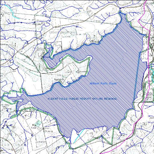
U2R003Q01
Rivs: Doring_Spruit Nculwane uMngeni
29o26'10.5"S 30o23'18.2"E
(-29.43626, 30.388386)
Map 2930AD
8107m wide x 8728m high
Cape Datum.
Surveys and Mapping.
Data from file
/iwqs3/tmp/dams/tmp/wla500-geo
| Albert Falls (reservoir) | ||
|---|---|---|
|
|
|
|
|
Albert Falls U2R003Q01 Rivs: Doring_Spruit Nculwane uMngeni |
||
|
Locality: 29o26'10.5"S 30o23'18.2"E (-29.43626, 30.388386) Map 2930AD 8107m wide x 8728m high Cape Datum. |
||
|
Surveys and Mapping. Data from file /iwqs3/tmp/dams/tmp/wla500-geo |
||
| <--Previous | Home^ | Next--> | |
| Resource Quality Services | stmaphtml.aml 2004-05-21 - 07:42:24 | |