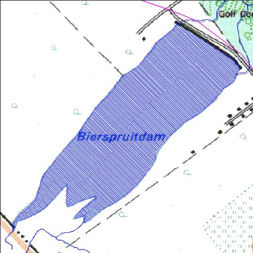
A2R010Q01
Rivs: Bofule
24o55'04.9"S 27o08'02.5"E
(-24.918017, 27.134038)
Map 2427CC
2106m wide x 2140m high
Cape Datum.
Surveys and Mapping.
Data from file
/iwqs3/tmp/dams/tmp/wla500-geo
| Bierspruit (reservoir) | ||
|---|---|---|
|
|
|
|
|
Bierspruit A2R010Q01 Rivs: Bofule |
||
|
Locality: 24o55'04.9"S 27o08'02.5"E (-24.918017, 27.134038) Map 2427CC 2106m wide x 2140m high Cape Datum. |
||
|
Surveys and Mapping. Data from file /iwqs3/tmp/dams/tmp/wla500-geo |
||
| <--Previous | Home^ | Next--> | |
| Resource Quality Services | stmaphtml.aml 2004-05-21 - 07:59:55 | |