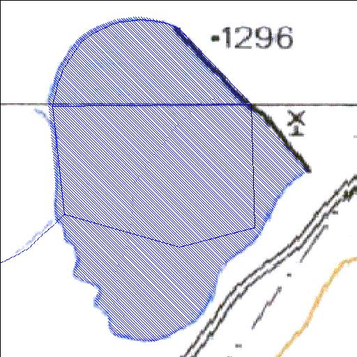
Rivs: _
31o30'07.1"S 23o08'15.5"E
(-31.501962, 23.13764)
Map 3123AC 3123CA
728m wide x 1043m high
Cape Datum.
Surveys and Mapping.
Data from file
/iwqs3/tmp/dams/tmp/wla500-geo
| Biesjesfontein186 (reservoir) | ||
|---|---|---|
|
|
|
|
|
Biesjesfontein186 Rivs: _ |
||
|
Locality: 31o30'07.1"S 23o08'15.5"E (-31.501962, 23.13764) Map 3123AC 3123CA 728m wide x 1043m high Cape Datum. |
||
|
Surveys and Mapping. Data from file /iwqs3/tmp/dams/tmp/wla500-geo |
||
| <--Previous | Home^ | Next--> | |
| Resource Quality Services | stmaphtml.aml 2004-05-21 - 08:01:10 | |