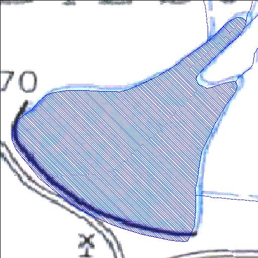
Rivs: _
31o27'18.3"S 22o23'44"E
(-31.455082, 22.395559)
Map 3122AD
692m wide x 779m high
Cape Datum.
Surveys and Mapping.
Data from file
/iwqs3/tmp/dams/tmp/wla500-geo
| Biesjespoort140 (reservoir) | ||
|---|---|---|
|
|
|
|
|
Biesjespoort140 Rivs: _ |
||
|
Locality: 31o27'18.3"S 22o23'44"E (-31.455082, 22.395559) Map 3122AD 692m wide x 779m high Cape Datum. |
||
|
Surveys and Mapping. Data from file /iwqs3/tmp/dams/tmp/wla500-geo |
||
| <--Previous | Home^ | Next--> | |
| Resource Quality Services | stmaphtml.aml 2004-05-21 - 08:02:29 | |