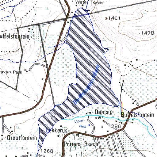
A2R005Q01
Rivs: Sterkstroom
25o47'31.2"S 27o29'11.6"E
(-25.791997, 27.486559)
Map 2527CD
1680m wide x 3057m high
Cape Datum.
Surveys and Mapping.
Data from file
/iwqs3/tmp/dams/tmp/wla500-geo
| Buffelspoort (reservoir) | ||
|---|---|---|
|
|
|
|
|
Buffelspoort A2R005Q01 Rivs: Sterkstroom |
||
|
Locality: 25o47'31.2"S 27o29'11.6"E (-25.791997, 27.486559) Map 2527CD 1680m wide x 3057m high Cape Datum. |
||
|
Surveys and Mapping. Data from file /iwqs3/tmp/dams/tmp/wla500-geo |
||
| <--Previous | Home^ | Next--> | |
| Resource Quality Services | stmaphtml.aml 2004-05-21 - 08:24:00 | |