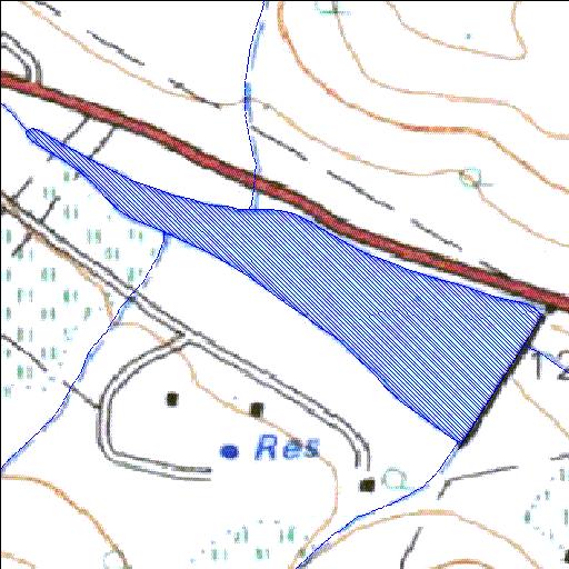
Rivs: Plat
24o49'27.5"S 28o12'23.9"E
(-24.824313, 28.206632)
Map 2428CC
1151m wide x 818m high
Cape Datum.
Surveys and Mapping.
Data from file
/iwqs3/tmp/dams/tmp/wla500-geo
| Buffelspruit443KR (reservoir) | ||
|---|---|---|
|
|
|
|
|
Buffelspruit443KR Rivs: Plat |
||
|
Locality: 24o49'27.5"S 28o12'23.9"E (-24.824313, 28.206632) Map 2428CC 1151m wide x 818m high Cape Datum. |
||
|
Surveys and Mapping. Data from file /iwqs3/tmp/dams/tmp/wla500-geo |
||
| <--Previous | Home^ | Next--> | |
| Resource Quality Services | stmaphtml.aml 2004-05-21 - 08:25:10 | |