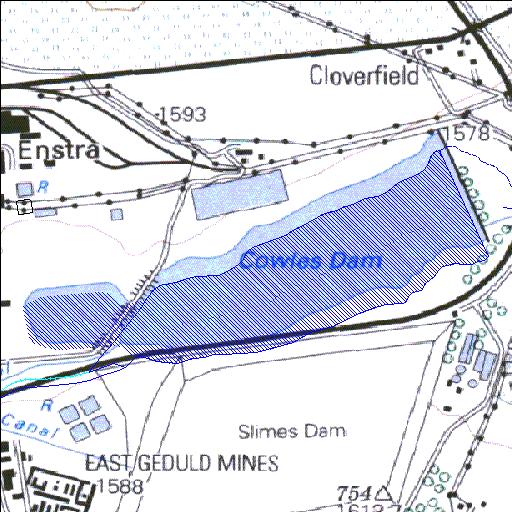
Rivs: _
26o12'35.1"S 28o27'20"E
(-26.209737, 28.455569)
Map 2628AB
2217m wide x 1257m high
Cape Datum.
Surveys and Mapping.
Data from file
/iwqs3/tmp/dams/tmp/wla500-geo
| Cowles (reservoir) | ||
|---|---|---|
|
|
|
|
|
Cowles Rivs: _ |
||
|
Locality: 26o12'35.1"S 28o27'20"E (-26.209737, 28.455569) Map 2628AB 2217m wide x 1257m high Cape Datum. |
||
|
Surveys and Mapping. Data from file /iwqs3/tmp/dams/tmp/wla500-geo |
||
| <--Previous | Home^ | Next--> | |
| Resource Quality Services | stmaphtml.aml 2004-05-21 - 08:38:56 | |