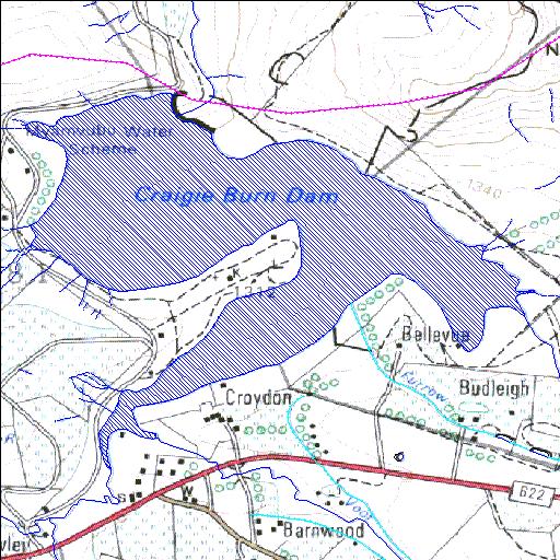
V2R001Q01
Rivs: Mnyamvubu Mpatheni
29o10'17.9"S 30o17'34.2"E
(-29.171636, 30.292836)
Map 2930AB
2933m wide x 2557m high
Cape Datum.
Surveys and Mapping.
Data from file
/iwqs3/tmp/dams/tmp/wla500-geo
| Craigie Burn (reservoir) | ||
|---|---|---|
|
|
|
|
|
Craigie Burn V2R001Q01 Rivs: Mnyamvubu Mpatheni |
||
|
Locality: 29o10'17.9"S 30o17'34.2"E (-29.171636, 30.292836) Map 2930AB 2933m wide x 2557m high Cape Datum. |
||
|
Surveys and Mapping. Data from file /iwqs3/tmp/dams/tmp/wla500-geo |
||
| <--Previous | Home^ | Next--> | |
| Resource Quality Services | stmaphtml.aml 2004-05-21 - 08:39:59 | |