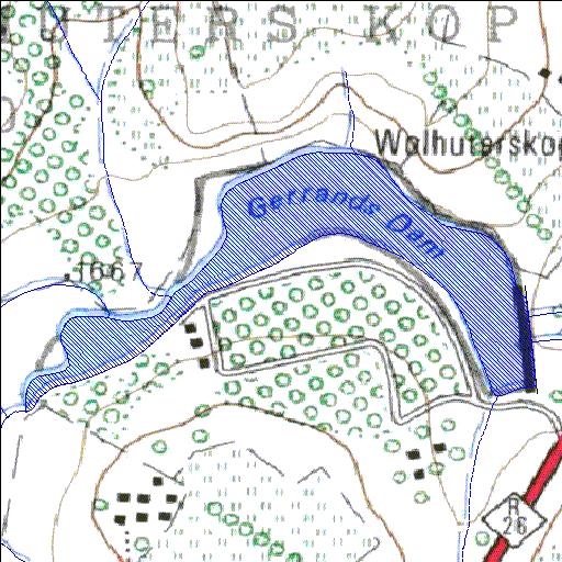
C8R006Q01
Rivs: _
28o16'47.5"S 28o17'04.6"E
(-28.279861, 28.284622)
Map 2828AD
1702m wide x 1067m high
Cape Datum.
Surveys and Mapping.
Data from file
/iwqs3/tmp/dams/tmp/wla500-geo
| Gerrands (reservoir) | ||
|---|---|---|
|
|
|
|
|
Gerrands C8R006Q01 Rivs: _ |
||
|
Locality: 28o16'47.5"S 28o17'04.6"E (-28.279861, 28.284622) Map 2828AD 1702m wide x 1067m high Cape Datum. |
||
|
Surveys and Mapping. Data from file /iwqs3/tmp/dams/tmp/wla500-geo |
||
| <--Previous | Home^ | Next--> | |
| Resource Quality Services | stmaphtml.aml 2004-05-21 - 09:29:30 | |