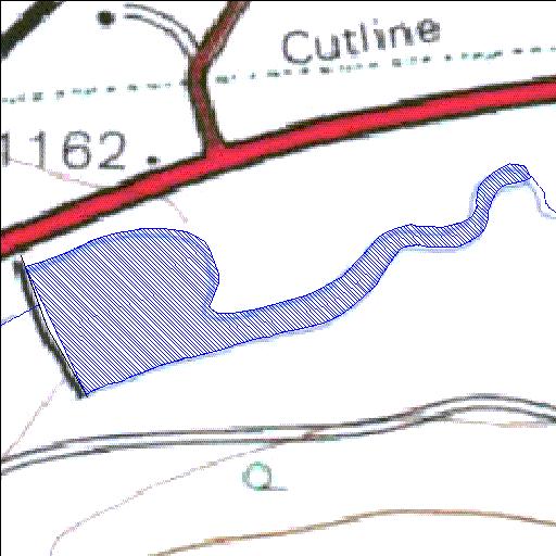
A6R004Q01
Rivs: _
24o09'44.6"S 29o02'00.7"E
(-24.162395, 29.033533)
Map 2429AA
900m wide x 499m high
Cape Datum.
Surveys and Mapping.
Data from file
/iwqs3/tmp/dams/tmp/wla500-geo
| Gert Combrink (reservoir) | ||
|---|---|---|
|
|
|
|
|
Gert Combrink A6R004Q01 Rivs: _ |
||
|
Locality: 24o09'44.6"S 29o02'00.7"E (-24.162395, 29.033533) Map 2429AA 900m wide x 499m high Cape Datum. |
||
|
Surveys and Mapping. Data from file /iwqs3/tmp/dams/tmp/wla500-geo |
||
| <--Previous | Home^ | Next--> | |
| Resource Quality Services | stmaphtml.aml 2004-05-21 - 09:30:34 | |