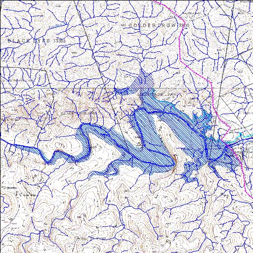
W1R001Q01
alias Goedertrouw
Rivs: Kwamazuka Mhlatuze
28o45'52.2"S 31o25'46.6"E
(-28.764501, 31.429605)
Map 2831CB 2831CD
9240m wide x 5880m high
Cape Datum.
Surveys and Mapping.
Data from file
/iwqs3/tmp/dams/tmp/wla500-geo
| Goedertrou (reservoir) | ||
|---|---|---|
|
|
|
|
|
Goedertrou W1R001Q01 alias Goedertrouw Rivs: Kwamazuka Mhlatuze |
||
|
Locality: 28o45'52.2"S 31o25'46.6"E (-28.764501, 31.429605) Map 2831CB 2831CD 9240m wide x 5880m high Cape Datum. |
||
|
Surveys and Mapping. Data from file /iwqs3/tmp/dams/tmp/wla500-geo |
||
| <--Previous | Home^ | Next--> | |
| Resource Quality Services | stmaphtml.aml 2004-05-21 - 09:33:59 | |