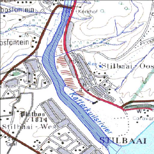
H9R002Q01
alias Goukou River Mouth
Rivs: Goukou
34o22'04"S 21o25'06.1"E
(-34.367788, 21.418362)
Map 3421AD
1093m wide x 2406m high
Cape Datum.
Surveys and Mapping.
Data from file
/iwqs3/tmp/dams/tmp/wla500-geo
| Goukou Estuary (natural) | ||
|---|---|---|
|
|
|
|
|
Goukou Estuary H9R002Q01 alias Goukou River Mouth Rivs: Goukou |
||
|
Locality: 34o22'04"S 21o25'06.1"E (-34.367788, 21.418362) Map 3421AD 1093m wide x 2406m high Cape Datum. |
||
|
Surveys and Mapping. Data from file /iwqs3/tmp/dams/tmp/wla500-geo |
||
| <--Previous | Home^ | Next--> | |
| Resource Quality Services | stmaphtml.aml 2004-05-21 - 09:34:46 | |