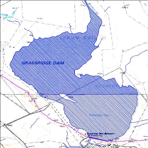
Q1R001Q01
Rivs: Groot-Brak
31o44'30.2"S 25o27'36"E
(-31.741734, 25.459994)
Map 3125CB 3125CD
5441m wide x 6691m high
Cape Datum.
Surveys and Mapping.
Data from file
/iwqs3/tmp/dams/tmp/wla500-geo
| Grassridge (reservoir) | ||
|---|---|---|
|
|
|
|
|
Grassridge Q1R001Q01 Rivs: Groot-Brak |
||
|
Locality: 31o44'30.2"S 25o27'36"E (-31.741734, 25.459994) Map 3125CB 3125CD 5441m wide x 6691m high Cape Datum. |
||
|
Surveys and Mapping. Data from file /iwqs3/tmp/dams/tmp/wla500-geo |
||
| <--Previous | Home^ | Next--> | |
| Resource Quality Services | stmaphtml.aml 2004-05-21 - 09:35:46 | |