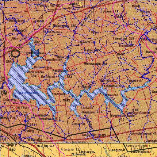
C1R002Q01
Rivs: Langspruit Leeuspruit Vaal
26o54'33.6"S 29o23'42.5"E
(-26.909328, 29.395127)
Map 2629CD 2629DC
21944m wide x 14870m high
Cape Datum.
Surveys and Mapping.
Data from file
/iwqs3/tmp/dams/tmp/wla500-geo
| Grootdraai (reservoir) | ||
|---|---|---|
|
|
|
|
|
Grootdraai C1R002Q01 Rivs: Langspruit Leeuspruit Vaal |
||
|
Locality: 26o54'33.6"S 29o23'42.5"E (-26.909328, 29.395127) Map 2629CD 2629DC 21944m wide x 14870m high Cape Datum. |
||
|
Surveys and Mapping. Data from file /iwqs3/tmp/dams/tmp/wla500-geo |
||
| <--Previous | Home^ | Next--> | |
| Resource Quality Services | stmaphtml.aml 2004-05-21 - 09:39:32 | |