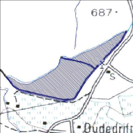
Rivs: _
32o24'46.1"S 24o16'54.5"E
(-32.412794, 24.281813)
Map 3224AD
1045m wide x 758m high
Cape Datum.
Surveys and Mapping.
Data from file
/iwqs3/tmp/dams/tmp/wla500-geo
| Grootevlakte132 (reservoir) | ||
|---|---|---|
|
|
|
|
|
Grootevlakte132 Rivs: _ |
||
|
Locality: 32o24'46.1"S 24o16'54.5"E (-32.412794, 24.281813) Map 3224AD 1045m wide x 758m high Cape Datum. |
||
|
Surveys and Mapping. Data from file /iwqs3/tmp/dams/tmp/wla500-geo |
||
| <--Previous | Home^ | Next--> | |
| Resource Quality Services | stmaphtml.aml 2004-05-21 - 09:40:36 | |