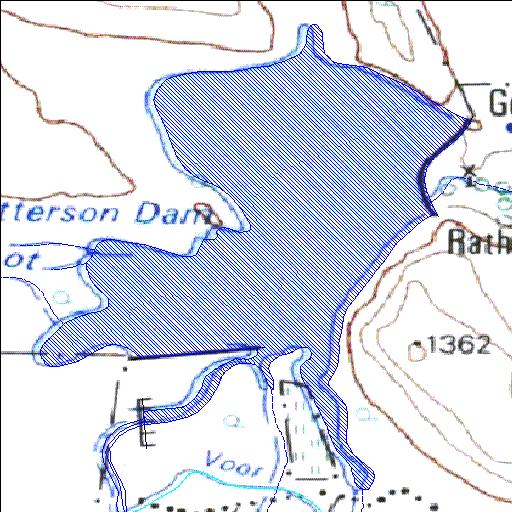
Rivs: Oompies
31o38'00.2"S 25o01'49.7"E
(-31.633392, 25.030468)
Map 3125CA
1339m wide x 1690m high
Cape Datum.
Surveys and Mapping.
Data from file
/iwqs3/tmp/dams/tmp/wla500-geo
| Kelly-Patterson (reservoir) | ||
|---|---|---|
|
|
|
|
|
Kelly-Patterson Rivs: Oompies |
||
|
Locality: 31o38'00.2"S 25o01'49.7"E (-31.633392, 25.030468) Map 3125CA 1339m wide x 1690m high Cape Datum. |
||
|
Surveys and Mapping. Data from file /iwqs3/tmp/dams/tmp/wla500-geo |
||
| <--Previous | Home^ | Next--> | |
| Resource Quality Services | stmaphtml.aml 2004-05-21 - 10:09:24 | |