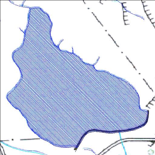
Rivs: _
31o32'07.8"S 25o26'51.2"E
(-31.535491, 25.447566)
Map 3125CB
1115m wide x 1300m high
Cape Datum.
Surveys and Mapping.
Data from file
/iwqs3/tmp/dams/tmp/wla500-geo
| Klipperif112 (reservoir) | ||
|---|---|---|
|
|
|
|
|
Klipperif112 Rivs: _ |
||
|
Locality: 31o32'07.8"S 25o26'51.2"E (-31.535491, 25.447566) Map 3125CB 1115m wide x 1300m high Cape Datum. |
||
|
Surveys and Mapping. Data from file /iwqs3/tmp/dams/tmp/wla500-geo |
||
| <--Previous | Home^ | Next--> | |
| Resource Quality Services | stmaphtml.aml 2004-05-21 - 10:30:11 | |