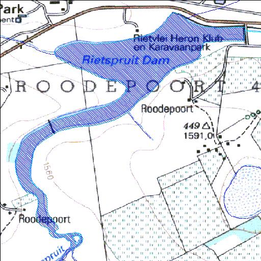
alias Rietspruit;Rietvlei
Rivs: Rietspruit
26o10'44.3"S 29o13'02.4"E
(-26.178965, 29.217331)
Map 2629AA
2489m wide x 2858m high
Cape Datum.
Surveys and Mapping.
Data from file
/iwqs3/tmp/dams/tmp/wla500-geo
| Klipplaat (reservoir) | ||
|---|---|---|
|
|
|
|
|
Klipplaat alias Rietspruit;Rietvlei Rivs: Rietspruit |
||
|
Locality: 26o10'44.3"S 29o13'02.4"E (-26.178965, 29.217331) Map 2629AA 2489m wide x 2858m high Cape Datum. |
||
|
Surveys and Mapping. Data from file /iwqs3/tmp/dams/tmp/wla500-geo |
||
| <--Previous | Home^ | Next--> | |
| Resource Quality Services | stmaphtml.aml 2004-05-21 - 10:31:03 | |