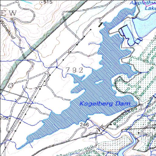
G4R006Q01
Rivs: Palmiet
34o12'29.3"S 18o58'15.7"E
(-34.20813, 18.971036)
Map 3418BB
2348m wide x 3328m high
Cape Datum.
Surveys and Mapping.
Data from file
/iwqs3/tmp/dams/tmp/wla500-geo
| Kogelberg (reservoir) | ||
|---|---|---|
|
|
|
|
|
Kogelberg G4R006Q01 Rivs: Palmiet |
||
|
Locality: 34o12'29.3"S 18o58'15.7"E (-34.20813, 18.971036) Map 3418BB 2348m wide x 3328m high Cape Datum. |
||
|
Surveys and Mapping. Data from file /iwqs3/tmp/dams/tmp/wla500-geo |
||
| <--Previous | Home^ | Next--> | |
| Resource Quality Services | stmaphtml.aml 2004-05-21 - 10:35:39 | |