Rivs: _
34o07'23.7"S 18o21'00.2"E
(-34.123245, 18.350068)
Map 3418AB
1116m wide x 1744m high
Cape Datum.
Surveys and Mapping.
Data from file
/iwqs3/tmp/dams/tmp/wla500-geo
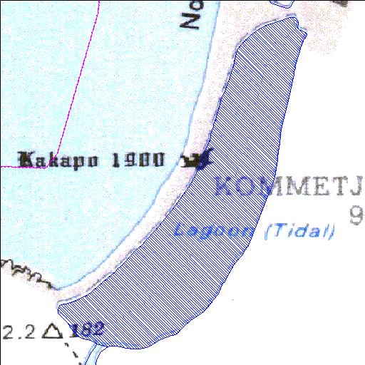
| Kommetjie lagoon (natural) | ||
|---|---|---|
|
|
|
|
|
Kommetjie lagoon Rivs: _ |
||
|
Locality: 34o07'23.7"S 18o21'00.2"E (-34.123245, 18.350068) Map 3418AB 1116m wide x 1744m high Cape Datum. |
||
|
Surveys and Mapping. Data from file /iwqs3/tmp/dams/tmp/wla500-geo |
||
| <--Previous | Home^ | Next--> | |
| Resource Quality Services | stmaphtml.aml 2004-05-21 - 10:37:08 | |