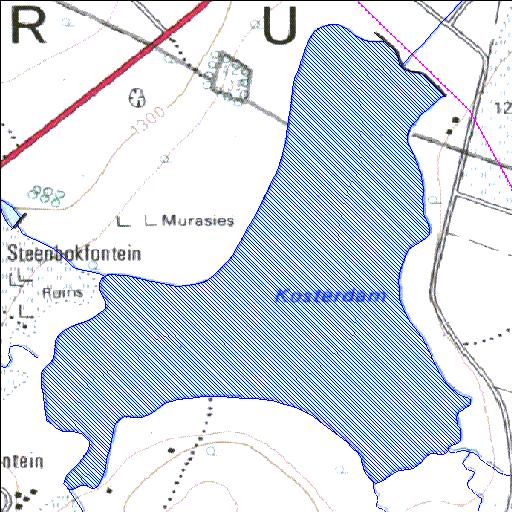
A2R011Q01
Rivs: Koster
25o42'32.2"S 26o53'50"E
(-25.708955, 26.897218)
Map 2526DB
2316m wide x 2768m high
Cape Datum.
Surveys and Mapping.
Data from file
/iwqs3/tmp/dams/tmp/wla500-geo
| Koster (reservoir) | ||
|---|---|---|
|
|
|
|
|
Koster A2R011Q01 Rivs: Koster |
||
|
Locality: 25o42'32.2"S 26o53'50"E (-25.708955, 26.897218) Map 2526DB 2316m wide x 2768m high Cape Datum. |
||
|
Surveys and Mapping. Data from file /iwqs3/tmp/dams/tmp/wla500-geo |
||
| <--Previous | Home^ | Next--> | |
| Resource Quality Services | stmaphtml.aml 2004-05-21 - 10:43:06 | |