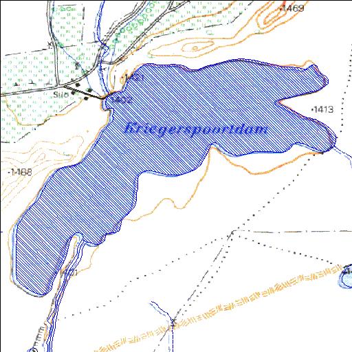
Rivs: Elandskloof
31o17'40"S 24o33'03.4"E
(-31.294445, 24.550955)
Map 3124BC
2972m wide x 2643m high
Cape Datum.
Surveys and Mapping.
Data from file
/iwqs3/tmp/dams/tmp/wla500-geo
| Kriegerspoort (reservoir) | ||
|---|---|---|
|
|
|
|
|
Kriegerspoort Rivs: Elandskloof |
||
|
Locality: 31o17'40"S 24o33'03.4"E (-31.294445, 24.550955) Map 3124BC 2972m wide x 2643m high Cape Datum. |
||
|
Surveys and Mapping. Data from file /iwqs3/tmp/dams/tmp/wla500-geo |
||
| <--Previous | Home^ | Next--> | |
| Resource Quality Services | stmaphtml.aml 2004-05-21 - 10:44:20 | |