Rivs: _
30o18'34.8"S 27o10'18.8"E
(-30.309656, 27.171883)
Map 3027AC
1535m wide x 2549m high
Cape Datum.
Surveys and Mapping.
Data from file
/iwqs3/tmp/dams/tmp/wla500-geo
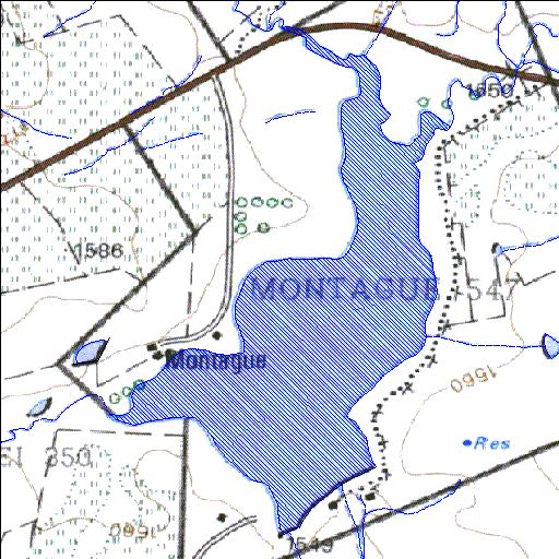
| Montague547 (reservoir) | ||
|---|---|---|
|
|
|
|
|
Montague547 Rivs: _ |
||
|
Locality: 30o18'34.8"S 27o10'18.8"E (-30.309656, 27.171883) Map 3027AC 1535m wide x 2549m high Cape Datum. |
||
|
Surveys and Mapping. Data from file /iwqs3/tmp/dams/tmp/wla500-geo |
||
| <--Previous | Home^ | Next--> | |
| Resource Quality Services | stmaphtml.aml 2004-05-21 - 11:45:34 | |