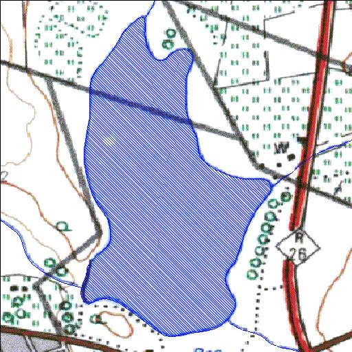
Rivs: _
29o58'42.6"S 27o01'25.1"E
(-29.978507, 27.023639)
Map 2927CC
941m wide x 1722m high
Cape Datum.
Surveys and Mapping.
Data from file
/iwqs3/tmp/dams/tmp/wla500-geo
| Mooifontein286 (reservoir) | ||
|---|---|---|
|
|
|
|
|
Mooifontein286 Rivs: _ |
||
|
Locality: 29o58'42.6"S 27o01'25.1"E (-29.978507, 27.023639) Map 2927CC 941m wide x 1722m high Cape Datum. |
||
|
Surveys and Mapping. Data from file /iwqs3/tmp/dams/tmp/wla500-geo |
||
| <--Previous | Home^ | Next--> | |
| Resource Quality Services | stmaphtml.aml 2004-05-21 - 11:46:54 | |