Rivs: _
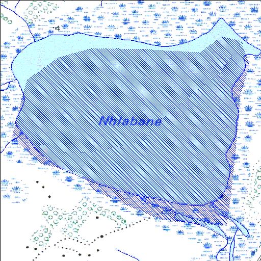
28o36'33.7"S 32o16'17.4"E
(-28.609347, 32.271496)
Map 2832CB
2670m wide x 2466m high
Cape Datum.
Surveys and Mapping.
Data from file
/iwqs3/tmp/dams/tmp/wla500-geo
| Nhlabane (natural) | ||
|---|---|---|
|
|
|
|
|
Nhlabane Rivs: _ |
||
|
Locality: 28o36'33.7"S 32o16'17.4"E (-28.609347, 32.271496) Map 2832CB 2670m wide x 2466m high Cape Datum. |
||
|
Surveys and Mapping. Data from file /iwqs3/tmp/dams/tmp/wla500-geo |
||
| <--Previous | Home^ | Next--> | |
| Resource Quality Services | stmaphtml.aml 2004-05-21 - 11:57:53 | |