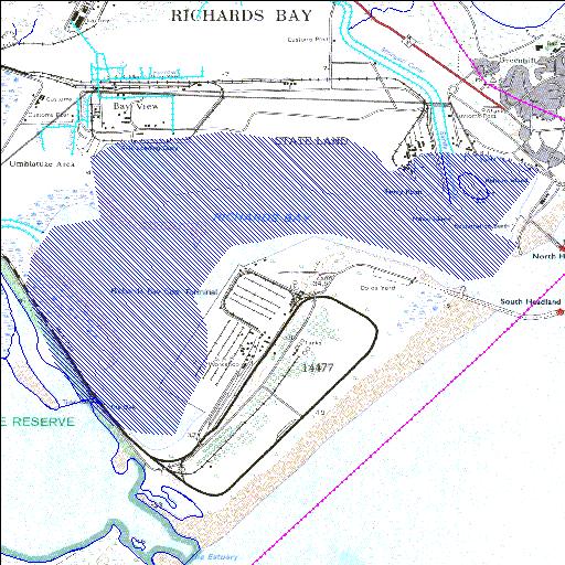
Rivs: Mzingazi
28o48'36.1"S 32o03'40.1"E
(-28.810036, 32.061146)
Map 2832CC
7283m wide x 5212m high
Cape Datum.
Surveys and Mapping.
Data from file
/iwqs3/tmp/dams/tmp/wla500-geo
| Richards Bay (natural) | ||
|---|---|---|
|
|
|
|
|
Richards Bay Rivs: Mzingazi |
||
|
Locality: 28o48'36.1"S 32o03'40.1"E (-28.810036, 32.061146) Map 2832CC 7283m wide x 5212m high Cape Datum. |
||
|
Surveys and Mapping. Data from file /iwqs3/tmp/dams/tmp/wla500-geo |
||
| <--Previous | Home^ | Next--> | |
| Resource Quality Services | stmaphtml.aml 2004-05-21 - 12:36:33 | |