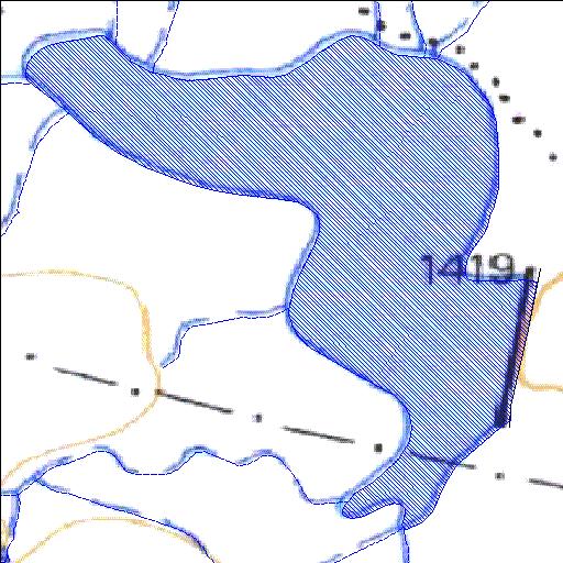
Rivs: _
31o19'20.9"S 22o30'24.5"E
(-31.322464, 22.506792)
Map 3122BC
1018m wide x 1155m high
Cape Datum.
Surveys and Mapping.
Data from file
/iwqs3/tmp/dams/tmp/wla500-geo
| Rietfontein572 (reservoir) | ||
|---|---|---|
|
|
|
|
|
Rietfontein572 Rivs: _ |
||
|
Locality: 31o19'20.9"S 22o30'24.5"E (-31.322464, 22.506792) Map 3122BC 1018m wide x 1155m high Cape Datum. |
||
|
Surveys and Mapping. Data from file /iwqs3/tmp/dams/tmp/wla500-geo |
||
| <--Previous | Home^ | Next--> | |
| Resource Quality Services | stmaphtml.aml 2004-05-21 - 12:37:27 | |