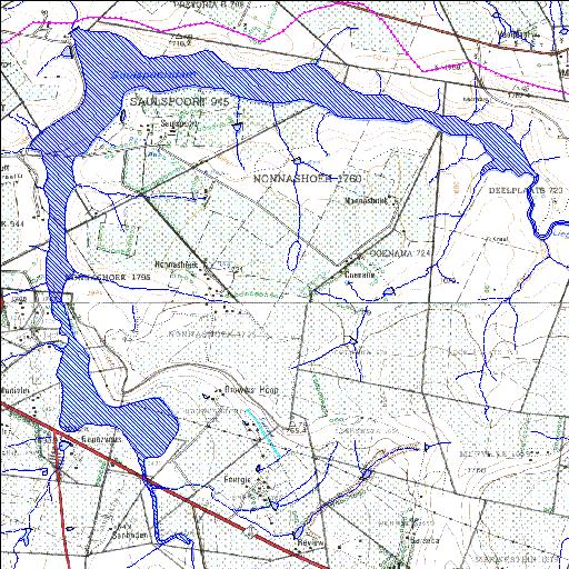
C8R004Q01
Rivs: As Liebenbergsvlei
28o14'52.2"S 28o23'21"E
(-28.247826, 28.389155)
Map 2828AB 2828AD
6664m wide x 7699m high
Cape Datum.
Surveys and Mapping.
Data from file
/iwqs3/tmp/dams/tmp/wla500-geo
| Saulspoort (reservoir) | ||
|---|---|---|
|
|
|
|
|
Saulspoort C8R004Q01 Rivs: As Liebenbergsvlei |
||
|
Locality: 28o14'52.2"S 28o23'21"E (-28.247826, 28.389155) Map 2828AB 2828AD 6664m wide x 7699m high Cape Datum. |
||
|
Surveys and Mapping. Data from file /iwqs3/tmp/dams/tmp/wla500-geo |
||
| <--Previous | Home^ | Next--> | |
| Resource Quality Services | stmaphtml.aml 2004-05-21 - 13:03:27 | |