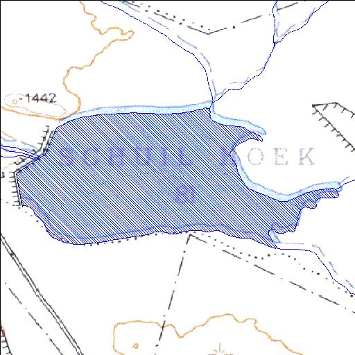
Rivs: Noupoortspruit
31o01'17.6"S 24o47'36.9"E
(-31.021563, 24.793592)
Map 3124BB
2118m wide x 1204m high
Cape Datum.
Surveys and Mapping.
Data from file
/iwqs3/tmp/dams/tmp/wla500-geo
| Schuilhoek081 (reservoir) | ||
|---|---|---|
|
|
|
|
|
Schuilhoek081 Rivs: Noupoortspruit |
||
|
Locality: 31o01'17.6"S 24o47'36.9"E (-31.021563, 24.793592) Map 3124BB 2118m wide x 1204m high Cape Datum. |
||
|
Surveys and Mapping. Data from file /iwqs3/tmp/dams/tmp/wla500-geo |
||
| <--Previous | Home^ | Next--> | |
| Resource Quality Services | stmaphtml.aml 2004-05-21 - 13:03:53 | |