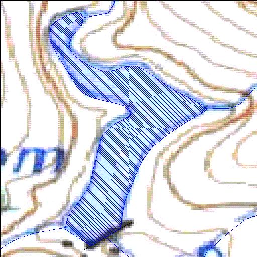
K3R001Q01
alias George Dam
Rivs: Swart
33o54'39.4"S 22o29'40.9"E
(-33.910933, 22.494703)
Map 3322CD
305m wide x 523m high
Cape Datum.
Surveys and Mapping.
Data from file
/iwqs3/tmp/dams/tmp/wla500-geo
| Swart River (reservoir) | ||
|---|---|---|
|
|
|
|
|
Swart River K3R001Q01 alias George Dam Rivs: Swart |
||
|
Locality: 33o54'39.4"S 22o29'40.9"E (-33.910933, 22.494703) Map 3322CD 305m wide x 523m high Cape Datum. |
||
|
Surveys and Mapping. Data from file /iwqs3/tmp/dams/tmp/wla500-geo |
||
| <--Previous | Home^ | Next--> | |
| Resource Quality Services | stmaphtml.aml 2004-05-21 - 13:29:25 | |