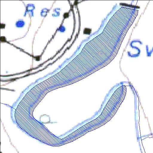
A2R013Q01
Rivs: Elands
25o39'51.4"S 26o41'32.1"E
(-25.664268, 26.692244)
Map 2526DA
575m wide x 710m high
Cape Datum.
Surveys and Mapping.
Data from file
/iwqs3/tmp/dams/tmp/wla500-geo
| Swartruggens (reservoir) | ||
|---|---|---|
|
|
|
|
|
Swartruggens A2R013Q01 Rivs: Elands |
||
|
Locality: 25o39'51.4"S 26o41'32.1"E (-25.664268, 26.692244) Map 2526DA 575m wide x 710m high Cape Datum. |
||
|
Surveys and Mapping. Data from file /iwqs3/tmp/dams/tmp/wla500-geo |
||
| <--Previous | Home^ | Next--> | |
| Resource Quality Services | stmaphtml.aml 2004-05-21 - 13:30:59 | |