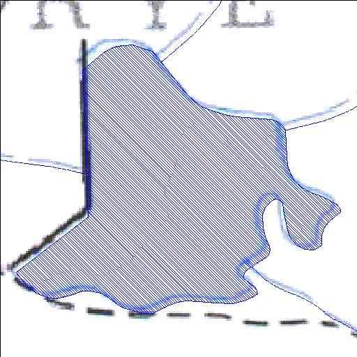
Rivs: Reitzvilleleegte
31o03'27.1"S 22o06'09.6"E
(-31.057536, 22.102674)
Map 3122AA
657m wide x 646m high
Cape Datum.
Surveys and Mapping.
Data from file
/iwqs3/tmp/dams/tmp/wla500-geo
| Vryelaagte529 (reservoir) | ||
|---|---|---|
|
|
|
|
|
Vryelaagte529 Rivs: Reitzvilleleegte |
||
|
Locality: 31o03'27.1"S 22o06'09.6"E (-31.057536, 22.102674) Map 3122AA 657m wide x 646m high Cape Datum. |
||
|
Surveys and Mapping. Data from file /iwqs3/tmp/dams/tmp/wla500-geo |
||
| <--Previous | Home^ | Next--> | |
| Resource Quality Services | stmaphtml.aml 2004-05-21 - 14:17:12 | |