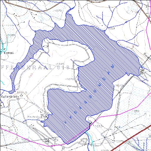
X1R003Q01
Rivs: Komati
25o51'48.1"S 30o37'00.1"E
(-25.863365, 30.616702)
Map 2530DC
4692m wide x 5337m high
Cape Datum.
Surveys and Mapping.
Data from file
/iwqs3/tmp/dams/tmp/wla500-geo
| Vygeboom (reservoir) | ||
|---|---|---|
|
|
|
|
|
Vygeboom X1R003Q01 Rivs: Komati |
||
|
Locality: 25o51'48.1"S 30o37'00.1"E (-25.863365, 30.616702) Map 2530DC 4692m wide x 5337m high Cape Datum. |
||
|
Surveys and Mapping. Data from file /iwqs3/tmp/dams/tmp/wla500-geo |
||
| <--Previous | Home^ | Next--> | |
| Resource Quality Services | stmaphtml.aml 2004-05-21 - 14:18:07 | |