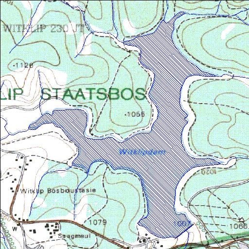
X2R003Q01
Rivs: Kruisfonteinspruit Sand
25o13'21.6"S 30o53'32"E
(-25.222658, 30.89221)
Map 2530BB
2701m wide x 3459m high
Cape Datum.
Surveys and Mapping.
Data from file
/iwqs3/tmp/dams/tmp/wla500-geo
| Witklip (reservoir) | ||
|---|---|---|
|
|
|
|
|
Witklip X2R003Q01 Rivs: Kruisfonteinspruit Sand |
||
|
Locality: 25o13'21.6"S 30o53'32"E (-25.222658, 30.89221) Map 2530BB 2701m wide x 3459m high Cape Datum. |
||
|
Surveys and Mapping. Data from file /iwqs3/tmp/dams/tmp/wla500-geo |
||
| <--Previous | Home^ | Next--> | |
| Resource Quality Services | stmaphtml.aml 2004-05-21 - 14:30:50 | |