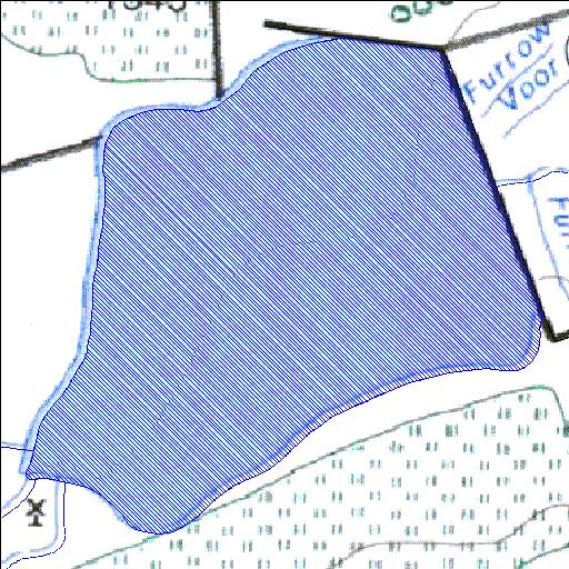
Rivs: Buisfonteinspruit
26o43'15.9"S 26o33'35"E
(-26.721079, 26.559735)
Map 2626DA
1372m wide x 1479m high
Cape Datum.
Surveys and Mapping.
Data from file
/iwqs3/tmp/dams/tmp/wla500-geo
| Witpoort394IP (reservoir) | ||
|---|---|---|
|
|
|
|
|
Witpoort394IP Rivs: Buisfonteinspruit |
||
|
Locality: 26o43'15.9"S 26o33'35"E (-26.721079, 26.559735) Map 2626DA 1372m wide x 1479m high Cape Datum. |
||
|
Surveys and Mapping. Data from file /iwqs3/tmp/dams/tmp/wla500-geo |
||
| <--Previous | Home^ | Next--> | |
| Resource Quality Services | stmaphtml.aml 2004-05-21 - 14:32:05 | |