

Department of Water and Sanitation
(data up to 20 years older)
Department of Land Affairs
Private Bag X10, MOWBRAY 7705
|
Chief Directorate of Surveys and Mapping
Department of Water and Sanitation |
|---|---|
| (c)1998 (data up to 20 years older) |
accuracy better than 50 metres |
| Number of arcs | 2 000 000 (river features only) |
| Attributes | Detailed topographical map classes (about 42) |
| Source |
Chief Directorate of Surveys and Mapping
Department of Land Affairs Private Bag X10, MOWBRAY 7705 |
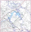 Example of river coverage resolution