Department of Water and Sanitation
REPORT ON OVERSEAS TRIP: INTERNATIONAL ASSOCIATION OF HYDROLOGICAL SCIENCES ASSEMBLY, RABAT (MOROCCO) AND SPACE APPLICATIONS INSTITUTE, ISPRA (ITALY)
May 1997
Institute for Water Quality Studies
Private Bag X313
PRETORIA
South Africa
0001
Tel.: + 27 12 808 0374
Fax: + 27 12 808 0338
E-mail: SilberbauerM@dwaf.gov.za
Author: M J Silberbauer
Status of report: Final
IWQS Report number N/0000/00//0000597
First Issue: May 1997
Last web update 2005-04-12 14:21
[PDF version] 3.6Mb
ii. Acknowledgment of IAHS contribution to DWAF attendance
b. Moroccan Royal Centre for Remote Sensing
i. South African representation
(1) Sustainability of water resources under increasing uncertainty
iv. Mid-conference technical excursion
(1) Association of African Hydrologists (AAH, or AHA in French)
(2) International Commission on Remote Sensing and Data Transmission (ICRSDT) 7
4. EUROPE--INSTITUTE FOR REMOTE SENSING APPLICATIONS
b. Seminar on GIS and water quality
EXECUTIVE SUMMARY
In April and May of 1997, I attended the fifth Scientific Assembly of the International Association of Hydrological Sciences (IAHS) in Rabat, Morocco, and visited the Space Applications Institute in Ispra, Italy. The IAHS funded a large part of my travelling expenses. While in Morocco, I also paid a courtesy call on the Royal Centre for Remote Sensing (a more technical visit was cancelled because of the untimely death of the contact person at the Centre).
The IAHS Assembly was held under the patronage of King Hassan II, and consisted of six symposia and five workshops between 23 April and 3 May, 1997. This was the first IAHS Assembly in Africa, and of the 440 delegates, a large number came from Africa, particularly the French-speaking parts. Six South Africans were present, but many people from all over Africa who wanted to attend could not obtain funding.
The symposia and workshops were held in parallel sessions, and I concentrated on papers in three general areas: sustainability of water resources, spatial analysis and freshwater contamination. I presented a paper on the geographic information systems (GIS) activities of the IWQS at the spatial analysis session. South African scientists have begun to build up contacts with researchers in neighbouring countries and further abroad, and this was particularly noticeable in the FRIEND international hydrological database project. We have had little communication with people using GIS for water quality mapping elsewhere in the world, so the contacts I made in this area were particularly useful. The papers on freshwater contamination were more familiar, with even the mighty USA struggling to enforce water quality regulations. A paper from Poland on radioactive contamination of surface water was of relevance to current initiatives in South Africa, with a parallel history of a former administration keeping controversial data from the public eye.
The mid-conference technical excursion to the Al Wahda Dam and the old city of Fès-el-Bali had a vaguely familiar feel to the South African scientist, with large irrigation schemes, a crowded city and severe water pollution. On closer inspection, the details are highly unfamiliar, modified by the Islamic culture and Arabic and French languages, not to mention the age of Fès, which boasts a university dating from the 800s.
From Morocco, I travelled to the Joint Research Centre of the European Commission at Ispra near Milan in northern Italy. Here, I gave a seminar at the Space Applications Institute, and spoke with several specialists on environmental mapping projects using satellite data and GIS. This visit was arranged by Dr P. Kennedy, who completed her hydrology practical for her British BSc at IWQS (then the HRI) under an exchange agreement that existed in the days before the academic boycott. The seminar sparked some discussion of the water problems of South Africa, not normally a concern of the European Commission.
The trip was generally successful, and underlined the importance of personal interaction, even in this age of the Internet. Dr Kennedy's assistance at the Joint Research Centre was a reminder that student exchange programmes continue to bear fruit even decades later. DWAF should consider reestablishing such links with Europe, and establishing new links with countries such as Morocco.
GENERAL INTRODUCTION
The International Association of Hydrological Sciences (IAHS) held its fifth Scientific Assembly in Rabat from 23 April to 3 May, 1997. The convenors of Symposium S3 (Remote Sensing & Geographic Information Systems) accepted my paper on the use of GIS in water quality monitoring applications developed by the Institute for Water Quality Studies (IWQS). The IAHS provided supplementary funding. I contacted GIS / Remote Sensing institutes in Europe and Morocco with the idea of extending the trip at little extra cost. Because of uncertainty about funding until the last moment, my official visit to Europe was limited to one site, the Space Applications Institute at the Joint Research Centre in Ispra, northern Italy. MOROCCO Introduction The IAHS
The International Association of Hydrological Sciences (IAHS -- AISH in French) was established in 1922 to promote international cooperation among hydrologists. IAHS is part of the International Union of Geodesy and Geophysics, established in 1919 to promote physical, chemical and mathematical studies of the Earth and its spatial environment (IAHS, 1996). Since 1982 IAHS has held Scientific Assemblies every three to four years: The Rabat assembly was the fifth, and the first in Africa. Acknowledgment of IAHS contribution to DWAF attendance
Where possible, the IAHS provides funding to help delegates in attending its
Assemblies. I was fortunate to be awarded a grant of US$1400.00 towards expenses. Background on Morocco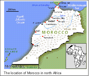
The Kingdom of Morocco covers about 700 000 km2 of north west Africa, with long coastlines on the Atlantic Ocean and Mediterranean Sea (Figure 1). It is in a winter rainfall area and the climate of the coastal regions is similar to that of the south western Cape. The rainfall range is analogous to that of the western part of South Africa: a large part of the country north of the Atlas Mountains lies within the 500 mm per annum rainfall area. The main drainage is to the north from the Atlas, and extensive irrigation schemes exist on the coastal plains. Morocco was a French protectorate during the first half of this century, but became an independent kingdom in 1955. It is now ruled by King Hassan II. The culture of the nation reflects its Arabian, Berber and French origins. King Hassan's enthusiasm for science and technology is apparent in the high level of achievement in these areas. Moroccan Royal Centre for Remote Sensing
Mr Merouane Soaud, our contact person at the Royal Centre for Remote Sensing in Rabat, died in a car accident in about February 1997. I only discovered this sad news on arrival in Rabat. Mr Arid, the head of the Oceanography, Climatology and Fisheries section arranged that I visit the centre on 21 April 1997 under the guidance of Mr Driss el Hadani. The centre has about eight SPARC 10 workstations running GIS and remote sensing applications, and its aquatic management and research functions are described in detail in El Hadani (1997) and Appendix I. The present offices in Avenue de France are a little cramped, but an imposing new centre is under construction in Avenue Assanaoubar in Hay Ryad. In Morocco, remote sensing is used for mapping surface water bodies, providing background information for catchment studies and for lineament mapping to aid in the detection of underground water. Geographical Information Systems (GIS) are used to integrate remote sensing data with other hydrological variables. IAHS Assembly
The Fifth Scientific Assembly of the IAHS consisted of six symposia and five workshops running in two to three parallel sessions from 23 April until 3 May 1997. Bureau meetings, plenary sessions, a technical tour, various ceremonies and a banquet were fitted into a crowded timetable. The assembly took place in the halls of the Ministry of Public Works Reception and Conference Centre, Hay Ryad, Rabat. Posters were displayed in a large tent in the conference grounds. About 440 delegates attended.
The Assembly was under the patronage of King Hassan II, and Abdelaziz Meziane Belfkih, minister for public works, inaugurated the proceedings with an overview of Morocco's thirty years of dam building. The deliberations of the Assembly would have practical application to Moroccan water problems (Appendix II). South African representation
The following delegates attended from South Africa:
Hugo Maaren (Water Research Commission)
Prof Roland Schulze (Natal University)
Dr Simon Lorenz (Natal University)
Prof Dennis Hughes (Rhodes University)
Bennie Haasbroek (DWAF)
Michael Silberbauer (DWAF) Symposia and workshops
Parallel sessions precluded attendance at all the sessions of interest, but I could attend many of the presentations in the sessions discussed below. Up to half the papers were in French, but were made intelligible by an excellent simultaneous translation service. The printed papers in the conference proceedings are only in French or English, with no translation of the abstract. Sustainability of water resources under increasing uncertainty
The proceedings of this large symposium are published in IAHS Publication 240 (Rosbjerg et al. 1997--see Appendix III for contents pages). Hugo Maaren kindly stepped in to present the paper of Diek van der Zel (DWAF) who was not able to obtain funding to attend the symposium. Several other authors from third-world countries experienced funding problems and for the assembly as a whole, at least twenty authors could not present their papers in person. The Sustainability symposium covered a wide geographic range and Africa was well-represented. Five papers concentrated on southern Africa (Bullock et al. 1997, Van der Zel 1997, Hughes et al. 1997, Smithers et al. 1997 and De Bruine & Lukire 1997). International cooperation in southern Africa on the FRIEND (Flow Regimes from International Experimental and Network Data) time series and spatial databases (Bullock et al. 1997) was particularly impressive. FRIEND has assembled a comprehensive southern African database of flow data, drainage basin GIS coverages and hydrological models. Remote sensing and geographic information systems for design and operation of water resources systems
This was a smaller symposium, but focussed on my area of interest. The proceedings are in IAHS Publication 242 (Baumgartner et al. 1997--see Appendix IV for contents pages). Papers were arbitrarily grouped into four sections: water resources management, snow hydrology, surface water & groundwater and new technologies. I presented a paper in the pre-lunch session on GIS and water quality (Silberbauer, 1997). Moroccan cuisine was a strong attraction, but some individuals made further enquiries afterwards and I met several people working in related fields (see Contacts Made below). Dr Ralf Busskamp's demonstration of the German Hydrological Atlas on ArcView was the most useful paper, parallelling some proposed developments for WaterMarc/View at IWQS (Busskamp, 1997--see Appendix VI).
Cost has become a factor in remote sensing, even for the wealthier nations, and free, low resolution, high repeat rate AVHRR images are apparently available off the Internet. These are a more attractive proposition than the better resolution Landsat or SPOT data, although no-one was prepared to put this view in writing!
Barret (1997) cautioned that generalisation of rain gauge data to areal precipitation could be highly misleading, particularly as all the rain gauges in the world, if packed next to each other, would only cover the area of a soccer pitch. The integrative ability of ground-based and remote sensing is essential for accurate prediction and monitoring.
The integration of remote sensing and GIS is far from complete, and in his concluding address the convenor, Dr Michael Baumgartner called for better integration of GIS and remote sensing software. He also felt that the potential for using remotely sensed data in hydrological models has not been fully realised. Freshwater contamination
Dr Norman (Jake) Peters (USGS) ensured that the water quality sessions were lively events. The Nutrients in Surface Waters session was a dramatic catalogue of water quality disasters around the world. Atlanta, Stratford-upon-Avon, the Vistula River and all of Hungary's groundwater came up for discussion.
Most of the problems were related to nutrients, but Dr Joanna Pociask-Karteczka's description of radium-226 contamination from coal mines in Silesia had everyone on the edges of their seats (Pociask-Karteczka et al. 1997). During the 1970s, the authorities would have kept information as controversial as this under wraps, but now they are prepared to admit the problem and take action. In the Gory Slask, Ra226 concentrations as high as 420 000 Bq m-3 have been measured (the risk of people contracting bone cancer increases if drinking water contains more than 420 Bq m-3 --Kempster et al. 1996). The Polish standard for water is 110 Bq m-3, but the Ra226 in the Vistula has reached 200 Bq m-3 on occasion. Dr Pociask-Karteczka reported 60 Bq kg-1 in carrots and 1000 Bq kg-1 in green grass in the drainage region. Polish coal miners are also exposed to high radiation levels from the solid coal. Ameliorative measures have reduced the radiation, but levels are still too high.
Dr Bruce Webb (Exeter University) summed up the session as showing that major gaps in our knowledge still exist, for example in endorheic systems and in the behaviour of heavy metals and sediment-bound components. He called for a global database and the posting of "grey" literature on the Internet. Contacts made
| Name, (Area of interest) |
Address | Phone and Facsimile | |
| Pierre-André Crausaz, (GESREAU integrated water management project) |
Hydrology and Land Improvement, Institute of Soil and Water, Ecole Polytechnique Fédérale de Lausanne, CH-1015 Lausanne, Switzerland |
Tél: +41 21 693 3743 Fax: +41 21 693 3739 |
|
| Dr Ralf Busskamp (Hydrological Atlas of Germany) |
Federal Institute of Hydrology, Kaiserin-Augusta-Anlagen 15-17, D-56068 Koblenz, Germany |
Tel: + 261 1306 255 Fax: + 261 1306 280 |
busskamp @koblenz. bfg. bund400. de |
| Dr Michael Baumgartner (Snowmelt hydrology-but works with other GIS specialists) |
Geographic Institute, University of Bern, 3012 Bern Switzerland |
Tel: +41 31 65 80 20 | mike@ giub.unibe.ch |
| Dr Joanna Pociask-Karteczka (Radium-226 in water) |
Geography Institute, Jagielloski University, 31 044 Kraków, ul. Grodzka 64 | Tel: +48 12 22 7111 Fax: +48 12 22 5578 |
jpociask@arsenal. geo.uj.edu.pl |
Mid-conference technical excursion
During the weekend in the middle of the conference, the Moroccan Water Resources Association took about 100 delegates on a tour of irrigation schemes to the north of Rabat, and to the ancient capital, Fès, nearly 200km inland from Rabat. Al Wahda Dam
The Al Wahda or "unity" dam is an imposing 100-metre high earth fill dam on the Oued Ouerrah, built between 1991 and 1996. It impounds a water body covering 12 000 hectares. The construction phase came close to disaster when the hydrological statistics proved to have too short a data record. An unexpected flood came within 30cm of overtopping the coffer dam. Al Wahda is part of a series in the Oued Ouerrah - Oued Sebou basins designed to provide irrigation water to the coastal plain and to adjoining basins. Fès
Fès has a vast medina or old city housing 300 000 people in a labyrinth of narrow streets and tightly-packed houses. An ancient university, dating from the 800s, is still active. The medina not only provides accommodation but is an important tourist attraction, with many labour-intensive industries such as textile dyeing, carpet manufacture, tanning and metalwork (Figures 2 to 7). These activities generate waste products transported by the Oued Fès into the Oued Sebou and contribute to the eutrophication problems in that river (Igouzal, 1997). UNESCO is supporting the upgrading of utilities such as water and sewage, a task complicated by the narrow streets and high density of historic structures.
IAHS procedural matters Association of African Hydrologists (AAH, or AHA in French)
Francophone Africa has spearheaded a drive to form an Association of African Hydrologists. The southern Africans spent a confused hour at a meeting where most of the proceedings were in French with no translation. Hugo Maaren found himself appointed "Vice-President for Southern Africa", despite his protests that this was undemocratic.
ICRSDT plans a symposium on remote sensing and GIS in the year 2000, to review progress in remote sensing related to hydrology. For more information on this and other ICRSDT matters, visit WWW page http: //hydrolab.arsusda.gov/ ~jritchie/. The ICRSDT newsletter is available at this site.
The IAHS has never charged a membership fee, but is considering introducing one soon. The figure on everyone's lips was US$50.00 per year, with adjustments for countries with weak currencies. Members of IAHS should watch their newsletters carefully.
The president called for everyone to stand in silence for a minute to honour those hydrologists who had passed away since the previous meeting. He mentioned only one by name, Professor Midgley of South Africa, winner of the 1996 International Hydrology Prize. Early in his long and distinguished hydrological career, Professor Midgley worked for DWAF (then the Irrigation Department) between 1935 and 1956.
Attendance at this assembly was very instructive, academically and culturally. I have met several people working in similar fields and have seen my work and that of the IWQS in a broader, global perspective.
The Space Applications Institute (SAI) is part of the Joint Research Centre (JRC) at Ispra, a town in the Varese province of Italy, northeast of Milan. This is one of seven JRCs at five sites across Europe, controlled and funded jointly by the members of the European Community. The nearest equivalent in South Africa is the CSIR. The reason for IWQS having contact with SAI is that in the 1970s an agreement existed with the United Kingdom by which British final-year hydrology students could do a three-month field study with DWAF. The student's report was beneficial to DWAF and was also submitted by the student as a thesis back in the UK. One of these students, Pam Kennedy, went on to obtain a directorate in remote sensing and has worked at SAI for the past decade. When she heard that I would be in the Mediterranean area, she invited me to visit SAI.
The SAI asked me to present a seminar on 13 May 1997 at the Environmental Mapping and Modelling Unit, in their series of afternoon communication sessions. The seminar was an extended version of the Rabat paper (Silberbauer, 1997), expanding on the use of remote sensing for land cover mapping. About 15 people from various departments of the JRC attended, and they appeared to find the information on South Africa interesting.
After the seminar, I was privileged to speak individually with several researchers about their projects, summarised below. The interested reader can find out more on their web site, or on the CD-ROM, The TREES Project -- a European initiative for tropical forest ecosystems, available from M. Silberbauer(Appendix VIII).
Frédéric Achard discussed the use of broad-scale vegetation mapping using the NOAA-AVHRR (National Oceanic and Atmospheric Administration Advanced Very High Resolution Radiometer) system for creating vegetation indices such as the NDVI or Normalised Difference Vegetation Index. He referred me to three papers by his colleagues, E. Lambin and D. Ehrlich, describing research conducted using data on Africa (Lambin & Ehrlich 1995, Lambin & Ehrlich 1996a and Lambin & Ehrlich 1996b--abstracts in Appendix IX).
Maria Luisa Paracchini showed me a procedure for erosion potential mapping that she had used for Sicily. The method overlays data from Landsat TM, a digital elevation model and a soil loss model to generate a map of erosion risk. This is similar to the technique used at IWQS by Juanita Moolman, except M-L. Paracchini has access to a powerful workstation with Arc/Info and Erdas Imagine running on the same platform. This combination speeds up testing and refining of procedures (Appendix X).
Another EMAP project is to map "desertification" in the Mediterranean region (MEditerranean Desertification And Land Use--MEDALUS III and DEsertification MOnitoring in the Mediterranean Basin--DeMon2). Desertification here refers to a tendency to drought rather than actual degeneration to bare soil, as we would understand the term. The research team uses a combination of all available satellite imagery plus ecological models.
To emphasise the wide variety of activities at JRC, my hosts showed me two experiments at one of the other institutes. In the first, the mobilisation and deposition of radioactive aerosol particles during reactor accidents is simulated to assist in mathematical modelling. The other uses an anechoic chamber in the European Microwave Signature Laboratory to test the use of microwave and radar for remote and proximal sensing applications, such as landmine detection.
The visit to SAI-JRC provided an unusual opportunity to present the activities of IWQS and DWAF to a European audience consisting of specialists in environmental mapping. I reestablished old contacts and created new lines of communication. The staff of JRC gave me many new references and data sources.
The IAHS Assembly and the visit to SAI-JRC were both valuable means for making contact with scientists working in the aquatic field in all parts of the world. Paradoxically, some of the knowledge I gained was about research being carried out in southern Africa. Apart from the formal presentations and informal communication, this trip was also an opportunity to see some environmental problems in the Mediterranean region at first hand. In parts of Morocco, as in parts of South Africa, concern for the environment takes second place to the daily struggle for survival.
In Europe, where technical and scientific resources are more abundant, we may find some willingness to help the third world in the identification and solving of environmental problems.
Barret, E.C. (1997) Satellite rainfall monitoring: recent progress and remaining problems. Remote Sensing and Geographic Information Systems for Design and Operation of Water Resources Systems (Proceedings of Rabat Symposium S3, April 1997). IAHS Publ. no. 242, 141-148.
Baumgartner, M.F., Schultz, G.A. & Johnson, A.I. (1997) Remote Sensing and Geographic Information Systems for Design and Operation of Water Resources Systems (Proceedings of Rabat Symposium S3, April 1997). IAHS Publ. no. 242, 1997.
Bullock, A., Andrews, A.J., Mkhandi, S., Mngodo, R. & Hughes, D.A. (1997) Southern African FRIEND--international collaboration in the hydrological science of flow regimes. Sustainability of Water Resources under Increasing Uncertainty (Proceedings of Rabat Symposium S1, April 1997). IAHS Publ. no. 240, 133-143.
Busskamp, R. & Liebscher, H.-J. (1997) Access to hydrological data from GIS applications by graphical software tools--an example from the Hydrological Atlas of Germany (HAD). Remote Sensing and Geographic Information Systems for Design and Operation of Water Resources Systems (Proceedings of Rabat Symposium S3, April 1997). IAHS Publ. no. 242, 255-259.
De Bruine, B. & Lukire, L. (1997) Sustainable development of water resources in a semiarid country such as Namibia. Sustainability of Water Resources under Increasing Uncertainty (Proceedings of Rabat Symposium S1, April 1997). IAHS Publ. no. 240, 503-508.
El Hadani, D. (1997) Télédétection et système d'information géographique pour la gestion et la recherche de l'eau (Remote sensing and geographic information systems for aquatic management and research). Remote Sensing and Geographic Information Systems for Design and Operation of Water Resources Systems (Proceedings of Rabat Symposium S3, April 1997). IAHS Publ. no. 242, 197-204.
Hughes, D.A., O'Keeffe, J. & King, J.A. (1997) Development of a reservoir release operating rule model to simulate demands for instream flow requirements and water resources. Sustainability of Water Resources under Increasing Uncertainty (Proceedings of Rabat Symposium S1, April 1997). IAHS Publ. no. 240, 321-329.
IAHS (1996) International Association of Hydrological Sciences Handbook 1995-1999. Wilfrid Laurier University Press, Ontario, Canada.
Igouzal, M., Maslouhi, A., Lahlou, F. & Daniane, M. (1997) Modélisation de la qualité des eaux de l'Oued Sebou à l'aval d'un rejet industriel (Modelling the water quality of Oued Sebou downstream of an industrial outfall). Freshwater Contamination (Proceedings of Rabat Symposium S4, April 1997). IAHS Publ. no. 2xx, pp xxx-xxx (exact publication details not available).
Kempster, P.L., Van Vliet, H.R., Looser, U., Parker, I., Silberbauer, M.J. & Du Toit, P. (1996) Overview of Radioactivity in Water Sources: Uranium, Radium and Thorium. IWQS internal report N/0000/00/RPQ/0196, Insitute for Water Quality Studies, Department of Water and Sanitation, Pretoria.
Pociask-Karteczka, J., Jasinska, M. & Mietelski, J.W. (1997) The influence of radionuclides released by Silesian coal mine activity on the natural environment in the Upper Vistula Basin (Poland). Freshwater Contamination (Proceedings of Rabat Symposium S4, April 1997). IAHS Publ. no. 2xx, pp xxx-xxx (exact publication details not available--please contact DWAF library).
Rosbjerg, D., Boutayeb, N.-E., Gustard, A., Kundewicz, W. & Rasmussen, P. F. (1997) Sustainability of Water Resources under Increasing Uncertainty (Proceedings of Rabat Symposium S1, April 1997). IAHS Publ. no. 240, 1997.
Silberbauer, M.J. (1997) The application of geographic information systems to water quality monitoring. Remote Sensing and Geographic Information Systems for Design and Operation of Water Resources Systems (Proceedings of Rabat Symposium S3, April 1997). IAHS Publ. no. 242, 189-195
Smithers, J., Schulze, R. & Kienzle, S. (1997) Design flood estimation using a modelling approach: a case study using the ACRU model. Sustainability of Water Resources under Increasing Uncertainty (Proceedings of Rabat Symposium S1, April 1997). IAHS Publ. no. 240, 365-375.
Van der Zel, D. (1997) Sustainable industrial afforestation in South Africa under water and other environmental pressures. Sustainability of Water Resources under Increasing Uncertainty (Proceedings of Rabat Symposium S1, April 1997). IAHS Publ. no. 240, 217-225.
APPENDIX I -- Royal Centre for Remote Sensing, Rabat, Morocco.
APPENDIX II -- L'expérience du Maroc donnée en exemple. -- Speech by the Minister of Public Works at the opening of the IAHS Assembly in Rabat. (24 April 1997) Le Matin du Sahara et du Magreb, page 5.
APPENDIX III -- Sustainability of Water Resources under Increasing Uncertainty -- Contents page of the Proceedings of Rabat Symposium S1, April 1997 (IAHS Publ. no. 240).
APPENDIX IV -- Remote Sensing and Geographic Information Systems for Design and Operation of Water Resources Systems -- Contents page of the Proceedings of Rabat Symposium S3, April 1997 (IAHS Publ. no. 242).
APPENDIX V -- Silberbauer, M.J. (1997) The application of geographic information systems to water quality monitoring -- copy of paper presented at IAHS Assembly.
APPENDIX VI -- Busskamp, R. & Liebscher, H.-J. (1997) Access to hydrological data from GIS applications by graphical software tools--an example from the Hydrological Atlas of Germany (HAD) -- copy of paper presented at IAHS Assembly.
APPENDIX VII -- Internet home page of the Joint Research Centre institutes of the European Commission.
APPENDIX VIII -- The TREES project CD-ROM. Available from M. J. Silberbauer, IWQS.
APPENDIX IX -- Abstracts of papers dealing with vegetation mapping using remote sensing at the Space Applications Institute.
APPENDIX X -- Internal report of the Space Applications Institute on a project to map soil erosion and land degradation in Sicily.
APPENDIX XI -- Miscellaneous conference announcements and abstracts.