Resource water quality data for region A.

Resource water quality data for region A. |
|
| Water quality | Description | Type | n | First date | Last date | med EC | Flow, if any |
Latitude | Longitude | ||
|---|---|---|---|---|---|---|---|---|---|---|---|
| A10 189482 | plot | data | Moilwas (Gopane) at Puageng/Dinokana Road on Tributary of MM Maphanyane | Rivers | 4 | 2007-08-20 | 2008-04-11 | 65 | A3NGOT-PUANE | -25.42919 | 25.86717 |
| A21 100000752 | plot | data | Hennops 01 on Skurweberg Dirt Road at Small Bridge | Rivers | 209 | 2002-06-18 | 2010-02-26 | 67 | A21 | -25.83053 | 28.11831 |
| A21 100000762 | plot | data | Rietvlei River 02 on Dirt Road Just downstream of Bridge (nemp) | Rivers | 219 | 2002-01-15 | 2018-08-06 | 67 | A21 | -25.96890 | 28.30100 |
| A21 100000763 | plot | data | Rietvlei 03 upstream of Sewage Works Close to Bridge | Rivers | 217 | 2002-01-15 | 2018-08-06 | 38 | A21 | -26.01920 | 28.30430 |
| A21 100000764 | plot | data | Rietvlei 04 Next to Road from Kempton Park to Bredell | Rivers | 8 | 2002-06-18 | 2008-07-30 | 24 | A21 | -26.02147 | 28.31357 |
| A21 100000766 | plot | data | Rietvlei 06 downstream of Farm Dam on Road R23 | Rivers | 186 | 2002-06-18 | 2010-02-26 | 38 | A21 | -26.05225 | 28.26608 |
| A21 100000767 | plot | data | Hennops O3 at Zwartkops Lapa | Rivers | 215 | 2002-06-18 | 2018-06-13 | 69 | A21 | -25.83085 | 28.12265 |
| A21 100000768 | plot | data | Hennops 02 at Bridge Close to Erasmia | Rivers | 221 | 2002-06-18 | 2017-11-02 | 69 | A21 | -25.82228 | 28.08213 |
| A21 100000771 | plot | data | Rietspruit 01 at Old Bridge Behind Sutherland Ridge (nmmp) | Rivers | 269 | 2002-06-18 | 2018-08-06 | 49 | A21 | -25.83757 | 28.10807 |
| A21 100000772 | plot | data | Rietspruit 02 at Bridge in Raslouw Ah | Rivers | 219 | 2002-06-18 | 2017-11-02 | 43 | A21 | -25.85438 | 28.10807 |
| A21 100000773 | plot | data | Swartbooispruit at Bridge on R511 from R28 to Erasmia | Rivers | 205 | 2002-06-18 | 2017-11-02 | 78 | A21 | -25.83708 | 28.04485 |
| A21 100000774 | plot | data | Kaalspruit 01 at Bridge from Centurion to Olifantsfontein | Rivers | 207 | 2002-06-18 | 2018-06-13 | 75 | A21 | -25.92293 | 28.22750 |
| A23 100000787 | plot | data | Tolwane River 2; Jericho at Bridge | Rivers | 129 | 2002-08-08 | 2017-01-24 | 67 | A23 | -25.32830 | 27.82760 |
| A23 100000789 | plot | data | Sandriver 2 Rosslyn Industrial Areas | Rivers | 134 | 2002-08-12 | 2017-11-01 | 68 | A23 | -25.61490 | 28.09475 |
| A23 100000790 | plot | data | Soshanguve Tributary of Apies River | Rivers | 117 | 2002-08-08 | 2010-01-14 | 69 | A23 | -25.61280 | 28.11300 |
| A23 100000881 | plot | data | Swawelpoort Tributary 2 Pienaars below Boschkop Bridge | Rivers | 117 | 2004-06-23 | 2012-10-25 | 34 | A23 | -25.41585 | 28.40528 |
| A23 100000882 | plot | data | Bloemendal at Kameelfontein on Gravel Road | Rivers | 117 | 2004-06-23 | 2012-10-25 | 36 | A23 | -25.66845 | 28.38607 |
| A23 100000883 | plot | data | Pienaarsriver 1; upstream of Boschkop Road | Rivers | 117 | 2004-06-23 | 2012-10-25 | 34 | A23 | -25.85843 | 28.45583 |
| A23 100000884 | plot | data | Moreleta Spruit at Kameeldrift | Rivers | 118 | 2004-06-23 | 2012-10-25 | 46 | A23 | -25.65688 | 28.30842 |
| A23 100000885 | plot | data | Pienaars River 13 Kameelfontein Road | Rivers | 113 | 2004-07-27 | 2012-10-25 | 58 | A23 | -25.66250 | 28.35083 |
| A23 100000886 | plot | data | At Pretoria Cullinan Road Bridge on Edendalspruit | Rivers | 117 | 2004-06-23 | 2012-10-25 | 36 | A23 | -25.67838 | 28.40172 |
| A23 100000887 | plot | data | Baviaanspoort 330 JR - downstream of Baviaanspoort WWTW on Pienaarsrivier | Rivers | 113 | 2004-06-23 | 2012-10-25 | 58 | A23 | -25.67877 | 28.35678 |
| A23 100000888 | plot | data | Roodeplaat Dam Outflow at Kwamhlanga Rd at Bridge | Rivers | 116 | 2004-06-23 | 2012-10-25 | 44 | A23 | -25.60820 | 28.36743 |
| A23 100000966 | plot | data | Platspruit in Warmbath | Rivers | 10 | 2004-07-27 | 2006-06-13 | 33 | A23 | -24.89193 | 28.29982 |
| A23 100000967 | plot | data | Pienaars (Plat) River at Pienaars River Town | Rivers | 105 | 2004-06-23 | 2012-10-25 | 48 | A23 | -25.21910 | 28.29438 |
| A23 188059 | plot | data | Buffelspruit at Warmbad Rifle Range on Buffelspruit (Plat) | Rivers | 1 | 2004-05-07 | 2004-05-07 | 7 | A23BUFF-KOMAN | -24.83468 | 28.22411 |
| A23 188060 | plot | data | Noodhulp at Baartman S Pumphouse on Platrivier | Rivers | 1 | 2004-05-07 | 2004-05-07 | 9 | A23PLAT-NOODS | -24.90610 | 28.25800 |
| A23 188054 | plot | data | Tooyskraal 200M ds of New Road at Old Brigde on Tooyspruit | Rivers | 1 | 2004-05-06 | 2004-05-06 | 13 | A23TOOY-ETOSH | -24.85750 | 27.91090 |
| A24 188058 | plot | data | Buffelshoek at Ben Alberts Nat Res Road Bridge on Krokodilriv Vier | Rivers | 1 | 2004-05-20 | 2004-05-20 | 73 | A24CROC-BENAL | -24.64160 | 27.36810 |
| A24 188057 | plot | data | Liverpool at Koedoeskop Doornfontein Bridge on Krokodilrivier R | Rivers | 1 | 2004-05-17 | 2004-05-17 | 71 | A24CROC-KOEDO | -24.88980 | 27.51830 |
| A24 188063 | plot | data | Welgevonden at Eden Farm Morgenzon ds of Weir on Krokodilriv Vier | Rivers | 1 | 2004-05-19 | 2004-05-19 | 75 | A24CROC-MORGE | -24.29250 | 27.02800 |
| A24 188061 | plot | data | Sweet Home at Old Northam Bridge on Krokodilrivier | Rivers | 1 | 2004-05-19 | 2004-05-19 | 69 | A24CROC-SWEET | -24.58770 | 27.24970 |
| A24 188052 | plot | data | Brakvallei at Bridge on Sandrivier | Rivers | 1 | 2004-05-05 | 2004-05-05 | 11 | A24SAND-BRAKV | -24.68420 | 27.46900 |
| A24 188050 | plot | data | Buffelshoek Upper Weir on Sondagsrivier | Rivers | 1 | 2004-05-04 | 2004-05-04 | 5 | A24SUND-BUFFE | -24.53810 | 27.64080 |
| A24 188051 | plot | data | Zandrivierpoort U/S Sandrivier on Sondagsrivier | Rivers | 1 | 2004-05-05 | 2004-05-05 | 10 | A24SUND-WATER | -24.63020 | 27.60580 |
| A24 188056 | plot | data | Rhenosterhoekspruit Kareefontein Bridge on Vingerkraal se Lo Oop | Rivers | 1 | 2004-05-06 | 2004-05-06 | 19 | A24VING-KAREE | -24.67800 | 27.89910 |
| A21 189445 | plot | data | Roodekopjes 427 JQ below New Sewage Works at R511 on Crocodile River | Rivers | 2 | 2016-09-07 | 2017-09-28 | 116 | A2CROC-BRITS | -25.61730 | 27.76687 |
| A21 189419 | plot | data | Zoutpansdrift 415 JQ at Old Bridge on Krokodilrivier | Rivers | 3 | 2006-09-04 | 2006-12-11 | 90 | A2CROC-ZOUTP | -25.54833 | 27.70939 |
| A22 189036 | plot | data | Bulhoek at Farm Road on Dwarsspruit | Rivers | 5 | 2006-06-27 | 2010-10-20 | 9 | A2DWAR-BULHO | -25.55511 | 26.90881 |
| A22 188078 | plot | data | Waterval at Road Bridge on Dwarsspruit | Rivers | 5 | 2004-07-02 | 2006-11-28 | 15 | A2DWAR-WATER | -25.51572 | 26.93144 |
| A22 189442 | plot | data | Bestershoek 3.1 km U/S of Brakkloofspruit Confluence at Maba Aalstad Road on Elandsrivi | Rivers | 6 | 2008-07-16 | 2012-02-22 | 29 | A2ELAN-BESTE | -25.46392 | 26.78925 |
| A22 188120 | plot | data | Bulhoek D/S Vaalkop Dam at Road Bridge on Elandsrivier | Rivers | 1 | 2004-08-18 | 2004-08-18 | 59 | A2ELAN-BULHO | -25.30617 | 27.47619 |
| A22 188073 | plot | data | Doornkom Brakfontein Mullet on Elandsrivier | Rivers | 3 | 2004-06-29 | 2006-06-30 | 7 | A2ELAN-DOORK | -25.70881 | 26.71431 |
| A22 189032 | plot | data | Doornpoort at Road Bridge on Elandsrivier | Rivers | 7 | 2006-06-26 | 2010-10-19 | 5 | A2ELAN-DOORN | -25.84103 | 26.75600 |
| A22 188070 | plot | data | Hoogeboomen at Causeway on Elandsrivier | Rivers | 5 | 2004-07-02 | 2008-07-16 | 50 | A2ELAN-HOOGE | -25.44653 | 26.89478 |
| A22 188072 | plot | data | Klipbankfontein at Mazista on Elandsrivier | Rivers | 11 | 2004-06-29 | 2012-02-23 | 9 | A2ELAN-KLIPB | -25.72656 | 26.72044 |
| A22 188071 | plot | data | Lindleyspoort downstream of Bridge on Elandsrivier | Rivers | 8 | 2004-06-30 | 2018-03-20 | 24 | A2ELAN-LINDL | -25.48240 | 26.69000 |
| A22 188075 | plot | data | Nooitgedacht at Road Bridge on Elandsrivier | Rivers | 6 | 2004-06-30 | 2008-07-18 | 17 | A2ELAN-NOOIT | -25.58186 | 26.67789 |
| A22 183156 | plot | data | Monnakato Rietspruit at Road Bridge on Elandsrivier (NEMP) | Rivers | 156 | 1999-11-09 | 2018-08-30 | 94 | A2ELAN-RIETS | -25.33440 | 27.29140 |
| A22 188076 | plot | data | Swartruggens at Road Bridge in Town on Elandsrivier | Rivers | 5 | 2004-06-29 | 2006-11-30 | 10 | A2ELAN-SWART | -25.65025 | 26.69061 |
| A22 189196 | plot | data | Vlakfontein 466 JP at Rosmincol Road on Elandsrivier | Rivers | 2 | 2006-06-26 | 2006-06-26 | 37 | A2ELAN-VLAKF | -25.86272 | 26.77842 |
| A23 90160 | plot | data | Pienaarsrivier 90 JR at Klipdrift on Pienaars River (NCWQ NCMP nemp NEMP) | Rivers | 1725 | 1976-02-02 | 2018-05-22 | 47 | A2H006 | -25.38056 | 28.31667 |
| A21 90162 | plot | data | Hennops River at Rietvlei/Rietvlei Dam | Rivers | 1 | 1997-12-02 | 1997-12-02 | 39 | A2H009 | -25.87639 | 28.26528 |
| A21 90164 | plot | data | Kalkheuwel 493 JQ on Crocodile River (NCWQ NCMP nemp GEMS NEMP) | Rivers | 4043 | 1971-07-04 | 2018-07-12 | 65 | A2H012 | -25.81048 | 27.90955 |
| A21 90165 | plot | data | Scheerpoort 477 JQ Magalies River at Scheerpoort (NCWQ NCMP nemp NEMP) | Rivers | 1832 | 1971-07-04 | 2018-04-25 | 41 | A2H013 | -25.77703 | 27.76111 |
| A21 90166 | plot | data | Schurveberg 488 JQ at Skurweberg on Hennopsrivier (NCWQ nemp NEMP) | Rivers | 1764 | 1976-01-27 | 2018-05-08 | 66 | A2H014 | -25.79842 | 27.98533 |
| A21 90167 | plot | data | Roodekopjes Dam on Crocodile River: downstream Weir (NCWQ NCMP nemp NEMP) | Rivers | 1617 | 1976-02-06 | 2018-05-30 | 68 | A2H019 | -25.40361 | 27.57478 |
| A23 90168 | plot | data | Pienaars River at Buffelspoort (NCWQ NCMP) | Rivers | 1874 | 1971-09-27 | 2018-05-30 | 62 | A2H021 | -25.12778 | 27.62889 |
| A21 90169 | plot | data | Nietgedacht 535 JQ DWJ26 on Jukskeirivier (NCWQ) | Rivers | 1600 | 1979-05-02 | 2018-05-21 | 62 | A2H023 | -25.95466 | 27.96217 |
| A21 90171 | plot | data | Brandvlei 261 IQ on Brandvleirivier (NCWQ) | Rivers | 380 | 1978-02-09 | 2018-04-30 | 4 | A2H024 | -26.15119 | 27.59486 |
| A24 90172 | plot | data | Crocodile River at Hardekoolbult | Rivers | 338 | 1971-09-28 | 1997-06-04 | 72 | A2H025 | -24.93333 | 27.54833 |
| A23 90173 | plot | data | Apies River at Hammanskraal | Rivers | 343 | 1975-09-23 | 1984-06-06 | 88 | A2H026 | -25.40583 | 28.27833 |
| A23 90174 | plot | data | Pienaars River at Baviaanspoort (NCWQ NCMP NEMP NMMP NEMP) | Rivers | 5027 | 1967-02-08 | 2018-08-27 | 61 | A2H027 | -25.66317 | 28.35115 |
| A23 90175 | plot | data | At Kameeldrift on Hartbeesspruit (NCWQ NEMP NMMP NEMP) | Rivers | 4098 | 1967-05-10 | 2018-08-27 | 47 | A2H028 | -25.65083 | 28.31944 |
| A23 90176 | plot | data | At Leeuwfontein on Edendalspruit (NCWQ NEMP NMMP) | Rivers | 2576 | 1967-02-08 | 2018-08-27 | 33 | A2H029 | -25.64889 | 28.39194 |
| A23 90177 | plot | data | Roodeplaat Spruit at Roodeplaat/Louwsbaken se Loop (NCWQ) | Rivers | 620 | 1968-05-15 | 2018-06-05 | 77 | A2H030 | -25.60167 | 28.37611 |
| A22 90178 | plot | data | Moedwil on Selonsrivier (ncwq) | Rivers | 139 | 1977-05-26 | 2017-04-18 | 21 | A2H032 | -25.63753 | 27.02703 |
| A21 90180 | plot | data | Scheerpoort 477 JO on Skeerpoortrivier (NCWQ) | Rivers | 1762 | 1976-01-21 | 2018-05-23 | 32 | A2H034 | -25.82483 | 27.77175 |
| A21 90181 | plot | data | Skeerpoort River at Hartbeeshoek | Rivers | 53 | 1980-02-03 | 1999-01-29 | 29 | A2H035 | -25.86750 | 27.78333 |
| A22 90182 | plot | data | Steenbokfontein 426 JP on Kosterrivier (NCWQ nemp nemp) | Rivers | 1552 | 1971-09-24 | 2017-12-12 | 10 | A2H036 | -25.72586 | 26.88444 |
| A24 90183 | plot | data | Crocodile River at Buffelshoek | Rivers | 119 | 1985-01-24 | 1991-04-04 | 68 | A2H037 | -24.66361 | 27.37583 |
| A22 90184 | plot | data | Rietvalei 314 JO on Waterkloofspruit Lower Site (NCWQ NCMP nemp NEMP) | Rivers | 378 | 1973-07-12 | 2018-05-03 | 4 | A2H038 | -25.73411 | 27.21422 |
| A22 90185 | plot | data | Upper Waterkloof at Rietvallei | Rivers | 66 | 1973-07-12 | 2015-05-26 | 3 | A2H039 | -25.71667 | 27.18611 |
| A21 90186 | plot | data | DWJ37 at Waterval D/S R101 on Jukskei (NTOX) | Rivers | 1751 | 1971-12-06 | 2018-08-21 | 117 | A2H040 | -26.03139 | 28.11222 |
| A21 90187 | plot | data | Jukskei River at Lone Hill | Rivers | 952 | 1971-12-06 | 1997-10-13 | 94 | A2H042 | -26.00528 | 28.03333 |
| A21 90188 | plot | data | Riverside Spruit at Diepsloot (ntox) | Rivers | 2 | 1971-12-06 | 1971-12-27 | 34 | A2H043 | -25.95806 | 28.03444 |
| A21 90189 | plot | data | Vlakfontein 494 JQ on Jukskeirivier (NCWQ) | Rivers | 1649 | 1971-12-06 | 2018-05-21 | 61 | A2H044 | -25.89550 | 27.93481 |
| A21 90190 | plot | data | Vlakfontein 494 JQ DWJ31 on Crocodile River (NCWQ) | Rivers | 1733 | 1979-05-02 | 2018-05-23 | 58 | A2H045 | -25.89264 | 27.91437 |
| A21 90191 | plot | data | Klipfontein/Randburg on Klein-Jukskeirivier (NCWQ) | Rivers | 639 | 1971-12-06 | 2018-06-05 | 38 | A2H047 | -26.06818 | 27.97202 |
| A21 90192 | plot | data | Krokodilpoort 418 JO /Thaba Moya on Krokodilrivier (NCWQ nemp NEMP) | Rivers | 1741 | 1976-02-19 | 2018-04-30 | 76 | A2H048 | -25.57327 | 27.75445 |
| A21 90193 | plot | data | Zwartkop 525 JQ on Bloubankspruit / Rietspruit (NCWQ) | Rivers | 1335 | 1979-05-23 | 2018-05-21 | 61 | A2H049 | -25.97681 | 27.83644 |
| A21 90194 | plot | data | Zwartkop 250 JQ Hoi-Hoi at Hoi-Hoi on Crocodile River (NCWQ NCMP) | Rivers | 1342 | 1979-05-02 | 2018-05-21 | 44 | A2H050 | -25.99136 | 27.84208 |
| A21 90195 | plot | data | Van Wyks Restant 182 IQ at Muldersdrift on Krokodilrivier (NCWQ) | Rivers | 919 | 1979-05-02 | 2016-12-19 | 24 | A2H051 | -26.03311 | 27.84269 |
| A21 90196 | plot | data | Crocodile River at Crocodile Drift/Brits Pump Sta | Rivers | 674 | 1976-02-06 | 1990-05-16 | 64 | A2H052 | -25.64556 | 27.78444 |
| A21 90197 | plot | data | Buffelsfontein 344 JQ at Grootfontein on Sterkstroom /Gwatlhe (NCWQ) | Rivers | 277 | 1978-03-07 | 1996-04-30 | 5 | A2H053 | -25.80928 | 27.47603 |
| A23 90198 | plot | data | At Wolmaranspoort on Hartbeesspruit (NCWQ) | Rivers | 1287 | 1982-11-16 | 2018-05-07 | 45 | A2H054 | -25.68333 | 28.28639 |
| A23 90199 | plot | data | Moretele River at Derdepoort Pretoria/Moreleta (NCWQ) | Rivers | 1357 | 1982-11-16 | 2018-05-07 | 49 | A2H055 | -25.69222 | 28.29306 |
| A23 90200 | plot | data | Steenoond Spruit at Belle Ombre Station/Apies Confluence (NCWQ nemp NEMP) | Rivers | 1440 | 1982-09-14 | 2018-05-08 | 50 | A2H056 | -25.73333 | 28.17917 |
| A23 90201 | plot | data | Skinner Spruit at Daspoort Pretoria/Bantule (NCWQ nemp NEMP) | Rivers | 1439 | 1982-11-17 | 2018-05-22 | 62 | A2H057 | -25.73333 | 28.16806 |
| A21 90202 | plot | data | Ifafa 457 JQ at Rietfontein / Syferfontein on Swartspruit (NCWQ) | Rivers | 474 | 1982-09-08 | 2018-05-29 | 71 | A2H058 | -25.74819 | 27.90986 |
| A24 90203 | plot | data | Vaalkop 192 JQ at Atlanta on Crocodile River (NCWQ NCMP) | Rivers | 1100 | 1985-02-07 | 2018-05-30 | 75 | A2H059 | -25.20639 | 27.55800 |
| A24 90204 | plot | data | Crocodile River at Nooitgedacht (NCWQ) | Rivers | 1592 | 1984-03-29 | 2018-05-30 | 69 | A2H060 | -25.06222 | 27.52111 |
| A23 90205 | plot | data | Apies River at Rondavel (NCWQ NCMP) | Rivers | 1355 | 1984-07-04 | 2018-05-22 | 74 | A2H061 | -25.45964 | 28.26431 |
| A23 90206 | plot | data | Walker Spruit at Sunnyside Pretoria/Loftus Versveld (NCWQ nemp NEMP) | Rivers | 1359 | 1984-08-07 | 2018-05-21 | 42 | A2H062 | -25.76000 | 28.22000 |
| A23 90207 | plot | data | Wonderboom Spruit at Mayville Pretoria (NCWQ nemp NEMP) | Rivers | 1365 | 1984-06-13 | 2018-05-22 | 51 | A2H063 | -25.70083 | 28.19111 |
| A23 90208 | plot | data | Apies River at Onderstepoort Nature Reserve | Rivers | 63 | 1980-04-08 | 1981-09-15 | 88 | A2H066 | -25.64167 | 28.18750 |
| A21 90214 | plot | data | Hartbeespoort Dam on Crocodile River: Down Stream Weir (NCWQ nemp NEMP) | Rivers | 861 | 1979-05-22 | 2018-05-29 | 54 | A2H083 | -25.71889 | 27.84361 |
| A21 90218 | plot | data | Hennops River at V Riebeeck Nat Res up/S Rietvlei (NCWQ NEMP) | Rivers | 576 | 1986-04-25 | 2018-08-20 | 53 | A2H090 | -25.88556 | 28.30278 |
| A22 90220 | plot | data | Tweedepoort 289 JQ downstream Weir for Bospoort Dam on Hex River (NCWQ NCMP) | Rivers | 221 | 1978-11-22 | 2004-01-02 | 77 | A2H094 | -25.54769 | 27.35233 |
| A23 90225 | plot | data | Roodeplaat Dam on Pienaars River: Down Stream Weir (NCWQ nemp NEMP) | Rivers | 829 | 1980-01-07 | 2018-05-22 | 43 | A2H102 | -25.61770 | 28.37210 |
| A22 90226 | plot | data | Waterkloof 423 JP Down Stream Weir for Koster Dam on Kosterrivier (nemp NEMP) | Rivers | 698 | 1972-01-15 | 2018-06-19 | 16 | A2H104 | -25.69847 | 26.90569 |
| A23 90227 | plot | data | Klipvoor Dam on Pienaars River: Down Stream Weir (NCWQ nemp NEMP) | Rivers | 740 | 1985-10-28 | 2018-05-30 | 60 | A2H106 | -25.13111 | 27.81111 |
| A22 90228 | plot | data | Brakfontein 404 JP Down Stream Weir for Swartruggens Dam on Elandsrivier (nemp nemp) | Rivers | 213 | 1985-02-01 | 2013-05-28 | 11 | A2H107 | -25.65700 | 26.69469 |
| A22 90230 | plot | data | Vaalkop Dam on Elands River: downstream Weir (NCWQ NCMP nemp NEMP) | Rivers | 1182 | 1985-02-28 | 2018-05-30 | 60 | A2H111 | -25.30658 | 27.47622 |
| A23 90238 | plot | data | At Franspoort Road Bridge on Edendalspruit (NEMP NMMP) | Rivers | 1329 | 1995-01-24 | 2018-08-27 | 42 | A2H126 | -25.67778 | 28.40194 |
| A23 90239 | plot | data | Pienaars River at Baviaanspoort (Magaliesberg) (nemp nmmp) | Rivers | 1268 | 1995-01-23 | 2018-03-12 | 47 | A2H127 | -25.69500 | 28.35861 |
| A24 188062 | plot | data | - A24CROC-Leeuw Faure 72 KQ - Leeuwdrift at Weir on Crocodile River (NCMP) | Rivers | 113 | 2004-05-19 | 2018-05-31 | 74 | A2H128 | -24.39619 | 27.08983 |
| A24 90233 | plot | data | Haakdoorndrift 373 KQ at Paul Hugo Dam on Crocodile River (NCWQ NCMP) | Rivers | 758 | 1989-12-07 | 2018-05-30 | 75 | A2H132 | -24.69514 | 27.40906 |
| A22 188098 | plot | data | Buffelsfontein at Road Bridge on Hexrivier | Rivers | 4 | 2004-08-10 | 2008-06-09 | 35 | A2HEX-BUFFE | -25.93947 | 27.33555 |
| A22 188106 | plot | data | Leeuwpoort at Road Bridge on Hexrivier (nemp) | Rivers | 99 | 2004-07-29 | 2018-01-19 | 66 | A2HEX-LEEUW | -25.88187 | 27.31008 |
| A22 188116 | plot | data | Olifantspoort on Hexrivier | Rivers | 5 | 2004-07-29 | 2008-06-09 | 52 | A2HEX-OLIFA | -25.81842 | 27.27068 |
| A22 184810 | plot | data | Paardekraal at Bridge near Boitekong on Hexrivier | Rivers | 35 | 1999-11-09 | 2006-09-08 | 121 | A2HEX-PAARD | -25.60810 | 27.28940 |
| A22 188118 | plot | data | Rooiwal 285 JQ on R559 D/S of Lesung Village on Hexrivier | Rivers | 5 | 2004-07-30 | 2008-06-11 | 105 | A2HEX-ROOIW | -25.52135 | 27.37527 |
| A22 189461 | plot | data | Paardekraal 297 JQ on Hexrivier | Rivers | 1 | 2012-03-23 | 2012-03-23 | 35 | A2HEX-RUSTE | -25.63094 | 27.29122 |
| A22 189436 | plot | data | Hex River at U/S of Rustenburg Site | Rivers | 4 | 2006-09-08 | 2018-10-17 | 76 | A2HEX-WATER | -25.67578 | 27.27714 |
| A21 188103 | plot | data | Hartebeestpoortb 410 JQ at Kareepoort on Tributary of Kareesp Pruit | Rivers | 2 | 2004-08-20 | 2008-05-12 | 146 | A2KARE-HARTB | -25.65619 | 27.66031 |
| A21 188122 | plot | data | Zoutpansdrift North of Losperfontein on Kareespruit | Rivers | 2 | 2004-08-13 | 2006-09-04 | 100 | A2KARE-ZOUTP | -25.57478 | 27.68303 |
| A22 188113 | plot | data | Middelfontein at Road Bridge on Rooikloofspruit (nemp) | Rivers | 103 | 2004-07-29 | 2018-02-02 | 57 | A2KLEI-MIDDE | -25.86445 | 27.16643 |
| A24 189038 | plot | data | Rhenosterkraal at Road on Kolobeng | Rivers | 1 | 2006-06-27 | 2006-06-27 | 15 | A2KOLO-RHENO | -25.00547 | 27.00111 |
| A22 188074 | plot | data | Naauwpoort 437 JP at Road Bridge on Kosterrivier | Rivers | 7 | 2004-07-01 | 2017-04-18 | 15 | A2KOST-NAAUW | -25.75286 | 26.89011 |
| A22 188077 | plot | data | Tweerivier at Road Bridge on Kosterrivier | Rivers | 3 | 2004-06-30 | 2006-06-27 | 45 | A2KOST-TWEER | -25.62008 | 27.00533 |
| A22 189418 | plot | data | Hartbeestspruit 88 JQ About 1.2KM U/S Elandsrivier Confluenc Ce on Leragane | Rivers | 3 | 2006-06-29 | 2006-11-27 | 176 | A2LARE-HARTB | -25.35919 | 27.21050 |
| A23 189440 | plot | data | Buffelsdraai 151 JQ at Road at Ga-Rasai on Pienaarsrivier | Rivers | 5 | 2006-09-06 | 2008-05-13 | 60 | A2PIEN-BUFFE | -25.13958 | 27.69114 |
| A21 188119 | plot | data | Mamogaleskraal on Rosespruit | Rivers | 6 | 2004-08-20 | 2008-05-15 | 126 | A2ROSE-MAMOG | -25.55339 | 27.79475 |
| A23 100000794 | plot | data | Nooitgedacht 256 JR About 380M U/S Nooitgedacht Dam on Sand River | Rivers | 120 | 2002-08-12 | 2010-01-14 | 59 | A2SAND-NOOIT | -25.52735 | 28.02798 |
| A21 188099 | plot | data | Grootfontein U/S Buffelspoort Dam on Barnardvlei Gravel Rd on Sterkstroom | Rivers | 5 | 2004-07-30 | 2008-06-10 | 5 | A2STER-BUFFE | -25.80745 | 27.47815 |
| A21 189435 | plot | data | Mamogales D/S of Sterkstroom and Maretlwane Confluence on G Gwathle | Rivers | 5 | 2006-08-22 | 2008-06-11 | 52 | A2STER-MAMOG | -25.59839 | 27.50575 |
| A21 188117 | plot | data | Rietfontein 348 JQ at Road Bridge on Sterkstroom | Rivers | 6 | 2004-07-29 | 2008-06-10 | 3 | A2STER-RIETF | -25.83350 | 27.38850 |
| A21 187088 | plot | data | At Spuitfontein Road Bridge on Sterkstroom (NMMP) | Rivers | 372 | 2003-04-23 | 2015-06-30 | 46 | A2STER-SPRUI | -25.72517 | 27.48333 |
| A21 185014 | plot | data | Gwatlhe River Bridge on Sterkstroom (NEMP) | Rivers | 119 | 1999-07-28 | 2017-11-16 | 79 | A2STER-WAAIK | -25.52676 | 27.55270 |
| A21 189433 | plot | data | Zwartkoppies 296 JQ at Road N of Marikana Station on Sterkst Troom | Rivers | 1 | 2006-08-22 | 2006-08-22 | 88 | A2STER-ZWART | -25.64964 | 27.48381 |
| A23 100000804 | plot | data | Tolwane upstream of Klipgat Sewage Works on Tolwane | Rivers | 129 | 2002-08-08 | 2010-01-14 | 46 | A2TOLW-NOOIT | -25.49450 | 28.02220 |
| A23 100000791 | plot | data | Sjambok Zyn Oude Kraal 258 JR About 820M U/S of Sandrivier C Confluence | Rivers | 139 | 2002-09-03 | 2017-11-01 | 69 | A2UNSP-OUDEK | -25.55840 | 28.00665 |
| A22 189031 | plot | data | Doornpoort at Road Bridge on Tributary of Elands | Rivers | 5 | 2006-06-26 | 2010-10-19 | 5 | A2UNSP-TRIBU | -25.84117 | 26.73508 |
| A22 188121 | plot | data | Waterkloof at Road Bridge on Waterkloofspruit | Rivers | 3 | 2004-07-30 | 2006-09-07 | 5 | A2WATE-WATER | -25.73597 | 27.26665 |
| A21 100001032 | plot | data | Blougatspruit D/S of Percy Stewart Sewage Treatment | Rivers | 66 | 2002-11-21 | 2017-03-08 | 77 | BGS1 | -26.06555 | 27.72232 |
| A21 100001027 | plot | data | Blougatspruit U/S of Percy Stewart Sewage Treatment | Rivers | 54 | 2002-11-21 | 2017-03-08 | 33 | BGS2 | -26.07138 | 27.72888 |
| A21 100001031 | plot | data | Crocodile D/S of JW Driefontein Sewage Treatment Plant | Rivers | 48 | 2002-11-21 | 2017-03-09 | 42 | CCR1 | -26.00990 | 27.83250 |
| A21 100001030 | plot | data | Crocodile River upstream of JW Driefontein Sewage Treatment | Rivers | 95 | 2002-11-21 | 2017-03-09 | 29 | CR1 | -26.01230 | 27.83340 |
| A21 100000908 | plot | data | Crocodile River downstream of JW Driefontein Sewage Treatment | Rivers | 41 | 2006-11-03 | 2009-04-28 | 36 | CR2 | -25.93504 | 27.90600 |
| A21 88648 | plot | data | Jukskei River U/S Confluence Modderfontein Marlboro (NMMP) | Rivers | 216 | 2002-12-11 | 2018-07-05 | 45 | DWJ12 | -26.08694 | 28.10889 |
| A21 191610 | plot | data | - Diepsloot 388 JR - U/S of Northern WWTW Discharge on Jukskeirivier | Rivers | 28 | 2006-11-03 | 2016-09-12 | 51 | DWJ27 | -25.95658 | 27.98989 |
| A21 185641 | n/a | n/a | Jukskei River - Northern End of Eastbank Road (nmmp) | Rivers | 73 | 2002-12-11 | 2007-06-19 | n/a | DWJ42 | -26.09470 | 28.10660 |
| A21 100001024 | plot | data | Elandsvlei 249 IQ D/S of Randfontein Sewage Treatment Plant on Bloubankspruit | Rivers | 65 | 2002-11-21 | 2017-03-08 | 60 | ELV1 | -26.14170 | 27.67560 |
| A21 187593 | plot | data | Upstream of R24 at Randfontein Estates on Tweelopiespru | Rivers | 103 | 2003-11-13 | 2008-09-30 | 330 | F1S1 | -26.10752 | 27.72268 |
| A21 187592 | plot | data | At Willow Tree in Krugersdorp Game Reserve on Tweelopie | Rivers | 100 | 2003-11-13 | 2008-09-30 | 328 | F2S2 | -26.10653 | 27.72227 |
| A21 187590 | plot | data | Krugersdorp Game Reserve - at Cemetery; on Tweelopiespruit | Rivers | 113 | 2003-11-13 | 2009-07-02 | 278 | F6S7 | -26.09671 | 27.71932 |
| A21 187589 | plot | data | At Broad Crest in Krugersdorp Game Reserve on Tweelopie | Rivers | 115 | 2003-11-14 | 2008-09-30 | 216 | F8S9 | -26.08527 | 27.70886 |
| A21 100000904 | plot | data | Honingkklip R47 | Rivers | 26 | 2002-12-11 | 2008-08-26 | 14 | HKS1 | -26.04135 | 27.78754 |
| A23 100000814 | plot | data | Itsoseng Tributary | Rivers | 68 | 2002-09-03 | 2006-07-11 | 24 | ISG2 | -25.53190 | 28.06990 |
| A21 191611 | plot | data | - Rietfontein 532 JQ - D/S of Northern WWTW Discharge on Jukskeirivier | Rivers | 24 | 2006-11-03 | 2006-12-21 | 53 | J7 | -25.90811 | 27.95033 |
| A21 191695 | n/a | n/a | - Bloubosrand Bothasfontein 408 JR - at Road Bridge on Klein Jukskeirivier Tributary (NMMP) | Rivers | 55 | 2008-11-06 | 2018-10-04 | n/a | KJ1 | -26.01662 | 27.96722 |
| A21 100000903 | plot | data | Klein River downstream | Rivers | 86 | 2002-11-21 | 2017-03-19 | 69 | KLR1 | -25.89570 | 27.58980 |
| A21 100000807 | plot | data | A21 Magalies downstream | Rivers | 74 | 2002-11-21 | 2017-03-09 | 41 | MGR1 | -25.86950 | 27.61490 |
| A21 100000907 | plot | data | Botanical Gardens upstream | Rivers | 31 | 2002-11-21 | 2017-03-09 | 12 | MSL1 | -26.10710 | 27.83890 |
| A21 100000965 | plot | data | Rietspruit downstream Cultera | Rivers | 87 | 2003-03-25 | 2017-03-08 | 61 | RTS1 | -26.11460 | 27.66200 |
| A21 1000013602 | plot | data | Snymansdrift 413 JQ - SD1 on | Rivers | 2 | 2006-01-12 | 2006-01-12 | 106 | SD1 | -25.53522 | 27.67636 |
| A21 100001025 | plot | data | Skeerpoort River Bridge at R612 in Hekpoort | Rivers | 84 | 2002-11-21 | 2017-03-09 | 35 | SPR1 | -25.78813 | 27.76698 |
| A23 100000816 | plot | data | Tributary at Garankuwa Next to Bp Garage | Rivers | 134 | 2002-08-08 | 2017-11-01 | 63 | SR4 | -25.60750 | 28.00640 |
| A23 100000812 | plot | data | Sandriver Before Confluence with Spruit from Medunsa | Rivers | 3 | 2003-05-06 | 2003-05-06 | 60 | SR5 | -25.55310 | 28.01150 |
| A23 100000805 | plot | data | Sandspruit Sewage Works | Rivers | 140 | 2002-08-08 | 2018-08-06 | 62 | SSW1 | -25.57570 | 28.04820 |
| A21 100000906 | plot | data | Krugersdorp Game Reserve - at Tweelopies Spring - Lodge Spring | Rivers | 4 | 2003-03-25 | 2017-03-08 | 84 | TLS1 | -26.09020 | 27.72020 |
| A21 187591 | plot | data | Krugersdorp Game Reserve - at Hippo Dam on Tweelopiespruit | Rivers | 122 | 2003-11-13 | 2010-02-24 | 341 | W1S3 | -26.09917 | 27.72128 |
| A21 100000811 | plot | data | A21 Wilgespruit | Rivers | 62 | 2002-12-11 | 2017-04-04 | 13 | WGS1 | -26.03640 | 27.85040 |
| A23 180555 | plot | data | Apies at Makapanstad -Swartdamstad/Hammanskraal Rd (NMMP) | Rivers | 1072 | 1999-05-31 | 2018-08-20 | 71 | ZAPI-MAKP | -25.23944 | 28.14417 |
| A21 88680 | plot | data | Modderfontein Spruit up Stream Jukskei Confluence (dup name 667) | Rivers | 1 | 2016-06-23 | 2016-06-23 | 49 | ZBMOD07 | -26.04611 | 28.11389 |
| A21 88737 | plot | data | Crocodile River D/S Confluence with Jukskei River | Rivers | 111 | 2005-01-12 | 2009-12-08 | 56 | ZDWJ32 | -25.86528 | 27.93333 |
| A23 180556 | plot | data | Moretele Sutelong/Rhenosterdrift(D/S Klipvoordam | Rivers | 32 | 1999-05-31 | 1999-07-19 | 70 | ZMOR-RHEN | -25.13139 | 27.96500 |
| A23 180557 | plot | data | Klipdrift 90JR at Rust de Winter Road on Pienaarsrivier | Rivers | 31 | 1999-05-31 | 1999-07-19 | 50 | ZPIE-KLIP | -25.37750 | 28.31806 |
| A23 180558 | plot | data | Klipplaatdrift 43 JR at Railway Bridge on Pienaarsrivier | Rivers | 30 | 1999-05-31 | 1999-07-19 | 50 | ZPIE-KLP | -25.15833 | 28.21278 |
| A23 180559 | plot | data | Pienaars River at Wallmansthal (Hammanskraal Road) | Rivers | 31 | 1999-05-31 | 1999-07-19 | 50 | ZPIE-WALL | -25.53333 | 28.32556 |
| A23 180561 | plot | data | Pienaars River at Vaalboschbult (Old Warmbad Road) | Rivers | 31 | 1999-05-31 | 1999-07-19 | 49 | ZPIN-VAAL | -25.21778 | 28.29472 |
| A21 90170 | n/a | n/a | Nietgedacht 535 JQ Biological Point 100M Down Stream of A2H023 on Jukskeirivier | Rivers | 1 | 1994-10-12 | 1994-10-12 | n/a | 90170 | -25.95222 | 27.96167 |
| A24 100796 | plot | data | Crocodile | Rivers | 1 | 1982-12-20 | 1982-12-20 | 89 | 100796 | -24.58667 | 27.25083 |
| A21 100893 | plot | data | De Kroon at Road Bridge on Krokodilrivier | Rivers | 13 | 1986-05-19 | 2004-08-18 | 66 | 100893 | -25.66667 | 27.79167 |
| A21 100895 | plot | data | Kaalspruit 60M D/S of Olifantsfontein - Midrand Old Tar Road (nmmp) | Rivers | 257 | 1987-02-06 | 2018-08-06 | 80 | 100895 | -25.95750 | 28.20694 |
| A21 101008 | plot | data | Zwartkrans at R563 Bridge on Bloubankspruit Rietspruit | Rivers | 44 | 1989-06-28 | 2008-09-30 | 87 | 101008 | -26.02083 | 27.72083 |
| A21 101438 | plot | data | Elandsvlei 249 IQ U/S of Randfontein Sewage Treatment Plant | Rivers | 67 | 1997-03-11 | 2017-03-08 | 21 | 101438 | -26.14528 | 27.67528 |
| A21 178860 | n/a | n/a | Leeuspruit Inflow into Hartbeespoort Dam | Rivers | 2 | 2001-03-28 | 2001-04-25 | n/a | 178860 | -25.77333 | 27.90722 |
| A21 179657 | plot | data | Magalies River - U/S of Hartbeespoort Dam on Farm S12 | Rivers | 3 | 1999-11-11 | 1999-11-12 | 48 | 179657 | -25.77223 | 27.75750 |
| A23 179682 | plot | data | Moretele River at Sutelong/Rt Tarrbridge (NMMP) | Rivers | 2537 | 2000-01-11 | 2018-09-26 | 49 | 179682 | -25.12617 | 27.95607 |
| A23 179683 | plot | data | Tolwane River at Legonyane 5M U/S Bridge (NMMP) | Rivers | 2505 | 2000-01-11 | 2018-09-26 | 66 | 179683 | -25.25920 | 27.77563 |
| A23 179684 | plot | data | Sand River at Madidi/50M D/S Left of River (NMMP) | Rivers | 2499 | 2000-01-11 | 2018-09-26 | 68 | 179684 | -25.43742 | 27.95943 |
| A23 180560 | plot | data | Pienaars River U/S Roodeplaat Dam/ Zeekoegat(300M D/S A2H | Rivers | 31 | 1999-05-31 | 1999-07-19 | 62 | 180560 | -25.66000 | 28.34944 |
| A23 183117 | plot | data | Rhenosterdrift Moretele Brug | Rivers | 1 | 2000-07-24 | 2000-07-24 | 62 | 183117 | -25.13167 | 27.96056 |
| A23 183119 | plot | data | Buffelsdrift Kgomo-Kgomobrug | Rivers | 3 | 2000-07-24 | 2001-11-23 | 64 | 183119 | -25.16444 | 28.08333 |
| A23 183121 | plot | data | Rhenostervallei Platrivier Brug | Rivers | 1 | 2000-07-24 | 2000-07-24 | 16 | 183121 | -25.10778 | 28.17972 |
| A23 183123 | plot | data | Vaalboschbult - Ou Warmbad Pad Brug - PR4 | Rivers | 3 | 2000-07-24 | 2001-11-23 | 42 | 183123 | -25.21833 | 28.29472 |
| A23 183125 | plot | data | Strydlus - Boekenhout Spruit Kloof Brug | Rivers | 1 | 2000-07-24 | 2000-07-24 | 11 | 183125 | -25.34194 | 28.38306 |
| A23 183127 | plot | data | Klipdrift 90 JR at Bridge near Klipdrift School on Pienaarsrivier | Rivers | 1 | 2000-07-24 | 2000-07-24 | 48 | 183127 | -25.37750 | 28.31806 |
| A22 183154 | plot | data | Chaneng | Rivers | 12 | 2000-03-14 | 2006-01-27 | 48 | 183154 | -25.39750 | 27.12720 |
| A22 183155 | plot | data | Frischgewaagd at Confluence with Elands River | Rivers | 29 | 2000-03-14 | 2006-01-27 | 32 | 183155 | -25.38940 | 27.06330 |
| A22 183157 | plot | data | Leragane River on Sun City Road Bridge | Rivers | 23 | 2000-03-14 | 2004-06-08 | 144 | 183157 | -25.37670 | 27.20690 |
| A22 183158 | plot | data | Buffelsfontein 85 JQ downstream of Mogwase WWTW on Seshabele | Rivers | 31 | 1999-11-09 | 2004-06-08 | 152 | 183158 | -25.33190 | 27.24030 |
| A23 183642 | plot | data | Platrivier (dup name 31292) | Rivers | 1 | 2000-11-08 | 2000-11-08 | 43 | 183642 | -25.15472 | 28.08333 |
| A23 184389 | plot | data | Moretele Brug PR1 | Rivers | 1 | 2001-06-27 | 2001-06-27 | 70 | 184389 | -25.13167 | 27.96056 |
| A22 184794 | plot | data | Bridge on Elands River at Vaalkop Dam Inlet | Rivers | 33 | 1999-07-28 | 2004-06-08 | 61 | 184794 | -25.32620 | 27.40580 |
| A21 184795 | plot | data | Krokodil River at Inlet to Roodekopjes Dam | Rivers | 33 | 1999-07-28 | 2004-06-08 | 66 | 184795 | -25.44440 | 27.65000 |
| A22 184796 | plot | data | Sandspruit Inlet to Elands River | Rivers | 28 | 2000-03-14 | 2004-06-08 | 62 | 184796 | -25.38920 | 27.06390 |
| A22 184797 | plot | data | Hex River downstream of the Hartebeesfontein STW (nemp) | Rivers | 47 | 1999-11-09 | 2014-06-12 | 82 | 184797 | -25.41860 | 27.46890 |
| A22 184798 | plot | data | Leragane River downstream of Legadigadi Junction | Rivers | 26 | 2000-03-14 | 2004-06-08 | 191 | 184798 | -25.44190 | 27.18220 |
| A22 184799 | plot | data | Legadidadi River near Leragane Junction | Rivers | 27 | 1999-11-09 | 2004-06-08 | 342 | 184799 | -25.46220 | 27.19110 |
| A22 184800 | plot | data | Leragane River upstream of Legadigadi Junction | Rivers | 30 | 2000-03-14 | 2004-06-08 | 194 | 184800 | -25.46330 | 27.19140 |
| A22 184801 | plot | data | Hex River Bridge near Moordkop | Rivers | 30 | 1999-11-09 | 2004-06-08 | 83 | 184801 | -25.47640 | 27.41140 |
| A22 184802 | plot | data | Tierkopspruit | Rivers | 17 | 2000-03-14 | 2004-06-08 | 32 | 184802 | -25.49330 | 27.40500 |
| A22 184804 | plot | data | Phokeng Bridge (NEMP) | Rivers | 128 | 2000-03-14 | 2018-08-30 | 105 | 184804 | -25.58000 | 27.29830 |
| A22 184805 | plot | data | Hex River Bridge near Tekwane (NEMP) | Rivers | 154 | 1999-11-09 | 2018-08-30 | 117 | 184805 | -25.58440 | 27.30500 |
| A22 184807 | plot | data | Spruit downstream of Impala STW | Rivers | 9 | 2000-03-14 | 2003-04-09 | 54 | 184807 | -25.58670 | 27.26420 |
| A22 184812 | plot | data | At Bridge near Prison in Rustenburg on Dorpspruit | Rivers | 32 | 1999-11-09 | 2004-06-08 | 99 | 184812 | -25.62940 | 27.26580 |
| A22 184813 | plot | data | Paardekraal Dam Wall | Rivers | 33 | 1999-11-09 | 2004-06-08 | 84 | 184813 | -25.64920 | 27.29140 |
| A22 184814 | plot | data | Naude Dam Overflow to Paardekraal Dam | Rivers | 32 | 1999-11-09 | 2004-06-08 | 737 | 184814 | -25.65060 | 27.29110 |
| A22 184816 | plot | data | Upstream of Naude Dam | Rivers | 18 | 2000-03-14 | 2004-06-08 | 139 | 184816 | -25.65060 | 27.29780 |
| A22 184817 | plot | data | At Rustenburgkloof on Dorpspruit | Rivers | 33 | 1999-11-09 | 2004-06-08 | 3 | 184817 | -25.68890 | 27.19280 |
| A22 184818 | plot | data | Hex River Bridge near Kroondal | Rivers | 30 | 1999-11-09 | 2006-01-27 | 60 | 184818 | -25.71440 | 27.29970 |
| A22 184820 | plot | data | Spruit near Kroondal Turn Off at Pelican Restaurant | Rivers | 22 | 2000-03-14 | 2006-01-25 | 71 | 184820 | -25.72390 | 27.31310 |
| A21 185640 | plot | data | On Jukskei River 150 M D/S of Bruma Lake (nemp nmmp) | Rivers | 477 | 2002-12-11 | 2014-06-23 | 40 | 185640 | -26.17870 | 28.10960 |
| A21 185688 | plot | data | Jukskei River U/S of Confluence with Klein Jukskei Braamfontein Spruit (NMMP ntox) | Rivers | 215 | 2002-12-11 | 2018-10-04 | 56 | 185688 | -26.01440 | 28.05250 |
| A23 186281 | plot | data | Pienaarsrivier 90 JR Klipdrif Purification Raw Water Extraction on Pienaarsrivier | Rivers | 47 | 2002-12-18 | 2007-06-14 | 48 | 186281 | -25.38583 | 28.31100 |
| A23 186303 | plot | data | Wallmansthal Purification Works Abstaction from Pienaars Riv | Rivers | 26 | 2002-12-18 | 2007-06-14 | 49 | 186303 | -25.57300 | 28.33417 |
| A21 186797 | n/a | n/a | Brits-upstream of R511 Road Bridge-Right Bank (NMMP) | Rivers | 421 | 2003-01-15 | 2015-09-10 | n/a | 186797 | -25.64750 | 27.77970 |
| A22 186798 | n/a | n/a | Hex River at First Bridge D/S of Bospoort Dam-Right Bank (NMMP) | Rivers | 377 | 2003-01-15 | 2015-06-30 | n/a | 186798 | -25.54460 | 27.35550 |
| A21 186800 | n/a | n/a | Tshukutswe River-East Bakwena Tribal Authority at Old Bridge (NMMP) | Rivers | 420 | 2003-01-15 | 2015-09-10 | n/a | 186800 | -25.39040 | 27.60680 |
| A22 186802 | n/a | n/a | Kroondal Village Rivierfontein-near Rustenburg Road Bridge (NMMP) | Rivers | 272 | 2003-01-15 | 2015-06-30 | n/a | 186802 | -25.70910 | 27.31110 |
| A21 186804 | n/a | n/a | Eagles Landing on Unknown River U/S of Hartbeespoort Dam (nmmp) | Rivers | 173 | 2003-01-15 | 2009-01-13 | n/a | 186804 | -25.77640 | 27.86690 |
| A23 187089 | n/a | n/a | At Maboloka downstream of Sewage Works on Phuleng River (NMMP) | Rivers | 412 | 2003-04-23 | 2015-09-10 | n/a | 187089 | -25.44458 | 27.86219 |
| A23 187095 | n/a | n/a | Near the Bridge at Ga Rasai on Moretele (NMMP) | Rivers | 400 | 2003-04-23 | 2015-09-10 | n/a | 187095 | -25.13606 | 27.69142 |
| A21 187114 | plot | data | Kempton Park Golf Course D/S of Small Dam on Swaartspruit | Rivers | 4 | 2003-04-23 | 2003-05-21 | 64 | 187114 | -26.10425 | 28.22086 |
| A21 187587 | plot | data | F11S12 at Sterkfontein U/S N14 on Tweelopiespruit | Rivers | 117 | 2003-11-14 | 2011-11-10 | 166 | 187587 | -26.06374 | 27.69589 |
| A21 187588 | plot | data | F10S11 at Northern Fence in Krugersdorp Game Reserve | Rivers | 114 | 2003-11-14 | 2008-09-30 | 167 | 187588 | -26.07620 | 27.69963 |
| A21 188048 | plot | data | Sterkfontein Waterfall on Tributary of Rietspruit | Rivers | 96 | 2004-06-24 | 2008-09-30 | 82 | 188048 | -26.06417 | 27.72072 |
| A22 188065 | plot | data | Klipbankfontein at Road Bridge on Tributary of Elands | Rivers | 1 | 2004-07-01 | 2004-07-01 | 2 | 188065 | -25.77031 | 26.69917 |
| A22 188066 | plot | data | Dwarsspruit at Road Bridge on Dwarsspruit | Rivers | 1 | 2004-06-30 | 2004-06-30 | 5 | 188066 | -25.57336 | 26.90008 |
| A22 188068 | plot | data | Doornpoort upstream of Elands on Tributary of Elands | Rivers | 1 | 2004-07-01 | 2004-07-01 | 5 | 188068 | -25.83649 | 26.75529 |
| A22 188069 | plot | data | Doornpoort on Elandsrivier | Rivers | 1 | 2004-07-01 | 2004-07-01 | 19 | 188069 | -25.83950 | 26.75722 |
| A21 188097 | plot | data | Buffelsfontein upstream of Buffelspoort Dam | Rivers | 1 | 2004-07-30 | 2004-07-30 | 5 | 188097 | -25.79850 | 27.49638 |
| A21 188101 | plot | data | Hartebeestpoort Kareepoort on Kareespruit | Rivers | 1 | 2004-07-30 | 2004-07-30 | 161 | 188101 | -25.64140 | 27.67498 |
| A21 188105 | plot | data | A2TRIBU-Klipk Klipkop 419JQ Hartebeestpoort on R511 at Old Road Bridge on R Ramogatla | Rivers | 7 | 2004-08-20 | 2008-05-12 | 100 | 188105 | -25.50681 | 27.69347 |
| A21 188108 | plot | data | A2UNSP-KR Kromrivier at Nooitgedacht Road Bridge Next to Utopia on Chri Istmaskloof Trib of Sterkstro | Rivers | 5 | 2004-07-29 | 2008-06-10 | 3 | 188108 | -25.82082 | 27.44497 |
| A21 188111 | plot | data | Mamogales at Buffelshoek on Sterkloop | Rivers | 1 | 2004-08-12 | 2004-08-12 | 155 | 188111 | -25.78739 | 27.53678 |
| A21 188123 | plot | data | Buffelshoek on Sterkloop | Rivers | 1 | 2004-07-30 | 2004-07-30 | 7 | 188123 | -25.78727 | 27.53673 |
| A21 188139 | plot | data | Farm Dam Randburg on Olienhoutspoortspruit (nemp) | Rivers | 31 | 2004-09-02 | 2008-04-02 | 48 | 188139 | -26.04344 | 27.96325 |
| A21 188141 | plot | data | Delta Park on Tributary of Braamfontein Spruit (nemp) | Rivers | 32 | 2004-09-02 | 2008-04-02 | 46 | 188141 | -26.12508 | 28.01256 |
| A21 188143 | plot | data | Brits at Krokodildrif Oos on Krokodil (nemp) | Rivers | 30 | 2004-08-27 | 2008-07-28 | 73 | 188143 | -25.65139 | 27.78894 |
| A23 188451 | plot | data | Mamelodi on Tributary of Edendalspruit Point a | Rivers | 1 | 2005-08-09 | 2005-08-09 | 90 | 188451 | -25.71170 | 28.39847 |
| A23 188452 | plot | data | Franspoort on Edendalspruit Point B | Rivers | 1 | 2005-08-09 | 2005-08-09 | 79 | 188452 | -25.68012 | 28.40320 |
| A23 188453 | plot | data | Franspoort on Tributary of Edendalspruit Point C | Rivers | 1 | 2005-08-09 | 2005-08-09 | 26 | 188453 | -25.68012 | 28.40281 |
| A23 188454 | plot | data | Leeuwfontein on Edendalspruit Point D | Rivers | 1 | 2005-08-09 | 2005-08-09 | 66 | 188454 | -25.65028 | 28.39115 |
| A21 188571 | n/a | n/a | Eastgate on Jukskei (NTOX) | Rivers | 879 | 2005-10-13 | 2018-08-21 | n/a | 188571 | -26.08494 | 28.10881 |
| A21 188572 | n/a | n/a | Knoppieslaagte U/S of R28 on Jukskei (NTOX) | Rivers | 870 | 2005-10-13 | 2018-08-21 | n/a | 188572 | -25.94933 | 27.95878 |
| A23 188653 | plot | data | Nooitgedacht at Road Bridge on Edendalspruit | Rivers | 86 | 2006-03-15 | 2012-10-25 | 29 | 188653 | -25.68514 | 28.41750 |
| A23 188816 | plot | data | Pretoria Industrial Area upstream of Pta West Power Station on Iscor Stream | Rivers | 62 | 2006-03-13 | 2010-02-26 | 110 | 188816 | -25.76050 | 28.14053 |
| A23 188821 | plot | data | Trans-Oranje Pretoria on Skinnerspruit | Rivers | 67 | 2006-03-13 | 2017-09-13 | 46 | 188821 | -25.74708 | 28.13272 |
| A21 188900 | plot | data | Krugersdorp Game Reserve - at Aviary Dam on Tweelopiespruit | Rivers | 7 | 2008-03-25 | 2010-02-24 | 306 | 188900 | -26.07380 | 27.69850 |
| A23 189422 | plot | data | A2PIEN-IFR2 Klipvoor 159 JQ 2.5 km D/S of Klipvoor Dam near Moretele on Pienaarsrivier | Rivers | 3 | 2006-09-06 | 2006-12-12 | 64 | 189422 | -25.12061 | 27.78778 |
| A22 189635 | plot | data | Brakfontein 404 JP Borolelo Swartruggens - downstream of Swartruggens WWTW on Elandsrivier (NMMP) | Rivers | 203 | 2007-04-24 | 2015-06-30 | 39 | 189635 | -25.62514 | 26.69047 |
| A22 189636 | n/a | n/a | Nooitgedacht on Elandsrivier | Rivers | 2 | 2007-04-24 | 2007-04-24 | n/a | 189636 | -25.60347 | 26.68447 |
| A22 190401 | plot | data | Waterval Suburb of Phuketbrug on Hexrivier Tributary (NMMP) | Rivers | 175 | 2008-04-01 | 2015-06-30 | n/a | 190401 | -25.69742 | 27.25603 |
| A21 191579 | plot | data | Krugersdorp Randfontein Estates Gold Mine - near R24 Road Bridge on Tweeloopiesspruit- Inlet Treate | Rivers | 16 | 2006-11-29 | 2010-02-24 | 366 | 191579 | -26.10758 | 27.72222 |
| A21 191580 | plot | data | Sterkfontein 173 IQ - at Bank of Bloubankspruit (Rietspruit); at Schutte Surface | Rivers | 5 | 2009-05-26 | 2010-02-24 | 303 | 191580 | -26.04747 | 27.71294 |
| A21 191581 | plot | data | Sterkfontein 173 IQ - at Bloubankspruit Bank; near Reserve - Morester Surface Water | Rivers | 6 | 2008-10-29 | 2010-02-24 | 312 | 191581 | -26.05397 | 27.70197 |
| A21 191584 | plot | data | Krugersdorp Game Reserve - at Spring Next to Lion S Den on Tweelopiespruit- Flippy se Gat | Rivers | 1 | 2009-07-02 | 2009-07-02 | 23 | 191584 | -26.07689 | 27.69925 |
| A22 192708 | plot | data | Koster River at Bridge in Koster Town | Rivers | 4 | 2011-07-18 | 2018-08-23 | 16 | 192708 | -25.84117 | 26.90222 |
| A22 192710 | plot | data | Hex River at Boitenkong WWTW | Rivers | 8 | 2018-04-18 | 2018-10-17 | 72 | 192710 | -25.61406 | 27.29278 |
| A22 192713 | plot | data | Hex River D/S of Lethabong WWTW | Rivers | 4 | 2018-04-18 | 2018-10-17 | 123 | 192713 | -25.42889 | 27.46881 |
| A22 192717 | n/a | n/a | Laraganr River at Ga-Luka Phokeng First Bridge | Rivers | 3 | 2018-07-26 | 2018-10-17 | n/a | 192717 | -25.53200 | 27.16838 |
| A22 192718 | n/a | n/a | Beestekraal at First Bridge from Kanano | Rivers | 4 | 2018-06-25 | 2018-10-11 | n/a | 192718 | -25.53549 | 27.16838 |
| A22 192719 | n/a | n/a | Hex Tributary at Kanana Bospoort Dam Inlet | Rivers | 4 | 2018-06-25 | 2018-10-17 | n/a | 192719 | -25.57994 | 27.30542 |
| A22 192720 | n/a | n/a | Hex Tri Crossing Rustenburg Correctional Services | Rivers | 7 | 2018-06-25 | 2018-10-17 | n/a | 192720 | -25.63581 | 27.25519 |
| A21 192721 | plot | data | Upstream Brits Industrial Area | Rivers | 18 | 2011-12-07 | 2017-04-10 | 131 | 192721 | -25.64411 | 27.81900 |
| A21 192722 | plot | data | Downstream Brits Industrial Area | Rivers | 22 | 2011-12-07 | 2017-09-28 | 171 | 192722 | -25.63611 | 27.81017 |
| A21 192723 | plot | data | Opkyk School at the Bridge Before the Gate | Rivers | 23 | 2011-12-07 | 2017-09-28 | 140 | 192723 | -25.65850 | 27.78571 |
| A21 192724 | plot | data | Ngwenya River Estate at the Bridge | Rivers | 23 | 2011-12-07 | 2017-09-28 | 122 | 192724 | -25.65292 | 27.79553 |
| A21 192725 | plot | data | U/S of Brits WWTW 2KM Before R511 Bridge | Rivers | 17 | 2011-12-07 | 2013-01-15 | 60 | 192725 | -25.62008 | 27.75210 |
| A21 192726 | plot | data | U/S Drie Berg Karavan at Small Bridge Along D1195 Road | Rivers | 22 | 2011-12-07 | 2017-04-10 | 139 | 192726 | -25.57458 | 27.77600 |
| A21 192727 | plot | data | U/S of Lethlabile WWTW at Bridge Before Cemetery | Rivers | 7 | 2011-12-07 | 2017-09-28 | 75 | 192727 | -25.59189 | 27.51989 |
| A21 192728 | plot | data | Swart Spruit at Bridge Next to Xanadu Eco Park | Rivers | 13 | 2012-02-09 | 2017-09-29 | 60 | 192728 | -25.73570 | 27.90180 |
| A21 192730 | plot | data | Scheerport River at Bridge Along Scheerport Main Road | Rivers | 11 | 2012-02-09 | 2017-04-12 | 34 | 192730 | -25.79166 | 27.77019 |
| A21 192731 | plot | data | D/S of NECSA at R512 at Caravan Park | Rivers | 10 | 2012-02-09 | 2017-04-12 | 62 | 192731 | -25.79739 | 27.89478 |
| A23 192746 | plot | data | Tholwane River at Legonyane Village | Rivers | 18 | 2016-10-18 | 2018-10-17 | 60 | 192746 | -25.26522 | 27.78183 |
| A24 192747 | plot | data | U/S of Rooiberg WWTW at Bridge | Rivers | 4 | 2011-12-20 | 2012-01-30 | 219 | 192747 | -24.77014 | 27.74144 |
| A24 192748 | plot | data | D/S of Thabazimbi WWTW at Unnamed River Joining Crocodile | Rivers | 9 | 2012-02-22 | 2018-04-24 | 112 | 192748 | -24.63008 | 27.37842 |
| A24 192749 | plot | data | Rooikuilspruit U/S of Thabazimbi WWTW | Rivers | 6 | 2012-02-22 | 2016-09-20 | 127 | 192749 | -24.62264 | 27.39069 |
| A24 192750 | plot | data | D/S of Rooiberg WWTW | Rivers | 11 | 2011-12-20 | 2018-01-23 | 100 | 192750 | -24.76742 | 27.74053 |
| A24 192754 | plot | data | Swartklip Road at Bridge-Brakspruit Northam Town | Rivers | 18 | 2011-12-19 | 2018-10-17 | 49 | 192754 | -24.91900 | 27.21681 |
| A24 192755 | plot | data | Tumela Mine at Bridge Brierspruit Northam | Rivers | 20 | 2011-12-19 | 2018-10-17 | 95 | 192755 | -24.79856 | 27.29064 |
| A24 192756 | plot | data | D/S of Tumela Mine at Bridge Bierspruit | Rivers | 16 | 2012-02-22 | 2018-10-17 | 150 | 192756 | -24.79856 | 27.30411 |
| A24 192757 | plot | data | Bierspruit Tributary at Bridge R 150 to Thabazimbi | Rivers | 3 | 2011-12-19 | 2017-05-22 | 283 | 192757 | -24.81797 | 27.31414 |
| A24 192758 | plot | data | Bierspruit River at Bridge Rhino Andalusite Mine | Rivers | 11 | 2011-12-19 | 2017-07-18 | 96 | 192758 | -24.68164 | 27.32197 |
| A24 192759 | plot | data | Rooikuil River at Small Bridge to Thabazimbi Golf Course | Rivers | 16 | 2011-12-19 | 2018-10-17 | 111 | 192759 | -24.63008 | 27.37842 |
| A21 193282 | n/a | n/a | Johannesburg Bruma Lake - Jukskei River at Bruma Lake (NTOX) | Rivers | 142 | 2013-04-15 | 2018-08-21 | n/a | 193282 | -26.17800 | 28.10700 |
| A21 193283 | n/a | n/a | Johannesburg Buccleuch - Juksei River at Buccleich (ntox) | Rivers | 91 | 2013-04-15 | 2015-05-26 | n/a | 193283 | -26.05700 | 28.10400 |
| A21 193284 | n/a | n/a | Johannesburg Eastbank - Jukskei River at Eastbank (ntox) | Rivers | 74 | 2013-04-15 | 2015-05-12 | n/a | 193284 | -26.10900 | 28.11400 |
| A21 193285 | n/a | n/a | Johannesburg Kyalami - Jukskei River at Kyalami (NTOX) | Rivers | 90 | 2013-05-06 | 2015-05-26 | n/a | 193285 | -26.00560 | 28.07836 |
| A21 193380 | plot | data | Medium a Dam Next to Area Commissioners Office Bramfontein Spruit Tributary of Jukskei River Johann (nemp) | Rivers | 29 | 2013-03-05 | 2014-02-25 | 50 | 193380 | -26.00623 | 28.04271 |
| A21 193381 | plot | data | Skulpad Dam at Wesselbrom Leeukop: Bramfontein Spruit at Bramfontein Spruit Tributary of Jukskei Rive (nemp) | Rivers | 37 | 2013-03-05 | 2014-02-25 | 65 | 193381 | -26.00623 | 28.04271 |
| A23 193592 | plot | data | Moreleta River at Small Bridge Entrance upstream of Moreleta Road Bridge (NEMP) | Rivers | 237 | 2014-01-13 | 2018-09-26 | 70 | 193592 | -25.13233 | 27.96033 |
| A23 193640 | plot | data | Soutpan Spruit Low Water Bridge at Tswaing Meteorite Crater Reserve (NEMP) | Rivers | 242 | 2014-02-14 | 2018-09-26 | 56 | 193640 | -25.41354 | 28.09718 |
| A22 193655 | plot | data | Koster River at N4 Bridge | Rivers | 5 | 2016-09-26 | 2017-08-24 | 19 | 193655 | -25.63075 | 26.96387 |
| A22 193656 | plot | data | Elands River upstream of Lindley Sport | Rivers | 3 | 2017-04-18 | 2017-08-24 | 27 | 193656 | -25.54933 | 26.69090 |
| A22 193657 | plot | data | Elands River ds of Koster Oxidation Ponds | Rivers | 4 | 2017-03-22 | 2017-07-20 | 45 | 193657 | -25.88127 | 26.88471 |
| A22 193658 | plot | data | Elands River up of Elands at Koster Town | Rivers | 2 | 2017-03-22 | 2017-04-18 | 34 | 193658 | -25.90911 | 26.86238 |
| A22 193659 | plot | data | Elands River Towards Lindlesporort | Rivers | 7 | 2017-03-22 | 2017-08-23 | 22 | 193659 | -25.56186 | 26.67980 |
| A23 193663 | plot | data | Zoutpansleegte Point at Bridge Inlet to Klipvoor Dam on Kutswane River (NEMP) | Rivers | 222 | 2014-05-14 | 2018-09-26 | 61 | 193663 | -25.17480 | 27.89580 |
| A21 195443 | plot | data | Centurion - at Road Bridge Over Hennops (Sesmylspruit) at Centurion Lake Inlet (NEMP nmmp) | Rivers | 79 | 2017-11-27 | 2018-08-20 | 66 | 195443 | -25.85725 | 28.19183 |
| A21 195444 | plot | data | Centurion - at Road Bridge Over Sesmylspruit - U/S of Centurion Dam Inlet (NEMP nmmp) | Rivers | 75 | 2017-11-27 | 2018-08-20 | 68 | 195444 | -25.85186 | 28.18714 |
| A21 197130 | plot | data | Atteridgeville - at Hennops River upstream Hartebeespoort Dam (NEMP) | Rivers | 67 | 2018-03-16 | 2018-08-31 | 65 | 197130 | -25.79314 | 28.00414 |
| A23 197131 | plot | data | Daspoort - at Apies River downstream Daspoort Sewage Works (NEMP) | Rivers | 65 | 2018-03-16 | 2018-08-31 | 53 | 197131 | -25.73135 | 28.17063 |
| A21 197132 | plot | data | Brits - at Crocodile River on N4 Bridge (NEMP) | Rivers | 64 | 2018-03-15 | 2018-08-30 | 60 | 197132 | -25.68131 | 27.80478 |
| A23 197133 | plot | data | Mamelodi - at Pienaars River near Mamelodi (NEMP) | Rivers | 65 | 2018-03-16 | 2018-08-31 | 50 | 197133 | -25.69907 | 28.35783 |
| A21 100000782 | plot | data | Dwj 30 Jukskei upstream of Confluence with Crocodile | Rivers | 124 | 2005-01-12 | 2010-02-23 | 55 | 1-782 | -25.88890 | 27.93300 |
| A23 100000784 | plot | data | Apies River at Fonteine Bridge on M18 | Rivers | 116 | 2004-02-17 | 2013-02-01 | 46 | 1-784 | -25.78136 | 28.19408 |
| A23 100000803 | plot | data | Ksw 1 Tolwane Sewage Works Final Effluent of Klipgat | Rivers | 141 | 2002-08-08 | 2018-08-06 | 77 | 1-803 | -25.48050 | 28.01280 |
| A23 100000808 | plot | data | Bks Boekenhoutspruit upstream of Rietgat Sewage Work (NEMP) | Rivers | 246 | 2014-02-14 | 2018-09-26 | 52 | 1-808 | -25.44040 | 28.09890 |
| A23 100000809 | plot | data | Isg 1 Itsoseng Tributary | Rivers | 62 | 2002-08-08 | 2008-05-08 | 25 | 1-809 | -25.53200 | 28.06970 |
| A23 100000813 | plot | data | Spruit from Medunsa Before Confluence with Sandriver | Rivers | 3 | 2003-05-06 | 2003-05-06 | 58 | 1-813 | -25.55290 | 28.01150 |
| A23 100000815 | plot | data | Isg 3 Itsoseng Tributary Confluence (NMMP) | Rivers | 854 | 2002-09-03 | 2018-08-20 | 26 | 1-815 | -25.53190 | 28.06950 |
| A23 100000824 | plot | data | RSW 1 Soutpan Spruit Rietgat Sewage Works | Rivers | 138 | 2002-08-08 | 2018-08-06 | 56 | 1-824 | -25.44043 | 28.09892 |
| A23 100000825 | plot | data | Tol 3 Tolwane River at Madidi | Rivers | 129 | 2002-08-08 | 2017-01-24 | 66 | 1-825 | -25.44015 | 27.96603 |
| A23 100000838 | plot | data | Sandriver Confluence at Spruit from Medunsa | Rivers | 122 | 2002-08-08 | 2016-11-28 | 65 | 1-838 | -25.55275 | 28.01165 |
| A23 100000893 | plot | data | Soutpan Spruit upstream of Rietgat Sewage Works | Rivers | 128 | 2002-08-08 | 2017-03-08 | 45 | 1-893 | -25.45467 | 28.10467 |
| A21 100000902 | plot | data | Doring Spruit downstream | Rivers | 3 | 2002-12-11 | 2004-10-26 | 62 | 1-902 | -25.85690 | 27.64610 |
| A21 100000905 | plot | data | Krugersdorp Game Reserve | Rivers | 1 | 2017-03-08 | 2017-03-08 | 353 | 1-905 | -26.09980 | 27.72050 |
| A21 100001023 | plot | data | Rfe Randfontein STW Plant Final Eff D/S Point Elandsvlei | Rivers | 65 | 2002-11-21 | 2017-03-08 | 70 | 1-1023 | -26.14140 | 27.67940 |
| A23 100001104 | plot | data | Stormwater Channel downstream PPC on Df Malan Garage Caltex | Rivers | 115 | 2004-02-17 | 2013-02-01 | 52 | 1-1104 | -25.71640 | 28.16860 |
| A23 100001105 | plot | data | Rooiwal Bridge downstream Rooiwal Sewage Works M39 | Rivers | 102 | 2004-02-17 | 2013-02-01 | 67 | 1-1105 | -25.55056 | 28.24381 |
| A23 100001106 | plot | data | Onderstepoort Bridge After Turning Left Old Warmbaths R101 | Rivers | 108 | 2004-03-11 | 2013-02-01 | 54 | 1-1106 | -25.65906 | 28.18781 |
| A23 100001111 | plot | data | Apies River upstream Daspoort Sewage Works | Rivers | 53 | 2005-12-13 | 2013-02-01 | 45 | 1-1111 | -25.73361 | 28.17847 |
| A23 100001112 | plot | data | Apies River - upstream of Rooiwal Sewage Works | Rivers | 9 | 2006-08-30 | 2008-05-06 | 68 | 1-1112 | -25.56708 | 28.22503 |
| A23 100001113 | plot | data | Apies Rooiwal WWTW Final Effluent | Rivers | 44 | 2005-05-11 | 2013-02-01 | 73 | 1-1113 | -25.55172 | 28.24392 |
| A23 100001114 | plot | data | Apies River - at Petronella Bridge on Old Warmbaths Road | Rivers | 100 | 2004-03-11 | 2013-02-01 | 70 | 1-1114 | -25.50028 | 28.24031 |
| A23 100001115 | plot | data | Apies River - at Babelegi Bridge near 10TH Street and Old Warmbaths Road R101 | Rivers | 87 | 2004-02-17 | 2013-02-01 | 73 | 1-1115 | -25.34542 | 28.26953 |
| A23 100001116 | plot | data | Skinnerspruit at Church Street on Kwaggasrand Centre | Rivers | 108 | 2004-02-17 | 2013-02-01 | 58 | 1-1116 | -25.74497 | 28.14922 |
| A23 100001117 | plot | data | Temba Sewage Works downstream Final Effluent | Rivers | 47 | 2006-03-13 | 2013-02-01 | 88 | 1-1117 | -25.36900 | 28.27408 |
| A23 100001171 | plot | data | Honingnestkrans Bridge Road R101 Warmbaths | Rivers | 102 | 2004-02-18 | 2013-02-01 | 51 | 1-1171 | -25.59950 | 28.20020 |
| A22 1000000866 | plot | data | Klipfontein Dam in Klipfontein Spruit KOO7 | Rivers | 5 | 1996-05-09 | 1996-09-20 | 284 | 1-866 | -25.69247 | 27.35723 |
| A22 1000000871 | plot | data | Paardekraal Phase 1 Return Water Dam in the Paardekraal K048 | Rivers | 13 | 1996-02-08 | 1997-03-20 | 517 | 1-871 | -25.59897 | 27.29285 |
| A21 1000003535 | plot | data | Tarlton - Bo | Rivers | 7 | 2003-04-10 | 2005-02-10 | 117 | 1-3535 | -26.06314 | 27.69583 |
| A21 1000003537 | plot | data | Tarlton - Onder | Rivers | 7 | 2003-04-10 | 2005-02-10 | 336 | 1-3537 | -26.10703 | 27.72289 |
| A21 1000003644 | plot | data | Sterk 3 Sterkfontein 173 IQ at N14 Road Bridge on Sterkfonteinspruit | Rivers | 1 | 2003-04-16 | 2003-04-16 | 118 | 1-3644 | -26.03989 | 27.72094 |
| A21 1000004417 | plot | data | Sterk 6 Sterkfontein 173 IQ at N14 Road Bridge on Sterkfonteinspruit | Rivers | 1 | 2003-07-16 | 2003-07-16 | 122 | 1-4417 | -26.04069 | 27.72056 |
| A21 1000004419 | plot | data | Sterk 7 Sterkfontein I73 IQ at N14 Road Bridge on Tweelopiespruit | Rivers | 1 | 2003-07-16 | 2003-07-16 | 93 | 1-4419 | -26.06311 | 27.69608 |
| A21 1000008110 | plot | data | Tweefontein at Dam Sampling Point 1 | Rivers | 2 | 2004-01-19 | 2004-01-19 | 73 | 1-8110 | -26.02917 | 28.34444 |
| A21 1000008112 | plot | data | Tweefontein at Farm Road Sampling Point 2 | Rivers | 2 | 2004-01-19 | 2004-01-19 | 15 | 1-8112 | -26.02639 | 28.33889 |
| A21 1000009298 | plot | data | F14S15 Bothasfontein 408 JR on Rietfontein Tributary of Bloubankspruit | Rivers | 95 | 2004-06-24 | 2008-09-29 | 60 | 1-9298 | -25.96478 | 27.81492 |
| A21 1000013612 | plot | data | Beestekraal - BS1 | Rivers | 2 | 2006-01-13 | 2006-01-13 | 195 | 1-13612 | -25.37737 | 27.58017 |
| A21 1000016346 | plot | data | Glen Almond - 2LS at Glen | Rivers | 33 | 2007-01-16 | 2008-09-29 | 248 | 1-16346 | -26.05594 | 27.69958 |
| A32 188040 | plot | data | Derdepoort at Road Bridge on Maricorivier | Rivers | 8 | 2004-05-10 | 2005-11-22 | 46 | A32MARI-DERDE | -24.65078 | 26.40928 |
| A31 188028 | plot | data | Bokkraal at Bokkraal se Oog on Bokkraal se Loop | Rivers | 6 | 2004-05-12 | 2008-04-10 | 37 | A3BOKK-BOKKR | -25.80815 | 26.45655 |
| A31 189602 | plot | data | Bokkraal 344JP 1.4KM U/S Rietspruit Confluence on Bokkraal S se Loop | Rivers | 7 | 2007-03-08 | 2008-04-10 | 38 | A3BOKK-WATER | -25.79869 | 26.44869 |
| A31 188258 | plot | data | Bronkhorstfontein on Groot-Maricorivier | Rivers | 7 | 2005-04-21 | 2007-08-22 | 33 | A3DRAA-BRONK | -25.69372 | 26.43011 |
| A31 188519 | plot | data | Rhenosterfontein on Groot Marico Tributary on Rhenosterfonte Ein | Rivers | 5 | 2005-07-27 | 2007-08-23 | 38 | A3DRAA-DRAAI | -25.74461 | 26.35217 |
| A31 188520 | plot | data | Rhenosterfontein on Groot-Maricorivier | Rivers | 5 | 2005-07-27 | 2007-08-23 | 50 | A3DRAA-RHENO | -25.74097 | 26.34797 |
| A31 188032 | plot | data | Wonderfontein on Groot-Maricorivier | Rivers | 6 | 2004-05-13 | 2007-08-23 | 32 | A3GMAR-DOORN | -25.56370 | 26.40535 |
| A31 188035 | plot | data | Koedoesfontein on Groot-Maricorivier | Rivers | 12 | 2004-05-12 | 2008-04-08 | 30 | A3GMAR-KOEDO | -25.65867 | 26.43503 |
| A32 188037 | plot | data | Lotteringskop on Maricorivier | Rivers | 2 | 2004-05-10 | 2005-04-19 | 41 | A3GMAR-LOTTE | -24.84370 | 26.48602 |
| A31 188039 | plot | data | Riekersdam 109 JP on Groot-Maricorivier | Rivers | 12 | 2004-05-13 | 2008-04-07 | 29 | A3GMAR-RIEKE | -25.46118 | 26.39190 |
| A31 188265 | plot | data | Sallileni South of Groot Marico on Groot-Maricorivier | Rivers | 4 | 2005-04-26 | 2005-11-23 | 30 | A3GMAR-SALLI | -25.63286 | 26.40967 |
| A31 188042 | plot | data | Straatsdrift 74 JP at Road Bridge on Groot-Maricorivier | Rivers | 2 | 2004-05-10 | 2004-07-23 | 65 | A3GMAR-STRAA | -25.31866 | 26.40103 |
| A31 188268 | plot | data | Tswasa on the Madikwe Northern Border of Tswasa upstream of Weir on Groot-Maricorivier | Rivers | 7 | 2005-04-19 | 2008-04-09 | 47 | A3GMAR-TSWAS | -25.70581 | 26.42367 |
| A31 188029 | plot | data | Vergenoegd 289 at Road Bridge on Groot-Maricorivier | Rivers | 10 | 2004-05-11 | 2007-08-22 | 30 | A3GMAR-VERGE | -25.64260 | 26.41322 |
| A32 90295 | plot | data | At Eerstepoort on Maricorivier | Rivers | 175 | 1978-09-05 | 2014-06-03 | 42 | A3H007 | -24.86806 | 26.45444 |
| A31 90303 | plot | data | Wilgeboom Spruit at Wilgeboomspruit | Rivers | 55 | 1971-09-09 | 1991-09-07 | 4 | A3H016 | -25.59722 | 26.30694 |
| A31 90311 | plot | data | At Hazia Zeerust Drive-in on Klein Maricorivier | Rivers | 11 | 1981-07-14 | 2000-02-22 | 59 | A3H024 | -25.53750 | 26.10417 |
| A31 90314 | plot | data | Riekersdam 109 JP downstream Weir of Marico-Bosveld Dam | Rivers | 6 | 1994-03-22 | 1994-10-05 | 30 | A3H029 | -25.46178 | 26.39233 |
| A31 90315 | plot | data | Kalkdam 241 JP Weir for Leakage from Klein-Maricopoort Dam on Klein-Maricor | Rivers | 57 | 1989-07-19 | 1993-06-21 | 51 | A3H030 | -25.52208 | 26.15114 |
| A31 90317 | plot | data | Veeplaats 108 JP downstream Weir for Kromellenboog Dam | Rivers | 3 | 1993-11-10 | 1994-03-22 | 38 | A3H032 | -25.43894 | 26.35014 |
| A32 90321 | plot | data | Marico River at Mooiplaats/Tzwasa Weir Abstraction (NCMP) | Rivers | 509 | 1995-12-04 | 2009-10-06 | 32 | A3H040 | -24.72889 | 26.41861 |
| A31 90322 | plot | data | Zeerust Hazia 240 JP - at R27 Road Bridge on Kareespruit; D/S of Zeerust WWTW (NMMP) | Rivers | 127 | 1996-02-12 | 2018-08-21 | 81 | A3H041 | -25.54222 | 26.10139 |
| A31 192994 | plot | data | Klein Marico River downstream of the Klein Maricopoort Dam (NCMP) | Rivers | 61 | 2012-06-27 | 2018-05-30 | 62 | A3H042 | -25.52155 | 26.15156 |
| A31 188034 | plot | data | Grootfontein on Kaaloog se Loop | Rivers | 12 | 2004-05-12 | 2008-04-10 | 29 | A3KAAL-GROOT | -25.78362 | 26.37925 |
| A31 188041 | plot | data | Rietspruit at Bridge on Kaaloog se Loop | Rivers | 12 | 2004-05-11 | 2008-04-08 | 29 | A3KAAL-RIETS | -25.77651 | 26.43378 |
| A31 188256 | plot | data | Zeerust Instant Lawn | Rivers | 8 | 2005-04-27 | 2007-08-29 | 95 | A3KARE-ABJAT | -25.54147 | 26.10222 |
| A31 188254 | plot | data | Zeerust Golf Course at N4 Bridge | Rivers | 3 | 2005-04-27 | 2005-12-02 | 75 | A3KARE-GHOLF | -25.54689 | 26.07361 |
| A31 188255 | plot | data | Zeerust Railway Station | Rivers | 6 | 2005-04-27 | 2007-03-15 | 82 | A3KARE-RAILW | -25.54722 | 26.08892 |
| A31 188031 | plot | data | Doornhoek at Road Bridge on Klein-Maricorivier | Rivers | 3 | 2004-05-13 | 2007-08-23 | 65 | A3KMAR-DOORN | -25.68800 | 26.14148 |
| A31 188257 | plot | data | Kalkdam at Enzelsberg Road on Klein-Maricorivier | Rivers | 5 | 2005-04-27 | 2007-08-29 | 76 | A3KMAR-KALKD | -25.51633 | 26.15861 |
| A31 188038 | plot | data | Nooitgedacht on Klein-Maricorivier | Rivers | 3 | 2004-05-16 | 2005-04-27 | 78 | A3KMAR-NOOIT | -25.50543 | 26.20622 |
| A31 189655 | plot | data | Ottoshoop on Malmanieloop | Rivers | 2 | 2007-08-20 | 2007-08-20 | 56 | A3MOLE-OTTOS | -25.74667 | 25.97353 |
| A31 188044 | plot | data | Syferfontein upstream of Bridge on Ribbokfontein se Loop | Rivers | 4 | 2004-05-14 | 2005-07-22 | 18 | A3RIBB-SYFER | -25.79208 | 26.52098 |
| A31 188264 | plot | data | Renosterfontein near Groot Marico Towards Koster on Rietspru Uit Tributary of Groot Mar | Rivers | 10 | 2005-04-21 | 2008-04-10 | 33 | A3RIET-RENOS | -25.82181 | 26.43628 |
| A31 188251 | plot | data | Sterkstroom at Sterkstroom Road | Rivers | 4 | 2005-04-25 | 2005-11-29 | 11 | A3STER-DOORD | -25.66619 | 26.57175 |
| A31 188267 | plot | data | Swartruggens on Bokkraal Road near Swartruggens on Western S Side of Road on Sterkstroo | Rivers | 8 | 2005-04-25 | 2007-08-24 | 4 | A3STER-SWART | -25.68789 | 26.63158 |
| A31 188252 | plot | data | Twyfelspoort near Twyfelspoort Dam | Rivers | 8 | 2005-04-25 | 2007-08-27 | 14 | A3STER-TWYFE | -25.64697 | 26.48928 |
| A31 188269 | plot | data | Vleidraai on Vleidraai Road Before N4 Toll Gate on Sterkstro Oom | Rivers | 7 | 2005-04-25 | 2007-08-24 | 6 | A3STER-VLEID | -25.66758 | 26.61800 |
| A31 188645 | plot | data | Sterkstroom at Farm Road on Uitvlugspruit | Rivers | 8 | 2005-04-25 | 2007-08-27 | 4 | A3UITV-STERK | -25.66697 | 26.53997 |
| A31 188260 | plot | data | Driefontein on Bokkraal Road on Sterkstroom | Rivers | 1 | 2005-04-25 | 2005-04-25 | 4 | A3UNSP-BOKKR | -25.69364 | 26.61528 |
| A31 188250 | plot | data | Vleidraai 2 on Bokkraal Road | Rivers | 4 | 2005-04-25 | 2005-11-28 | 3 | A3UNSP-RIETV | -25.68331 | 26.61994 |
| A31 188026 | plot | data | Rietfontein 316 on Vanstraatensvlei | Rivers | 10 | 2004-05-14 | 2007-08-24 | 13 | A3VANS-RIETF | -25.73958 | 26.52458 |
| A31 188030 | plot | data | Dammenbrug at Bridge on Klein Marico | Rivers | 1 | 2004-05-11 | 2004-05-11 | 83 | 188030 | -25.48718 | 26.25185 |
| A31 188046 | plot | data | A3KMAR-N4ROA Zeerust at Road Just North of Railway on Klein-Maricorivier | Rivers | 2 | 2004-05-13 | 2004-07-22 | 93 | 188046 | -25.54555 | 26.10267 |
| A31 188261 | plot | data | A3GMAR Groot- Marico Wonderfontein 258 JP - at N4 Road Bridge on Groot Marico Rivier (NMMP) | Rivers | 108 | 2005-04-26 | 2018-08-21 | 32 | 188261 | -25.58903 | 26.41253 |
| A31 190432 | plot | data | Pachsdraai 50 JP on Groot-Maricorivier | Rivers | 2 | 2008-04-07 | 2008-04-07 | 26 | 190432 | -25.19756 | 26.41361 |
| A31 192586 | plot | data | Ramokgolela Nooitgedacht 17 JP - U/S of Molatedi Dam (nmmp) | Rivers | 16 | 2011-05-16 | 2011-09-20 | n/a | 192586 | -25.04684 | 26.42535 |
| A32 192587 | plot | data | Madikwe Game Reserve - at Tswasa Weir (nmmp) | Rivers | 14 | 2011-05-16 | 2011-09-20 | n/a | 192587 | -24.70606 | 26.42358 |
| A42 85195 | plot | data | Zandrivier Vaalwater | Rivers | 1 | 2016-07-20 | 2016-07-20 | 32 | A4H002 | -24.28222 | 28.09028 |
| A42 90327 | plot | data | Mokolo River at Zandrivier/Vaalwater (ncwq NCMP) | Rivers | 629 | 1977-12-06 | 2018-06-07 | 8 | A4H002 | -24.28222 | 28.09028 |
| A41 90328 | plot | data | Matlabas River at Haarlem East (ncwq NCMP) | Rivers | 309 | 1971-09-28 | 2018-05-14 | 5 | A4H004 | -24.15944 | 27.47972 |
| A42 90329 | plot | data | Mokolo River at Dwaalhoek (NCWQ) | Rivers | 500 | 1971-09-28 | 2018-06-07 | 6 | A4H005 | -24.08278 | 27.77306 |
| A42 90330 | plot | data | Tambotie River at Blakeney (ncwq NCMP) | Rivers | 233 | 1977-12-27 | 2018-06-07 | 5 | A4H007 | -23.76306 | 27.90861 |
| A42 90331 | plot | data | Sterkstroom River at Doornspruit (NCWQ) | Rivers | 772 | 1971-09-28 | 2018-06-07 | 3 | A4H008 | -24.21583 | 27.97361 |
| A42 90332 | plot | data | Mokolo Dam on Mokolo River: Down Stream Weir (NCWQ) | Rivers | 145 | 1984-01-03 | 2018-06-07 | 8 | A4H010 | -23.97139 | 27.72639 |
| A41 177699 | plot | data | Olifantshoek/Buffelsdrif (ncwq) | Rivers | 1 | 2000-10-09 | 2000-10-09 | 71 | A4H012 | -23.70000 | 26.98222 |
| A42 90334 | plot | data | Mokolo River at Moorddrift/Vught (ncwq NCMP) | Rivers | 291 | 1994-02-16 | 2018-05-16 | 9 | A4H013 | -23.59917 | 27.74194 |
| A42 189537 | plot | data | Zandpan 63 LQ at Samevloei Dam on Mokolo (NCMP) | Rivers | 40 | 2008-01-24 | 2017-06-08 | 9 | A4H014 | -23.23572 | 27.71700 |
| A42 190195 | plot | data | Vaalwater 137 KR upstream of Vaalwater Ponds 1 km to Sederberg Rest Camp on Mokolo River (NMMP) | Rivers | 94 | 2005-05-04 | 2017-03-07 | 9 | 190195 | -24.28952 | 28.09081 |
| A42 190198 | plot | data | Beska Monte Christo 128 LQ Road to Stockpoort R572 Beska Bridge on Mokolo River | Rivers | 71 | 2009-01-20 | 2017-03-08 | 8 | 190198 | -23.36407 | 27.68271 |
| A42 190201 | plot | data | Ellisras Residential Area Rietspruit 527 LQ R33 Bridge downstream of Mokolo Dam on Mokolo River | Rivers | 79 | 2009-01-20 | 2017-03-08 | 7 | 190201 | -23.68738 | 27.74528 |
| A42 190206 | plot | data | Sandrivierspoort 146 KR R33 Bridge Road to Vaalwater on Klein Sand River | Rivers | 49 | 2010-11-02 | 2017-03-07 | 8 | 190206 | -24.40915 | 28.12214 |
| A42 190207 | plot | data | Atoom Leeupoort 370 KR R33 Bridge Road to Vaalwater upstream of Alma Village on Sand River | Rivers | 26 | 2010-11-02 | 2017-03-07 | 15 | 190207 | -24.55794 | 28.30281 |
| A42 190209 | plot | data | Alma Village Knopfontein 184 KR Bridge Before Cofluence of Sand + Grootspruit into Mokolo River Poi | Rivers | 57 | 2010-10-12 | 2017-03-07 | 9 | 190209 | -24.48596 | 28.07354 |
| A42 190210 | plot | data | Vaalwater Hartebeestpoort 84 KR Bridge 2 km near Senderberg Rest Camp on Mokolo River | Rivers | 13 | 2016-07-05 | 2017-03-07 | 15 | 190210 | -24.27558 | 28.08288 |
| A42 190211 | plot | data | Vaalwater 137 KR D/S Vaalwater Ponds 0.5 km to Sederberg Rest Camp on Mokolo (NMMP) | Rivers | 130 | 2005-03-22 | 2017-03-07 | 9 | 190211 | -24.28756 | 28.09559 |
| A42 190296 | plot | data | Ellisras Werkendam 474 LQ R518 Bridge 3 km Before Comfluence of Mokolo + Tambotie Rive | Rivers | 83 | 2009-01-20 | 2017-03-08 | 12 | 190296 | -23.65361 | 27.76356 |
| A42 190297 | plot | data | Ellisras Werkendam 474 LQ R518 Bridge 3KM Before Comfluence on Mokolo River (NMMP) | Rivers | 70 | 2009-01-20 | 2017-03-08 | 8 | 190297 | -23.65222 | 27.75953 |
| A50 90336 | plot | data | Limpopo River at Botswana/Oxenham Ranch | Rivers | 2 | 2015-12-23 | 2016-12-22 | 36 | A5H003 | -22.95000 | 27.97389 |
| A50 90337 | plot | data | Limpopo River at Groblersbrug - 4KM U/S at Botswana (ncwq) | Rivers | 19 | 1997-07-09 | 1998-01-29 | 56 | A5H003 | -22.95000 | 27.97389 |
| A50 90338 | plot | data | At Muisvogelkraal on Lephalala (NCWQ) | Rivers | 435 | 1971-09-29 | 2018-06-07 | 3 | A5H004 | -23.98111 | 28.40000 |
| A50 90339 | plot | data | At Hopetown on Lephalala | Rivers | 202 | 1977-12-13 | 2005-02-11 | 8 | A5H005 | -23.62028 | 28.14722 |
| A50 90340 | plot | data | At Botswana Sterkloop on Limpopo River (NCWQ NCMP gems) | Rivers | 332 | 1980-01-12 | 2018-07-11 | 26 | A5H006 | -22.93500 | 28.00417 |
| A50 90341 | plot | data | Ga-Seleka Village Bossche Diesch 53 LQ R572 Bridge on Lephalala River (ncwq NCMP nmmp) | Rivers | 270 | 1995-05-31 | 2018-06-06 | 11 | A5H008 | -23.21694 | 27.89167 |
| A50 88544 | plot | data | Lephalala River at Bamboeskloof | Rivers | 2 | 1995-01-11 | 1995-01-11 | 3 | ZLEPH-BAM | -24.30861 | 28.52194 |
| A50 88545 | plot | data | Lephalala River at Buffelshoek (Natuurpraal) | Rivers | 2 | 1995-01-12 | 1995-01-12 | 5 | ZLEPH-BUF | -23.99333 | 28.41528 |
| A50 88547 | plot | data | Lephalala River at Doornkom (4;5 km up/St A5H001) | Rivers | 2 | 1995-01-12 | 1995-01-12 | 5 | ZLEPH-DRK | -24.02806 | 28.43111 |
| A50 88548 | plot | data | Lephalala River at Doornleegte Bridge | Rivers | 2 | 1994-10-21 | 1994-10-21 | 6 | ZLEPH-DRN | -23.87889 | 28.33667 |
| A50 88549 | plot | data | Lephalala River at Emaweni | Rivers | 4 | 1994-10-20 | 1995-01-13 | 5 | ZLEPH-EMA | -24.11528 | 28.47000 |
| A50 88550 | plot | data | Lephalala River at Lepotedi | Rivers | 2 | 1994-10-18 | 1994-10-18 | 6 | ZLEPH-LEP | -23.84194 | 28.30389 |
| A50 88551 | plot | data | Lephalala River at Modjamela Cliffs | Rivers | 2 | 1994-10-20 | 1994-10-20 | 6 | ZLEPH-MOD | -23.84722 | 28.33000 |
| A50 88552 | plot | data | Lephalala River at Molope - up/Str Doornleegte BR | Rivers | 4 | 1994-10-21 | 1995-01-13 | 7 | ZLEPH-MOL | -23.89139 | 28.33417 |
| A50 88553 | plot | data | Lephalala River at Tambuti - D/Str Bokland Spr. C | Rivers | 2 | 1994-10-19 | 1994-10-19 | 7 | ZLEPH-TAM | -23.80000 | 28.26861 |
| A50 88555 | plot | data | Lephalala River at Wildernis School | Rivers | 2 | 1994-10-20 | 1994-10-20 | 6 | ZLEPH-WIL | -23.87472 | 28.33222 |
| A50 190190 | plot | data | Melk River Town Muisvogelkraal 654 LR R518 Bridge on Lephalala River | Rivers | 48 | 2005-08-18 | 2017-03-08 | 4 | 190190 | -23.98472 | 28.40500 |
| A50 190192 | plot | data | Shongwane Kwarriehoek 584 LR R518 Bridge 4 km to Groesbeek on Lephalala River | Rivers | 116 | 2005-06-24 | 2017-03-08 | 7 | 190192 | -23.89667 | 28.45417 |
| A50 190193 | plot | data | Groblersbrug Borderpost to Botswana Klipppan 25 LQ N11 Bridge on Limpopo River | Rivers | 124 | 2005-02-11 | 2017-03-08 | 39 | 190193 | -22.99797 | 27.94206 |
| A50 190298 | plot | data | Susandale Farm 175 LR Bridge 240M upstream of Dam Wall on Lephalala River | Rivers | 133 | 2005-03-22 | 2017-03-08 | 12 | 190298 | -23.38336 | 28.02229 |
| A50 1000004413 | plot | data | Herenberg Farm Barhanfia-Chiamar 38 LQ Bridge 3 km from Noord Brabant Game Reserve on Lephalala Riv | Rivers | 105 | 2005-03-22 | 2017-03-08 | 14 | 1-4413 | -23.14192 | 27.88278 |
| A61 177772 | plot | data | Moorddrift (NCWQ) | Rivers | 30 | 2000-03-17 | 2017-01-24 | 18 | A6H001 | -24.27667 | 28.97500 |
| A61 90345 | plot | data | Nyl River at Deelkraal (NCWQ) | Rivers | 170 | 1983-11-30 | 2017-03-14 | 10 | A6H002 | -24.68250 | 28.62889 |
| A61 90346 | plot | data | Little Nyl River at Nylstroom (NCWQ) | Rivers | 324 | 1972-02-14 | 2017-03-14 | 9 | A6H006 | -24.69917 | 28.40917 |
| A63 90347 | plot | data | Mogalakwena River at Leniesrus/Aden | Rivers | 346 | 1971-10-01 | 1996-08-19 | 48 | A6H009 | -22.59722 | 28.88639 |
| A61 90348 | plot | data | At Vischgat on Bad se Loop (NCWQ) | Rivers | 477 | 1972-02-14 | 2018-06-14 | 15 | A6H010 | -24.57806 | 28.64000 |
| A61 90349 | plot | data | At Modderpoort on Groot-Nylrivier (NCWQ) | Rivers | 587 | 1972-02-14 | 2018-06-12 | 5 | A6H011 | -24.76111 | 28.34556 |
| A61 90350 | plot | data | Olifant Spruit at Olifantspoort (NCWQ) | Rivers | 546 | 1972-02-14 | 2018-06-12 | 6 | A6H012 | -24.66472 | 28.47556 |
| A61 90351 | plot | data | Rasloop River at Modderpoort (NCWQ) | Rivers | 395 | 1977-12-05 | 2018-06-12 | 4 | A6H018 | -24.77083 | 28.34861 |
| A61 90352 | plot | data | At Rietspruit on Hessie se Water (NCWQ) | Rivers | 353 | 1977-12-05 | 2016-10-14 | 5 | A6H019 | -24.66250 | 28.45528 |
| A61 90353 | plot | data | Middelfontein Spruit at Middelfontein (NCMP) | Rivers | 205 | 1977-12-05 | 2018-06-12 | 7 | A6H020 | -24.67083 | 28.56083 |
| A61 90354 | plot | data | De Wet Spruit at Groenvaley (NCWQ) | Rivers | 60 | 1977-12-26 | 2018-05-22 | 4 | A6H021 | -24.63278 | 28.59694 |
| A61 90355 | plot | data | At Hartbeestlaagte on Hartebeestlaagtespruit | Rivers | 32 | 1978-01-02 | 1981-02-18 | 3 | A6H022 | -24.60139 | 28.60778 |
| A61 90356 | plot | data | Tobias Spruit at Saratoga/Rietvalley | Rivers | 59 | 1978-01-09 | 1985-12-25 | 18 | A6H023 | -24.45361 | 28.75000 |
| A61 90357 | plot | data | Kootjie se Loop Spruit at Waterval (NCWQ) | Rivers | 78 | 1977-12-26 | 2017-05-23 | 13 | A6H024 | -24.31658 | 28.91629 |
| A63 90359 | plot | data | Limpopo River at Pont Drift (ncwq) | Rivers | 7 | 1994-01-18 | 1994-03-28 | 18 | A6H034 | -22.21444 | 29.13944 |
| A63 103349 | plot | data | At Leniesrus on Mogalakwena (NCMP) | Rivers | 29 | 1997-09-01 | 2017-11-15 | 35 | A6H035 | -22.54889 | 28.89806 |
| A61 90360 | plot | data | Sterk River at Appingen Dam (NCWQ) | Rivers | 15 | 1997-07-08 | 2017-04-03 | 13 | A6H036 | -23.98056 | 28.69611 |
| A61 85264 | plot | data | Vogelfontein (NCWQ) | Rivers | 28 | 2009-06-24 | 2018-04-25 | 19 | A6H037 | -24.61500 | 28.69028 |
| A61 193382 | plot | data | Sekgakgapeng at upstream of Sekgakgapeng Oxidation Ponds on Dorps River | Rivers | 48 | 2010-10-13 | 2015-07-31 | 153 | 193382 | -24.17245 | 28.98664 |
| A61 1000003333 | n/a | n/a | Grootvlei 417 KR R33 Bridge upstream of Modemolle STW on Klein Nyl River | Rivers | 2 | 2015-06-01 | 2015-06-01 | n/a | 1-3333 | -24.74861 | 28.44361 |
| A61 1000004230 | plot | data | Macalacaskop 243 KR R33 Bridge downstream of Sekgakgapeng Oxidation Ponds on Dorpsrivier (nmmp) | Rivers | 107 | 2009-01-21 | 2017-03-13 | 127 | 1-4230 | -24.16481 | 28.97425 |
| A61 1000004237 | plot | data | Lekalakala Township Macalacaskop 243 KR downstream of Masehlaleng Oxidation Ponds on Rooisloot Rive (nmmp) | Rivers | 113 | 2009-01-21 | 2016-12-20 | 98 | 1-4237 | -24.13444 | 28.95250 |
| A61 1000004239 | plot | data | Madiba Macalacaskop 243 KR downstream of Mahwelereng STW on Rooisloot River | Rivers | 34 | 2005-03-17 | 2016-11-22 | 48 | 1-4239 | -24.12083 | 29.00056 |
| A61 1000004240 | plot | data | Lekalakala Township Macalacaskop 243 KR Bridge upstream of Masehlaleng Oxidation Ponds on Rooisloot | Rivers | 89 | 2005-03-17 | 2017-03-13 | 86 | 1-4240 | -24.13528 | 28.96139 |
| A62 1000004245 | plot | data | Mabuladihlare Haakoorndraai 758 LR Bridge upstream of George Masebe Hospital Oxidation Ponds on Mog | Rivers | 1 | 2010-11-10 | 2010-11-10 | n/a | 1-4245 | -23.88869 | 28.69767 |
| A61 1000004246 | plot | data | Nylstroom Town R101 Bridge on Dam Wall Downstrean of Klatrade on Klein Nyl | Rivers | 6 | 2008-08-12 | 2017-03-13 | 15 | 1-4246 | -24.69894 | 28.40675 |
| A61 1000004247 | plot | data | Nylstroom Town Bridge Upstrem of Modimolle STW on Klien Nyl River | Rivers | 62 | 2008-08-12 | 2015-07-30 | 14 | 1-4247 | -24.70478 | 28.42406 |
| A62 1000004250 | plot | data | Uitzicht Verstooteling 670 LR Bridge on Mogalakwena River 0.6 km Before Confluence with Matlalane R | Rivers | 4 | 2009-01-22 | 2009-02-25 | 1060 | 1-4250 | -23.50903 | 28.65739 |
| A61 1000004251 | plot | data | Ga-Mapela Sandsloot 236 KR Bridge 2 km downstream of Potties Platinum Mine on Pholotsi River | Rivers | 54 | 2005-03-17 | 2017-02-14 | 190 | 1-4251 | -24.03528 | 28.90139 |
| A61 1000004252 | n/a | n/a | Ga-Molekane Vaalkop 819 LR 0.6 km upstream of Vaalkop Dam Before Potties Platinum Mine on Pholotsi | Rivers | 1 | 2005-06-23 | 2005-06-23 | n/a | 1-4252 | -24.00111 | 28.93806 |
| A61 1000004253 | plot | data | Mokopane Portgieterus Town 44 KS Bridge downstream of Mokopane STW near Dam on Mogalakwena | Rivers | 17 | 2005-03-17 | 2017-03-13 | 123 | 1-4253 | -24.19750 | 28.97139 |
| A61 1000004254 | plot | data | Mokopane Moorddrift 298 KR upstream of Mokopane STW 0.6 km to Airstrip Runway on Mogalakwena River | Rivers | 41 | 2005-03-17 | 2011-11-01 | 30 | 1-4254 | -24.24011 | 28.97716 |
| A61 1000004262 | plot | data | Doornhoek 342 KR Bridge downstream of Union Tin Mine on Tributary of Sterk River | Rivers | 14 | 2005-03-30 | 2006-09-21 | 13 | 1-4262 | -24.49528 | 28.54528 |
| A61 1000004264 | plot | data | Manitoba Buffelsfontein 347 KR R520 Bridge 1.5 km downstream of Buffalo Fluorspar Mines on Naboomsp | Rivers | 24 | 2005-03-30 | 2008-08-12 | 49 | 1-4264 | -24.47278 | 28.68111 |
| A61 1000004265 | plot | data | Buffelsfontein 347 KR 0.1 km upstream of Buffalo Fluorspar Mines on Naboomspuit | Rivers | 21 | 2005-04-28 | 2006-08-15 | 13 | 1-4265 | -24.48936 | 28.66061 |
| A61 1000004268 | plot | data | Phagameng Nylstroom 419 KR downstream of Modimolle STW on Klien Nyl River | Rivers | 81 | 2005-03-29 | 2017-03-13 | 59 | 1-4268 | -24.70628 | 28.42783 |
| A62 1000004273 | plot | data | Mabuladihlare Haakoorndraai 758 LR Bridge downstream of George Masebe Hospital Oxidation Ponds on Mo (nmmp) | Rivers | 68 | 2005-03-17 | 2017-03-14 | 17 | 1-4273 | -23.87936 | 28.68953 |
| A71 90370 | plot | data | At Waterpoort on Sand River (NCWQ ncmp) | Rivers | 995 | 1969-07-03 | 2015-06-11 | 10 | A7H001 | -22.90833 | 29.61417 |
| A71 90371 | plot | data | Sand River at Zamenkomst (ncwq) | Rivers | 85 | 1978-01-04 | 1996-02-19 | 59 | A7H003 | -23.06667 | 29.57917 |
| A71 90372 | plot | data | Limpopo River at Beit Bridge | Rivers | 68 | 1980-01-10 | 1993-12-14 | 29 | A7H004 | -22.22389 | 29.98722 |
| A71 90373 | plot | data | Sand River at Stockford (Road Bridge) | Rivers | 91 | 1978-01-11 | 1981-04-24 | 59 | A7H005 | -22.40000 | 30.10000 |
| A71 90374 | plot | data | Sand River at Pietersburg (NCWQ) | Rivers | 154 | 1995-03-24 | 2018-06-08 | 67 | A7H007 | -23.88389 | 29.43028 |
| A71 90375 | plot | data | Downstream of Beit Bridge on Limpopo River (NCWQ NCMP gems nmmp) | Rivers | 275 | 1993-02-09 | 2018-06-05 | 56 | A7H008 | -22.22556 | 29.99056 |
| A71 103350 | plot | data | At Dorothy on Sandrivier (ncwq) | Rivers | 23 | 1997-07-31 | 2001-12-27 | 258 | A7H009 | -22.49056 | 29.98333 |
| A71 188153 | plot | data | Waterpoort 695 MS on Sand River (NCWQ NCMP) | Rivers | 77 | 2008-01-25 | 2018-05-16 | 10 | A7H010 | -22.91028 | 29.61111 |
| A71 1000259863 | plot | data | Pietersburg R521 Dendron Road Bridge Next to Excel Garage on Sand River | Rivers | 74 | 2007-10-03 | 2017-03-07 | 68 | F1 | -23.86956 | 29.43617 |
| A71 190178 | plot | data | New Pietersburg Pilgrimshoop 630 LS Dendron R521 Road Bridge on Bloedrivier (NMMP) | Rivers | 74 | 2007-10-03 | 2017-01-18 | 112 | F10 | -23.82468 | 29.42549 |
| A71 190182 | plot | data | Pietersburg Sterkloop 688 LS Bridge Waterland Road on Sterkloop Stream Tributary of Sand River | Rivers | 81 | 2007-10-03 | 2017-02-13 | 58 | F14 | -23.92097 | 29.45514 |
| A71 190170 | plot | data | Seshego After Madiba Park Nelson Mandela Drive on Tributary Stream of Bloedrivier | Rivers | 43 | 2007-10-03 | 2014-09-05 | 110 | F4 | -23.85783 | 29.40269 |
| A71 190172 | plot | data | Waterval 669 LS Bridge Before Seshego Dam on Blood River | Rivers | 65 | 2007-10-16 | 2017-01-18 | 30 | F5 | -23.85128 | 29.35708 |
| A71 190173 | plot | data | Pietersburg Corner Nelson Mandela Drive Taxi Holding Area Devenish Street on Tributary of Sand Ri | Rivers | 85 | 2007-10-03 | 2017-03-07 | 68 | F6 | -23.90658 | 29.44192 |
| A71 190176 | plot | data | Polokwane Matlala Road Bridge 3.5 km to Seshego Dam on Bloed River | Rivers | 25 | 2007-10-16 | 2017-03-07 | 40 | F8 | -23.86990 | 29.34165 |
| A71 190177 | plot | data | Vaalkop 656 LS Exit Ga-Mamadila Polokwane Matlala Road Bridge near Brick Works on Hout River | Rivers | 16 | 2007-10-16 | 2011-08-18 | 33 | F9 | -23.80969 | 29.21472 |
| A71 187939 | plot | data | In Church Street Polokwane on Sterkloop | Rivers | 3 | 2004-03-09 | 2004-03-09 | 67 | PLK01 | -23.91592 | 29.45122 |
| A71 187201 | plot | data | 6.5 km downstream of A7H008 on Limpopo | Rivers | 1 | 2003-03-06 | 2003-03-06 | 78 | 187201 | -22.25420 | 30.02463 |
| A71 190253 | plot | data | Pilgrimshoop 630 LS U/S of Polokwane WWTW Effluent Discharge on Sandrivier (NMMP) | Rivers | 46 | 2013-11-20 | 2017-03-07 | 86 | 190253 | -23.85044 | 29.43603 |
| A71 191505 | plot | data | Messina - at Messina WWTW Oxidation Pond Discharge pt on Messina Waters | Rivers | 102 | 2006-07-25 | 2017-03-07 | 117 | 191505 | -22.36261 | 30.05681 |
| A71 191507 | plot | data | Nancefield Uitenpas 2 MT - at Nancefield Oxidation Pond Discharge Point on Malala River | Rivers | 99 | 2006-07-25 | 2017-03-07 | 153 | 191507 | -22.32847 | 30.04786 |
| A71 191518 | plot | data | Makhado - at Road Bridge Over Dorprivier | Rivers | 30 | 2010-10-12 | 2017-03-09 | 35 | 191518 | -23.05167 | 29.91438 |
| A71 191532 | plot | data | Ramagoep 744 LS - D/S of Soekmekaar WWTW at Road Bridge on Dwarsrivier (NMMP) | Rivers | 32 | 2010-10-12 | 2016-11-22 | 138 | 191532 | -23.47167 | 29.80167 |
| A71 191594 | n/a | n/a | Louis Trichardt Makhado - D/S of Makhado WWTW - on Dorprivier (nmmp) | Rivers | 7 | 2010-08-30 | 2012-08-10 | n/a | 191594 | -23.06247 | 29.89086 |
| A71 193660 | plot | data | Bloed River - downstream of Seshego Dam on Bloed River Bridge (upstream of | Rivers | 20 | 2013-12-18 | 2017-03-07 | 33 | 193660 | -23.83208 | 29.37953 |
| A80 90379 | plot | data | Nzhelele Dam on Nzhelele River: Down Stream Weir (ncwq nemp nemp) | Rivers | 23 | 1992-02-16 | 2012-11-09 | 34 | A8H008 | -22.72500 | 30.09583 |
| A80 90380 | plot | data | Luphephe Dam on Luphephe River: downstream Weir (ncwq NCMP) | Rivers | 385 | 1987-06-30 | 2018-06-05 | 11 | A8H009 | -22.63383 | 30.40186 |
| A80 90381 | plot | data | Nwanedi (Nwanedzi) Dam on Nwanedi River: Down Stream Weir (NCWQ) | Rivers | 392 | 1987-06-30 | 2018-06-05 | 10 | A8H010 | -22.63441 | 30.39894 |
| A80 90382 | plot | data | Mutshedzi Dam on Mutshedzi River: Down Stream Weir (ncwq) | Rivers | 92 | 1991-07-31 | 2008-07-17 | 8 | A8H011 | -22.94222 | 30.16278 |
| A80 190946 | plot | data | Beaconsfield 212 MT - on Mutshedzi (NCWQ) | Rivers | 50 | 2012-05-28 | 2018-06-04 | 13 | A8H014 | -22.93504 | 30.15727 |
| A80 188510 | plot | data | Ha-Rabali at Dzanani to Rabali Road Bridge on Nzhelele (nmmp) | Rivers | 112 | 2006-08-17 | 2017-03-06 | 35 | 188510 | -22.88050 | 30.11078 |
| A80 188512 | plot | data | Cordon 218 MT - Tshitavha at Tshedza Tshitavha Bridge on Tshikhwikhwikhwi (nmmp) | Rivers | 88 | 2008-08-26 | 2017-03-06 | 7 | 188512 | -22.96489 | 30.17819 |
| A80 188514 | plot | data | Tshitavha Colerbre 217 MT - at Bridge from Tshitavha to Phadzima on Tshiluvhadi (nmmp) | Rivers | 109 | 2006-09-28 | 2017-03-06 | 8 | 188514 | -22.95519 | 30.19908 |
| A80 188515 | plot | data | Dopeni - at Bridge on Road from Tshikombani to Dopeni on Nzhelele | Rivers | 106 | 2006-09-28 | 2017-03-06 | 11 | 188515 | -22.91640 | 30.21270 |
| A80 190603 | plot | data | Tshamulungwi Village at Bridge on Luphephe (Tshaanda) | Rivers | 11 | 2016-08-05 | 2017-03-08 | 4 | 190603 | -22.73650 | 30.42990 |
| A80 190605 | plot | data | Kondoa 191 MT - Musekwa at Bridge on Nzhelele | Rivers | 14 | 2016-08-05 | 2017-03-07 | 46 | 190605 | -22.78710 | 30.07730 |
| A80 190607 | plot | data | Mulala Drift 83 MT - at Bridge on Nwanedzi | Rivers | 16 | 2011-10-25 | 2017-03-08 | 165 | 190607 | -22.35250 | 30.58890 |
| A80 191508 | plot | data | Siloam 199 MT - at Oxidation Pond Discharge Point on Nzhelele | Rivers | 89 | 2006-07-25 | 2017-03-07 | 42 | 191508 | -22.90456 | 30.19953 |
| A80 194543 | plot | data | Lupepe River on Bridge at Nwanedi Nature Reserve | Rivers | 12 | 2016-08-05 | 2017-03-08 | 13 | 194543 | -22.62989 | 30.40000 |
| A80 194544 | plot | data | Nwanedi River at Agriven Depot | Rivers | 5 | 2017-01-18 | 2017-03-08 | 74 | 194544 | -22.47117 | 30.46339 |
| A80 194545 | plot | data | Nwanedi River on Bridge at Folovhodwe | Rivers | 12 | 2016-08-05 | 2017-03-08 | 38 | 194545 | -22.58761 | 30.42108 |
| A80 194546 | plot | data | Nwanedi River on Bridge at Tshamulungwi | Rivers | 12 | 2016-08-05 | 2017-03-08 | 3 | 194546 | -22.74031 | 30.39203 |
| A80 194547 | plot | data | Savhani River on Bridge at Ngalavhani | Rivers | 12 | 2016-08-05 | 2017-03-08 | 6 | 194547 | -22.67928 | 30.50297 |
| A80 194548 | plot | data | Tshikakavhe River on Brigde at Mavhode | Rivers | 11 | 2016-08-05 | 2017-03-08 | 5 | 194548 | -22.74133 | 30.37189 |
| A91 90388 | plot | data | Luvuvhu River at Weltevreden/Schuynshoog (NCWQ ncmp) | Rivers | 300 | 1966-02-23 | 2009-06-26 | 13 | A9H001 | -23.11167 | 30.38972 |
| A91 90389 | plot | data | Mutshindudi River at Chibase/Sibase (ncwq) | Rivers | 216 | 1971-10-04 | 2014-03-07 | 11 | A9H002 | -22.90722 | 30.52833 |
| A91 90390 | plot | data | Tshinane River at Chibase/Sibasa (NCWQ) | Rivers | 269 | 1972-02-15 | 2018-06-06 | 10 | A9H003 | -22.89722 | 30.52389 |
| A92 90391 | plot | data | Mutale River at Tengwe (ncwq) | Rivers | 150 | 1971-10-04 | 2004-06-22 | 8 | A9H004 | -22.77028 | 30.53917 |
| A91 90392 | plot | data | Luvuvhu River at Nooitgedacht | Rivers | 26 | 1966-02-24 | 1986-09-30 | 12 | A9H005 | -23.08472 | 30.17333 |
| A91 90393 | plot | data | Livhungwa River at Barotta | Rivers | 61 | 1966-02-24 | 1999-08-30 | 6 | A9H006 | -23.03694 | 30.27694 |
| A91 90394 | plot | data | Latonanda River at Levubu Settlement (ncwq) | Rivers | 227 | 1966-02-24 | 2008-11-06 | 8 | A9H007 | -23.05500 | 30.24500 |
| A91 90395 | plot | data | Luvuvhu River at Shidzivane/Kruger National Park | Rivers | 975 | 1983-10-19 | 2017-12-20 | 13 | A9H008 | -22.63556 | 30.95861 |
| A91 90396 | plot | data | Luvuvhu River at Tshikondeni/Kruger National Park | Rivers | 252 | 1983-10-19 | 1997-03-11 | 13 | A9H009 | -22.49722 | 31.05861 |
| A91 90397 | plot | data | Luvuvhu River at Mutale Bend/Kruger National Park | Rivers | 258 | 1983-11-07 | 2017-01-18 | 14 | A9H010 | -22.44361 | 31.08333 |
| A91 90398 | plot | data | Luvuvhu River at Pafuri/Kruger National Park (NCMP) | Rivers | 753 | 1983-11-07 | 2018-05-19 | 15 | A9H011 | -22.42167 | 31.21111 |
| A91 90399 | plot | data | At Mhingas on Luvuvhu River (NCWQ NCMP) | Rivers | 617 | 1988-08-30 | 2018-09-27 | 15 | A9H012 | -22.76972 | 30.88694 |
| A92 85326 | plot | data | At Mutale Bend Kruger National Park on Mutale (NCMP) | Rivers | 174 | 2003-08-16 | 2018-05-19 | 16 | A9H013 | -22.43772 | 31.07806 |
| A91 90402 | plot | data | Albasini Dam on Luvhuvu River: Down Stream Weir | Rivers | 9 | 1993-11-29 | 2012-01-18 | 25 | A9H020 | -23.10667 | 30.12833 |
| A91 90403 | plot | data | Mutshindudi River at Chibase/Sibasa (NCWQ) | Rivers | 115 | 1997-06-30 | 2007-09-14 | 5 | A9H024 | -22.94806 | 30.35639 |
| A91 90404 | plot | data | Mutshindudi River at Vredenburg/Tshidzini (ncmp) | Rivers | 21 | 1997-08-12 | 2017-08-17 | 11 | A9H025 | -22.85278 | 30.68639 |
| A91 188154 | plot | data | Tshivhasa Duthuni near R523 Road on Mutshindudi River (NCWQ) | Rivers | 110 | 2007-06-19 | 2018-06-06 | 5 | A9H026 | -22.95139 | 30.35806 |
| A91 188155 | plot | data | At Levubu Settlements on Latonanda (NCWQ) | Rivers | 98 | 2007-06-19 | 2018-06-06 | 9 | A9H027 | -23.05250 | 30.23944 |
| A91 188156 | n/a | n/a | Luvuvhu at Nooitgedacht | Rivers | 2 | 2014-02-13 | 2014-02-13 | n/a | A9H028 | -23.08645 | 30.17488 |
| A91 190136 | plot | data | Nandoni Dam downstream of Dam Weir on Luvuvhu River (NCMP nmmp) | Rivers | 88 | 2009-01-20 | 2017-02-15 | 15 | A9H030 | -22.97852 | 30.60104 |
| A91 192345 | plot | data | - Thusalashaka Chibase 213 MT - upstream WWTP on Mvudi River | Rivers | 4 | 2011-04-12 | 2011-04-12 | 14 | S1 | -22.99369 | 30.46647 |
| A91 192346 | plot | data | - Thusalashaka Mpapuli 278 MT - downstream WWTP on Mvudi River | Rivers | 6 | 2011-04-12 | 2011-04-12 | 18 | S2 | -23.00275 | 30.47894 |
| A91 192347 | plot | data | - Dididi Molenje 204 LT - at Nzindi River and Luvuvhu River Confluence | Rivers | 2 | 2011-04-12 | 2011-04-12 | 12 | S3 | -22.99714 | 30.50569 |
| A91 192465 | plot | data | - Molenje 204 LT - D/S Nandoni Dam; 100M South of Nandoni Bridge on Luvuvhu | Rivers | 4 | 2011-04-12 | 2011-04-12 | 12 | S6 | -22.97180 | 30.60329 |
| A91 88562 | plot | data | Luvuvhu River at Lambani (3KM up Stream A9H012) | Rivers | 2 | 1994-10-12 | 1994-10-12 | 19 | ZLUVU-LAM | -22.77333 | 30.86139 |
| A91 88563 | plot | data | Luvuvhu River at Mahinga (1;7KM Down Stream A9H01 | Rivers | 1 | 1994-10-12 | 1994-10-12 | n/a | ZLUVU-MAH | -22.75722 | 30.89500 |
| A91 88581 | plot | data | Mutshindudi River at Shapela | Rivers | 2 | 1994-10-13 | 1994-10-13 | 12 | ZMUTS-SHA | -22.87556 | 30.60583 |
| A91 88582 | plot | data | Mutshindudi River at Tshibielwe (Bridge) | Rivers | 2 | 1994-10-13 | 1994-10-13 | 12 | ZMUTS-TSH | -22.85944 | 30.64389 |
| A91 88965 | plot | data | Tshinane River at Ngudza (600M Down Stream A9H003 | Rivers | 2 | 1994-10-13 | 1994-10-15 | 10 | ZTSHI-NGU | -22.90000 | 30.52833 |
| A91 88966 | plot | data | Tshinane River at Vredenburg/Gondeni | Rivers | 2 | 1994-10-13 | 1994-10-13 | 9 | ZTSHI-VRE | -22.91056 | 30.44083 |
| A91 103117 | plot | data | Vondo Damwall | Rivers | 3 | 2014-11-05 | 2015-01-26 | 4 | 103117 | -23.06000 | 30.44000 |
| A91 188124 | plot | data | Tshinane River upstream of Tshtereke Ponds Discharge Point | Rivers | 19 | 2004-09-28 | 2010-02-24 | 19 | 188124 | -22.89733 | 30.49960 |
| A91 188125 | plot | data | Tshinane River upstream of Matatshe Prison Ponds | Rivers | 102 | 2004-11-10 | 2017-03-09 | 10 | 188125 | -22.90497 | 30.53532 |
| A91 188152 | plot | data | Styldrift 46 LT - upstream of Waterval Sewage Works on Mudzwiriti | Rivers | 42 | 2005-06-20 | 2016-10-27 | 26 | 188152 | -23.15758 | 30.07111 |
| A91 188179 | plot | data | Mphaphuli upstream of Thohoyandou Sewage Treatment Works | Rivers | 119 | 2004-11-10 | 2015-06-03 | 17 | 188179 | -23.00007 | 30.47090 |
| A91 188180 | plot | data | Mphaphuli downstream of Thohoyandou Sewage Treatment Works | Rivers | 134 | 2004-11-10 | 2017-03-07 | 22 | 188180 | -23.00170 | 30.47725 |
| A92 188507 | plot | data | Tshandama Tengwe S 255 MT Bridge 2 km to Tshandama Tribal Office near Studam on Mutale River (nmmp) | Rivers | 118 | 2005-02-10 | 2017-03-09 | 7 | 188507 | -22.77214 | 30.53856 |
| A92 188509 | plot | data | Tshandama Tengwe S 255 MT Bridge near Tshandama Tribal Office on Nyahalwe River (nmmp) | Rivers | 96 | 2005-03-17 | 2017-03-08 | 6 | 188509 | -22.75439 | 30.52019 |
| A92 188516 | plot | data | Sanari Village Mutale Bridge upstream of Tshikondeni Mine near Mine Security Gate on Mutale River | Rivers | 109 | 2005-02-10 | 2017-03-09 | 10 | 188516 | -22.47292 | 30.87958 |
| A92 188517 | plot | data | Bileni Tshikondeni 88 MT downstream of Tshikondeni Mine near Private Guest Camp on Mutale River | Rivers | 86 | 2005-03-17 | 2017-01-17 | 13 | 188517 | -22.46942 | 30.95514 |
| A91 188566 | plot | data | Lwamondo U/S of Tshifulanani Thohoyando Bridge on Dzindi | Rivers | 17 | 2014-09-04 | 2017-03-09 | 13 | 188566 | -23.02103 | 30.39764 |
| A91 188568 | plot | data | Styldrift at Bridge on Mudzwiriti | Rivers | 1 | 2006-04-26 | 2006-04-26 | 28 | 188568 | -23.14967 | 30.08308 |
| A91 189081 | plot | data | Segalos at Thohoyandou Punda Malia Road Bridge on Luvuvhu | Rivers | 12 | 2009-01-20 | 2017-03-08 | 16 | 189081 | -22.90153 | 30.69578 |
| A91 189421 | plot | data | Kruger National Park at Hulukulu on Limpopo (ncwq NCMP GEMS) | Rivers | 79 | 2006-12-12 | 2018-05-19 | 52 | 189421 | -22.33339 | 31.14636 |
| A91 190111 | plot | data | Tshivhase 213 MT Bridge in Khubvi Village on Mbwedi River | Rivers | 11 | 2009-08-04 | 2017-03-08 | 6 | 190111 | -22.84833 | 30.55883 |
| A92 190114 | plot | data | Sambandou Village Next to Community Residents on Sambandou River | Rivers | 76 | 2006-08-31 | 2017-03-08 | 4 | 190114 | -22.73256 | 30.71503 |
| A92 190115 | plot | data | Tshitavha Village Bridge on Sambandou River | Rivers | 121 | 2005-02-10 | 2017-03-08 | 6 | 190115 | -22.73583 | 30.65925 |
| A92 190116 | plot | data | Sambandou Village Sambandou Well Next to Nnyawedzeni Primary School near River | Rivers | 65 | 2006-08-31 | 2017-01-17 | 16 | 190116 | -22.73147 | 30.70122 |
| A92 190118 | plot | data | Tshandama Pile Village Community Residence on Tshiombedi River | Rivers | 108 | 2005-06-28 | 2017-03-09 | 3 | 190118 | -22.76153 | 30.48086 |
| A91 190132 | plot | data | Thohoyandou Bridge to University of Venda on Madadzhe Tributary of Mvudi | Rivers | 10 | 2016-09-29 | 2017-03-09 | 19 | 190132 | -22.97179 | 30.45233 |
| A91 190134 | plot | data | Lwamondo upstream of Vuwani Military Base STW Bridge on Dzondo River | Rivers | 2 | 2009-08-24 | 2009-08-24 | 19 | 190134 | -23.05691 | 30.39279 |
| A91 190137 | plot | data | Nooitgedacht 14 LT Weir in Luvuvhu Farms on Luvuvhu River | Rivers | 32 | 2007-01-30 | 2011-01-19 | 15 | 190137 | -23.08567 | 30.17528 |
| A91 190138 | plot | data | Klein Australie 13 LT Weir on Lotanyanda River Before Tshakhuma Village | Rivers | 42 | 2007-01-30 | 2009-06-23 | 9 | 190138 | -23.05661 | 30.24306 |
| A92 190148 | plot | data | Tengwe 255 MT Bashasha Village downstream of Tshilamba Oxidation Ponds on Lumvulini River | Rivers | 59 | 2008-01-29 | 2015-07-31 | 7 | 190148 | -22.74586 | 30.55044 |
| A92 190149 | plot | data | Tengwe 255 MT Tshilamba Location at the Bridge upstream of Tshilamba Oxidation Ponds on Lumvulini R | Rivers | 56 | 2008-01-29 | 2017-02-15 | 6 | 190149 | -22.74319 | 30.53325 |
| A92 190151 | plot | data | Tshidzivhe Village at the Bridge Next to Potholes on Tshirovha River | Rivers | 34 | 2008-01-29 | 2017-03-09 | 3 | 190151 | -22.85950 | 30.40353 |
| A92 190153 | plot | data | Tshapasha Village Bridge to Village on Pfelani River | Rivers | 60 | 2005-07-18 | 2017-03-09 | 4 | 190153 | -22.78006 | 30.45031 |
| A91 190213 | plot | data | Doornspruit 41 LT - Mpheni Village - at Culvert D/S Elim Hospital WWTW on Doringspruit Tributary | Rivers | 22 | 2005-08-26 | 2008-01-16 | 61 | 190213 | -23.14619 | 30.05825 |
| A91 190217 | plot | data | Manini Village Thohoyandou Bridge downstream of Manini Pump Station on Lukunde Stream | Rivers | 111 | 2005-07-25 | 2015-06-01 | 29 | 190217 | -22.97879 | 30.48058 |
| A91 190223 | plot | data | Manini Village Thohoyandou upstream of a Pump Station on Lukunde Stream | Rivers | 102 | 2005-07-25 | 2014-11-26 | 27 | 190223 | -22.97807 | 30.48235 |
| A91 190224 | plot | data | Ka-Hasane Bridge on Road to Mashawana Village on Luvuvhu River | Rivers | 50 | 2013-10-31 | 2017-03-07 | 13 | 190224 | -23.08547 | 30.47319 |
| A91 191601 | plot | data | Didide Molenje 204 LT - on Luvuvhu River; U/S of Confluence with Dzindi | Rivers | 13 | 2010-01-13 | 2010-11-30 | n/a | 191601 | -23.00239 | 30.50422 |
| A91 191602 | plot | data | Dididi Mpapuli 278 MT - on Dzindi River; U/S of Confluence with Luvuvhu | Rivers | 9 | 2010-01-13 | 2010-11-29 | n/a | 191602 | -23.00283 | 30.49631 |
| A91 191603 | plot | data | Dididi Chibase 213 MT - on Mvudi River; U/S of Confluence with Dzindi | Rivers | 9 | 2010-01-13 | 2010-12-01 | n/a | 191603 | -23.00125 | 30.49572 |
| A91 193383 | plot | data | Dzindi River at D/S of Vuwani Military Base WWTW | Rivers | 64 | 2010-10-12 | 2017-03-09 | 18 | 193383 | -23.04509 | 30.41032 |
| A91 193622 | plot | data | Tshino Bridge on Luvhuvu River | Rivers | 48 | 2013-10-29 | 2017-03-09 | 13 | 193622 | -23.11167 | 30.38972 |
| A91 193857 | plot | data | Tshinane River- downstream of Matashe Prison Ponds on Tshinane River.. | Rivers | 2 | 2014-10-30 | 2014-10-30 | 12 | 193857 | -22.90364 | 30.53944 |
| A91 194057 | plot | data | Dzindi River Bridge at Tswinga Village | Rivers | 38 | 2014-04-23 | 2017-03-07 | 14 | 194057 | -23.01055 | 30.47712 |
| A91 194058 | plot | data | Luvuvhu River upstream of Nandoni Dam | Rivers | 29 | 2014-08-05 | 2017-02-15 | 15 | 194058 | -22.99770 | 30.51013 |
| A91 194059 | plot | data | Mvudi River Bridge at Mvudi Park | Rivers | 32 | 2014-07-05 | 2017-03-07 | 16 | 194059 | -22.98499 | 30.45388 |
| A91 1000005466 | plot | data | Tributary of Luvuvhu River at Mhinga upstream of the Ponds - Please Check Position | Rivers | 36 | 2013-10-31 | 2017-02-15 | 13 | 1-5466 | -22.77825 | 30.89155 |
| A91 1000005468 | plot | data | Styldrift 46 LT - Duplicate of Point 188152 | Rivers | 28 | 2004-09-28 | 2009-05-12 | 22 | 1-5468 | -23.15758 | 30.07111 |
| A91 1000005469 | plot | data | Mudzwiriti River downstream of Waterval S/W - Check Position (nmmp) | Rivers | 102 | 2004-09-28 | 2017-03-07 | 43 | 1-5469 | -23.14940 | 30.08302 |
| A91 1000005471 | plot | data | Tributary of Muhohode downstream of Elim S/W | Rivers | 34 | 2004-09-28 | 2009-01-21 | 70 | 1-5471 | -23.14625 | 30.05822 |
| A91 1000009909 | plot | data | Tshinane River downstream of Thsitereke Discharge Point | Rivers | 36 | 2004-09-28 | 2005-10-11 | 40 | 1-9909 | -22.89817 | 30.50117 |
| A21 90240 | plot | data | Hartbeespoort Dam on Crocodile River: near Dam Wall (NCWQ NEMP GEMS) Q01 | Dam / Barrage | 37821 | 1968-03-18 | 2018-09-27 | 54 | A2R001 | -25.72654 | 27.84884 |
| A21 90241 | plot | data | Hartbeespoort Dam on Crocodile River Point in Dam Q02 | Dam / Barrage | 35 | 1962-06-19 | 1979-08-03 | 52 | A2R001 | -25.74508 | 27.85010 |
| A21 90242 | plot | data | Hartbeespoort Dam on Crocodile River: Point in Dam Q03 | Dam / Barrage | 26 | 1962-06-19 | 1965-03-23 | 50 | A2R001 | -25.76165 | 27.80364 |
| A21 90243 | plot | data | Hartbeespoort Dam on Crocodile River: Point in Dam Q04 | Dam / Barrage | 26 | 1962-06-19 | 1965-03-23 | 51 | A2R001 | -25.76284 | 27.86602 |
| A21 90244 | plot | data | Hartbeespoort Dam on Crocodile River: Point in Dam Q05 | Dam / Barrage | 26 | 1962-06-19 | 1965-03-23 | 59 | A2R001 | -25.76173 | 27.89027 |
| A21 90245 | plot | data | Hartbeespoort Dam on Crocodile River: Point in Dam Q06 | Dam / Barrage | 3 | 1975-03-10 | 1975-03-10 | 45 | A2R001 | -25.75207 | 27.89392 |
| A21 90246 | plot | data | Hartbeespoort Dam on Crocodile River: Point in Dam Q07 | Dam / Barrage | 132 | 1980-03-11 | 1983-12-28 | 60 | A2R001 | -25.76022 | 27.82184 |
| A21 90247 | plot | data | Hartbeespoort Dam on Crocodile River: Point in Dam Q08 | Dam / Barrage | 213 | 1980-03-11 | 1983-12-28 | 60 | A2R001 | -25.73993 | 27.86422 |
| A21 90248 | plot | data | Hartbeespoort Dam on Crocodile River: Point in Dam Q10 | Dam / Barrage | 222 | 1980-03-11 | 1983-12-28 | 60 | A2R001 | -25.74242 | 27.88278 |
| A23 90249 | plot | data | Bon Accord Dam on Apies River: near Dam Wall (NCWQ NEMP) Q01 | Dam / Barrage | 3437 | 1975-02-27 | 2018-08-20 | 52 | A2R002 | -25.62262 | 28.18955 |
| A23 90250 | plot | data | Bon Accord Dam on Apies River: Position in Dam Unknown Q02 | Dam / Barrage | 4 | 1986-09-16 | 1995-11-16 | 76 | A2R002 | -25.62300 | 28.18900 |
| A23 90251 | plot | data | Bon Accord Dam on Apies River: Position in Dam Unknown Q03 | Dam / Barrage | 2 | 1986-09-16 | 1986-09-16 | 76 | A2R002 | -25.62300 | 28.18900 |
| A23 90252 | plot | data | Bon Accord Dam on Apies River: Position in Dam Unknown Q04 | Dam / Barrage | 2 | 1986-09-16 | 1986-09-16 | 76 | A2R002 | -25.62300 | 28.18900 |
| A23 90253 | plot | data | Bon Accord Dam on Apies River: Position in Dam Unknown Q05 | Dam / Barrage | 2 | 1986-09-16 | 1986-09-16 | 77 | A2R002 | -25.62300 | 28.18900 |
| A23 90254 | plot | data | Bon Accord Dam on Apies River: Position in Dam Unknown Q06 | Dam / Barrage | 2 | 1986-09-16 | 1986-09-16 | 78 | A2R002 | -25.62300 | 28.18900 |
| A23 90255 | plot | data | Bon Accord Dam on Apies River: Position in Dam Unknown Q07 | Dam / Barrage | 2 | 1986-09-16 | 1986-09-16 | 78 | A2R002 | -25.62300 | 28.18900 |
| A23 90256 | plot | data | Bon Accord Dam on Apies River: Position in Dam Unknown Q08 | Dam / Barrage | 2 | 1986-09-16 | 1986-09-16 | 78 | A2R002 | -25.62300 | 28.18900 |
| A23 90257 | plot | data | Bon Accord Dam on Apies River: Point in Dam Q09 | Dam / Barrage | 2 | 1986-09-16 | 1986-09-16 | 78 | A2R002 | -25.62300 | 28.18900 |
| A23 90258 | plot | data | Bon Accord Dam on Apies River: Point in Dam Q10 | Dam / Barrage | 2 | 1986-09-16 | 1986-09-16 | 78 | A2R002 | -25.62300 | 28.18900 |
| A22 90259 | plot | data | Olifantsnek Dam at Commissiesdrift 327 JQ on Hexrivier near Dam Wall (NCWQ NEMP) Q01 | Dam / Barrage | 1130 | 1975-03-05 | 2018-08-22 | 27 | A2R003 | -25.78511 | 27.25933 |
| A21 90260 | plot | data | Rietvlei Dam on Hennops River: near Dam Wall (NCWQ NEMP) Q01 | Dam / Barrage | 4233 | 1968-06-24 | 2018-08-20 | 50 | A2R004 | -25.87639 | 28.26528 |
| A21 90261 | plot | data | Rietvlei Dam on Hennops River: Point in Dam Q02 | Dam / Barrage | 5 | 1986-09-16 | 2016-12-12 | 66 | A2R004 | -25.87639 | 28.26528 |
| A21 90262 | plot | data | Rietvlei Dam on Hennops River: Point in Dam Q03 | Dam / Barrage | 4 | 1986-09-16 | 2016-10-10 | 66 | A2R004 | -25.87639 | 28.26528 |
| A21 90263 | plot | data | Rietvlei Dam on Hennops River: Point in Dam Q04 | Dam / Barrage | 2 | 1986-09-16 | 1986-09-16 | 65 | A2R004 | -25.87639 | 28.26528 |
| A21 90264 | plot | data | Rietvlei Dam on Hennops River: Point in Dam Q05 | Dam / Barrage | 2 | 1986-09-16 | 1986-09-16 | 65 | A2R004 | -25.87639 | 28.26528 |
| A21 90265 | plot | data | Rietvlei Dam on Hennops River: Point in Dam Q06 | Dam / Barrage | 2 | 1986-06-16 | 1986-09-16 | 65 | A2R004 | -25.87639 | 28.26528 |
| A21 90266 | plot | data | Rietvlei Dam on Hennops River: Point in Dam Q07 | Dam / Barrage | 2 | 1986-09-16 | 1986-09-16 | 64 | A2R004 | -25.87639 | 28.26528 |
| A21 90267 | plot | data | Rietvlei Dam on Hennops River: Point in Dam Q08 | Dam / Barrage | 2 | 1986-09-16 | 1986-09-16 | 66 | A2R004 | -25.87639 | 28.26528 |
| A21 90268 | plot | data | Rietvlei Dam on Hennops River: Point in Dam Q09 | Dam / Barrage | 4 | 1986-09-16 | 2016-08-24 | 65 | A2R004 | -25.87639 | 28.26528 |
| A21 90269 | plot | data | Rietvlei Dam on Hennops River: Point in Dam Q10 | Dam / Barrage | 2 | 1986-09-16 | 1986-09-16 | 65 | A2R004 | -25.87639 | 28.26528 |
| A21 90270 | plot | data | Rietvlei Dam on Hennops River: Point in Dam Q11 | Dam / Barrage | 2 | 1986-09-16 | 1986-09-16 | 64 | A2R004 | -25.87639 | 28.26528 |
| A21 90271 | plot | data | Buffelspoort Dam on Sterkstroom River: near Dam Wall (NCWQ NEMP) Q01 | Dam / Barrage | 1378 | 1968-03-18 | 2018-08-22 | 7 | A2R005 | -25.77917 | 27.48750 |
| A22 90272 | plot | data | Bospoort Dam at Tweedepoort 283 JQ on Hexrivier near Dam Wall (ncwq NEMP) Q01 | Dam / Barrage | 2418 | 1975-03-06 | 2018-08-22 | 87 | A2R006 | -25.56281 | 27.34936 |
| A22 90273 | plot | data | Lindleyspoort Dam at Lindleyspoort 220 JP on Elandsrivier near Dam Wall (NCWQ NEMP) Q01 | Dam / Barrage | 2433 | 1968-03-18 | 2018-08-28 | 17 | A2R007 | -25.49769 | 26.69047 |
| A23 90274 | plot | data | Warmbad Dam on Buffels Spruit: near Dam Wall (NCWQ) Q01 | Dam / Barrage | 221 | 1976-02-18 | 2004-01-22 | 7 | A2R008 | -24.86722 | 28.26000 |
| A23 90275 | plot | data | Roodeplaat Dam on Pienaars River: near Dam Wall (NCWQ NEMP NMMP) Q01 | Dam / Barrage | 20890 | 1968-01-14 | 2019-09-02 | 45 | A2R009 | -25.62200 | 28.37300 |
| A23 90276 | plot | data | Roodeplaat Dam on Pienaars River: Point in Dam (NEMP nmmp) Q02 | Dam / Barrage | 6156 | 1977-02-09 | 2019-05-13 | 42 | A2R009 | -25.62000 | 28.35800 |
| A23 90277 | plot | data | Roodeplaat Dam on Pienaars River: Point in Dam Q03 | Dam / Barrage | 47 | 1977-02-09 | 1980-01-03 | 40 | A2R009 | -25.62083 | 28.37333 |
| A23 90278 | plot | data | Roodeplaat Dam on Pienaars River: Point in Dam Q04 | Dam / Barrage | 37 | 1977-12-21 | 1980-01-03 | 41 | A2R009 | -25.62083 | 28.37333 |
| A23 90279 | plot | data | Roodeplaat Dam on Pienaars River: Point in Dam Q05 | Dam / Barrage | 36 | 1977-12-06 | 1984-06-27 | 43 | A2R009 | -25.62083 | 28.37333 |
| A23 90280 | plot | data | Roodeplaat Dam on Pienaars River: Point in Dam Q06 | Dam / Barrage | 34 | 1977-12-21 | 1980-01-03 | 38 | A2R009 | -25.62083 | 28.37333 |
| A23 90281 | plot | data | Roodeplaat Dam on Pienaars River: Point in Dam (NEMP nmmp) Q07 | Dam / Barrage | 5701 | 1980-01-07 | 2019-05-13 | 43 | A2R009 | -25.64000 | 28.34400 |
| A23 90282 | plot | data | Roodeplaat Dam on Pienaars River: Point in Dam (NEMP nmmp) Q08 | Dam / Barrage | 6186 | 1980-01-07 | 2019-05-13 | 42 | A2R009 | -25.63500 | 28.37900 |
| A23 90283 | plot | data | Roodeplaat Dam on Pienaars River: Point in Dam (NEMP nmmp) Q09 | Dam / Barrage | 5045 | 1980-04-06 | 2019-05-13 | 44 | A2R009 | -25.62700 | 28.34900 |
| A23 90284 | plot | data | Roodeplaat Dam on Pienaars River: Point in Dam (nemp nmmp) Q10 | Dam / Barrage | 745 | 1982-01-28 | 2018-02-26 | 58 | A2R009 | -25.62554 | 28.34544 |
| A22 90285 | plot | data | Koster River Dam on Koster River: near Dam Wall (NCWQ NEMP) Q01 | Dam / Barrage | 2327 | 1971-11-30 | 2018-08-28 | 16 | A2R011 | -25.70000 | 26.90500 |
| A23 90286 | plot | data | Klipvoor Dam on Pienaars River: near Dam Wall (NCWQ NEMP) Q01 | Dam / Barrage | 3911 | 1975-03-05 | 2018-08-20 | 62 | A2R012 | -25.13111 | 27.81111 |
| A22 90287 | plot | data | Swartruggens Dam at Brakfontein 404 JP on Elandsrivier near Dam Wall (NCWQ) Q01 | Dam / Barrage | 329 | 1980-02-13 | 2018-05-28 | 12 | A2R013 | -25.66181 | 26.69400 |
| A22 90288 | plot | data | Bulhoek 75 JQ - Vaalkop Dam on Elandsrivier: near Dam Wall (NCWQ NEMP) Q01 | Dam / Barrage | 2713 | 1975-03-04 | 2018-08-22 | 53 | A2R014 | -25.30930 | 27.47500 |
| A21 90289 | plot | data | Roodekopjes 203 JQ - Roodekopjes Dam on Krokodilrivier: near Dam Wall (NCWQ NEMP) Q01 | Dam / Barrage | 2644 | 1984-11-15 | 2018-08-22 | 69 | A2R015 | -25.40740 | 27.57720 |
| A21 90290 | plot | data | Roodekopjes Dam on Crocodile River: Point in Dam Q02 | Dam / Barrage | 4 | 1986-05-20 | 1986-05-23 | 86 | A2R015 | -25.40472 | 27.57667 |
| A21 90291 | plot | data | Roodekopjes Dam on Crocodile River: Point in Dam Q03 | Dam / Barrage | 4 | 1986-05-20 | 1986-05-23 | 74 | A2R015 | -25.40472 | 27.57667 |
| A21 90292 | plot | data | Roodekopjes Dam on Crocodile River: Point in Dam Q04 | Dam / Barrage | 2 | 1986-08-25 | 1986-09-17 | 96 | A2R015 | -25.40472 | 27.57667 |
| A23 90293 | plot | data | Leeukraal Dam on Apies River: near Dam Wall (NCWQ NEMP) Q01 | Dam / Barrage | 1999 | 1985-05-01 | 2018-09-18 | 75 | A2R016 | -25.38950 | 28.27662 |
| A21 187130 | plot | data | Ifafa (Ifafi) at Nature Reserve on Hartbeespoortdam | Dam / Barrage | 2 | 2003-05-23 | 2003-05-23 | 81 | 187130 | -25.75142 | 27.88406 |
| A23 188906 | plot | data | Roodeplaat Test Site 1 on Roodeplaat Dam | Dam / Barrage | 24 | 2006-04-13 | 2006-05-10 | 42 | 188906 | -25.63931 | 28.33719 |
| A23 188907 | plot | data | Roodeplaat Test Site 2 on Roodeplaat Dam | Dam / Barrage | 18 | 2006-04-13 | 2006-05-10 | 42 | 188907 | -25.63897 | 28.33703 |
| A23 188908 | plot | data | Roodeplaat Test Site 3 on Roodeplaat Dam | Dam / Barrage | 18 | 2006-04-13 | 2006-05-10 | 42 | 188908 | -25.63844 | 28.33647 |
| A23 188909 | plot | data | Roodeplaat Test Site a on Roodeplaat Dam | Dam / Barrage | 3 | 2006-03-29 | 2006-03-29 | 46 | 188909 | -25.63975 | 28.33606 |
| A23 189121 | plot | data | Boschkop Theunis Bester Dam at Jetty | Dam / Barrage | 14 | 2006-08-10 | 2006-09-04 | 43 | 189121 | -25.83897 | 28.44628 |
| A23 189122 | plot | data | Boschkop Theunis Bester Dam at Lodge | Dam / Barrage | 14 | 2006-08-10 | 2006-09-04 | 42 | 189122 | -25.83553 | 28.44150 |
| A22 190398 | plot | data | Rustenburg Correctional Services at Correctional Services Dam (NMMP) | Dam / Barrage | 182 | 2008-03-18 | 2015-06-30 | 28 | 190398 | -25.63533 | 27.25867 |
| A21 195445 | plot | data | Centurion at Centurion Lake (NEMP nmmp) | Lake | 73 | 2017-11-27 | 2018-08-20 | 67 | 195445 | -25.85540 | 28.18781 |
| A23 100000792 | plot | data | Nooitgedacht Dam Outlet | Dam / Barrage | 32 | 2002-08-08 | 2005-09-22 | 48 | 1-792 | -25.51177 | 28.03048 |
| A31 90323 | plot | data | Marico-Bosveld Dam at Doornkraal 110 JP on Groot-Marico Rivier near Dam Wall (NCWQ NEMP) Q01 | Dam / Barrage | 1208 | 1968-03-18 | 2018-08-21 | 28 | A3R001 | -25.47044 | 26.39258 |
| A31 90324 | plot | data | Klein-Maricopoort Dam at Kalkdam 241 JP near Dam Wall (NCWQ NEMP) Q01 | Dam / Barrage | 784 | 1971-09-26 | 2018-08-21 | 54 | A3R002 | -25.52189 | 26.14942 |
| A31 90325 | plot | data | Kromellenboog Dam at Kromellenboog 104 JP near Dam Wall (ncwq NCMP) Q01 | Dam / Barrage | 233 | 1966-07-19 | 2018-05-04 | 23 | A3R003 | -25.44353 | 26.34539 |
| A32 90326 | plot | data | Molatedi Dam at Eerstepoort 136 KP on Marico River near Dam Wall (ncwq NCMP NEMP) Q01 | Dam / Barrage | 663 | 1988-05-09 | 2017-11-02 | 26 | A3R004 | -24.87017 | 26.45400 |
| A31 177753 | plot | data | Lehujwane- / Sehujwane Dam at Buispoort 22 JO near Dam Wall (NCWQ) Q01 | Dam / Barrage | 60 | 2000-08-28 | 2018-05-30 | 15 | A3R005 | -25.30642 | 25.94886 |
| A32 188206 | plot | data | Waterval in Molatedi Dam | Dam / Barrage | 3 | 2005-01-14 | 2005-01-14 | 43 | 188206 | -24.89442 | 26.47508 |
| A42 90335 | plot | data | Mokolo Dam on Mokolo River: near Dam Wall (NCWQ NEMP) Q01 | Dam / Barrage | 1326 | 1981-03-11 | 2017-03-31 | 7 | A4R001 | -23.98514 | 27.72367 |
| A42 193591 | plot | data | Mokolo Dam Mokolo Dam at Picnic Site | Dam / Barrage | 43 | 2013-11-25 | 2017-03-08 | 6 | 193591 | -24.00610 | 27.70370 |
| A50 90343 | plot | data | Vischgat Dam on Palala River: near Dam Wall (NCWQ nemp) Q01 | Dam / Barrage | 368 | 1978-11-07 | 2018-06-06 | 10 | A5R001 | -23.63333 | 28.16250 |
| A50 90344 | plot | data | Susandale Dam on Palala River: near Dam Wall (NCWQ) Q01 | Dam / Barrage | 353 | 1978-11-07 | 2018-06-06 | 24 | A5R002 | -23.37917 | 28.02361 |
| A61 90361 | plot | data | Doorndraai Dam on Sterk River: near Dam Wall (ncwq NEMP) Q01 | Dam / Barrage | 1373 | 1968-03-19 | 2018-06-08 | 9 | A6R001 | -24.27983 | 28.77731 |
| A61 90362 | plot | data | Doorndraai Dam on Sterk River: Point in Dam Q02 | Dam / Barrage | 24 | 1975-03-13 | 1977-04-12 | 8 | A6R001 | -24.27994 | 28.77675 |
| A61 90363 | plot | data | Doorndraai Dam on Sterk River: Point in Dam Q03 | Dam / Barrage | 4 | 1975-03-13 | 1975-03-13 | 6 | A6R001 | -24.28227 | 28.77685 |
| A61 90364 | plot | data | Doorndraai Dam on Sterk River: Point in Dam Q04 | Dam / Barrage | 3 | 1975-03-13 | 1975-03-13 | 7 | A6R001 | -24.29343 | 28.77681 |
| A61 90365 | plot | data | Doorndraai Dam on Sterk River: Point in Dam Q05 | Dam / Barrage | 3 | 1975-03-13 | 1975-03-13 | 7 | A6R001 | -24.29621 | 28.76469 |
| A62 90366 | plot | data | Glen Alpine Dam on Mogalakwena River: near Dam Wa (ncwq NEMP) Q01 | Dam / Barrage | 721 | 1975-11-12 | 2018-07-10 | 27 | A6R002 | -23.19186 | 28.69747 |
| A61 90367 | plot | data | Donkerpoort Dam on Little Nyl River: near Dam Wal Q01 | Dam / Barrage | 60 | 1976-04-06 | 1997-07-01 | 6 | A6R003 | -24.67083 | 28.32083 |
| A61 90368 | plot | data | Donkerpoort Dam on Little Nyl River: Point in Dam Q02 | Dam / Barrage | 25 | 1976-10-12 | 1977-04-16 | 4 | A6R003 | -24.67083 | 28.32083 |
| A61 90369 | plot | data | Gert Combrink Dam on Dorps River: near Dam Wall Q01 | Dam / Barrage | 9 | 1980-01-09 | 1982-07-01 | 58 | A6R004 | -24.16306 | 29.02944 |
| A71 90376 | plot | data | Dr Neethling Dam on Sand River/Voorburg: near Dam Q01 | Dam / Barrage | 16 | 1979-12-03 | 1983-01-31 | 76 | A7R001 | -22.53333 | 29.86250 |
| A71 191516 | plot | data | Madaheni Capesthorne 233 LS - at Capesthorne Dam Wall near Dirt Road | Dam / Barrage | 25 | 2010-10-12 | 2017-01-17 | 16 | 191516 | -23.04483 | 29.68412 |
| A80 90384 | plot | data | Nzhelele Dam on Nzhelele River: near Dam Wall (NCWQ NEMP) Q01 | Dam / Barrage | 1362 | 1969-07-25 | 2018-10-22 | 27 | A8R001 | -22.72500 | 30.09583 |
| A80 90385 | plot | data | Luphephe Dam on Luphephe River: near Dam Wall (ncwq NEMP) Q01 | Dam / Barrage | 618 | 1968-09-04 | 2018-10-22 | 11 | A8R002 | -22.63456 | 30.40172 |
| A80 90386 | plot | data | Nwanedi (Nwanedzi) Dam on Nwanedi: near Dam Wall (NCWQ NEMP) Q01 | Dam / Barrage | 664 | 1968-05-01 | 2018-11-07 | 10 | A8R003 | -22.63561 | 30.39861 |
| A80 90387 | plot | data | Mutshedzi Dam on Mutshedzi River: near Dam Wall (NCWQ NEMP) Q01 | Dam / Barrage | 530 | 1994-11-30 | 2018-07-11 | 8 | A8R004 | -22.94542 | 30.16478 |
| A91 90405 | plot | data | Albasini Dam on Luvuvhu River: near Dam Wall (NCWQ NEMP) Q01 | Dam / Barrage | 837 | 1966-02-23 | 2018-07-10 | 22 | A9R001 | -23.10686 | 30.12506 |
| A91 90406 | plot | data | Mutshindudi River at Vondo Dam at Vhutanda (NCWQ NEMP) Q01 | Dam / Barrage | 449 | 1986-10-01 | 2018-07-09 | 5 | A9R002 | -22.95029 | 30.35172 |
| A91 190095 | plot | data | Molenje S 204 LT Nandoni Dam near Dam Wall on Luvuvhu (NEMP) Q01 | Dam / Barrage | 578 | 2007-11-02 | 2018-09-25 | 15 | A9R004 | -22.98219 | 30.59897 |
| A91 191596 | plot | data | Nandoni 3 - Mulenzhe Molenje 204 LT - at Nandoni Dam on Luvuvhu | Dam / Barrage | 13 | 2010-01-13 | 2010-11-30 | n/a | 191596 | -22.99800 | 30.54322 |
| A91 191597 | plot | data | Nandoni 5 - Mpapuli 278 MT - at Nandoni Dam on Luvuvhu | Dam / Barrage | 9 | 2010-01-13 | 2010-11-30 | n/a | 191597 | -22.99036 | 30.54781 |
| A91 191598 | plot | data | Nandoni 4 - Budeli Mpapuli 278 MT - at Nandoni Dam on Luvuvhu | Dam / Barrage | 10 | 2010-01-13 | 2010-11-30 | n/a | 191598 | -22.98306 | 30.56378 |
| A91 191599 | plot | data | Nandoni 2 - Mulenzhe Molenje 204 LT at Nandoni Dam on Luvuvhu | Dam / Barrage | 10 | 2010-01-13 | 2010-11-29 | n/a | 191599 | -22.99642 | 30.57536 |
| A91 191600 | plot | data | Nandoni 1 - Molenje 204 LT - near Nandoni Dam Wall on Luvuvhu | Dam / Barrage | 7 | 2010-01-13 | 2010-11-29 | n/a | 191600 | -22.98200 | 30.59553 |
| A10 101556 | plot | data | Dinokana Lower (A1H002) - WR78 | Spring/Eye | 3 | 1997-10-02 | 2007-11-17 | 52 | 198 | -25.44440 | 25.86210 |
| A10 101555 | plot | data | Dikokane Upper (A1H001) - WR77 | Spring/Eye | 3 | 1997-10-02 | 2007-11-17 | 45 | 199 | -25.45740 | 25.85300 |
| A10 84962 | plot | data | Tweefontein Lower (A1H004) - WR59 | Spring/Eye | 2 | 2007-11-17 | 2007-11-17 | 46 | 394 | -25.54410 | 25.94560 |
| A10 84961 | plot | data | Tweefontein Upper (A1G003) - WR70 | Spring/Eye | 2 | 2007-11-17 | 2007-11-17 | 40 | 395 | -25.54540 | 25.94080 |
| A10 101764 | plot | data | Moilos 37 JO on Dinokana Upper Eye at Dinokana Pump Station (NCWQ) | Spring/Eye | 192 | 1971-09-26 | 2018-05-30 | 44 | A1H001 | -25.45700 | 25.85331 |
| A10 101765 | plot | data | Dinokana Lower Eye at Dinokana (at Dam) (NCWQ) | Spring/Eye | 119 | 1977-07-28 | 2009-02-23 | 48 | A1H002 | -25.44440 | 25.86210 |
| A10 101766 | plot | data | Tweefontein Upper Eye at Tweefontein | Spring/Eye | 87 | 1977-10-25 | 1993-06-22 | 38 | A1H003 | -25.54500 | 25.93528 |
| A10 101767 | plot | data | Tweefontein Lower Eye at Tweefontein (at Road) | Spring/Eye | 86 | 1977-07-28 | 1992-08-26 | 44 | A1H004 | -25.54417 | 25.94750 |
| A10 101768 | plot | data | Skilpad Eye at Moilwas (at Stock-Yard) (NCWQ) | Spring/Eye | 101 | 1971-09-26 | 1996-11-06 | 54 | A1H005 | -25.33111 | 25.76000 |
| A10 88622 | plot | data | Tweefontein Lower Eye at Tweefontein | Spring/Eye | 1 | 1994-05-31 | 1994-05-31 | 45 | ZQMBM41 | -25.54167 | 25.94583 |
| A10 88626 | plot | data | Tweefontein Upper Eye at Tweefontein | Spring/Eye | 1 | 1994-05-31 | 1994-05-31 | 34 | ZQMBM45 | -25.54583 | 25.94167 |
| A23 101182 | plot | data | Pretoria Fountains Low - WR10 | Spring/Eye | 4 | 1993-08-24 | 2007-10-24 | 49 | 62 | -25.78480 | 28.19460 |
| A21 101185 | plot | data | Sterkfontein - WR15 | Spring/Eye | 4 | 1993-08-24 | 2007-10-17 | 42 | 959 | -25.93620 | 28.24490 |
| A23 101181 | plot | data | Pretoria Fountains Upper - WR72 | Spring/Eye | 4 | 1993-08-24 | 2007-10-18 | 41 | 960 | -25.78480 | 28.19490 |
| A21 101615 | plot | data | Grootfontein Rietvlei - WR13 | Spring/Eye | 3 | 1998-05-04 | 2007-10-24 | 23 | 436 | -25.91710 | 28.33830 |
| A21 101616 | plot | data | Erasmus Rietvlei - WR14 | Spring/Eye | 3 | 1998-05-04 | 2007-10-24 | 22 | 442 | -25.91570 | 28.34380 |
| A21 101554 | plot | data | Elandsfontein (A2H008) - WR75 | Spring/Eye | 3 | 1997-10-11 | 2007-10-24 | 27 | 443 | -25.98590 | 28.33140 |
| A21 1000006250 | plot | data | Krugersdorp Game Reserve Spring NO1 - F3S4 | Spring/Eye | 105 | 2003-11-13 | 2008-09-30 | 111 | 267 | -26.09802 | 27.71962 |
| A21 1000006252 | plot | data | Krugersdorp Game Reserve Spring NO2 - F4S5 | Spring/Eye | 112 | 2003-11-13 | 2008-09-30 | 95 | 268 | -26.09762 | 27.71931 |
| A21 1000006254 | plot | data | Krugersdorp Game Reserve Spring NO3 - F5S6 | Spring/Eye | 111 | 2003-11-13 | 2008-09-30 | 63 | 269 | -26.09681 | 27.71916 |
| A21 1000006256 | plot | data | Krugersdorp Game Reserve Spring NO4 - F7S8 | Spring/Eye | 112 | 2003-11-14 | 2008-09-30 | 8 | 270 | -26.09076 | 27.72222 |
| A21 1000006258 | plot | data | Krugersdorp Game Reserve Spring NO5 - F9S10 | Spring/Eye | 113 | 2003-11-14 | 2008-09-30 | 24 | 271 | -26.07725 | 27.69912 |
| A21 101430 | plot | data | Maloneys Eye (A2H010) - WR08 | Spring/Eye | 5 | 1996-04-17 | 2007-11-17 | 27 | 706 | -26.02680 | 27.56410 |
| A21 90161 | plot | data | Elandsfontein 412 JR on Elandsfontein Eye | Spring/Eye | 241 | 1980-01-29 | 1998-10-17 | 26 | A2H008 | -25.98583 | 28.33111 |
| A21 90163 | plot | data | Maloney S Eye at Steenekoppie (ncwq NCMP) | Spring/Eye | 432 | 1978-02-09 | 2018-05-29 | 26 | A2H010 | -26.02167 | 27.56472 |
| A21 90179 | plot | data | Nouklip Eye at Hartbeeshoek (NCWQ) | Spring/Eye | 175 | 1980-03-03 | 2018-05-29 | 37 | A2H033 | -25.87444 | 27.78222 |
| A23 89803 | plot | data | 2428CD00293 Warmbad(Ou Oord) (N_GW) | Spring/Eye | 48 | 1997-06-11 | 2017-09-19 | 64 | ZQMWBD1 | -24.88472 | 28.28944 |
| A23 89804 | plot | data | 2428CD00012 Aventura Oord Warmbad (N_GW) | Spring/Eye | 48 | 1997-06-11 | 2017-09-19 | 64 | ZQMWBD2 | -24.88583 | 28.29167 |
| A21 182701 | n/a | n/a | Plovers Lake Spring on Farm Kromdraai 520 JQ | Spring/Eye | 2 | 2000-08-01 | 2000-10-10 | n/a | 182701 | -25.97810 | 27.77860 |
| A21 182705 | n/a | n/a | Cattle Spring on Grootvlei Spruit on Farm Rietfontein 522 JQ | Spring/Eye | 3 | 2000-08-01 | 2000-10-10 | n/a | 182705 | -25.90806 | 27.79775 |
| A21 182709 | n/a | n/a | Bridge Spring on Farm Uitkoms 499 JQ | Spring/Eye | 2 | 2000-08-01 | 2000-10-10 | n/a | 182709 | -25.89470 | 27.76555 |
| A21 182712 | n/a | n/a | Pool Spring on Grootvlei Spruit on Farm Harbeeshoek 498 JQ | Spring/Eye | 2 | 2000-08-01 | 2000-10-10 | n/a | 182712 | -25.87533 | 27.78639 |
| A31 101547 | plot | data | Stinkhoutboom Oog Lower (A3H010) - WR54 | Spring/Eye | 3 | 1997-10-02 | 2007-11-17 | 61 | 393 | -25.65060 | 25.99590 |
| A31 101546 | plot | data | Buffelshoek Oog (A3H009) - WR53 | Spring/Eye | 3 | 1997-10-02 | 2007-11-19 | 50 | 755 | -25.70130 | 26.00810 |
| A31 90304 | plot | data | Rhenosterfontein(A3H017) - WR60 (NCWQ) | Spring/Eye | 158 | 1977-07-25 | 2018-02-13 | 50 | 756 | -25.72110 | 26.13540 |
| A31 1000009019 | plot | data | Bronkhorstfontein - Bneye | Spring/Eye | 2 | 2004-01-07 | 2004-01-07 | 8 | 262 | -25.72869 | 26.30048 |
| A31 101557 | plot | data | Upper Malmani - MM | Spring/Eye | 3 | 1997-10-01 | 2007-11-18 | 30 | 486 | -25.82640 | 26.06550 |
| A31 1000009057 | plot | data | Rhenosterfontein - RN22 | Spring/Eye | 1 | 2004-01-14 | 2004-01-14 | 43 | 200 | -25.75153 | 26.35021 |
| A31 1000009093 | plot | data | Rhenosterfontein - RN23 | Spring/Eye | 1 | 2004-01-14 | 2004-01-14 | 30 | 201 | -25.76127 | 26.34914 |
| A31 1000009095 | plot | data | Rhenosterhoek - RK7 | Spring/Eye | 2 | 2004-02-10 | 2004-02-10 | 32 | 209 | -25.82081 | 26.43637 |
| A31 1000009049 | plot | data | Rhenosterhoek - RK5 | Spring/Eye | 2 | 2004-02-03 | 2004-02-03 | 32 | 213 | -25.82572 | 26.43815 |
| A31 1000008916 | plot | data | Bokkraal - BK21 | Spring/Eye | 2 | 2004-02-03 | 2004-02-03 | 35 | 219 | -25.82356 | 26.46827 |
| A31 1000009089 | plot | data | Rhenosterfontein - RN37 | Spring/Eye | 1 | 2004-01-14 | 2004-01-14 | 6 | 301 | -25.76592 | 26.35962 |
| A31 1000009087 | plot | data | Grootfontein - Gfeye | Spring/Eye | 2 | 2003-12-05 | 2003-12-05 | 28 | 310 | -25.78872 | 26.36678 |
| A31 1000009011 | plot | data | Bokkraal - BK22 | Spring/Eye | 2 | 2004-02-04 | 2004-02-04 | 34 | 312 | -25.82007 | 26.46838 |
| A31 1000009017 | plot | data | Bronkhorstfontein -BNEYE2 | Spring/Eye | 2 | 2004-01-07 | 2004-01-07 | 49 | 315 | -25.76096 | 26.32484 |
| A31 1000008981 | plot | data | Kuilfontein - KF16 | Spring/Eye | 2 | 2004-01-09 | 2004-01-09 | 39 | 324 | -25.75812 | 26.34331 |
| A31 1000008983 | plot | data | Kuilfontein - KFEYE1 | Spring/Eye | 2 | 2004-01-07 | 2004-01-07 | 43 | 325 | -25.75848 | 26.32906 |
| A31 85141 | plot | data | Bokkraal no. 1 | Spring/Eye | 2 | 2014-12-08 | 2015-03-11 | 68 | A3H002 | -25.82250 | 26.46806 |
| A31 90296 | plot | data | Buffelshoek Eye at Buffelshoek (NCWQ) | Spring/Eye | 107 | 1977-07-26 | 2015-03-16 | 47 | A3H009 | -25.69583 | 26.00833 |
| A31 90297 | plot | data | Stinkhoutboom Eye at Stinkhoutboom (NCWQ) | Spring/Eye | 110 | 1977-08-24 | 2000-11-29 | 48 | A3H010 | -25.66611 | 25.99639 |
| A31 90298 | plot | data | Vergenoegd Eye at Vergenoegd | Spring/Eye | 55 | 1971-09-27 | 1992-08-26 | 51 | A3H011 | -25.60417 | 25.99139 |
| A31 90299 | plot | data | Klaarstroom Eye at Klaarstroom | Spring/Eye | 1 | 1971-09-28 | 1971-09-28 | 28 | A3H012 | -25.55167 | 25.99750 |
| A31 90300 | plot | data | Malmanie-Eye at Malmanieloop 66JO | Spring/Eye | 45 | 1971-09-28 | 1991-03-11 | 52 | A3H013 | -25.64722 | 25.94889 |
| A31 90301 | plot | data | Rietpoort Eye at Rietpoort | Spring/Eye | 51 | 1971-09-28 | 1996-10-14 | 48 | A3H014 | -25.66722 | 25.94889 |
| A31 90302 | plot | data | Doornfontein Eye at Doornfontein (ncwq) | Spring/Eye | 91 | 1977-07-27 | 1995-08-14 | 60 | A3H015 | -25.63833 | 25.92889 |
| A31 90305 | plot | data | Malmanieloop at Naauwpoort | Spring/Eye | 74 | 1977-07-25 | 1992-05-20 | 31 | A3H018 | -25.81361 | 26.04889 |
| A31 90307 | plot | data | Kareebosch Eye at Kareebosch | Spring/Eye | 53 | 1978-02-06 | 1992-08-20 | 50 | A3H020 | -25.83472 | 25.98472 |
| A31 90308 | plot | data | Paardenvallei 67 JO on Malmanieloop Upper Eye (NCWQ) | Spring/Eye | 120 | 1971-09-29 | 2018-05-30 | 55 | A3H021 | -25.63314 | 25.99131 |
| A31 90309 | plot | data | Paardenvallei 67 JO on Malmanieloop Lower Eye (NCWQ) | Spring/Eye | 135 | 1979-12-19 | 2018-05-30 | 58 | A3H022 | -25.63153 | 25.99542 |
| A31 90310 | plot | data | Malmanie Eye at Eye of Malmanie | Spring/Eye | 64 | 1977-07-25 | 1992-05-30 | 30 | A3H023 | -25.82750 | 26.06361 |
| A31 90312 | plot | data | Doornplaat Eye at Doornplaat | Spring/Eye | 60 | 1977-07-25 | 1993-07-26 | 47 | A3H026 | -25.76806 | 25.98472 |
| A63 89988 | plot | data | 2229AC00122 Evangelina (Game Ranch) (N_GW) | Spring/Eye | 32 | 1995-06-26 | 2017-09-12 | 225 | ZQMEVA1 | -22.41556 | 29.20944 |
| A63 89777 | plot | data | 2228DA00520 Tugela Bad (N_GW) | Spring/Eye | 48 | 1995-06-27 | 2017-09-19 | 247 | ZQMTUG4 | -22.57028 | 28.62222 |
| A71 1000262557 | plot | data | H19S0242 2329AB Buisdorp ptn. Buysdorp | Spring/Eye | 2 | 2013-06-10 | 2013-06-10 | 7 | 1000262557 | -23.05421 | 29.39144 |
| A80 1000002777 | plot | data | Mpefu H27S0071 | Spring/Eye | 2 | 2003-02-25 | 2003-02-25 | 21 | 216 | -22.87804 | 29.95945 |
| A80 1000002779 | plot | data | Jazz H27S0075 | Spring/Eye | 2 | 2003-02-25 | 2003-02-25 | 14 | 217 | -22.86527 | 29.92562 |
| A80 1000002775 | plot | data | Serole H27S0070 | Spring/Eye | 4 | 2003-02-25 | 2003-02-25 | 33 | 232 | -22.90324 | 30.01801 |
| A80 1000002781 | plot | data | Cliffside H27S0083 | Spring/Eye | 2 | 2003-02-25 | 2003-02-25 | 5 | 233 | -22.92318 | 30.06705 |
| A80 1000002795 | plot | data | Bloemfontein H27S0273 | Spring/Eye | 2 | 2003-02-25 | 2003-02-25 | 6 | 234 | -22.96996 | 30.10372 |
| A80 1000002797 | plot | data | Joubertsboom H27S0282 | Spring/Eye | 2 | 2003-02-25 | 2003-02-25 | 4 | 235 | -22.88594 | 30.14708 |
| A80 1000001728 | plot | data | Ramputas H22S0762 | Spring/Eye | 2 | 2002-11-02 | 2002-11-02 | 16 | 145 | -22.81716 | 30.30754 |
| A80 89732 | plot | data | 2230CC00116 Soutpansberg (N_GW) | Spring/Eye | 52 | 1996-06-06 | 2017-10-20 | 36 | ZQMSOU1 | -22.90583 | 30.18056 |
| A80 89766 | plot | data | 2230CA00190 Honnet - Aventura (N_GW) | Spring/Eye | 53 | 1995-06-26 | 2017-10-12 | 81 | ZQMTPS1 | -22.60750 | 30.17472 |
| A92 184190 | plot | data | Tonondwe - MP02 (dup name 31293) | Spring/Eye | 1 | 2001-05-17 | 2001-05-17 | 31 | 77 | -22.87722 | 30.25667 |
| A92 184194 | plot | data | Tonondwe - MT006 (dup name 31295) | Spring/Eye | 1 | 2001-05-17 | 2001-05-17 | 38 | 78 | -22.87389 | 30.25972 |
| A92 1000001726 | plot | data | Ramputas H22S0761 | Spring/Eye | 2 | 2002-11-02 | 2002-11-02 | 18 | 144 | -22.82376 | 30.31515 |
| A91 1000001744 | plot | data | Chibase H20S0921 | Spring/Eye | 2 | 2003-01-08 | 2003-01-08 | 10 | 146 | -22.97229 | 30.33396 |
| A92 1000007192 | plot | data | Ramputas H20S1074 | Spring/Eye | 2 | 2003-11-06 | 2003-11-06 | 20 | 155 | -22.82814 | 30.48669 |
| A92 1000007201 | plot | data | Ramputas H20S1078 | Spring/Eye | 2 | 2003-11-07 | 2003-11-07 | 10 | 158 | -22.81839 | 30.45487 |
| A92 1000007205 | plot | data | Ramputas H20S1079 | Spring/Eye | 2 | 2003-08-07 | 2003-11-07 | 8 | 159 | -22.82151 | 30.45656 |
| A92 1000002769 | plot | data | Tshipise H22S0756 | Spring/Eye | 2 | 2002-12-27 | 2002-12-27 | 34 | 105 | -22.52959 | 30.68160 |
| A92 1000001853 | plot | data | Matatani H22S0696 | Spring/Eye | 2 | 2002-12-28 | 2002-12-28 | 19 | 82 | -22.56966 | 30.76507 |
| A91 1000007325 | plot | data | Thondoni H20S1126 | Spring/Eye | 2 | 2003-12-12 | 2003-12-12 | 7 | 98 | -22.70792 | 30.76401 |
| A91 187038 | plot | data | Mphaphuli H200846 | Spring/Eye | 2 | 2002-11-20 | 2002-11-20 | 46 | 436 | -22.92667 | 30.52527 |
| A91 1000001740 | plot | data | Paswanes H20S0907 | Spring/Eye | 2 | 2002-12-13 | 2002-12-13 | 32 | 438 | -22.79020 | 30.72548 |
| A91 1000001742 | plot | data | Paswanes H20S0908 | Spring/Eye | 2 | 2002-12-13 | 2002-12-13 | 20 | 439 | -22.79582 | 30.71538 |
| A91 1000003257 | plot | data | Chibase H20S0905 | Spring/Eye | 2 | 2003-02-14 | 2003-02-14 | 9 | 441 | -22.80333 | 30.56722 |
| A92 89767 | plot | data | 2230DA00058 Klein Tsipise - Gagole Spa (N_GW) | Spring/Eye | 47 | 1997-05-28 | 2017-10-23 | 34 | ZQMTPS2 | -22.52889 | 30.68000 |
| A23 188186 | plot | data | Tswaing Crater Lake in Tswaing Nature Reserve | Pan | 2 | 2004-10-26 | 2004-10-26 | 8500 | ZOUTPAN | -25.40797 | 28.08225 |
| A23 103025 | plot | data | Kwalata 201 JR Klipdrift Purification Works Raw ex Rdp Left Canal | Potable Water Treatment Works | 458 | 1979-06-26 | 2011-11-09 | 43 | A2H070 | -25.38350 | 28.30600 |
| A23 103026 | plot | data | Kwalata 201 JR Klipdrift Purification Works Potable Water | Potable Water Treatment Works | 448 | 1979-06-26 | 2007-06-14 | 45 | A2H070 | -25.38500 | 28.30950 |
| A23 103027 | plot | data | Wallmannsthal Purification Works-Roodeplaat Canal | Potable Water Treatment Works | 356 | 1985-09-02 | 2007-05-16 | 44 | A2H071 | -25.57867 | 28.32900 |
| A23 103028 | plot | data | Wallmannsthal Purification Works-Potable Water | Potable Water Treatment Works | 348 | 1985-09-02 | 2007-06-14 | 45 | A2H071 | -25.57433 | 28.32883 |
| A22 103029 | plot | data | Magalies W B Treatment Works - Vaalkop Dam Raw Water | Potable Water Treatment Works | 9 | 1987-02-16 | 2005-06-02 | 30 | A2H072 | -25.30667 | 27.48639 |
| A22 103030 | plot | data | Magalies Water Board Treatment Works - Treated Water | Potable Water Treatment Works | 5 | 1987-05-04 | 2005-06-02 | 39 | A2H072 | -25.30667 | 27.48639 |
| A21 103031 | plot | data | Rietvlei Treatment Works - Rietvlei Dam Raw Water | Potable Water Treatment Works | 11 | 1987-03-16 | 1987-06-08 | 43 | A2H073 | -25.88111 | 28.26306 |
| A23 183996 | plot | data | DWAF Emanzini Building | Potable Water Treatment Works | 1 | 2001-03-15 | 2001-03-15 | 44 | 183996 | -25.74583 | 28.18750 |
| A23 186341 | plot | data | Leeukraal Dam Pump Sta Raw Water for Temba Purification Work (nemp nemp) | Potable Water Treatment Works | 155 | 2002-12-18 | 2012-06-21 | 72 | 186341 | -25.38917 | 28.27633 |
| A23 186343 | plot | data | Temba Purification Works Potable Water | Potable Water Treatment Works | 74 | 2002-12-18 | 2007-06-14 | 77 | 186343 | -25.38267 | 28.25433 |
| A22 188247 | plot | data | Vaalkop Dam Raw Water for Purification Works at Tap Before Pump | Potable Water Treatment Works | 37 | 2005-02-03 | 2007-06-14 | 71 | 188247 | -25.30898 | 27.47568 |
| A22 188249 | plot | data | Vaalkop Dam Purified Water at Tap at Purification Plant | Potable Water Treatment Works | 33 | 2005-02-03 | 2007-06-14 | 71 | 188249 | -25.30935 | 27.48620 |
| A23 189080 | plot | data | Pretoria West 474 Carl Street Drinking Water | Potable Water Treatment Works | 6 | 2006-07-17 | 2006-07-17 | 28 | 189080 | -25.75783 | 28.15081 |
| A61 103032 | plot | data | Makopane Treatm Works - Doorndraai Dam Raw Water | Potable Water Treatment Works | 308 | 1980-04-01 | 1998-01-16 | 12 | A6H025 | -24.27917 | 28.77917 |
| A61 103033 | plot | data | Makopane Treatment Works - Treated Water | Potable Water Treatment Works | 293 | 1980-04-01 | 1994-01-08 | 14 | A6H025 | -24.27917 | 28.77917 |
| A23 100000890 | plot | data | Zeekoegat Sewage Effluent at Kwamhlanga Road | Waste Water Treatment Works | 114 | 2004-06-23 | 2010-02-23 | 57 | A23 | -25.62320 | 28.33874 |
| A23 90234 | plot | data | Roodeplaat Sewage: Settling Pond S Outflow (NEMP NMMP) | Waste Water Treatment Works | 1374 | 1993-10-27 | 2018-08-27 | 63 | A2H122 | -25.61500 | 28.37056 |
| A23 90235 | plot | data | Roodeplaat Sewage in Settling Pond (nemp nmmp) | Waste Water Treatment Works | 96 | 1995-03-06 | 2017-06-19 | 68 | A2H122 | -25.61500 | 28.37056 |
| A23 90236 | plot | data | Zeekoegat Sewage Effluent (NEMP NMMP) | Waste Water Treatment Works | 1375 | 1995-01-23 | 2018-08-27 | 59 | A2H124 | -25.62320 | 28.33874 |
| A23 90237 | plot | data | Baviaanspoort Sewage Effluent (NEMP NMMP) | Waste Water Treatment Works | 1333 | 1995-01-23 | 2018-08-27 | 61 | A2H125 | -25.68861 | 28.36194 |
| A21 191608 | plot | data | Diepsloot 388 JR - at Northern WWTW Stormwater Oxidation Pond Outlet | Oxidation Pond | 33 | 2006-11-01 | 2006-12-28 | 98 | ND2 | -25.95094 | 27.98744 |
| A21 179114 | plot | data | Zesfontein 27 IR - Erwat: Benoni Waste Water Treatment Works Final Effluent | Waste Water Treatment Works | 3057 | 1996-12-11 | 2019-03-06 | 64 | 179114 | -26.08333 | 28.36667 |
| A21 190454 | plot | data | Sunderland Ridge Waste Water Treatment Works Final Effluent Discharge on Canal to Hennops River | Waste Water Treatment Works | 73 | 2008-02-22 | 2018-08-06 | 76 | 190454 | -25.82716 | 28.10339 |
| A21 190457 | plot | data | Olifantsfontein Waste Water Treatment Works Final Effluent Discharge on Canal to Kaalspruit | Waste Water Treatment Works | 68 | 2007-08-18 | 2018-08-06 | 71 | 190457 | -25.93652 | 28.20916 |
| A21 190458 | plot | data | Hartebeestfontein Waste Water Treatment Works Final Effluent Discharge on a Canal to Riet River | Waste Water Treatment Works | 67 | 2008-04-03 | 2018-08-06 | 68 | 190458 | -26.00714 | 28.29995 |
| A22 192706 | plot | data | Swartruggens WWTW Next to Engen Garage | Waste Water Treatment Works | 7 | 2011-07-19 | 2017-06-28 | 12 | 192706 | -25.65017 | 26.69525 |
| A22 192709 | plot | data | Boitekong WWTW at Hex River | Waste Water Treatment Works | 6 | 2018-04-18 | 2018-10-17 | 109 | 192709 | -25.59880 | 27.29840 |
| A22 192712 | plot | data | Lethabong Package Plant Next to Hex River | Waste Water Treatment Works | 4 | 2018-04-18 | 2018-10-17 | 110 | 192712 | -25.42620 | 27.46690 |
| A22 192715 | plot | data | Monakato WWTW Oxidation Pond to Elands River | Waste Water Treatment Works | 7 | 2018-03-20 | 2018-08-23 | 59 | 192715 | -25.33936 | 27.26920 |
| A22 192716 | plot | data | Rustenburg WWTW Discharging to Hex | Waste Water Treatment Works | 1 | 2018-03-20 | 2018-03-20 | 24 | 192716 | -25.61406 | 27.29278 |
| A21 192733 | plot | data | Losperfontein WWTW | Waste Water Treatment Works | 15 | 2012-01-10 | 2017-09-28 | 104 | 192733 | -25.56916 | 27.69642 |
| A21 192737 | plot | data | Mothutlong WWTW | Waste Water Treatment Works | 15 | 2012-02-08 | 2017-09-29 | 94 | 192737 | -25.59310 | 27.89340 |
| A23 192739 | plot | data | Lethlabile WWTW | Waste Water Treatment Works | 17 | 2011-12-07 | 2017-09-29 | 106 | 192739 | -25.46060 | 27.85060 |
| A21 192740 | plot | data | Brits WWTW | Waste Water Treatment Works | 19 | 2012-02-08 | 2017-09-28 | 203 | 192740 | -25.62008 | 27.75210 |
| A24 192742 | plot | data | Rooiberg WWTW | Waste Water Treatment Works | 19 | 2011-12-20 | 2018-10-17 | 96 | 192742 | -24.76742 | 27.74083 |
| A24 192745 | plot | data | Thabazimbi WWTW | Waste Water Treatment Works | 22 | 2011-12-19 | 2018-02-27 | 116 | 192745 | -24.60642 | 27.38797 |
| A24 192752 | plot | data | Inlet of Thabazimbi WWTW | Waste Water Treatment Works | 8 | 2011-12-19 | 2016-10-18 | 134 | 192752 | -24.60597 | 27.38869 |
| A21 100001017 | plot | data | Dfe Driefontein Stp Final Effluent | Waste Water Treatment Works | 63 | 2002-11-21 | 2017-03-09 | 56 | 1-1017 | -26.01150 | 27.83530 |
| A21 100001026 | plot | data | Psfe Percy Stewart STW Final Effluent Discharge to Blougatspruit | Waste Water Treatment Works | 69 | 2002-11-21 | 2017-03-08 | 103 | 1-1026 | -26.07483 | 27.72700 |
| A21 100001029 | plot | data | Dfe-G Driefontien Swt Plant Effluent Discharge Crocodile River | Waste Water Treatment Works | 103 | 2006-11-01 | 2009-12-30 | 56 | 1-1029 | -26.01150 | 27.53530 |
| A23 100001170 | plot | data | Babelegi Sewage Works Final Effluent | Waste Water Treatment Works | 84 | 2004-02-18 | 2013-02-01 | 184 | 1-1170 | -25.35100 | 28.27140 |
| A42 190208 | plot | data | Paarl 102 LQ Woudend at Bridge near R572 Road downstream of Ellisras Town on Mokolo River | Waste Water Treatment Works | 72 | 2009-05-13 | 2017-03-08 | 63 | 190208 | -23.28824 | 27.73326 |
| A42 193407 | plot | data | Marapong Township WWTW - Discharge into Mokolo River Through a Pipeline | Waste Water Treatment Works | 50 | 2011-09-05 | 2017-01-18 | 83 | 193407 | -23.64383 | 27.64653 |
| A61 193503 | plot | data | Modimolle WWTW at Final Discharge Through a Pipe into Nyl River | Waste Water Treatment Works | 56 | 2010-10-13 | 2017-03-13 | 88 | 193503 | -24.70480 | 28.42690 |
| A71 190180 | plot | data | Syferkuil 921 LS Mankweng Oxidation Ponds Effluent Discharge Point to Irrigation Area | Waste Water Treatment Works | 96 | 2006-08-17 | 2017-02-13 | 52 | F11 | -23.85292 | 29.71531 |
| A71 190356 | plot | data | Doornkraal 680 LS near Polokwane International Airport Effluent Discharge Point of Polokwane Sew | Waste Water Treatment Works | 106 | 2006-08-17 | 2017-03-07 | 122 | F12 | -23.85211 | 29.43931 |
| A71 190181 | plot | data | Seshego Sewage Work Discharge Point | Waste Water Treatment Works | 89 | 2006-11-16 | 2015-07-31 | 119 | F13 | -23.82930 | 29.39250 |
| A91 188177 | plot | data | Mpapuli downstream of Thohoyandou Central Prison Ponds | Waste Water Treatment Works | 27 | 2004-11-10 | 2005-11-17 | 12 | 188177 | -22.90500 | 30.53967 |
| A91 190475 | plot | data | Matatshe WWTW Oxidation Ponds Effluent Discharge to Tshinane River | Waste Water Treatment Works | 19 | 2005-07-25 | 2007-05-31 | 45 | 190475 | -22.90221 | 30.53509 |
| A91 190482 | plot | data | Langverwacht 27 LT - Vuwani Oxidation Ponds Final Discharge to Madikahla | Waste Water Treatment Works | 72 | 2009-03-25 | 2017-03-09 | 40 | 190482 | -23.11758 | 30.42519 |
| A91 190494 | plot | data | Waterval 45 LT - Elim - Final Discharge of Elim Hospital WWTW to Doringspruit Tribut | Waste Water Treatment Works | 72 | 2006-01-17 | 2017-03-09 | 53 | 190494 | -23.14989 | 30.05836 |
| A91 190871 | plot | data | Weltevreden 23 LT - Final Effluent Discharge from Vuwani Military Base WWTW | Waste Water Treatment Works | 80 | 2009-01-21 | 2017-03-09 | 31 | 190871 | -23.06544 | 30.39408 |
| A91 1000003139 | plot | data | Waterval S/W Final Dicharge Point to Mudzwiriti River | Waste Water Treatment Works | 141 | 2004-09-28 | 2017-03-07 | 72 | 1-3139 | -23.15190 | 30.08030 |
| A23 188810 | plot | data | Proklamasieheuwel Pretoria D/S Pta West Power Stn on Stormwater Channel to Skinner Spruit | Mineral Process Plant/Area | 65 | 2006-03-13 | 2013-02-01 | 66 | 188810 | -25.74939 | 28.14658 |
| A23 188817 | plot | data | Proklamasieheuwel Pretoria downstream of Iscor Works on Iscor Stream | Mineral Process Plant/Area | 66 | 2006-03-13 | 2012-11-30 | 45 | 188817 | -25.75019 | 28.13550 |
| A24 192743 | plot | data | Northam Oxidation Pond | Industrial Property | 9 | 2011-12-19 | 2013-01-28 | 132 | 192743 | -24.93603 | 27.23561 |
| A24 192751 | plot | data | Northam Oxidation Pond Inlet | Industrial Property | 2 | 2012-01-20 | 2012-01-20 | 132 | 192751 | -24.95181 | 27.23594 |
| A22 100001001 | plot | data | Imp 04 Runoff from the Area Between Smelter and Omnia | Mineral Process Plant/Area | 1 | 1999-01-05 | 1999-01-05 | 176 | 1-1001 | -25.32348 | 27.11105 |
| A21 100000777 | plot | data | Olifantsfontein Culvert on Irene Road | Canal | 105 | 2001-10-23 | 2017-03-09 | 104 | A21 | -25.93648 | 28.23283 |
| A23 100000996 | plot | data | Baviaanspoort Sewage Works Discharge | Canal | 117 | 2004-06-23 | 2012-10-25 | 59 | A23 | -25.68848 | 28.36294 |
| A21 90209 | plot | data | Hartbeespoort Dam Right Canal at Hartbeesfnt-D/S B | Canal | 65 | 1980-11-05 | 1980-12-05 | 63 | A2H067 | -25.70833 | 27.84583 |
| A21 90210 | plot | data | Hartbeespoort Dam Right Canal at Mamagalieskraal | Canal | 70 | 1980-11-05 | 1980-12-05 | 66 | A2H068 | -25.56444 | 27.83472 |
| A21 90211 | plot | data | Kleinfontein on Right Canal from Hartbeespoort Dam | Canal | 21 | 1980-11-05 | 1980-12-04 | 62 | A2H069 | -25.50833 | 27.76250 |
| A21 90212 | plot | data | Hartbeespoort Dam on Crocodile River: Left Canal (NCWQ nemp NEMP) | Canal | 1730 | 1962-06-19 | 2018-05-29 | 57 | A2H081 | -25.72444 | 27.84583 |
| A21 90213 | plot | data | Hartbeespoort Dam on Crocodile River: Right Canal (nemp) | Canal | 317 | 1962-06-19 | 2008-06-09 | 54 | A2H082 | -25.72389 | 27.84801 |
| A23 90215 | plot | data | Bon Accord Dam on Apies River: Right Canal to Left Canal | Canal | 12 | 1984-01-04 | 1987-09-16 | 55 | A2H084 | -25.62111 | 28.18972 |
| A23 90216 | plot | data | Bon Accord Dam on Apies River: Right Canal (NCWQ nemp NEMP) | Canal | 702 | 1980-01-04 | 2018-05-22 | 51 | A2H085 | -25.62194 | 28.19167 |
| A22 90217 | plot | data | Olifantsnek Dam on Hex River: Left Canal (NCWQ) | Canal | 45 | 1986-04-03 | 1991-02-28 | 15 | A2H088 | -25.78556 | 27.26000 |
| A21 90219 | plot | data | Buffelspoort Dam on Sterkstroom River: Left Canal | Canal | 11 | 1983-02-21 | 1996-03-19 | 8 | A2H092 | -25.78017 | 27.48722 |
| A22 90221 | plot | data | Lindleyspoort 220 JP on Right Canal from Lindley S Poort Dam (NCWQ nemp NEMP) | Canal | 564 | 1983-03-08 | 2018-03-15 | 17 | A2H096 | -25.49750 | 26.69036 |
| A23 90222 | plot | data | Warmbad Dam on Buffels Spruit: Left Canal | Canal | 17 | 1983-01-02 | 1987-03-02 | 8 | A2H097 | -24.86722 | 28.26000 |
| A23 90223 | plot | data | Roodeplaat Dam on Pienaars River: Left Canal (nemp nemp) | Canal | 2811 | 1980-01-07 | 2016-01-04 | 44 | A2H100 | -25.61860 | 28.37190 |
| A23 90224 | plot | data | Roodeplaat Dam on Pienaars River: Left Canal to Right Bank | Canal | 65 | 1975-09-17 | 1978-12-27 | 38 | A2H101 | -25.61850 | 28.37210 |
| A22 90229 | plot | data | Canal from Roodekopjes Dam at Bulhoek (nemp nemp) | Canal | 336 | 1986-06-09 | 2016-01-11 | 66 | A2H110 | -25.31856 | 27.48947 |
| A21 90231 | plot | data | Roodekopjes Dam on Crocodile River: Left Canal (nemp nemp) | Canal | 432 | 1986-05-20 | 2016-01-20 | 66 | A2H113 | -25.40667 | 27.57619 |
| A21 90232 | plot | data | Roodekopjes Dam on Crocodile River: Right Canal (nemp) | Canal | 216 | 1992-10-28 | 2007-05-15 | 70 | A2H114 | -25.40278 | 27.57622 |
| A21 85109 | plot | data | Hartbeesfontein Hartbeespoort (nemp nemp) | Canal | 150 | 2008-06-26 | 2015-12-14 | 54 | A2H117 | -25.72278 | 27.84778 |
| A21 177896 | plot | data | Manganese Metal Property | Unknown Transfer Feature Type | 4 | 2001-05-08 | 2001-11-22 | 100 | C2H236 | -26.11250 | 27.76000 |
| A23 184206 | plot | data | Rpd(L) -a on Farm Crocovango | Canal | 531 | 2000-10-12 | 2007-10-04 | 48 | 184206 | -25.59650 | 28.33400 |
| A23 184207 | plot | data | Rpd(L) -B Haakdoornfontein 119 JR at Murrayhill on Pienaars Riv Gws Lb Canal Frm Roodeplaat Dam | Canal | 520 | 2000-10-19 | 2007-10-04 | 48 | 184207 | -25.48560 | 28.33400 |
| A23 184208 | plot | data | Rpd(L) -C Alghark | Canal | 513 | 2001-01-11 | 2007-10-04 | 48 | 184208 | -25.40670 | 28.30370 |
| A21 184217 | plot | data | Hbp(West) -a Canal on Farm Sandfontein | Canal | 45 | 2002-06-07 | 2004-09-14 | 53 | 184217 | -25.68870 | 27.78640 |
| A21 184218 | plot | data | Hbp(West) -B Canal on Farm Uitval | Canal | 45 | 2002-06-07 | 2004-09-14 | 54 | 184218 | -25.65700 | 27.72670 |
| A21 184220 | plot | data | Hbp(East) -a Canal on Farm de Kroon | Canal | 43 | 2002-06-07 | 2004-09-14 | 53 | 184220 | -25.66710 | 27.82790 |
| A21 184221 | plot | data | Hbp(East) -B Hartebeestpoort C 419 JO Canal on Farm Hartebeestpoort | Canal | 43 | 2002-06-07 | 2004-09-14 | 54 | 184221 | -25.50020 | 27.75870 |
| A21 189089 | plot | data | Randfontein Police Station Water Supplied by Rand Water | Pipeline | 69 | 2006-01-17 | 2009-03-31 | 21 | 189089 | -26.18056 | 27.70639 |
| A21 191609 | plot | data | Nfe_g - Diepsloot 388 JR - at Northern WWTW Final Effluent at Jukskei River | Canal | 41 | 2006-11-01 | 2006-12-28 | 51 | 191609 | -25.95658 | 27.98967 |
| A21 100000942 | plot | data | Lts 5 Omnia Outlet 2 Discharge to Henry S Dam | Canal | 6 | 2002-03-12 | 2006-03-30 | 1568 | 1-942 | -26.18230 | 28.13980 |
| A23 1000263468 | plot | data | Madidi Tap 2527BD Kleinfontein ptn. Madidi - Tap | Lateral Collector | 2 | 2014-06-22 | 2014-06-22 | 41 | 1000263468 | -25.45409 | 27.94784 |
| A31 90306 | plot | data | Doornplaat 85 JO on Right Canal of Malmanieloop (NCWQ) | Canal | 39 | 1992-08-27 | 2003-11-06 | 48 | A3H019 | -25.76408 | 25.99167 |
| A31 90313 | plot | data | Riekersdam 109 JP on Left Canal from Marico-Bosveld Dam (NCWQ) | Canal | 623 | 1981-07-15 | 2018-05-04 | 28 | A3H028 | -25.46847 | 26.39283 |
| A31 90316 | plot | data | Kalkdam 241 JP on Left Canal from Klein-Maricopoort Dam (NCWQ) | Canal | 286 | 1981-07-14 | 2018-06-06 | 71 | A3H031 | -25.52169 | 26.15033 |
| A31 90318 | plot | data | Kromellenboog 104 JP on Left Canal from Kromellenboog Dam (NCWQ) | Canal | 320 | 1981-07-15 | 2018-05-28 | 22 | A3H033 | -25.44281 | 26.34569 |
| A32 90319 | plot | data | Molatedi Dam on Great Marico River: Outlet to Riv | Canal | 26 | 1993-03-15 | 1996-06-28 | 34 | A3H034 | -24.86972 | 26.45389 |
| A32 90320 | plot | data | Naaupoort at Moletedi Dam (Pipeline from Dam) | Pipeline | 88 | 1998-08-05 | 2010-11-15 | 34 | A3H039 | -24.86972 | 26.45389 |
| A42 90333 | plot | data | Pipeline from Mokolo Dam at Mokolo Bat Res. | Pipeline | 15 | 1996-03-29 | 1997-09-30 | 6 | A4H011 | -23.98257 | 27.71864 |
| A61 90358 | plot | data | Doorndraai Dam on Sterk River: Right Canal (NCWQ) | Canal | 60 | 1987-04-02 | 2009-06-23 | 9 | A6H030 | -24.27500 | 28.77500 |
| A62 195142 | plot | data | George Masebe Hospital Oxidation Ponds -Haakdoorndraai into Mokgalakwena River | Canal | 7 | 2016-07-06 | 2016-12-20 | 67 | 195142 | -23.87897 | 28.69339 |
| A71 190164 | plot | data | New Pietersburg Laboria Opposite Mika Street on a Stormwater Channel | Storm Water System | 13 | 2007-10-03 | 2011-03-24 | 90 | F2 | -23.87214 | 29.43958 |
| A71 190168 | plot | data | New Pietersburg Laboria After Marko Hall on a Stormwater Channel | Storm Water System | 9 | 2007-10-03 | 2011-03-24 | 72 | F3 | -23.86656 | 29.44272 |
| A80 90377 | plot | data | Canal from Nzhelele Dam on Nzhelele Riv at Kransp | Canal | 82 | 1980-04-11 | 1981-12-31 | 21 | A8H006 | -22.70417 | 30.10417 |
| A80 90378 | plot | data | Canal from Nzhelele Dam on Nzhelele Riv at Bosbok | Canal | 79 | 1980-04-11 | 1981-12-31 | 22 | A8H007 | -22.49583 | 30.24583 |
| A80 182009 | plot | data | Beacon Field -Mutshedzi Dam | Pipeline | 1 | 1999-07-29 | 1999-07-29 | 7 | A8H012 | -22.94028 | 30.16389 |
| A80 194865 | plot | data | Dzanani WWTW- Dicsharge via Pipe Line into Nzhelele River | Pipeline | 9 | 2016-07-06 | 2017-03-07 | 224 | 194865 | -22.90106 | 30.04619 |
| A91 85328 | plot | data | Barotta | Canal | 1 | 2016-07-19 | 2016-07-19 | 7 | A9H015 | -23.03694 | 30.27694 |
| A91 177703 | plot | data | Livhungwa River: Barotta Canal (NCWQ) | Canal | 133 | 2000-05-16 | 2018-06-06 | 7 | A9H015 | -23.03694 | 30.27694 |
| A91 90400 | plot | data | Canal from Latonanda River at Levubu Settlement (NCWQ) | Canal | 129 | 1986-05-30 | 2018-06-06 | 9 | A9H016 | -23.05500 | 30.24500 |
| A91 90401 | plot | data | Albasini Dam on Luvhuvu River: Left Canal | Canal | 41 | 1983-02-25 | 1992-03-31 | 25 | A9H017 | -23.10528 | 30.12639 |
| A91 193471 | plot | data | Thohoyandou Waste Water Treatment Discharge Through a Pipe into Mvudi River | Pipeline | 69 | 2010-10-12 | 2017-03-07 | 49 | 193471 | -23.00130 | 30.47510 |
| A10 100306 | plot | data | Malmanieoog | unknown | 1 | 1976-07-08 | 1976-07-08 | 29 | 100306 | -24.82500 | 26.06250 |
| A10 101022 | plot | data | Tweefontein (dup name 6700) | unknown | 1 | 1990-05-15 | 1990-05-15 | 40 | 101022 | -25.54167 | 25.95000 |
| A10 101553 | plot | data | Tweefontein (dup name 7025) | unknown | 1 | 1997-10-02 | 1997-10-02 | 38 | 101553 | -25.54500 | 25.93944 |
| A23 100000992 | plot | data | Warmbaths Sewage Works Outflow | unknown | 114 | 2004-07-27 | 2012-10-25 | 83 | A23 | -24.89928 | 28.30698 |
| A21 88617 | plot | data | Maloneys Eye at Steenekoppie | unknown | 2 | 1994-03-28 | 1994-06-05 | 25 | ZQMBM36 | -26.02500 | 27.56250 |
| A21 99811 | plot | data | Maloneys Eye (dup name 5988) | unknown | 1 | 1976-08-05 | 1976-08-05 | 25 | 99811 | -26.02500 | 27.56250 |
| A22 99861 | plot | data | Goedgedacht 110 JQ Wonderfontein | unknown | 1 | 1977-06-14 | 1977-06-14 | 197 | 99861 | -25.41250 | 27.17917 |
| A23 99865 | plot | data | Apies (dup name 6017) | unknown | 1 | 1977-07-21 | 1977-07-21 | 88 | 99865 | -25.59944 | 28.18417 |
| A23 99965 | plot | data | Apies (dup name 6079) | unknown | 1 | 1978-09-26 | 1978-09-26 | 91 | 99965 | -25.59111 | 28.20083 |
| A23 100006 | plot | data | Platrivier (dup name 6113) | unknown | 1 | 1979-10-12 | 1979-10-12 | 7 | 1-6 | -24.87389 | 28.26361 |
| A23 100016 | plot | data | Het Bad (dup name 6120) | unknown | 1 | 1979-12-05 | 1979-12-05 | 66 | 100016 | -24.88528 | 28.29028 |
| A23 100038 | plot | data | Apies River U/S Bon Accord Dam (dup name 6130) | unknown | 3 | 1979-05-07 | 1979-07-05 | 84 | 100038 | -25.63656 | 28.18750 |
| A23 100039 | plot | data | Moretelespruit (dup name 6131) | unknown | 12 | 1979-06-05 | 1979-11-27 | 39 | 100039 | -25.77083 | 28.28889 |
| A23 100040 | plot | data | Pienaars (dup name 6132) | unknown | 12 | 1979-06-05 | 1979-11-27 | 22 | 100040 | -25.87500 | 28.42500 |
| A23 100041 | plot | data | Swawelpoortspruit | unknown | 12 | 1979-06-05 | 1979-11-27 | 24 | 100041 | -25.81389 | 28.40833 |
| A22 100187 | plot | data | Bospoortdamfontein | unknown | 1 | 1975-03-06 | 1975-03-06 | 72 | 100187 | -25.56278 | 27.35000 |
| A23 100230 | plot | data | Apies (dup name 6177) | unknown | 1 | 1976-04-09 | 1976-04-09 | 62 | 100230 | -25.60000 | 28.20139 |
| A23 100231 | plot | data | Apies (dup name 6178) | unknown | 1 | 1976-04-09 | 1976-04-09 | 80 | 100231 | -25.66111 | 28.19167 |
| A23 100232 | plot | data | Apiesrivier (dup name 6179) | unknown | 1 | 1976-05-14 | 1976-05-14 | 62 | 100232 | -25.59889 | 28.20083 |
| A23 100233 | plot | data | Apiesrivier (dup name 6180) | unknown | 2 | 1976-05-13 | 1976-06-16 | 59 | 100233 | -25.61889 | 28.19222 |
| A23 100243 | plot | data | Apiesrivier (dup name 6187) | unknown | 4 | 1976-04-29 | 1976-05-18 | 59 | 100243 | -25.60556 | 28.19528 |
| A23 100244 | plot | data | Apiesrivier (dup name 6188) | unknown | 3 | 1976-04-29 | 1976-05-18 | 64 | 100244 | -25.60861 | 28.19528 |
| A23 100245 | plot | data | Apiesrivier (dup name 6189) | unknown | 1 | 1976-06-17 | 1976-06-17 | 75 | 100245 | -25.59861 | 28.20139 |
| A23 100247 | plot | data | Apies (dup name 6190) | unknown | 49 | 1976-06-17 | 1977-07-20 | 67 | 100247 | -25.60528 | 28.19500 |
| A23 100248 | plot | data | Apies (dup name 6191) | unknown | 46 | 1976-06-17 | 1977-07-20 | 61 | 100248 | -25.60833 | 28.19417 |
| A23 100249 | plot | data | Apies (dup name 6192) | unknown | 23 | 1976-07-16 | 1978-11-28 | 72 | 100249 | -25.59944 | 28.20083 |
| A23 100250 | plot | data | Apies (dup name 6193) | unknown | 23 | 1976-07-16 | 1978-11-28 | 60 | 100250 | -25.61861 | 28.19194 |
| A23 100271 | plot | data | Bon Accord Dam | unknown | 22 | 1976-07-29 | 1977-02-11 | 58 | 100271 | -25.62639 | 28.18750 |
| A23 100297 | plot | data | Apies (dup name 6217) | unknown | 1 | 1976-10-27 | 1976-10-27 | 71 | 100297 | -25.60833 | 28.19361 |
| A23 100298 | plot | data | Apies (dup name 6218) | unknown | 1 | 1976-11-23 | 1976-11-23 | 60 | 100298 | -25.60833 | 28.19389 |
| A23 100316 | plot | data | Pienaars (dup name 6221) | unknown | 12 | 1979-06-05 | 1979-11-27 | 44 | 100316 | -25.77778 | 28.40694 |
| A23 100317 | plot | data | Pienaars (dup name 6222) | unknown | 12 | 1979-06-05 | 1979-11-27 | 50 | 100317 | -25.75417 | 28.38056 |
| A23 100318 | plot | data | Moretelespruit (dup name 6223) | unknown | 12 | 1979-06-05 | 1979-11-27 | 39 | 100318 | -25.73194 | 28.30833 |
| A23 100319 | plot | data | Hartbeesspruit | unknown | 12 | 1979-06-05 | 1979-11-27 | 59 | 100319 | -25.69722 | 28.28194 |
| A23 100320 | plot | data | Moretelespruit (dup name 6224) | unknown | 12 | 1979-06-05 | 1979-11-27 | 75 | 100320 | -25.69306 | 28.29167 |
| A23 100321 | plot | data | Pienaars (dup name 6225) | unknown | 51 | 1979-06-05 | 1980-02-12 | 61 | 100321 | -25.67083 | 28.36389 |
| A23 100322 | plot | data | Pienaars (dup name 6226) | unknown | 18 | 1979-06-05 | 1980-02-12 | 64 | 100322 | -25.68056 | 28.36111 |
| A23 100323 | plot | data | Pienaars (dup name 6227) | unknown | 16 | 1979-06-05 | 1980-02-12 | 38 | 100323 | -25.62222 | 28.37500 |
| A23 100324 | plot | data | Baviaanspoort Rioo | unknown | 4 | 1979-05-02 | 1979-05-30 | 82 | 100324 | -25.68889 | 28.36250 |
| A23 100326 | plot | data | Apies Above Bon U/S Bon Accord Dam (dup name 6228) | unknown | 1 | 1979-08-06 | 1979-08-06 | 84 | 100326 | -25.63756 | 28.18750 |
| A23 100371 | plot | data | Buiskop (dup name 6250) | unknown | 1 | 1980-05-07 | 1980-05-07 | 71 | 100371 | -24.87833 | 28.31278 |
| A23 100388 | plot | data | Pretoria Fonteine | unknown | 2 | 1980-08-15 | 1980-08-15 | 42 | 100388 | -25.77917 | 28.19583 |
| A24 100440 | plot | data | Krokodilrivier (dup name 6298) | unknown | 1 | 1980-10-30 | 1980-10-30 | 57 | 100440 | -25.23667 | 27.54306 |
| A24 100441 | plot | data | Krokodilrivier (dup name 6299) | unknown | 1 | 1980-11-03 | 1980-11-03 | 71 | 100441 | -25.06250 | 27.52111 |
| A24 100445 | plot | data | Krokodilrivier (dup name 6300) | unknown | 1 | 1980-11-19 | 1980-11-19 | 58 | 100445 | -24.81444 | 27.46250 |
| A24 100446 | plot | data | Krokodilrivier (dup name 6301) | unknown | 1 | 1980-11-14 | 1980-11-14 | 71 | 100446 | -24.93361 | 27.54833 |
| A24 100447 | plot | data | Krokodilrivier (dup name 6302) | unknown | 1 | 1980-11-19 | 1980-11-19 | 78 | 100447 | -24.74306 | 27.41528 |
| A24 100448 | plot | data | Krokodilrivier (dup name 6303) | unknown | 1 | 1980-11-20 | 1980-11-20 | 79 | 100448 | -24.87083 | 27.50083 |
| A23 100491 | plot | data | Apies (dup name 6331) | unknown | 6 | 1980-01-04 | 1980-02-07 | 87 | 100491 | -25.61667 | 28.18333 |
| A24 100533 | plot | data | Vaalrivier (dup name 6357) | unknown | 1 | 1980-05-09 | 1980-05-09 | 73 | 100533 | -24.74167 | 27.58750 |
| A24 100675 | plot | data | Krokodilrivier (dup name 6453) | unknown | 1 | 1982-04-20 | 1982-04-20 | 78 | 100675 | -24.52444 | 27.21278 |
| A24 100676 | plot | data | Krokodilrivier (dup name 6454) | unknown | 1 | 1982-03-15 | 1982-03-15 | 78 | 100676 | -24.40000 | 27.09583 |
| A24 100677 | plot | data | Krokodilrivier (dup name 6455) | unknown | 1 | 1982-03-16 | 1982-03-16 | 76 | 100677 | -24.40250 | 27.10028 |
| A24 100678 | plot | data | Krokodilrivier (dup name 6456) | unknown | 1 | 1982-03-16 | 1982-03-16 | 78 | 100678 | -24.40667 | 27.11556 |
| A24 100679 | plot | data | Krokodilrivier (dup name 6457) | unknown | 1 | 1982-03-17 | 1982-03-17 | 77 | 100679 | -24.47417 | 27.62861 |
| A24 100680 | plot | data | Krokodilrivier (dup name 6458) | unknown | 1 | 1982-03-15 | 1982-03-15 | 76 | 100680 | -24.45889 | 27.14528 |
| A24 100681 | plot | data | Krokodilrivier (dup name 6459) | unknown | 1 | 1982-03-18 | 1982-03-18 | 76 | 100681 | -24.52417 | 27.21306 |
| A24 100682 | plot | data | Krokodilrivier (dup name 6460) | unknown | 1 | 1982-03-22 | 1982-03-22 | 74 | 100682 | -24.55194 | 27.23194 |
| A24 100683 | plot | data | Krokodilrivier (dup name 6461) | unknown | 1 | 1982-03-23 | 1982-03-23 | 74 | 100683 | -24.28972 | 27.01722 |
| A24 100797 | plot | data | Krokodilrivier (dup name 6548) | unknown | 1 | 1982-12-23 | 1982-12-23 | 72 | 100797 | -24.40694 | 27.11583 |
| A21 100845 | plot | data | Vaal River (dup name 6574) | unknown | 1 | 1984-10-31 | 1984-10-31 | 75 | 100845 | -25.57500 | 27.57500 |
| A21 100851 | plot | data | Rietvleidam (dup name 6580) | unknown | 1 | 1985-05-08 | 1985-05-08 | 23 | 100851 | -25.87722 | 28.31083 |
| A21 100852 | plot | data | Rietvleidam (dup name 6581) | unknown | 2 | 1985-05-08 | 1985-05-08 | 22 | 100852 | -25.88306 | 28.30889 |
| A21 100853 | plot | data | Rietvleidam (dup name 6582) | unknown | 1 | 1985-05-08 | 1985-05-08 | 25 | 100853 | -25.89083 | 28.31444 |
| A21 100854 | plot | data | Rietvleidam (dup name 6583) | unknown | 1 | 1985-05-08 | 1985-05-08 | 22 | 100854 | -25.91583 | 28.33833 |
| A21 100855 | plot | data | Rietvlei (dup name 6584) | unknown | 1 | 1985-05-08 | 1985-05-08 | 78 | 100855 | -25.91056 | 28.30833 |
| A21 100856 | plot | data | Rietvlei (dup name 6585) | unknown | 1 | 1985-05-08 | 1985-05-08 | 76 | 100856 | -25.88111 | 28.29556 |
| A21 100880 | plot | data | Rietspruit (dup name 6601) | unknown | 1 | 1986-08-04 | 1986-08-04 | 142 | 100880 | -26.08611 | 27.73750 |
| A21 100881 | plot | data | Rietspruit (dup name 6602) | unknown | 1 | 1986-08-04 | 1986-08-04 | 143 | 100881 | -26.05833 | 27.72222 |
| A21 100882 | plot | data | Rietspruit (dup name 6603) | unknown | 1 | 1986-08-04 | 1986-08-04 | 147 | 100882 | -26.03056 | 27.71944 |
| A21 100883 | plot | data | Rietspruit (dup name 6604) | unknown | 1 | 1986-08-04 | 1986-08-04 | 152 | 100883 | -26.01667 | 27.73611 |
| A21 100884 | plot | data | Rietspruit (dup name 6605) | unknown | 1 | 1986-08-04 | 1986-08-04 | 86 | 100884 | -26.00278 | 27.76111 |
| A21 100885 | plot | data | Rietspruit (dup name 6606) | unknown | 1 | 1986-08-04 | 1986-08-04 | 60 | 100885 | -26.00389 | 27.75667 |
| A23 100890 | plot | data | Roodepoort (dup name 6610) | unknown | 5 | 1986-11-25 | 1989-04-24 | 44 | 100890 | -24.88167 | 28.26500 |
| A21 100894 | plot | data | Krokodilrivier (dup name 6612) (NEMP) | unknown | 132 | 1986-05-20 | 2018-08-30 | 84 | 100894 | -25.55627 | 27.69026 |
| A21 100896 | plot | data | Rietvlei (dup name 6613) | unknown | 1 | 1987-02-06 | 1987-02-06 | 62 | 100896 | -26.05111 | 28.26583 |
| A21 100897 | plot | data | Rietvlei (dup name 6614) | unknown | 1 | 1987-02-06 | 1987-02-06 | 58 | 100897 | -26.00222 | 28.30083 |
| A21 101007 | plot | data | Rietspruit (dup name 6692) | unknown | 1 | 1989-06-28 | 1989-06-28 | 95 | 101007 | -26.04028 | 27.72083 |
| A21 101009 | plot | data | Rietspruit (dup name 6693) | unknown | 1 | 1989-06-28 | 1989-06-28 | 97 | 101009 | -26.02778 | 27.71944 |
| A21 101010 | plot | data | Rietspruit (dup name 6694) | unknown | 1 | 1989-06-28 | 1989-06-28 | 94 | 101010 | -26.03194 | 27.71806 |
| A21 101037 | plot | data | Erasmus Spring | unknown | 1 | 1991-03-07 | 1991-03-07 | 22 | 101037 | -25.81667 | 28.05000 |
| A21 101038 | plot | data | Grootfontein Rietvl | unknown | 1 | 1991-03-07 | 1991-03-07 | 24 | 101038 | -25.91667 | 28.35000 |
| A21 101039 | plot | data | Rietvlei Fountain | unknown | 1 | 1991-03-07 | 1991-03-07 | 23 | 101039 | -25.88333 | 28.26667 |
| A21 101040 | plot | data | Pta Lower Fountain | unknown | 1 | 1991-03-07 | 1991-03-07 | 47 | 101040 | -25.88333 | 28.13333 |
| A21 101041 | plot | data | Pta Upper Fountain | unknown | 1 | 1991-03-07 | 1991-03-07 | 40 | 101041 | -25.83333 | 28.13333 |
| A21 101042 | plot | data | Sterkfontein Spring | unknown | 1 | 1991-03-07 | 1991-03-07 | 35 | 101042 | -25.81667 | 28.08333 |
| A23 101096 | plot | data | Warmbad (dup name 6733) | unknown | 1 | 1992-08-04 | 1992-08-04 | 66 | 101096 | -24.90000 | 28.26472 |
| A21 101186 | plot | data | Grootfontein Erasmus Spring | unknown | 2 | 1993-08-24 | 1994-08-05 | 22 | 101186 | -25.90417 | 28.35278 |
| A21 101187 | plot | data | Grootfontein (dup name 6781) | unknown | 2 | 1993-08-24 | 1994-08-05 | 23 | 101187 | -25.91389 | 28.34500 |
| A24 101284 | plot | data | Buffelshoek/Warm Spa (dup name 6818) | unknown | 2 | 1994-07-18 | 1994-12-05 | 90 | 101284 | -24.56861 | 27.60694 |
| A21 101439 | n/a | n/a | Elandsvlei (dup name 6938) | unknown | 1 | 1997-03-11 | 1997-03-11 | n/a | 101439 | -26.14556 | 27.67528 |
| A23 101539 | plot | data | Pretoria Fountains | unknown | 2 | 1997-10-12 | 1997-10-12 | 44 | 101539 | -25.78806 | 28.19361 |
| A21 101540 | plot | data | Sterkfontein (dup name 7014) | unknown | 1 | 1997-10-11 | 1997-10-11 | 45 | 101540 | -25.94000 | 28.24333 |
| A21 101619 | plot | data | Maloneys | unknown | 1 | 1998-05-08 | 1998-05-08 | 27 | 101619 | -26.02639 | 27.56472 |
| A21 192734 | plot | data | Rietfontein WWTW WWTW Activated Sludge 3.5 Meld | Solid Waste Site | 13 | 2012-02-09 | 2017-09-29 | 78 | 192734 | -25.73574 | 27.91875 |
| A23 100001110 | plot | data | Daspoort Sewage Works Discharge Point | unknown | 53 | 2005-09-22 | 2013-02-01 | 53 | 1-1110 | -25.73361 | 28.17847 |
| A31 88618 | plot | data | Buffelshoek Eye at Buffelshoek | unknown | 1 | 1994-06-01 | 1994-06-01 | 48 | ZQMBM37 | -25.69583 | 26.00833 |
| A31 88619 | plot | data | Doornplaat Eye at Doornplaat | unknown | 1 | 1994-05-31 | 1994-05-31 | 48 | ZQMBM38 | -25.76667 | 25.99167 |
| A31 88620 | plot | data | Stinkhoutboom Eye at Stinkhoutboom | unknown | 1 | 1994-05-31 | 1994-05-31 | 48 | ZQMBM39 | -25.66611 | 25.99639 |
| A31 88621 | plot | data | Malmanieloop Lower Eye at Paardenvallei | unknown | 1 | 1994-05-31 | 1994-05-31 | 58 | ZQMBM40 | -25.63333 | 25.99583 |
| A31 88623 | plot | data | Rhenosterfontein Eye at Rhenosterfontein | unknown | 1 | 1994-05-30 | 1994-05-30 | 48 | ZQMBM42 | -25.72083 | 26.13750 |
| A31 88627 | plot | data | Vergenoegd Eye at Vergenoegd | unknown | 1 | 1994-05-31 | 1994-05-31 | 49 | ZQMBM46 | -25.60417 | 25.99167 |
| A31 99815 | plot | data | Doornfonteinoog | unknown | 2 | 1976-08-19 | 1990-05-15 | 53 | 99815 | -25.63750 | 25.92917 |
| A31 99816 | plot | data | Malmanie-Eye at Malmanieloop 66 JO | unknown | 1 | 1976-08-19 | 1976-08-19 | 65 | 99816 | -25.64583 | 25.95000 |
| A31 99818 | plot | data | Rhenosterfonteinoog | unknown | 2 | 1976-08-24 | 1990-05-15 | 44 | 99818 | -25.72083 | 26.13750 |
| A31 99819 | plot | data | Klaarstroomoog | unknown | 1 | 1976-08-31 | 1976-08-31 | 34 | 99819 | -25.55000 | 25.99583 |
| A31 100304 | plot | data | Strydfonteinoog | unknown | 1 | 1976-08-24 | 1976-08-24 | 41 | 100304 | -25.76111 | 26.12639 |
| A31 100305 | plot | data | Wonderfontein 336 JP Wonderfonteinoog | unknown | 1 | 1976-09-02 | 1976-09-02 | 25 | 100305 | -25.83750 | 26.18333 |
| A31 100309 | plot | data | Buffelshoek Oog | unknown | 2 | 1976-07-08 | 1990-05-15 | 42 | 100309 | -25.69583 | 26.00833 |
| A31 100310 | plot | data | Stinkhoutboom (dup name 6220) | unknown | 2 | 1976-07-13 | 1990-05-15 | 41 | 100310 | -25.65417 | 25.99167 |
| A31 100311 | plot | data | Paardenvalleioog Laer | unknown | 1 | 1976-07-13 | 1976-07-13 | 48 | 100311 | -25.63333 | 25.99583 |
| A31 100312 | plot | data | Paardenvalleioog Hoer | unknown | 1 | 1976-07-13 | 1976-07-13 | 46 | 100312 | -25.63333 | 25.99167 |
| A31 100313 | plot | data | Vergenoegdoog | unknown | 2 | 1976-07-13 | 1990-05-15 | 47 | 100313 | -25.60417 | 25.99167 |
| A31 100908 | plot | data | Bokkraal se Loop (dup name 6620) | unknown | 1 | 1987-06-04 | 1987-06-04 | 33 | 100908 | -25.82167 | 26.46667 |
| A31 100909 | plot | data | Rietspruit (dup name 6621) | unknown | 1 | 1987-06-04 | 1987-06-04 | 30 | 100909 | -25.82083 | 26.43500 |
| A31 100910 | plot | data | Groot Marico | unknown | 1 | 1987-06-04 | 1987-06-04 | 26 | 100910 | -25.78167 | 26.37528 |
| A31 100911 | plot | data | Bokkraal se Loop (dup name 6622) | unknown | 1 | 1987-06-04 | 1987-06-04 | 33 | 100911 | -25.83000 | 26.47722 |
| A31 101021 | plot | data | Oog van Halhanie | unknown | 1 | 1990-05-15 | 1990-05-15 | 33 | 101021 | -25.83056 | 26.06111 |
| A31 101099 | plot | data | Strydfontein (dup name 6736) | unknown | 1 | 1992-08-27 | 1992-08-27 | 51 | 101099 | -25.76528 | 26.11000 |
| A31 101132 | plot | data | Mosters Hoek | unknown | 1 | 1992-09-25 | 1992-09-25 | 57 | 101132 | -25.66972 | 26.24889 |
| A31 101392 | plot | data | Rietspruit (dup name 6898) | unknown | 1 | 1995-03-03 | 1995-03-03 | 34 | 101392 | -25.77139 | 26.43972 |
| A31 101549 | plot | data | Rhenosterfontein (dup name 7022) | unknown | 1 | 1997-10-02 | 1997-10-02 | 50 | 101549 | -25.72417 | 26.13361 |
| A31 101552 | plot | data | Grootfontein (dup name 7024) | unknown | 1 | 1997-10-03 | 1997-10-03 | 27 | 101552 | -25.79083 | 26.37000 |
| A31 193665 | plot | data | Sannieshof Sannieshof Oxidation Ponds Extreme Right on the R375 Dischar | Solid Waste Site | 72 | 2011-06-28 | 2015-07-08 | 150 | 193665 | -25.54569 | 25.81144 |
| A41 100821 | plot | data | Limpopo (dup name 6564) | unknown | 1 | 1983-05-04 | 1983-05-04 | 32 | 100821 | -23.69667 | 26.98056 |
| A41 100822 | plot | data | Limpopo (dup name 6565) | unknown | 1 | 1983-05-04 | 1983-05-04 | 29 | 100822 | -23.97917 | 26.91278 |
| A41 100823 | plot | data | Limpopo (dup name 6566) | unknown | 1 | 1983-05-03 | 1983-05-03 | 93 | 100823 | -24.14583 | 26.87361 |
| A41 100930 | plot | data | Colchester (dup name 6639) | unknown | 1 | 1987-12-03 | 1987-12-03 | 257 | 100930 | -24.05194 | 27.36444 |
| A50 100918 | plot | data | Lephalala | unknown | 1 | 1987-09-08 | 1987-09-08 | 104 | 100918 | -23.32556 | 27.99611 |
| A63 1000190170 | plot | data | De Vrede ptn. de Vrede Drop in - H26-0644 | unknown | 2 | 2007-06-28 | 2007-06-28 | 37 | 102 | -22.91211 | 29.02493 |
| A62 1000190176 | plot | data | De Villiers Dale ptn. de Villiers Dale - H11-2209 | unknown | 2 | 2007-06-15 | 2007-06-15 | 282 | 401 | -23.24703 | 28.78364 |
| A63 1000190178 | plot | data | Springfield ptn. Morotsi - H11-2349 | unknown | 2 | 2007-06-15 | 2007-06-15 | 231 | 402 | -23.13639 | 28.81489 |
| A63 1000190180 | plot | data | Les Fontains ptn. Sekhung - H11-2383 | unknown | 2 | 2007-05-25 | 2007-05-25 | 122 | 403 | -23.13839 | 28.77083 |
| A63 1000190182 | plot | data | Les Fontains ptn. Sekhung - H11-2385 | unknown | 2 | 2007-05-28 | 2007-05-28 | 414 | 404 | -23.14003 | 28.77219 |
| A63 1000190184 | plot | data | La Rochelle ptn. Sekhung - H11-2401 | unknown | 2 | 2007-05-31 | 2007-05-31 | 162 | 405 | -23.15244 | 28.77261 |
| A63 1000190212 | plot | data | La Rochelle ptn. la-Rochelle - H11-1417 | unknown | 2 | 2007-06-17 | 2007-06-17 | 48 | 406 | -23.17781 | 28.75486 |
| A63 1000190222 | plot | data | Sweethome ptn. Sebotlana - H11-2407 | unknown | 2 | 2007-06-29 | 2007-06-29 | 24 | 409 | -23.18550 | 28.82681 |
| A61 1000190084 | plot | data | Mozambique ptn. Ramorulana - H03-2039 | unknown | 2 | 2007-06-28 | 2007-06-28 | 233 | 277 | -23.94744 | 28.79833 |
| A61 1000190086 | plot | data | Overysel ptn. Ga-Malebana - H03-2141 | unknown | 2 | 2007-06-17 | 2007-06-17 | 24 | 343 | -23.92860 | 28.89500 |
| A61 1000190202 | plot | data | Commandodrift ptn. Mapela - H03-2592 | unknown | 2 | 2007-06-18 | 2007-06-18 | 260 | 384 | -23.99272 | 28.83521 |
| A61 1000190204 | plot | data | Molendraai ptn. Mmahlogo - H03-2600 | unknown | 2 | 2007-06-24 | 2007-06-24 | 207 | 388 | -23.98659 | 28.79842 |
| A61 1000190206 | plot | data | Noord Braband ptn. Noord Braband - H03-3046 | unknown | 2 | 2007-06-26 | 2007-06-26 | 113 | 389 | -23.90658 | 28.96136 |
| A61 1000190208 | plot | data | Noord Braband ptn. Noordbraband - H03-3048 | unknown | 2 | 2007-06-21 | 2007-06-21 | 91 | 400 | -23.91508 | 28.98625 |
| A61 1000190088 | plot | data | Zwartfontein ptn. Skimming - H03-2266 | unknown | 2 | 2007-06-15 | 2007-06-15 | 79 | 401 | -23.99051 | 28.87758 |
| A61 1000190210 | plot | data | Molendraai ptn. Ga-Mabuela - H03-3521 | unknown | 2 | 2007-06-25 | 2007-06-25 | 213 | 405 | -23.95025 | 28.80597 |
| A61 1000190078 | plot | data | Macalacaskop ptn. Sekgakgapeng - H03-1823 | unknown | 2 | 2007-05-22 | 2007-05-22 | 288 | 237 | -24.17778 | 28.95422 |
| A61 1000190072 | plot | data | Gezond ptn. Sandsloot/Masahleng - H03-1601 | unknown | 2 | 2007-05-31 | 2007-05-31 | 235 | 295 | -24.03522 | 28.87819 |
| A61 1000190074 | plot | data | Macalacaskop ptn. Tsebisi - H03-1712 | unknown | 2 | 2007-05-29 | 2007-05-29 | 111 | 310 | -24.13308 | 28.96997 |
| A61 1000190172 | plot | data | Turfspruit ptn. Lekalakala - H03-2950 | unknown | 2 | 2007-05-26 | 2007-05-26 | 73 | 319 | -24.14367 | 28.92900 |
| A61 1000190076 | plot | data | Macalacaskop ptn. Lekalakala - H03-1816 | unknown | 2 | 2007-05-26 | 2007-05-26 | 167 | 338 | -24.15678 | 28.94547 |
| A61 1000190080 | plot | data | Rietfontein ptn. Ga-Letwaba - H03-2238 | unknown | 2 | 2007-05-30 | 2007-05-30 | 220 | 352 | -24.09233 | 28.91039 |
| A61 1000190082 | n/a | n/a | Turfspruit ptn. Ga-Kgubudi - H03-2242 | unknown | 1 | 2007-06-02 | 2007-06-02 | n/a | 355 | -24.08800 | 28.93953 |
| A61 1000190174 | plot | data | Turfspruit ptn. Ga-Kgubudi - H03-3086 | unknown | 2 | 2007-06-12 | 2007-06-12 | 155 | 357 | -24.10839 | 28.93778 |
| A61 1000190090 | plot | data | Commandodrift ptn. Ga-Mapela/Matlou - H03-2281 | unknown | 2 | 2007-06-15 | 2007-06-15 | 62 | 407 | -24.01533 | 28.84206 |
| A61 88838 | plot | data | De Hoop A6N021Q01 | unknown | 1 | 1971-04-23 | 1971-04-23 | 46 | ZQM021DEH | -24.43889 | 28.90361 |
| A61 88839 | plot | data | Vaalkop A6N026Q01 | unknown | 1 | 1971-04-26 | 1971-04-26 | 36 | ZQM026VAA | -24.39444 | 28.93389 |
| A61 88840 | plot | data | Vogelfontein A6N027Q01 | unknown | 1 | 1971-04-23 | 1971-04-23 | 66 | ZQM027VOG | -24.61444 | 28.69167 |
| A61 88841 | plot | data | Derdekraal A6N031Q01 | unknown | 1 | 1971-04-27 | 1971-04-27 | 89 | ZQM031DER | -24.44167 | 28.91111 |
| A61 99966 | plot | data | Dorps River (dup name 6080) | unknown | 3 | 1979-04-24 | 1983-09-27 | 58 | 99966 | -24.17000 | 29.07917 |
| A61 99967 | plot | data | Dorps River (dup name 6081) | unknown | 2 | 1979-04-24 | 1980-10-03 | 42 | 99967 | -24.14889 | 29.16556 |
| A61 99968 | plot | data | Dorps River (dup name 6082) | unknown | 1 | 1979-04-24 | 1979-04-24 | 5 | 99968 | -24.11667 | 29.20000 |
| A61 99969 | plot | data | Dorps River (dup name 6083) | unknown | 1 | 1979-04-24 | 1979-04-24 | 53 | 99969 | -24.15889 | 29.12167 |
| A61 99970 | plot | data | Dorps River (dup name 6084) | unknown | 1 | 1979-04-24 | 1979-04-24 | 54 | 99970 | -24.16111 | 29.04444 |
| A61 99971 | plot | data | Dorps River (dup name 6085) | unknown | 1 | 1979-04-26 | 1979-04-26 | 23 | 99971 | -24.16028 | 29.22556 |
| A61 99972 | plot | data | Dorps River (dup name 6086) | unknown | 1 | 1979-04-26 | 1979-04-26 | 52 | 99972 | -24.17194 | 29.21417 |
| A61 99981 | plot | data | Rooisloot (dup name 6095) | unknown | 1 | 1979-06-21 | 1979-06-21 | 44 | 99981 | -24.01278 | 29.12167 |
| A61 100206 | plot | data | Fontein Naam Onbekend (dup name 6165) | unknown | 2 | 1974-02-28 | 1979-04-19 | 51 | 100206 | -24.21306 | 29.17083 |
| A61 100207 | plot | data | Fontein Naam Onbekend (dup name 6166) | unknown | 1 | 1974-02-28 | 1974-02-28 | 45 | 100207 | -24.21028 | 29.16972 |
| A61 100208 | plot | data | Dorpsrivier Tributary | unknown | 1 | 1974-02-28 | 1974-02-28 | 40 | 100208 | -24.18694 | 29.15278 |
| A61 100209 | plot | data | Dorps Rivier Makapansgatdrift | unknown | 1 | 1974-02-28 | 1974-02-28 | 53 | 100209 | -24.15056 | 29.15500 |
| A61 100228 | plot | data | Sinkhole Buffelshoek | unknown | 1 | 1976-03-16 | 1976-03-16 | 56 | 100228 | -24.21250 | 29.17222 |
| A61 100229 | plot | data | Stream Flow Buffelshoek | unknown | 1 | 1976-03-16 | 1976-03-16 | 55 | 100229 | -24.21250 | 29.17083 |
| A61 100246 | plot | data | Donkerpoortdam | unknown | 27 | 1976-04-06 | 1976-04-06 | 4 | 100246 | -24.67083 | 28.32083 |
| A61 100400 | plot | data | Rooisloot (dup name 6267) | unknown | 1 | 1980-10-01 | 1980-10-01 | 55 | 100400 | -24.07861 | 29.06667 |
| A61 100401 | plot | data | Rooisloot (dup name 6268) | unknown | 1 | 1980-10-01 | 1980-10-01 | 37 | 100401 | -24.04444 | 29.09611 |
| A61 100402 | plot | data | Rooisloot (dup name 6269) | unknown | 1 | 1980-10-01 | 1980-10-01 | 42 | 100402 | -24.01444 | 29.12111 |
| A61 100403 | plot | data | Rooisloot (dup name 6270) | unknown | 1 | 1980-10-01 | 1980-10-01 | 30 | 100403 | -24.10528 | 29.02778 |
| A61 100404 | plot | data | Mogalakwena (dup name 6271) | unknown | 1 | 1980-10-01 | 1980-10-01 | 52 | 100404 | -24.11389 | 28.91194 |
| A61 100405 | plot | data | Landsberg | unknown | 1 | 1980-10-01 | 1980-10-01 | 52 | 100405 | -24.12389 | 28.91250 |
| A61 100406 | plot | data | Rooisloot (dup name 6272) | unknown | 1 | 1980-10-01 | 1980-10-01 | 69 | 100406 | -24.13611 | 28.96389 |
| A61 100407 | plot | data | Mogalakwena (dup name 6273) | unknown | 1 | 1980-10-01 | 1980-10-01 | 112 | 100407 | -24.15083 | 28.83833 |
| A61 100408 | plot | data | Mogalakwena (dup name 6274) | unknown | 1 | 1980-10-01 | 1980-10-01 | 48 | 100408 | -24.15583 | 28.94417 |
| A61 100409 | plot | data | Mogalakwena (dup name 6275) | unknown | 1 | 1980-10-01 | 1980-10-01 | 126 | 100409 | -24.17028 | 28.95306 |
| A61 100410 | plot | data | Mogalakwena (dup name 6276) | unknown | 1 | 1980-10-01 | 1980-10-01 | 40 | 100410 | -24.17778 | 28.95333 |
| A61 100411 | plot | data | Nyl (dup name 6277) | unknown | 1 | 1980-10-02 | 1980-10-02 | 46 | 100411 | -24.18611 | 28.96194 |
| A61 100413 | plot | data | Nyl (dup name 6279) | unknown | 1 | 1980-10-02 | 1980-10-02 | 45 | 100413 | -24.20528 | 28.97139 |
| A61 100414 | plot | data | Nyl (dup name 6280) | unknown | 1 | 1980-10-02 | 1980-10-02 | 27 | 100414 | -24.26222 | 28.97972 |
| A61 100415 | plot | data | Nyl (dup name 6281) | unknown | 1 | 1980-10-02 | 1980-10-02 | 29 | 100415 | -24.27167 | 28.97806 |
| A61 100416 | plot | data | Nyl (dup name 6282) | unknown | 1 | 1980-10-02 | 1980-10-02 | 24 | 100416 | -24.27806 | 28.97389 |
| A61 100417 | plot | data | Nyl (dup name 6283) | unknown | 1 | 1980-10-02 | 1980-10-02 | 32 | 100417 | -24.28472 | 28.95917 |
| A61 100418 | plot | data | Little Dorps | unknown | 1 | 1980-10-03 | 1980-10-03 | 80 | 100418 | -24.17389 | 29.01667 |
| A61 100419 | plot | data | Bongo | unknown | 3 | 1980-10-03 | 1981-01-26 | 63 | 100419 | -24.16389 | 29.02806 |
| A61 100420 | plot | data | Combrinck | unknown | 1 | 1980-10-03 | 1980-10-03 | 69 | 100420 | -24.16417 | 29.03194 |
| A61 100421 | plot | data | Dorps (dup name 6284) | unknown | 1 | 1980-10-03 | 1980-10-03 | 56 | 100421 | -24.16806 | 29.06694 |
| A61 100422 | plot | data | Weenen (dup name 6285) | unknown | 1 | 1980-10-03 | 1980-10-03 | 44 | 100422 | -24.15694 | 29.12417 |
| A61 100423 | plot | data | Dorps (dup name 6286) | unknown | 1 | 1980-10-03 | 1980-10-03 | 41 | 100423 | -24.15694 | 29.15750 |
| A61 100449 | plot | data | Buffelsspruit | unknown | 2 | 1980-12-11 | 1982-05-17 | 27 | 100449 | -24.47194 | 28.68028 |
| A61 100452 | plot | data | Mogalakwena (dup name 6304) | unknown | 1 | 1980-12-19 | 1980-12-19 | 58 | 100452 | -24.09083 | 28.90222 |
| A61 100686 | plot | data | Tobiaspruit (dup name 6464) | unknown | 1 | 1982-05-03 | 1982-05-03 | 26 | 100686 | -24.44667 | 28.66056 |
| A61 100687 | plot | data | Andriespruit | unknown | 1 | 1982-05-05 | 1982-05-05 | 14 | 100687 | -24.38333 | 28.69500 |
| A61 100688 | plot | data | Tobiaspruit (dup name 6465) | unknown | 1 | 1982-05-06 | 1982-05-06 | 13 | 100688 | -24.48333 | 28.61056 |
| A61 100689 | plot | data | Tobiaspruit (dup name 6466) | unknown | 1 | 1982-05-06 | 1982-05-06 | 43 | 100689 | -24.45444 | 28.64583 |
| A61 100690 | plot | data | Tobiaspruit (dup name 6467) | unknown | 1 | 1982-05-06 | 1982-05-06 | 22 | 100690 | -24.45639 | 28.62417 |
| A61 100691 | plot | data | Tobiaspruit (dup name 6468) | unknown | 1 | 1982-05-10 | 1982-05-10 | 9 | 100691 | -24.48139 | 28.59778 |
| A61 100692 | plot | data | Tobiaspruit (dup name 6469) | unknown | 1 | 1982-05-11 | 1982-05-11 | 5 | 100692 | -24.51944 | 28.62861 |
| A61 100693 | plot | data | Tobiaspruit (dup name 6470) | unknown | 1 | 1982-05-11 | 1982-05-11 | 5 | 100693 | -24.51389 | 28.62917 |
| A61 100694 | plot | data | Tobiaspruit (dup name 6471) | unknown | 1 | 1982-05-11 | 1982-05-11 | 3 | 100694 | -24.51528 | 28.62083 |
| A61 100695 | plot | data | Tobiaspruit (dup name 6472) | unknown | 1 | 1982-05-11 | 1982-05-11 | 4 | 100695 | -24.51361 | 28.62583 |
| A61 100696 | plot | data | Tobiaspruit (dup name 6473) | unknown | 1 | 1982-05-12 | 1982-05-12 | 11 | 100696 | -24.42806 | 28.64528 |
| A61 100697 | plot | data | Tobiaspruit (dup name 6474) | unknown | 1 | 1982-05-12 | 1982-05-12 | 8 | 100697 | -24.41889 | 28.64667 |
| A61 100698 | plot | data | Tobiaspruit (dup name 6475) | unknown | 1 | 1982-05-12 | 1982-05-12 | 13 | 100698 | -24.43833 | 28.66111 |
| A61 100699 | plot | data | Tobiaspruit (dup name 6476) | unknown | 1 | 1982-05-12 | 1982-05-12 | 6 | 100699 | -24.52111 | 28.59778 |
| A61 100700 | plot | data | Tobiaspruit (dup name 6477) | unknown | 1 | 1982-05-13 | 1982-05-13 | 2 | 100700 | -24.52583 | 28.64500 |
| A61 100701 | plot | data | Tobiaspruit (dup name 6478) | unknown | 1 | 1982-05-13 | 1982-05-13 | 5 | 100701 | -24.53333 | 28.63833 |
| A61 100702 | plot | data | Tobiaspruit (dup name 6479) | unknown | 1 | 1982-05-14 | 1982-05-14 | 7 | 100702 | -24.48778 | 28.65889 |
| A61 100703 | plot | data | Tobiaspruit (dup name 6480) | unknown | 1 | 1982-05-14 | 1982-05-14 | 4 | 100703 | -24.48972 | 28.64389 |
| A61 100704 | plot | data | Driefontein 317 KR | unknown | 1 | 1982-05-17 | 1982-05-17 | 60 | 100704 | -24.42917 | 28.74250 |
| A61 100706 | plot | data | Buffelspruit | unknown | 1 | 1982-05-28 | 1982-05-28 | 38 | 100706 | -24.48833 | 28.66306 |
| A61 100707 | plot | data | Driefontein 317 KR (dup name 6482) | unknown | 1 | 1982-05-30 | 1982-05-30 | 57 | 100707 | -24.41611 | 28.75361 |
| A61 100816 | plot | data | Weenen (dup name 6561) | unknown | 1 | 1983-09-27 | 1983-09-27 | 56 | 100816 | -24.15250 | 29.12917 |
| A61 100817 | plot | data | Dorps River | unknown | 1 | 1983-09-27 | 1983-09-27 | 76 | 100817 | -24.16278 | 29.04472 |
| A61 100818 | plot | data | Cambrinck Dam (dup name 6562) | unknown | 1 | 1983-09-27 | 1983-09-27 | 57 | 100818 | -24.16500 | 29.02556 |
| A61 100819 | plot | data | Cambrinck Dam (dup name 6563) | unknown | 1 | 1983-09-27 | 1983-09-27 | 56 | 100819 | -24.16333 | 29.02361 |
| A63 101001 | plot | data | Rain Water (dup name 6687) | unknown | 1 | 1989-04-22 | 1989-04-22 | 14 | 101001 | -22.72833 | 28.94472 |
| A63 101002 | plot | data | Rain Water (dup name 6688) | unknown | 1 | 1989-04-27 | 1989-04-27 | 2 | 101002 | -22.69111 | 29.00611 |
| A61 101094 | plot | data | Ronaldia | unknown | 1 | 1992-08-04 | 1992-08-04 | 36 | 101094 | -24.45361 | 28.59806 |
| A61 101095 | plot | data | Libertas (dup name 6732) | unknown | 1 | 1992-08-04 | 1992-08-04 | 26 | 101095 | -24.41667 | 28.73528 |
| A61 101238 | plot | data | Rietfontein (Die Oog ) | unknown | 1 | 1994-02-21 | 1994-02-21 | 40 | 101238 | -24.44778 | 28.61278 |
| A61 101239 | plot | data | Welgewonden (Libertas Spa) | unknown | 2 | 1994-02-21 | 1994-11-21 | 24 | 101239 | -24.45917 | 28.57028 |
| A72 1000190092 | plot | data | Black Hill ptn. Kobe - H11-0502 | unknown | 2 | 2007-06-27 | 2007-06-27 | 135 | 216 | -23.17253 | 28.88447 |
| A72 1000190094 | plot | data | Gallashiels ptn. Ga-Hlako - H11-1224 | unknown | 2 | 2007-06-26 | 2007-06-26 | 87 | 333 | -23.22351 | 28.88381 |
| A72 1000190214 | plot | data | Millbank ptn. Bodie - H11-1864 | unknown | 2 | 2007-06-28 | 2007-06-28 | 201 | 407 | -23.23805 | 28.91737 |
| A72 1000190218 | plot | data | Blackhill ptn. Kobe - H11-1906 | unknown | 2 | 2007-06-30 | 2007-06-30 | 218 | 408 | -23.17095 | 28.90192 |
| A72 1000190220 | plot | data | Pickum ptn. Pickum - H11-2117 | unknown | 2 | 2007-07-03 | 2007-07-03 | 272 | 220 | -23.16876 | 29.06372 |
| A72 1000190216 | plot | data | Rittershouse ptn. Mokumuru - H11-1889 | unknown | 2 | 2007-07-04 | 2007-07-04 | 567 | 218 | -23.26448 | 29.03198 |
| A71 1000190158 | plot | data | Dikgale ptn. Dikgale - H16-1885 | unknown | 2 | 2007-06-25 | 2007-06-25 | 90 | 215 | -23.74729 | 29.77571 |
| A71 1000190228 | plot | data | Nooitgedacht ptn. Mokotopong - H16-1890 | unknown | 2 | 2007-07-03 | 2007-07-03 | 66 | 367 | -23.82362 | 29.61848 |
| A71 99893 | plot | data | Sandrivier (dup name 6042) | unknown | 1 | 1978-02-03 | 1978-02-03 | 37 | 99893 | -22.78306 | 29.60611 |
| A72 99894 | plot | data | Brakrivier (dup name 6043) | unknown | 1 | 1978-02-03 | 1978-02-03 | 44 | 99894 | -22.67667 | 29.51667 |
| A71 99895 | plot | data | Sandrivier (dup name 6044) | unknown | 1 | 1978-02-03 | 1978-02-03 | 45 | 99895 | -22.56667 | 29.76861 |
| A71 99896 | plot | data | Sandkompartement in Die Sandr | unknown | 1 | 1978-02-03 | 1978-02-03 | 70 | 99896 | -22.55500 | 29.79250 |
| A71 99901 | plot | data | Sand te Kutamas Location | unknown | 2 | 1978-02-08 | 1978-02-09 | 56 | 99901 | -23.04444 | 29.60694 |
| A71 99902 | plot | data | Sand te Langdraai | unknown | 2 | 1978-02-08 | 1978-02-09 | 45 | 99902 | -22.78194 | 29.60694 |
| A72 99903 | plot | data | Brak te Geline | unknown | 2 | 1978-02-08 | 1978-02-09 | 49 | 99903 | -22.67361 | 29.51528 |
| A71 99904 | plot | data | Sand te Delft | unknown | 2 | 1978-02-08 | 1978-02-09 | 60 | 99904 | -22.56333 | 29.76806 |
| A71 99905 | plot | data | Limpopo te Beit Bridge | unknown | 2 | 1978-02-08 | 1978-02-09 | 19 | 99905 | -22.23000 | 29.98194 |
| A71 99911 | plot | data | Sandrivier (dup name 6049) | unknown | 2 | 1978-07-11 | 1978-08-14 | 75 | 99911 | -23.03528 | 29.60111 |
| A71 99912 | plot | data | Sandrivier (dup name 6050) | unknown | 3 | 1978-07-11 | 1978-11-06 | 36 | 99912 | -22.76917 | 29.60111 |
| A71 99913 | plot | data | Sandrivier (dup name 6051) | unknown | 4 | 1978-07-11 | 1978-11-06 | 60 | 99913 | -22.53583 | 29.78472 |
| A71 99915 | plot | data | Sand (dup name 6052) | unknown | 1 | 1978-07-12 | 1978-07-12 | 75 | 99915 | -22.38444 | 30.10000 |
| A71 99919 | plot | data | Sand (dup name 6056) | unknown | 2 | 1978-08-14 | 1978-11-06 | 15 | 99919 | -22.90139 | 29.60167 |
| A71 99921 | plot | data | Sand (dup name 6057) | unknown | 2 | 1978-08-15 | 1978-11-06 | 72 | 99921 | -22.55222 | 29.76694 |
| A71 100805 | plot | data | Prinzenhage | unknown | 1 | 1983-02-22 | 1983-02-22 | 114 | 100805 | -22.36667 | 30.06222 |
| A71 100832 | plot | data | 5SAND River | unknown | 1 | 1984-03-08 | 1984-03-08 | 9 | 100832 | -23.11111 | 29.59361 |
| A71 101013 | plot | data | Salt Works | unknown | 1 | 1989-12-04 | 1989-12-04 | 10 | 101013 | -22.97083 | 29.33333 |
| A71 101014 | plot | data | Robertson | unknown | 1 | 1989-12-07 | 1989-12-07 | 10 | 101014 | -22.98194 | 29.62222 |
| A71 101053 | plot | data | Leek | unknown | 1 | 1992-02-05 | 1992-02-05 | 4 | 101053 | -22.99250 | 29.70583 |
| A71 101055 | plot | data | Crewe | unknown | 1 | 1992-02-05 | 1992-02-05 | 4 | 101055 | -23.00139 | 29.71639 |
| A71 101056 | plot | data | Treurfontein (dup name 6711) | unknown | 1 | 1992-02-05 | 1992-02-05 | 6 | 101056 | -23.00861 | 29.70278 |
| A71 101360 | plot | data | Syferfontein(Ga-Kama) (dup name 6877) | unknown | 2 | 1994-11-23 | 1995-01-10 | 83 | 101360 | -23.88056 | 29.78361 |
| A71 101361 | plot | data | Syferfontein(Ga-Kama) (dup name 6878) | unknown | 1 | 1994-11-24 | 1994-11-24 | 57 | 101361 | -23.88083 | 29.78528 |
| A71 101362 | plot | data | Mabuls Location (dup name 6879) | unknown | 1 | 1994-11-30 | 1994-11-30 | 59 | 101362 | -23.84944 | 29.83278 |
| A71 101363 | plot | data | Mabulus Location | unknown | 2 | 1994-11-26 | 1995-01-10 | 56 | 101363 | -23.86361 | 29.82833 |
| A71 101364 | plot | data | Mabuls Location (dup name 6880) | unknown | 1 | 1994-12-03 | 1994-12-03 | 54 | 101364 | -23.84611 | 29.83139 |
| A71 101365 | plot | data | Doornfontein (dup name 6881) | unknown | 1 | 1994-12-06 | 1994-12-06 | 108 | 101365 | -23.79500 | 29.76722 |
| A71 101366 | plot | data | Doornfontein (dup name 6882) | unknown | 1 | 1994-12-07 | 1994-12-07 | 127 | 101366 | -23.79500 | 29.76861 |
| A71 101367 | plot | data | Turfloop | unknown | 1 | 1994-12-08 | 1994-12-08 | 103 | 101367 | -23.88889 | 29.76944 |
| A71 101368 | plot | data | Doornfontein (dup name 6883) | unknown | 1 | 1994-11-17 | 1994-11-17 | 189 | 101368 | -23.85611 | 29.76694 |
| A71 101369 | plot | data | Doornfontein (dup name 6884) | unknown | 1 | 1994-11-16 | 1994-11-16 | 171 | 101369 | -23.83361 | 29.79250 |
| A71 101370 | plot | data | Syferkuil (dup name 6885) | unknown | 1 | 1994-11-10 | 1994-11-10 | 84 | 101370 | -23.84750 | 29.74639 |
| A71 101371 | plot | data | Syferkuil (dup name 6886) | unknown | 1 | 1994-11-08 | 1994-11-08 | 184 | 101371 | -23.85806 | 29.75306 |
| A71 101386 | plot | data | Bristol (dup name 6894) | unknown | 1 | 1995-02-17 | 1995-02-17 | 34 | 101386 | -23.00222 | 29.62028 |
| A80 99892 | plot | data | Mutamba Rivier (dup name 6041) | unknown | 1 | 1978-02-03 | 1978-02-03 | 14 | 99892 | -22.88611 | 29.79778 |
| A80 99897 | plot | data | Nzhelele Rivier | unknown | 1 | 1978-02-03 | 1978-02-03 | 27 | 99897 | -22.60528 | 30.16250 |
| A80 99898 | plot | data | Mutamba Rivier (dup name 6045) | unknown | 1 | 1978-02-03 | 1978-02-03 | 48 | 99898 | -22.68333 | 30.07917 |
| A80 99899 | plot | data | Mutamba Rivier (dup name 6046) | unknown | 1 | 1978-02-03 | 1978-02-03 | 27 | 99899 | -22.81000 | 29.88778 |
| A80 99906 | plot | data | Mutamba te Schuitdrif | unknown | 2 | 1978-02-08 | 1978-02-09 | 13 | 99906 | -22.68333 | 30.08000 |
| A80 99907 | plot | data | Mutamba te Windhoek | unknown | 2 | 1978-02-08 | 1978-02-09 | 24 | 99907 | -22.80556 | 29.89028 |
| A80 99908 | plot | data | Mutamba te Queensdale | unknown | 5 | 1978-02-08 | 1978-11-06 | 16 | 99908 | -22.88333 | 29.80000 |
| A80 99916 | plot | data | Njelele (dup name 6053) | unknown | 3 | 1978-07-12 | 1978-11-07 | 74 | 99916 | -22.60139 | 30.16667 |
| A80 99917 | plot | data | Mutamba (dup name 6054) | unknown | 3 | 1978-07-12 | 1978-11-06 | 200 | 99917 | -22.68333 | 30.06889 |
| A80 99918 | plot | data | Mutamba (dup name 6055) | unknown | 1 | 1978-07-12 | 1978-07-12 | 28 | 99918 | -22.80083 | 29.88444 |
| A80 99925 | plot | data | Njelele te Lotsieus | unknown | 1 | 1978-11-06 | 1978-11-06 | 30 | 99925 | -22.66944 | 30.08333 |
| A80 100052 | plot | data | Warmwater Bron te Messina | unknown | 3 | 1970-01-20 | 1978-02-09 | 20 | 100052 | -22.60833 | 30.16667 |
| A80 100053 | plot | data | Tshipise BR0NNE | unknown | 1 | 1971-01-13 | 1971-01-13 | 67 | 100053 | -22.60000 | 30.20000 |
| A80 100214 | plot | data | Tshipise Warmwaterbron | unknown | 2 | 1975-11-12 | 1975-11-12 | 92 | 100214 | -22.50000 | 30.18333 |
| A80 100398 | plot | data | Njelel | unknown | 1 | 1980-08-13 | 1980-08-13 | 217 | 100398 | -22.36250 | 30.36528 |
| A80 100399 | plot | data | Limpopo (dup name 6266) | unknown | 1 | 1980-08-13 | 1980-08-13 | 45 | 100399 | -22.35556 | 30.29167 |
| A80 100596 | plot | data | Leeuwdraai (dup name 6406) | unknown | 1 | 1981-10-02 | 1981-10-02 | 130 | 100596 | -22.36667 | 30.24056 |
| A80 100597 | plot | data | Njelele (dup name 6407) | unknown | 1 | 1981-10-10 | 1981-10-10 | 181 | 100597 | -22.35972 | 30.36472 |
| A80 100598 | plot | data | Njelele (dup name 6408) | unknown | 1 | 1981-10-02 | 1981-10-02 | 164 | 100598 | -22.60861 | 30.16472 |
| A80 100599 | plot | data | Honnet Game Reserve (dup name 6409) | unknown | 1 | 1981-09-18 | 1981-09-18 | 78 | 100599 | -22.60917 | 30.17389 |
| A80 100604 | plot | data | Njelele (dup name 6413) | unknown | 1 | 1981-10-07 | 1981-10-07 | 168 | 100604 | -22.42167 | 30.28417 |
| A80 100605 | plot | data | Njelele (dup name 6414) | unknown | 1 | 1981-10-07 | 1981-10-07 | 191 | 100605 | -22.50278 | 30.23806 |
| A80 101054 | plot | data | Peover | unknown | 1 | 1992-02-05 | 1992-02-05 | 5 | 101054 | -22.98833 | 29.73806 |
| A80 101092 | plot | data | Tshipise (dup name 6730) | unknown | 1 | 1992-08-03 | 1992-08-03 | 80 | 101092 | -22.60194 | 30.18639 |
| A80 101093 | plot | data | Moreson (dup name 6731) | unknown | 1 | 1992-08-03 | 1992-08-03 | 60 | 101093 | -22.57389 | 30.17639 |
| A80 191510 | plot | data | Makhado - at Makhado Oxidation Pond Discharge Point. | unknown | 57 | 2009-06-23 | 2015-07-30 | 81 | 191510 | -22.88573 | 30.03581 |
| A91 1000190050 | plot | data | Limondo ptn. Makambe - H20-0617 | unknown | 2 | 2007-05-23 | 2007-05-23 | 16 | 135 | -22.99967 | 30.36645 |
| A91 1000190042 | plot | data | Mpapuli ptn. Mutoti - H20-0163 | unknown | 2 | 2007-05-24 | 2007-05-24 | 87 | 359 | -22.96191 | 30.58911 |
| A91 1000190100 | plot | data | Klipfontein ptn. Valdezia - H17-0695 | unknown | 2 | 2007-06-25 | 2007-06-25 | 24 | 226 | -23.10852 | 30.17683 |
| A91 1000190162 | plot | data | Klipfontein ptn. Maboko - H17-0218 | unknown | 2 | 2007-06-20 | 2007-06-20 | 27 | 233 | -23.12011 | 30.18847 |
| A91 1000190064 | plot | data | Driefontein ptn. Mashau-Tondoni - H17-0069 | unknown | 2 | 2007-06-28 | 2007-06-28 | 30 | 333 | -23.14422 | 30.21147 |
| A91 1000190068 | plot | data | Klipfontein ptn. Ndhekeni - H17-0140 | unknown | 2 | 2007-06-21 | 2007-06-21 | 21 | 383 | -23.12130 | 30.21561 |
| A91 1000190044 | plot | data | Mpapuli ptn. Manamani - H20-0204 | unknown | 2 | 2007-05-28 | 2007-05-28 | 56 | 268 | -23.03938 | 30.43195 |
| A91 1000190046 | plot | data | Reubander ptn. Tsianda - H20-0210 | unknown | 2 | 2007-05-27 | 2007-05-27 | 17 | 277 | -23.04786 | 30.34036 |
| A91 1000190168 | plot | data | Lomondo ptn. Lukau - H20-0619 | unknown | 2 | 2007-06-16 | 2007-06-16 | 22 | 356 | -23.00547 | 30.32883 |
| A91 99924 | plot | data | Sand te Buffelspoort | unknown | 1 | 1978-11-06 | 1978-11-06 | 77 | 99924 | -23.03528 | 29.93444 |
| A91 101078 | plot | data | Lisbon (dup name 6723) | unknown | 1 | 1992-04-13 | 1992-04-13 | 6 | 101078 | -23.00833 | 30.21167 |
| A91 101379 | plot | data | Lambani (dup name 6892) | unknown | 1 | 1994-11-08 | 1994-11-08 | 38 | 101379 | -22.71528 | 30.74889 |
| A10 84958 | plot | data | Moilwas 900 JO (Gopane) Evaporation Station at Ngotwane Dam | Meteorology | 6 | 1999-10-25 | 2004-02-20 | 76 | A1E001 | -25.19358 | 25.80122 |
| A10 1000004210 | plot | data | Stinkhoutboom - G045366 (Rainfall) | Meteorology | 6 | 2003-04-16 | 2008-02-08 | 4 | 1-4210 | -25.52472 | 25.91944 |
| A23 101749 | plot | data | Pretoria - Garsfontein - Parkacr-Rf | Meteorology | 10 | 1999-03-23 | 2008-01-19 | 3 | 101749 | -25.79833 | 28.29250 |
| A23 163969 | plot | data | Lynwood Glen Pta | Meteorology | 7 | 1984-03-20 | 2008-07-23 | 4 | 163969 | -25.77778 | 28.28194 |
| A23 184780 | plot | data | Haakdoringbult- Pnrivrf (Rainfall Guage - G47308) | Meteorology | 9 | 2001-07-31 | 2011-10-06 | 4 | 184780 | -25.09972 | 28.08361 |
| A23 1000011133 | plot | data | Pretoria Wes - Pta-Wes (Rainfall) | Meteorology | 1 | 2005-01-28 | 2005-01-28 | 5 | 1-11133 | -25.75785 | 28.15408 |
| A21 1000016445 | plot | data | Sterkfontein Caves - Sterkfnt.C (Rainfall) | Meteorology | 2 | 2007-01-16 | 2008-01-23 | 5 | 1-16445 | -26.01705 | 27.74833 |
| A23 1000261762 | plot | data | Parkacrs (Rainfall) Garsfontein | Meteorology | 5 | 2010-04-19 | 2013-01-29 | 6 | 1000261762 | -25.79892 | 28.29222 |
| A21 1000261787 | plot | data | Sterkfnt (Rainfall) Zwartkrans | Meteorology | 2 | 2012-01-03 | 2012-01-27 | 72 | 1000261787 | -26.01694 | 27.73508 |
| A23 1000261788 | plot | data | LINR2 (Rainfall) Lynnwood Glen | Meteorology | 2 | 2010-12-31 | 2012-02-06 | 8 | 1000261788 | -25.76744 | 28.26161 |
| A23 1000261795 | plot | data | Parkacrs (Rainfall) Es Garsfontein | Meteorology | 2 | 2011-03-25 | 2012-03-27 | 6 | 1000261795 | -25.79892 | 28.29222 |
| A23 1000261796 | plot | data | Parkacrs (Rainfall) Tc Garsfontein | Meteorology | 1 | 2010-09-12 | 2010-09-12 | 6 | 1000261796 | -25.79892 | 28.29222 |
| A31 1000004211 | plot | data | Bokkraal - G039325 (Rainfall) | Meteorology | 5 | 2003-04-17 | 2008-02-04 | 3 | 1-4211 | -25.84203 | 26.34306 |
| A31 1000260071 | plot | data | PV20 (Rainfall) Pardevlei | Meteorology | 2 | 2008-02-08 | 2012-01-03 | 8 | 1000260071 | -25.62234 | 25.97537 |
| A63 1000003715 | plot | data | Eldorado - Eldorado (Rainfall) | Meteorology | 4 | 2003-05-07 | 2005-05-03 | 5 | 1-3715 | -22.88461 | 28.84703 |
| A63 1000003716 | plot | data | Rosyth - Rosyth (Rainfall) | Meteorology | 3 | 2003-05-07 | 2005-05-05 | 6 | 1-3716 | -22.86597 | 29.08181 |
| A63 1000003717 | plot | data | Greenfield - Greenfield (Rainfall) | Meteorology | 3 | 2003-05-07 | 2005-05-06 | 7 | 1-3717 | -22.83914 | 29.00355 |
| A62 1000008095 | plot | data | Matlala - H04-1459 (Rainfall) | Meteorology | 2 | 2004-01-20 | 2008-01-30 | 10 | 1-8095 | -23.81719 | 29.04914 |
| A72 1000003718 | plot | data | Devon - Blouberg (Rainfall) | Meteorology | 4 | 2003-05-07 | 2005-05-04 | 4 | 1-3718 | -23.00025 | 29.04442 |
| A72 1000003719 | plot | data | Langjan - Langjan (Rainfall) | Meteorology | 3 | 2003-05-07 | 2005-05-04 | 9 | 1-3719 | -22.83200 | 29.21994 |
| A71 1000008090 | plot | data | Matlala -G047390 (H041458) (Rainfall) | Meteorology | 4 | 2004-01-20 | 2008-01-22 | 25 | 1-8090 | -23.80539 | 29.42447 |
| A71 1000260070 | plot | data | Rooigrond (Rainfall) Rooigrond | Meteorology | 1 | 2008-02-06 | 2008-02-06 | 4 | 1000260070 | -22.92500 | 29.38333 |
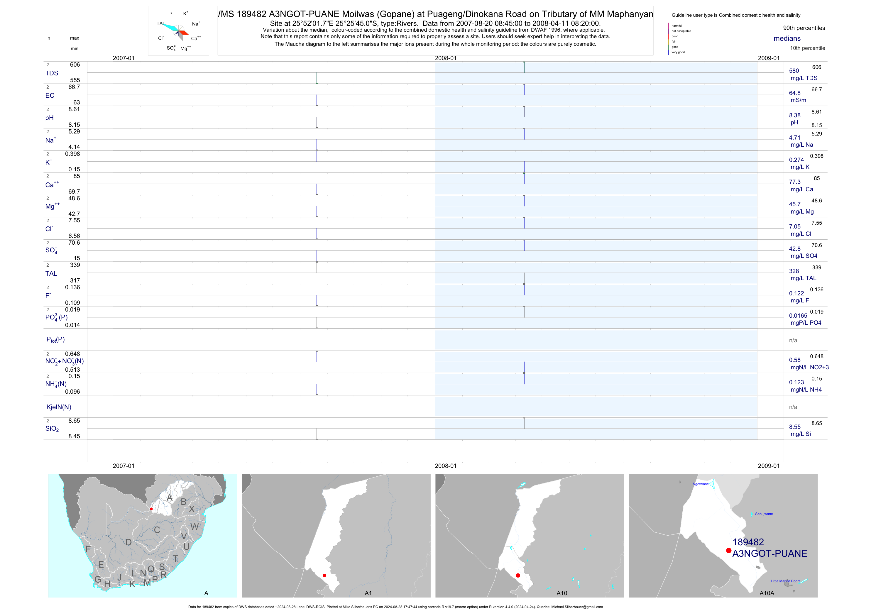
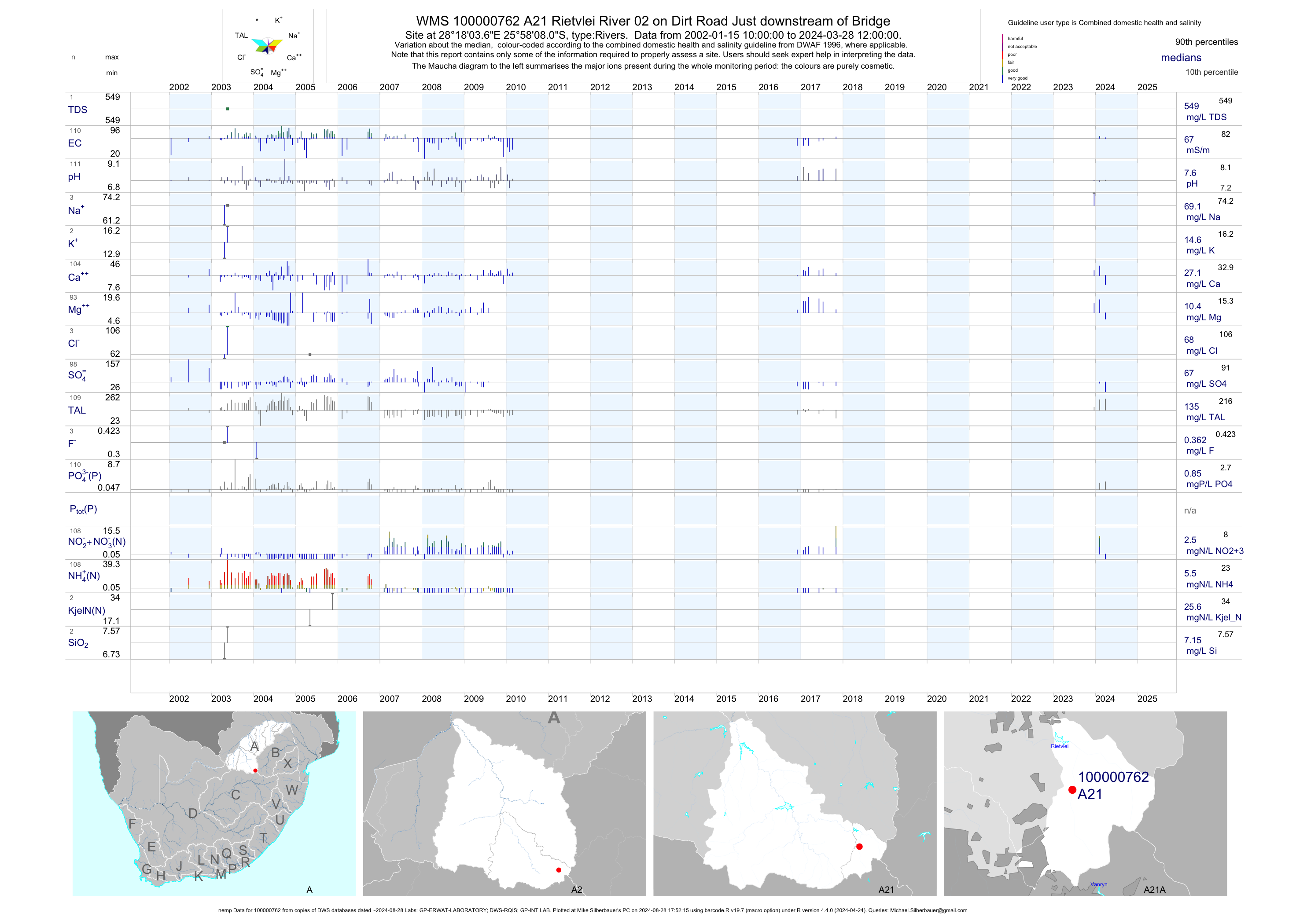
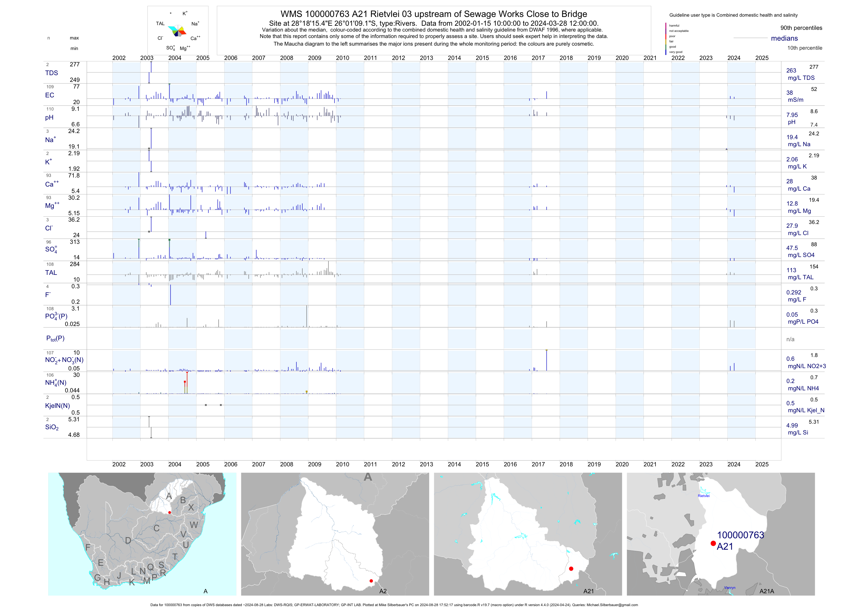
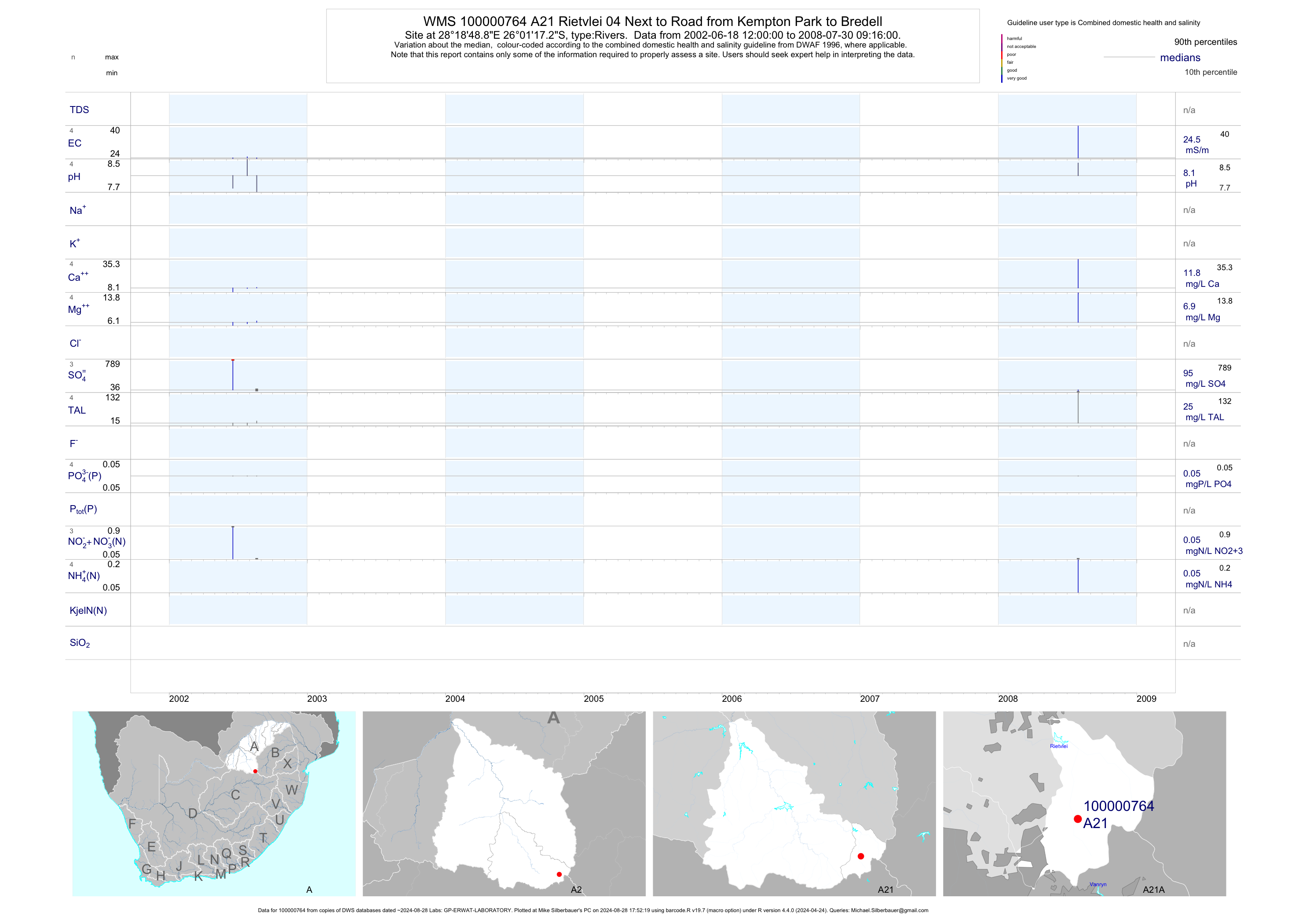
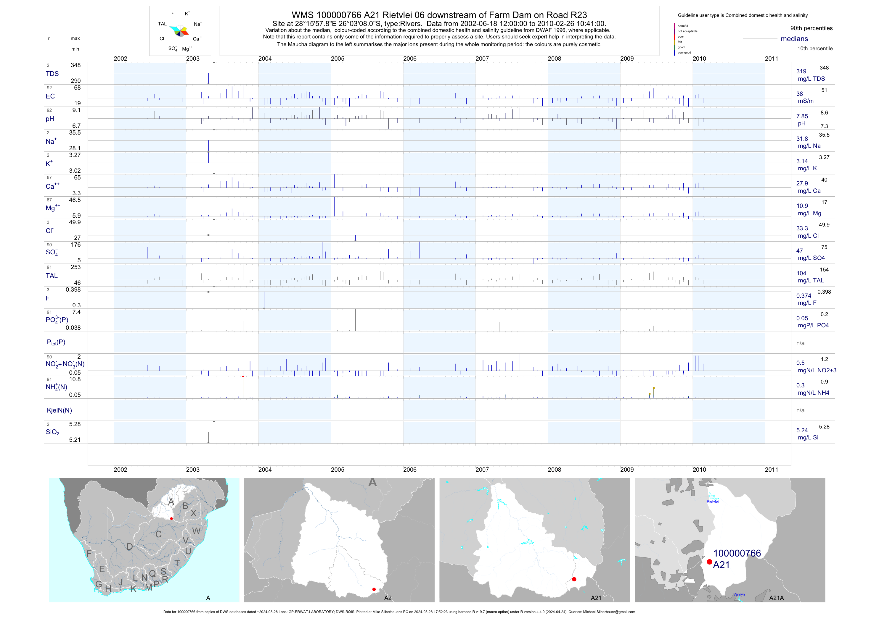
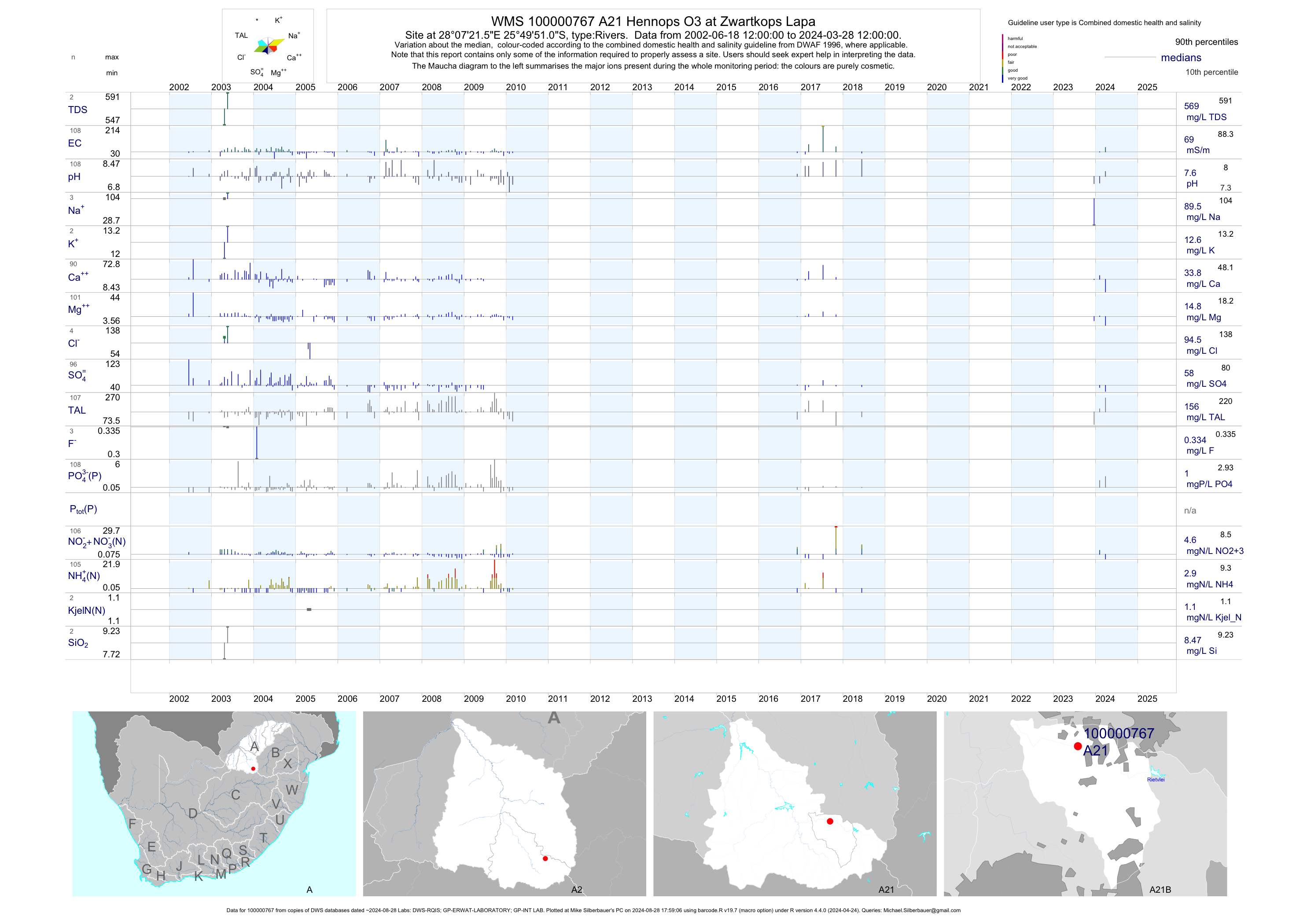
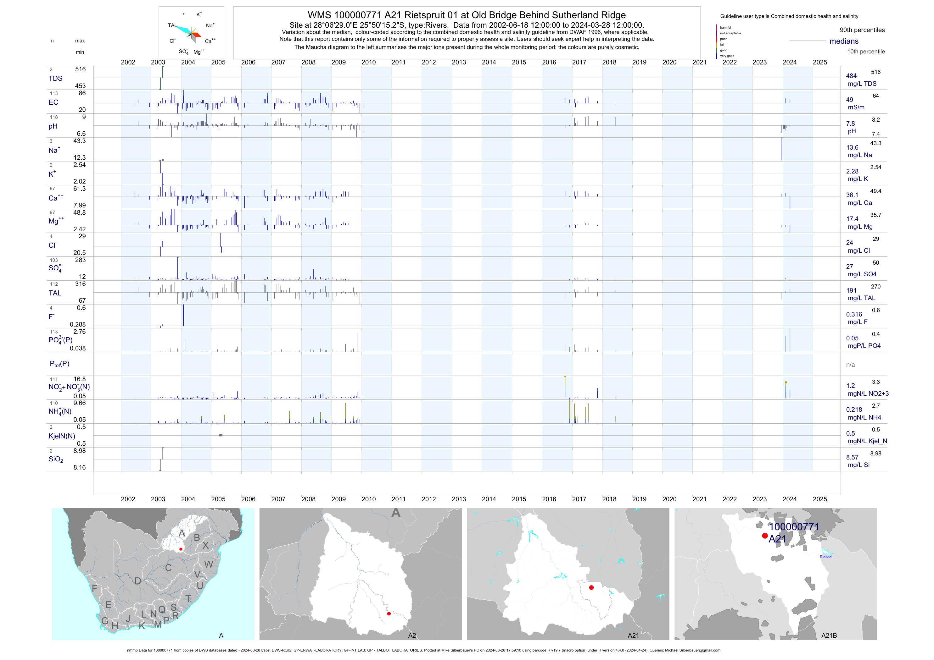
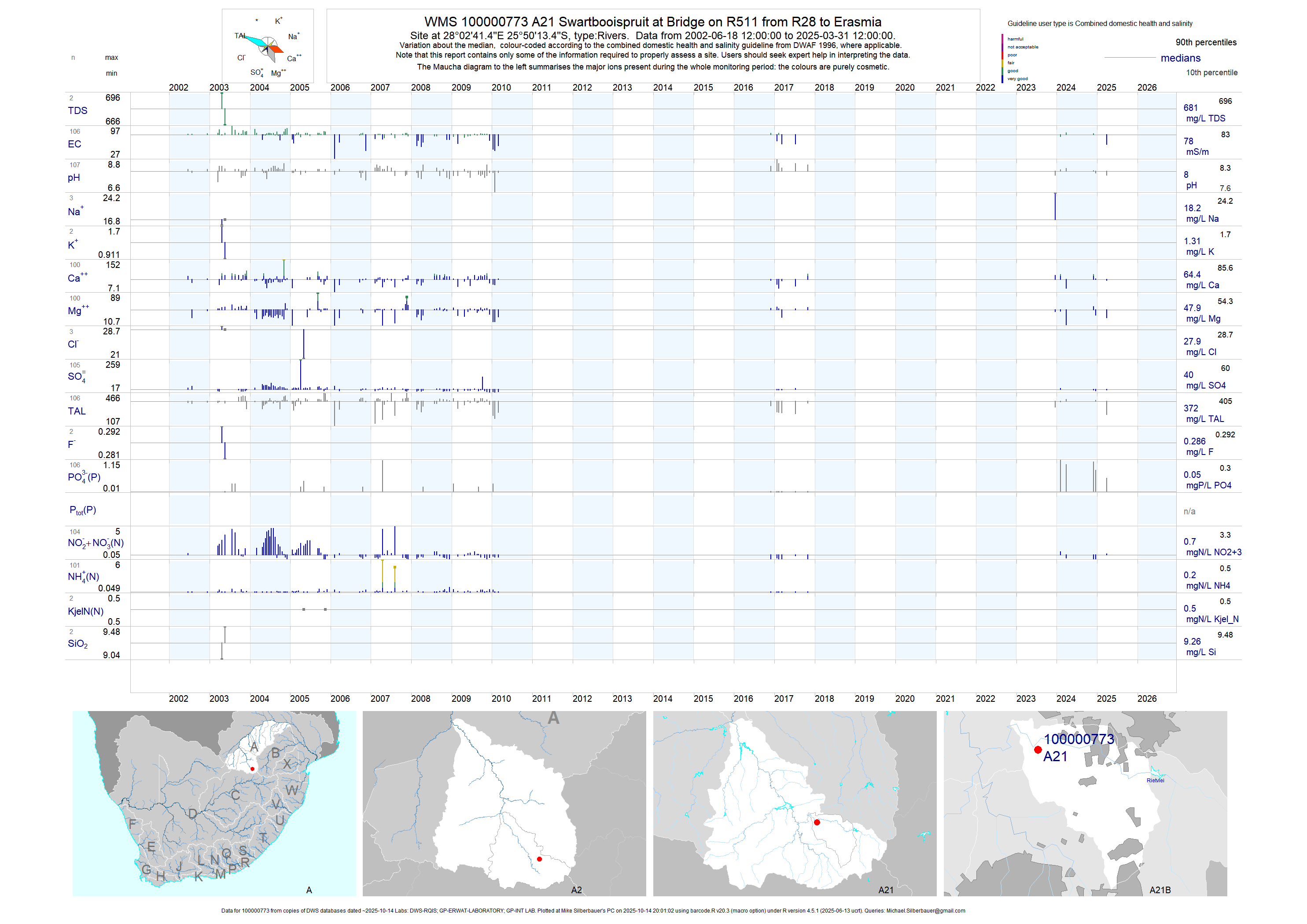
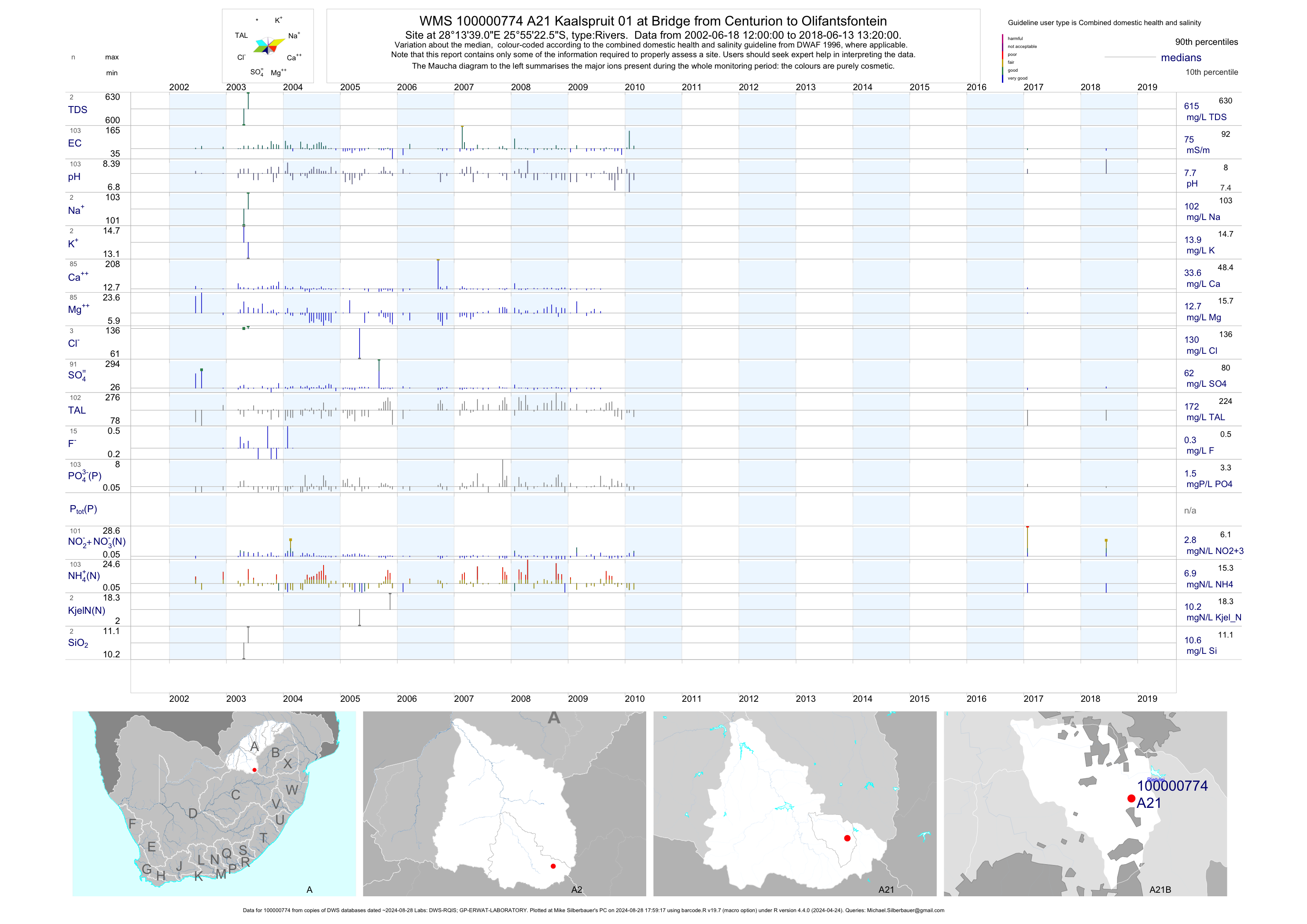
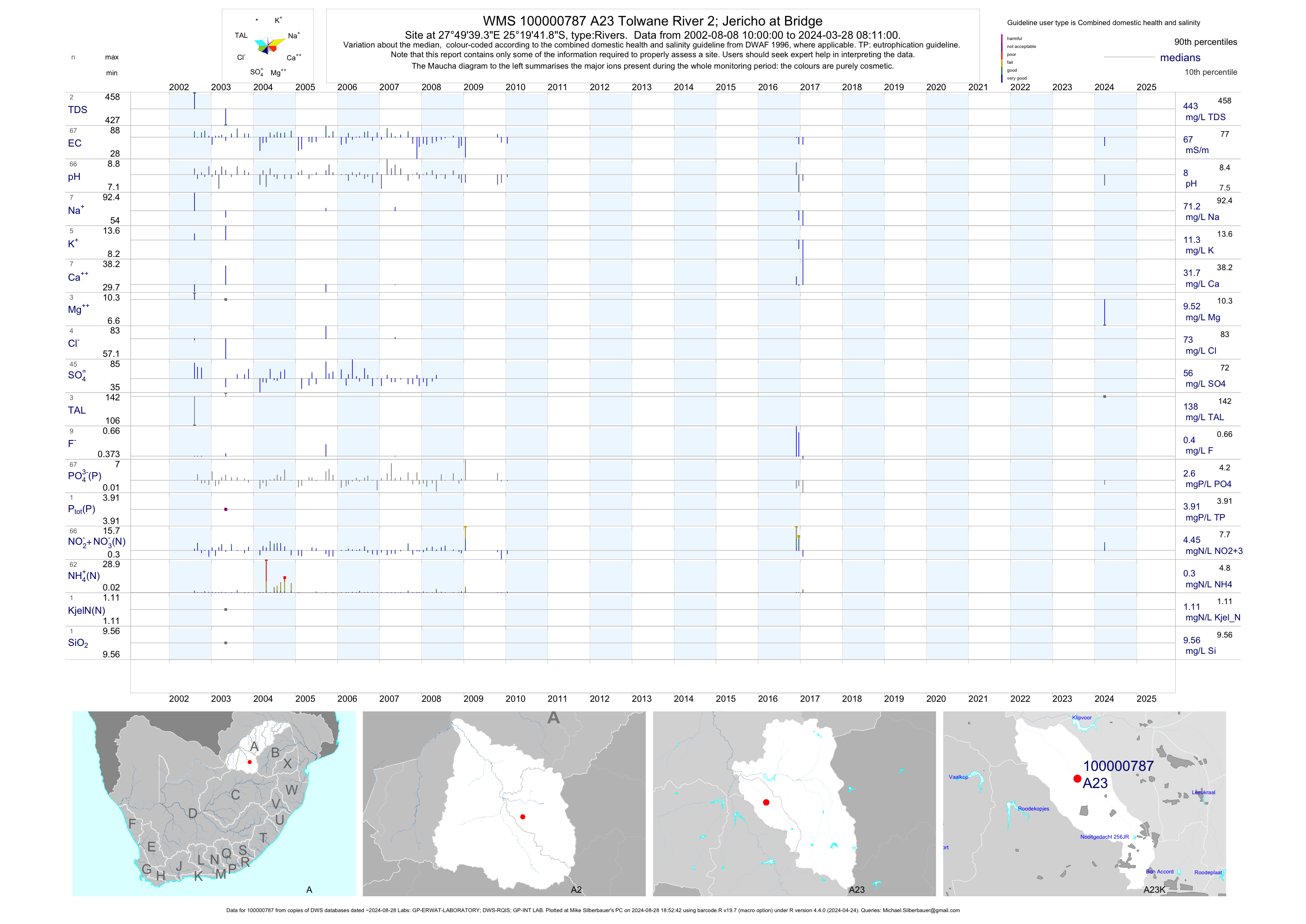
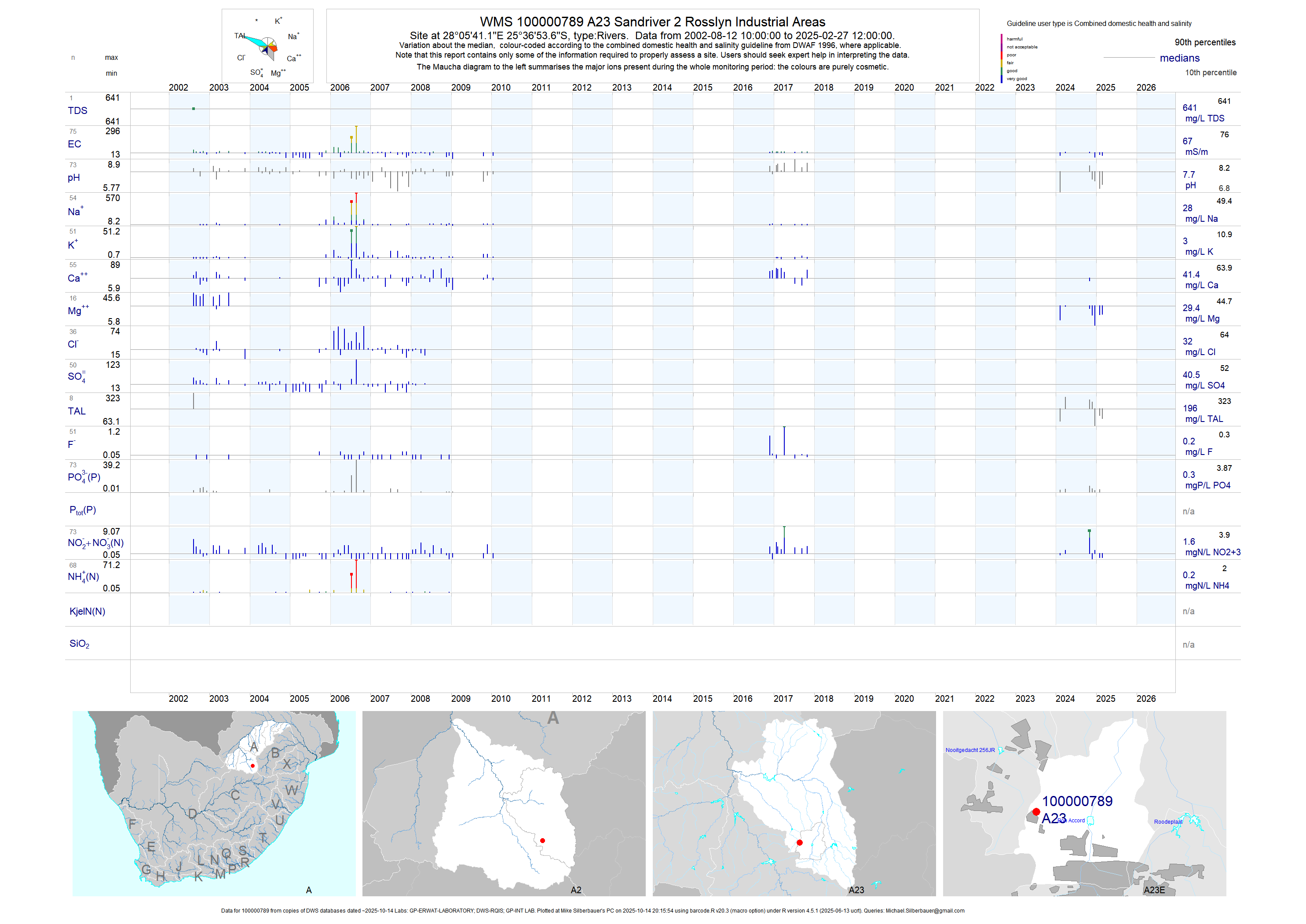
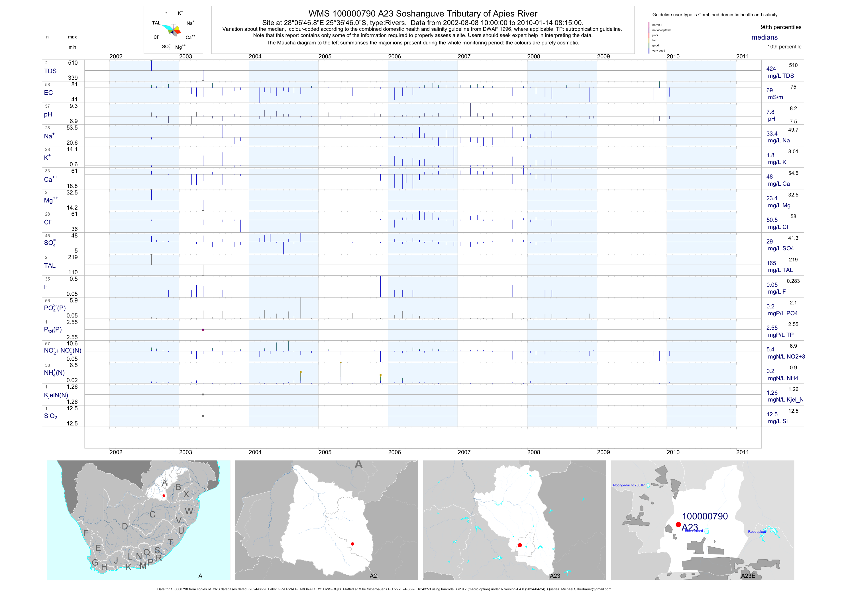
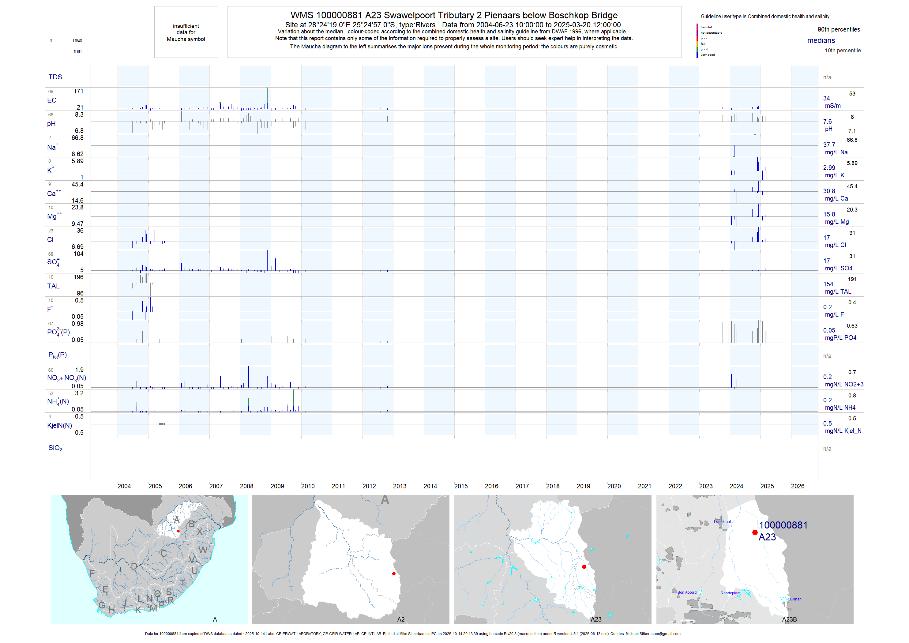
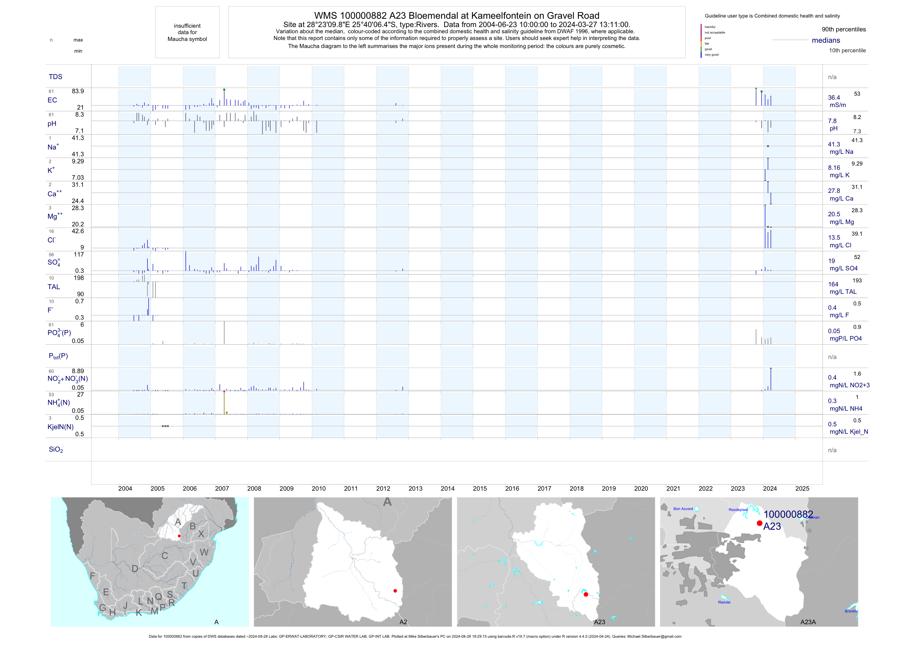
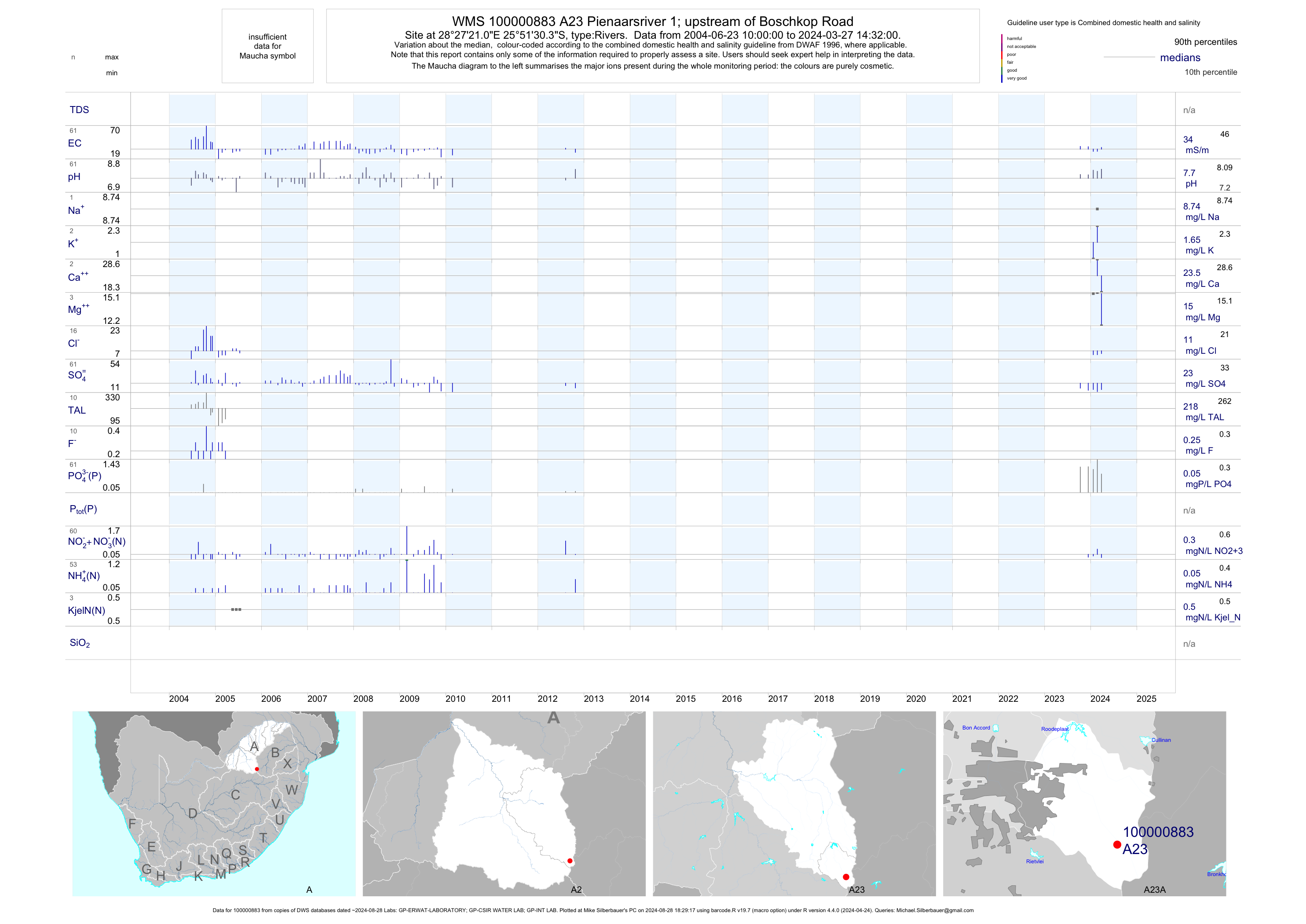
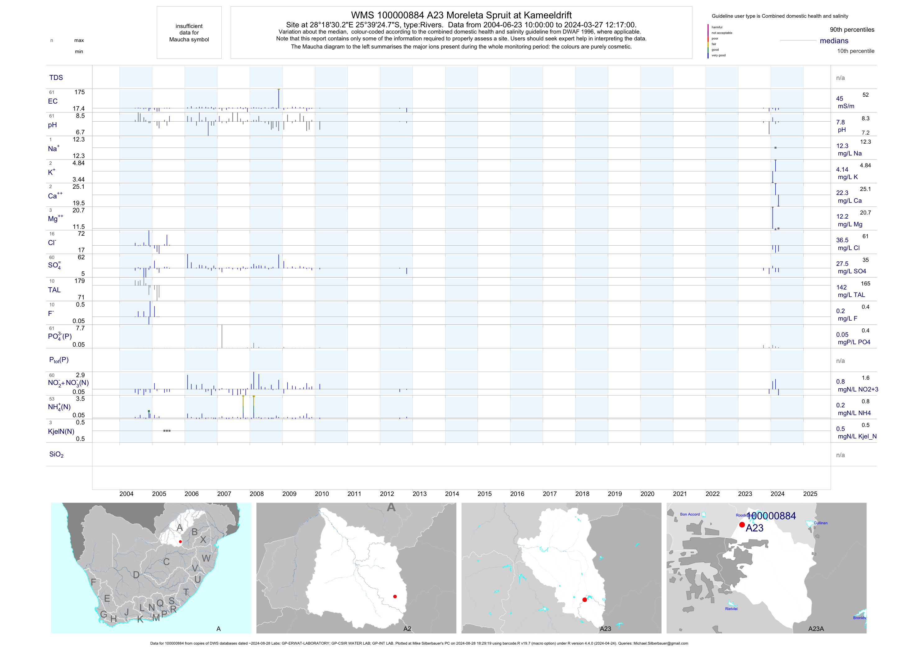
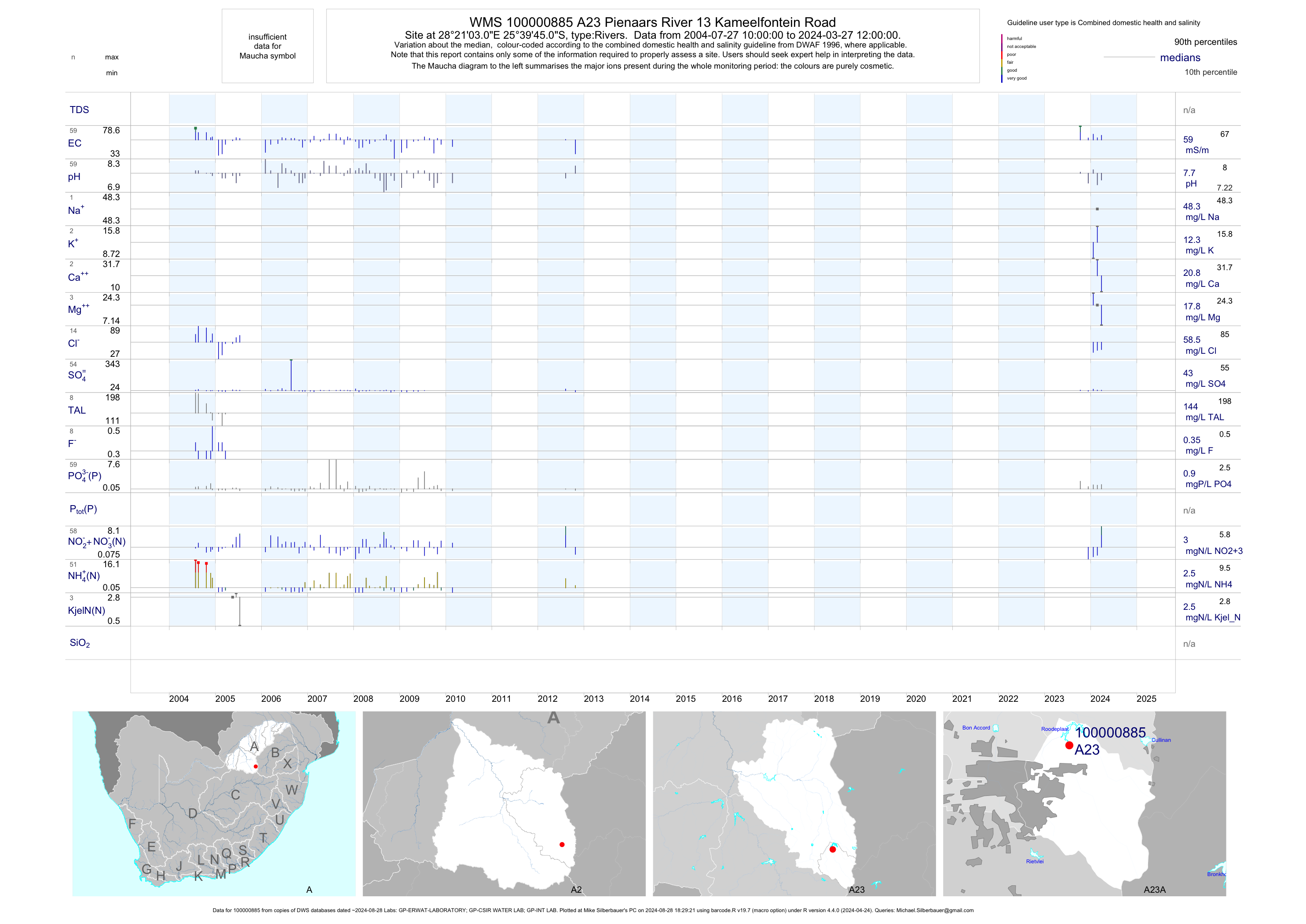
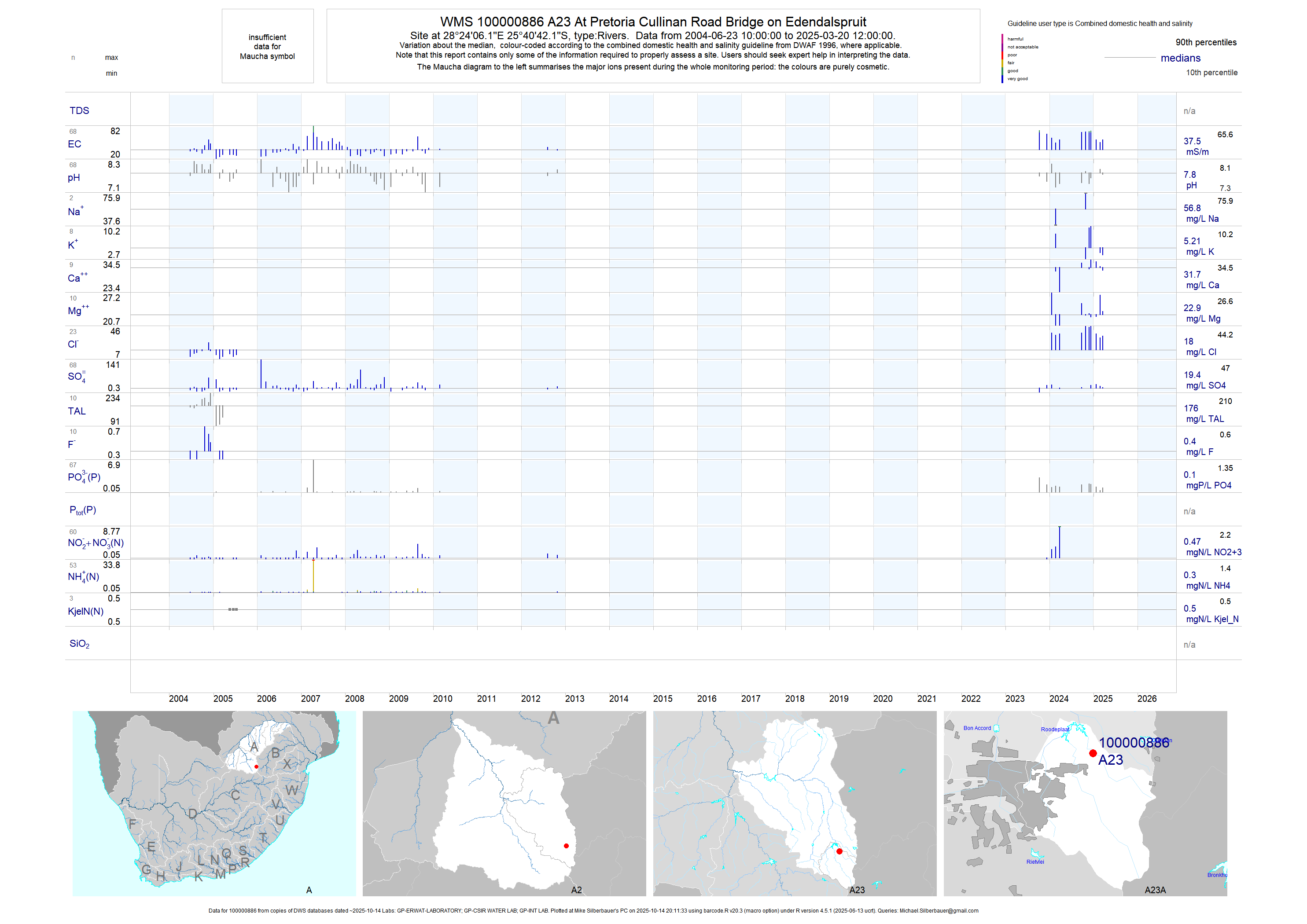
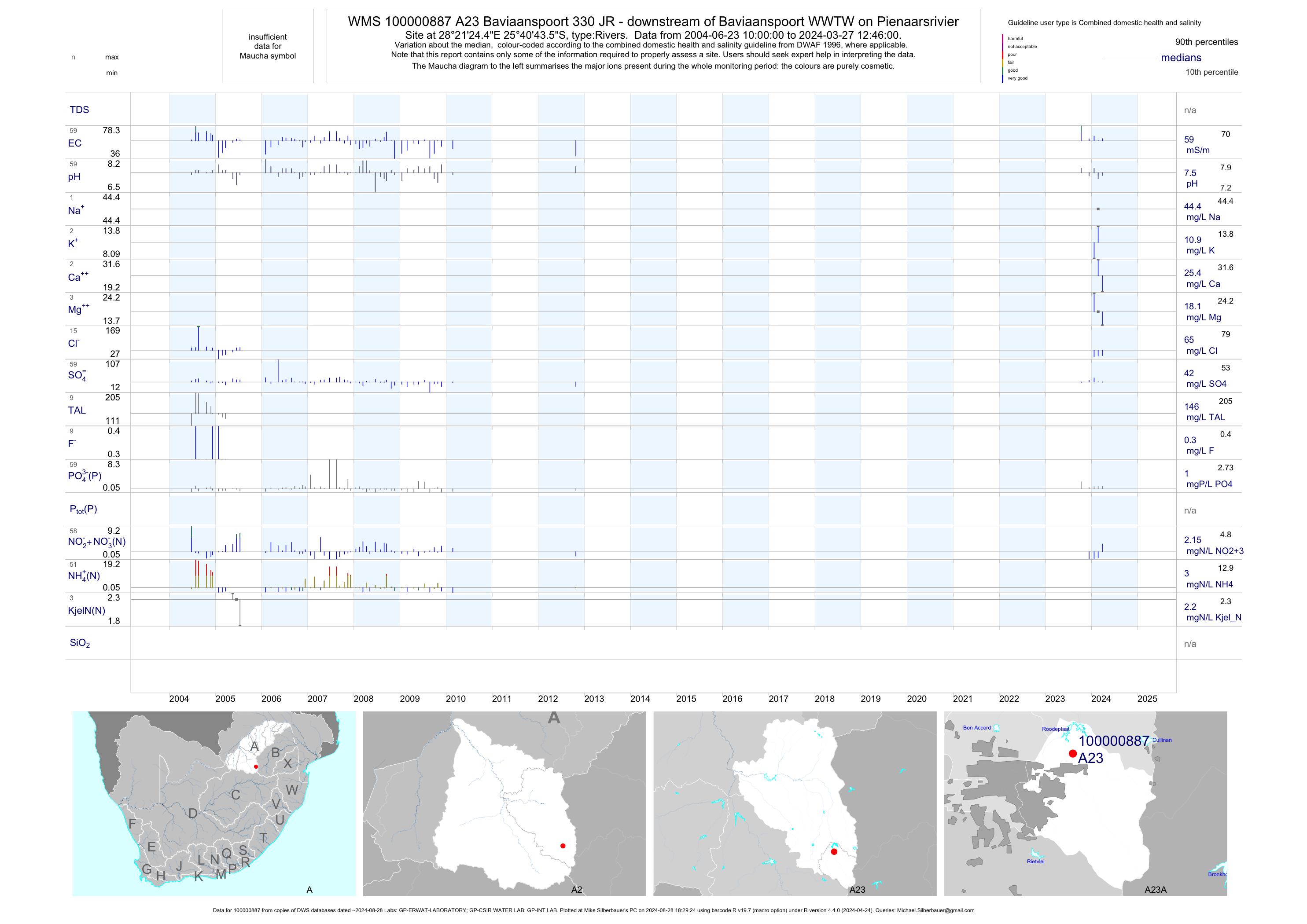
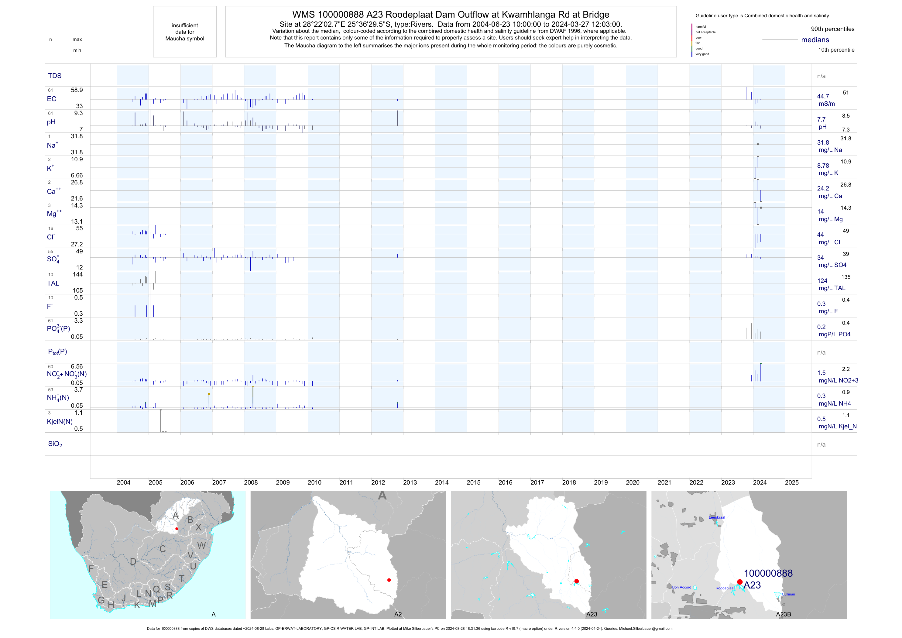
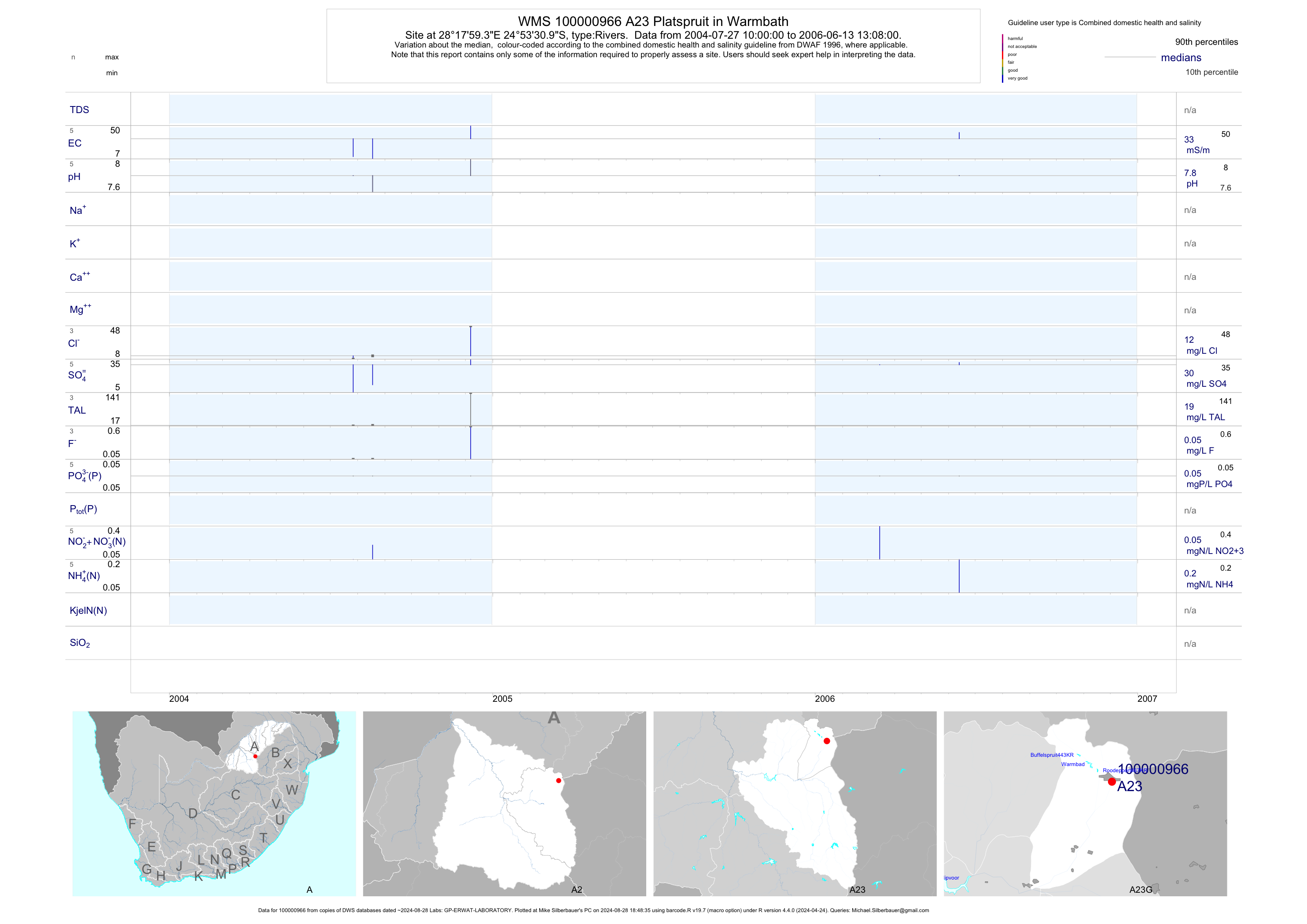
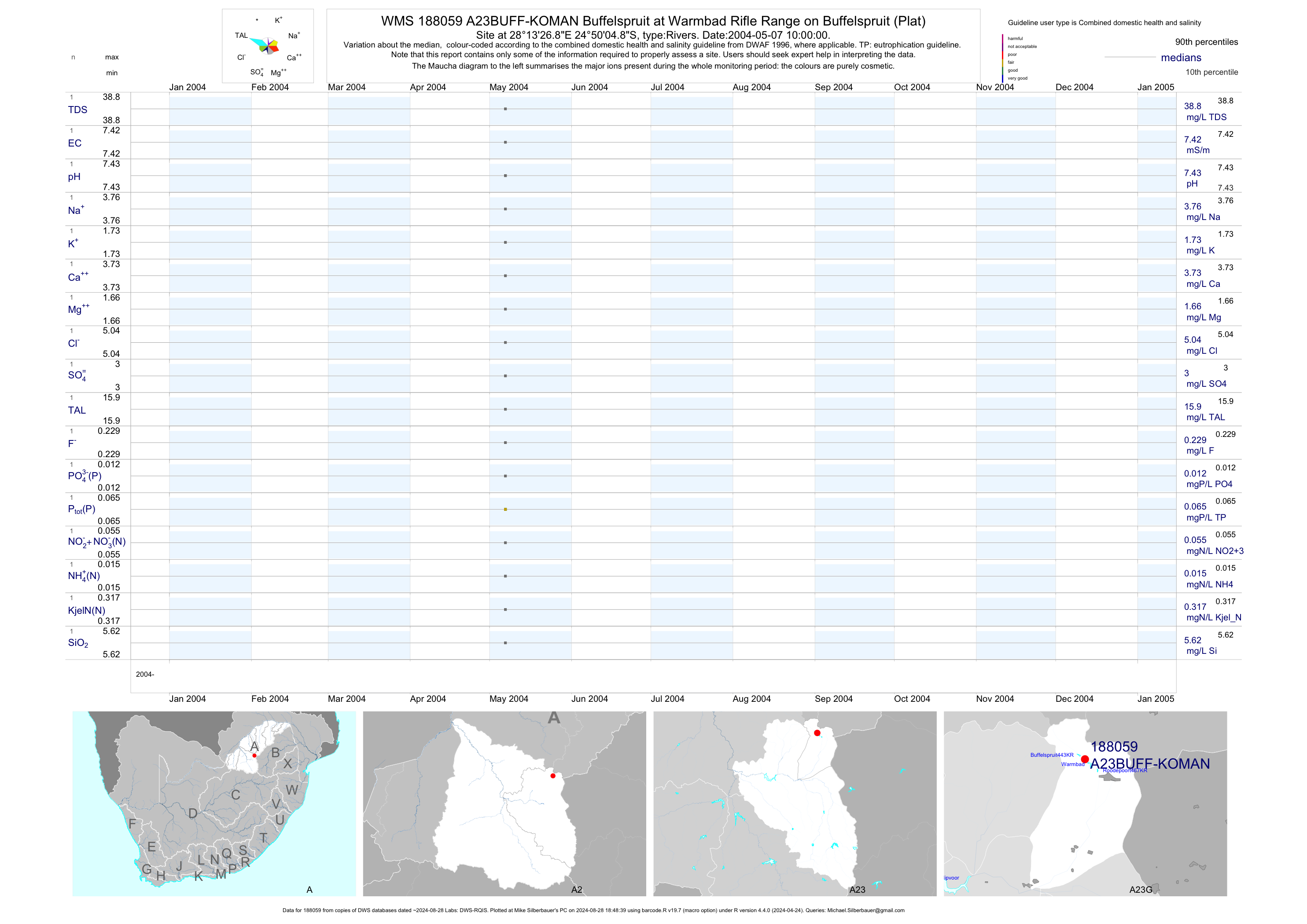
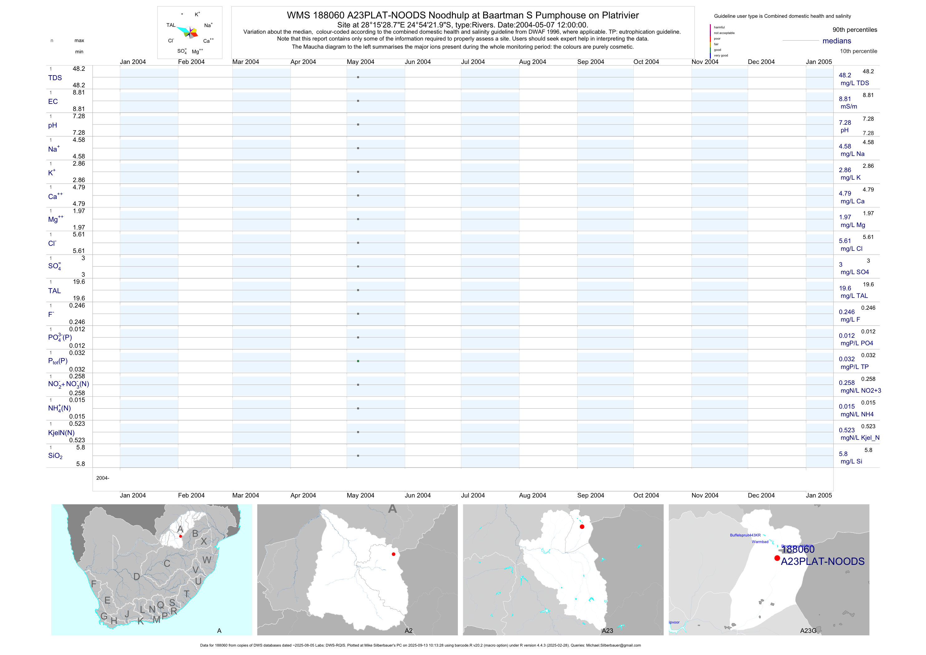
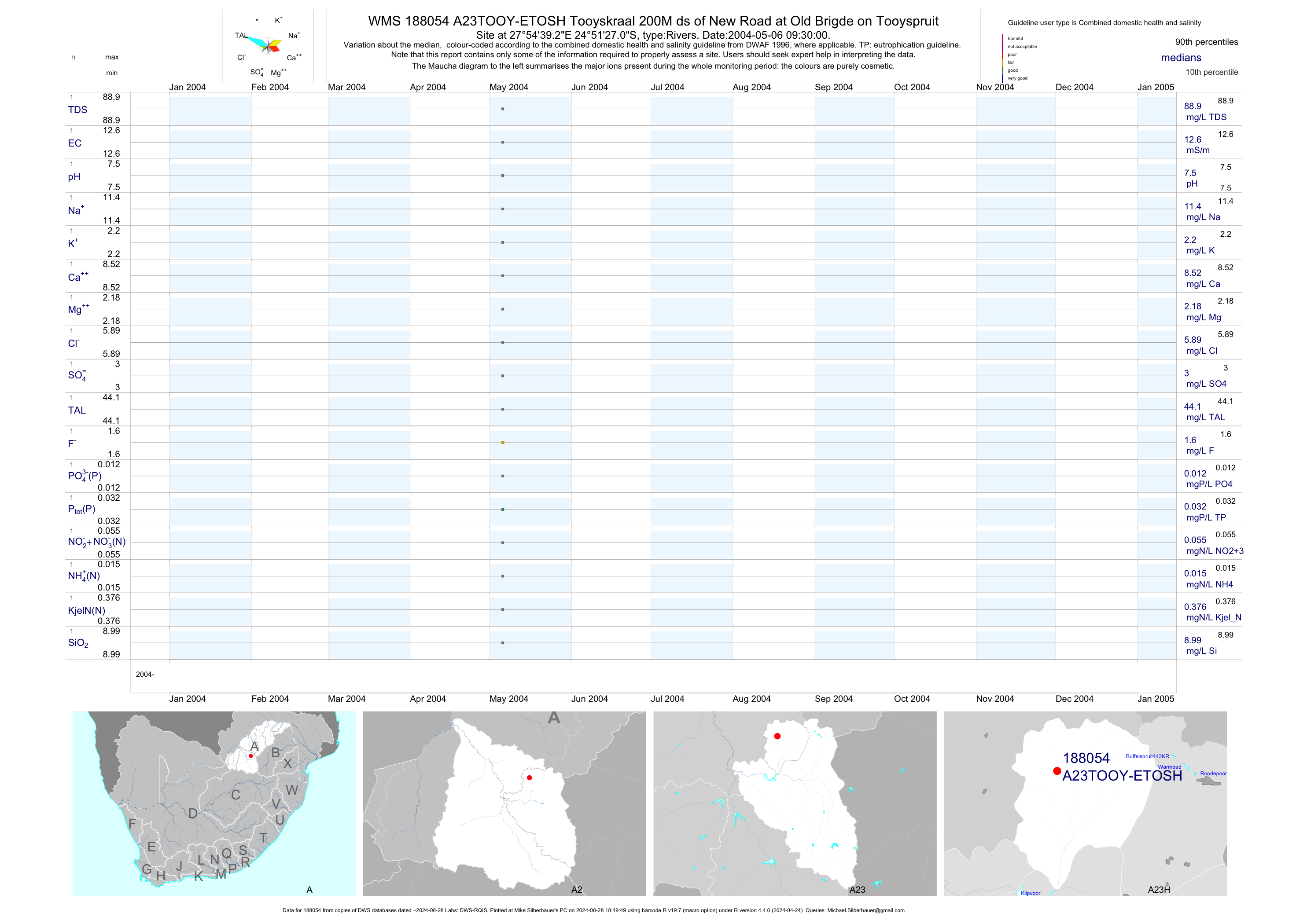
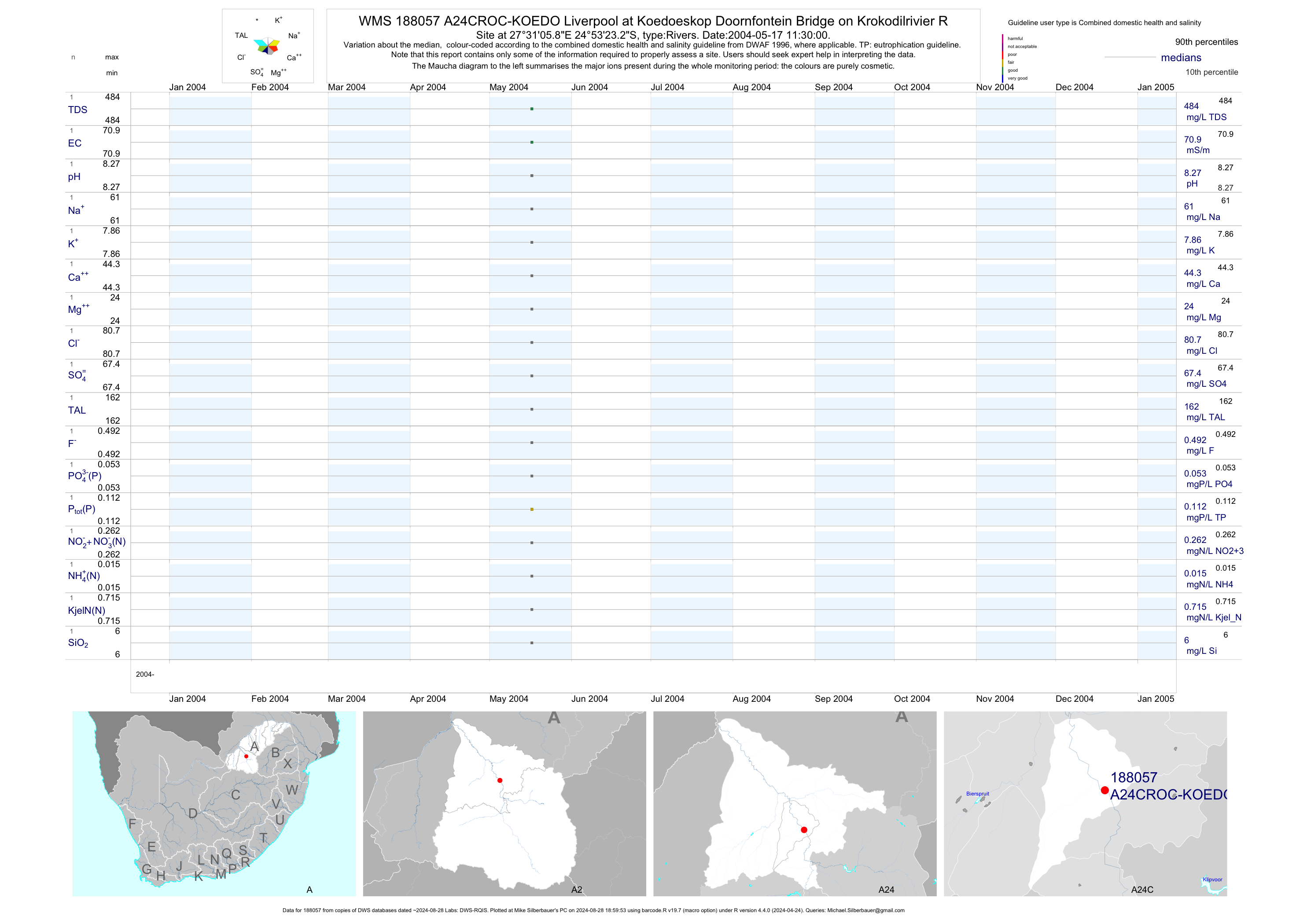
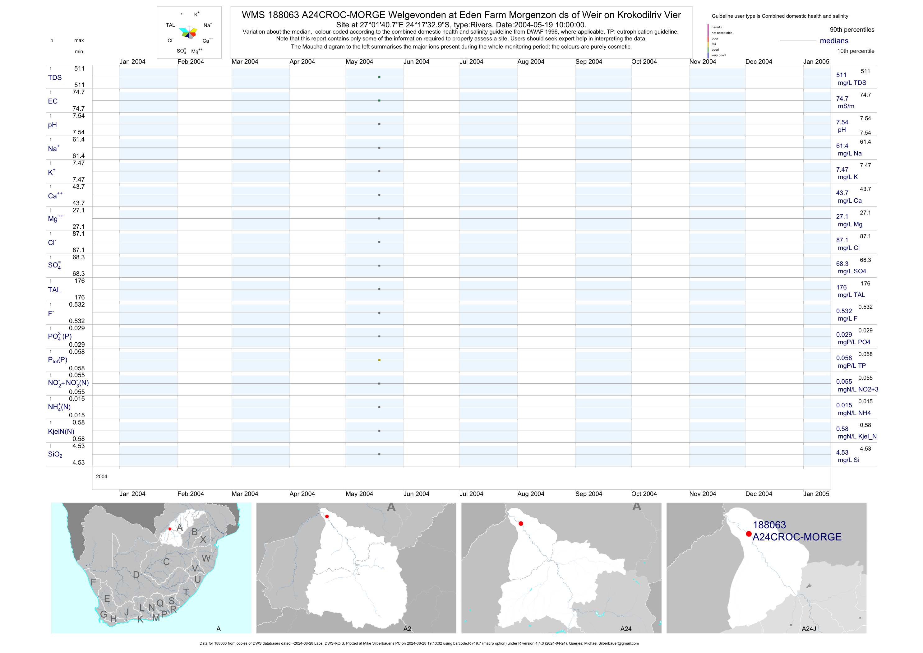
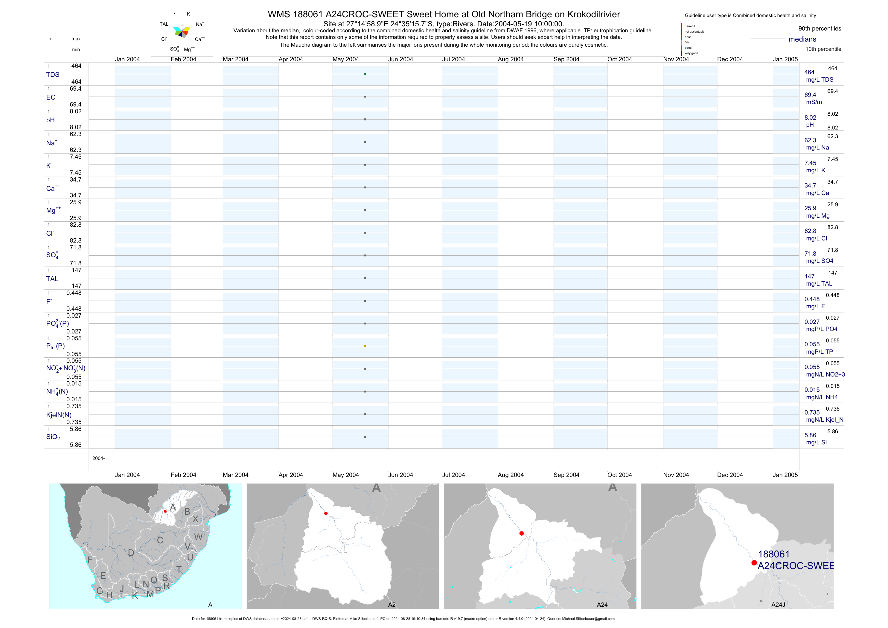
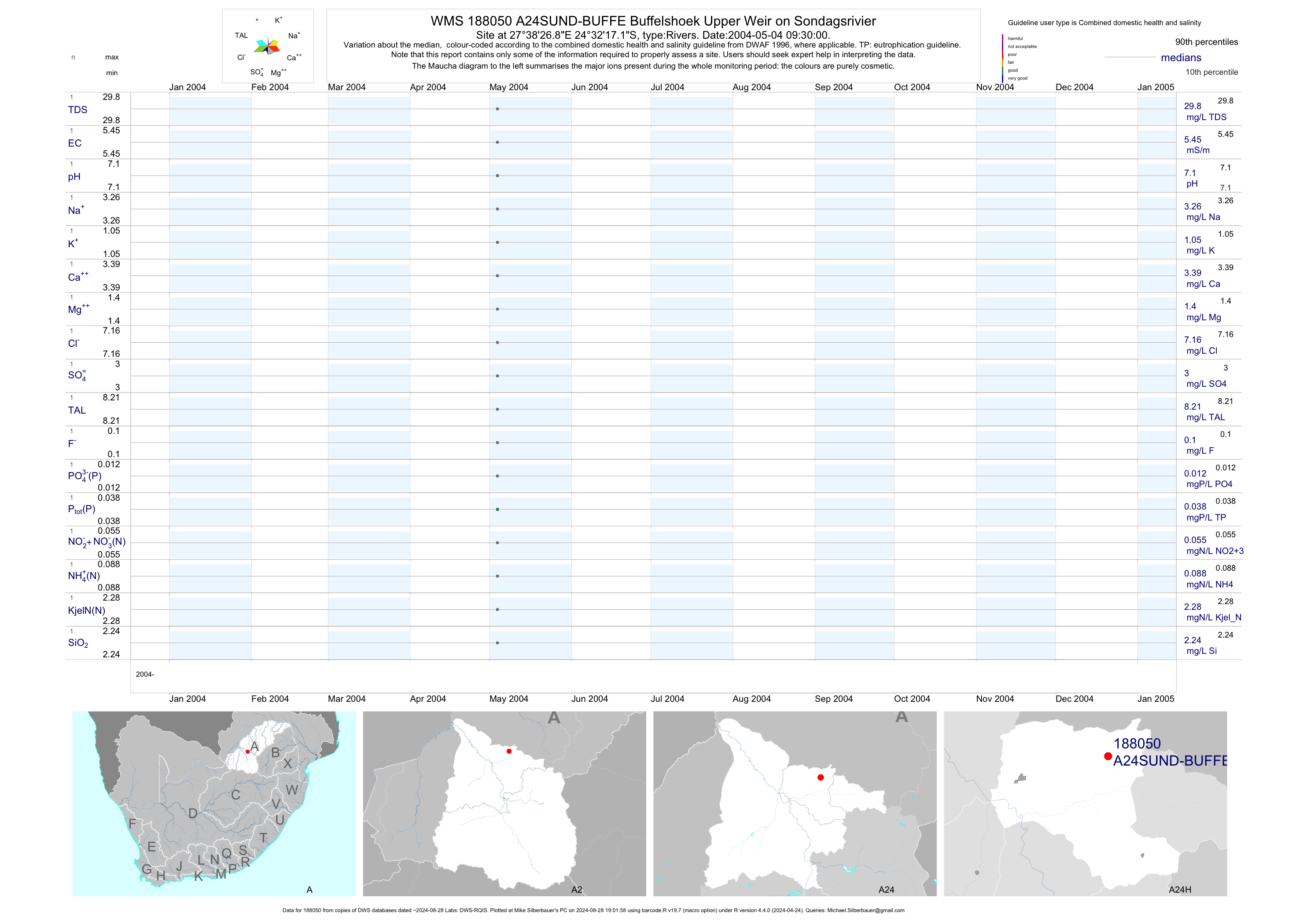
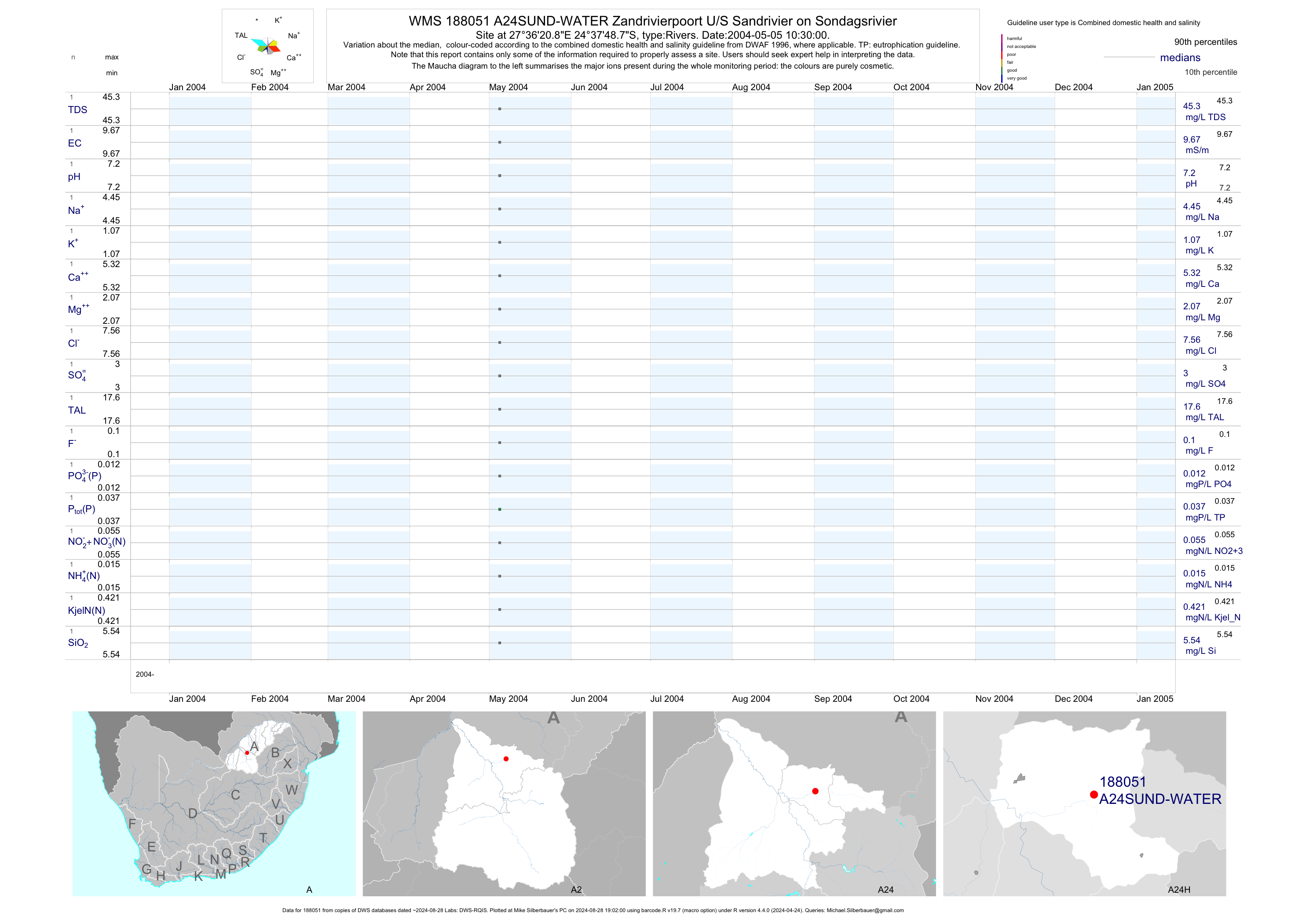
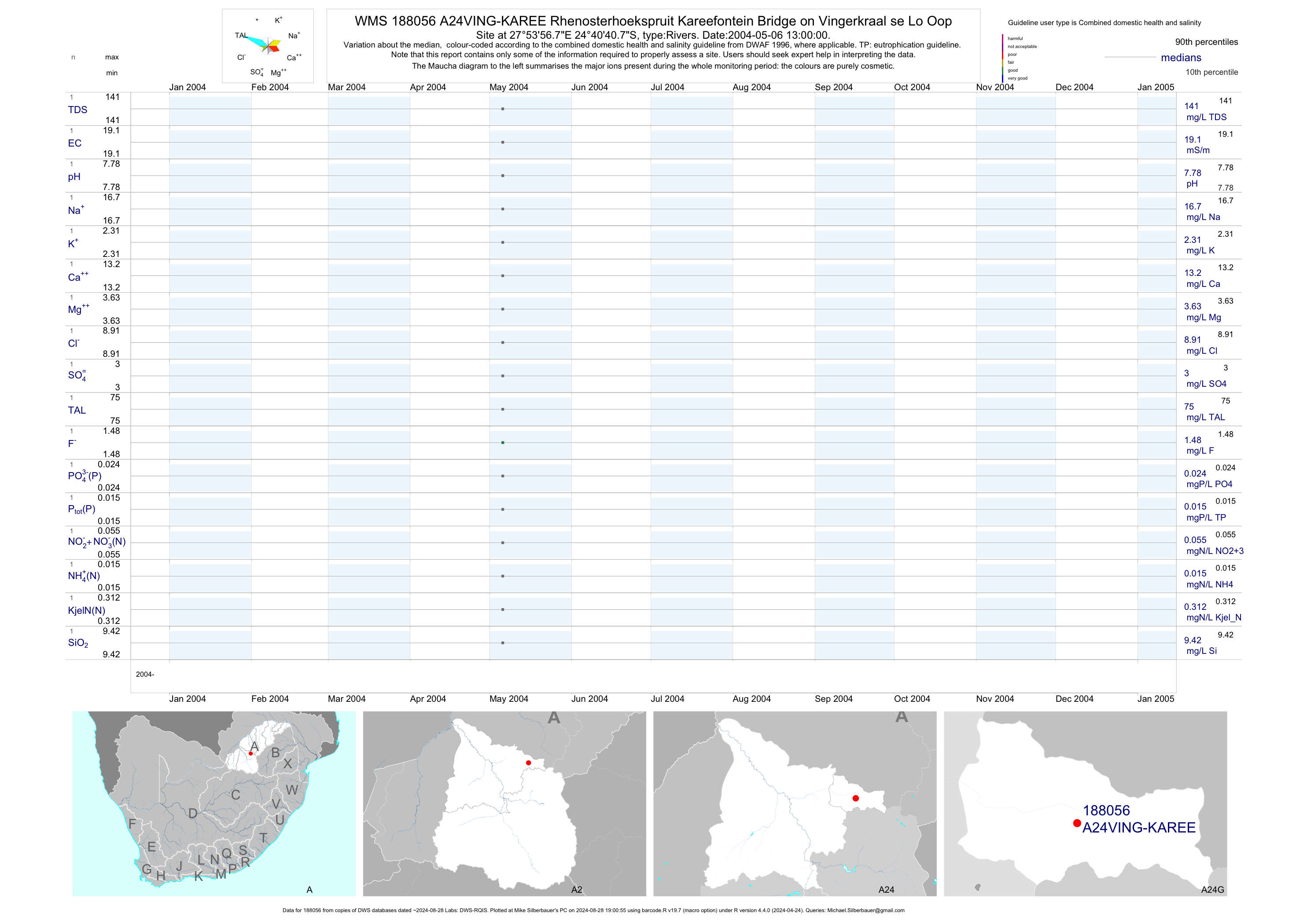
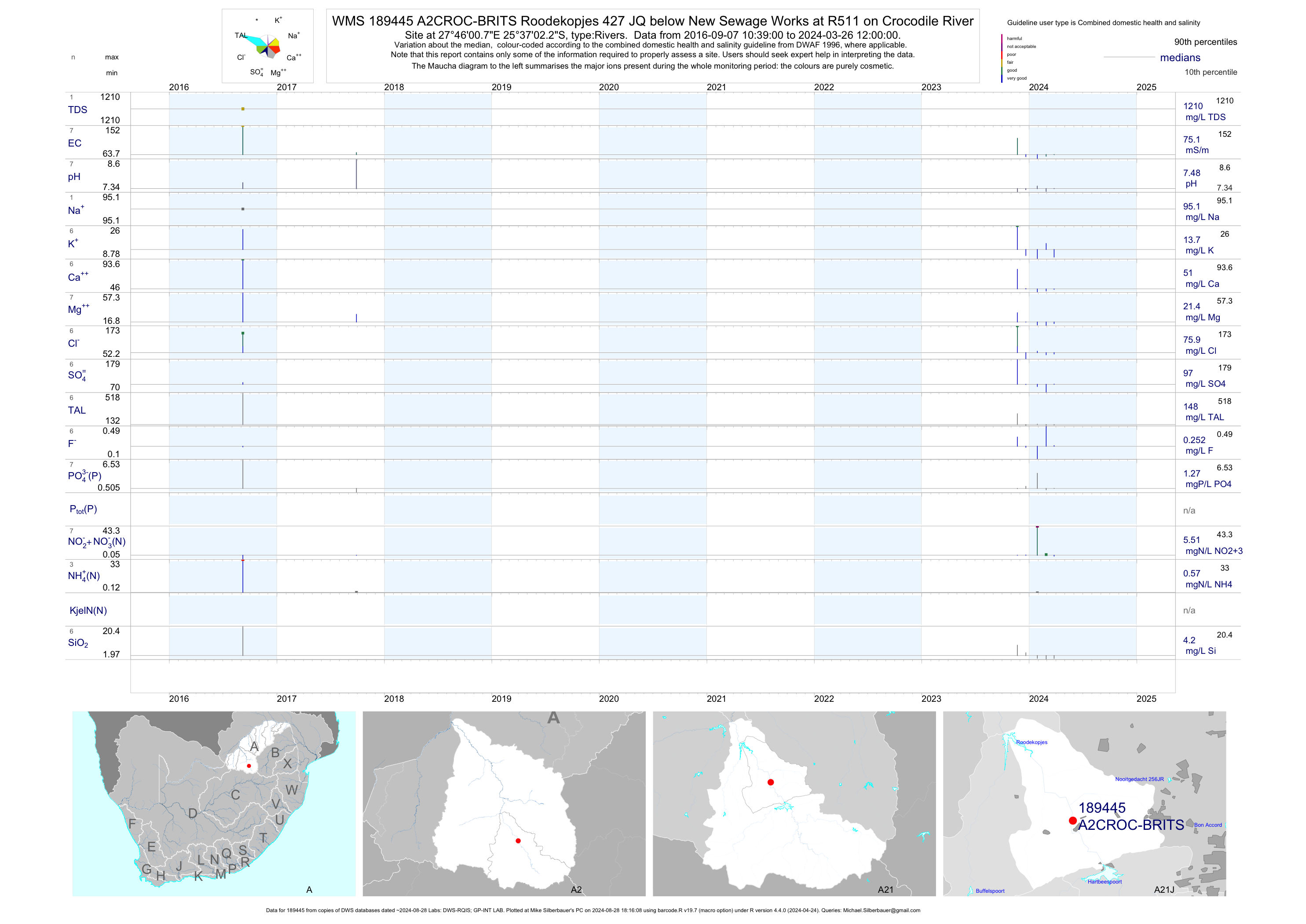
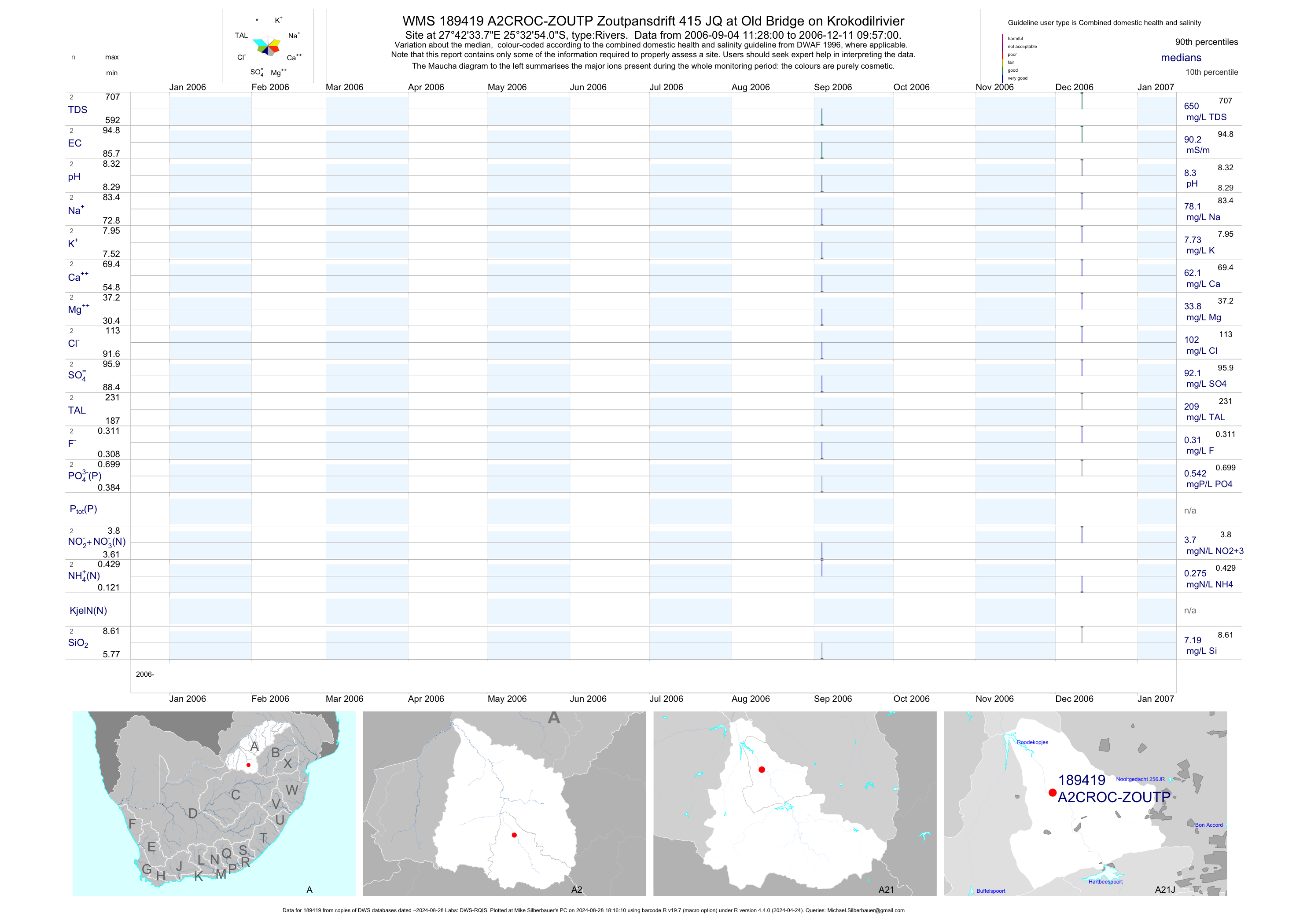
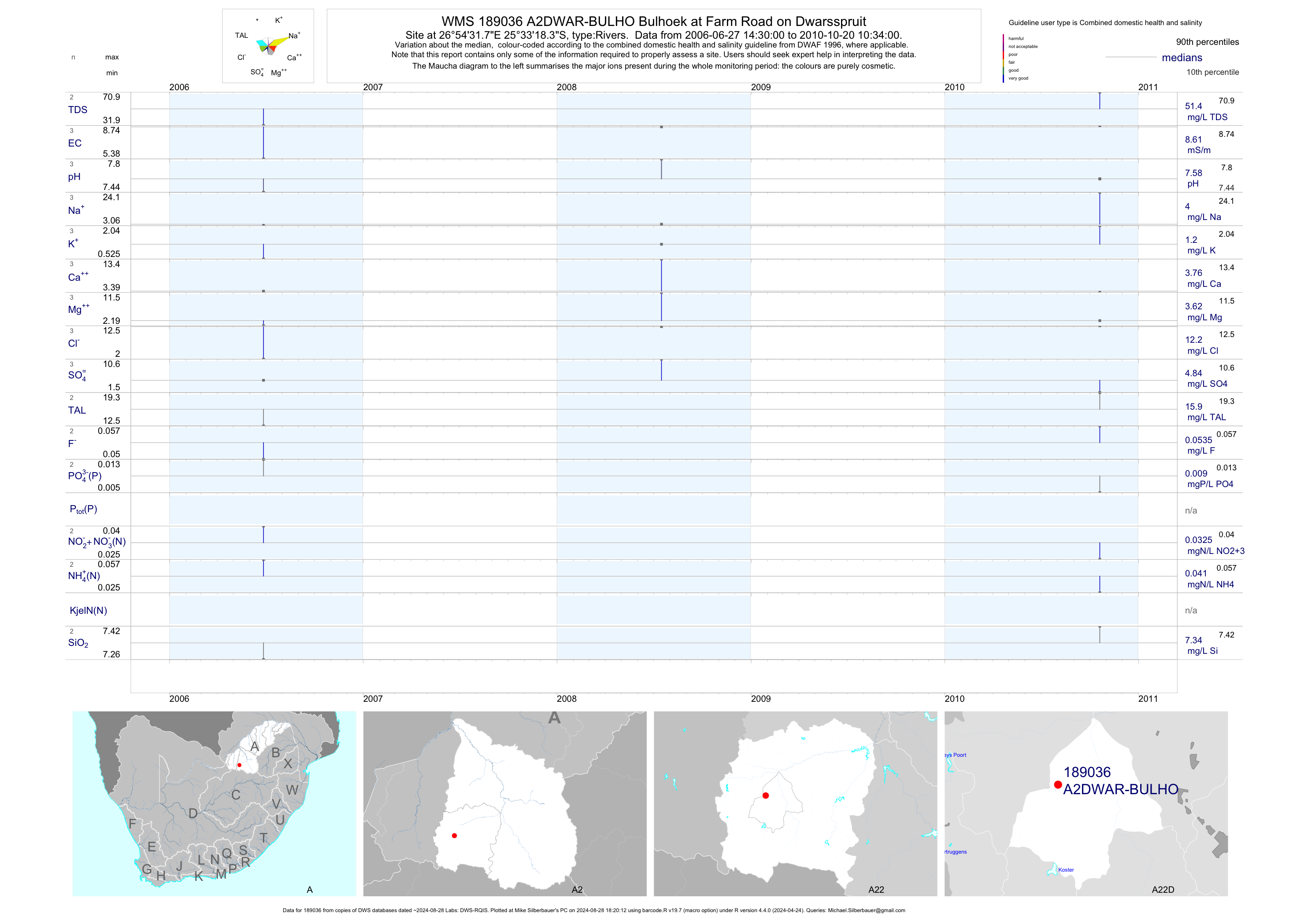
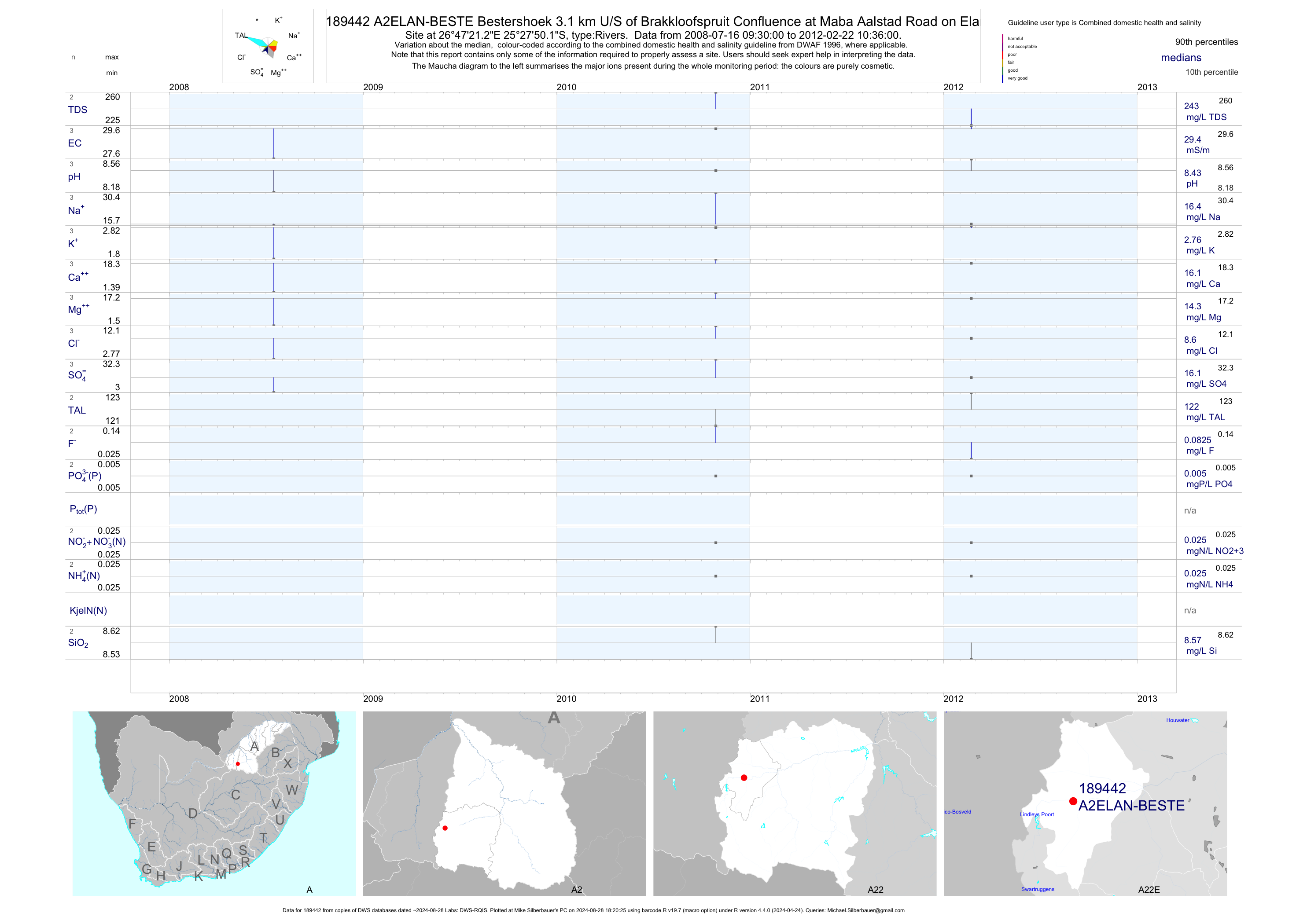
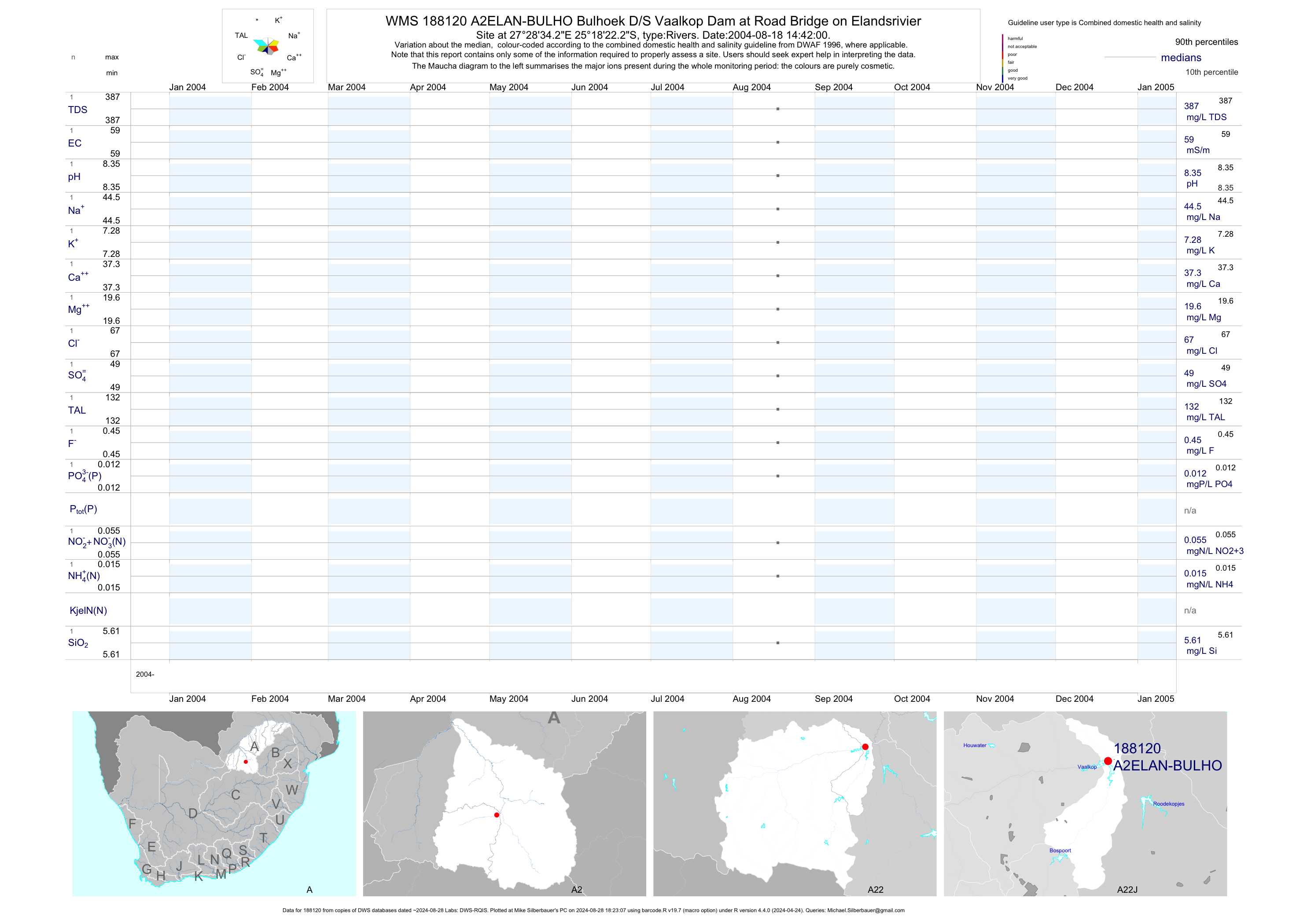
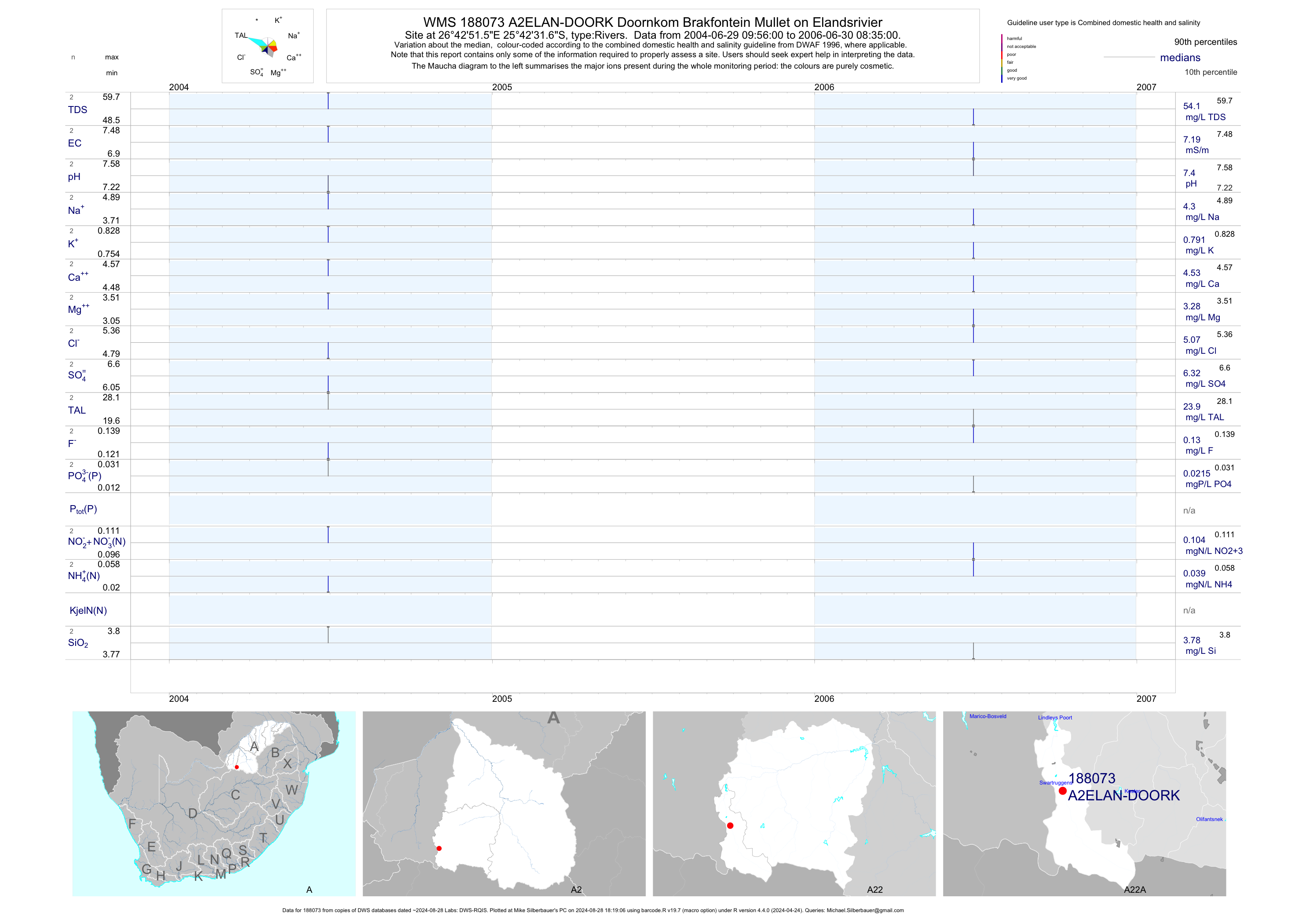
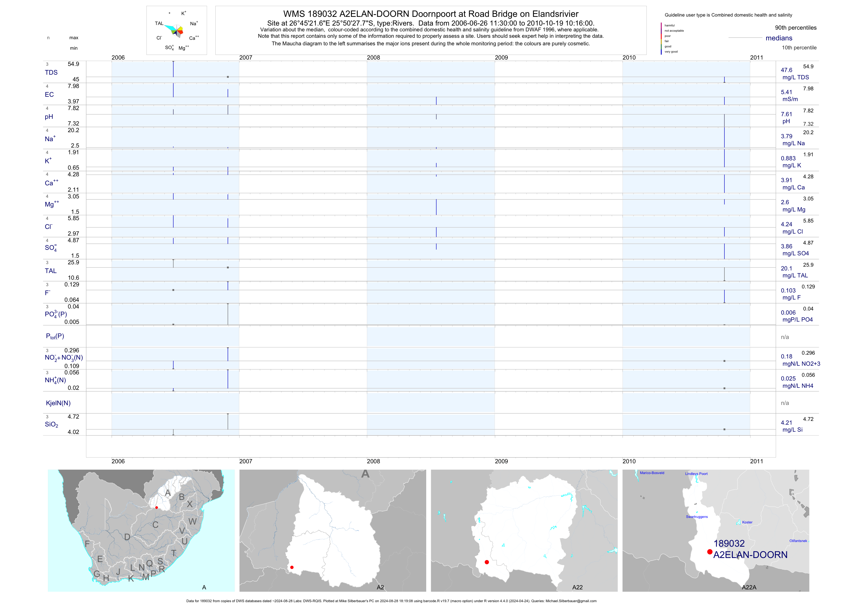
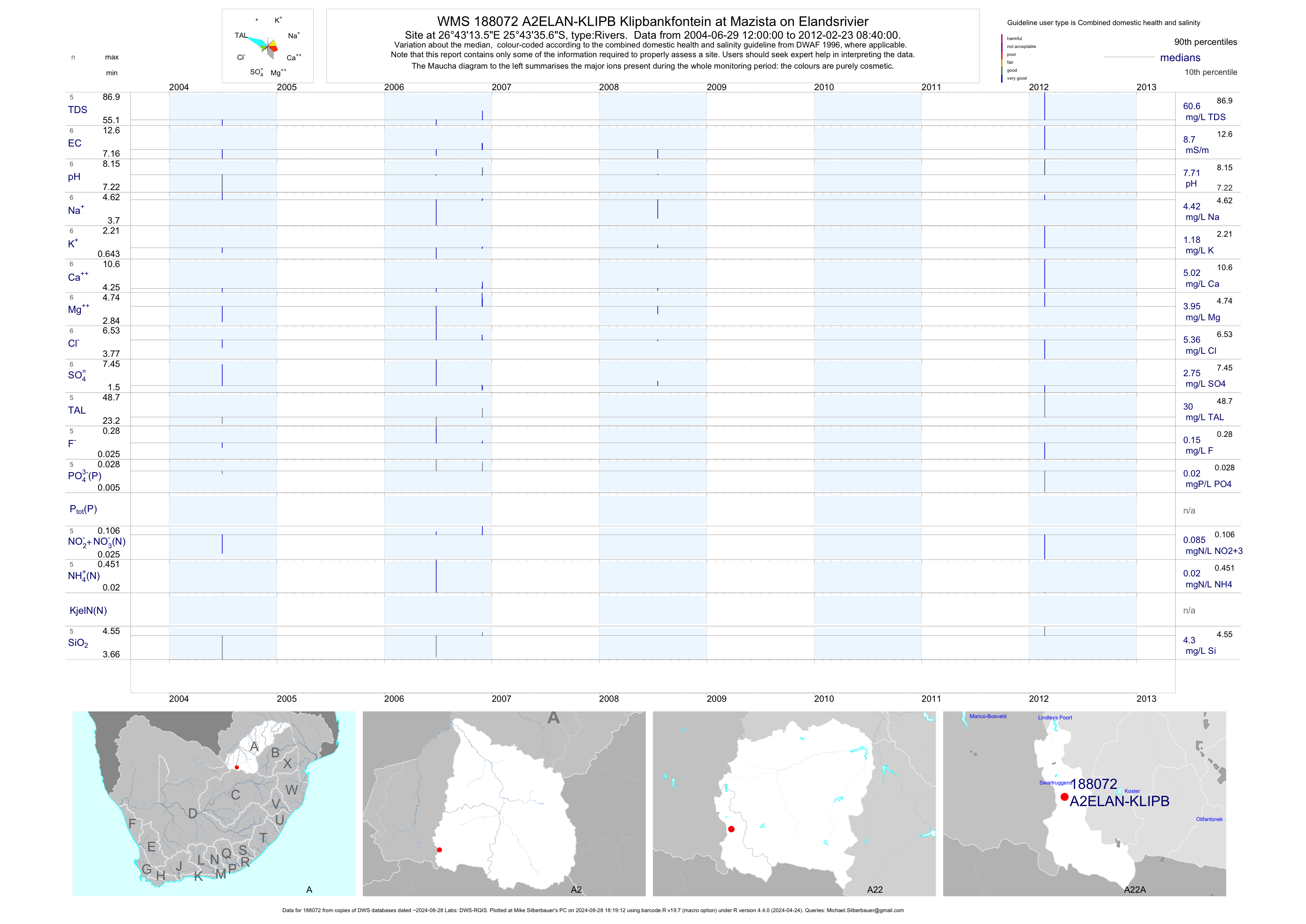
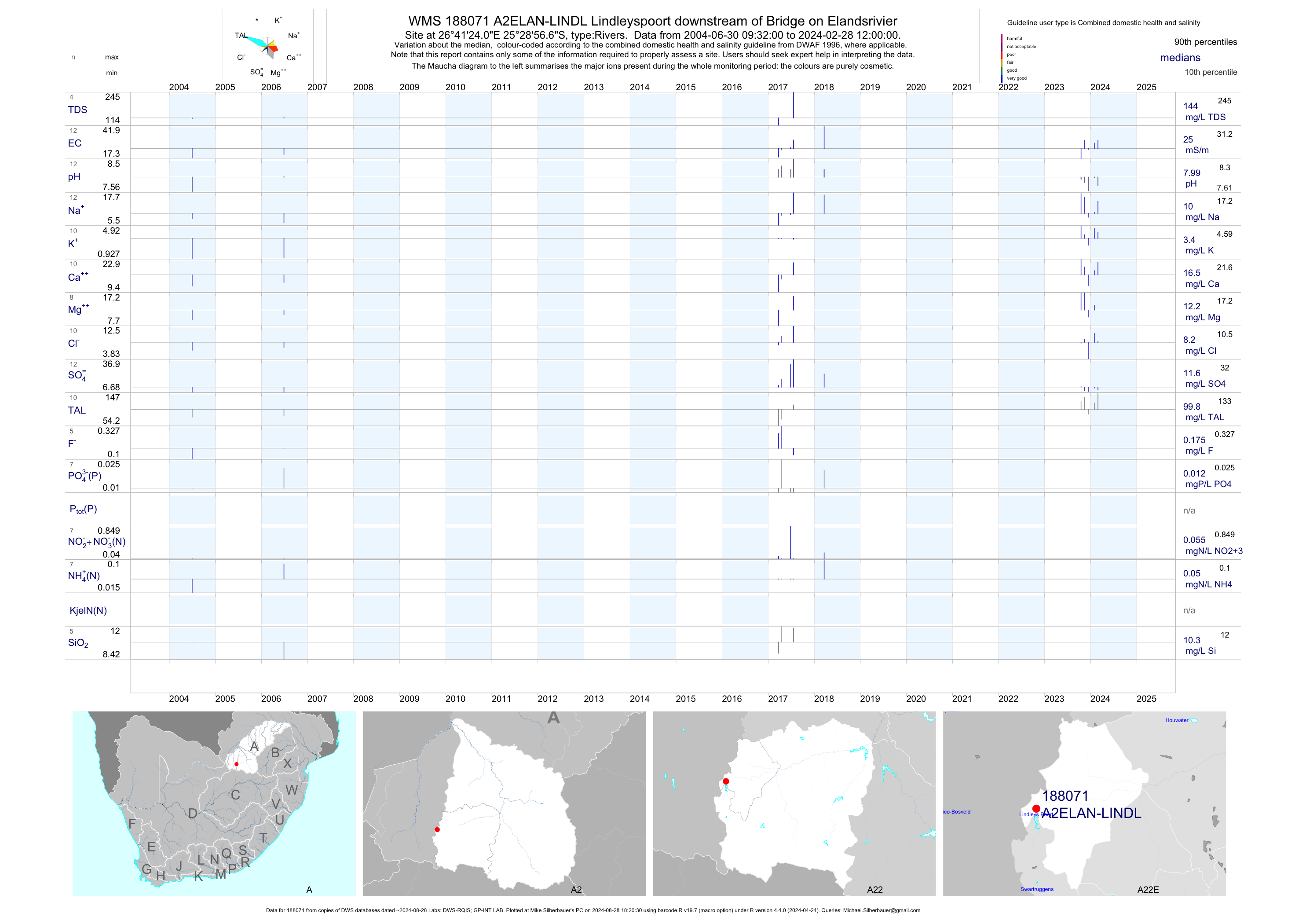
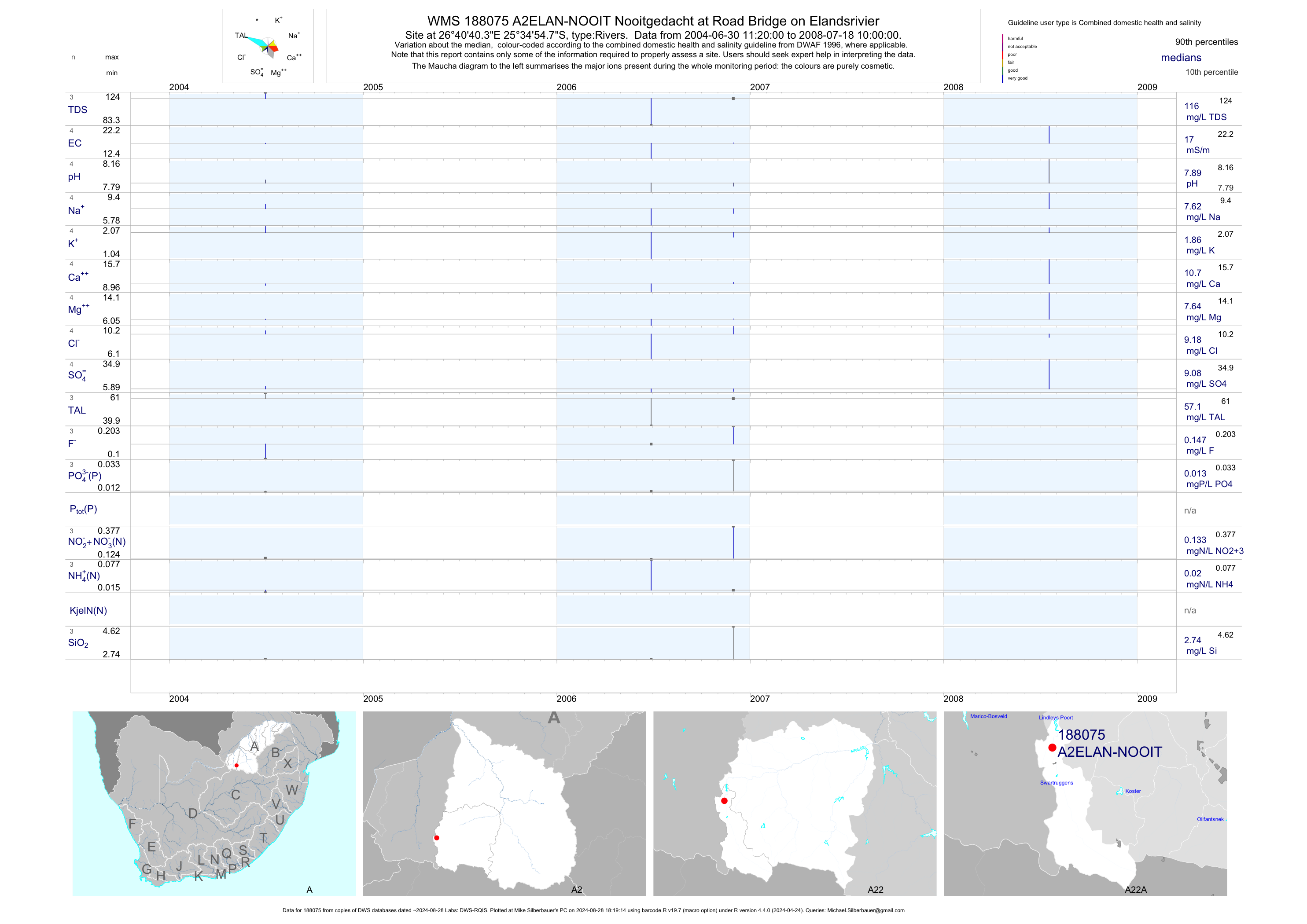
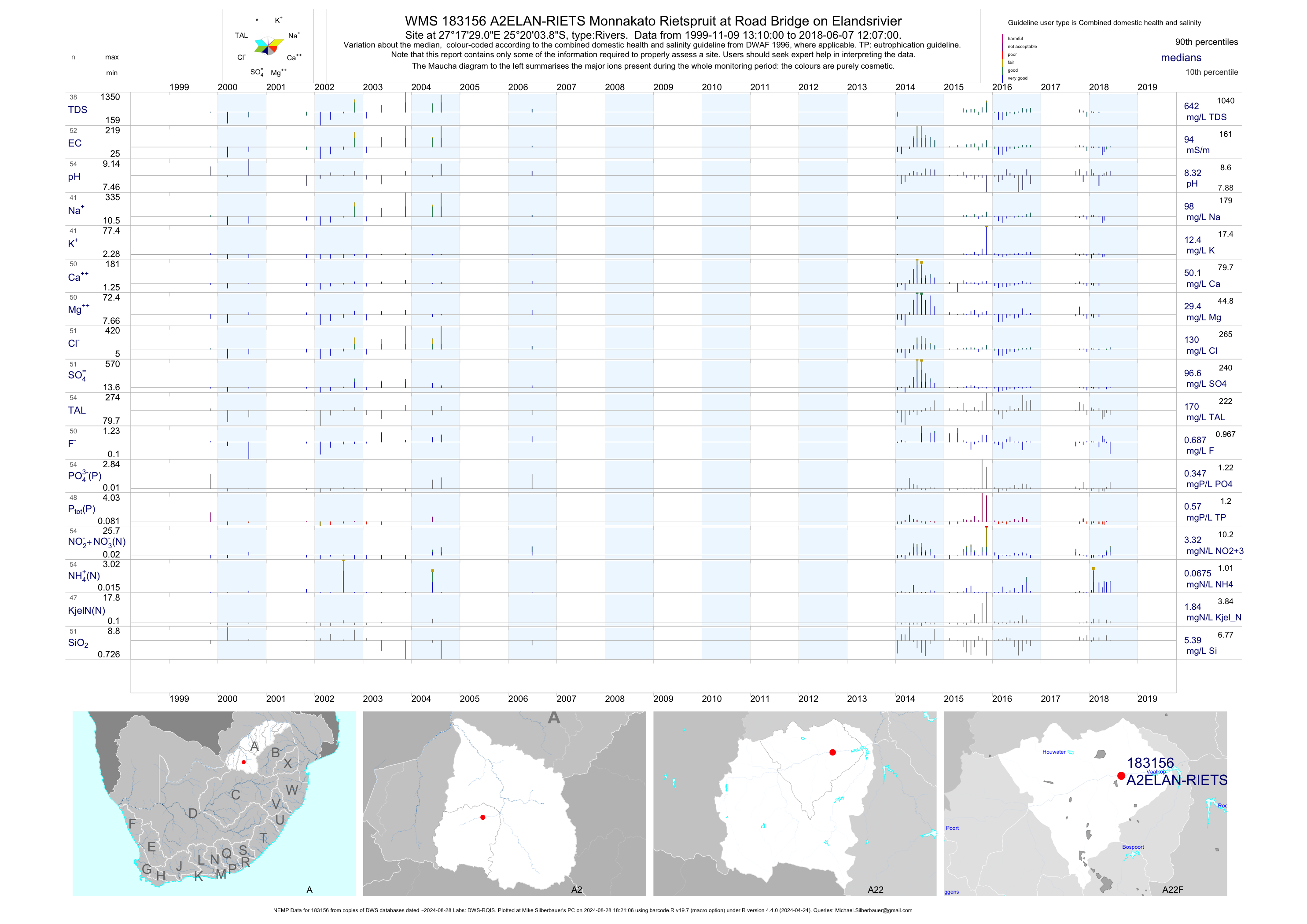
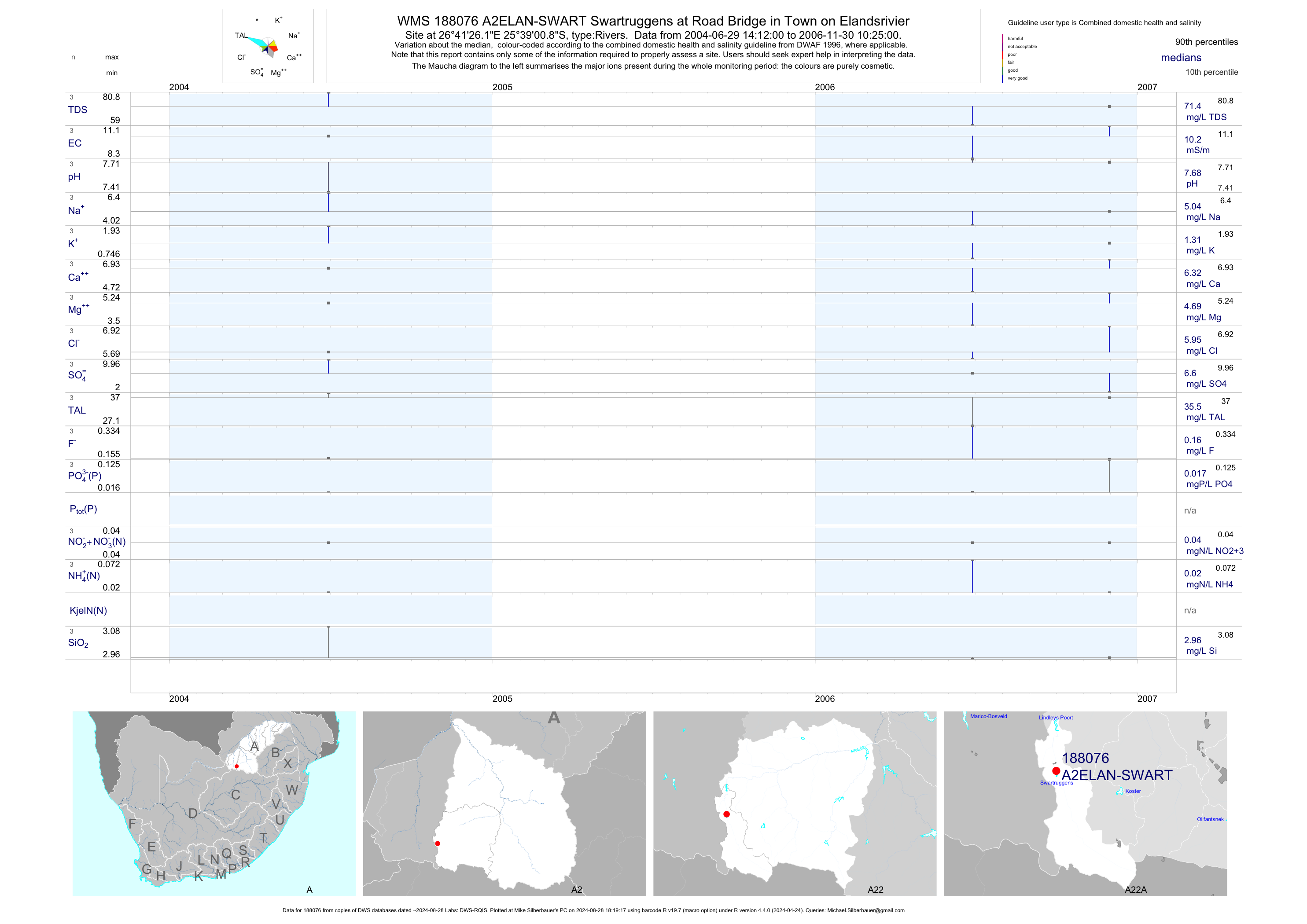
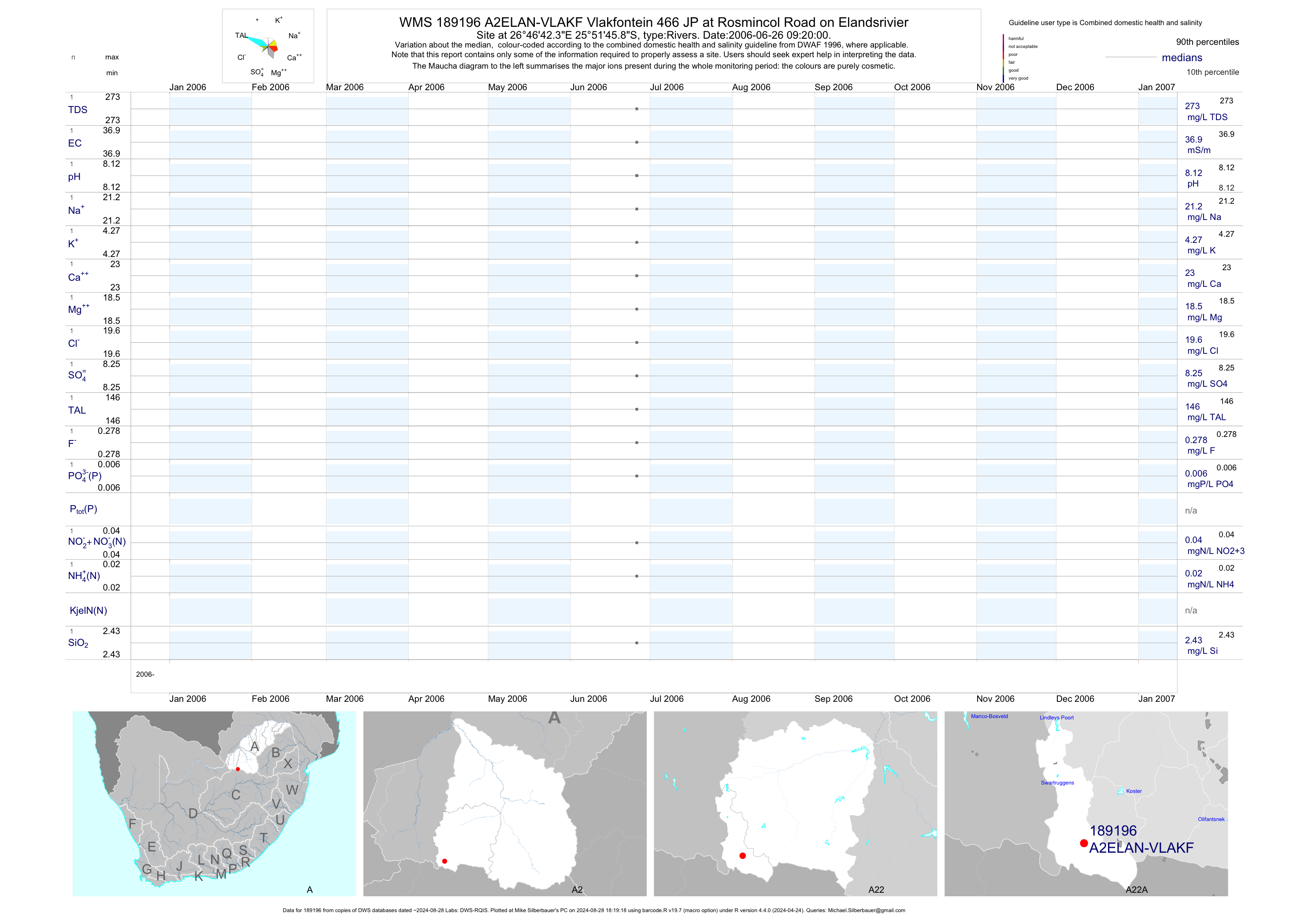
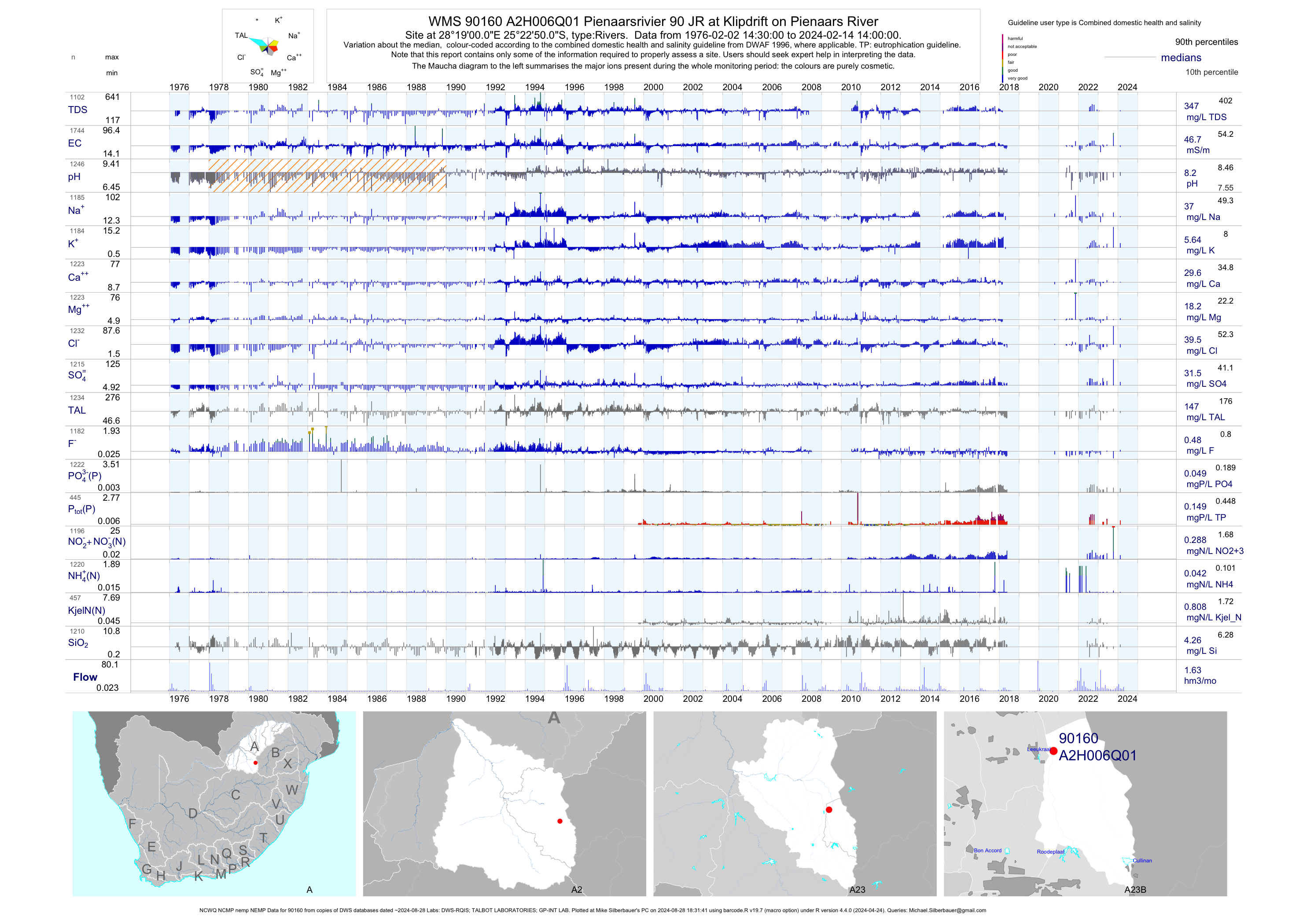
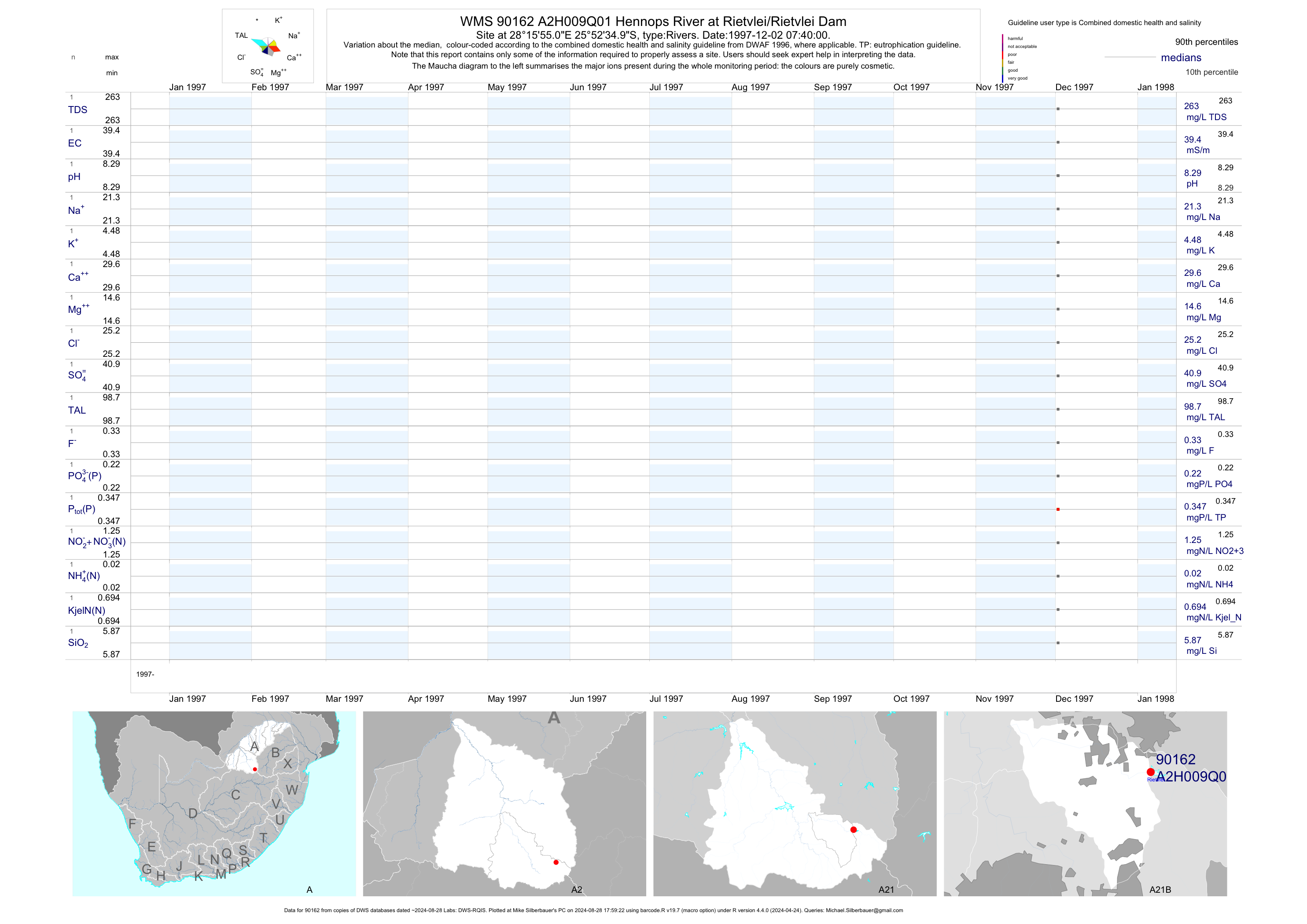
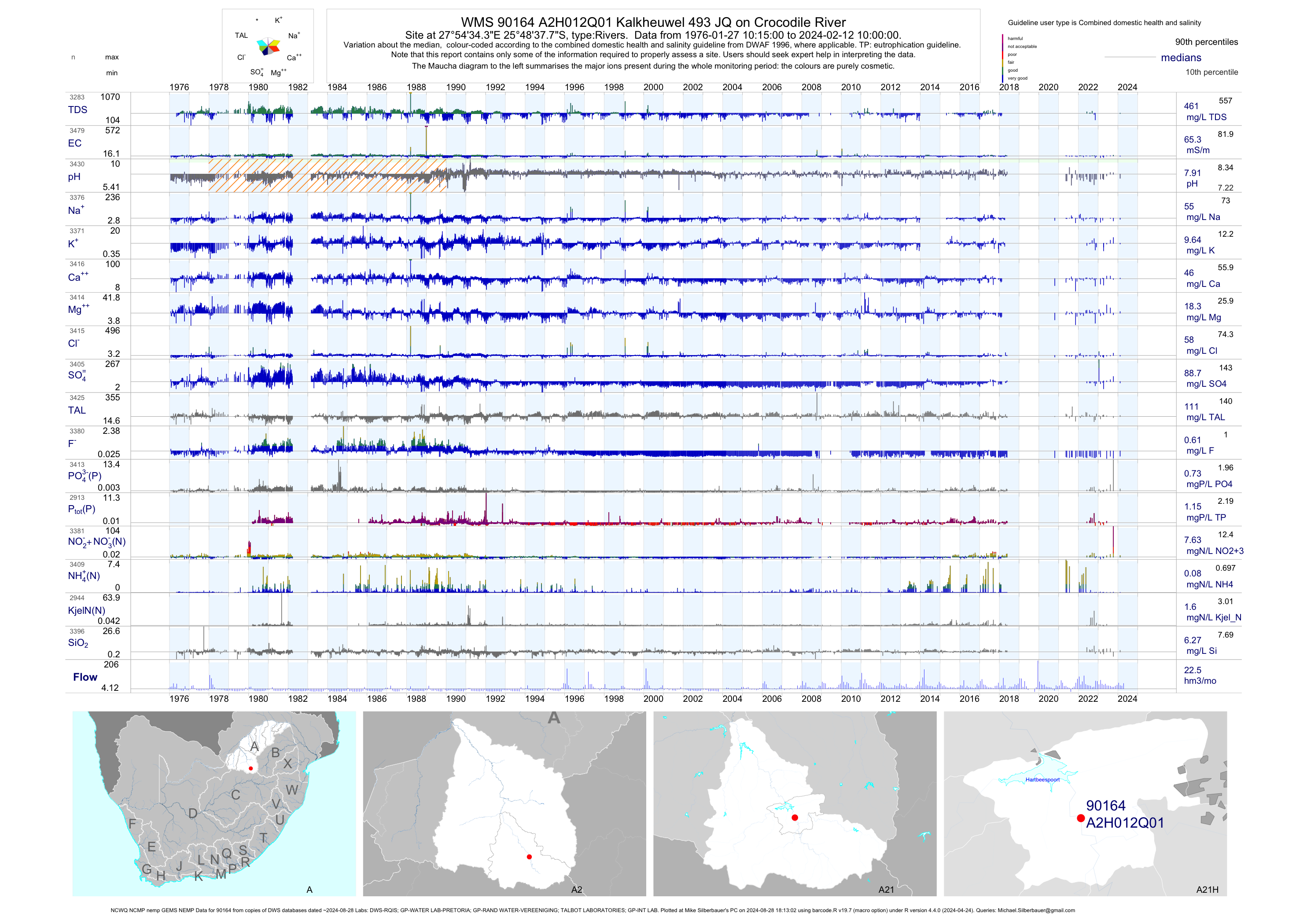
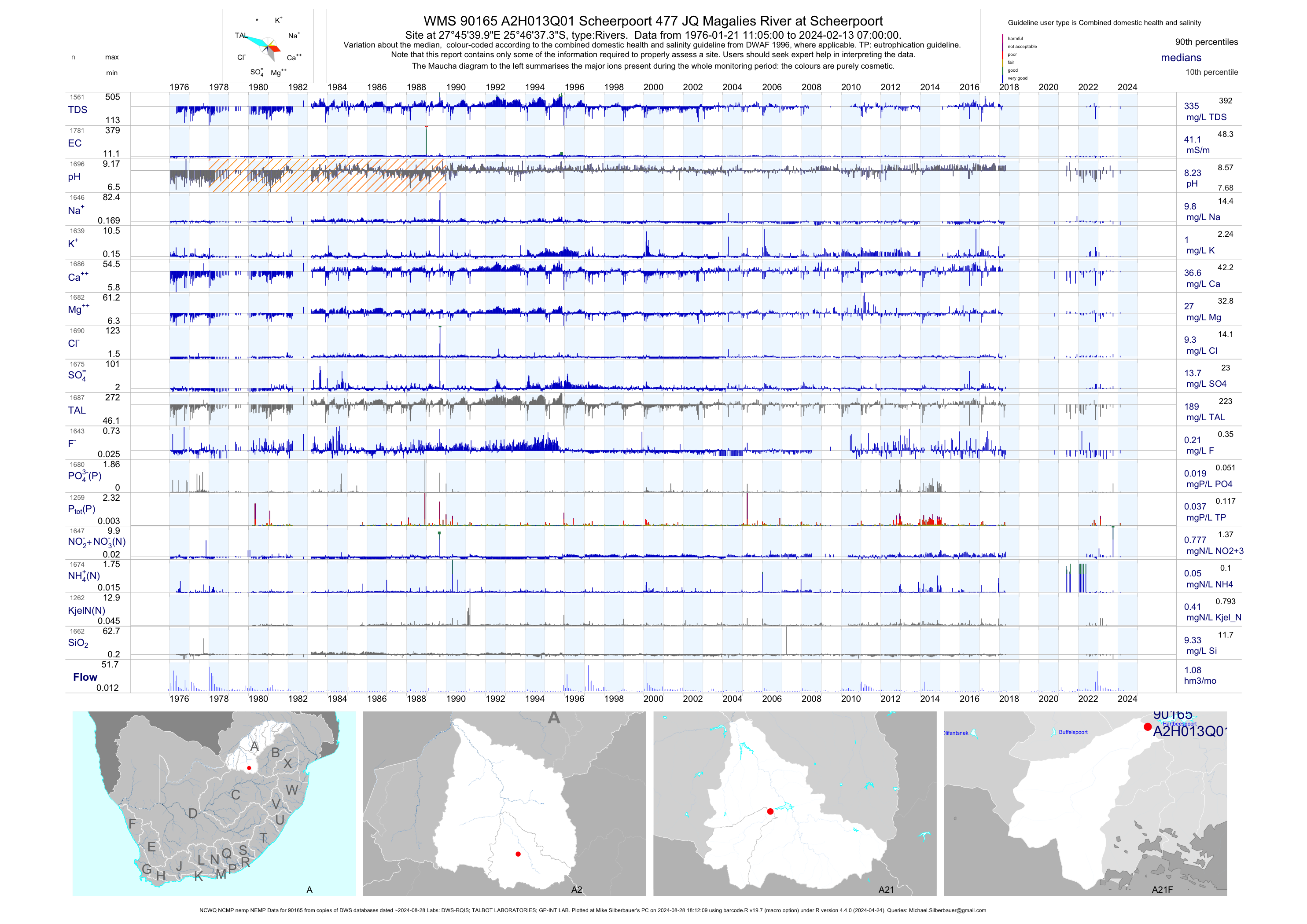
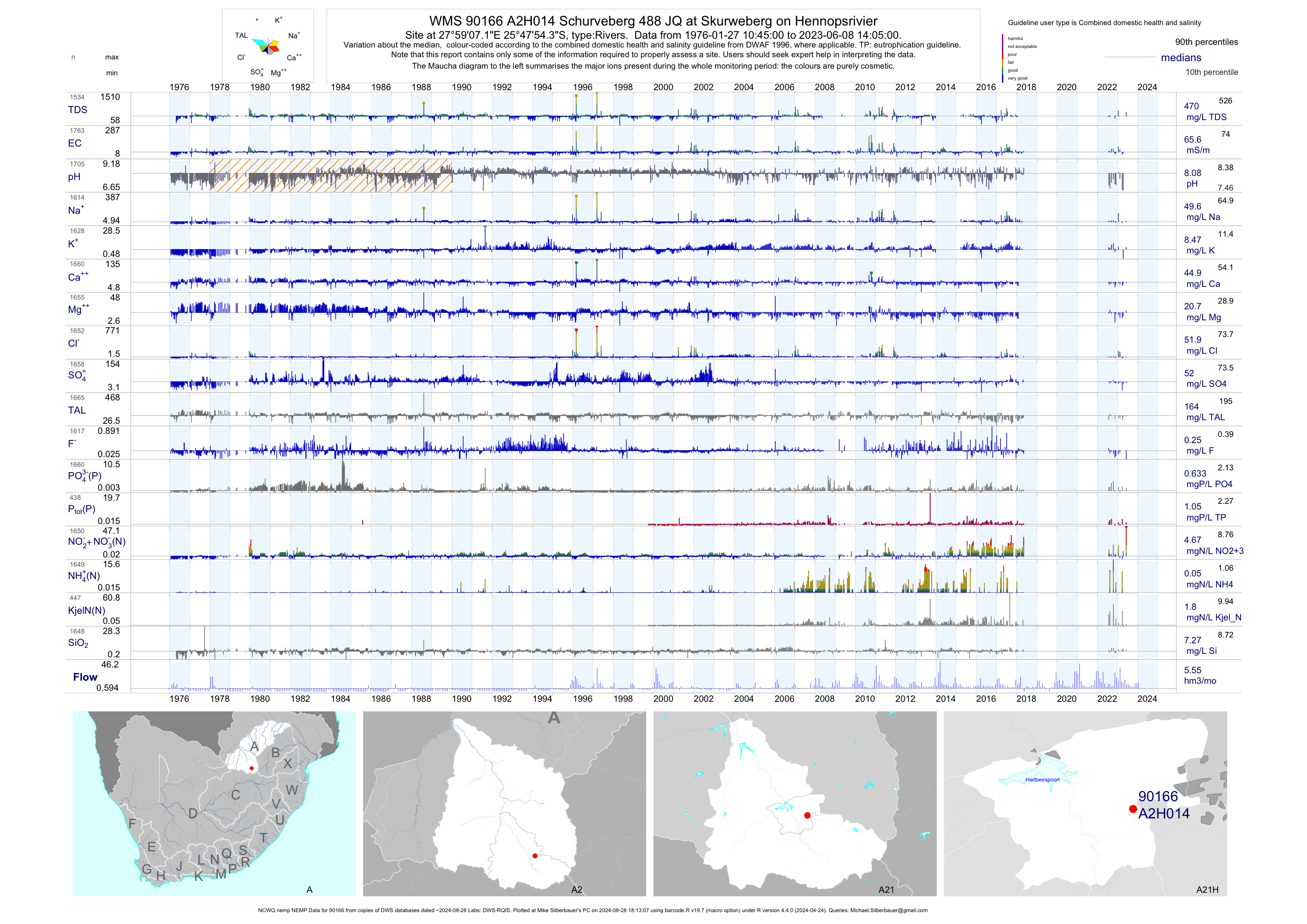
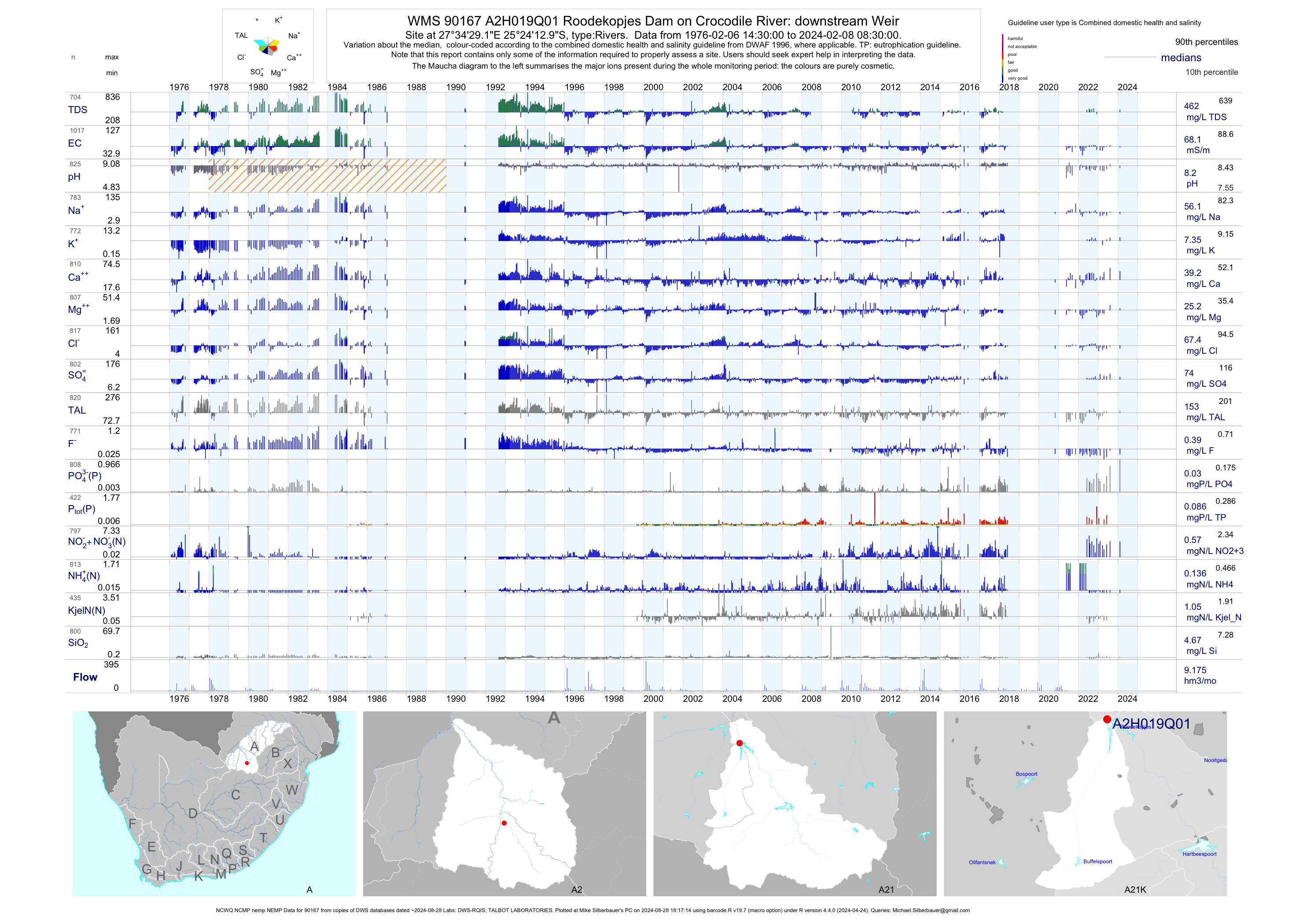
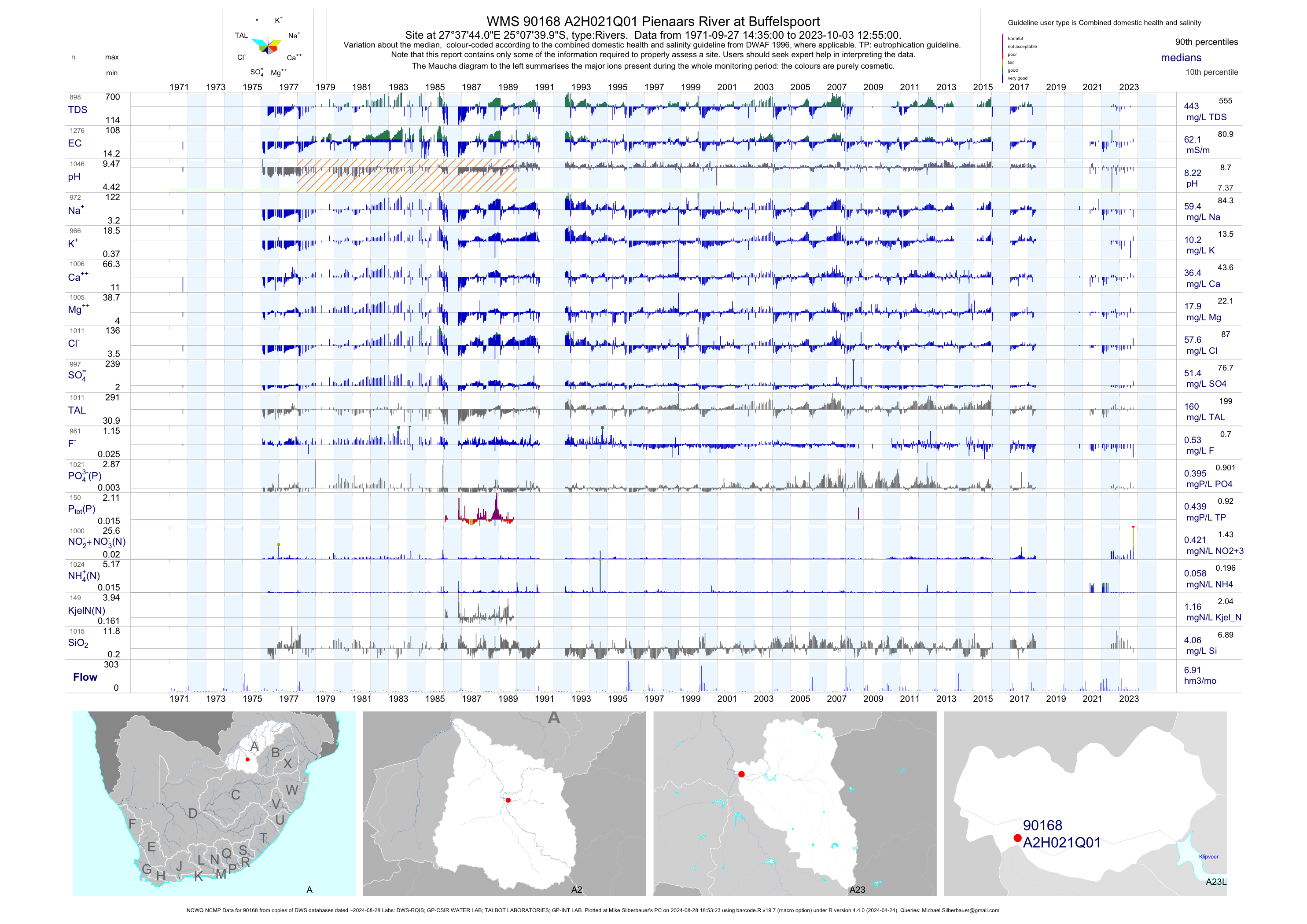
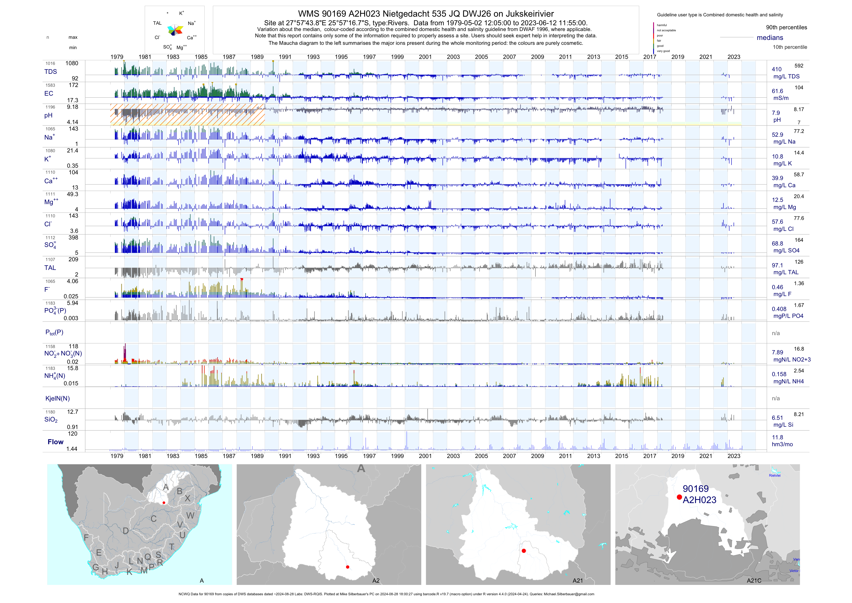
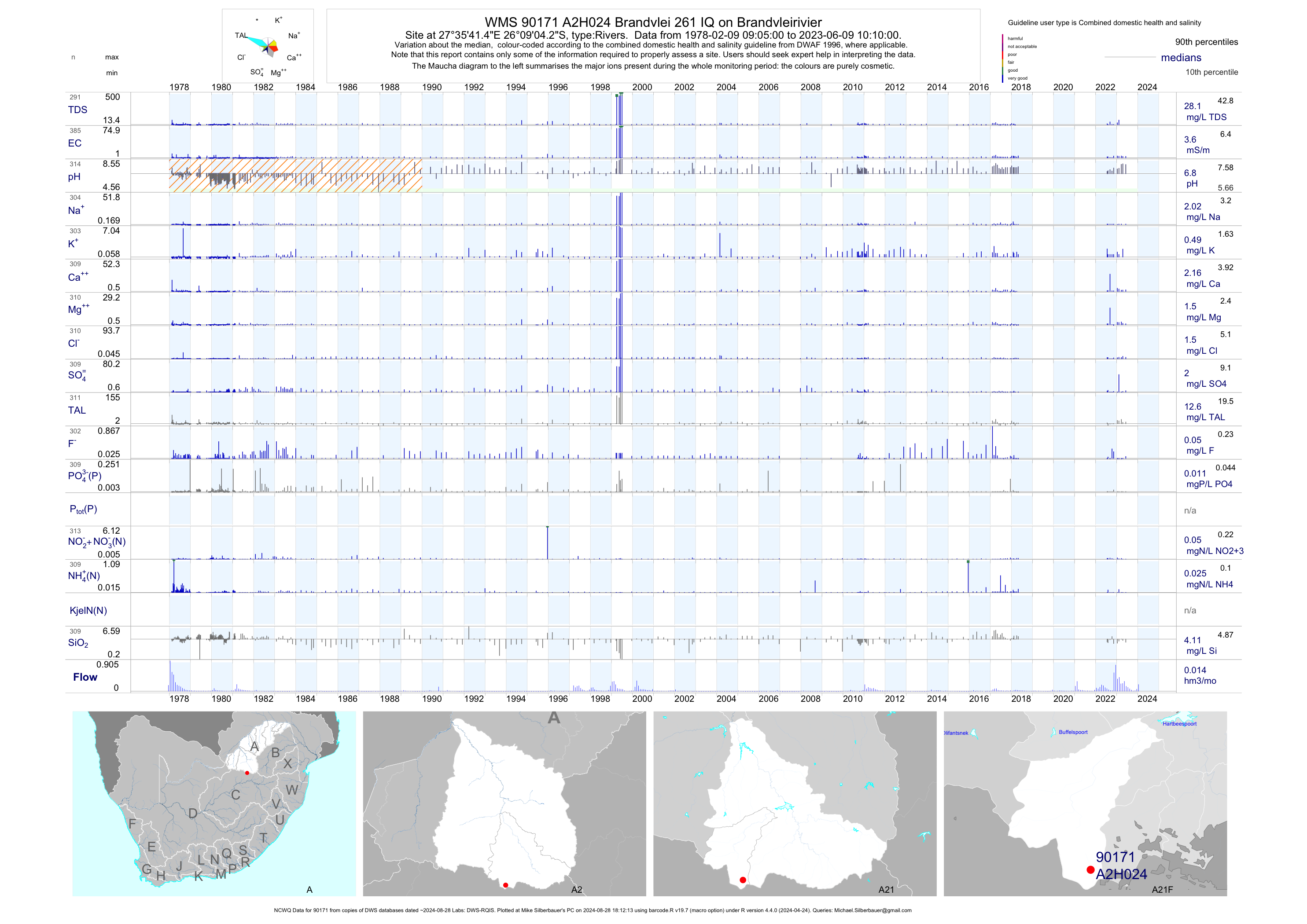
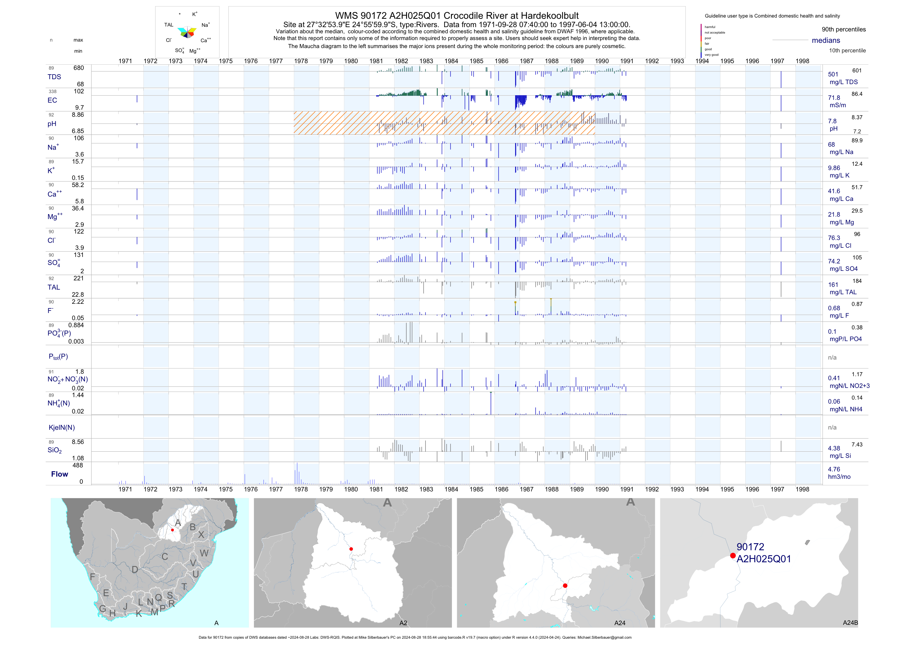
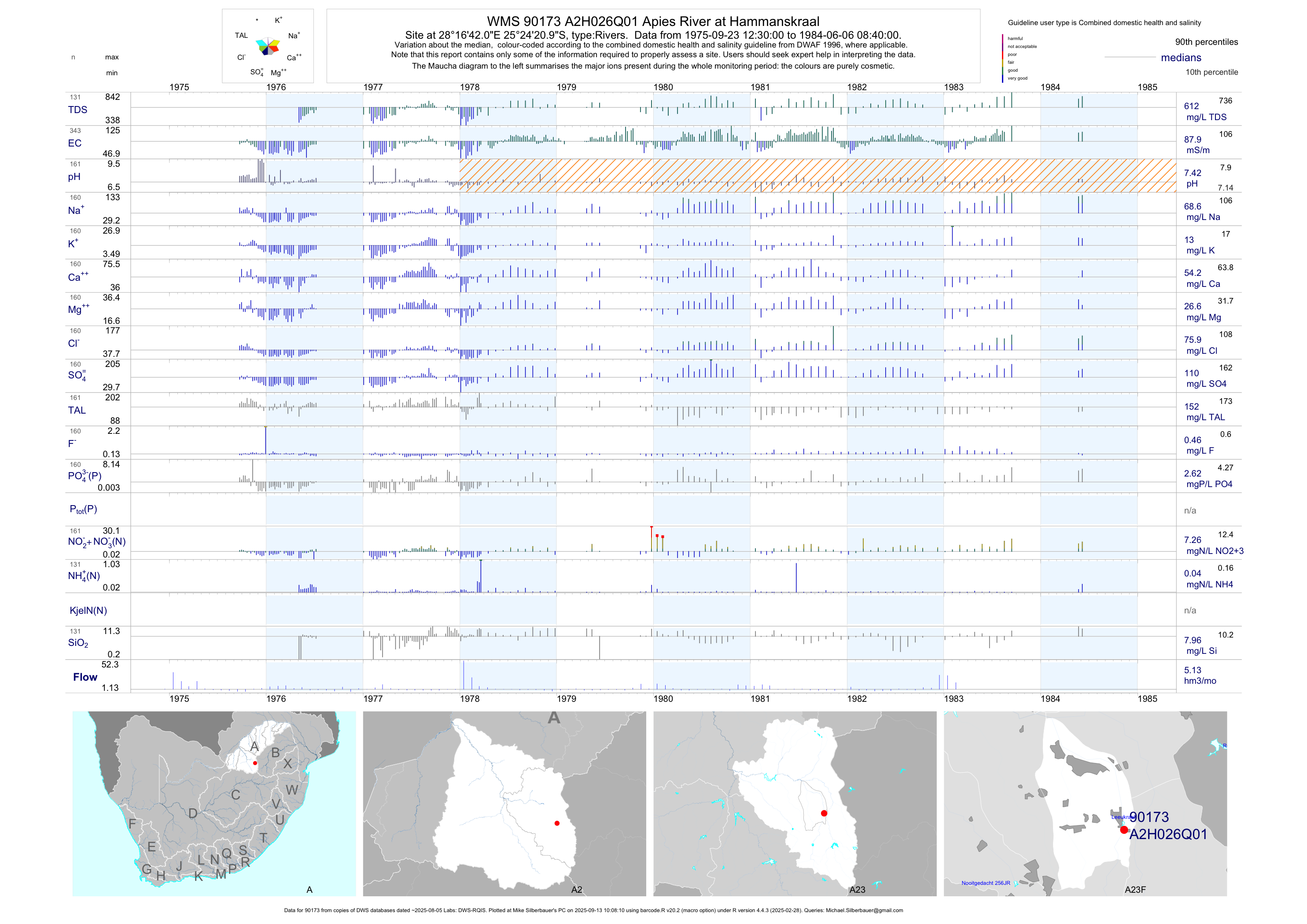
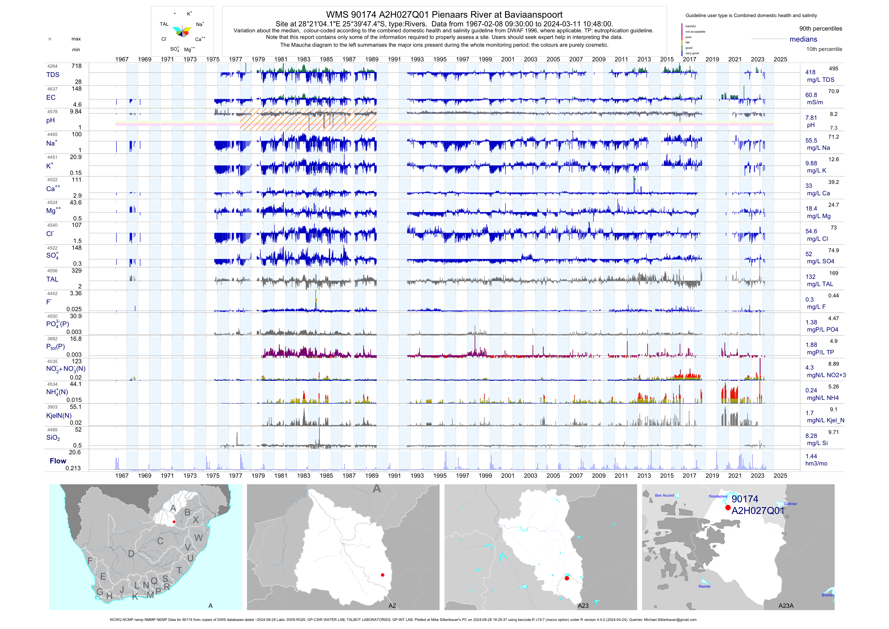
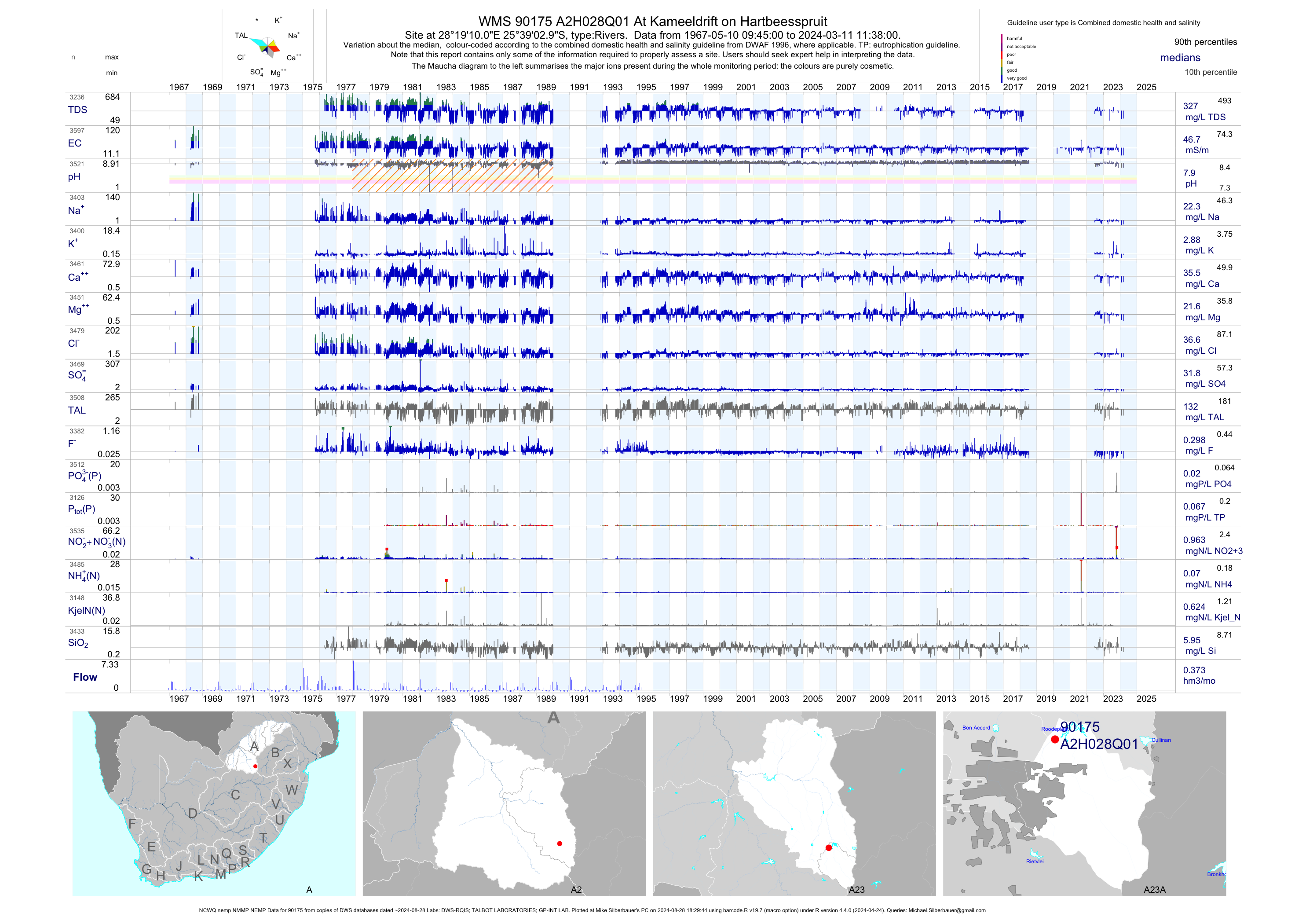
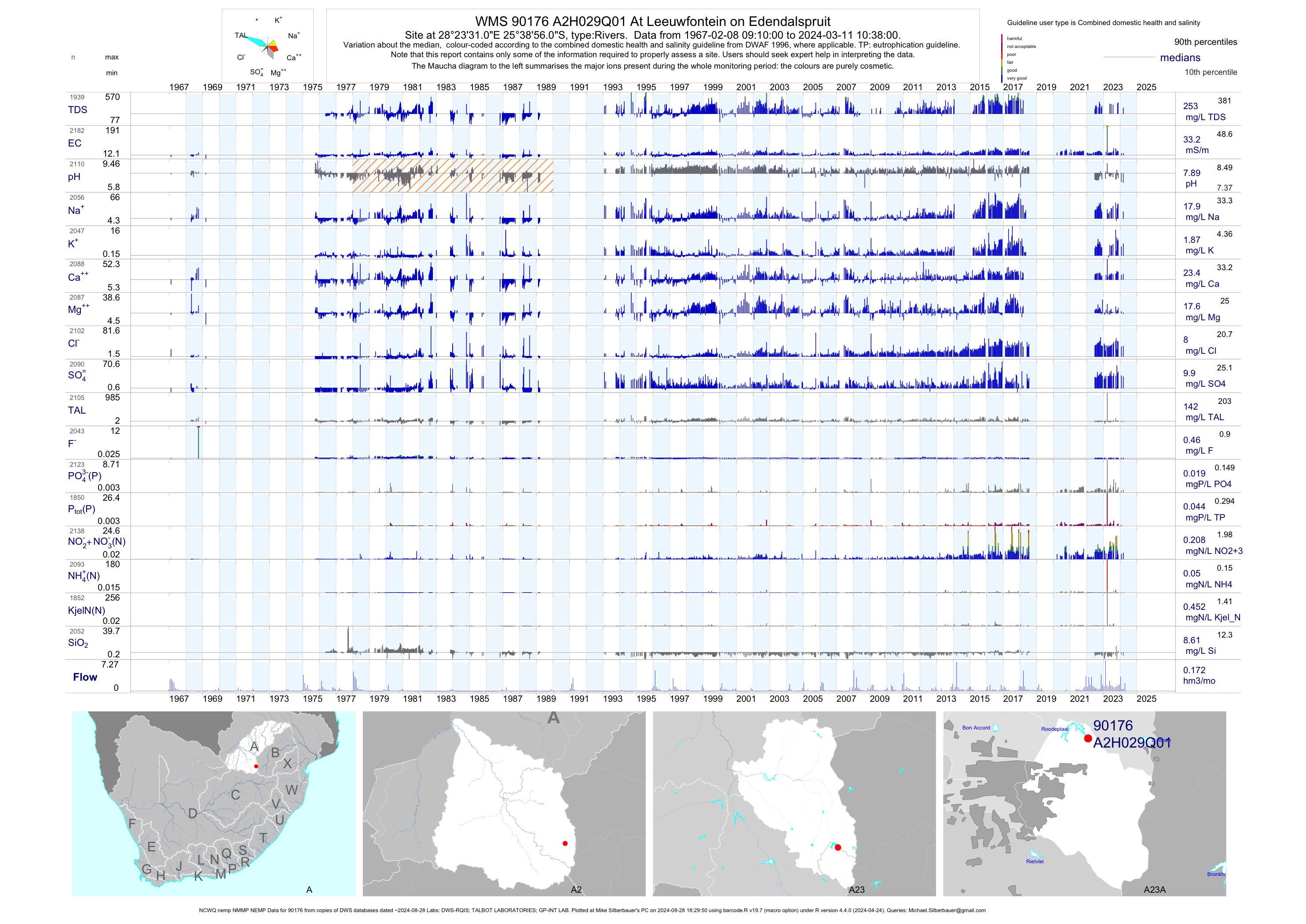
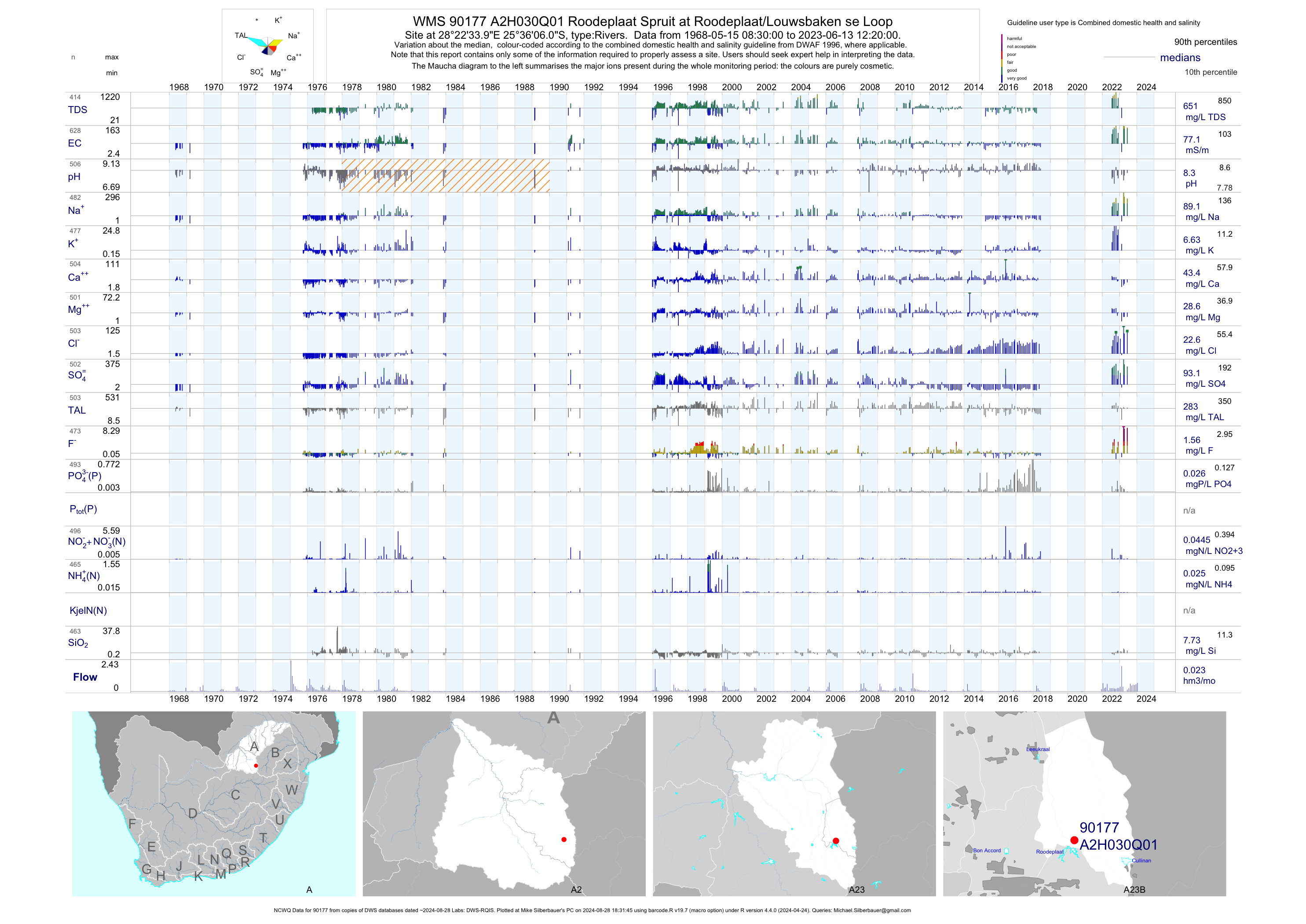
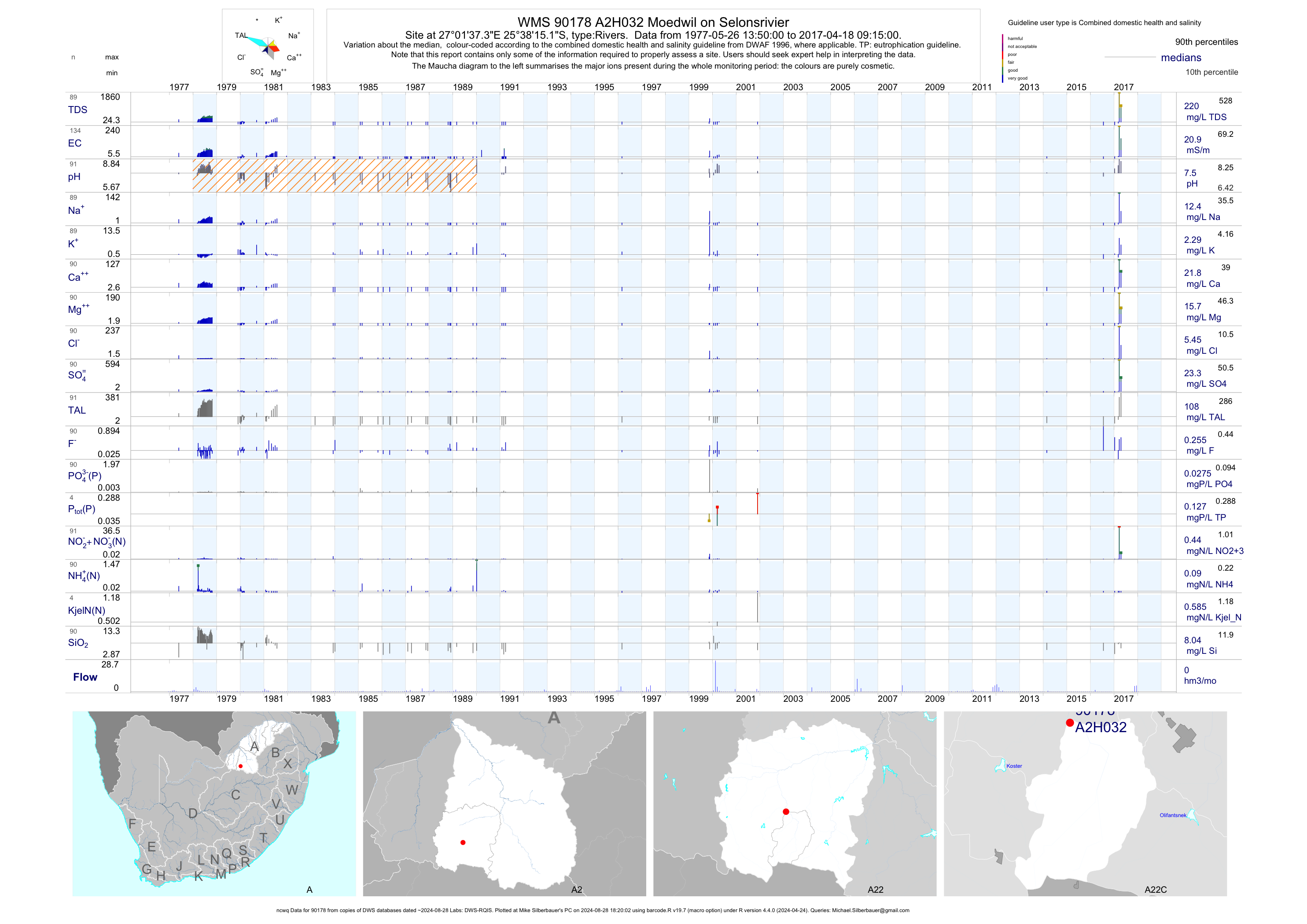
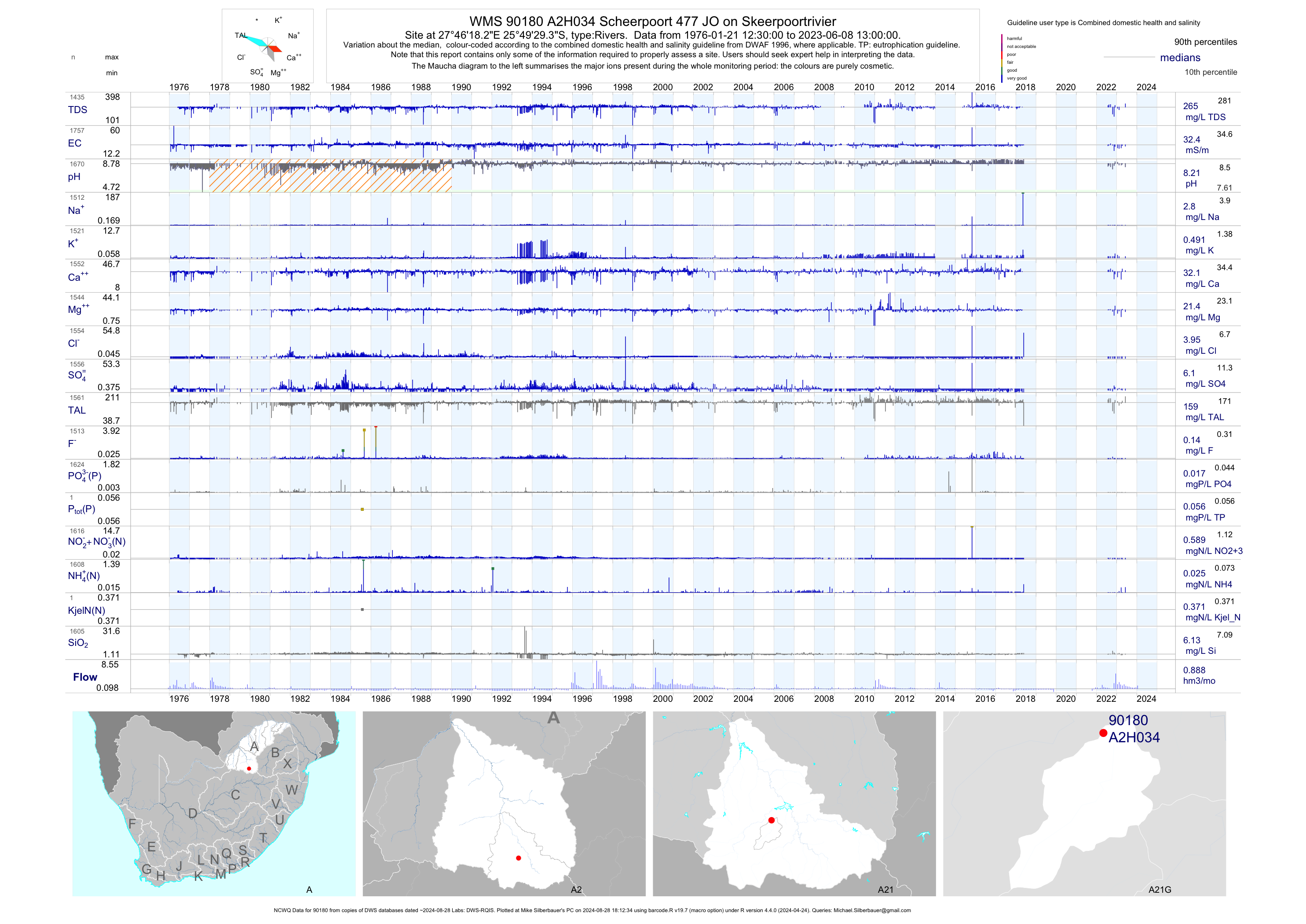
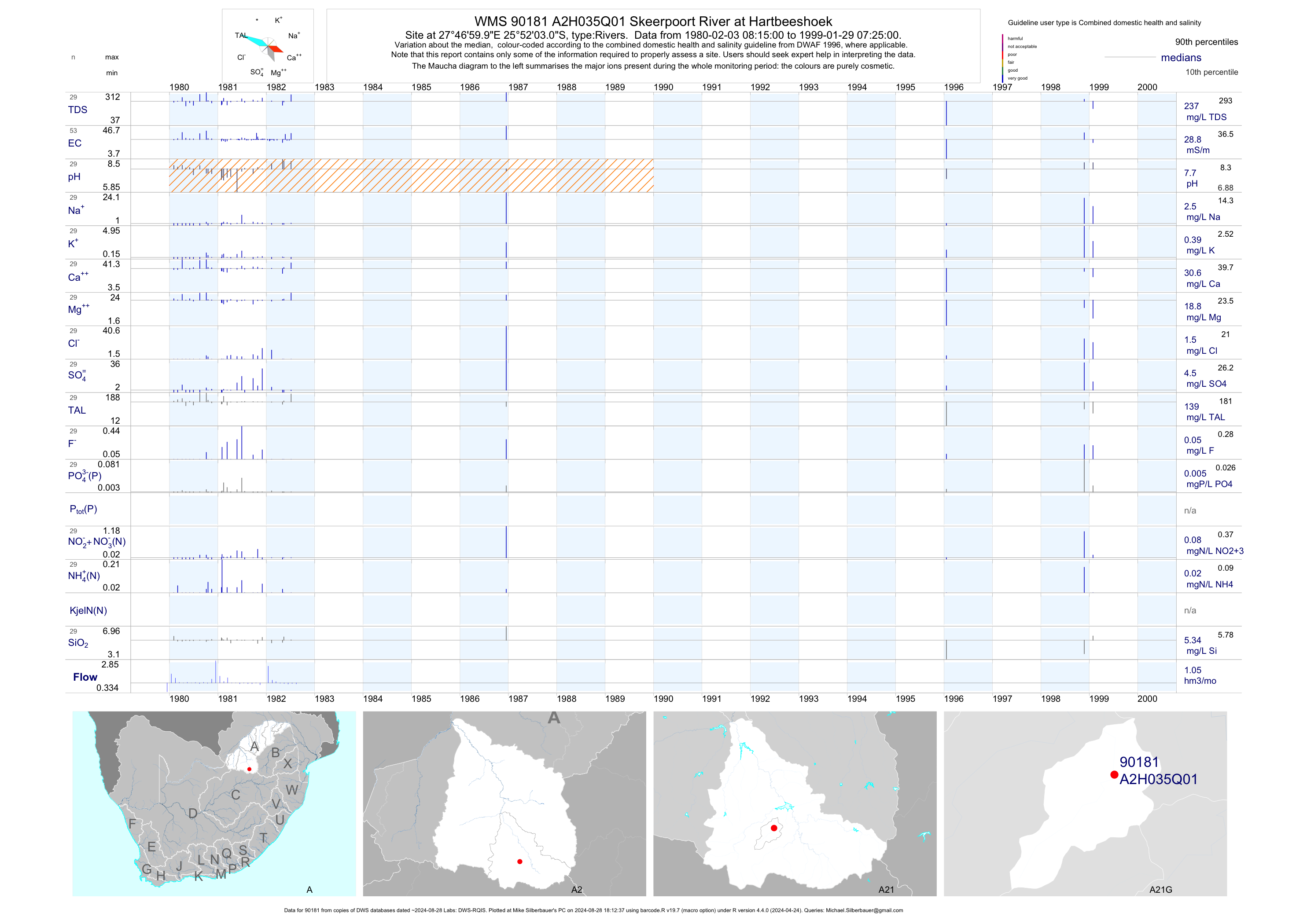
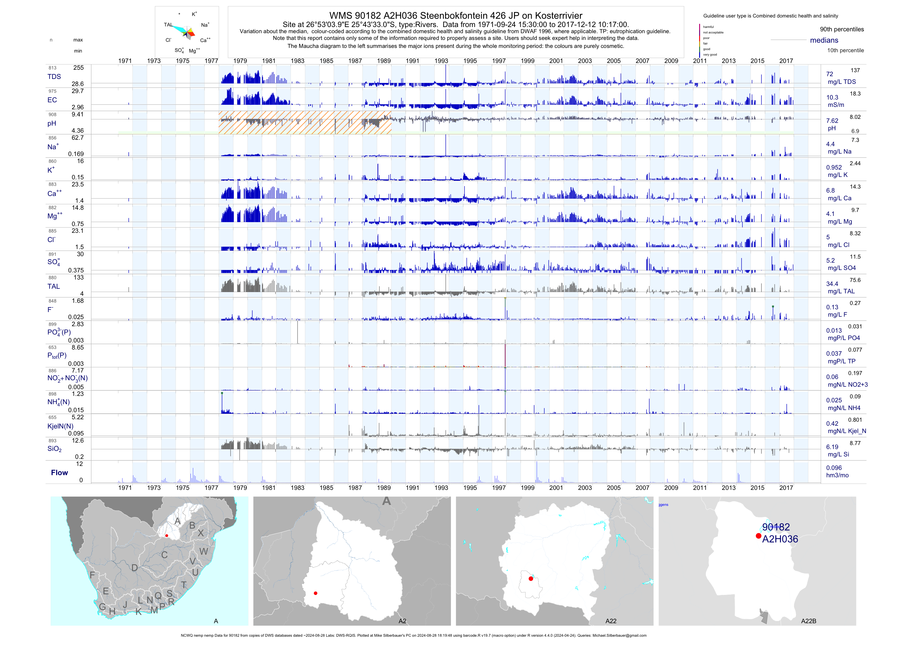
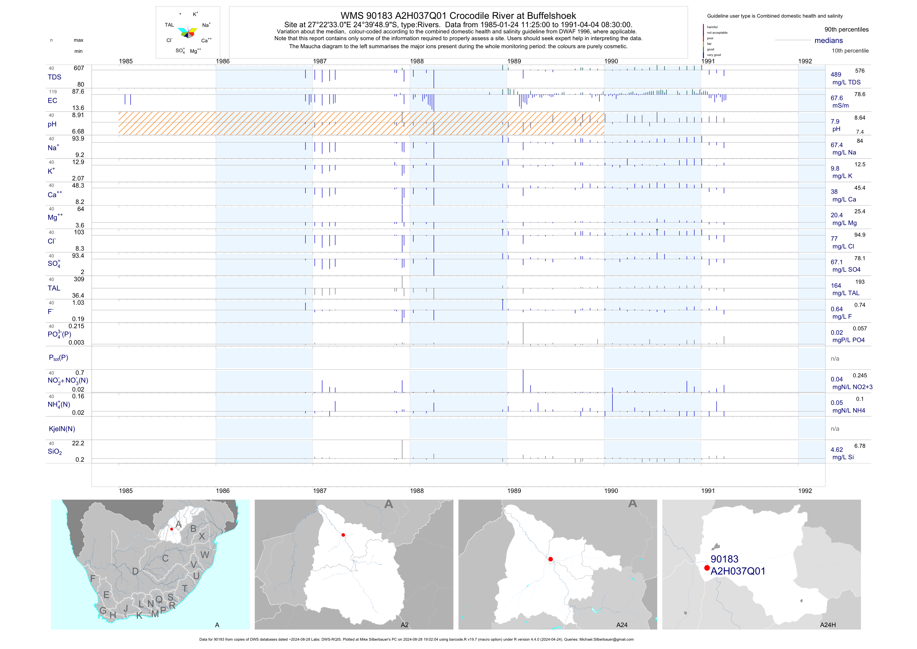
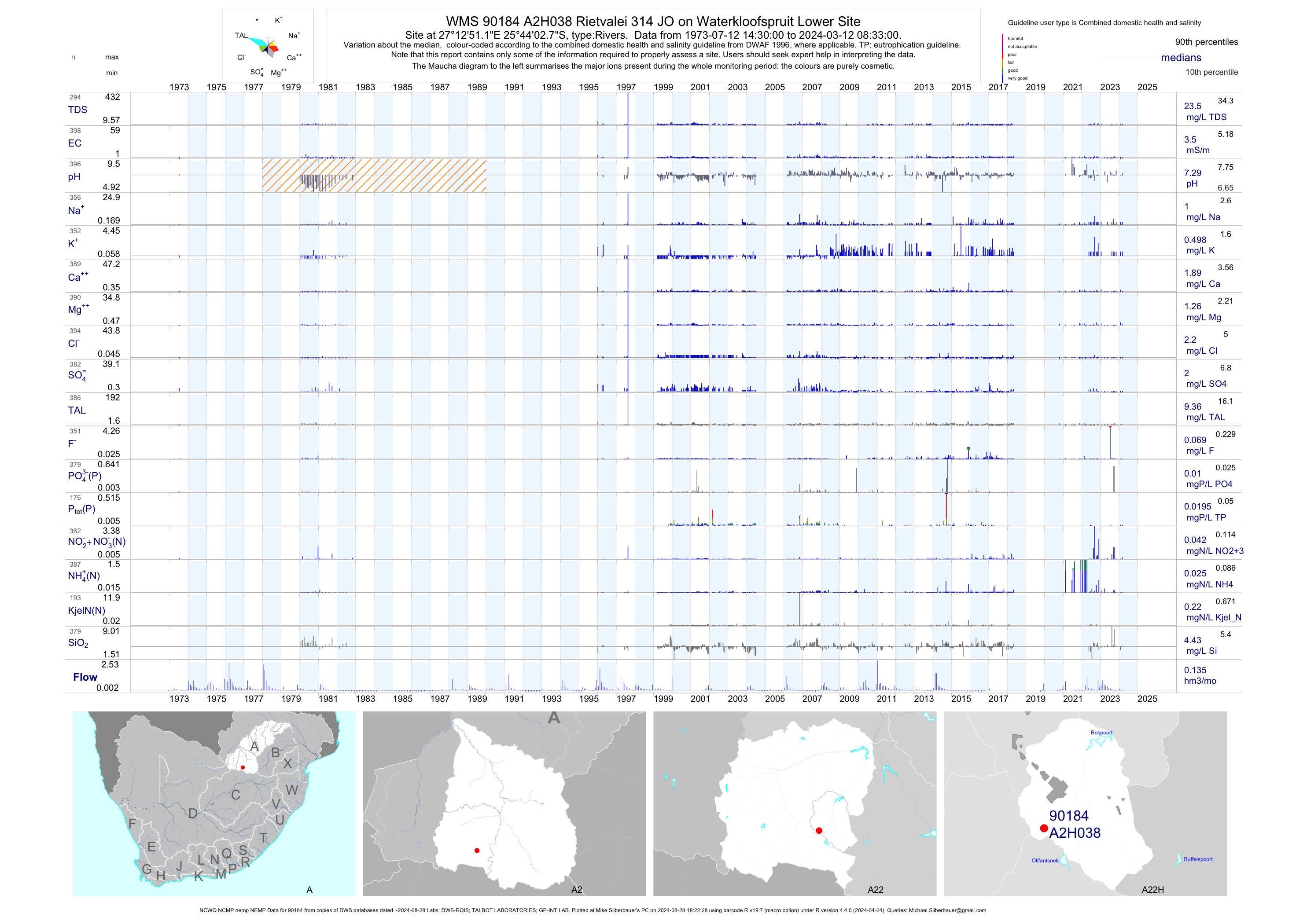
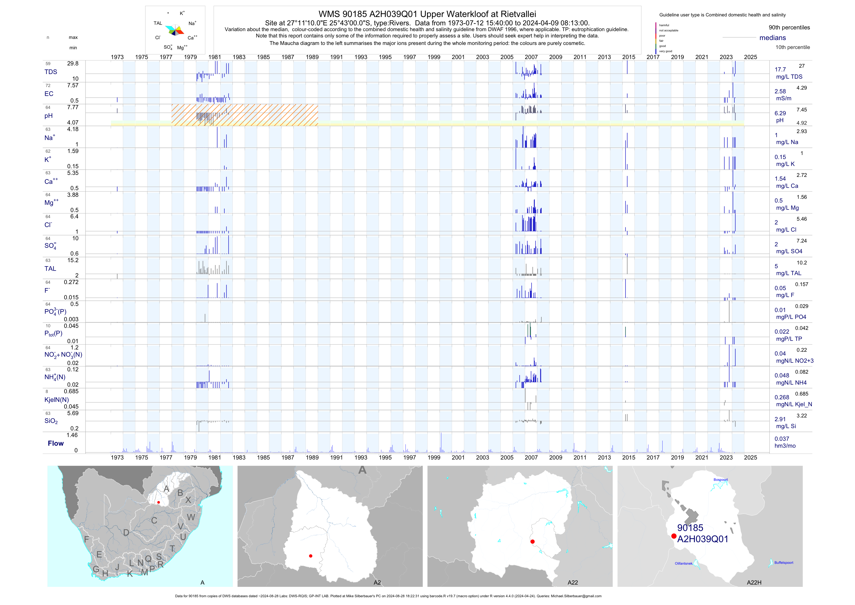
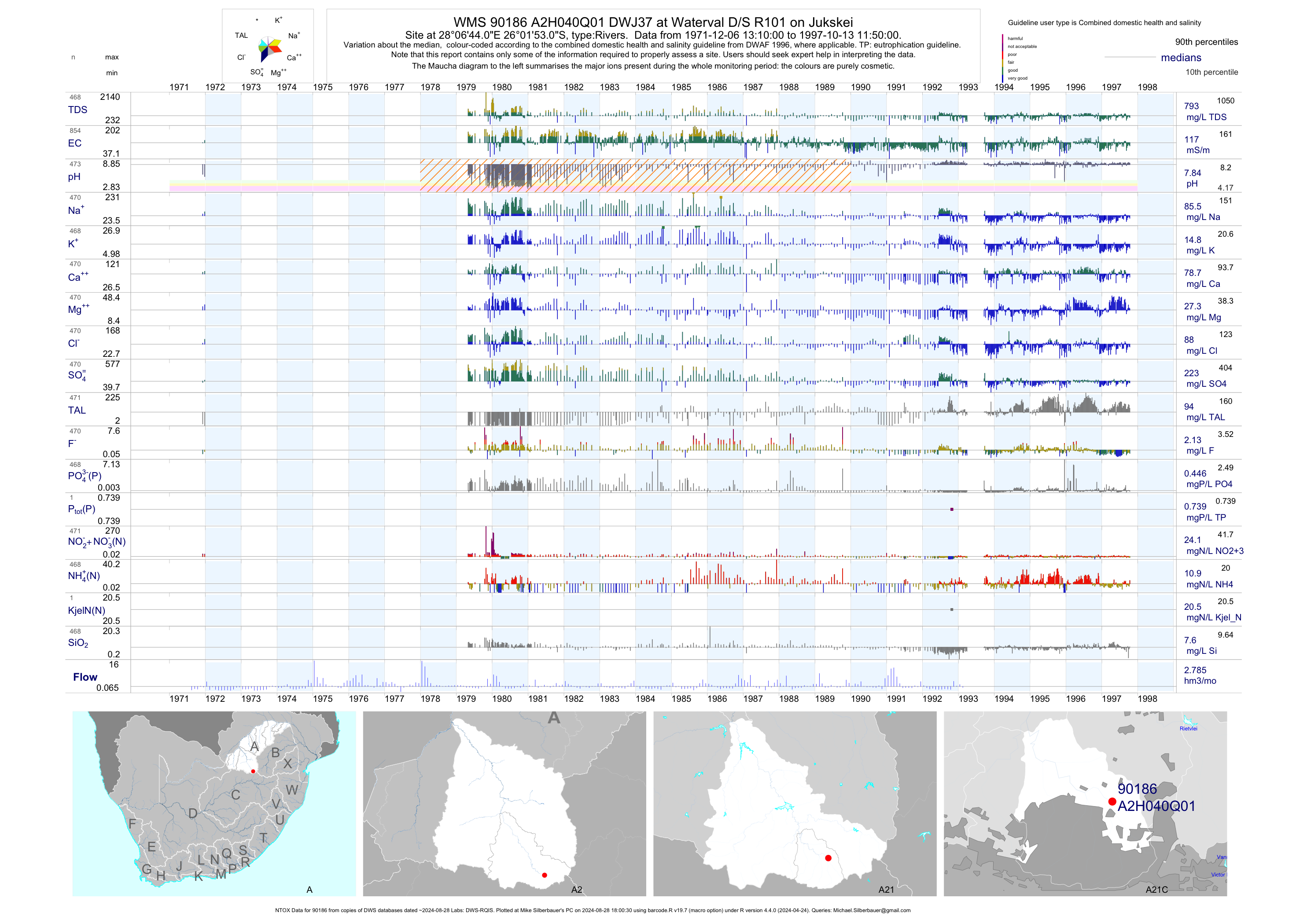
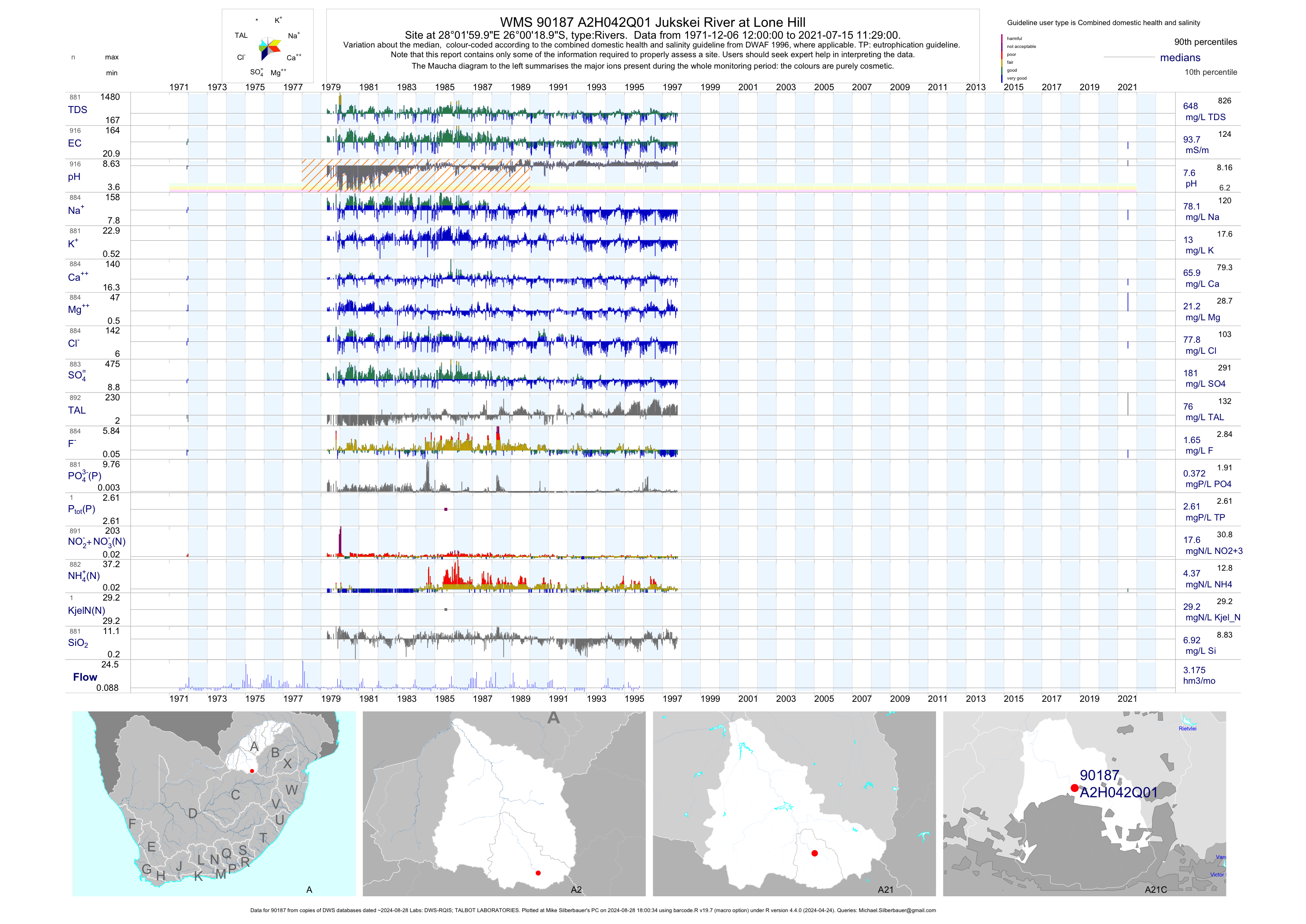
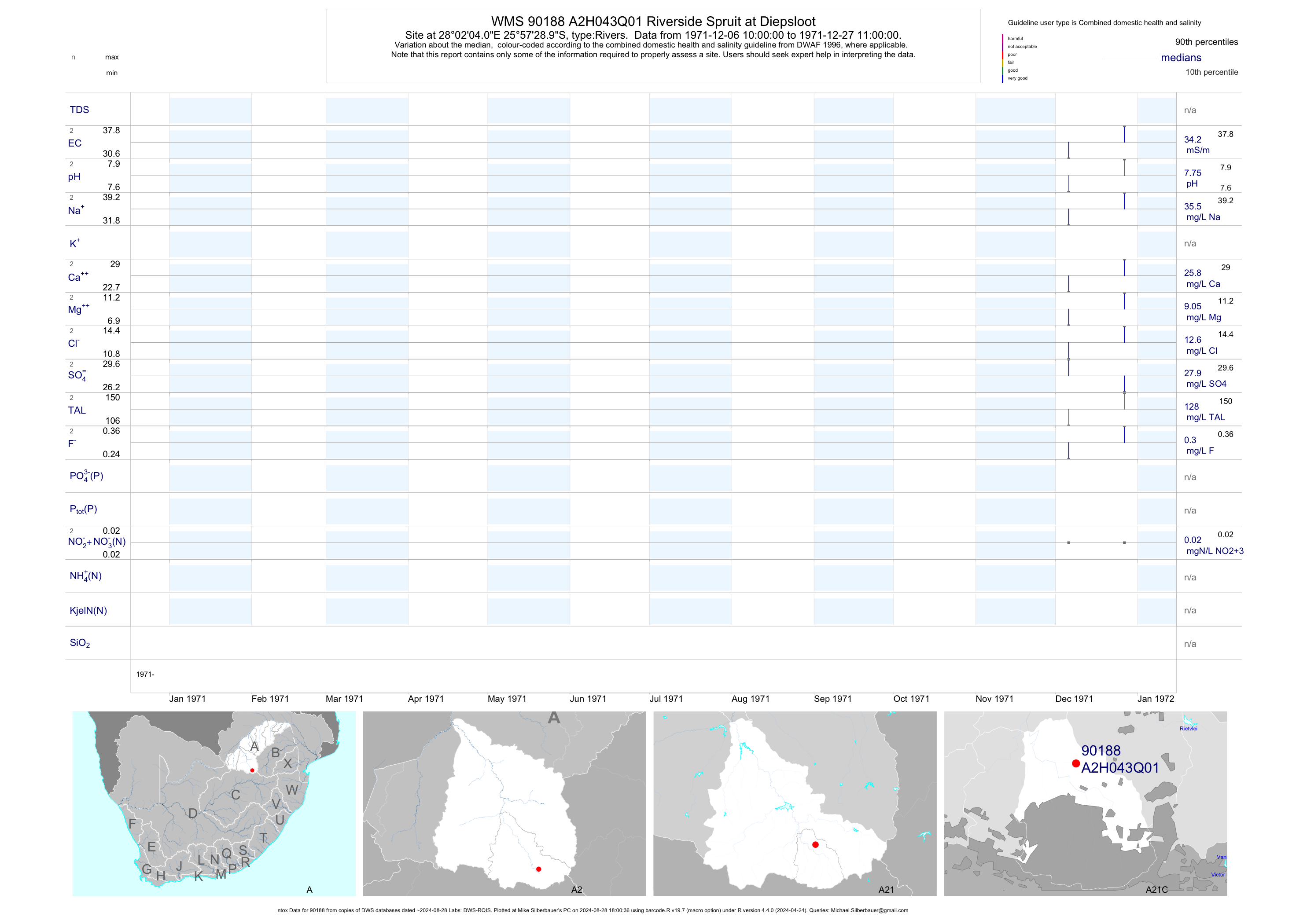
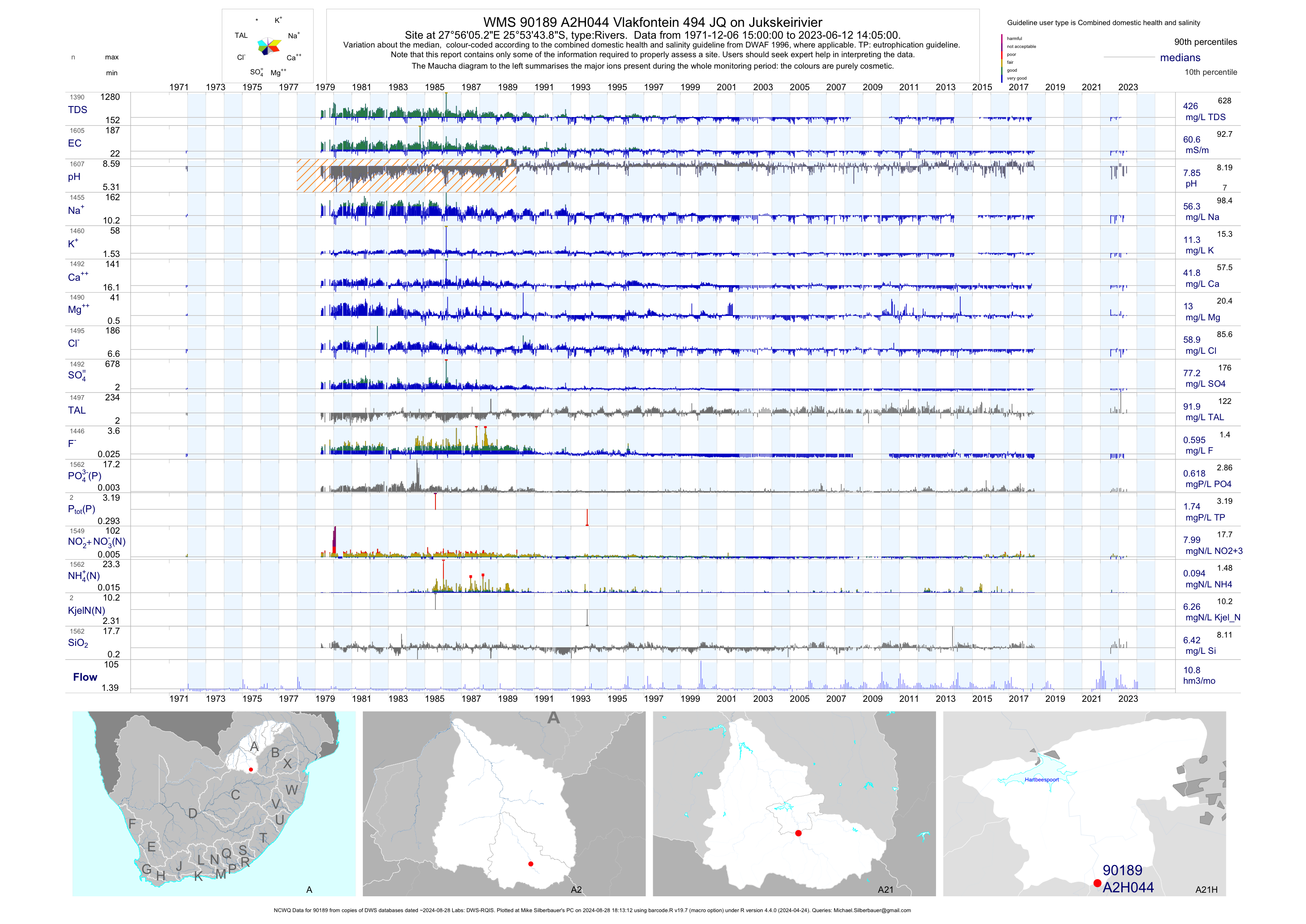
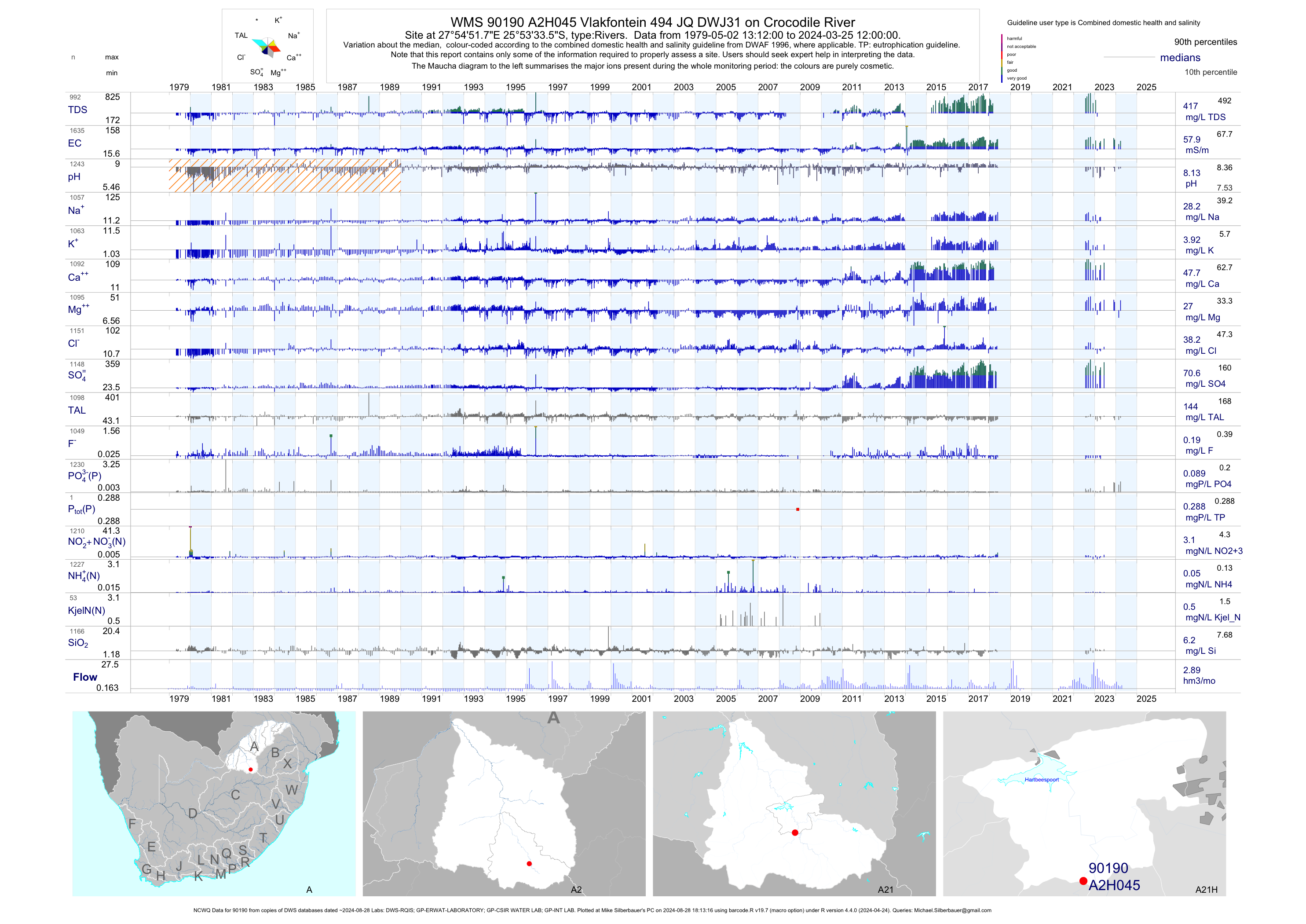
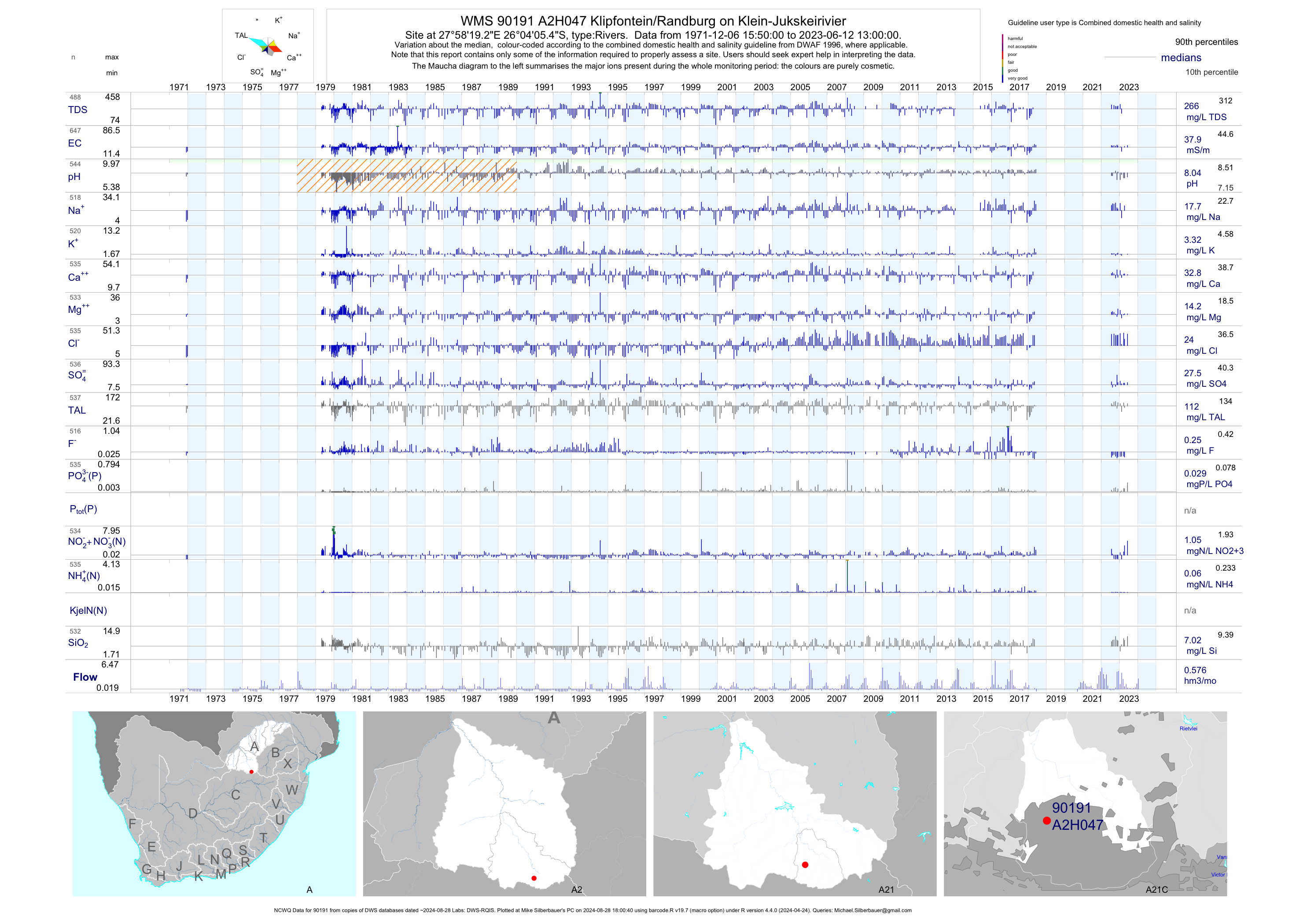
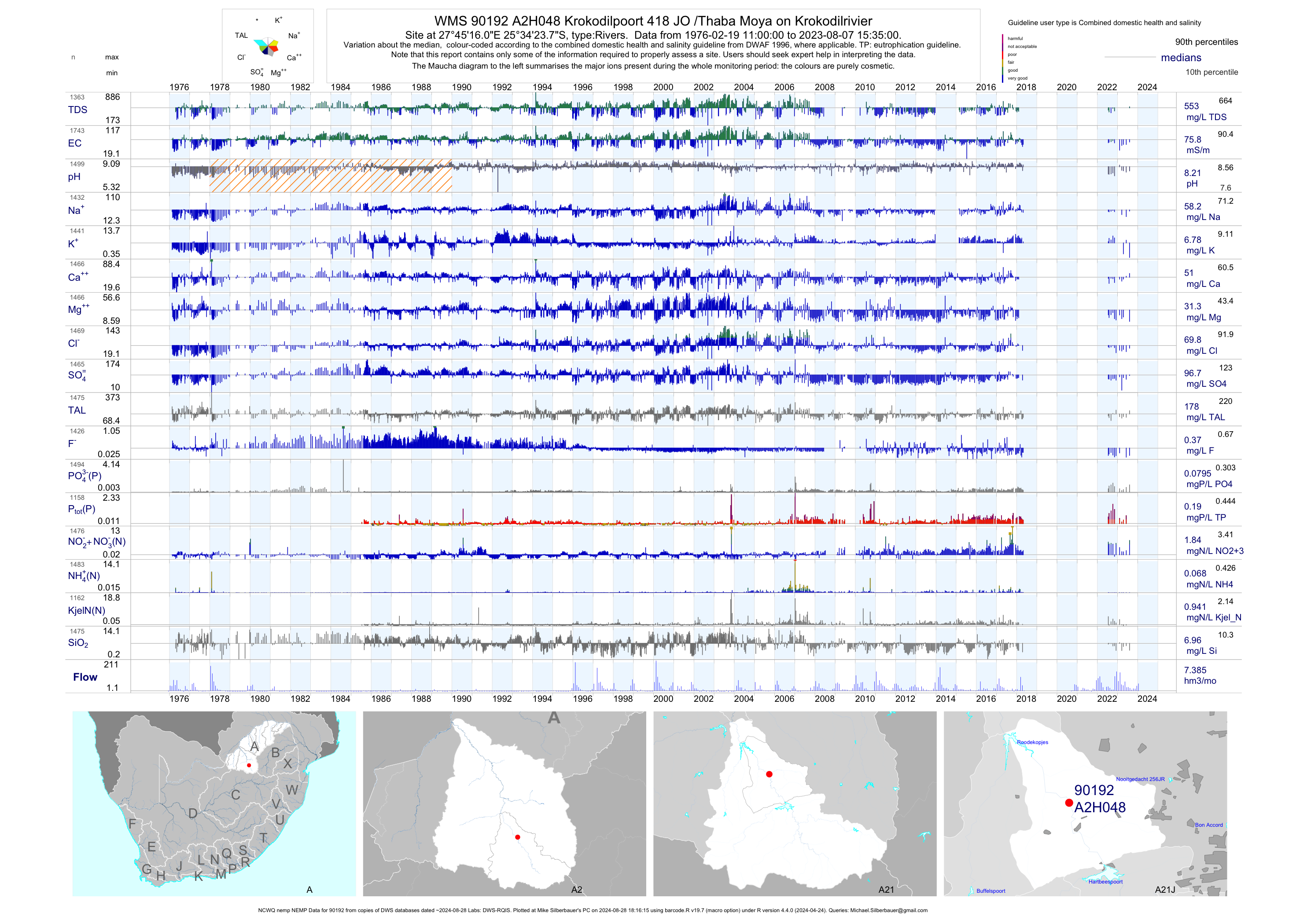
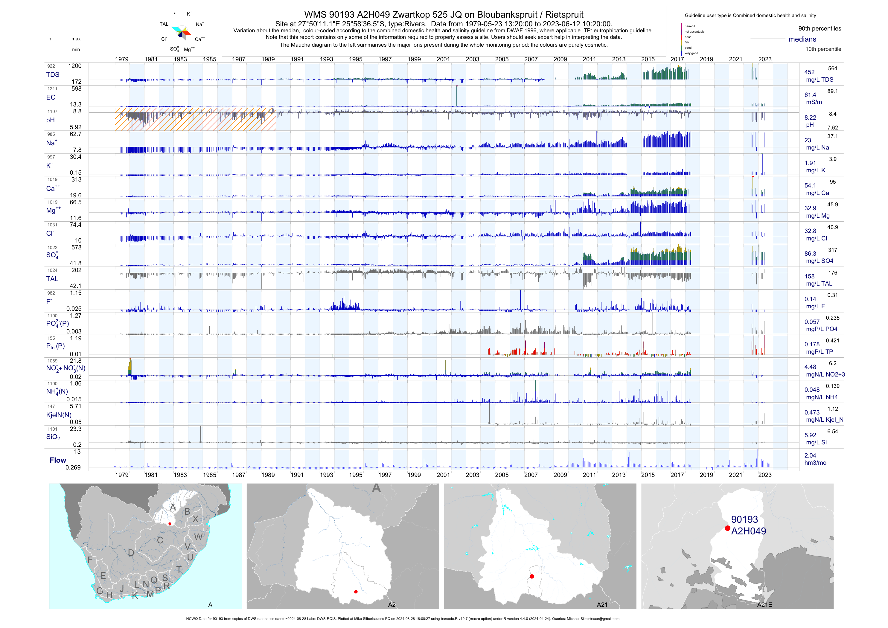
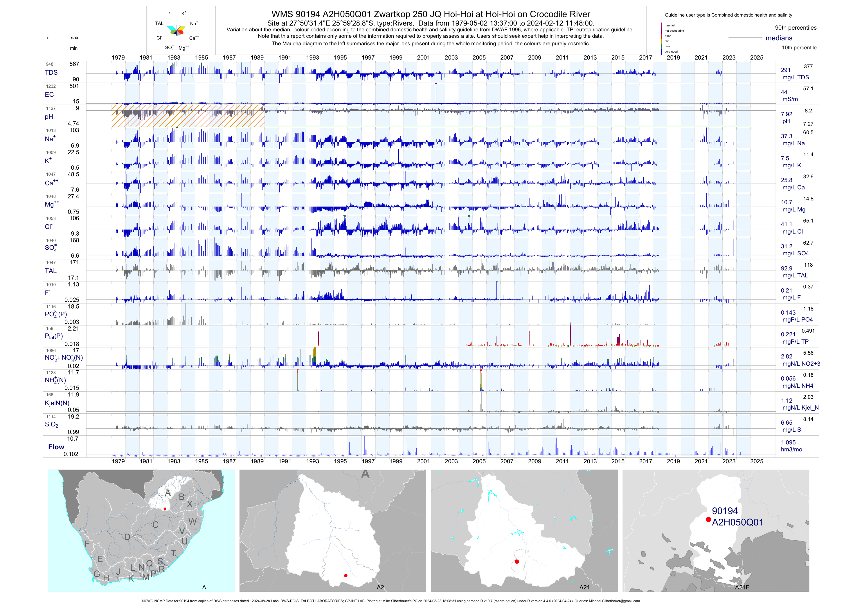
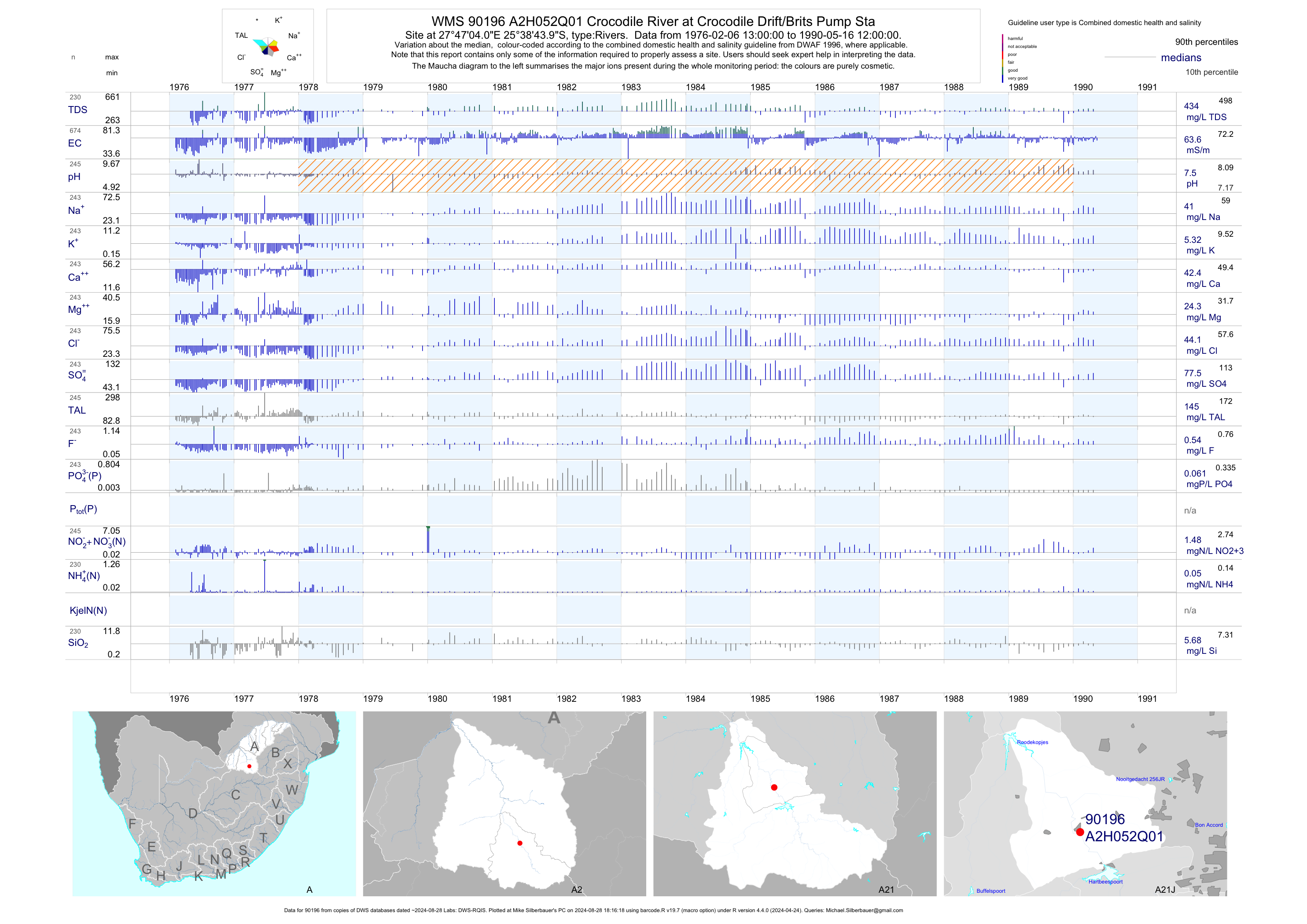
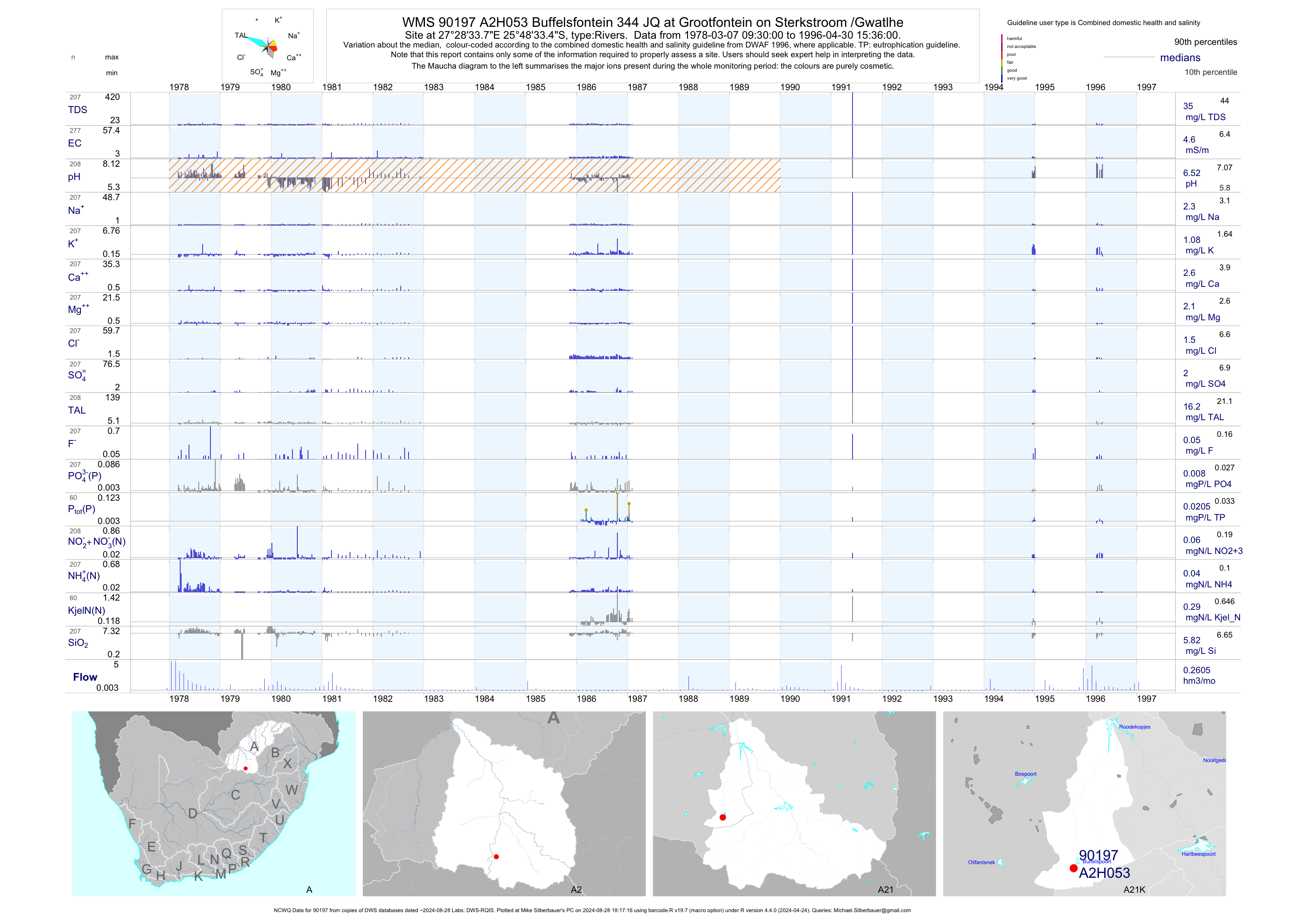
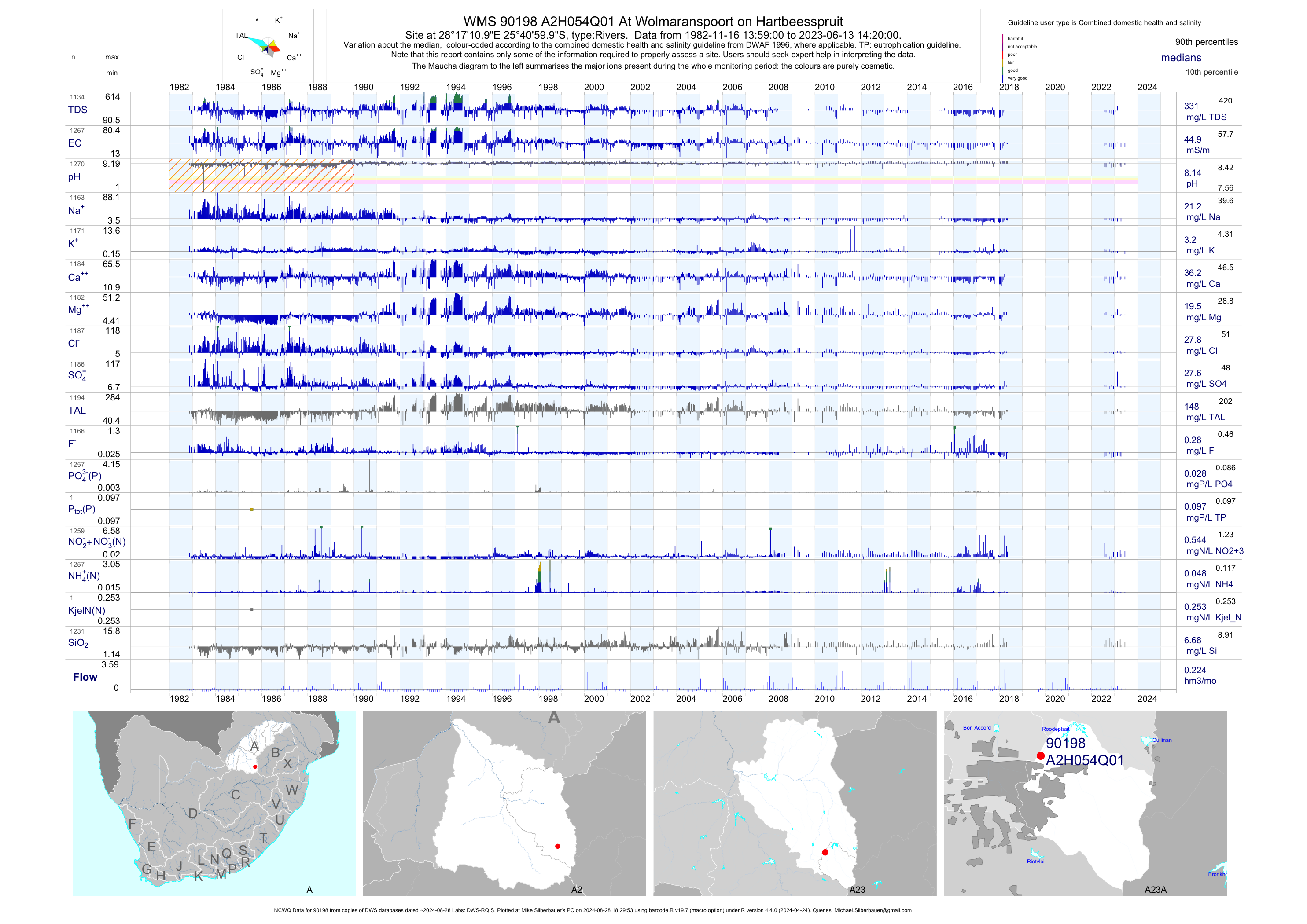
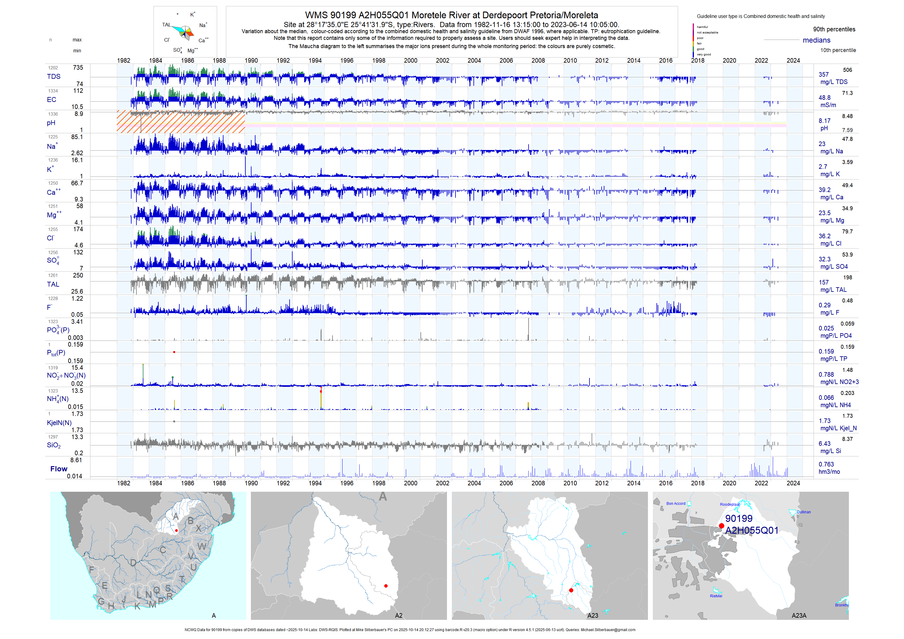
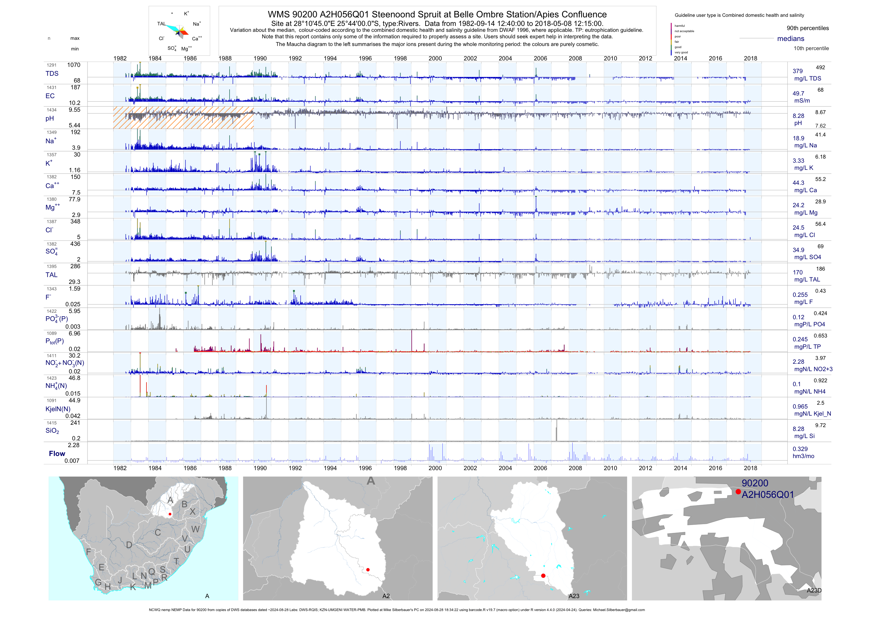
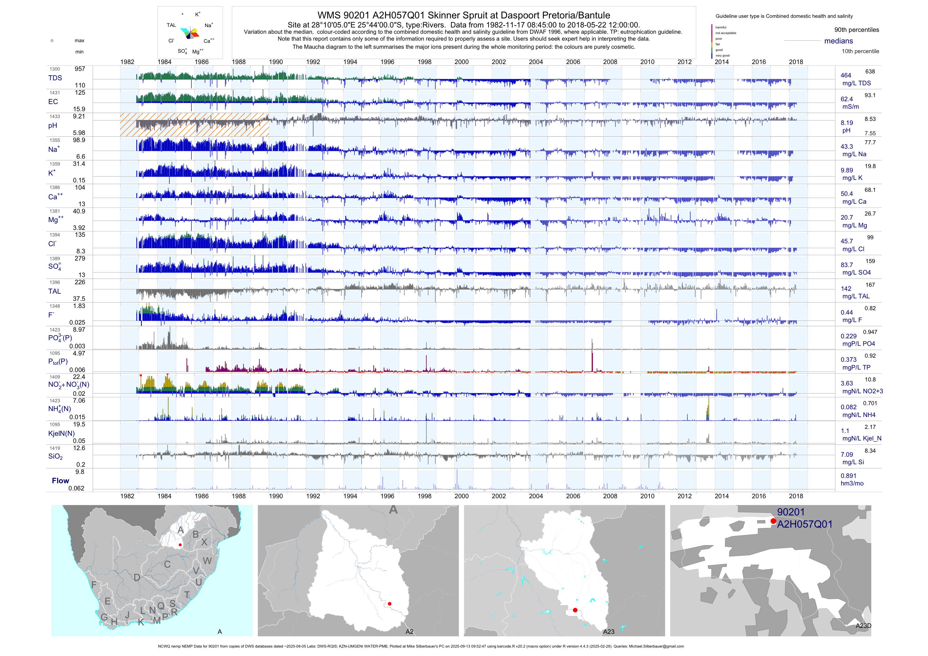
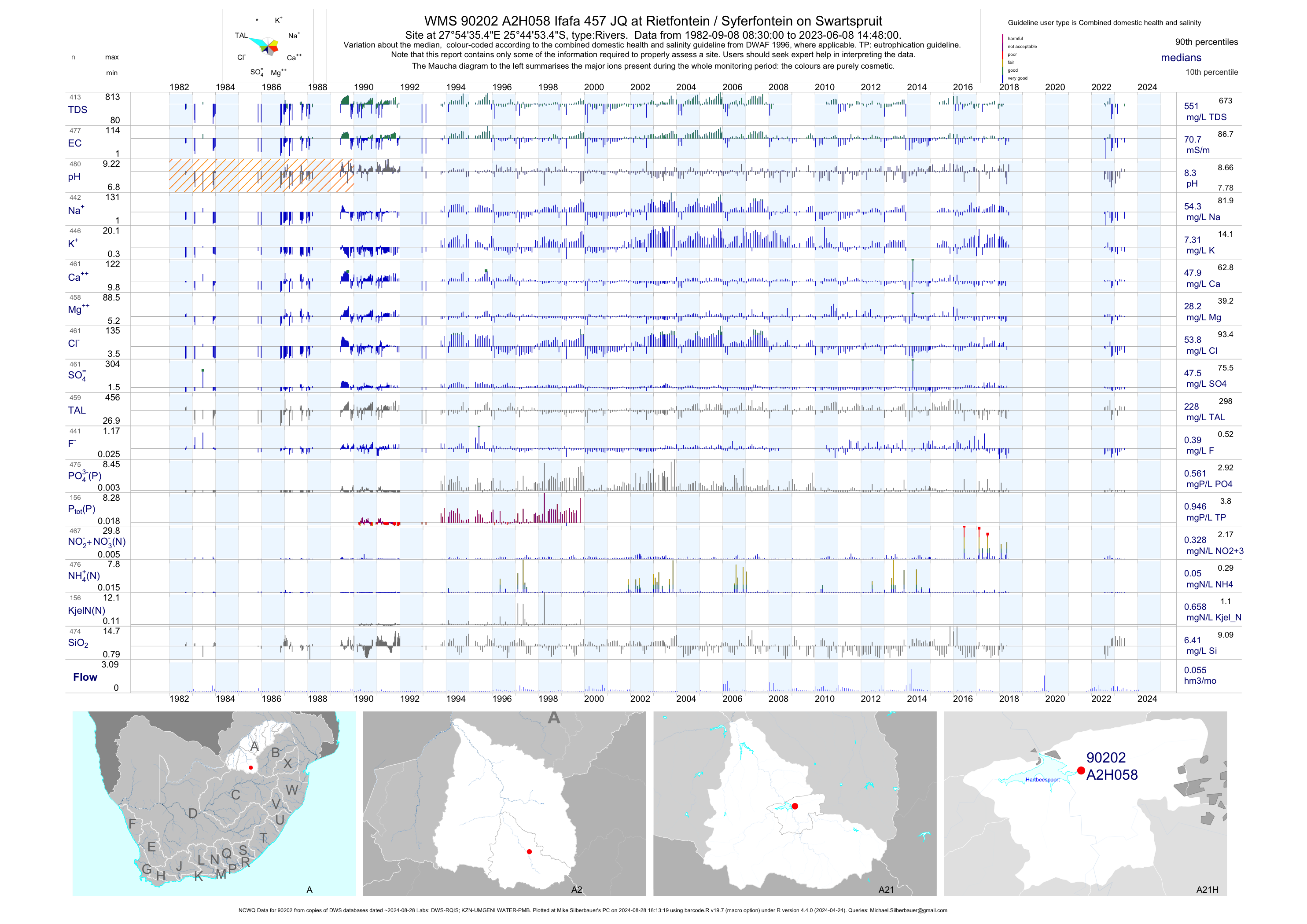
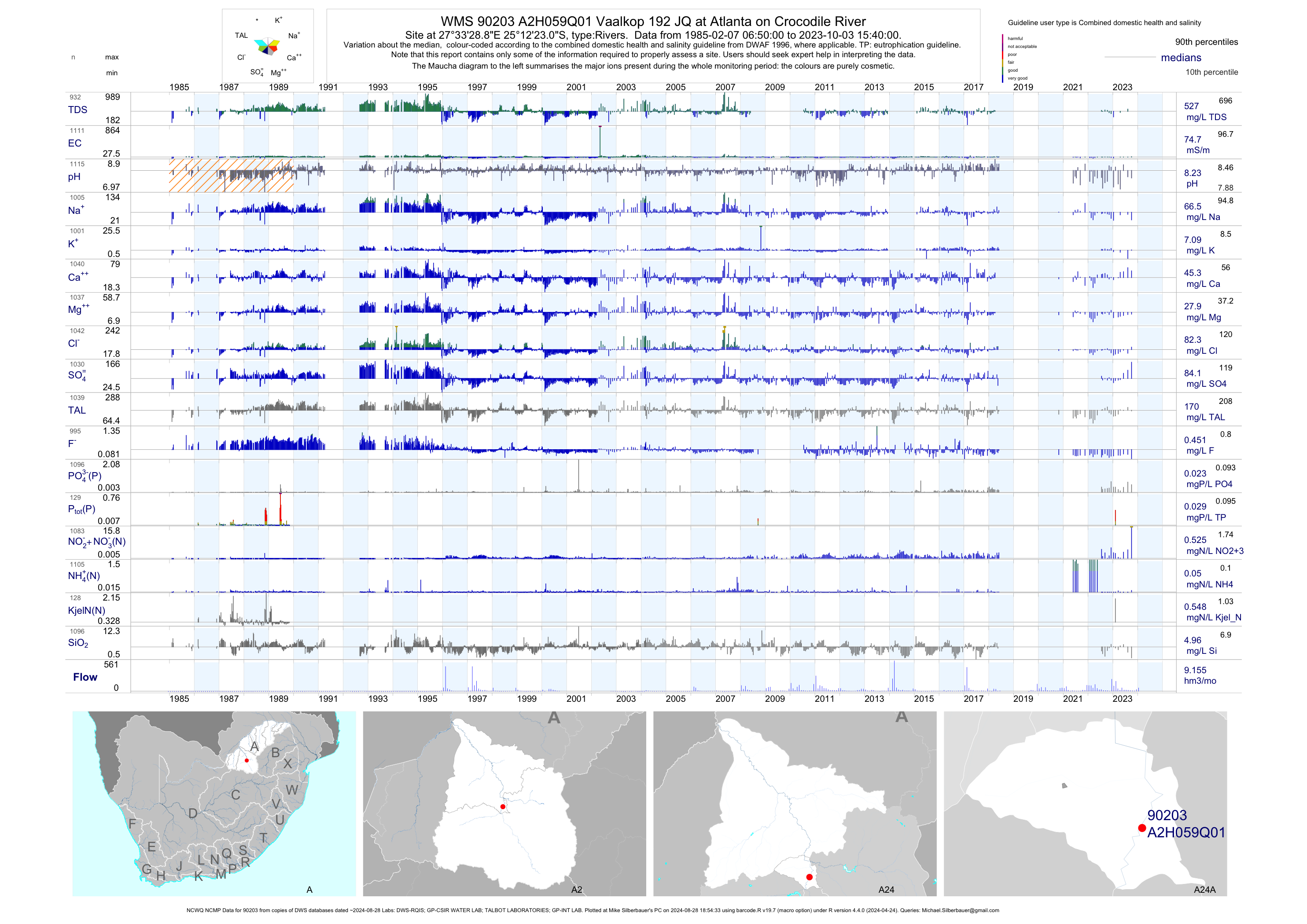
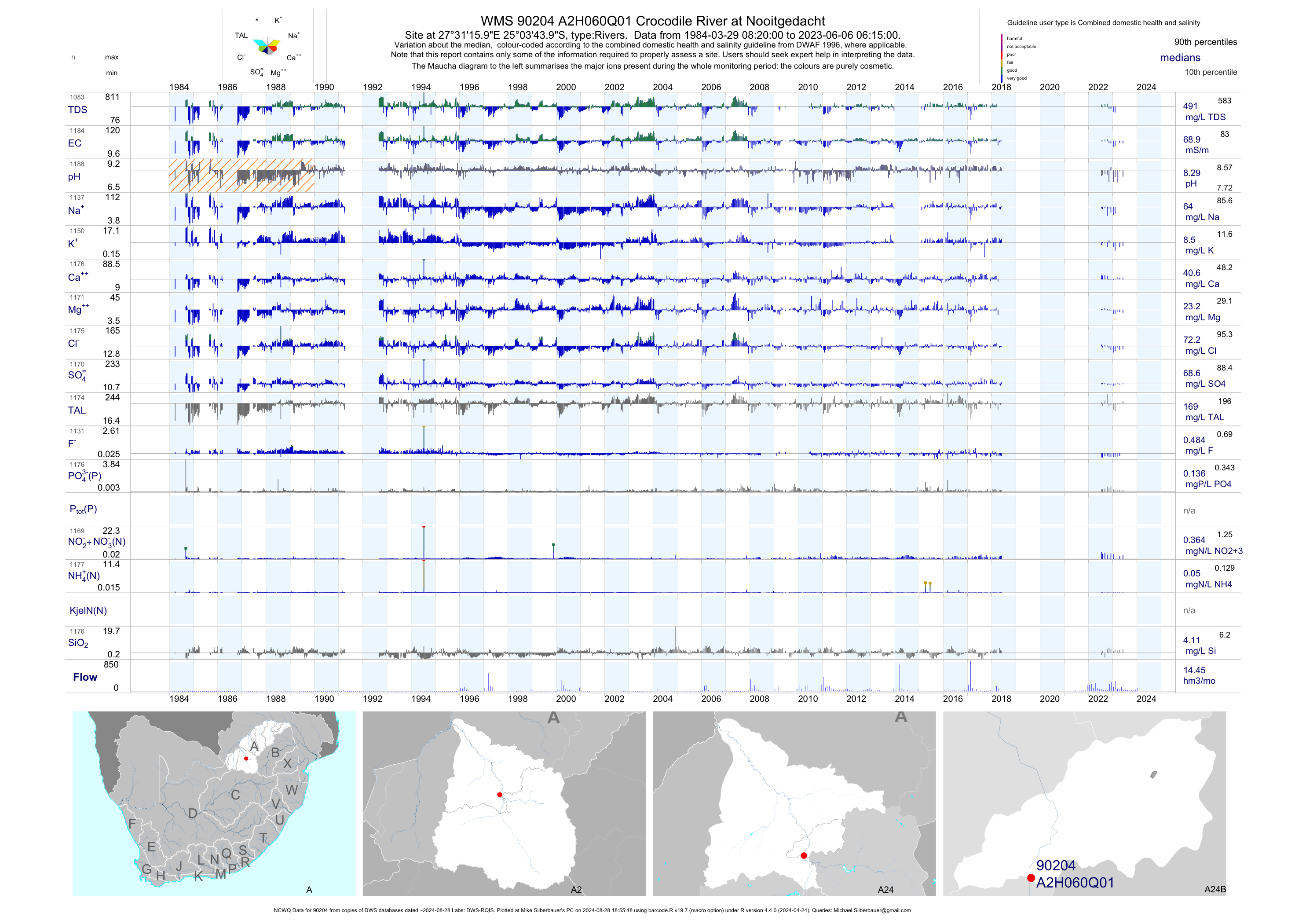
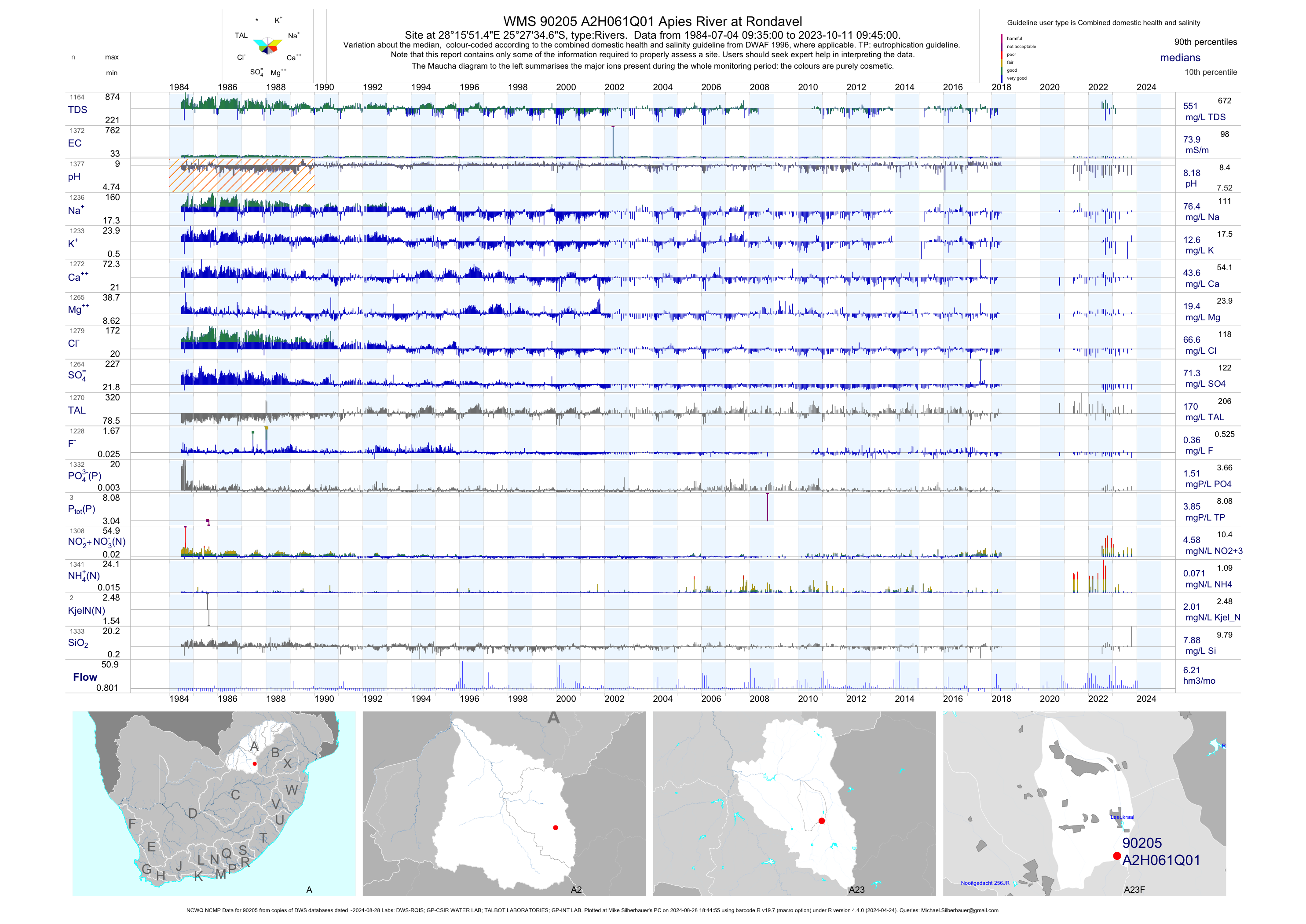
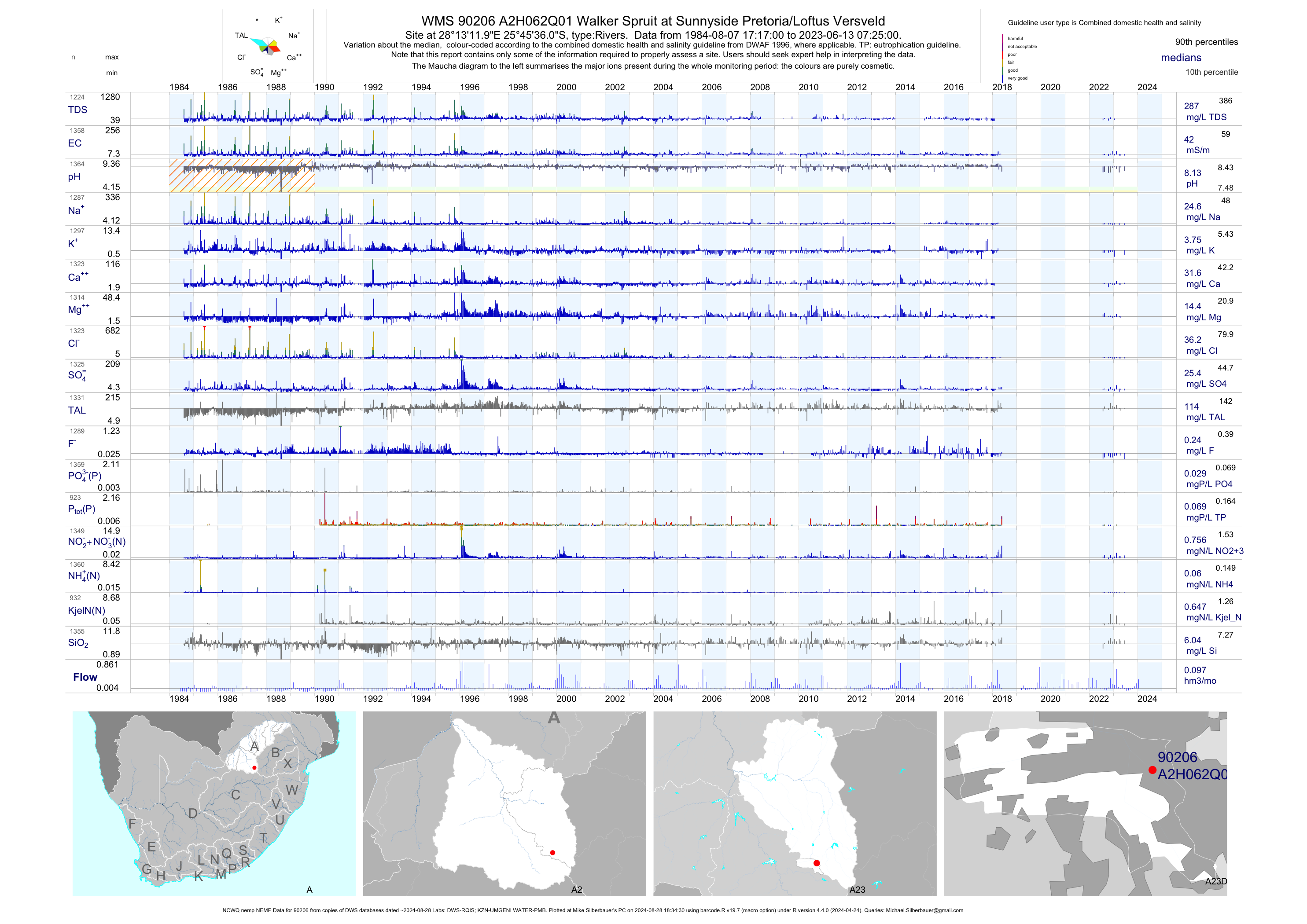
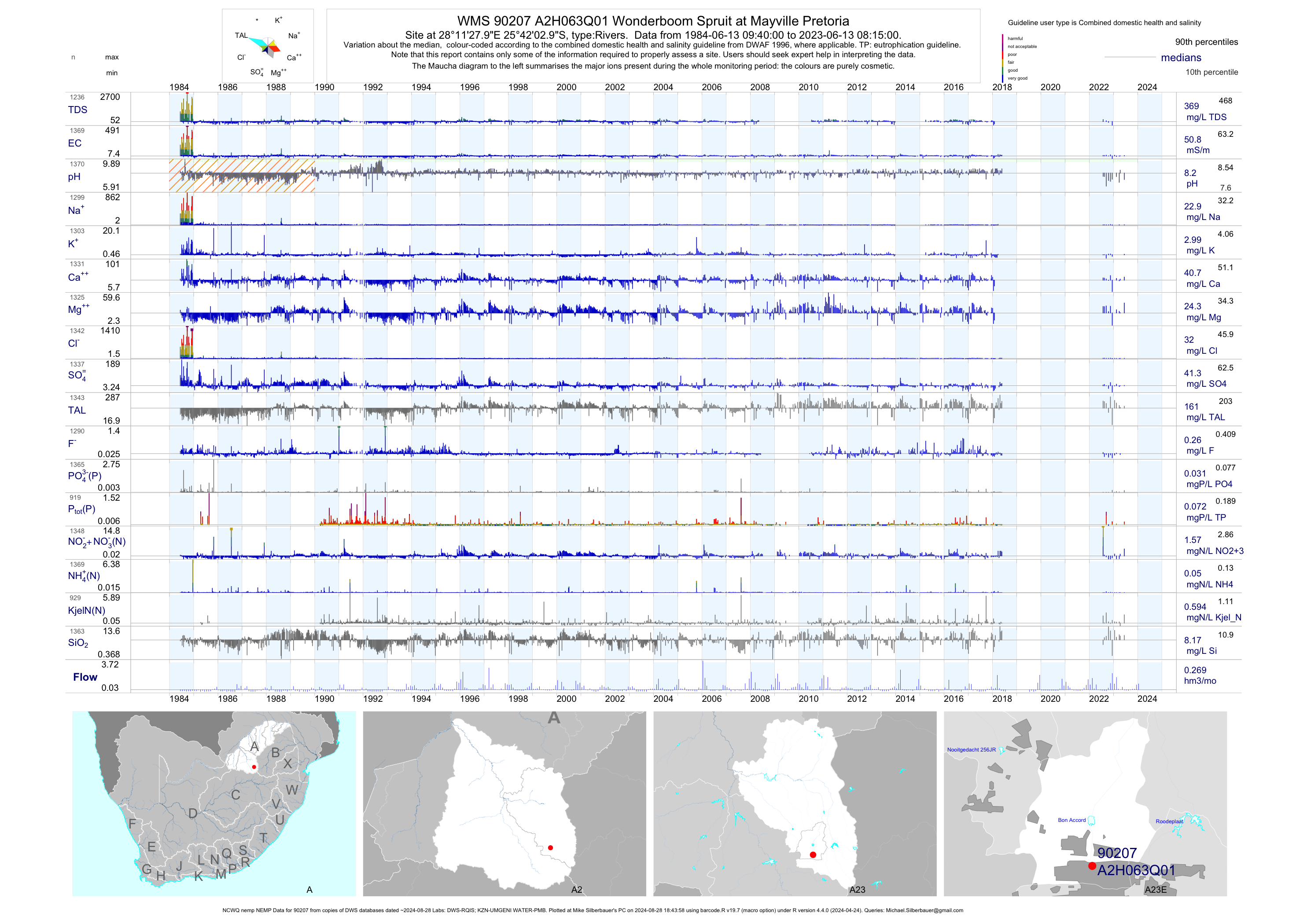
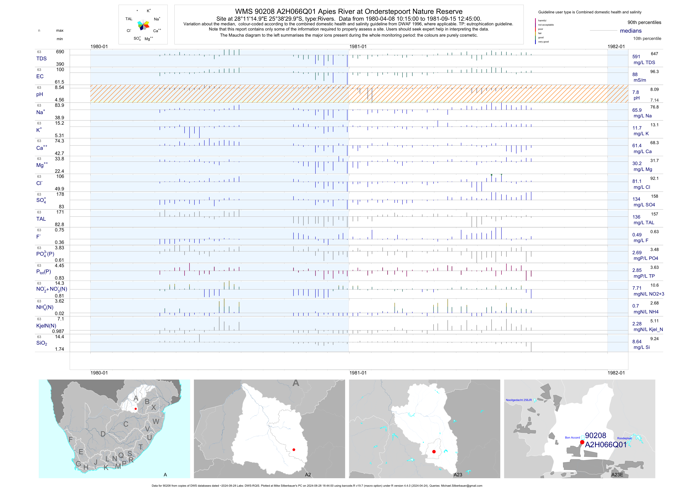
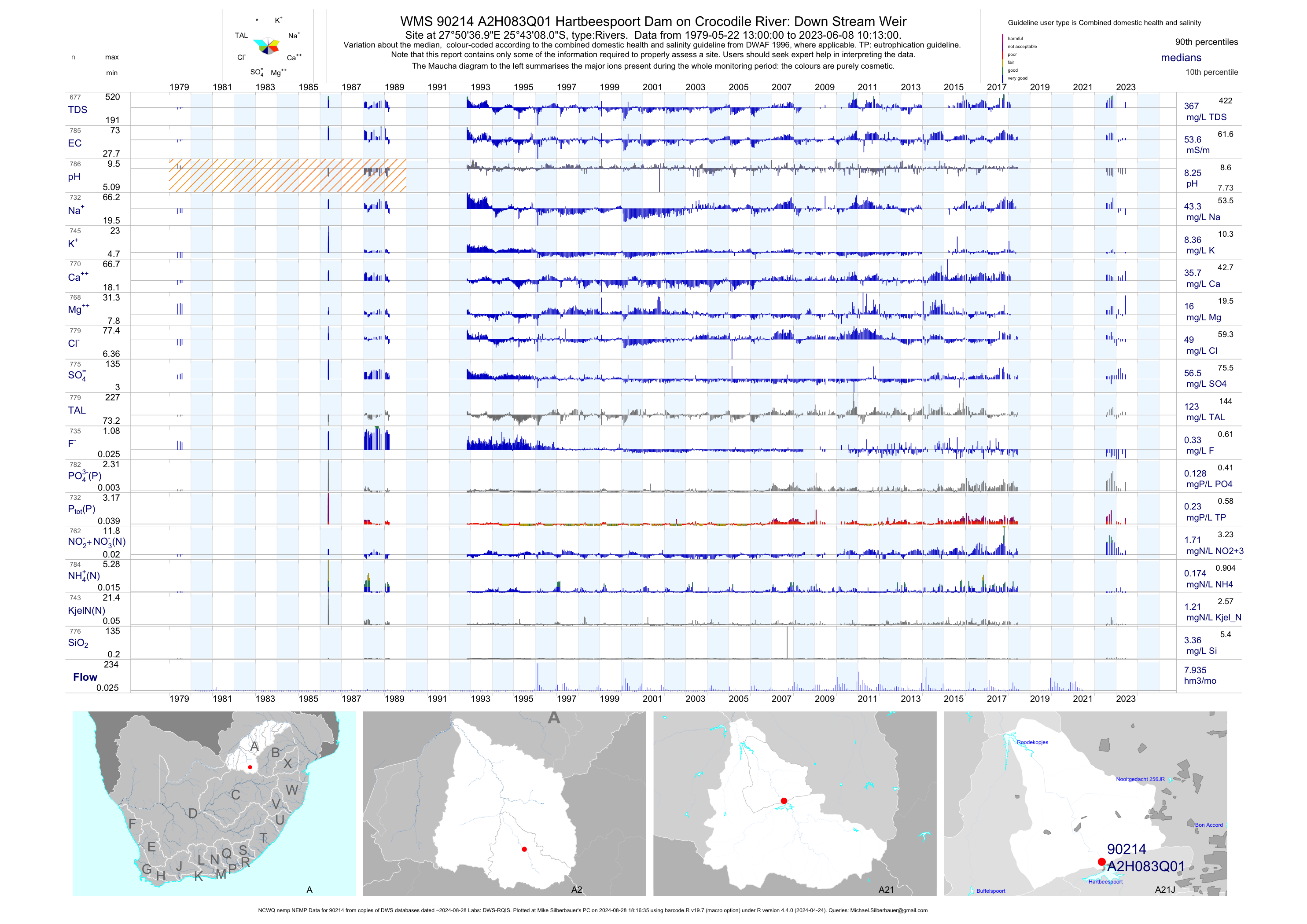
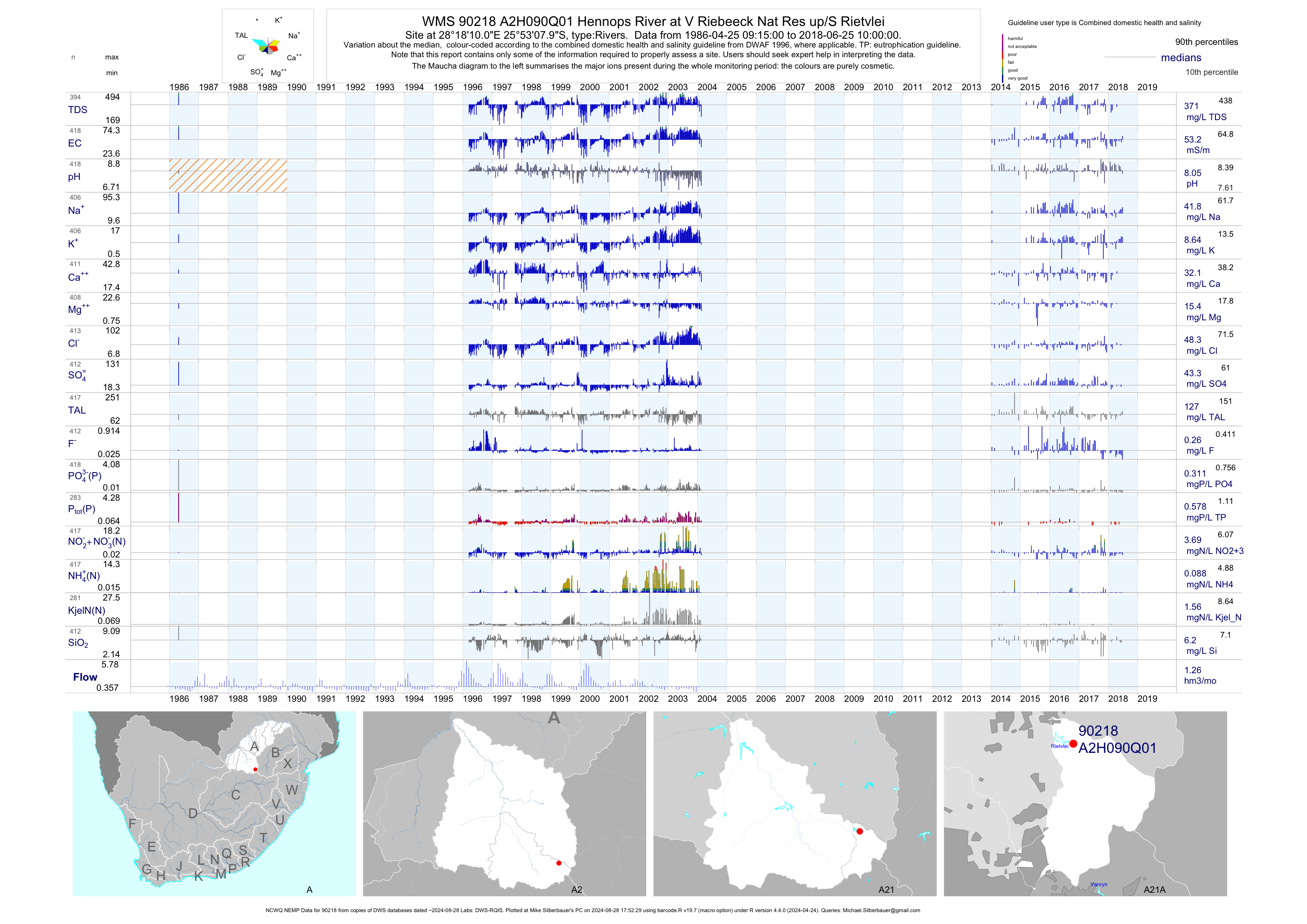
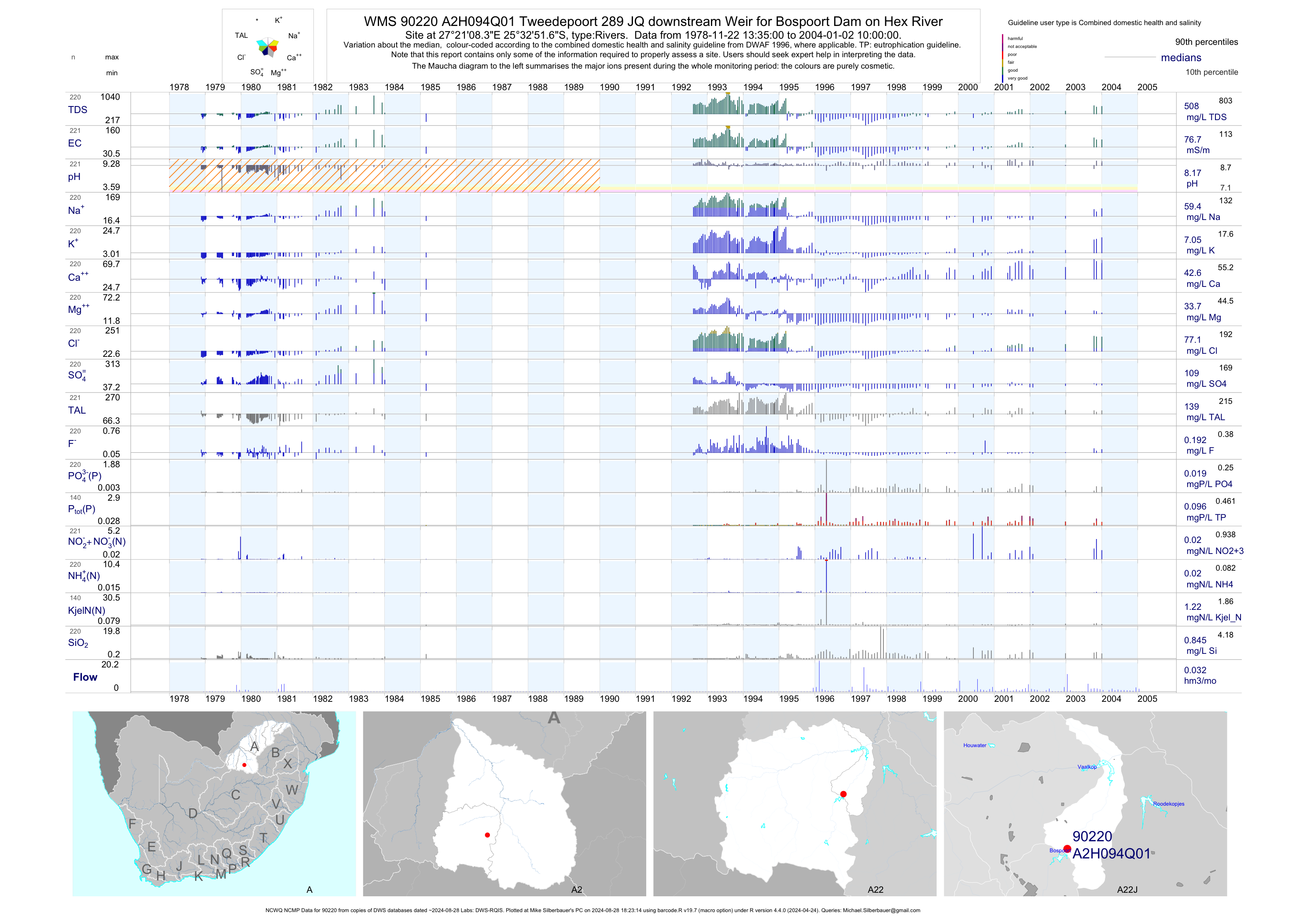
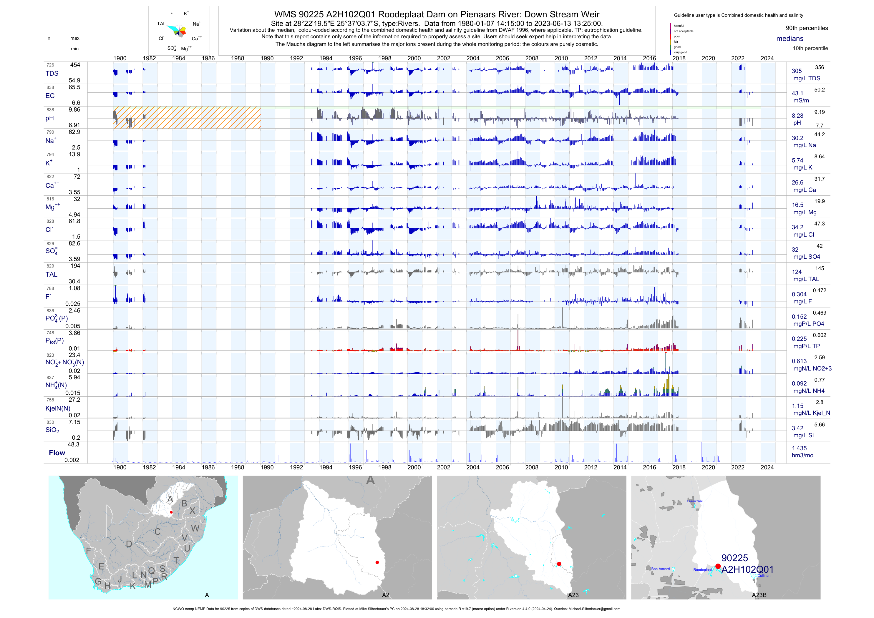
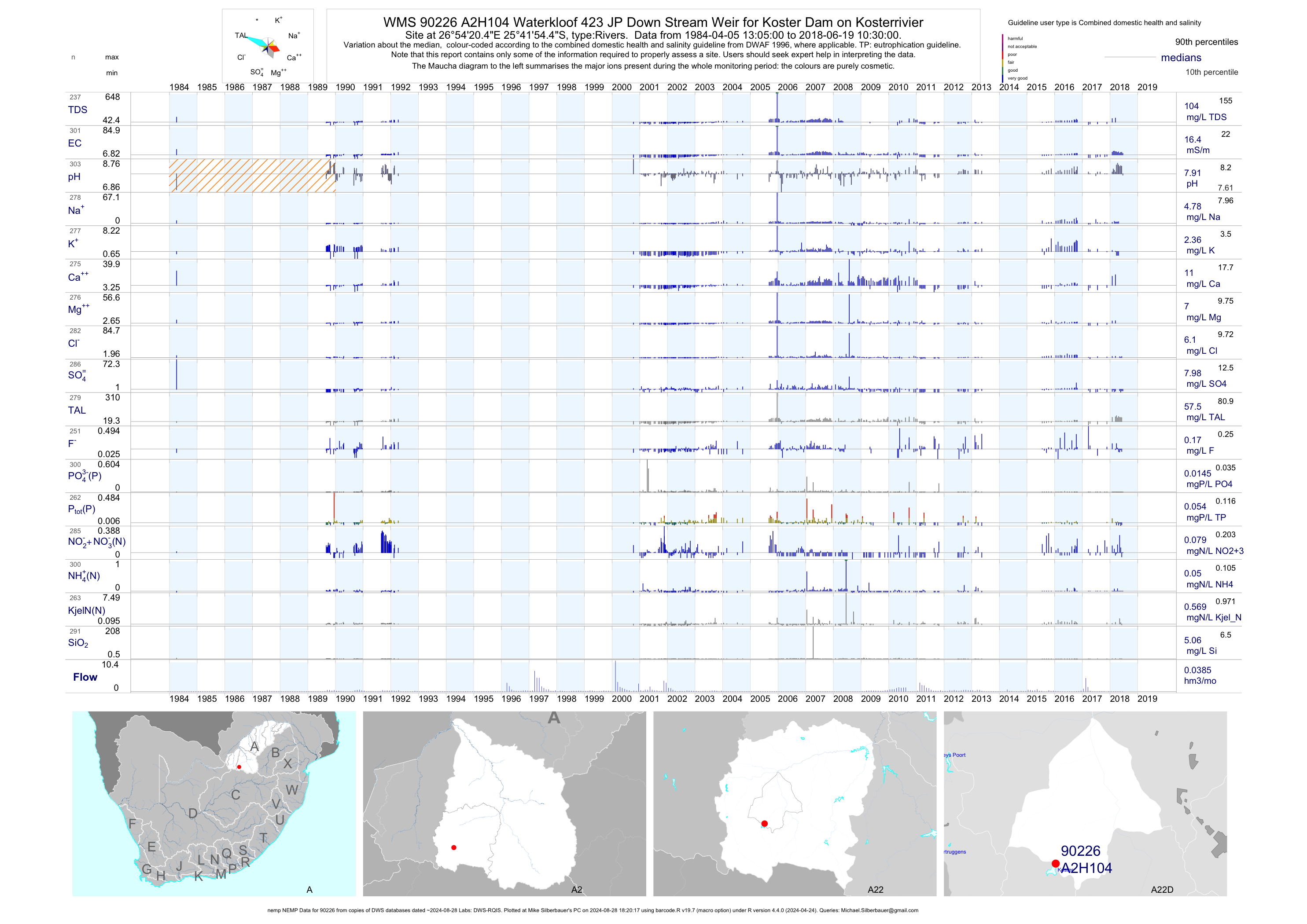
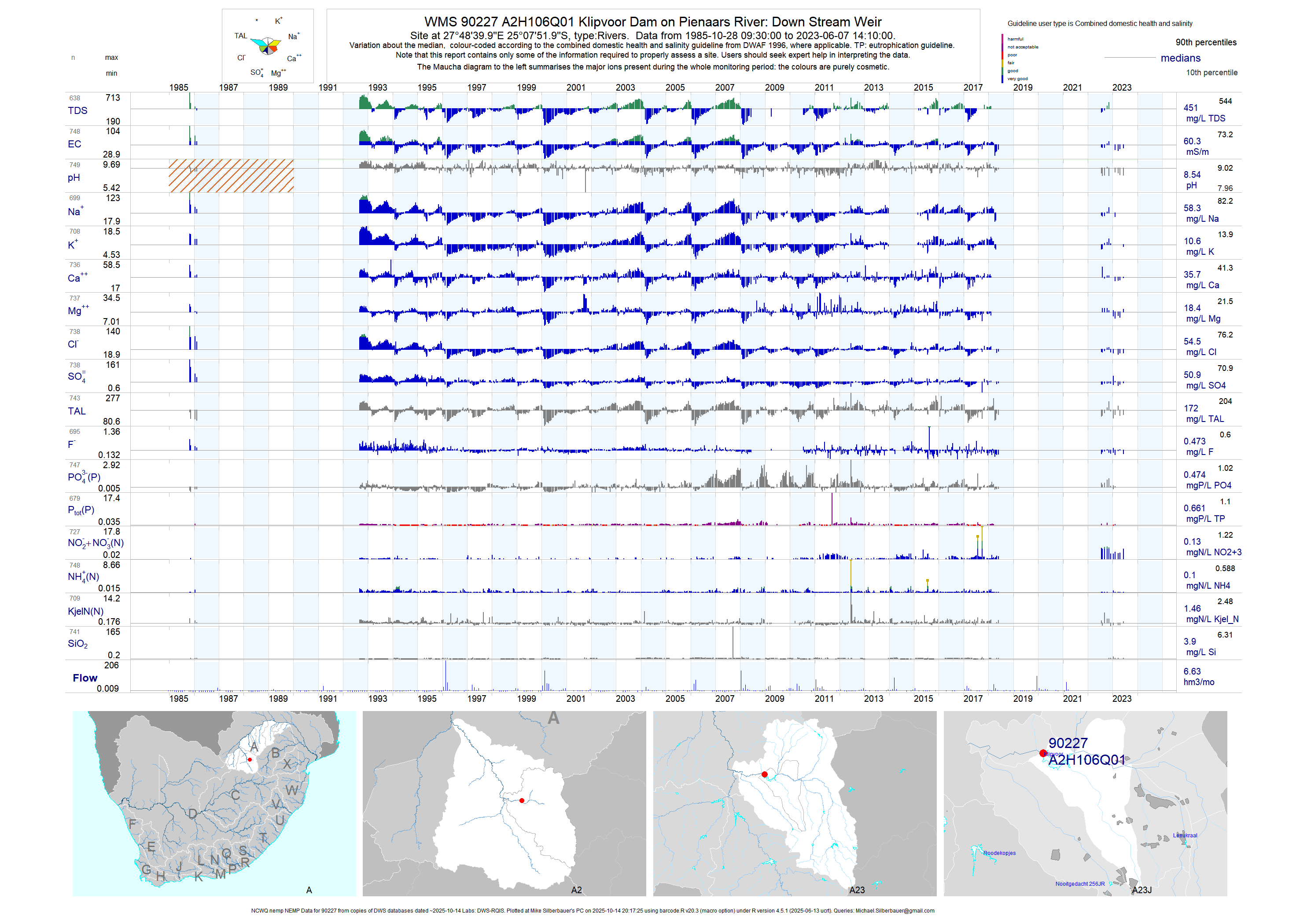
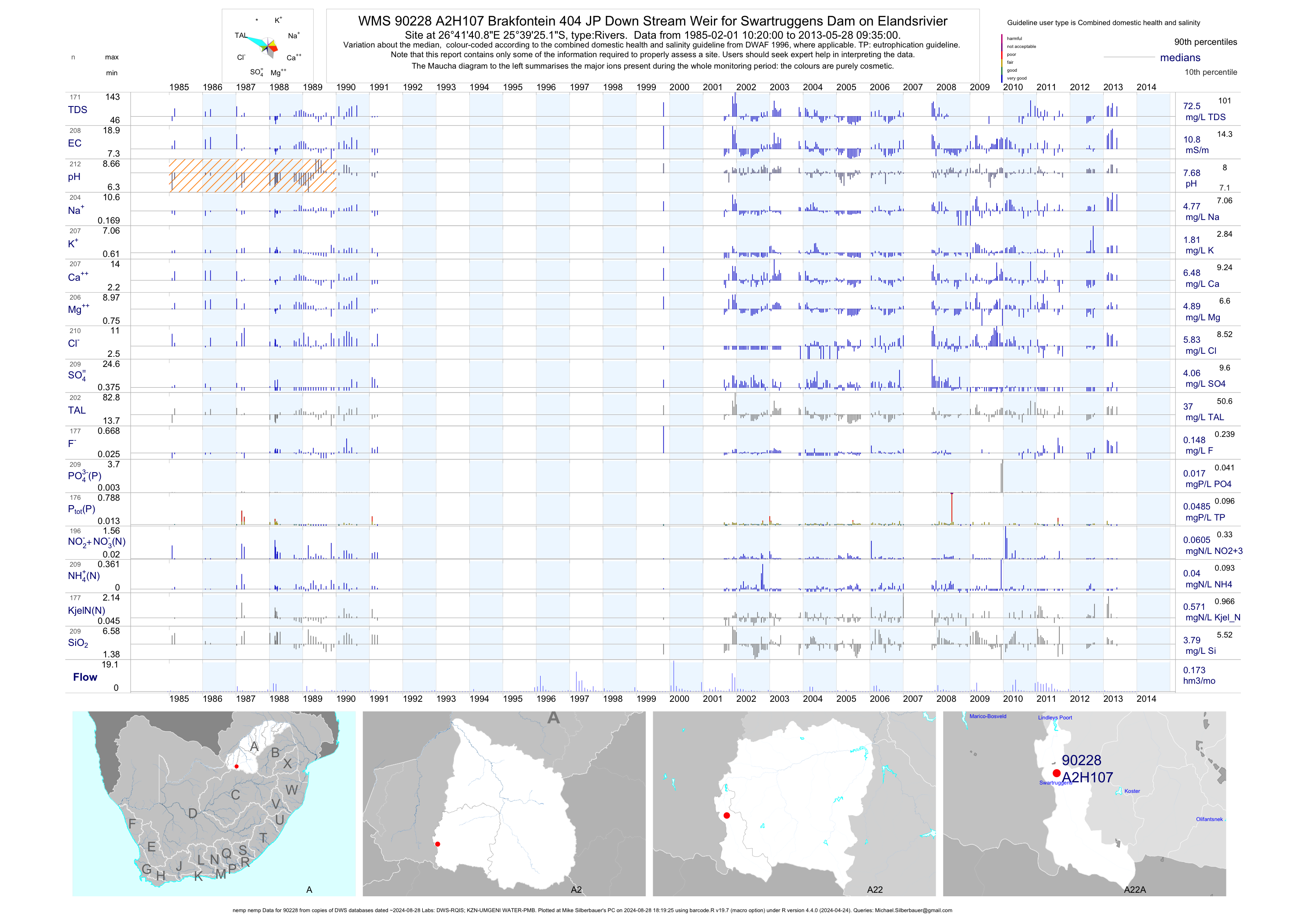
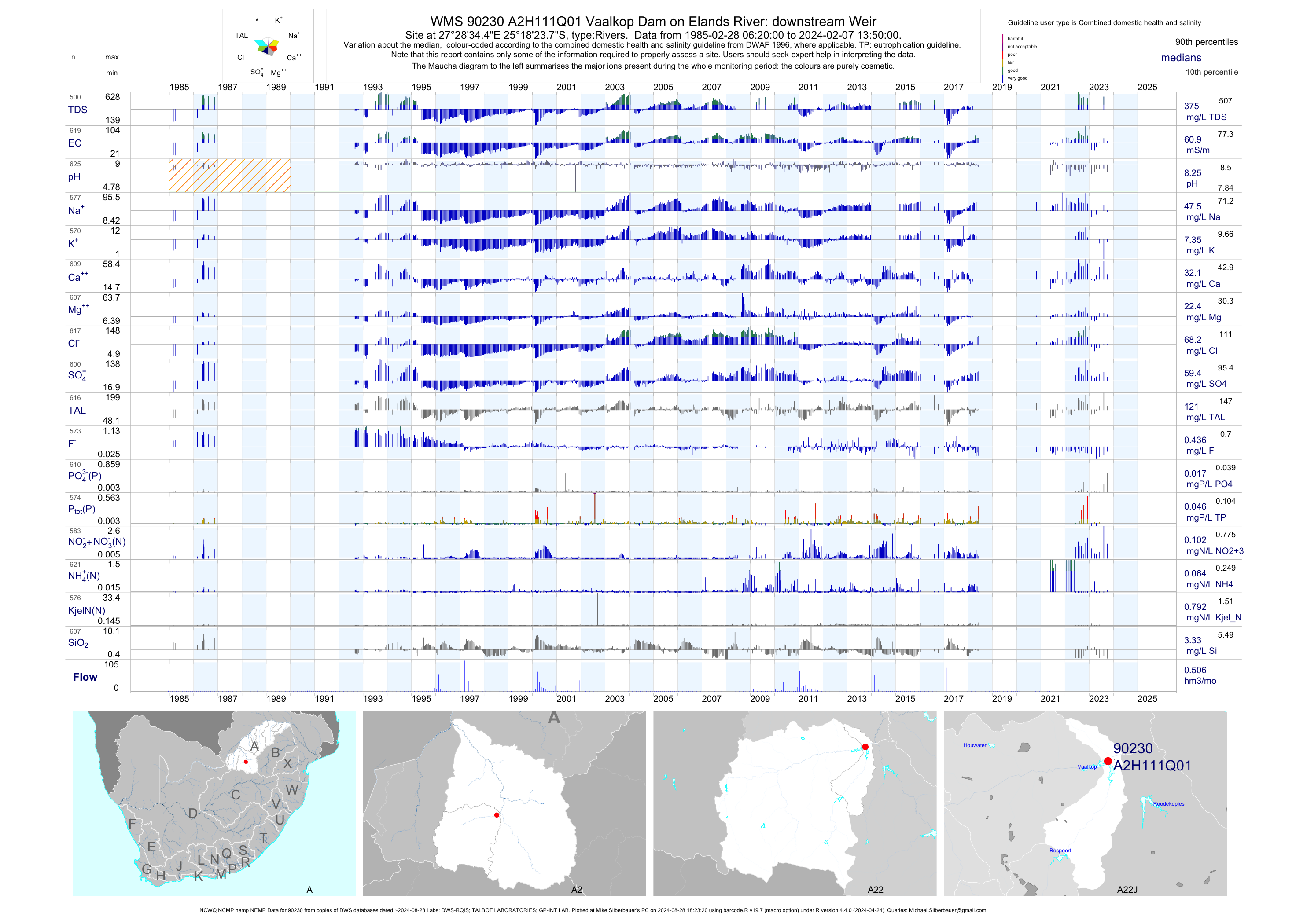
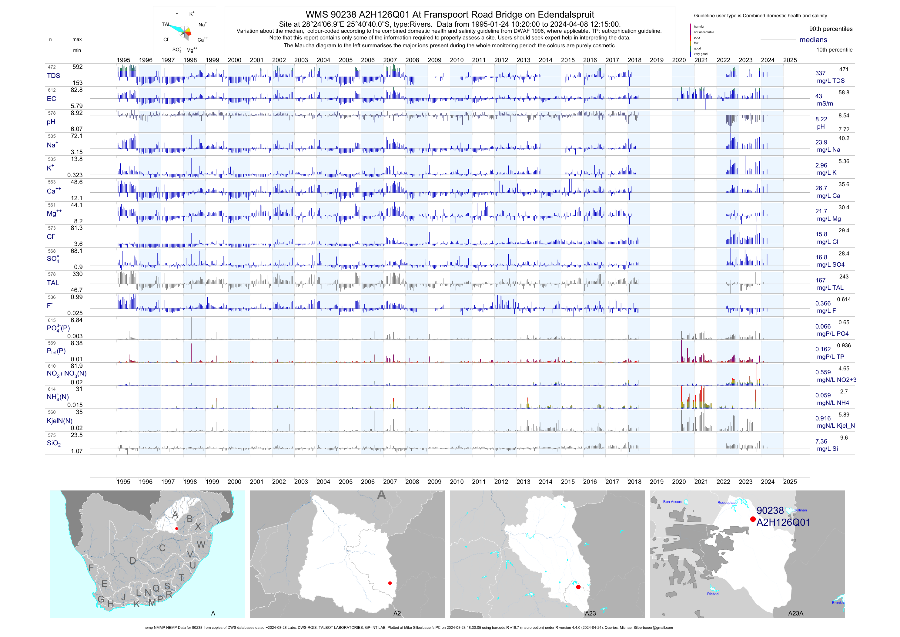
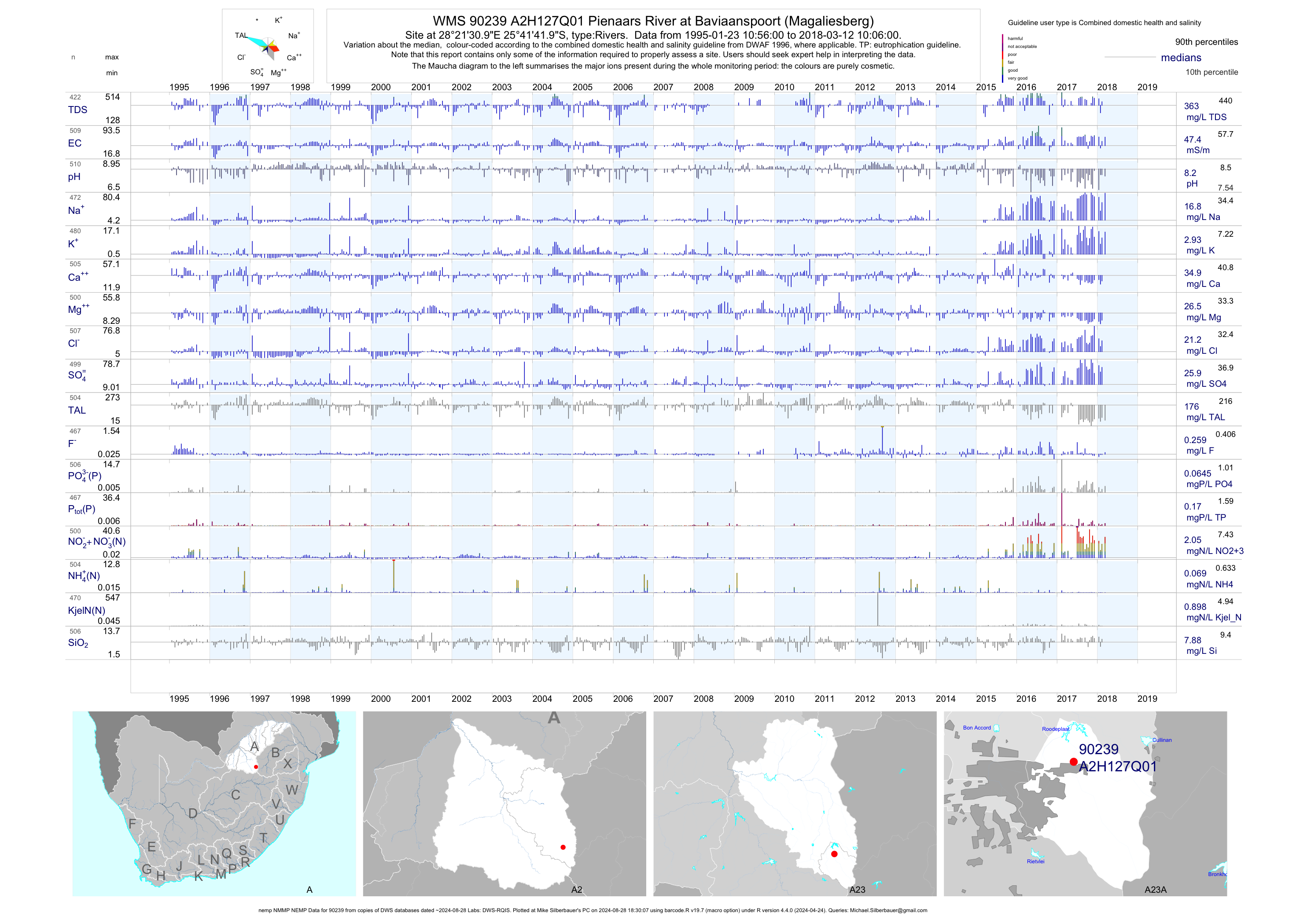
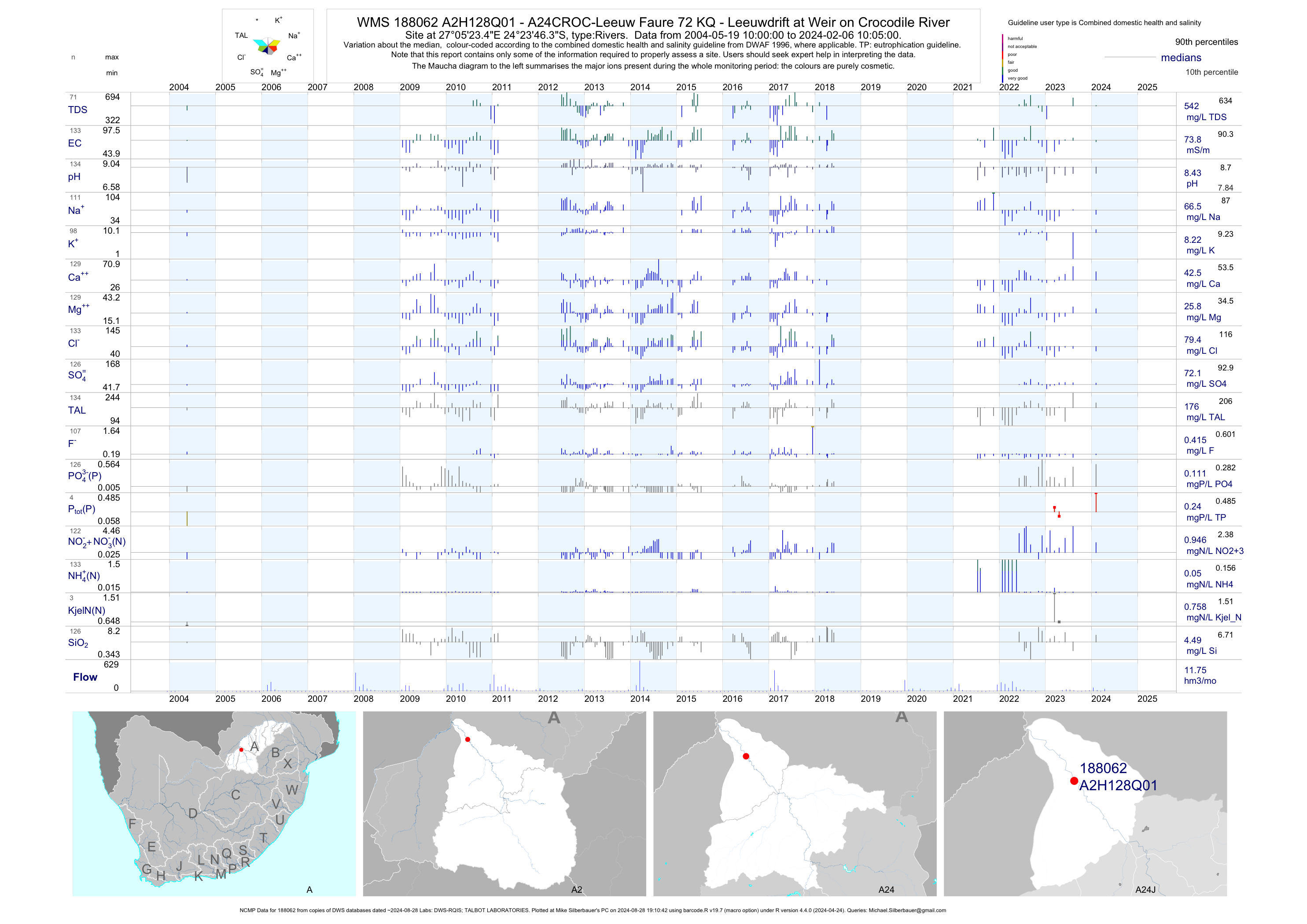
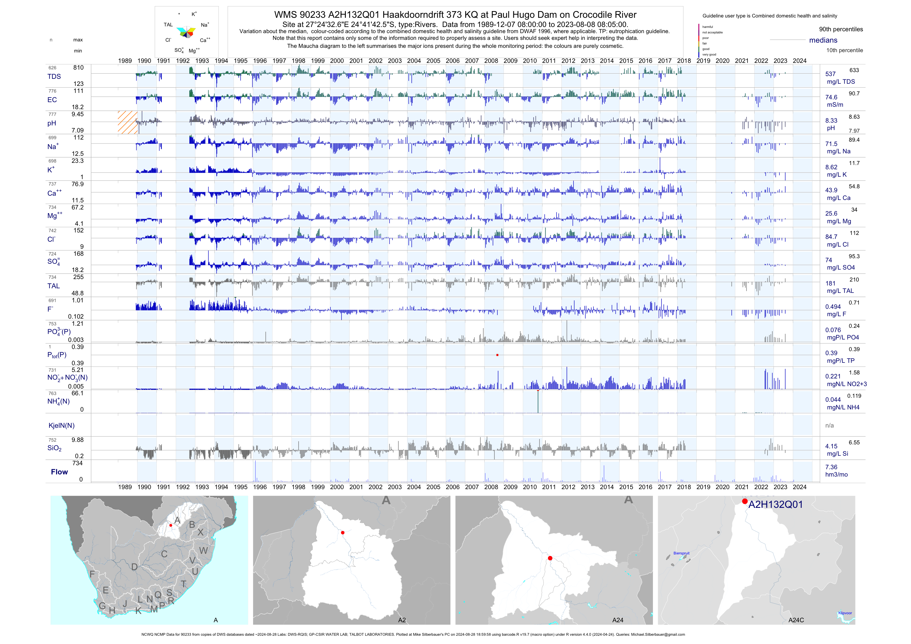
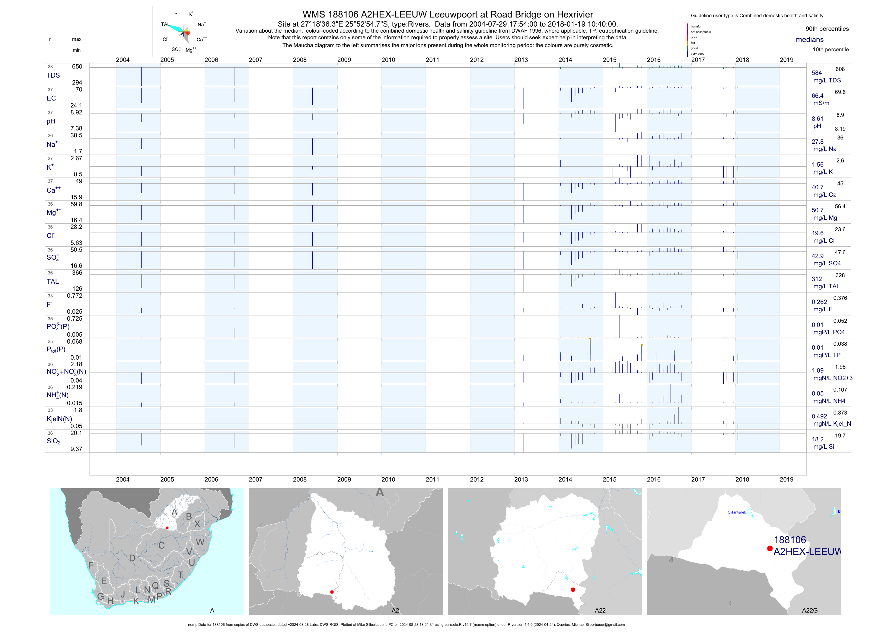
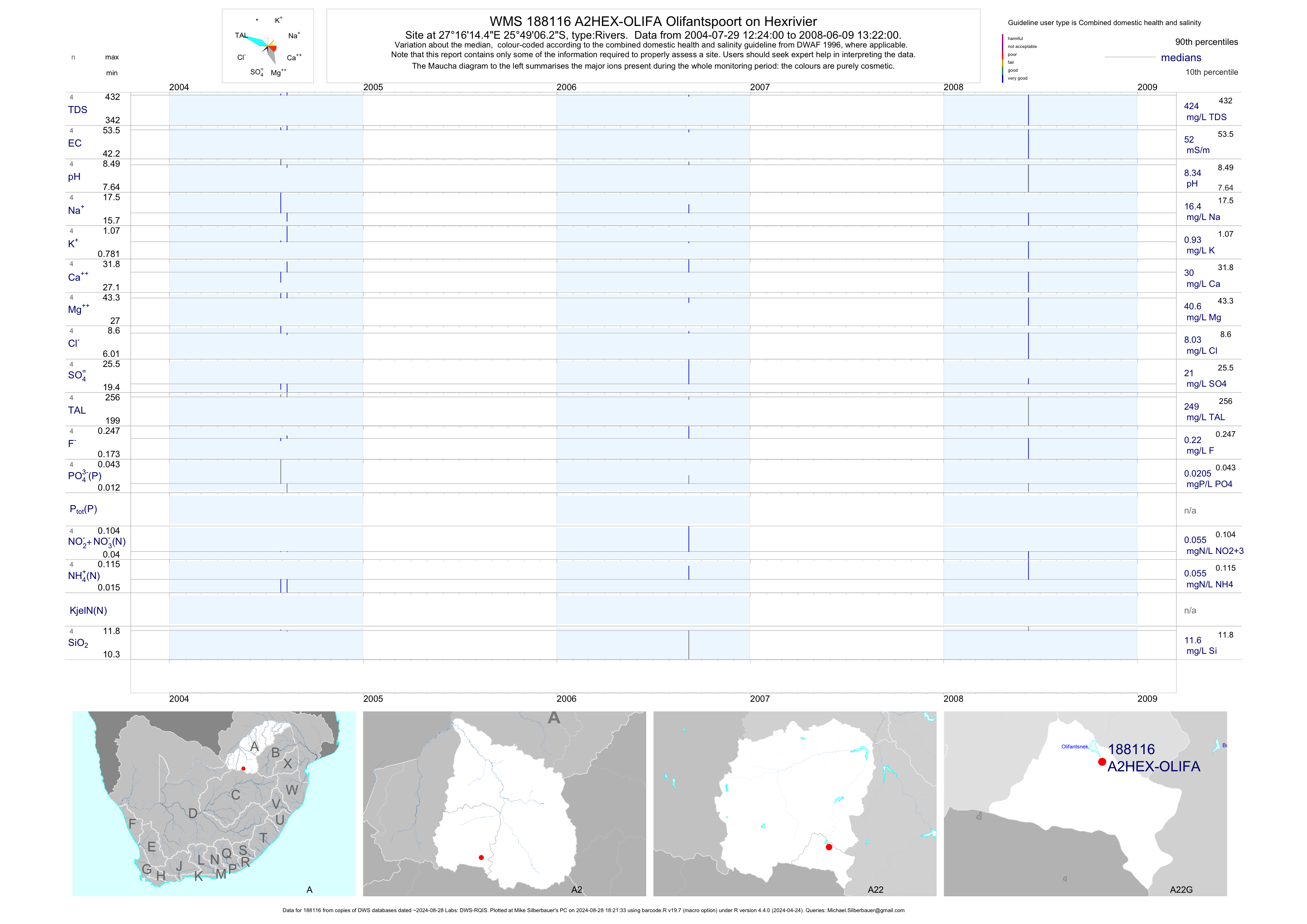
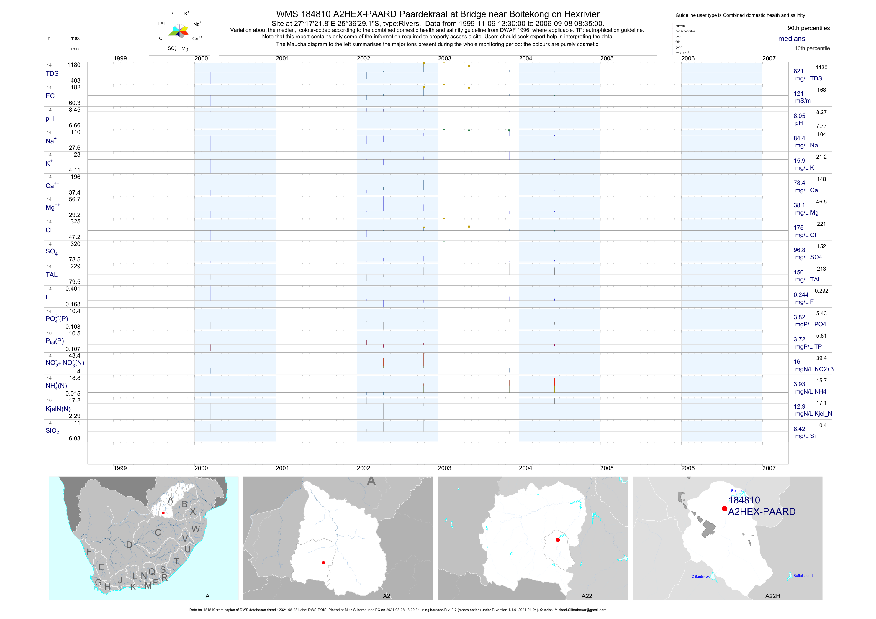
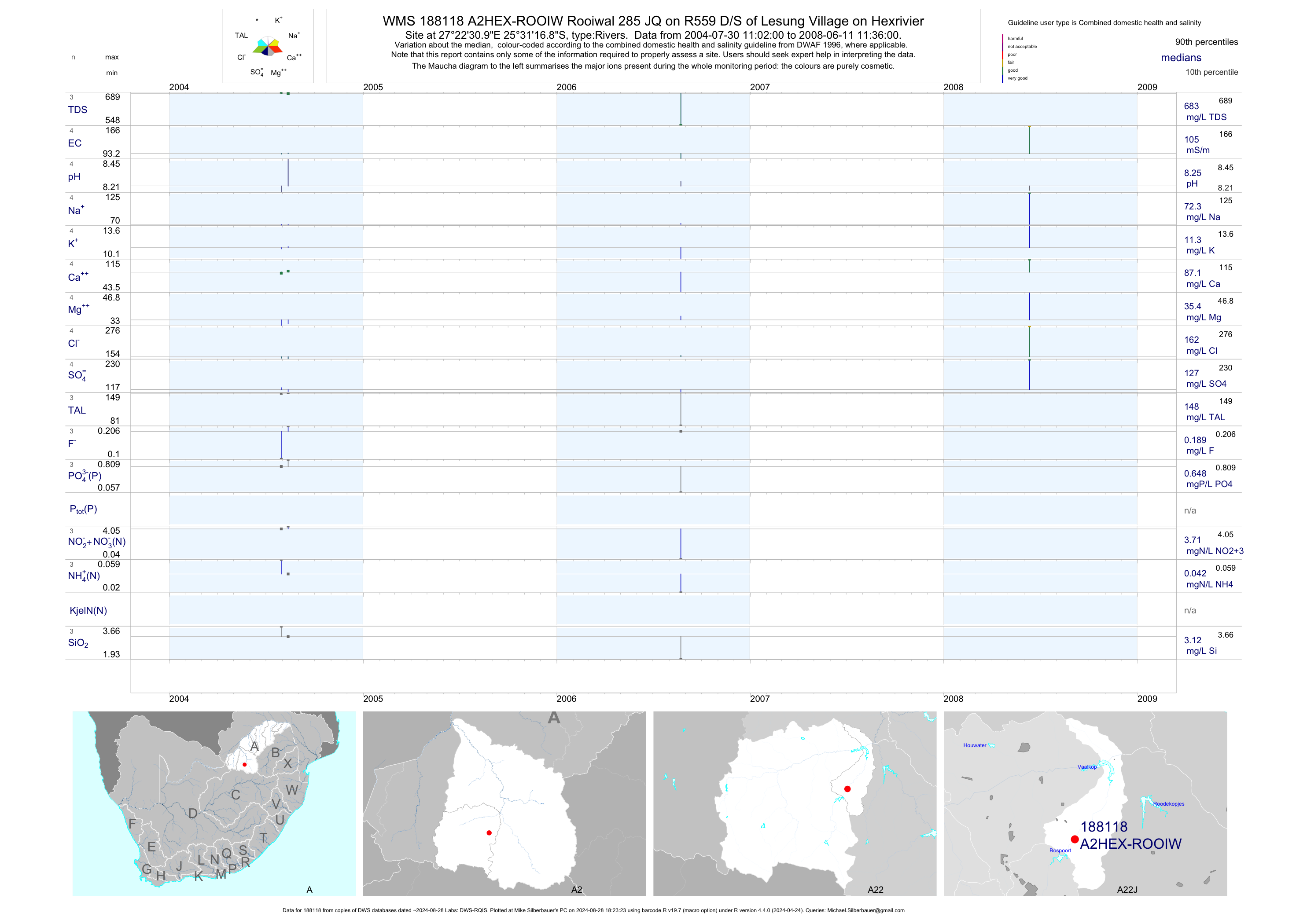
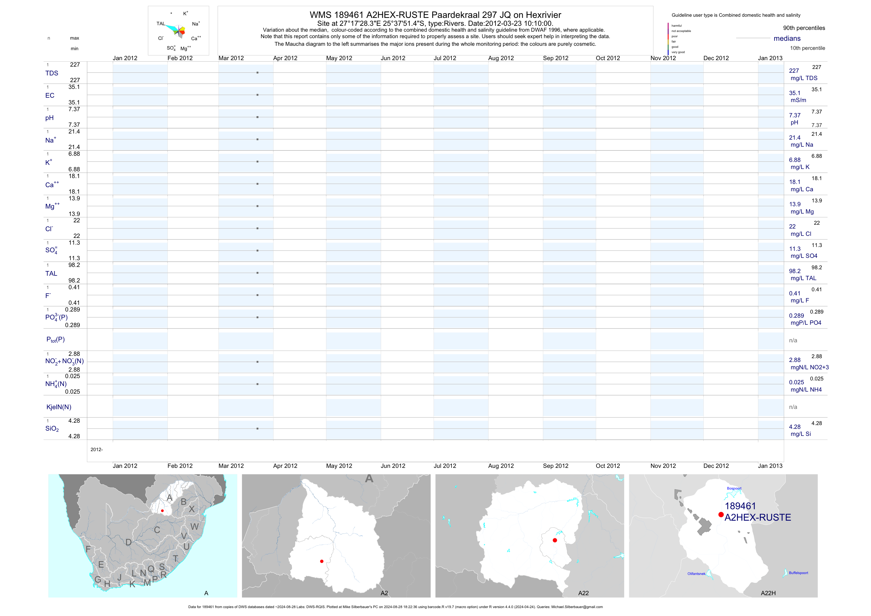
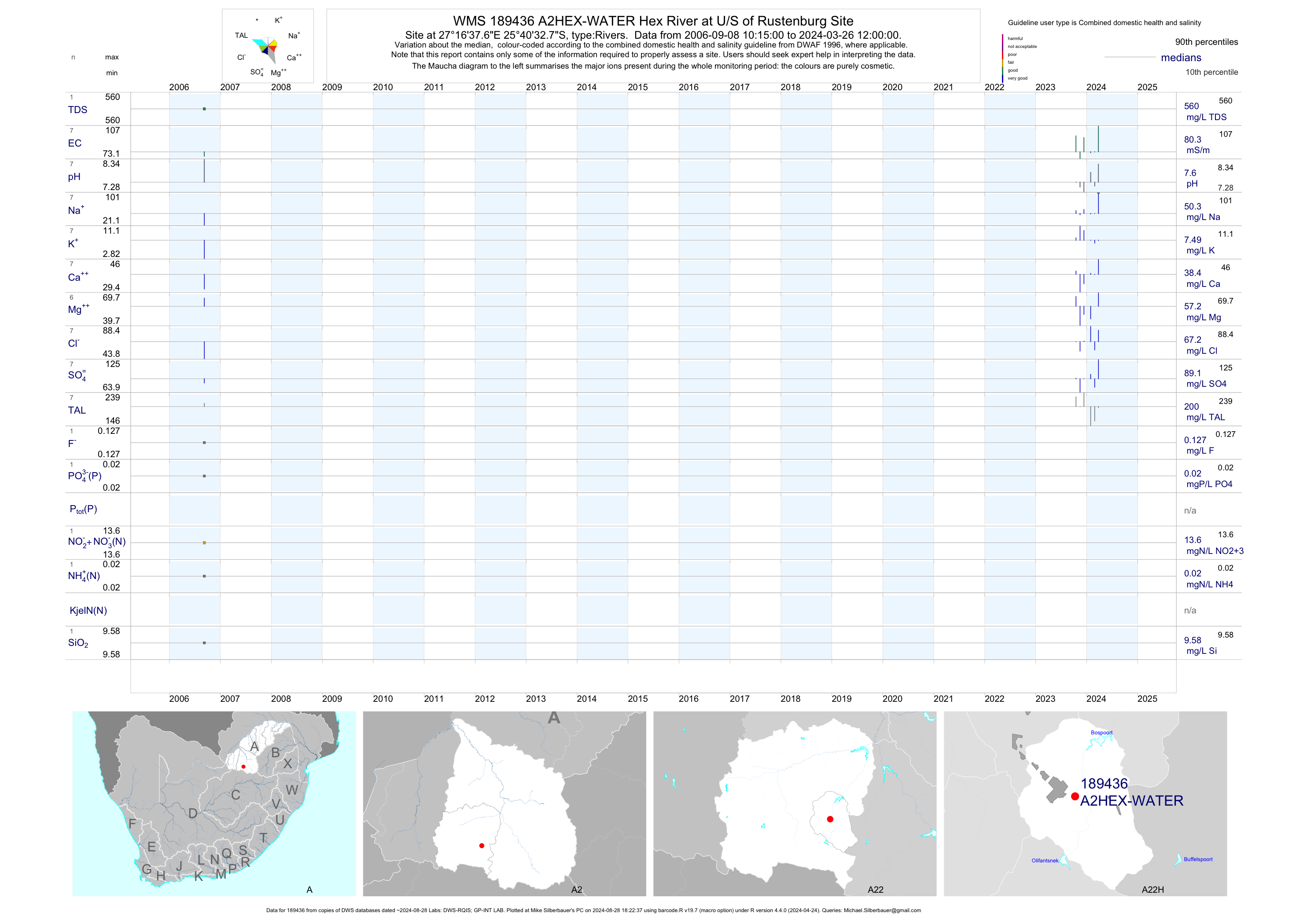
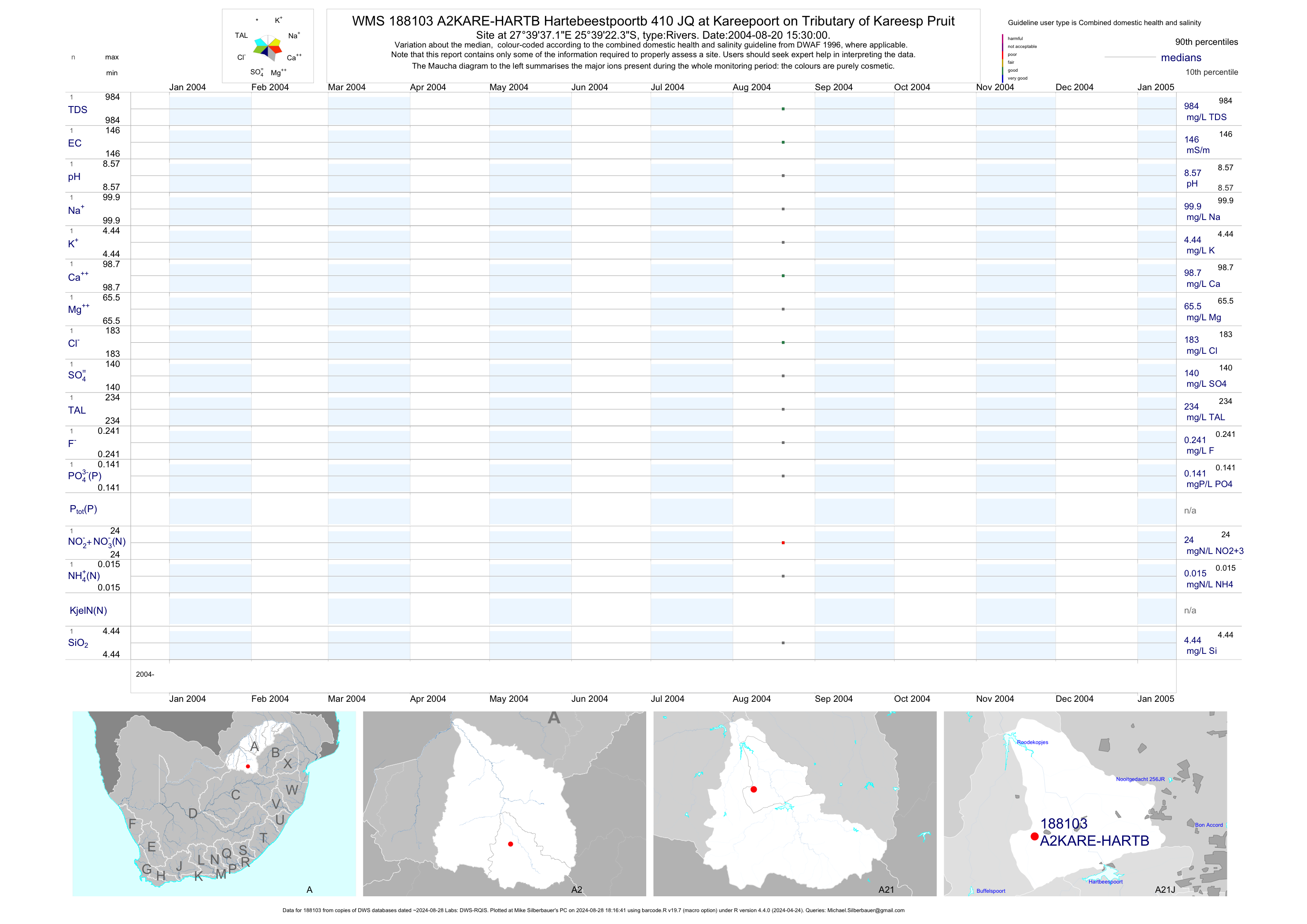
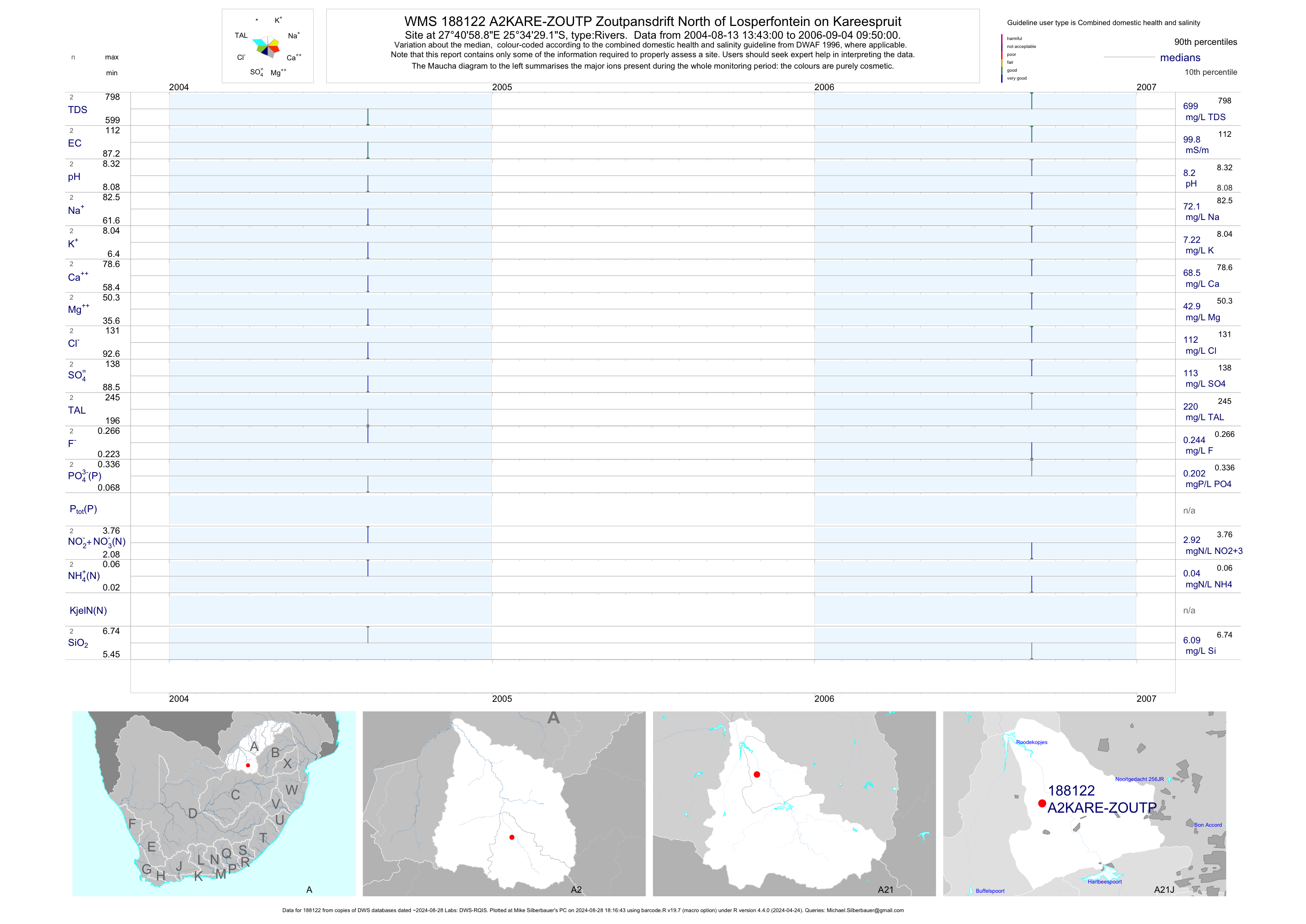
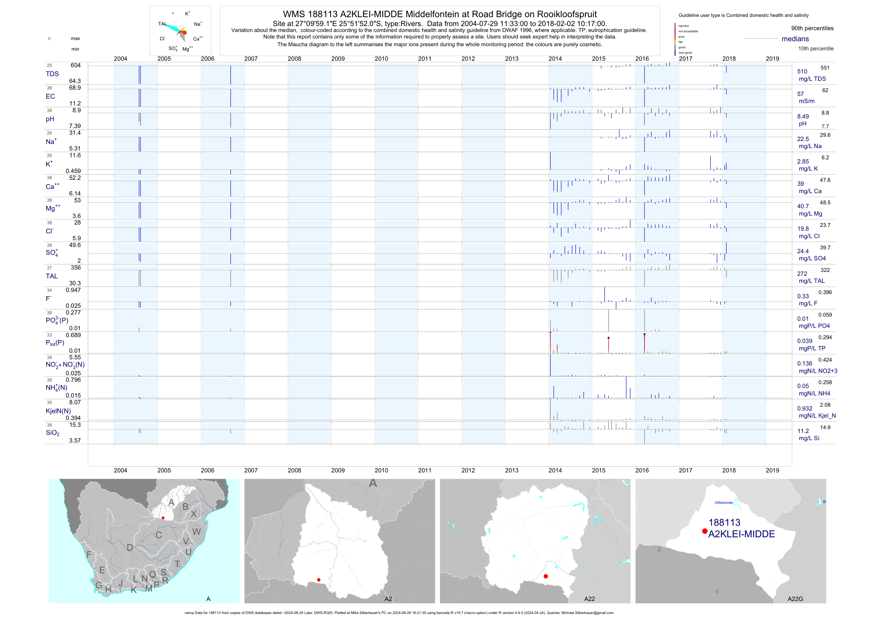
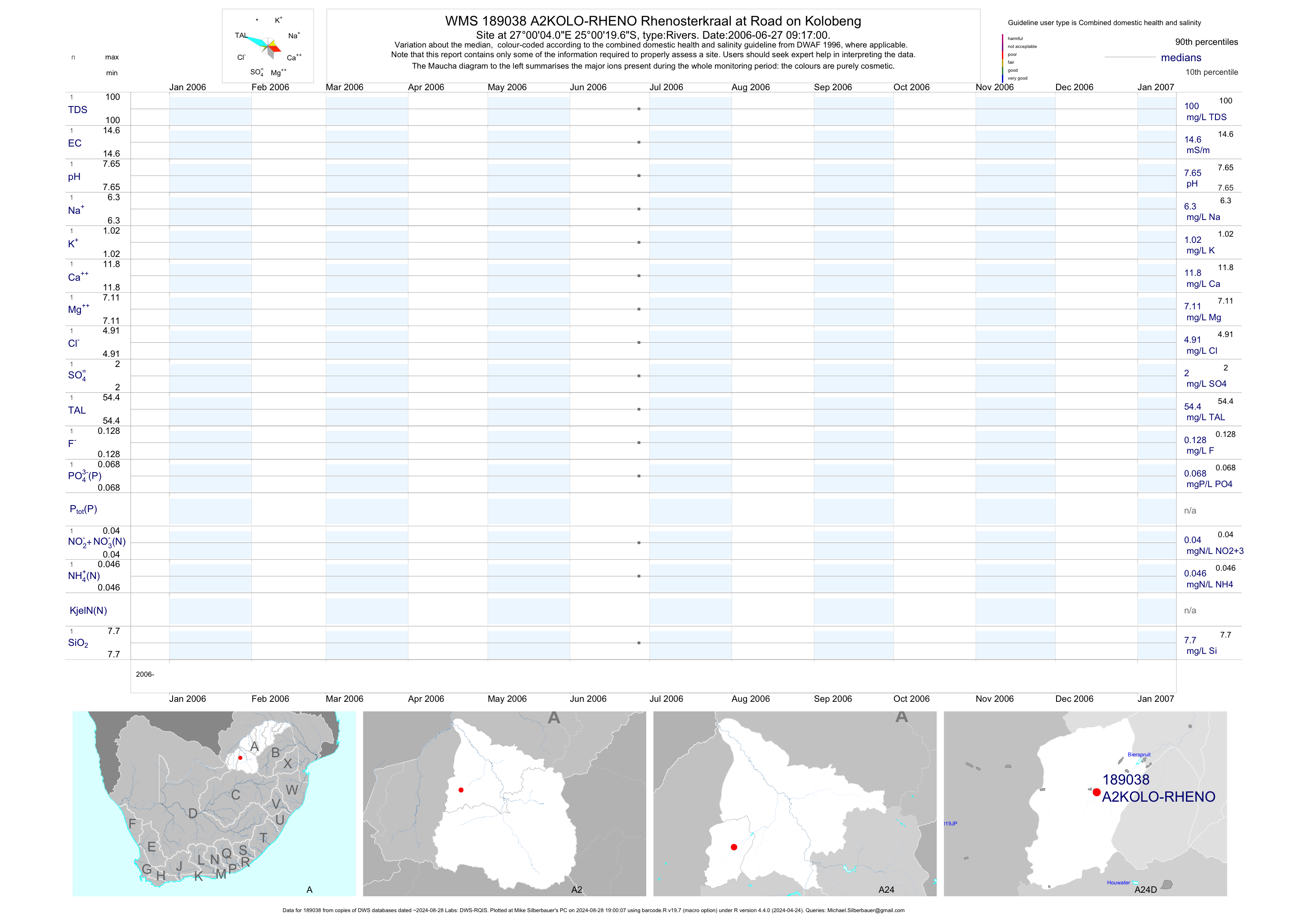
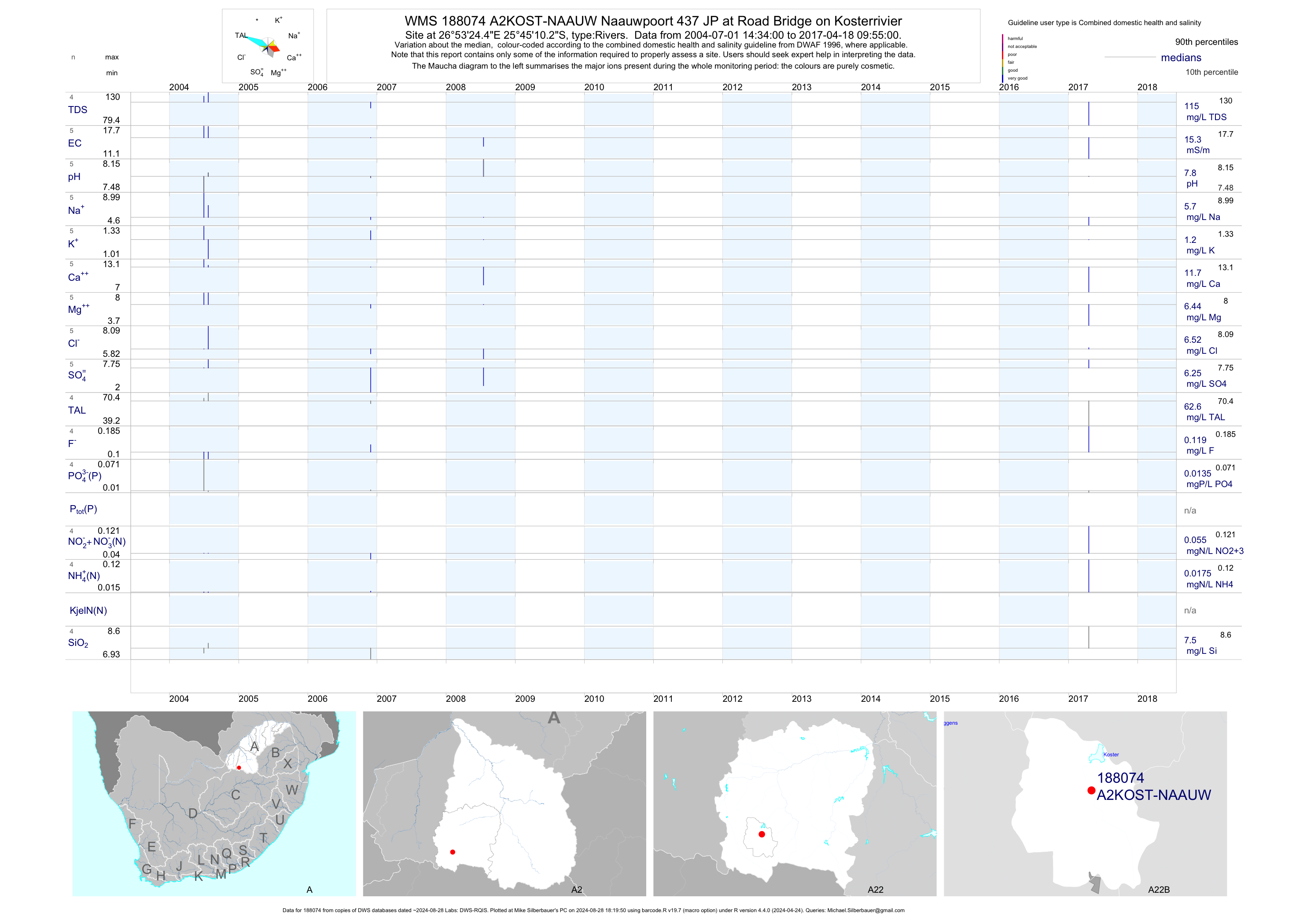
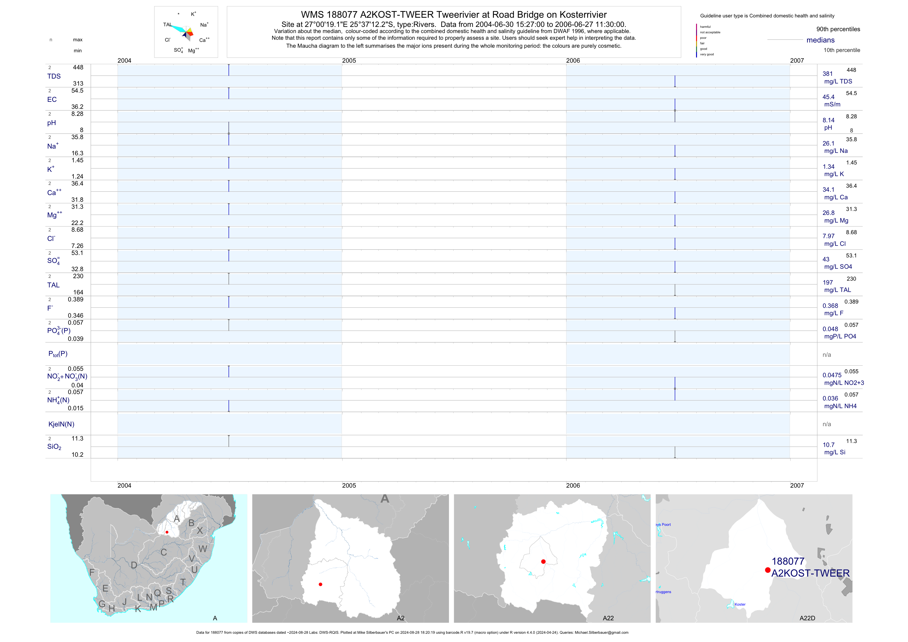
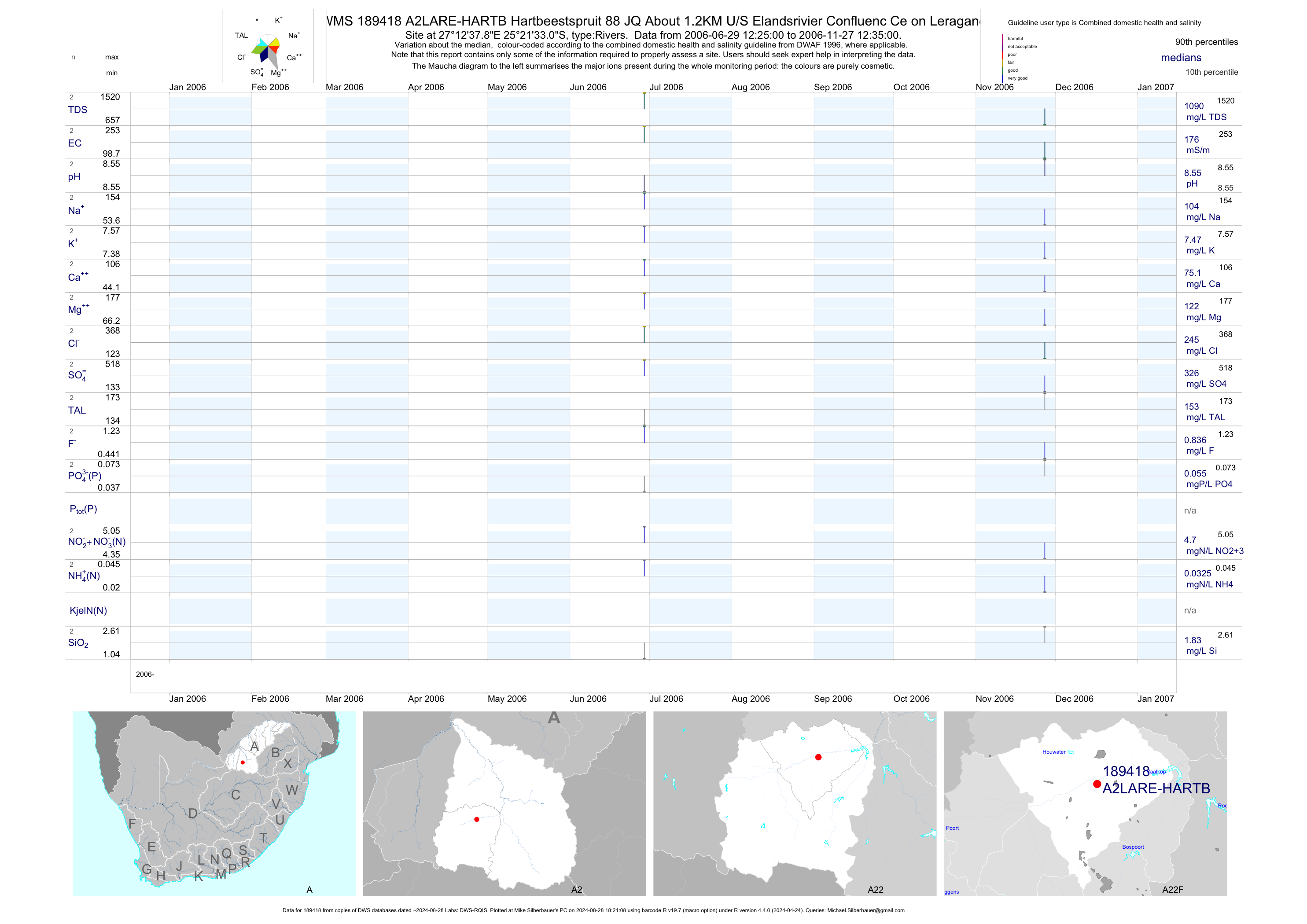
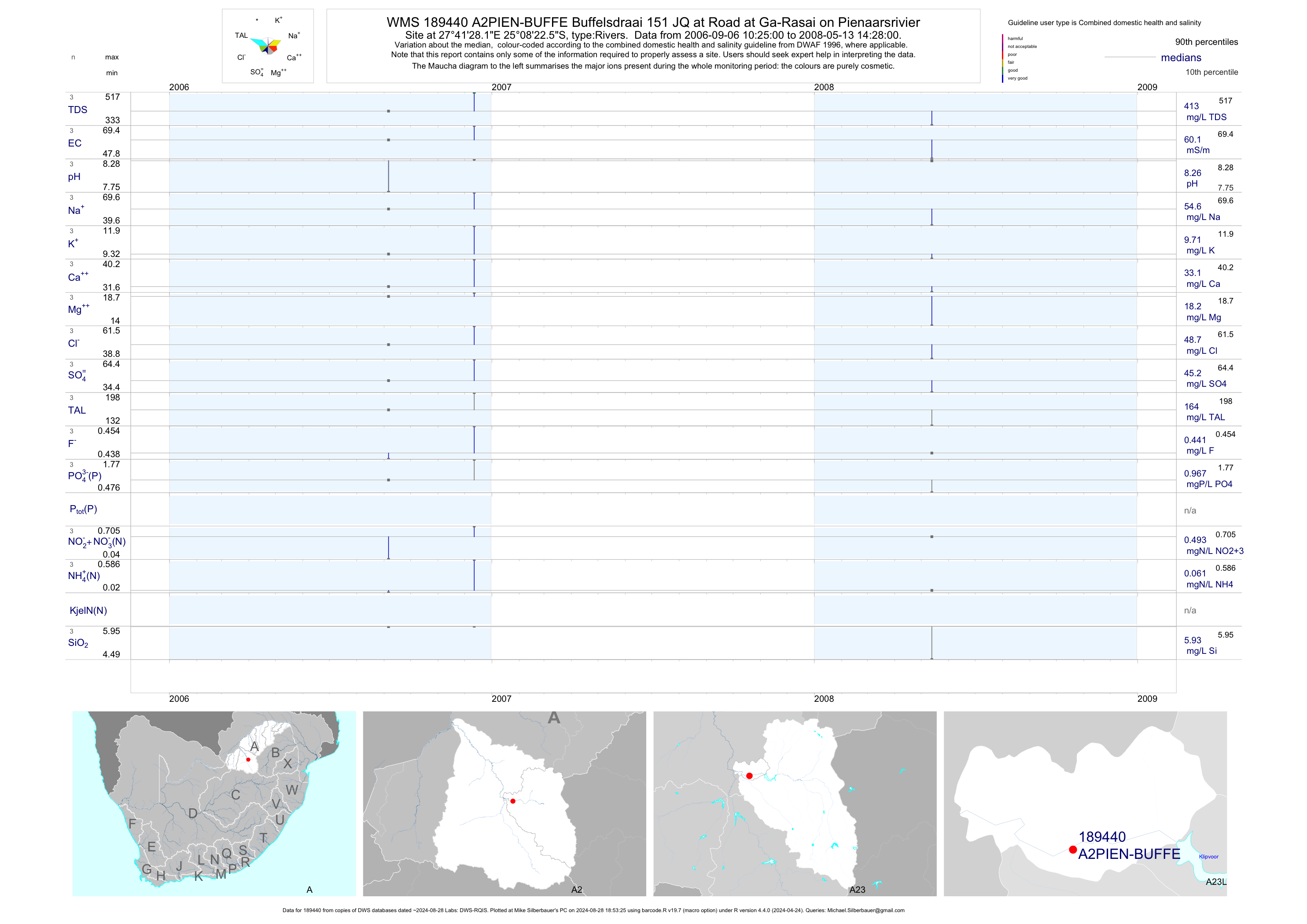
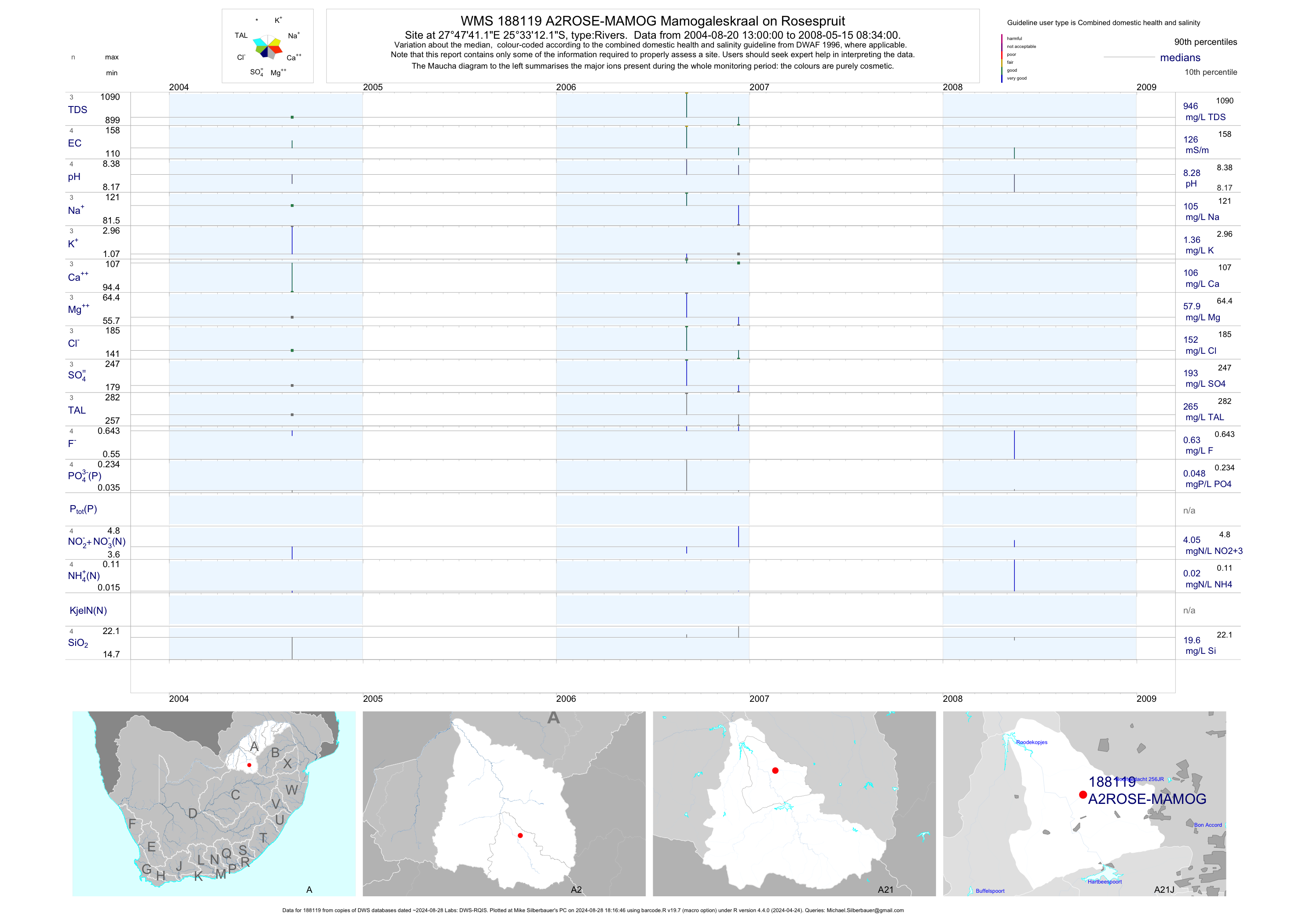
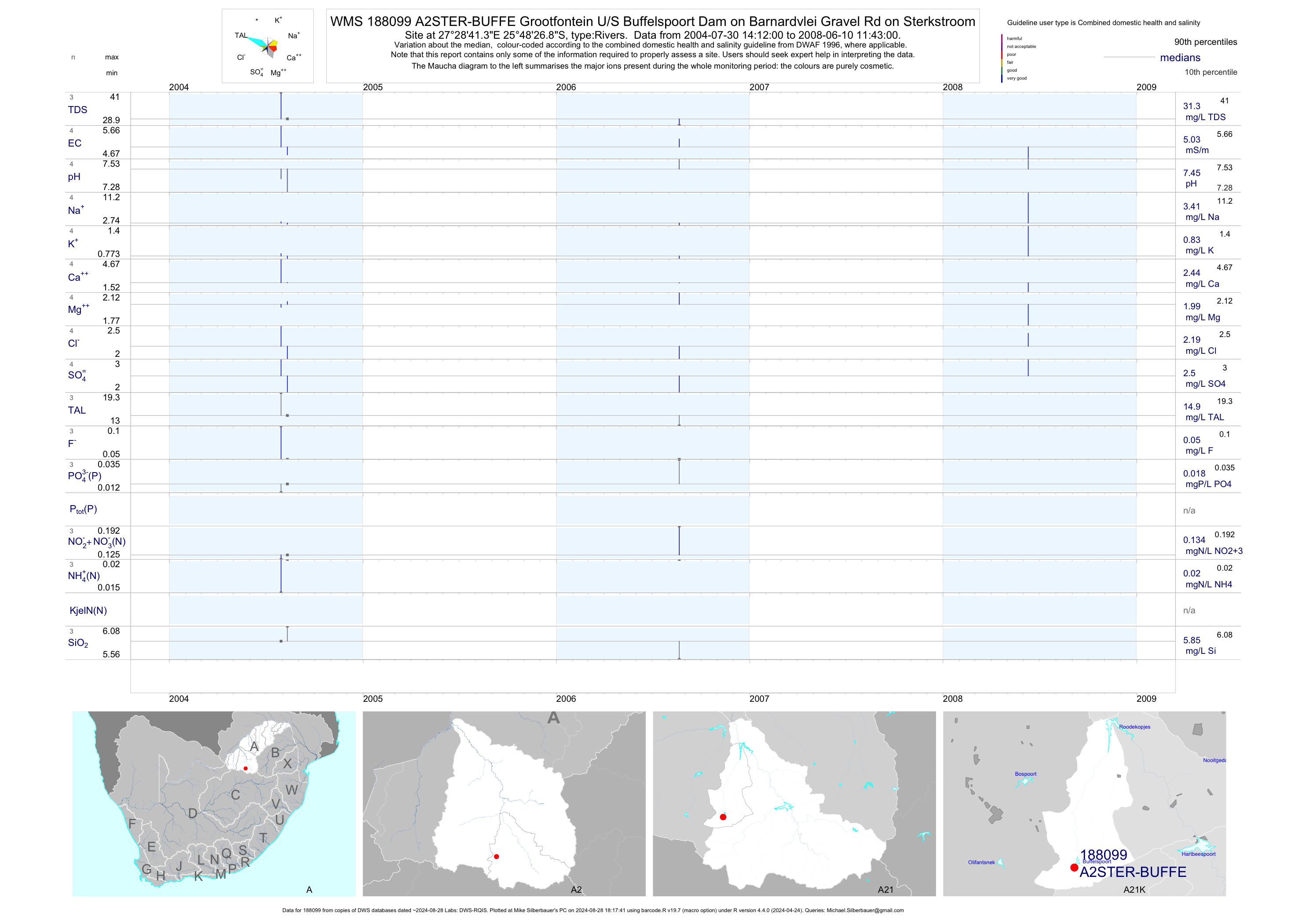
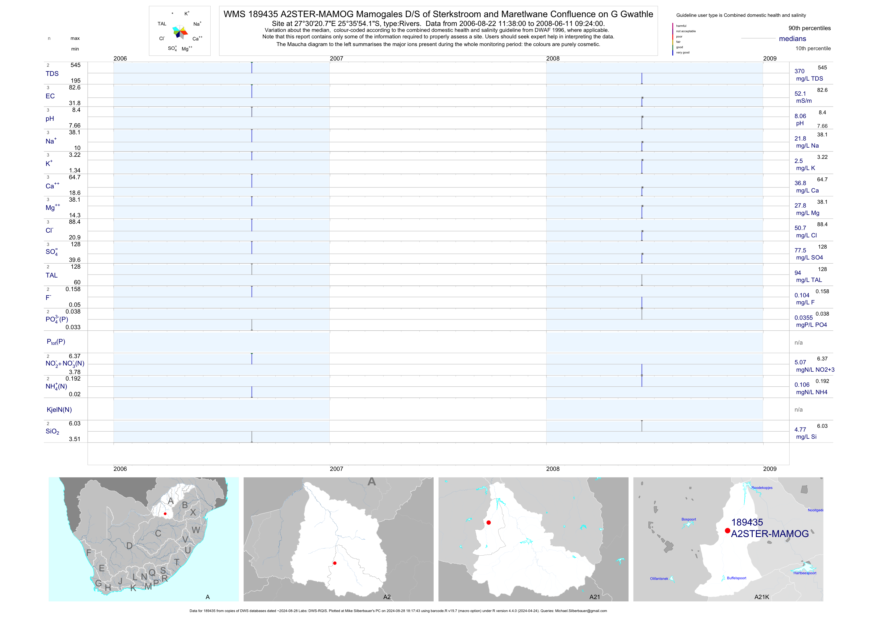
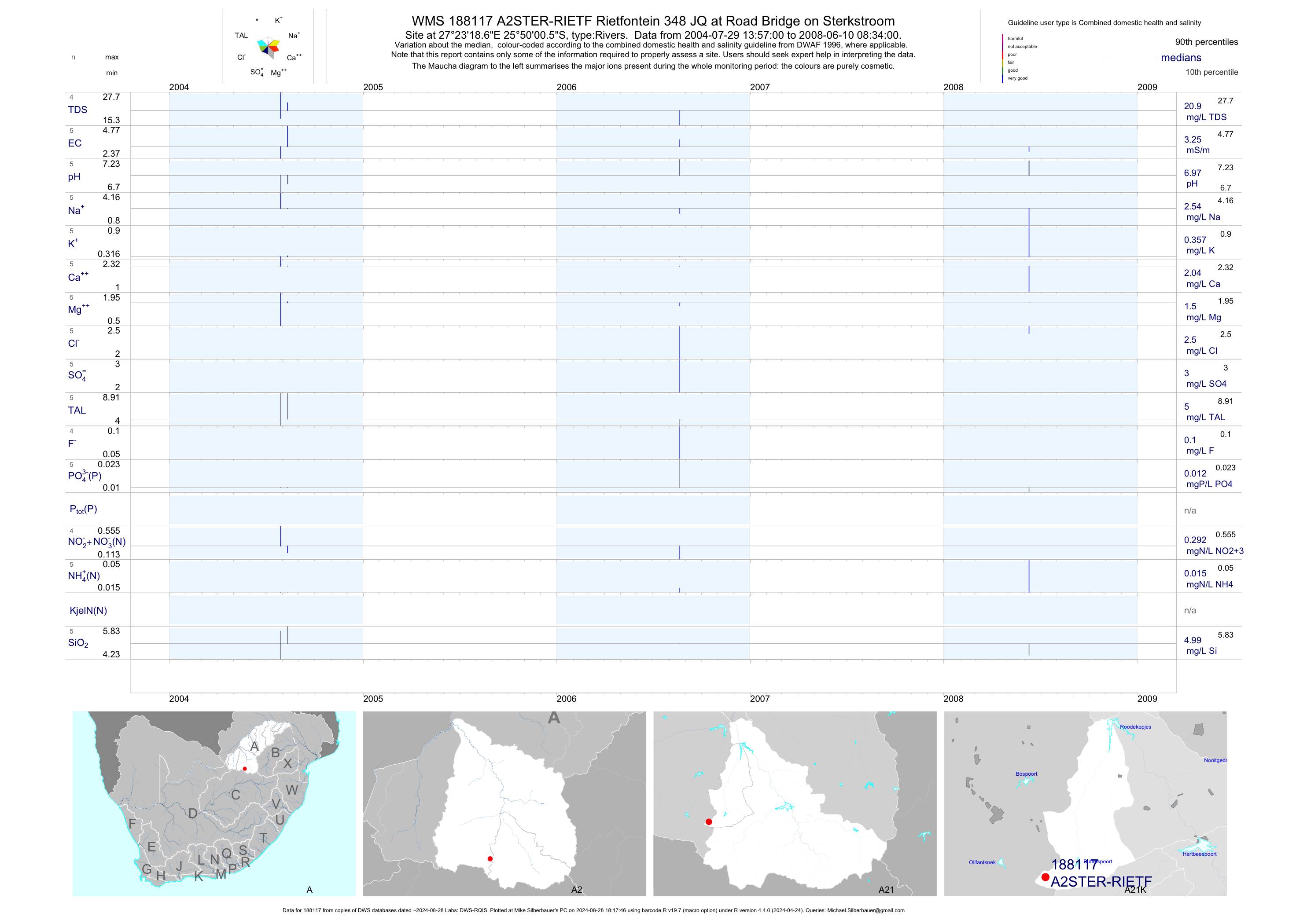
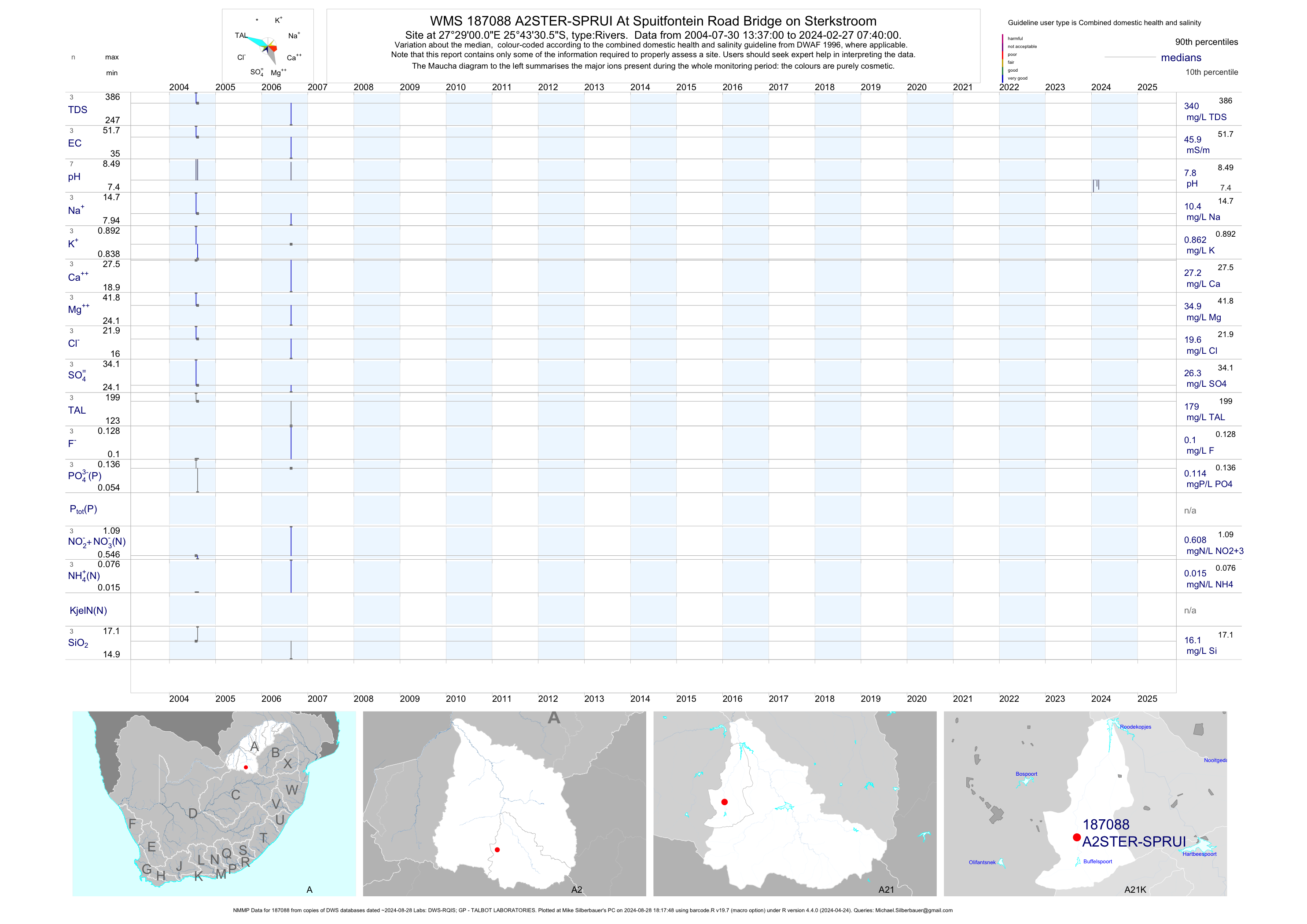
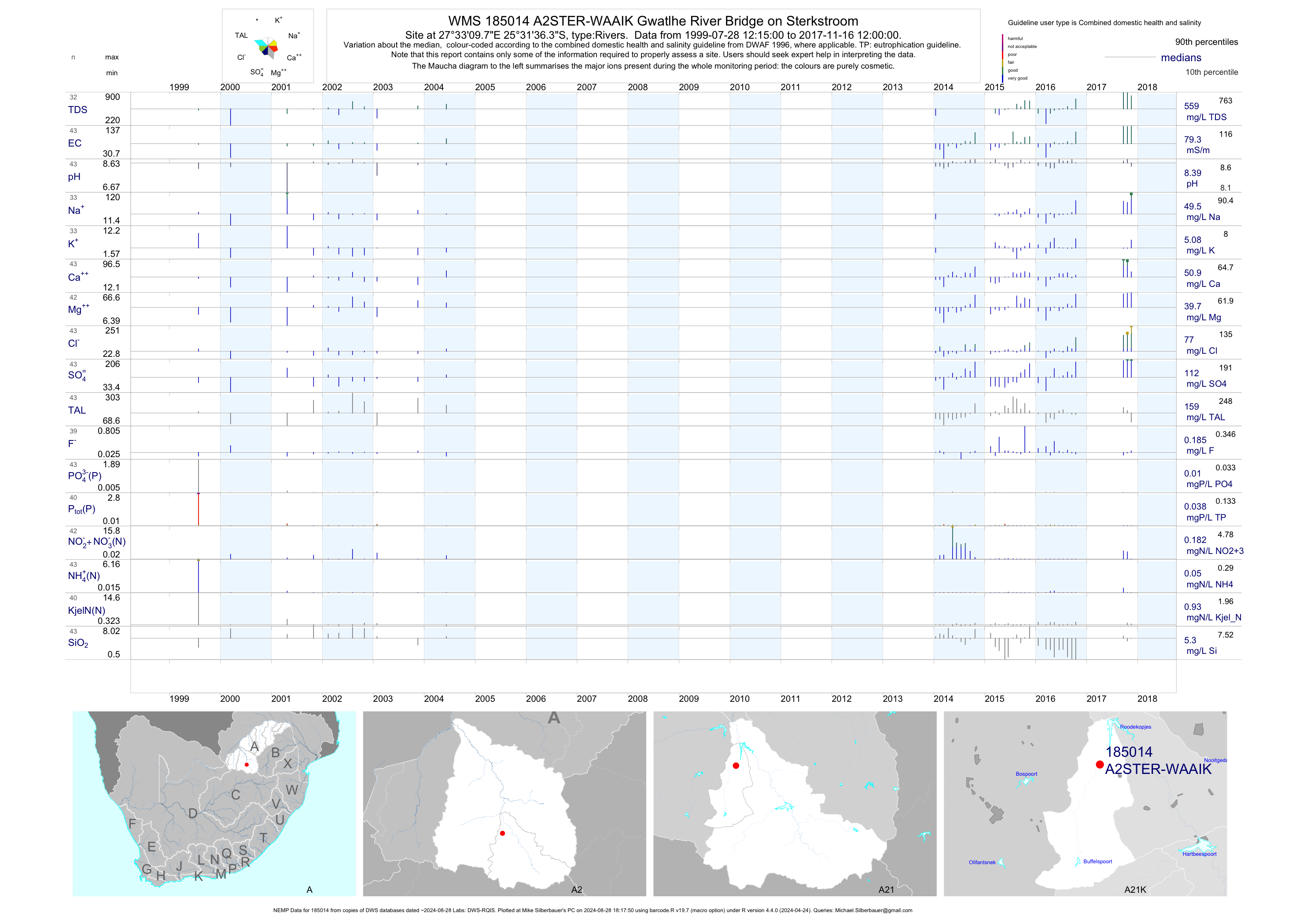
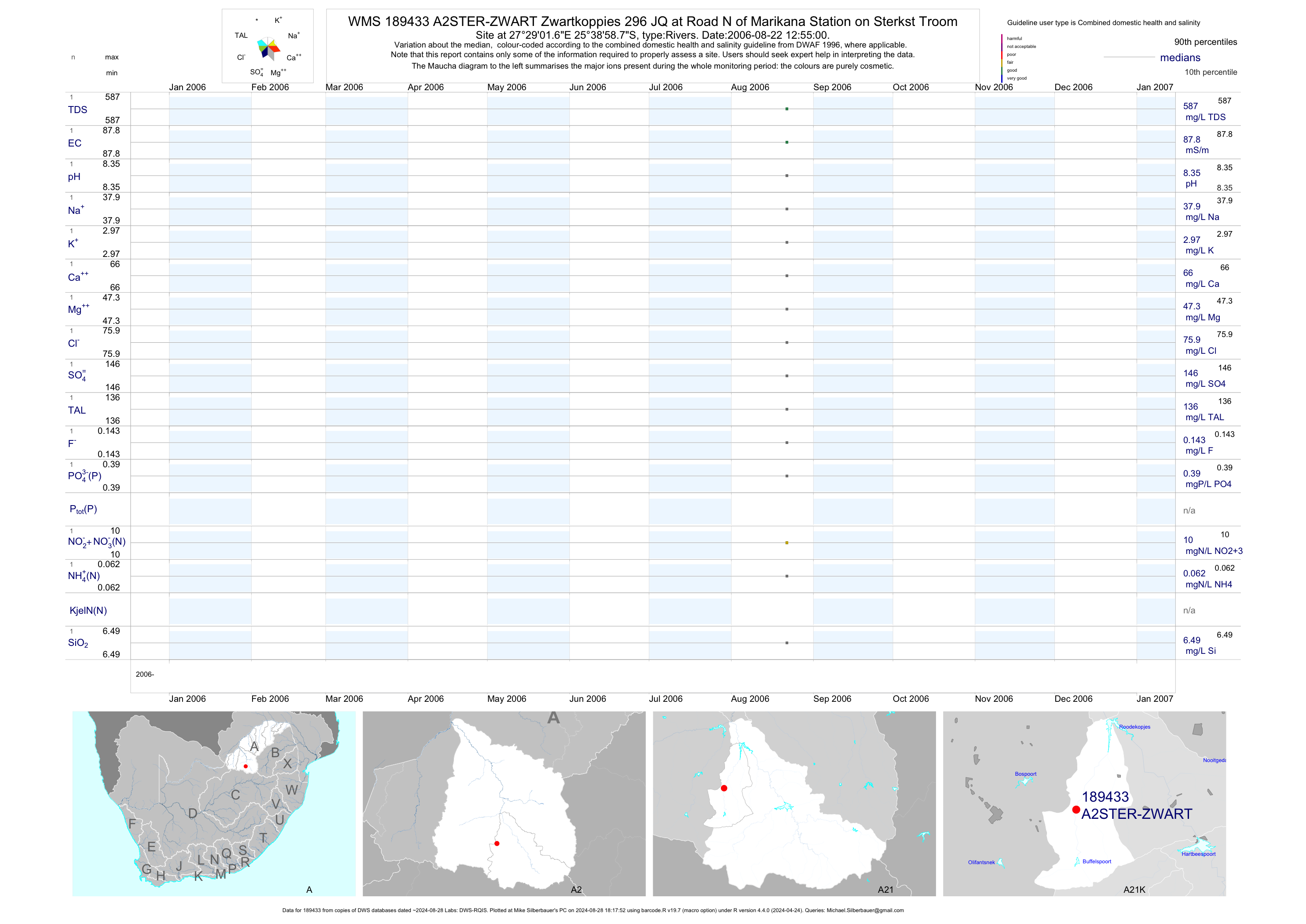
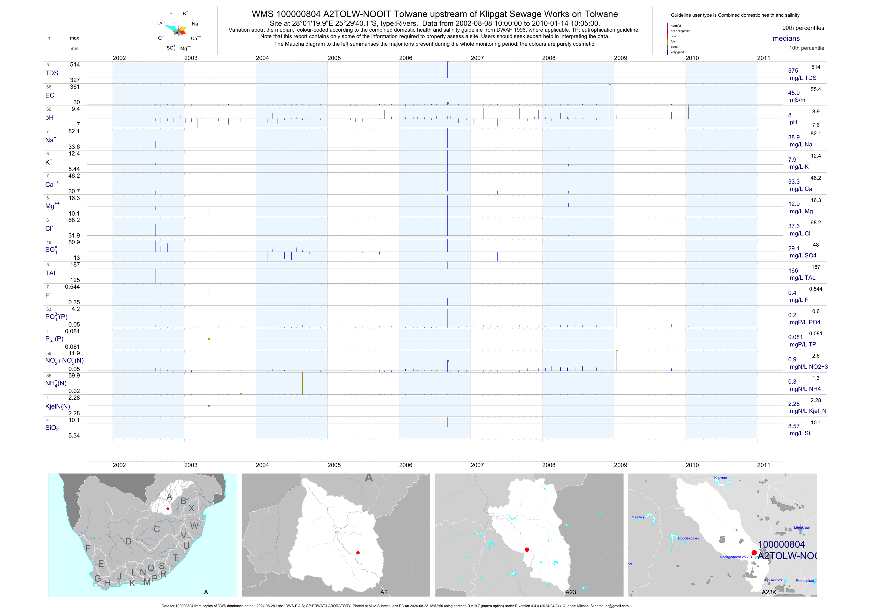
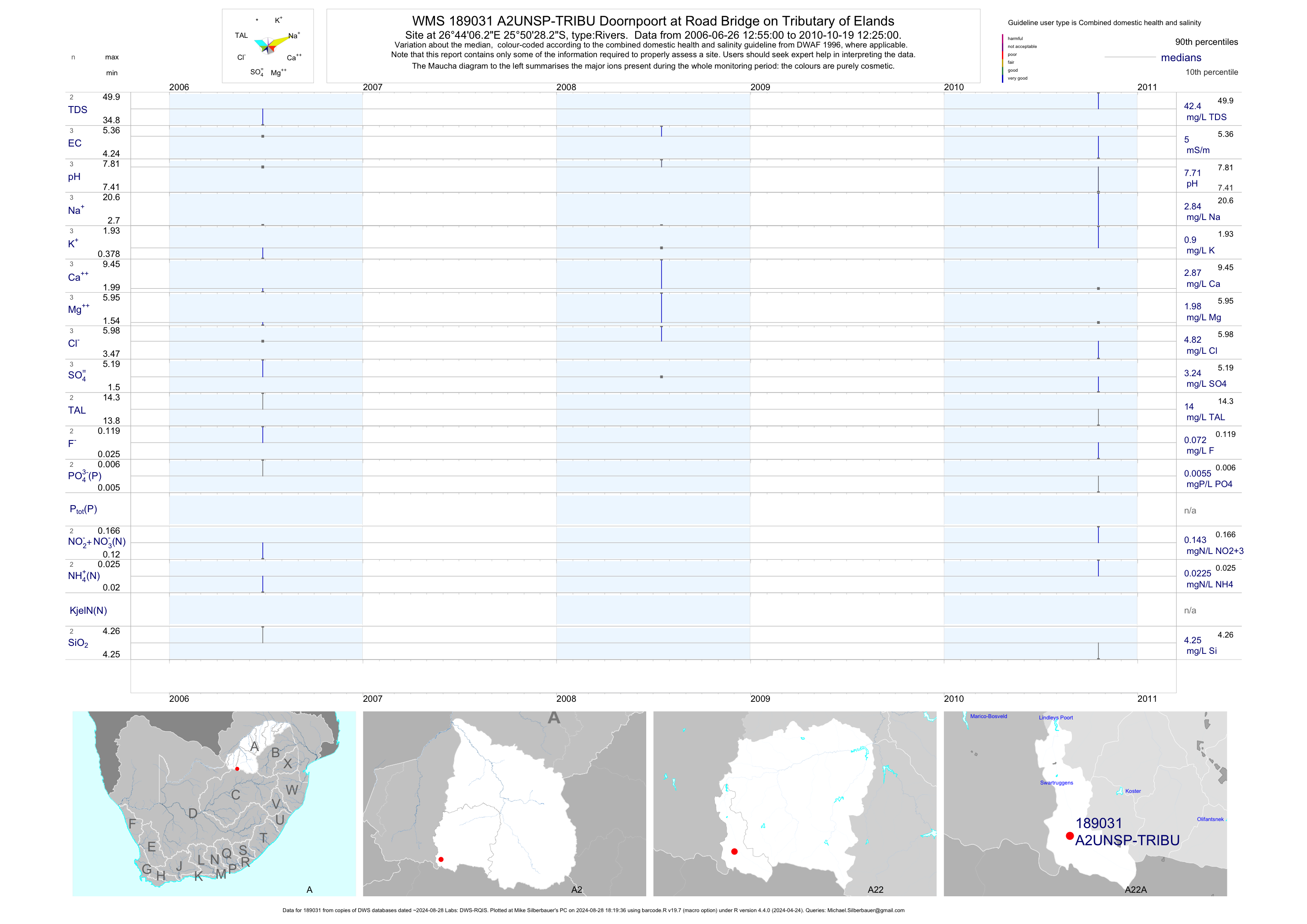
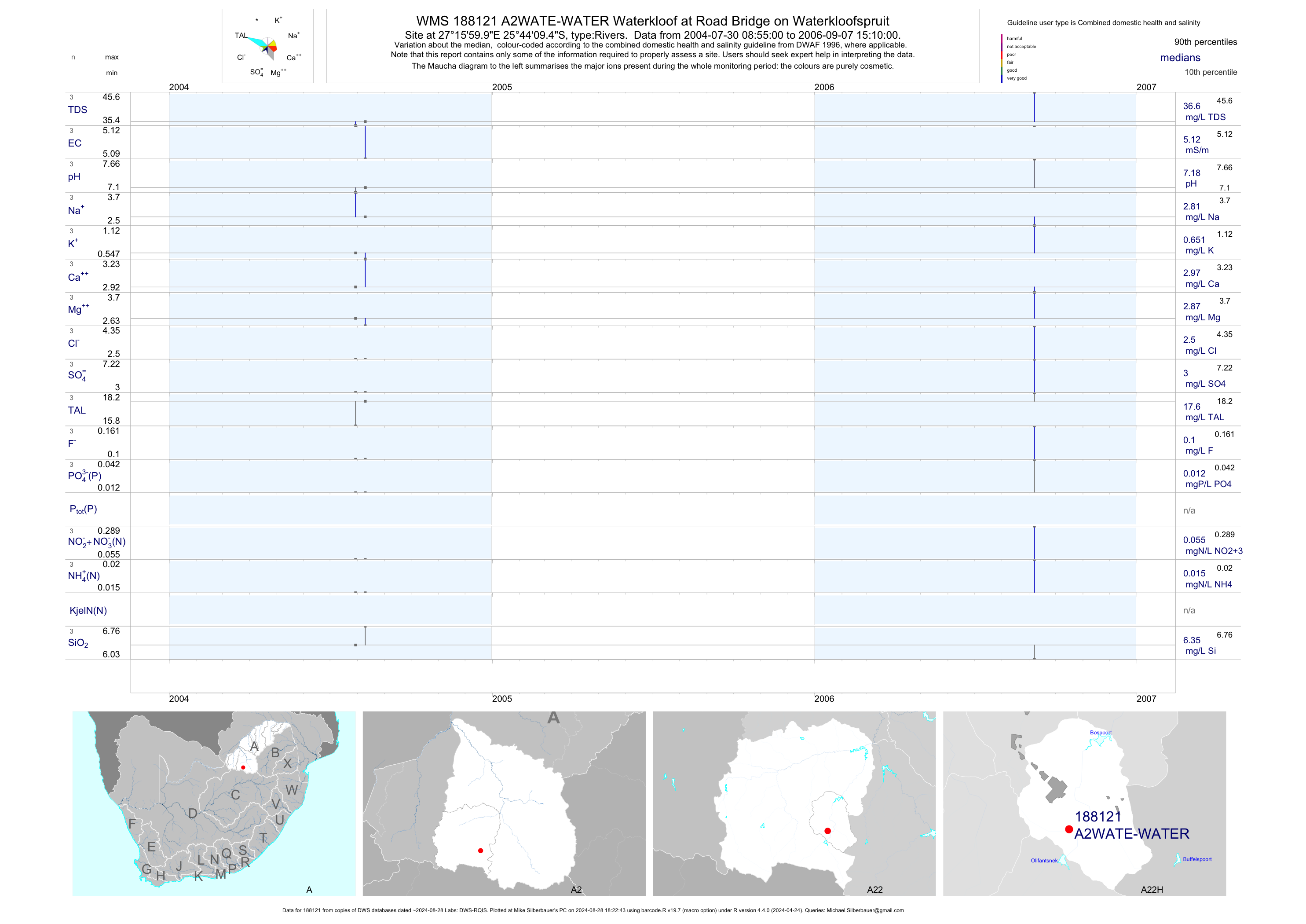
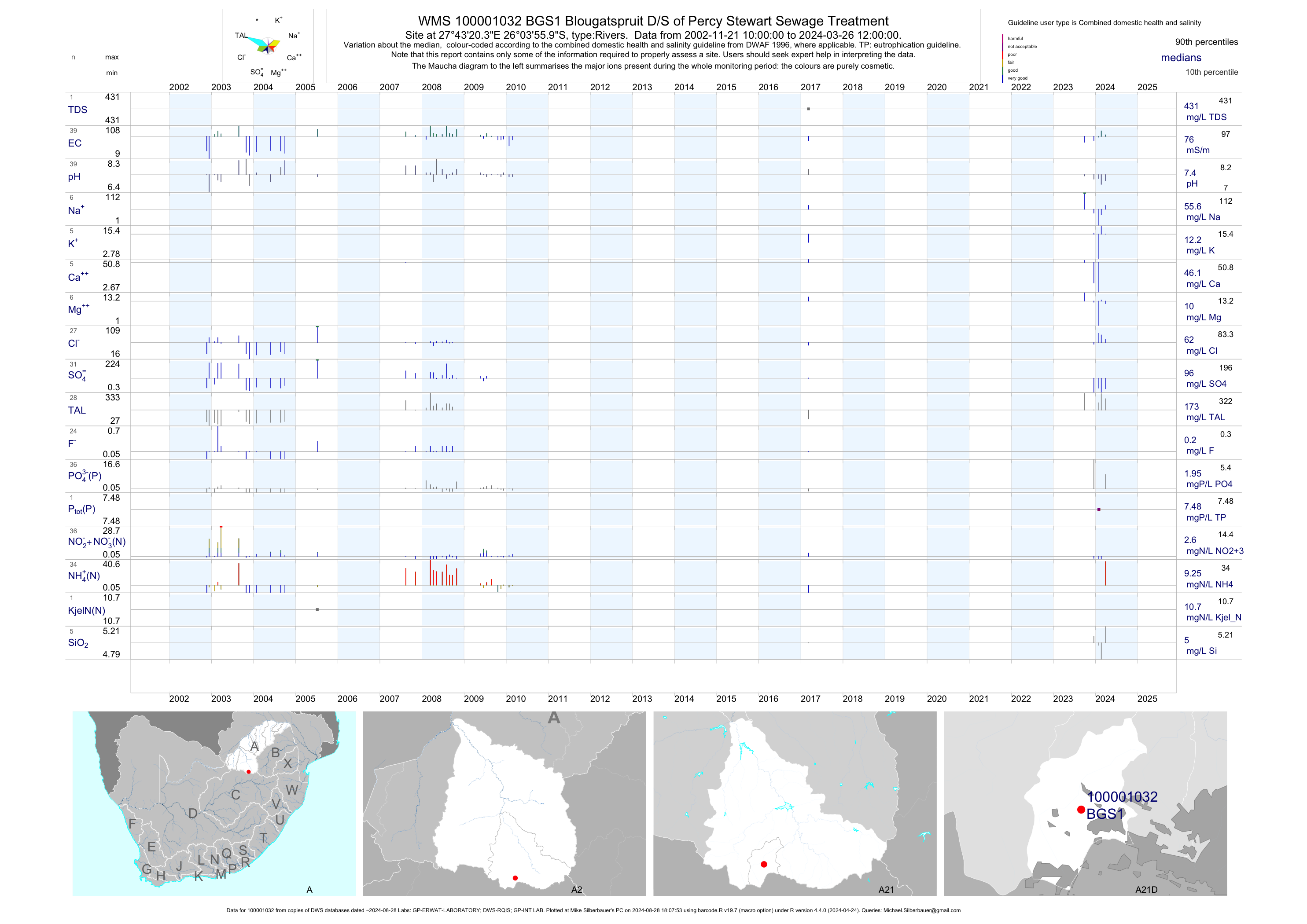
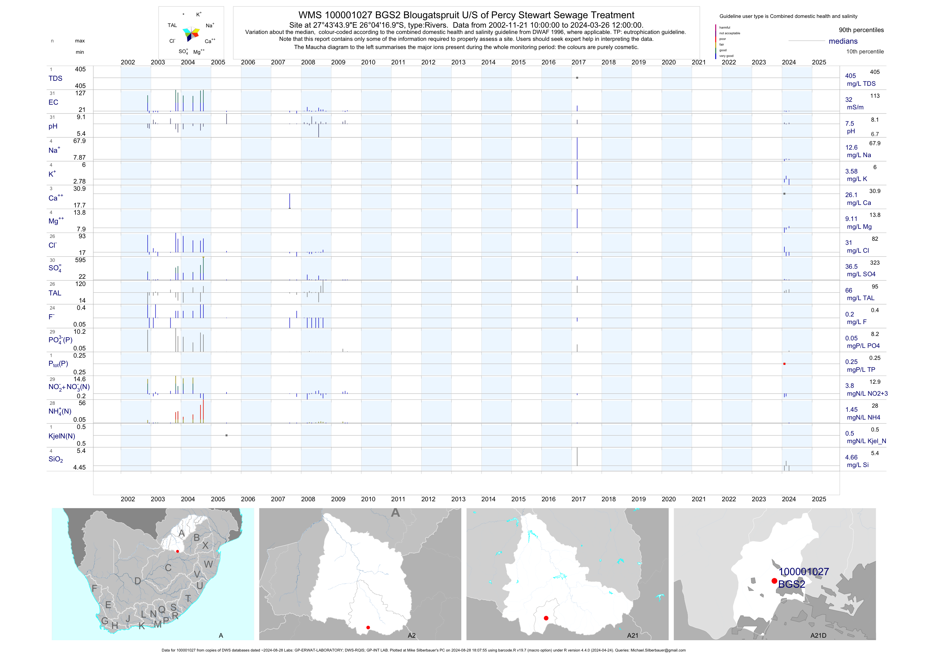
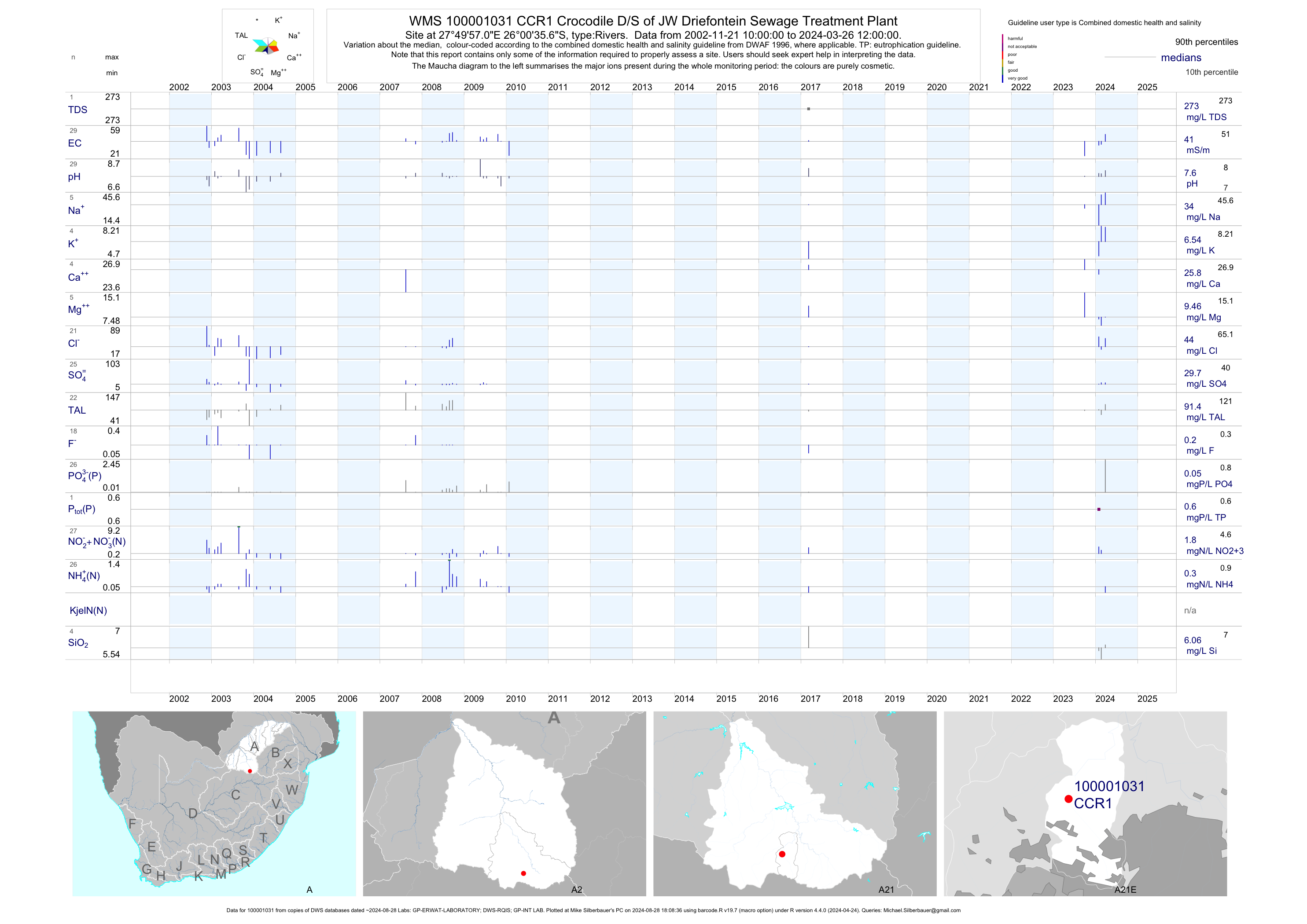
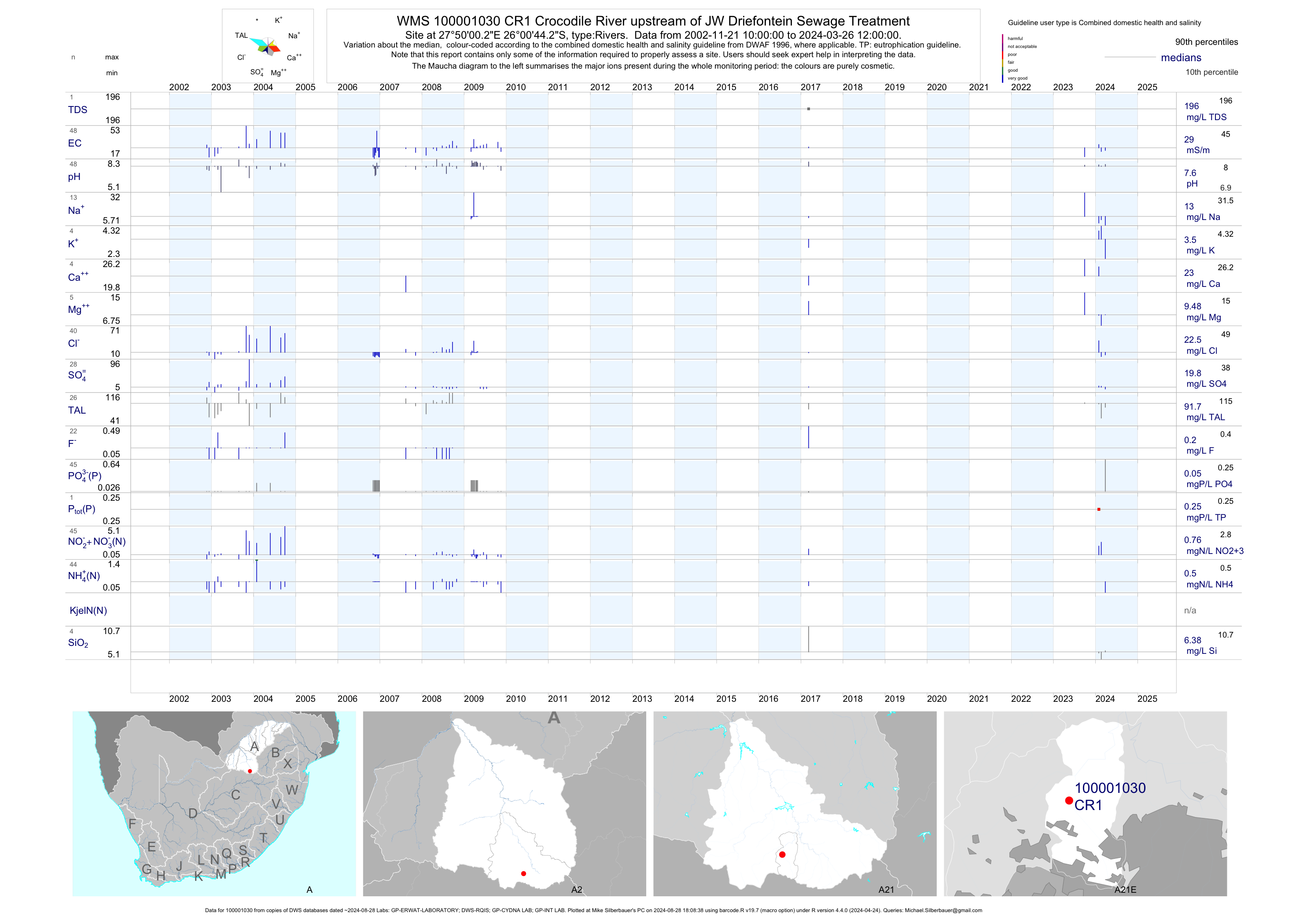
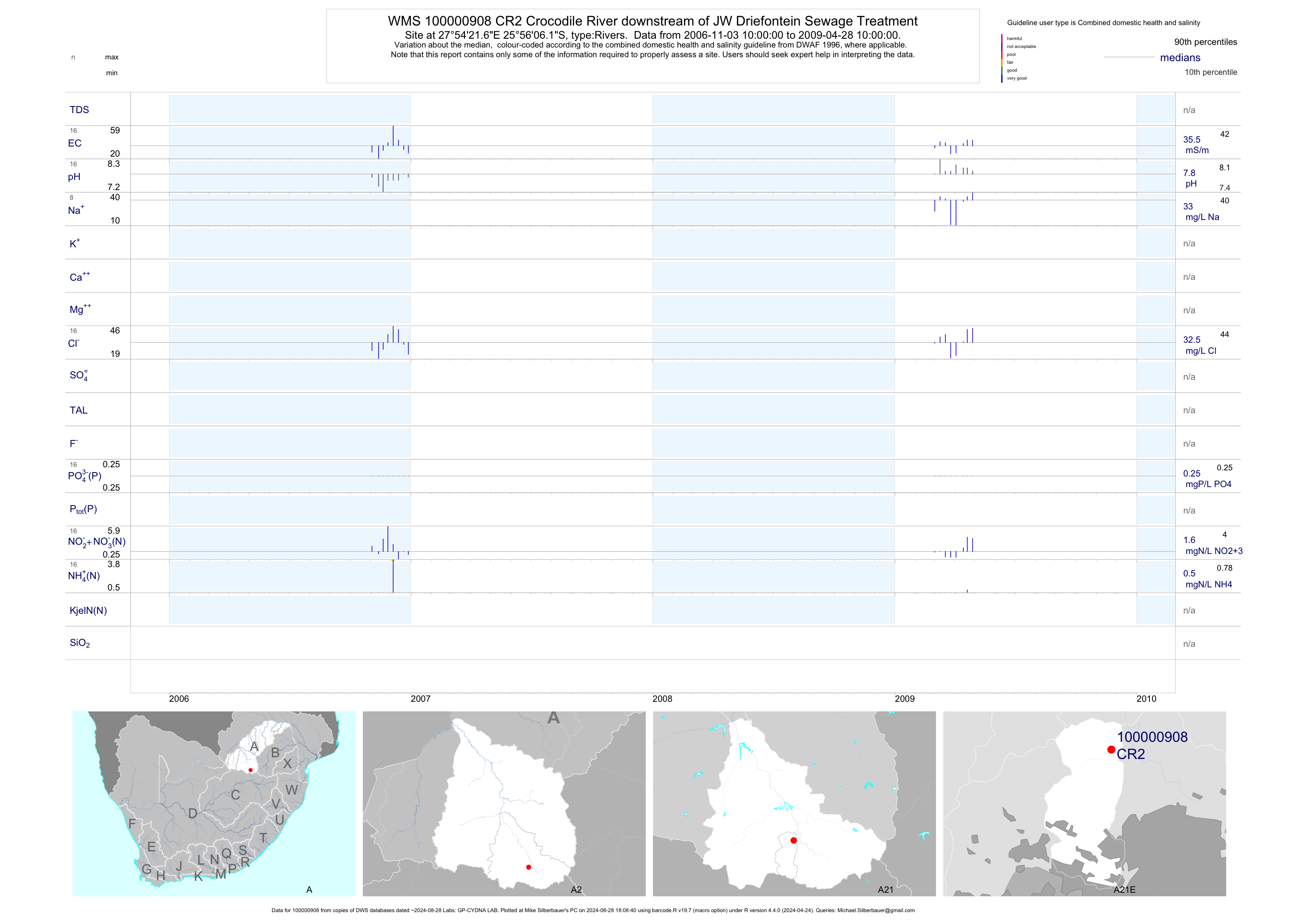
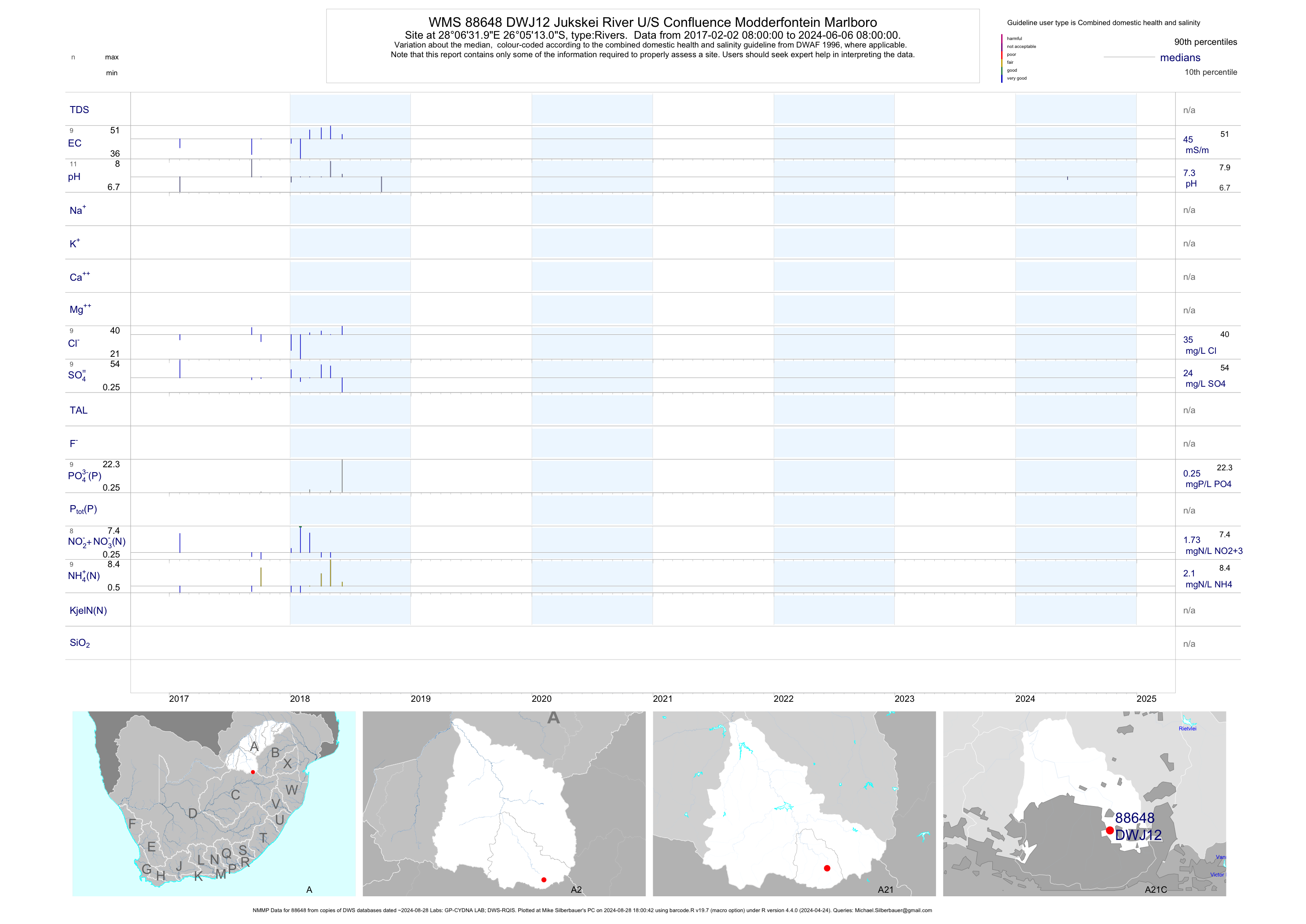
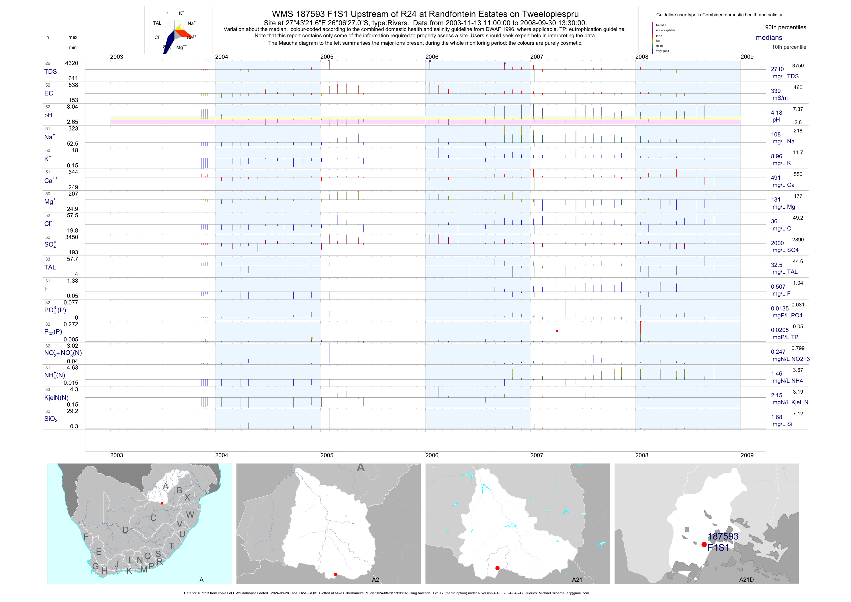
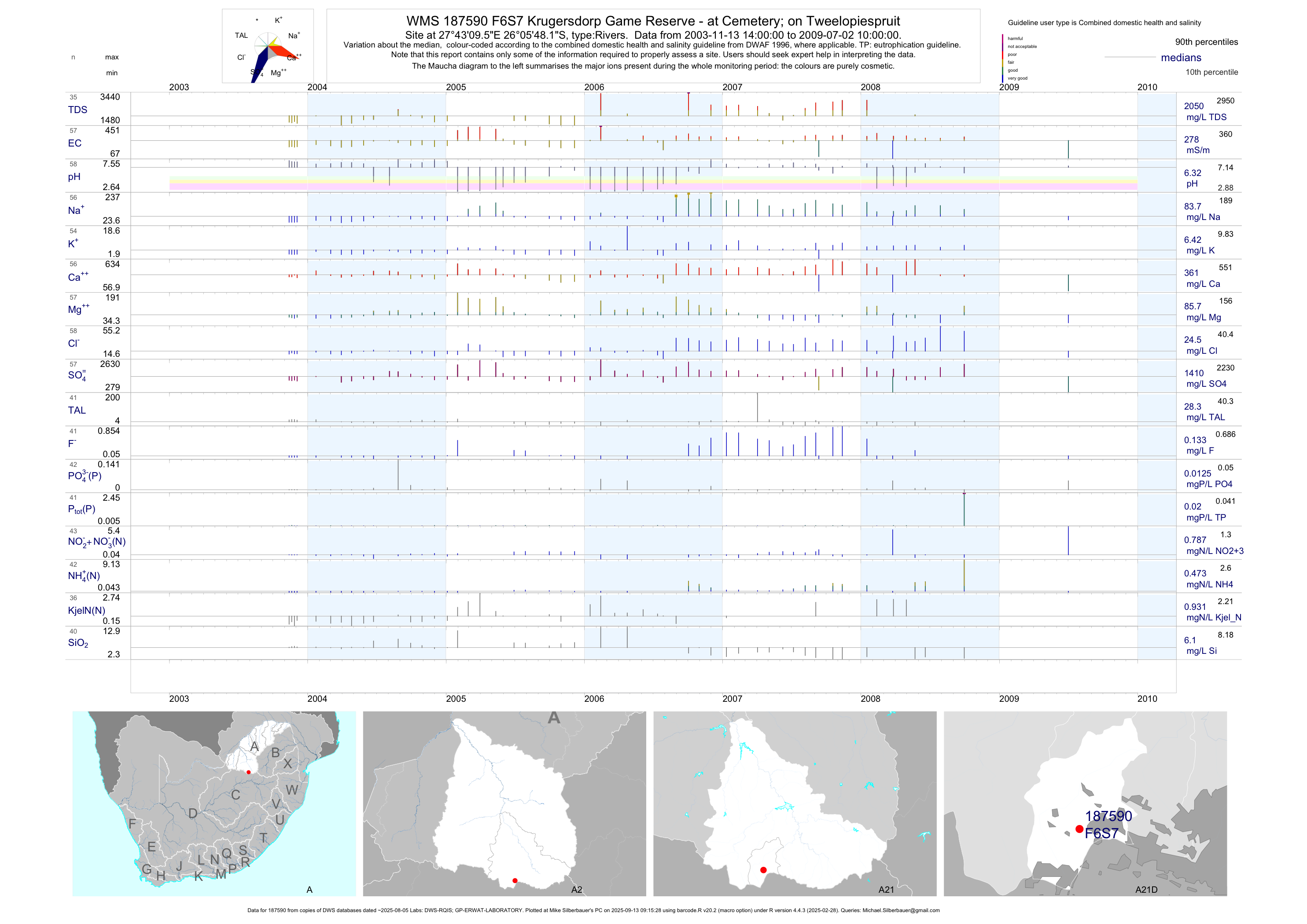
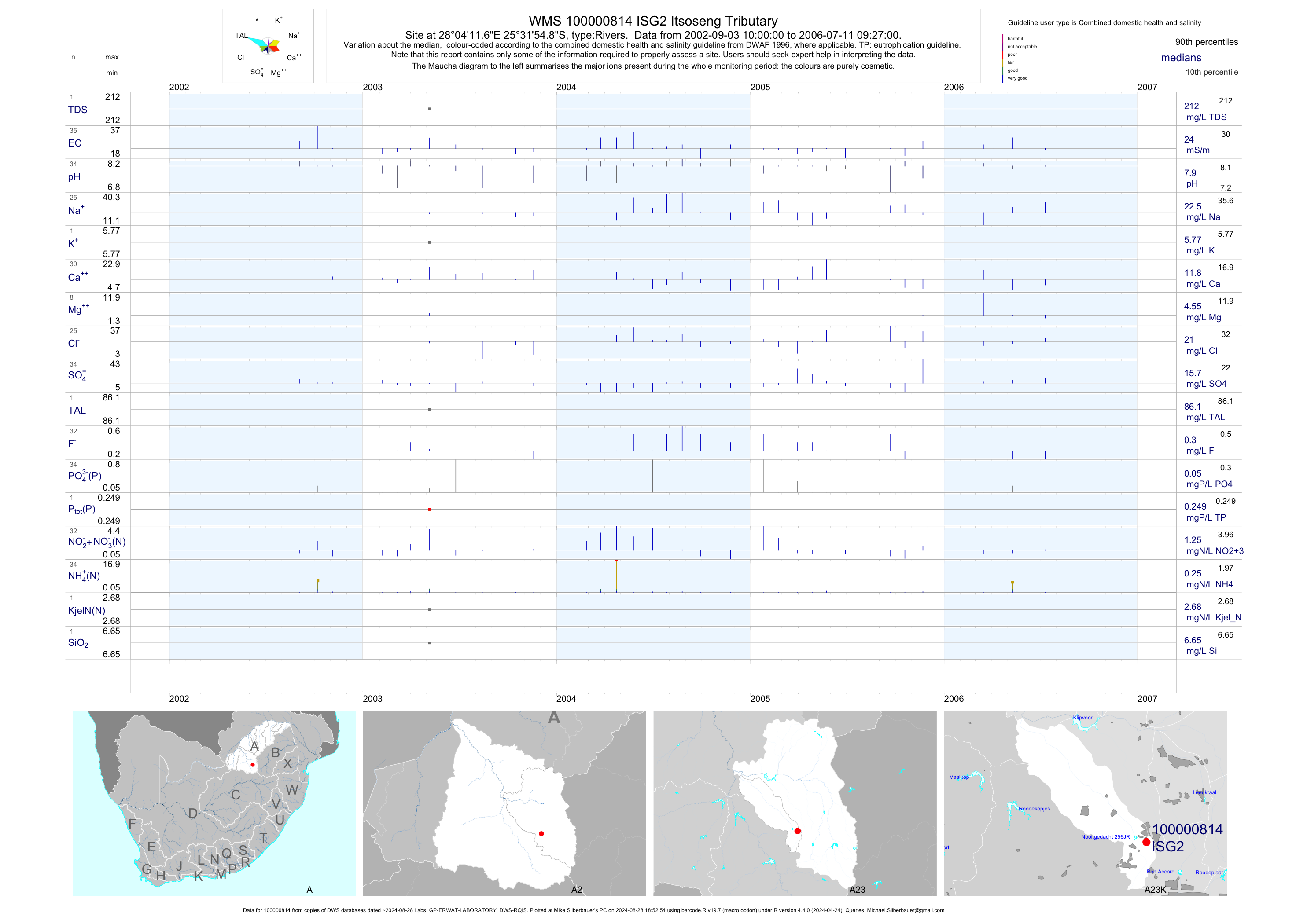
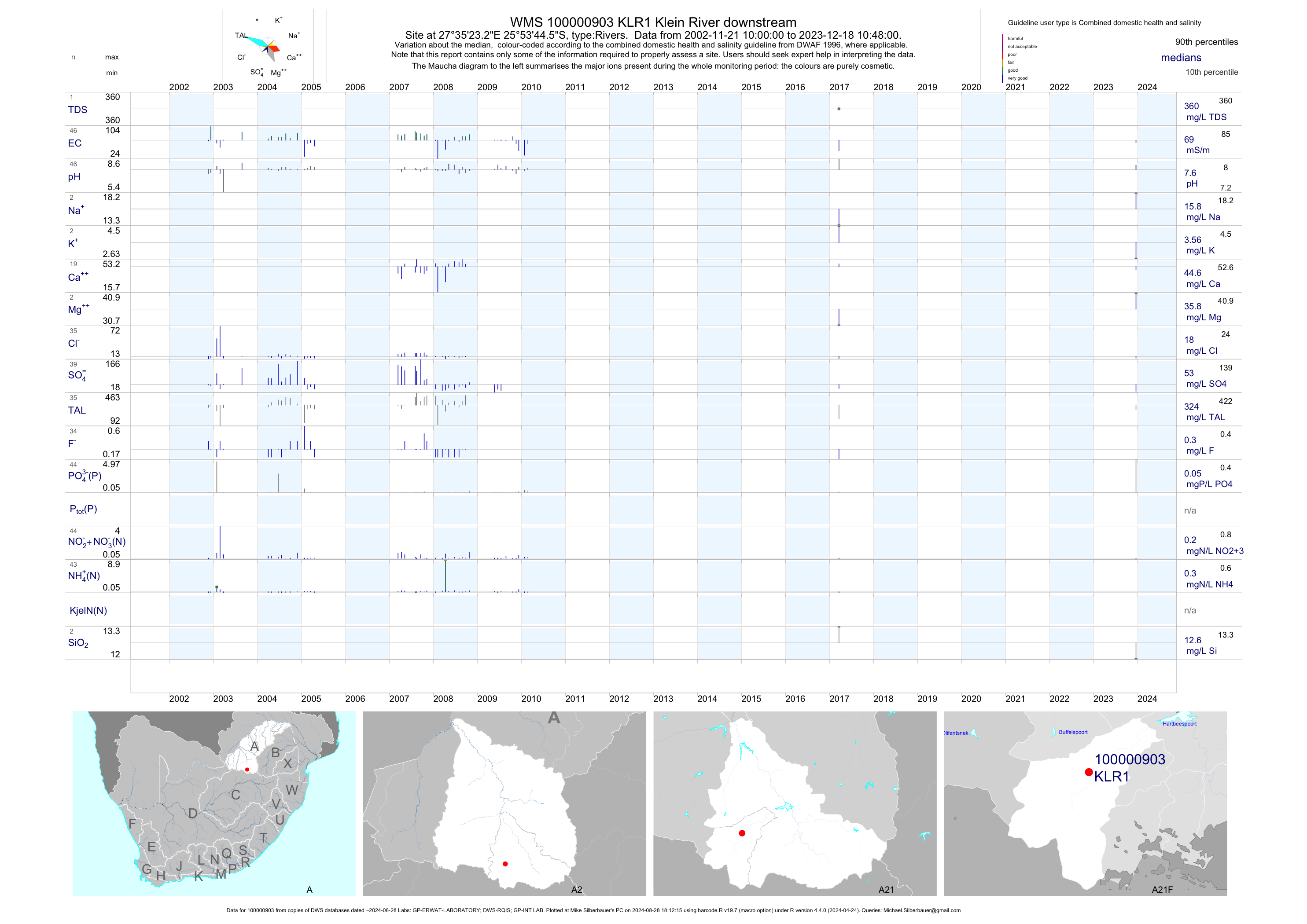
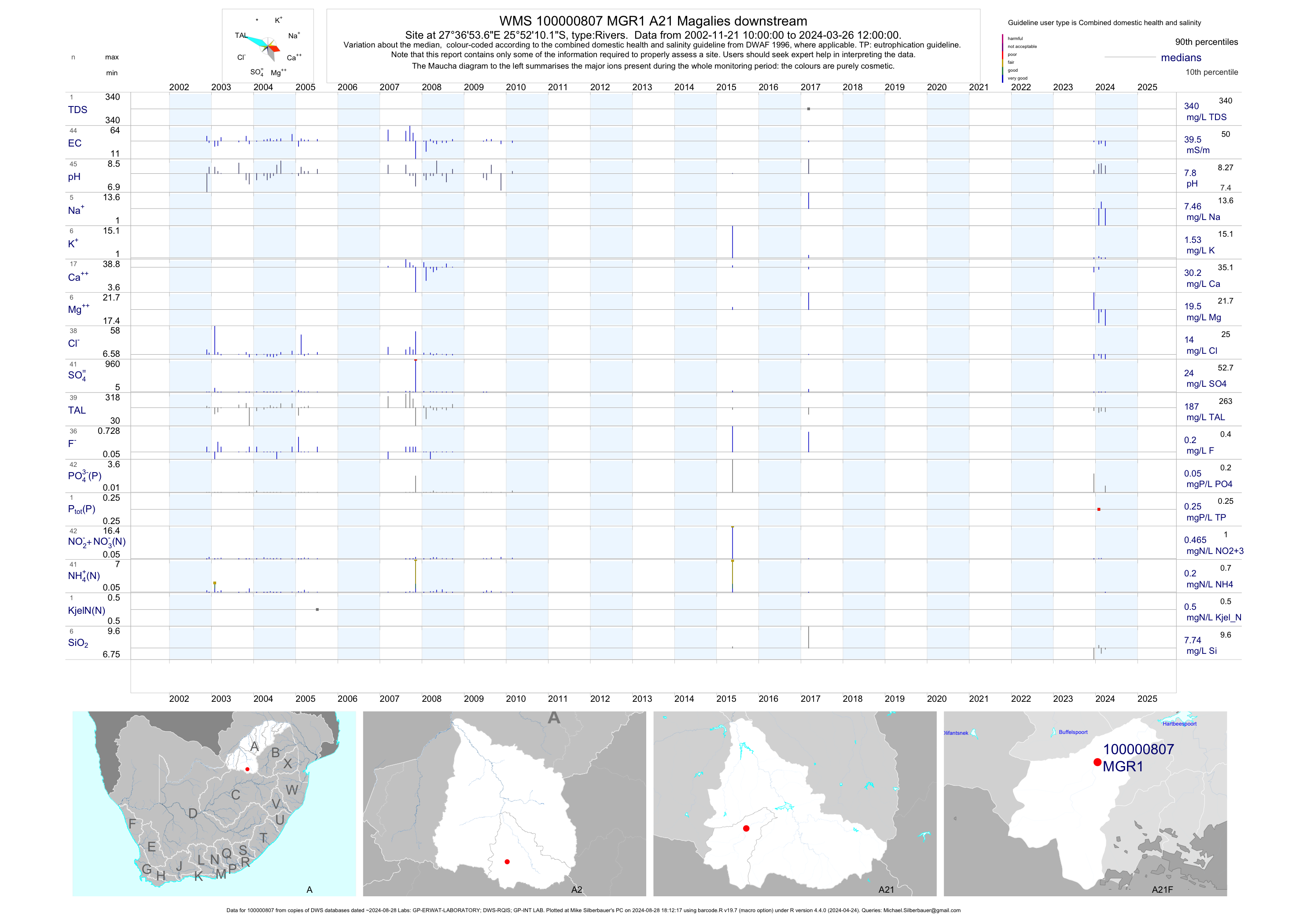
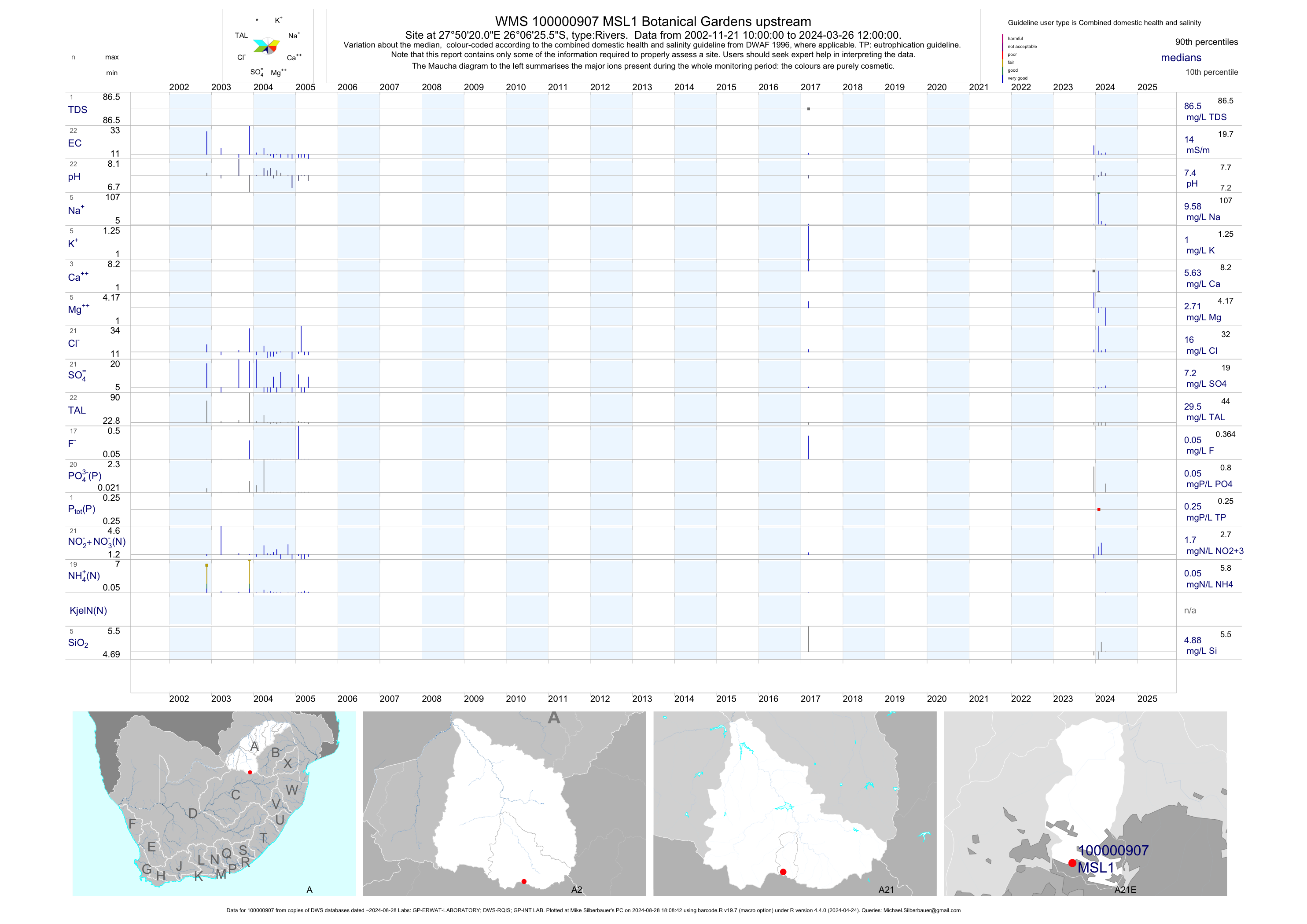
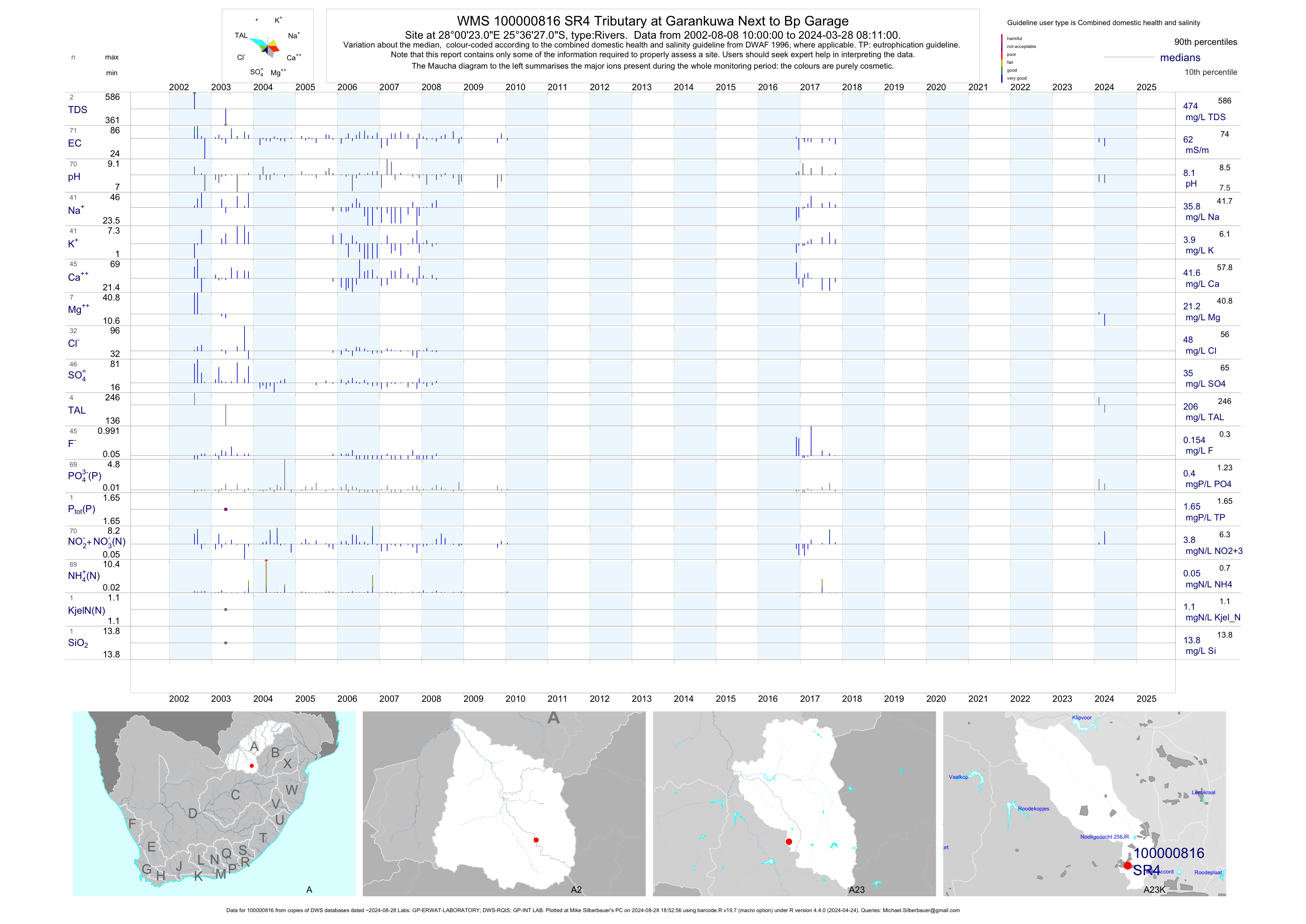
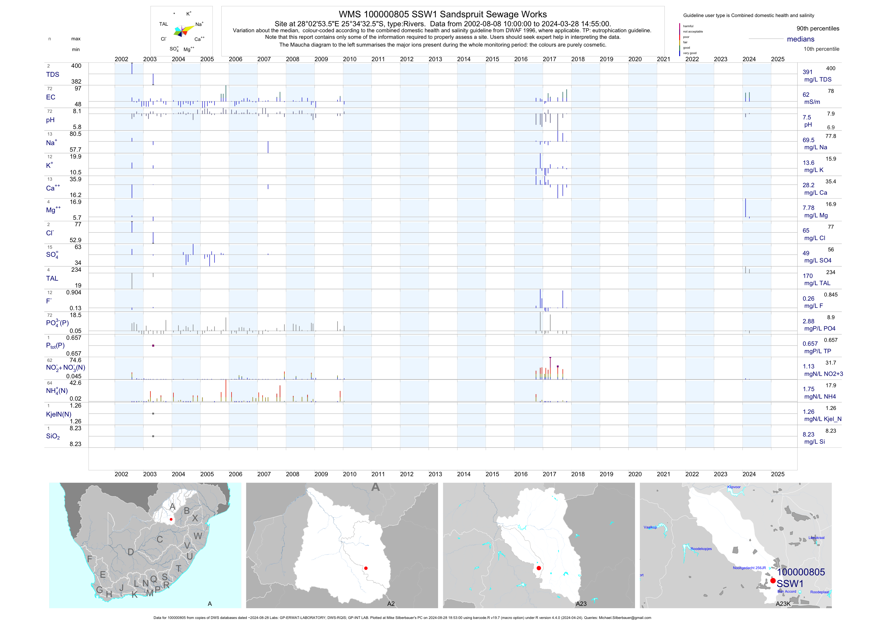
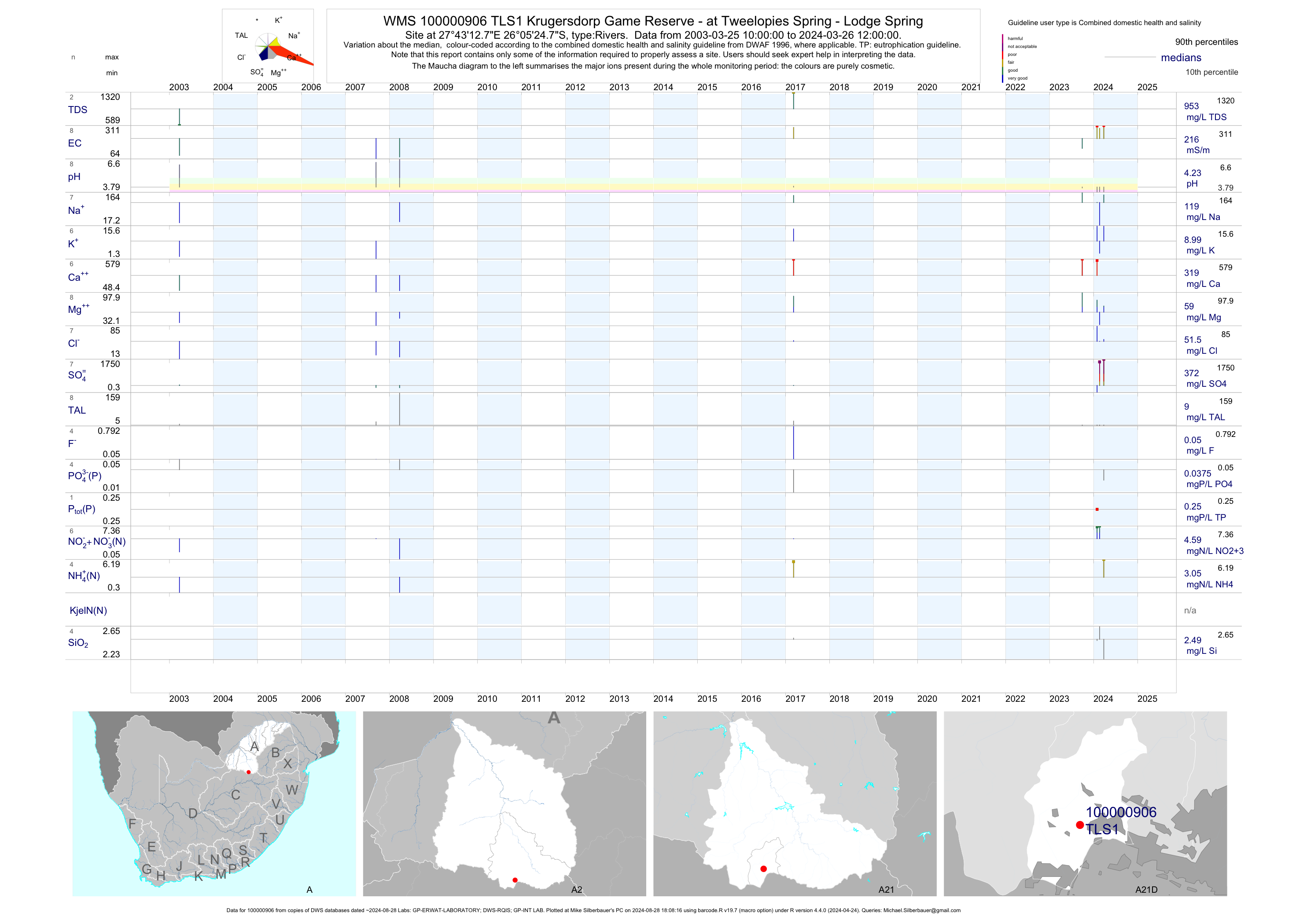
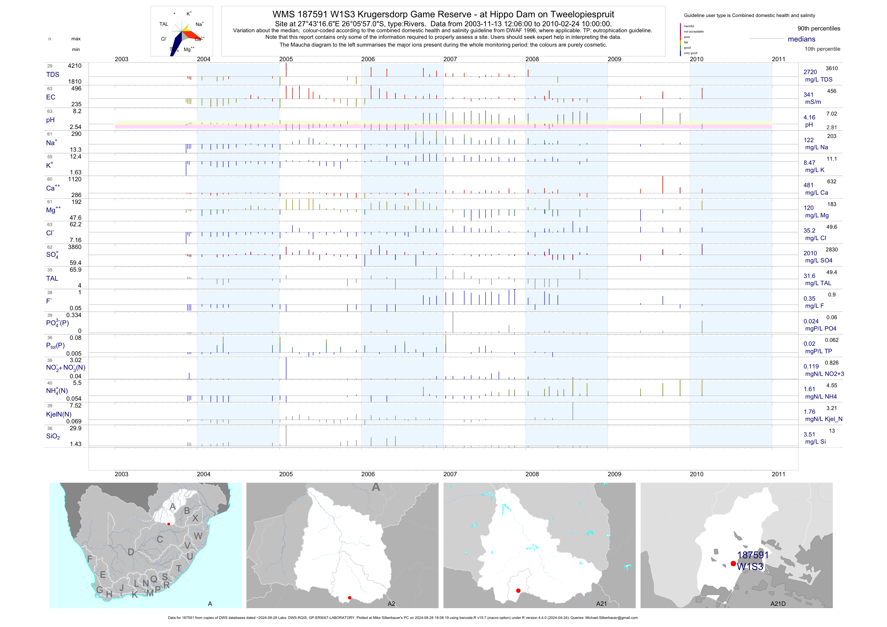
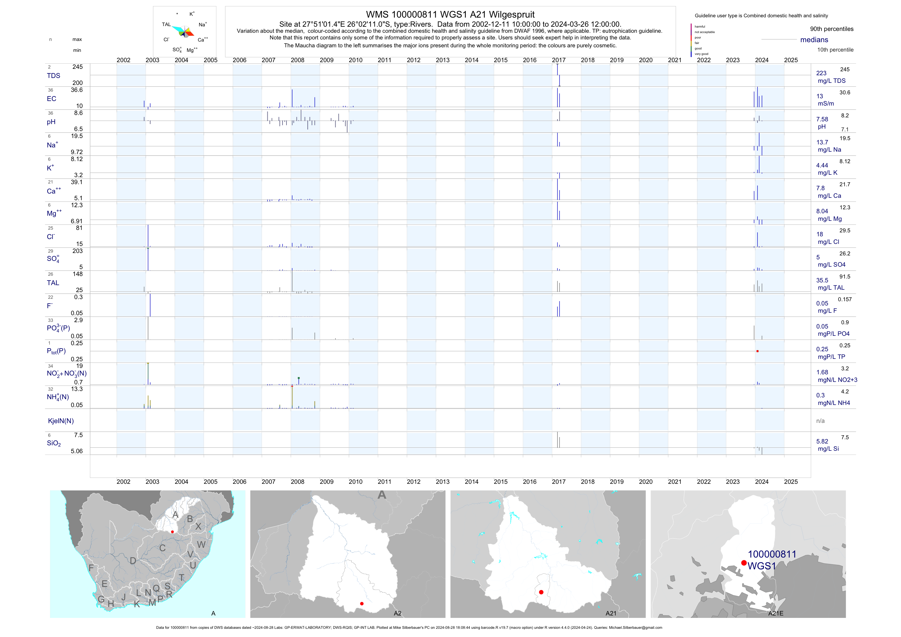
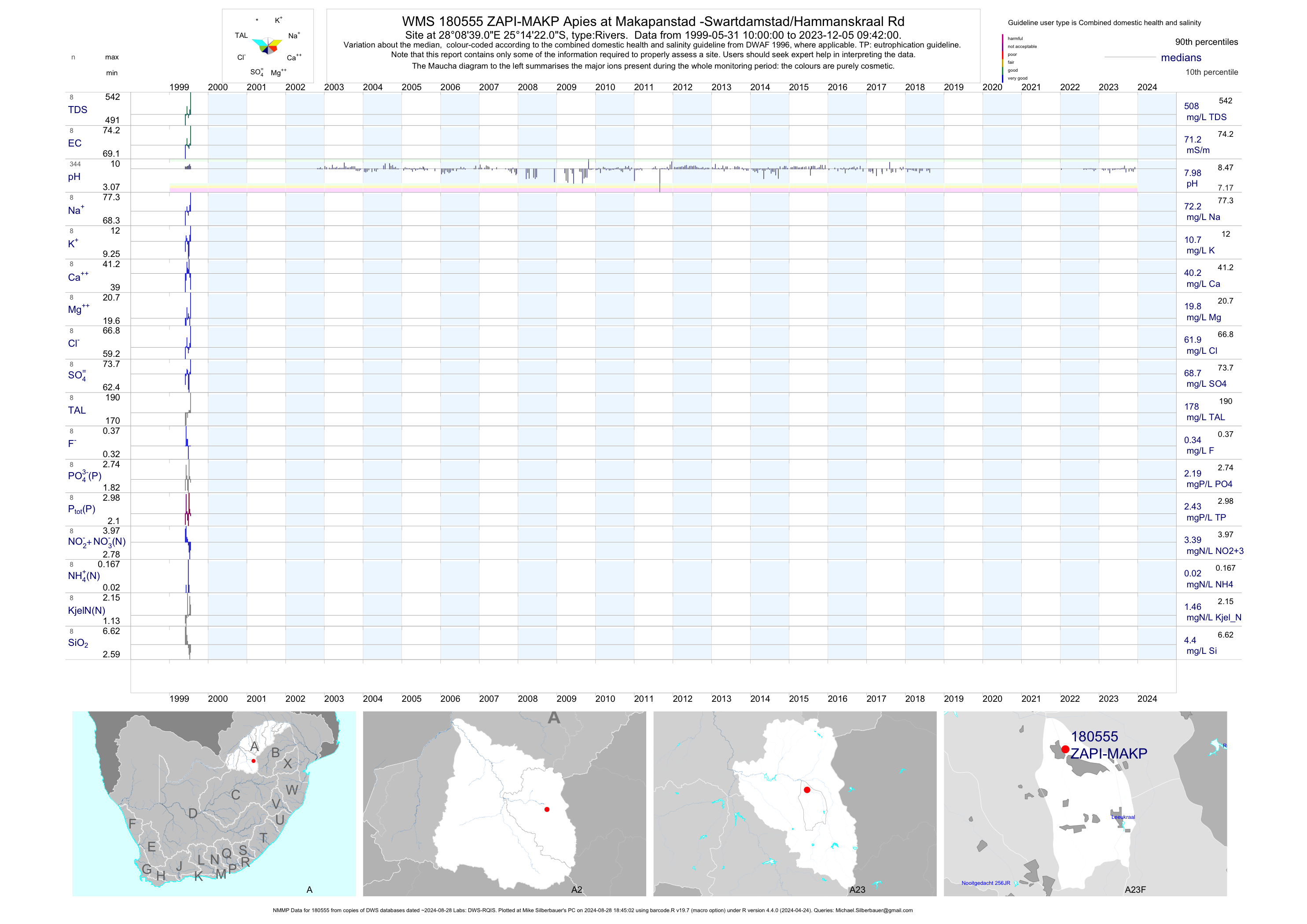
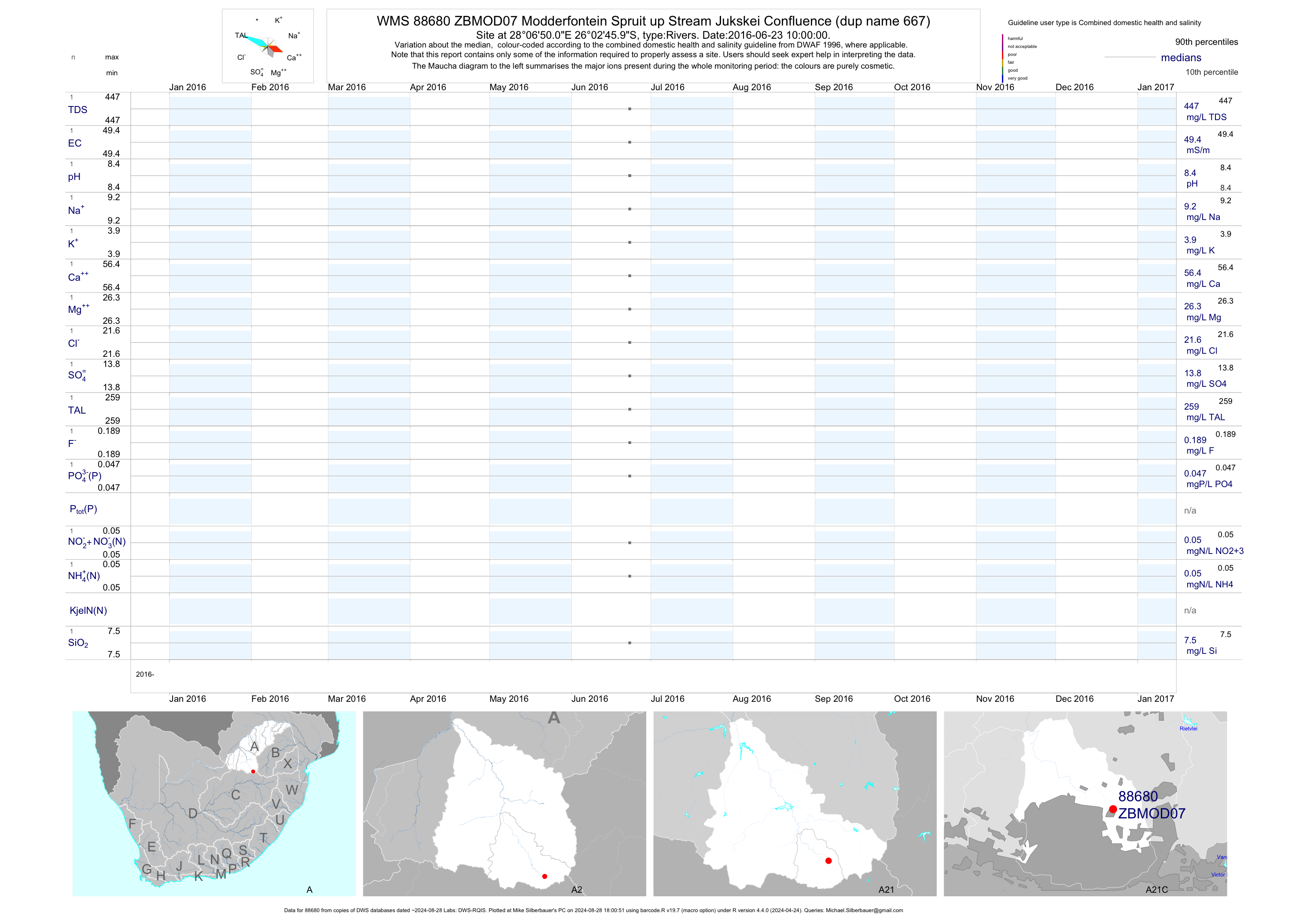
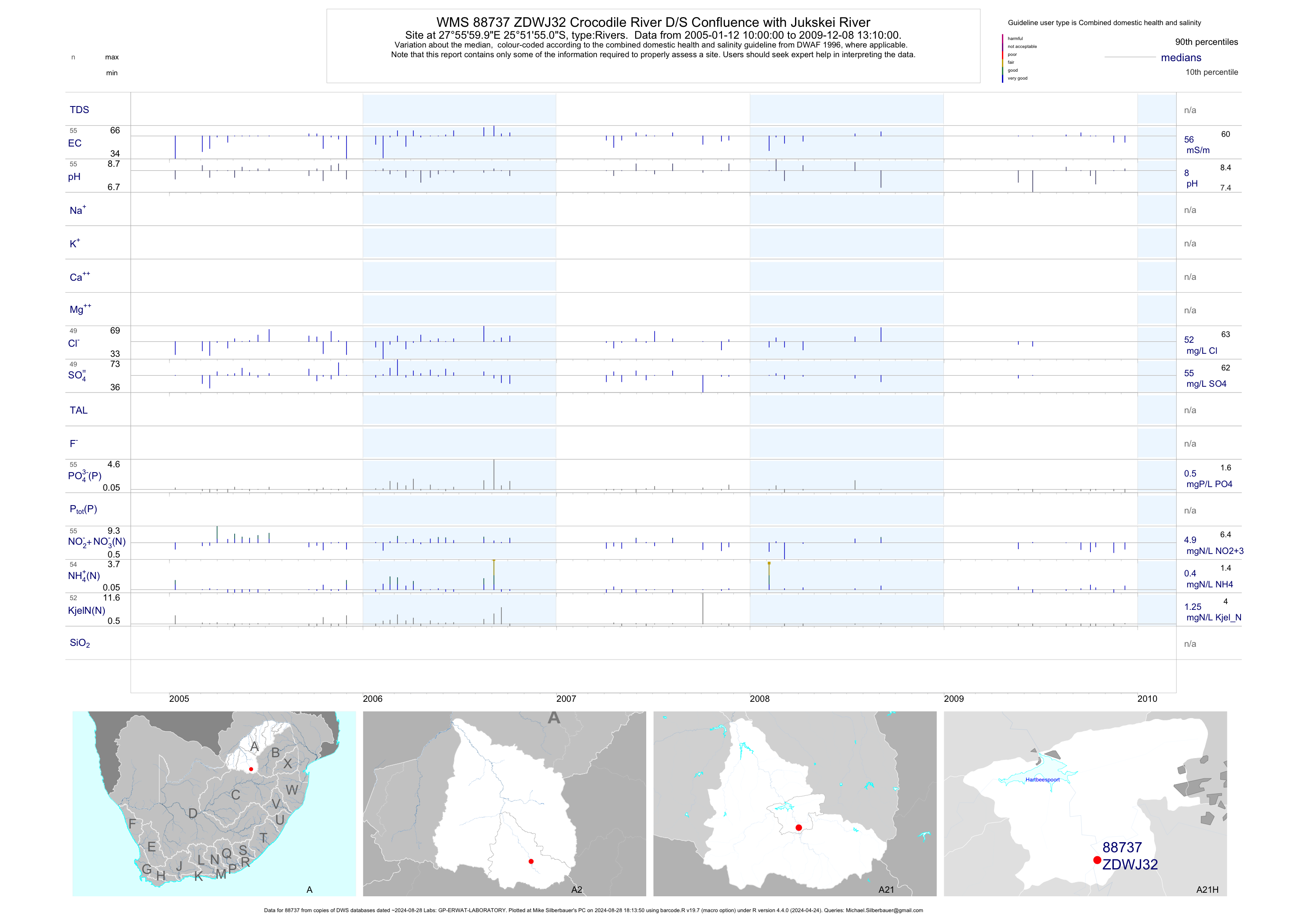
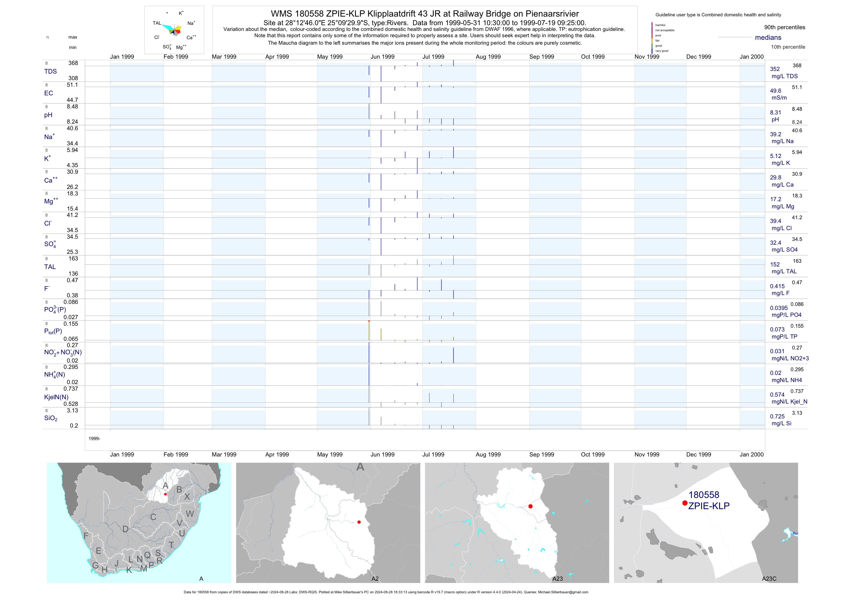
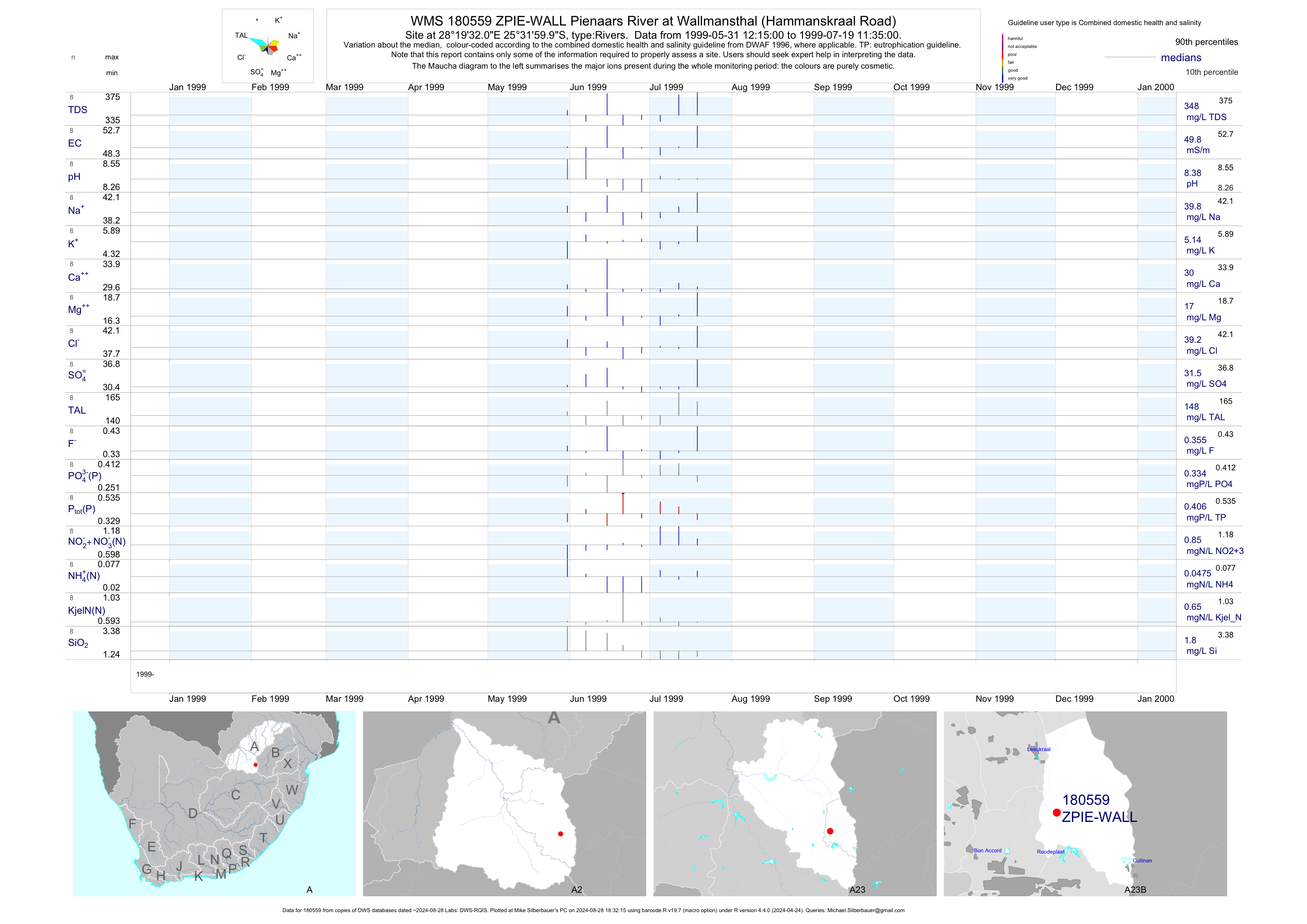
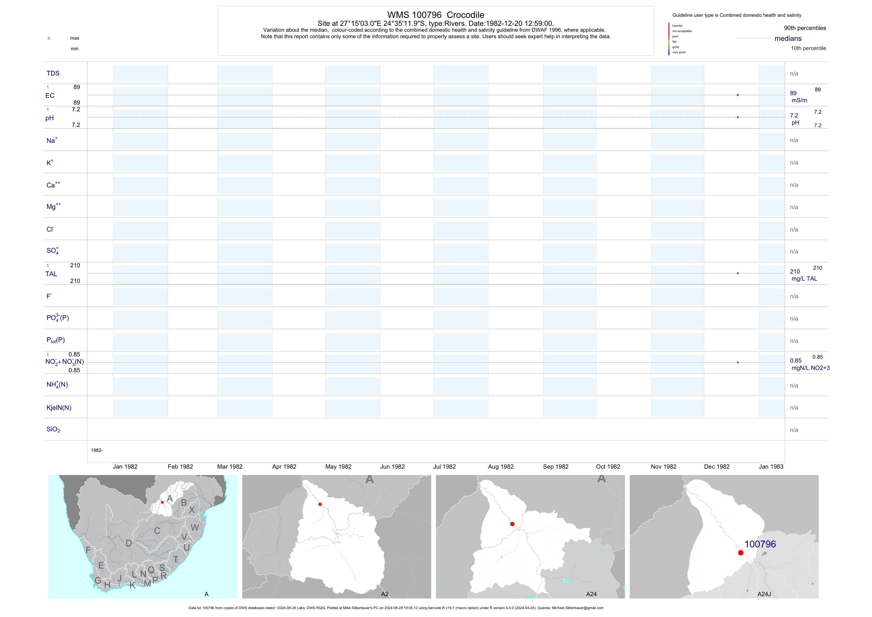
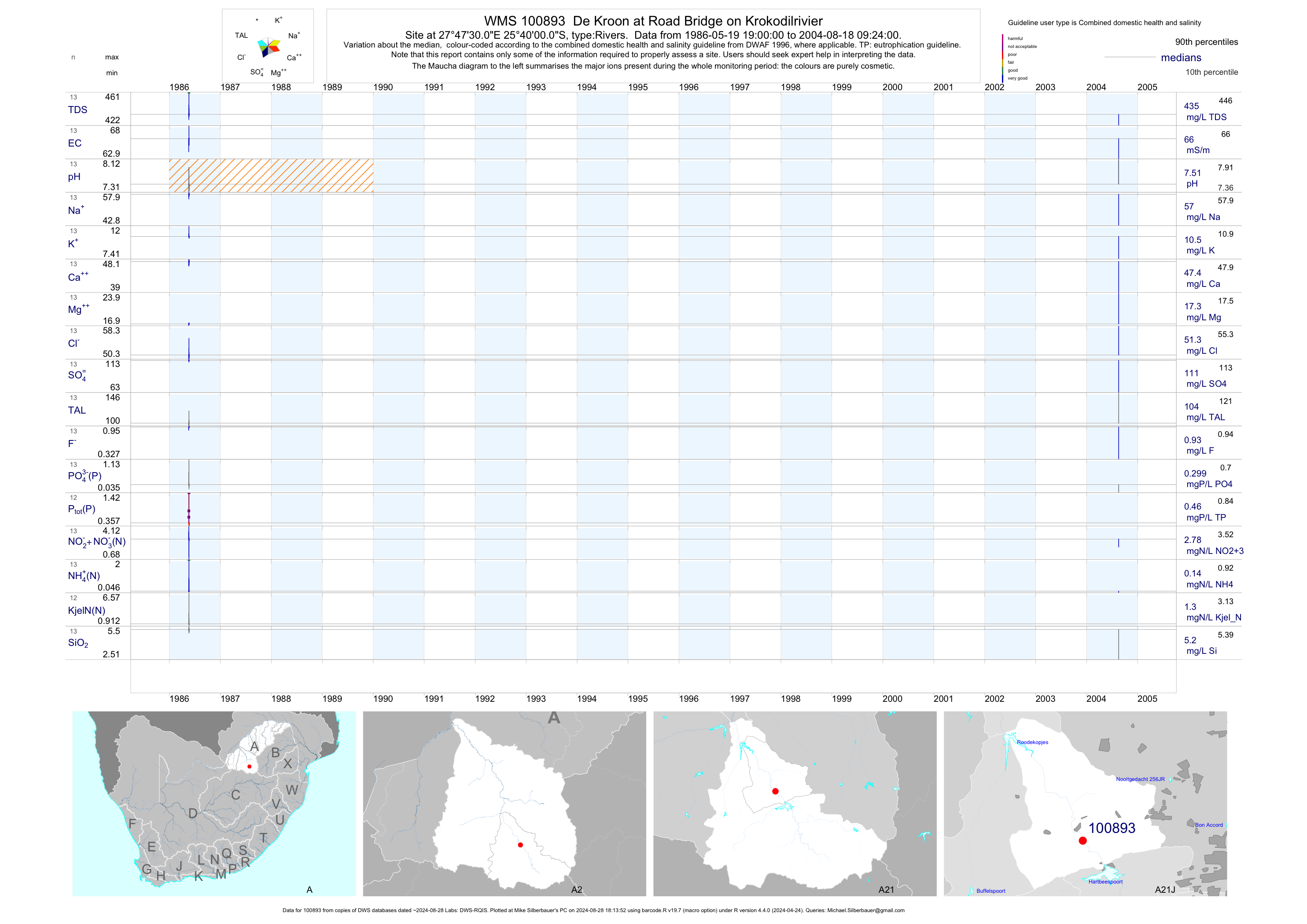
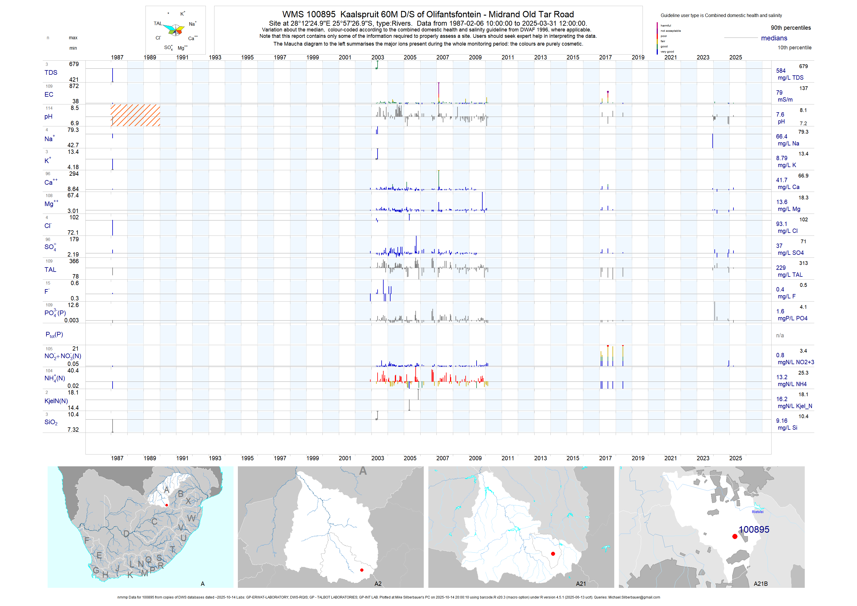
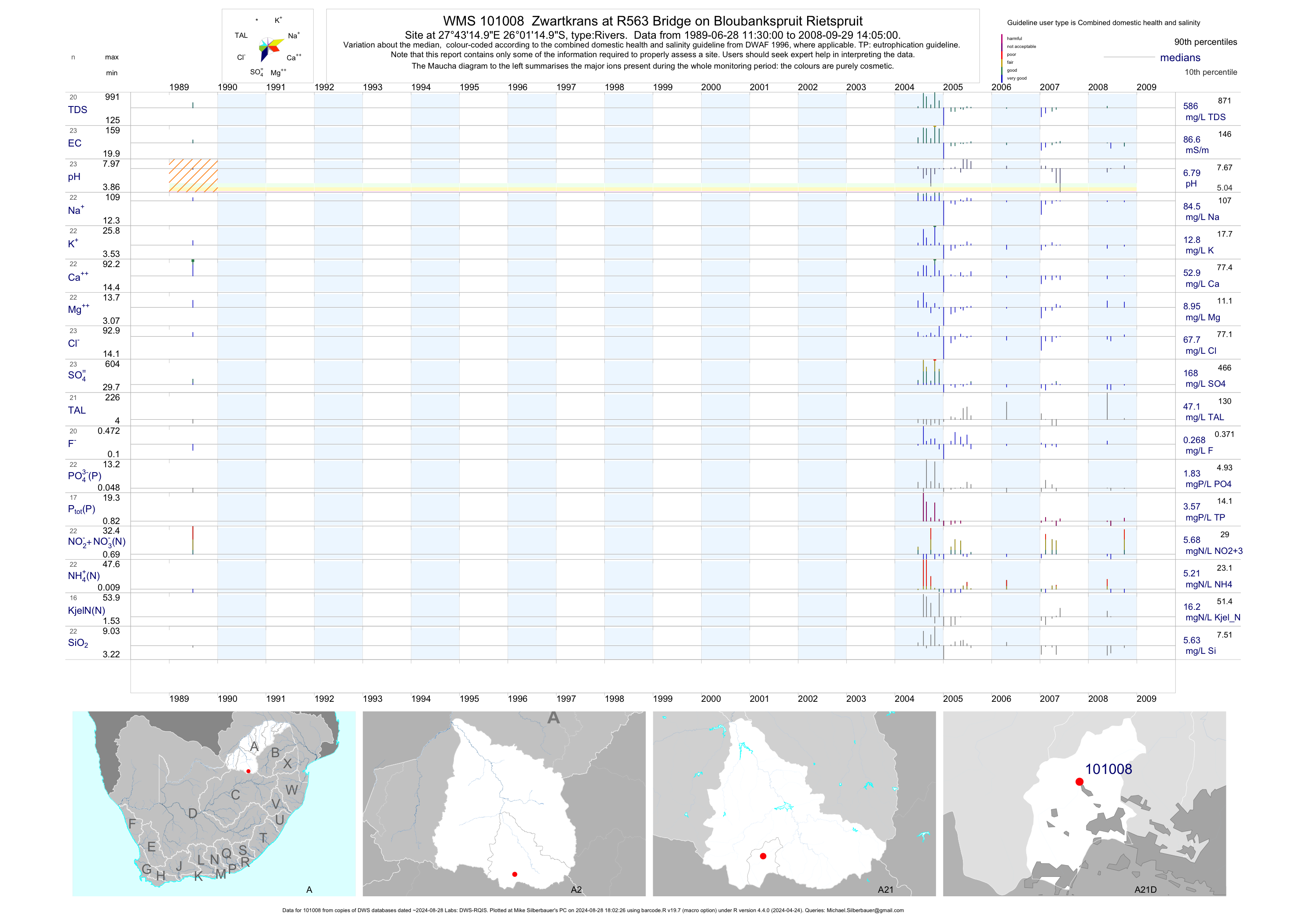
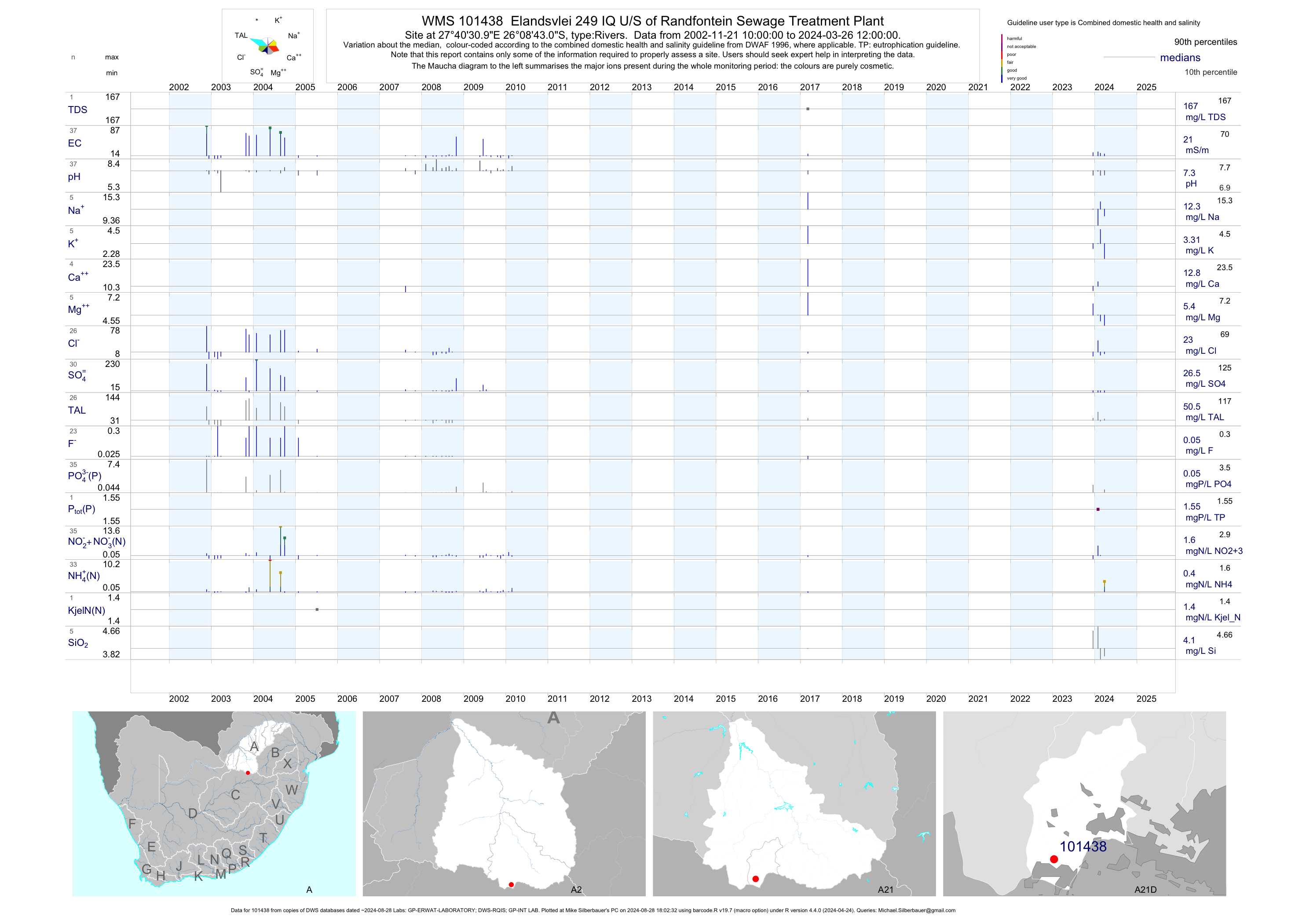
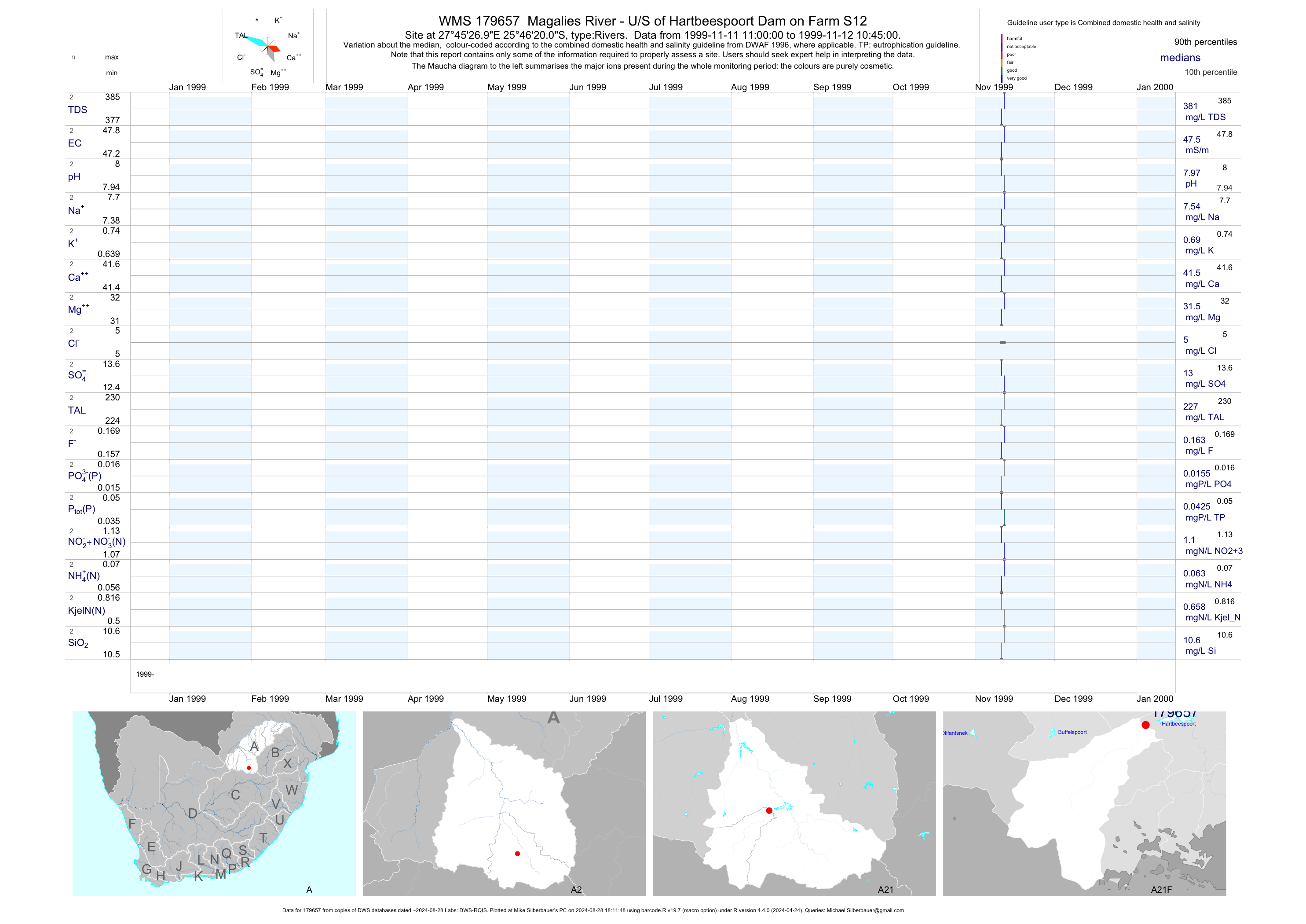
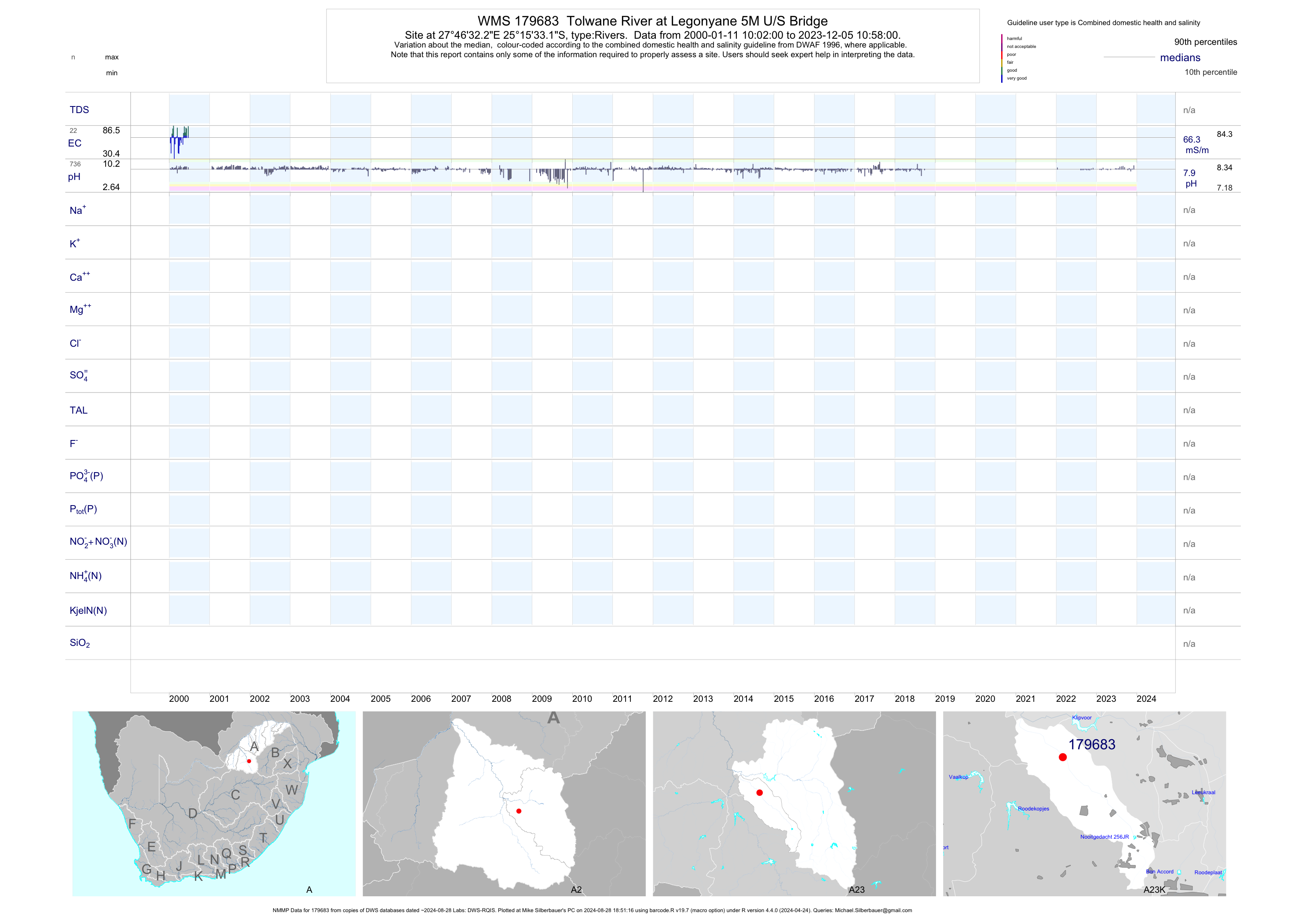
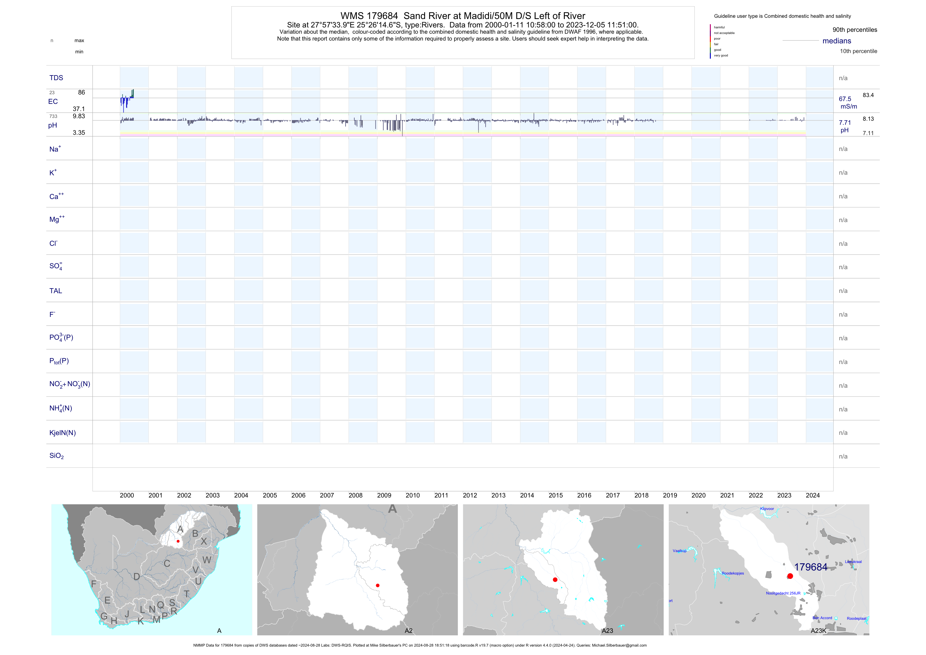
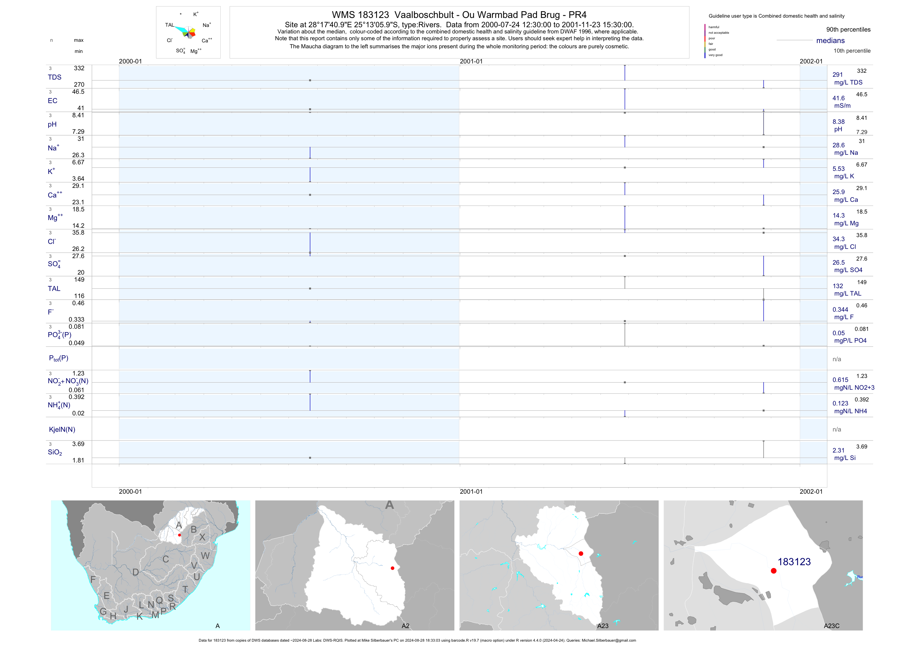
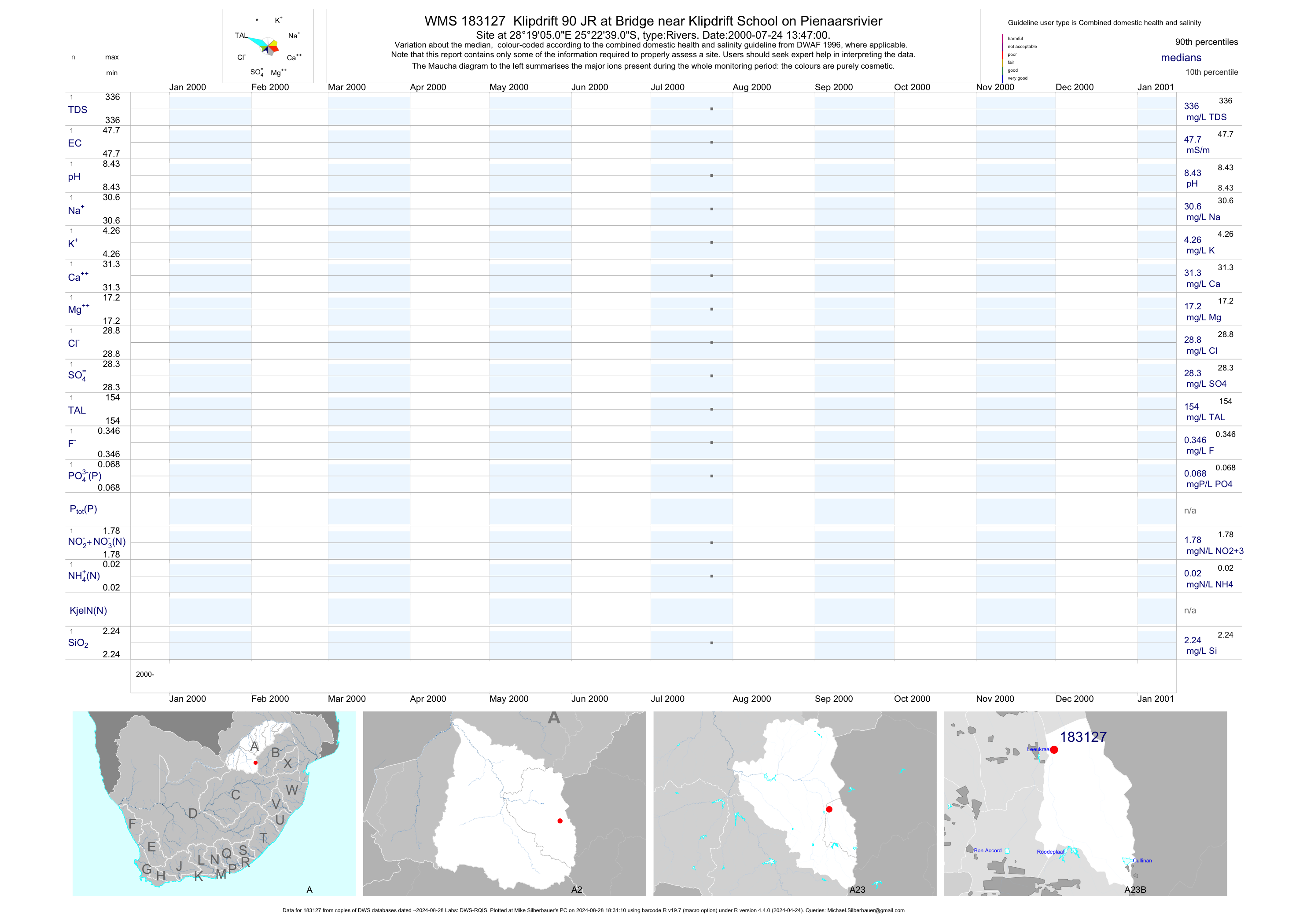
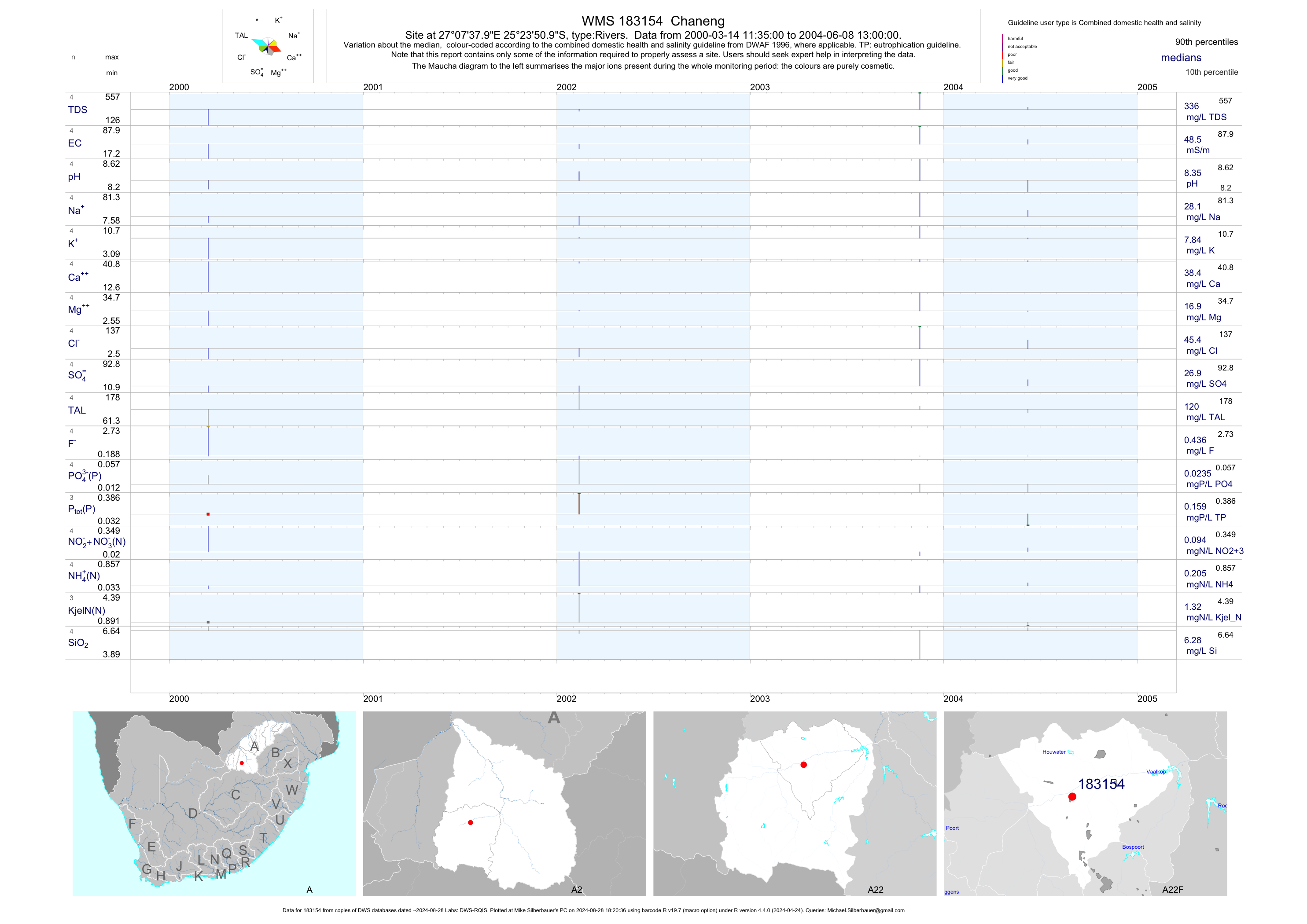
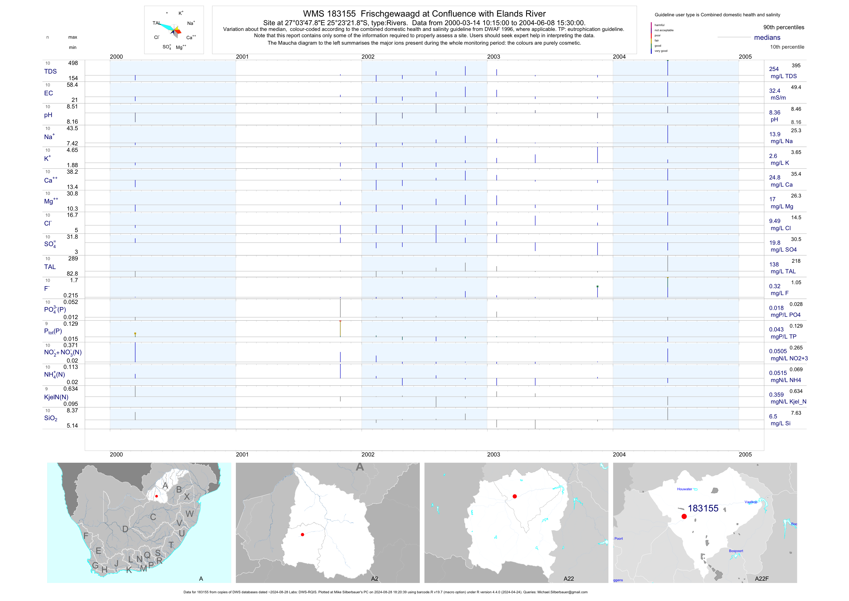
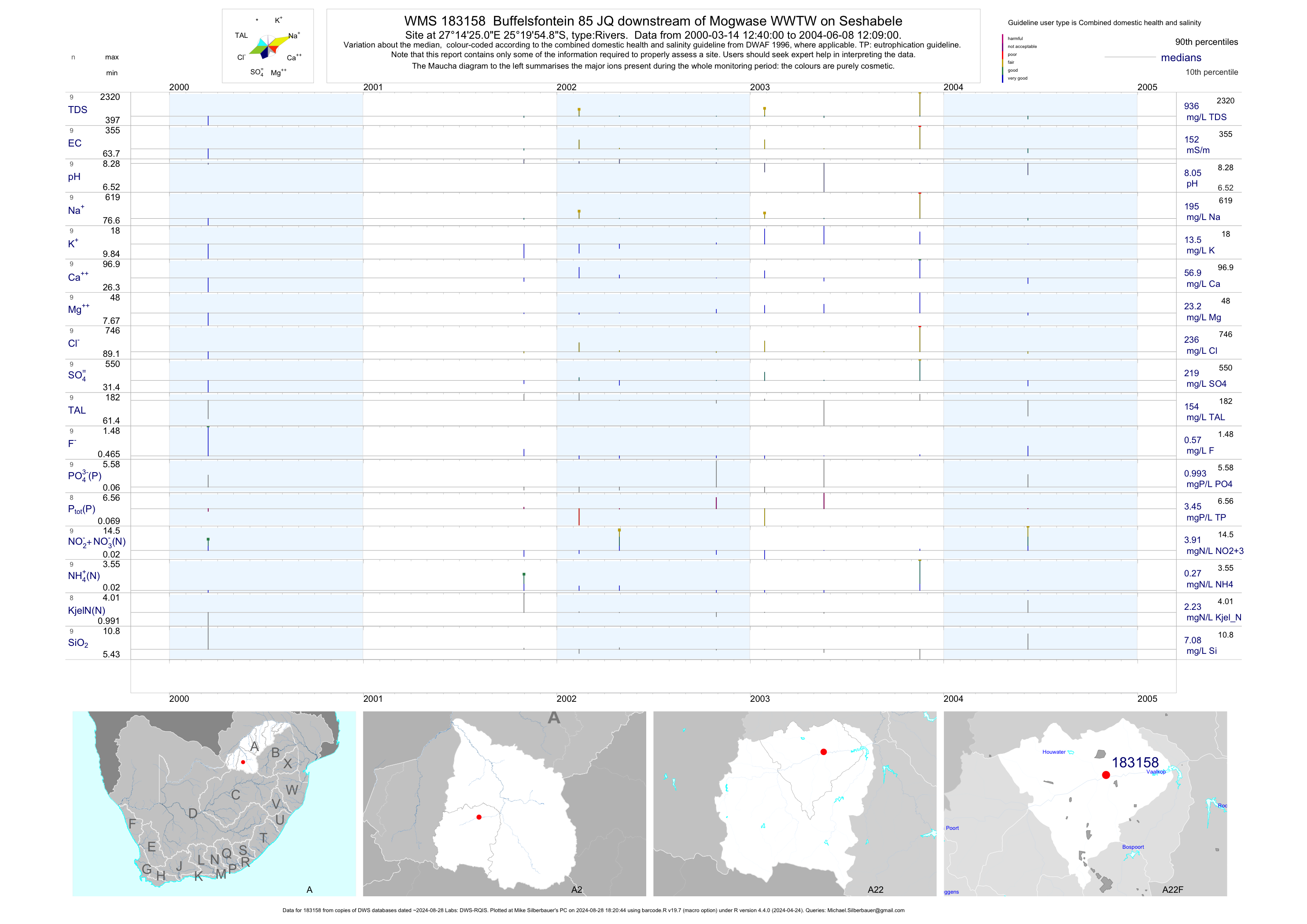
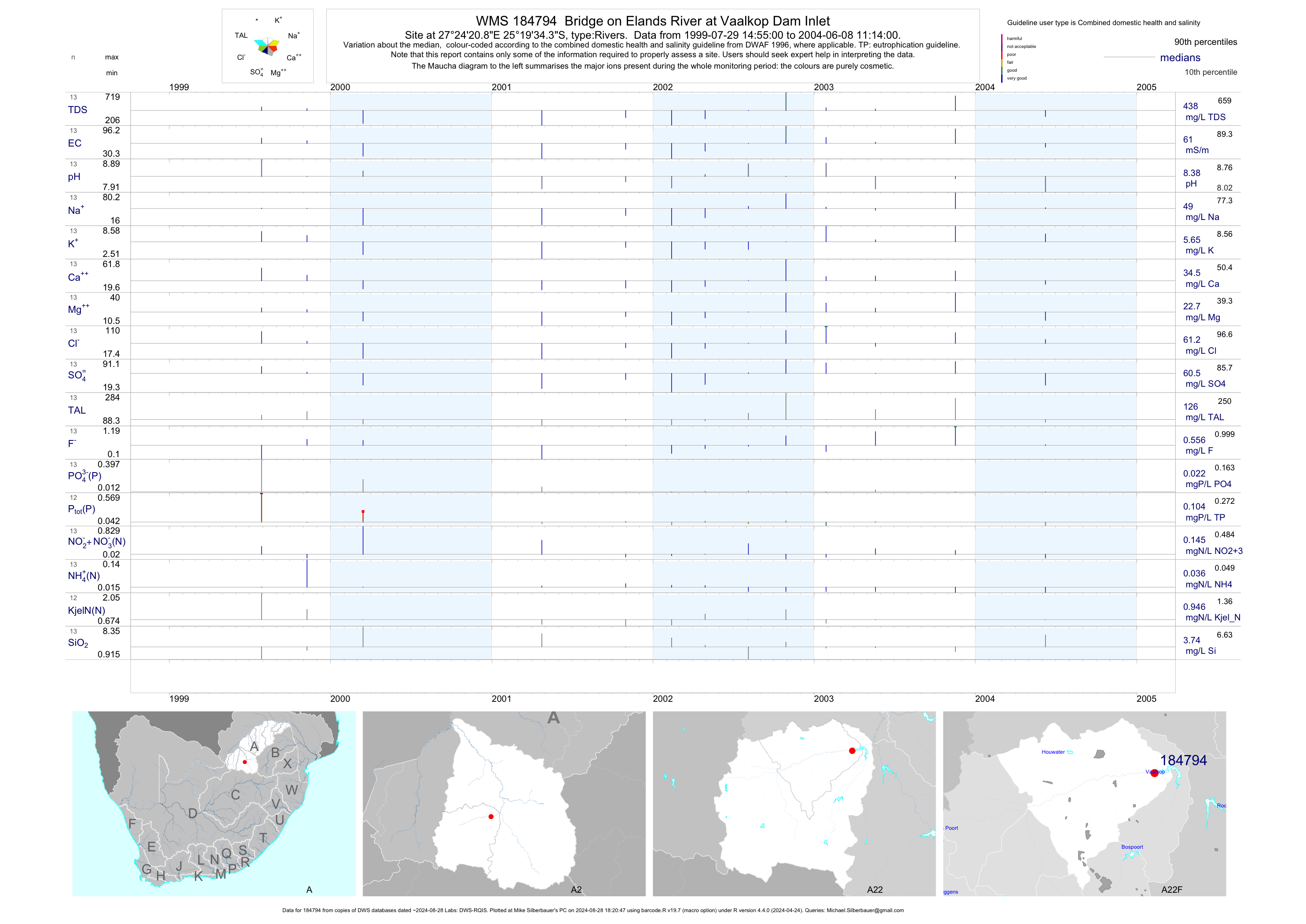
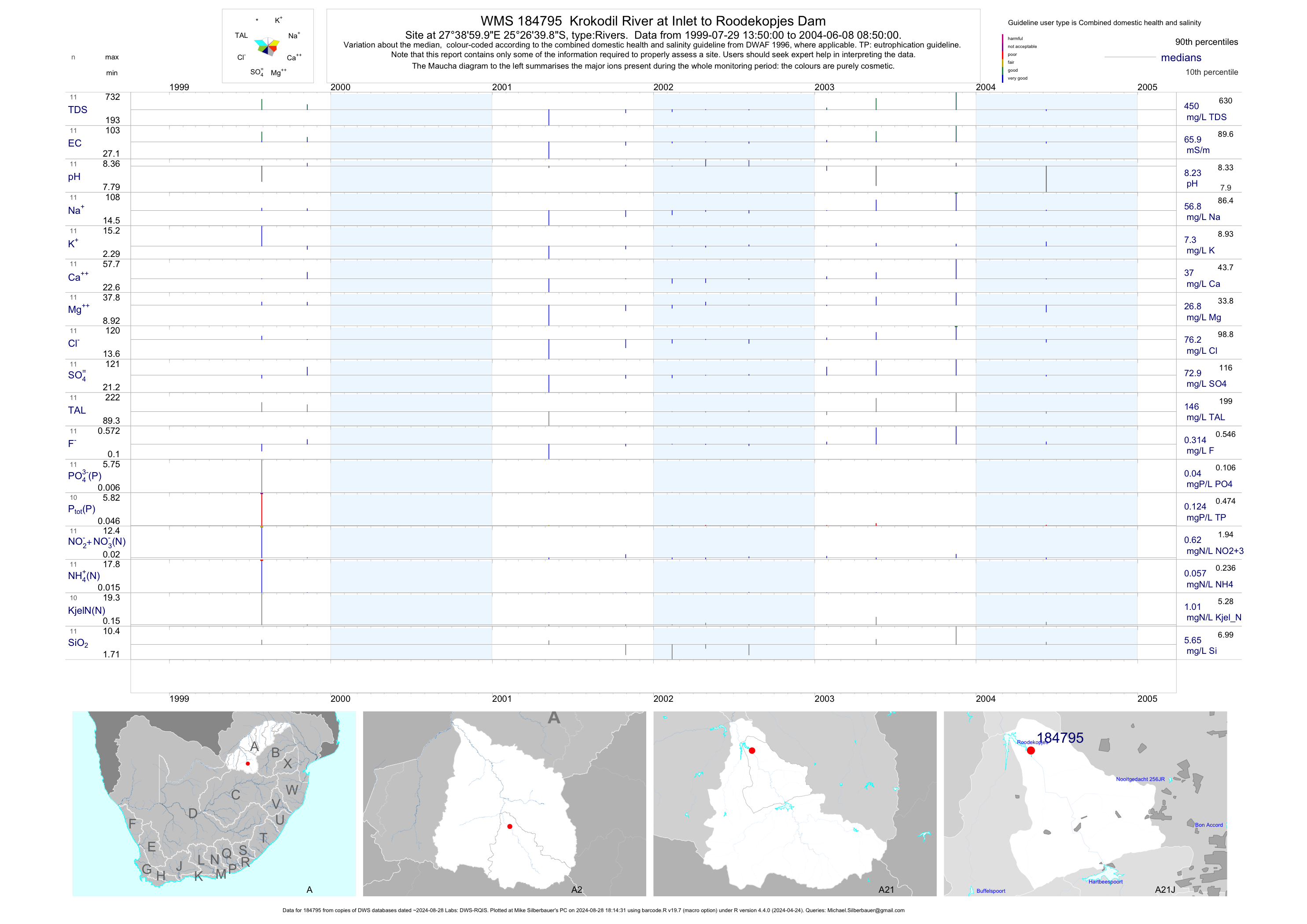
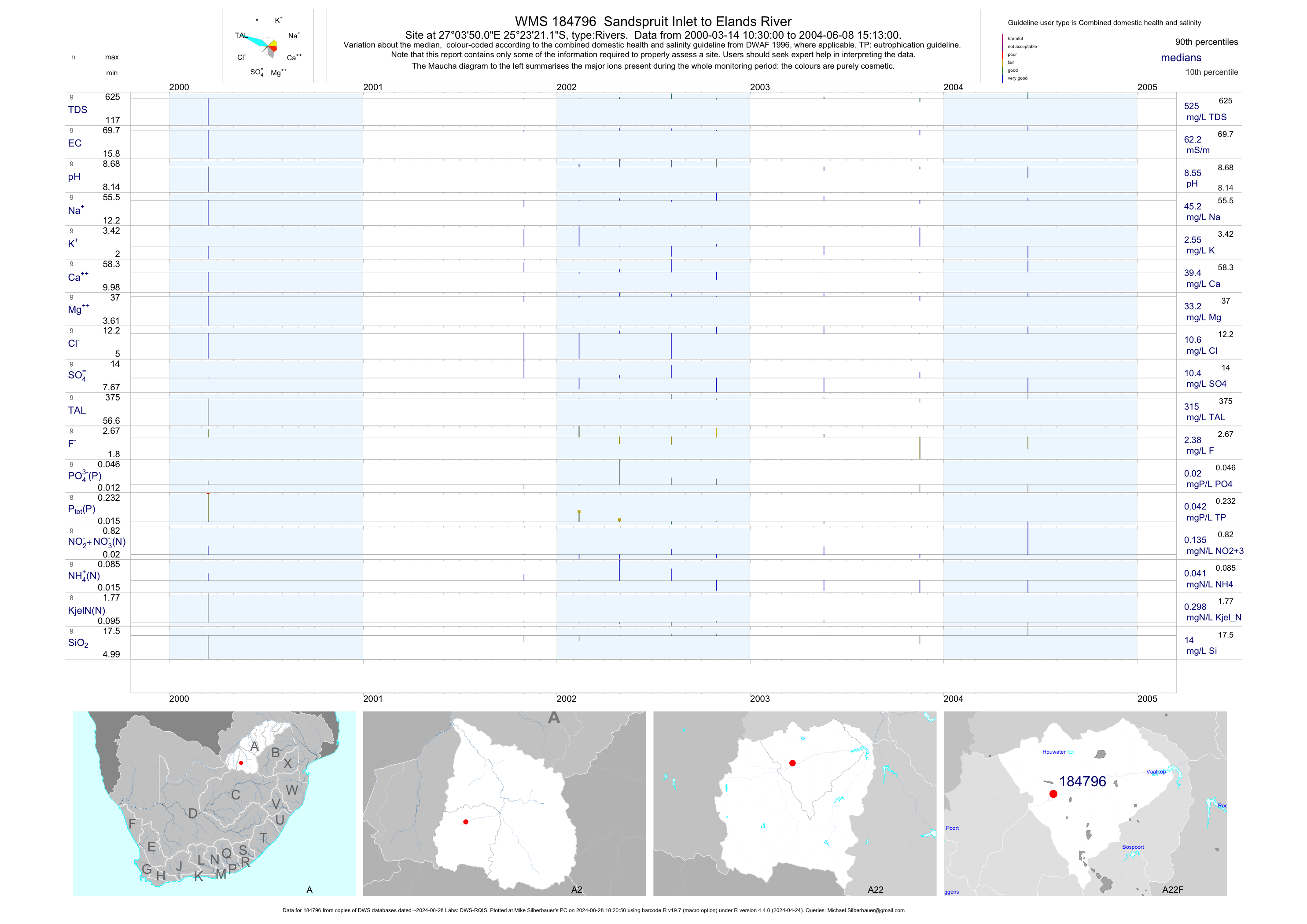
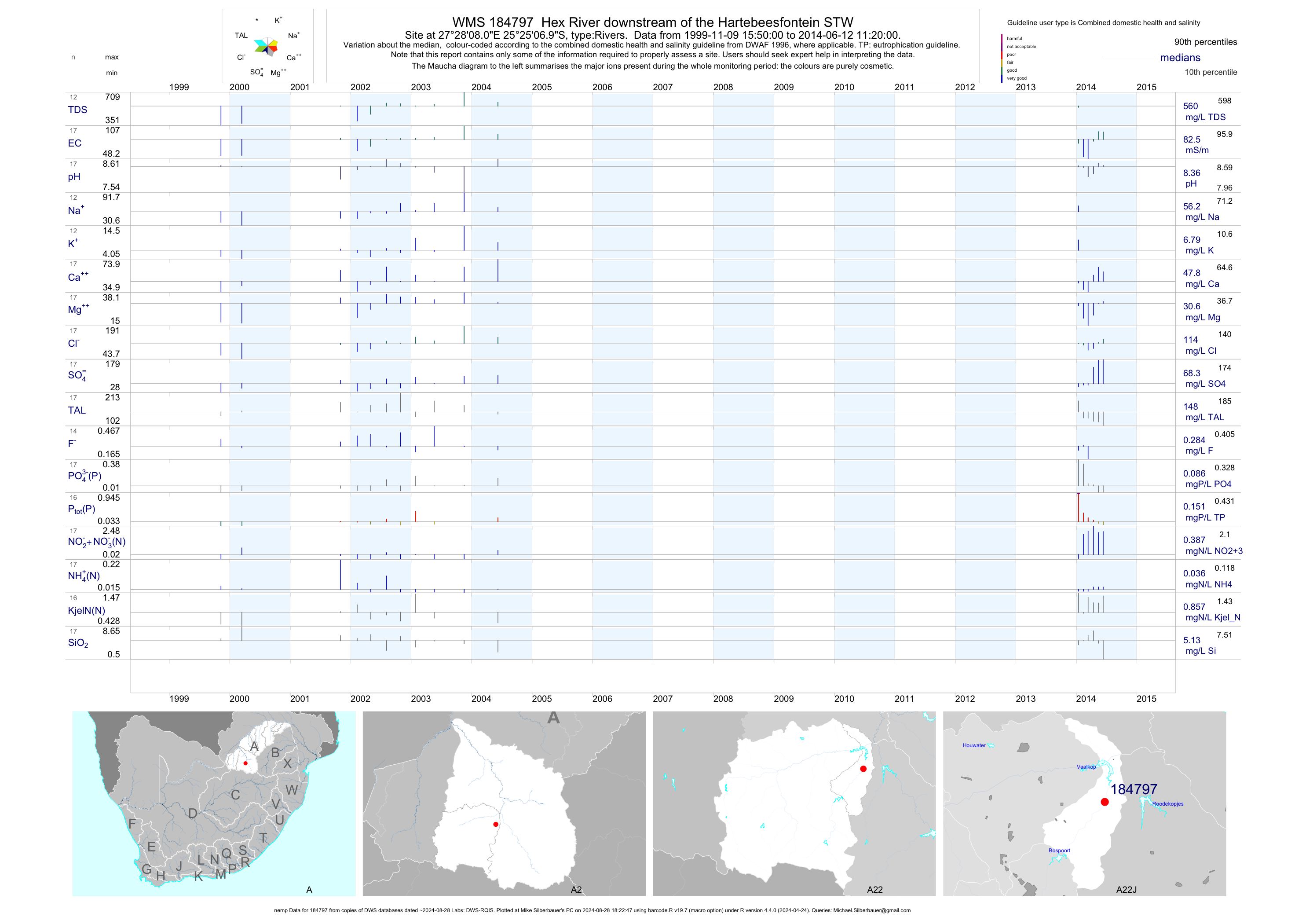
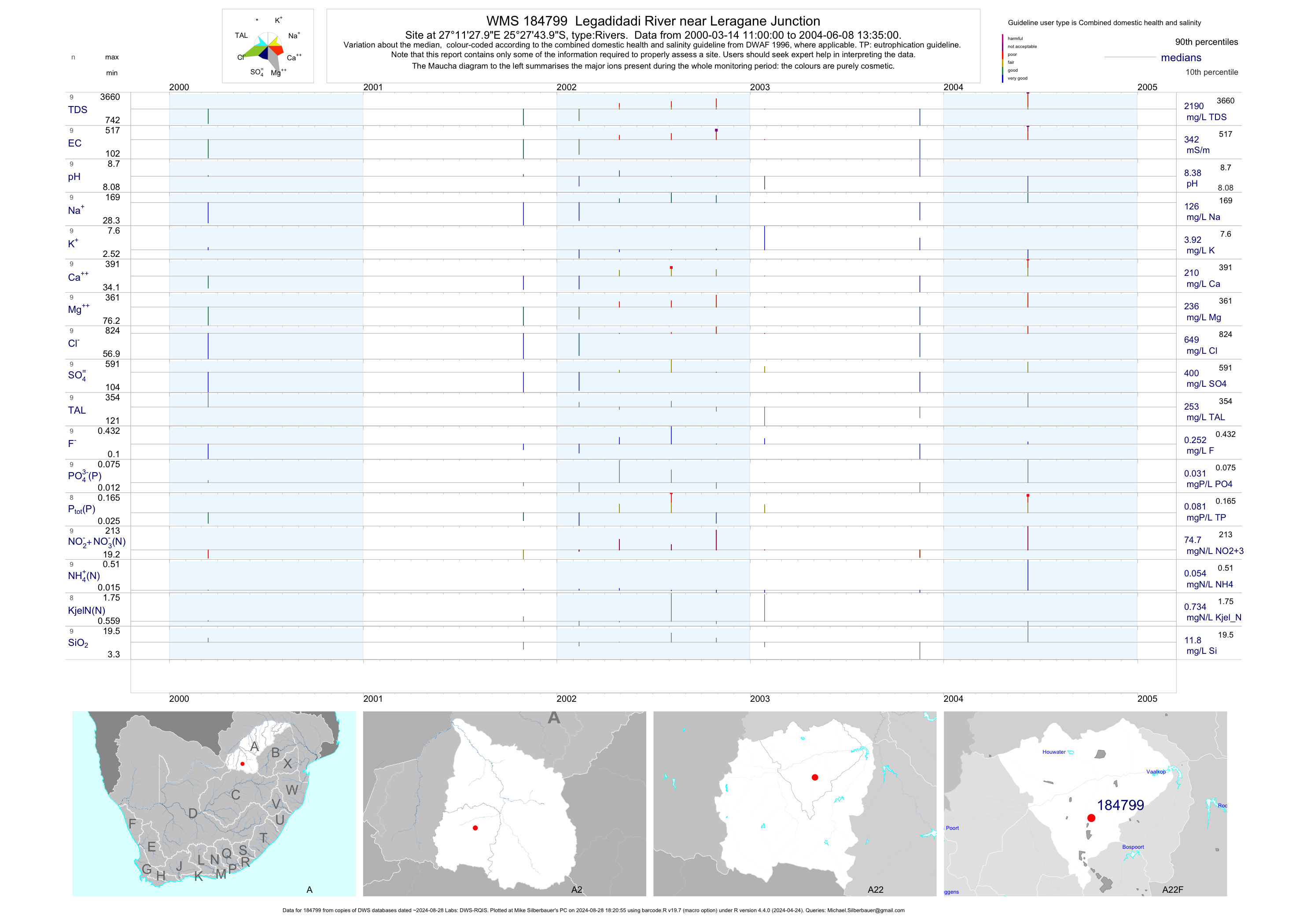
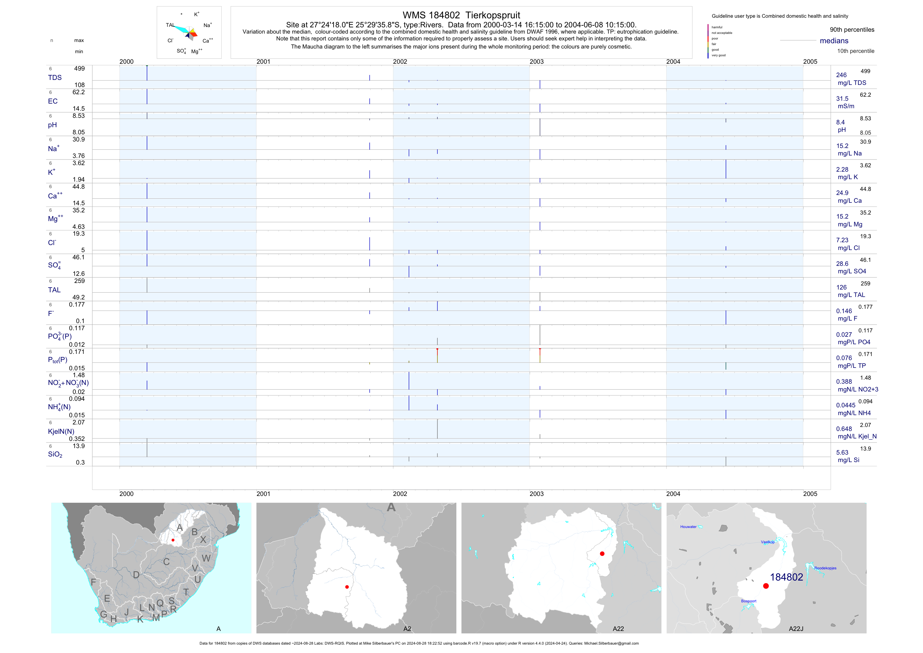
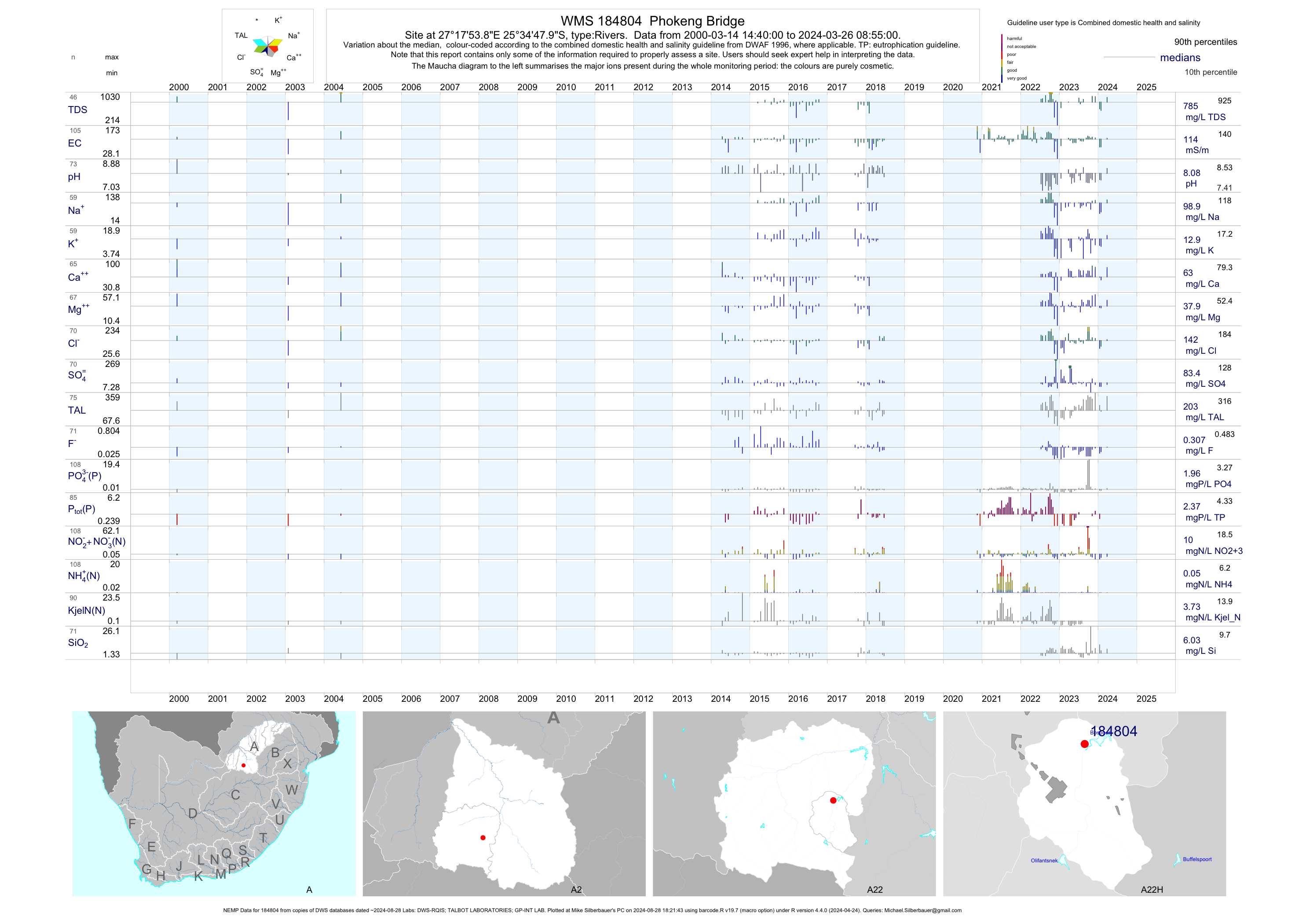
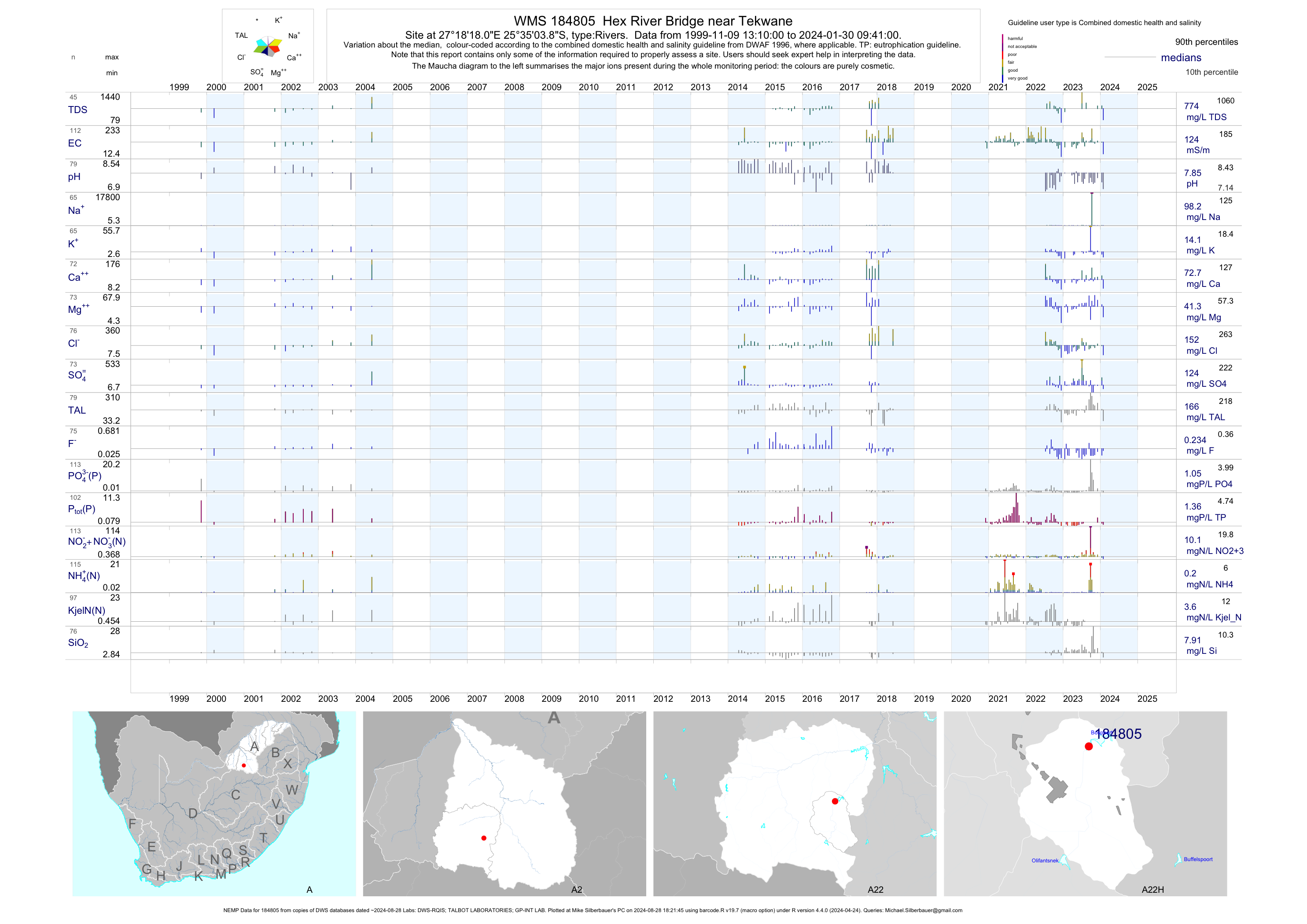
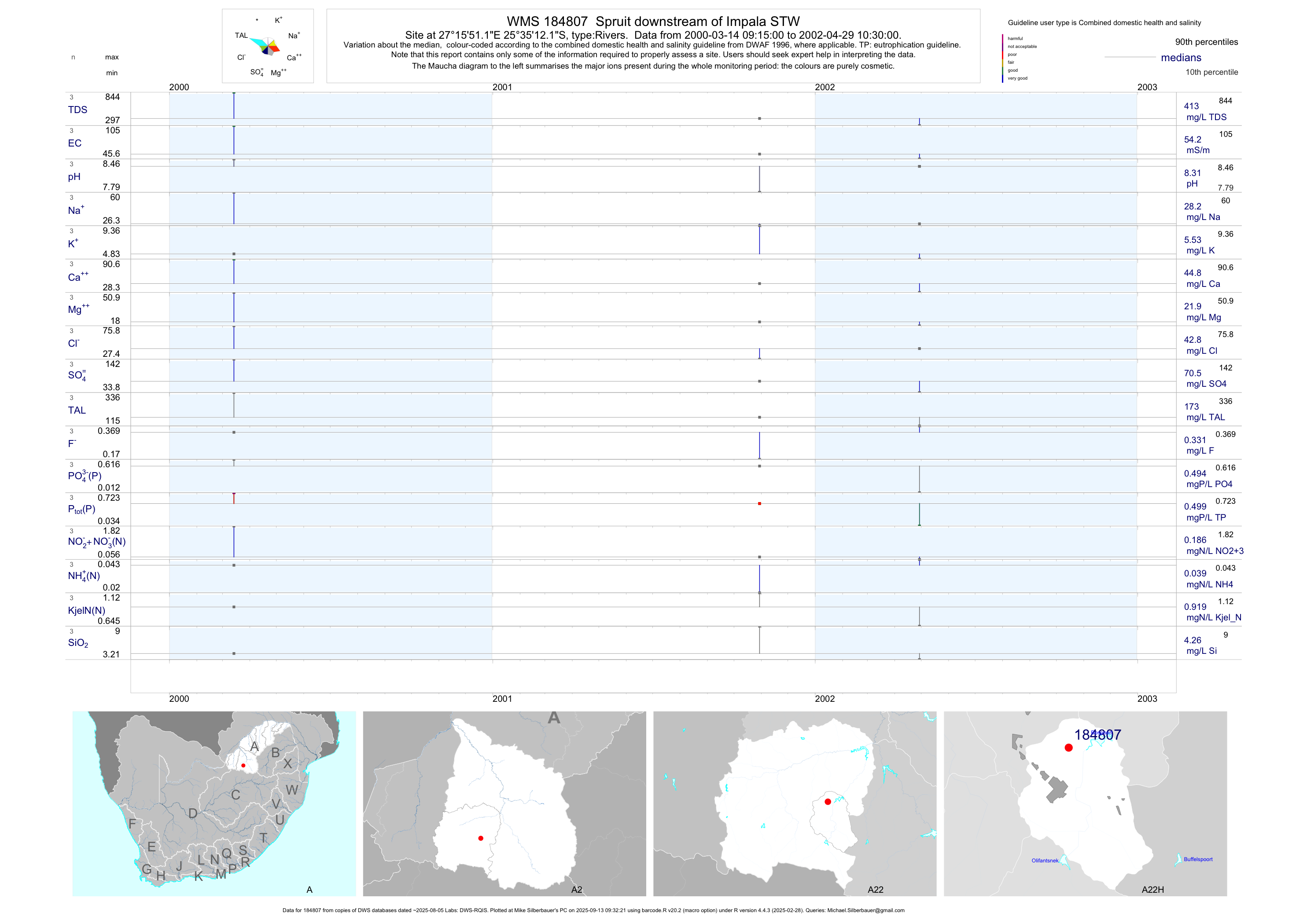
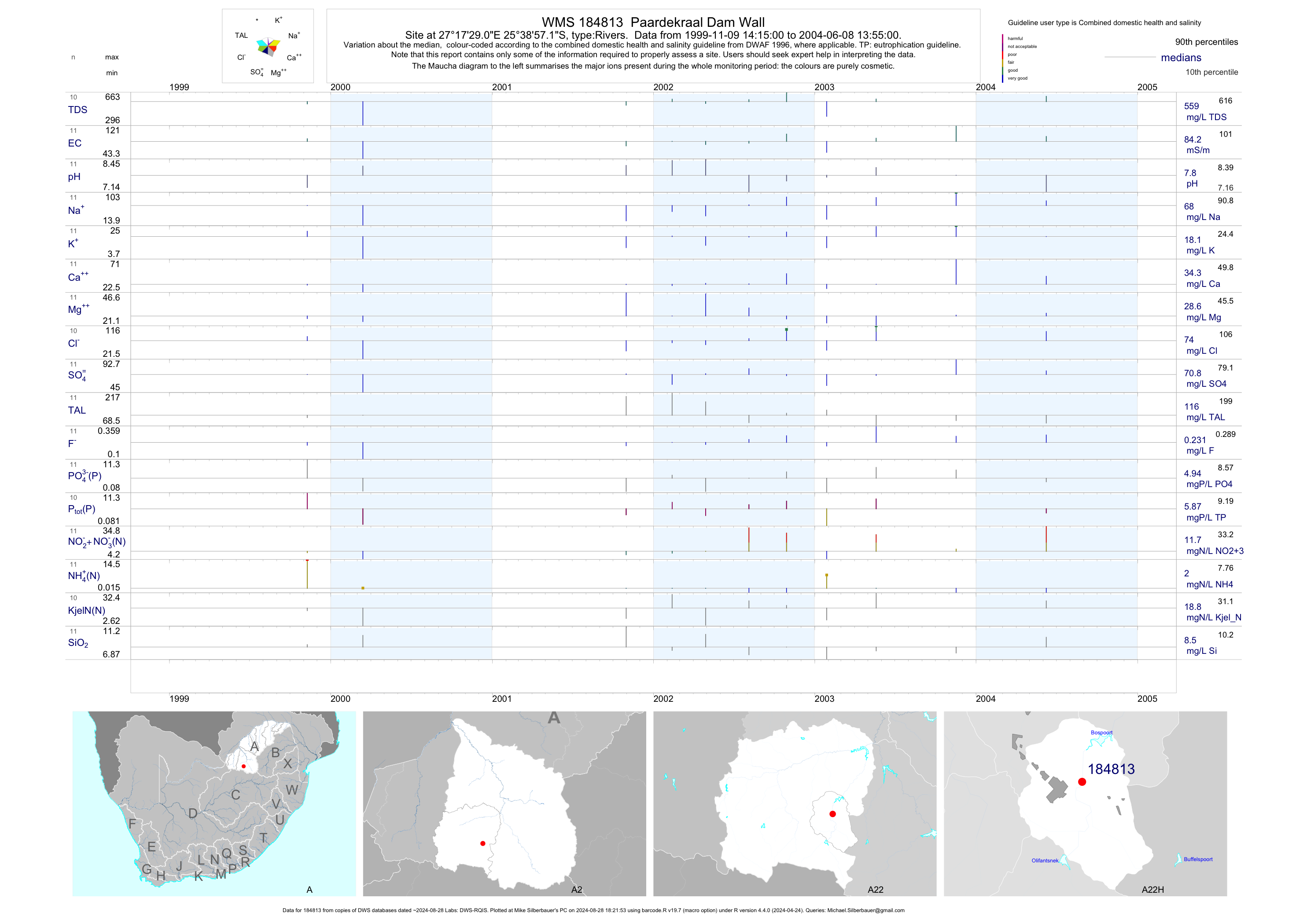
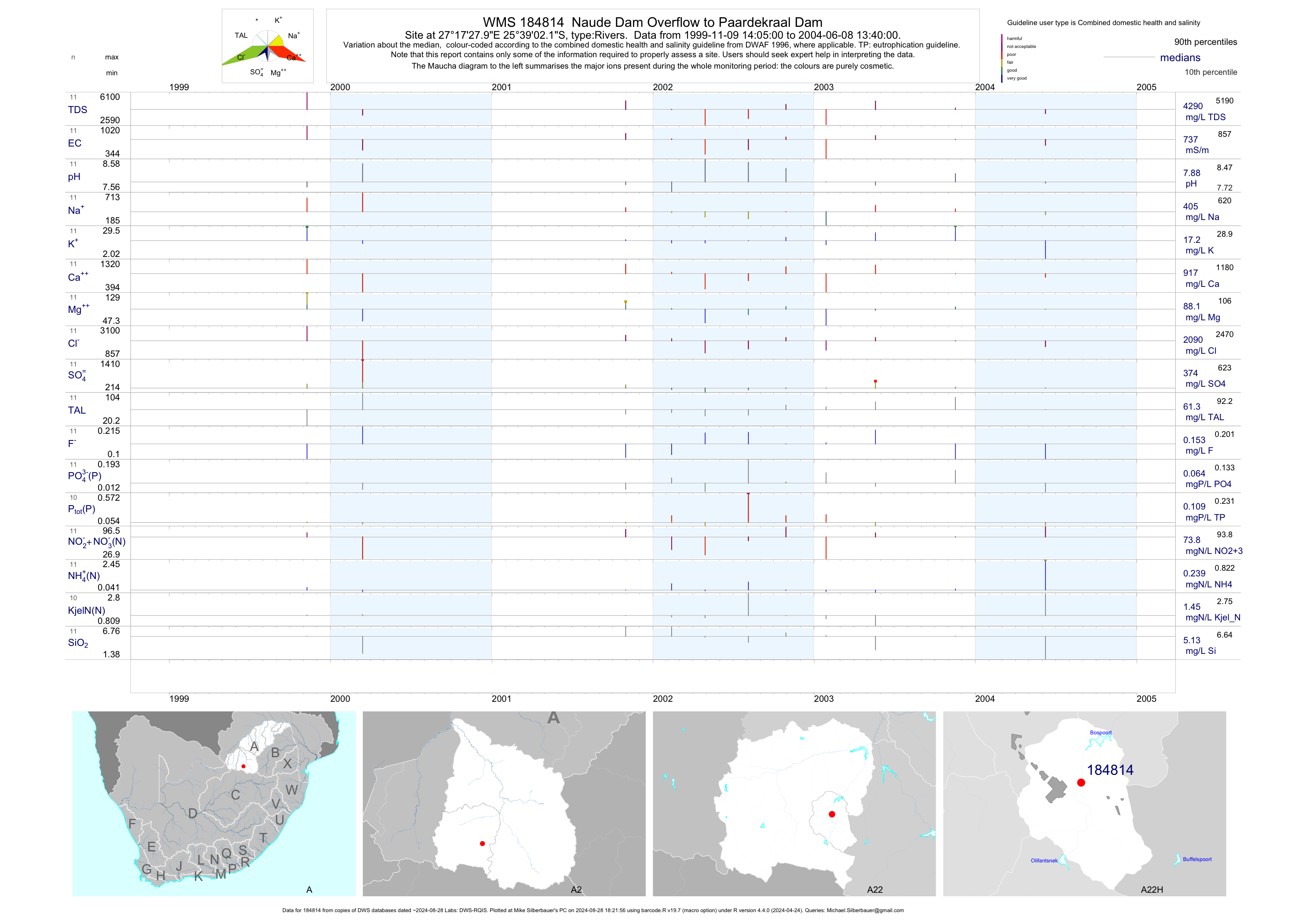
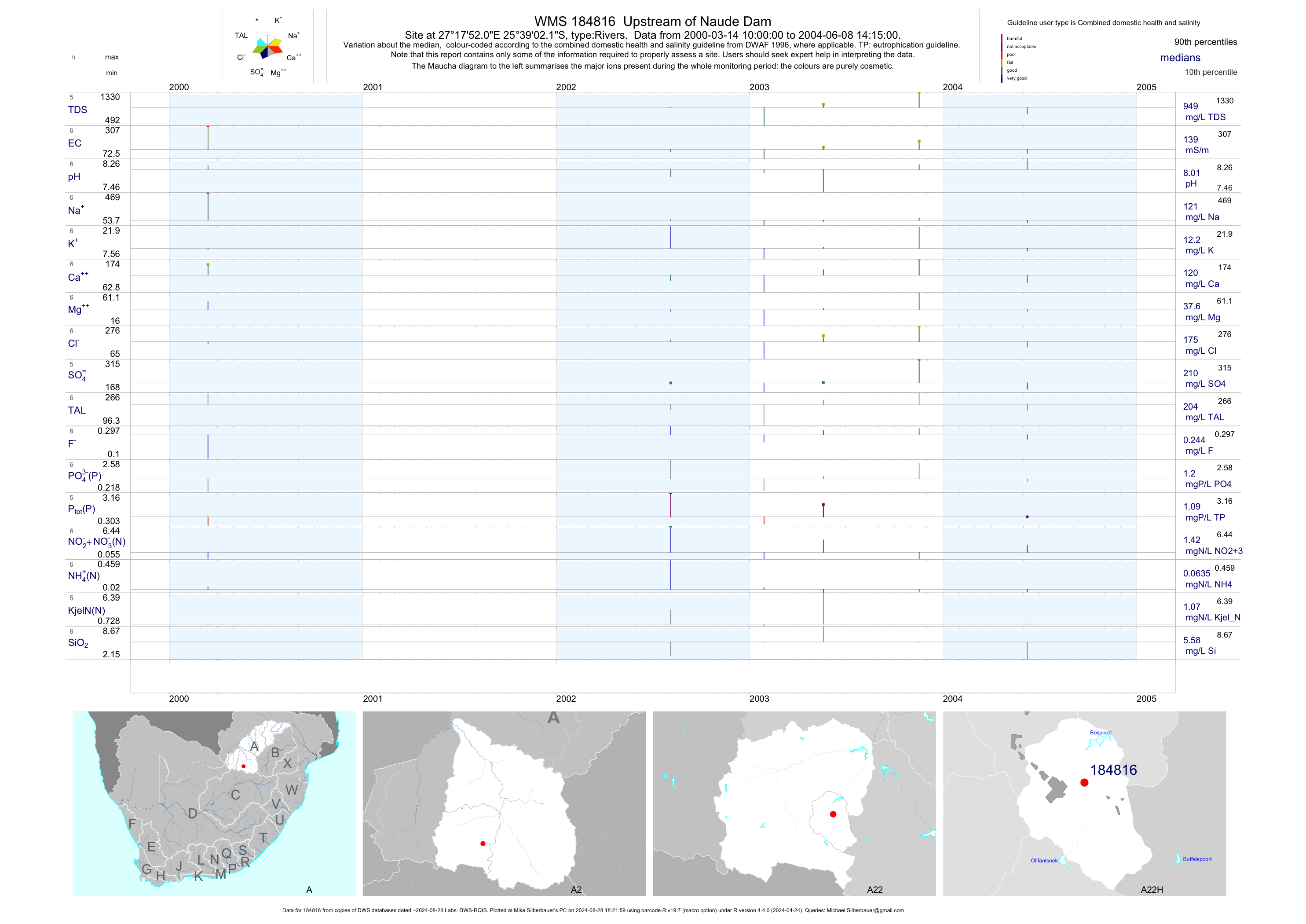
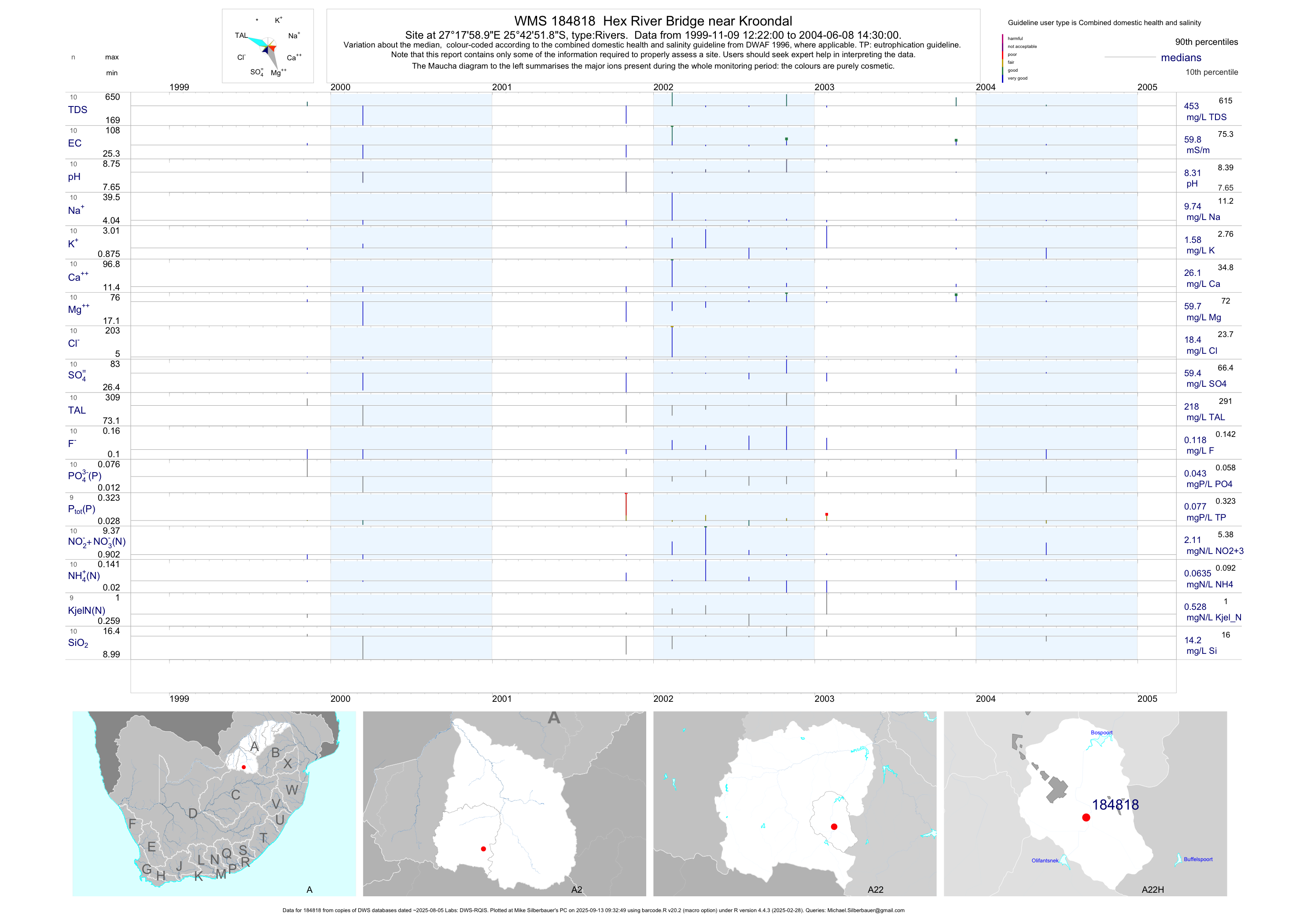
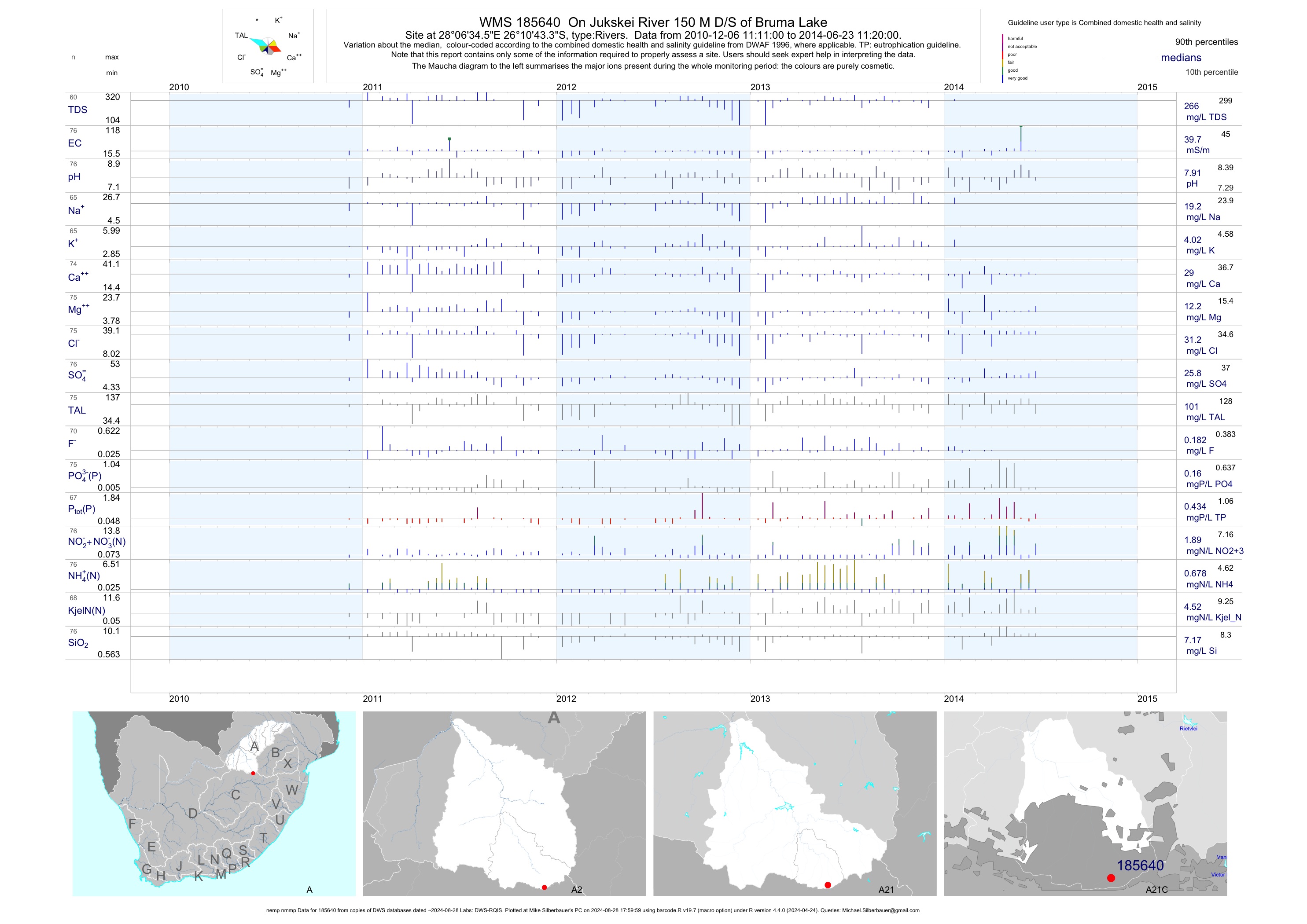
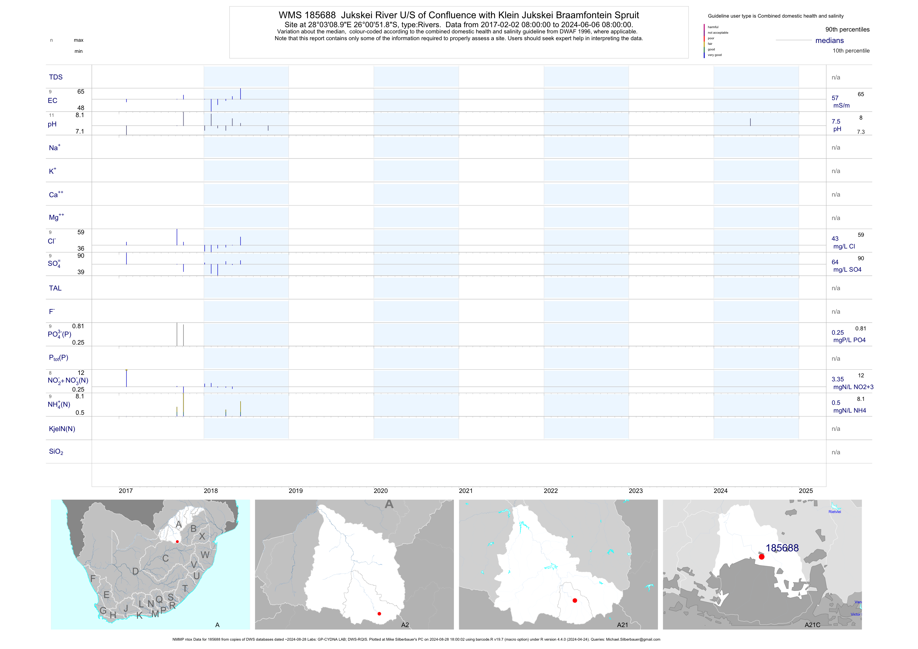
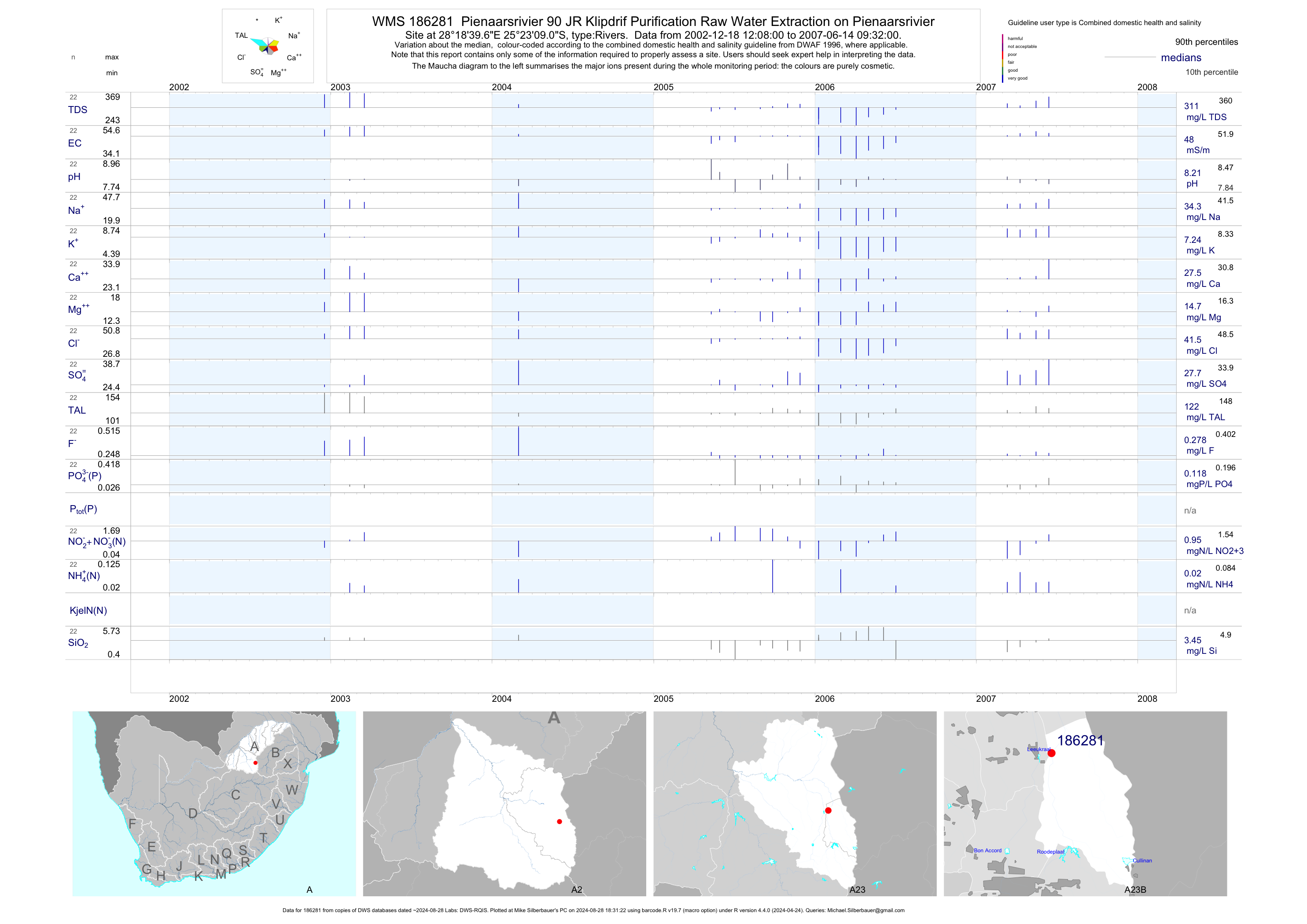
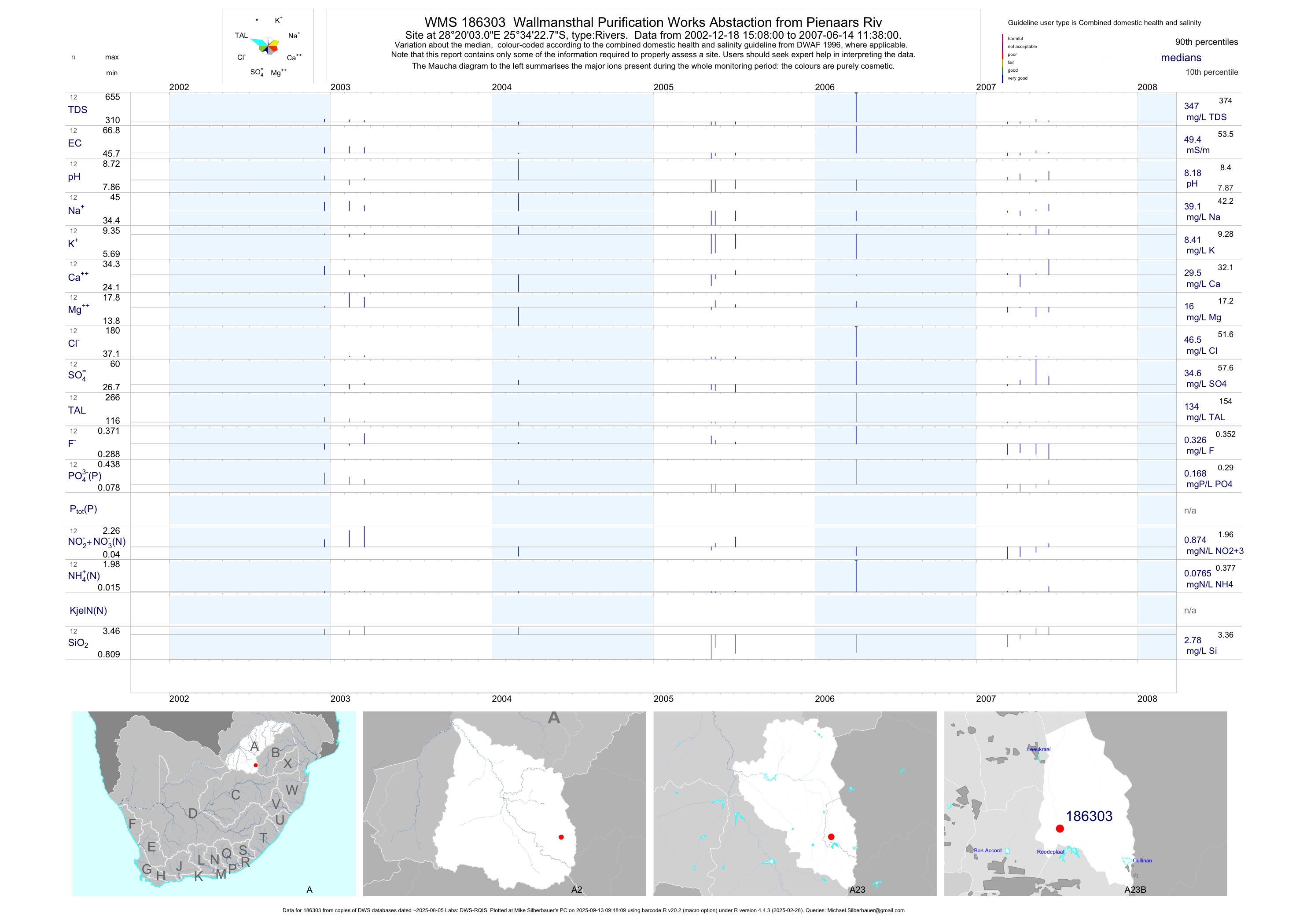
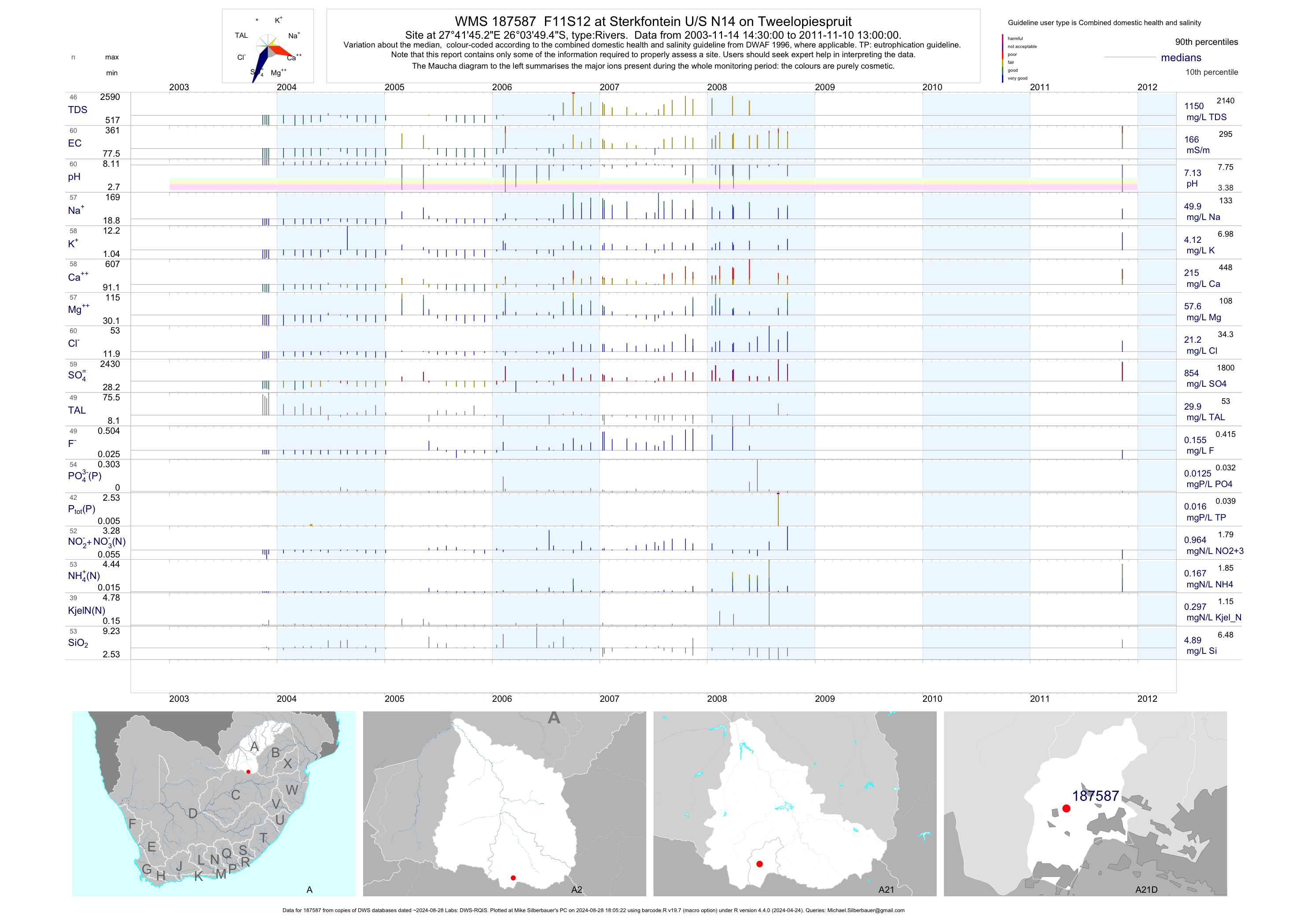
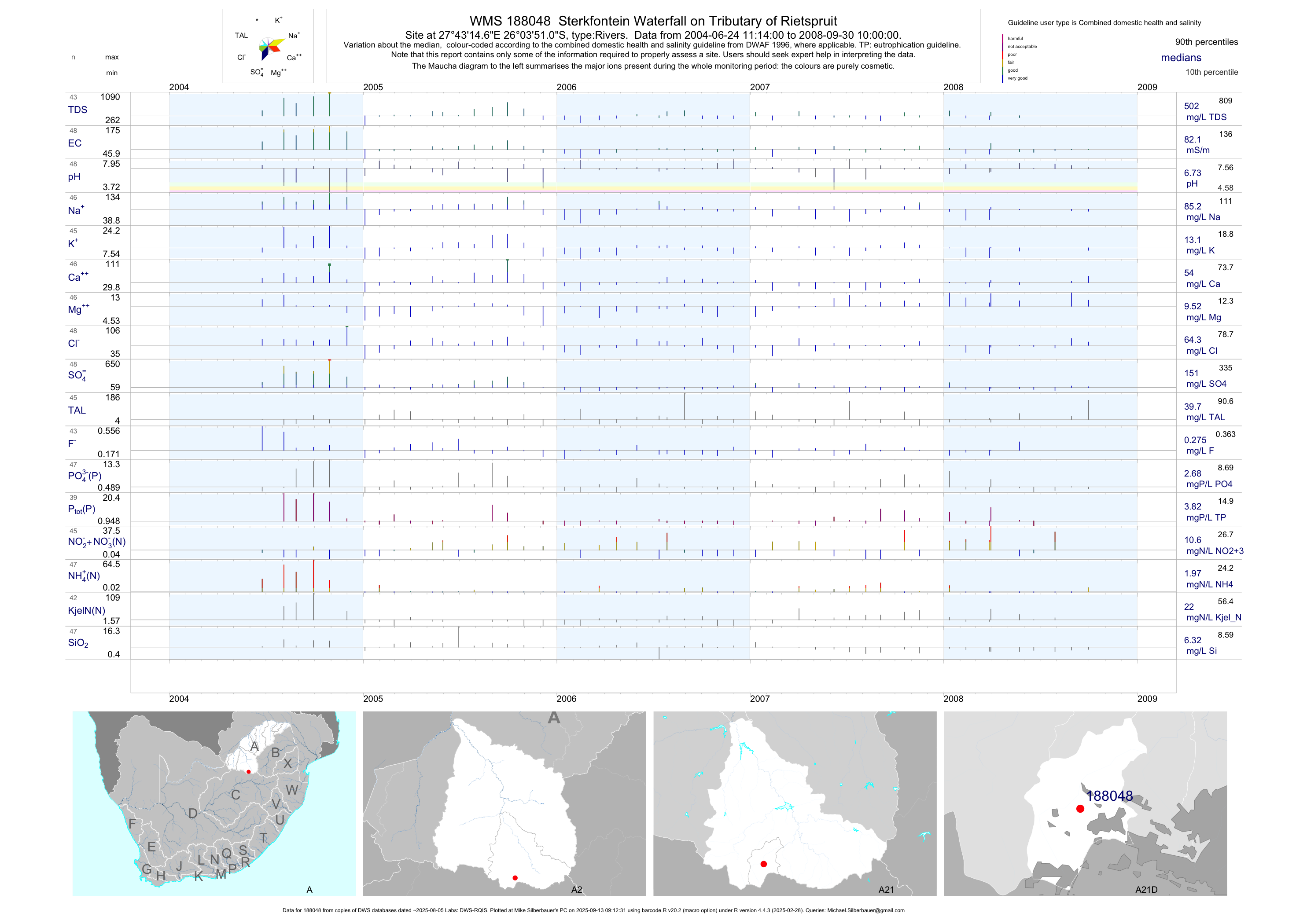
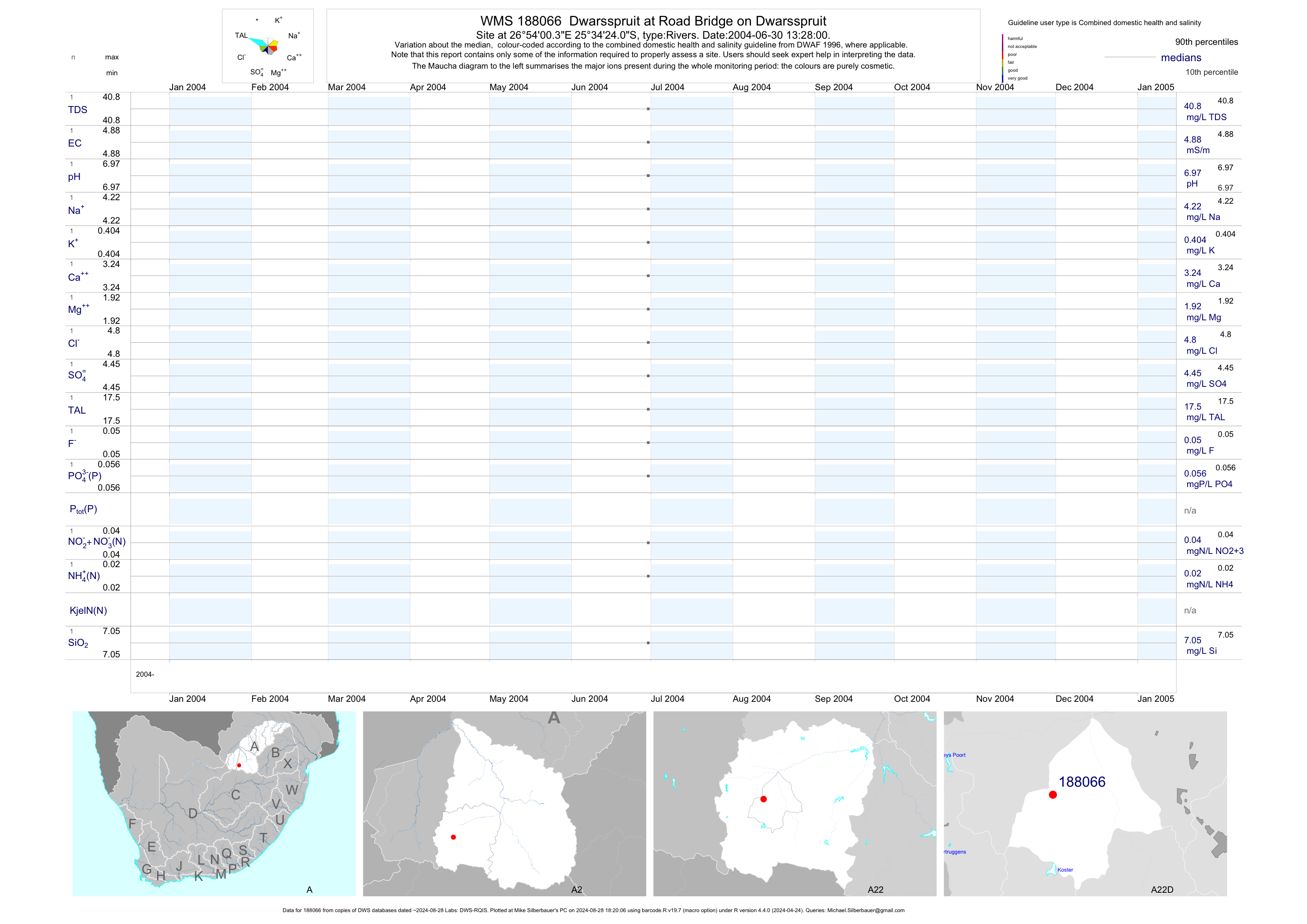
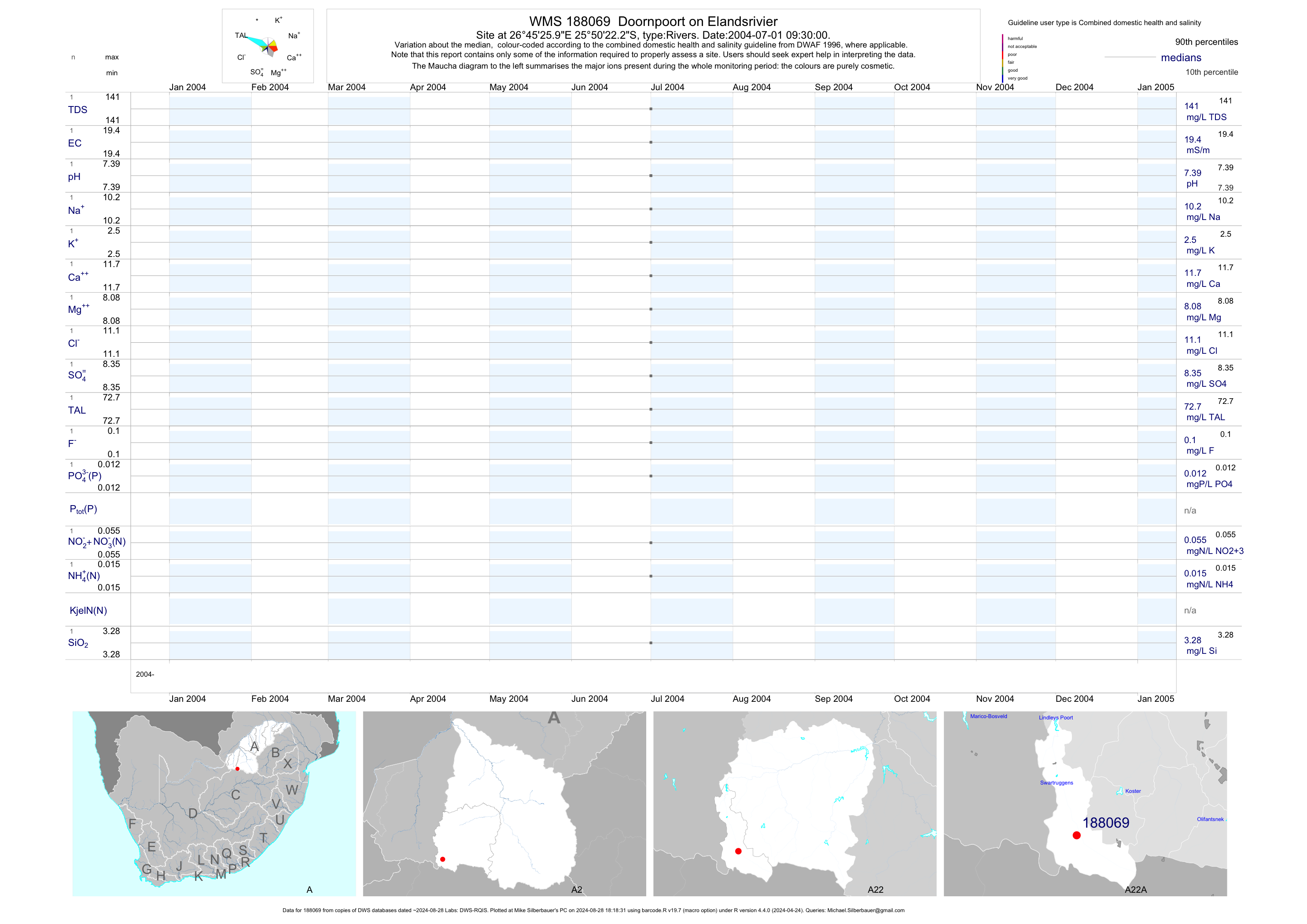
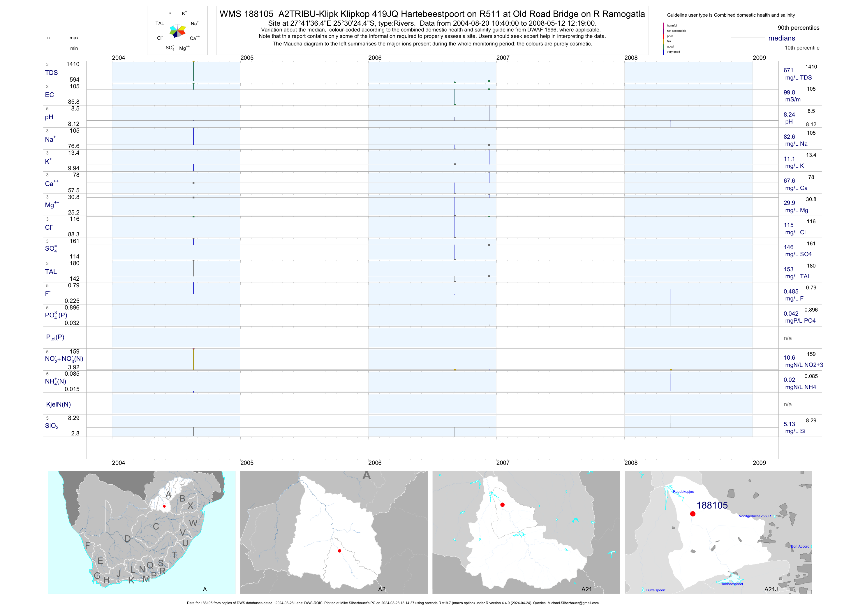
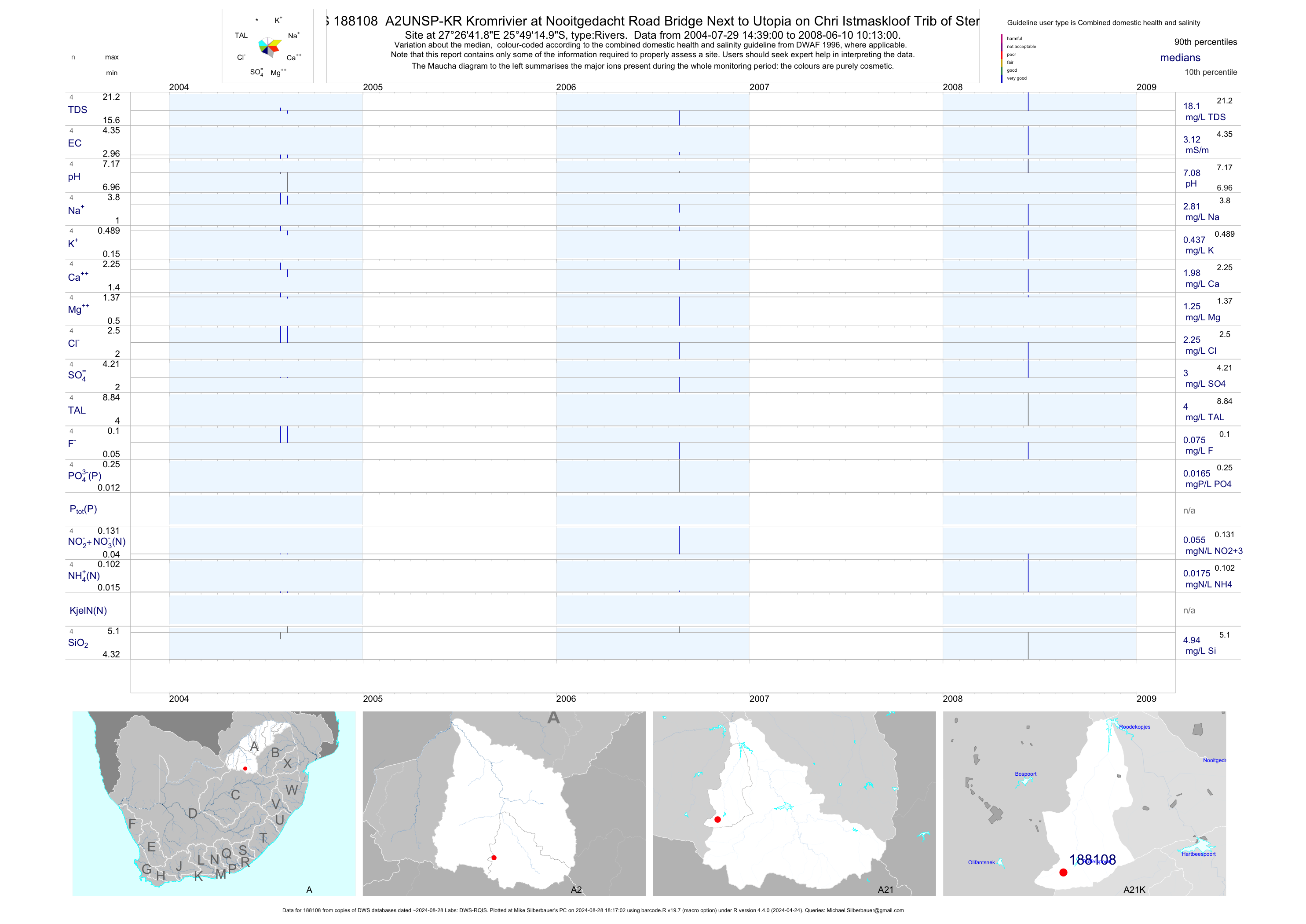
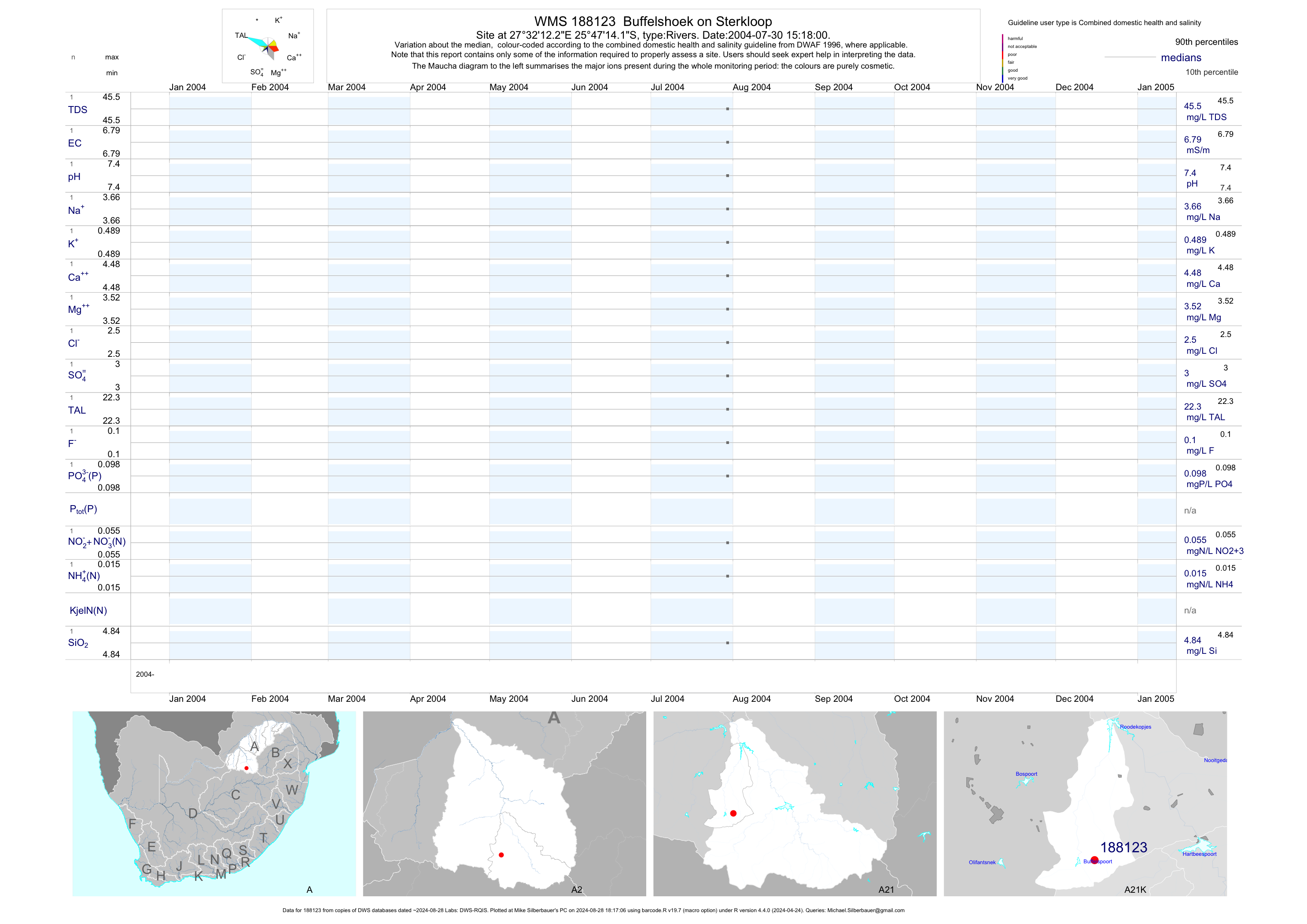
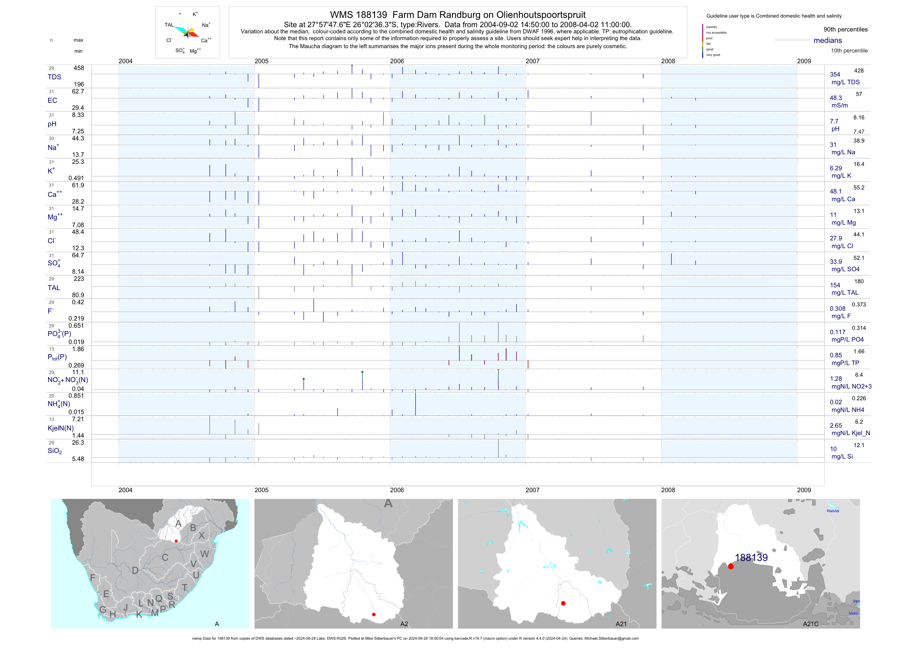
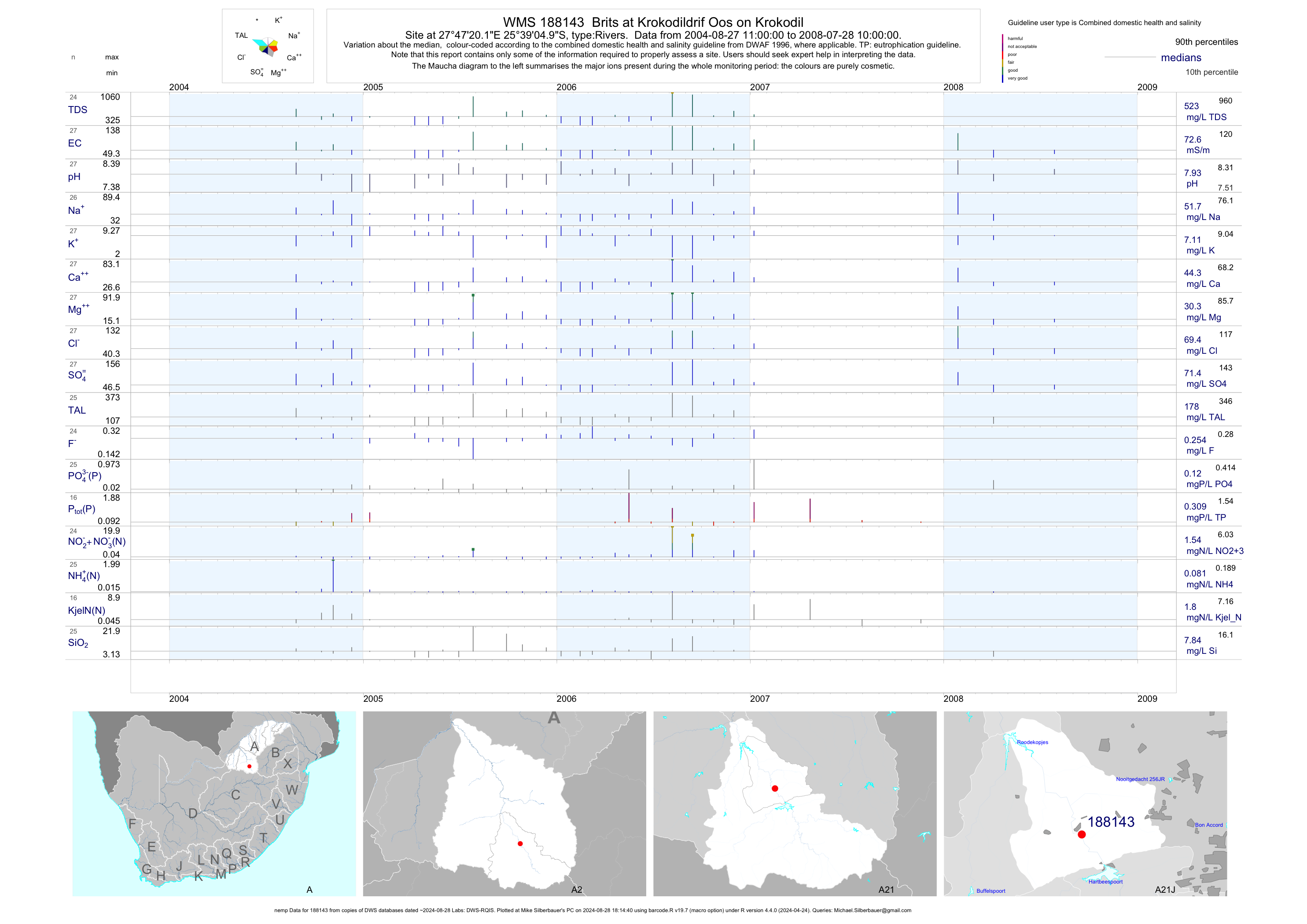
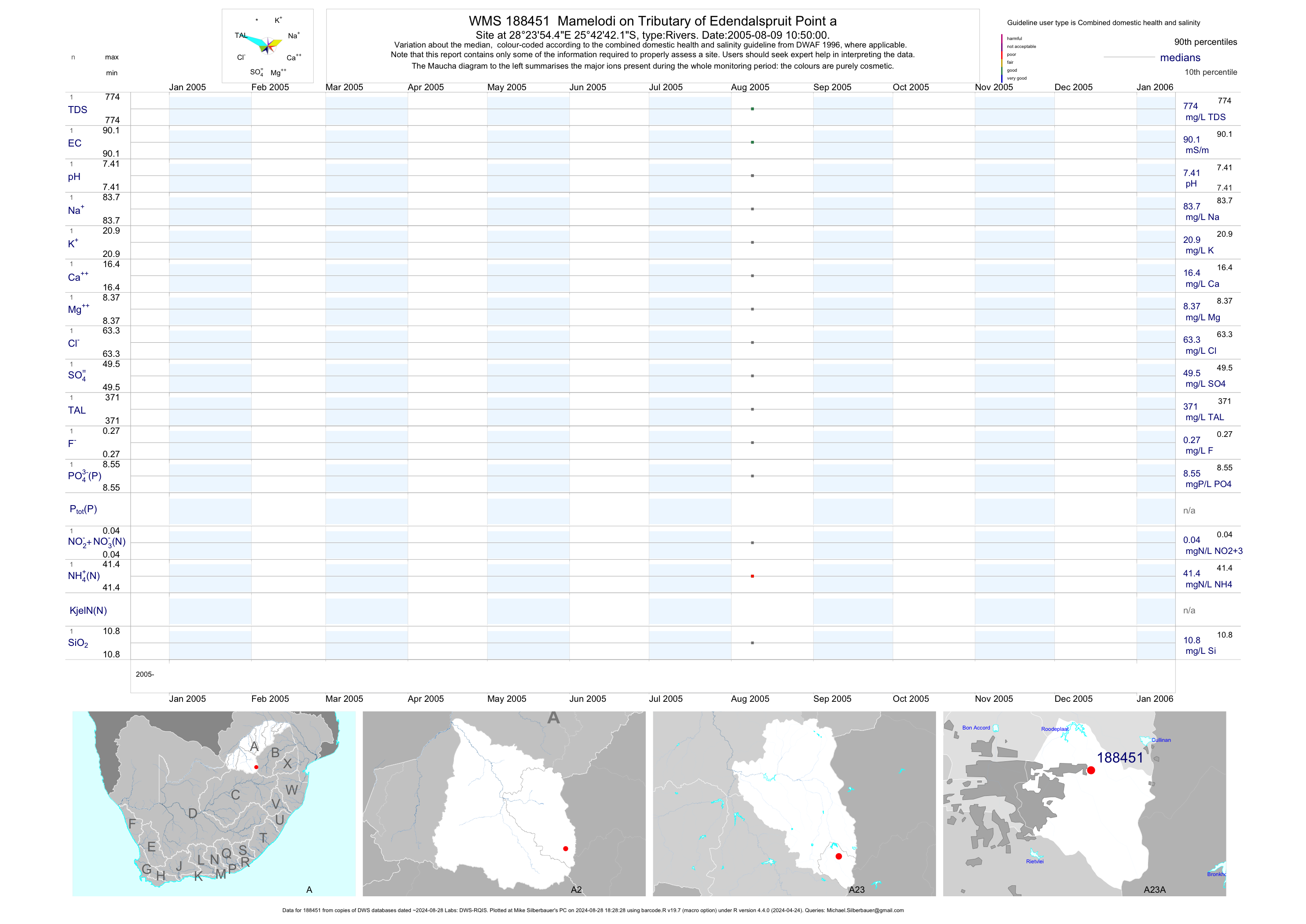
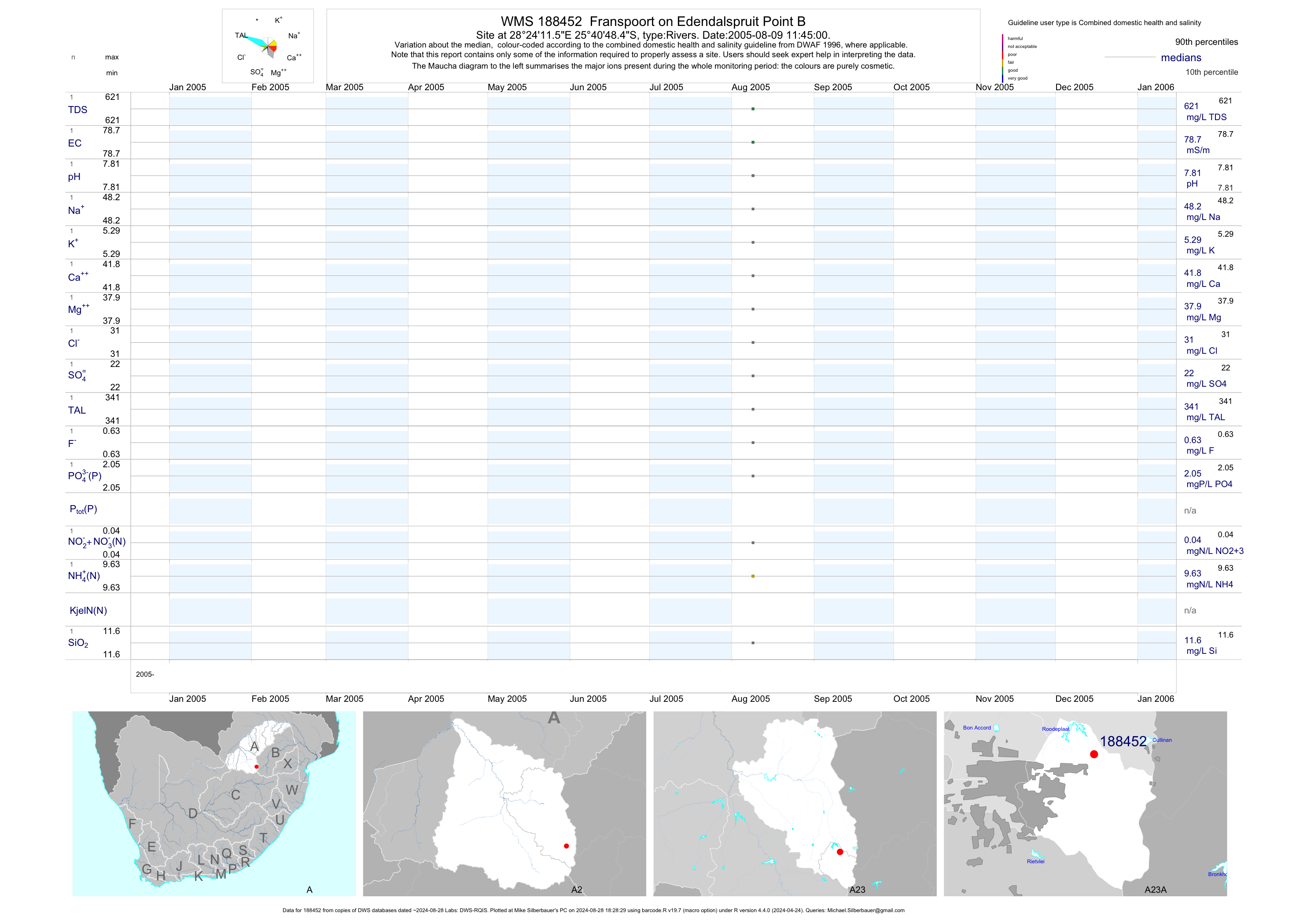
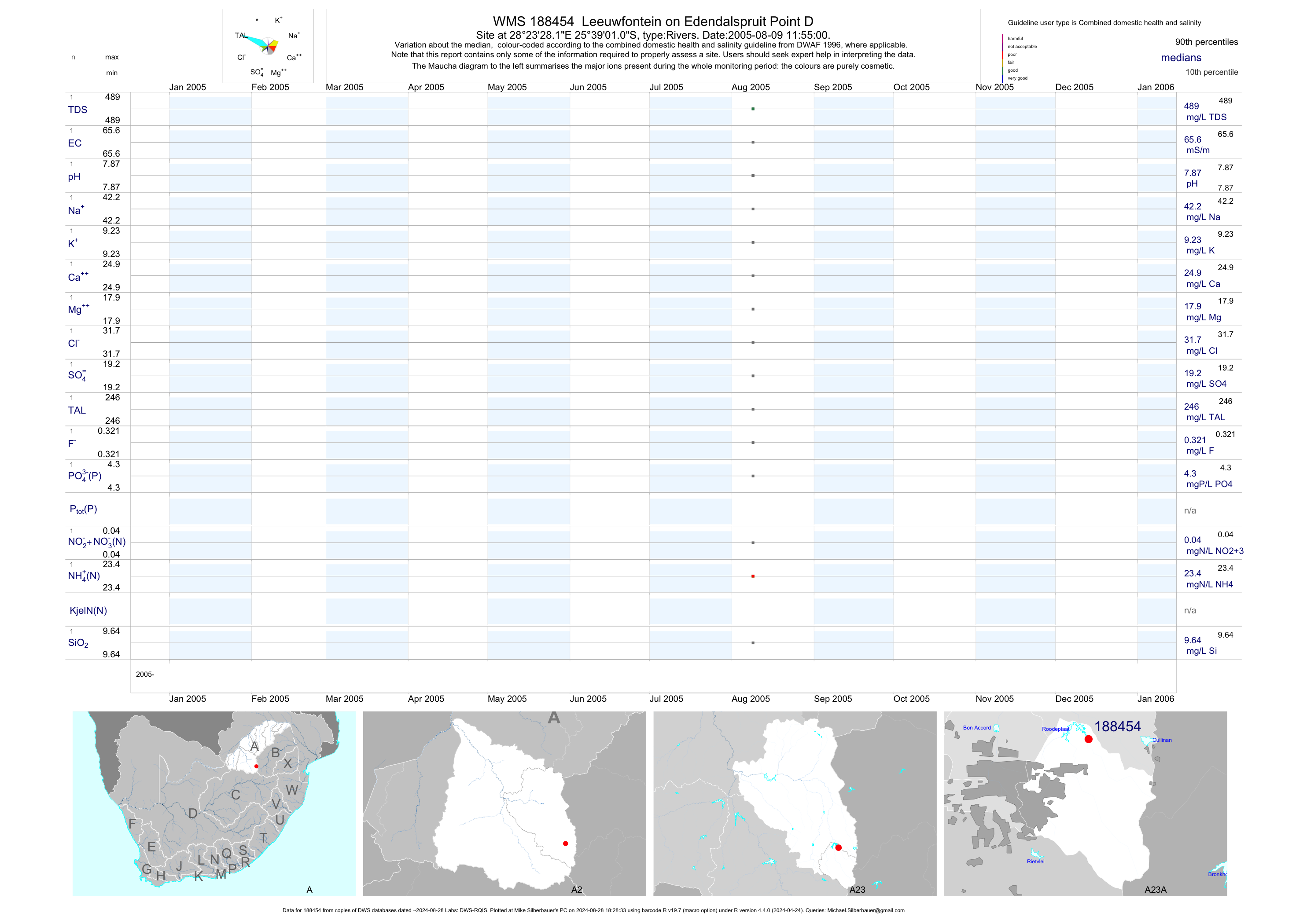
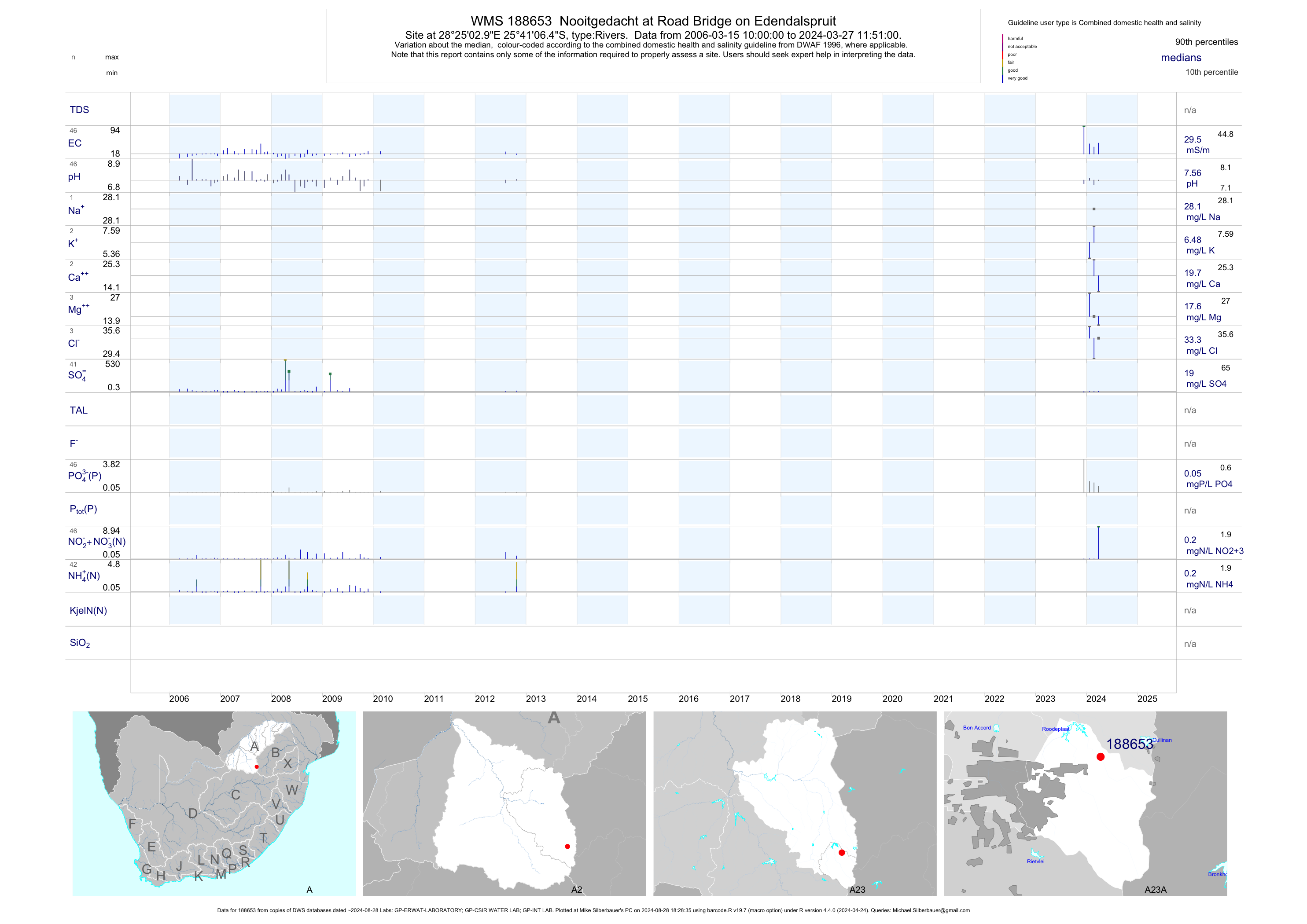
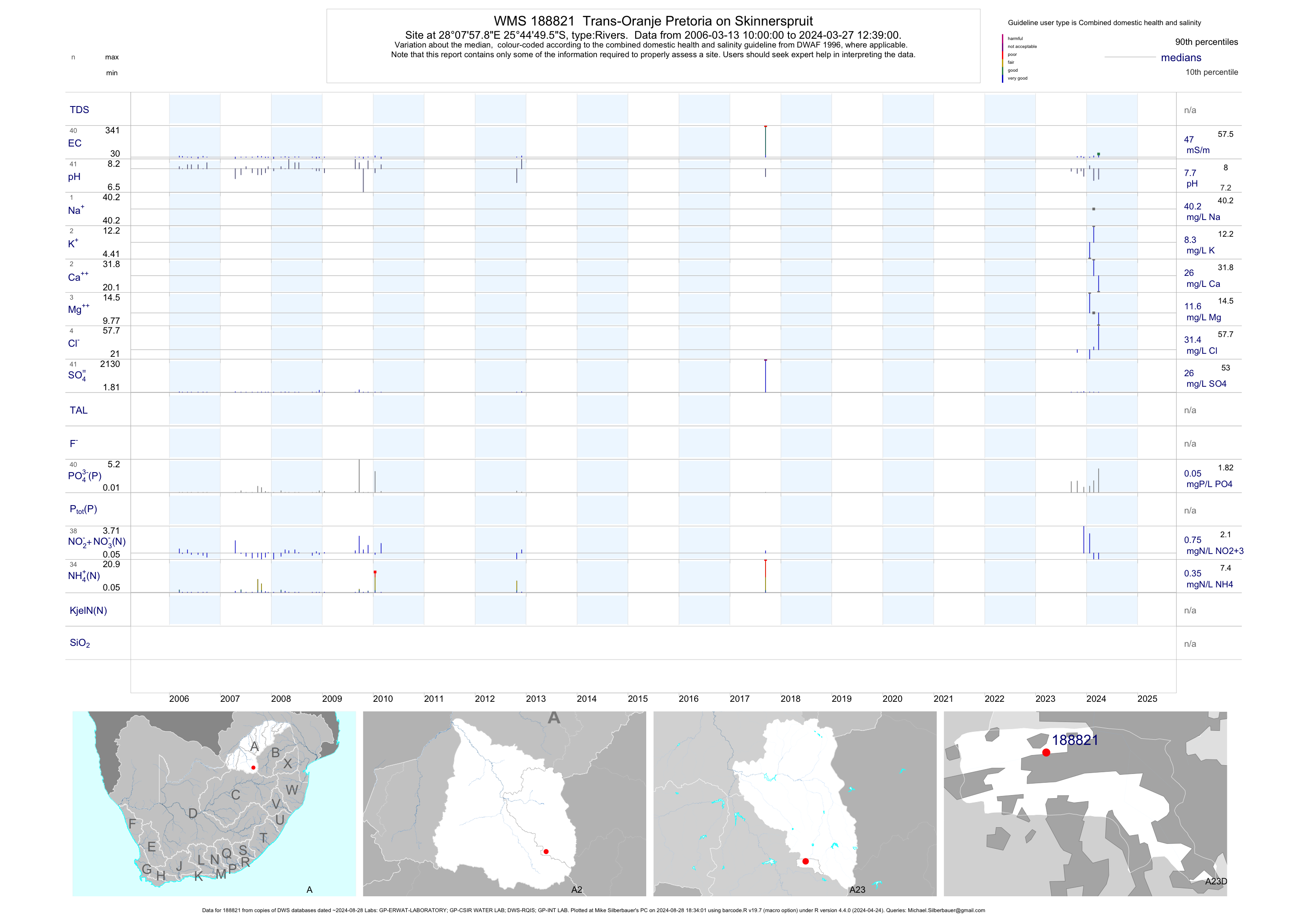
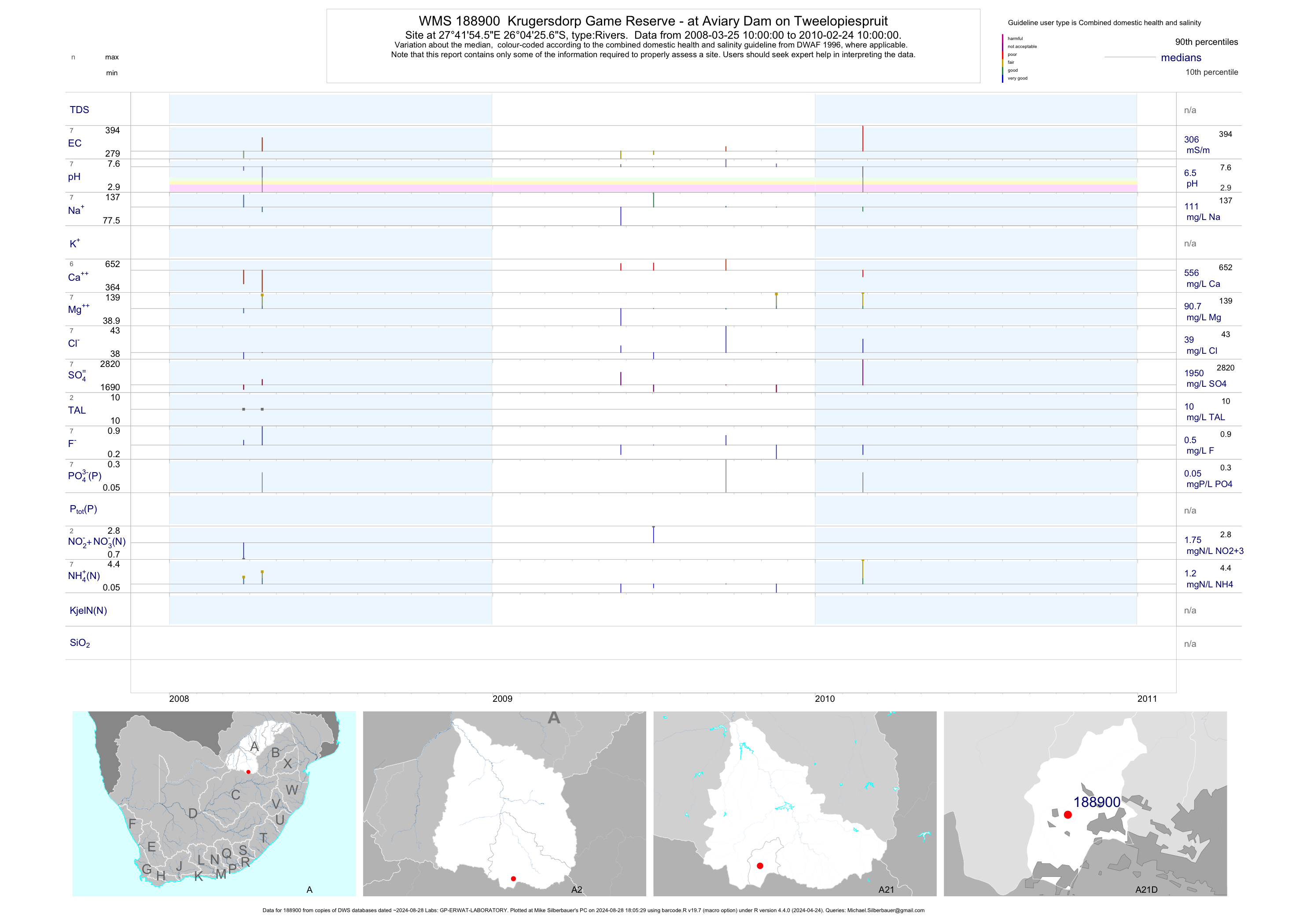
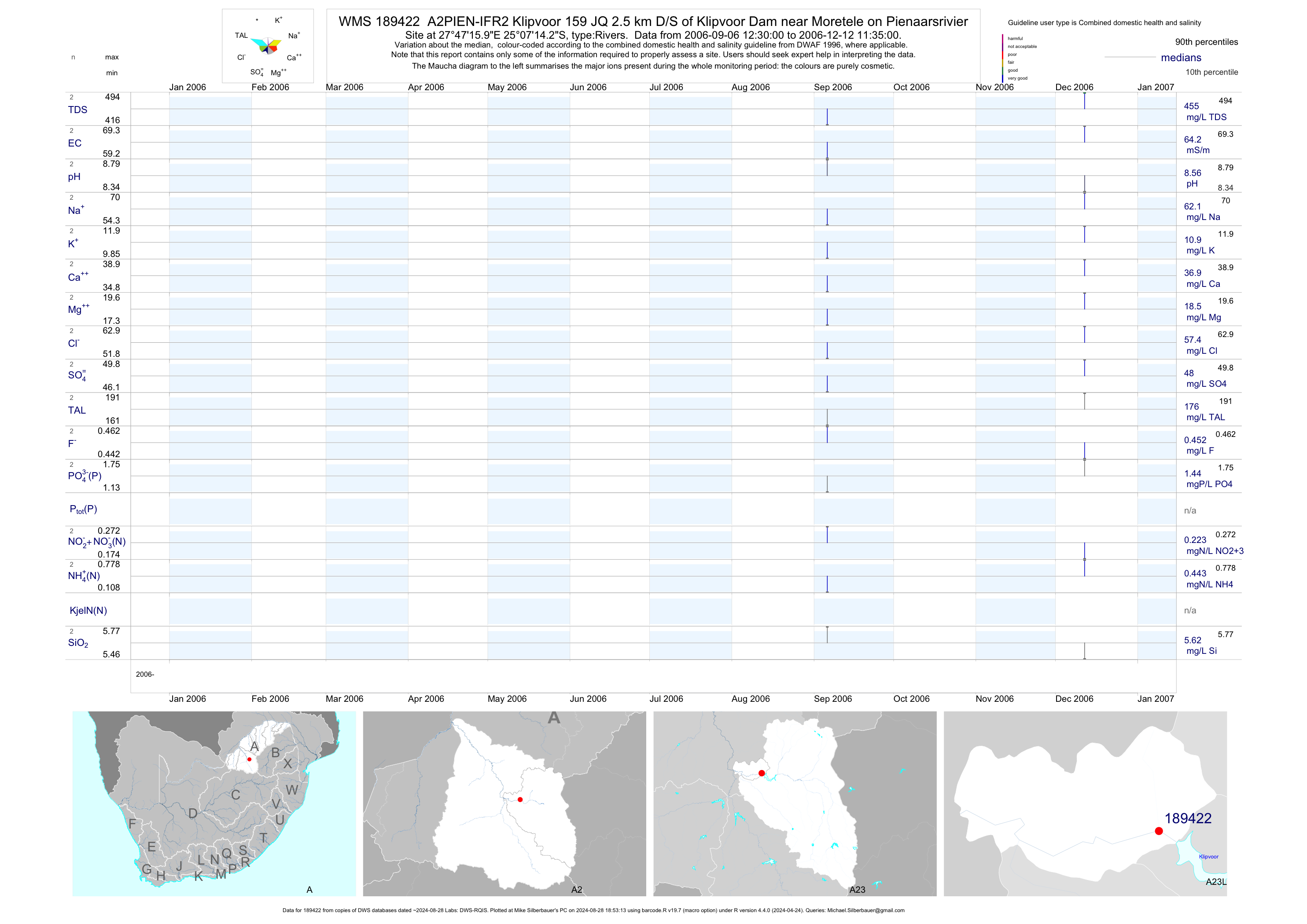
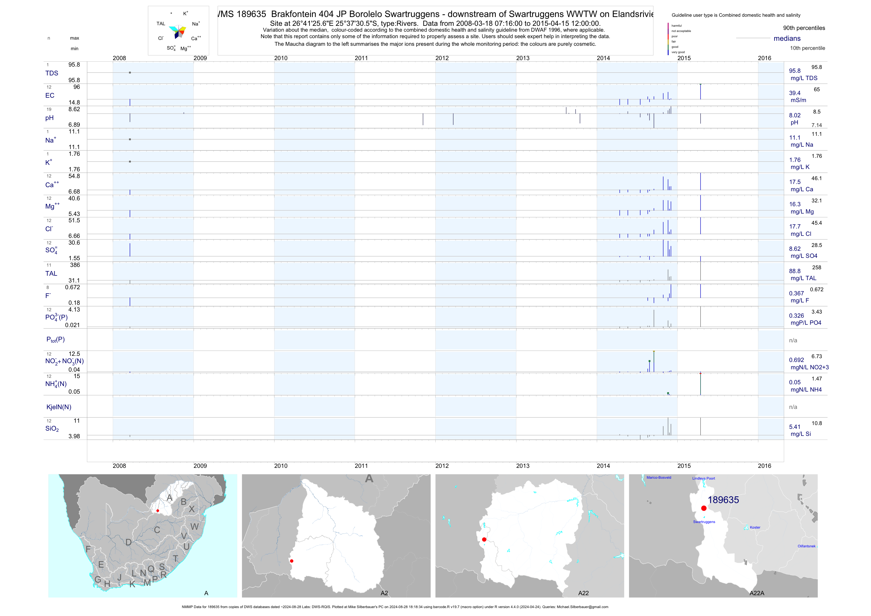
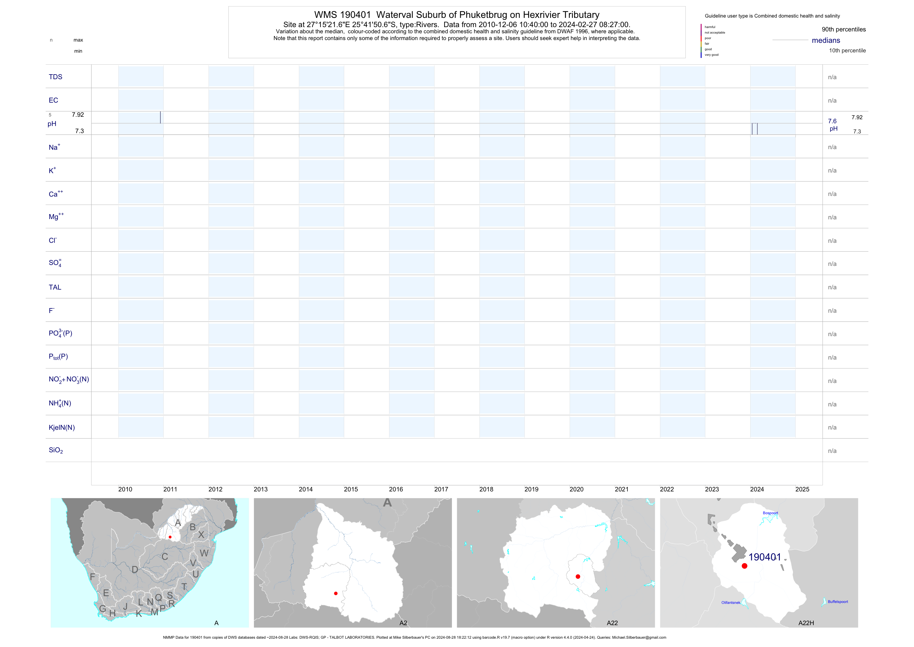
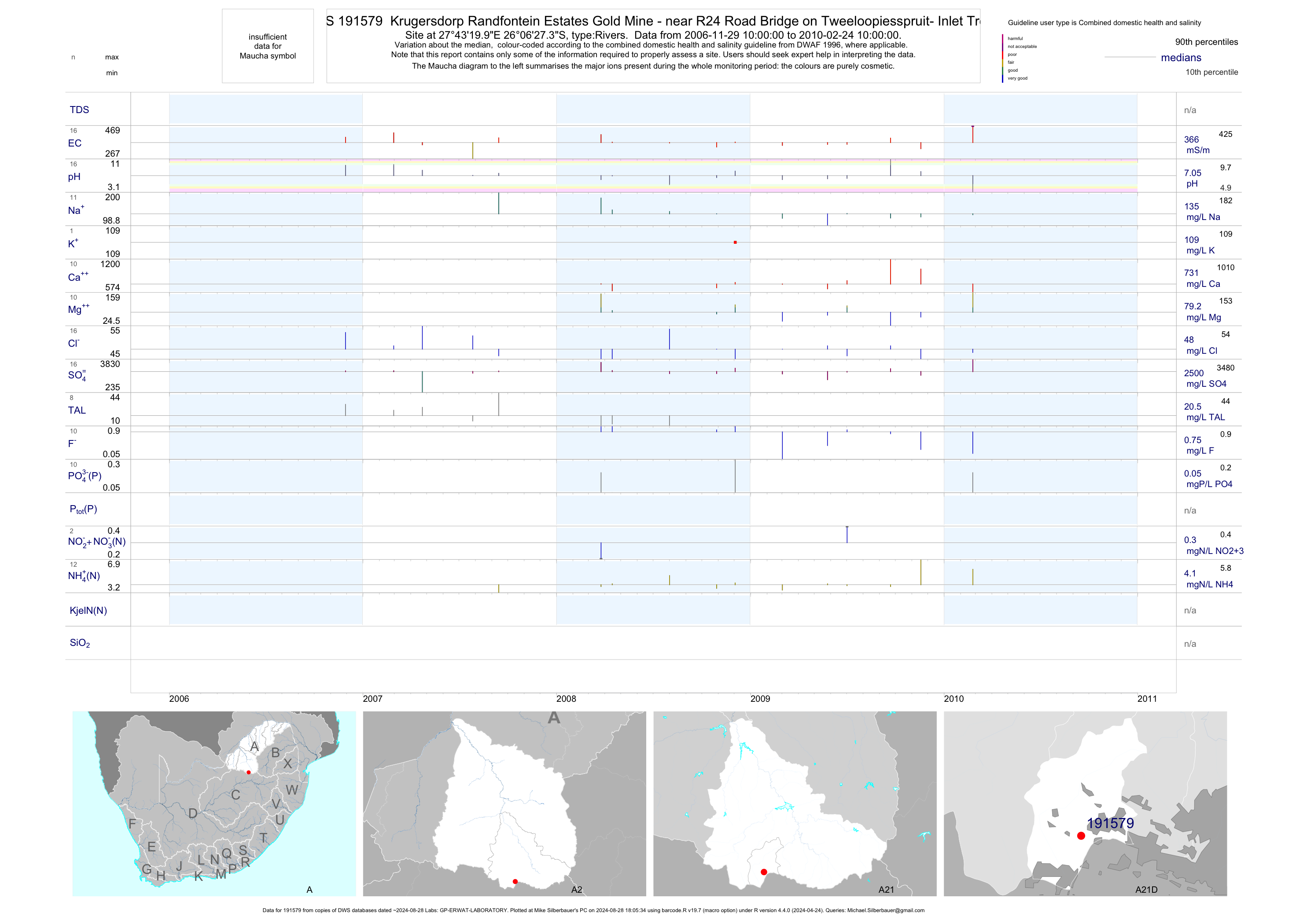
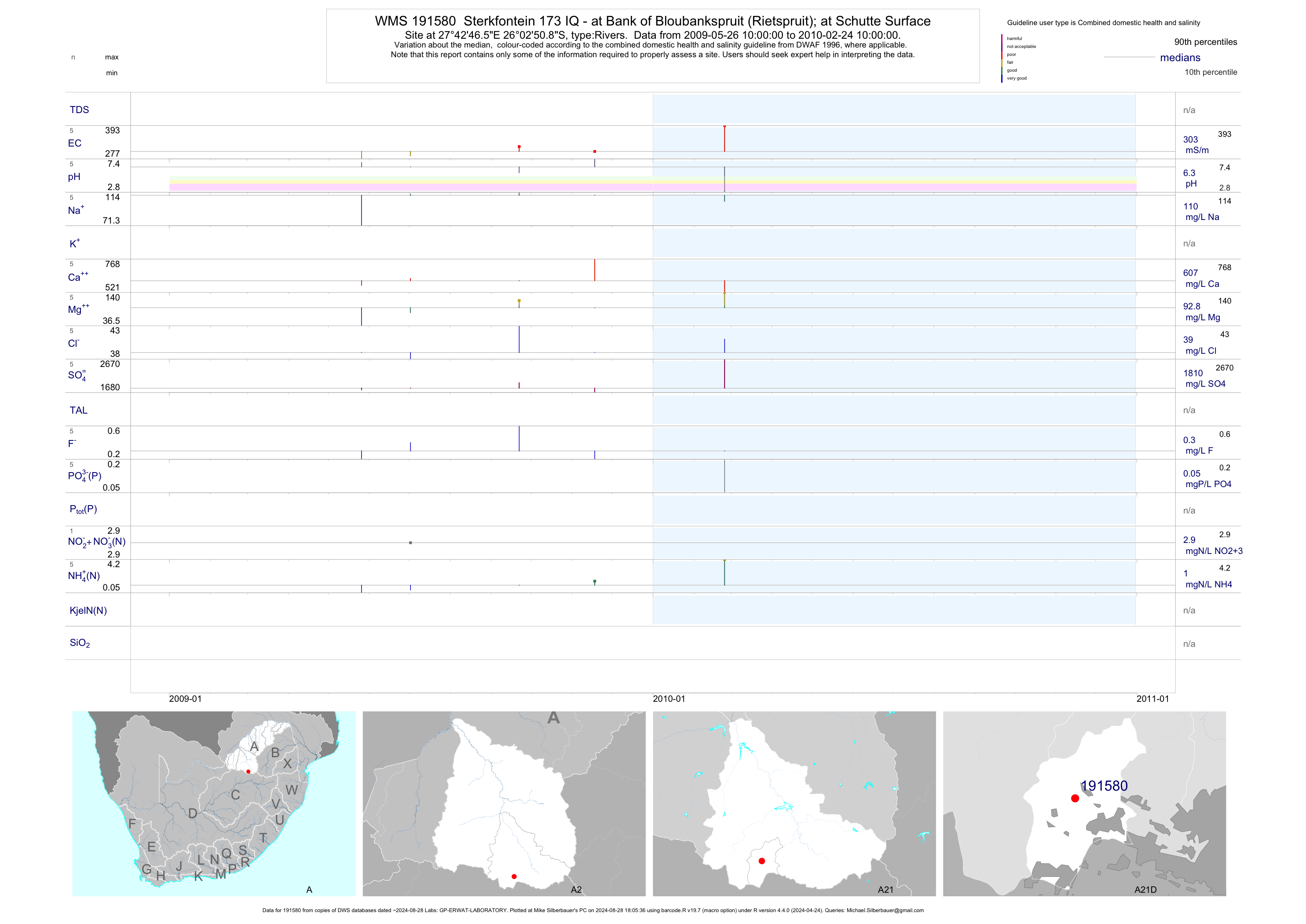
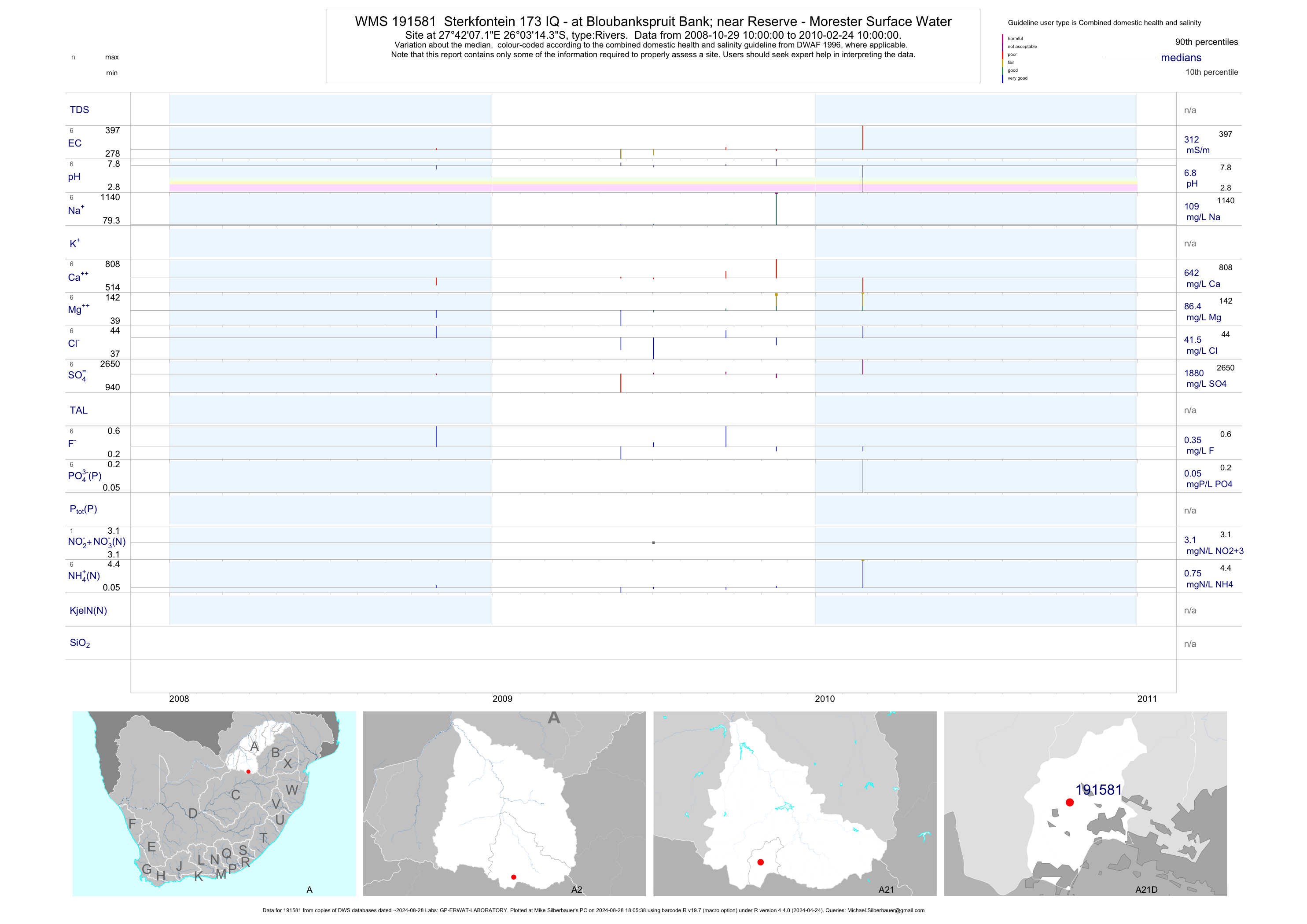
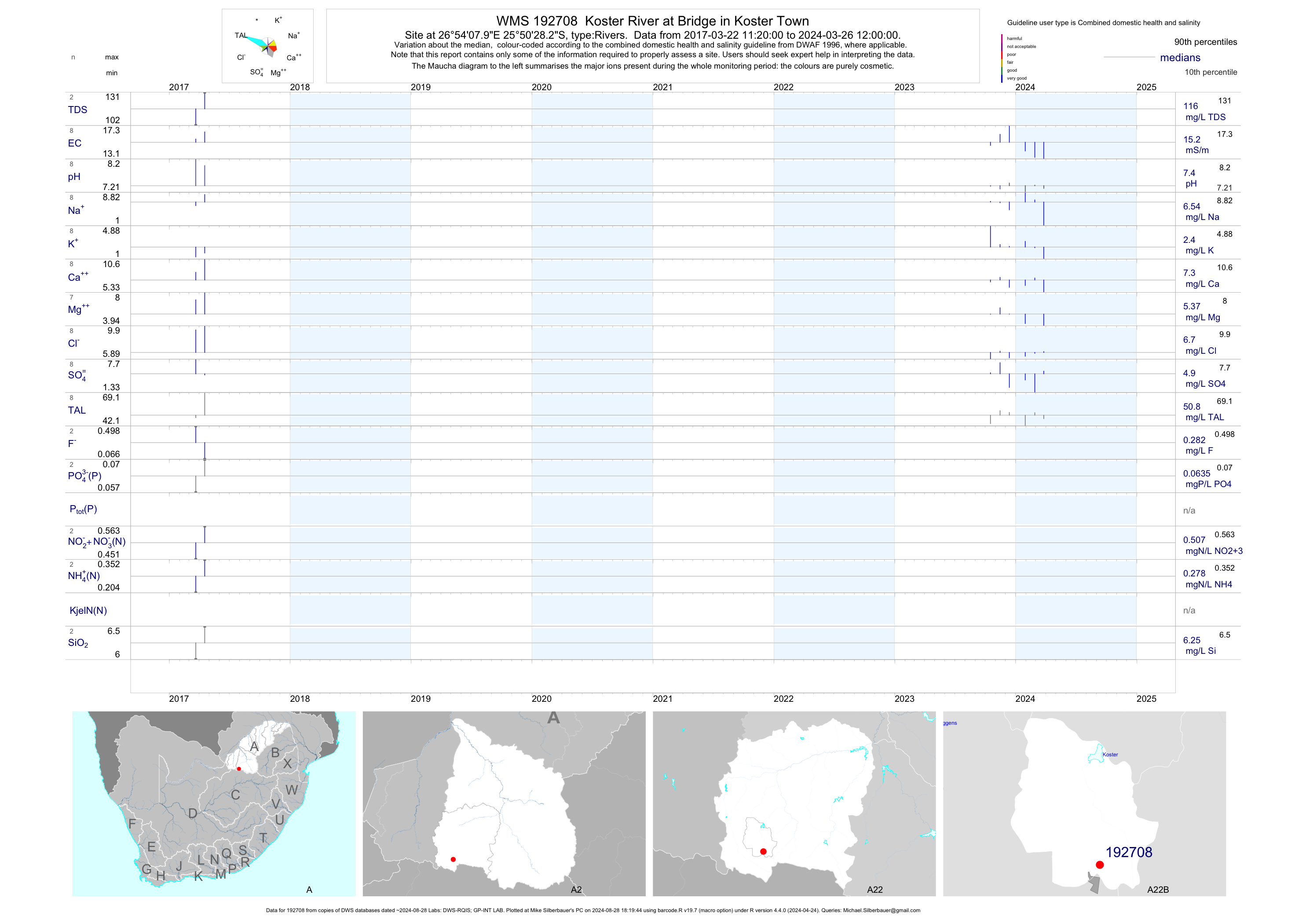
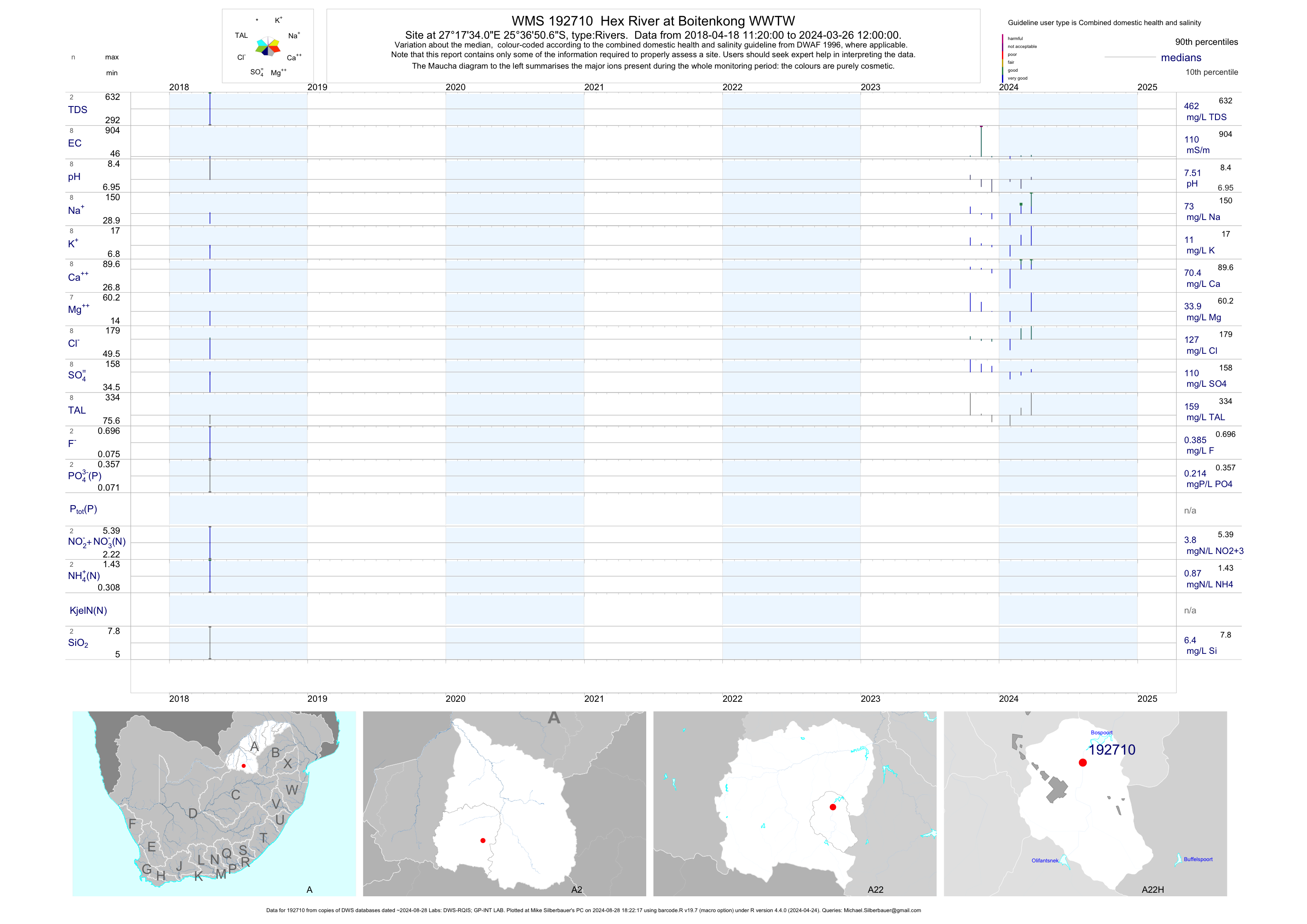
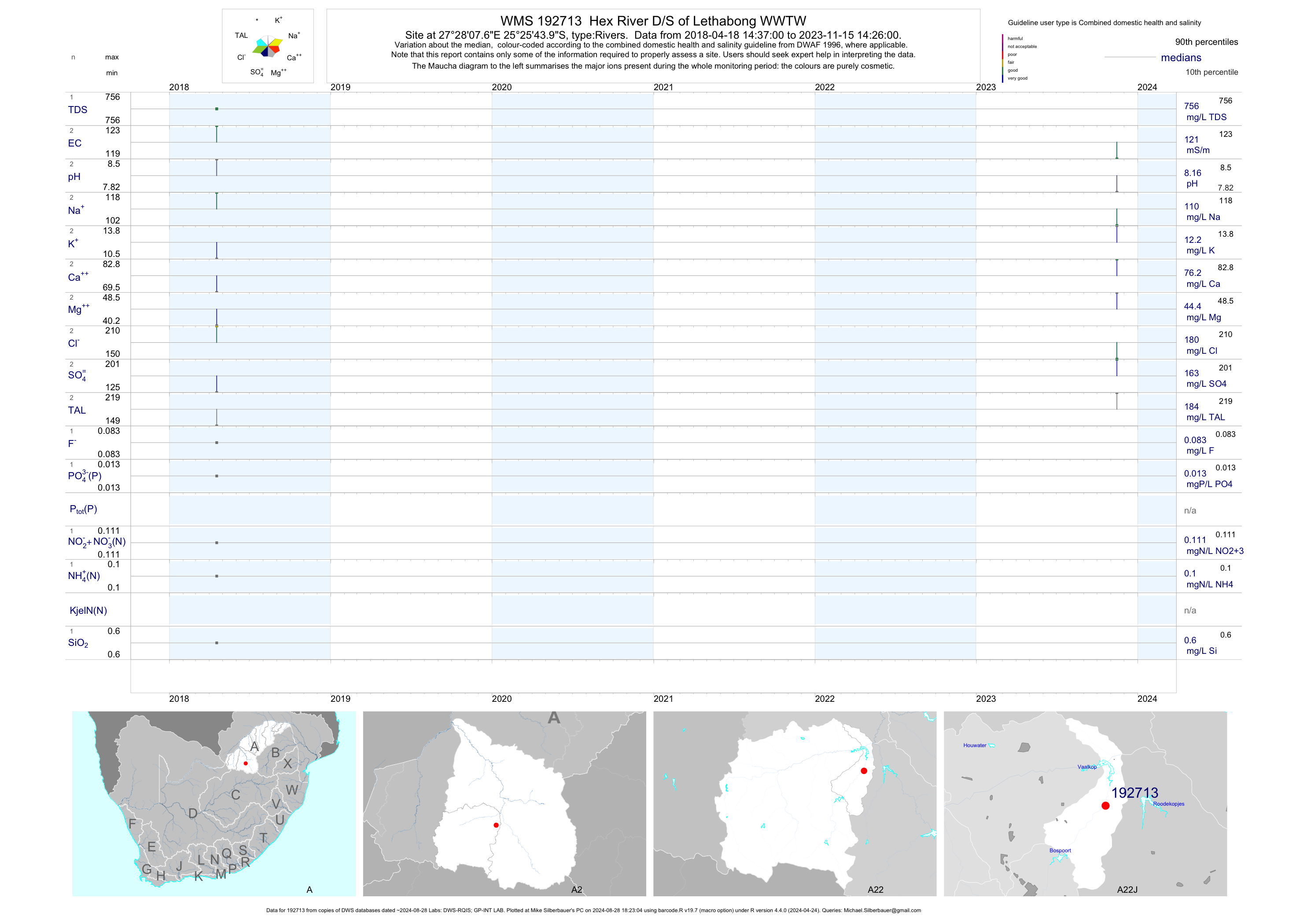
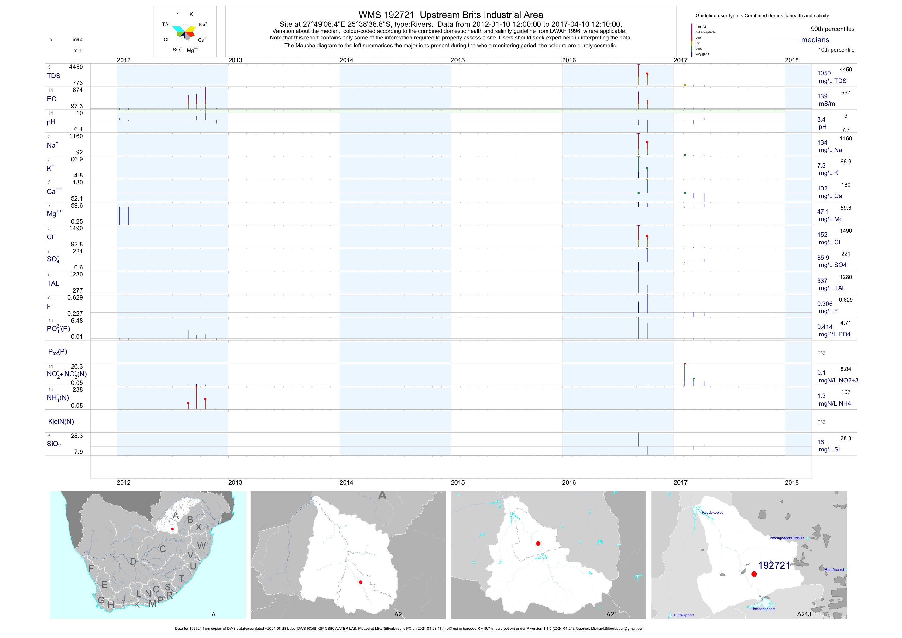
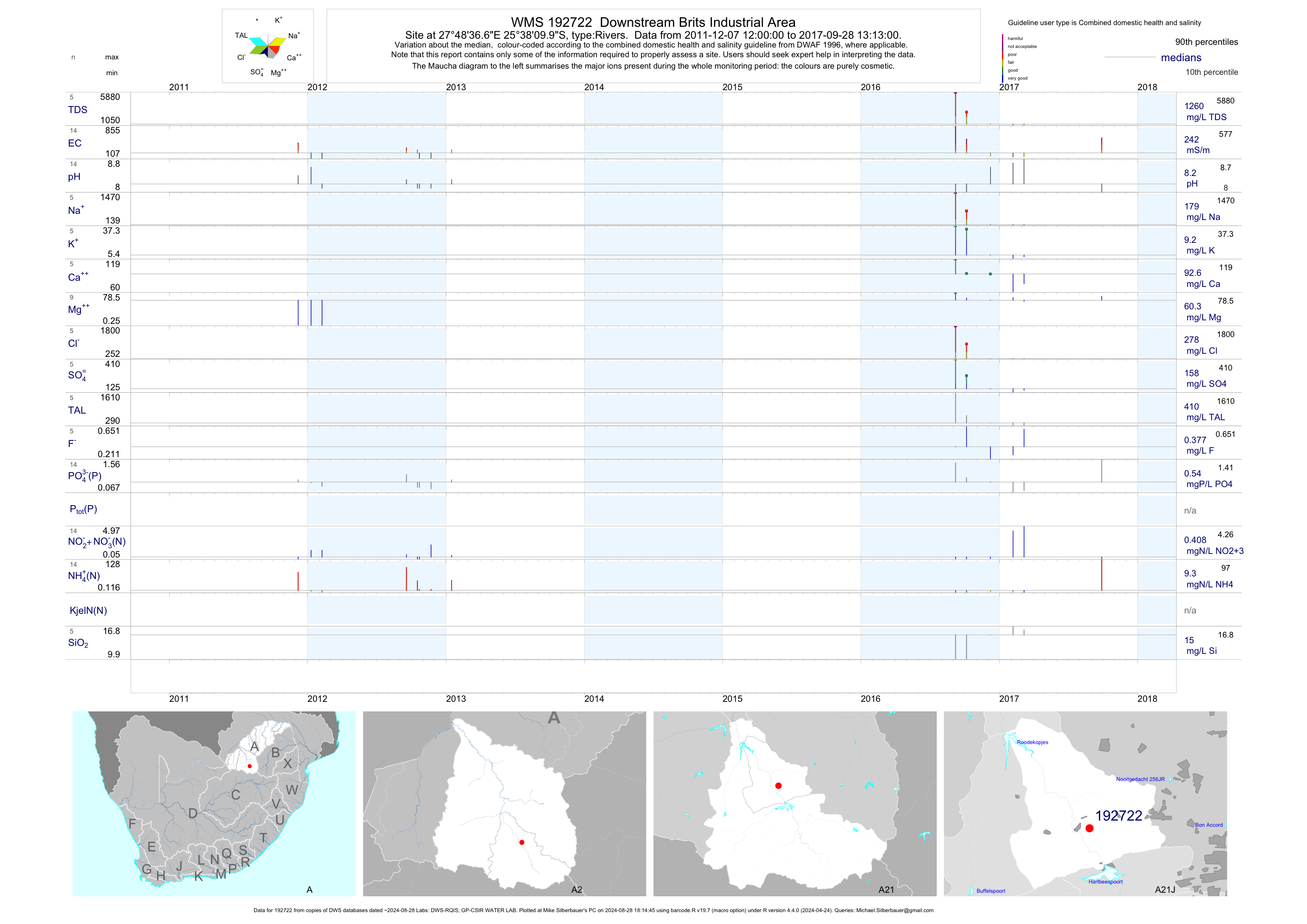
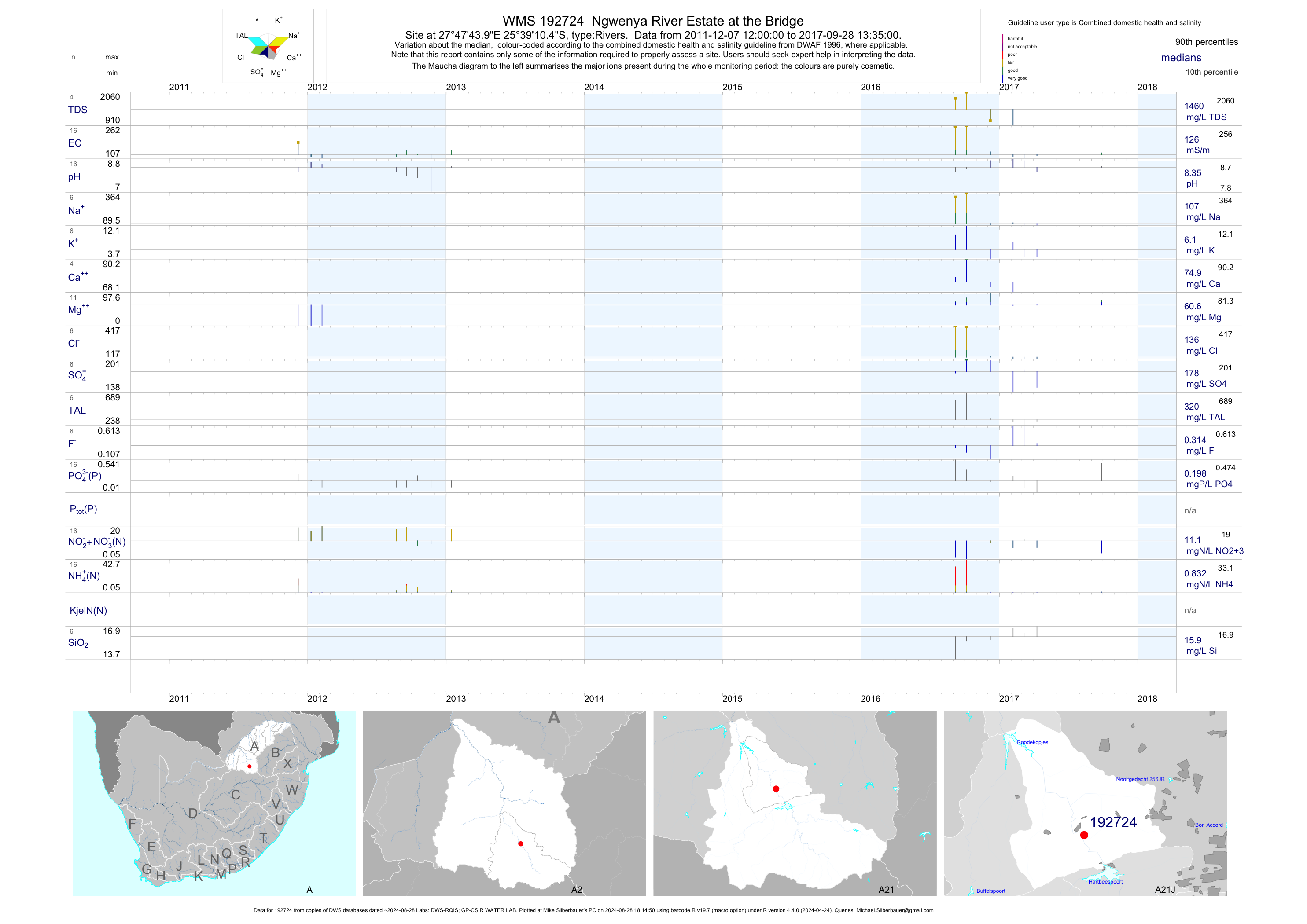
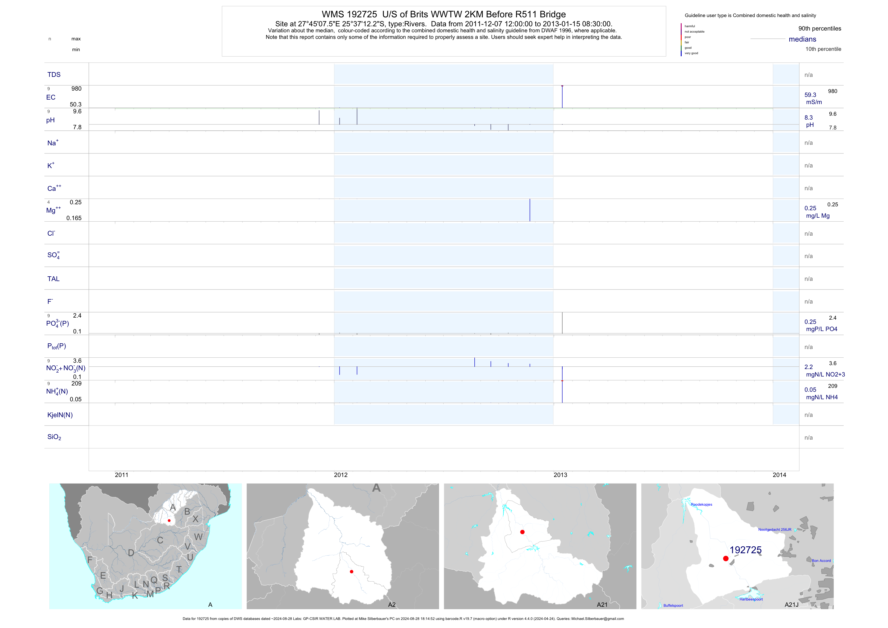
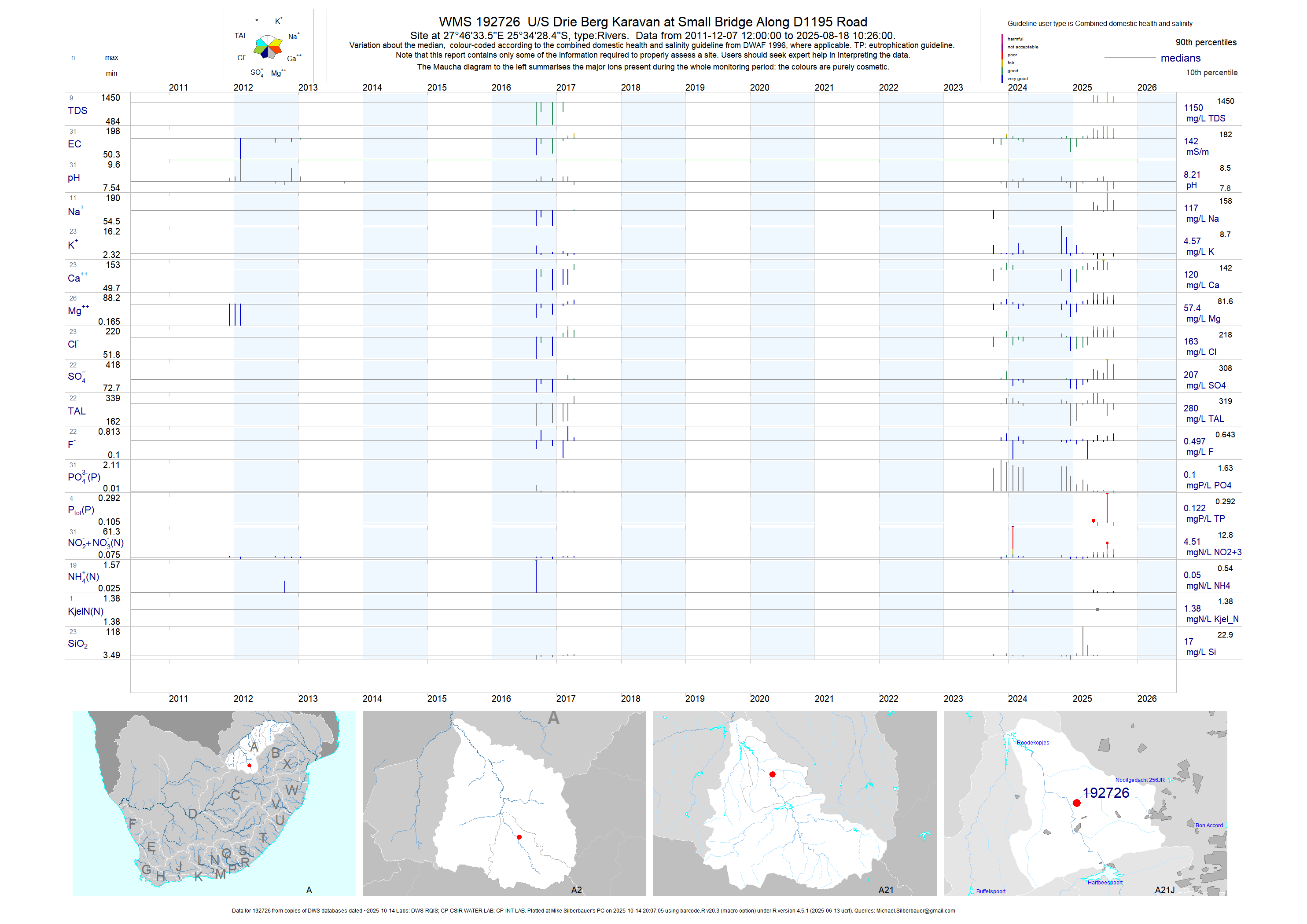
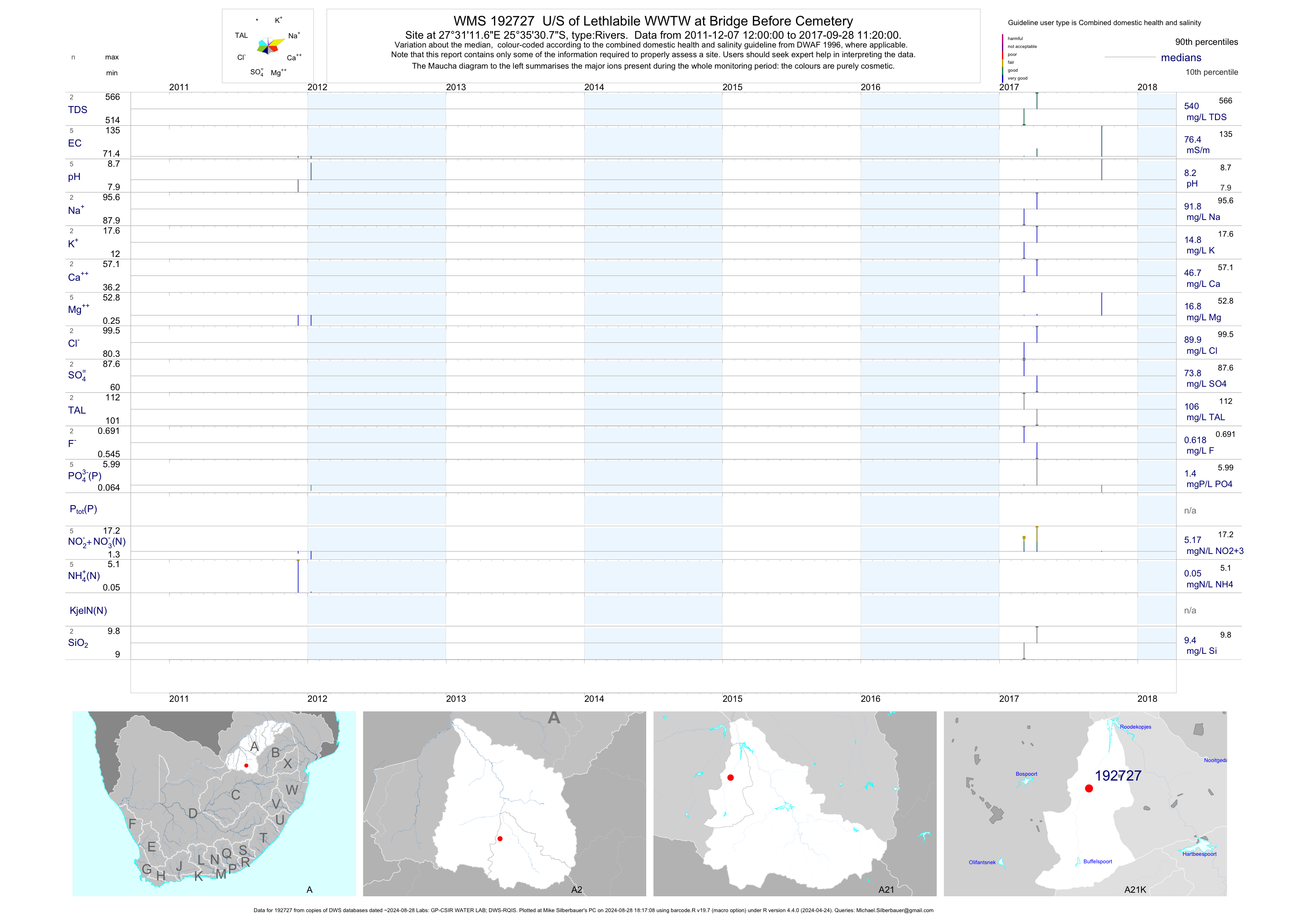
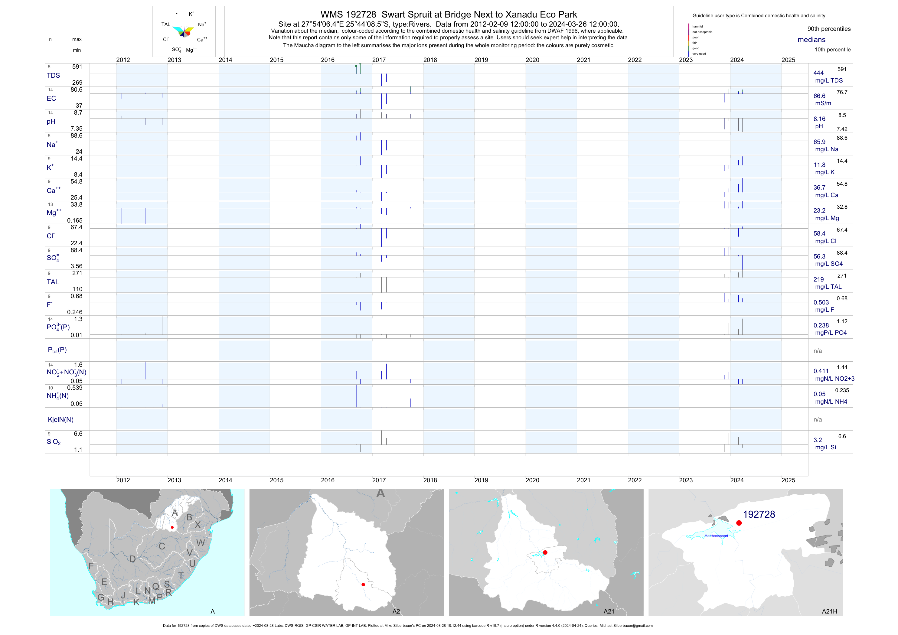
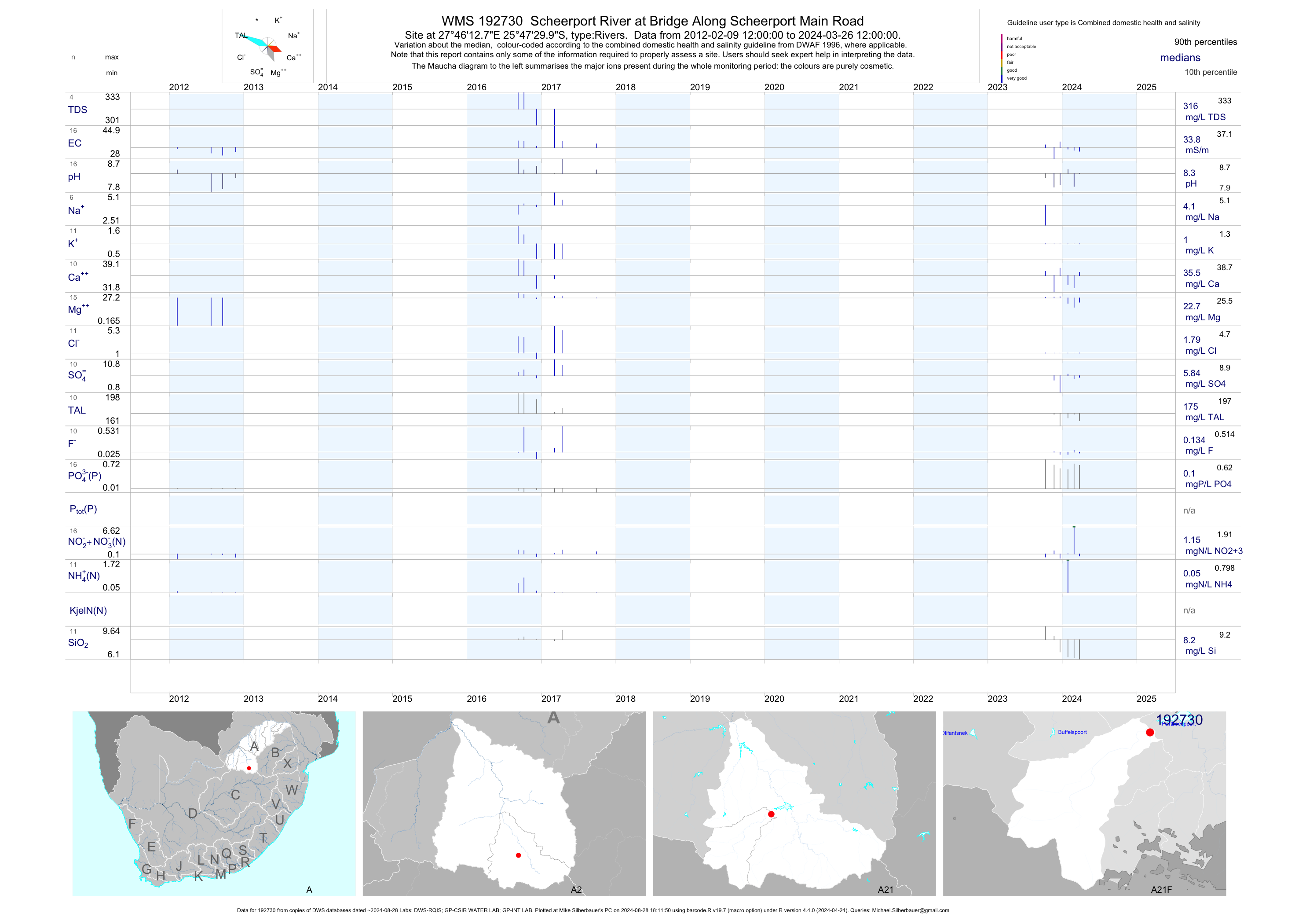
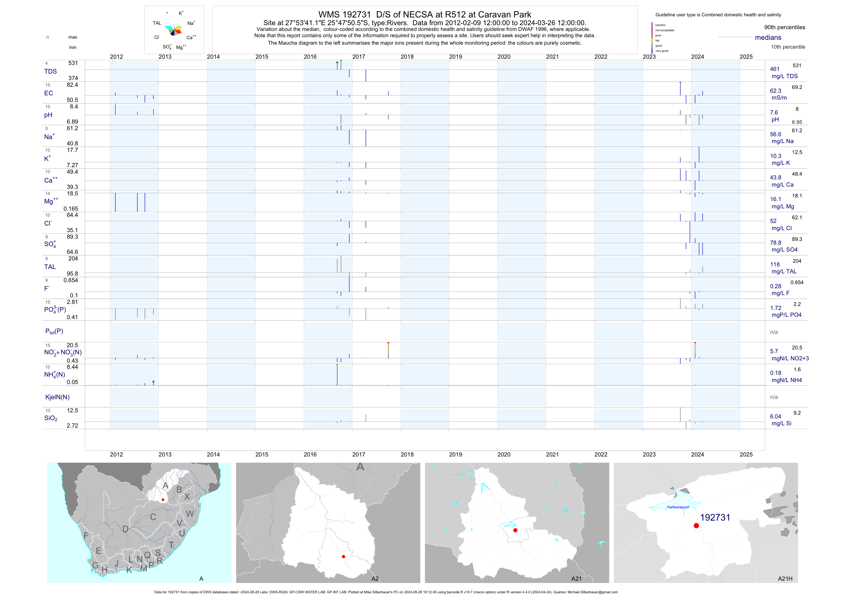
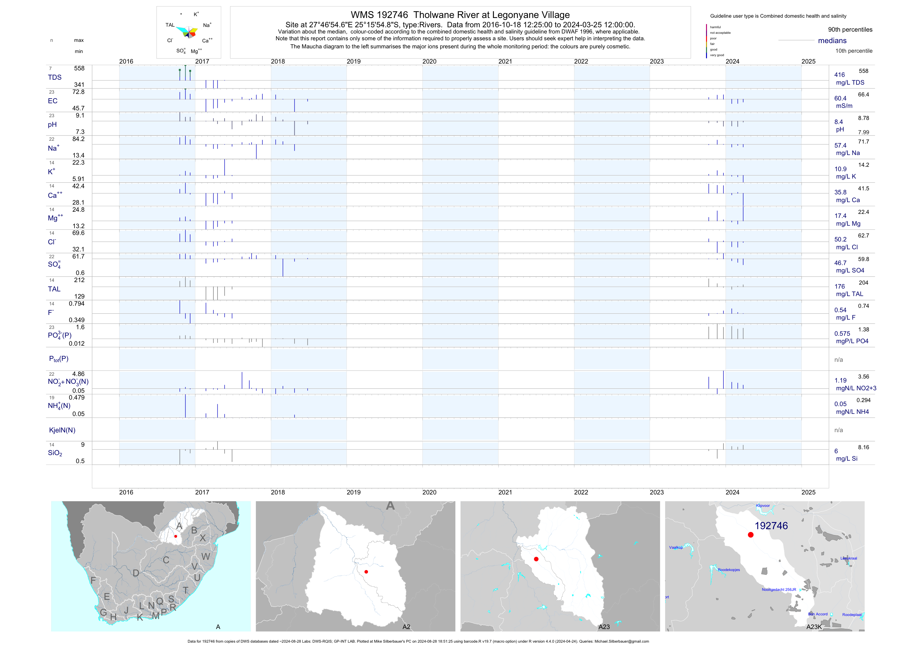
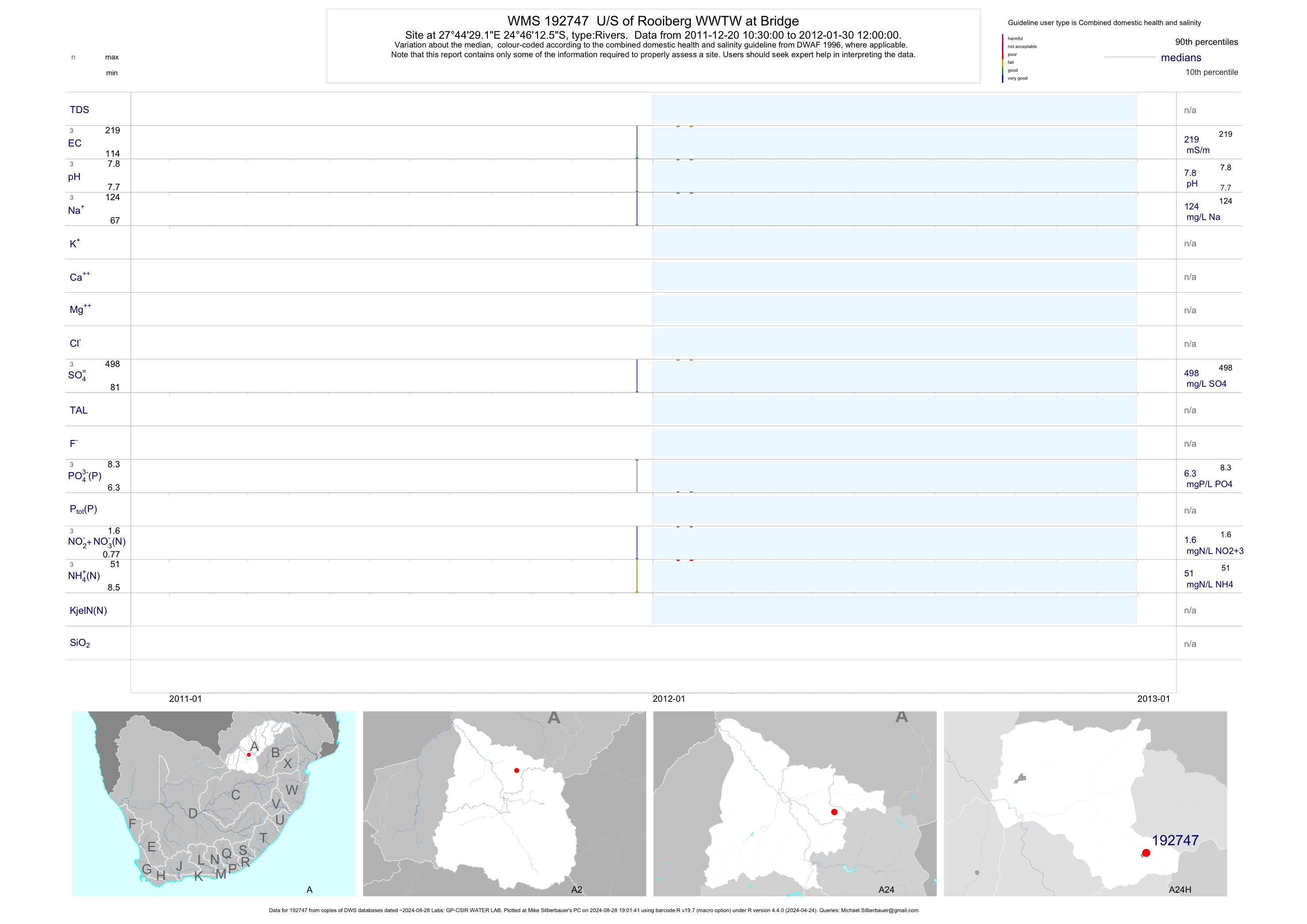
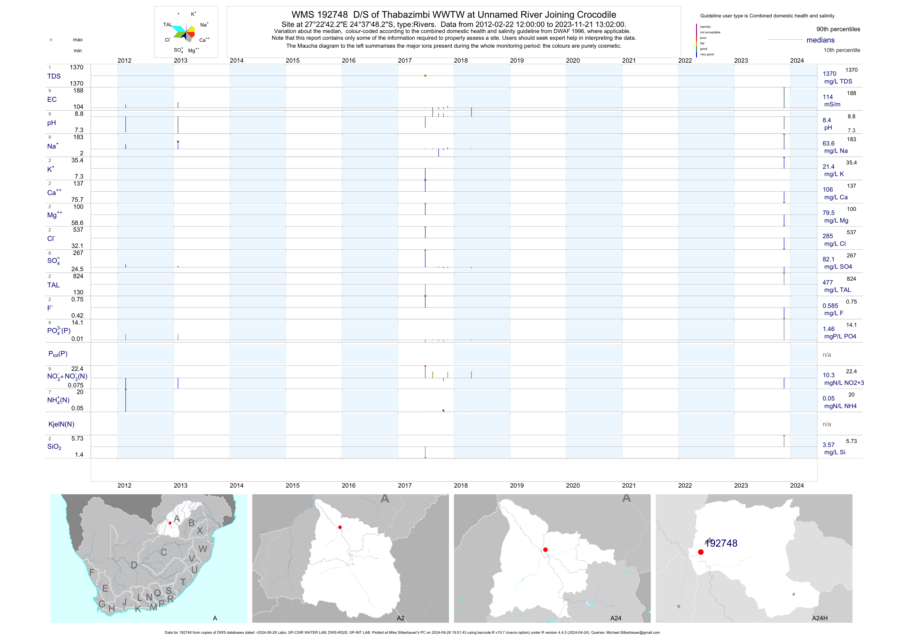
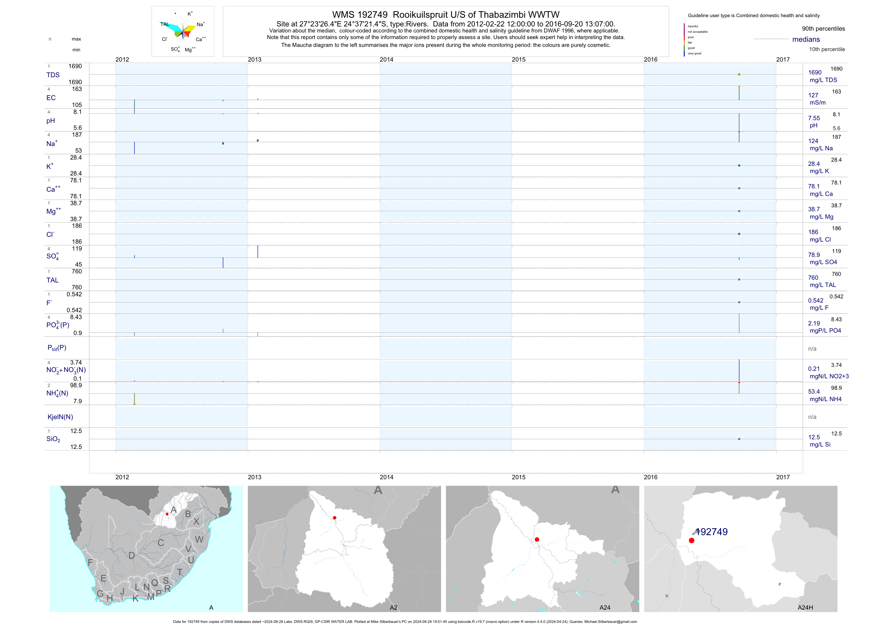
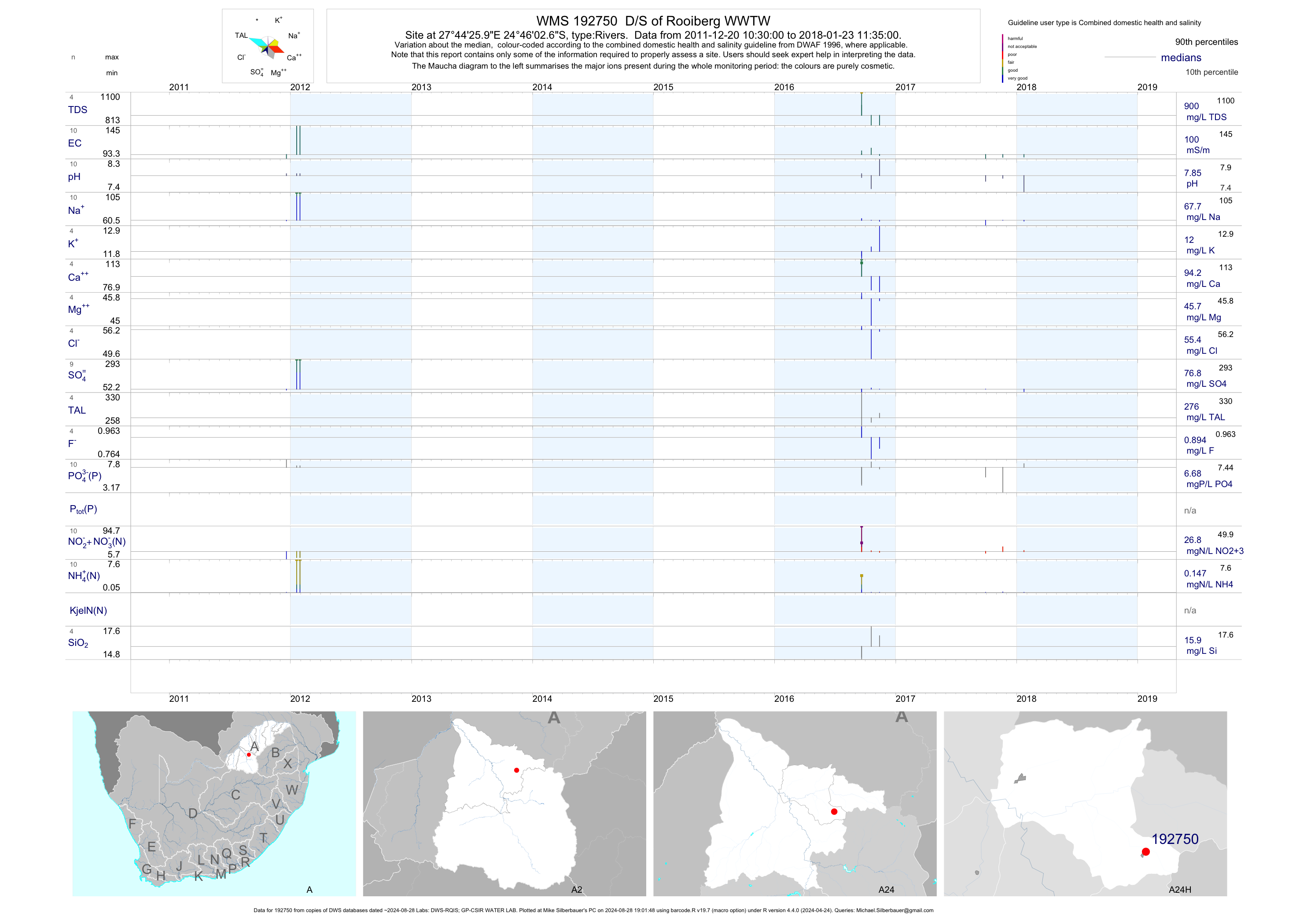
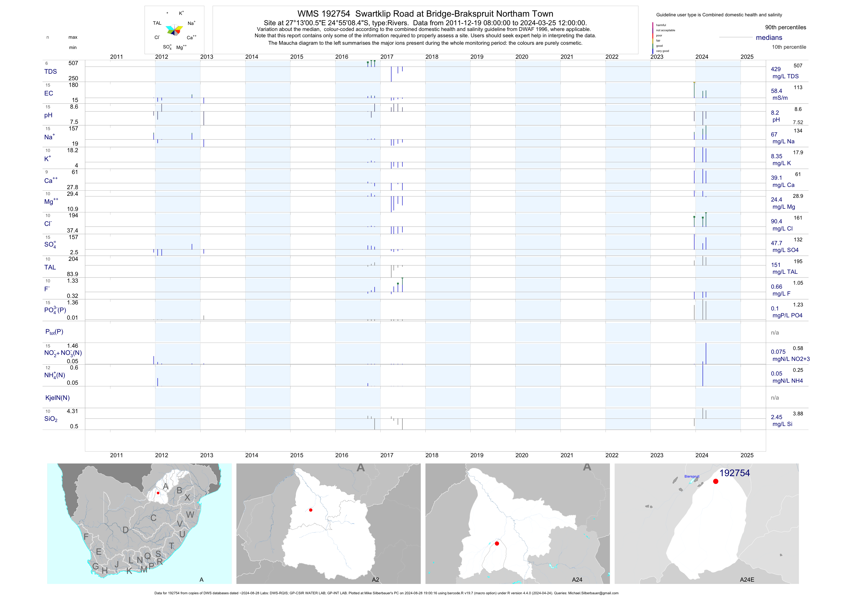
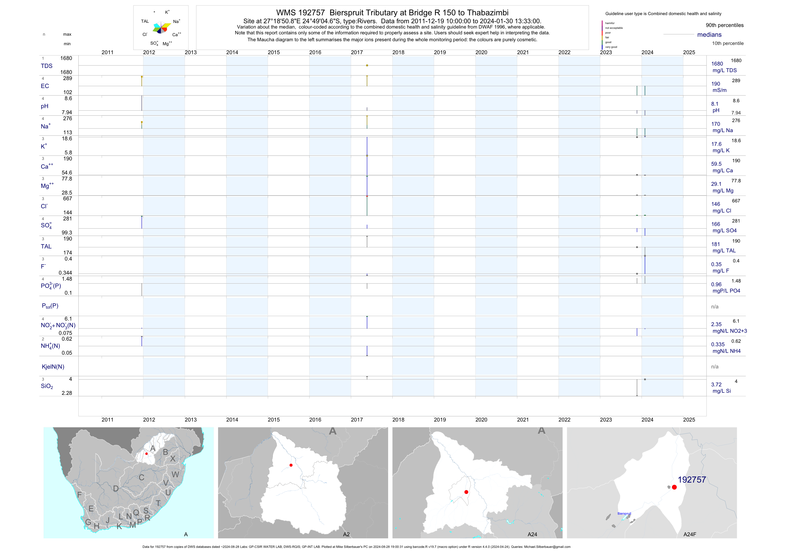
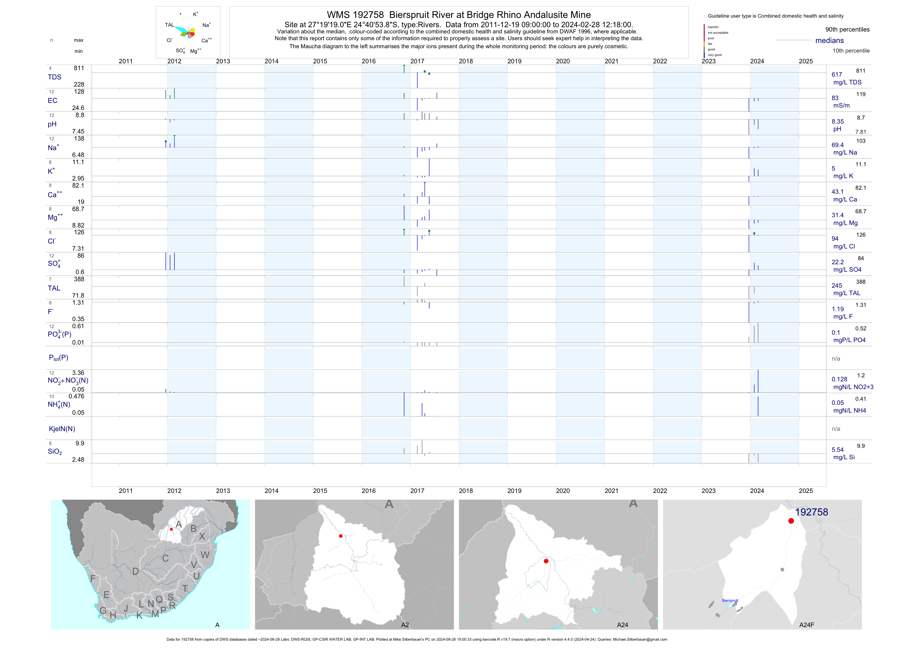
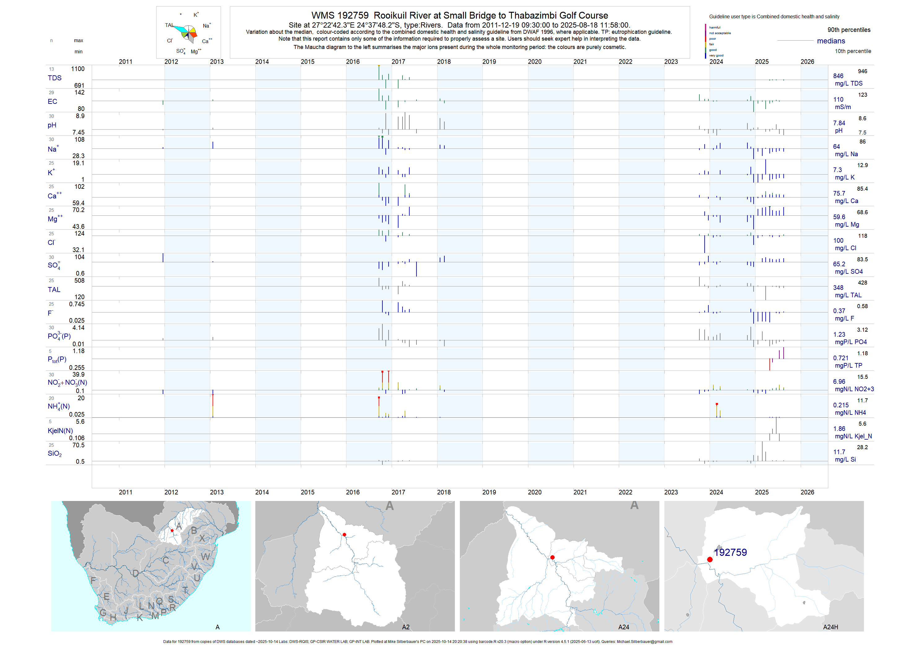
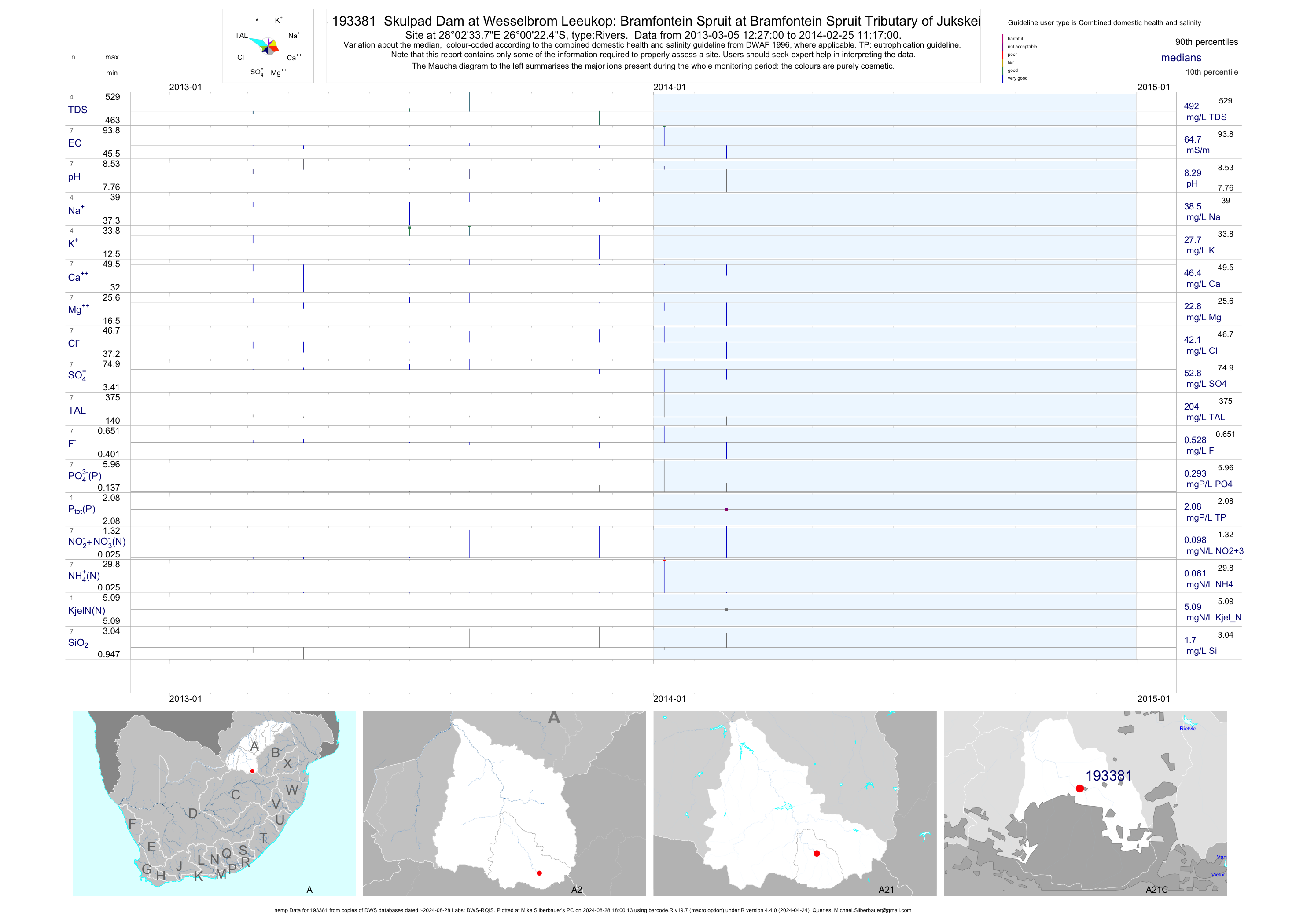
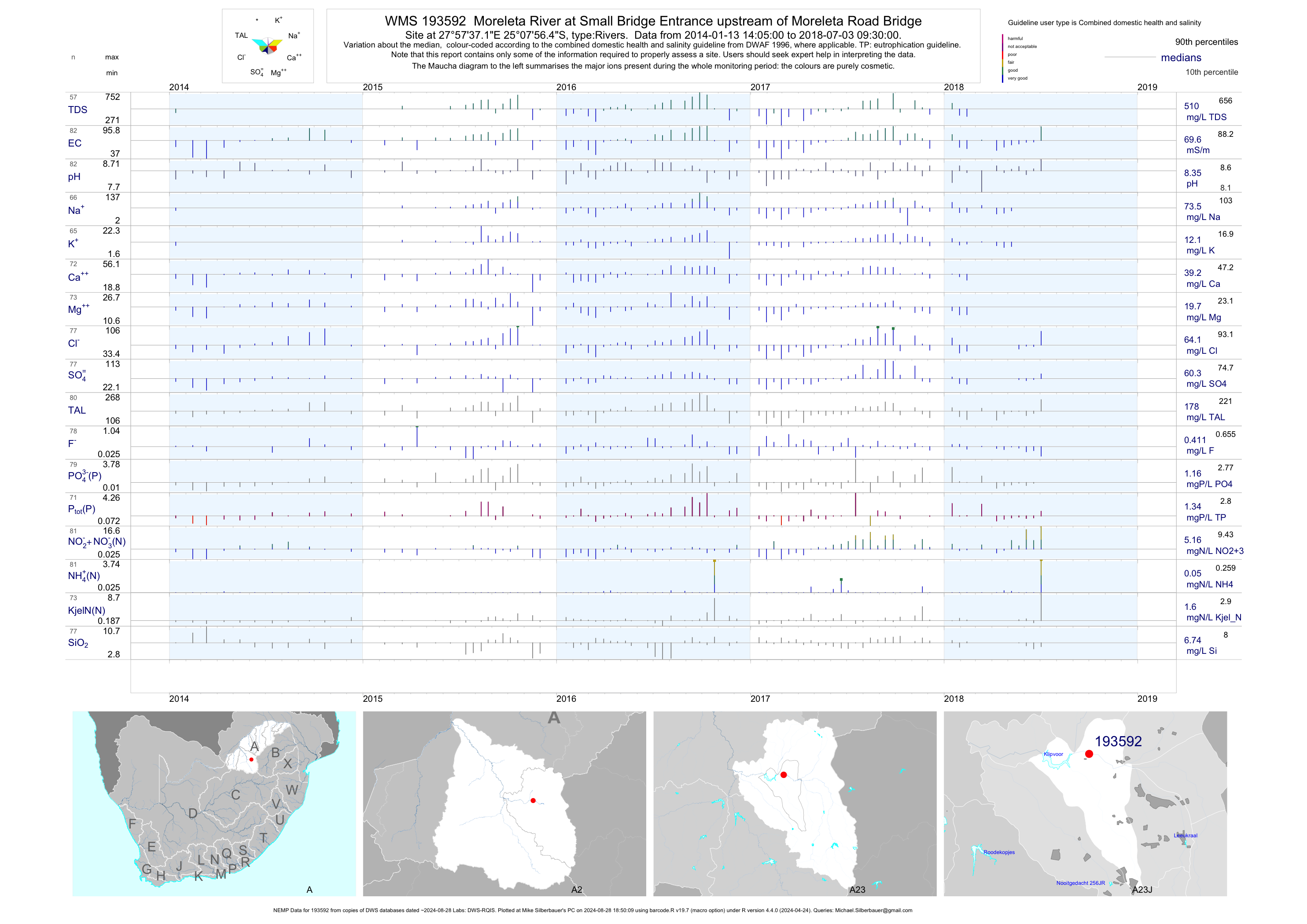
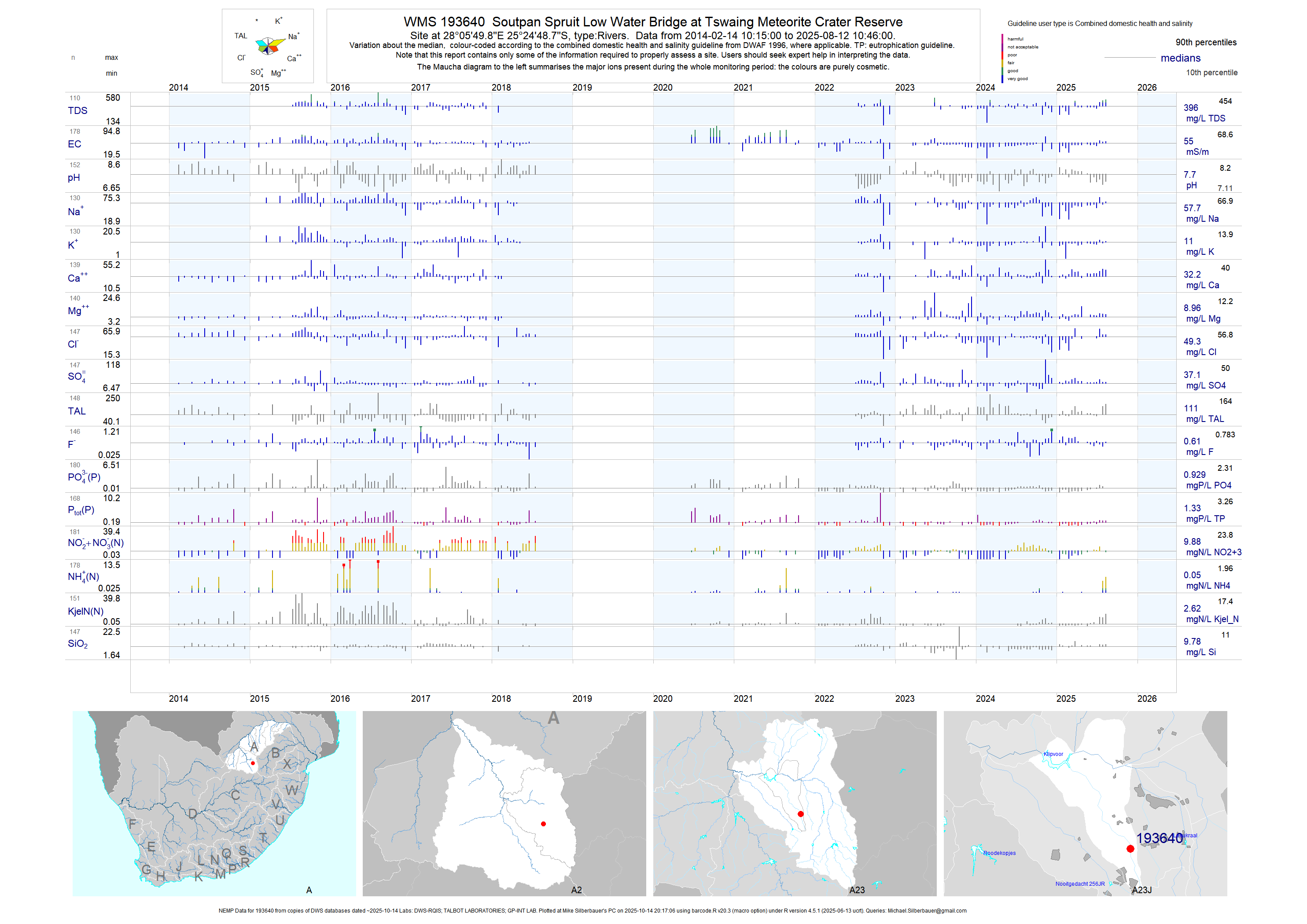
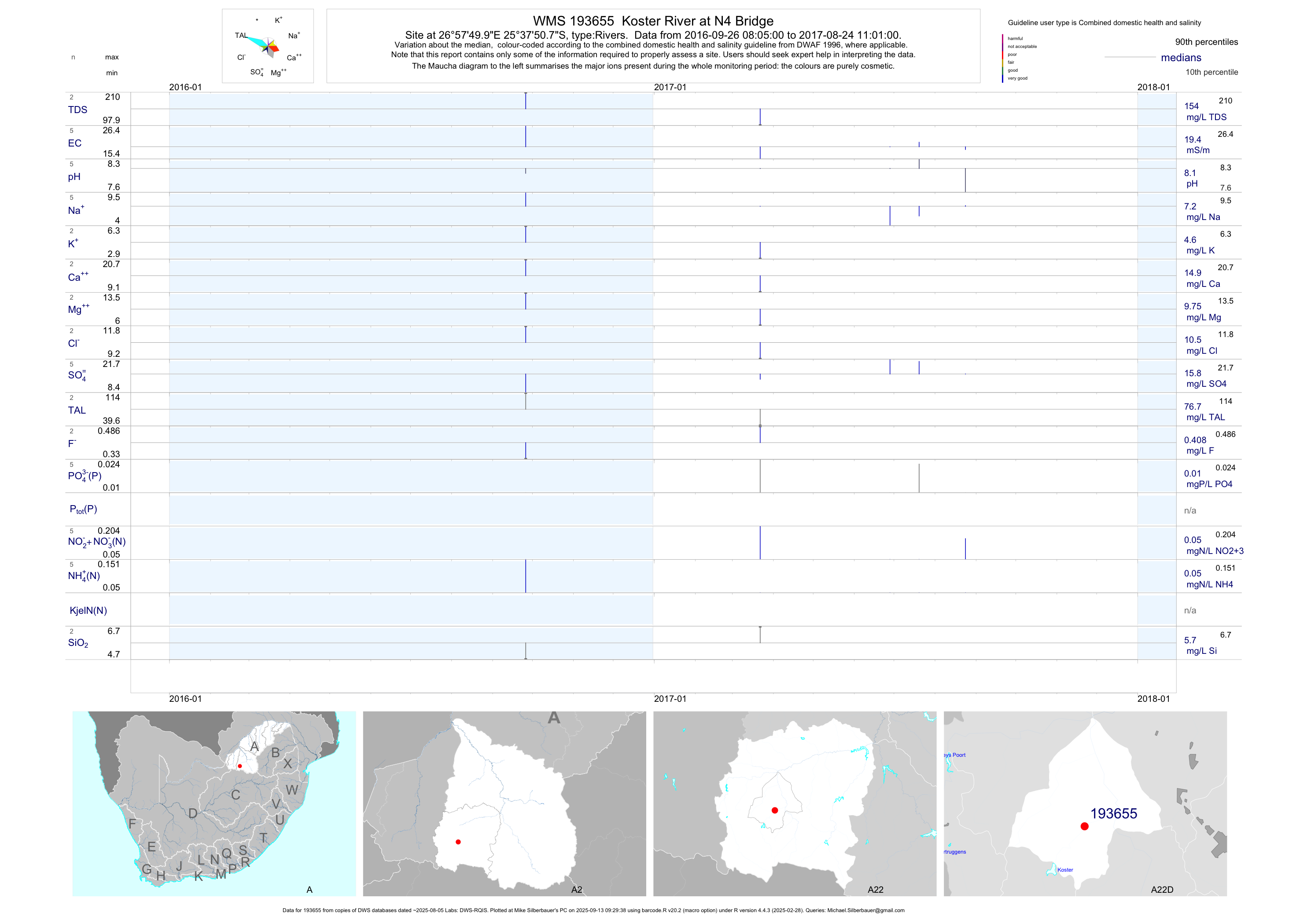
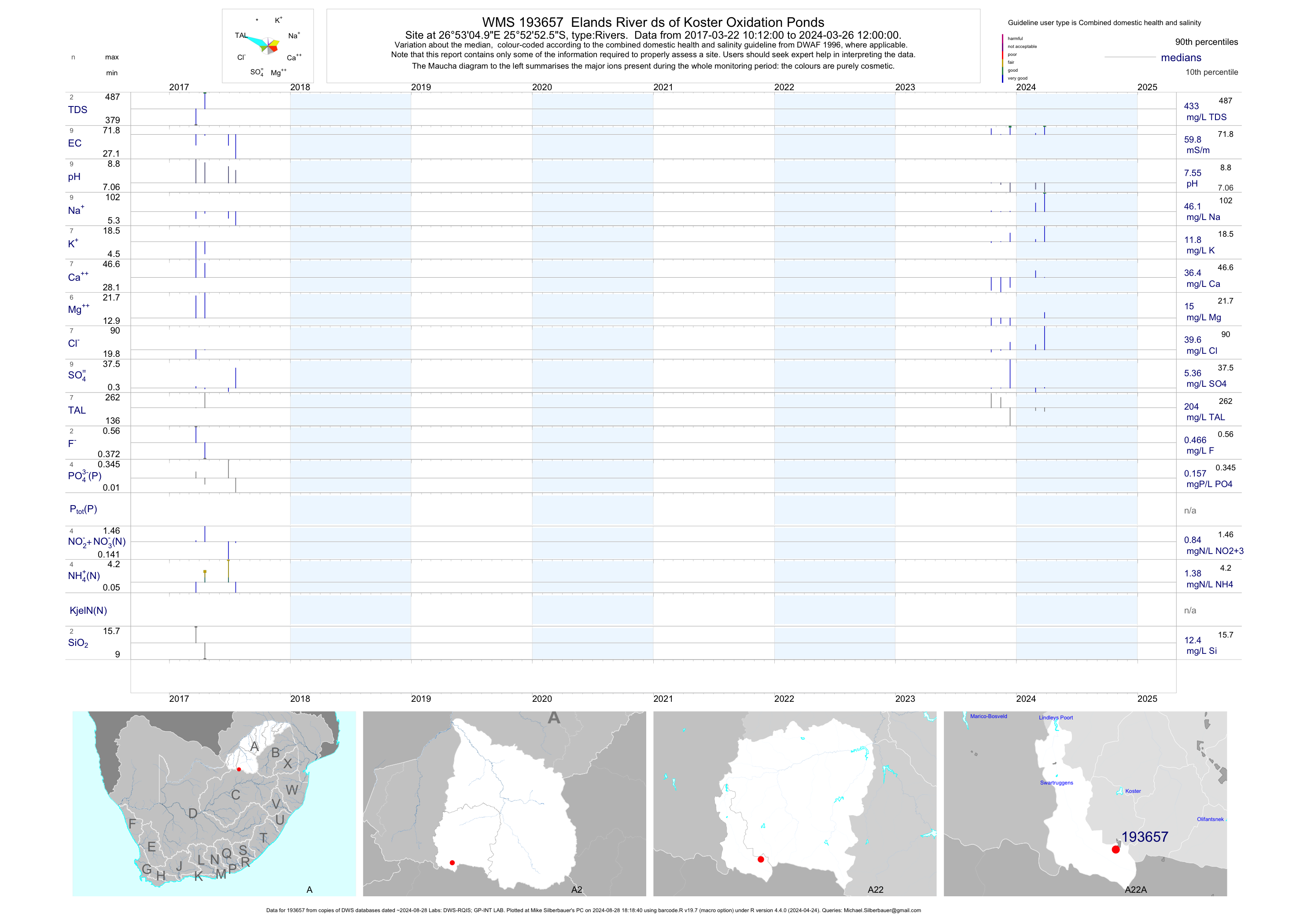
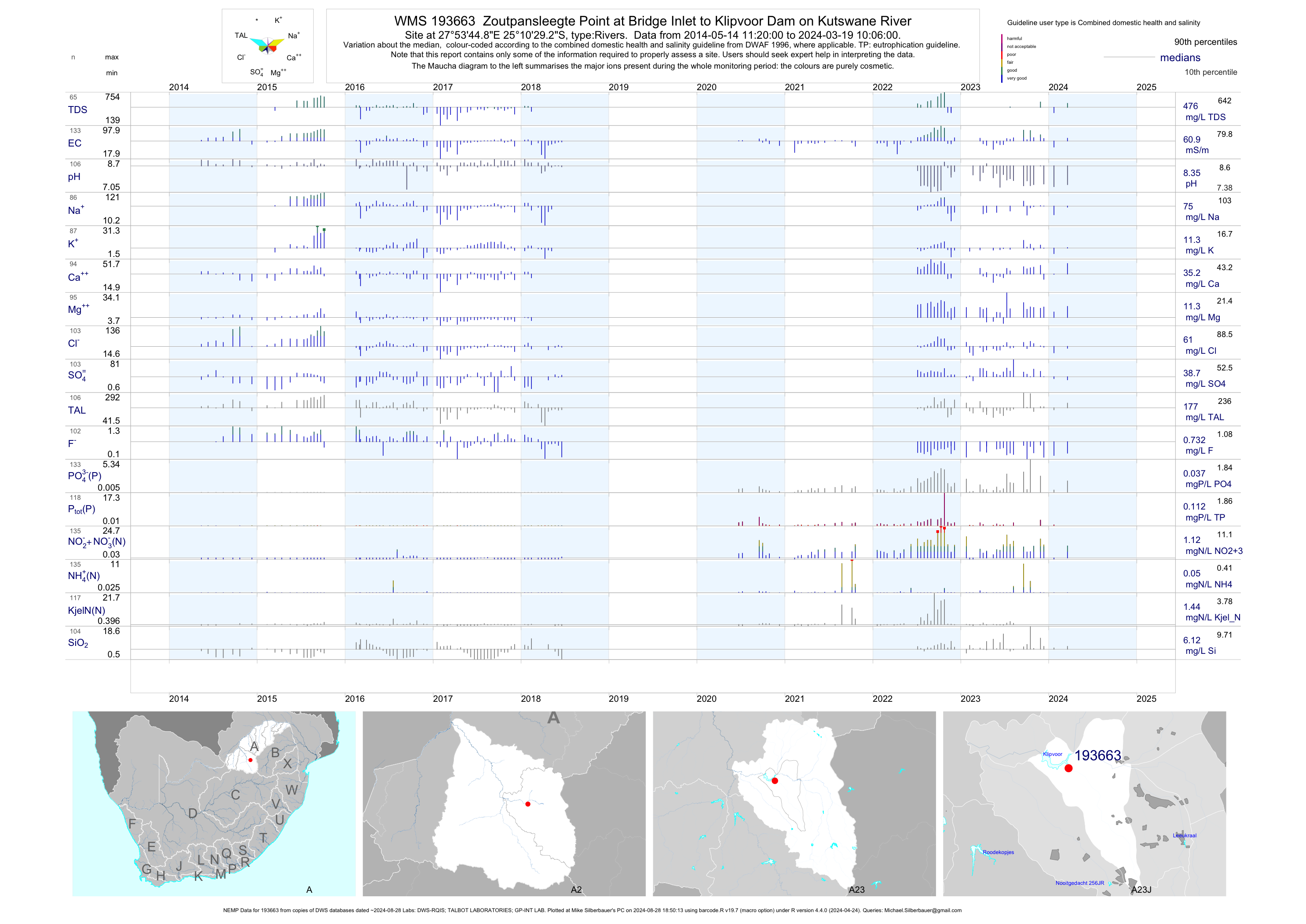
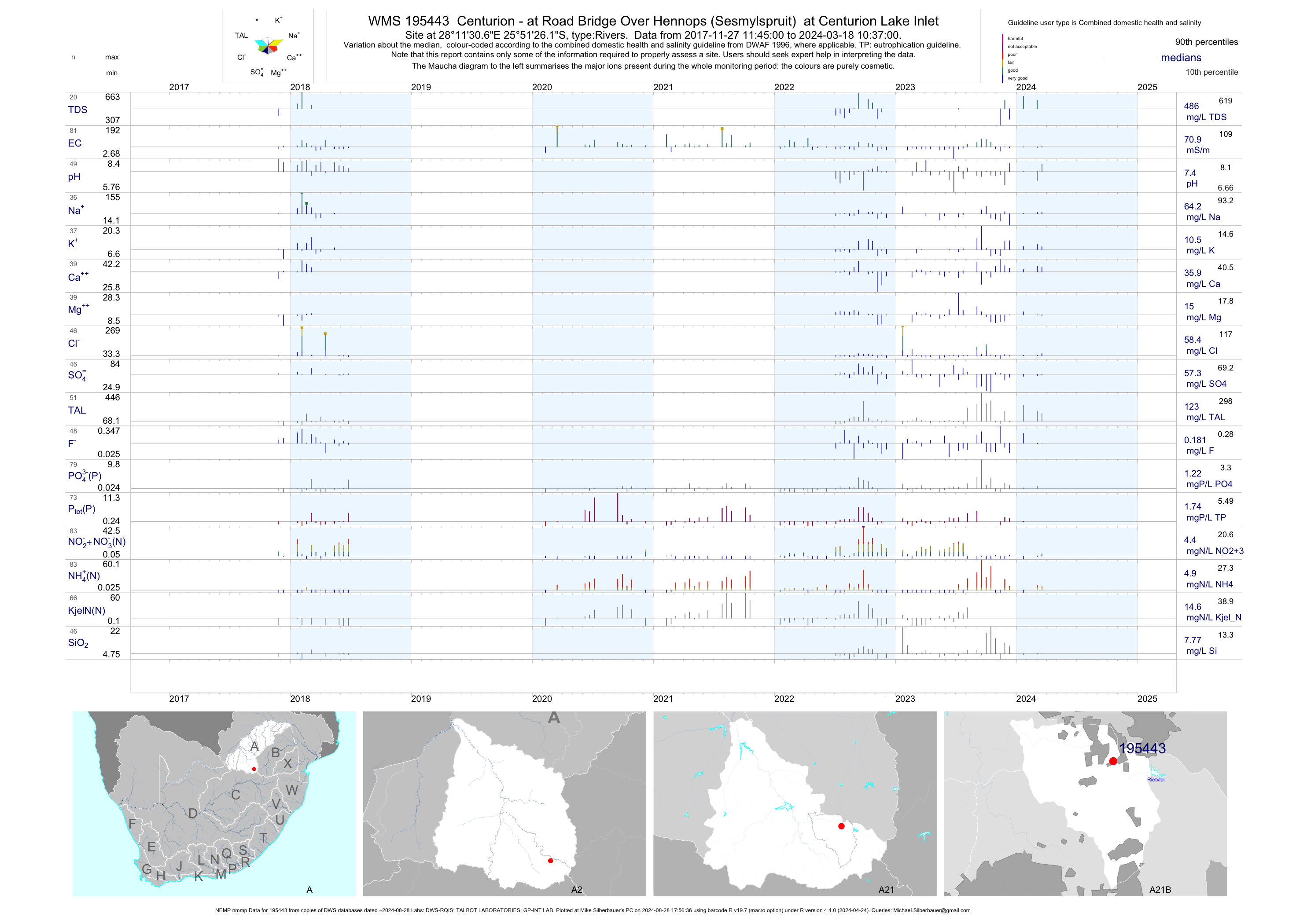
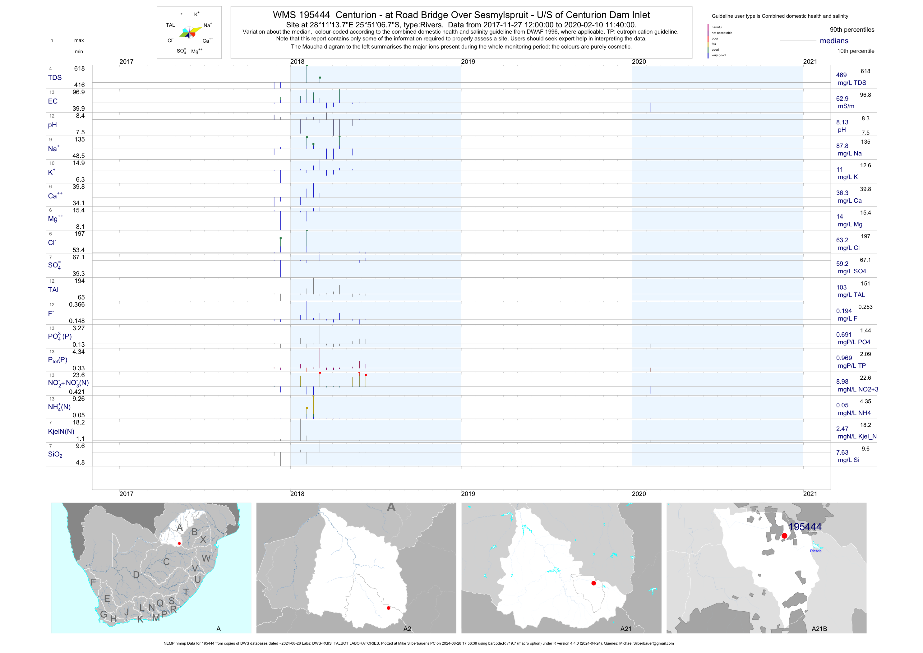
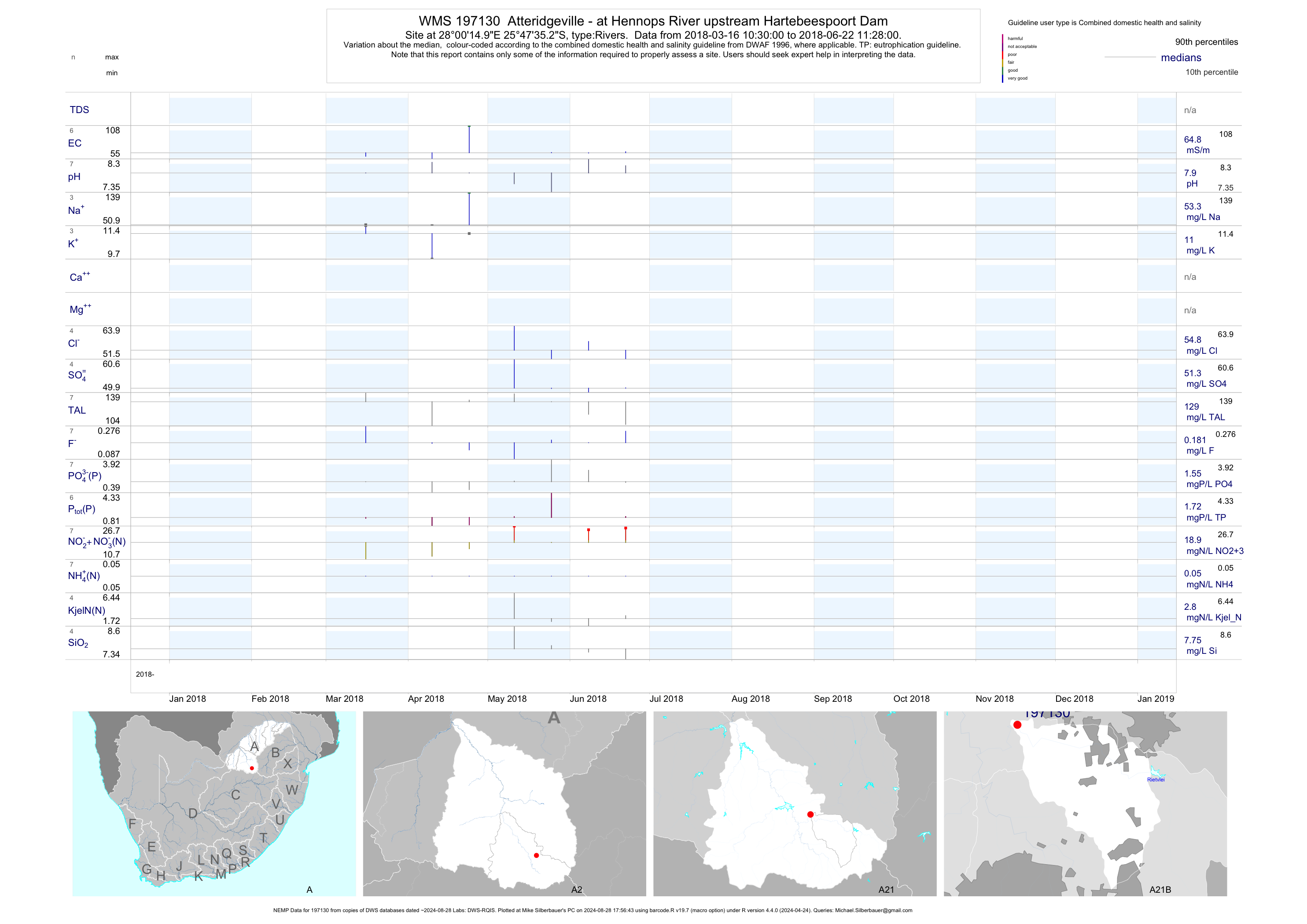
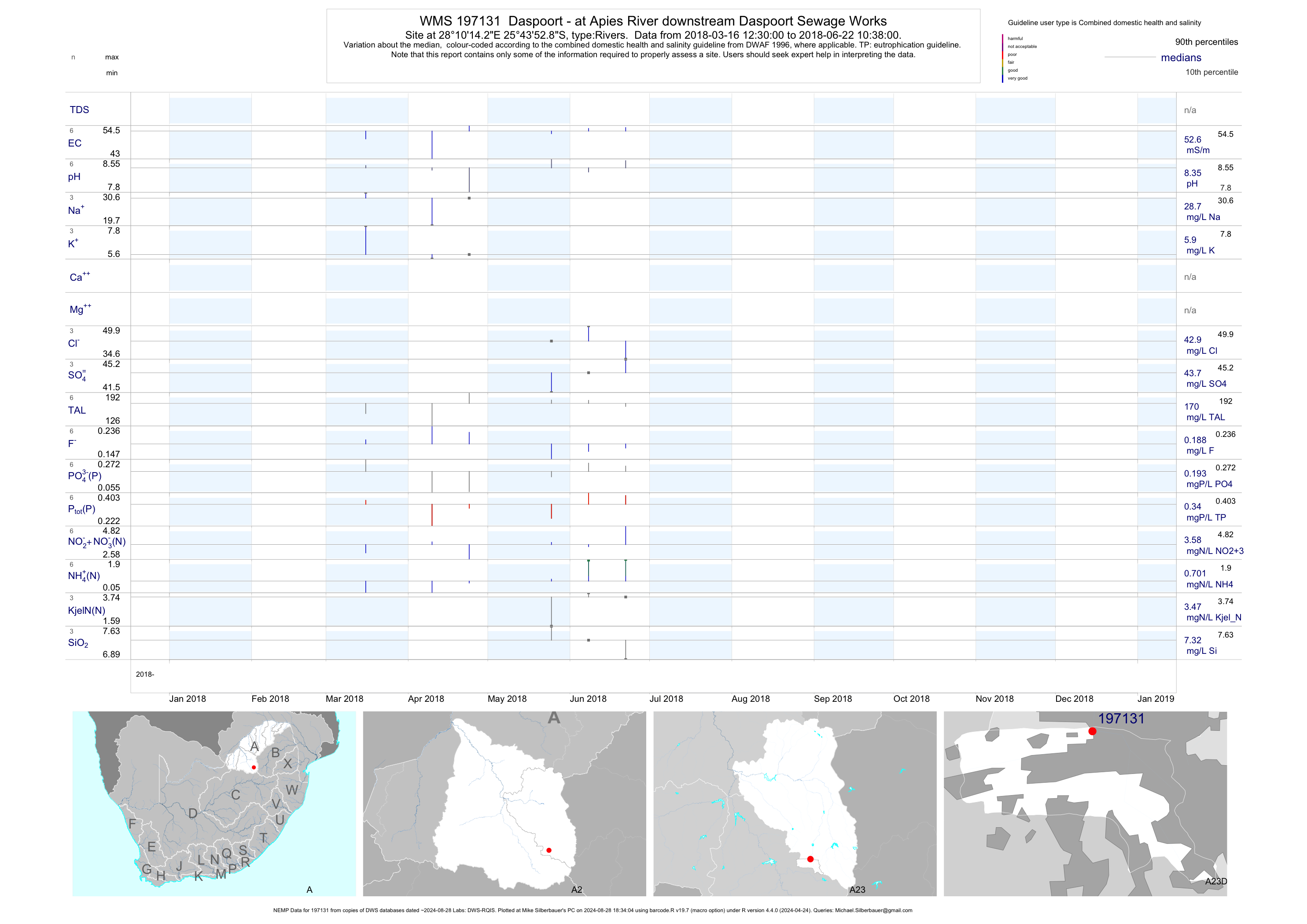
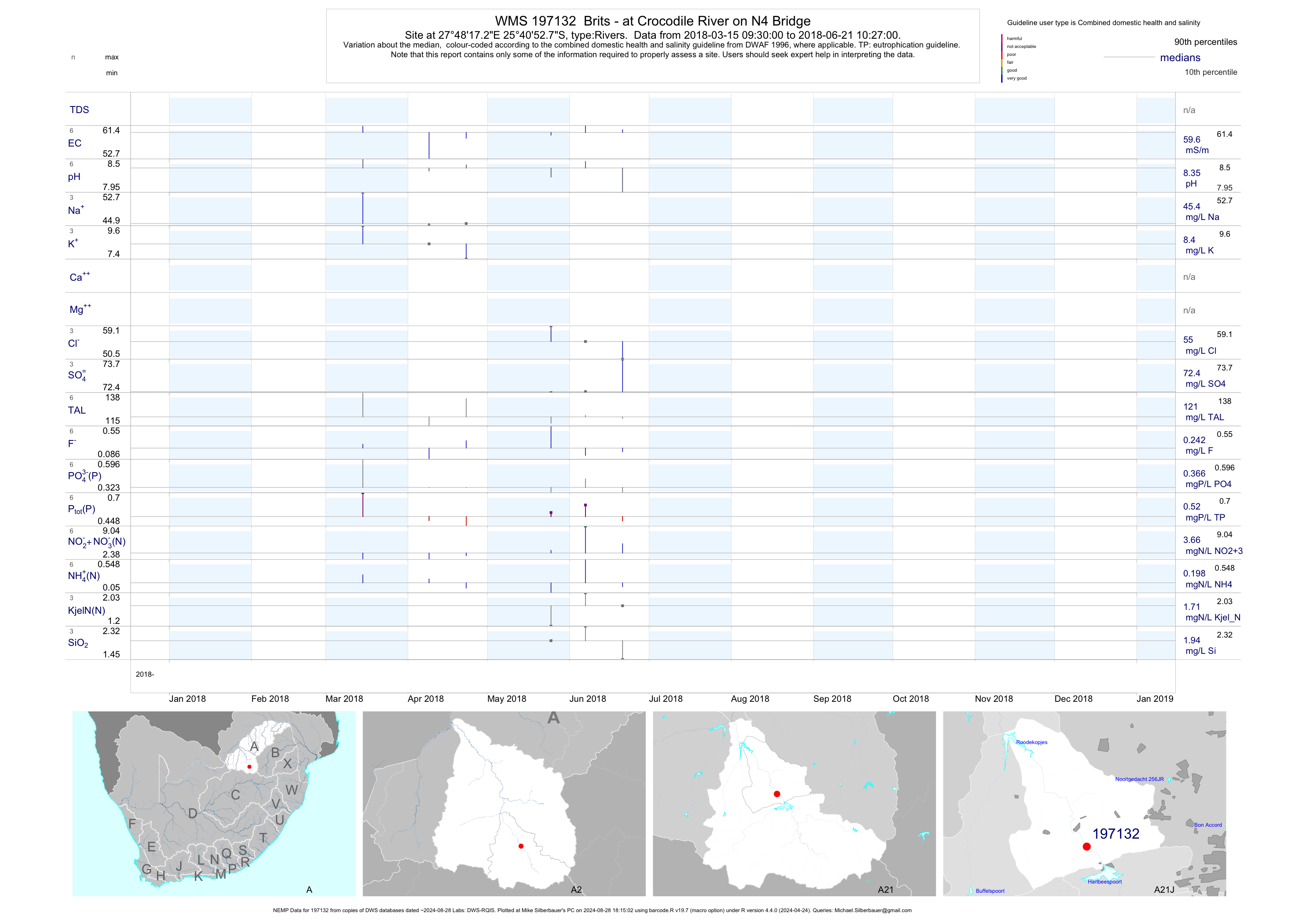
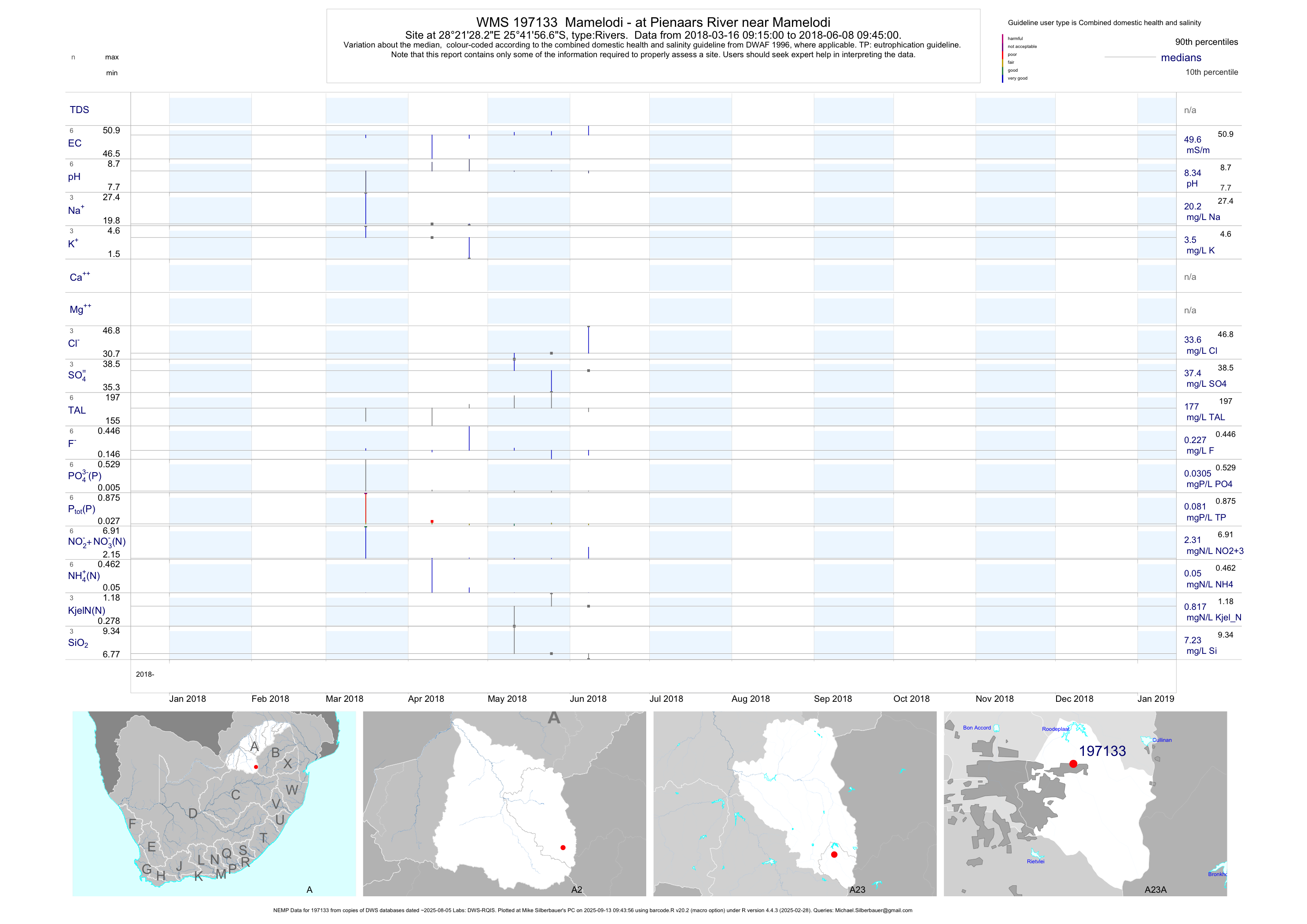
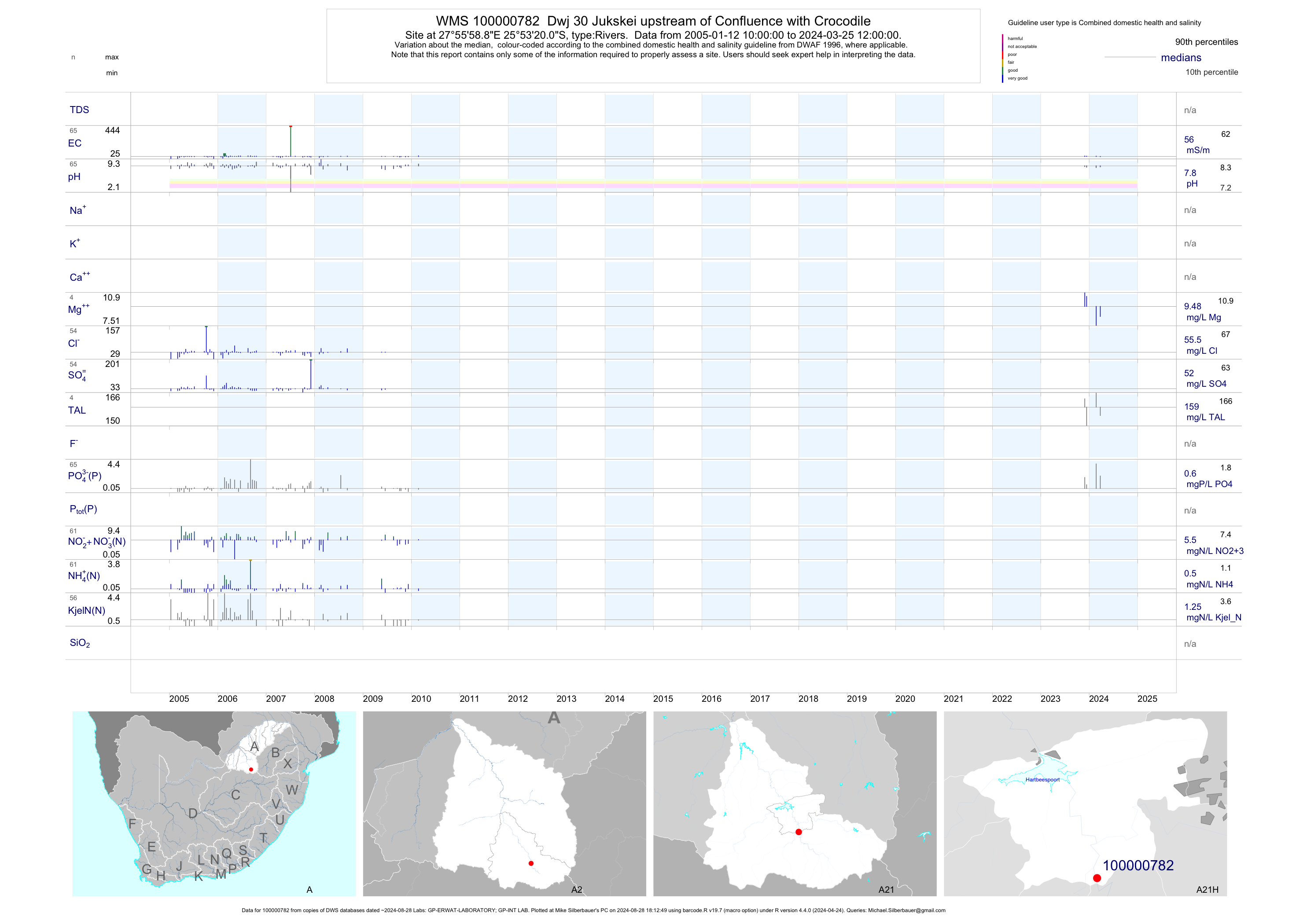
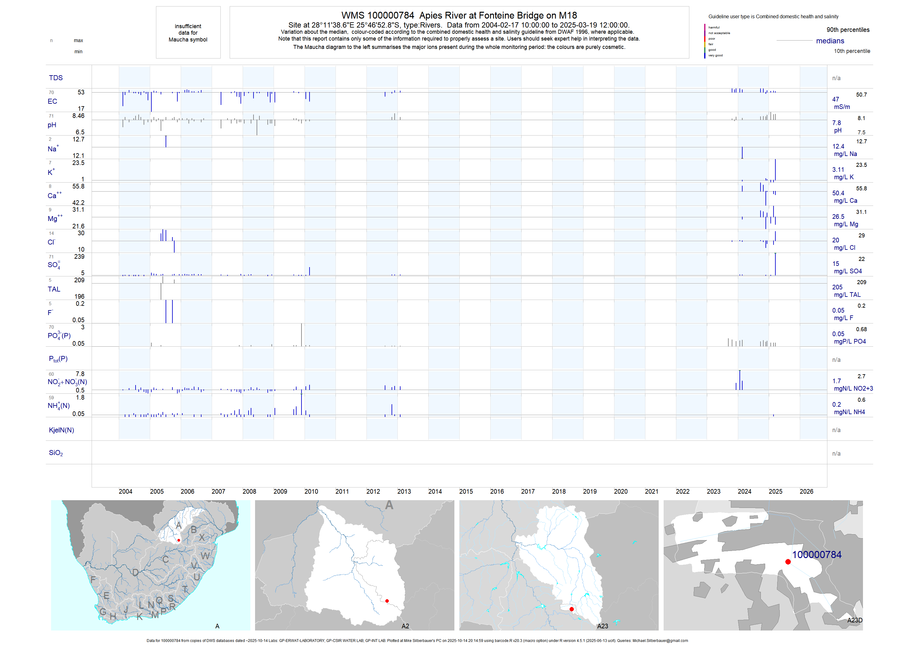
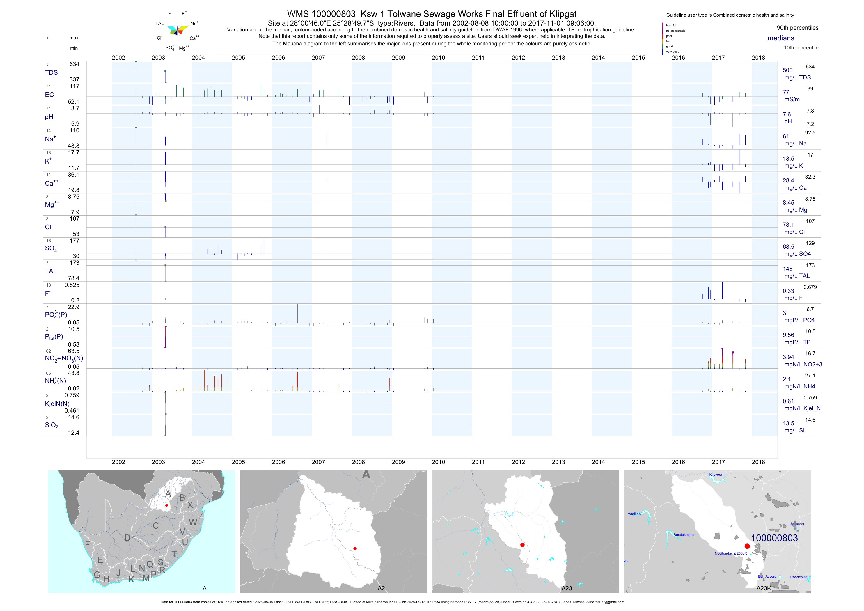
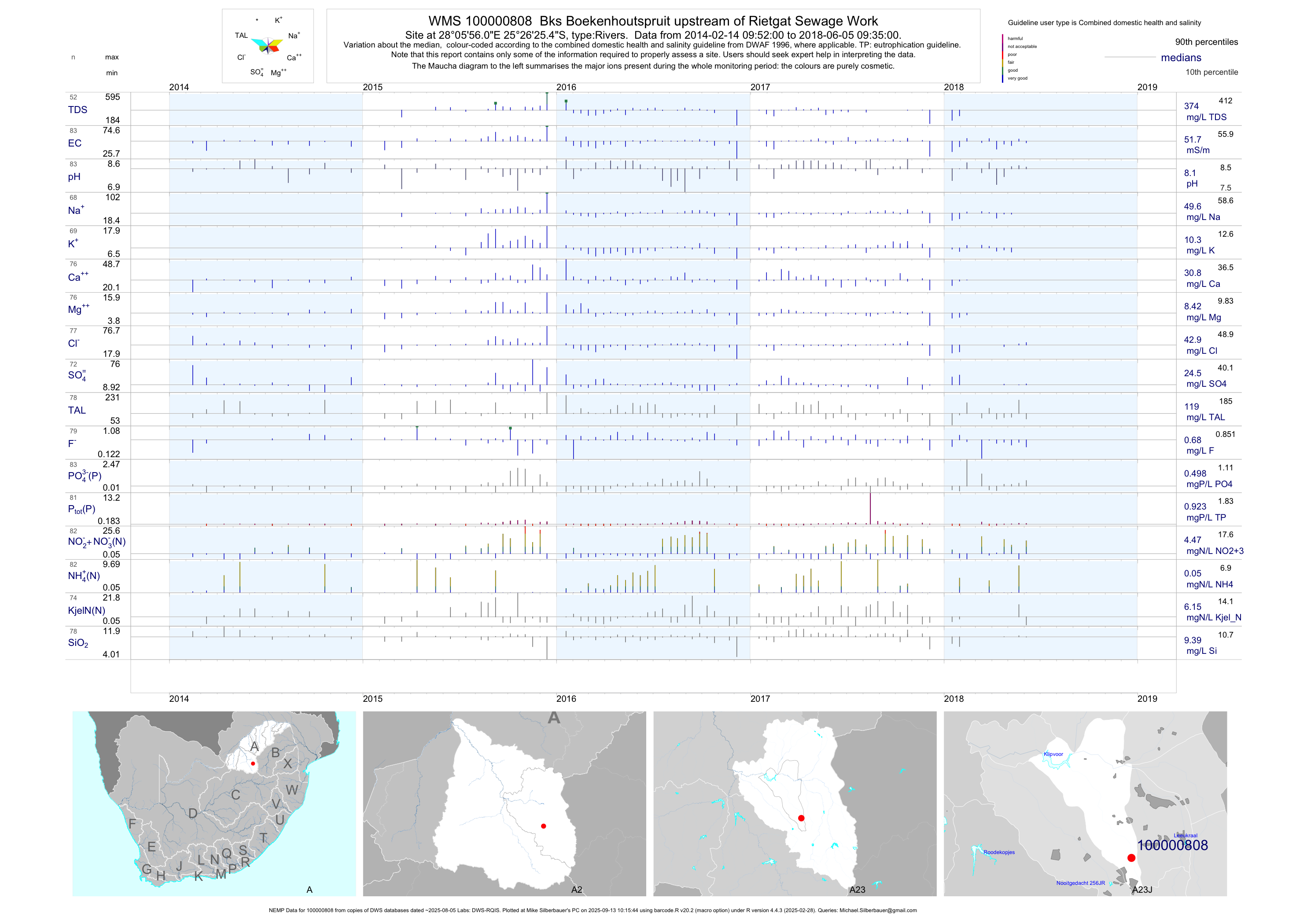
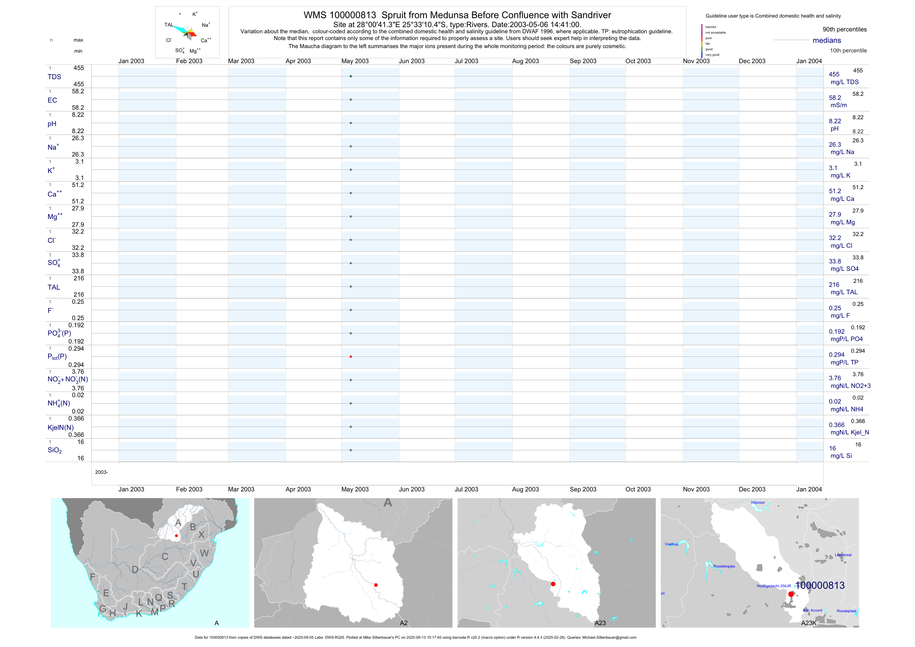
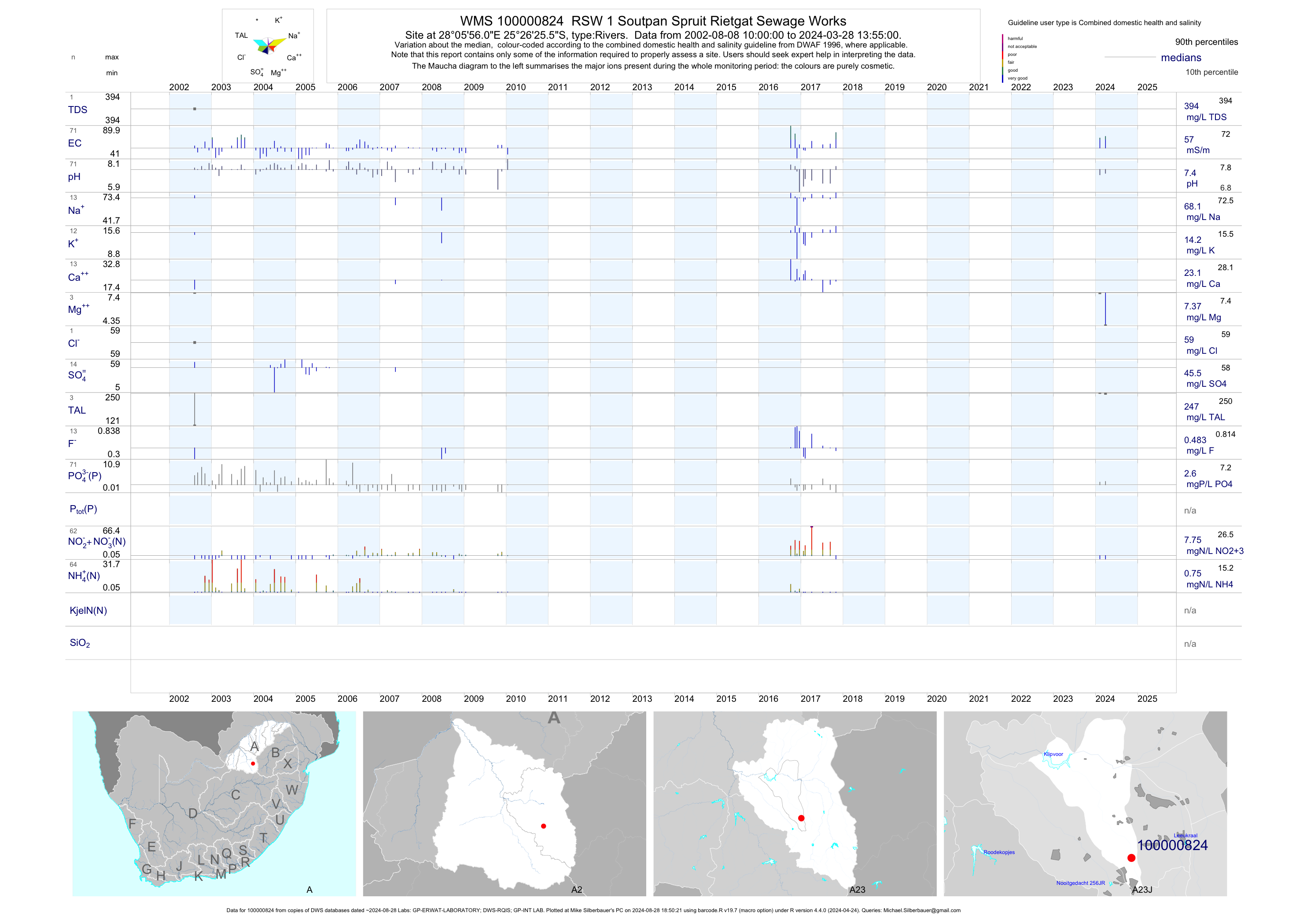
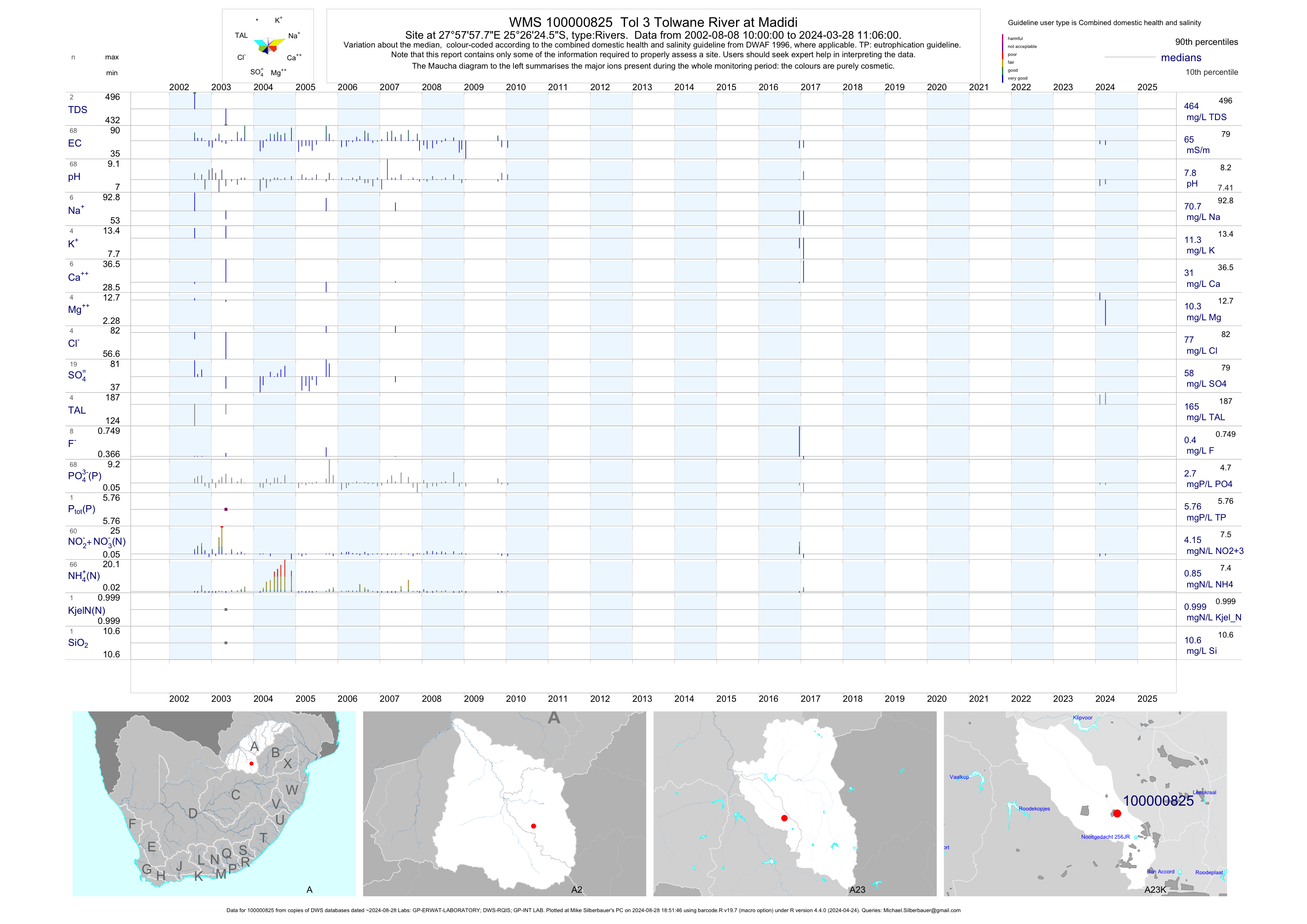
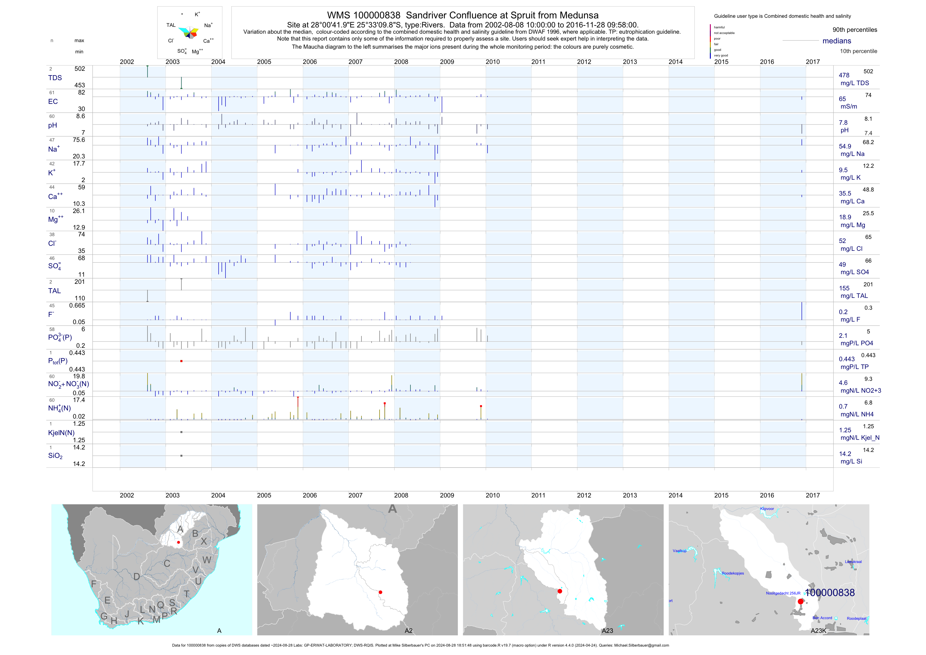
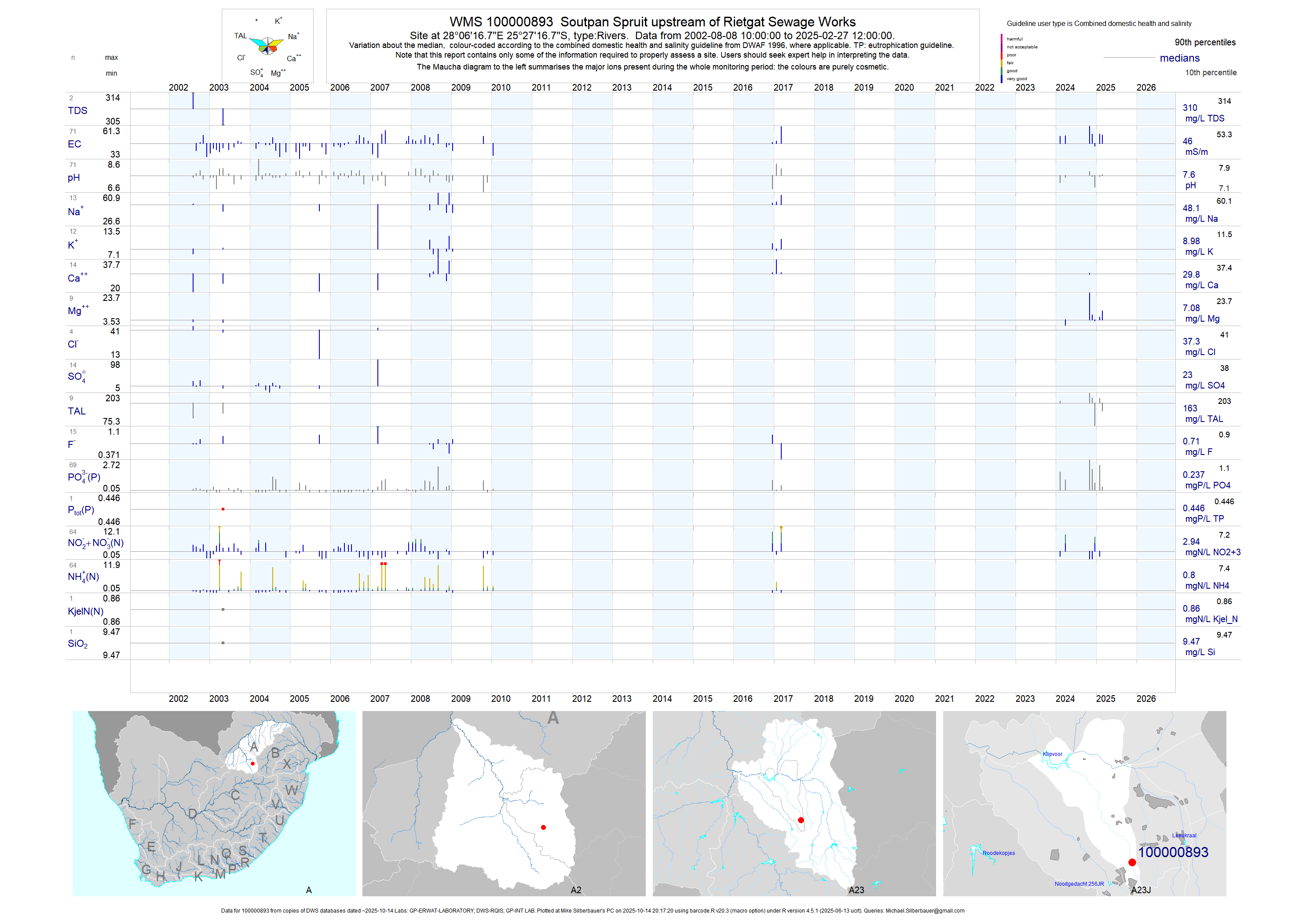
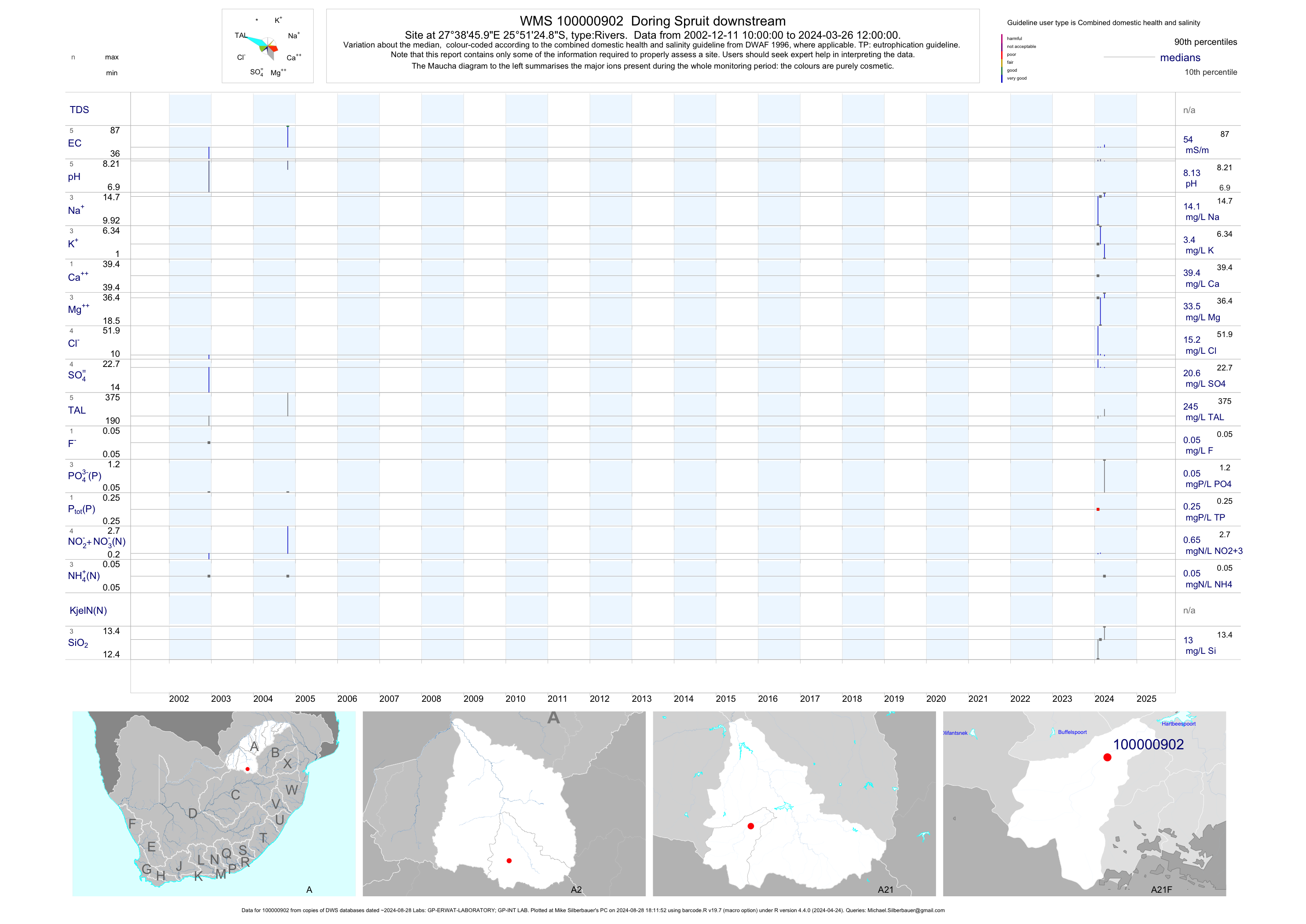
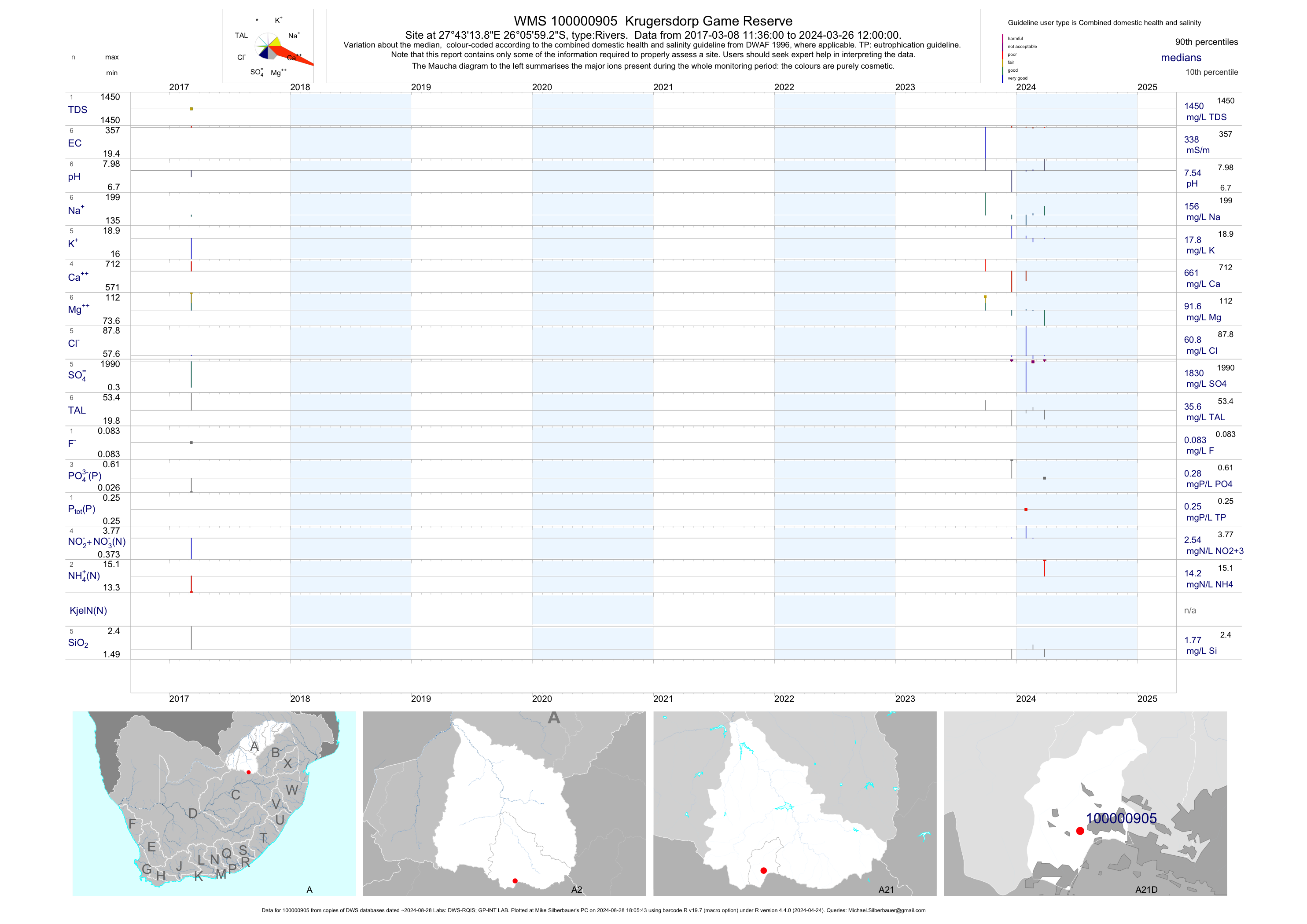
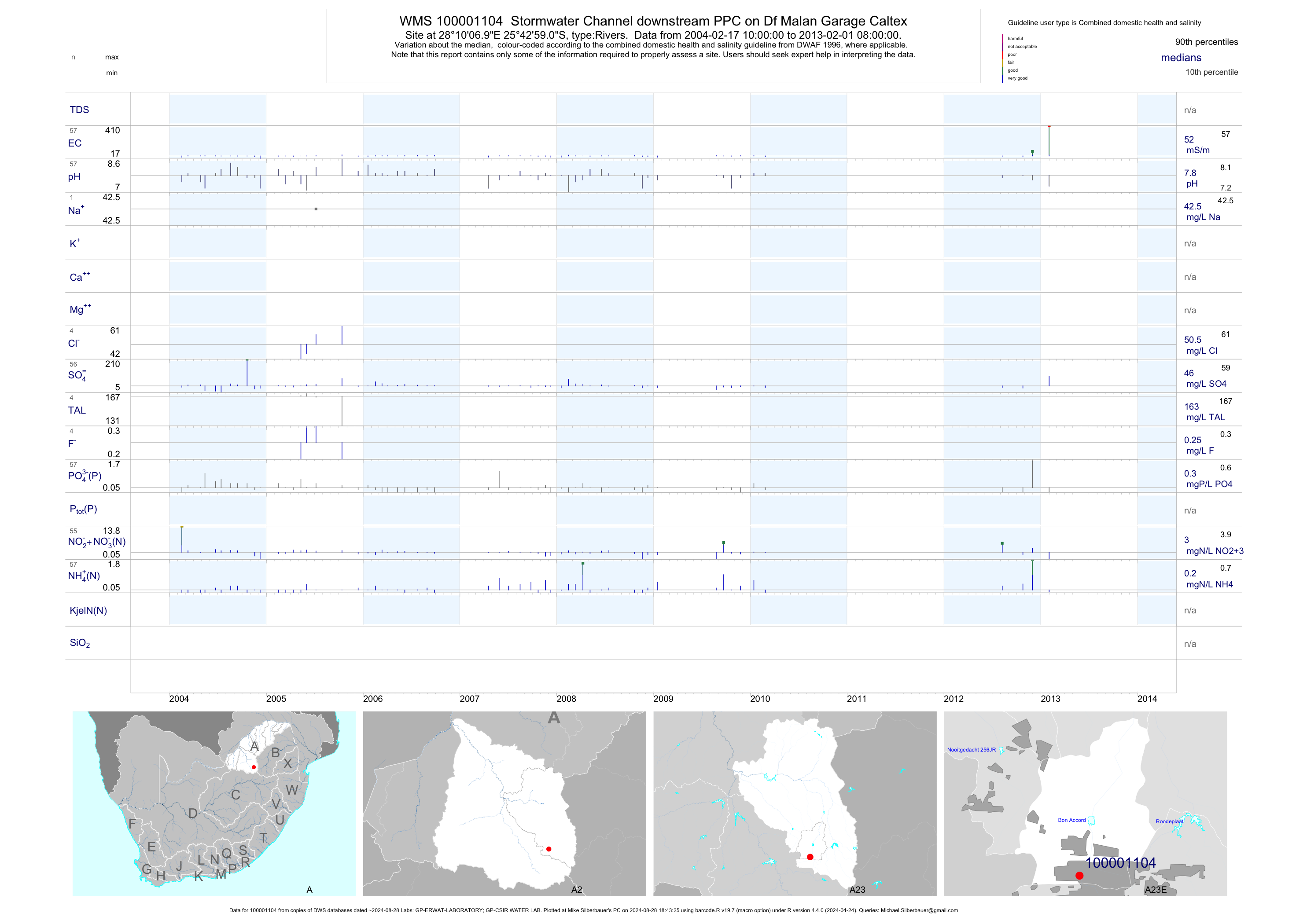
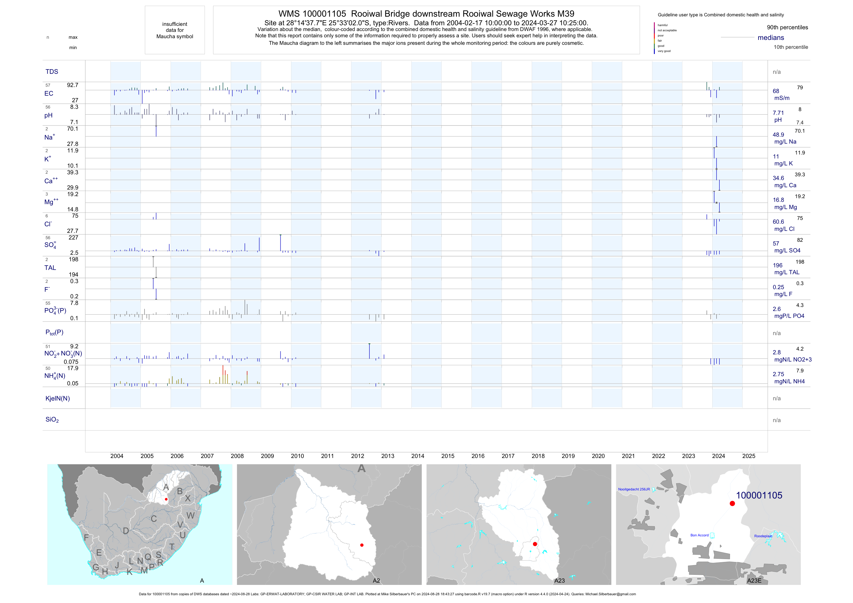
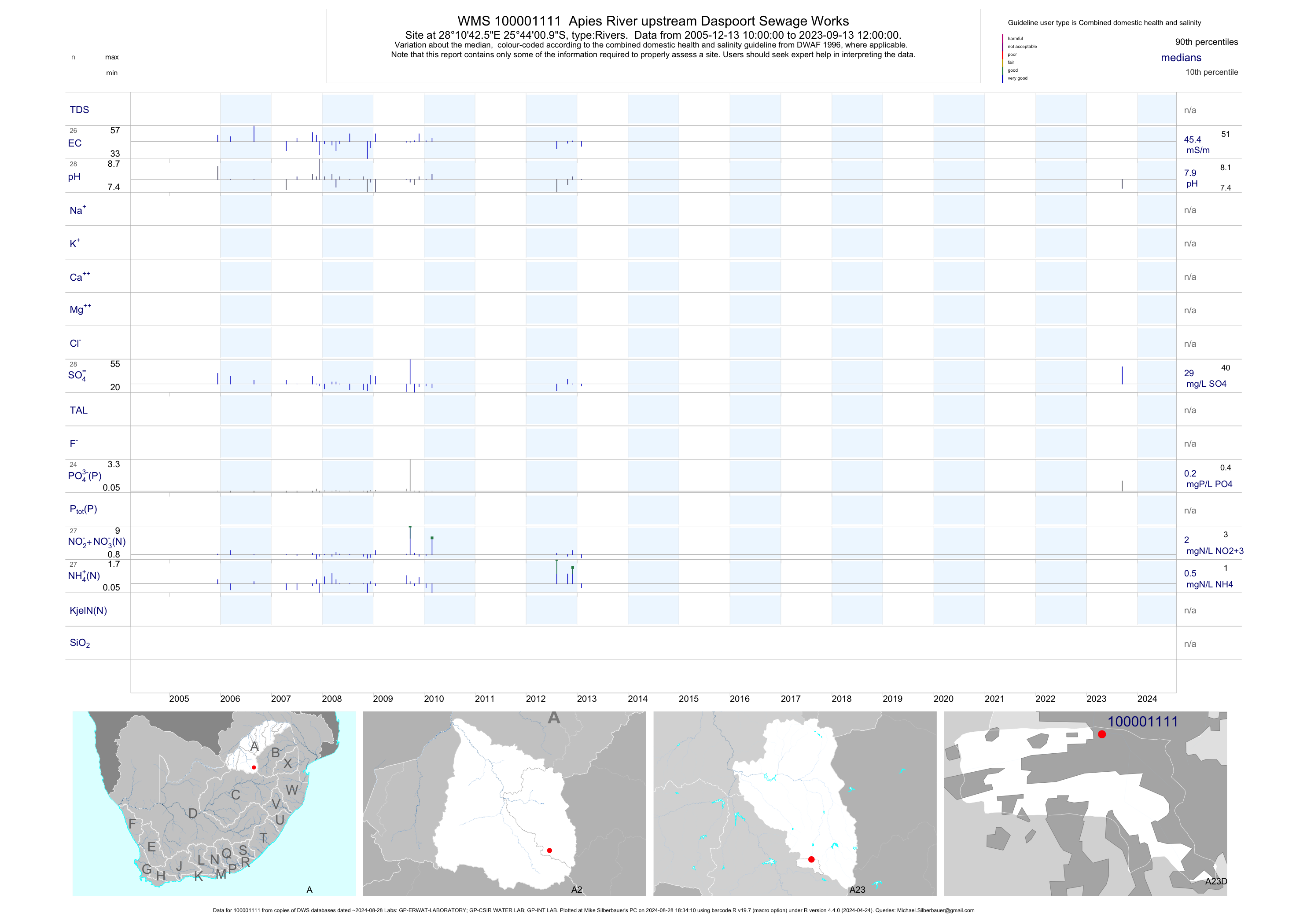
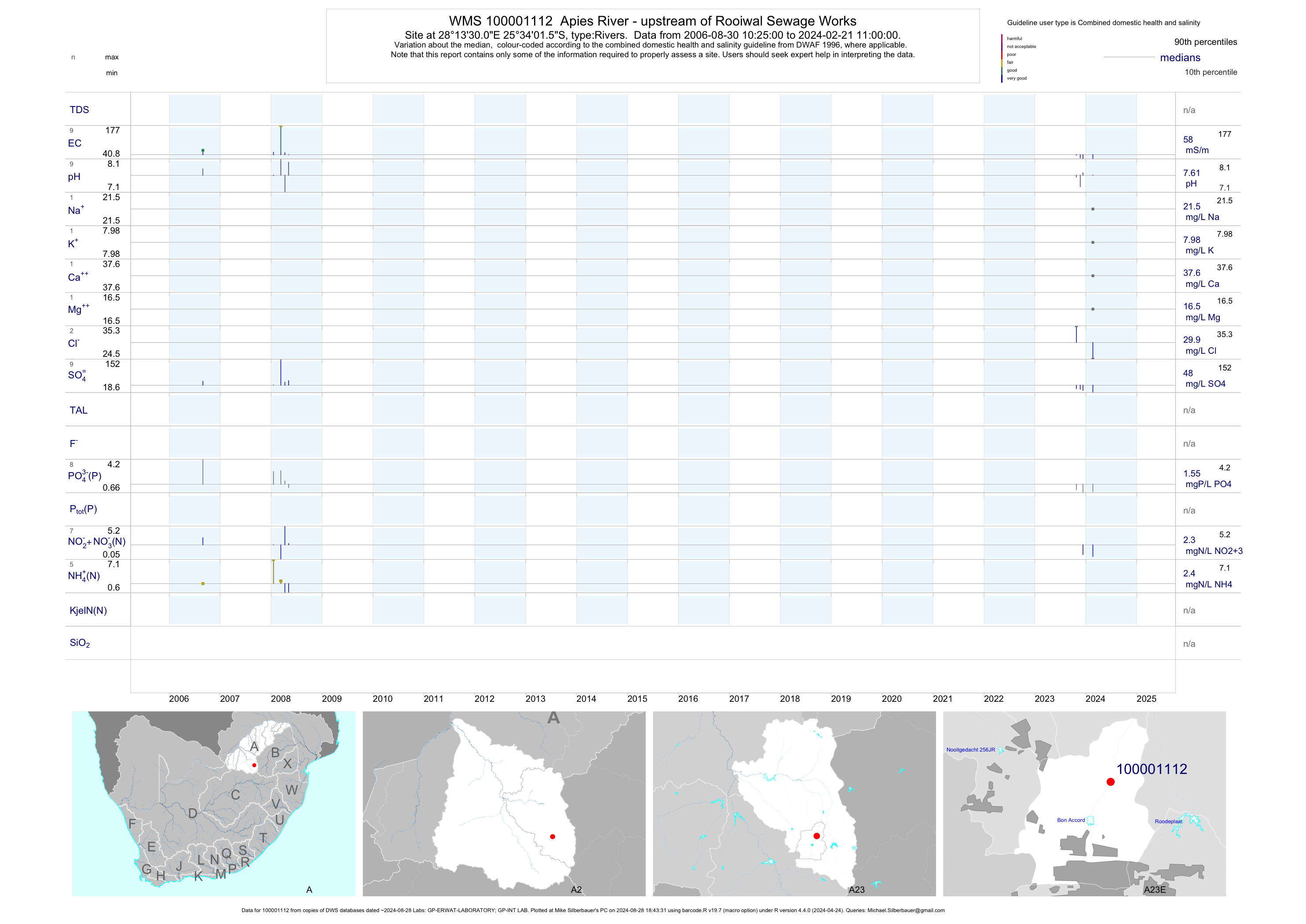
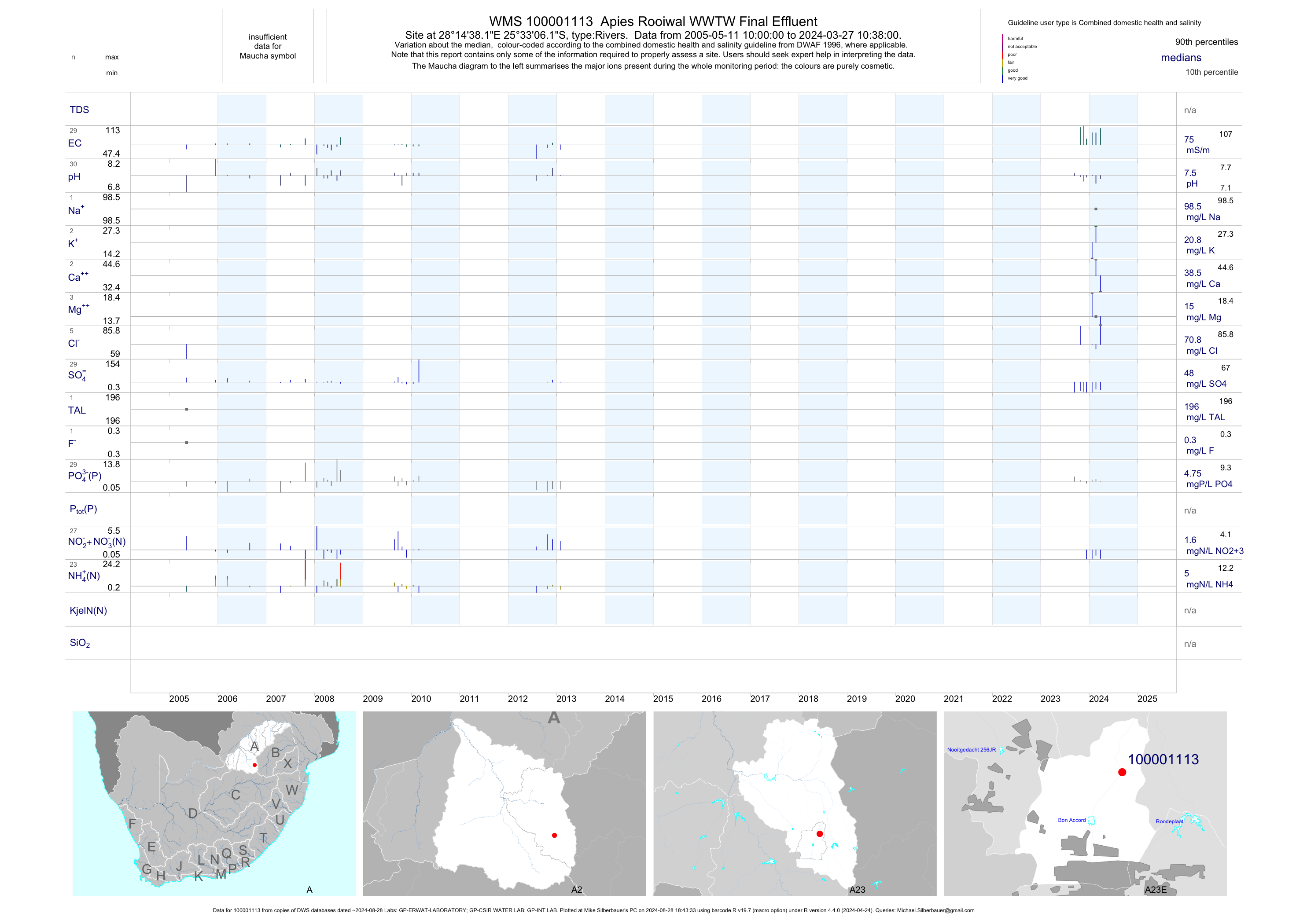
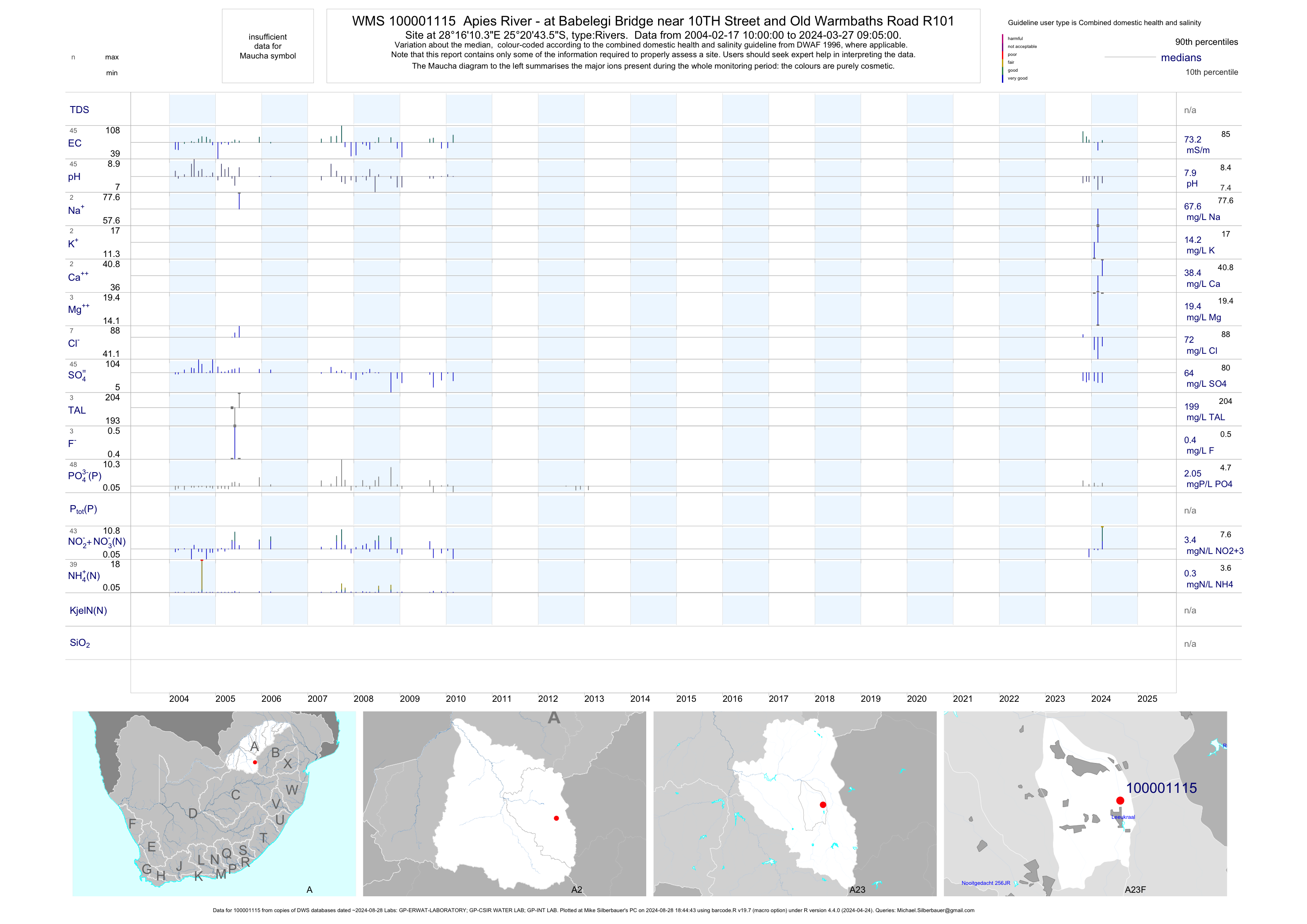
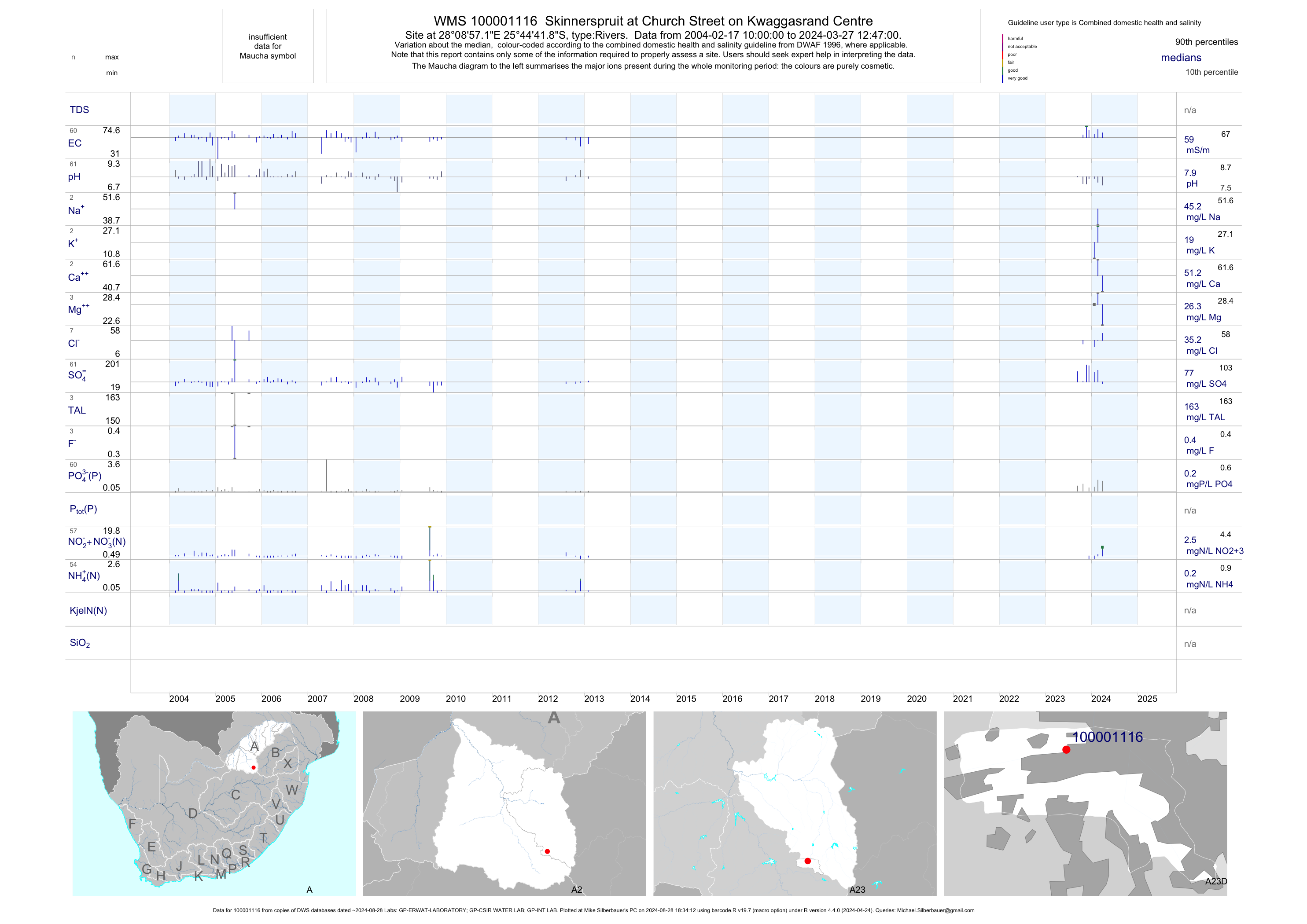
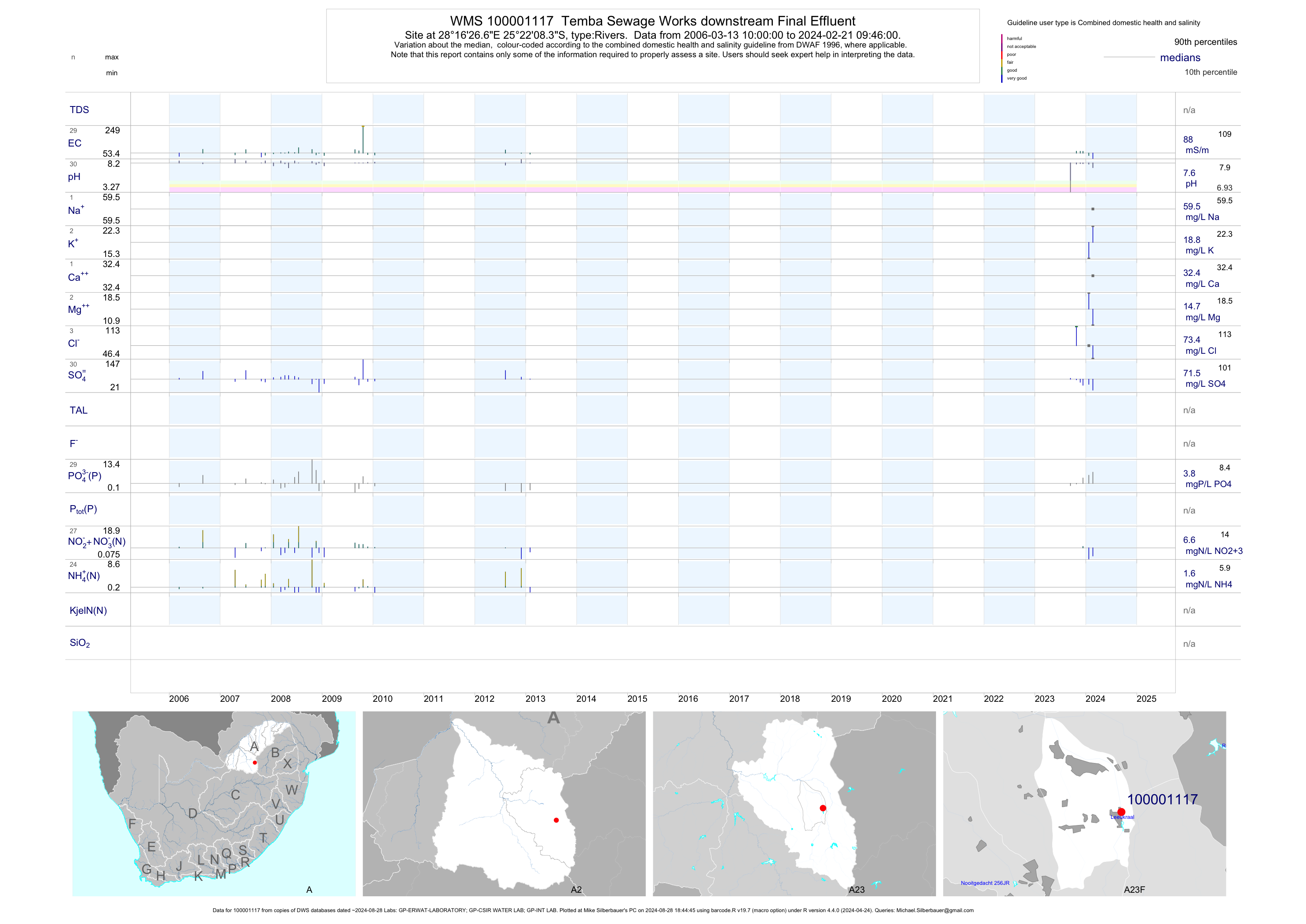
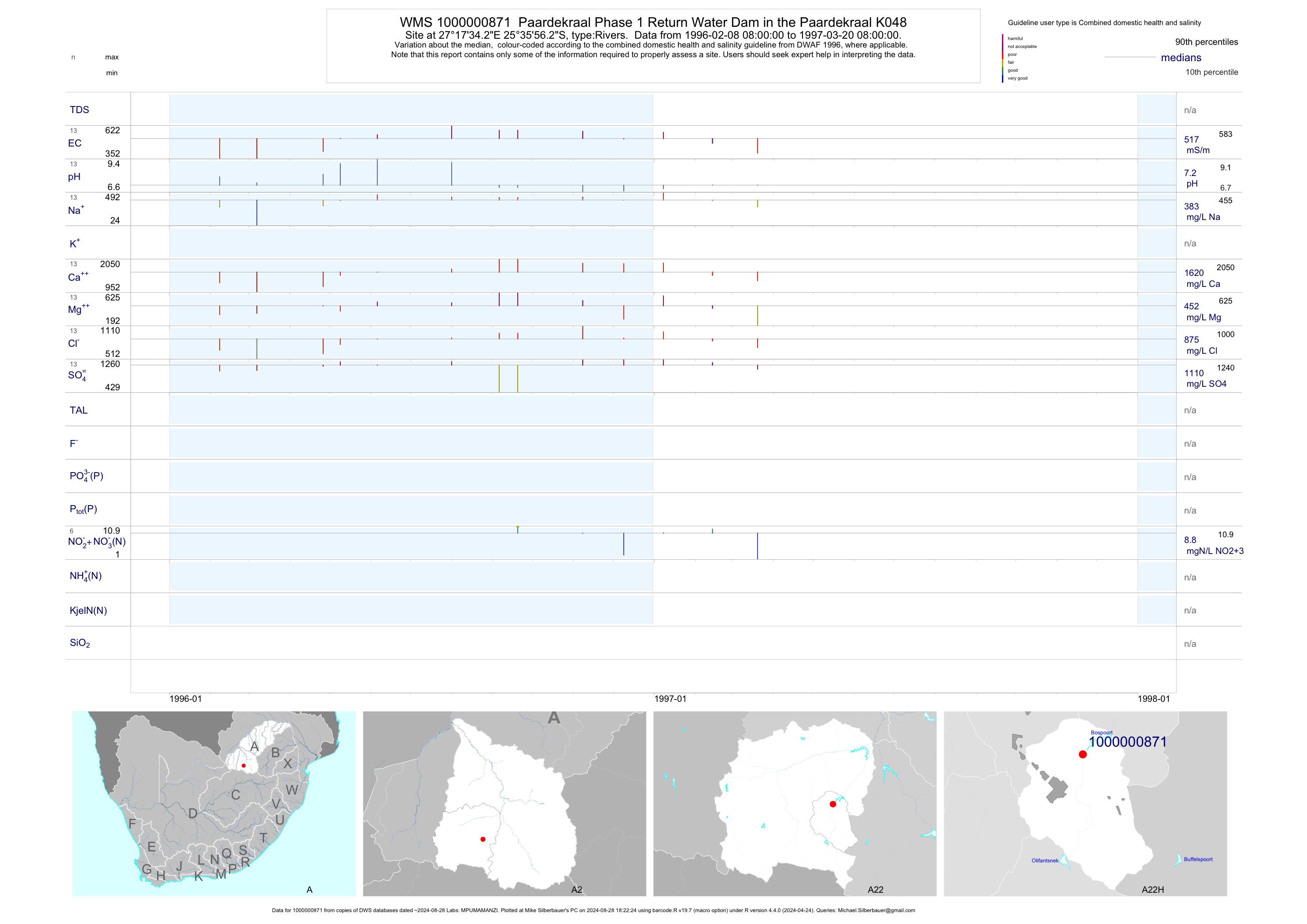
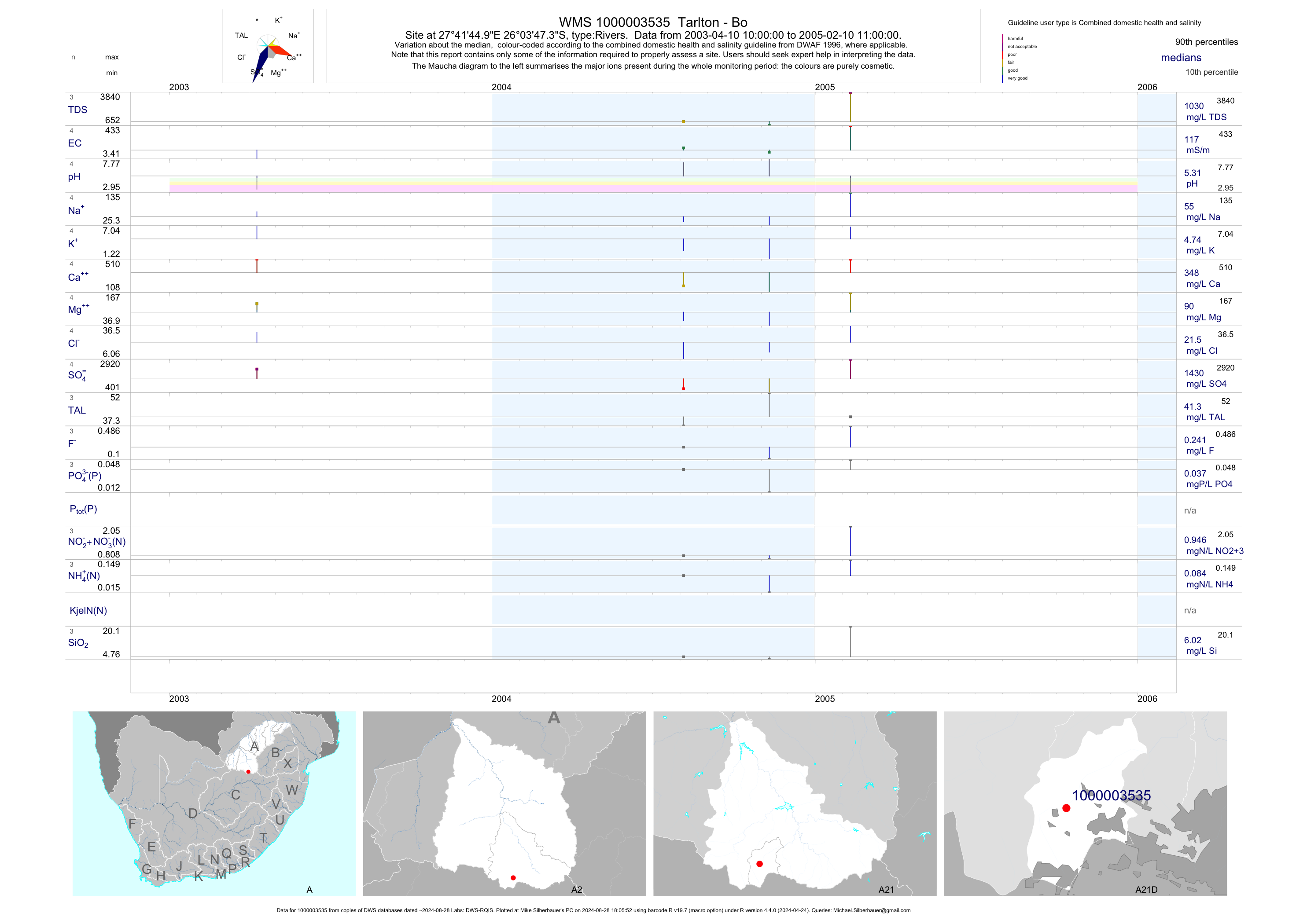
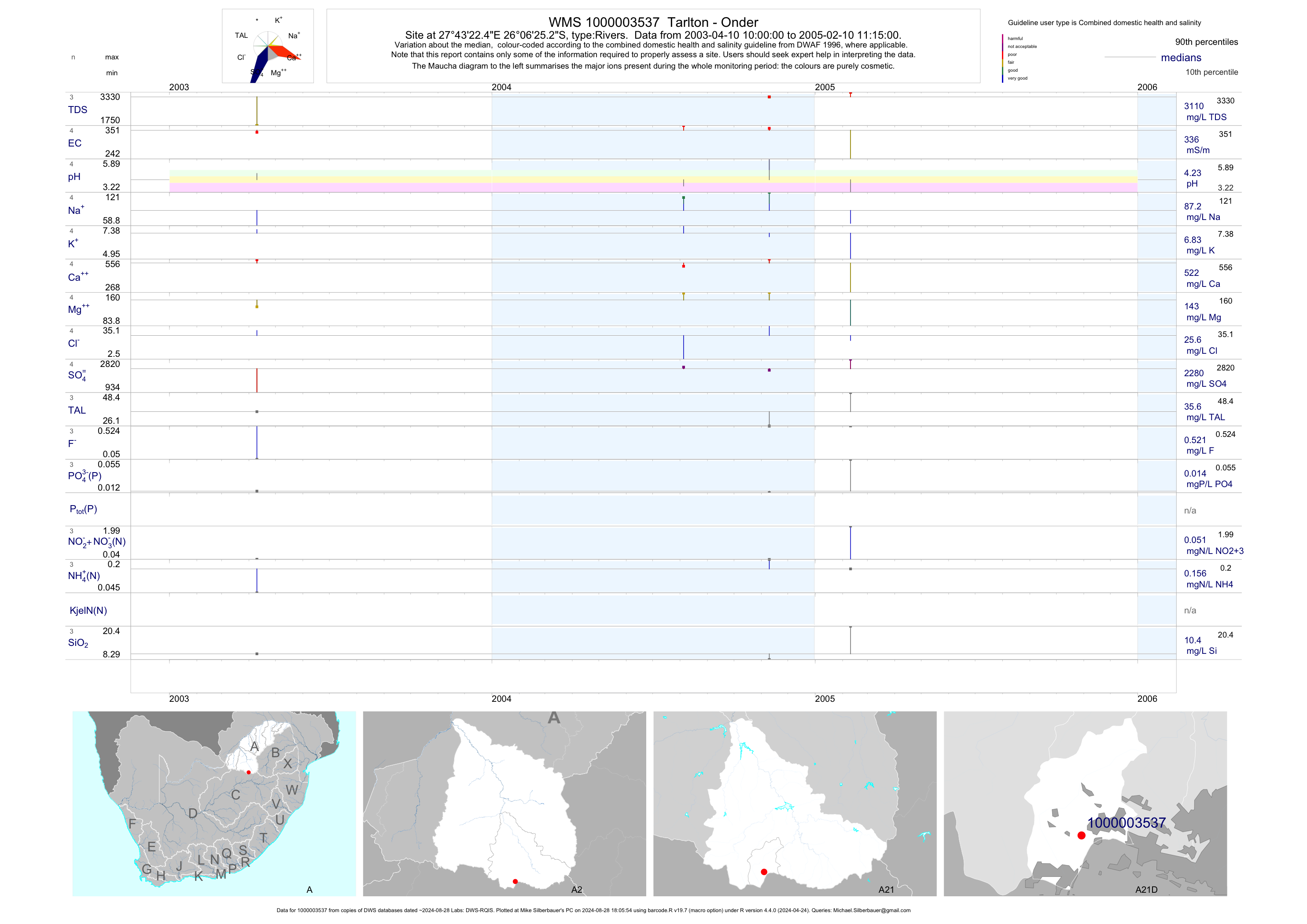
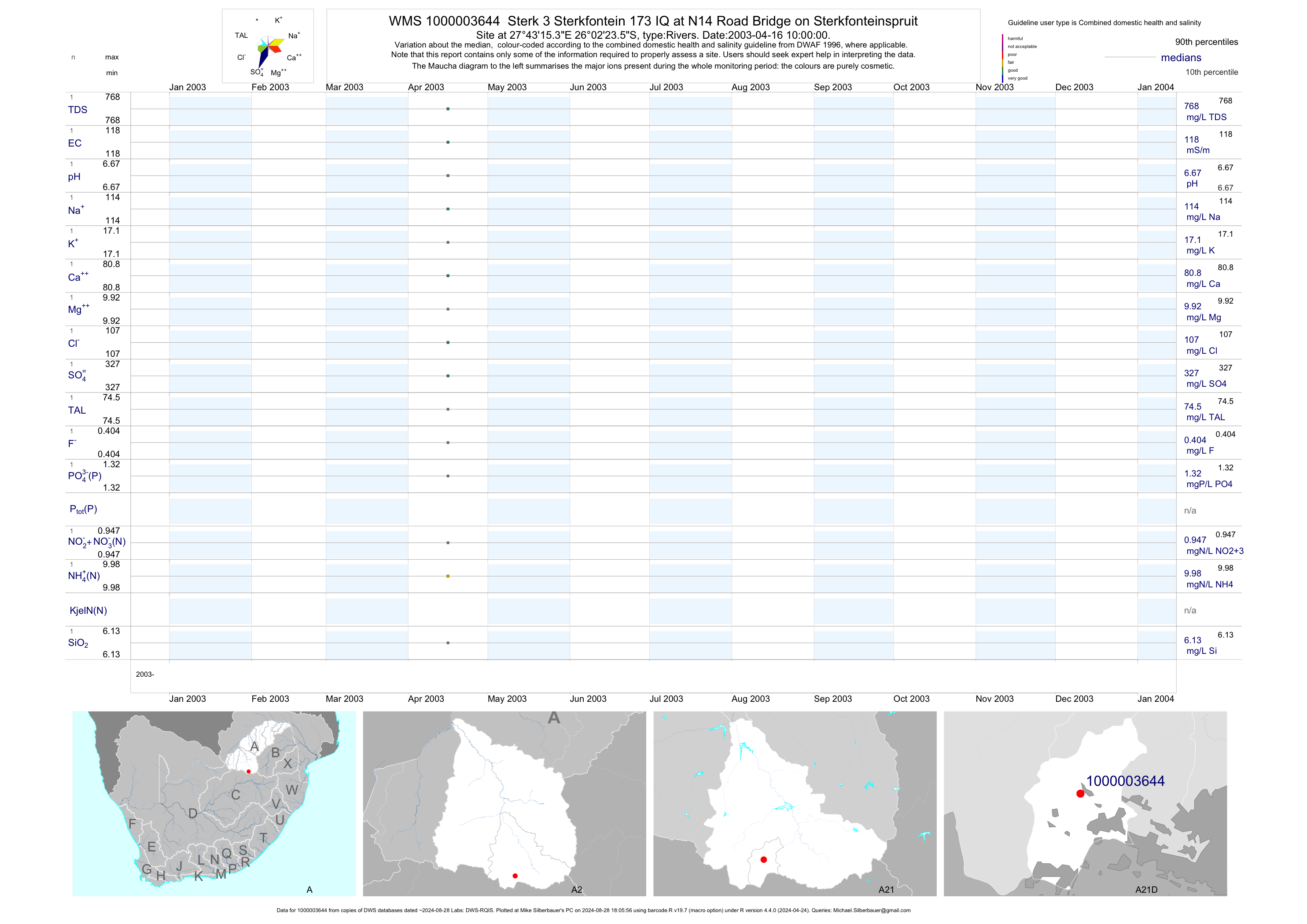
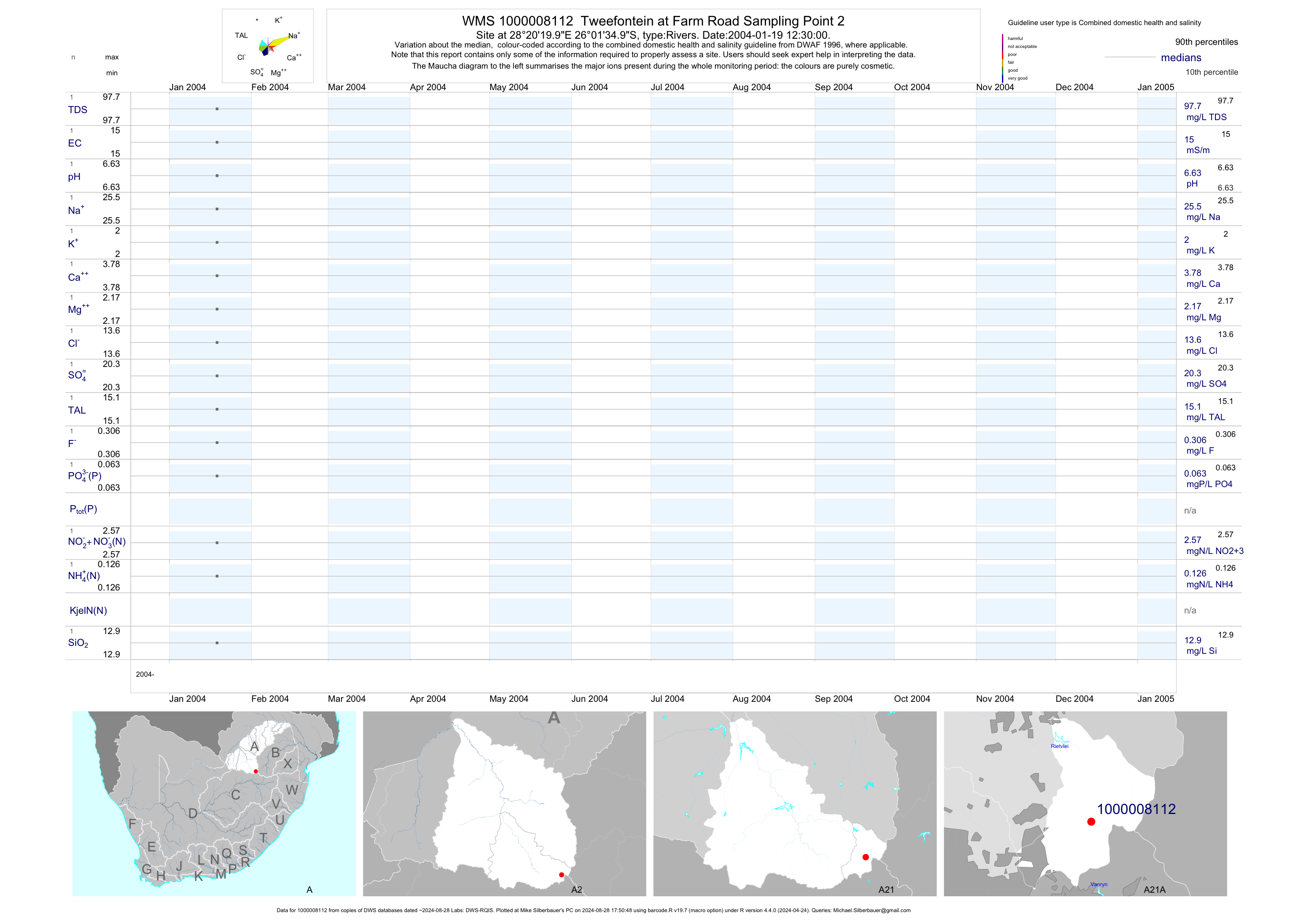
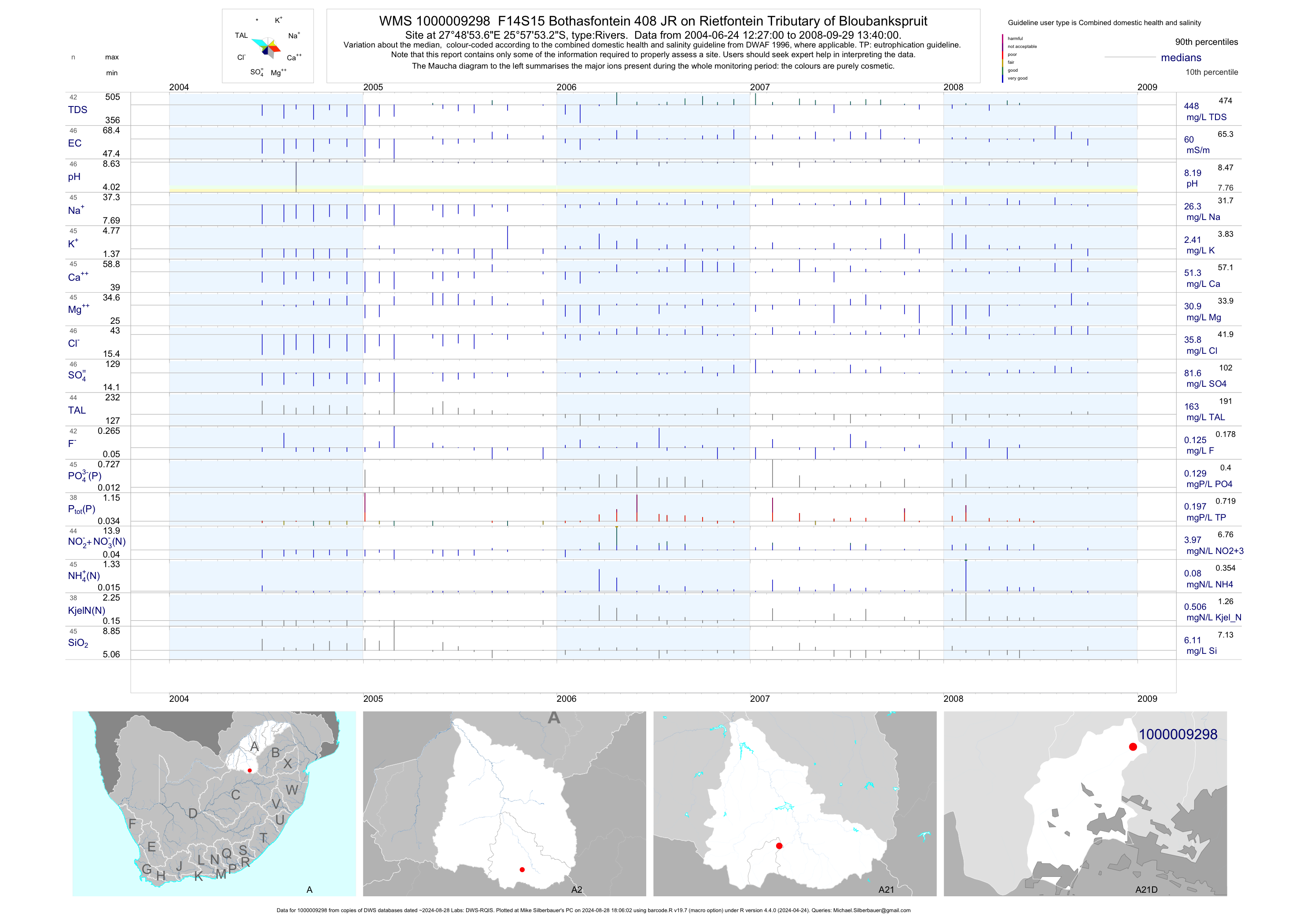
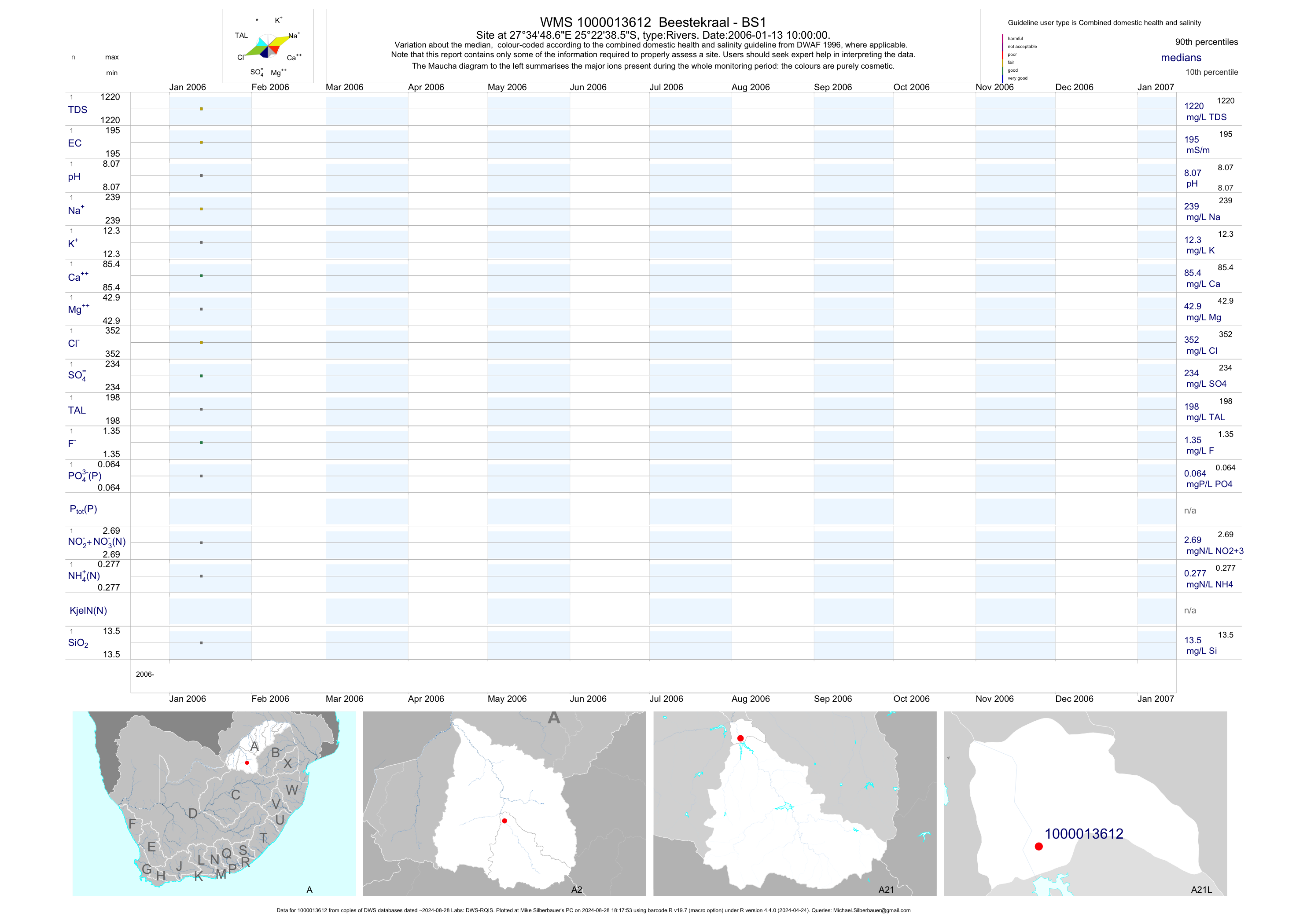
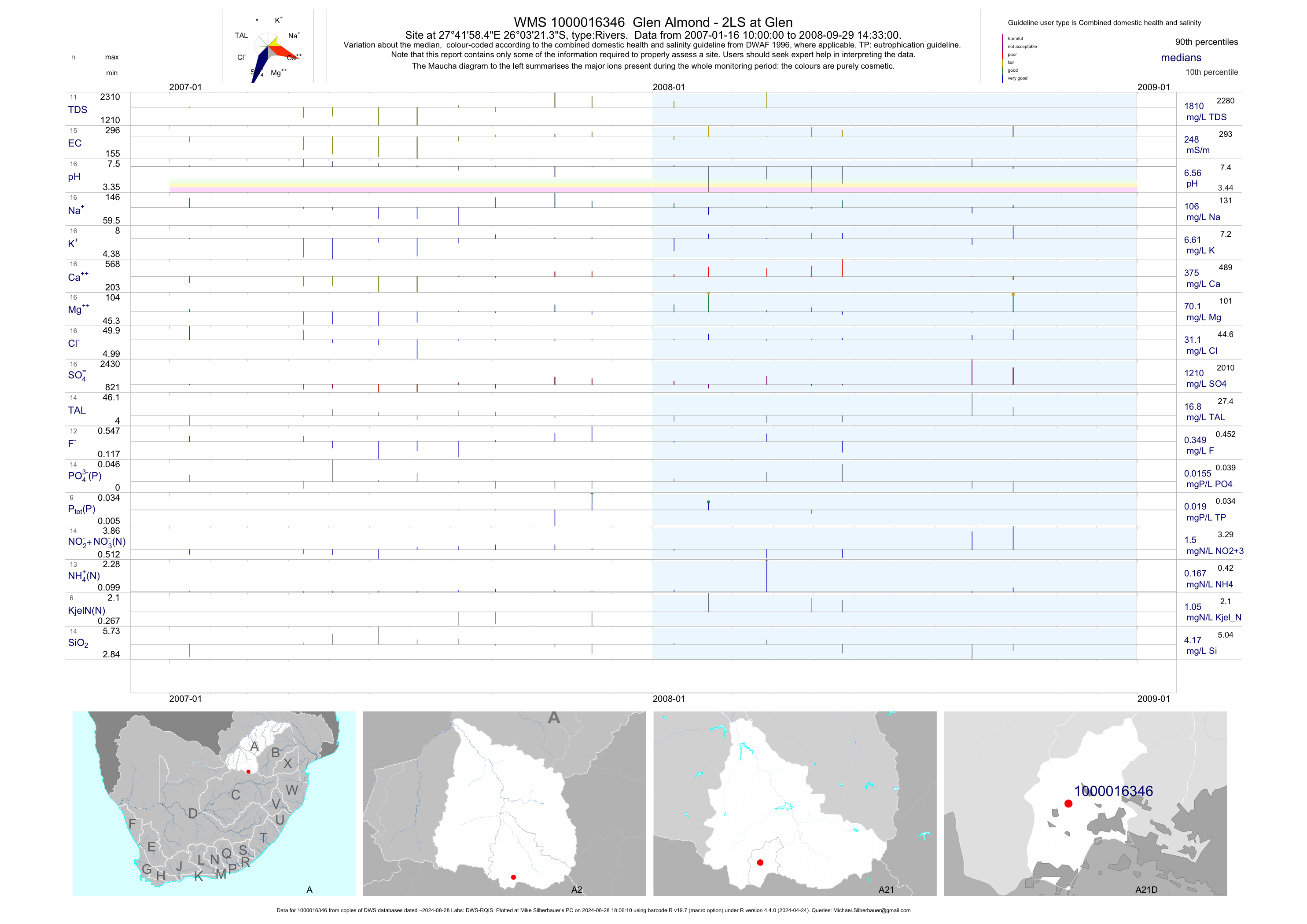
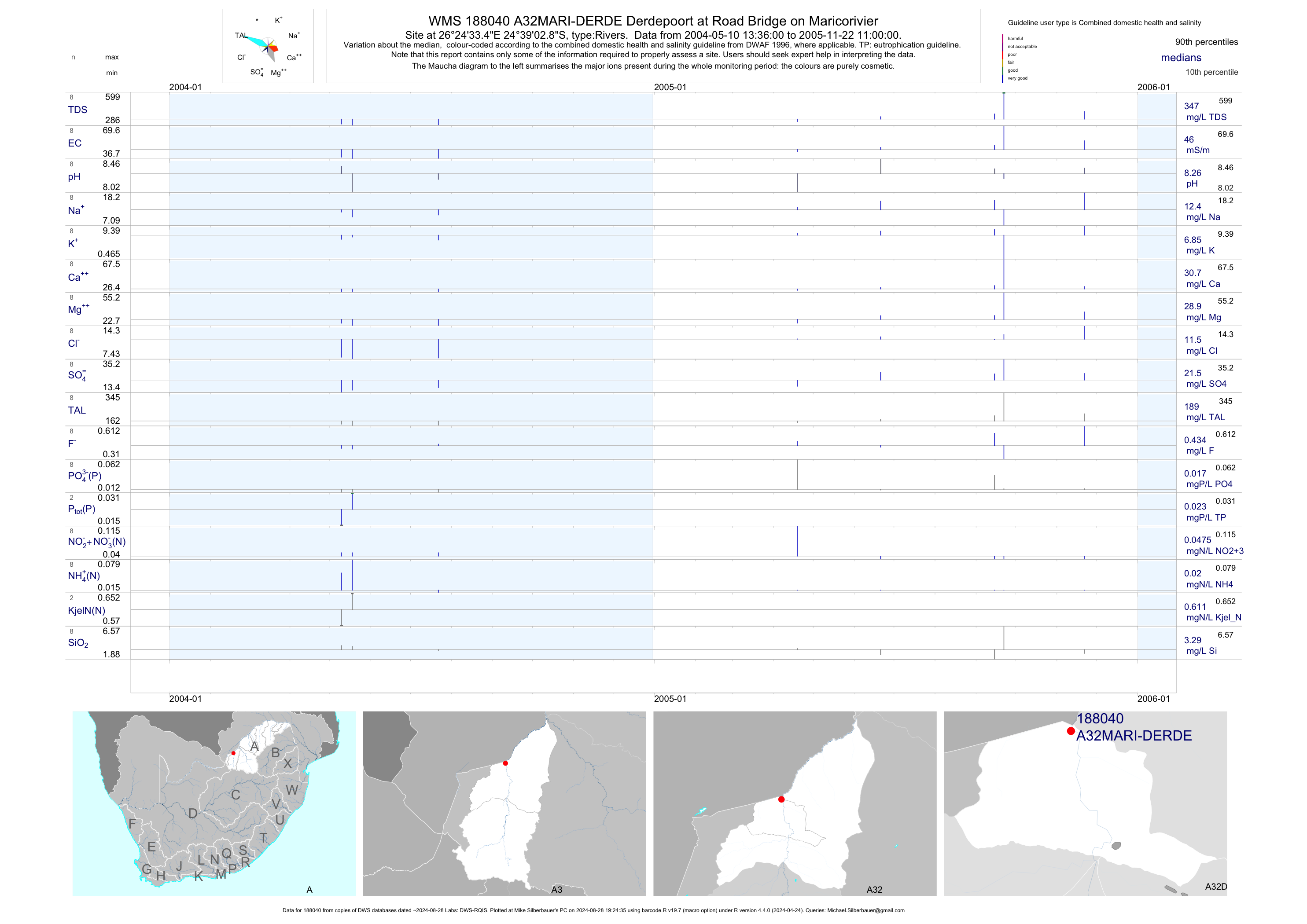
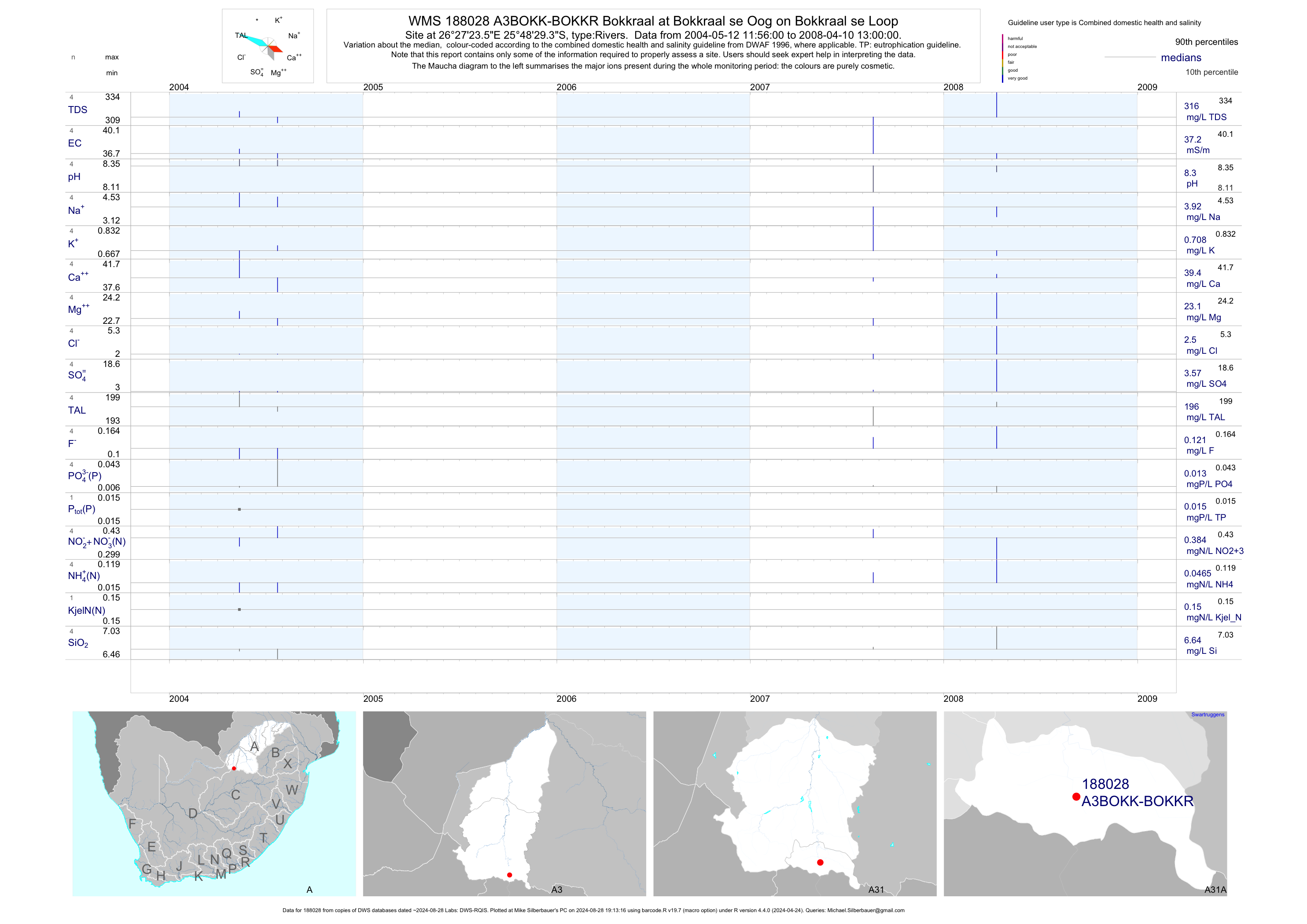
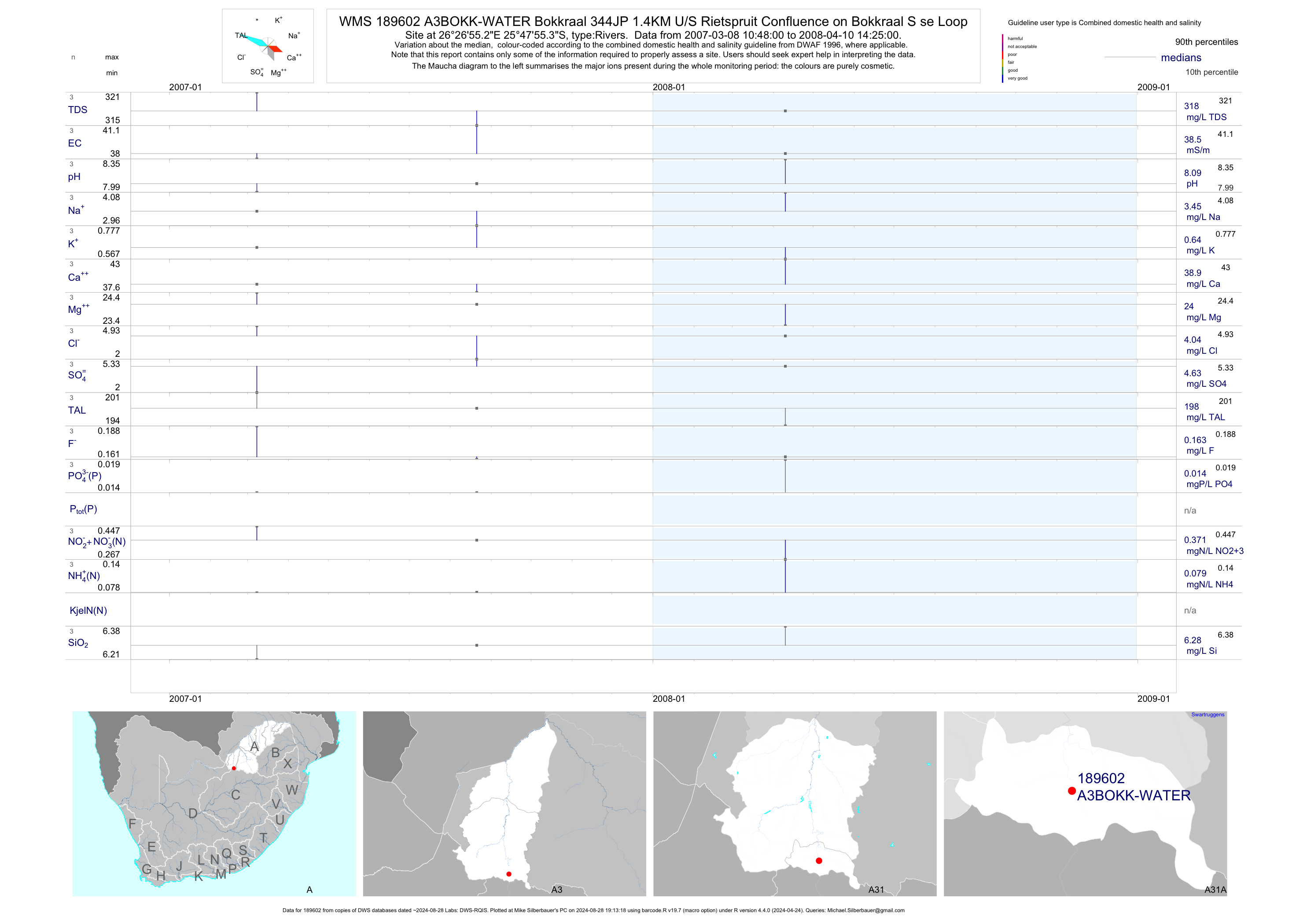
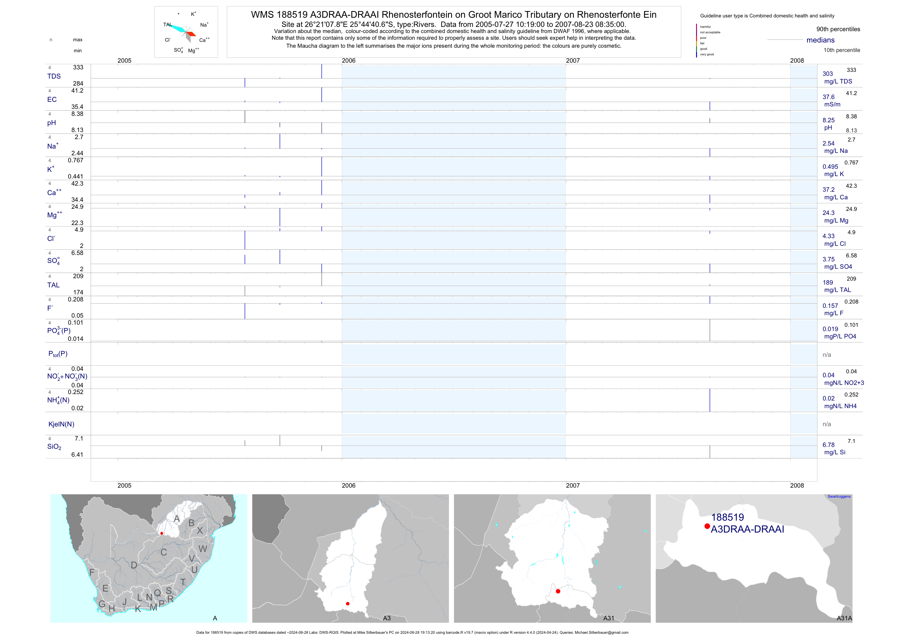
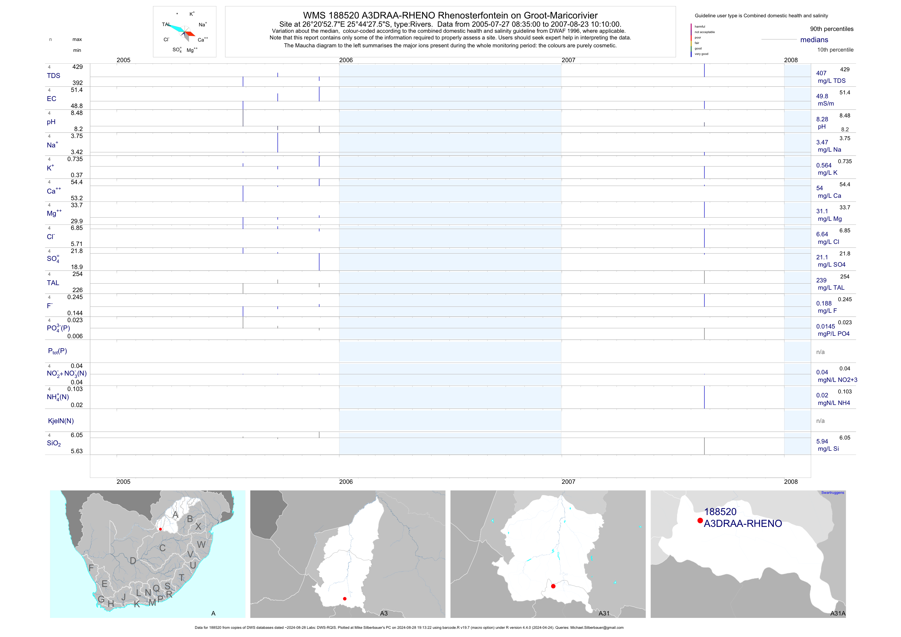
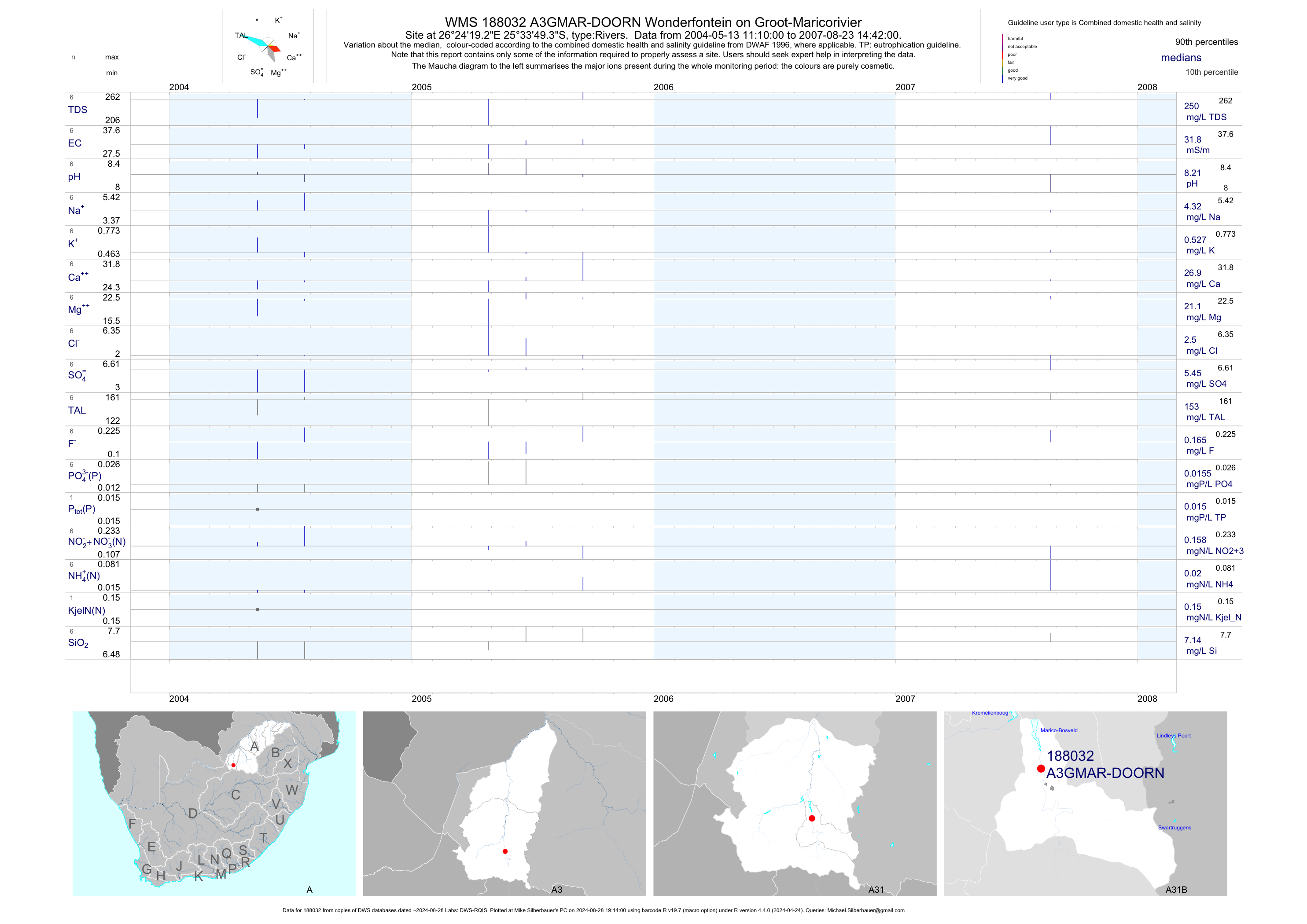
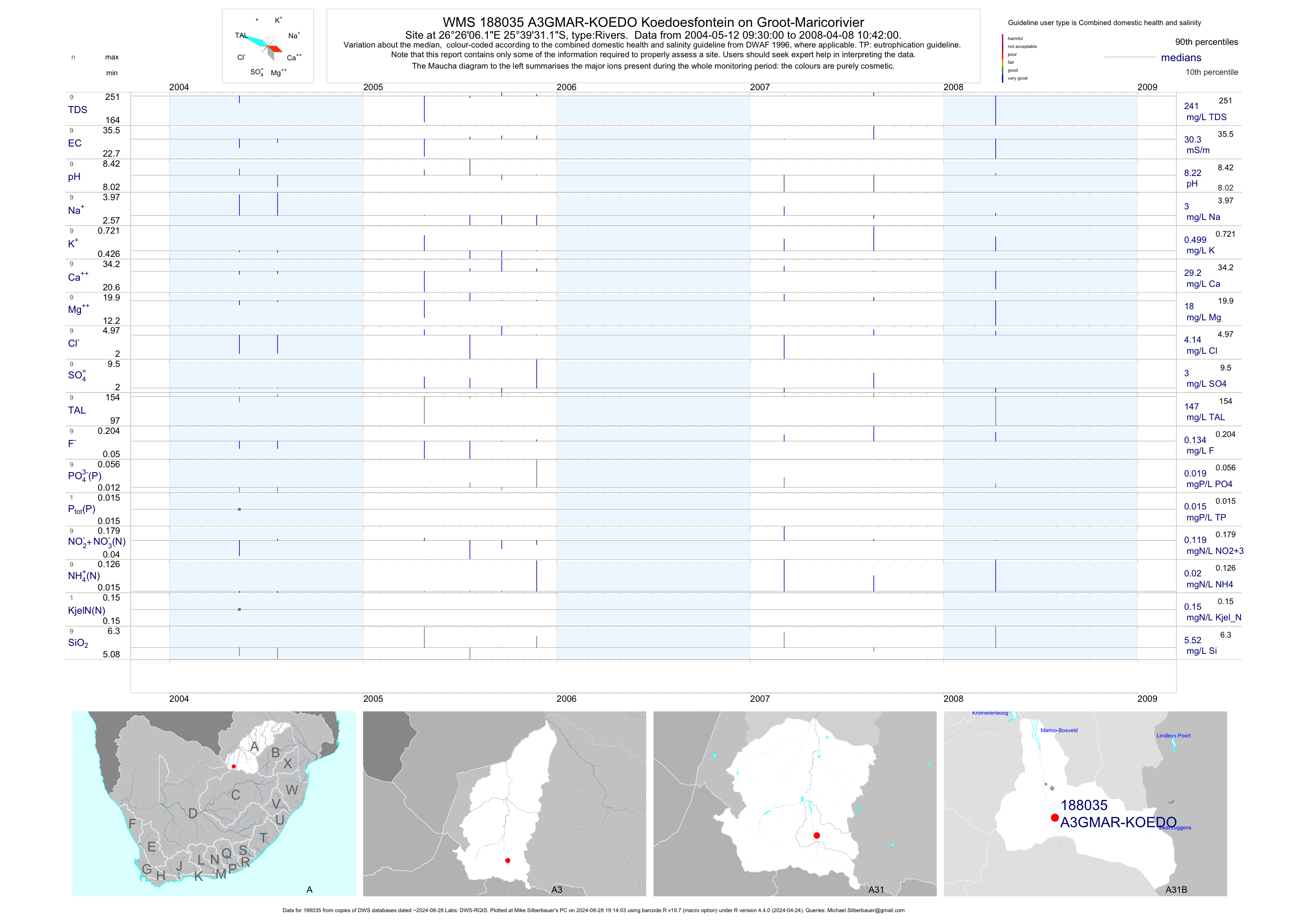
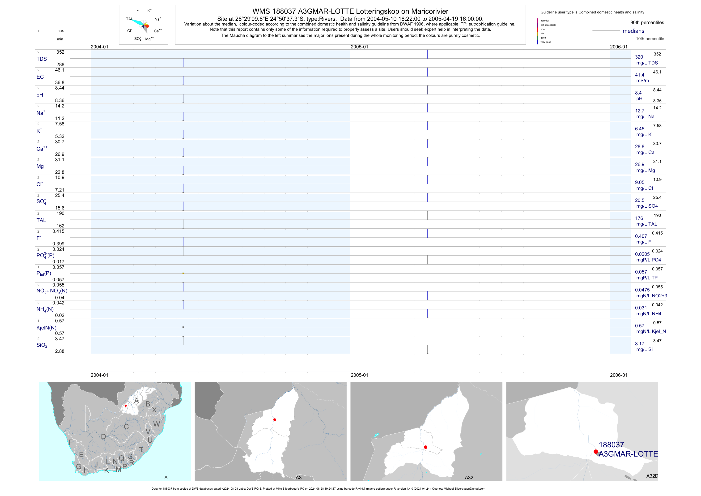
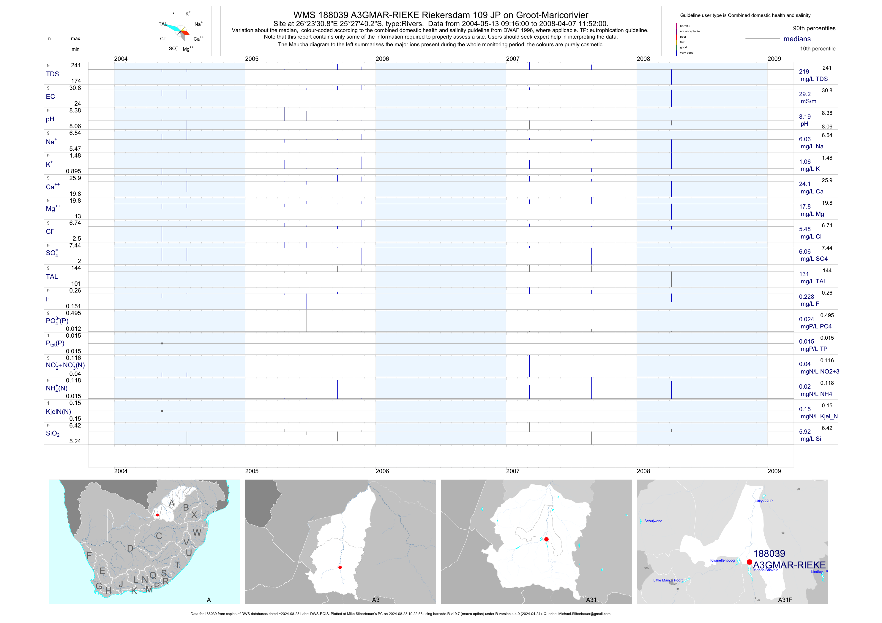
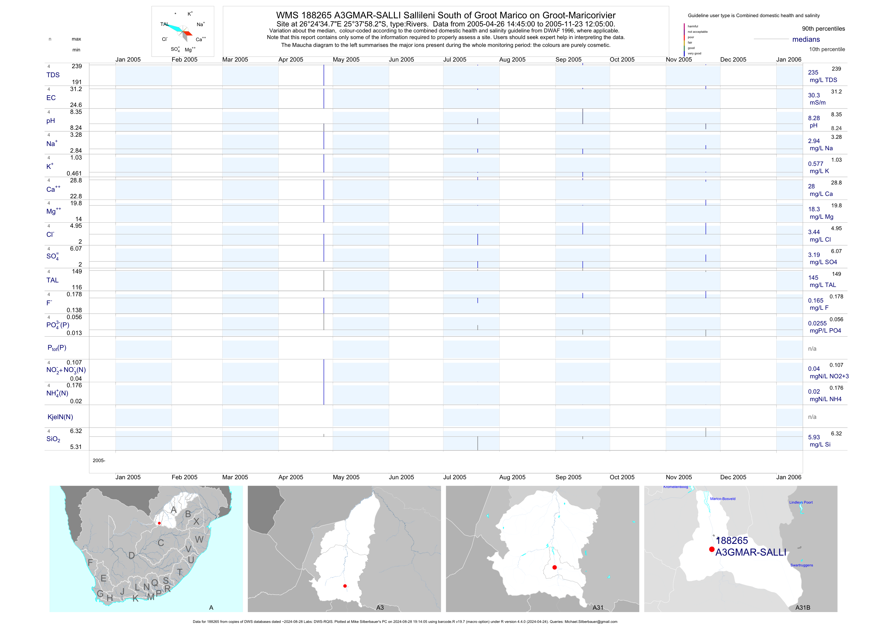
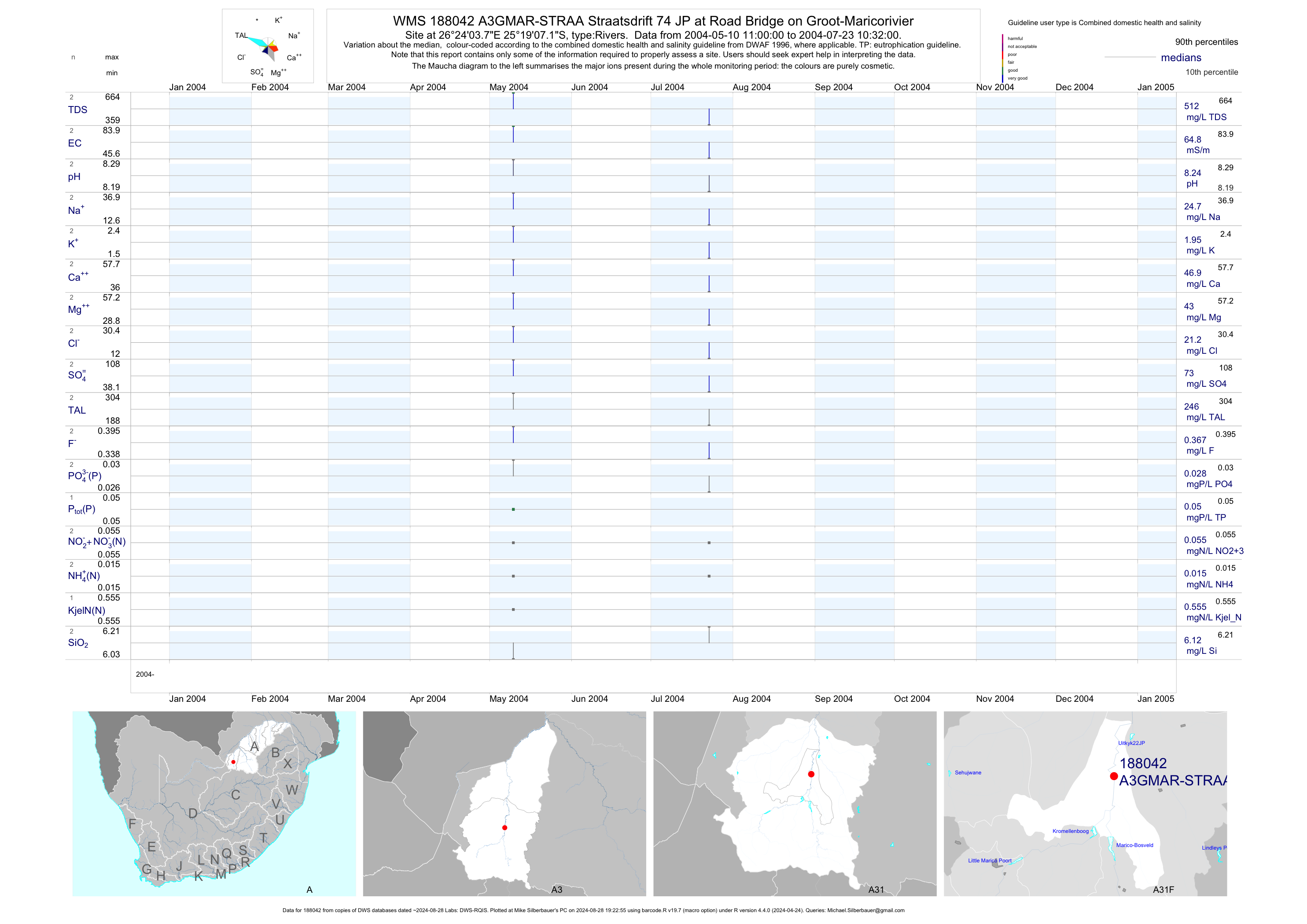
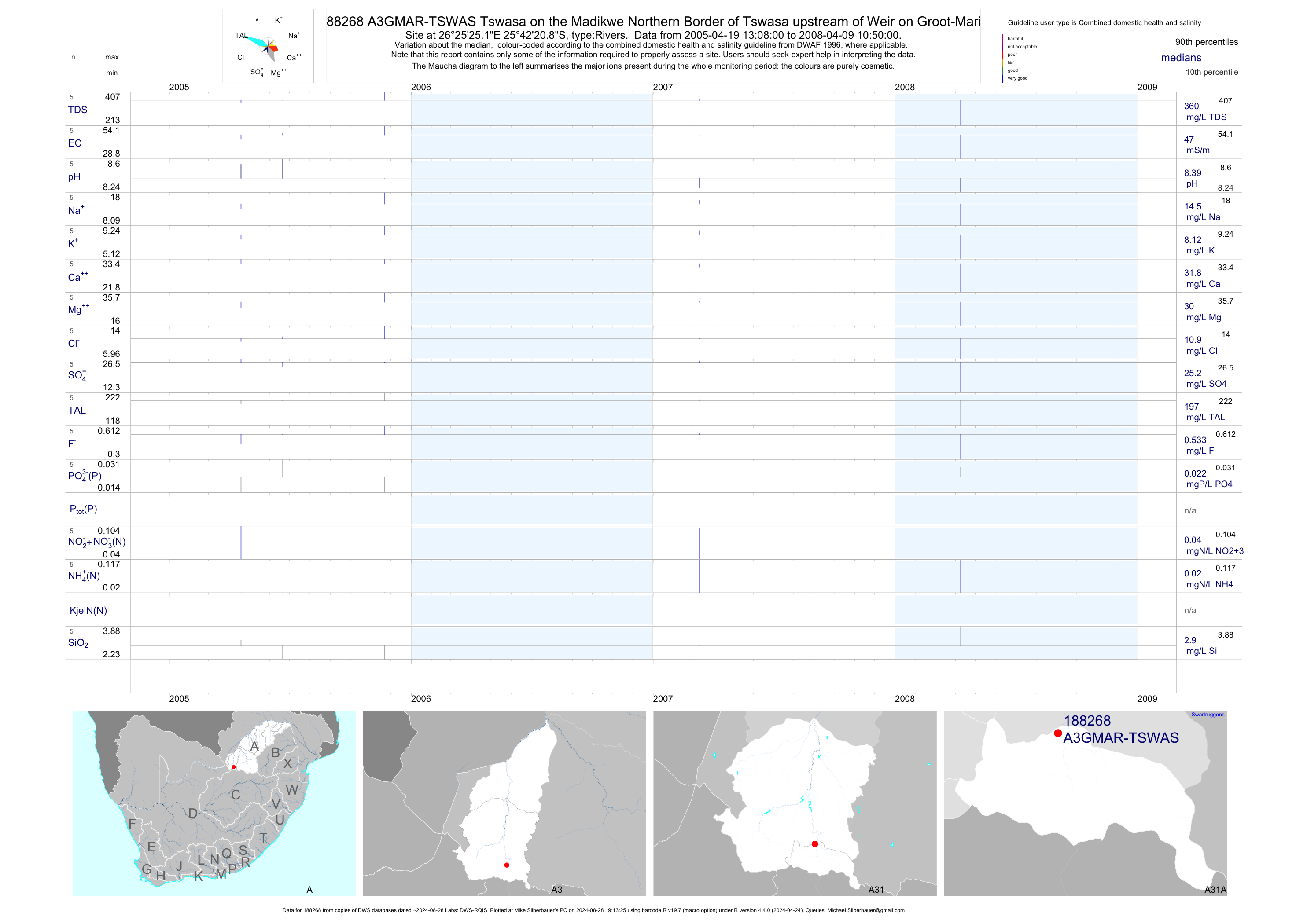
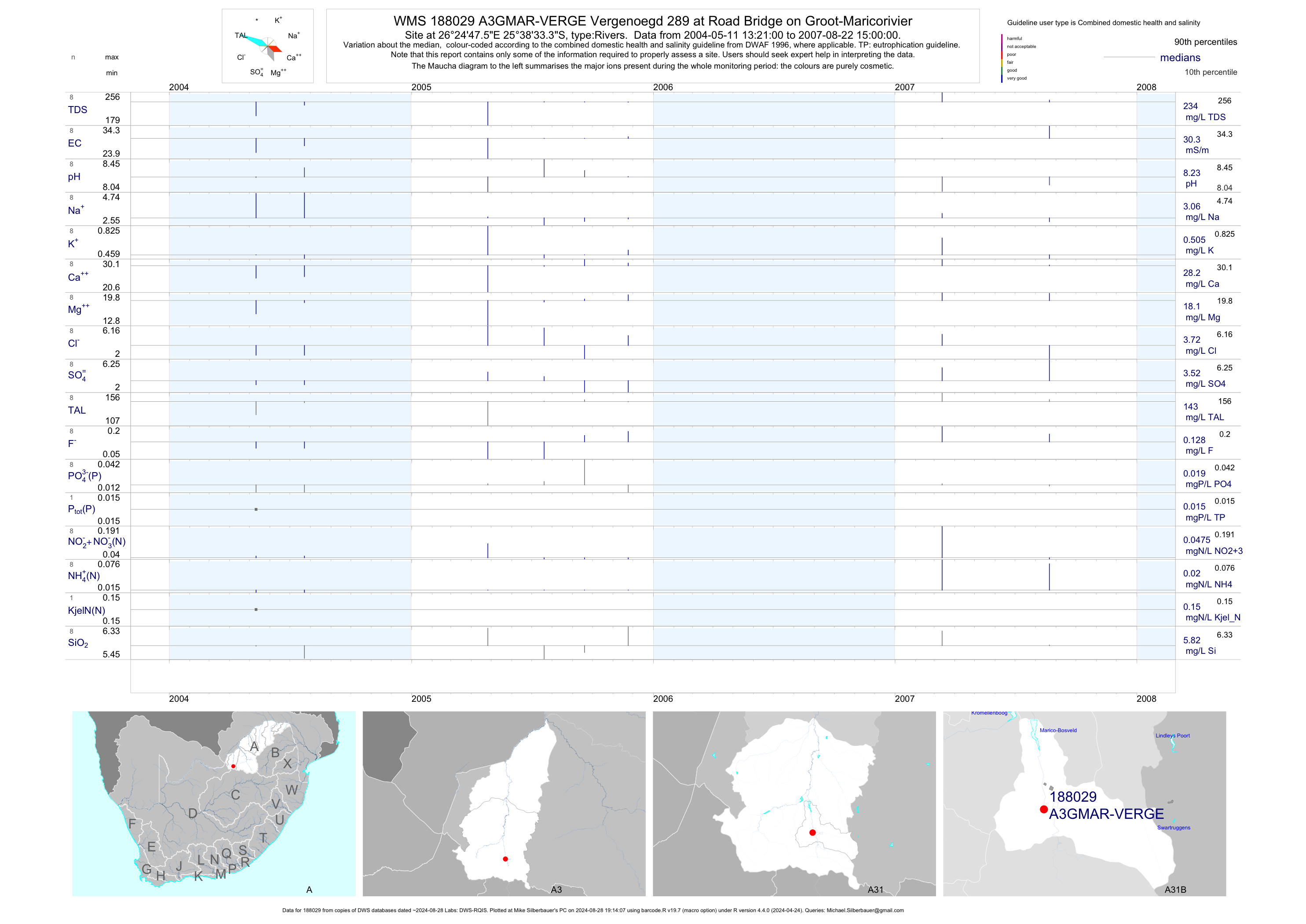
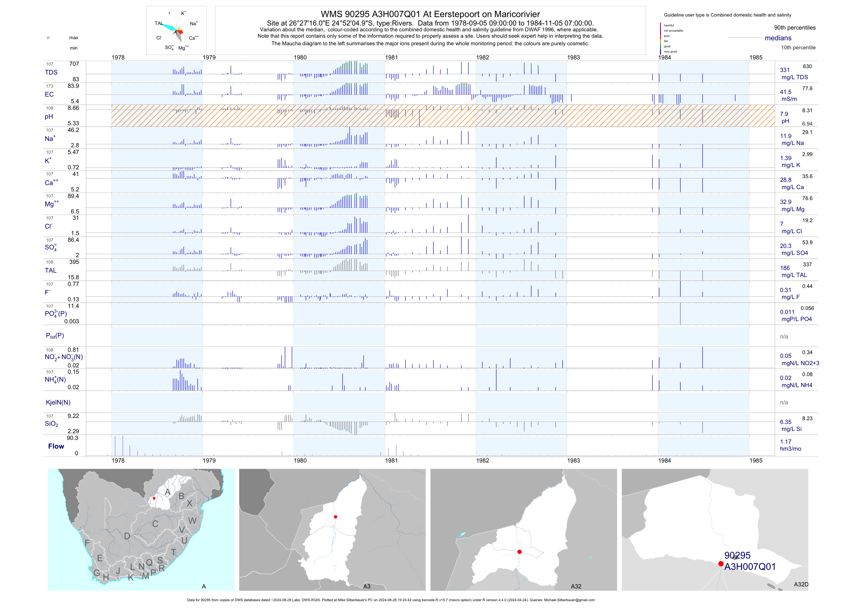
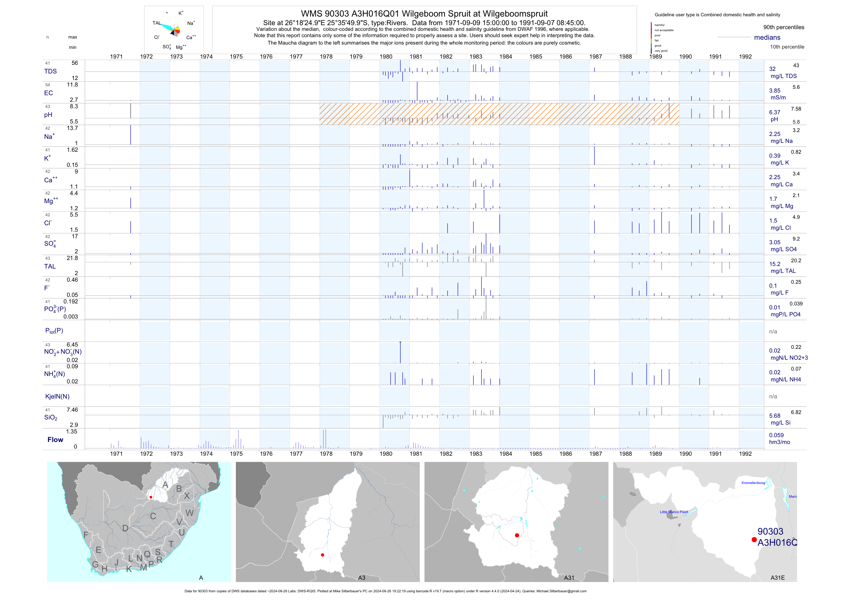
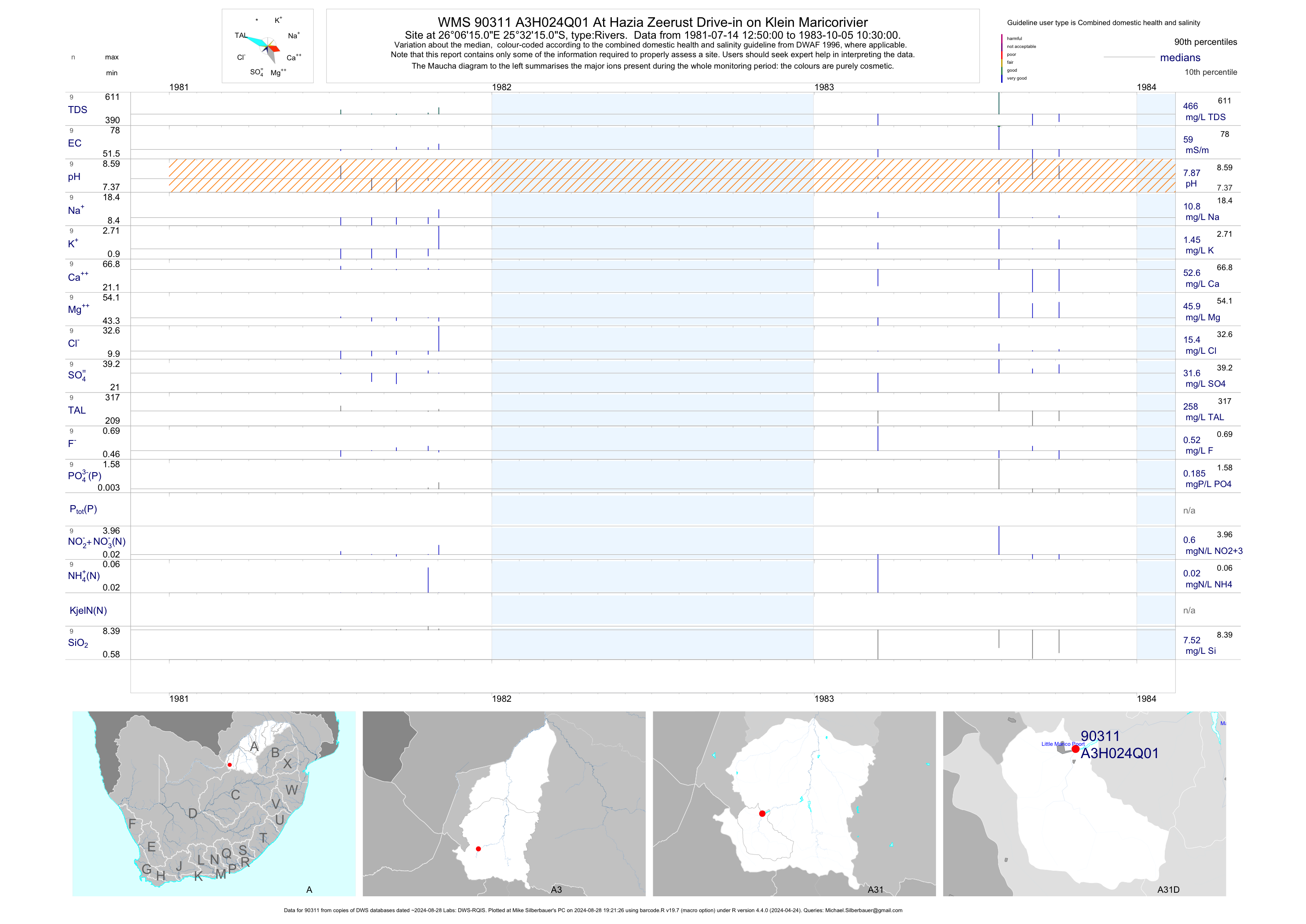
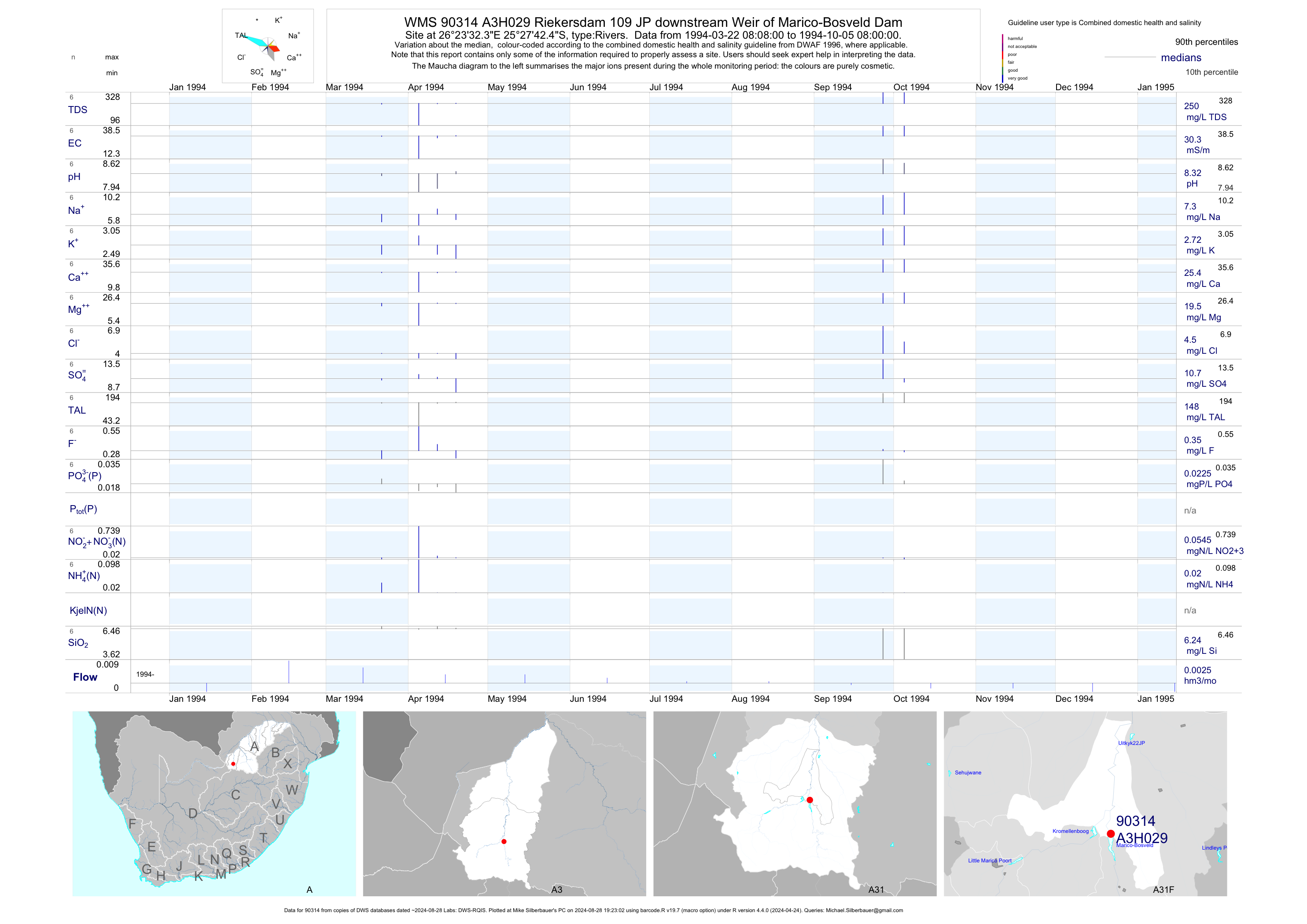
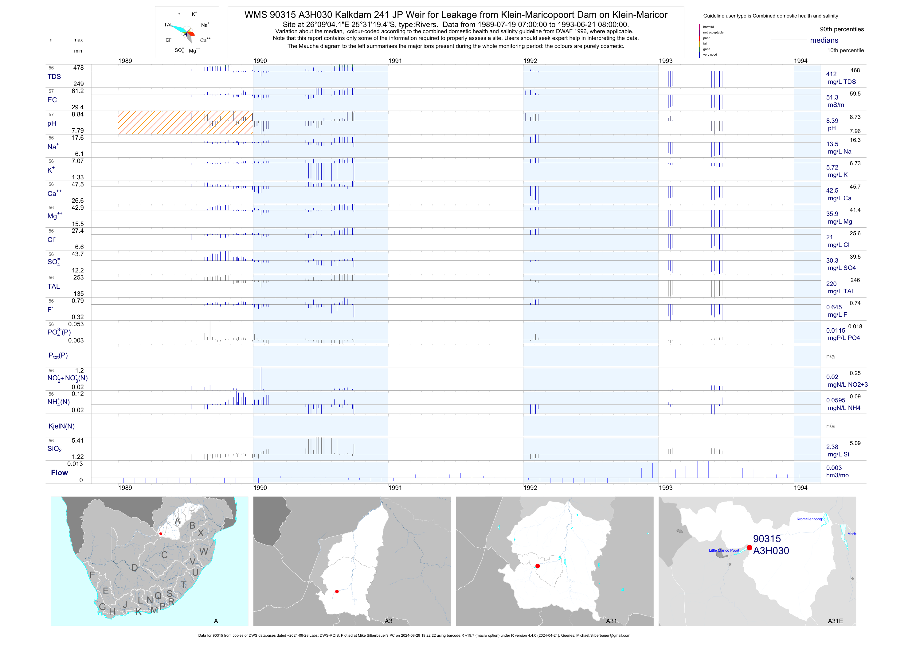
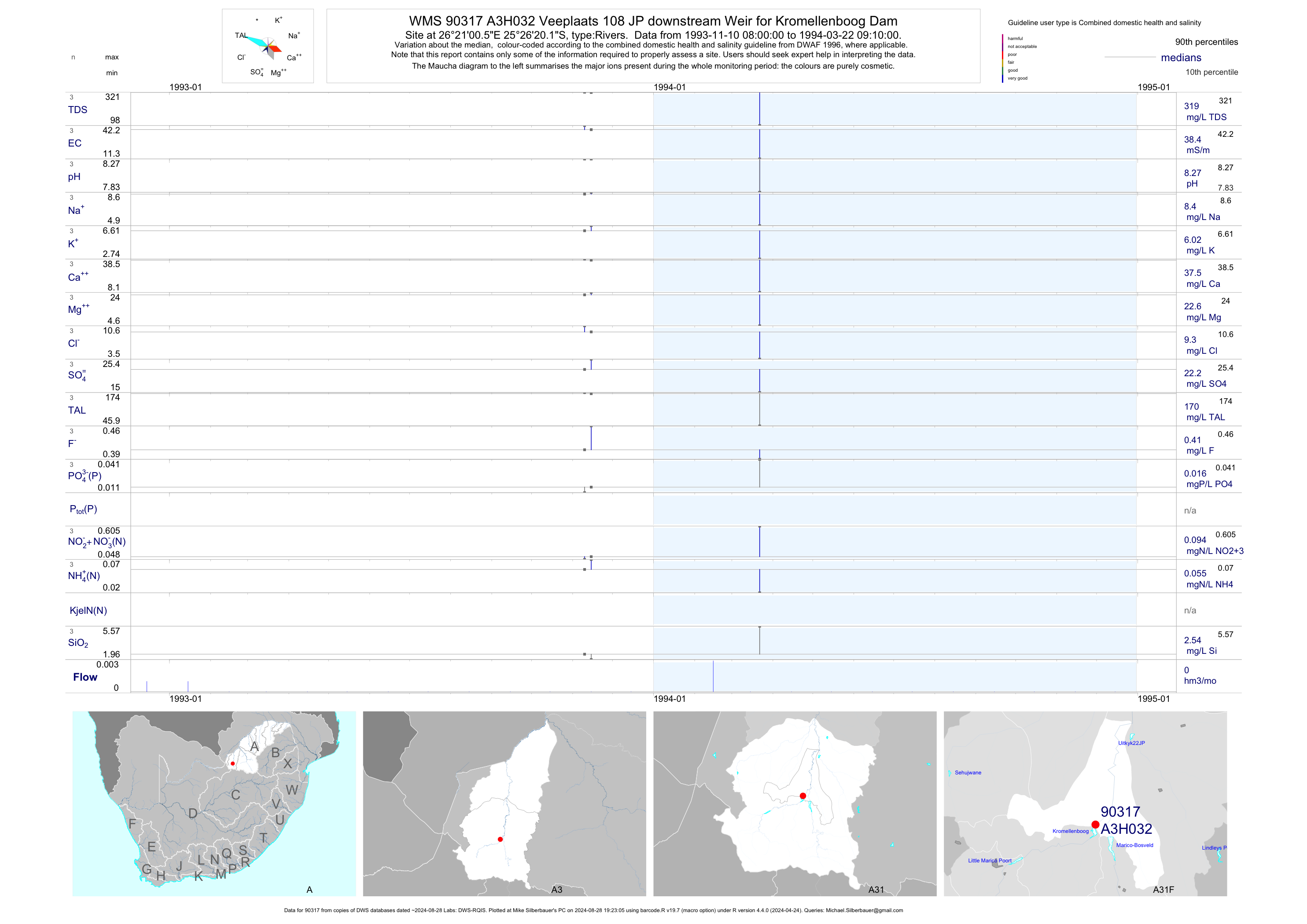
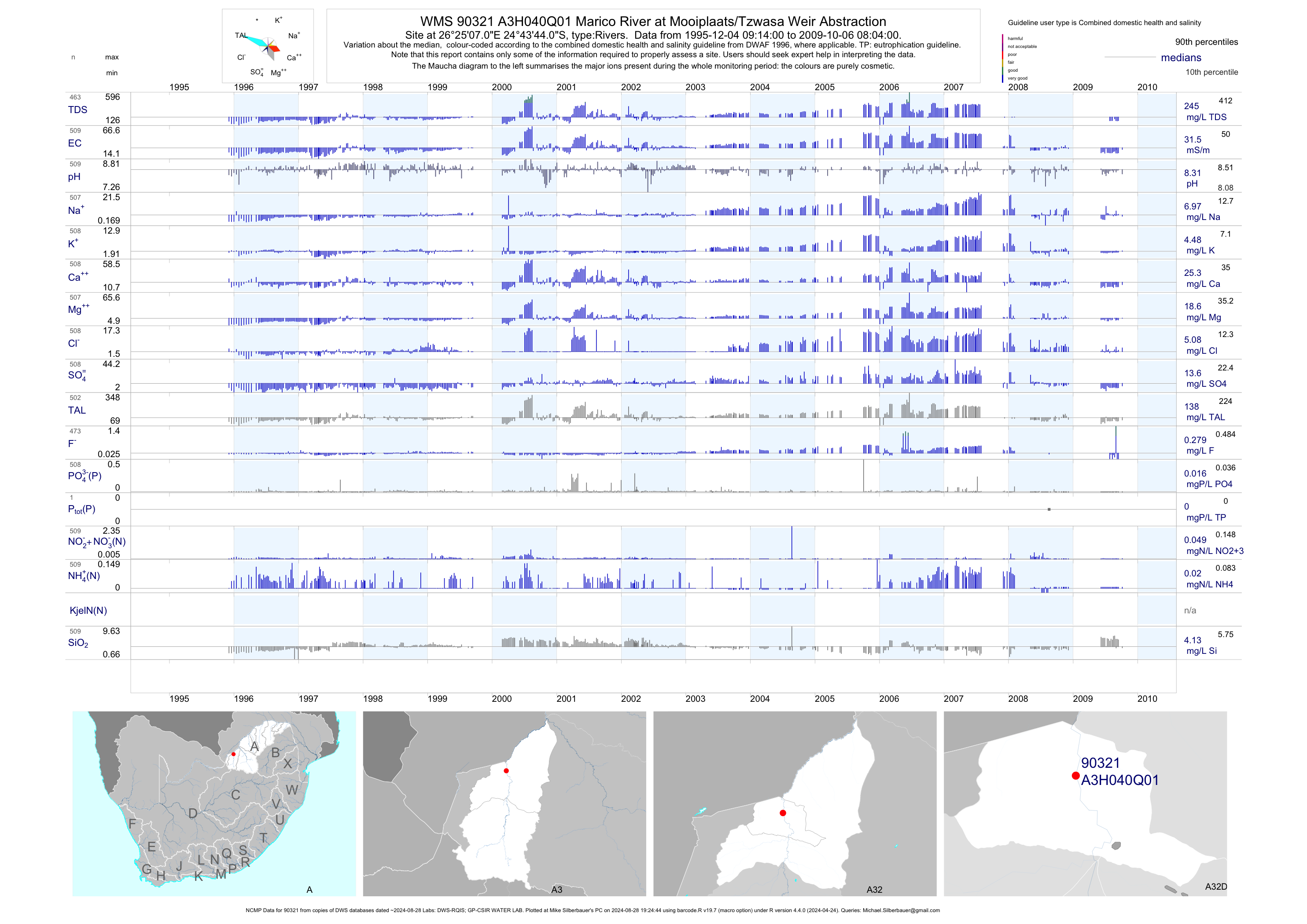
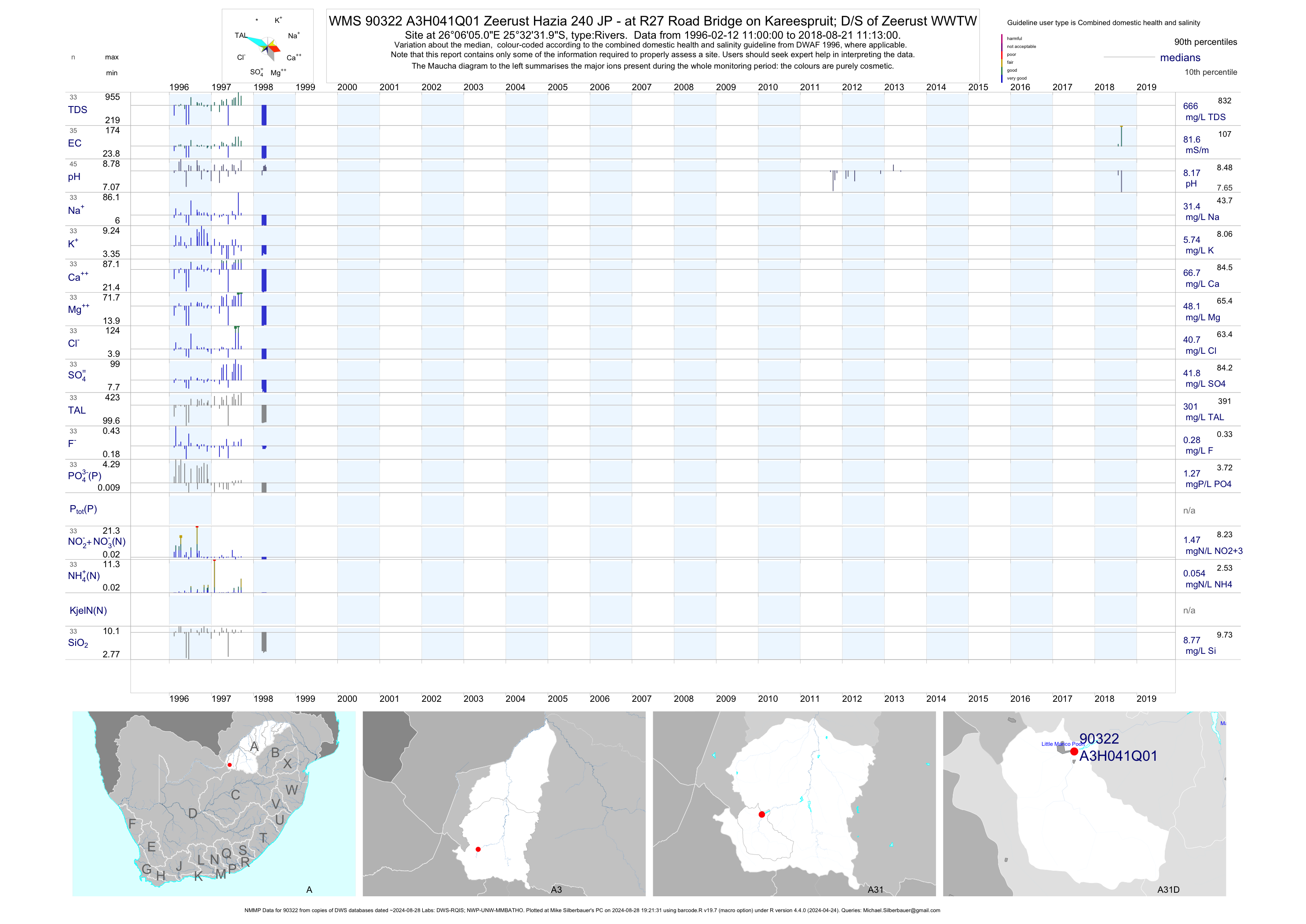
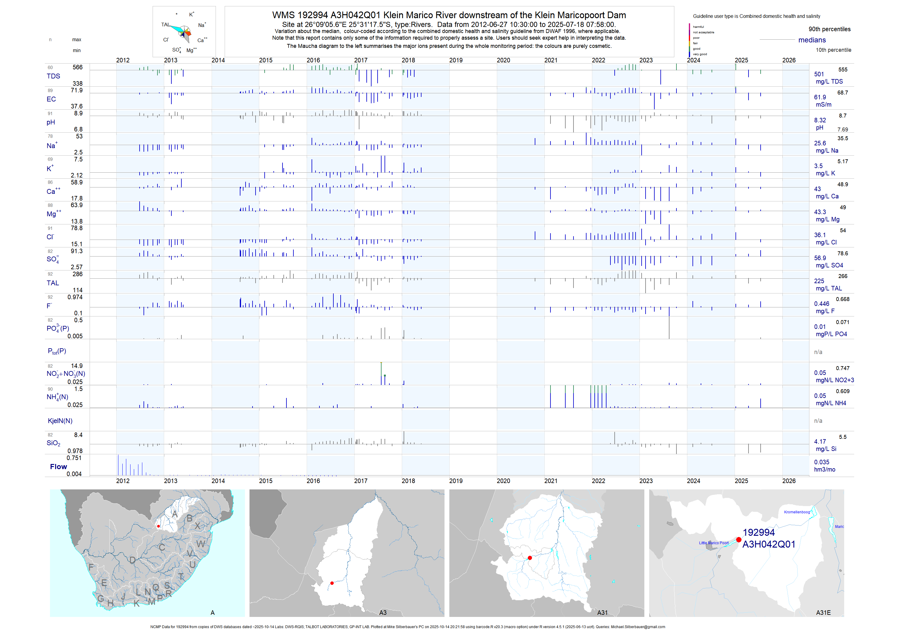
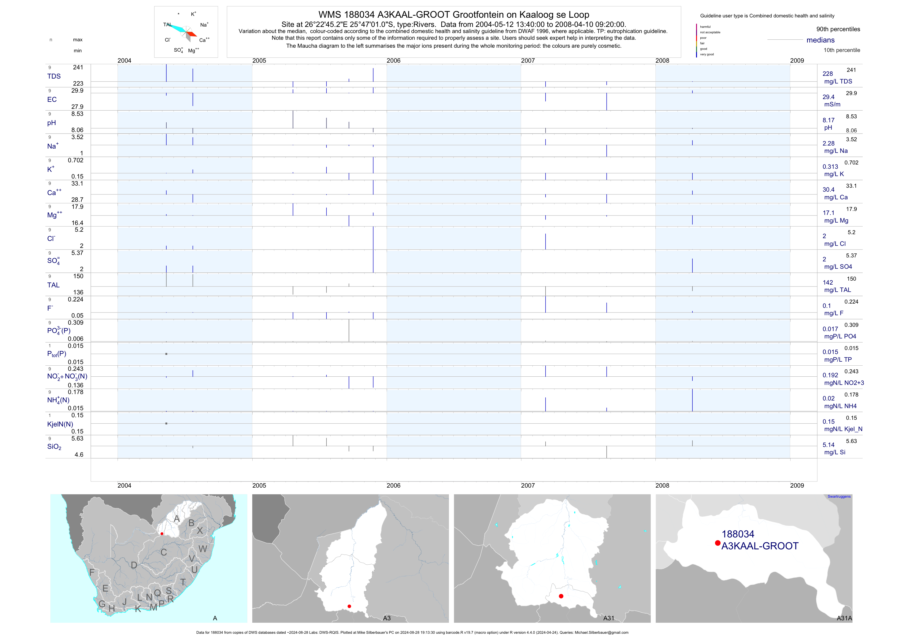
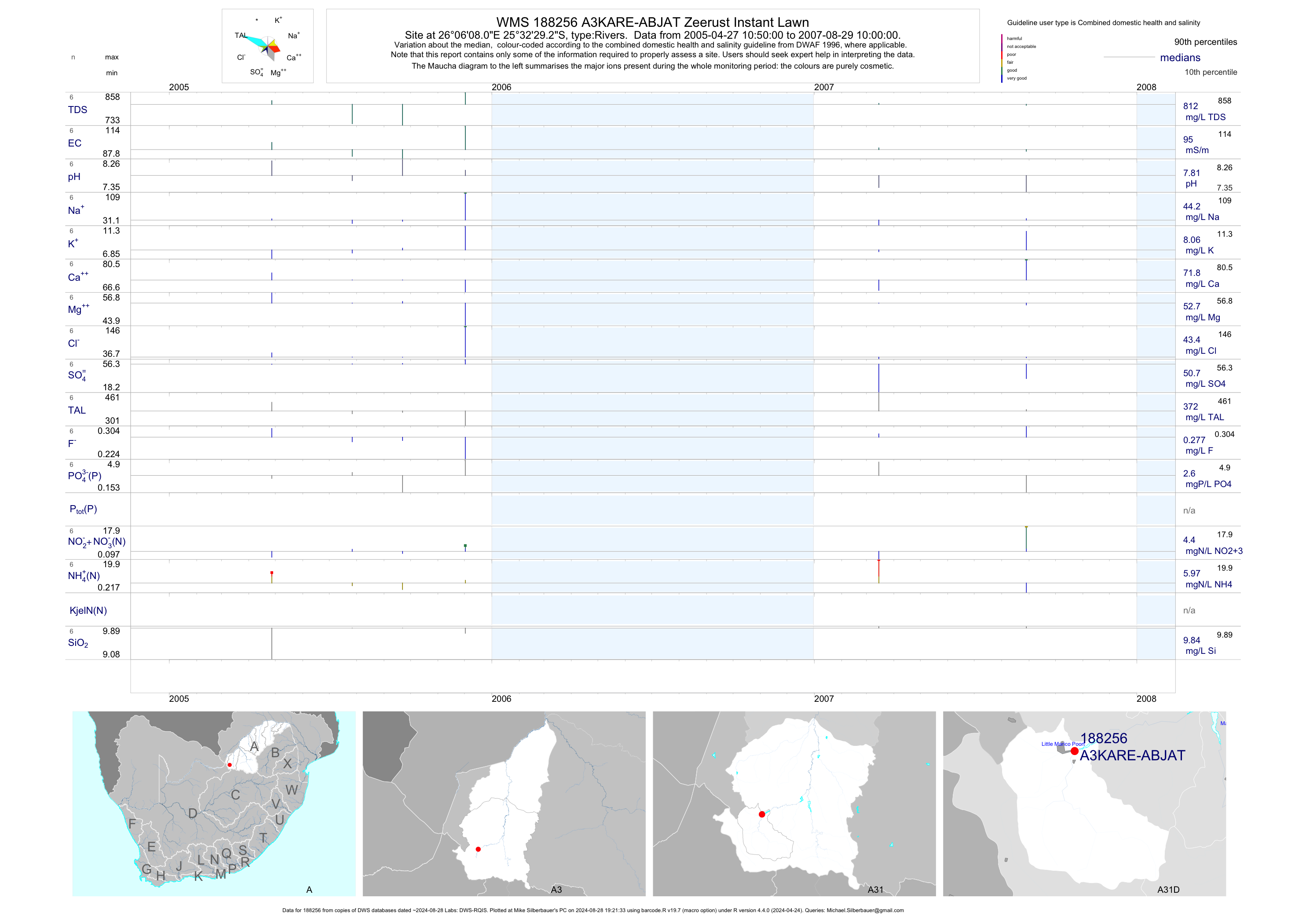
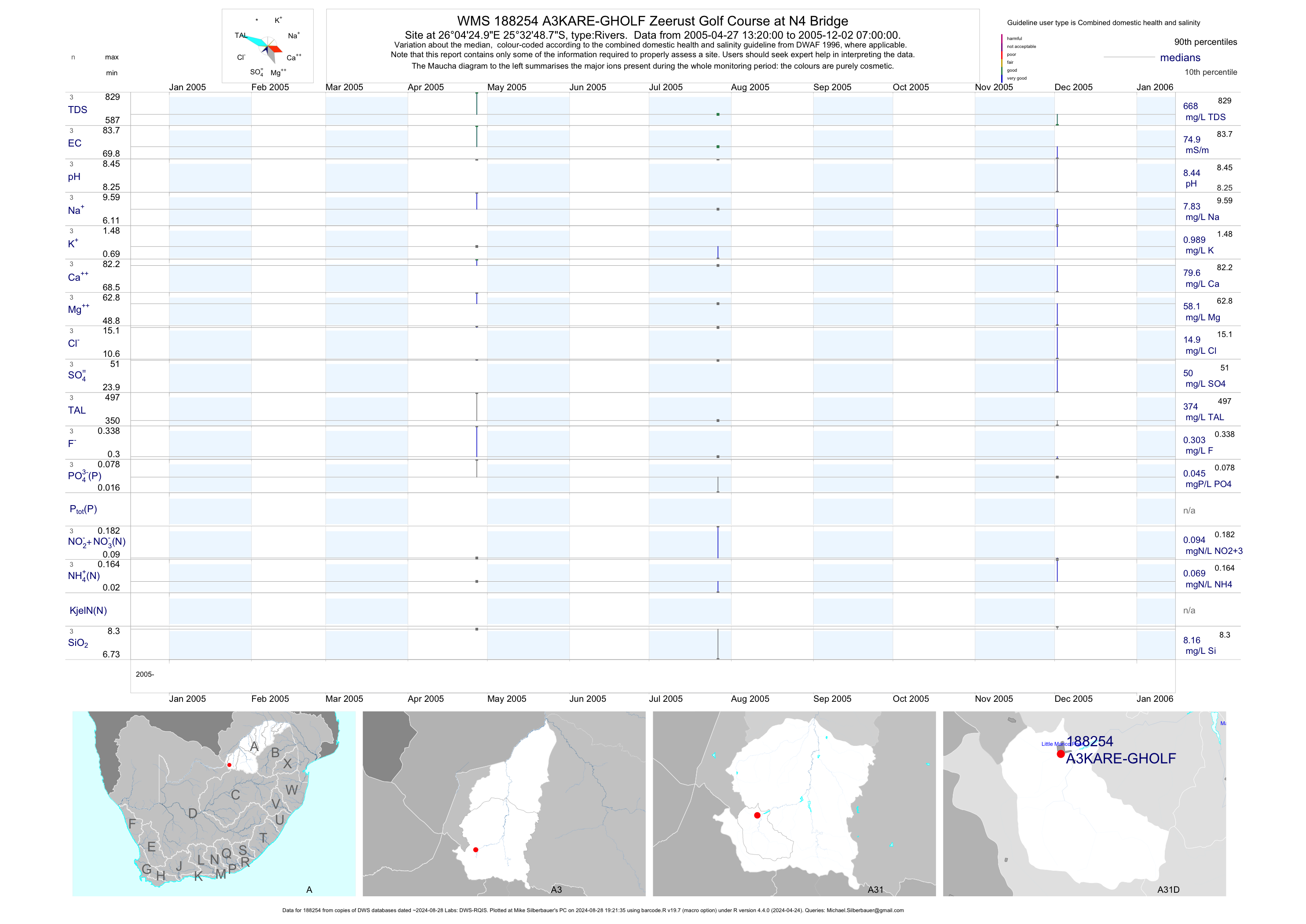
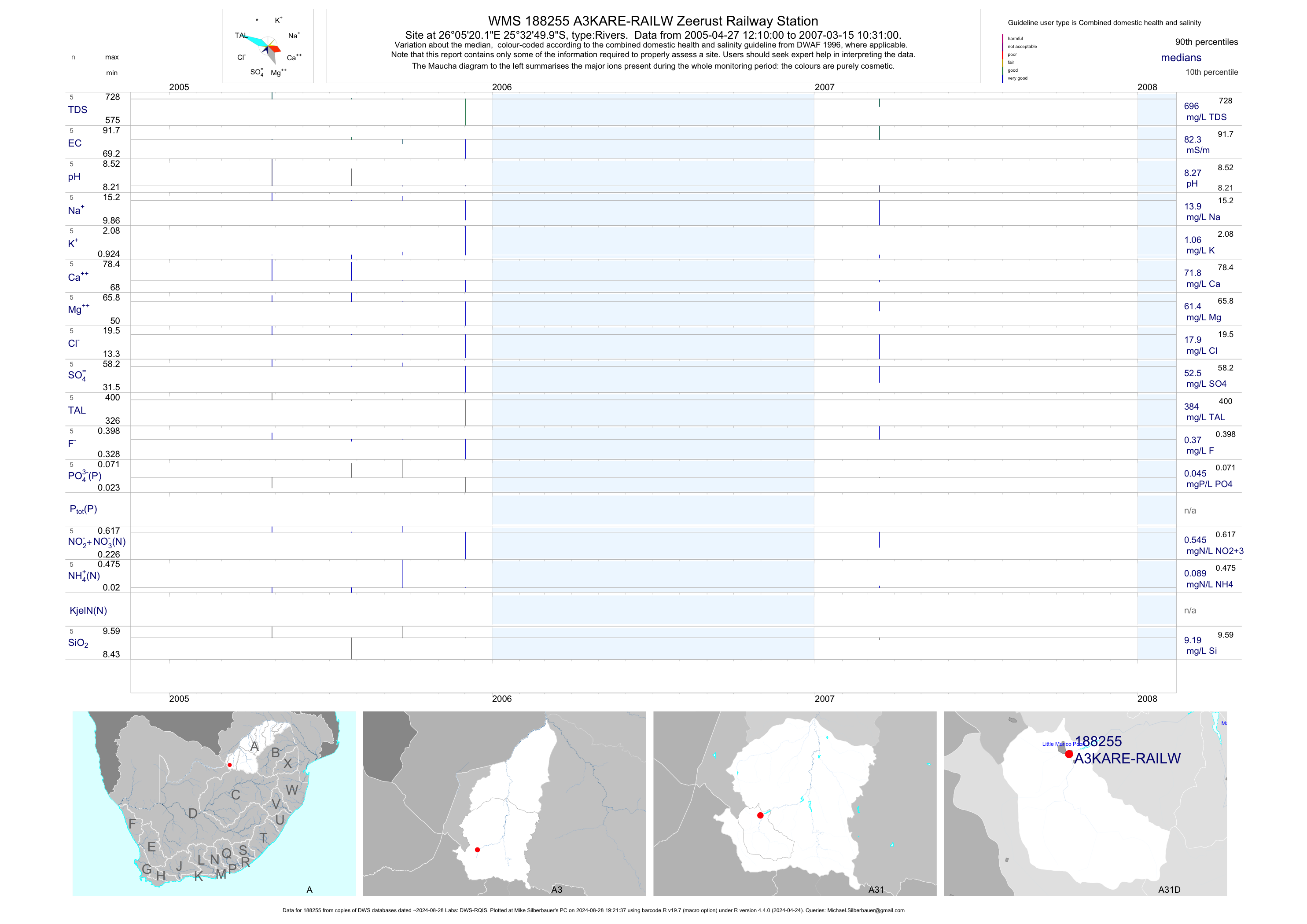
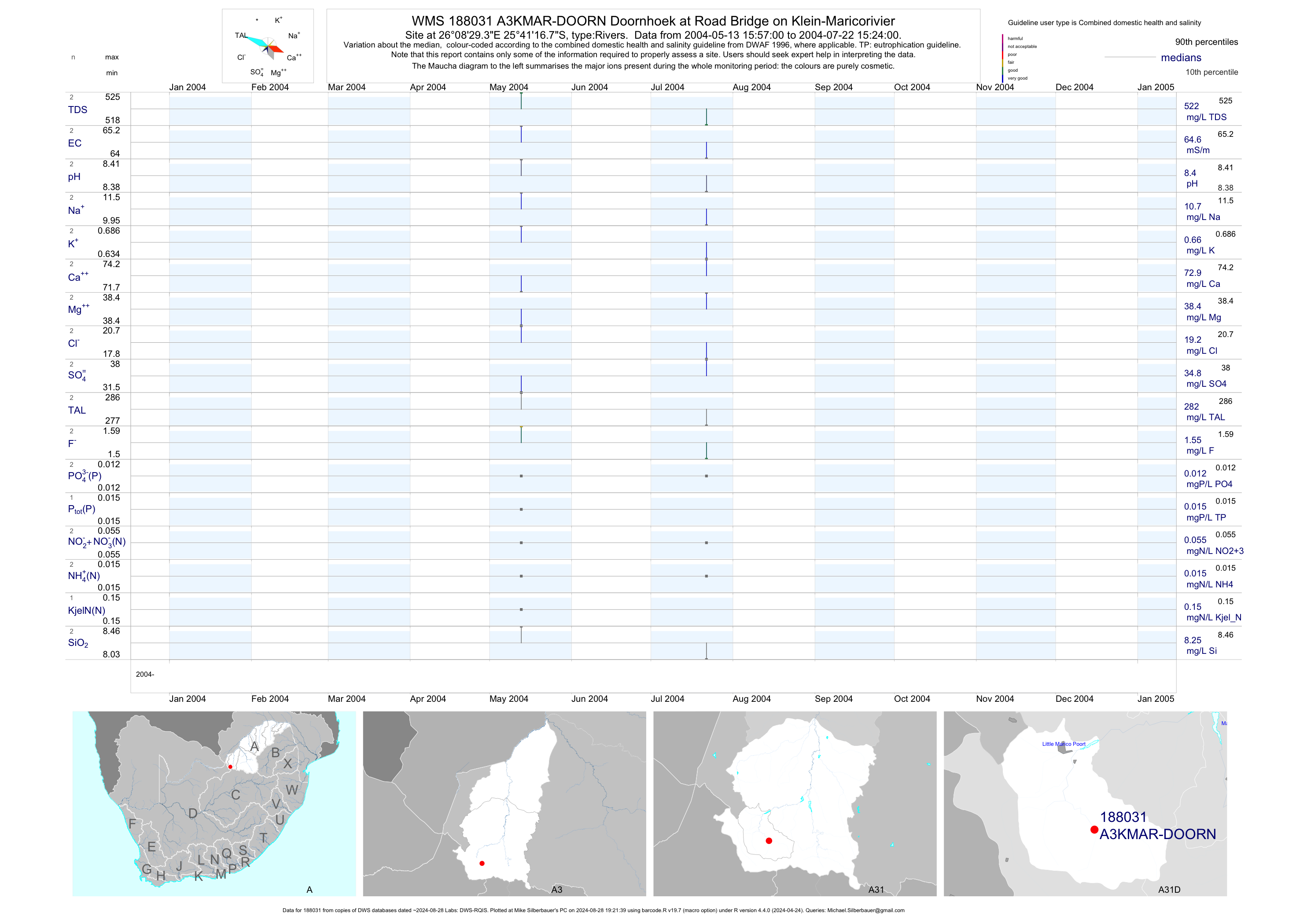
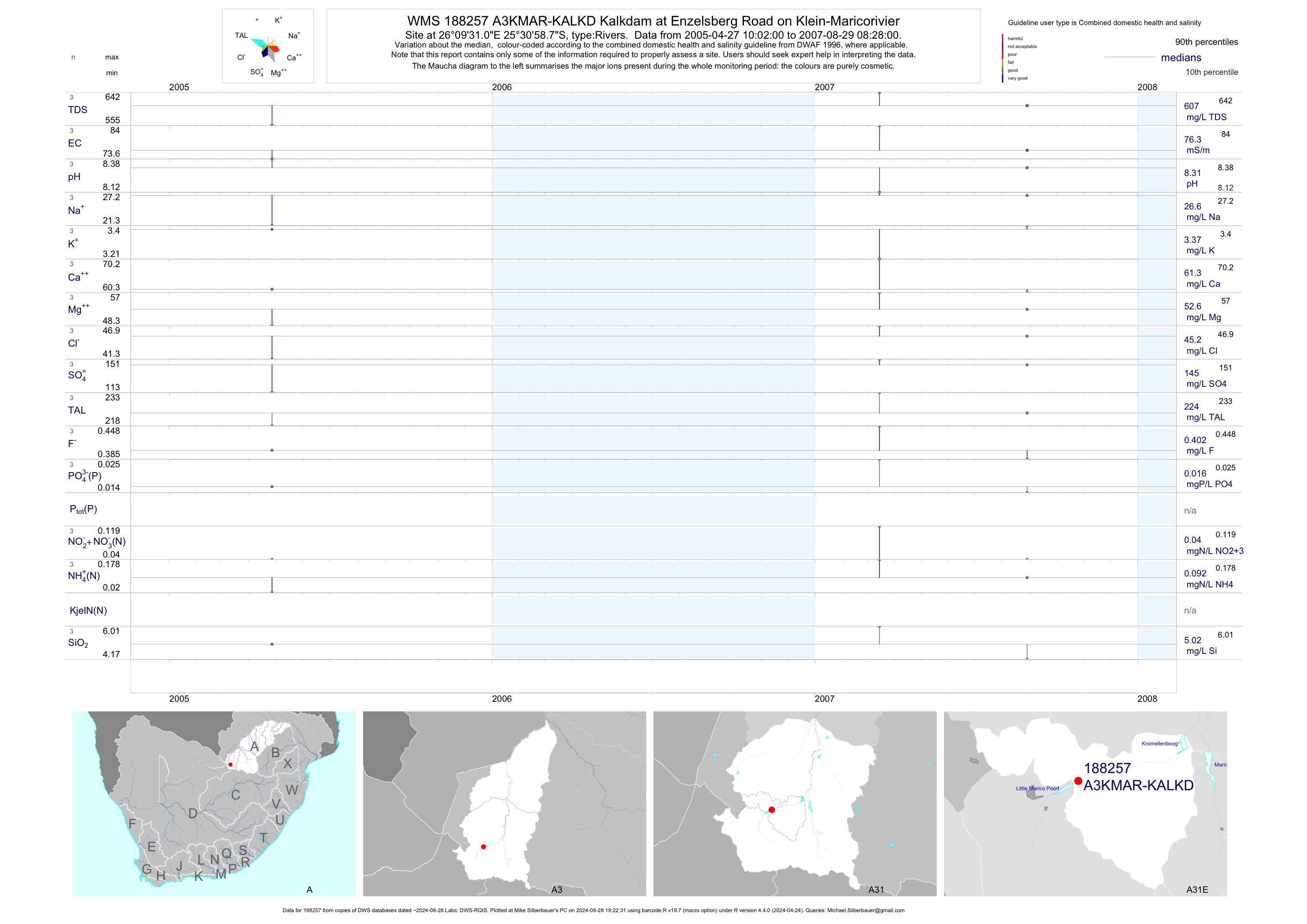
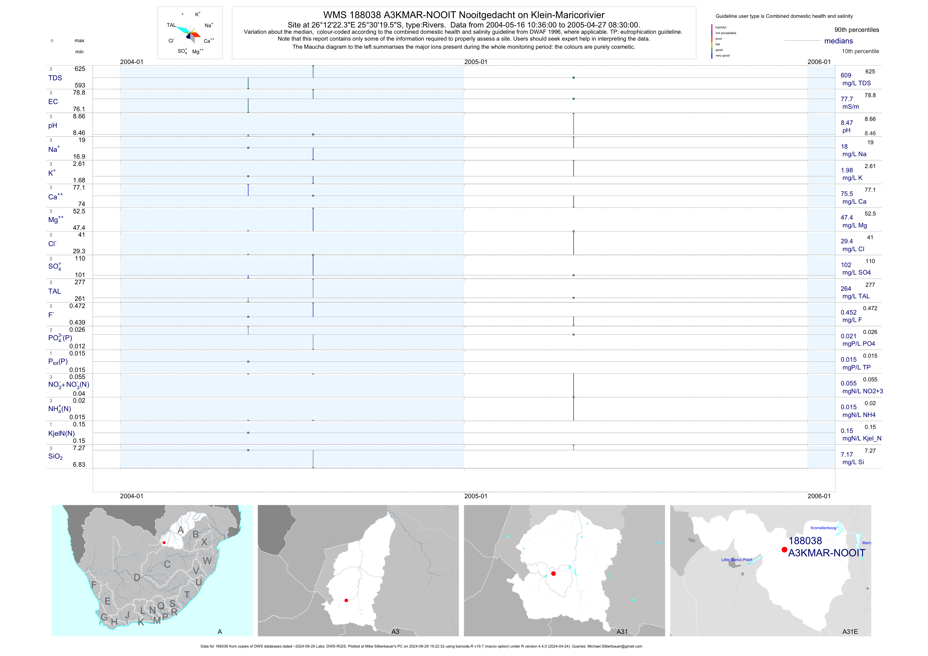
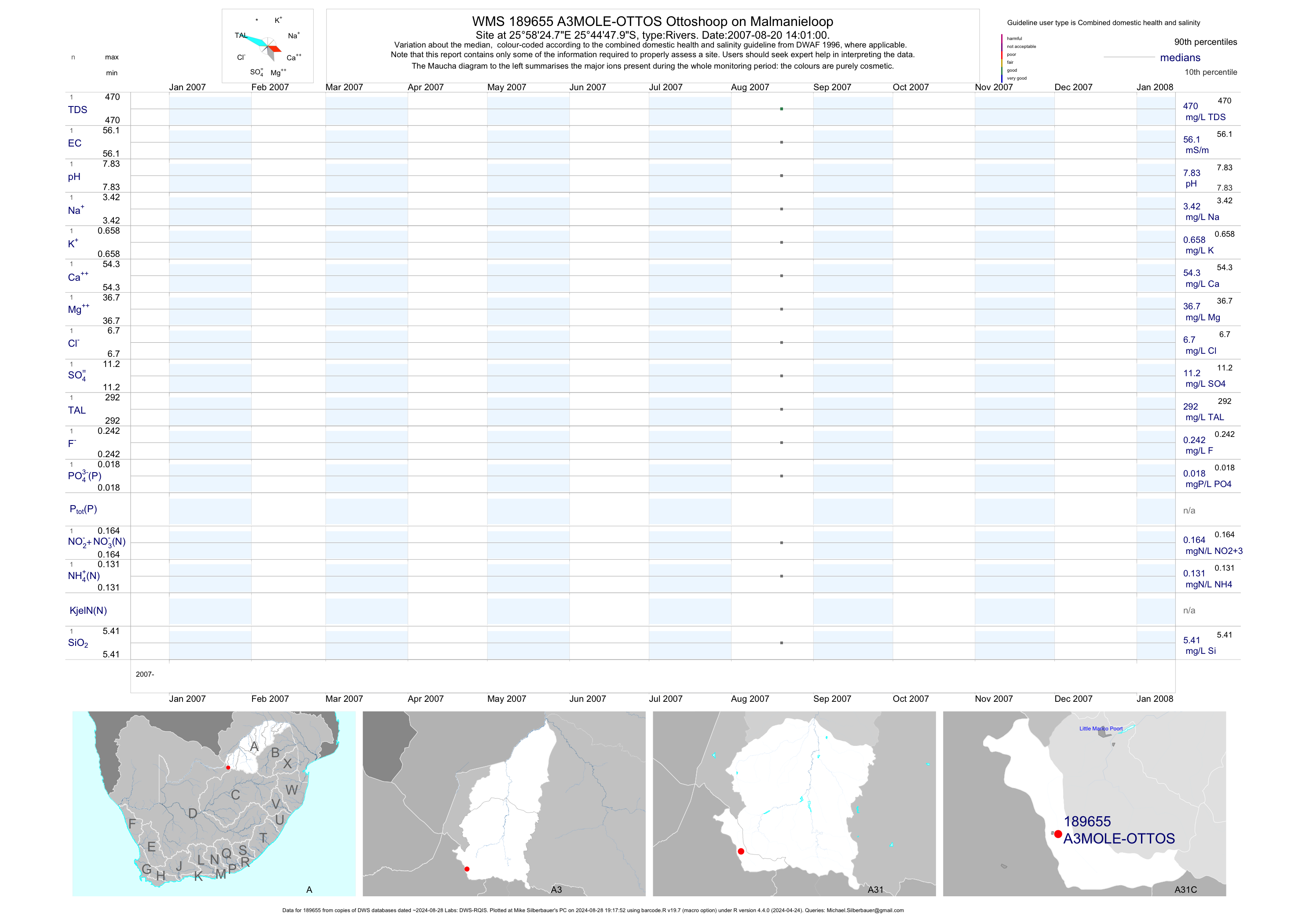
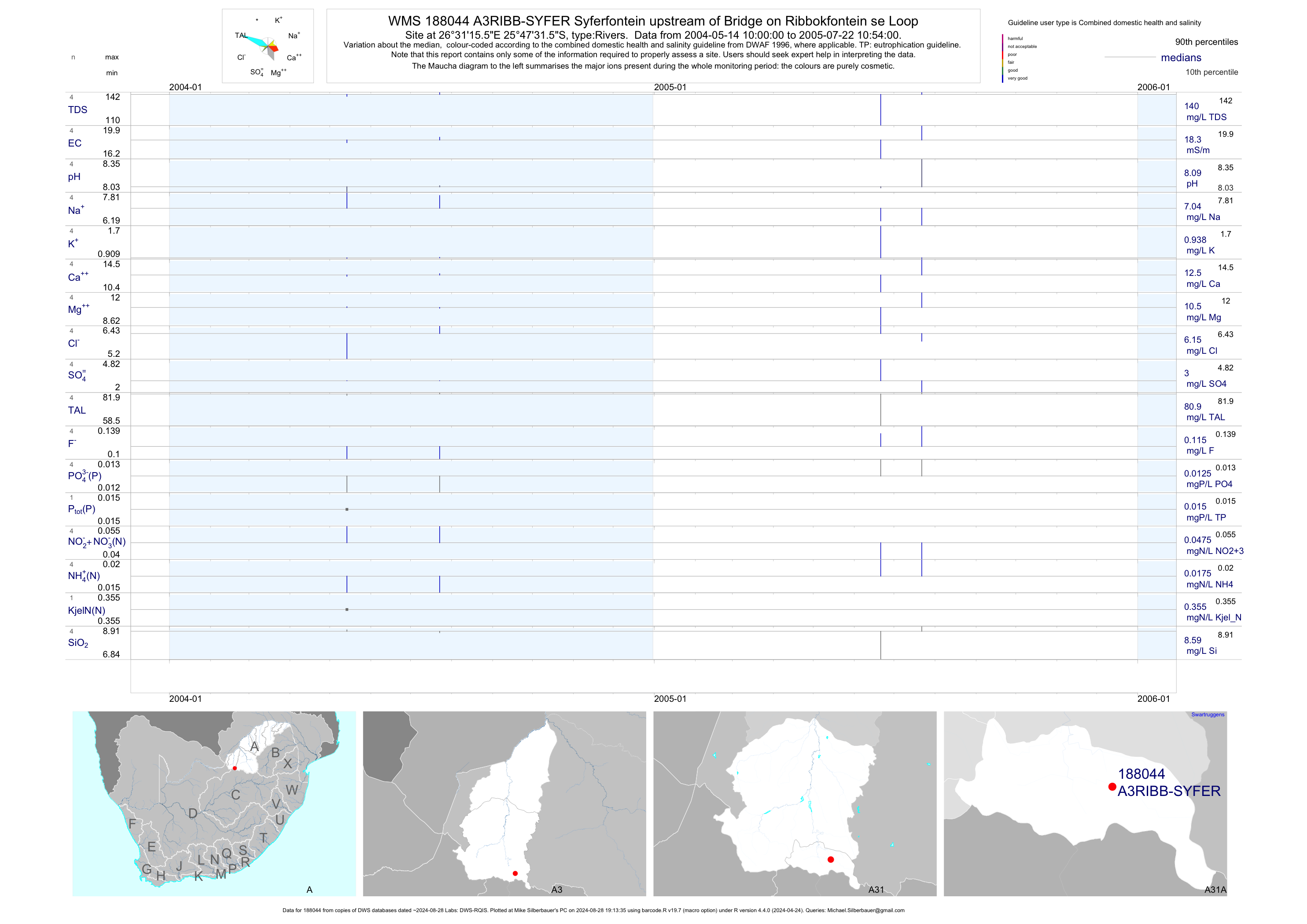
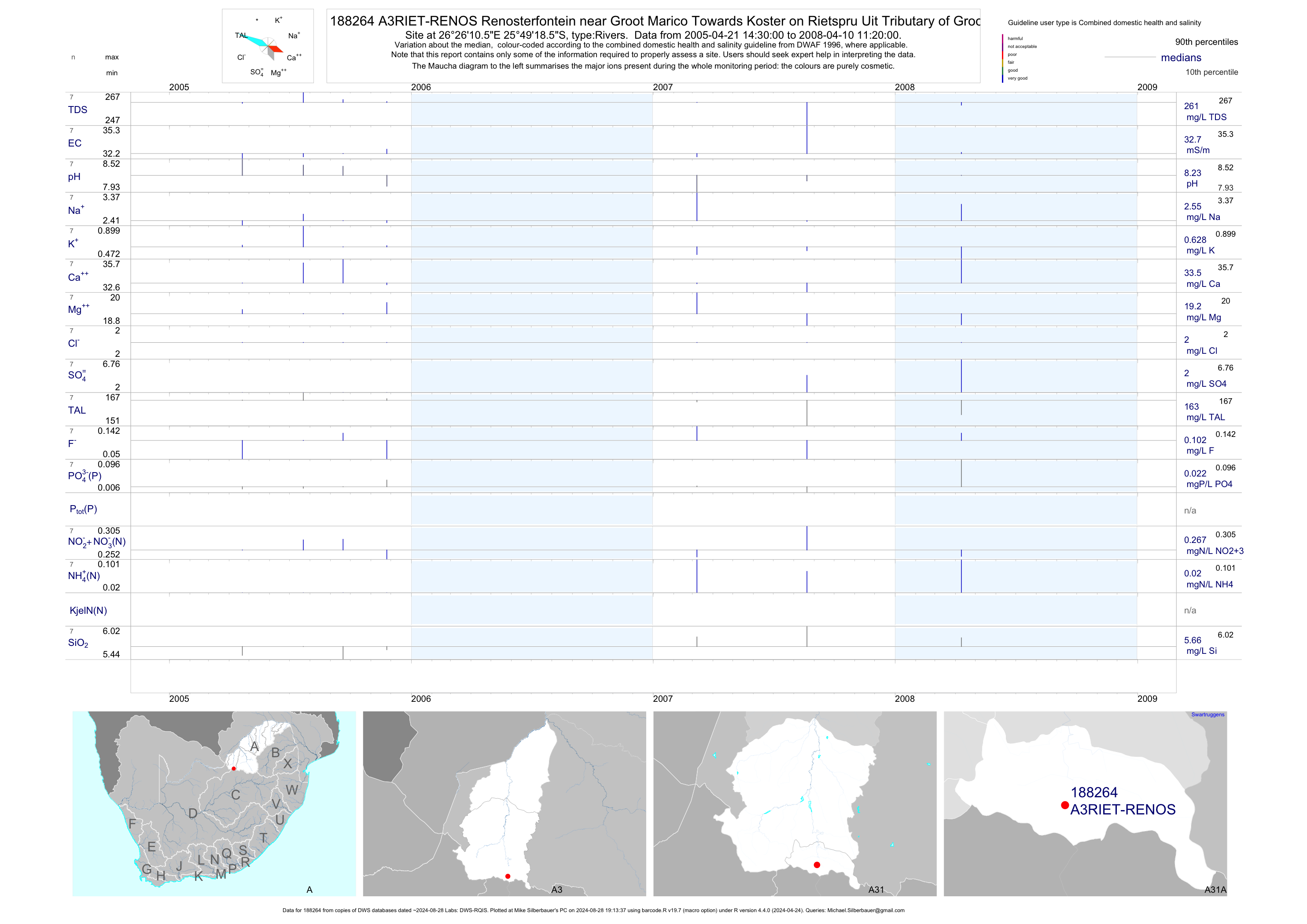
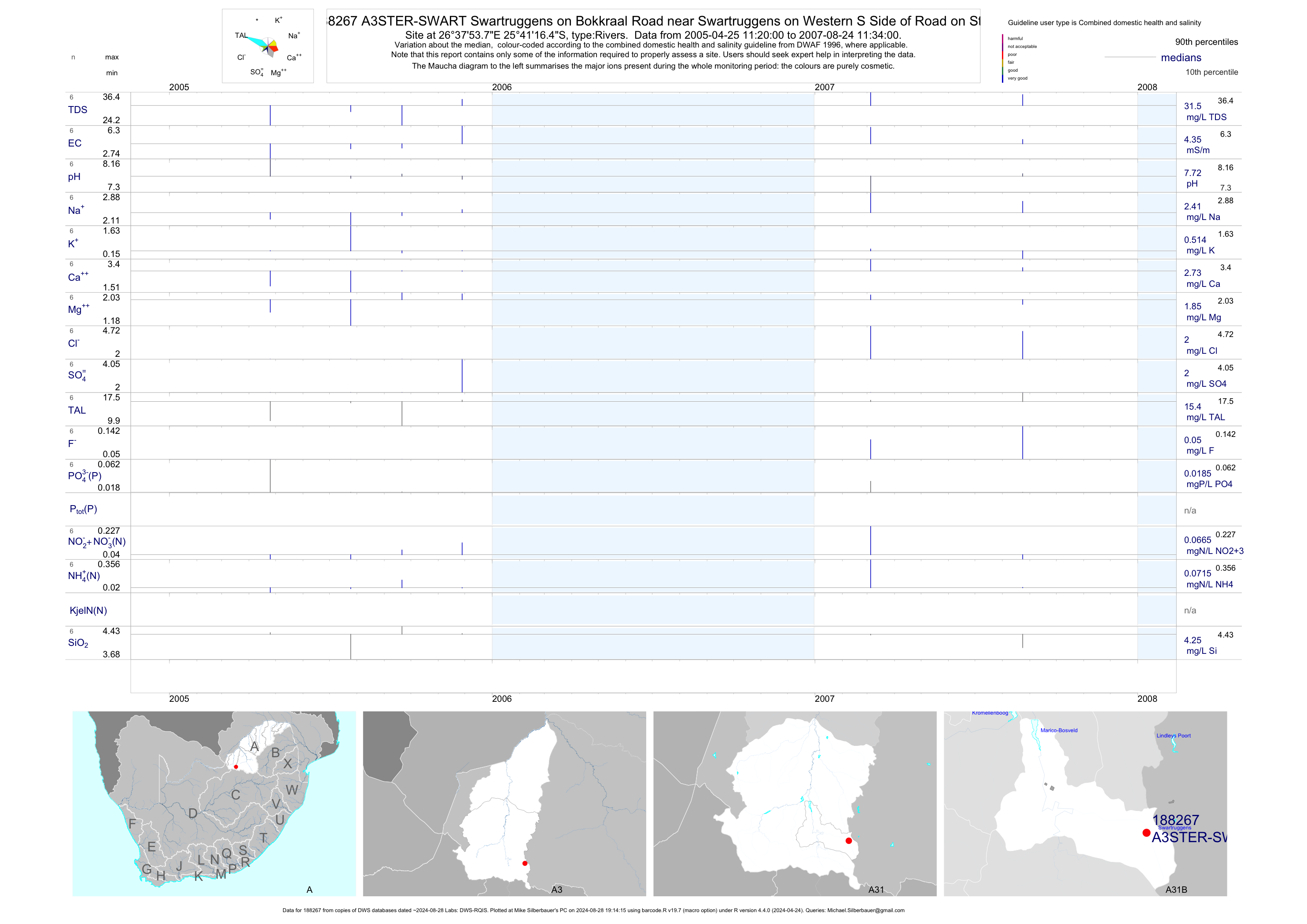
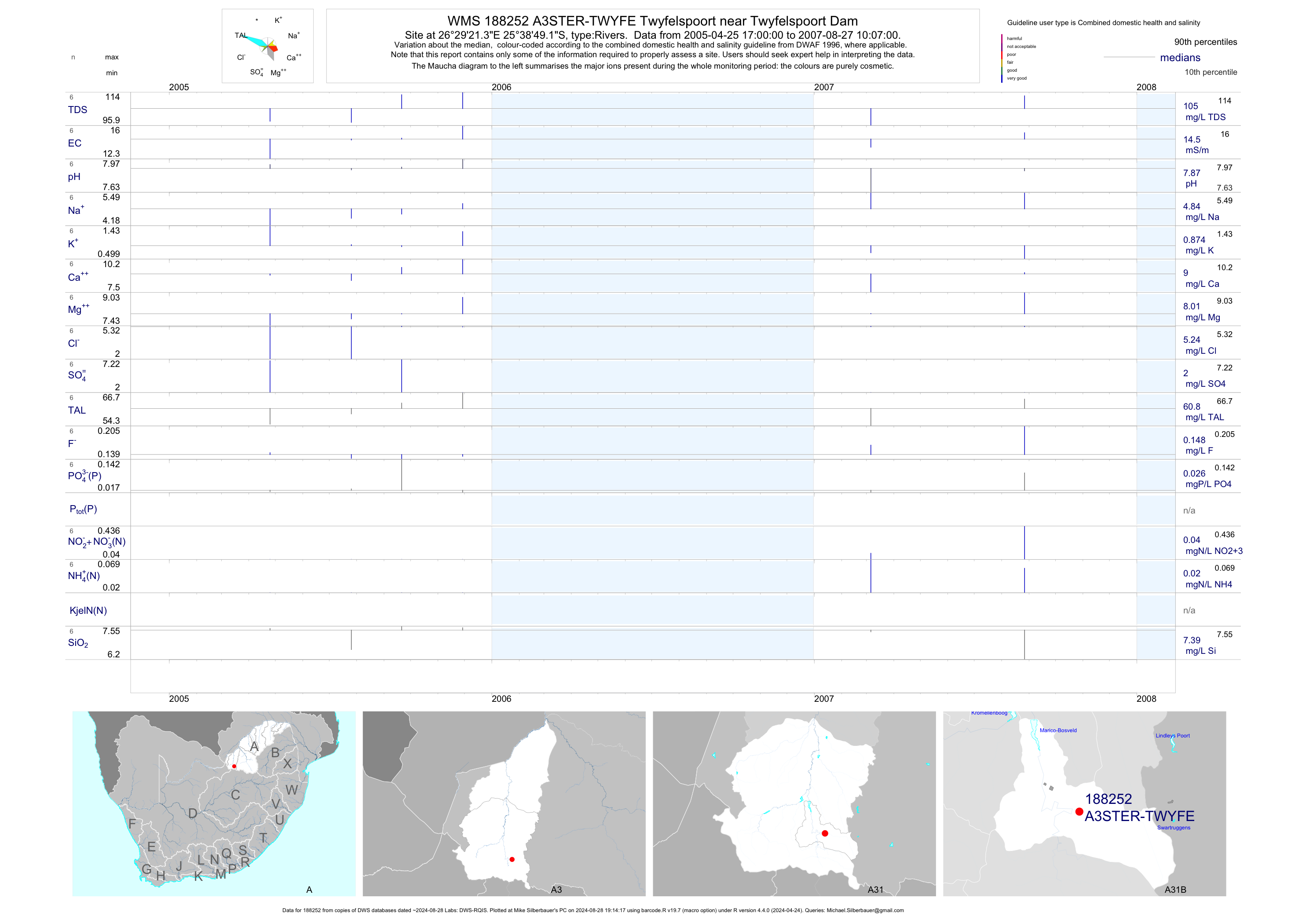
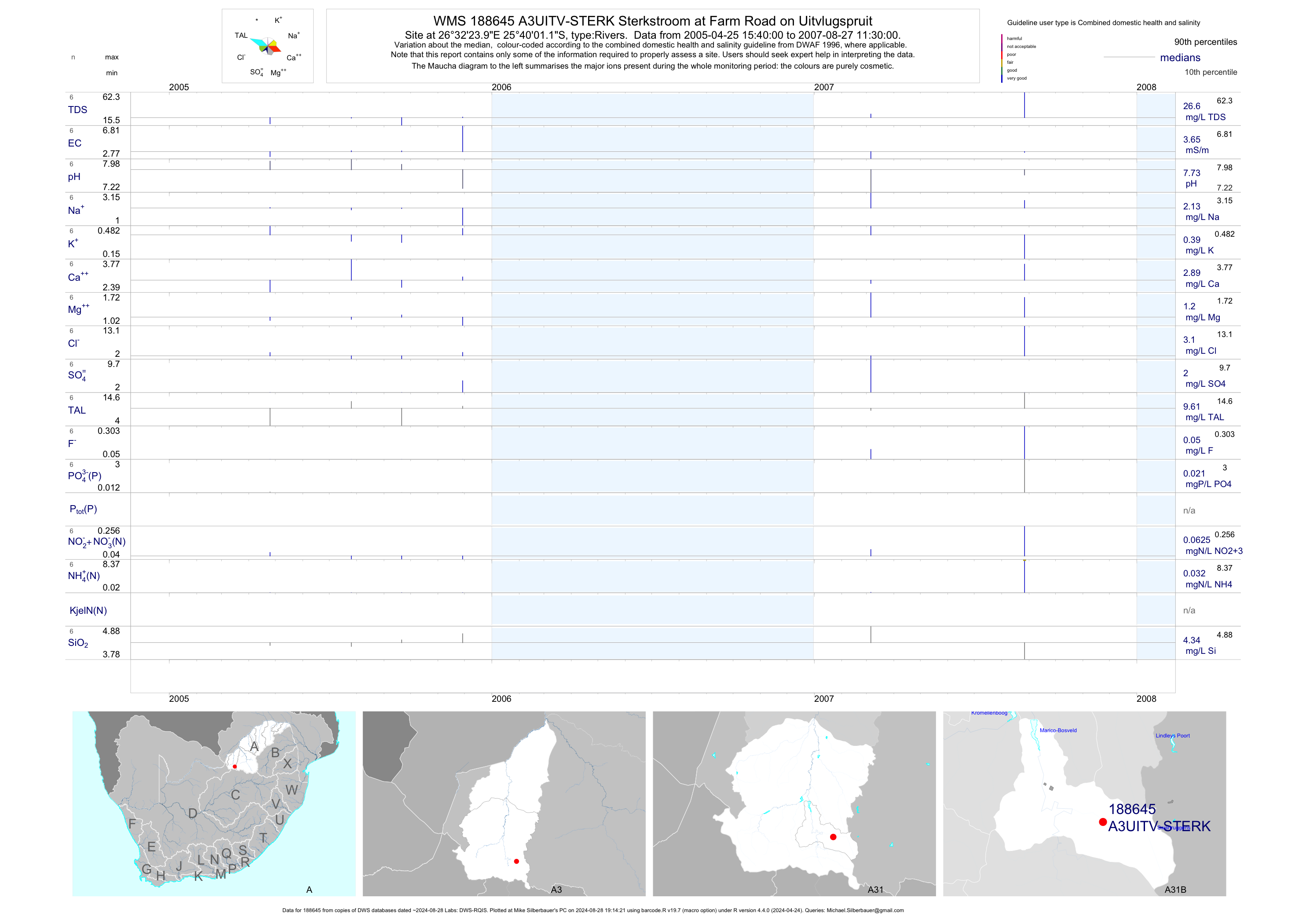
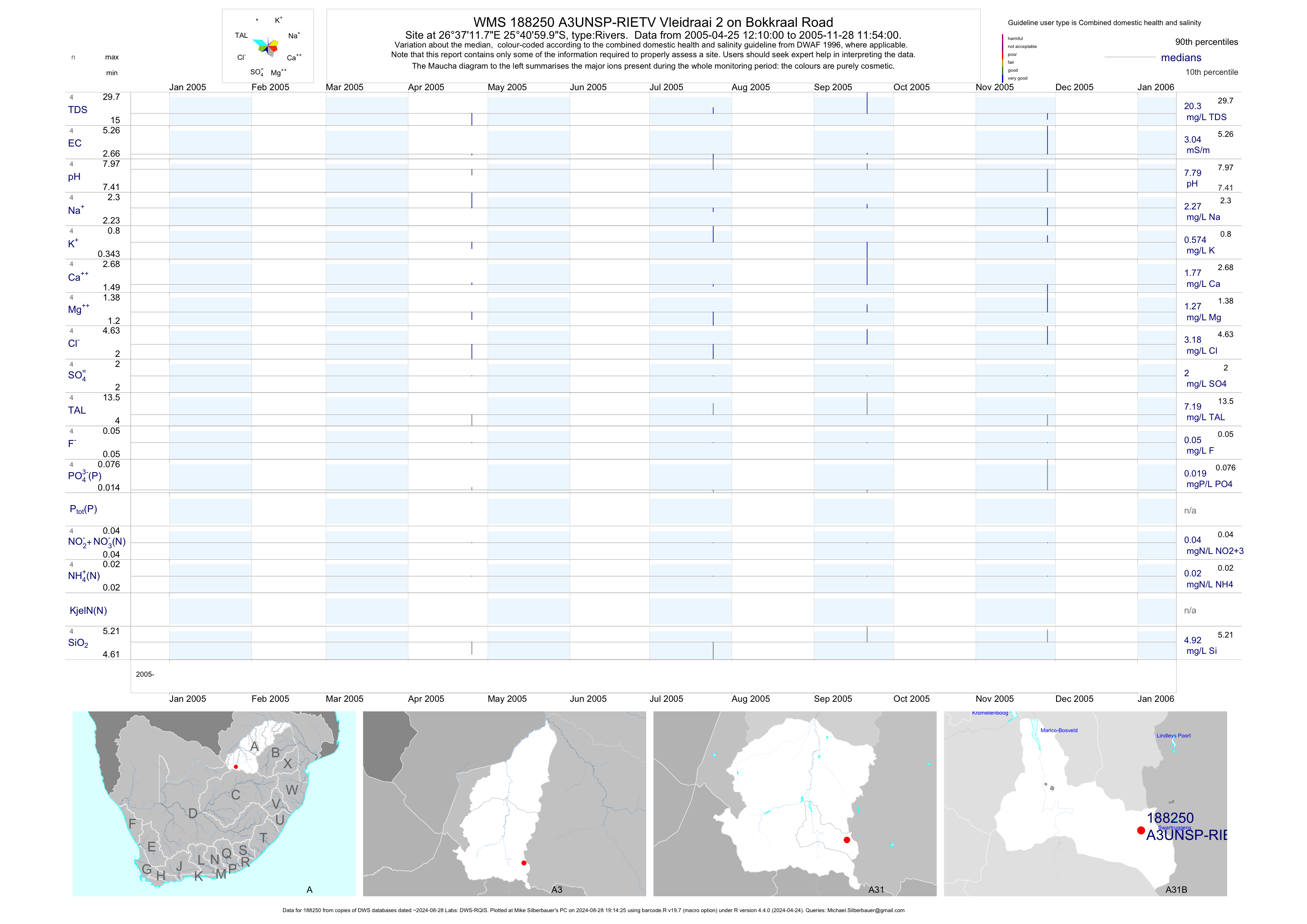
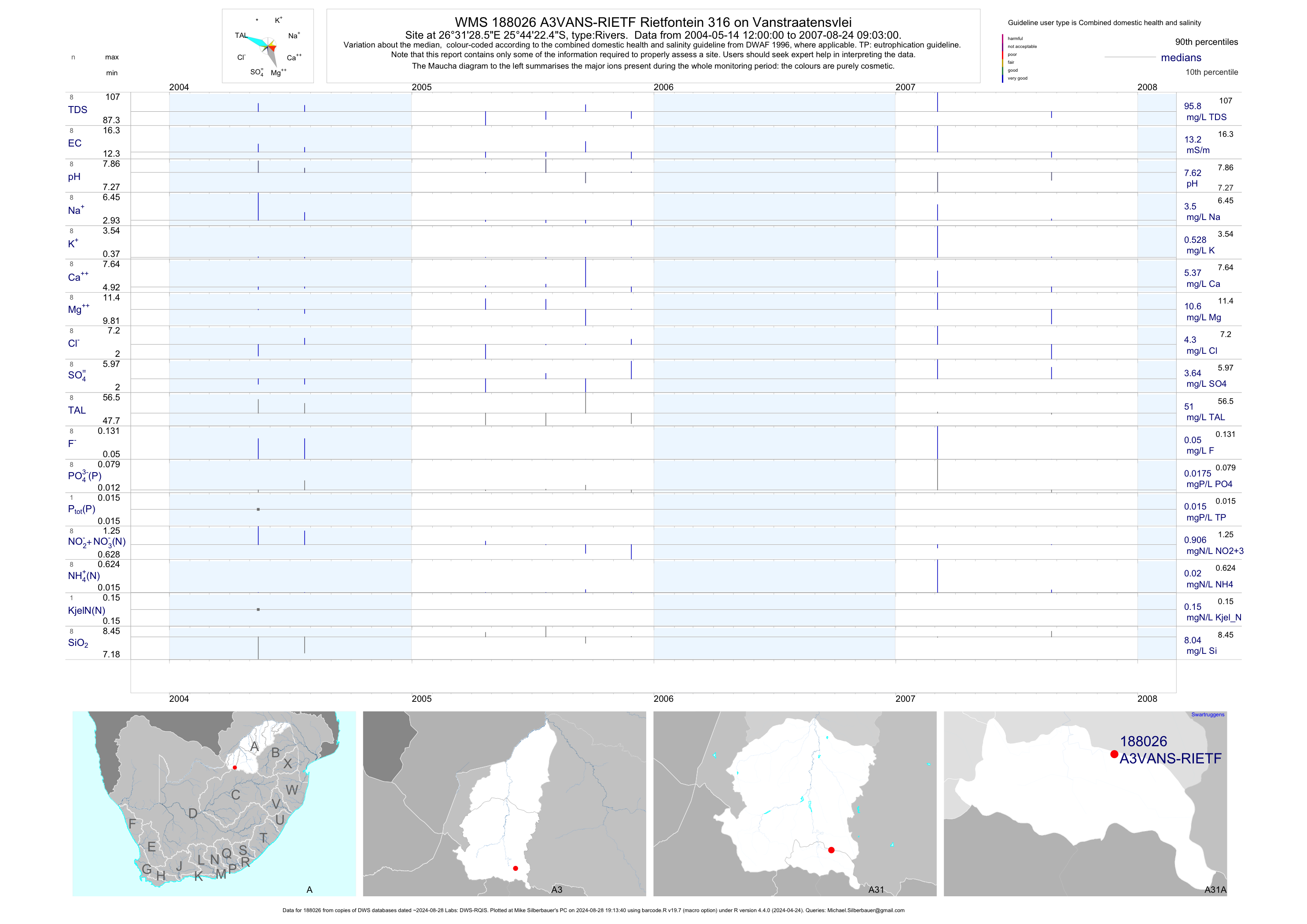
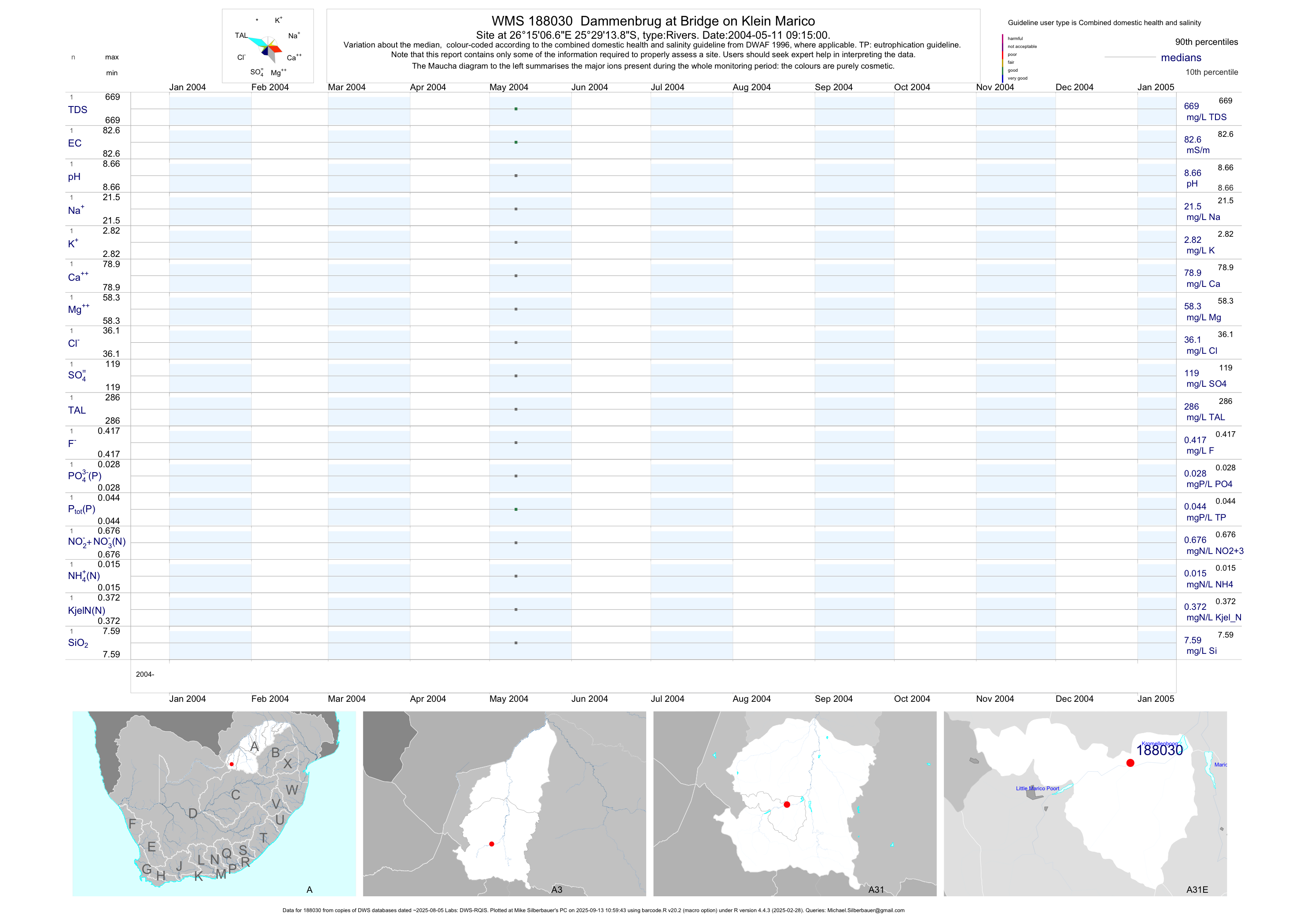
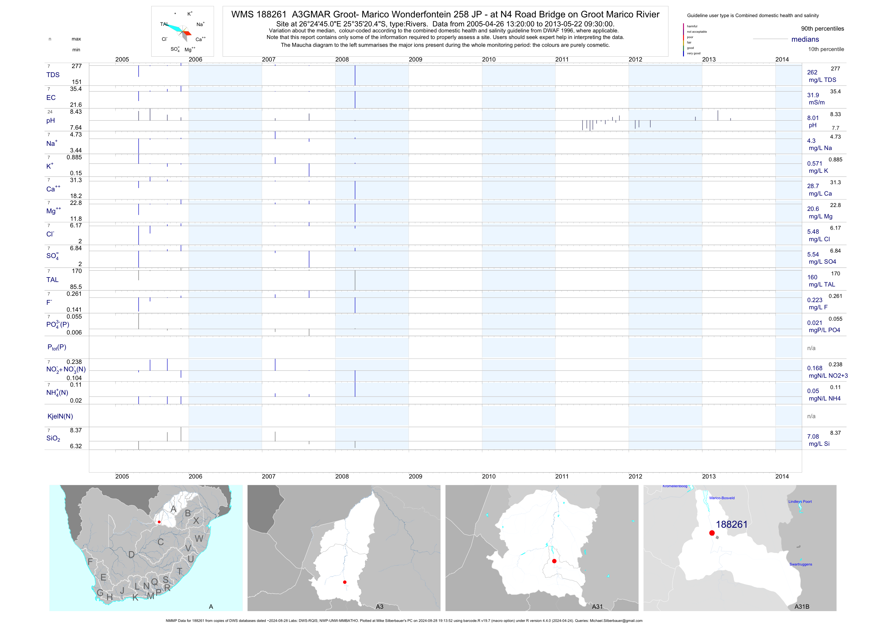
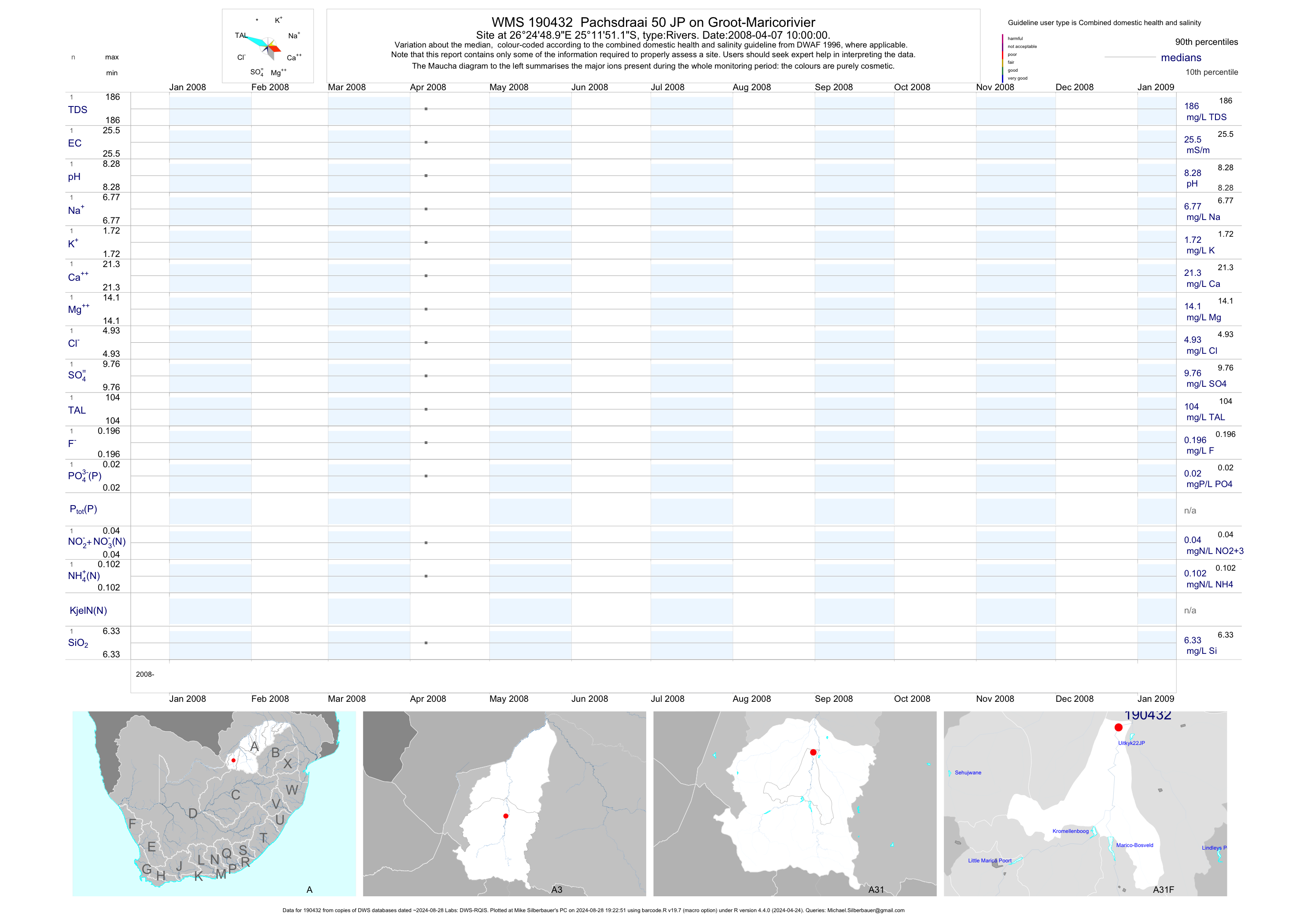
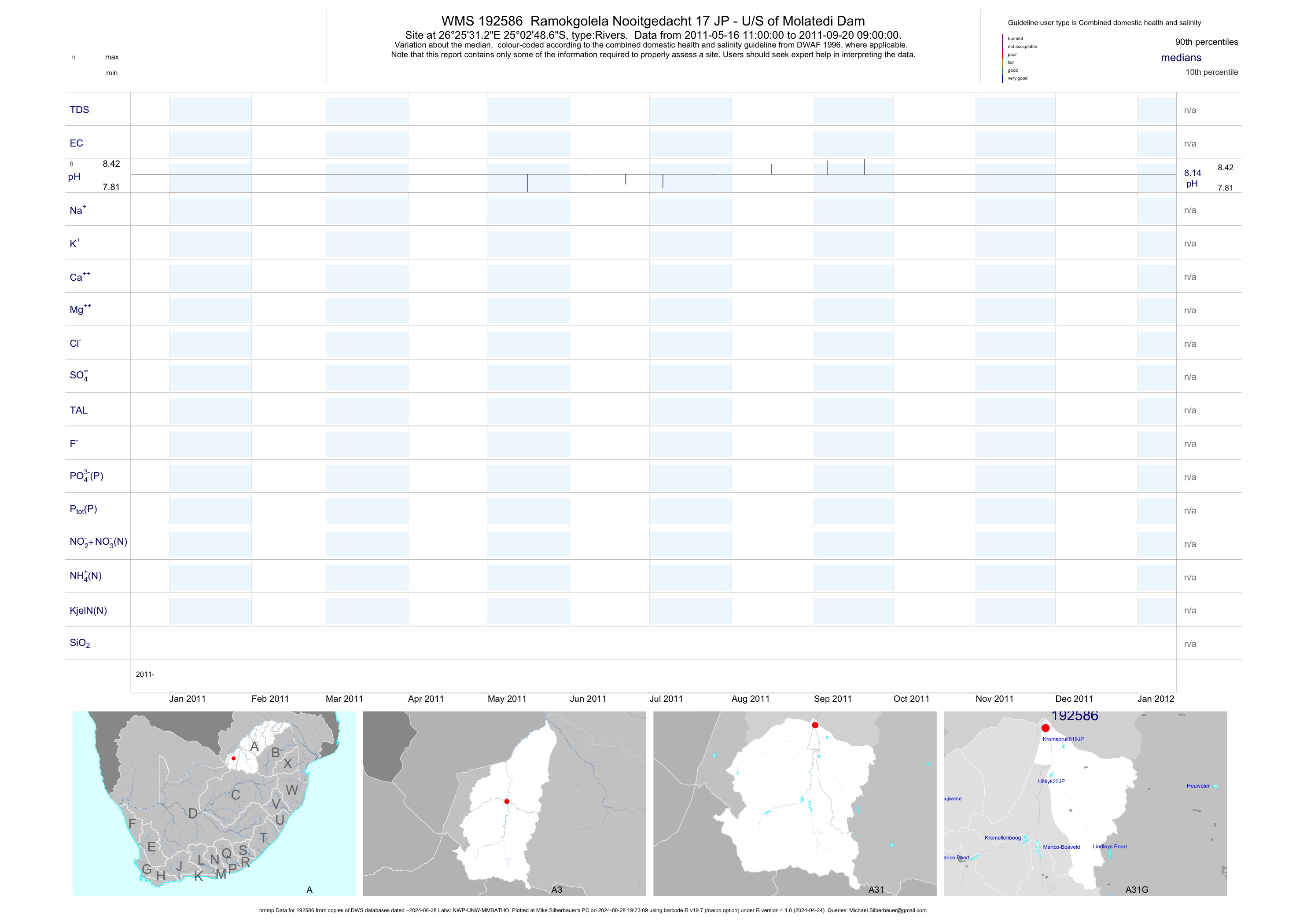
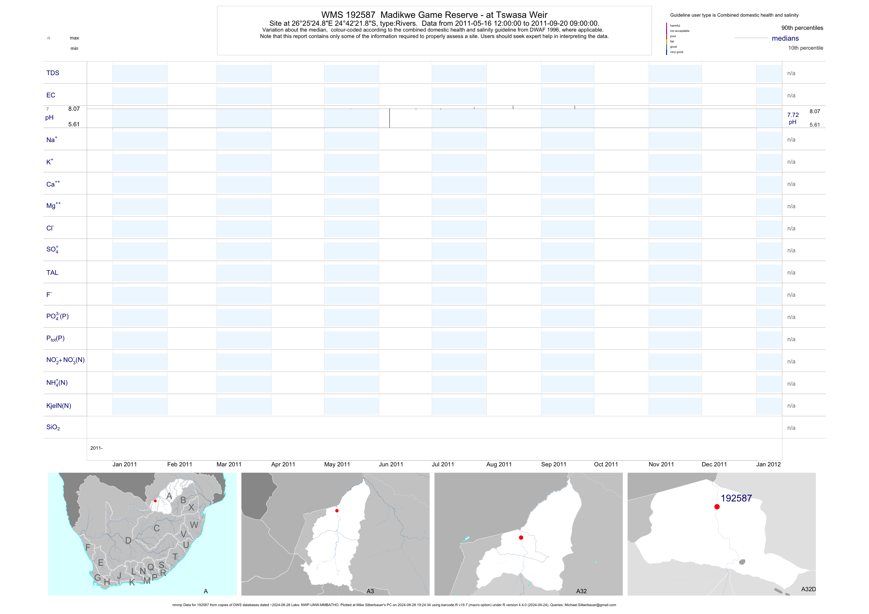
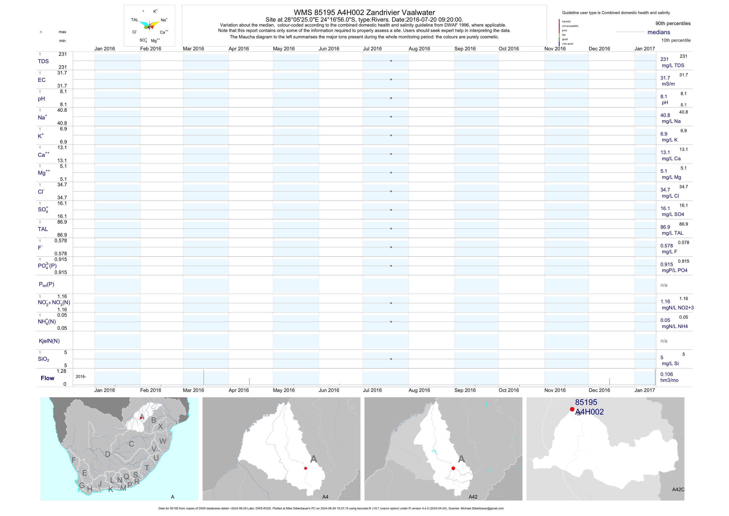
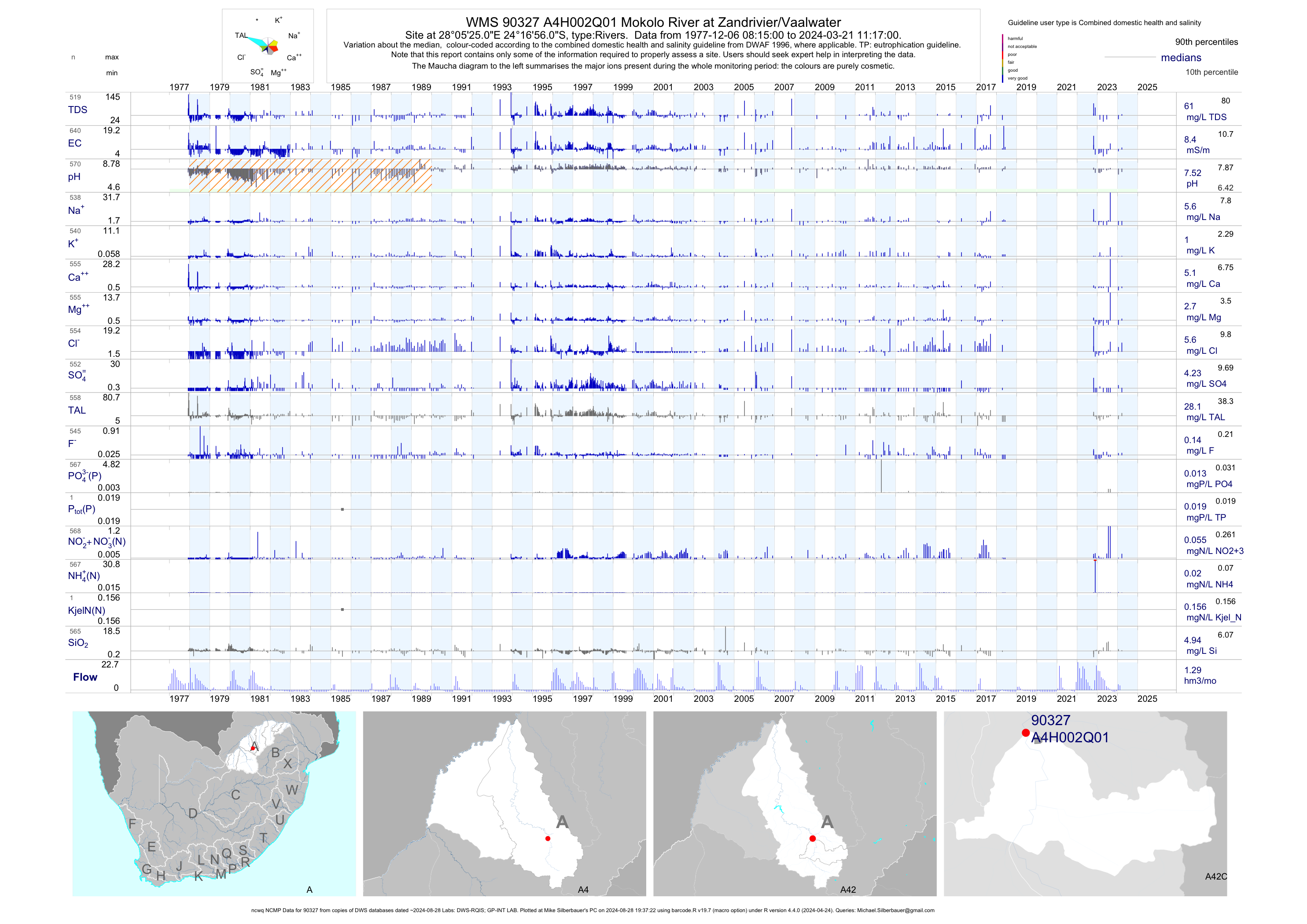
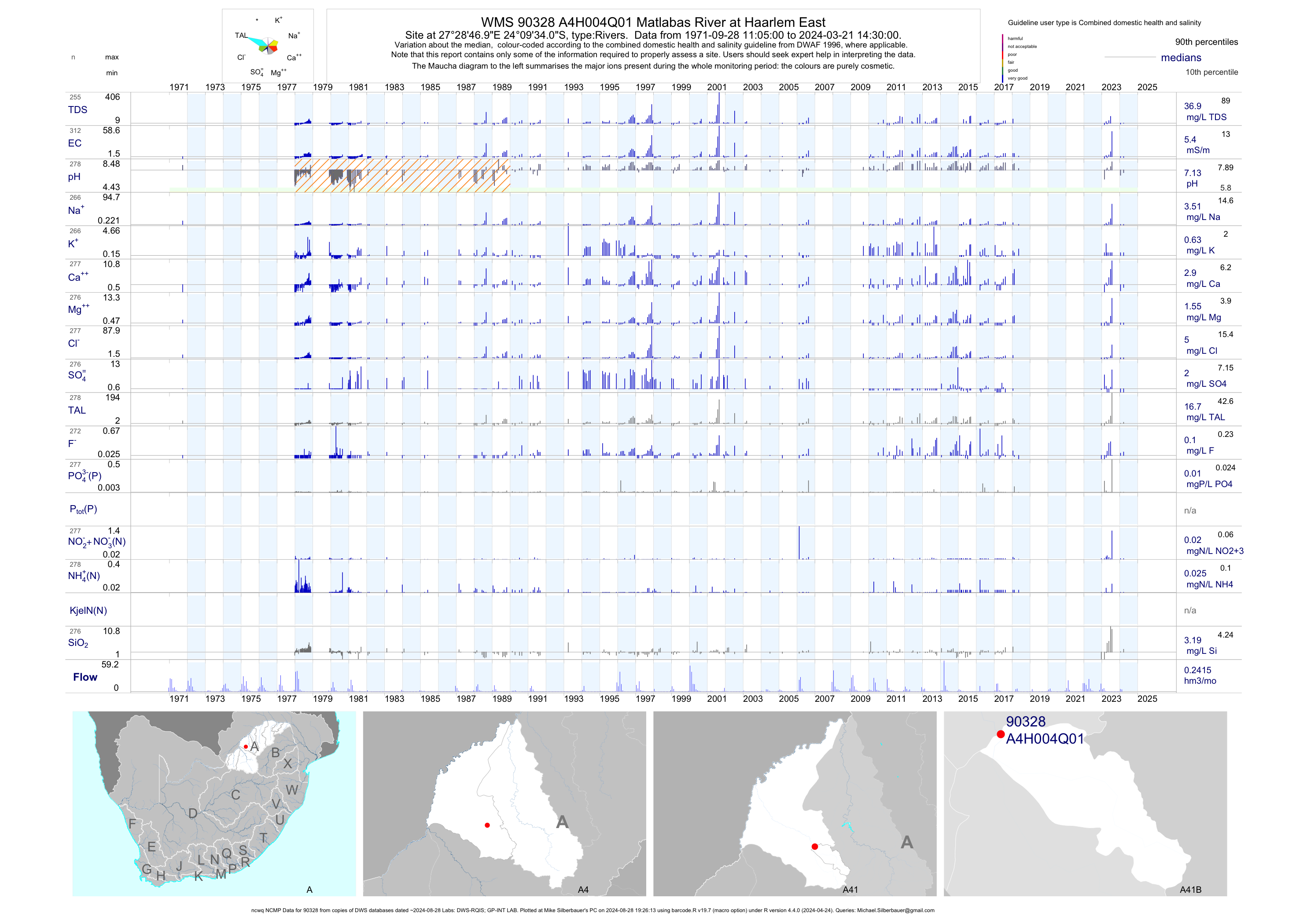
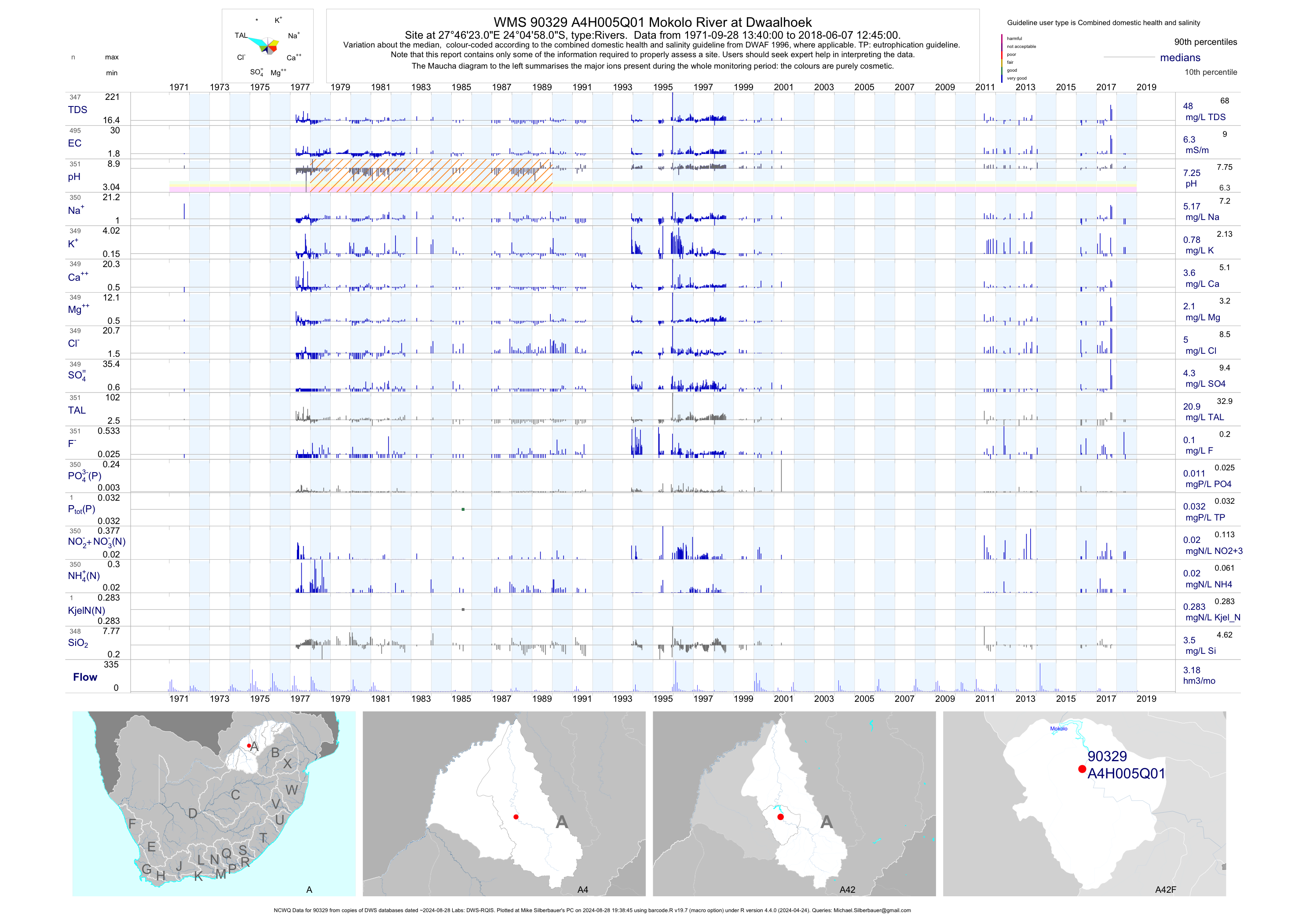
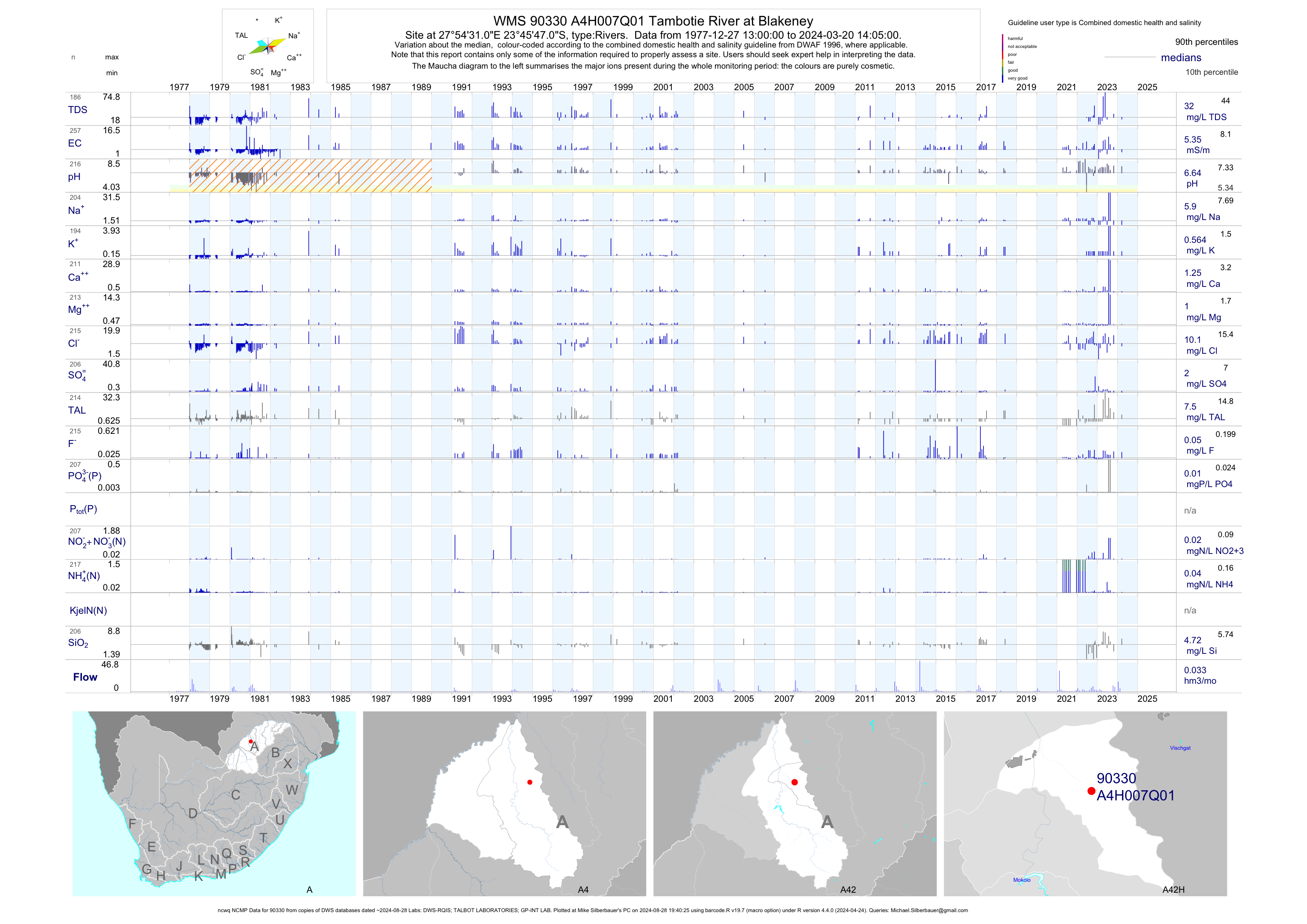
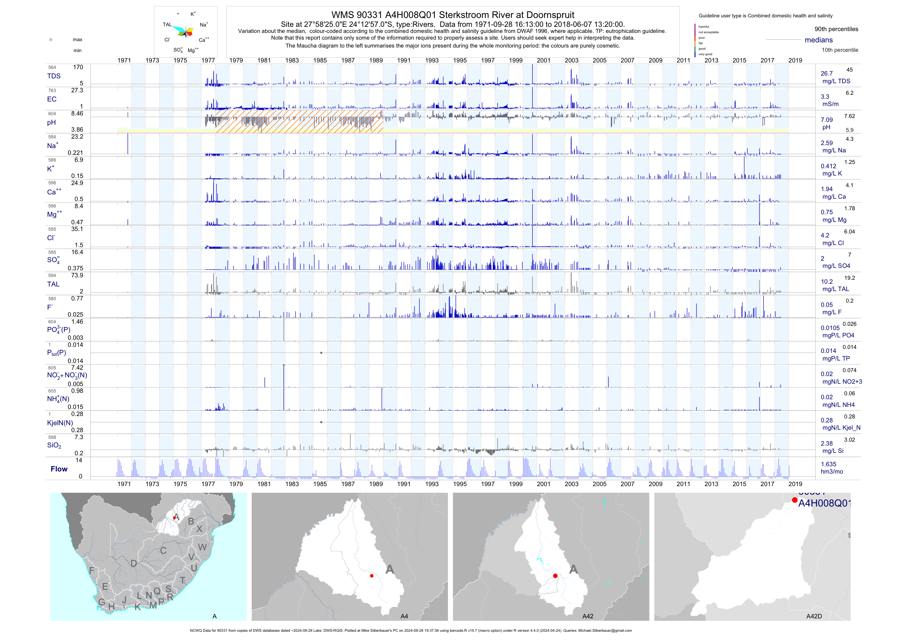
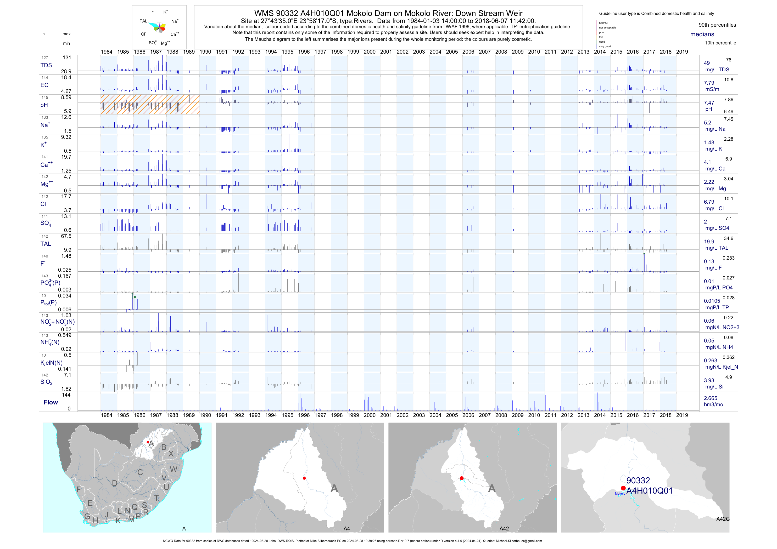
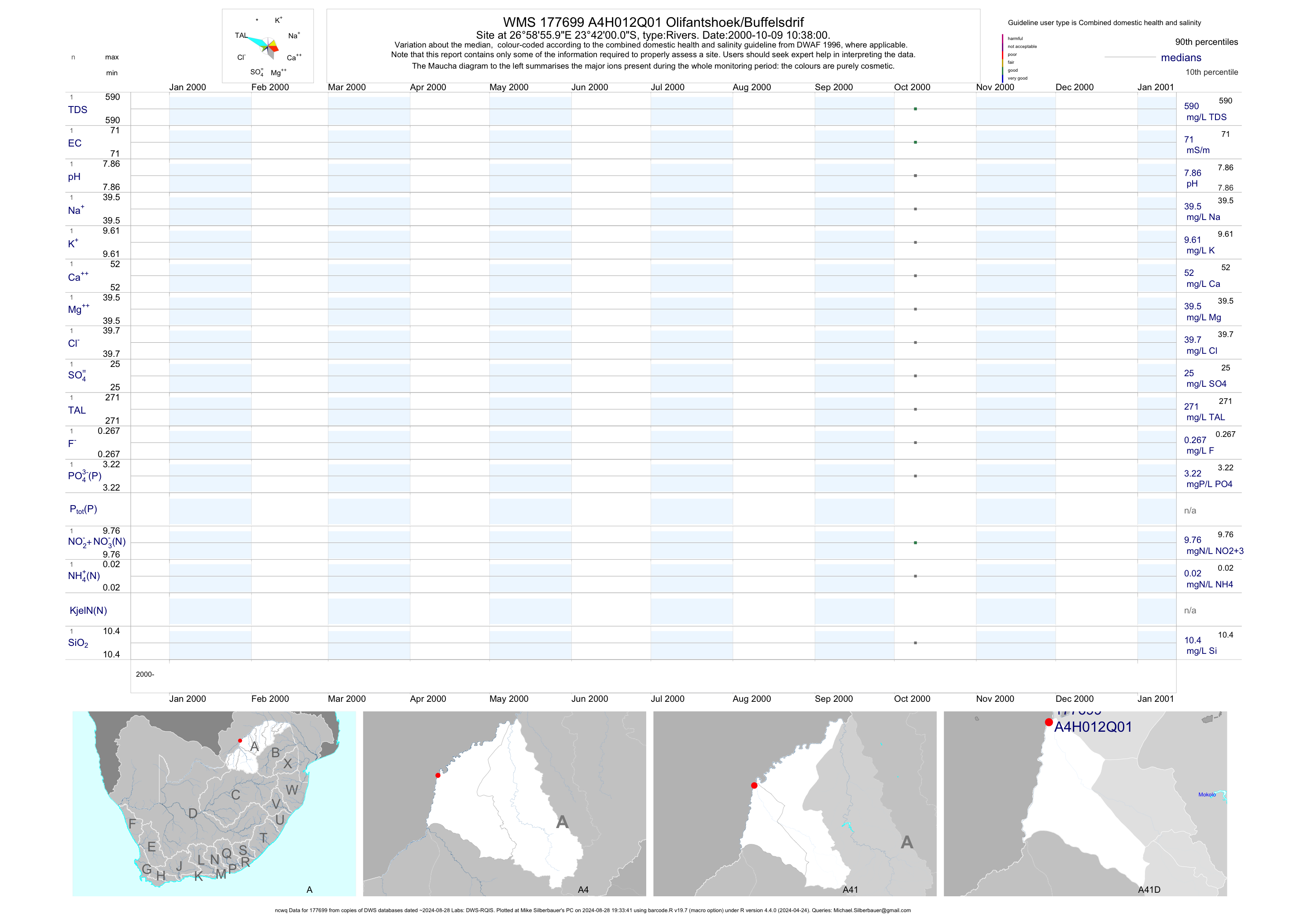
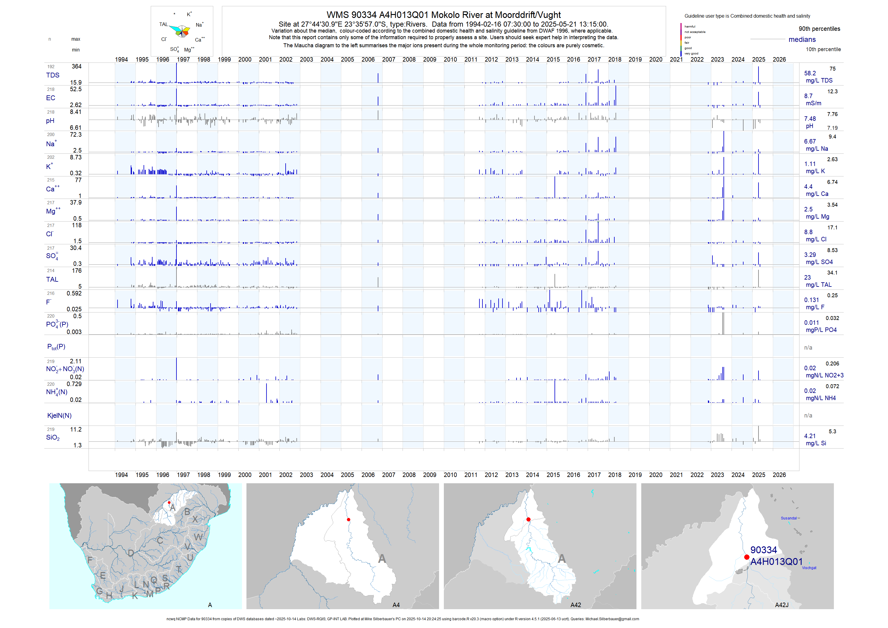
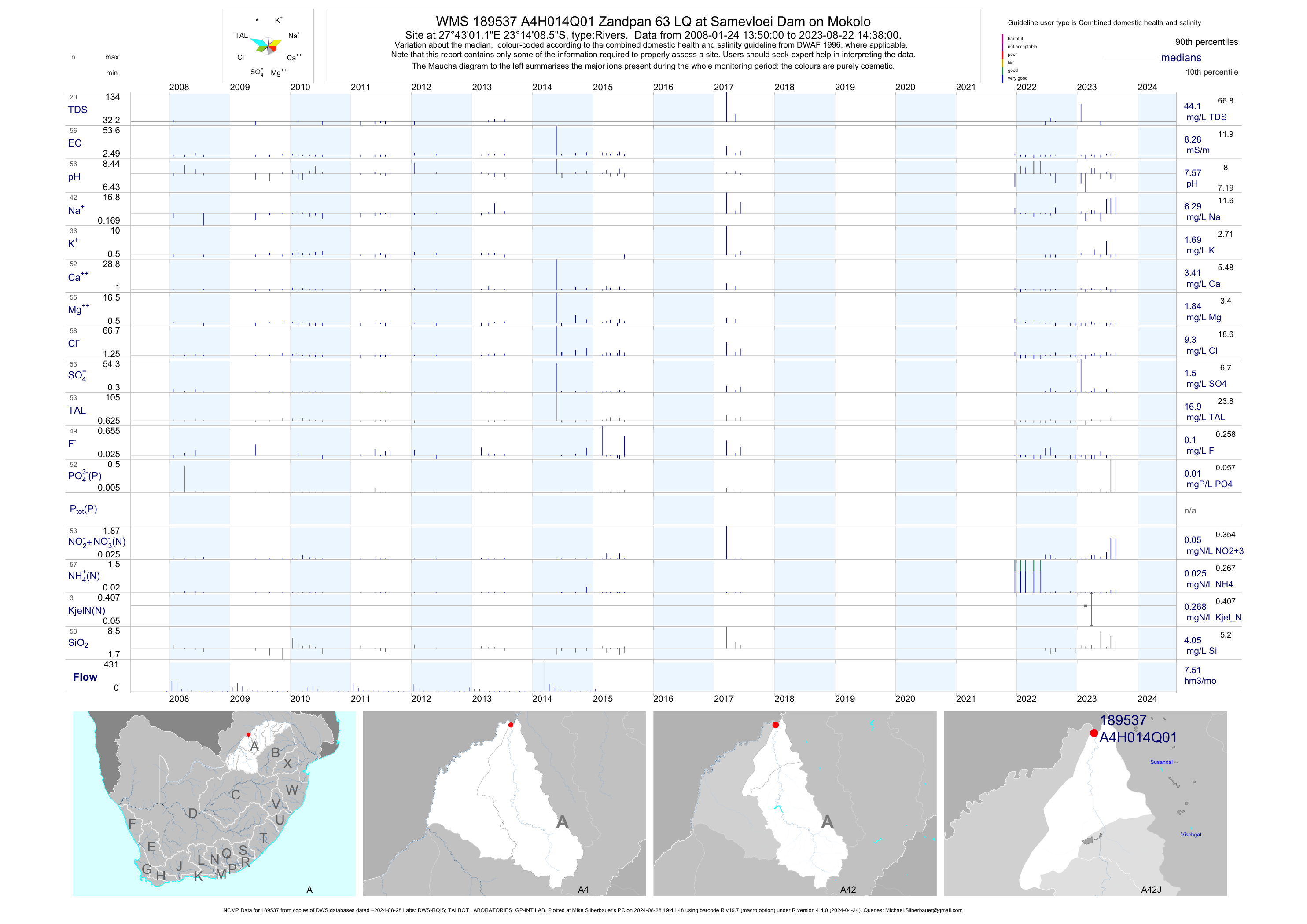
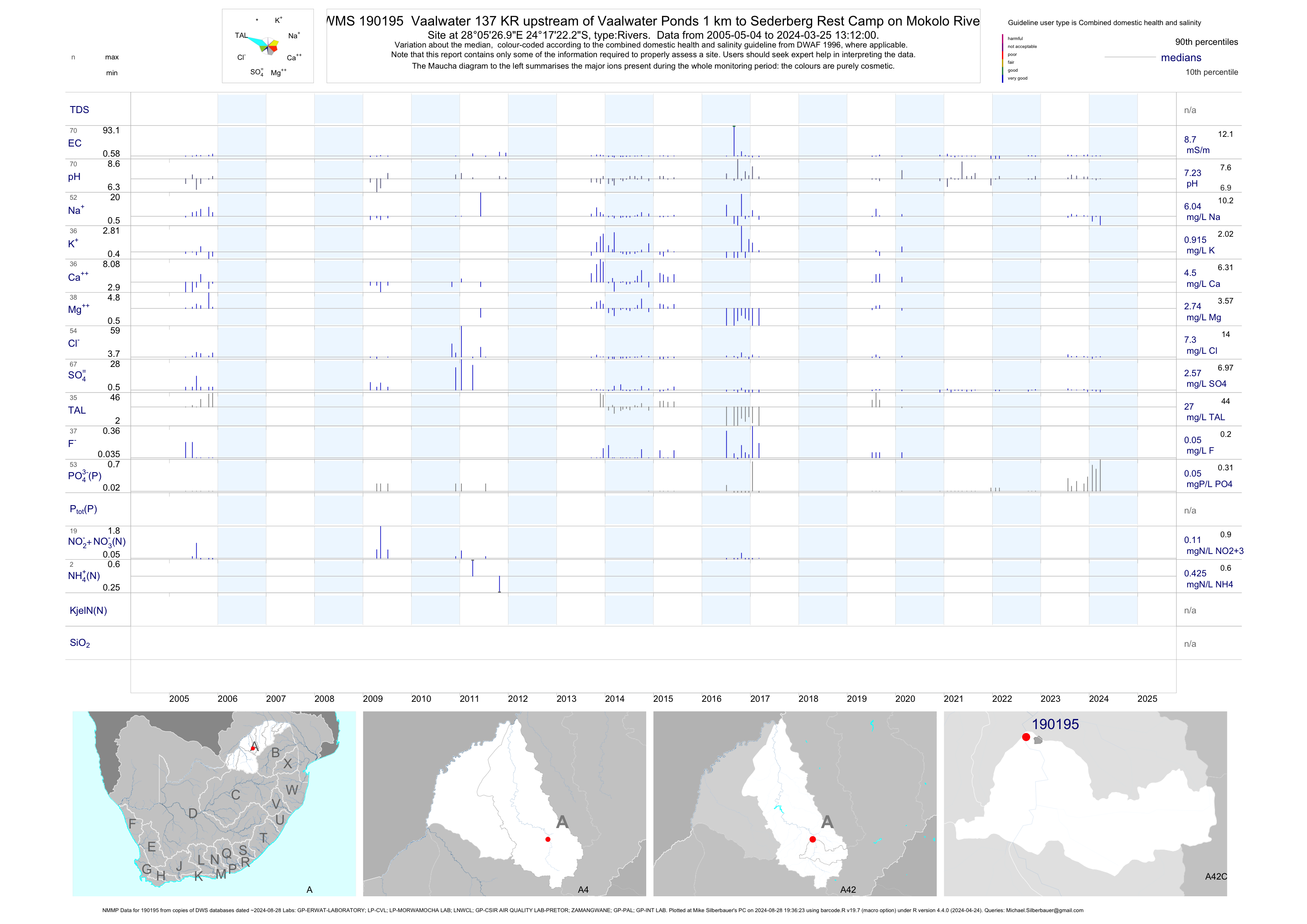
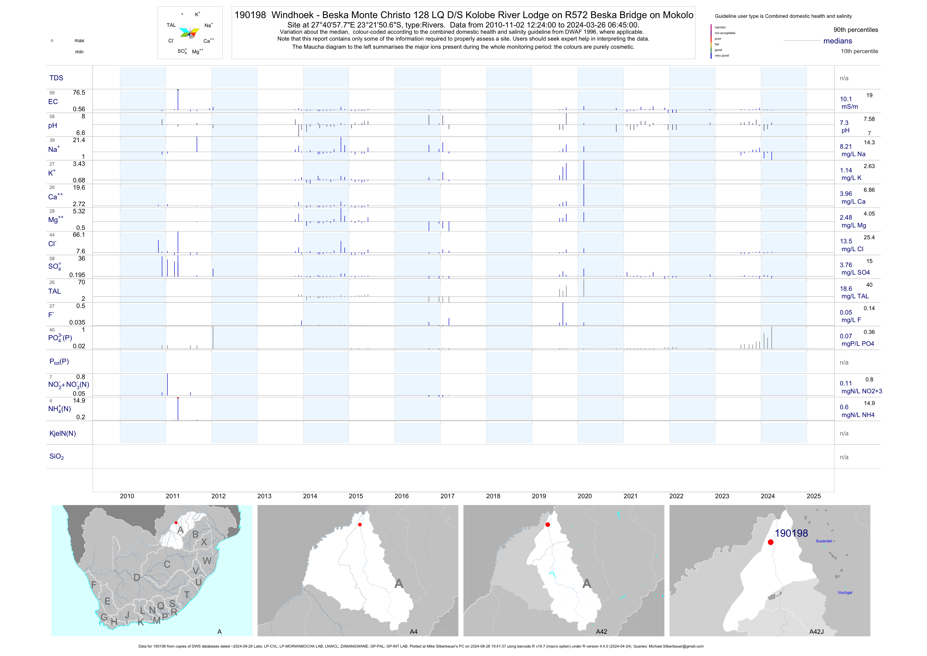
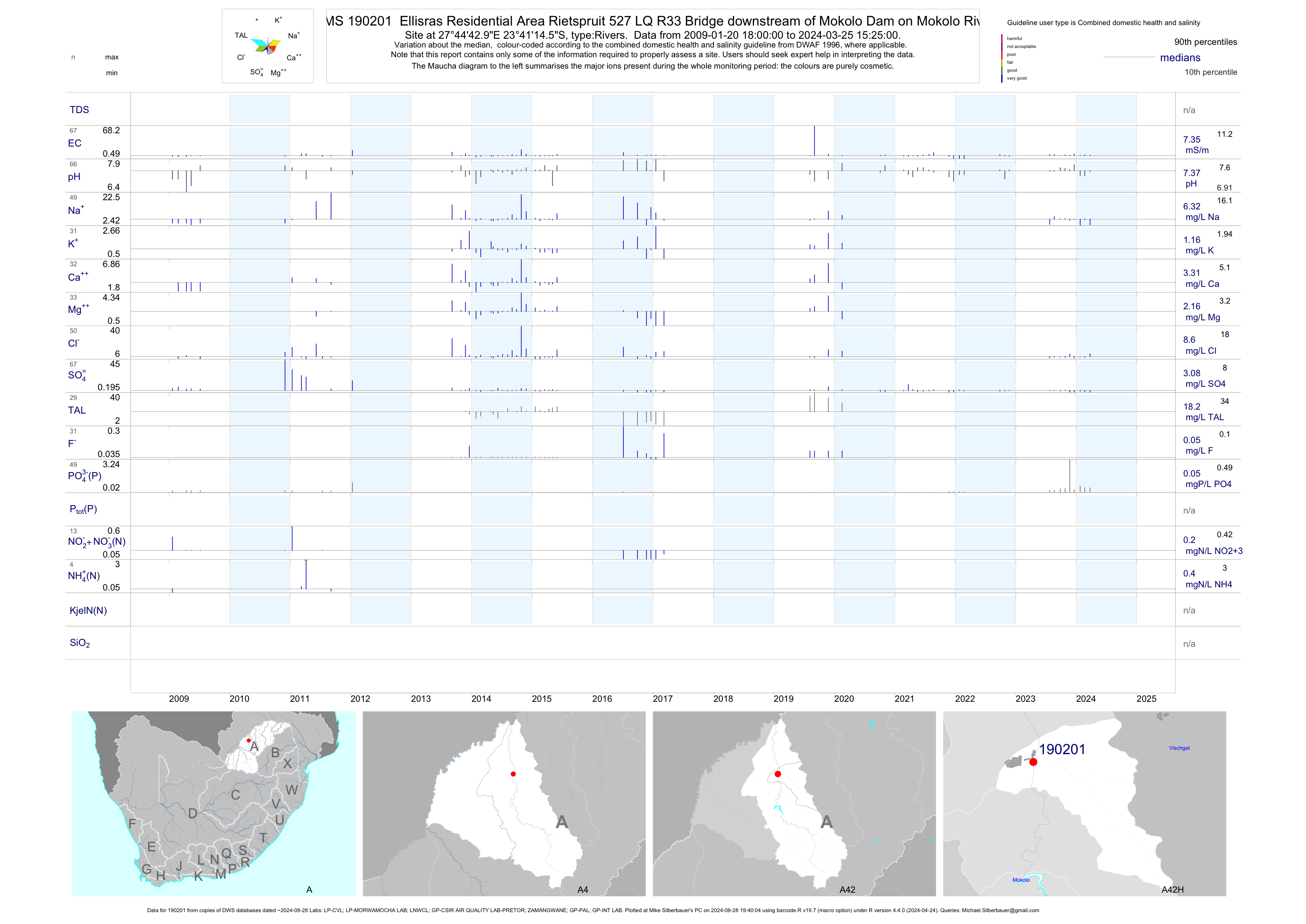
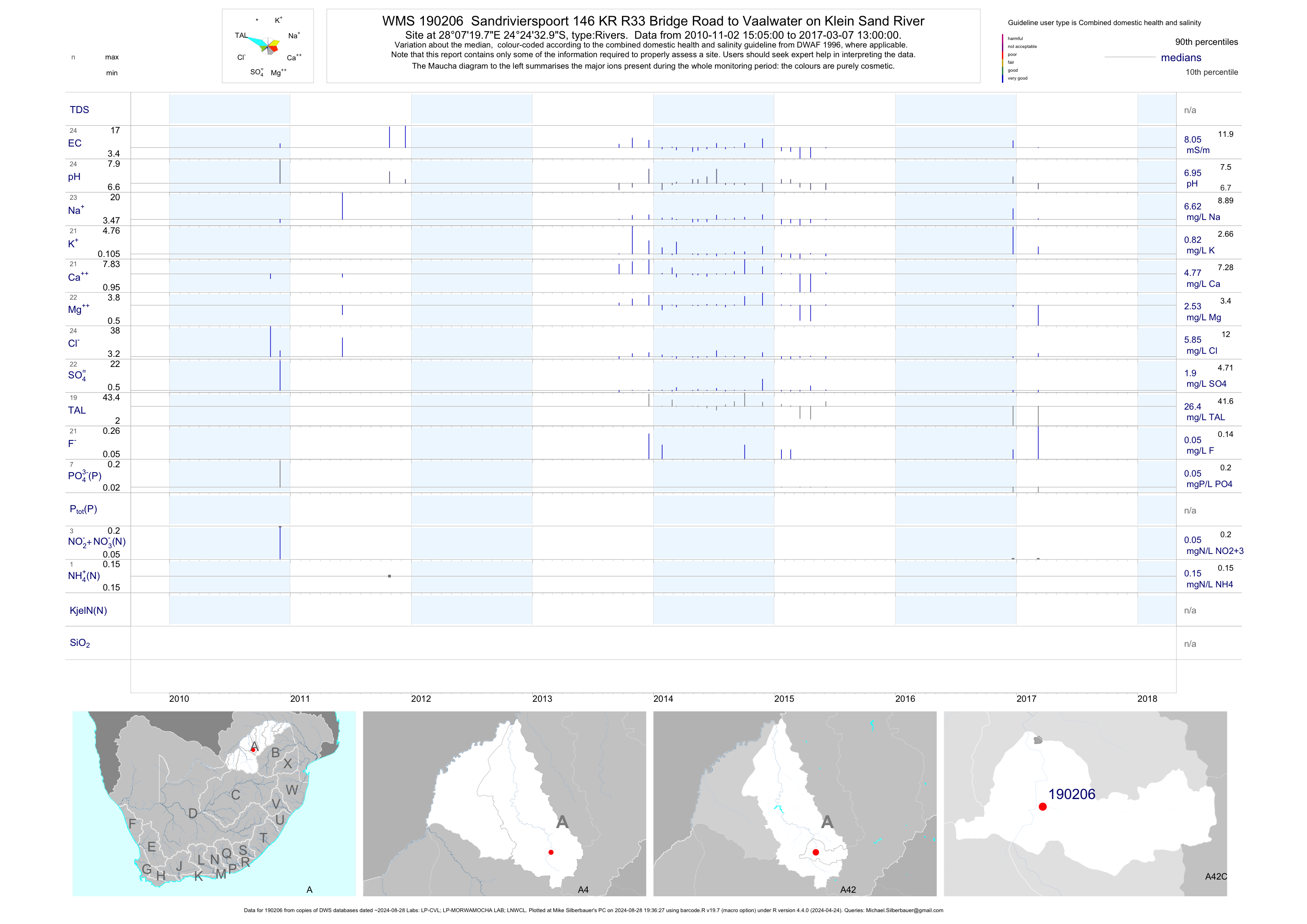
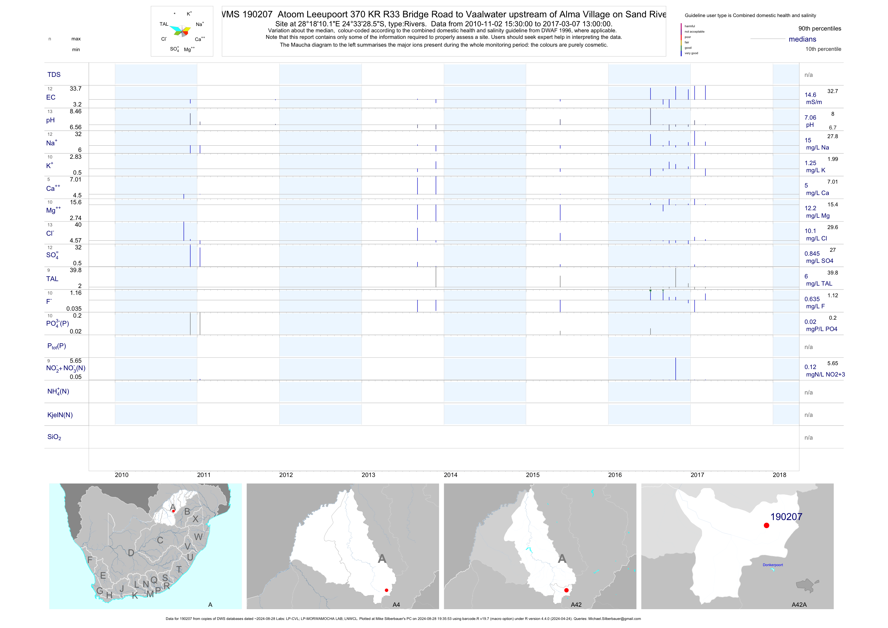
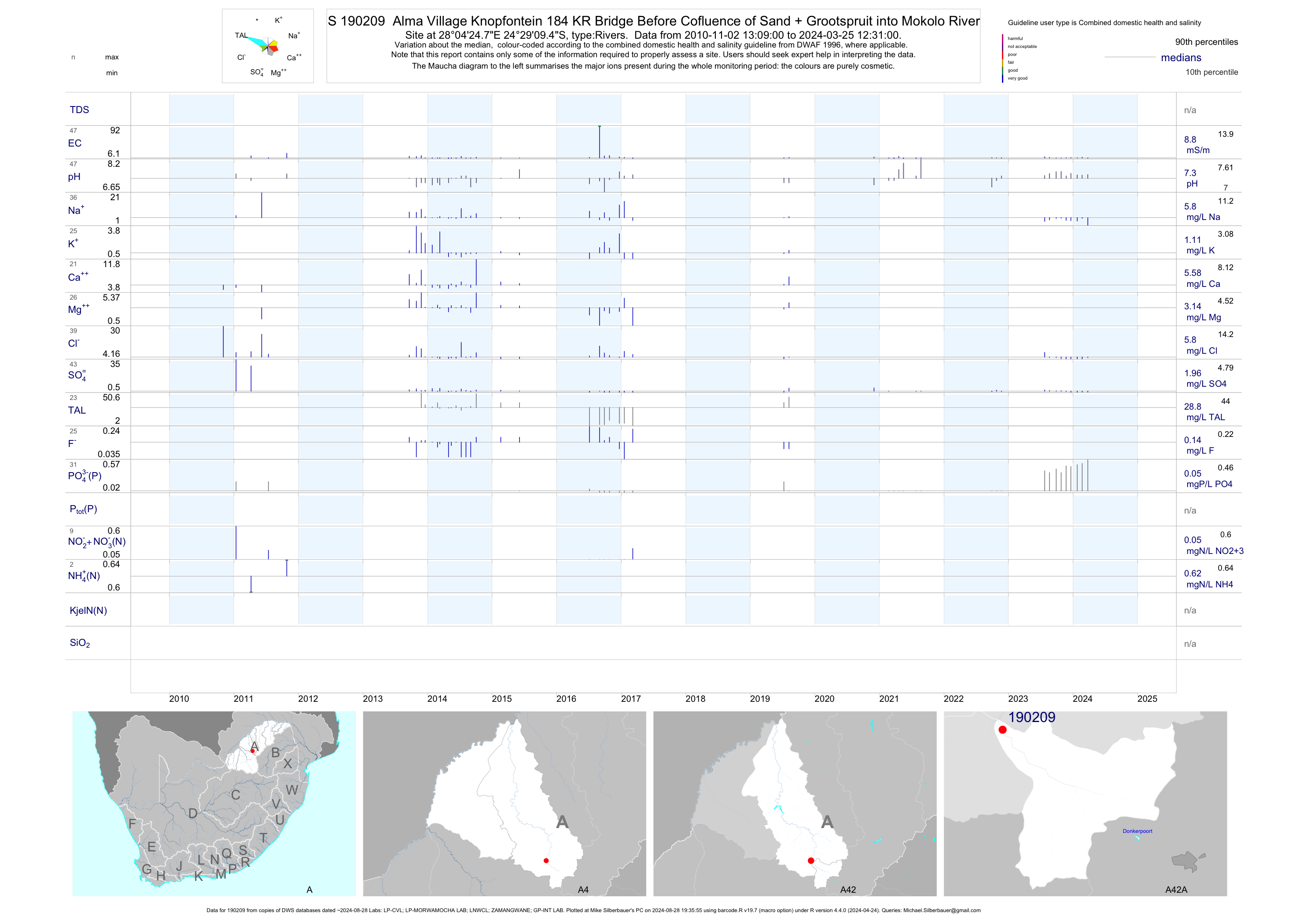
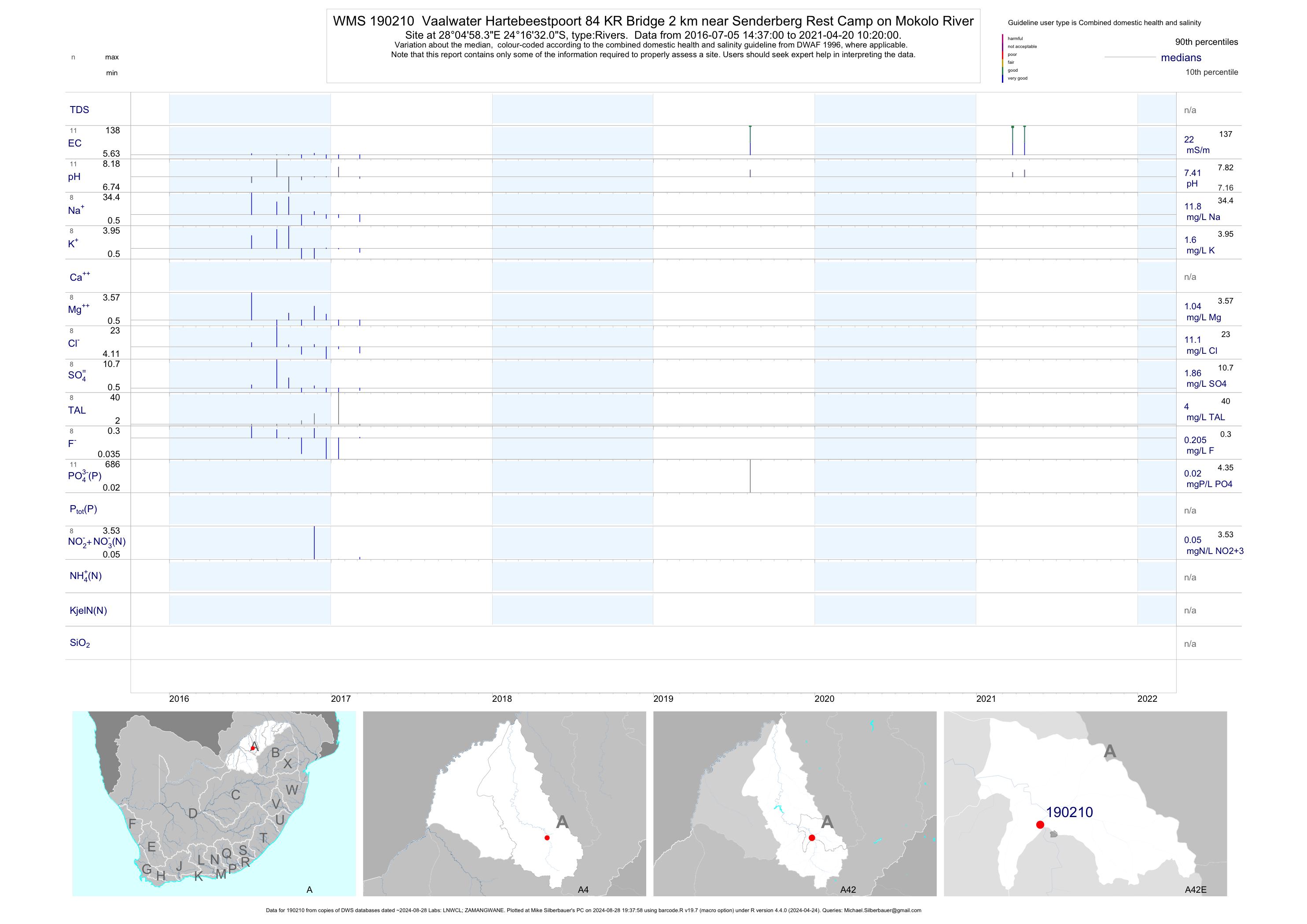
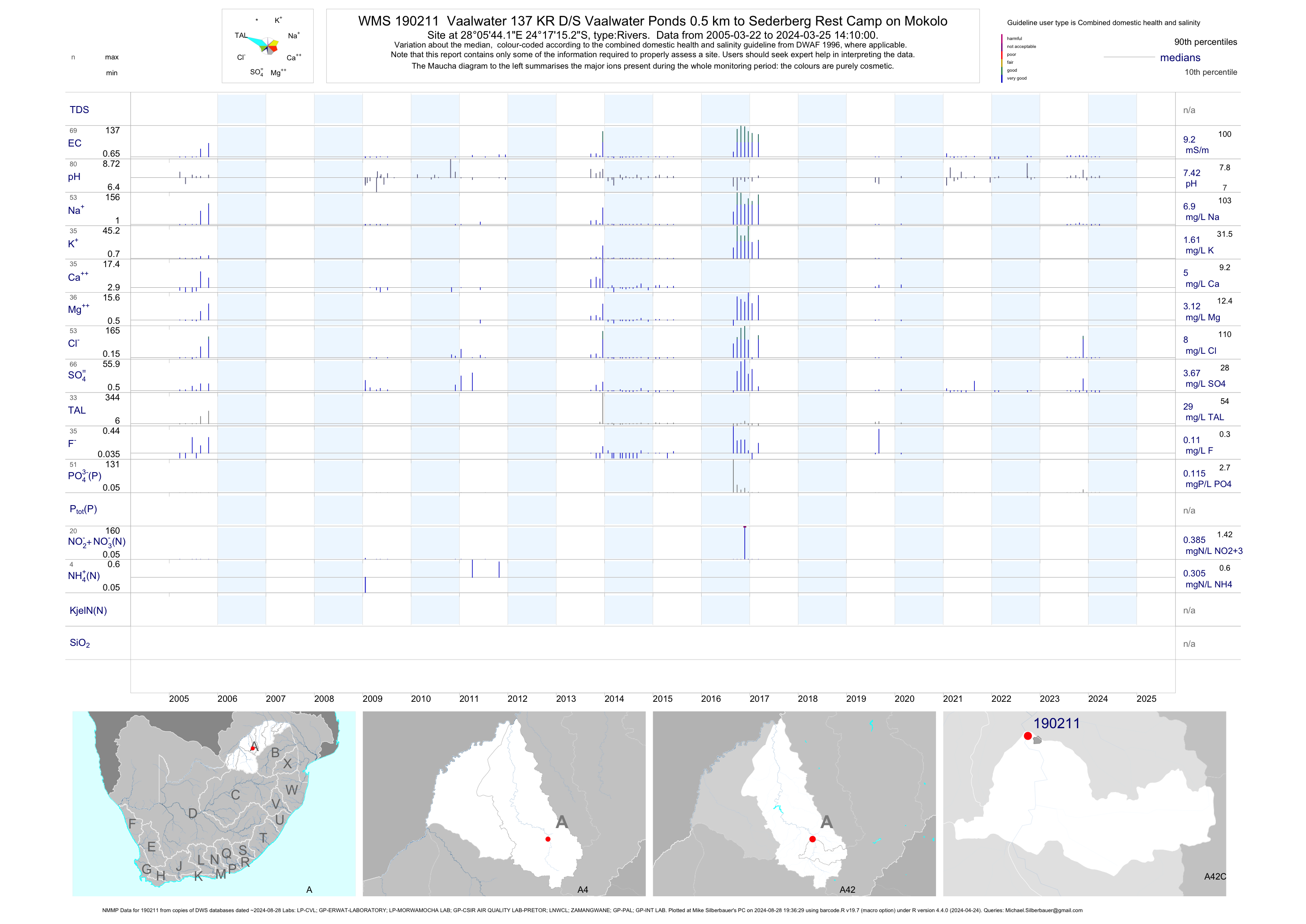
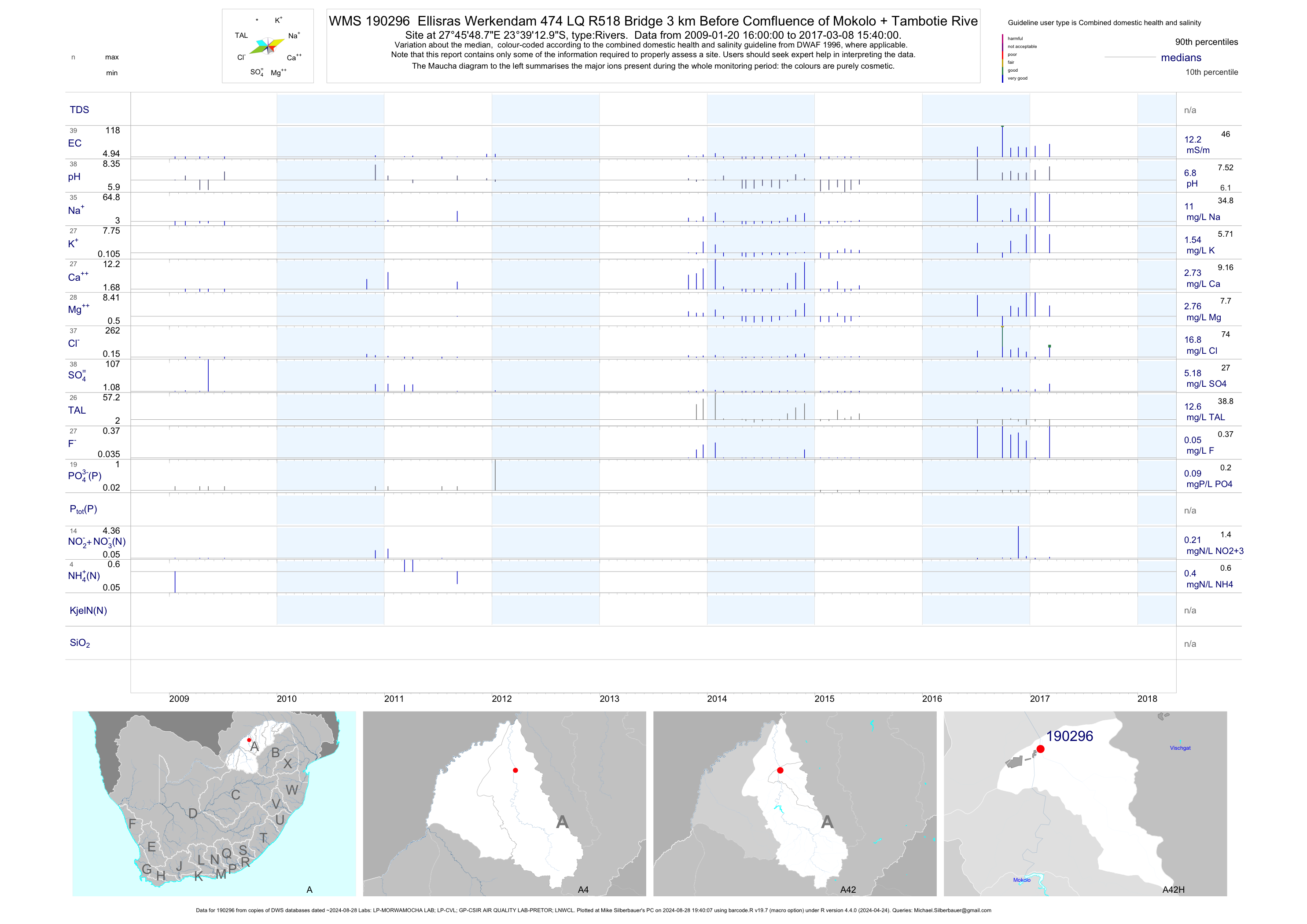
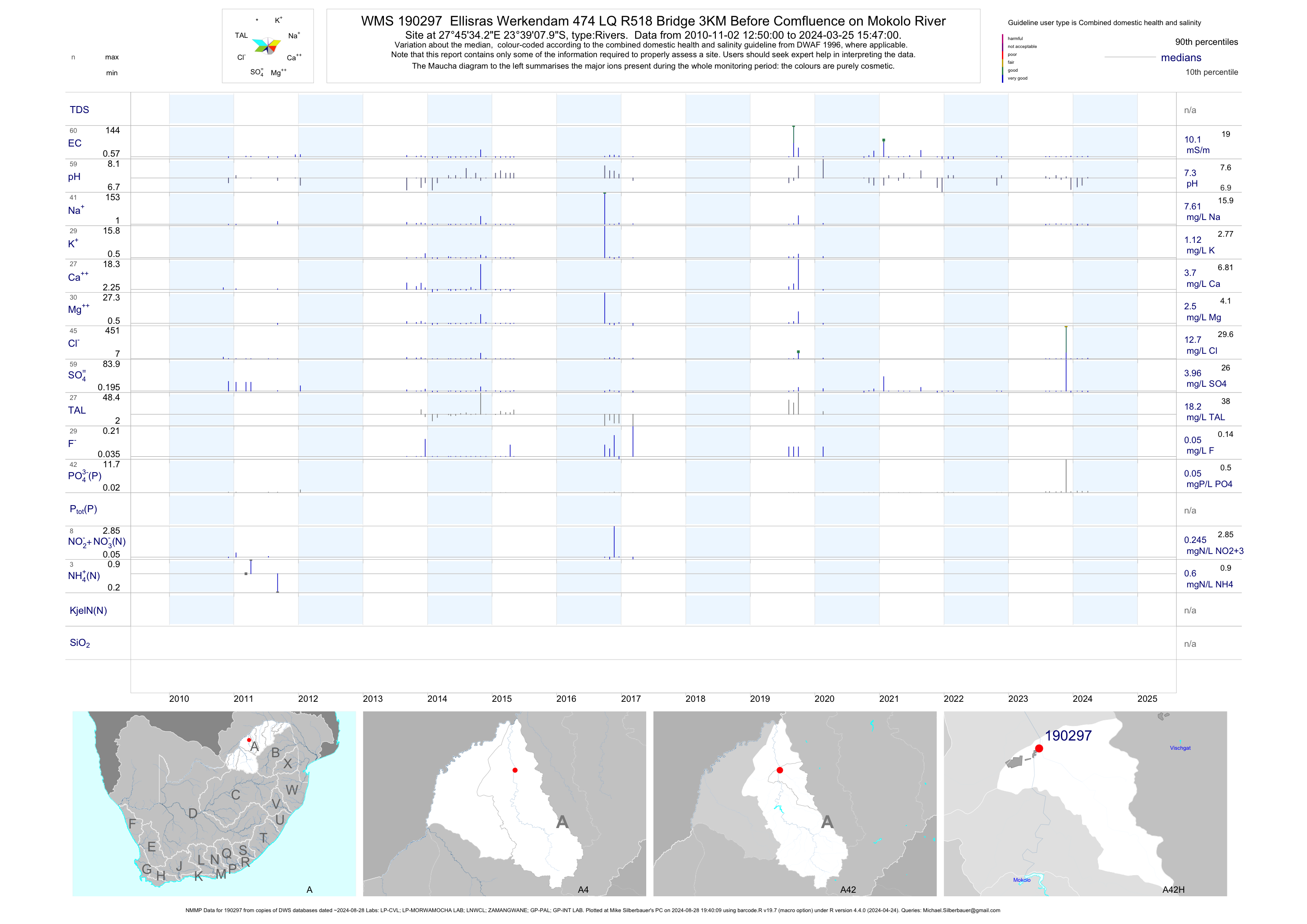
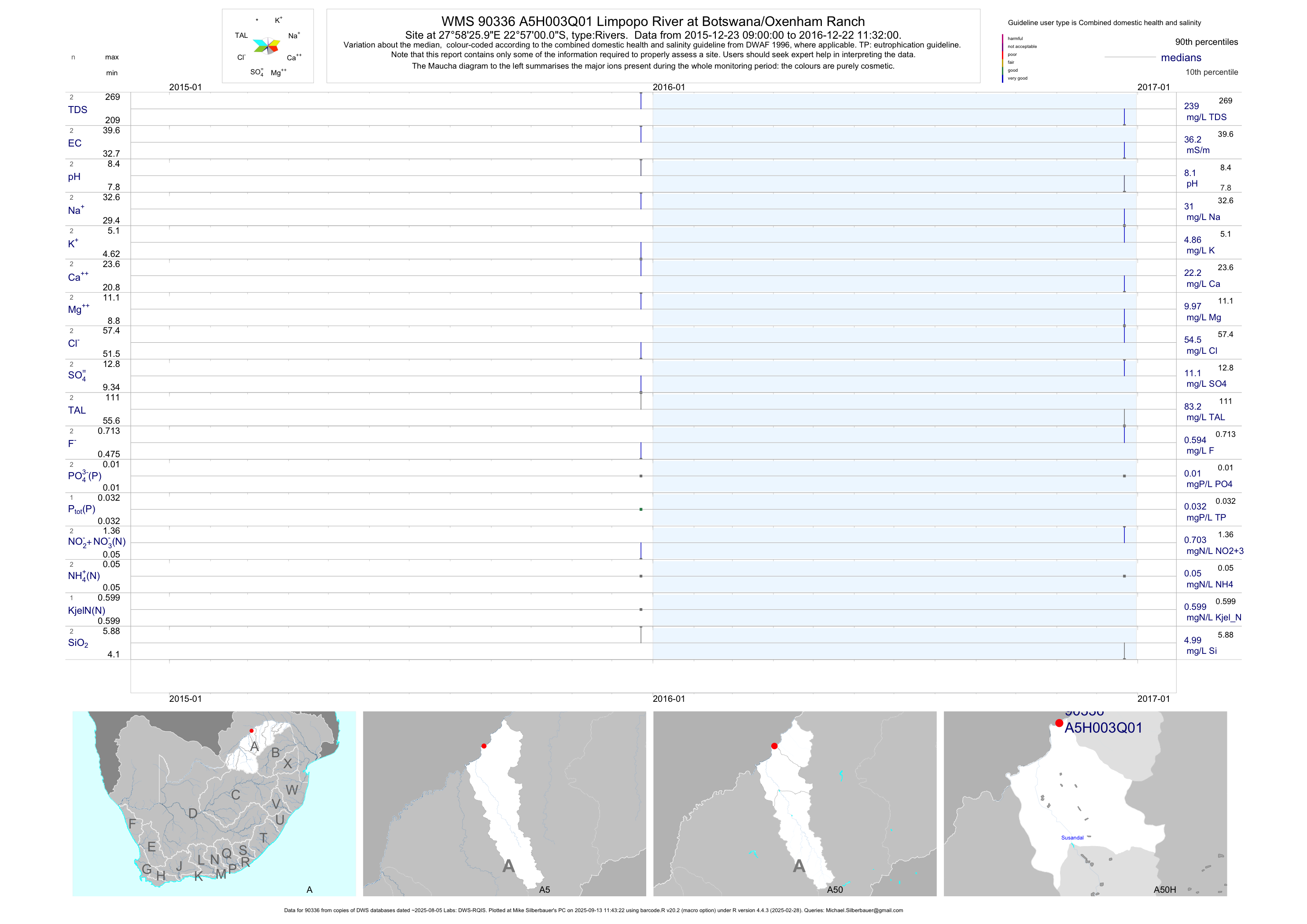
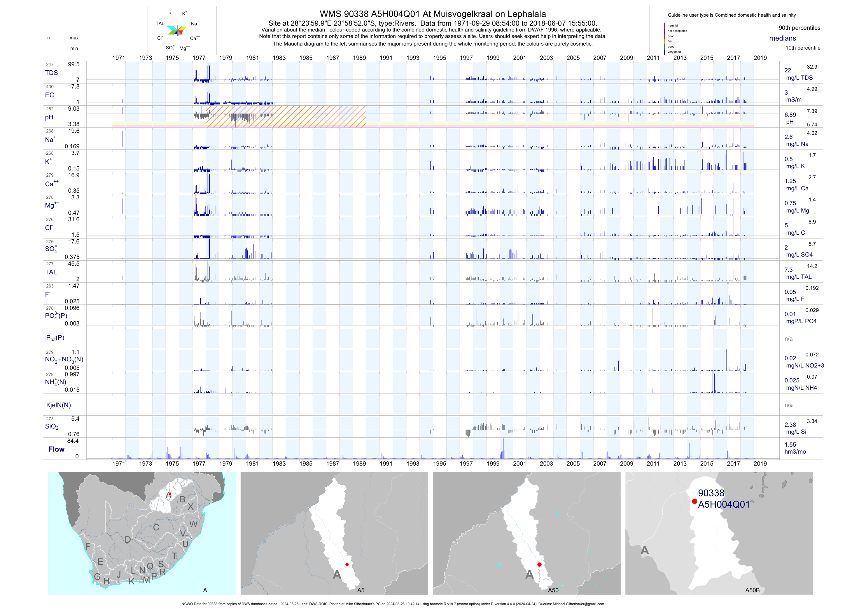
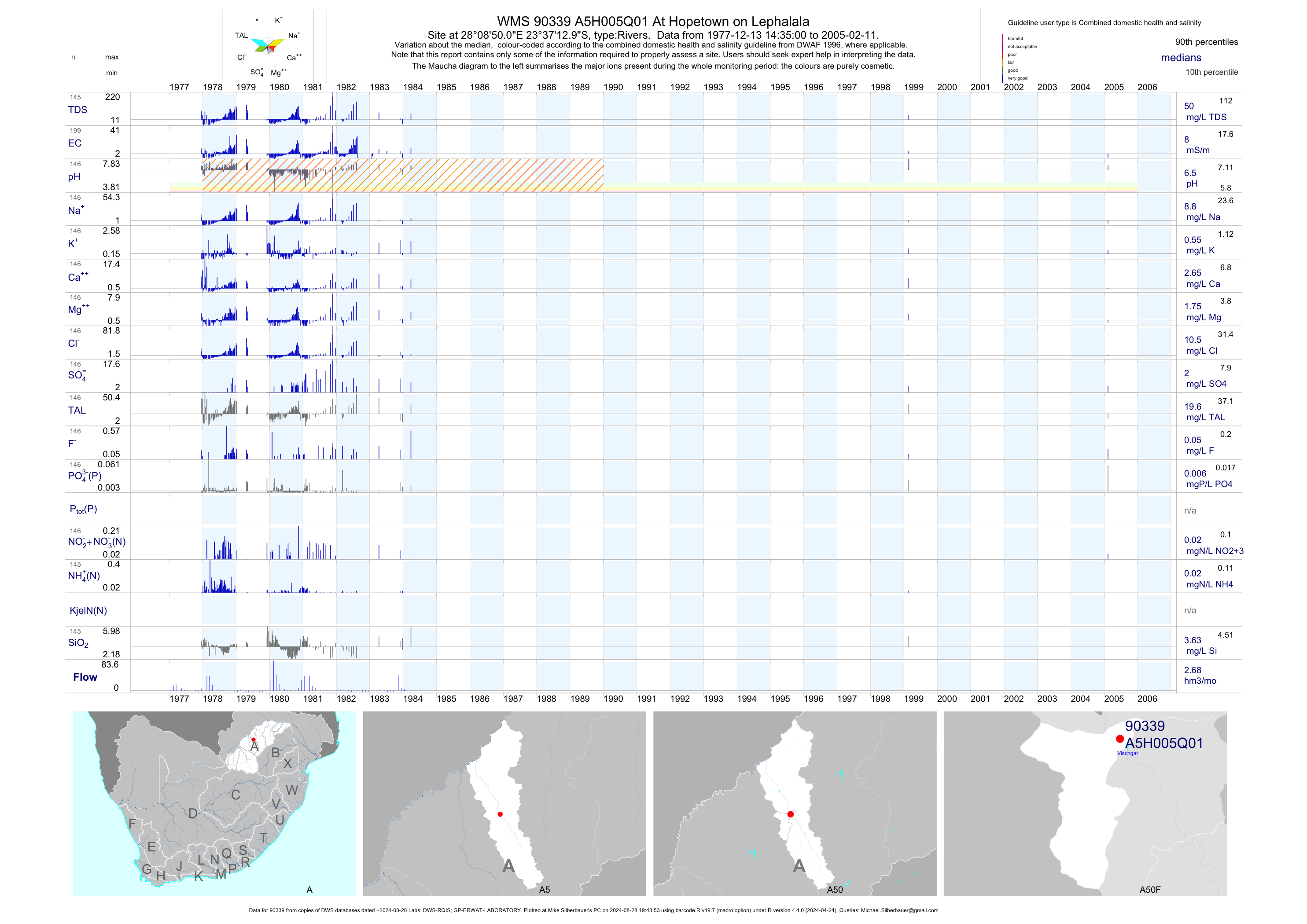
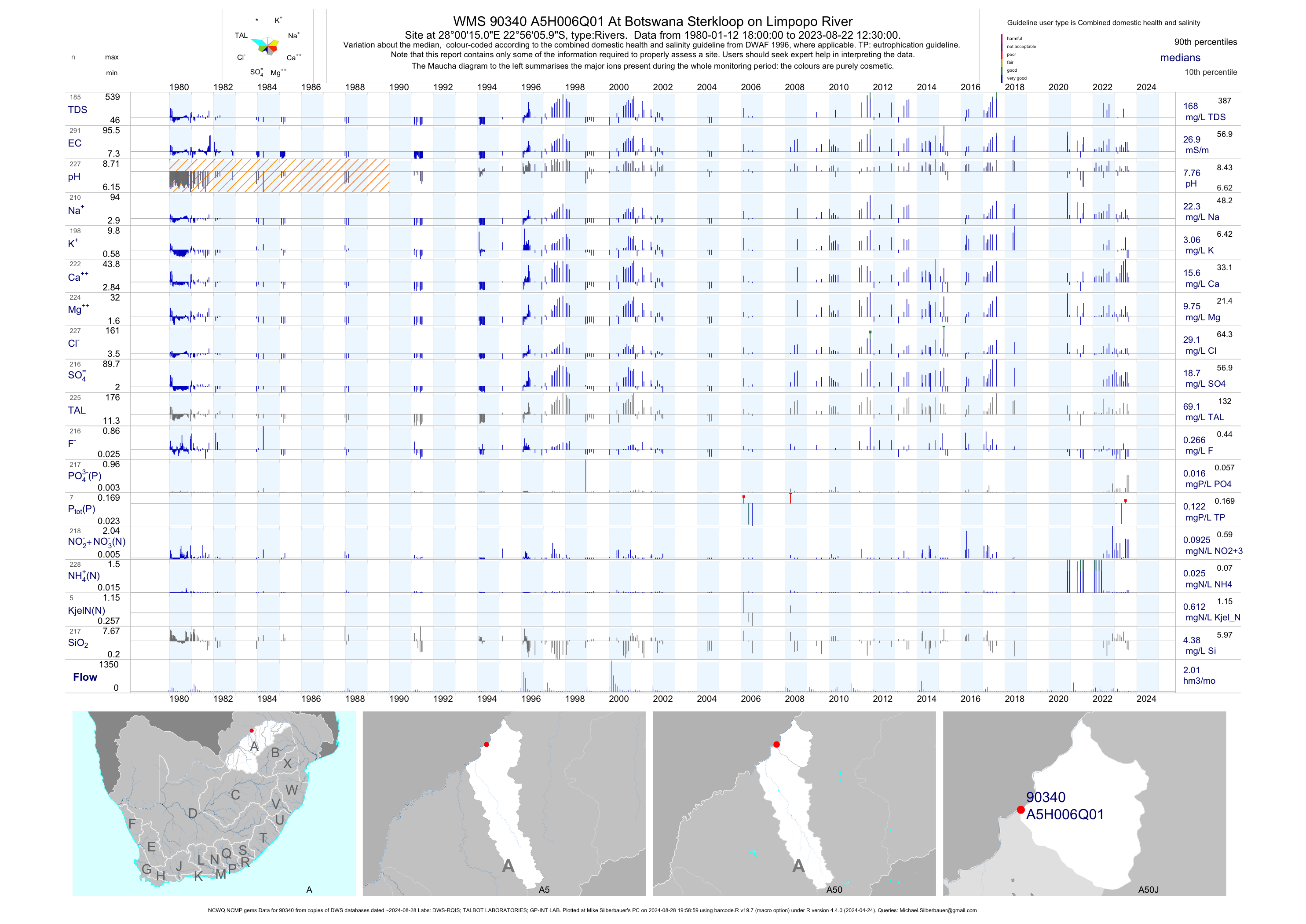
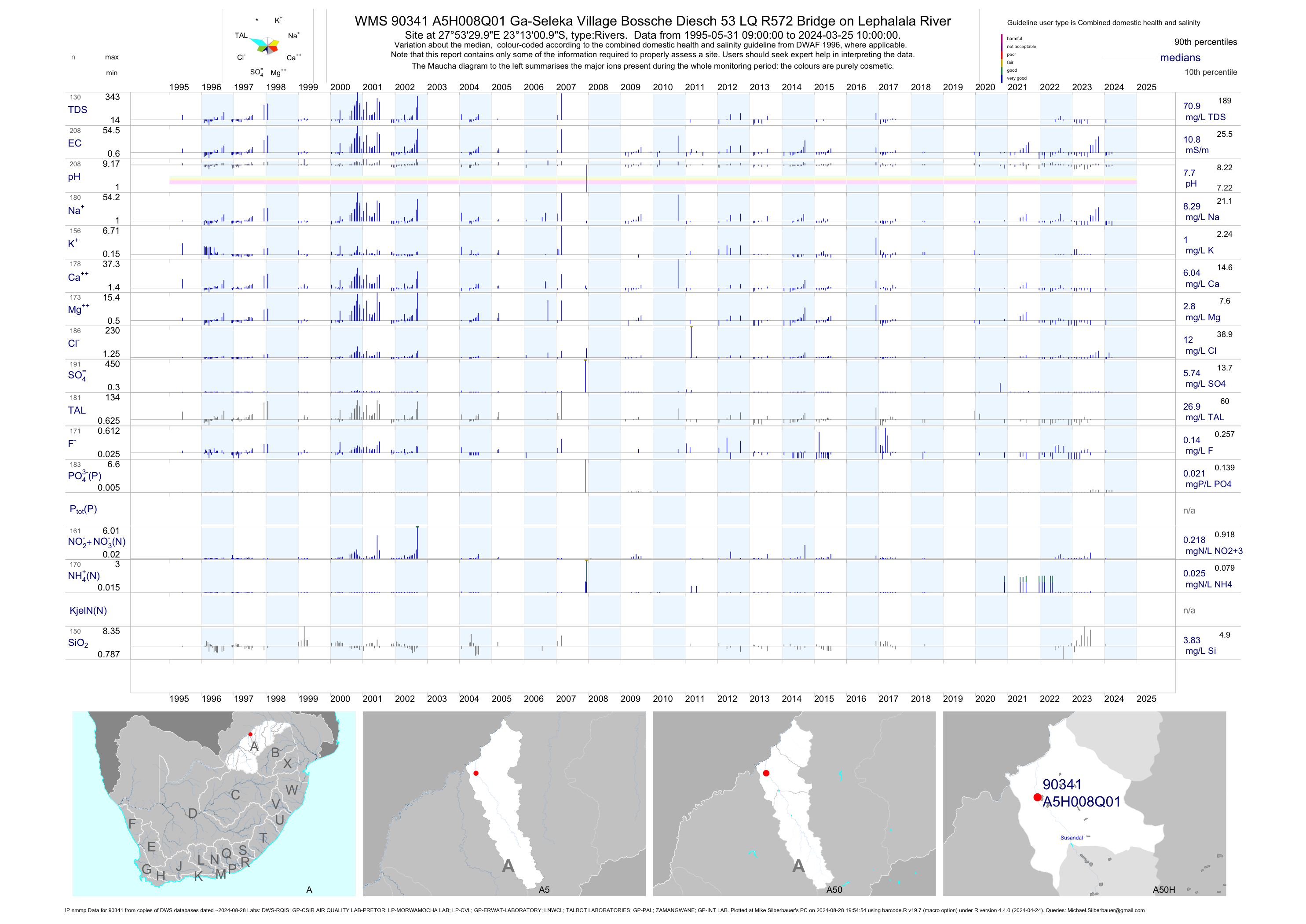
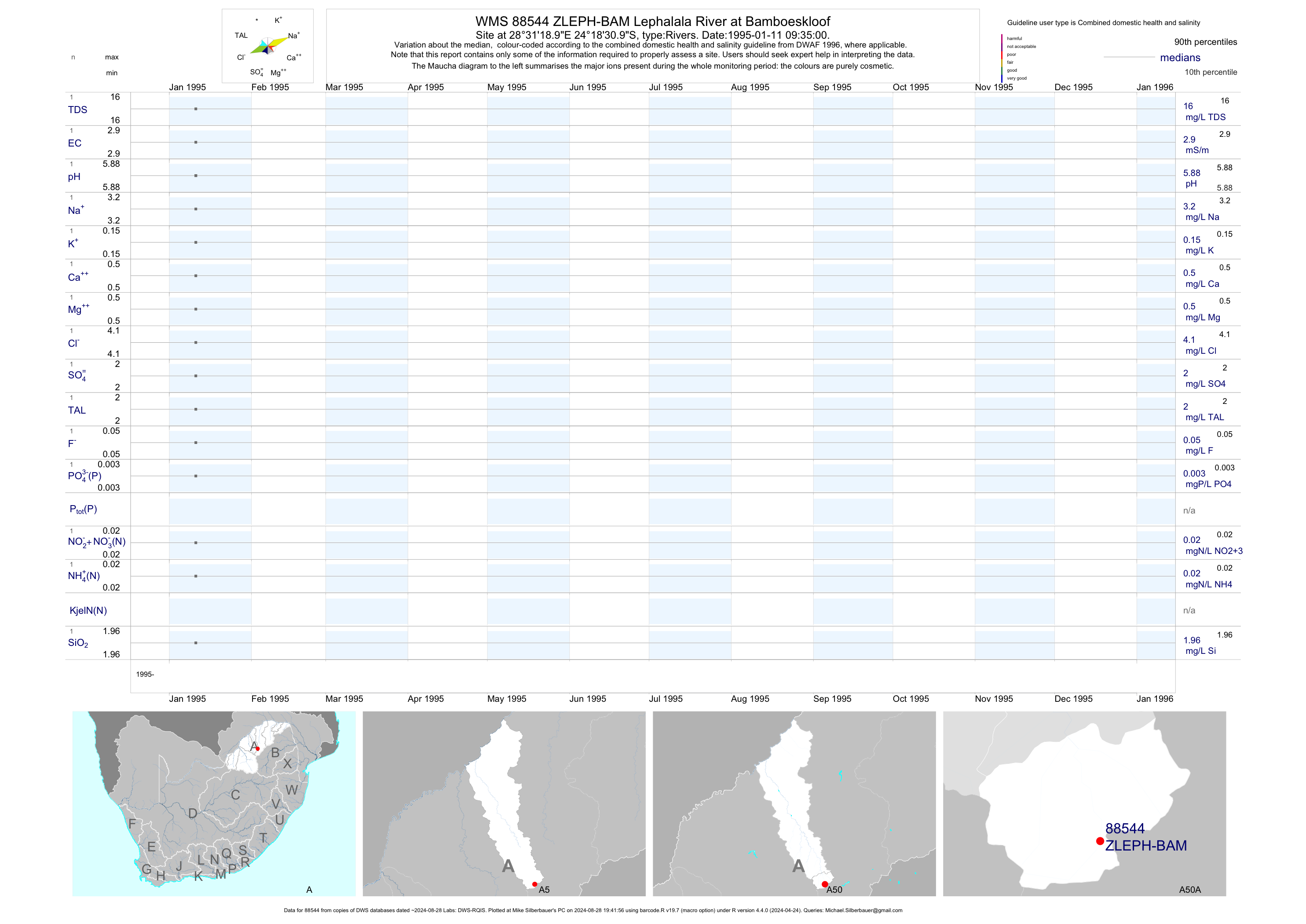
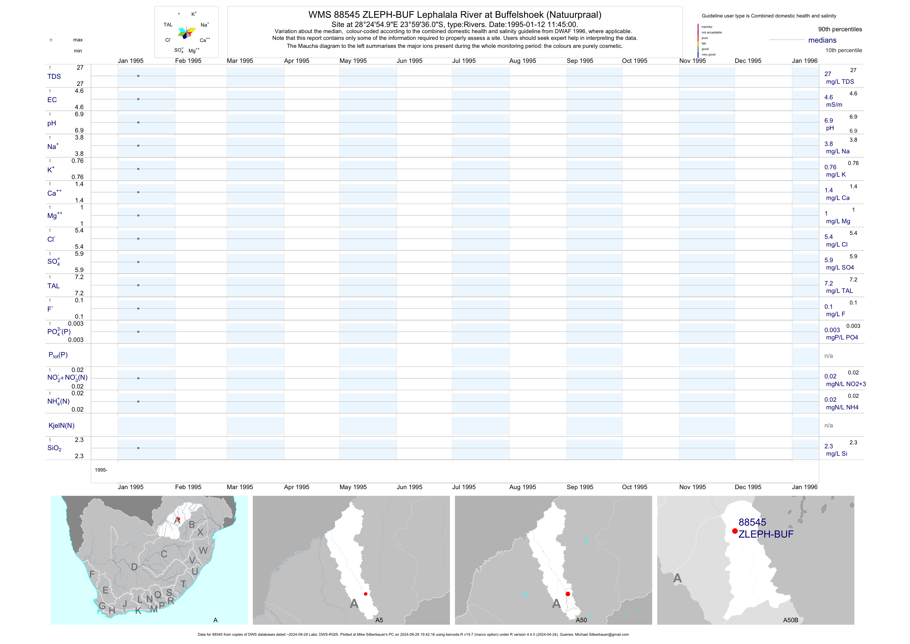
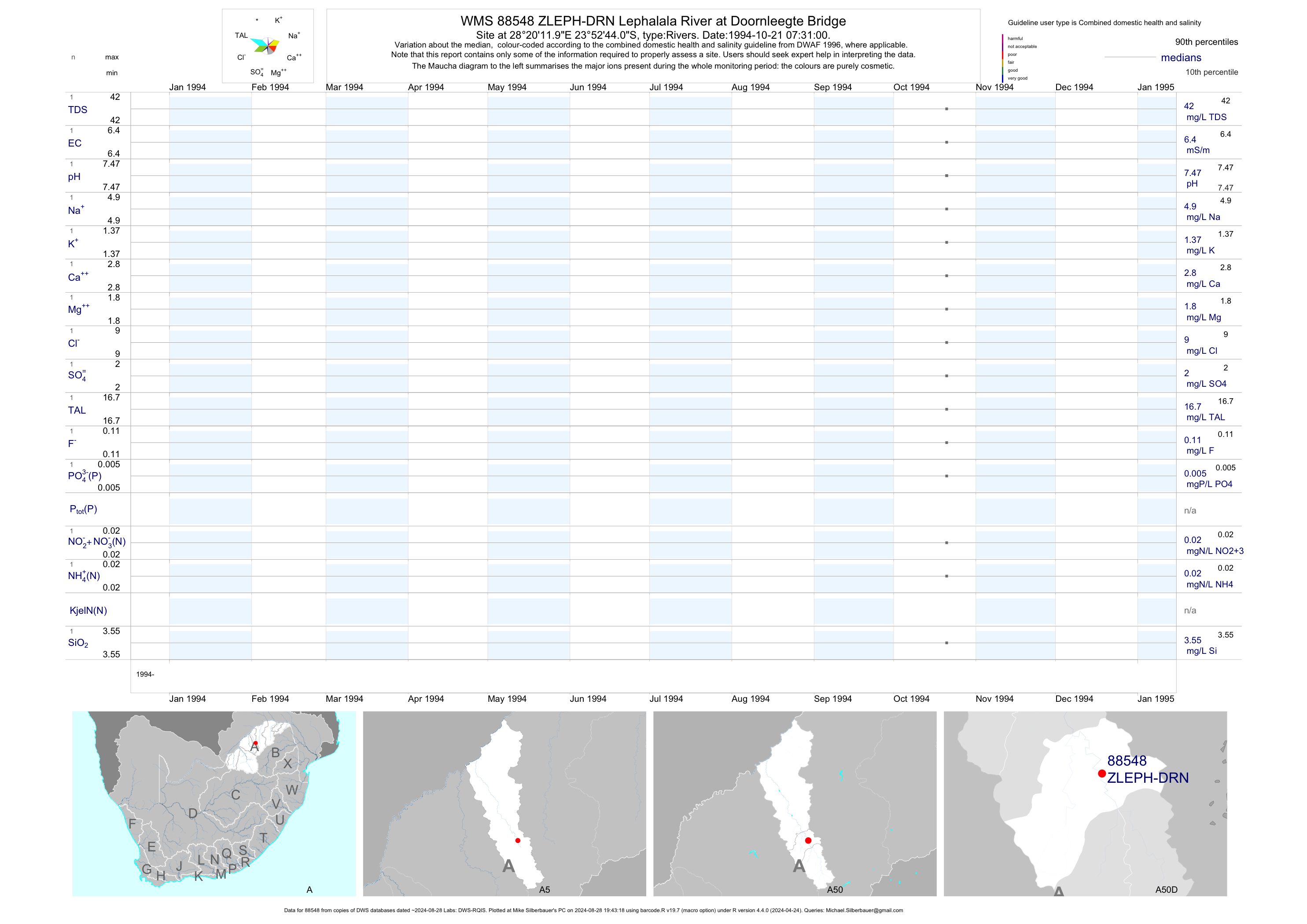
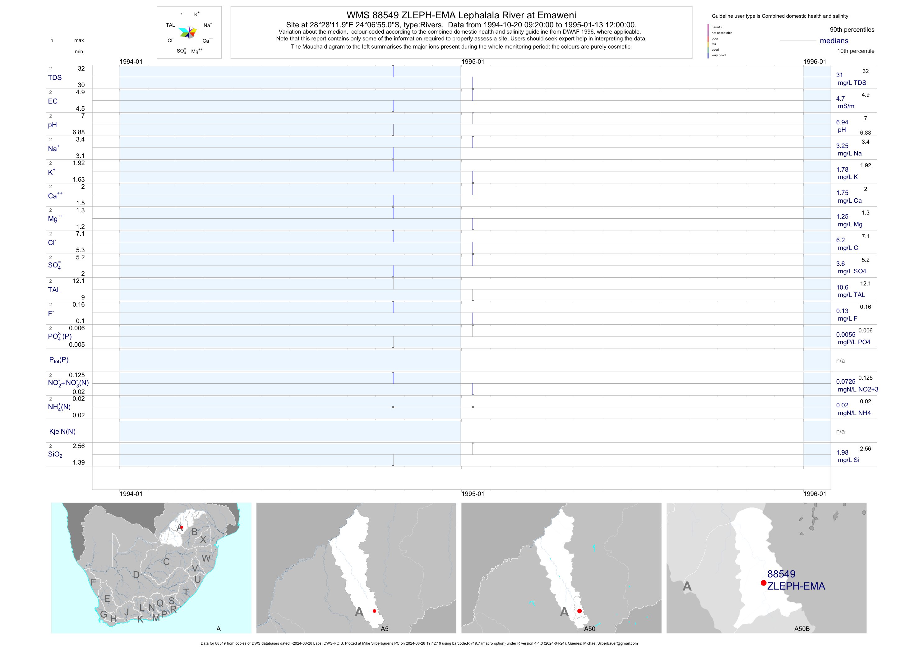
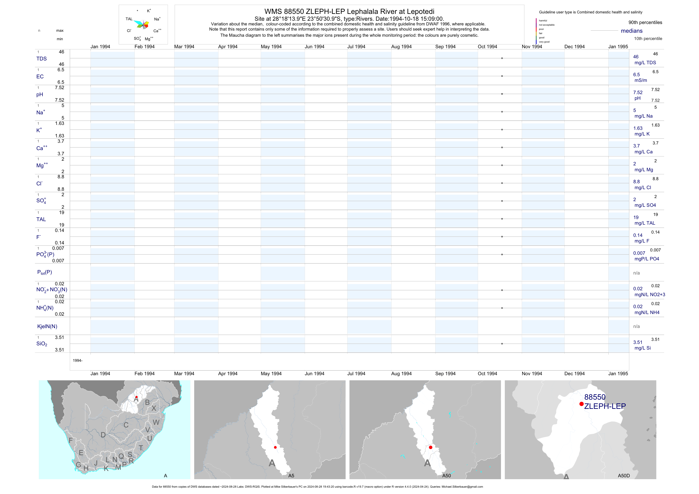
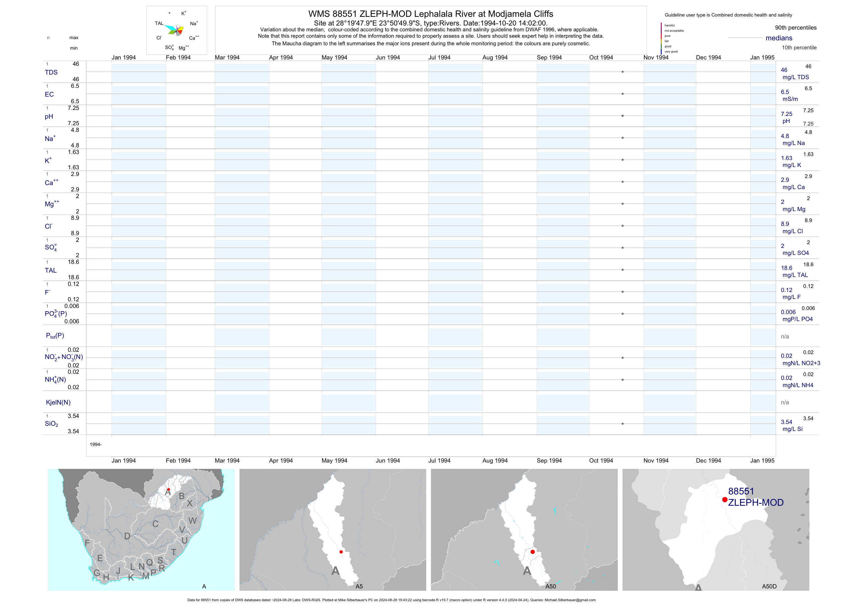
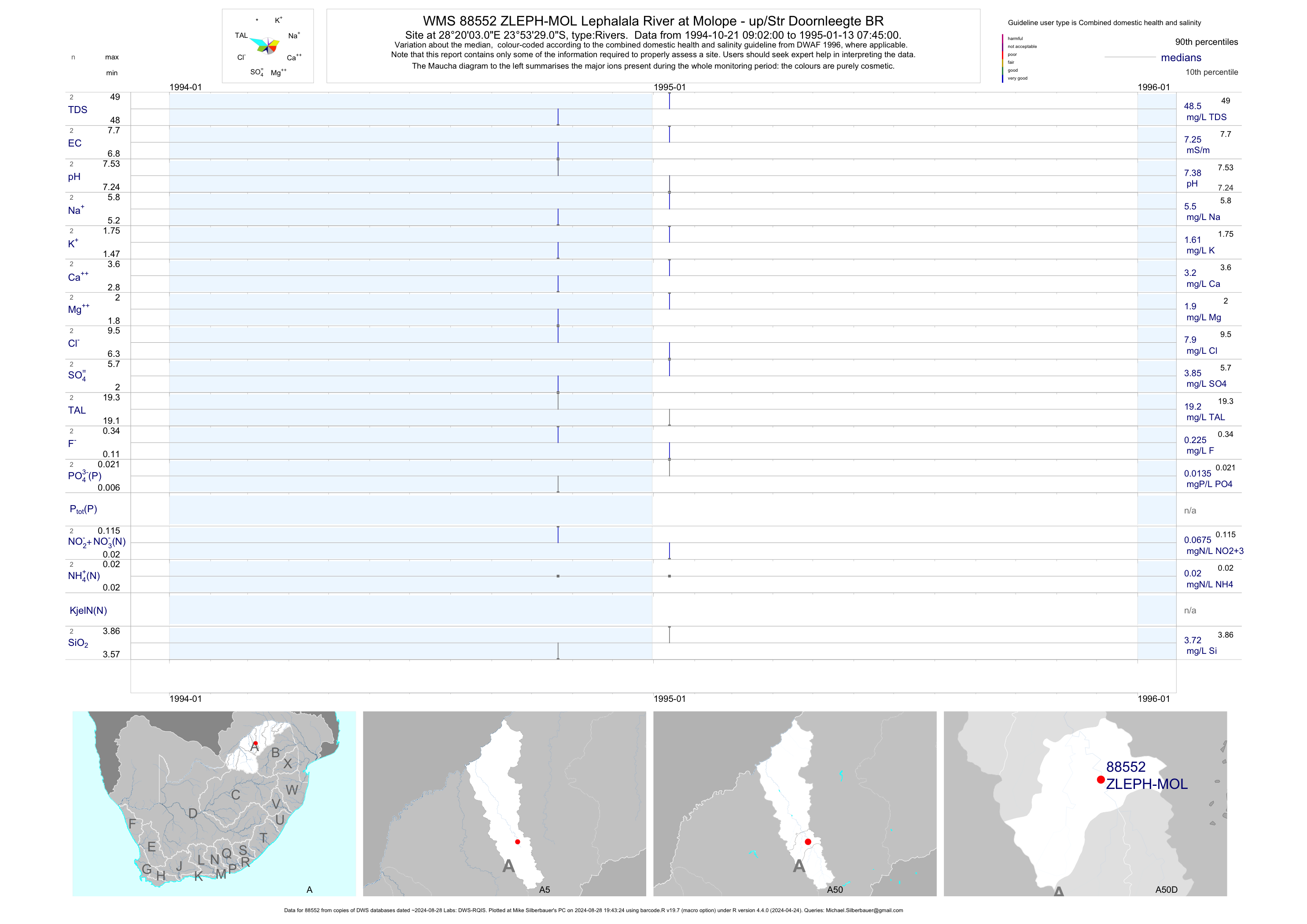
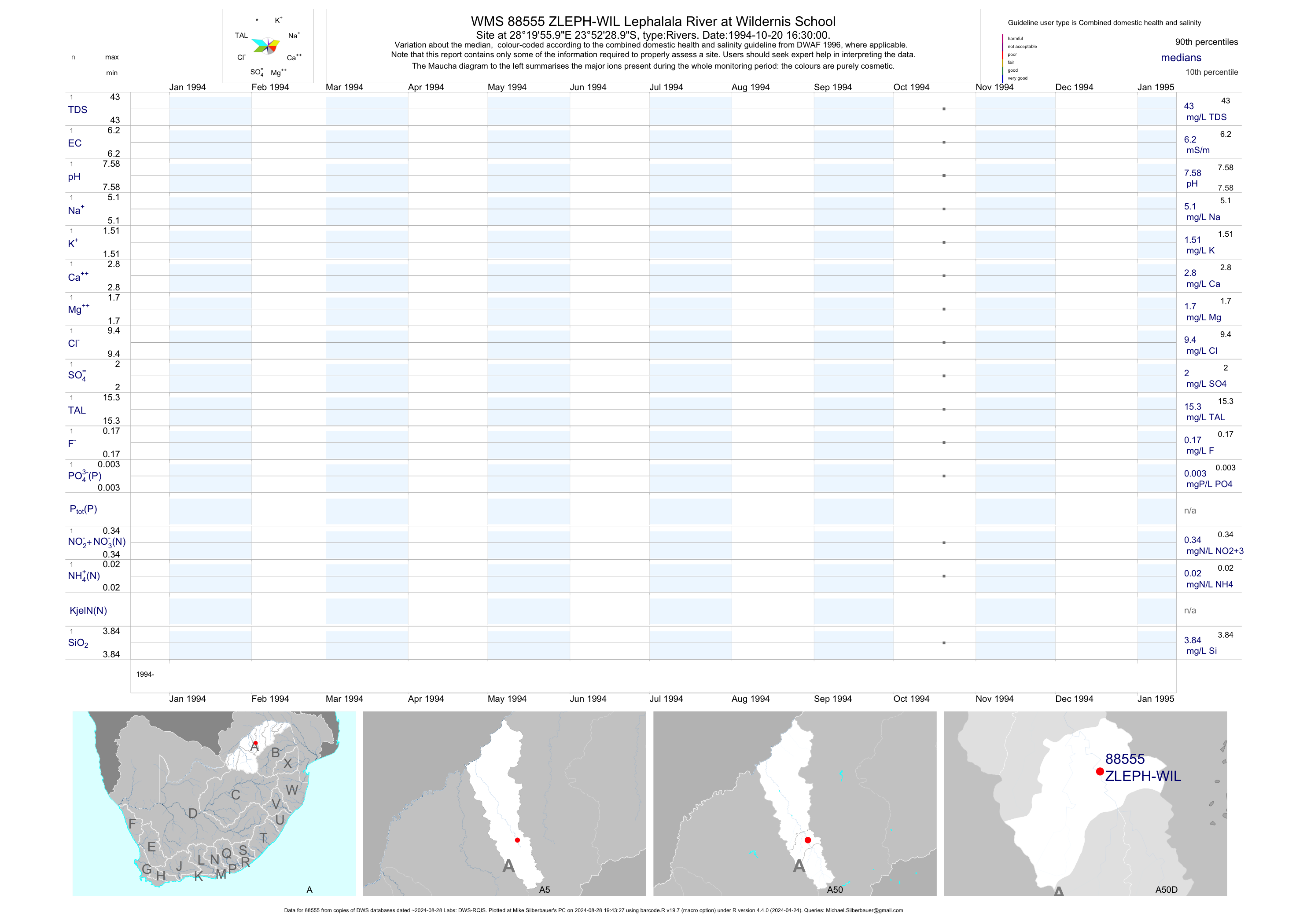
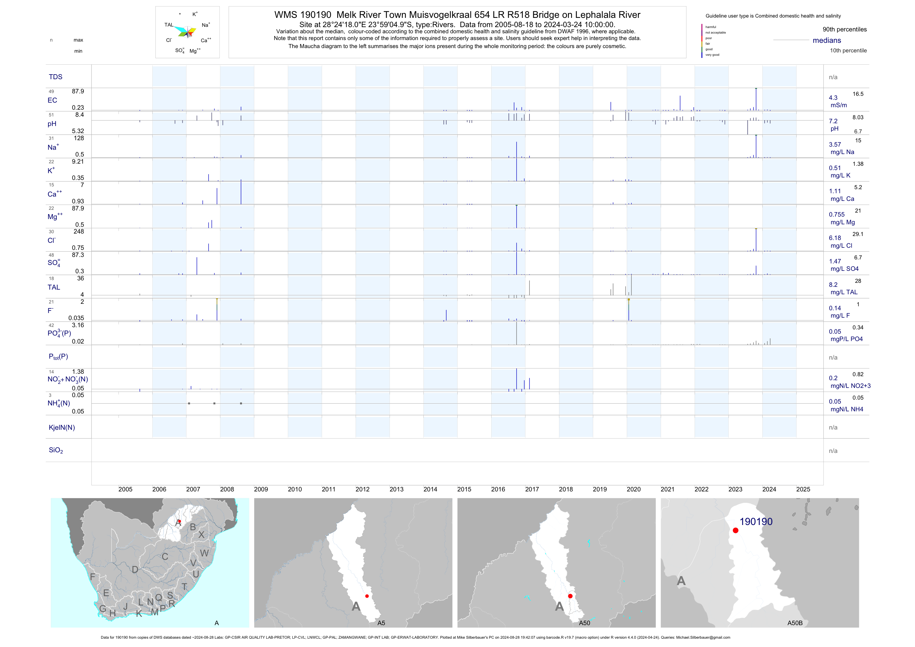
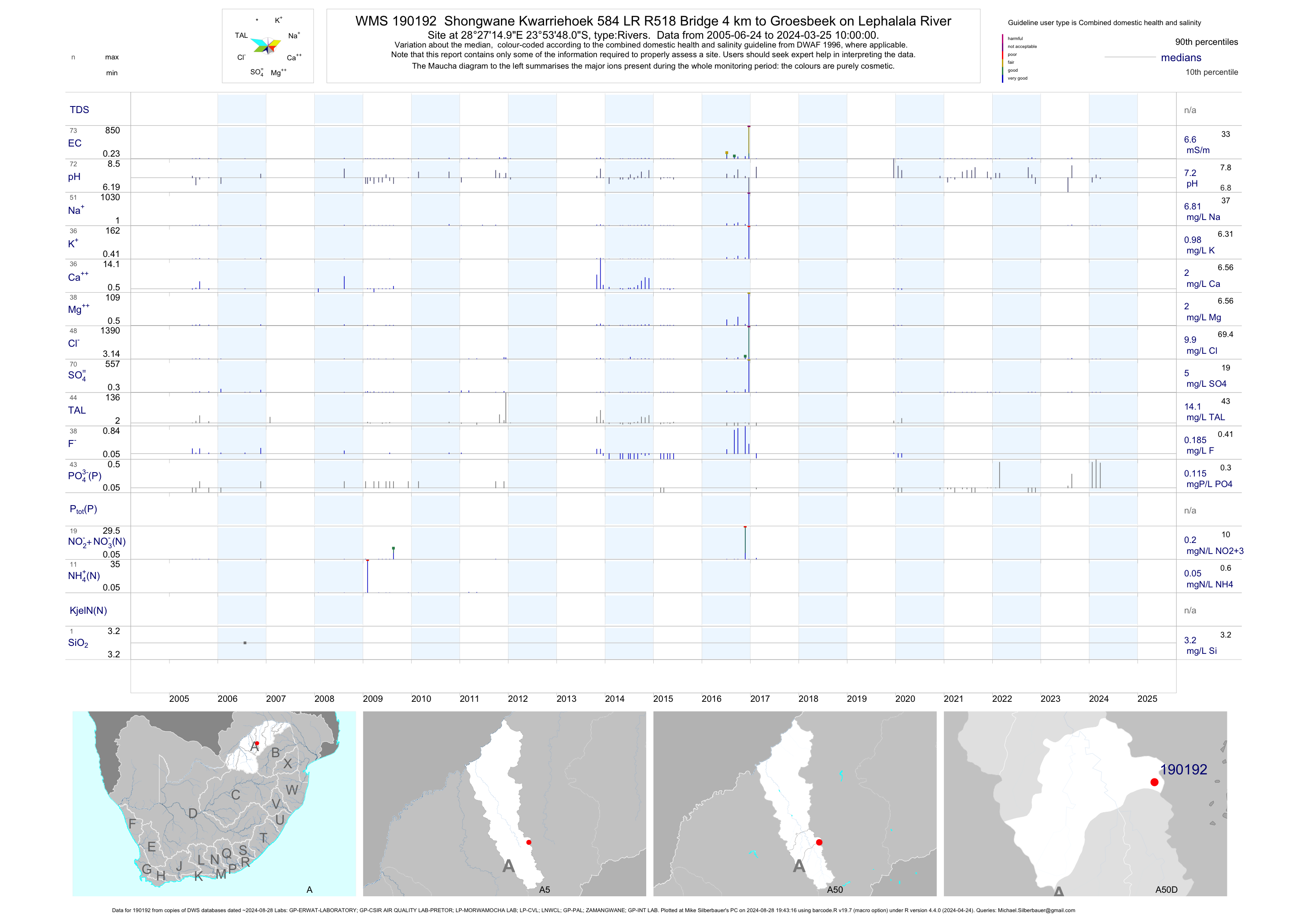
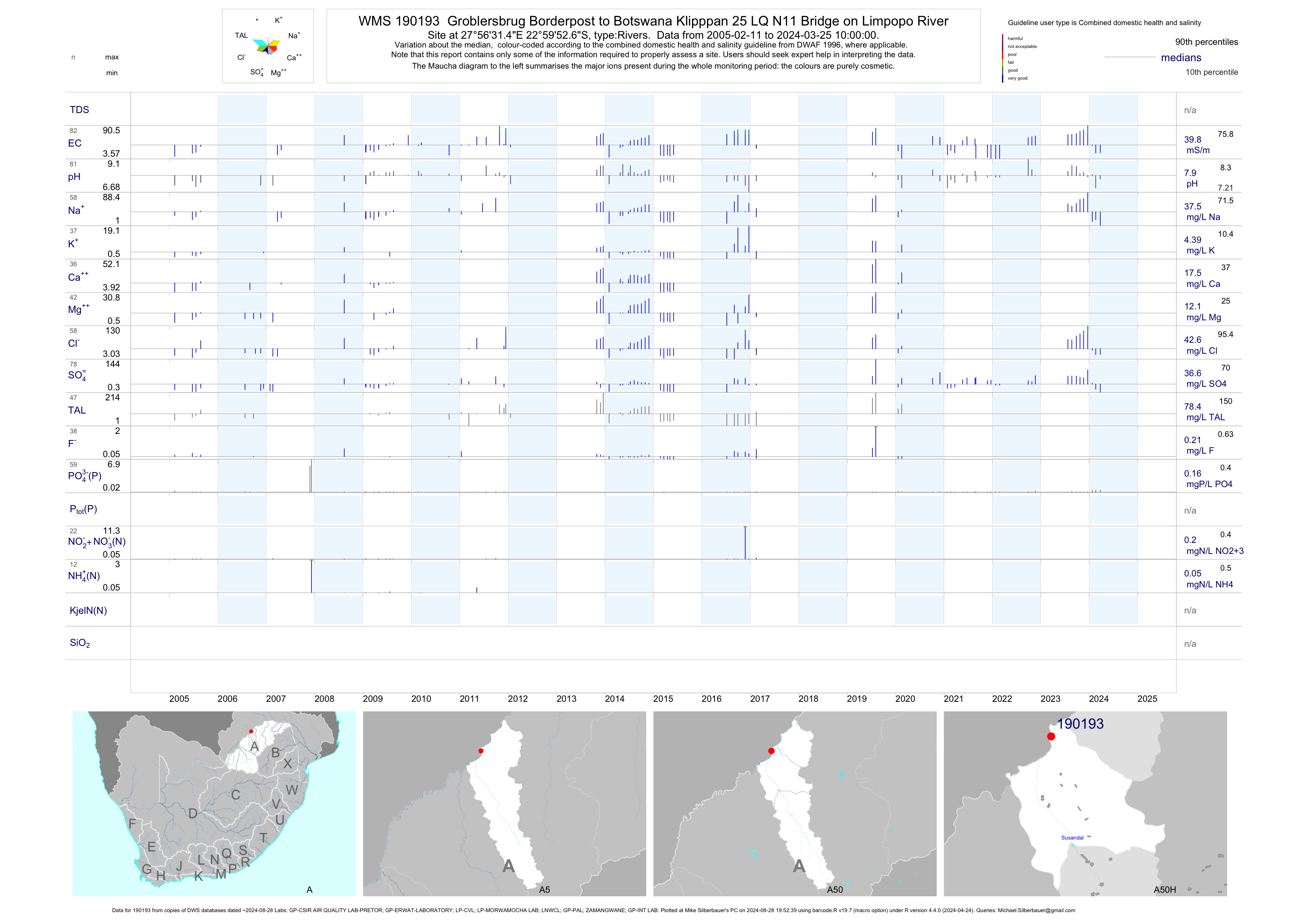
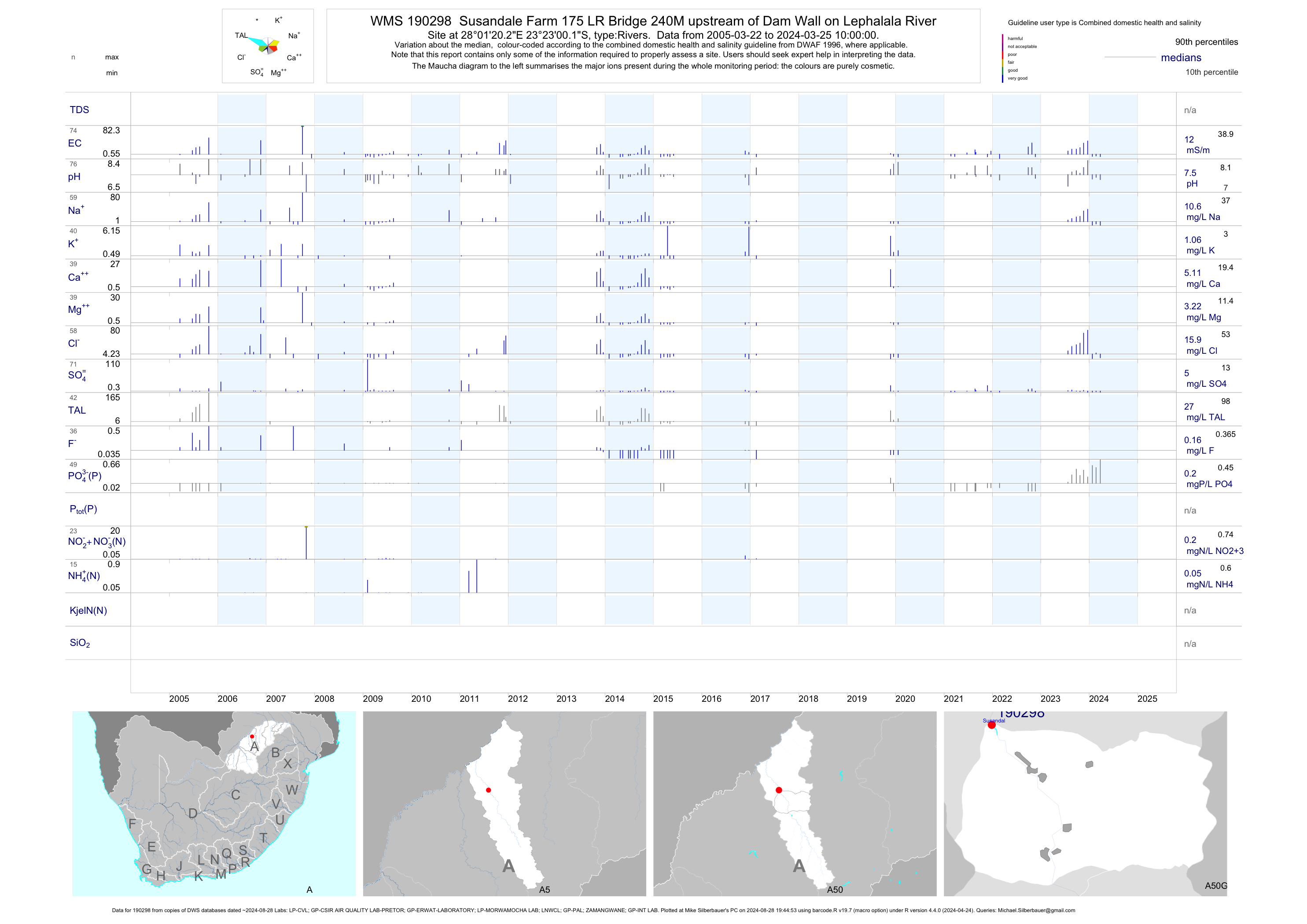
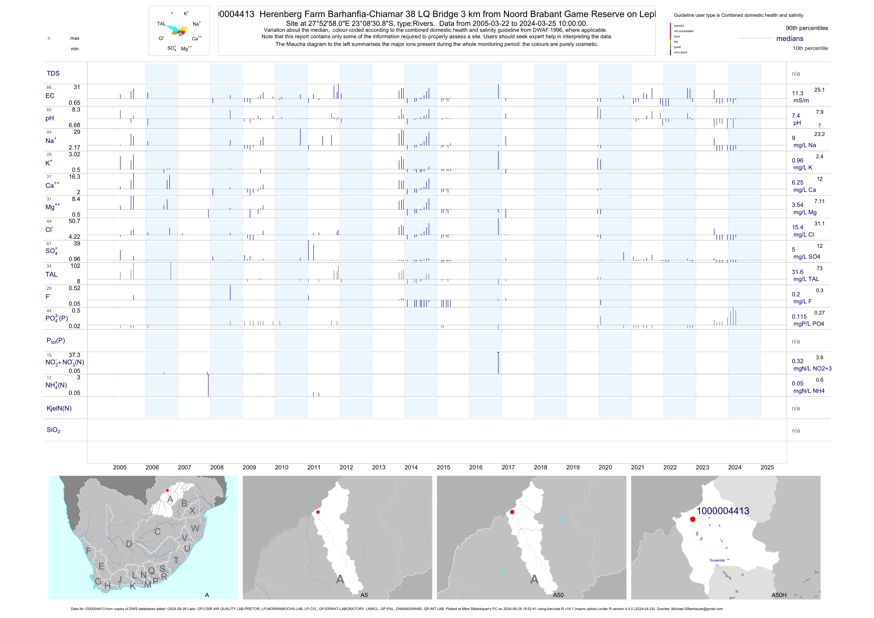
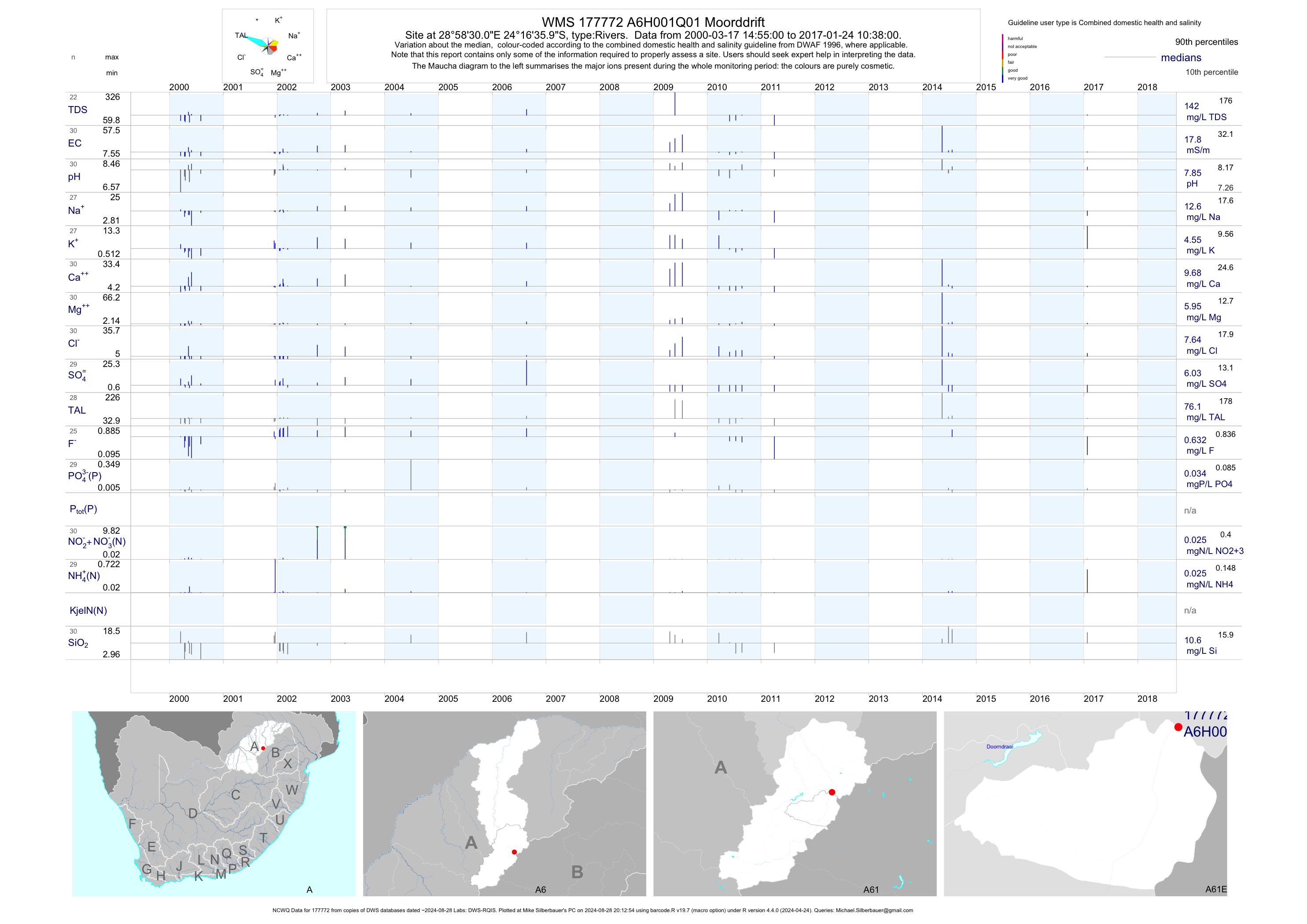
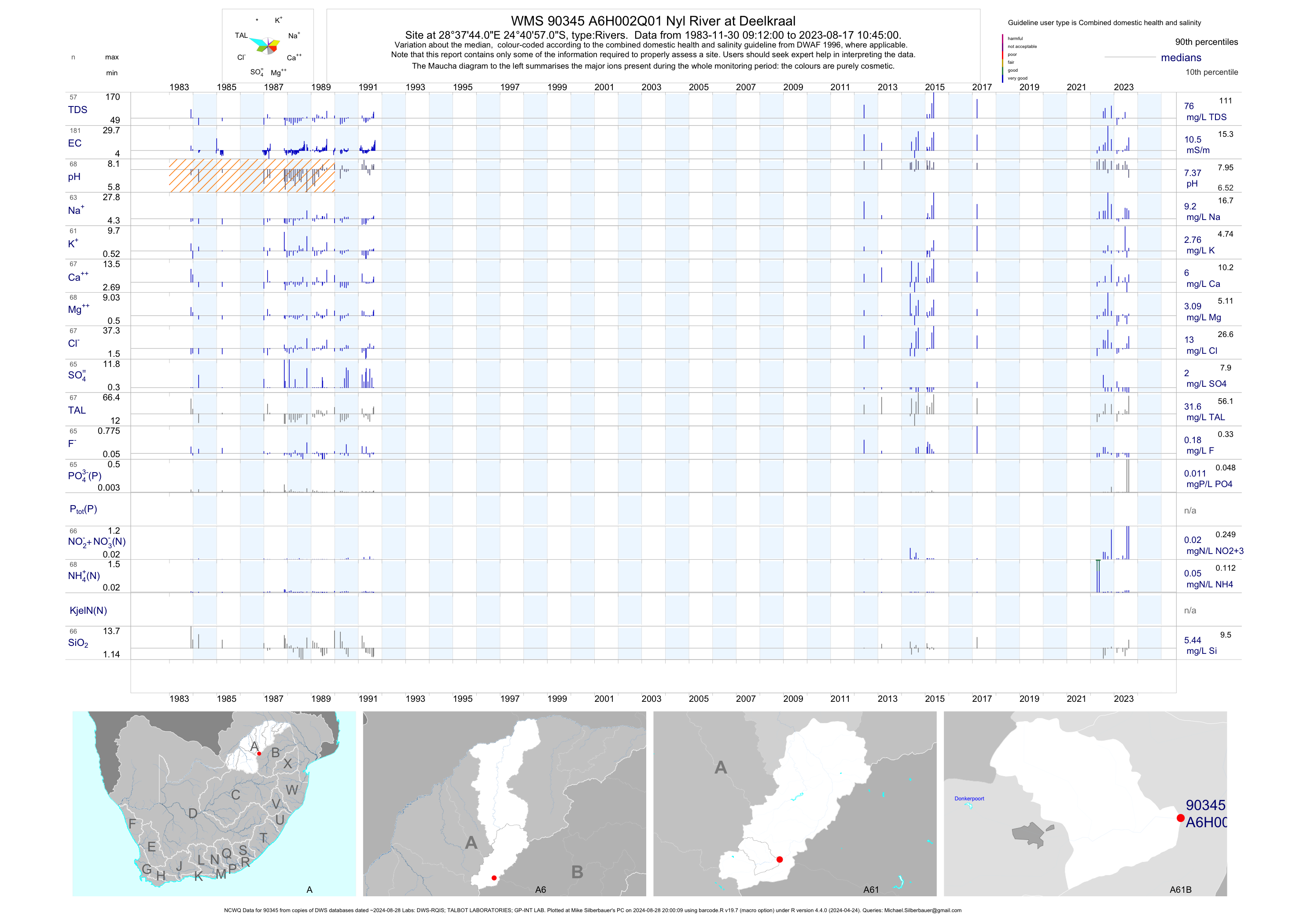
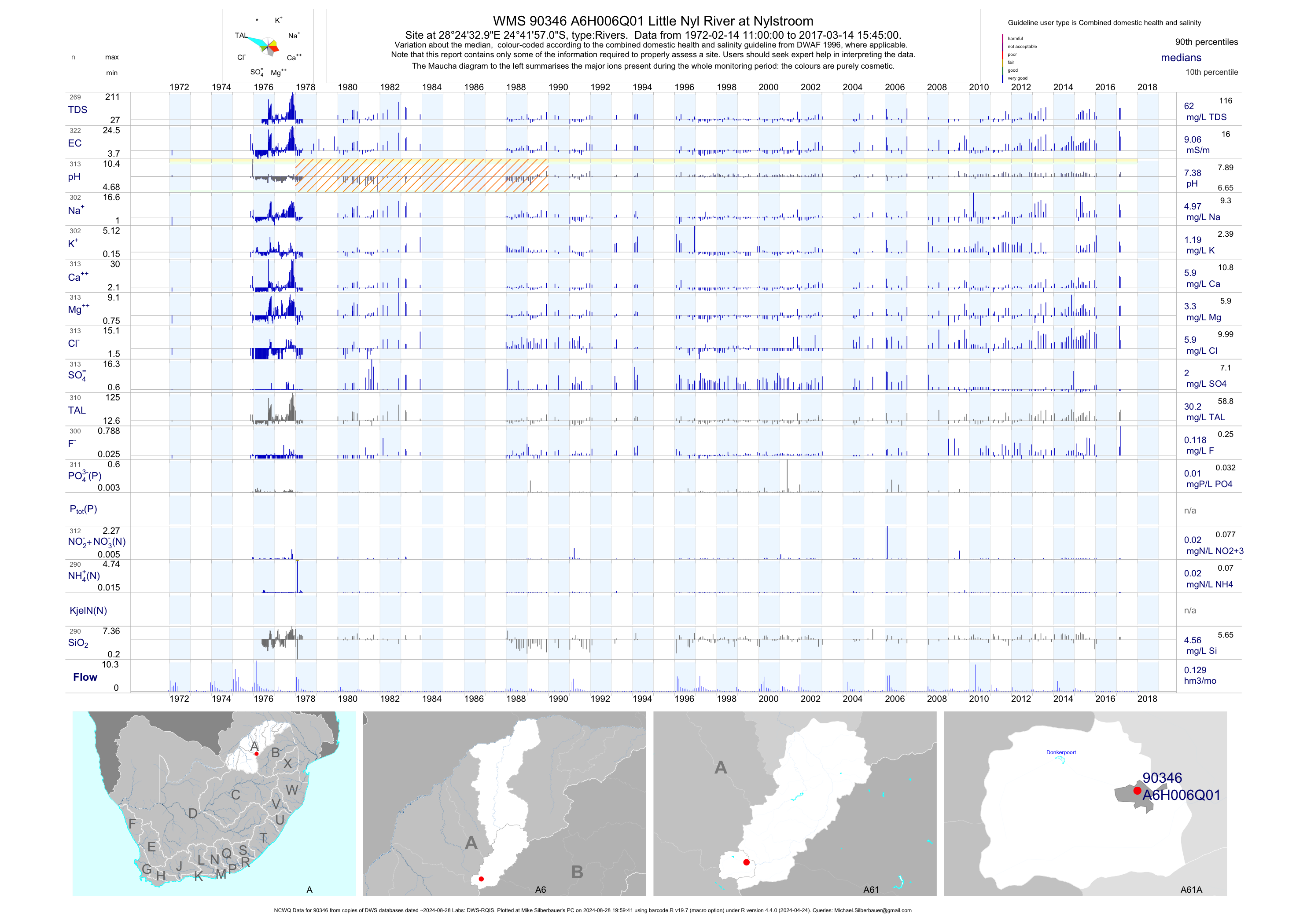
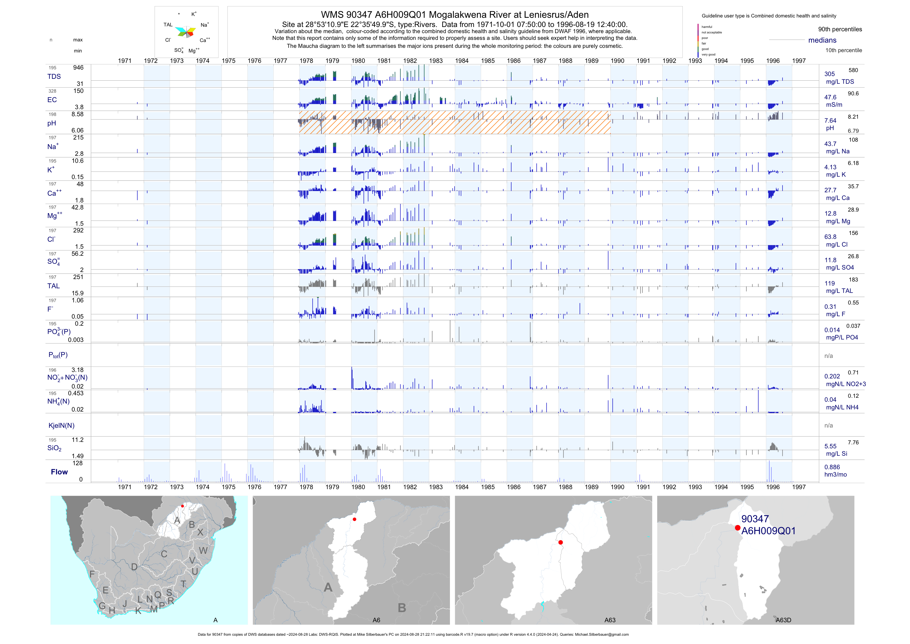
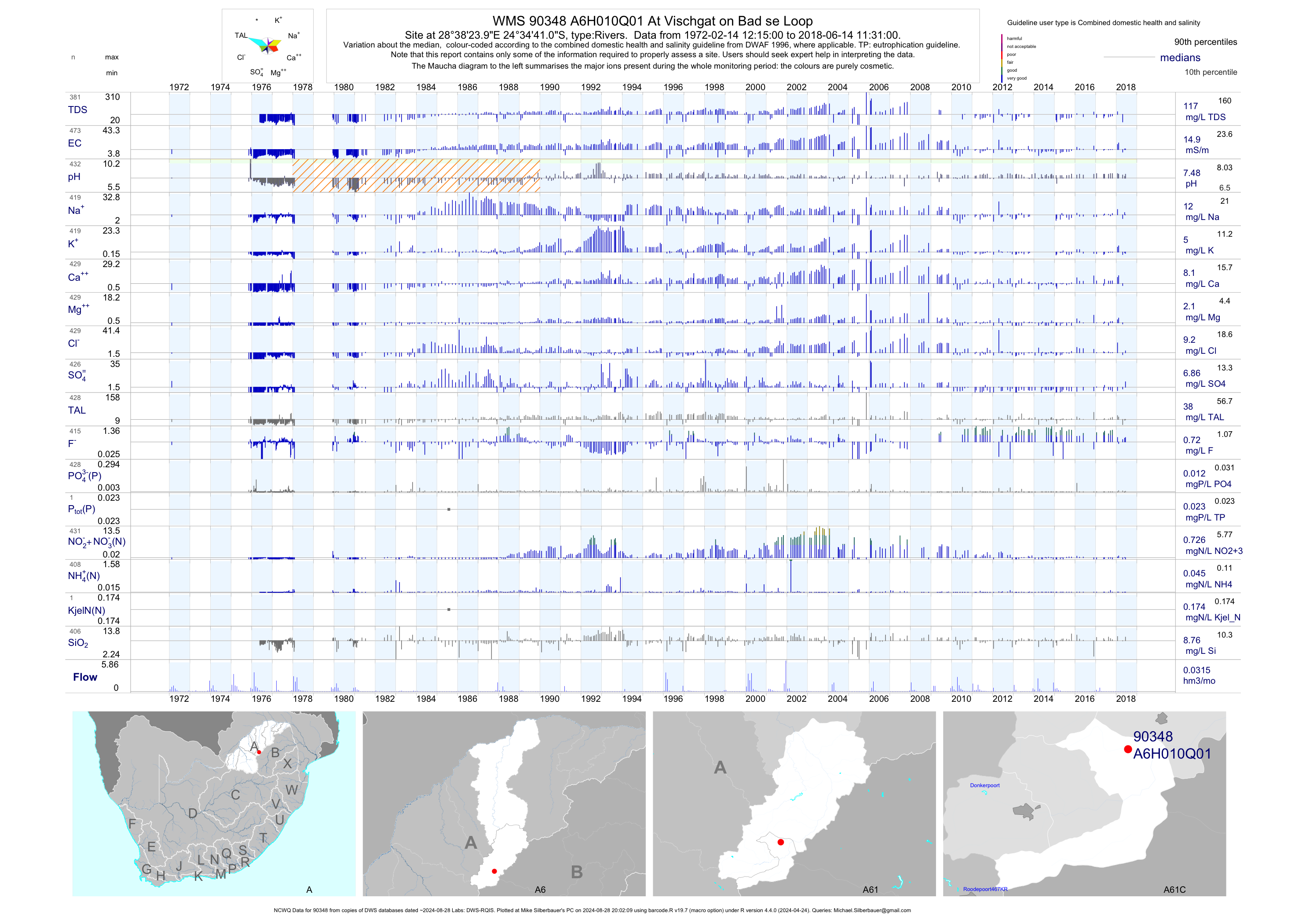
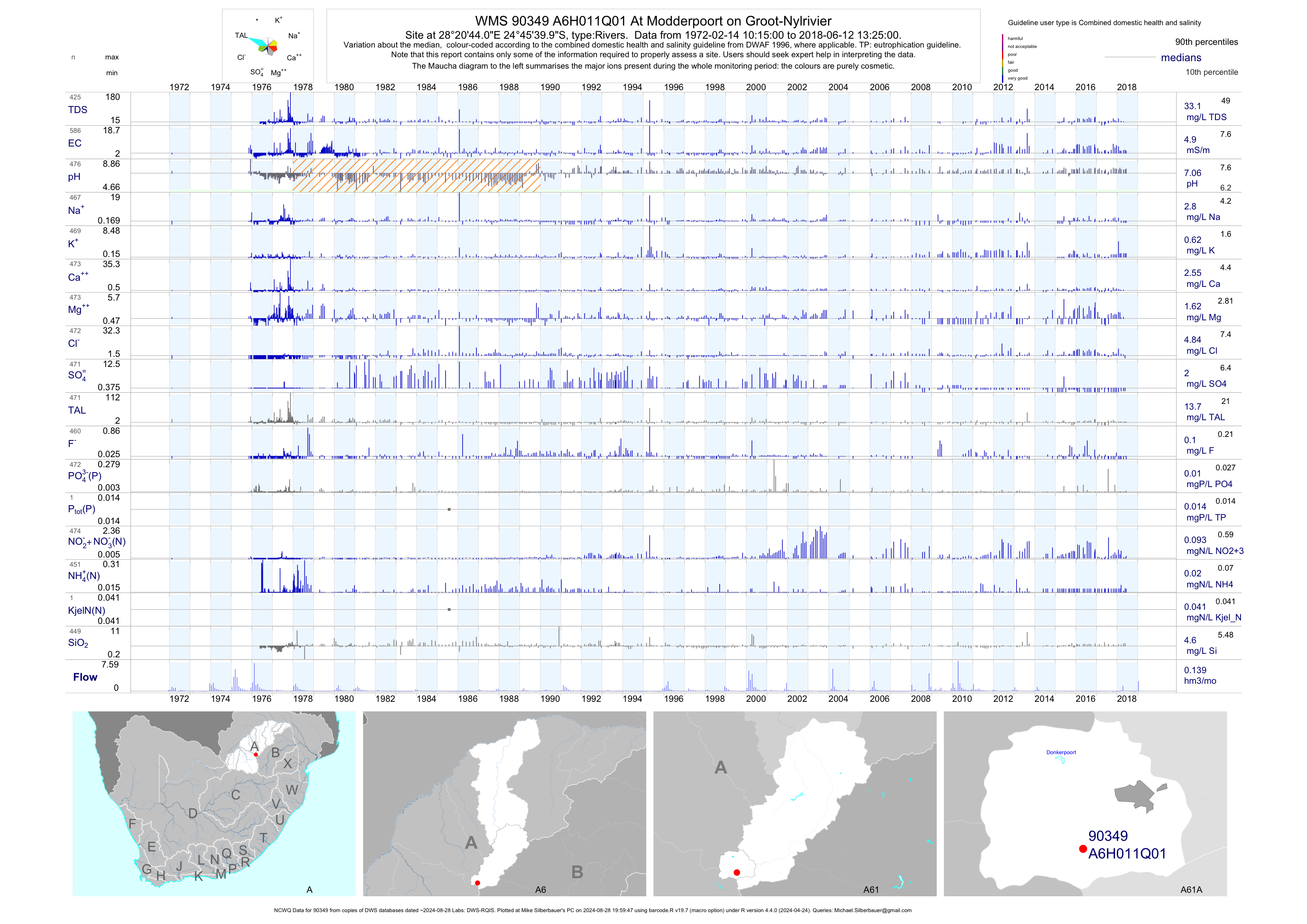
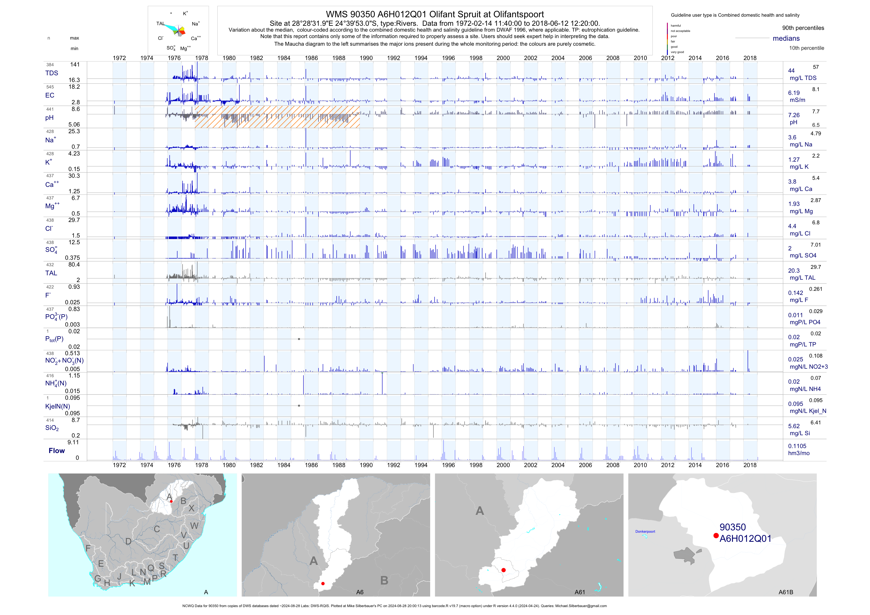
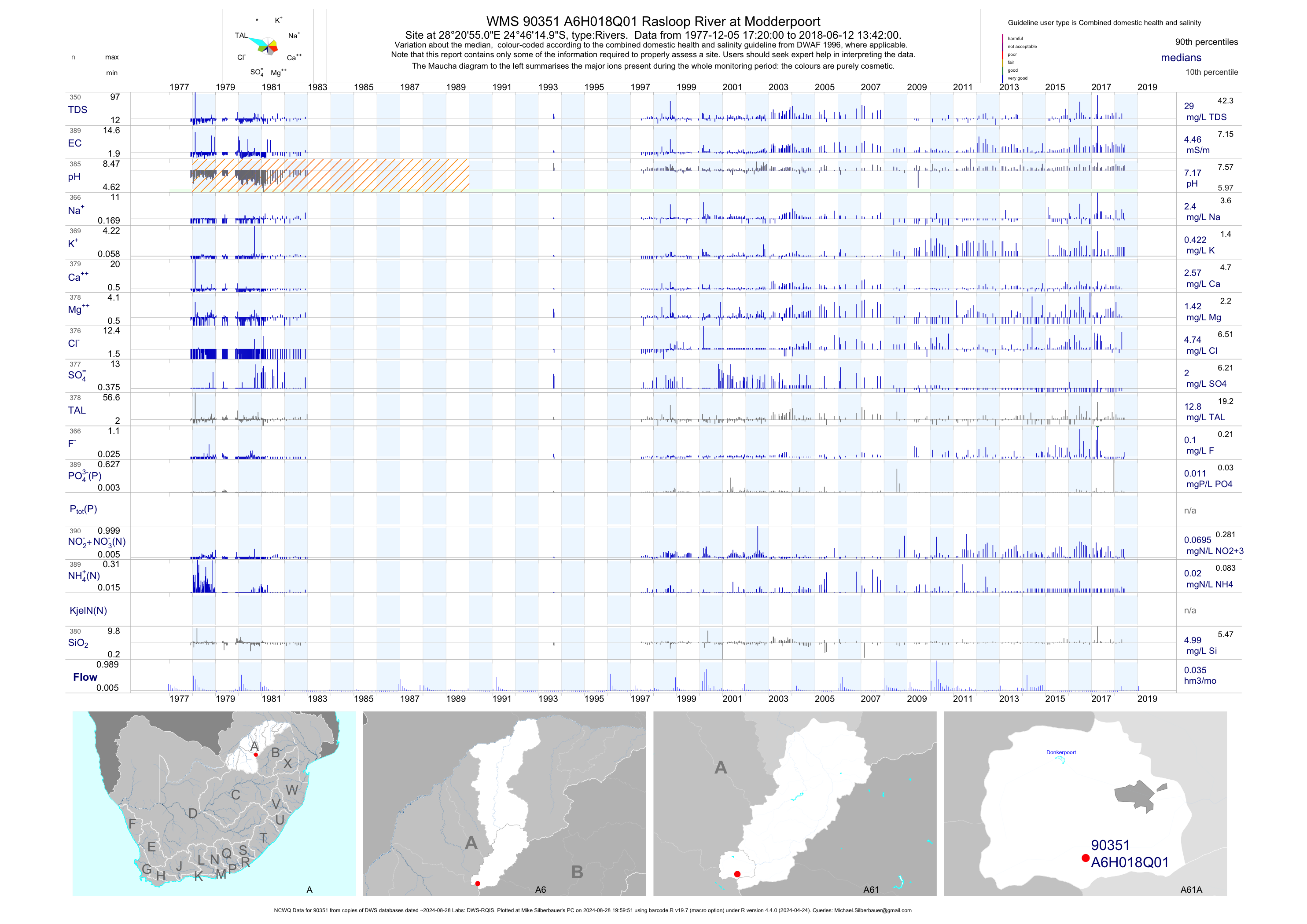
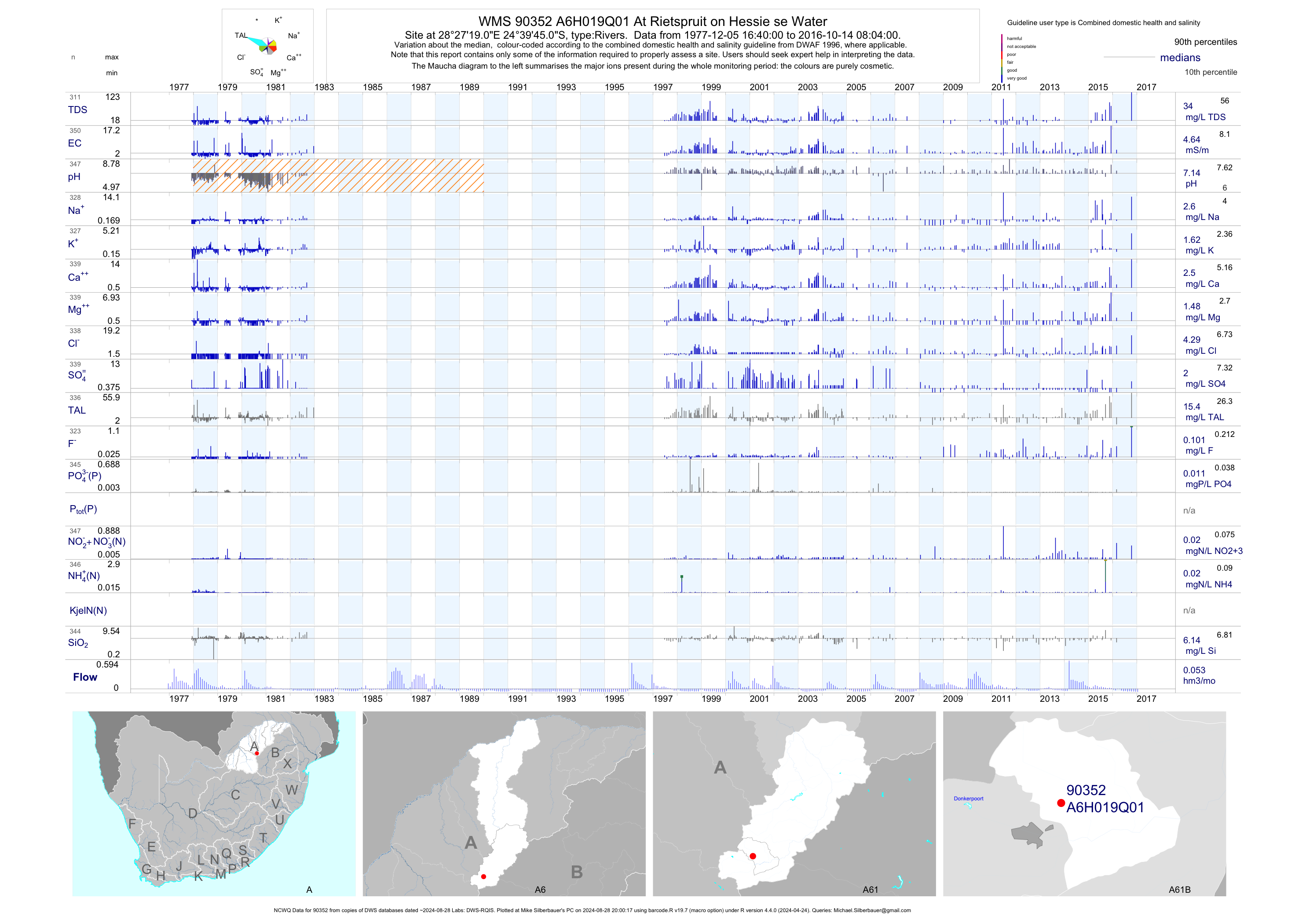
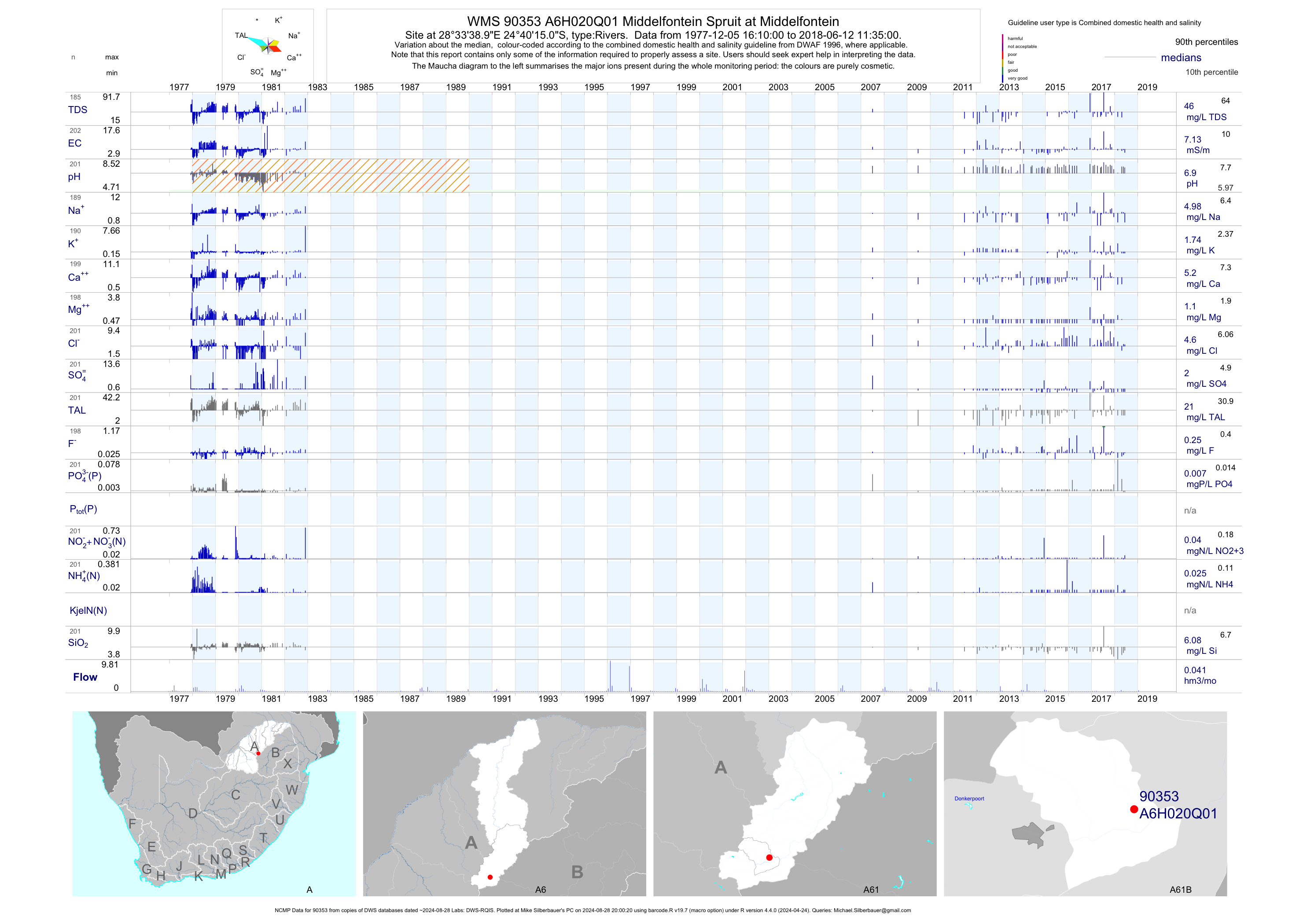
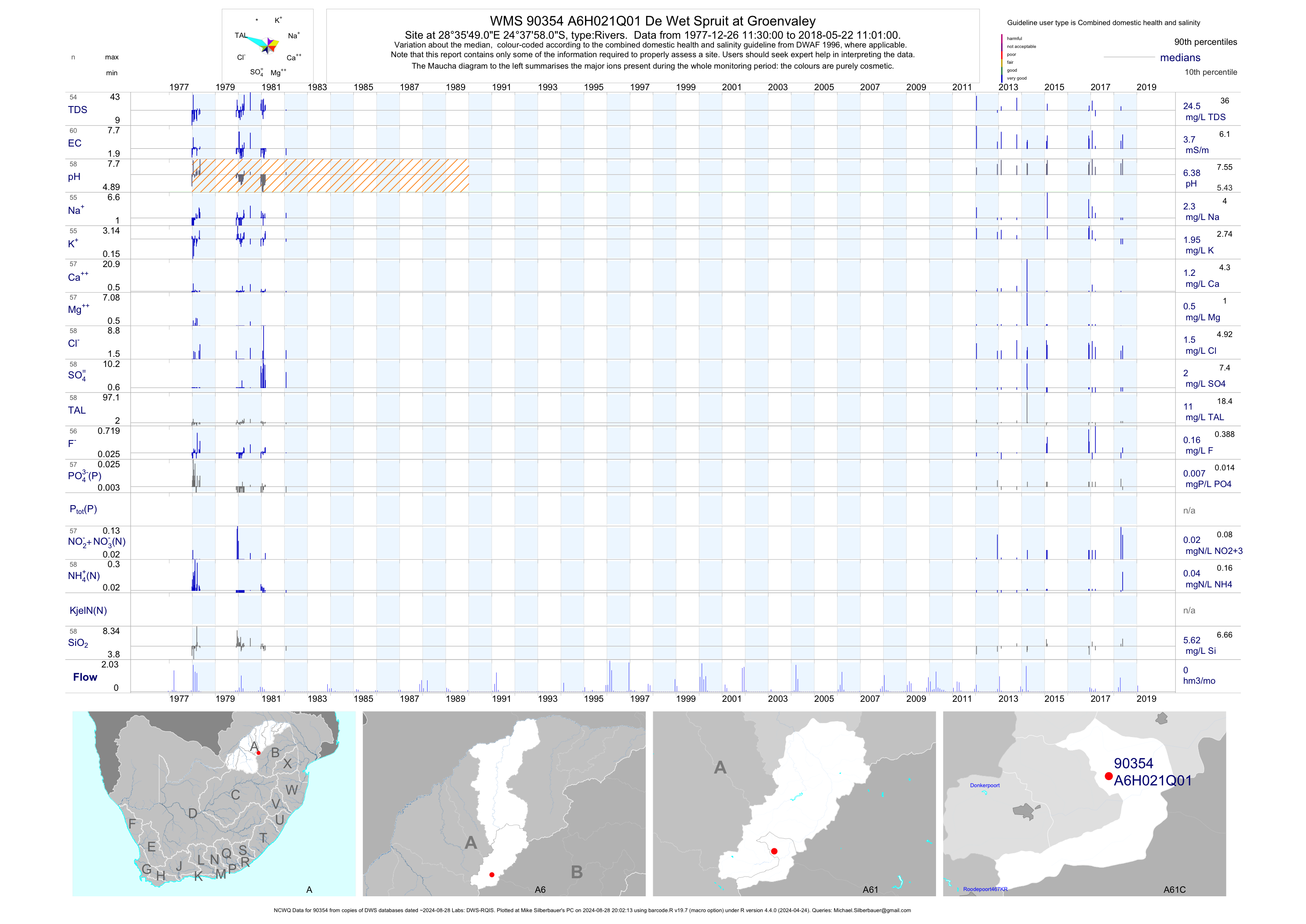
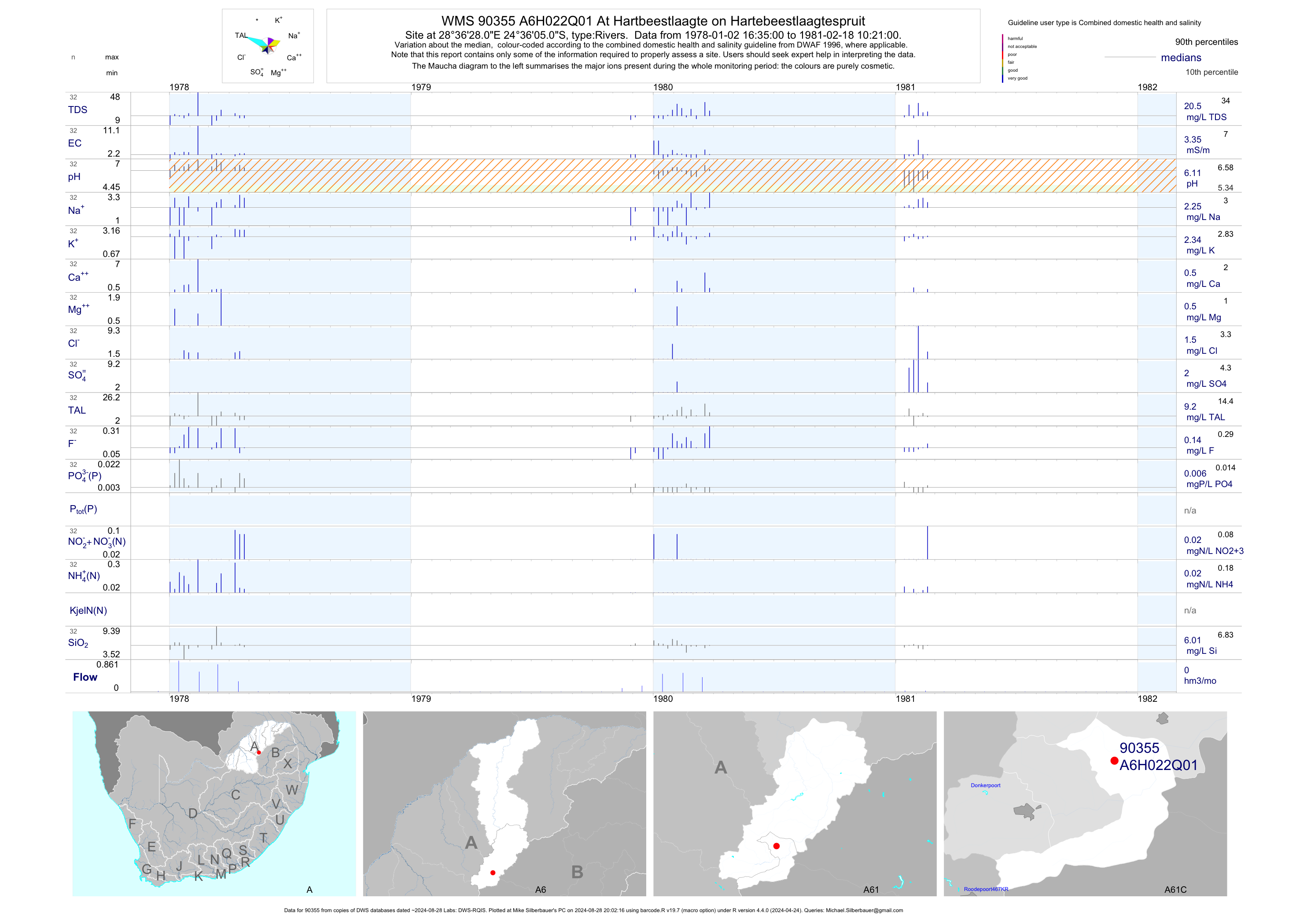
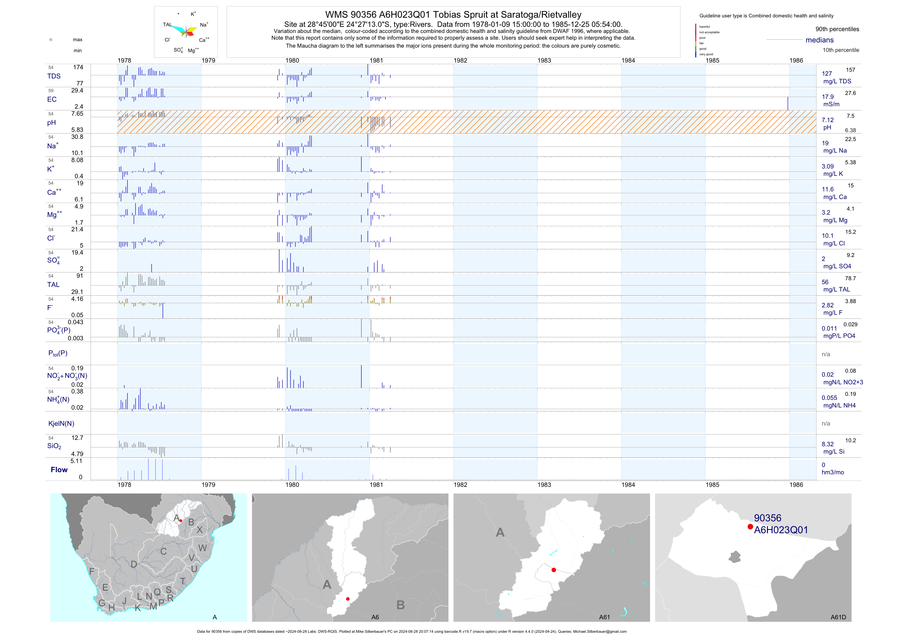
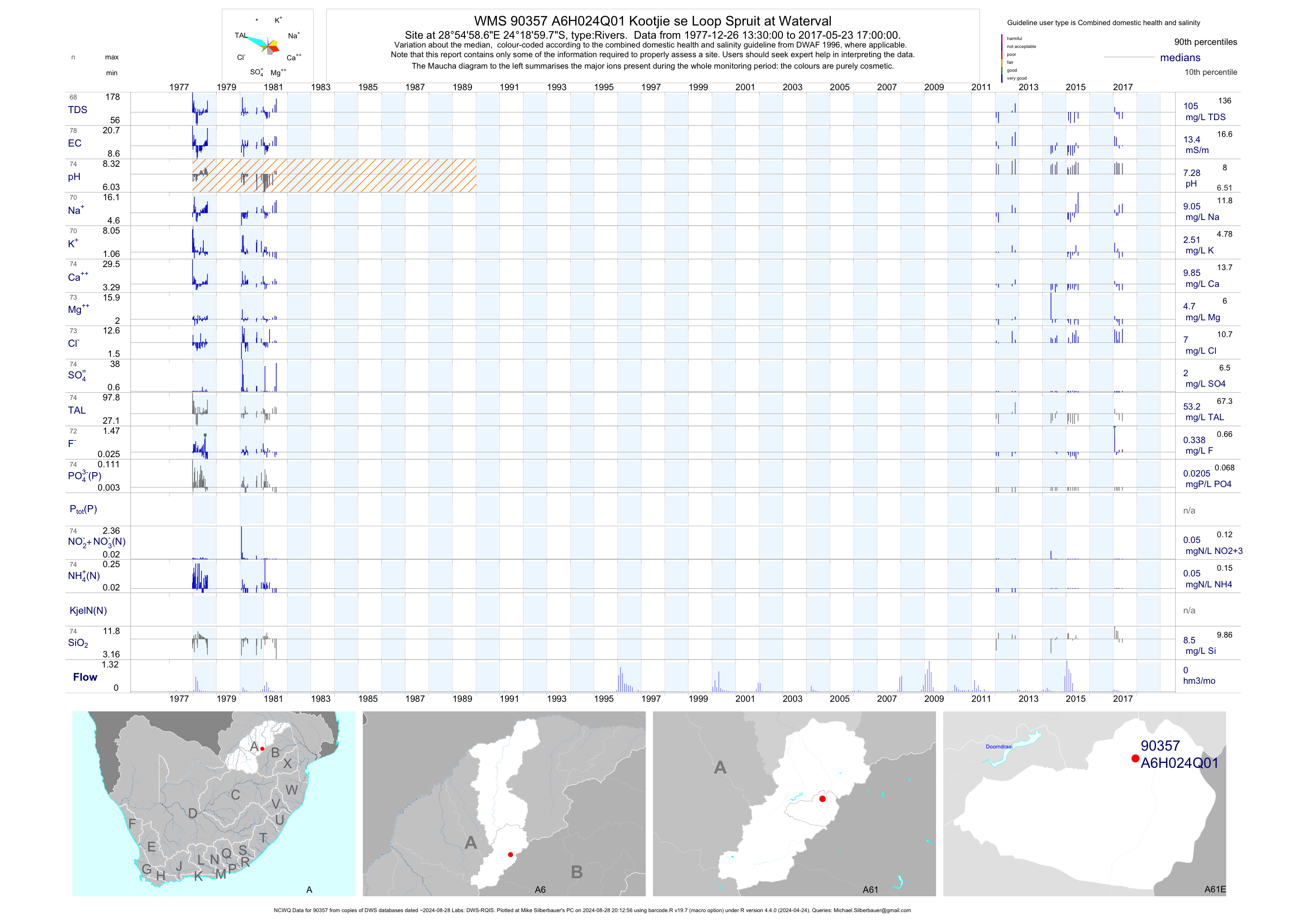
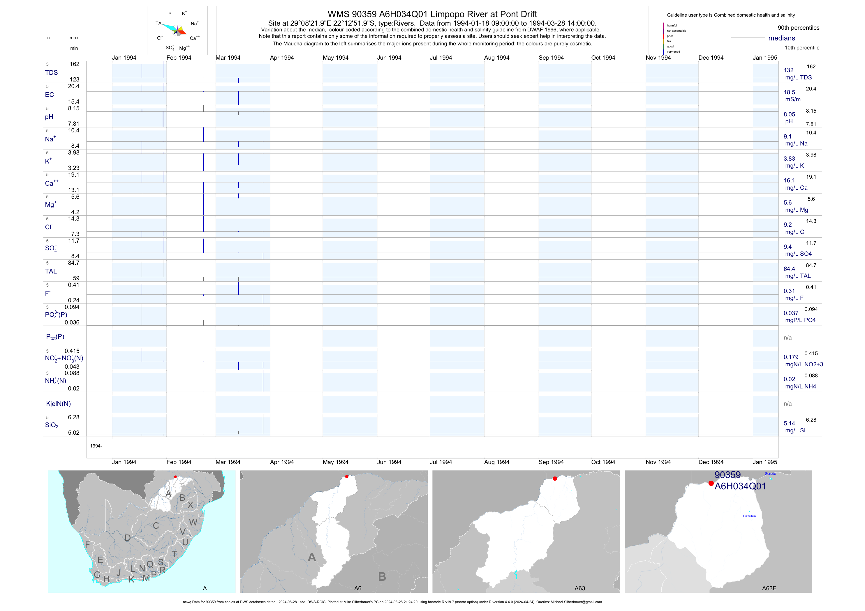
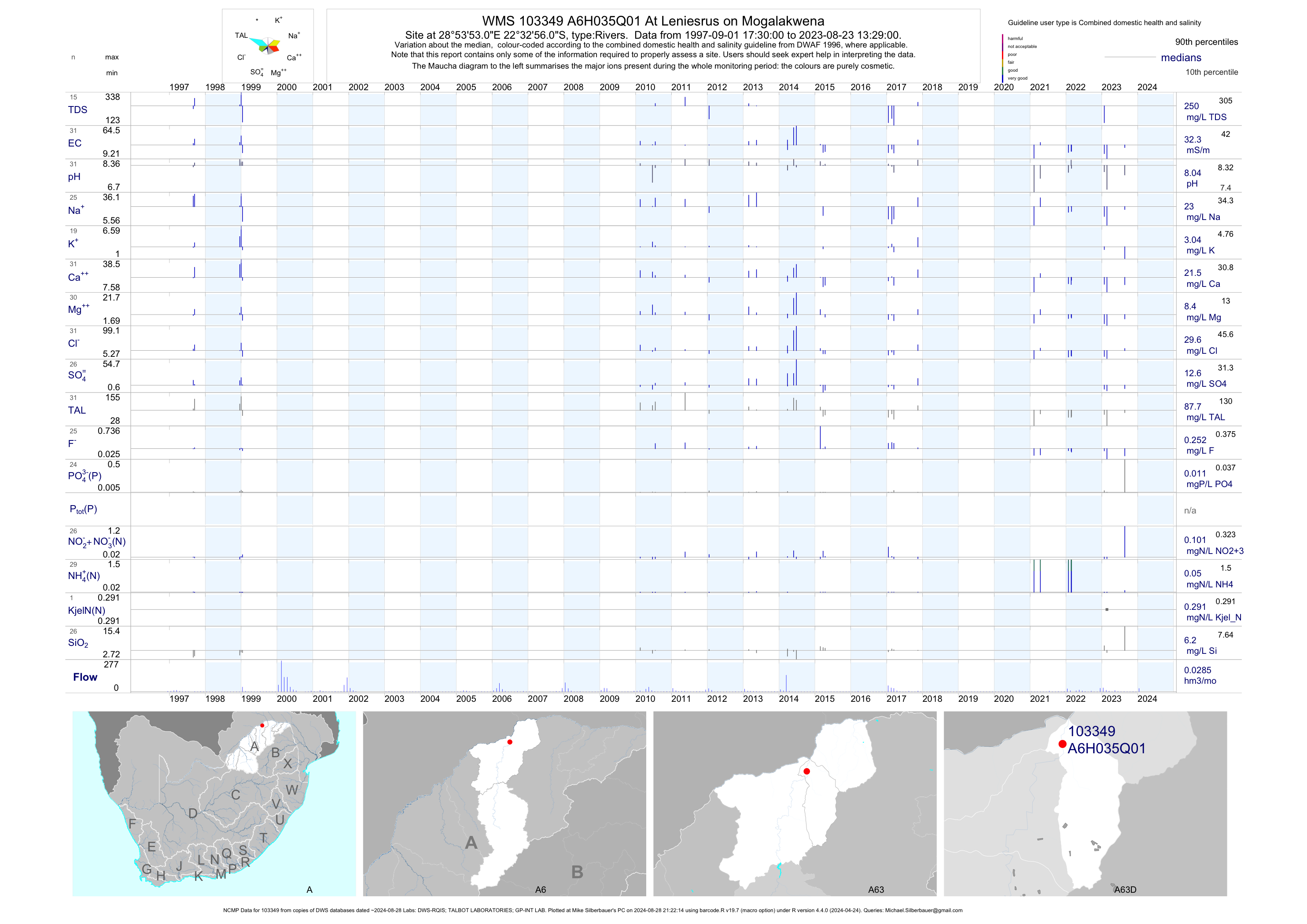
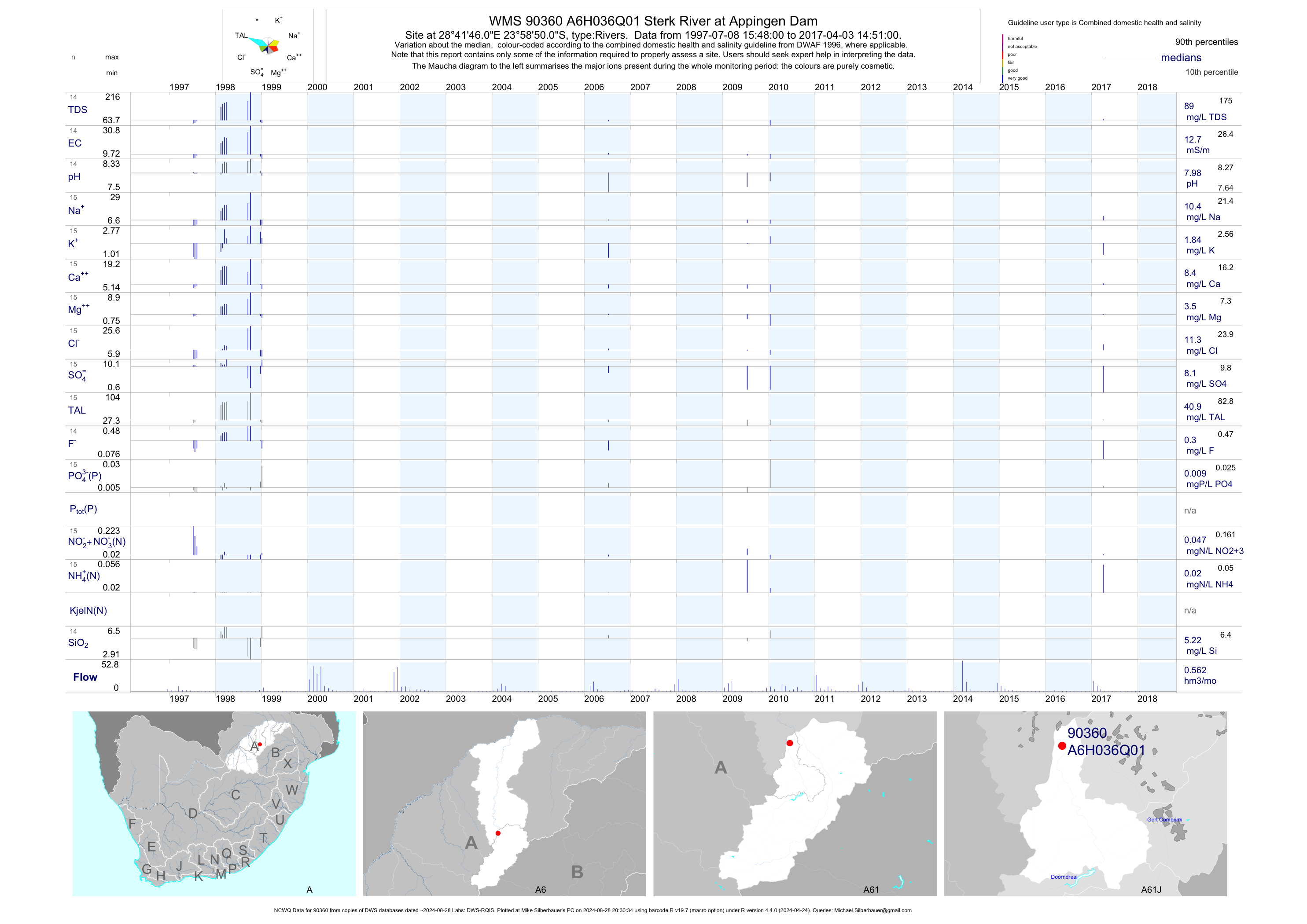
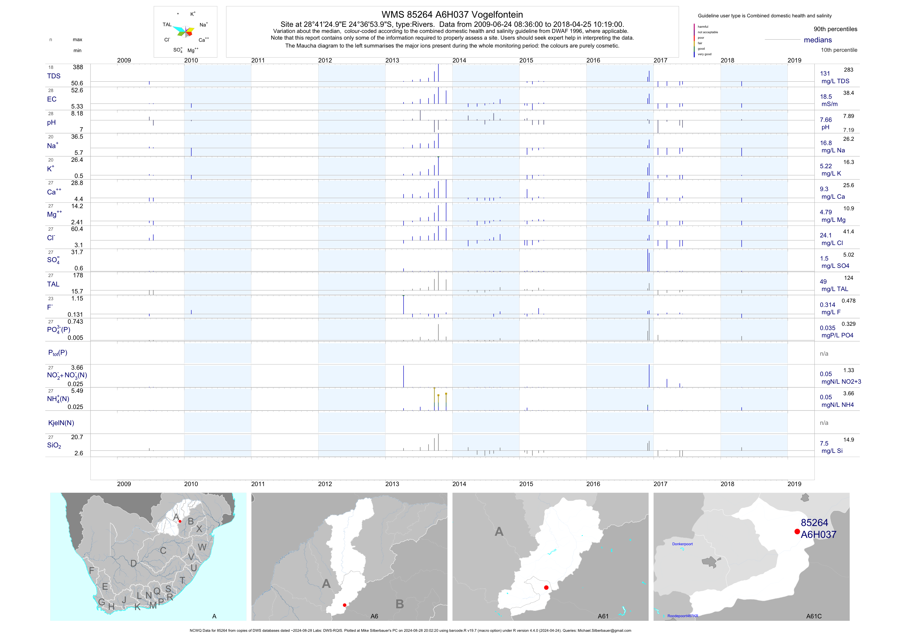
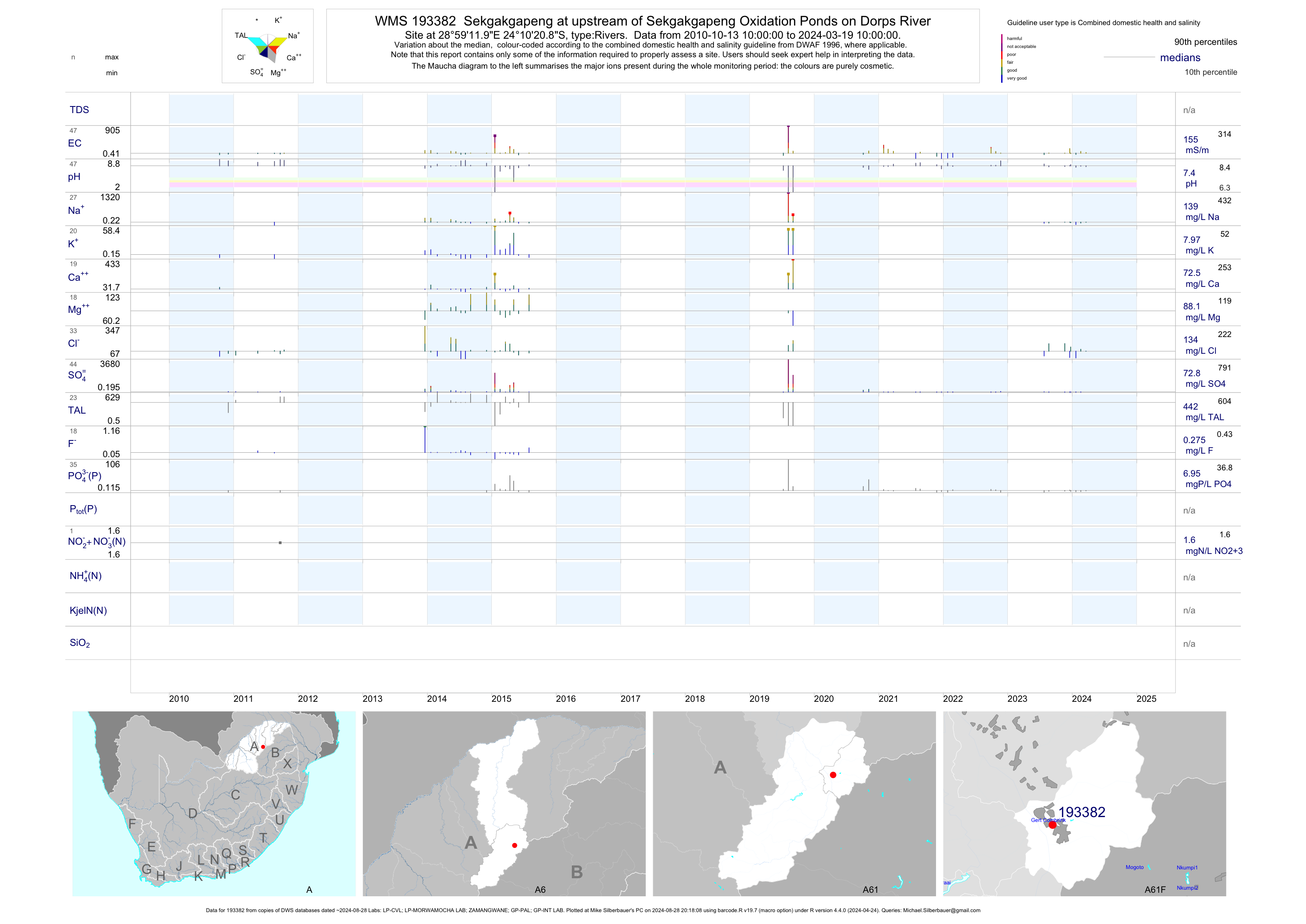
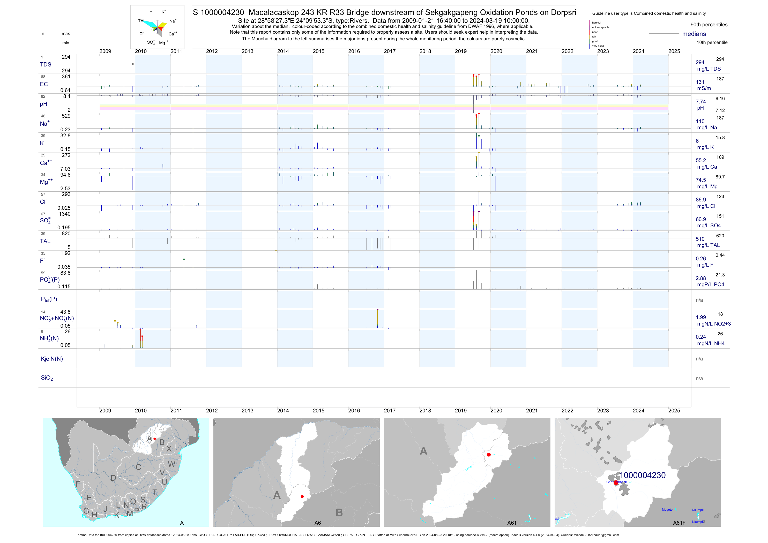
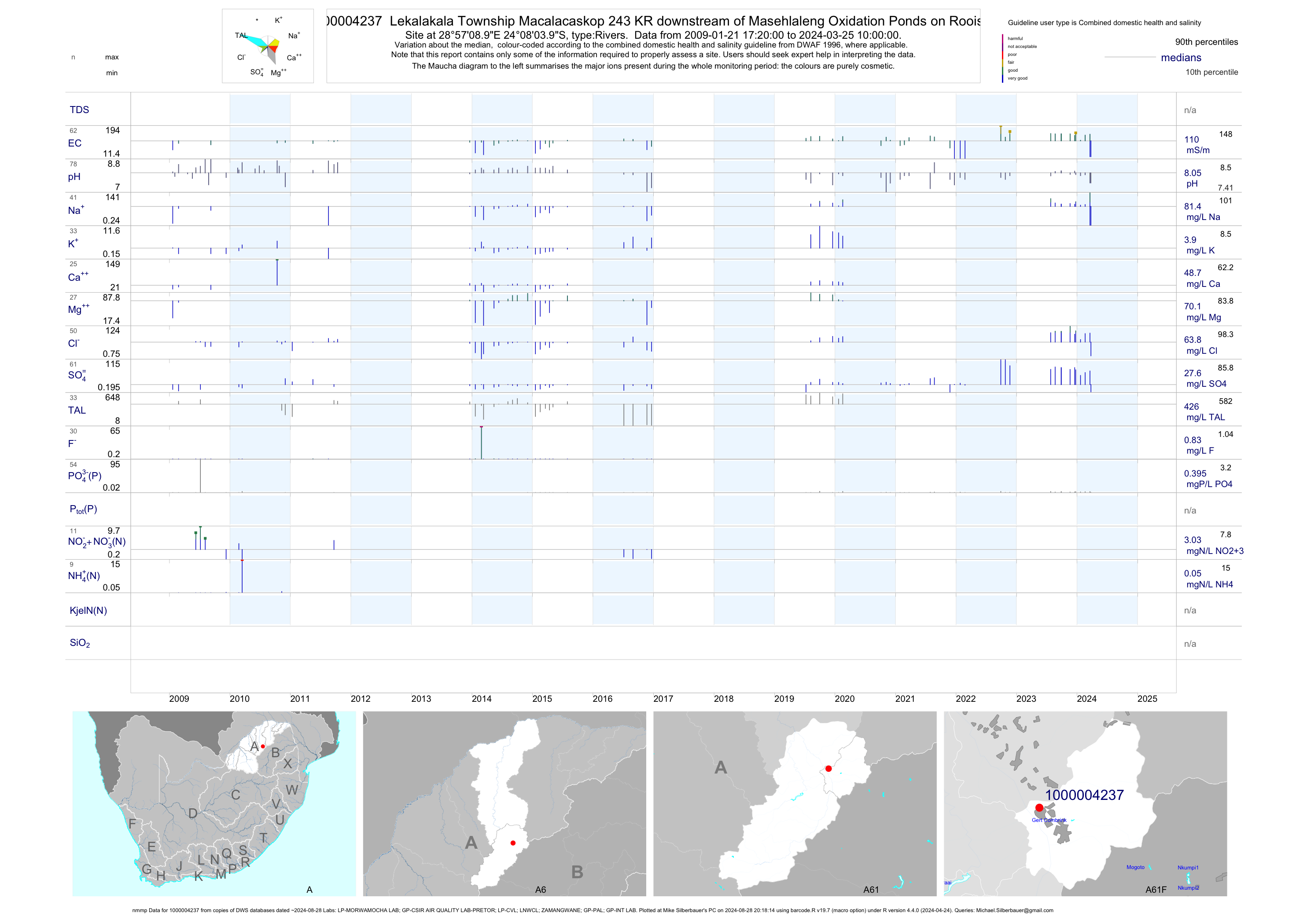
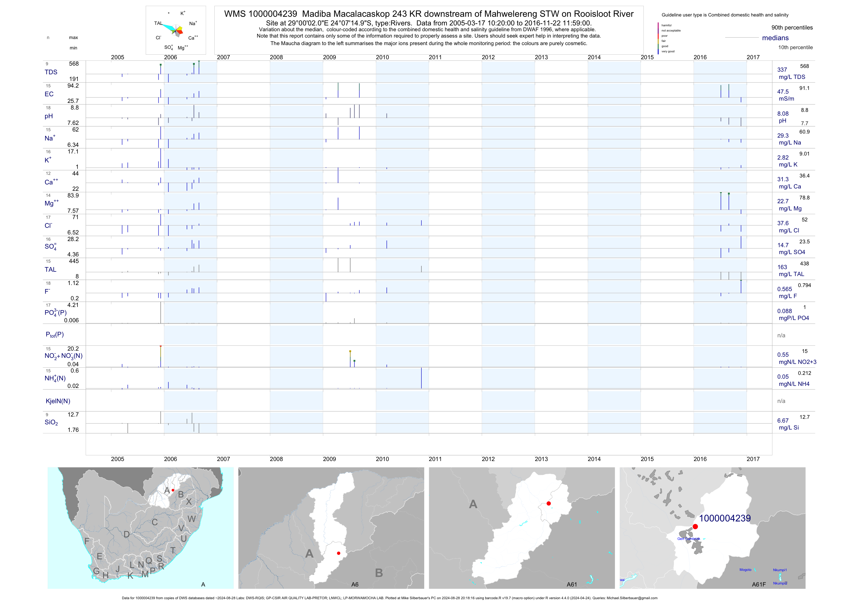
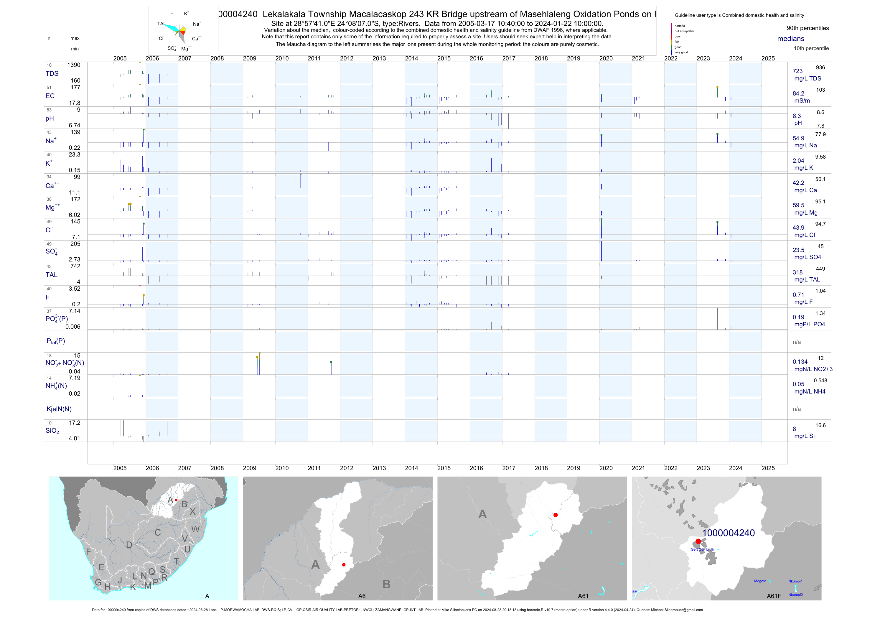
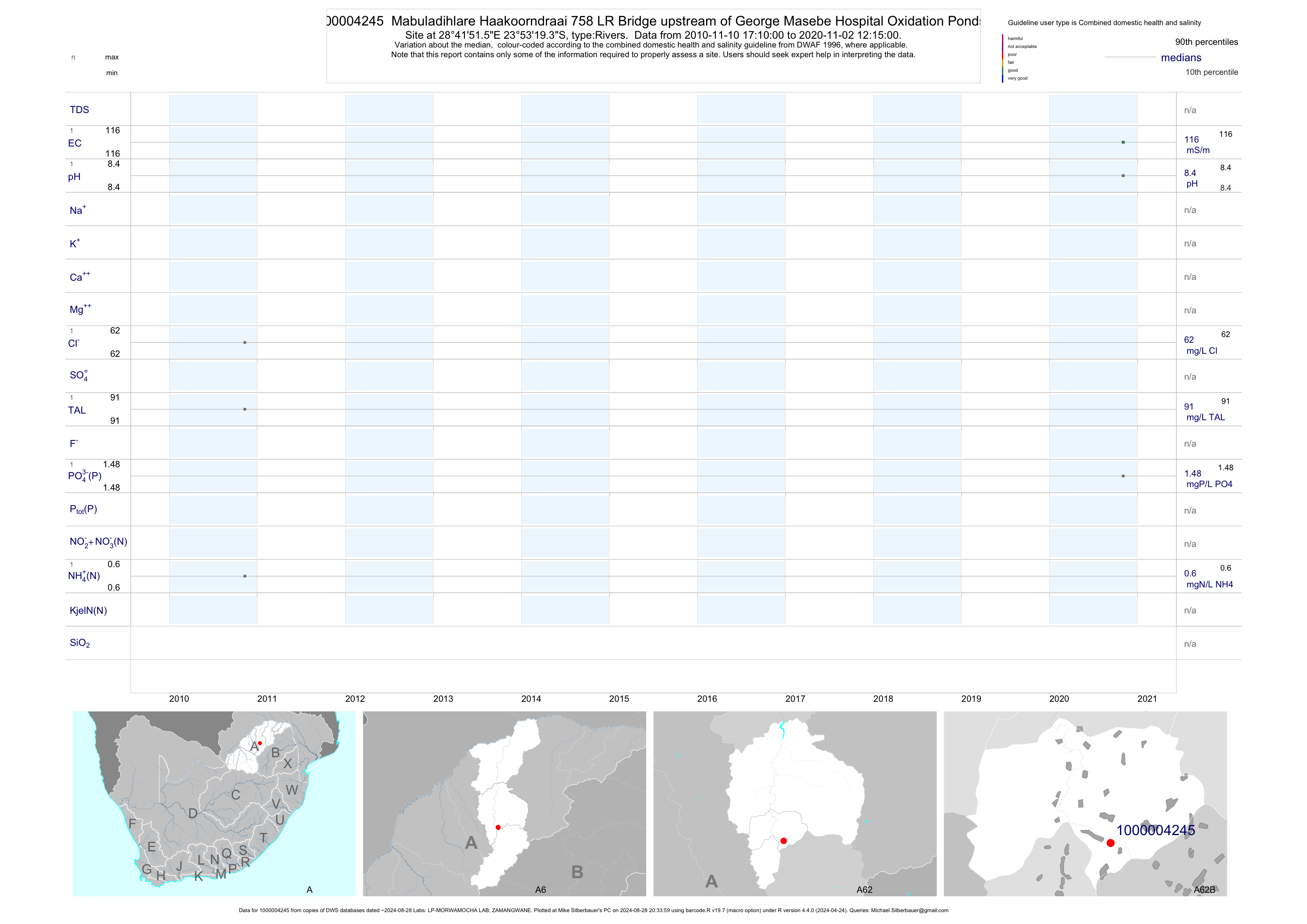
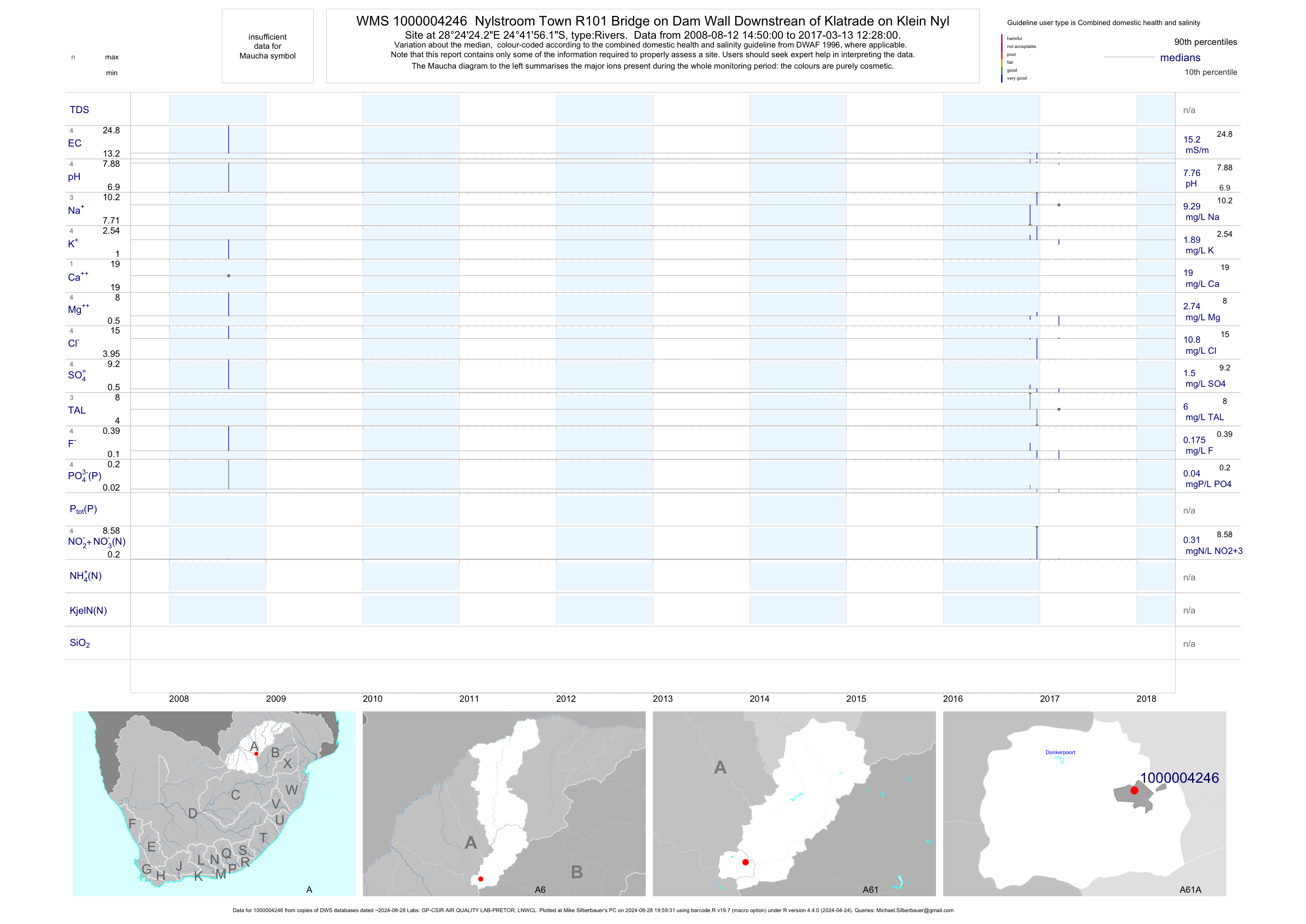
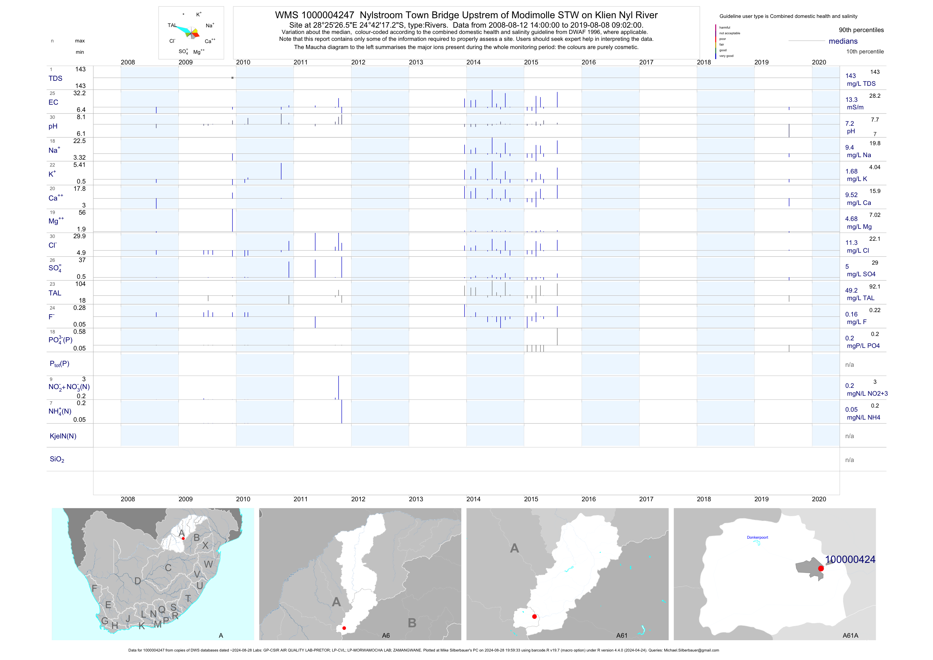
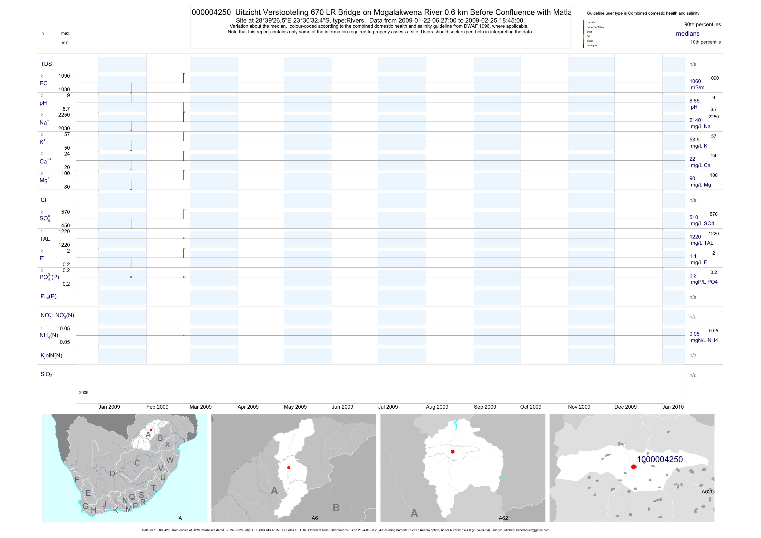
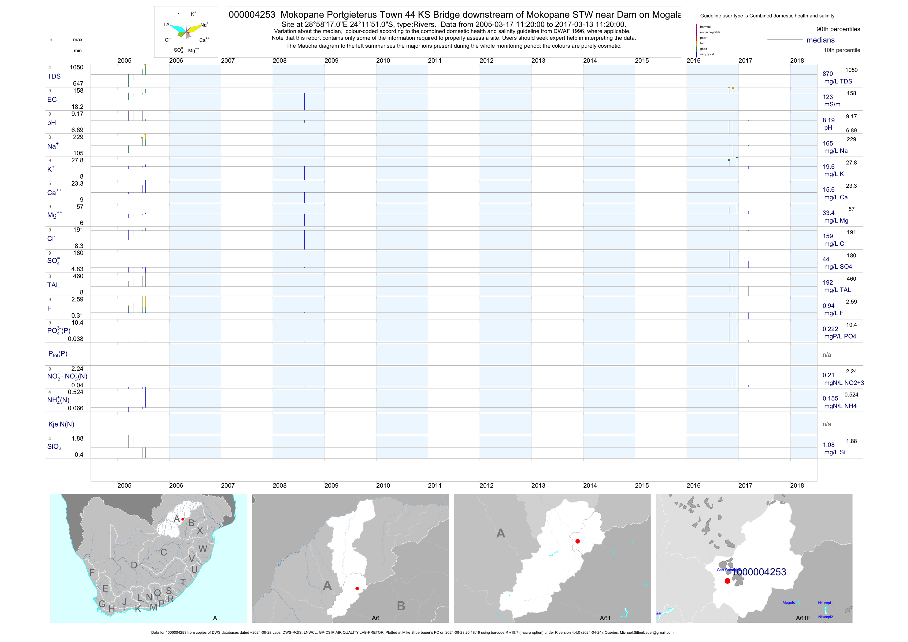
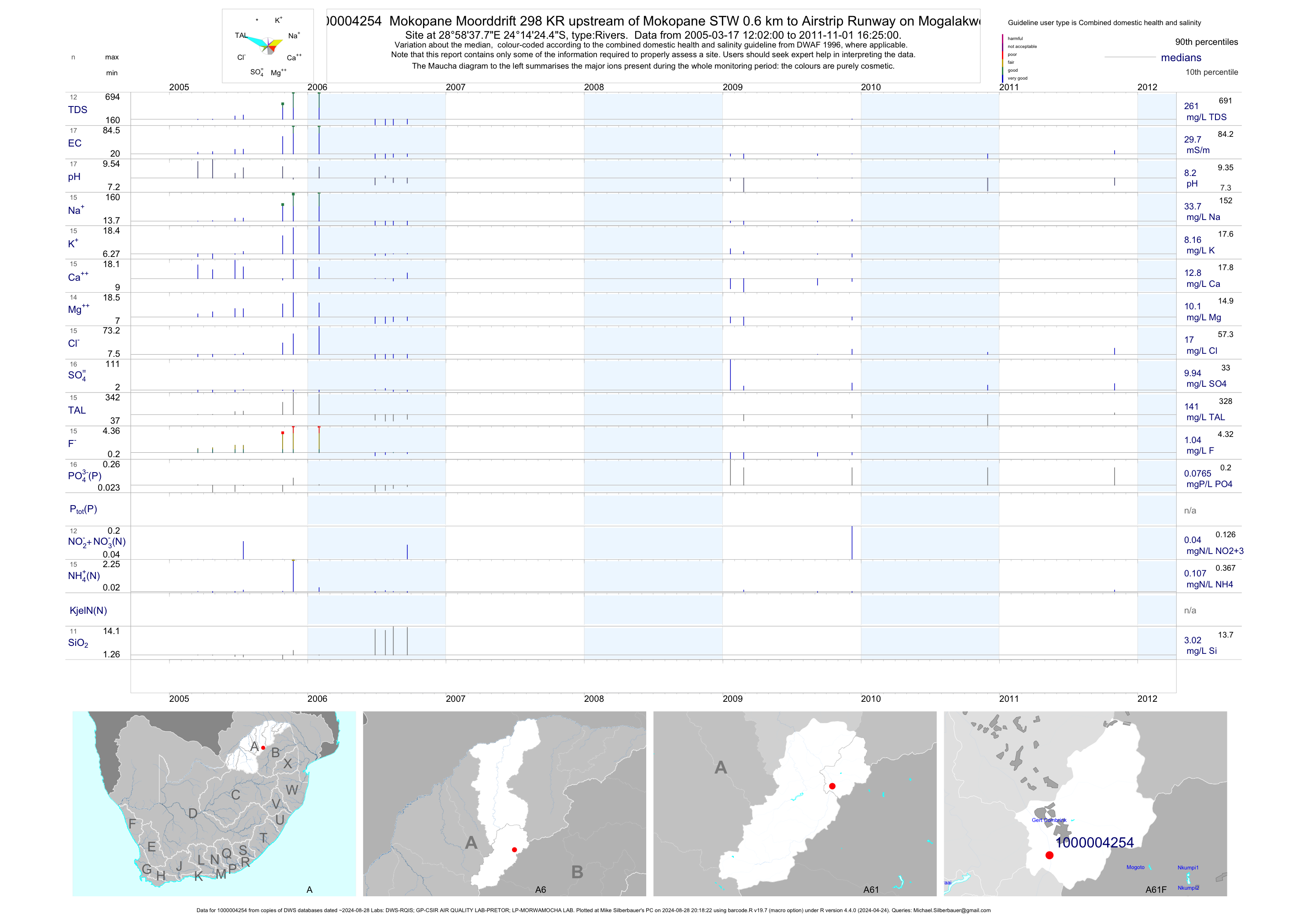
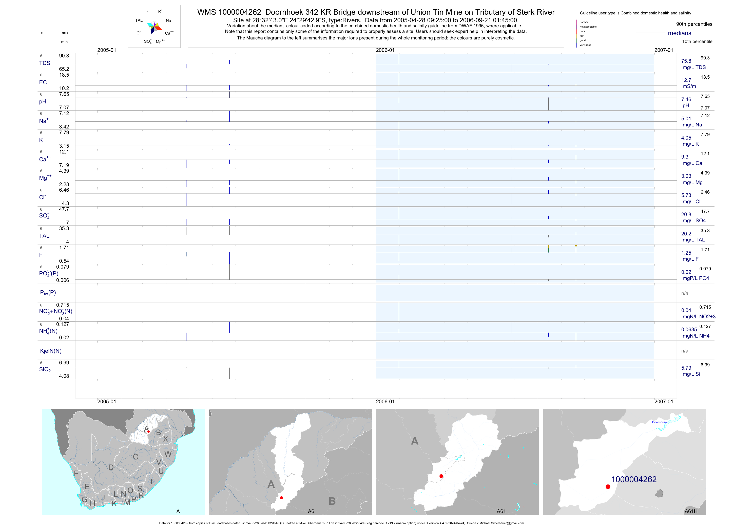
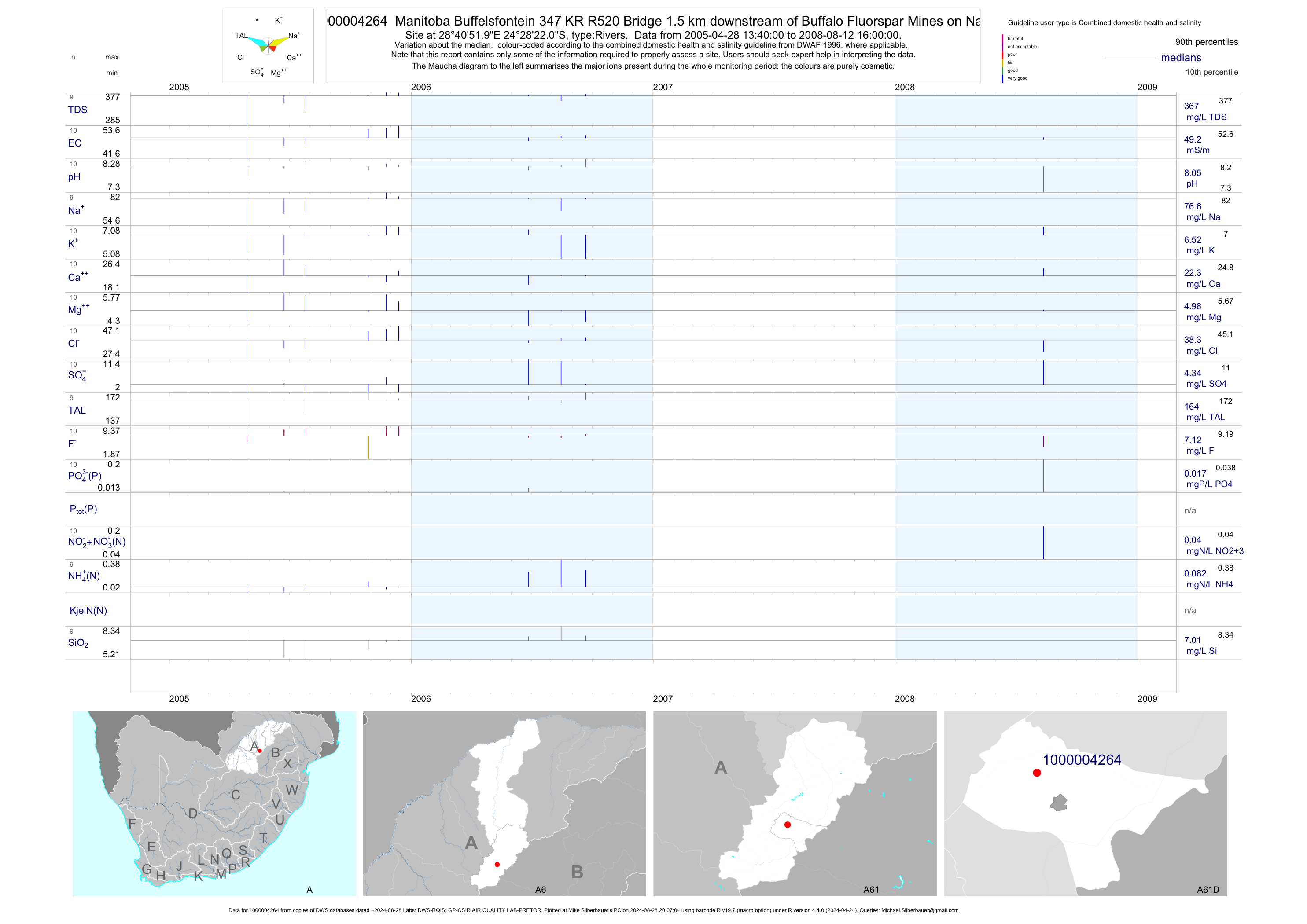
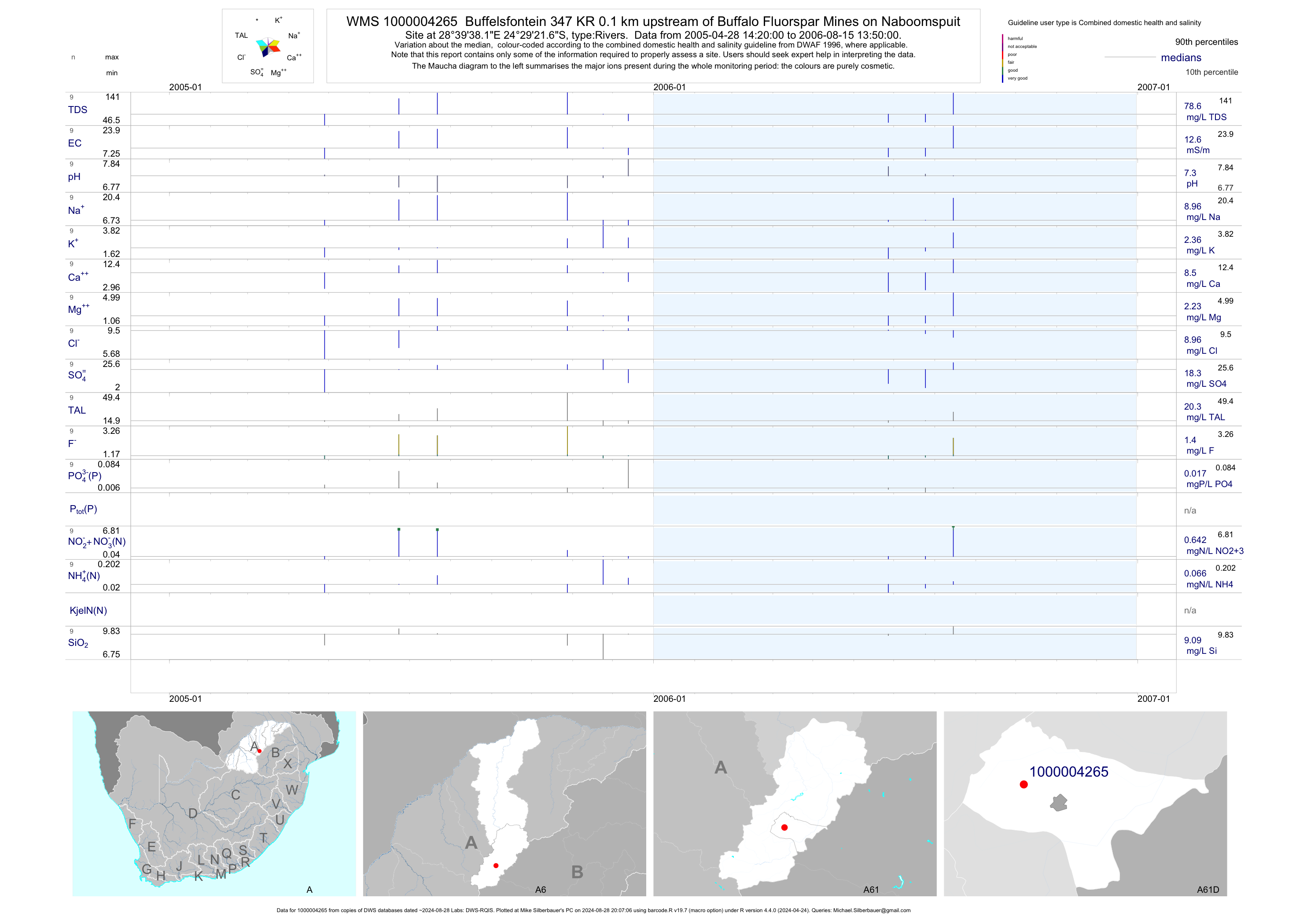
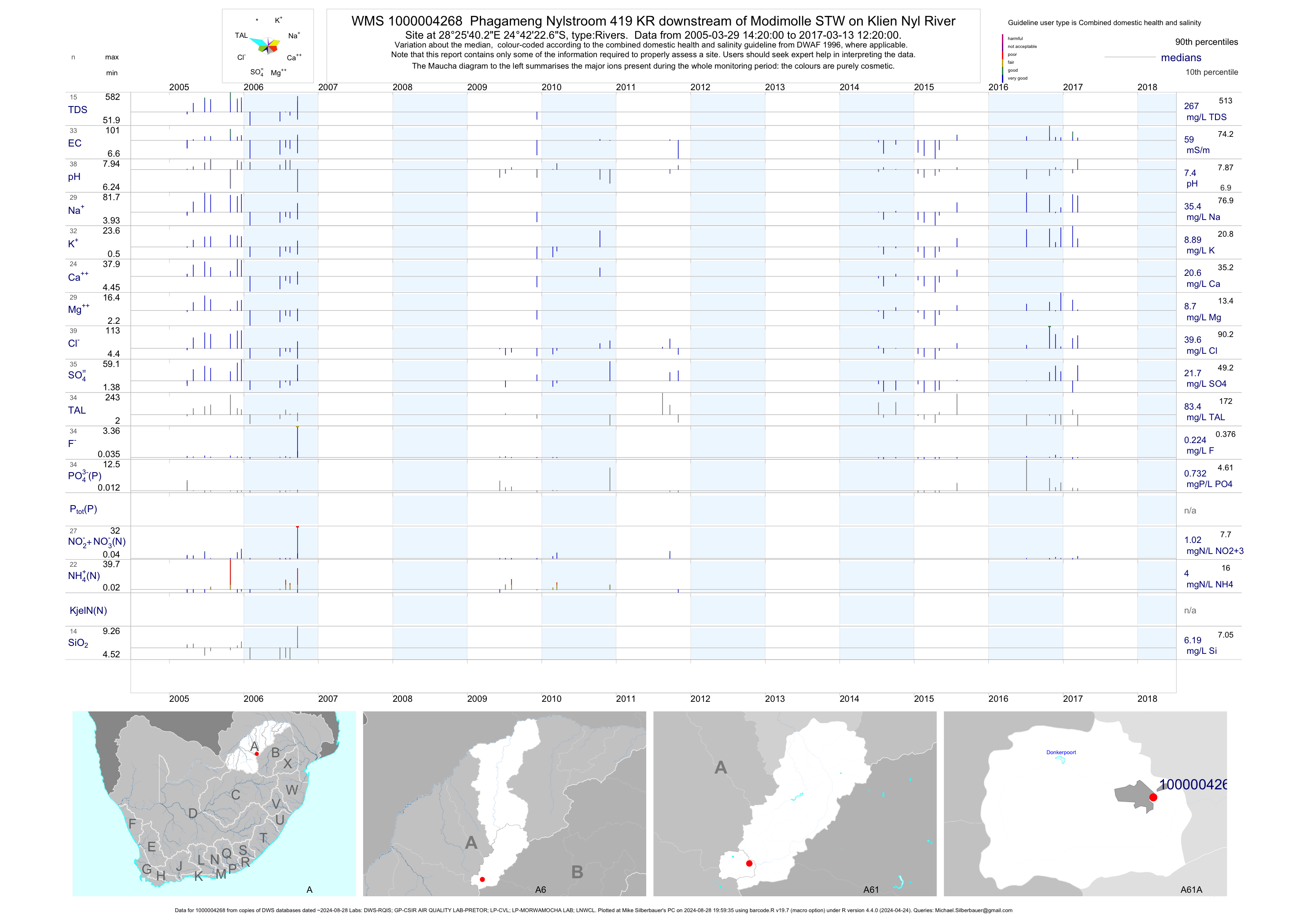
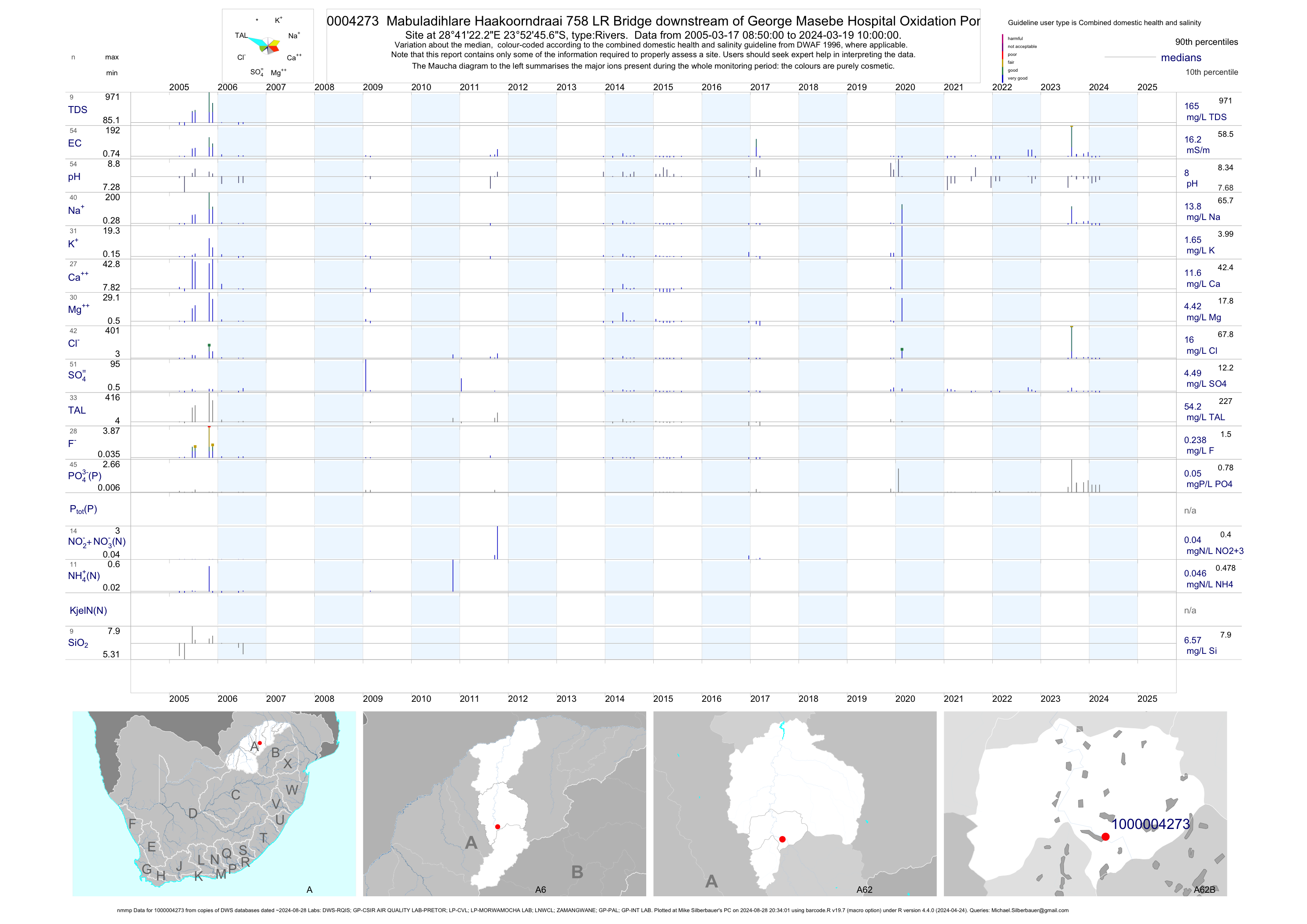
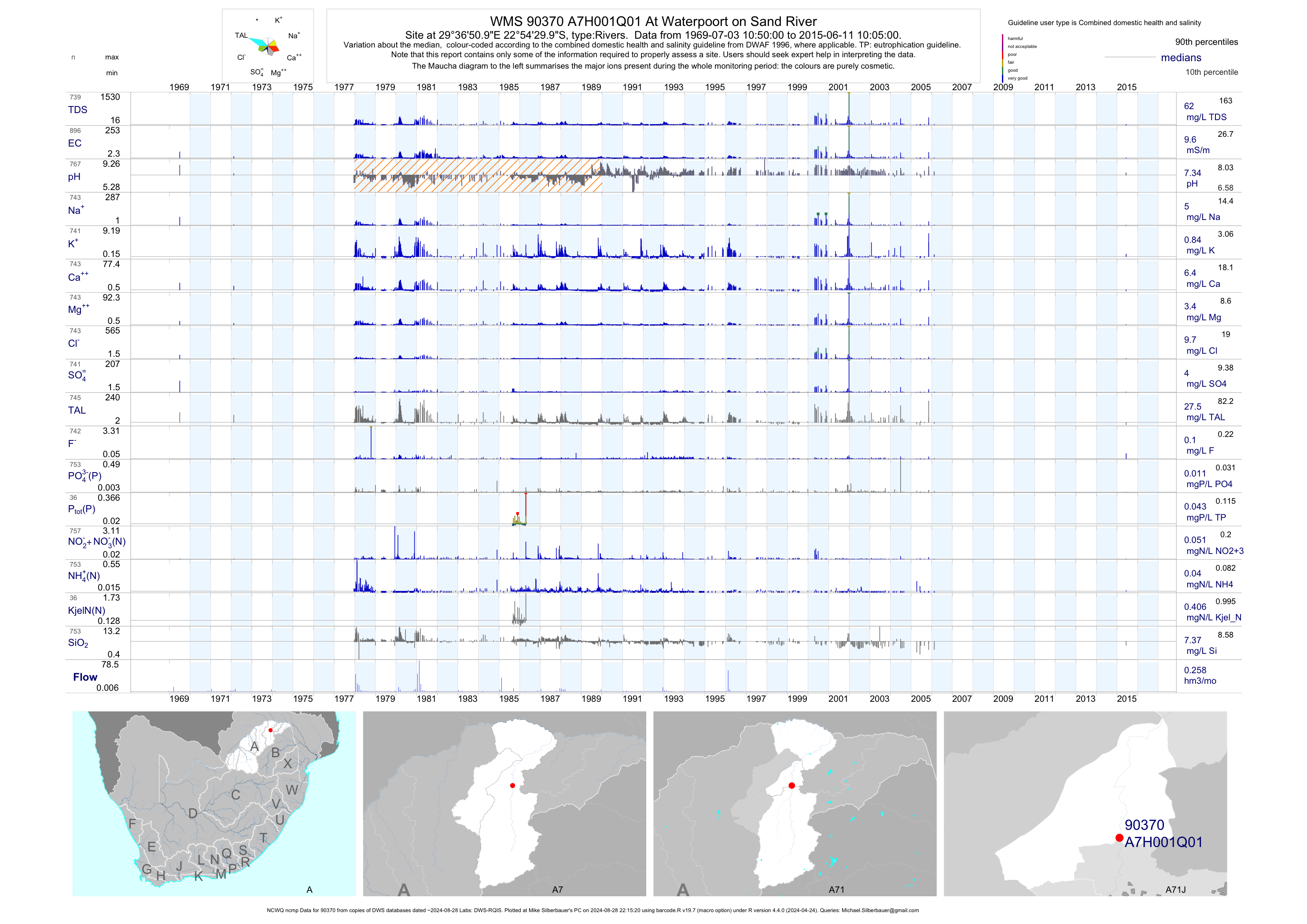
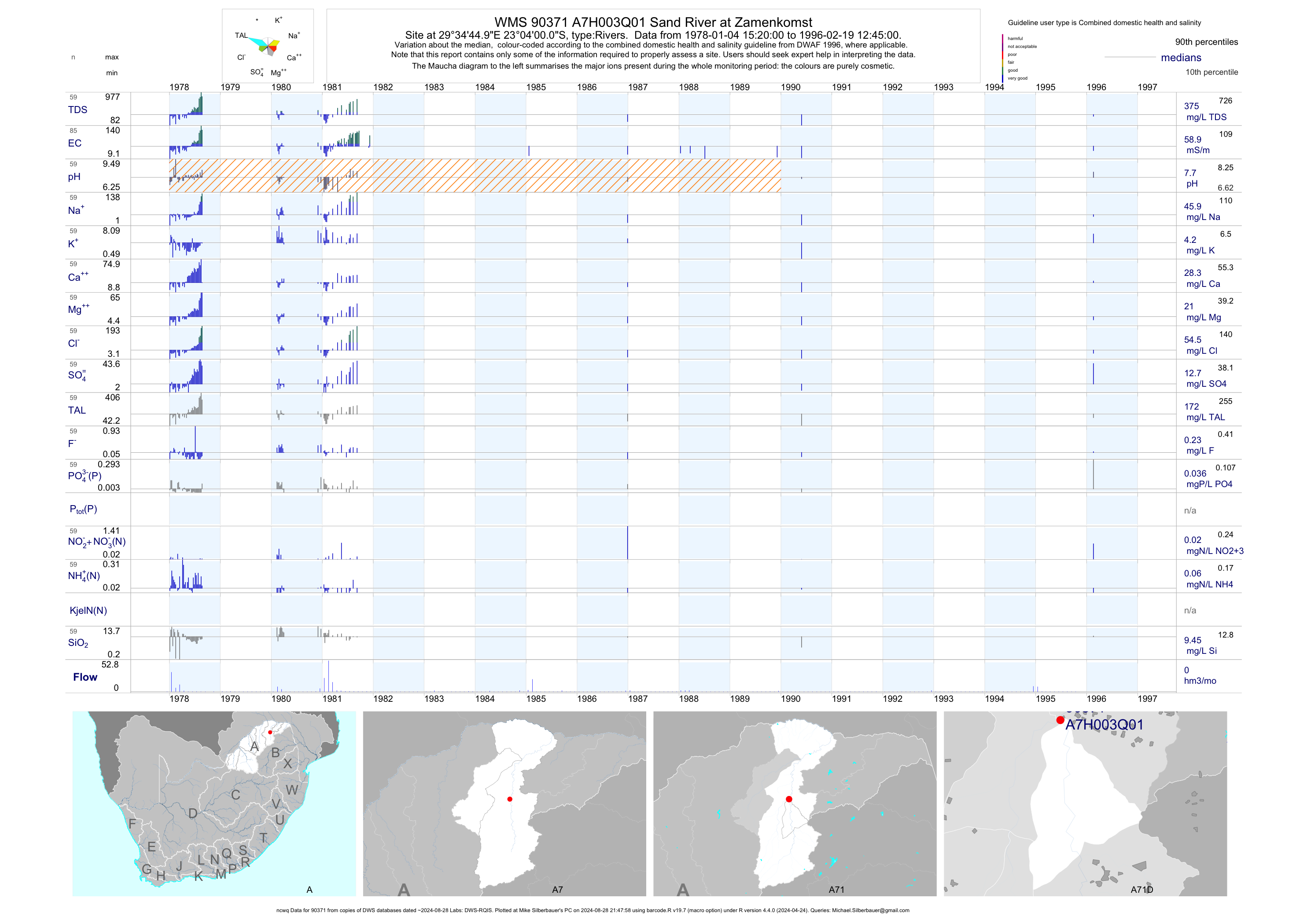
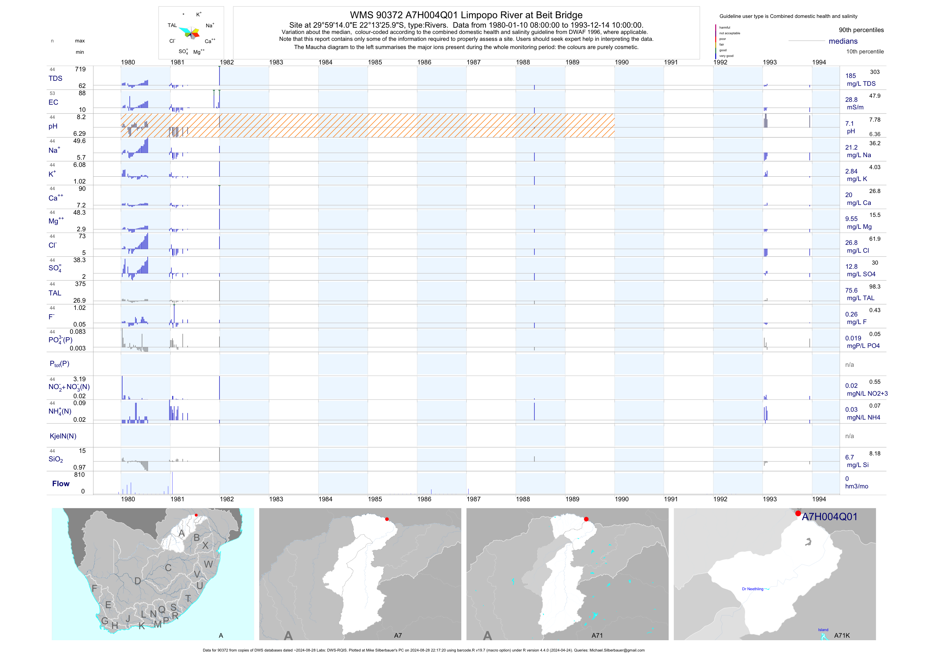
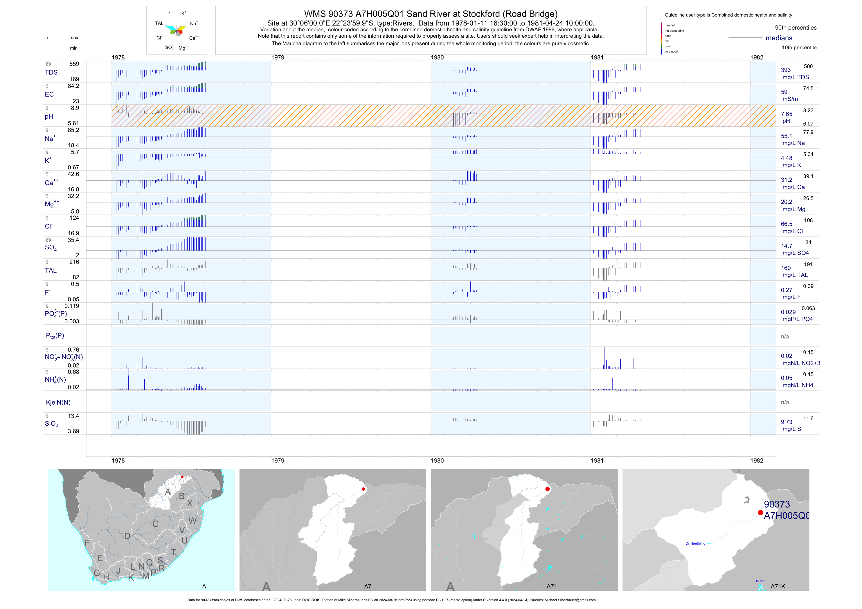
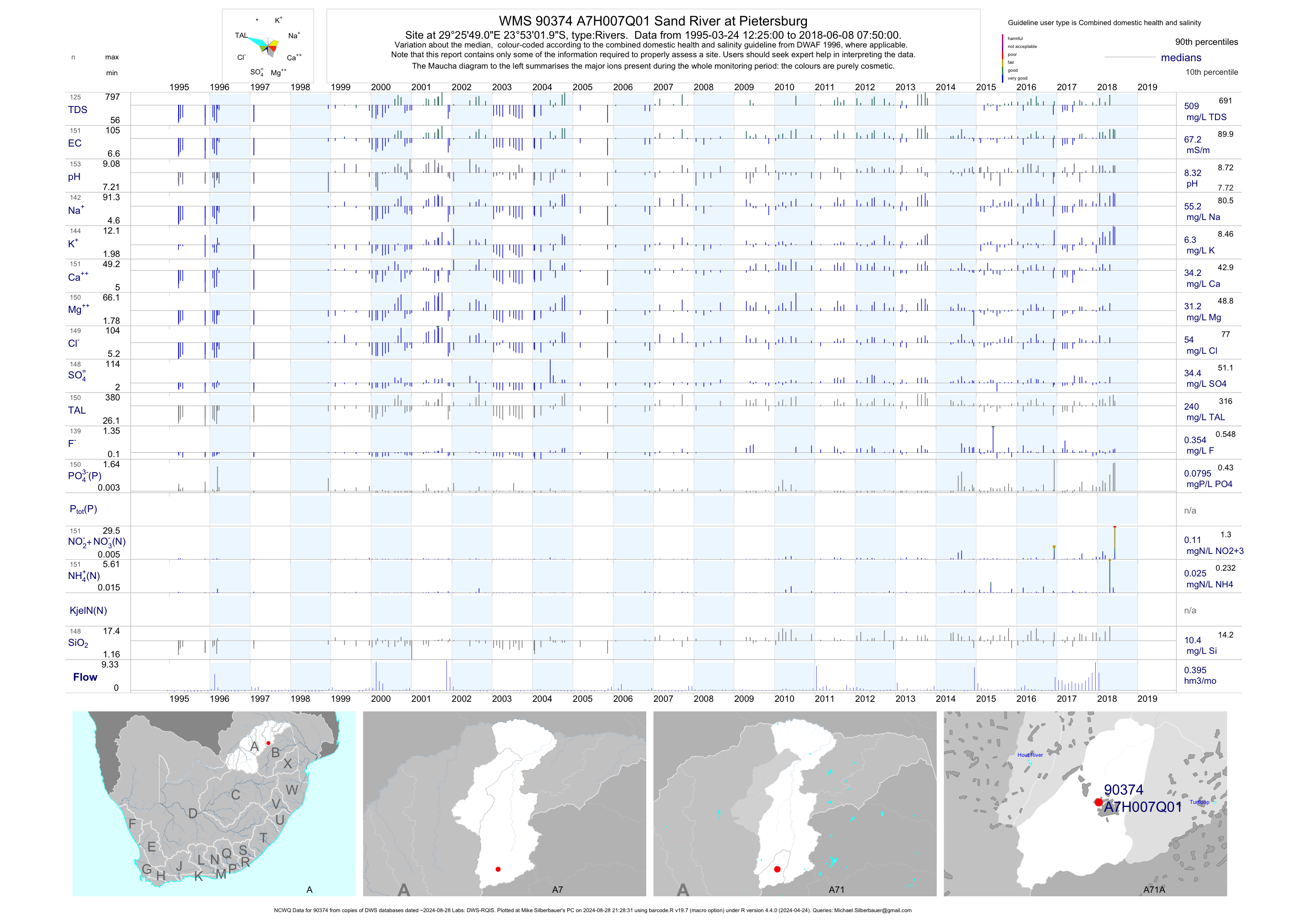
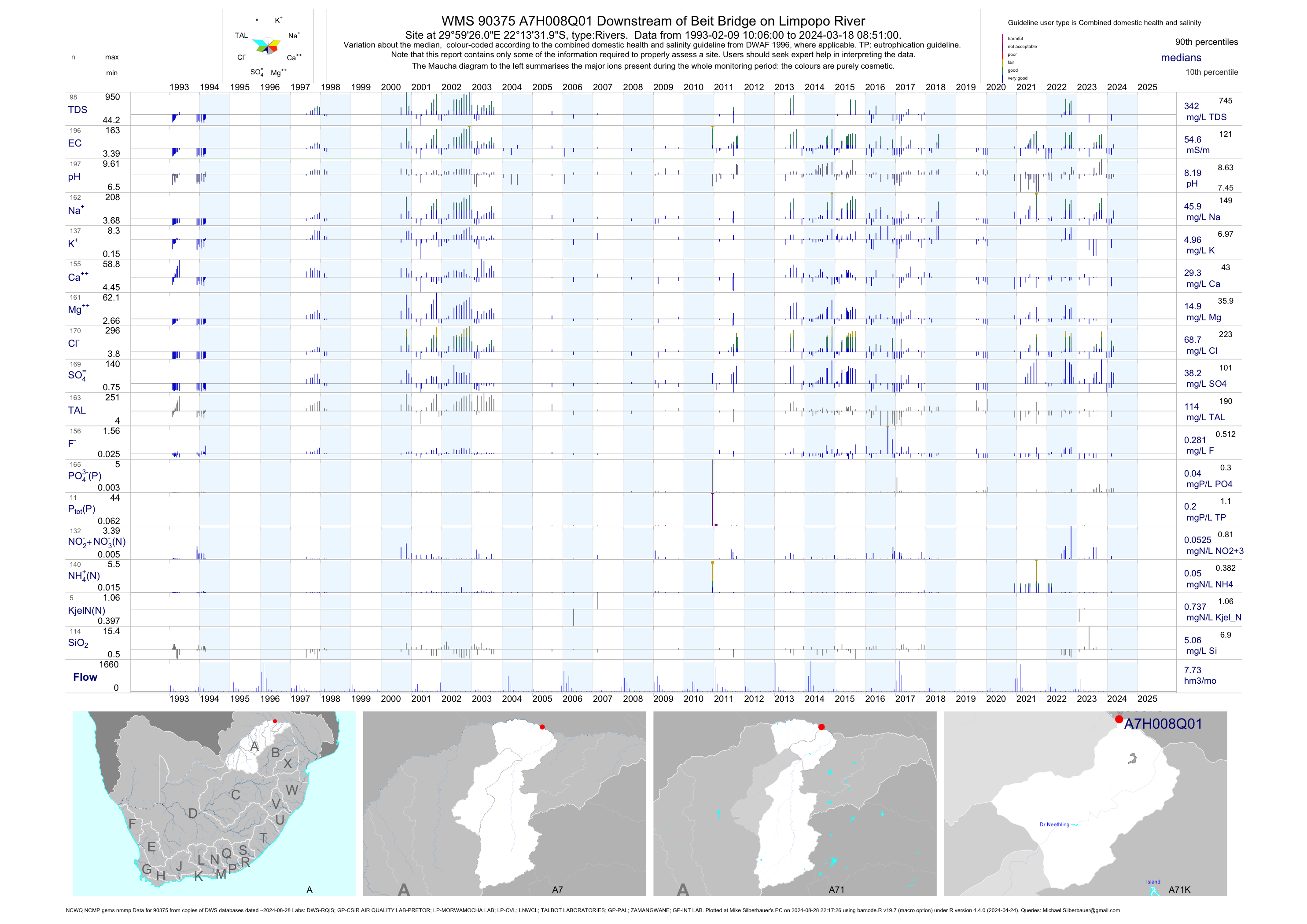
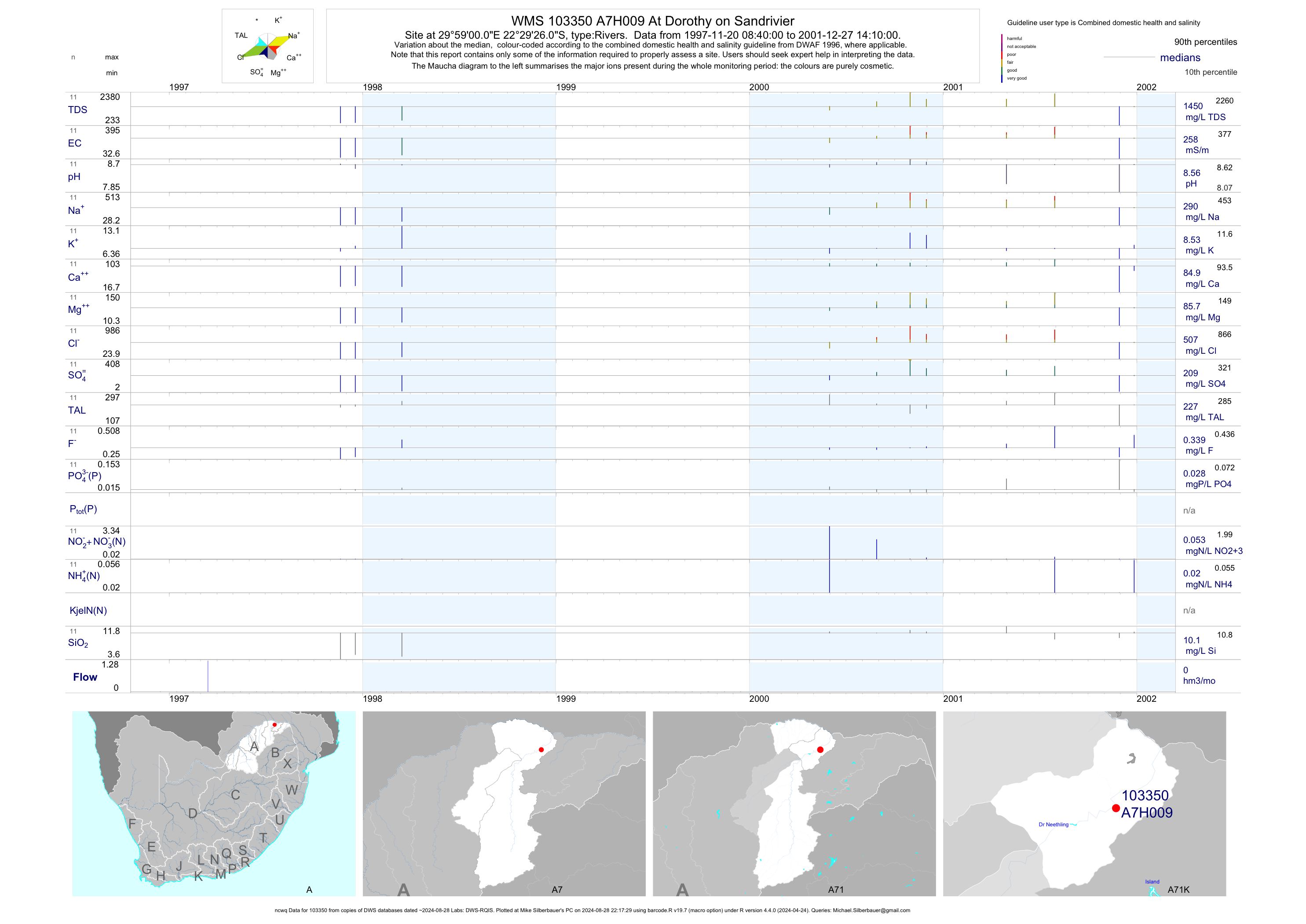
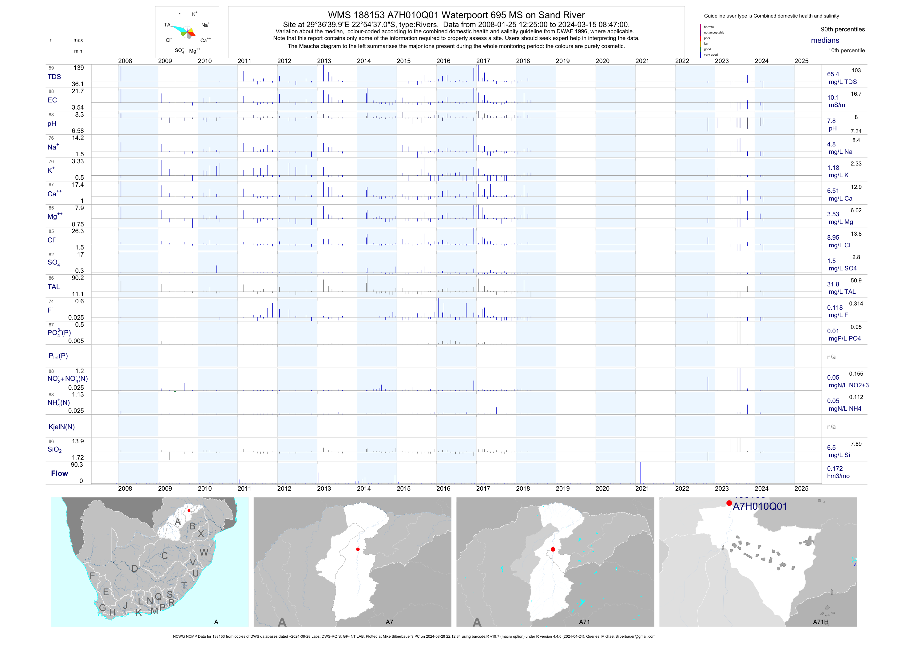
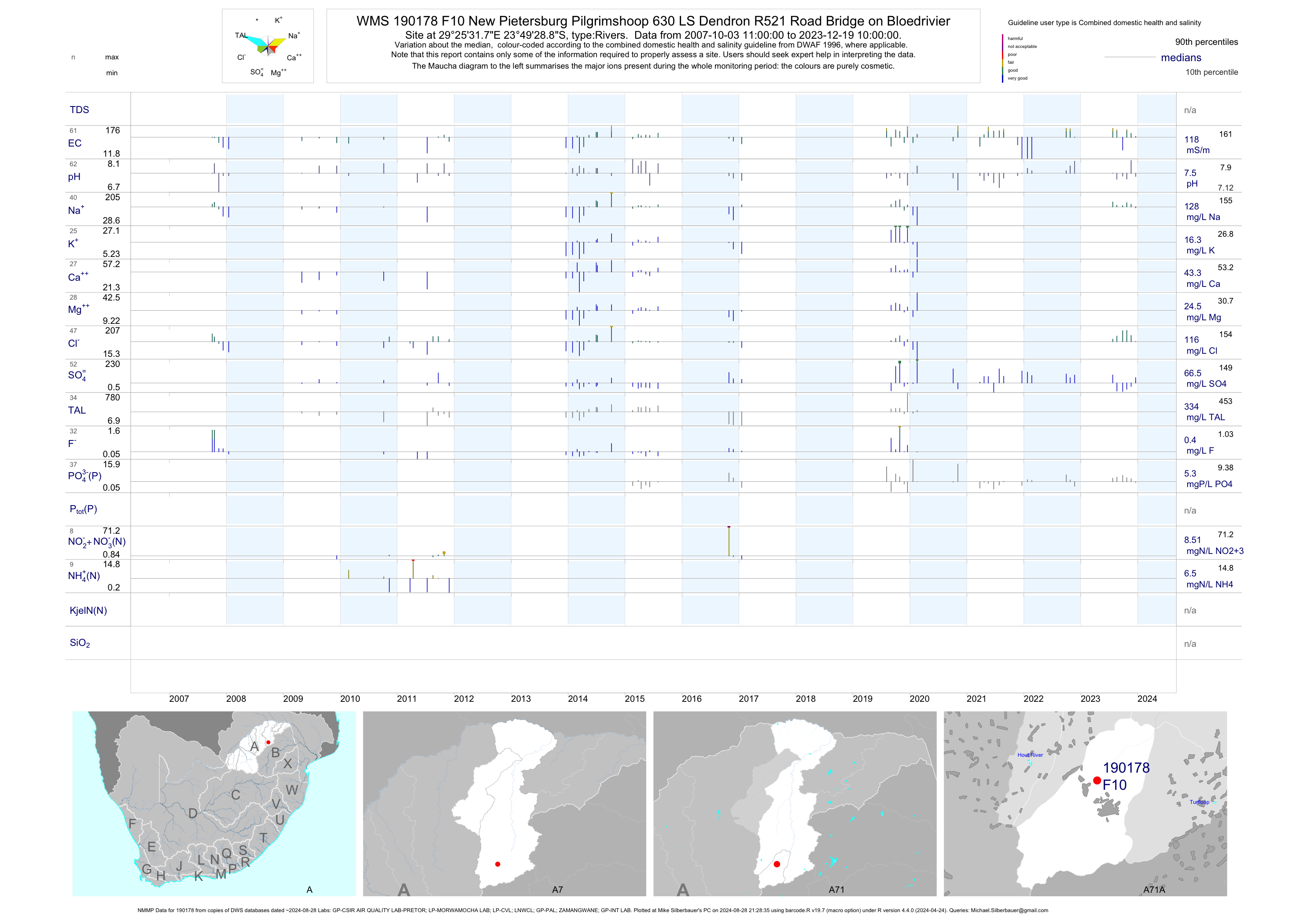
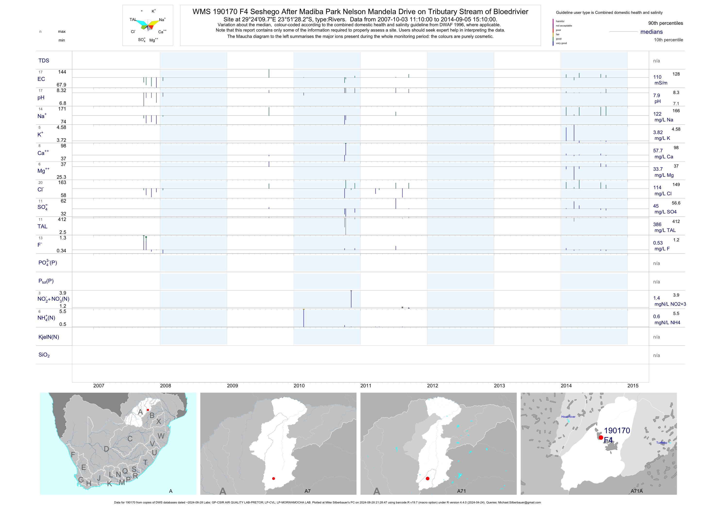
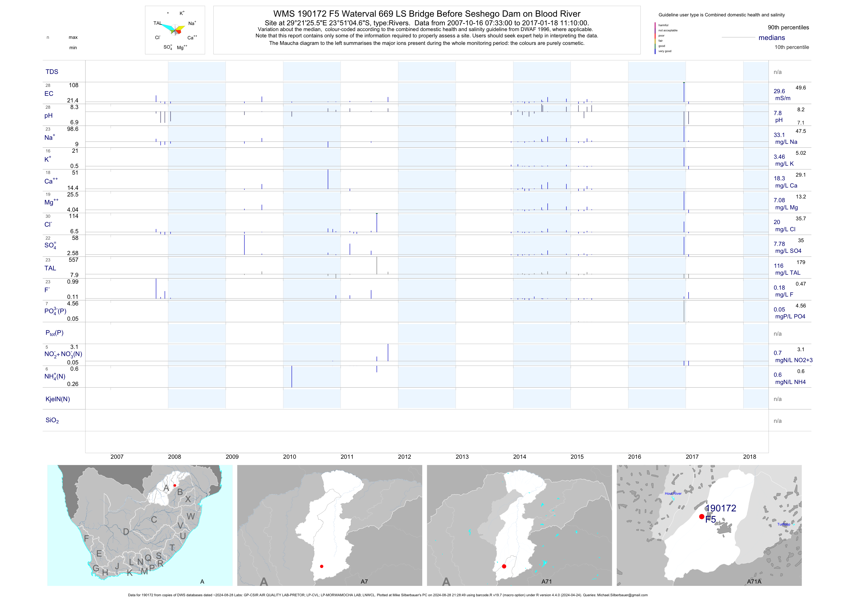
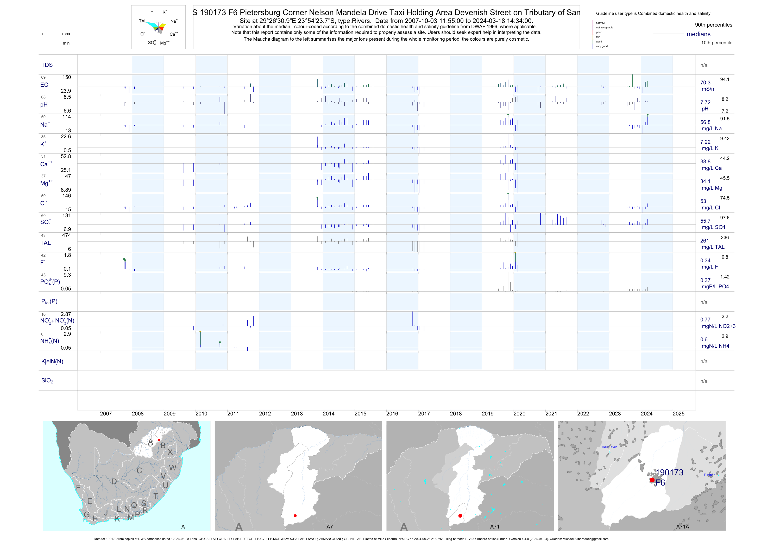
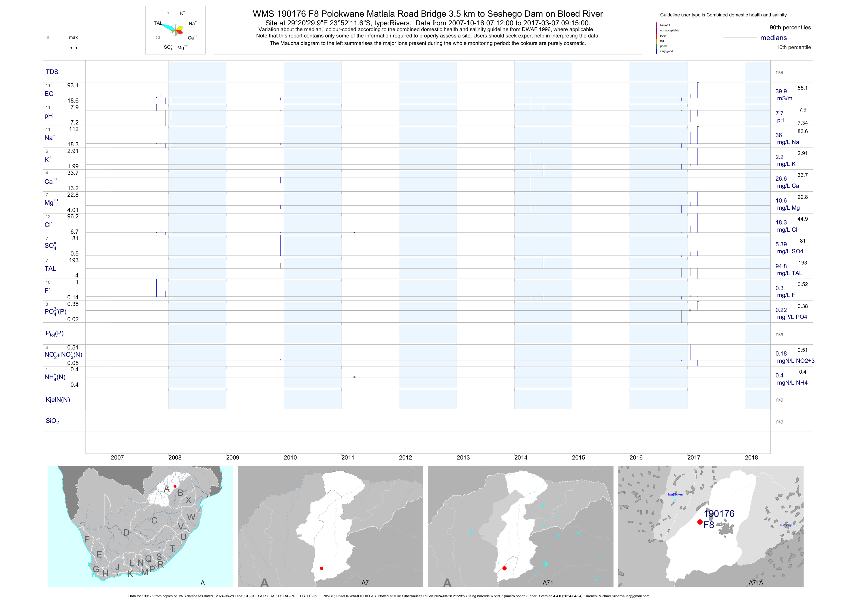
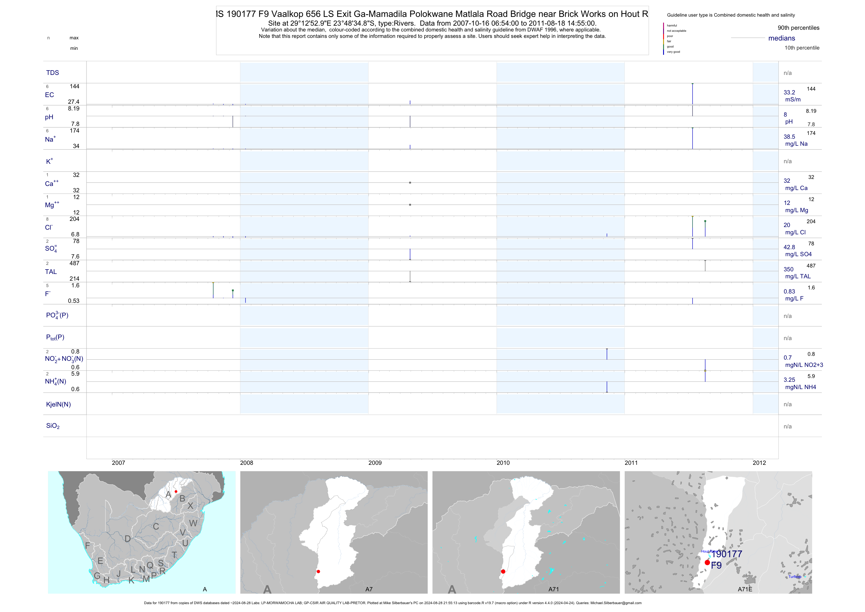
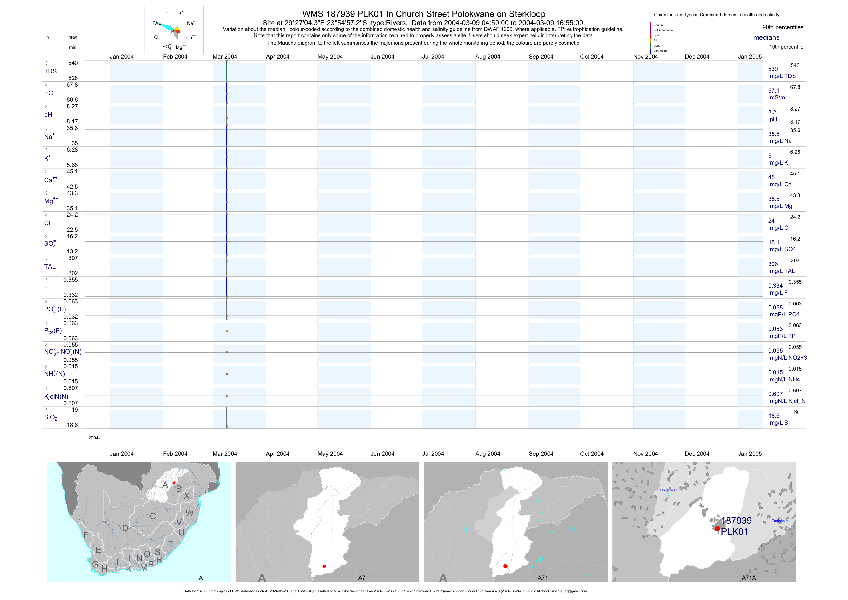
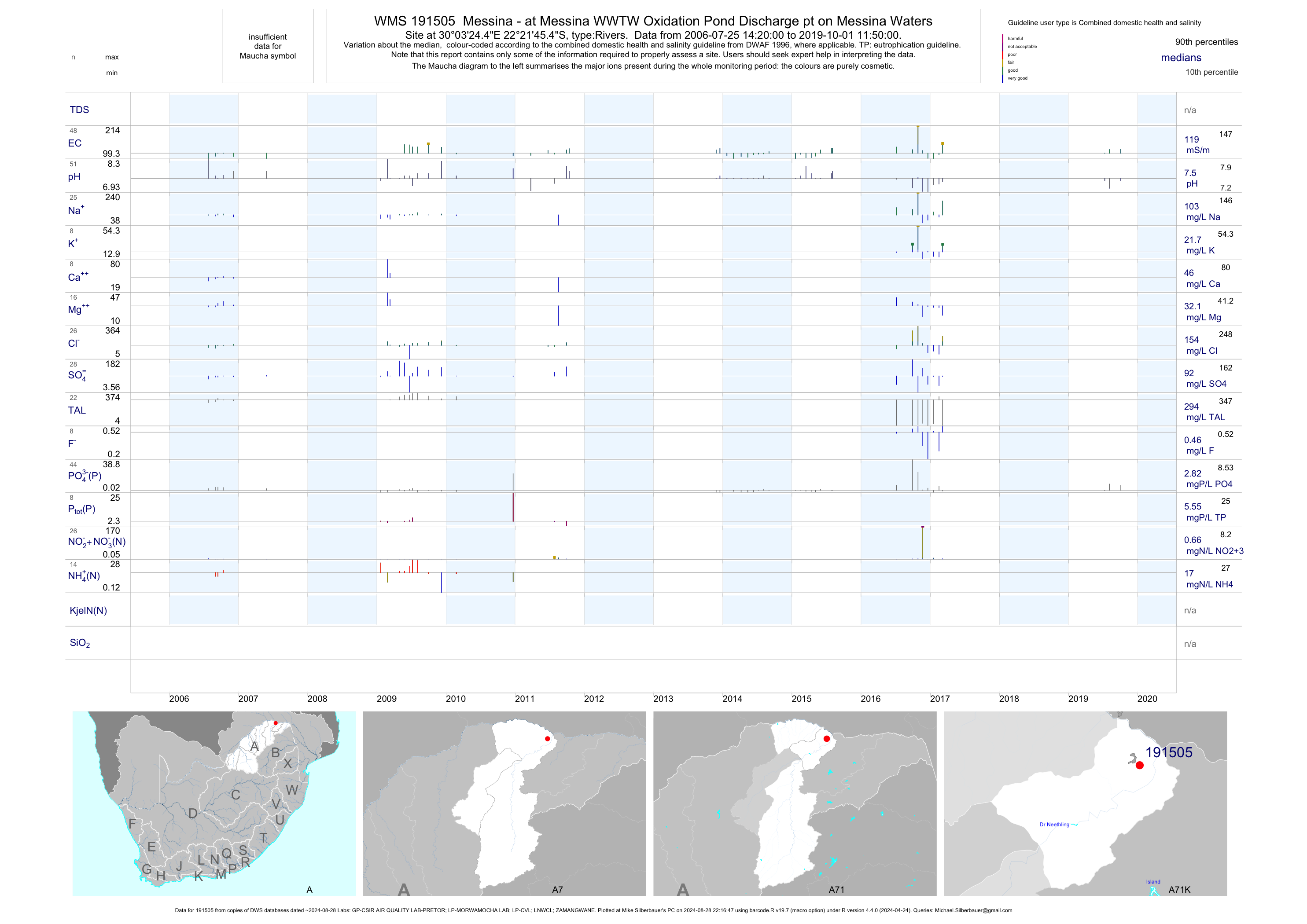
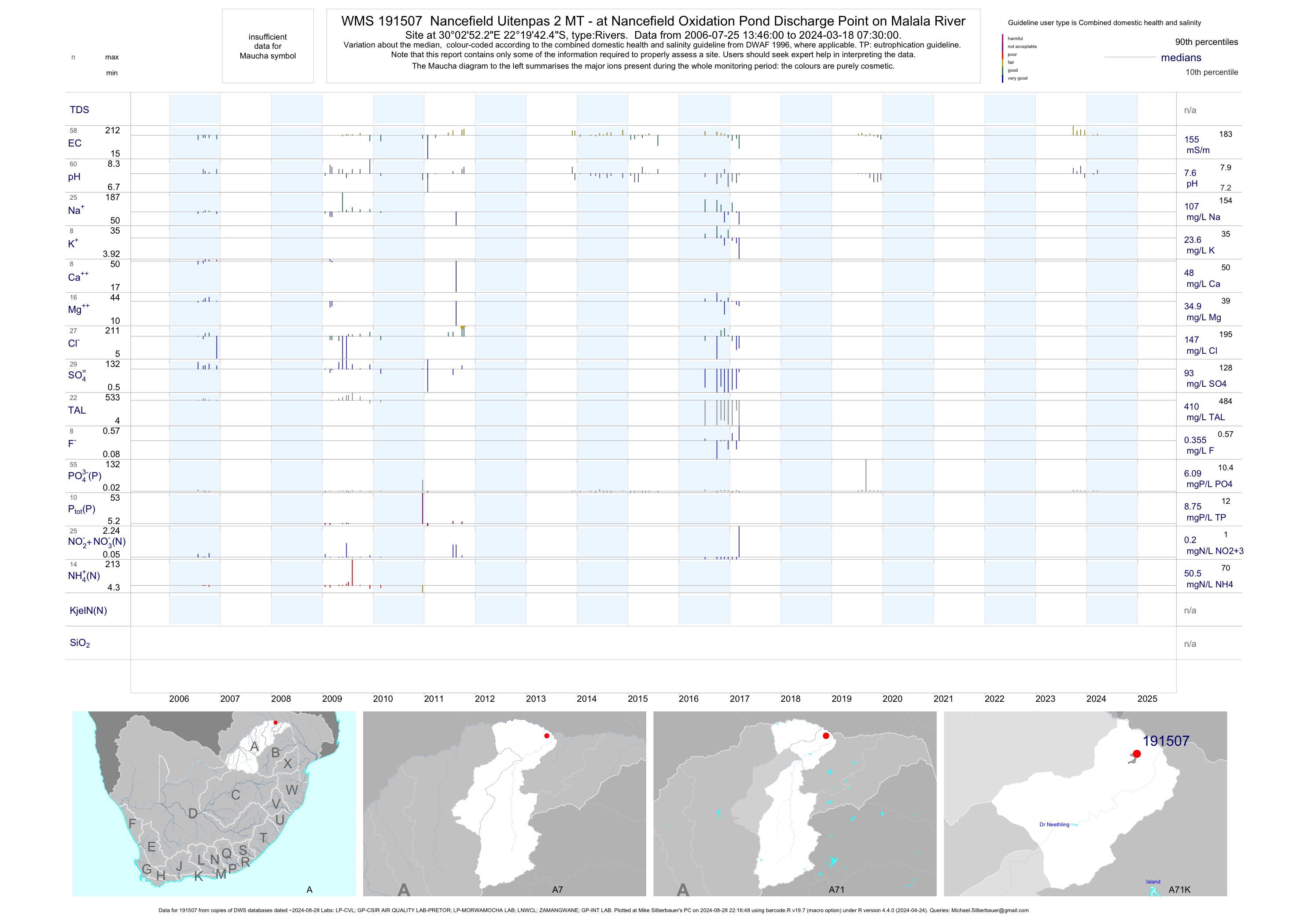
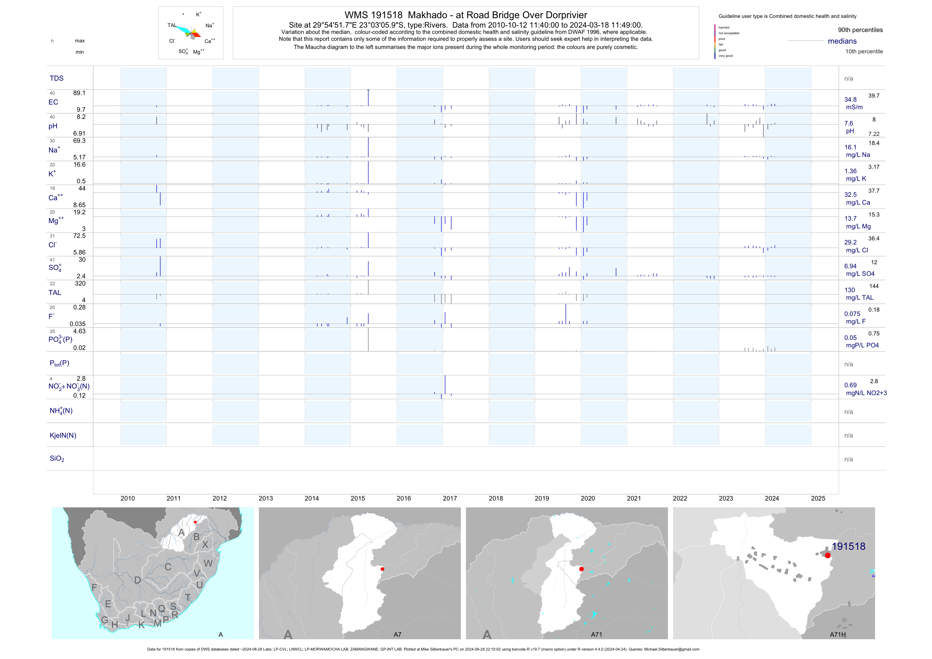
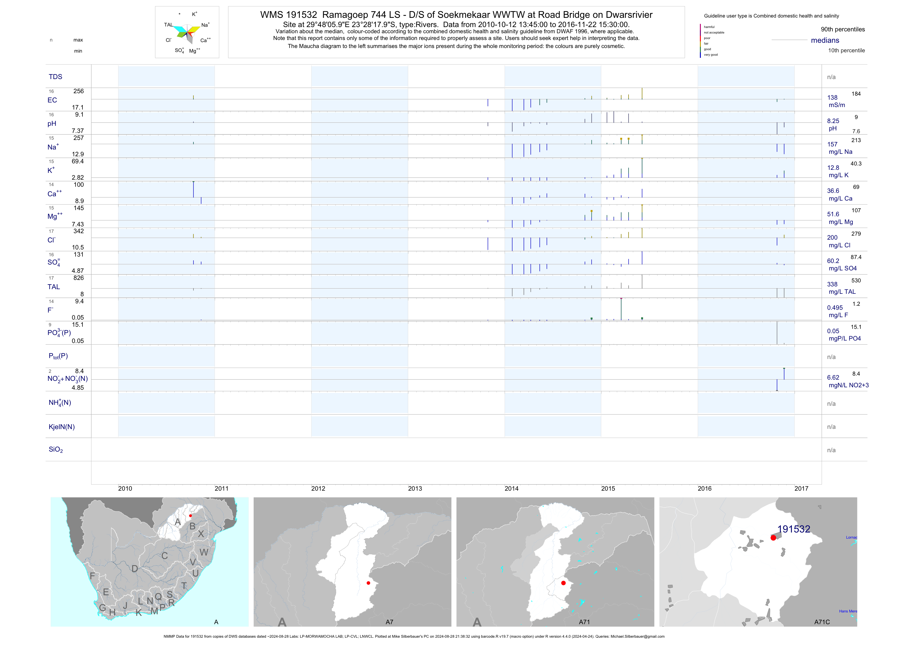
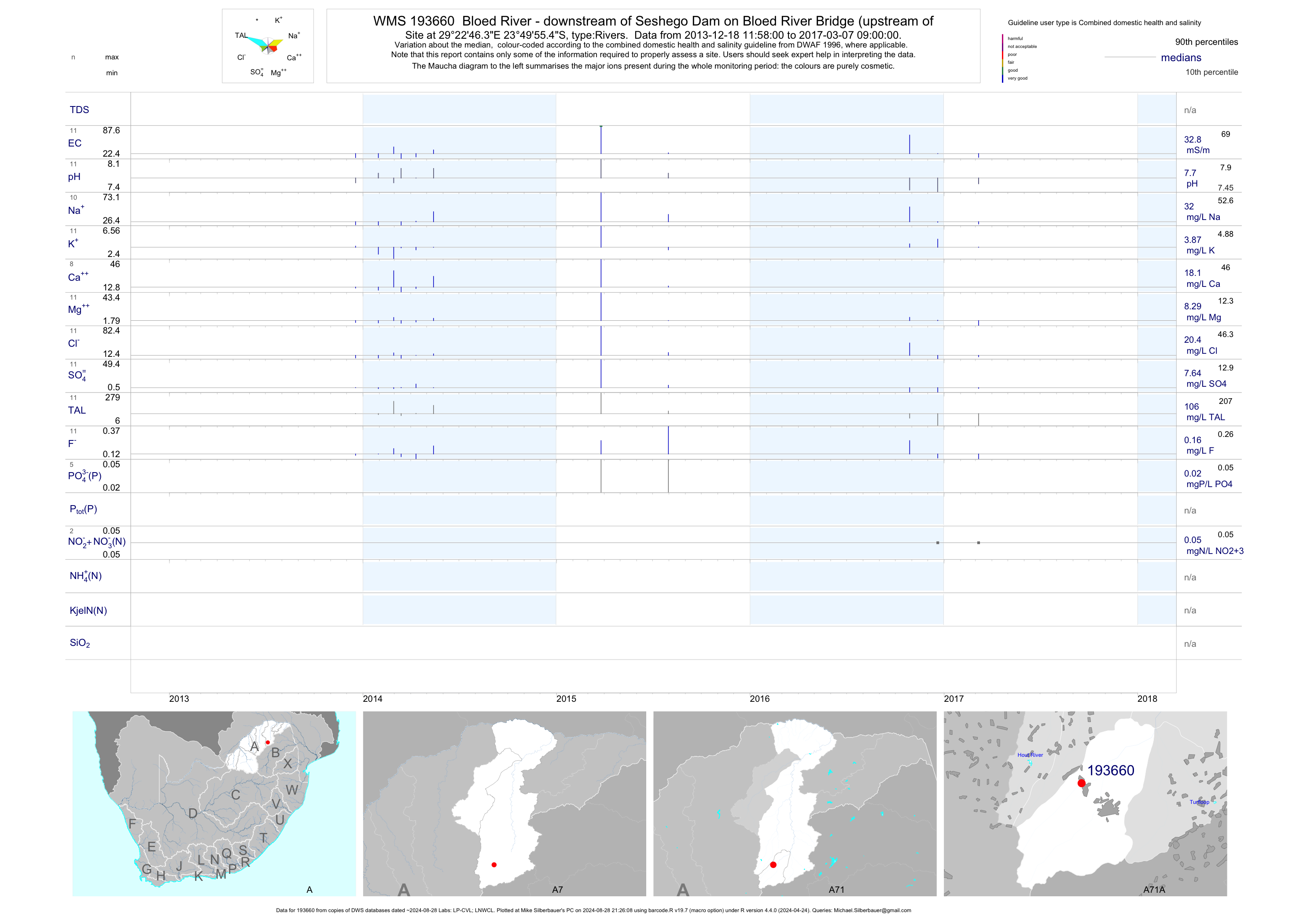
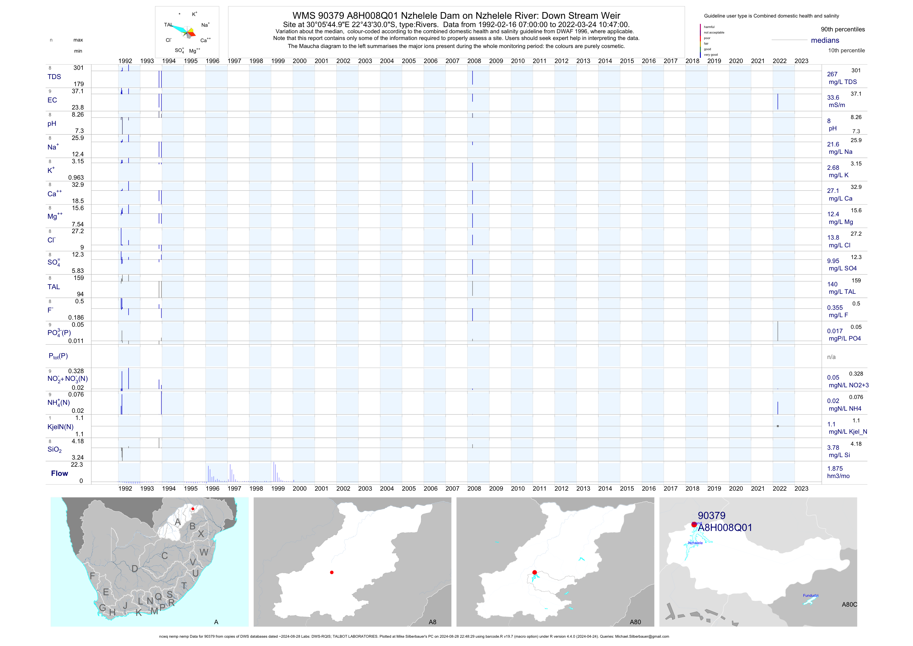
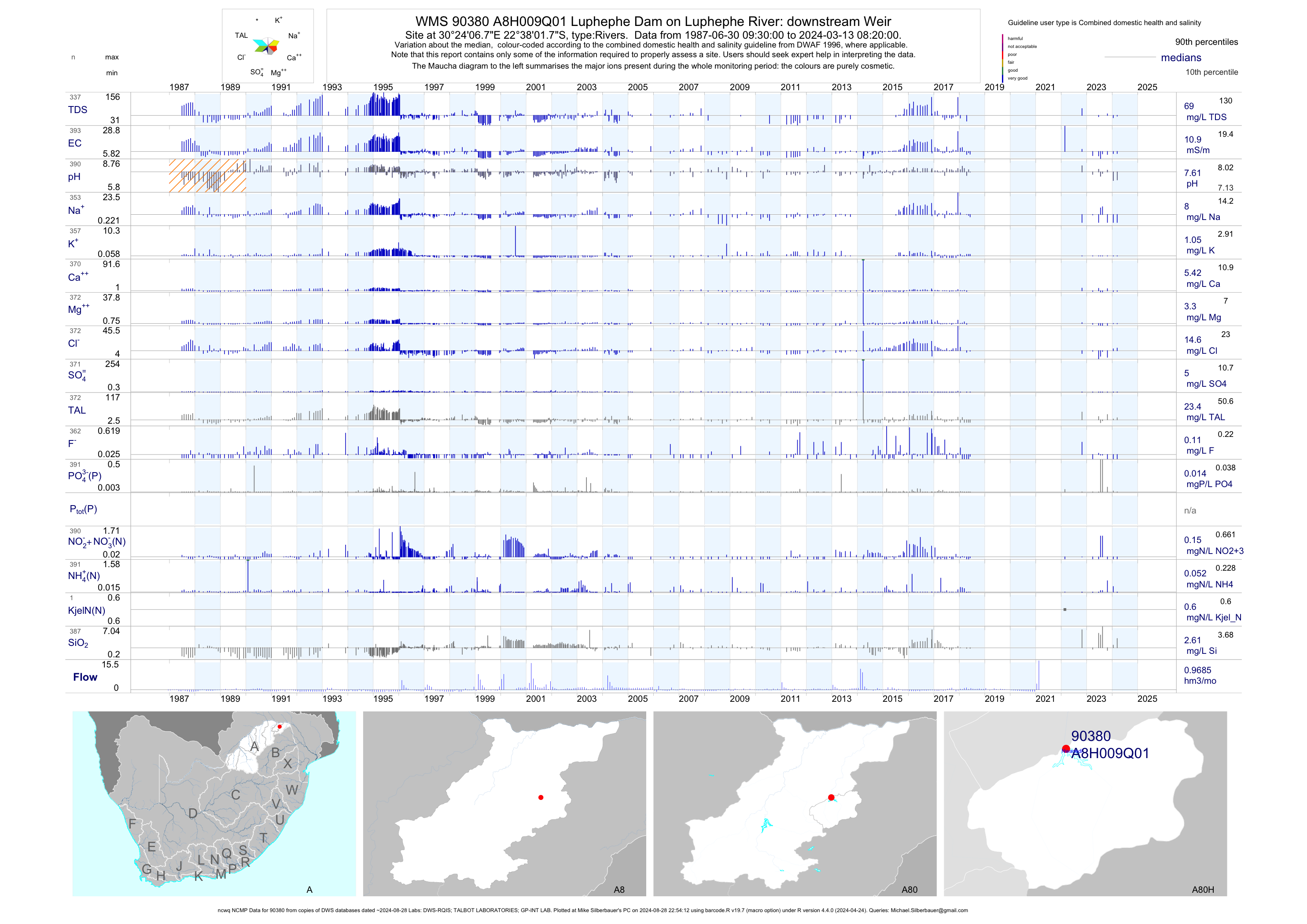
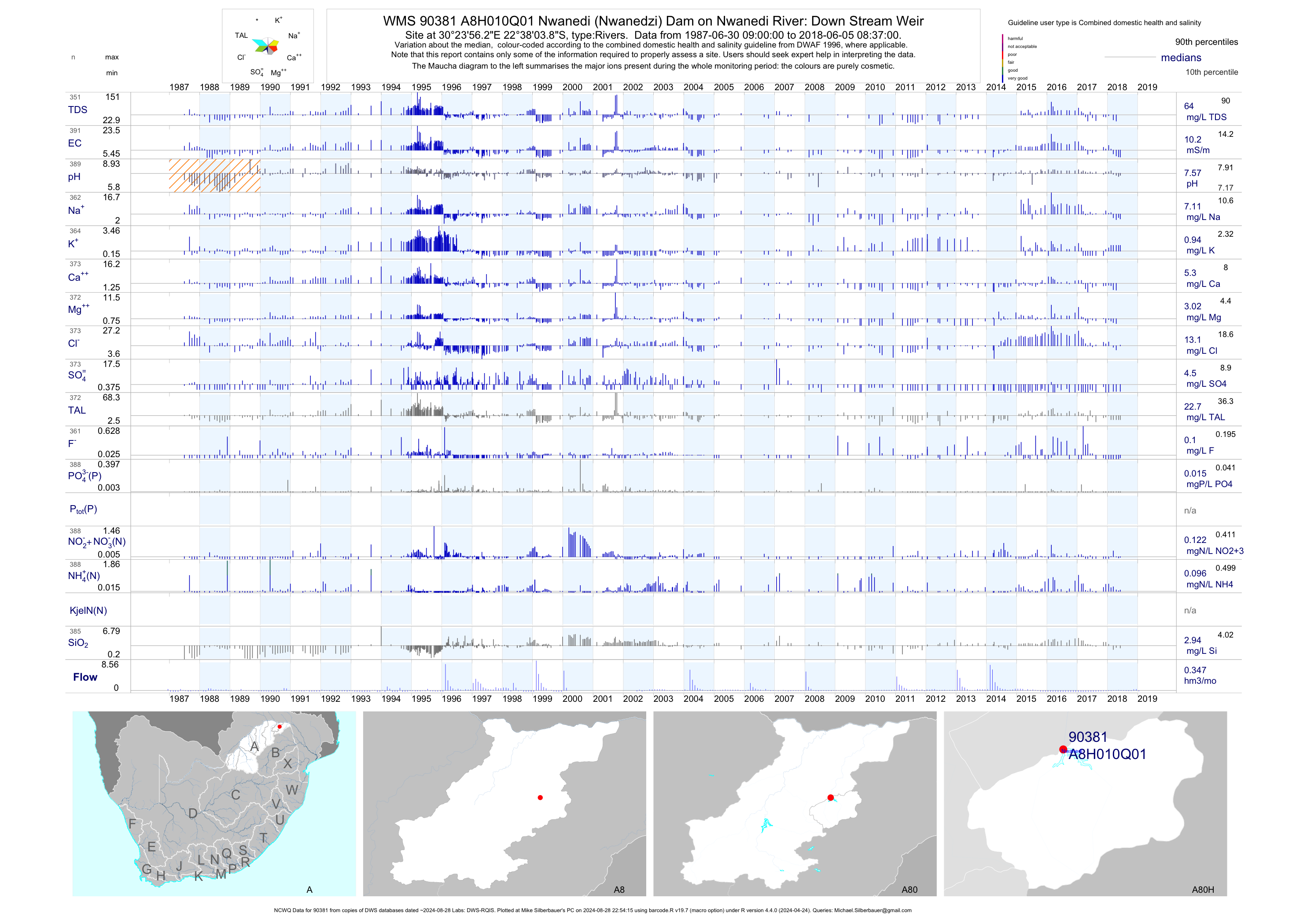
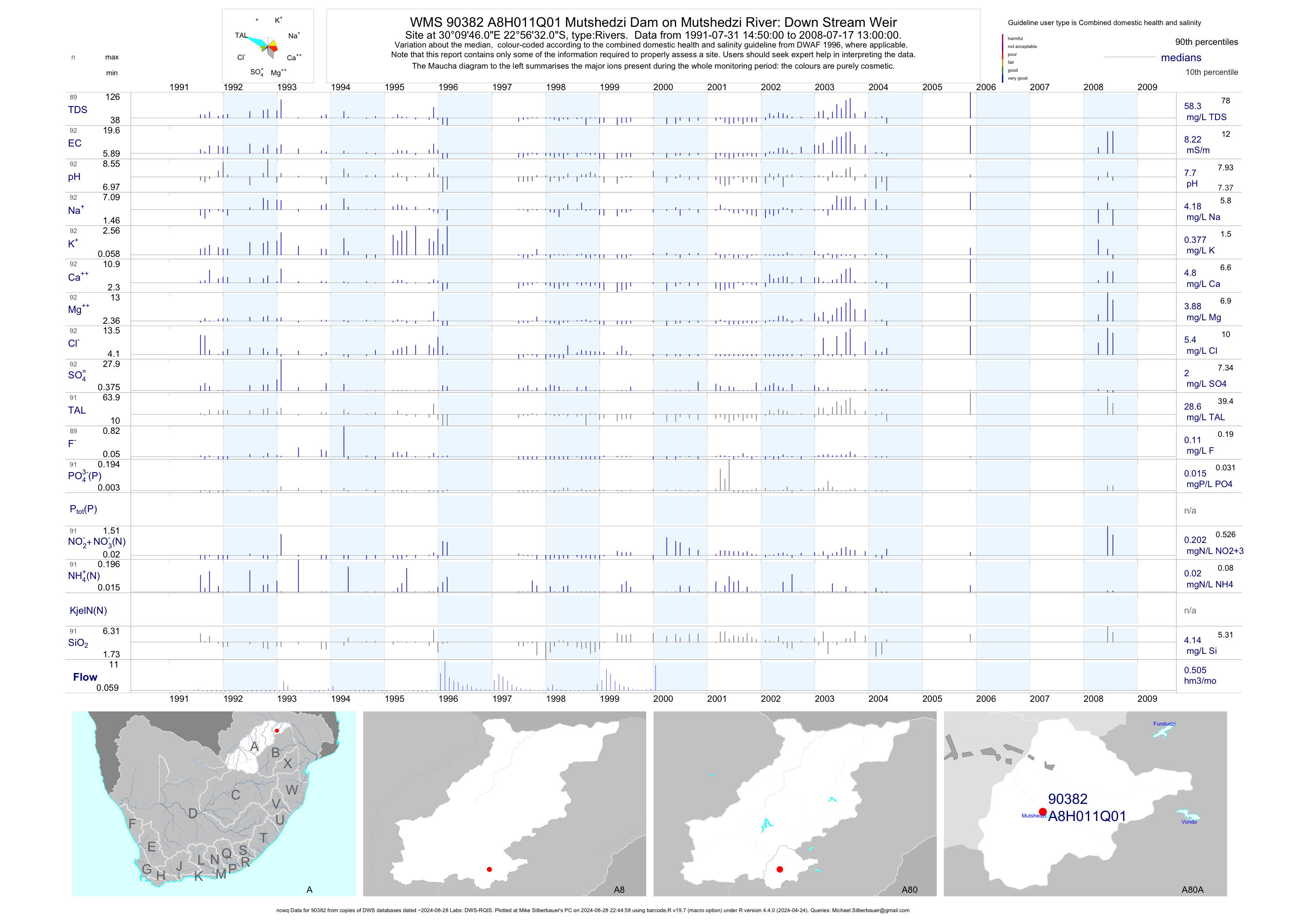
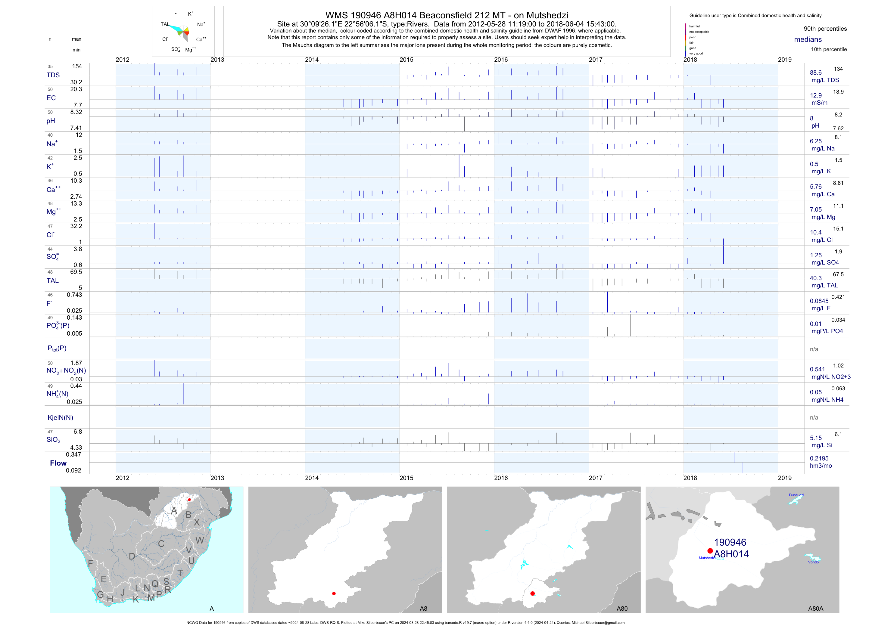
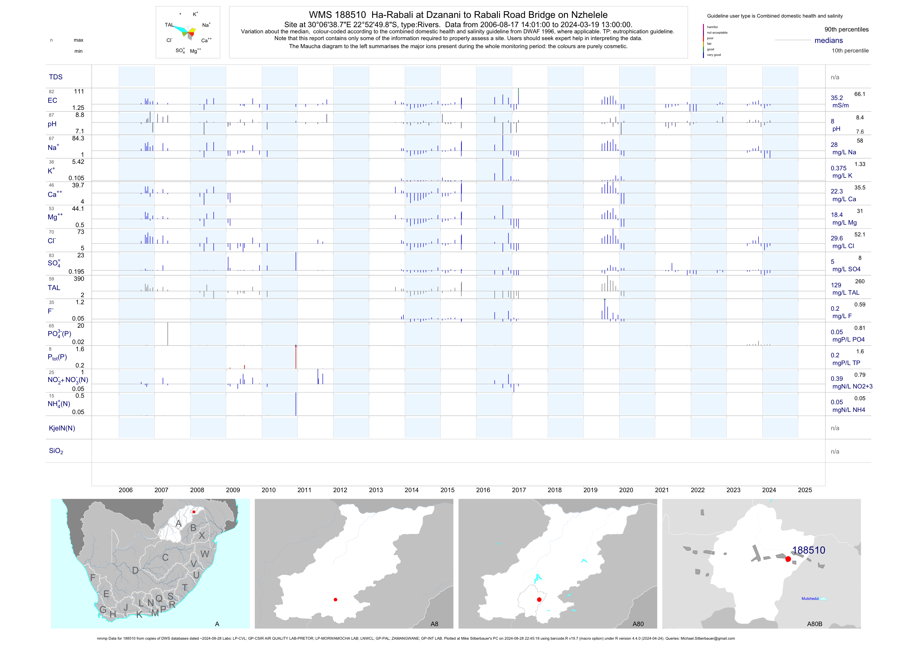
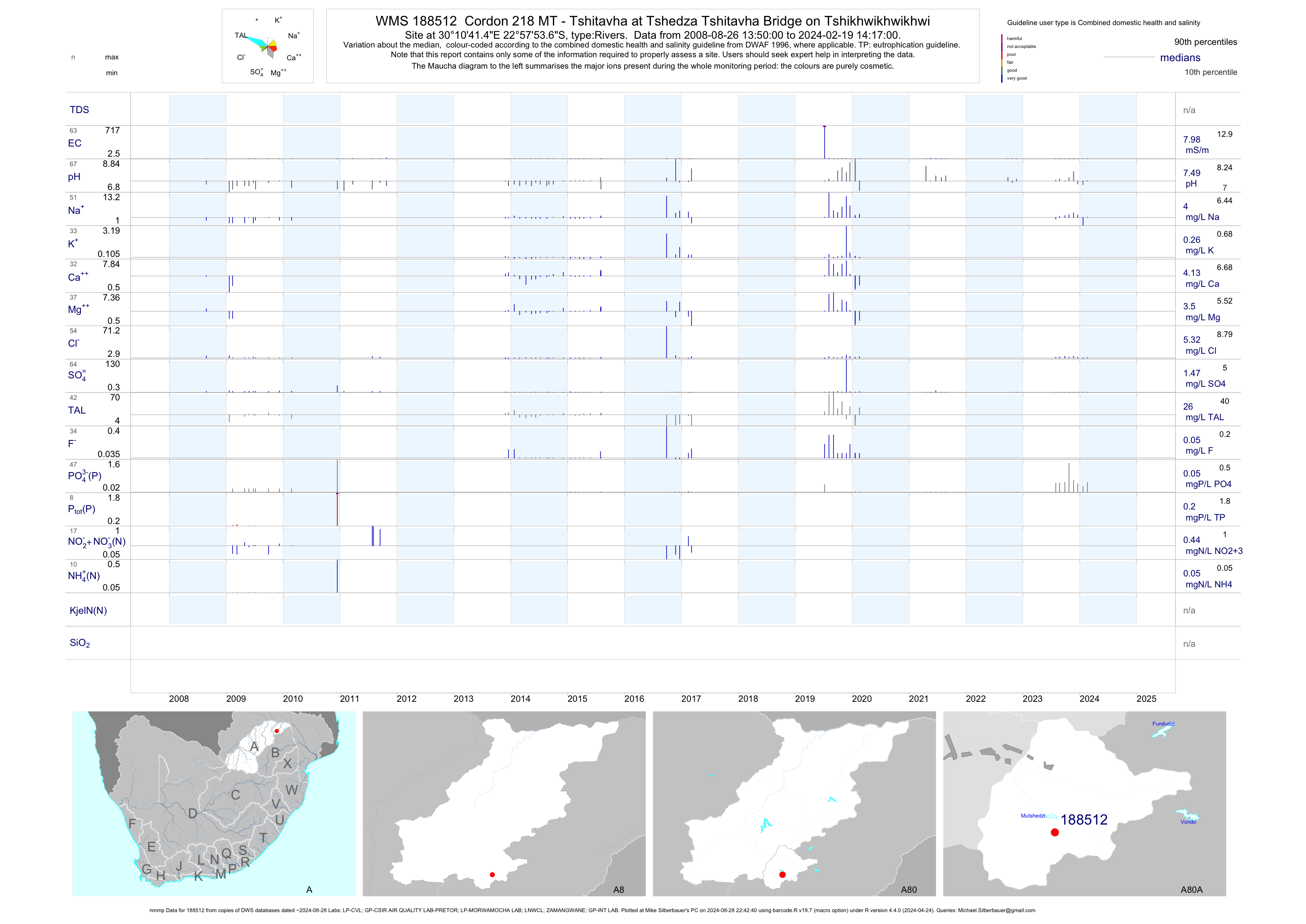
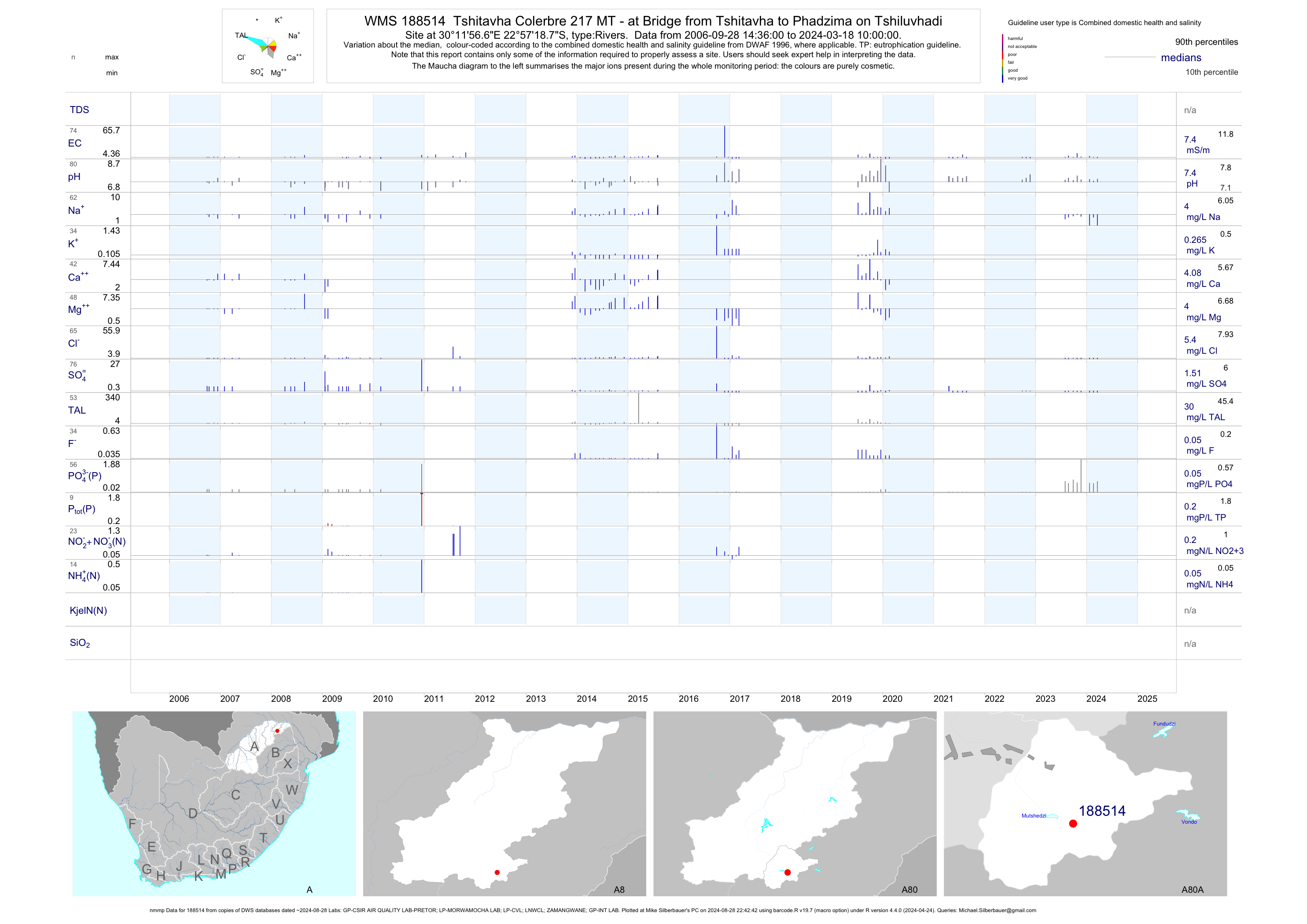
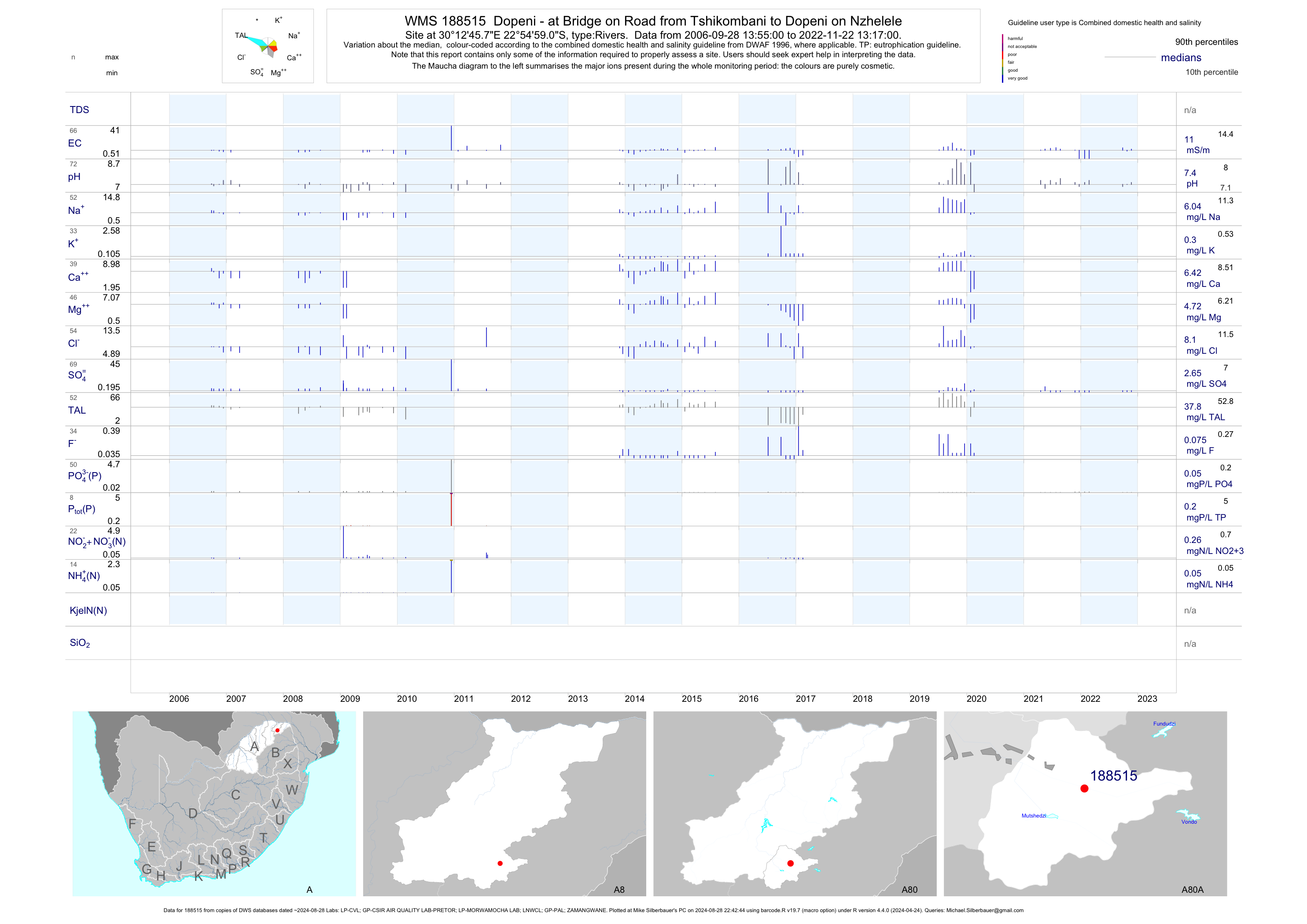
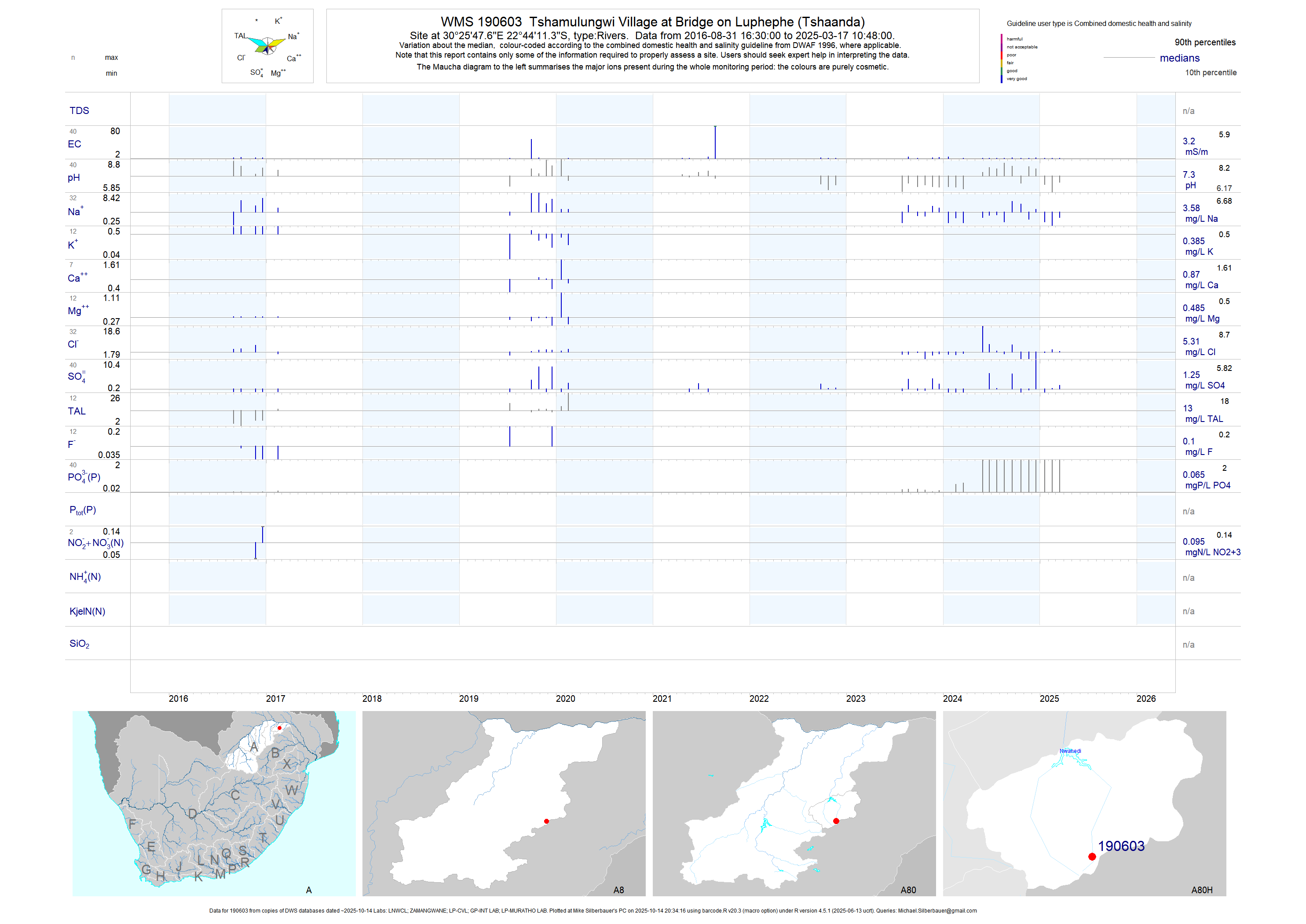
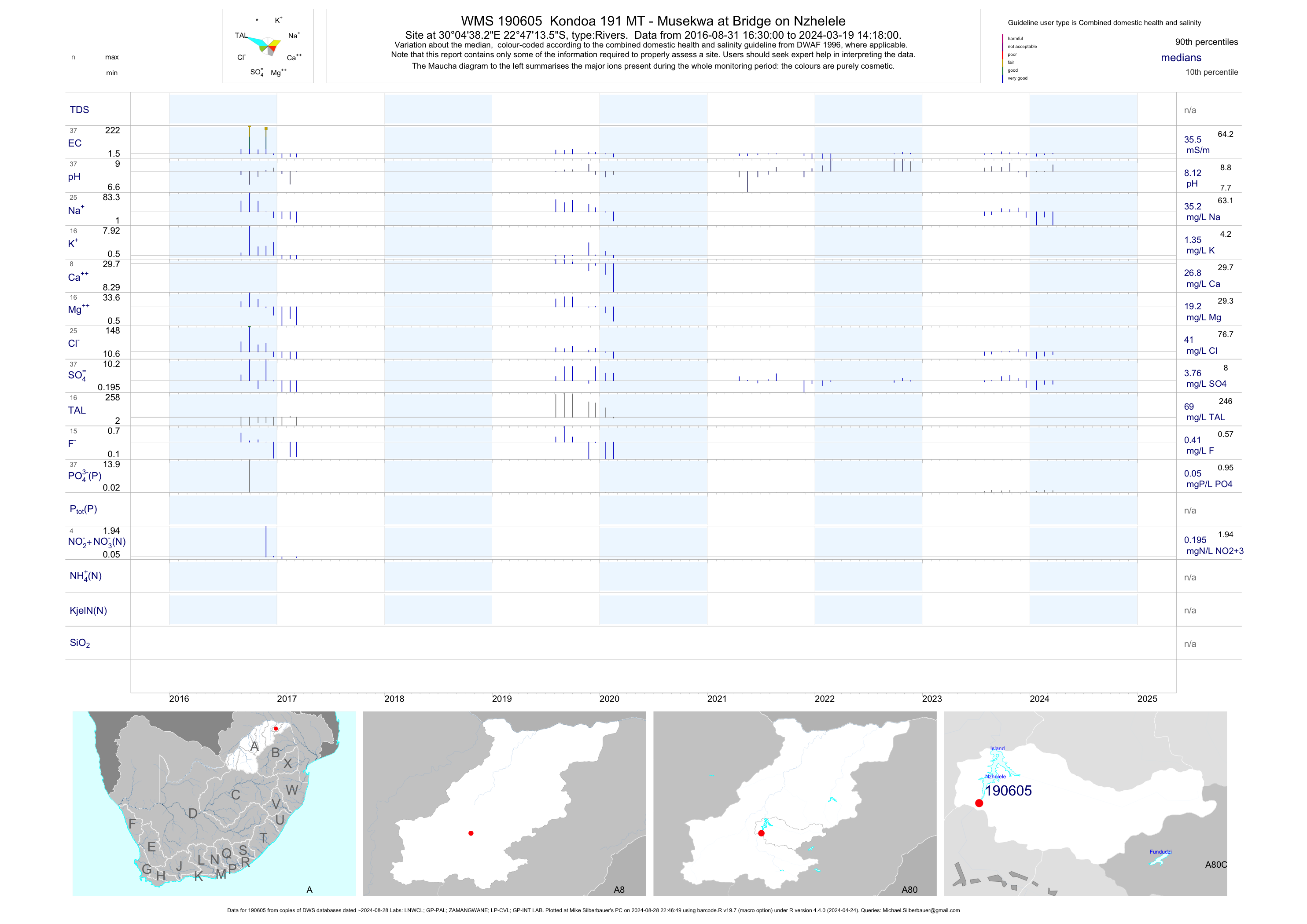
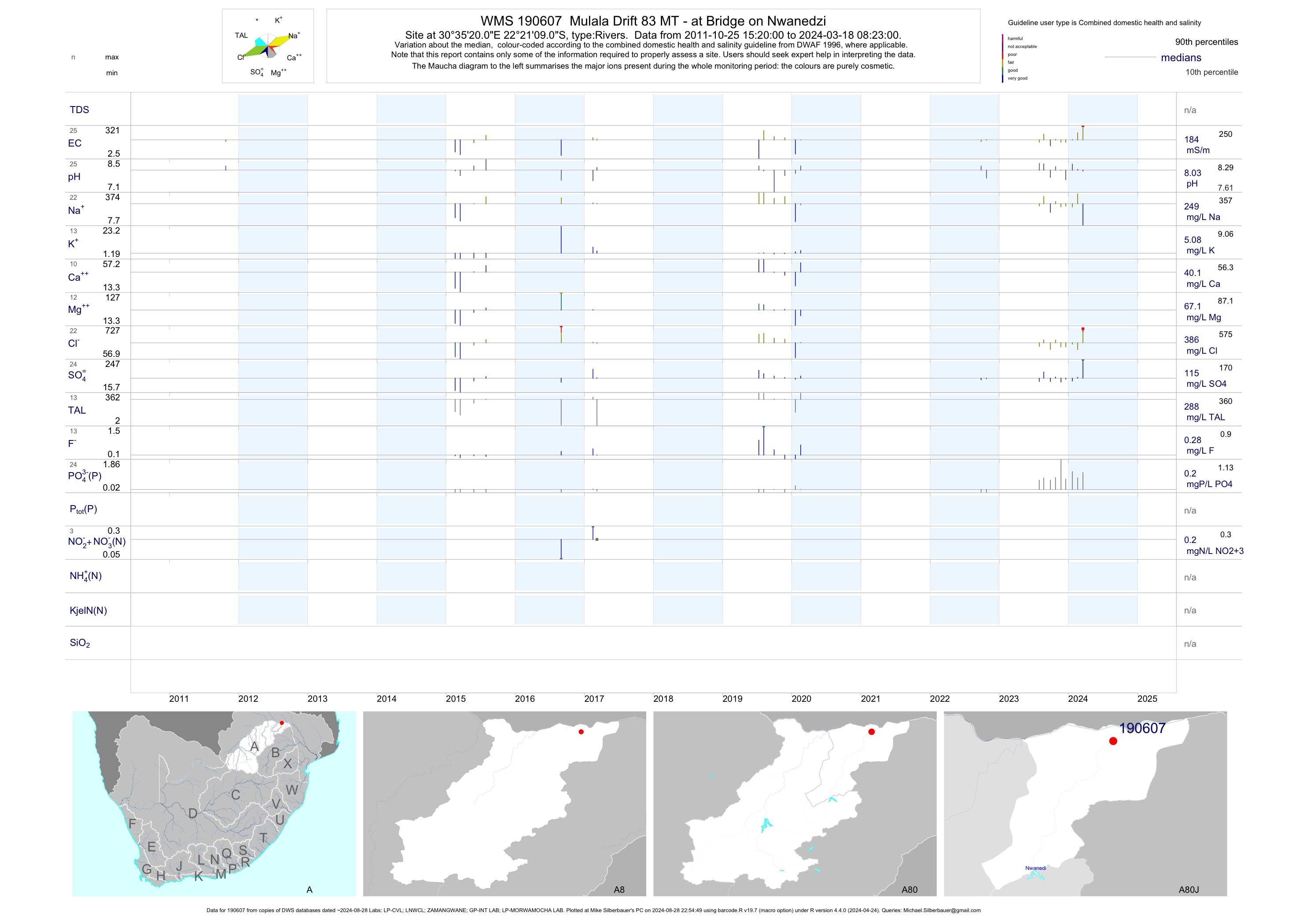
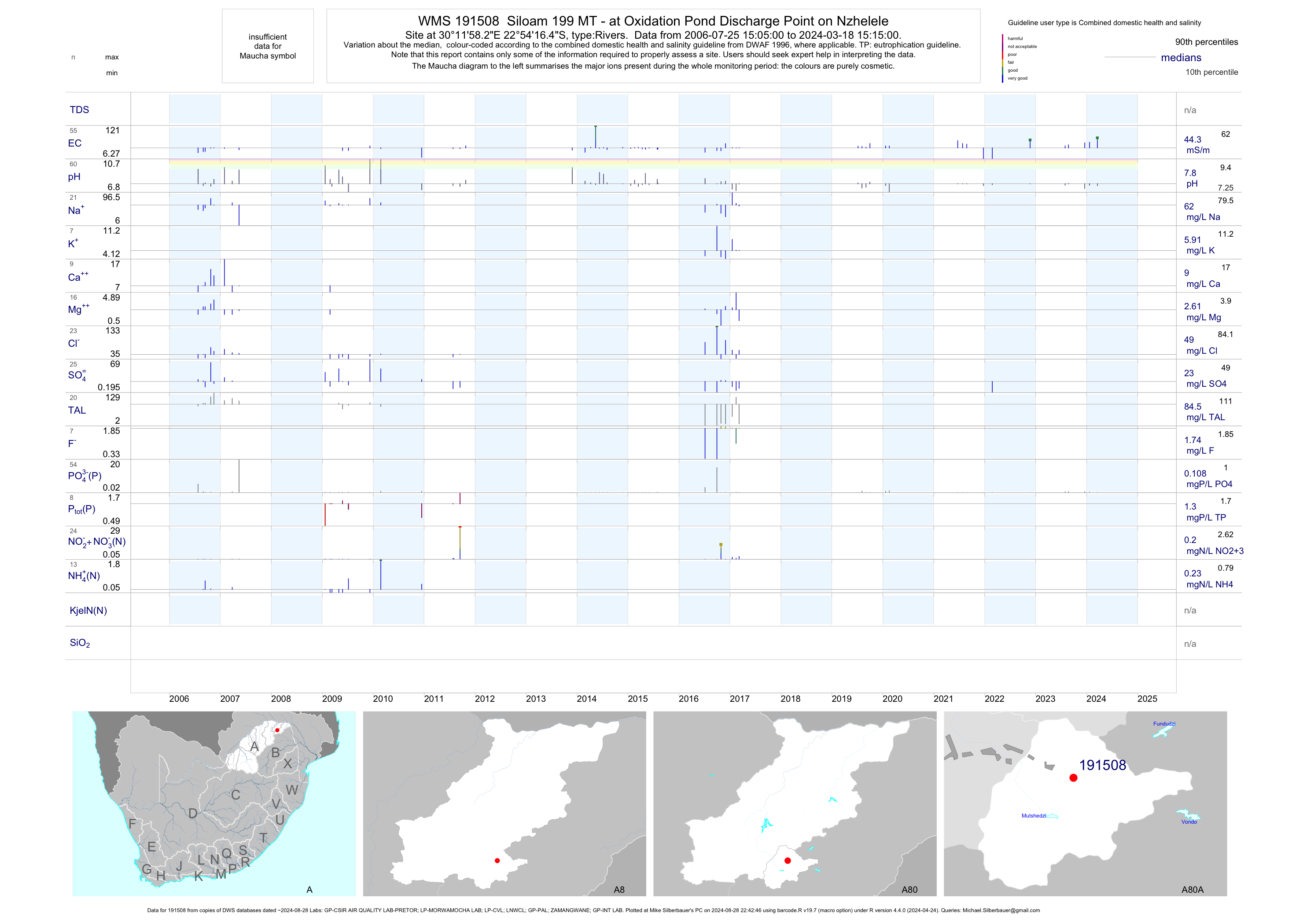
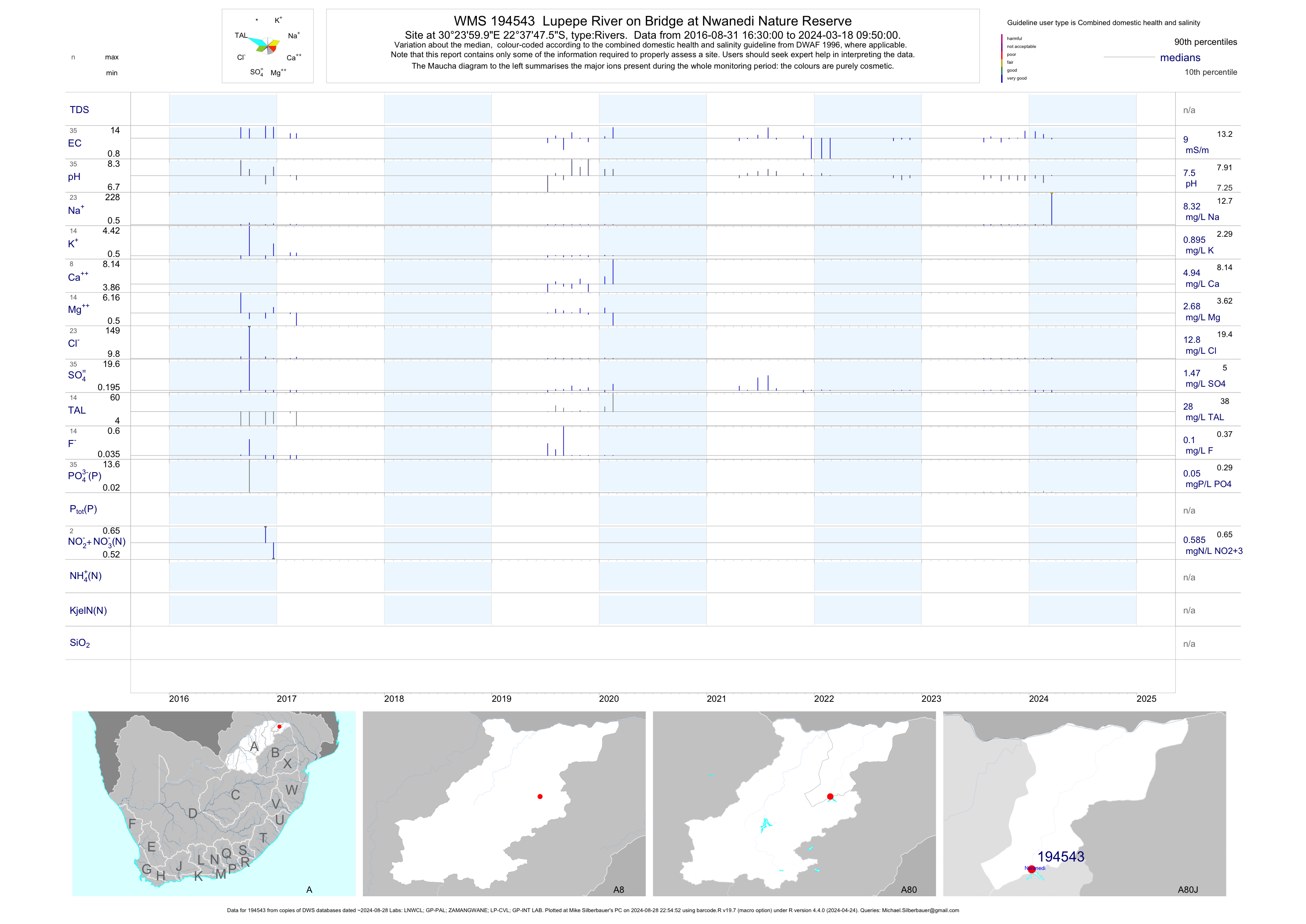
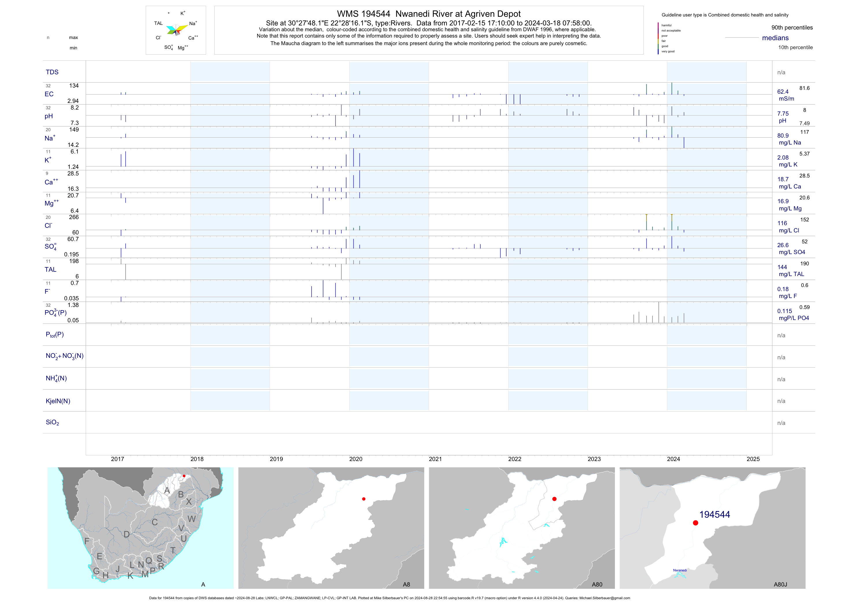
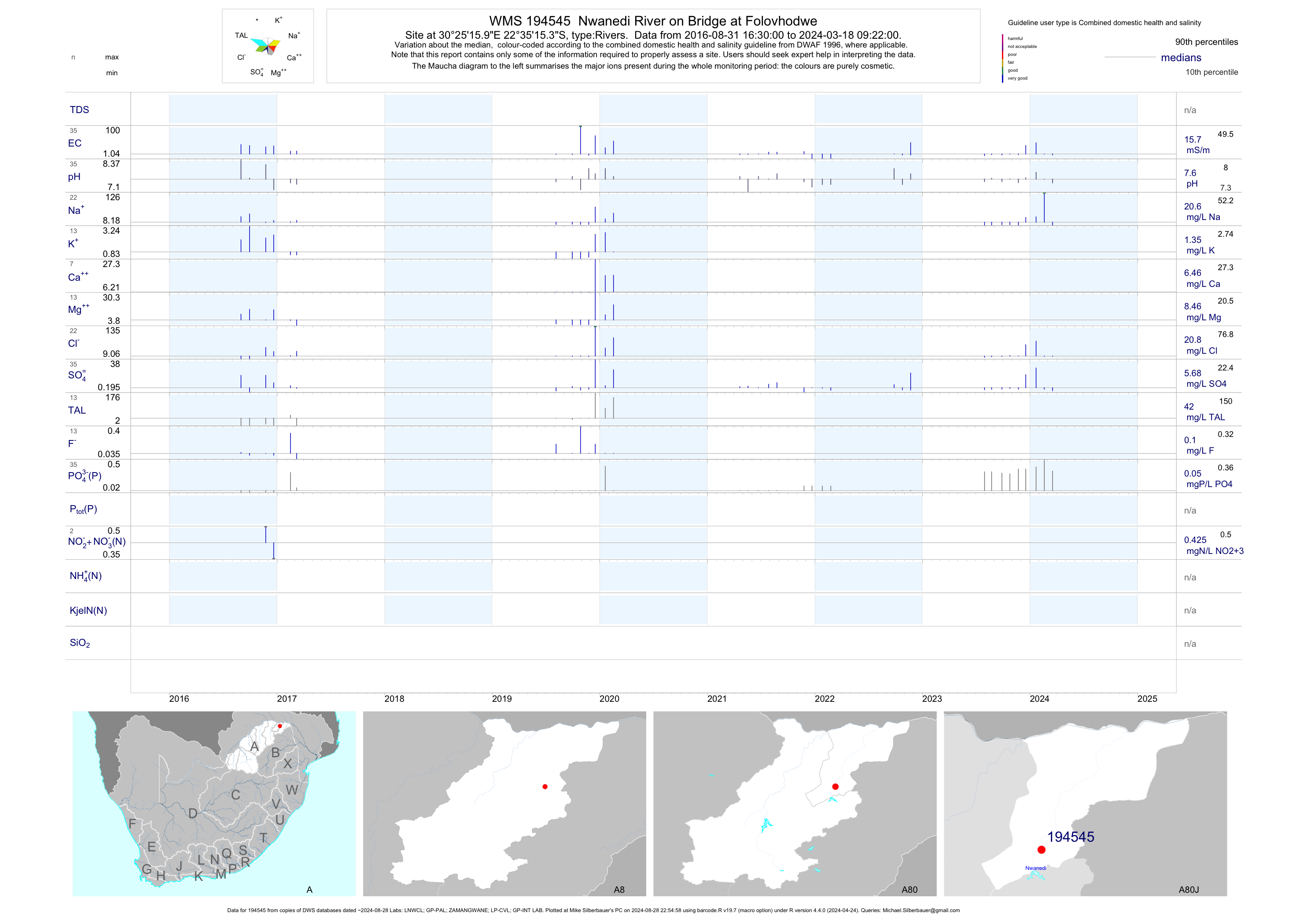
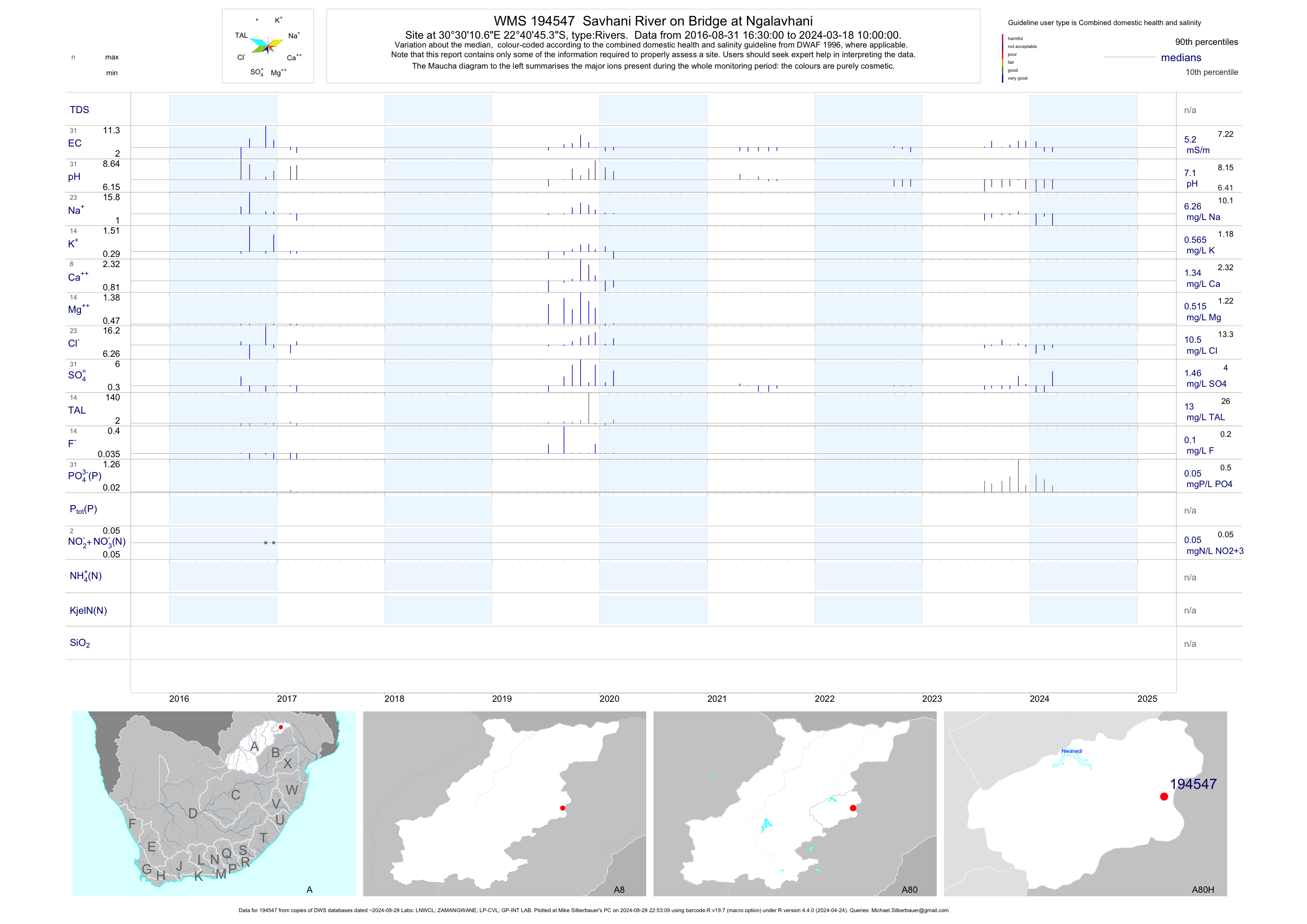
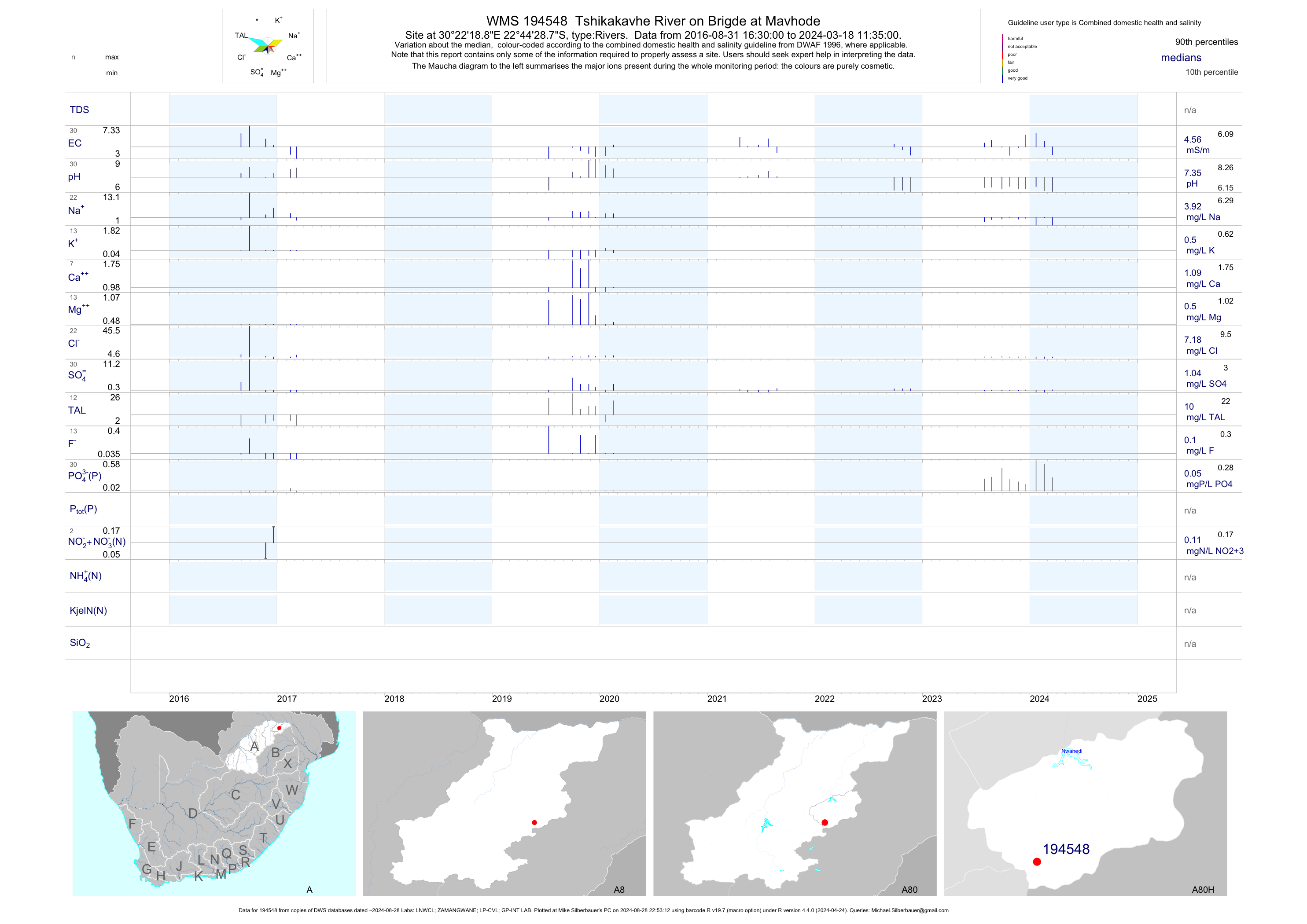
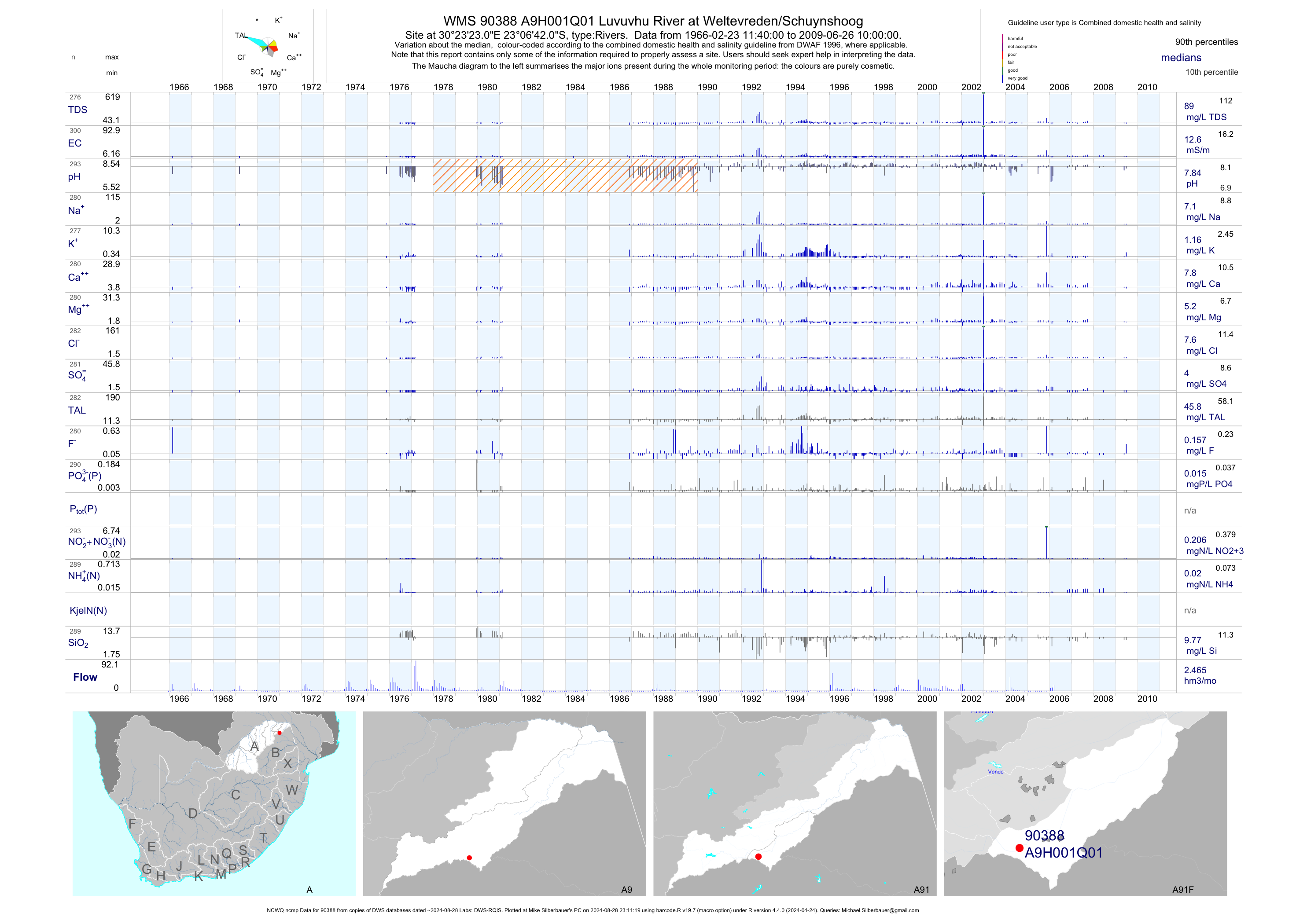
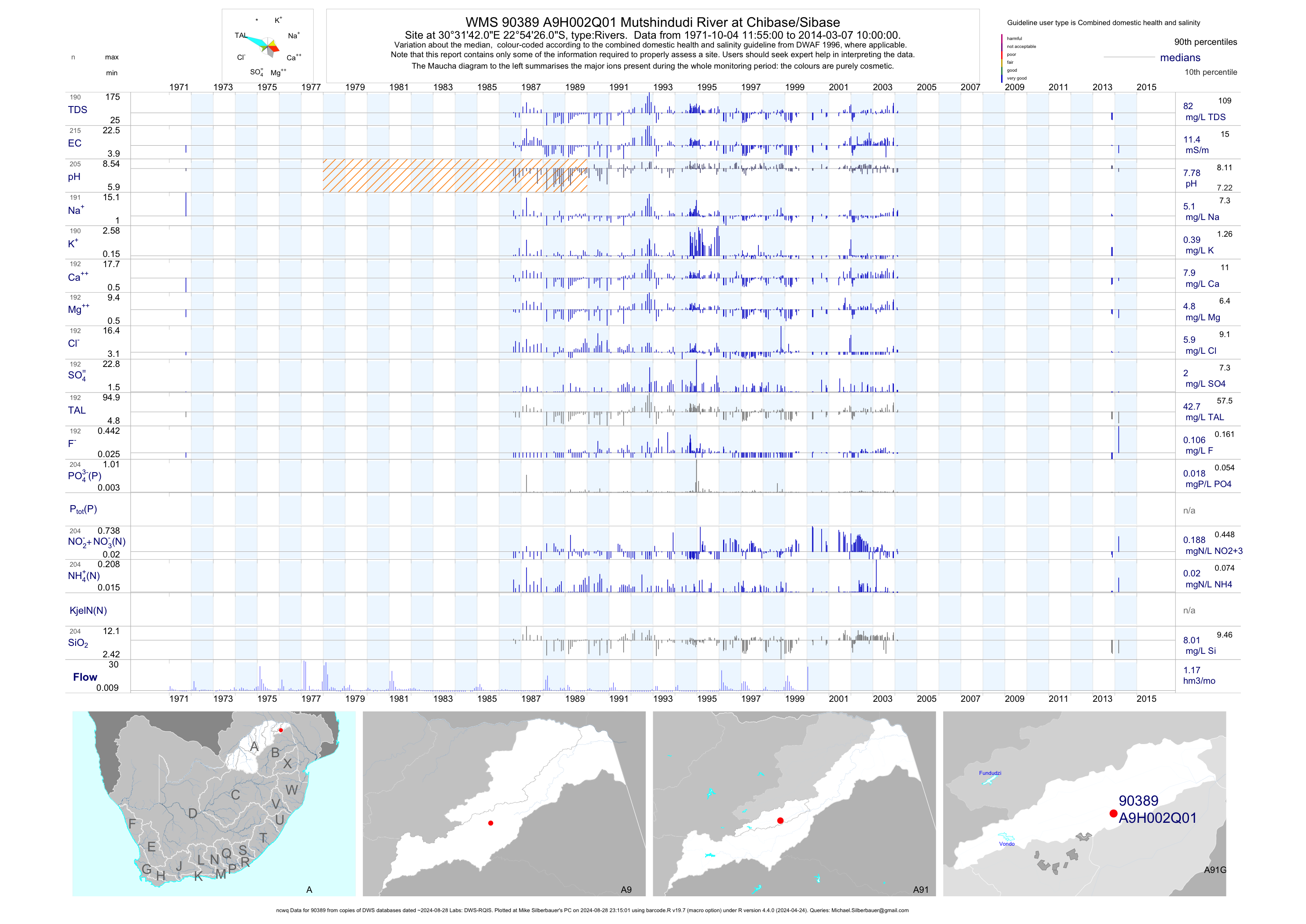
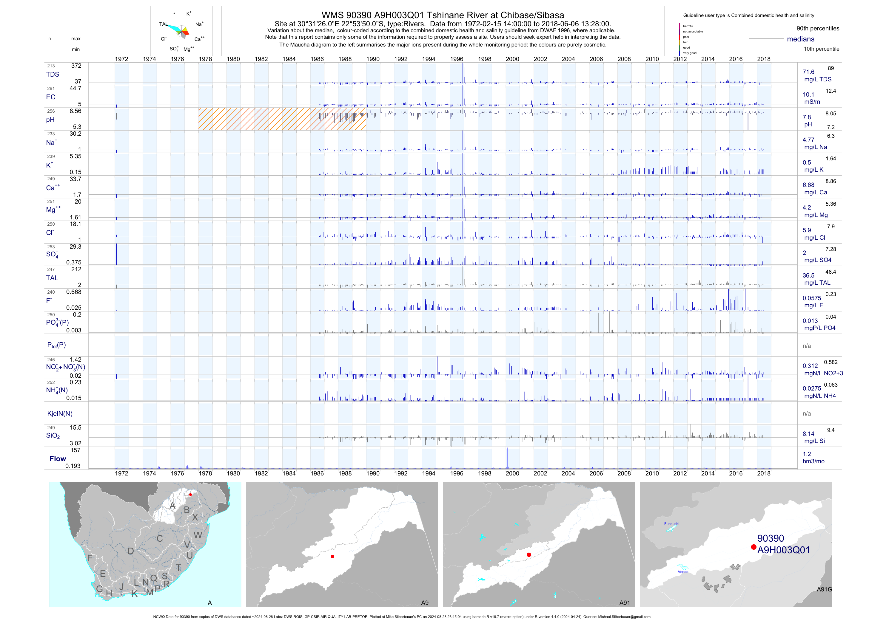
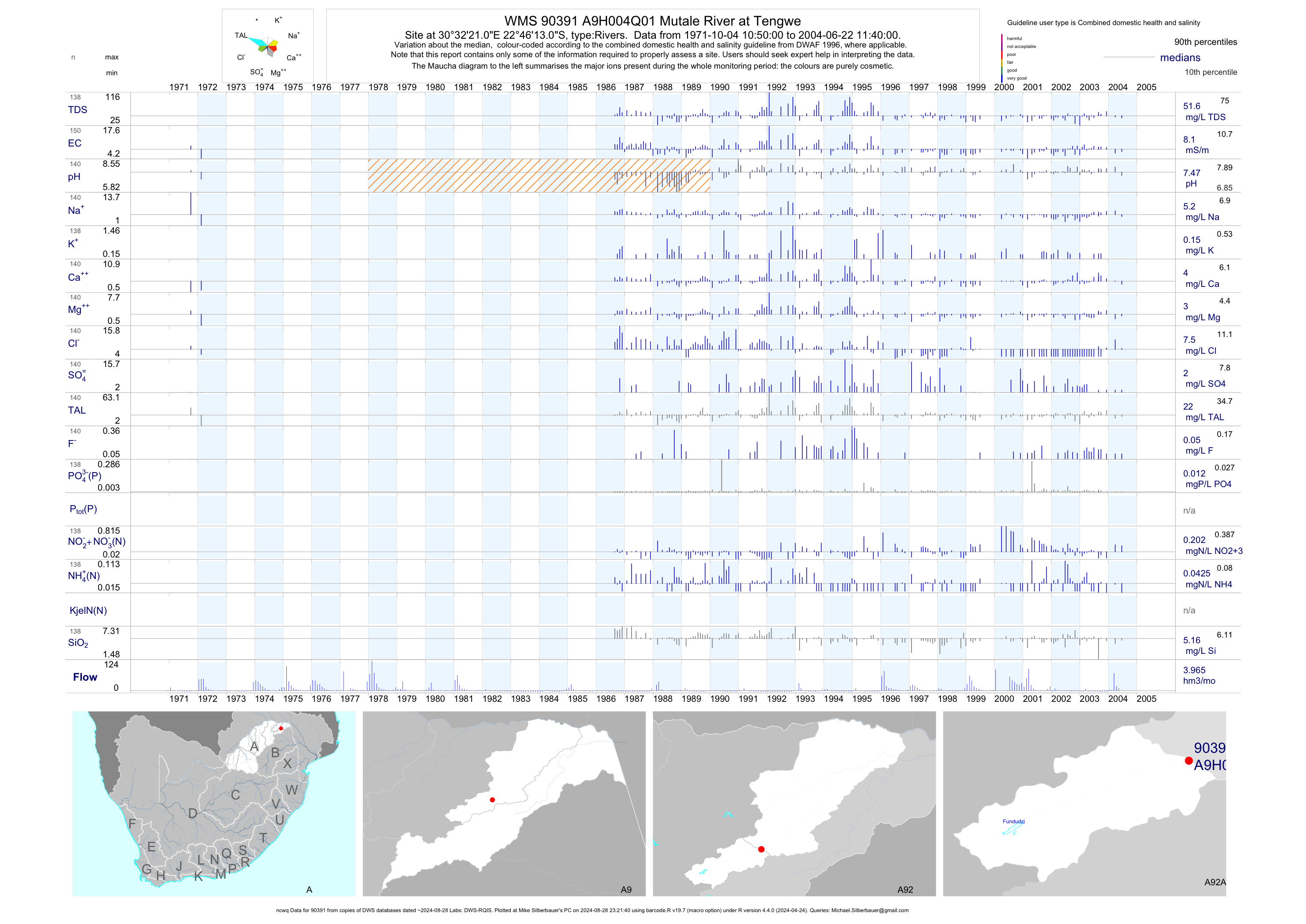
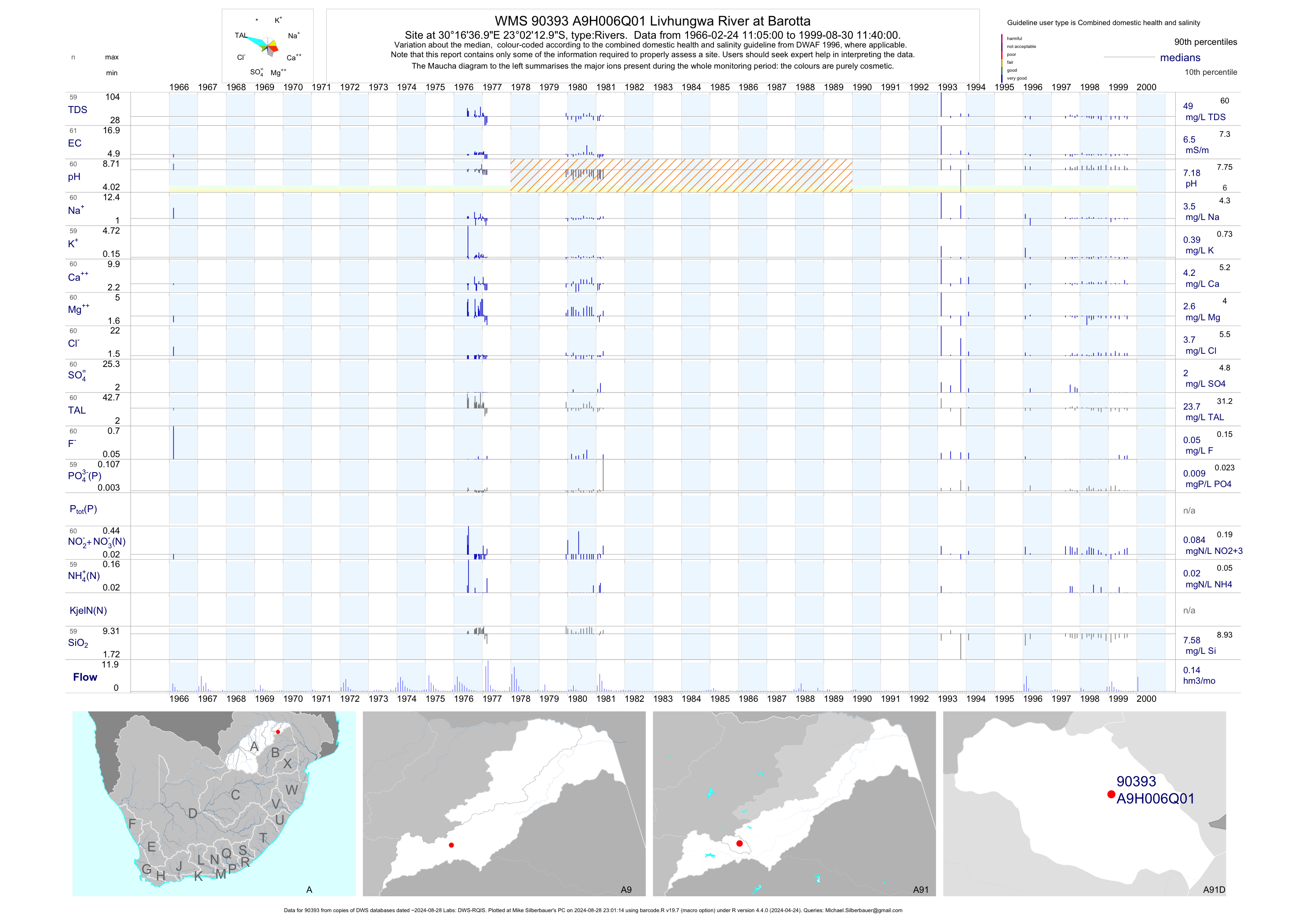
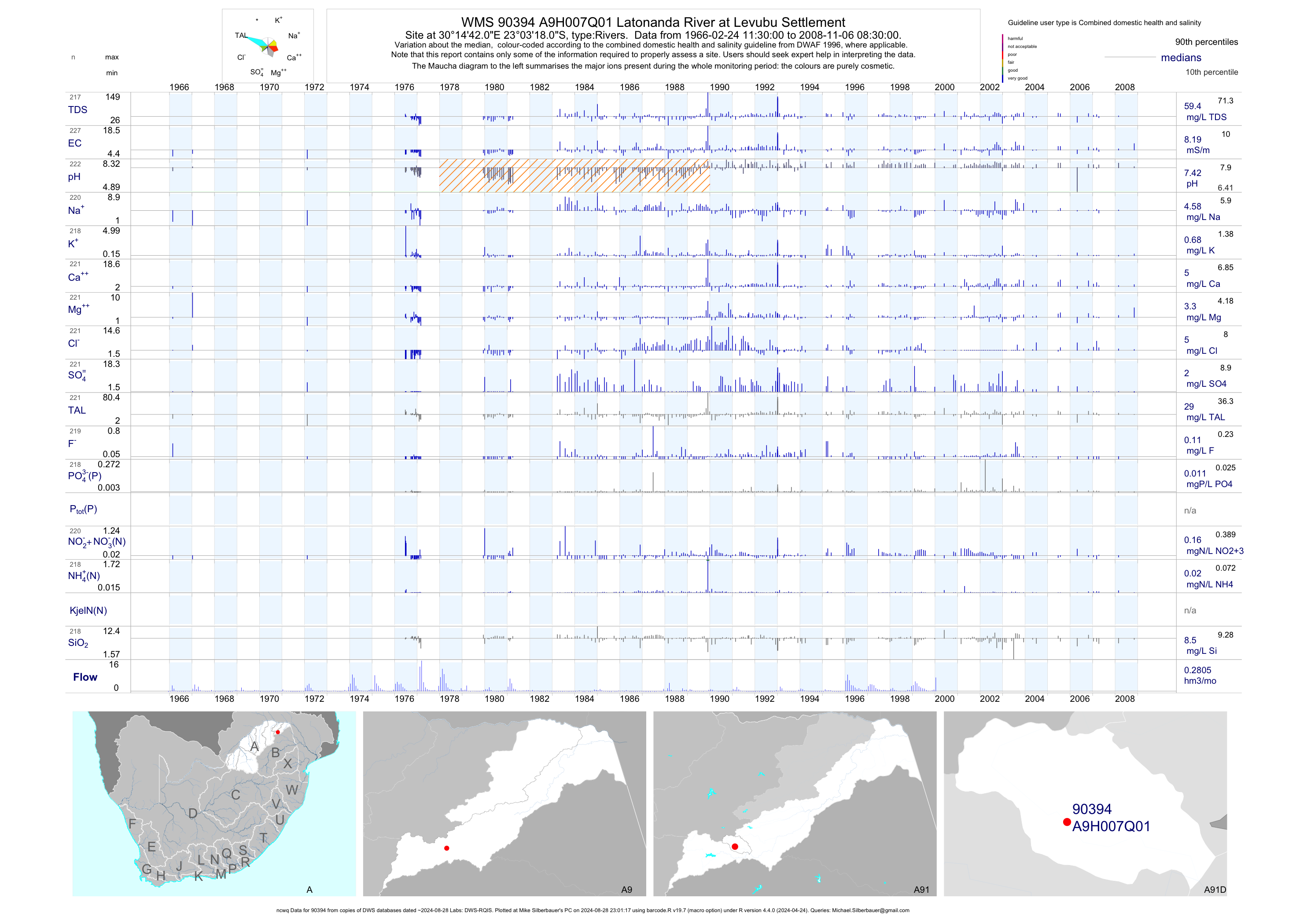
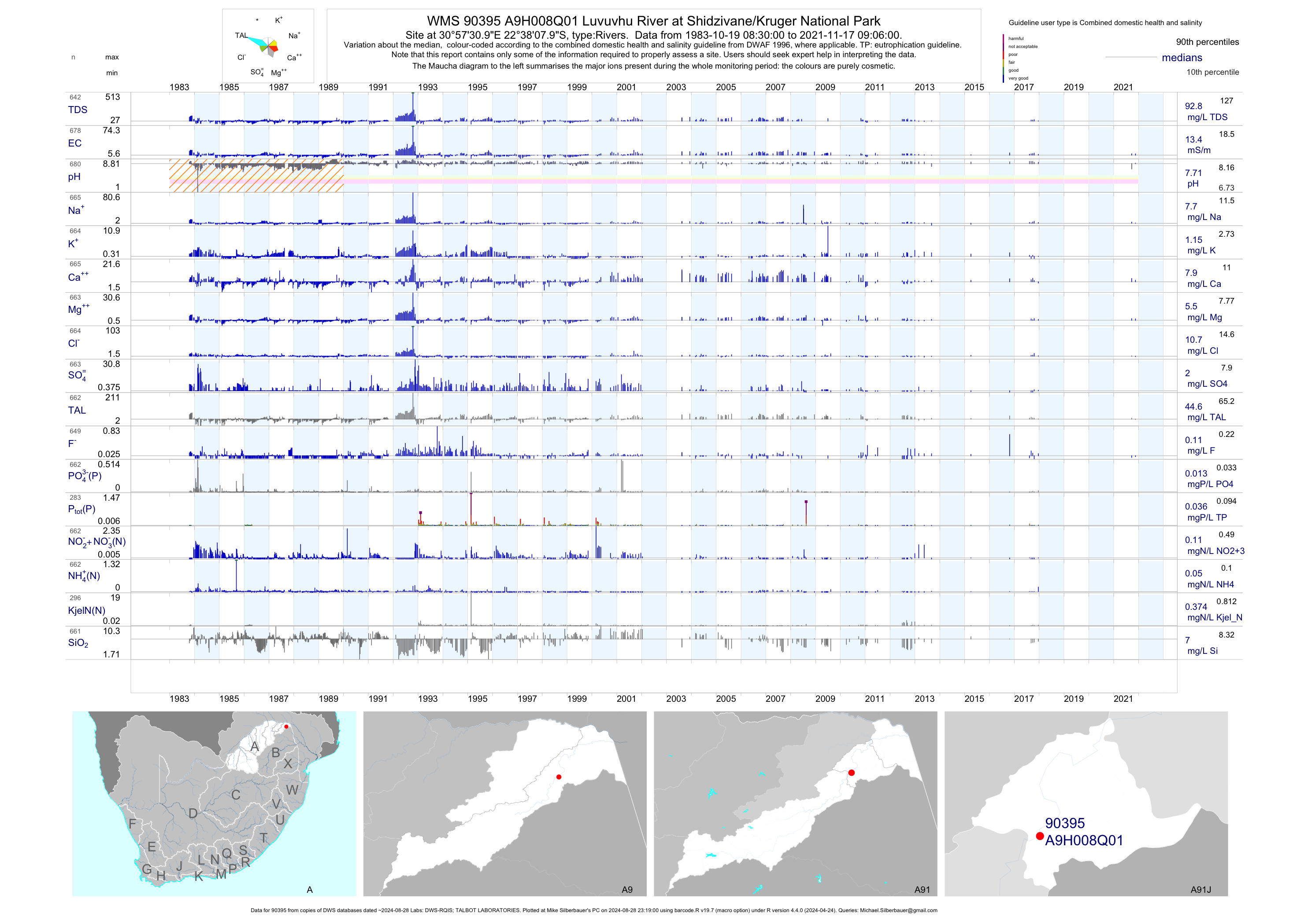
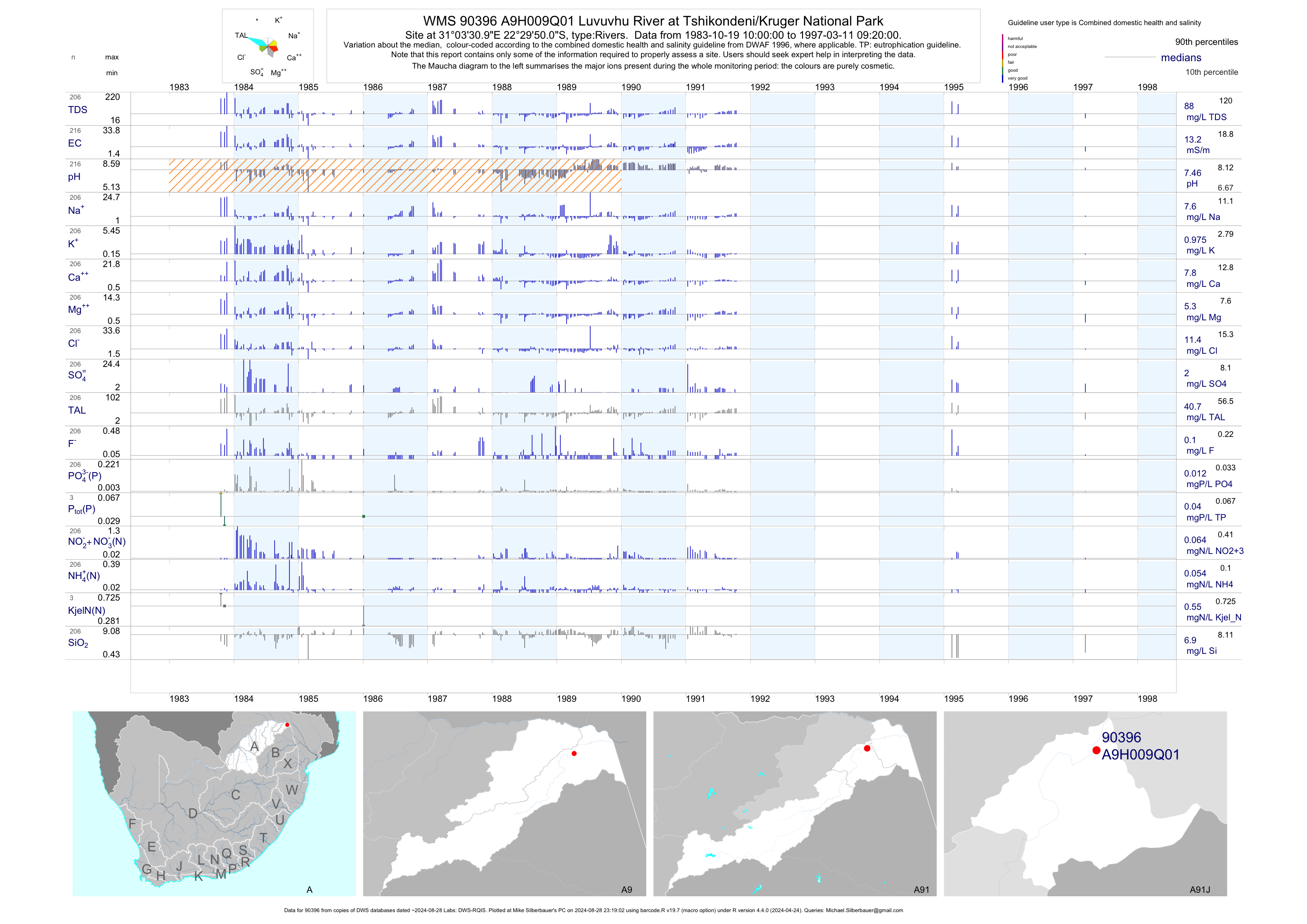
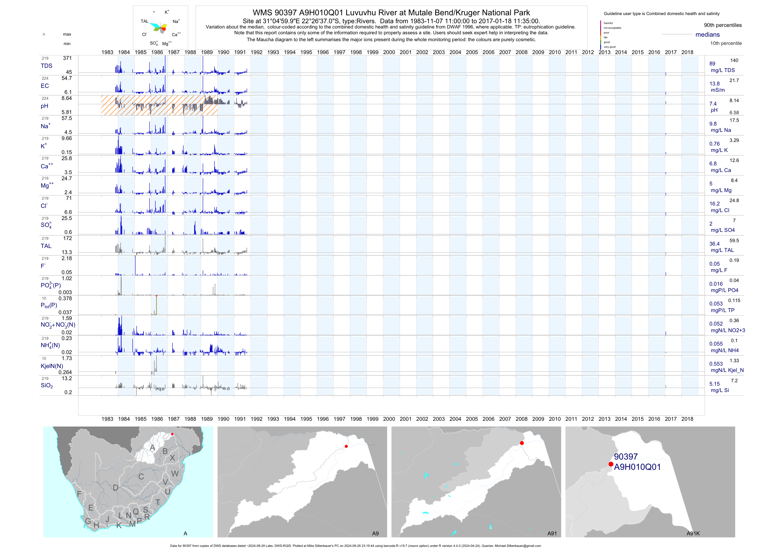
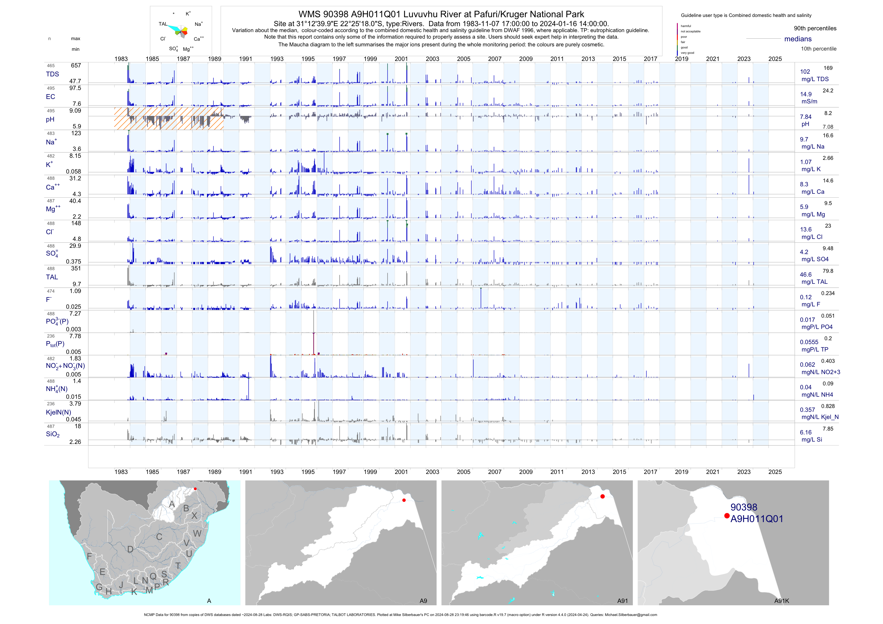
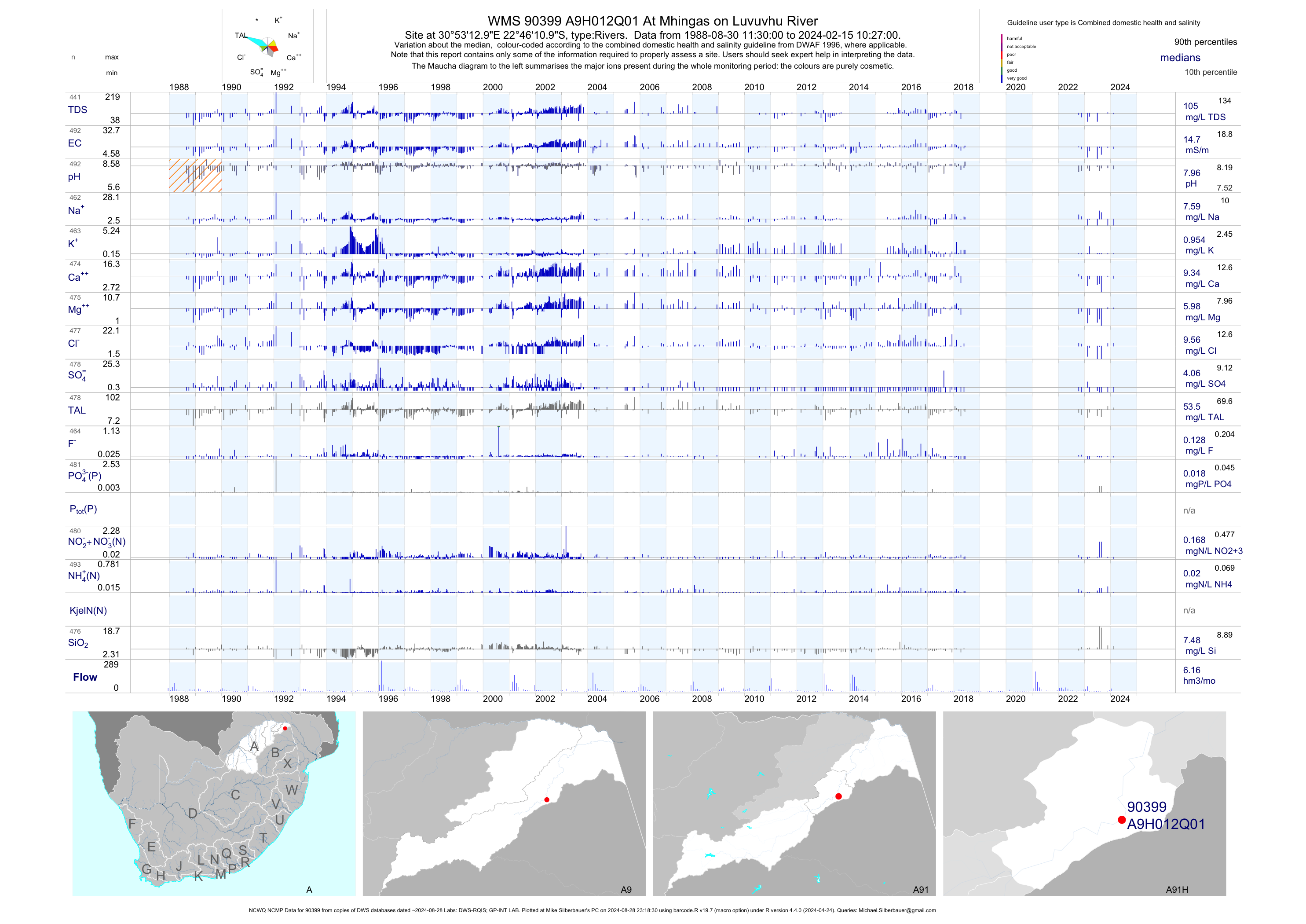
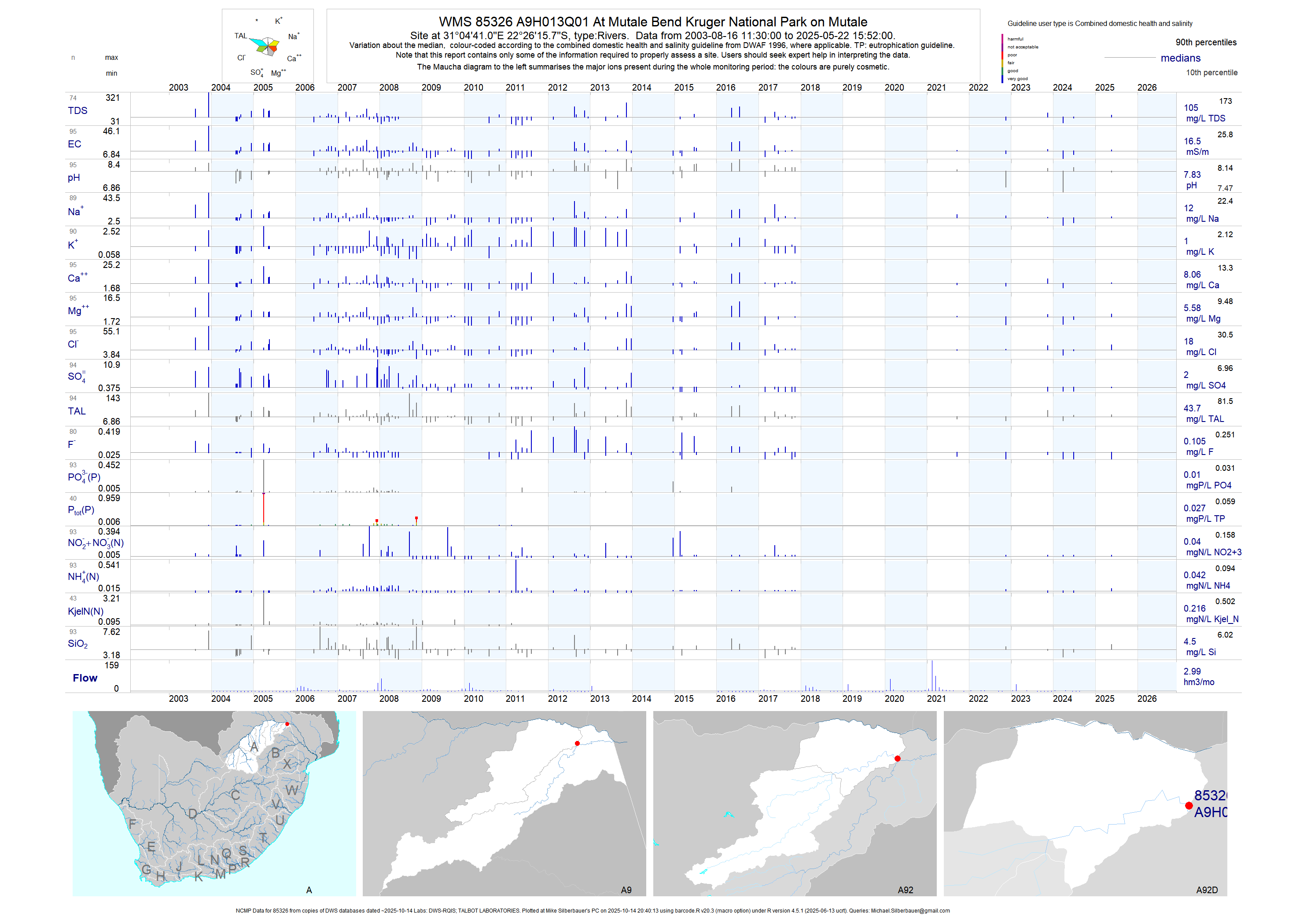
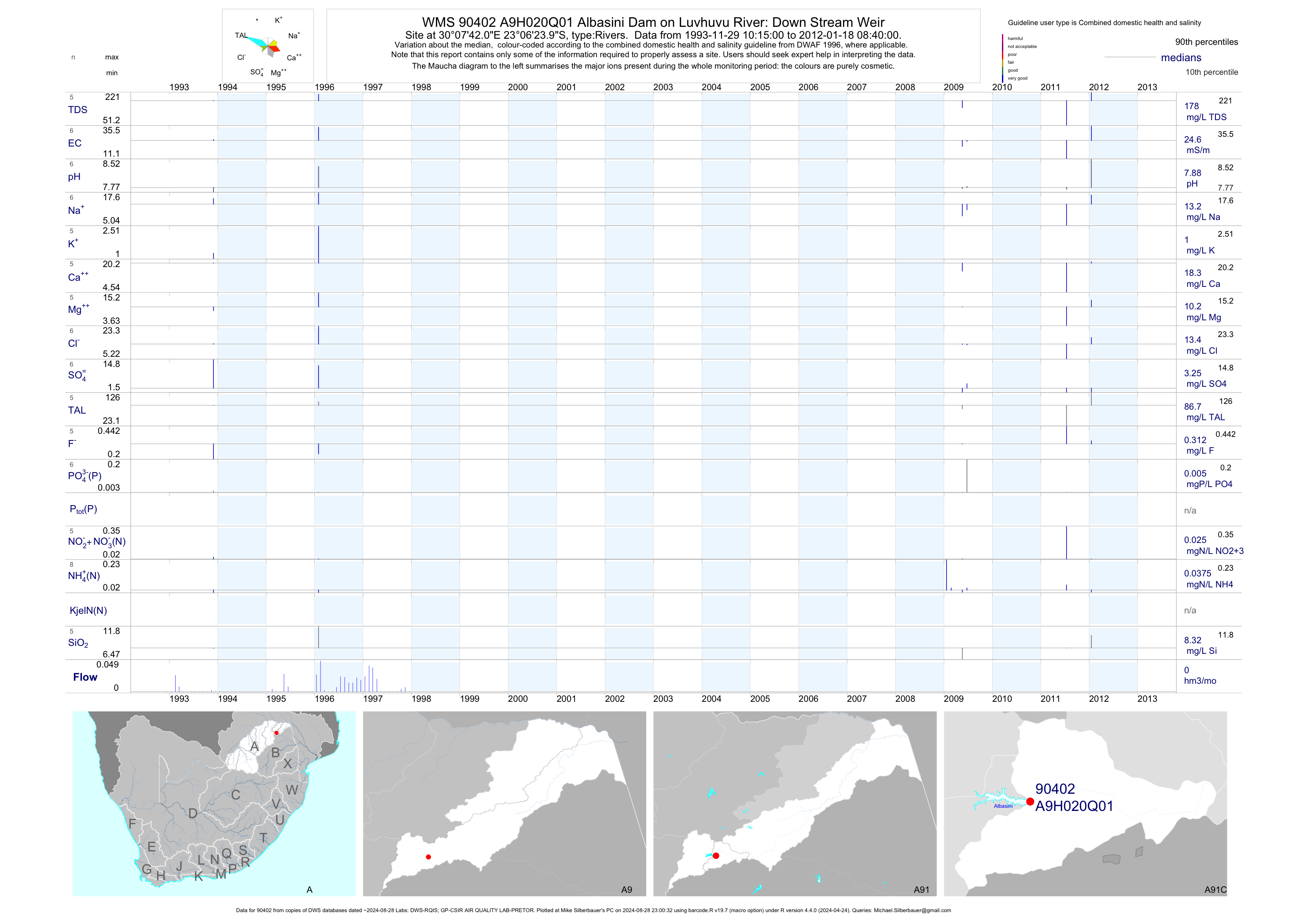
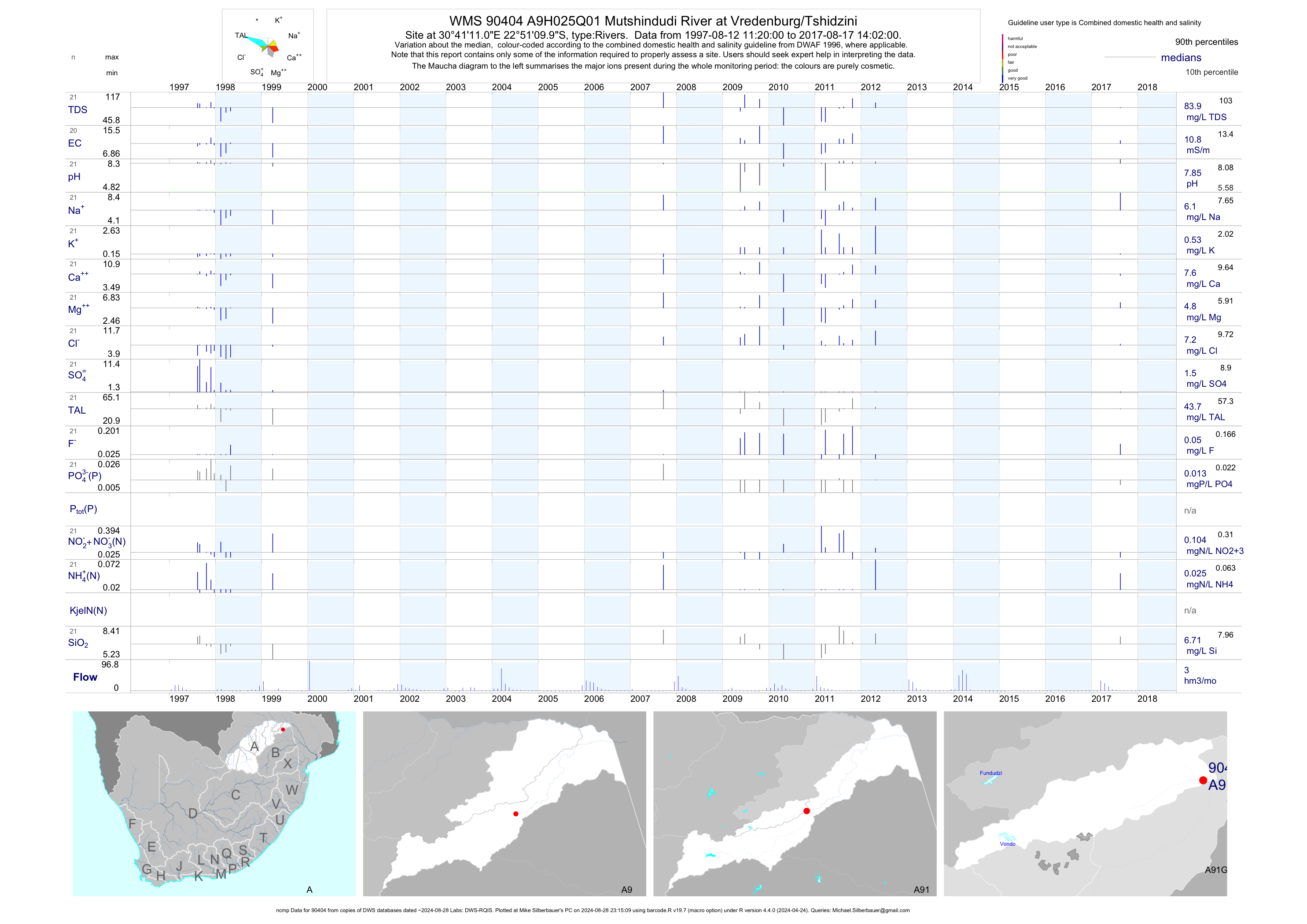
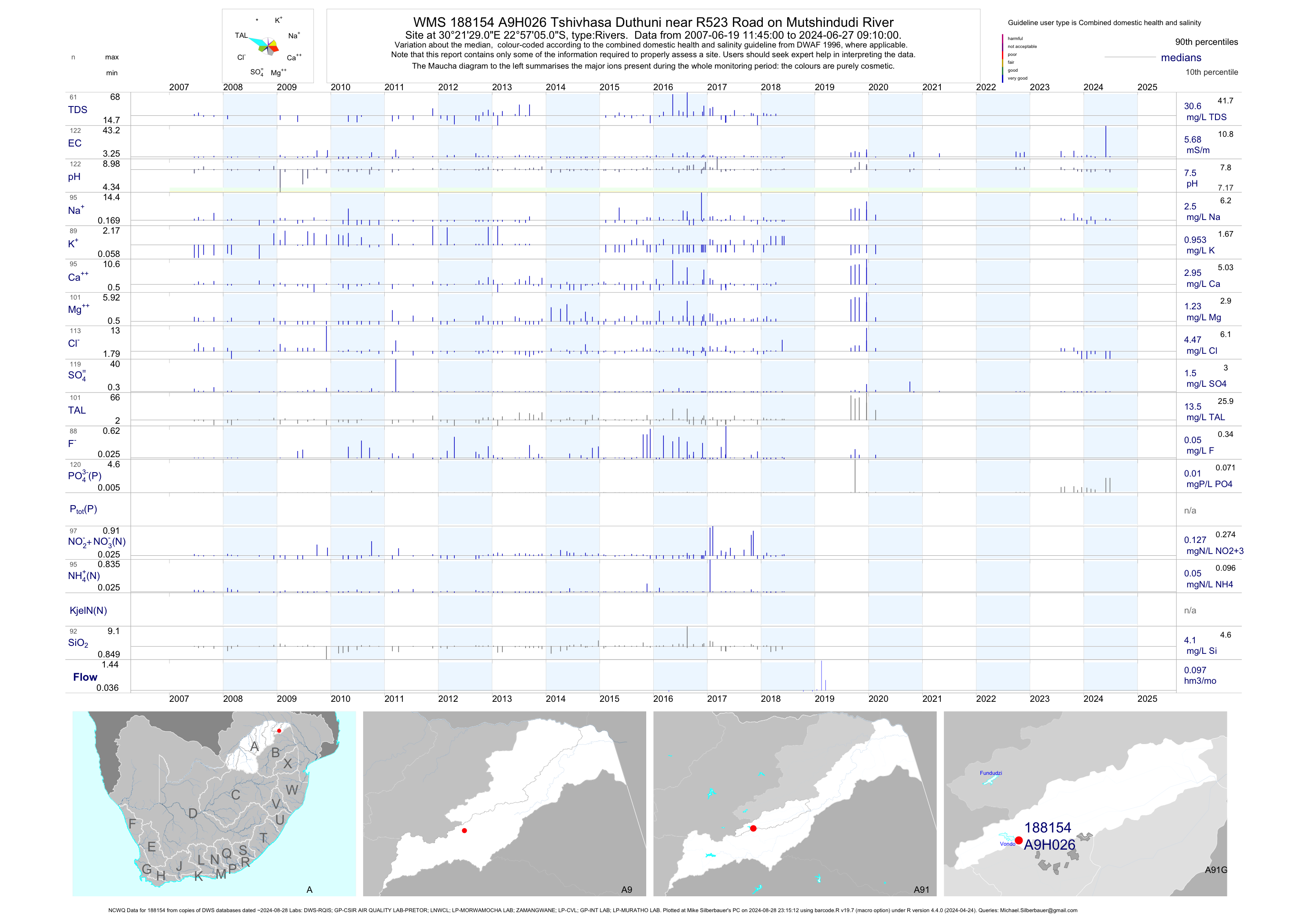
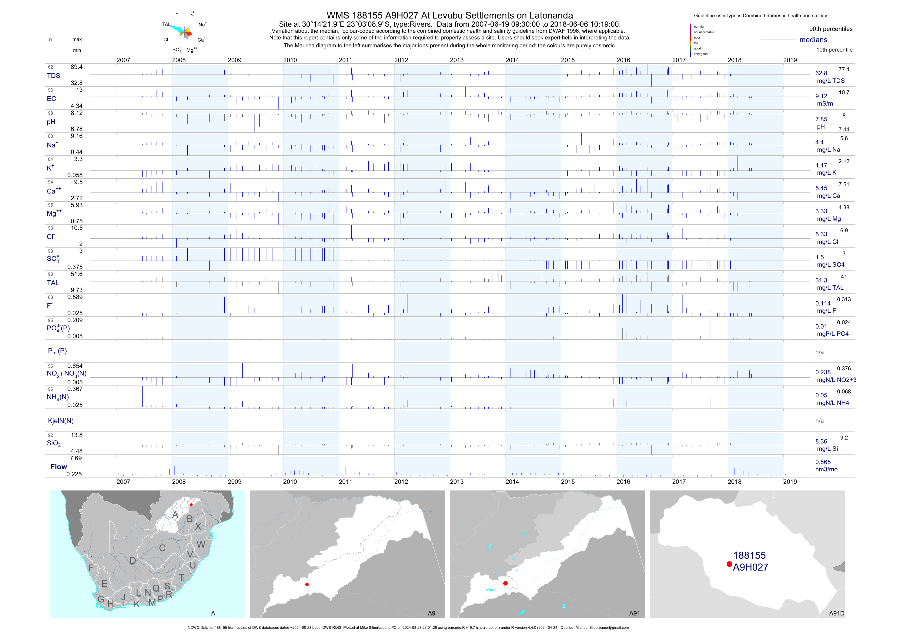
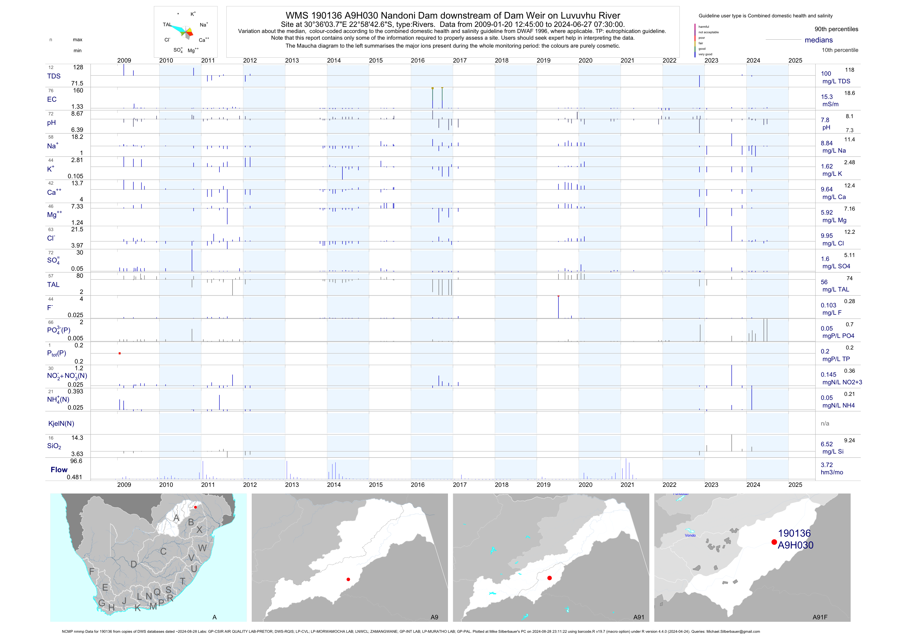
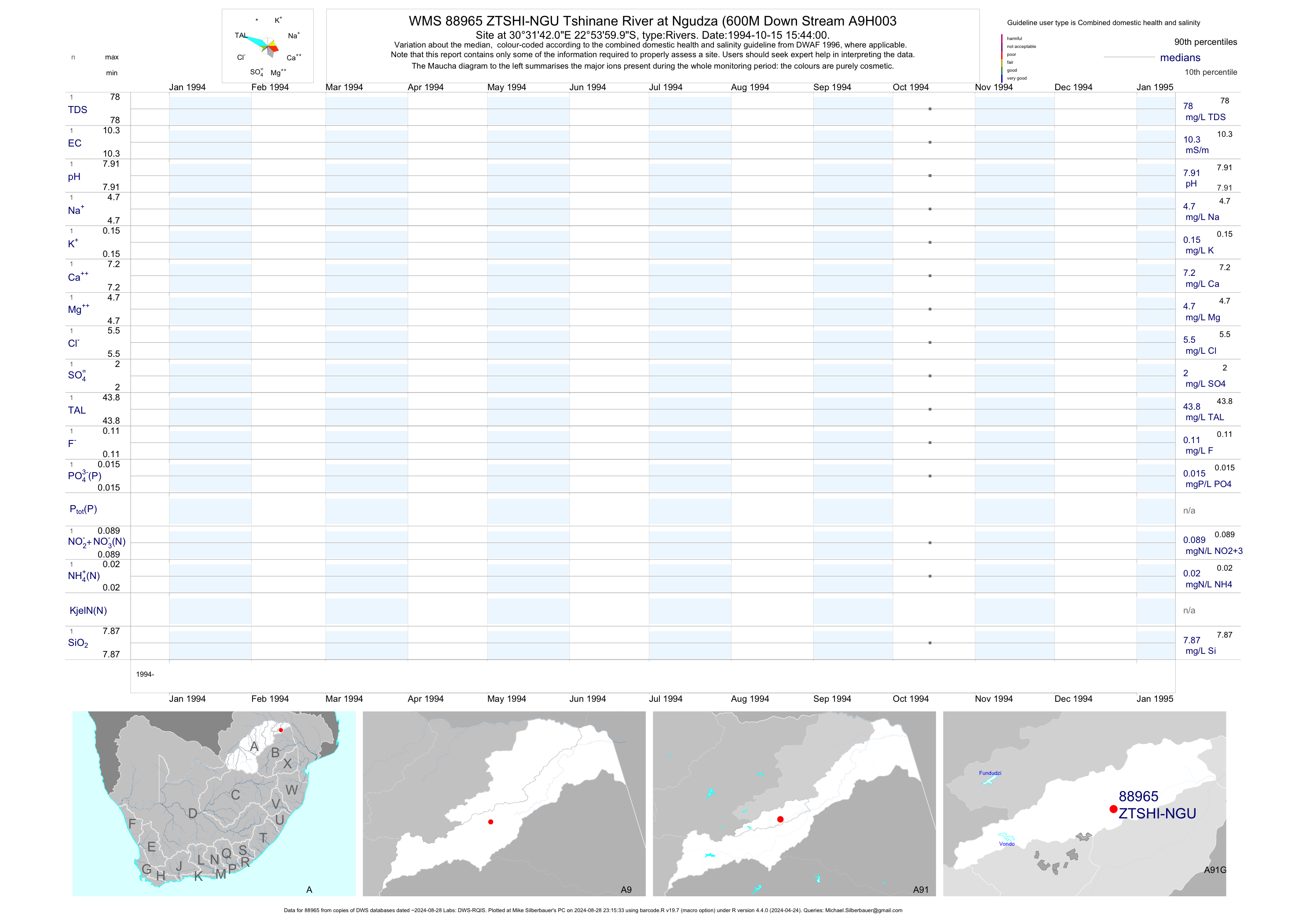
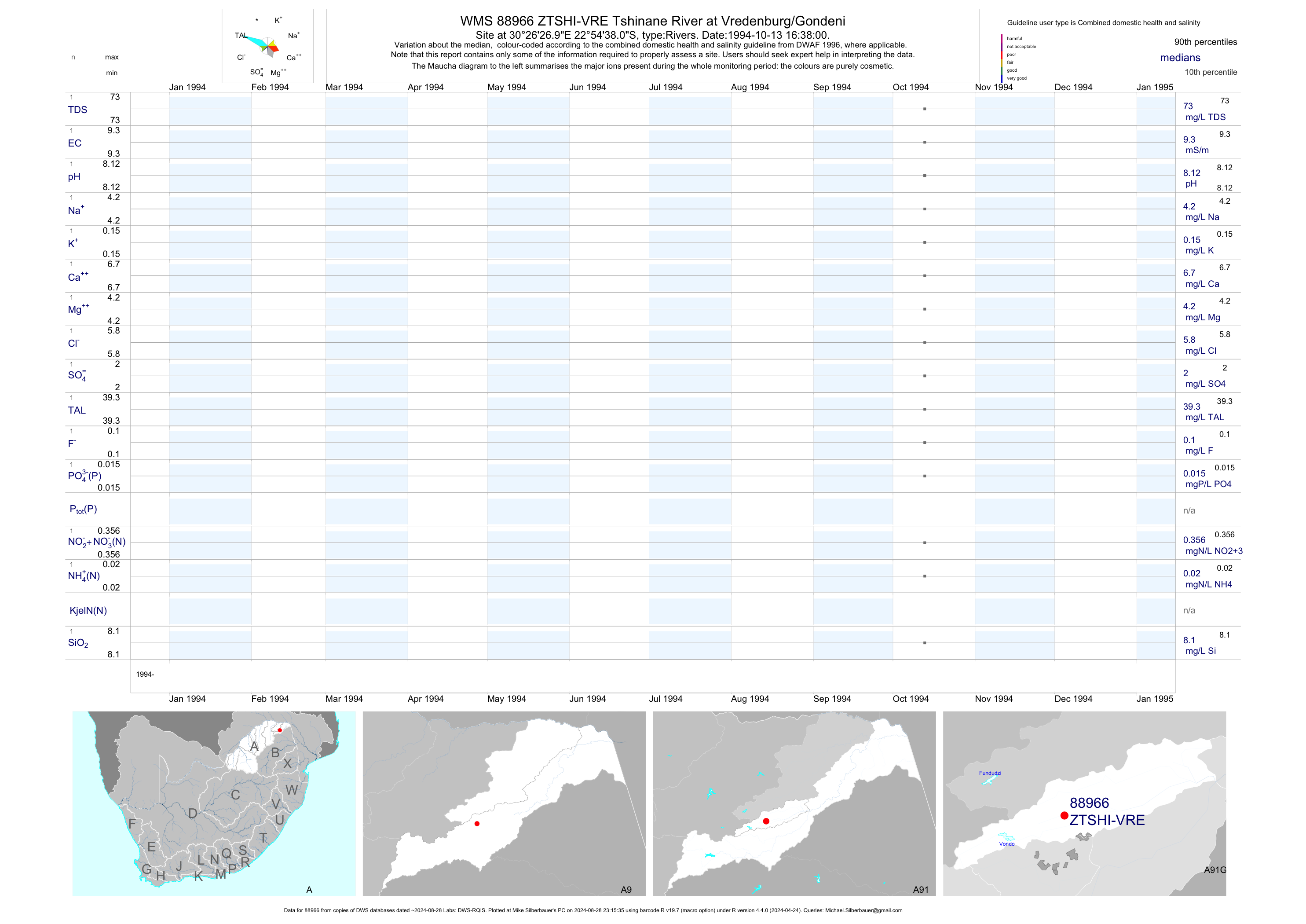
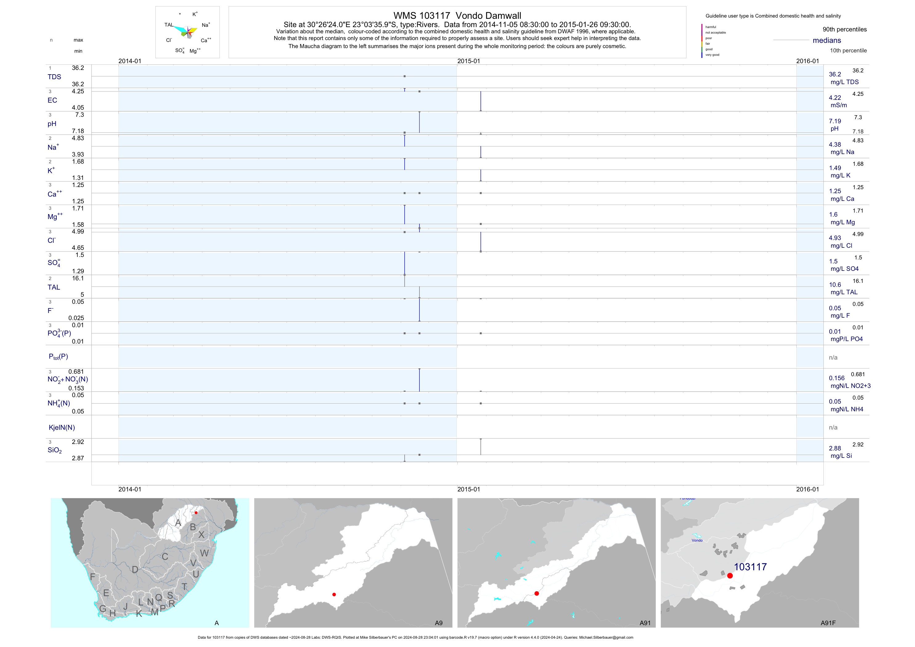
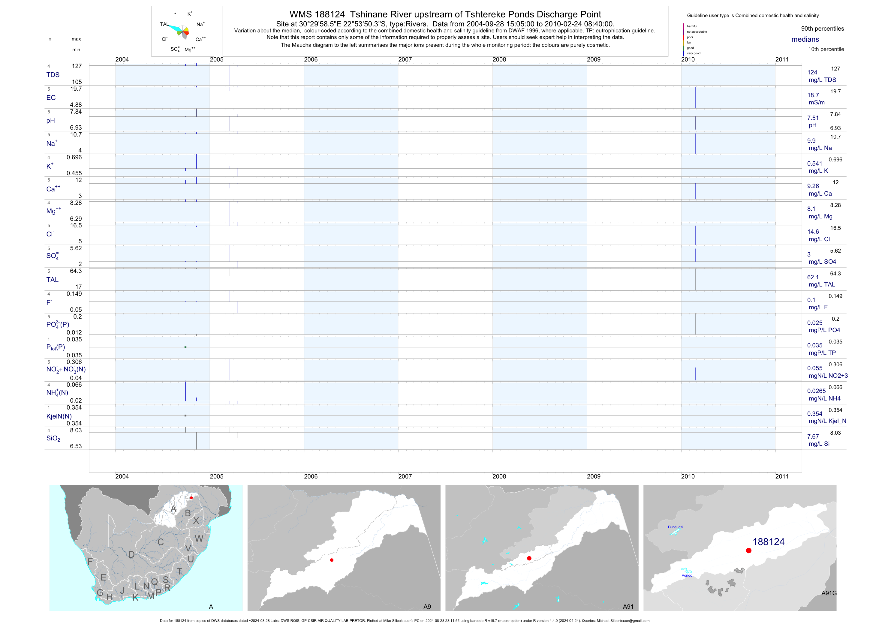
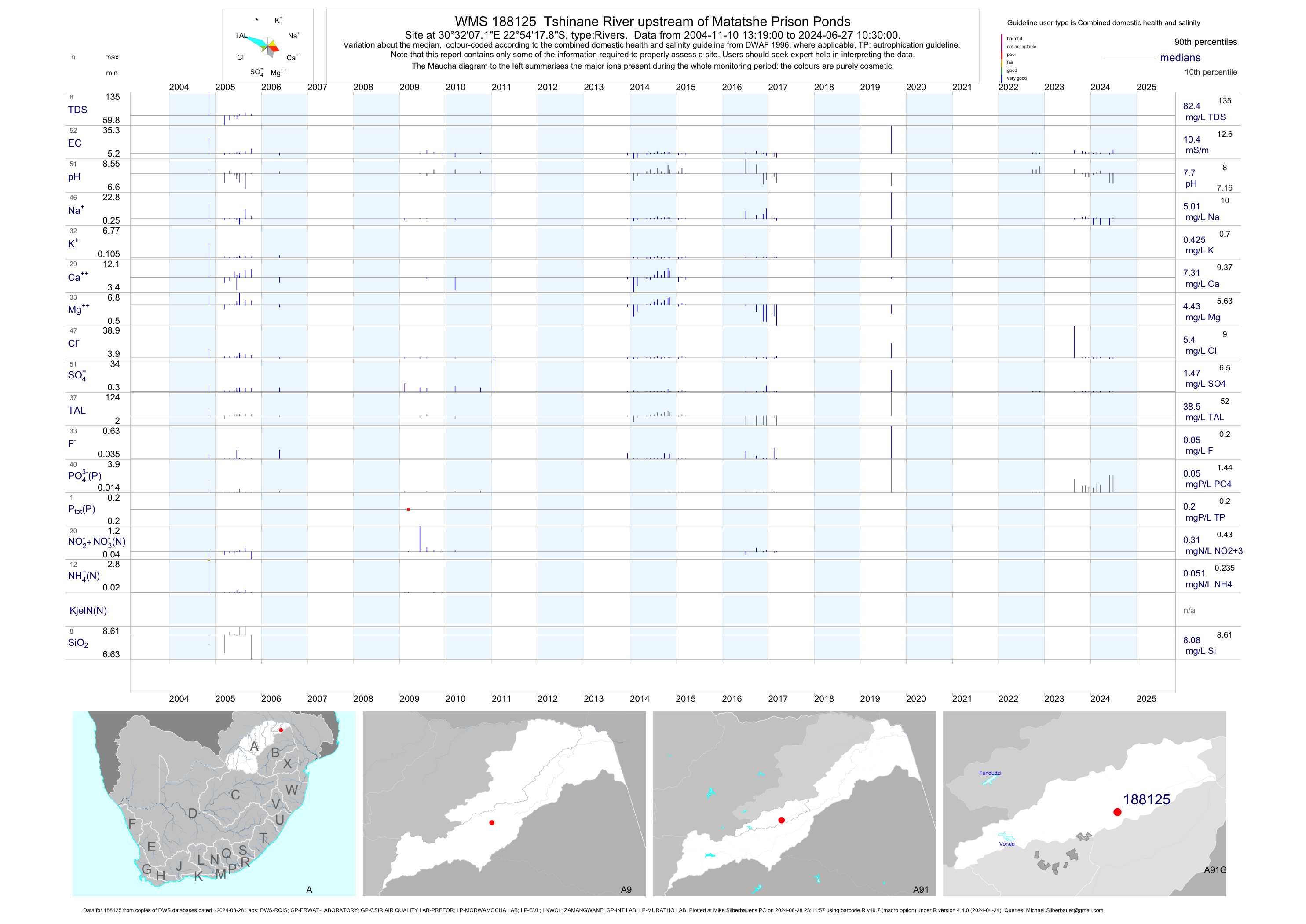
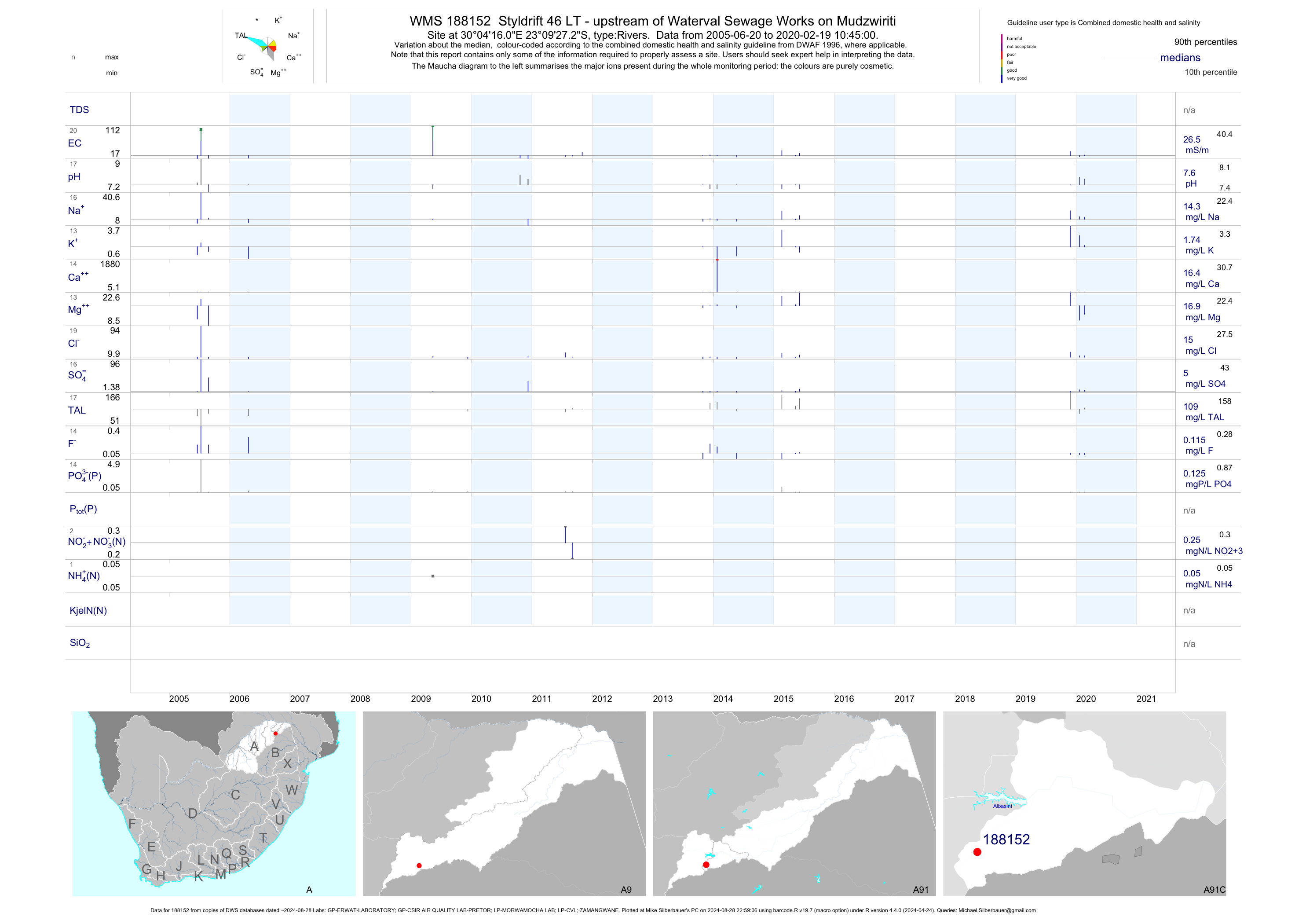
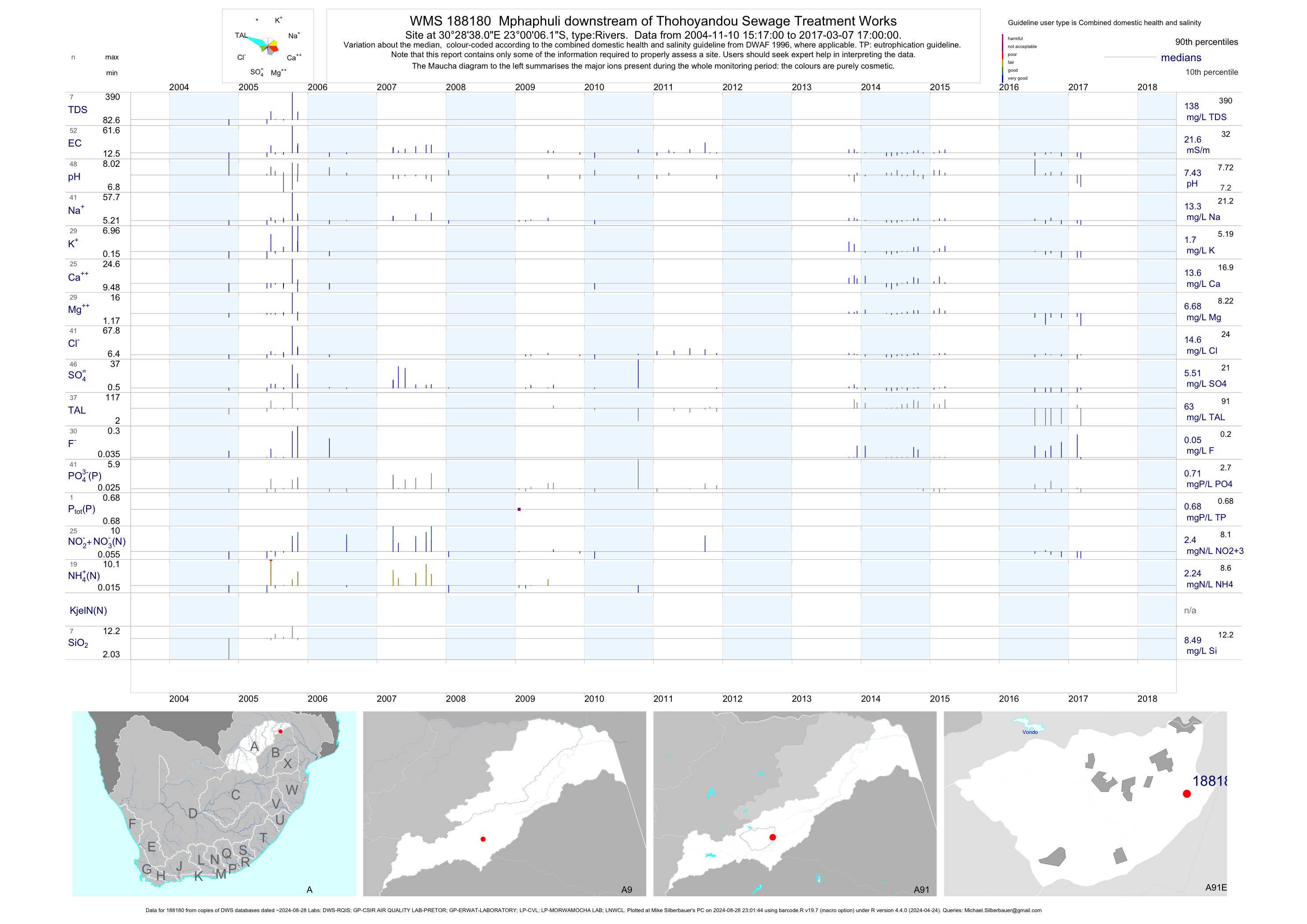
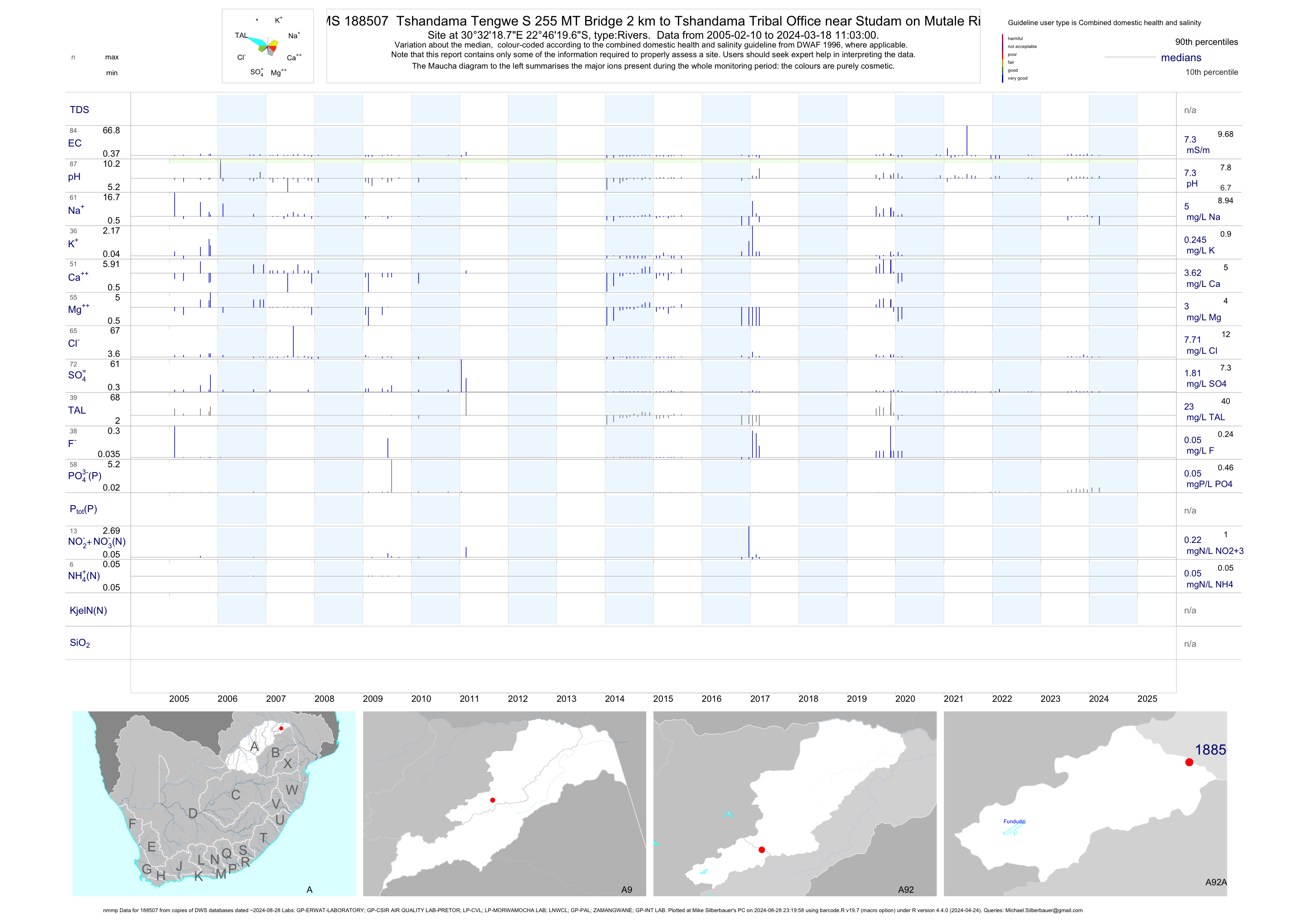
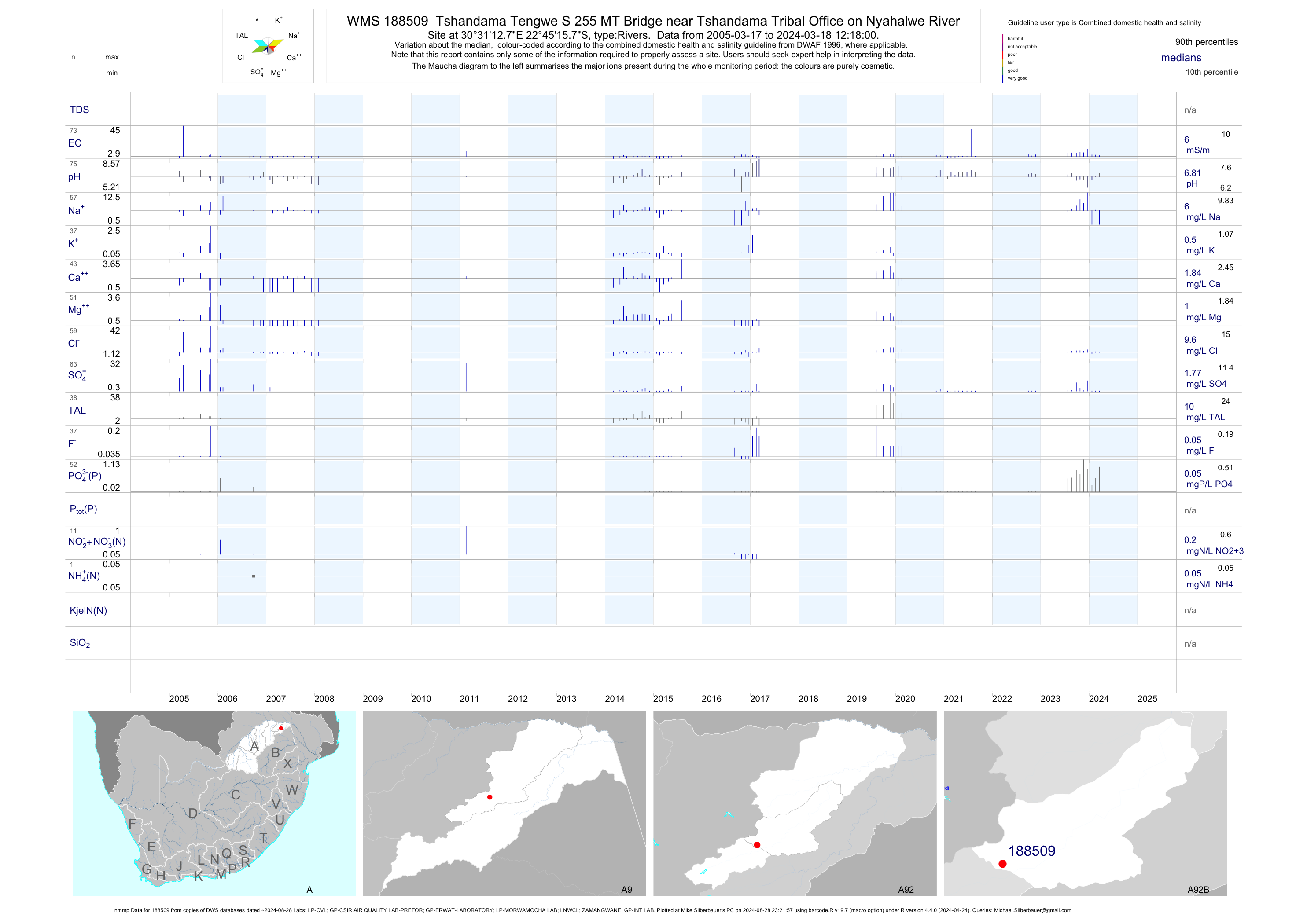
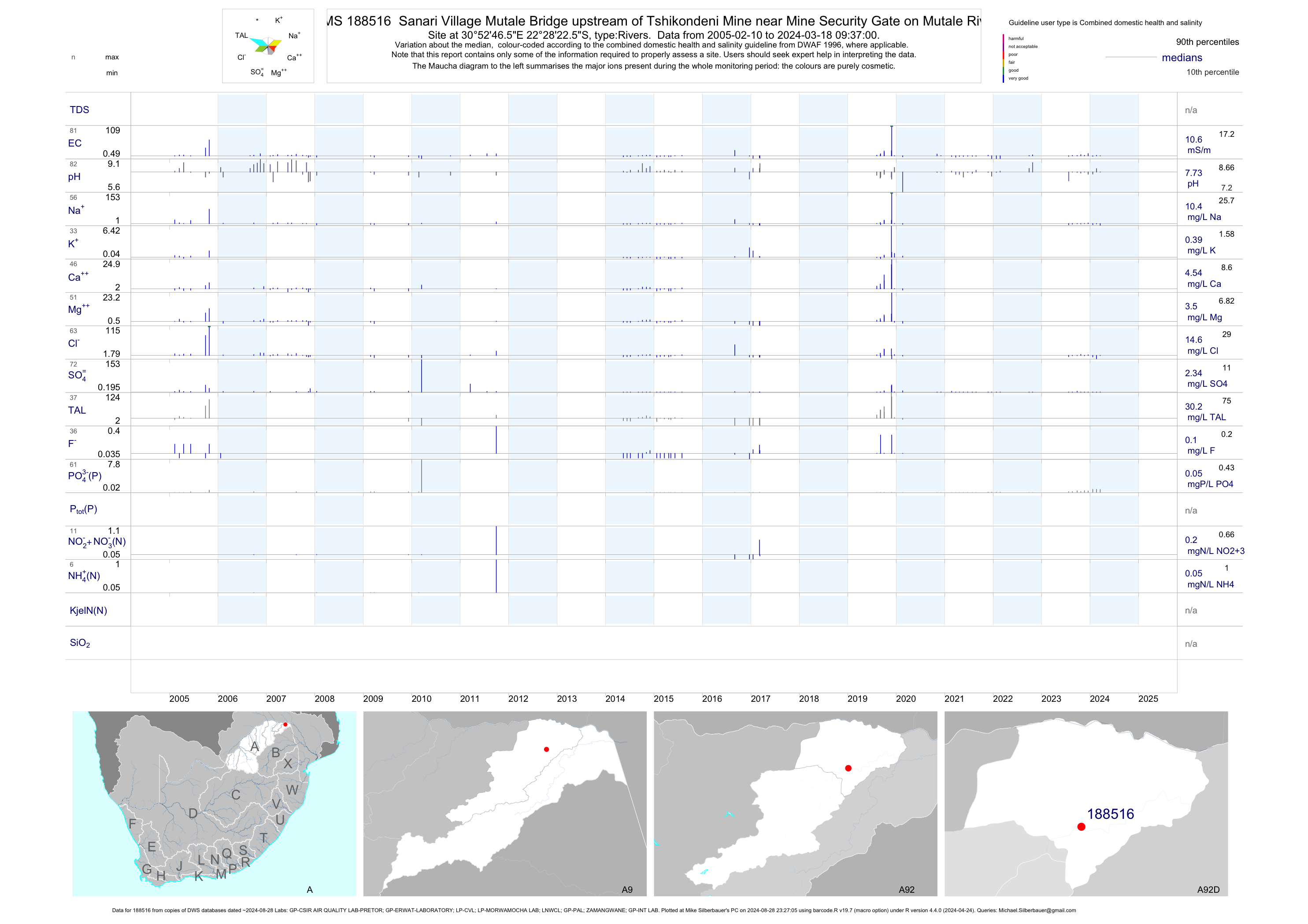
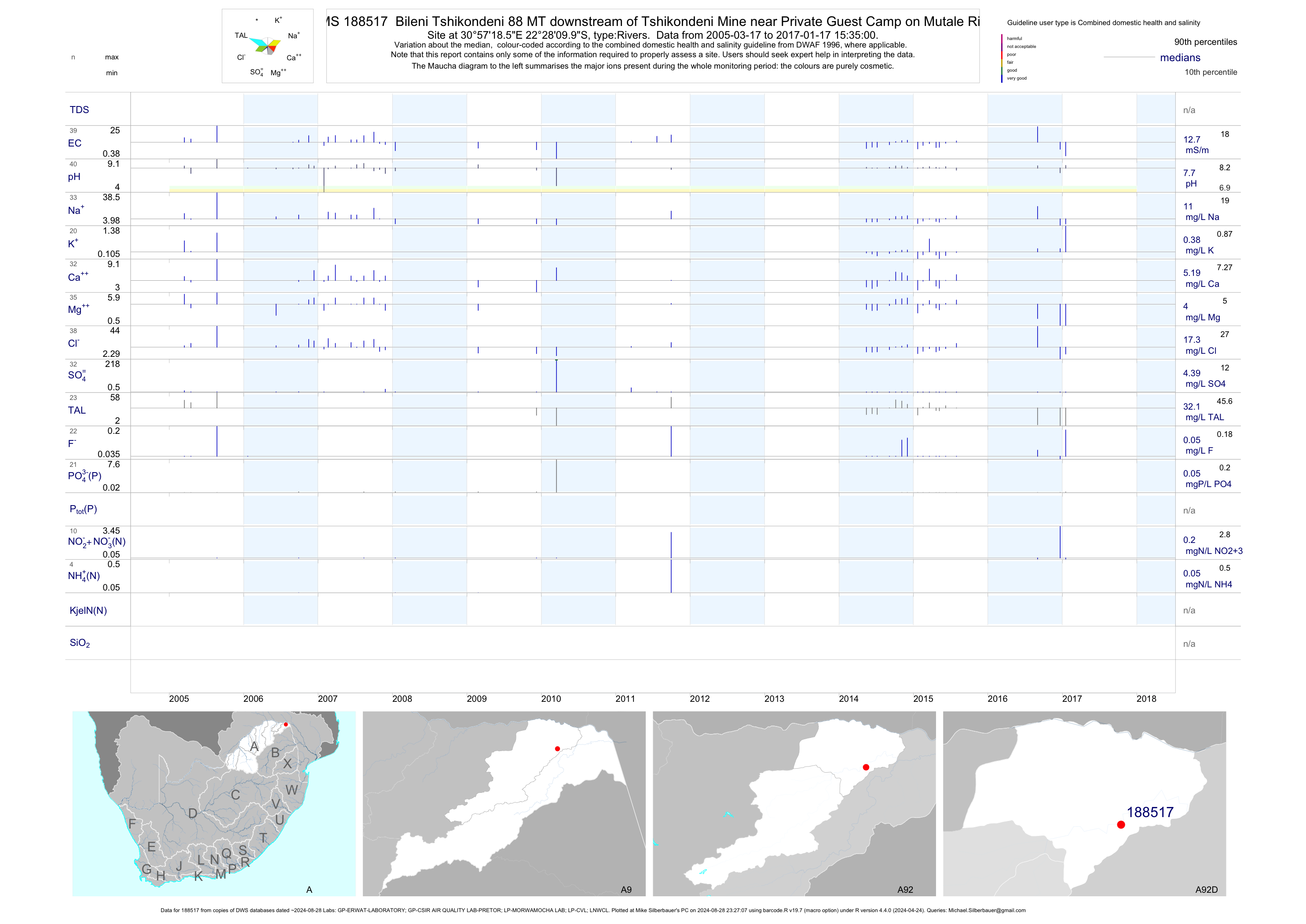
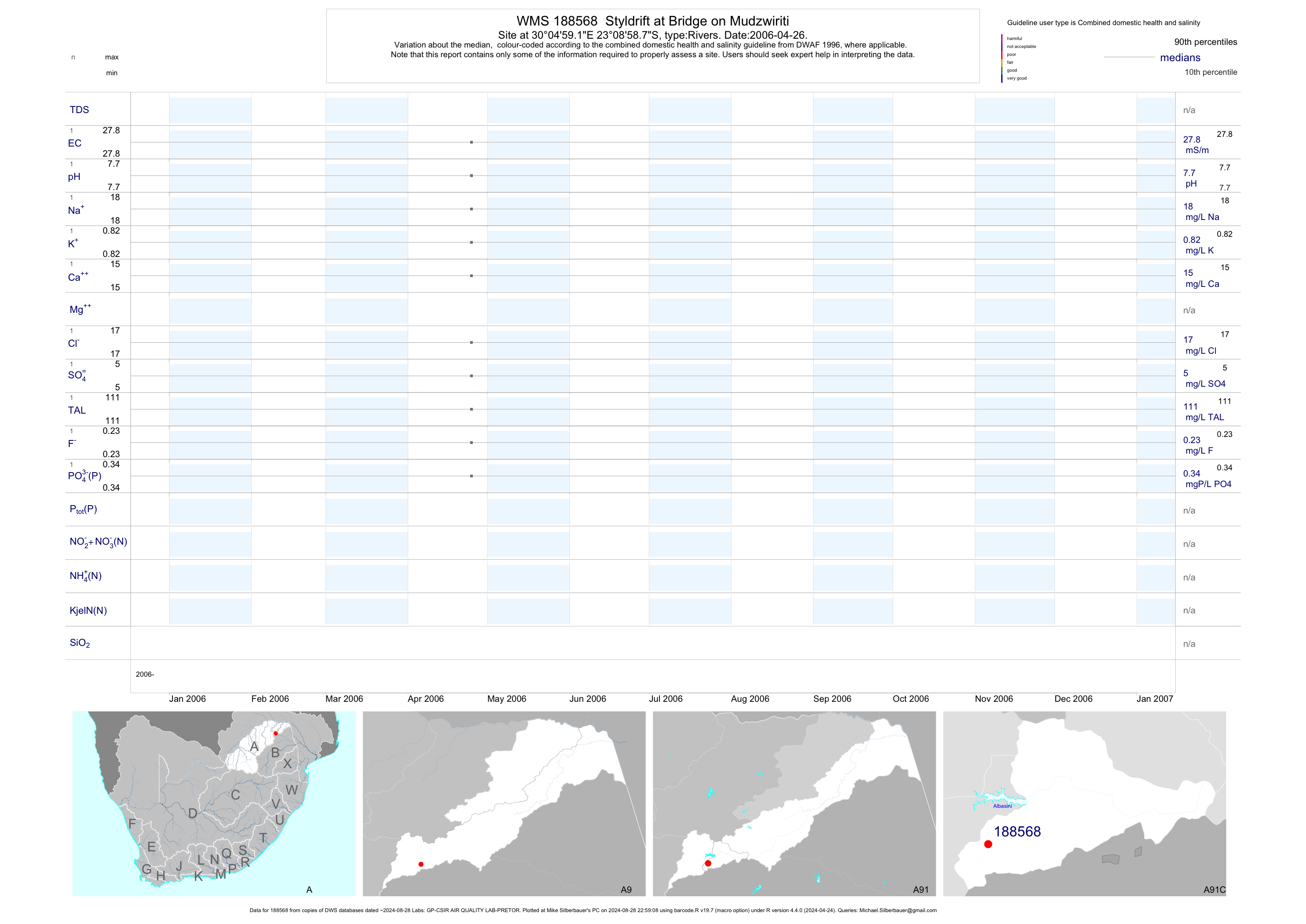
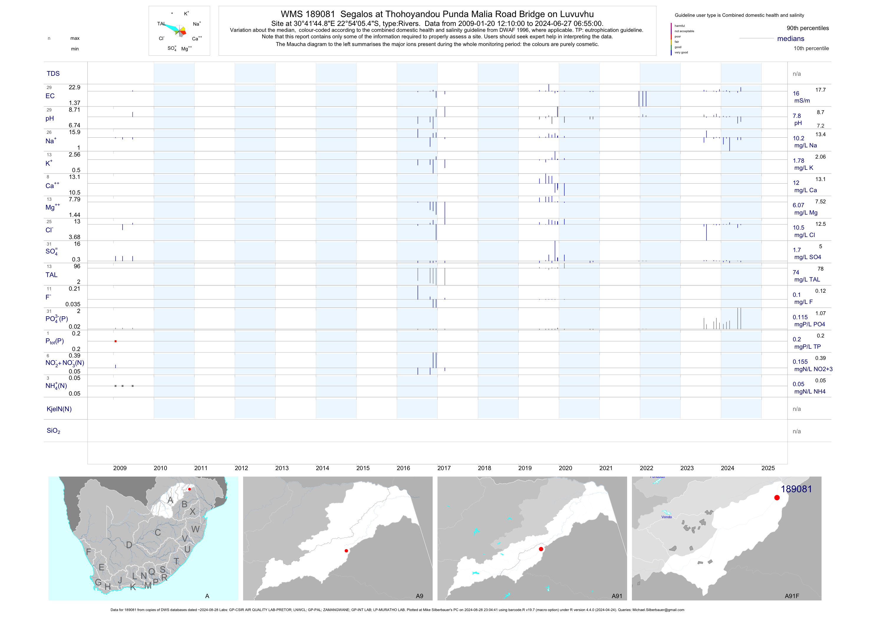
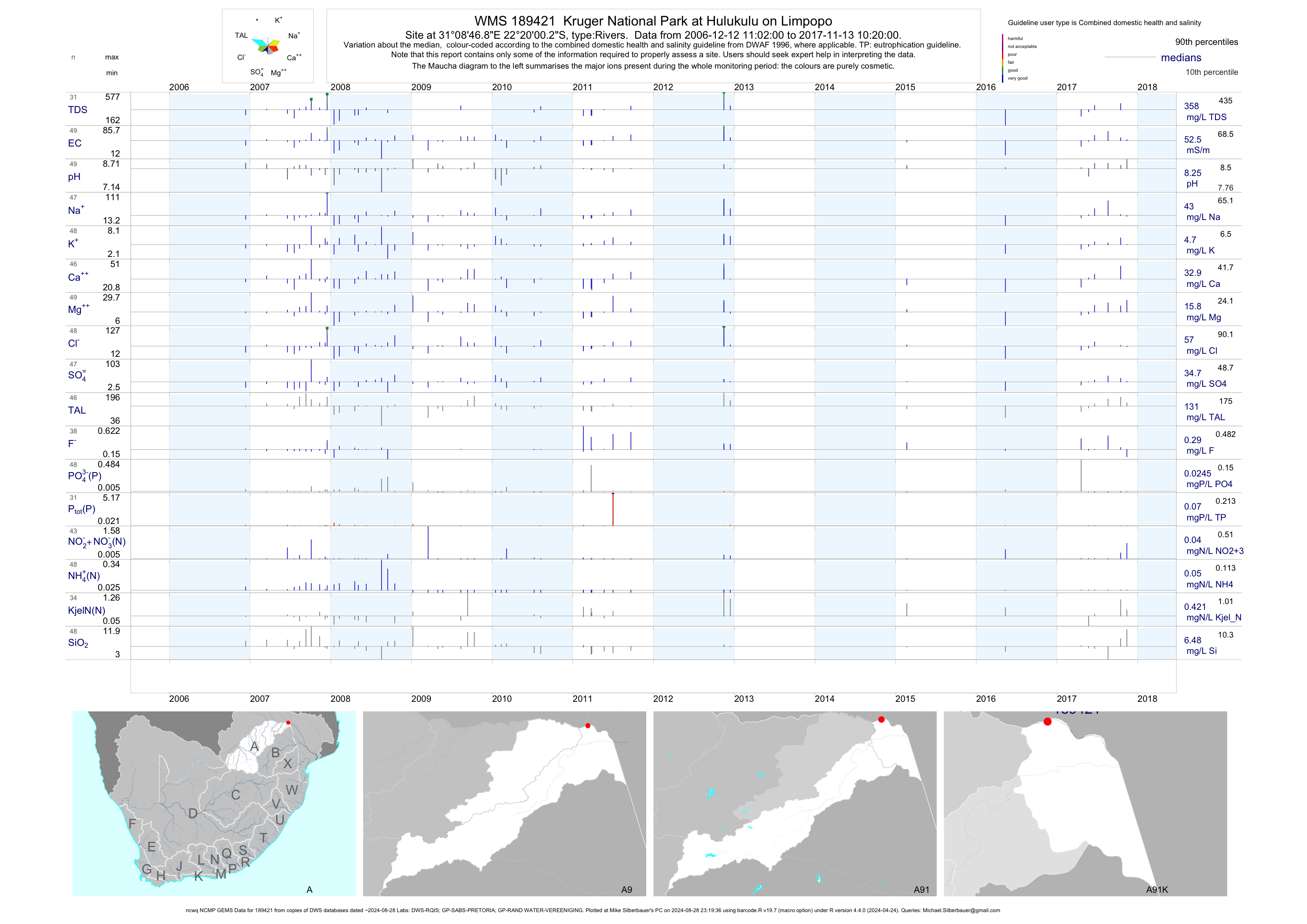
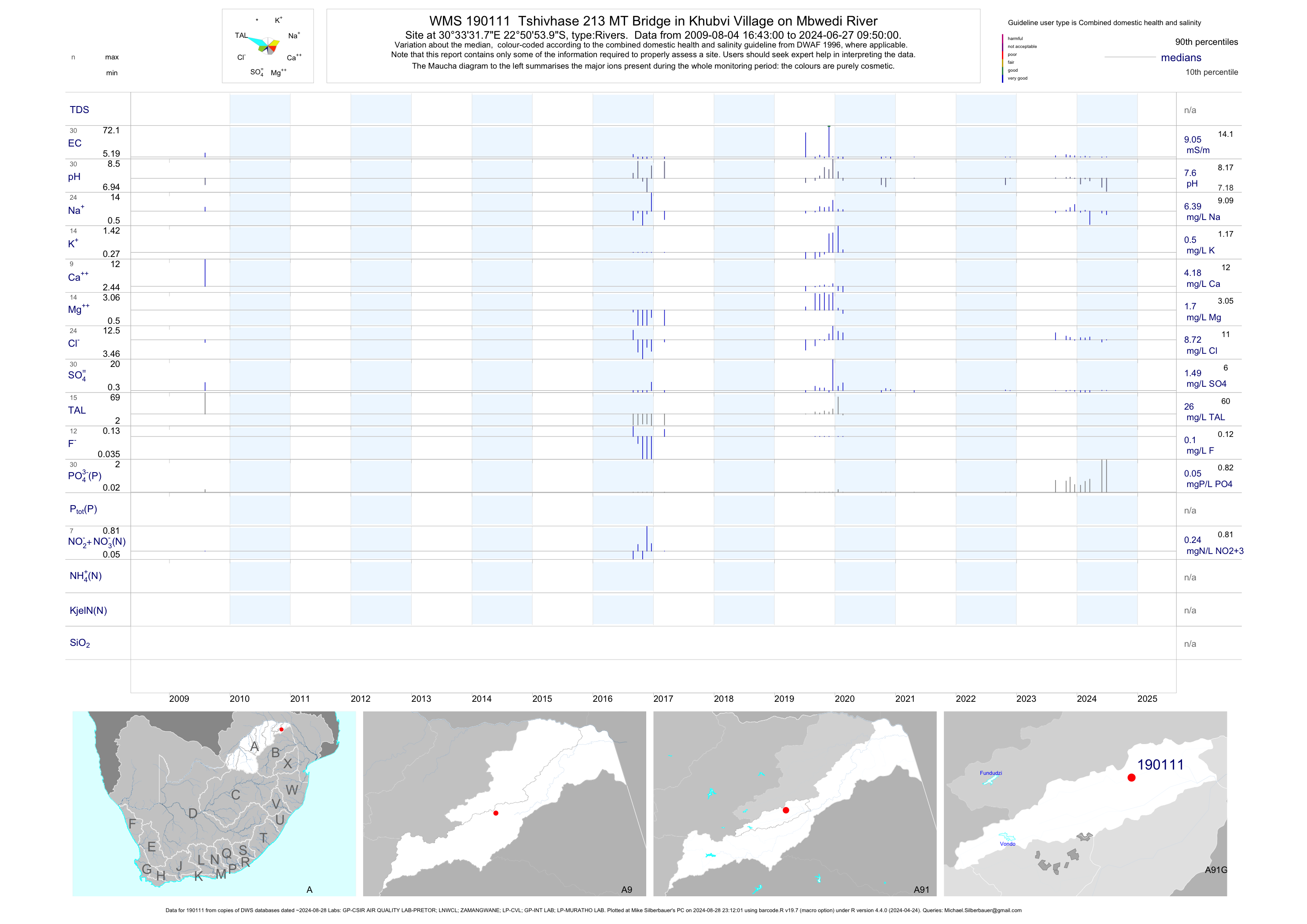
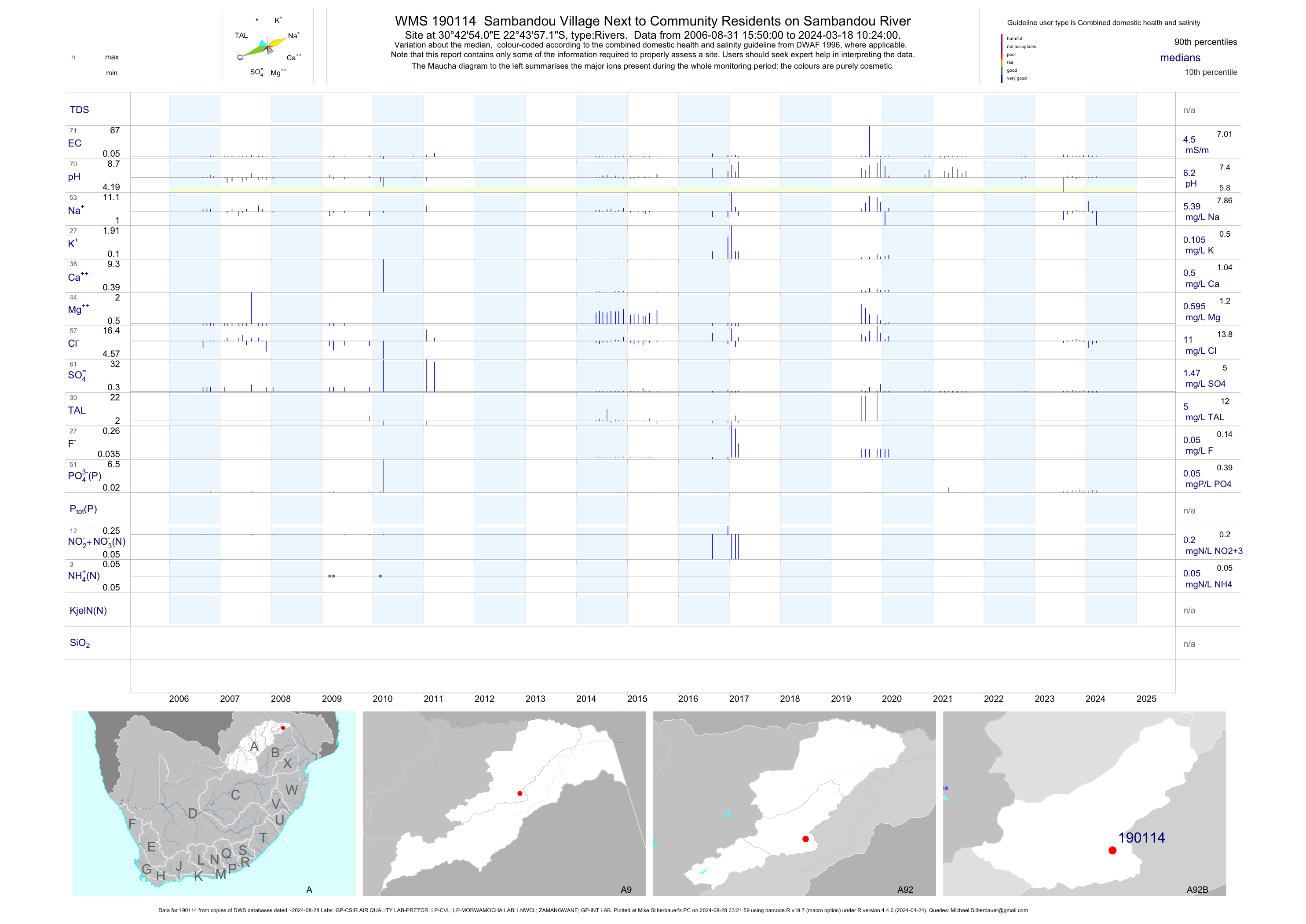
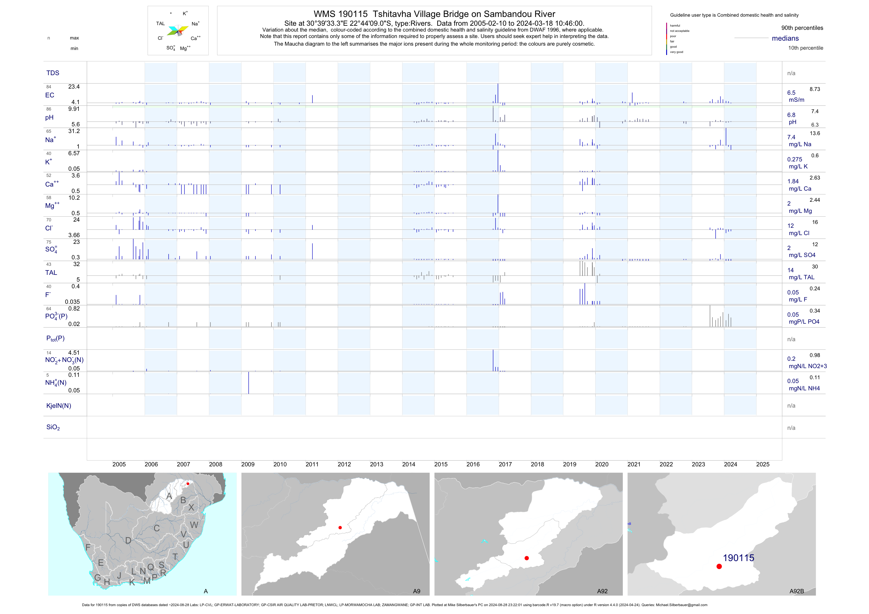
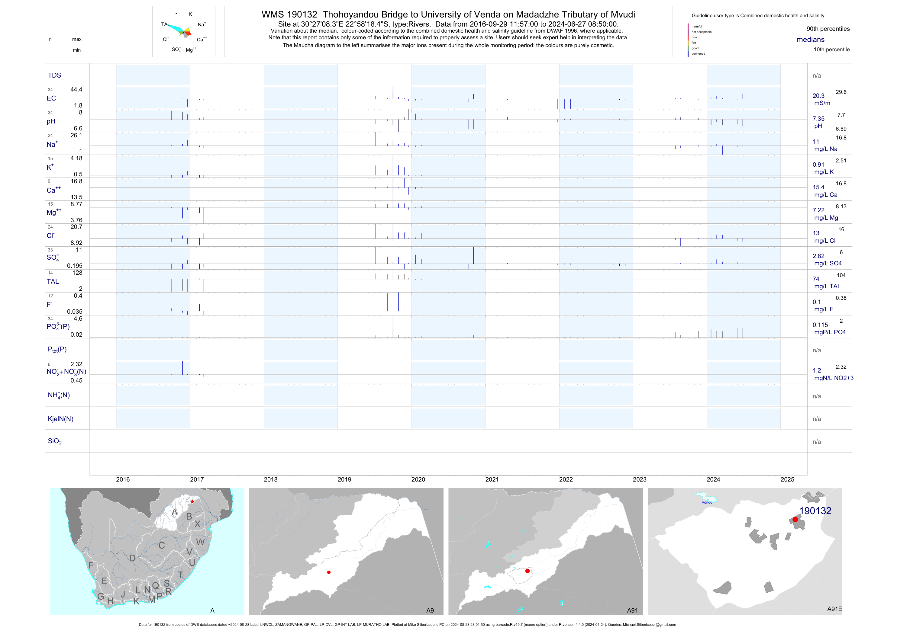
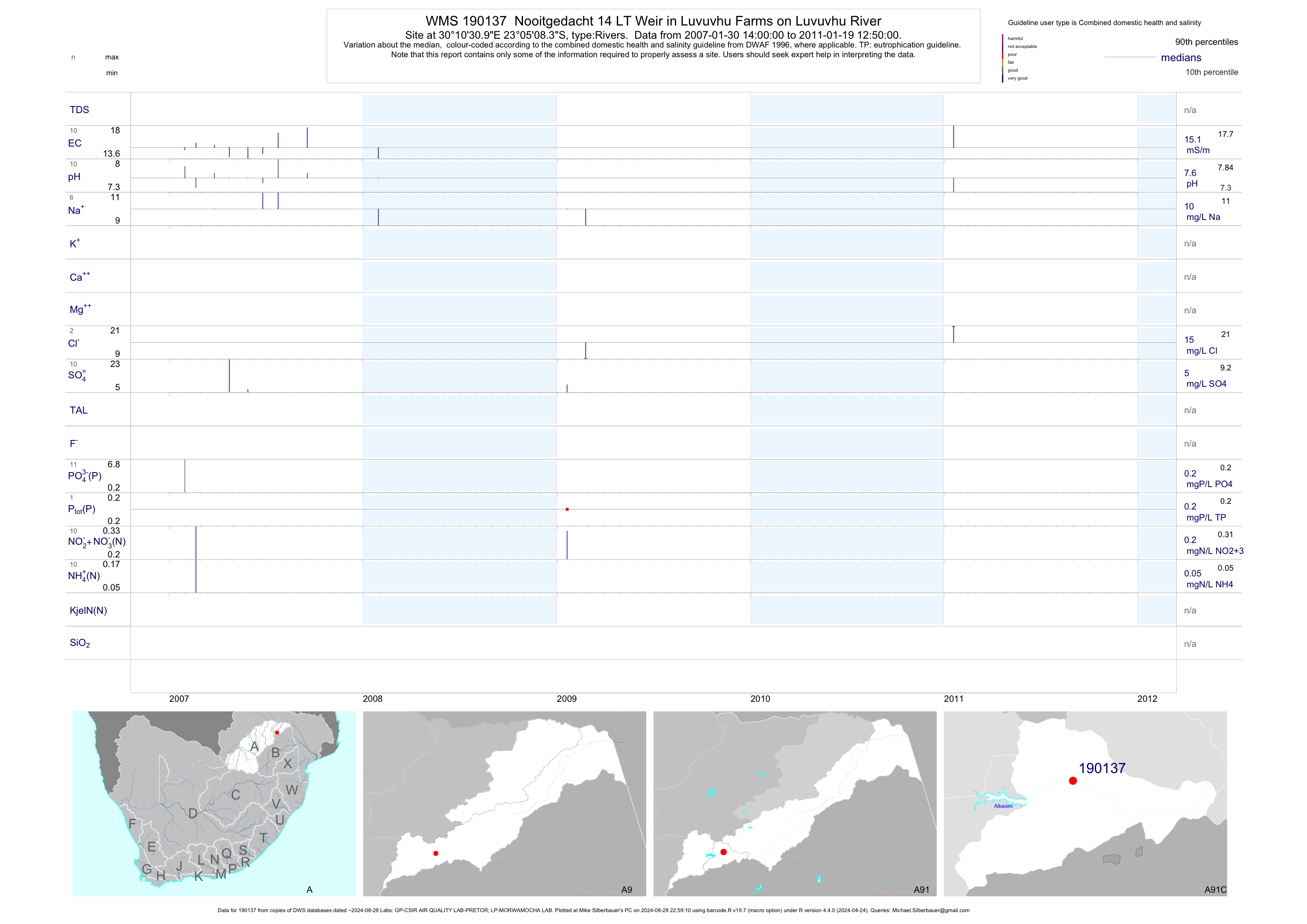
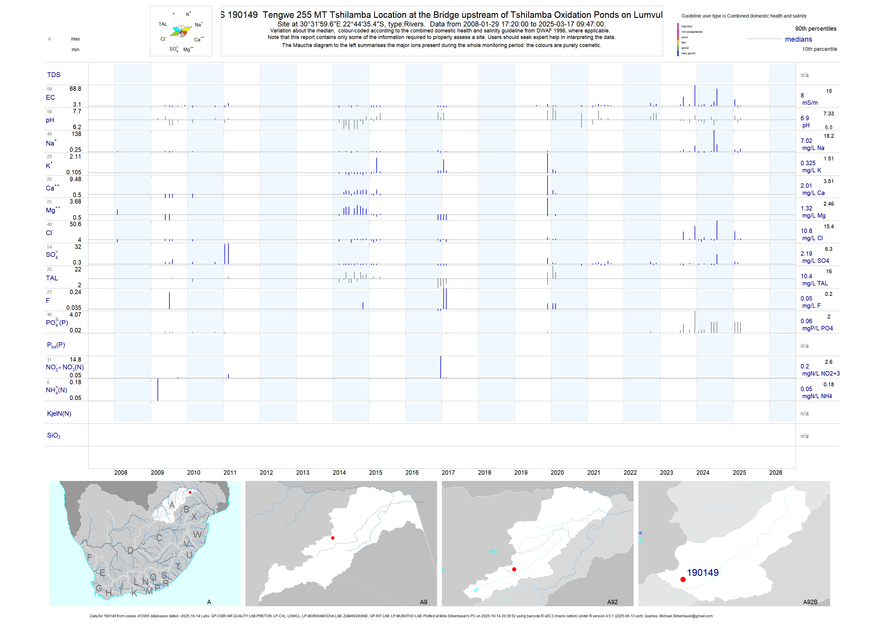
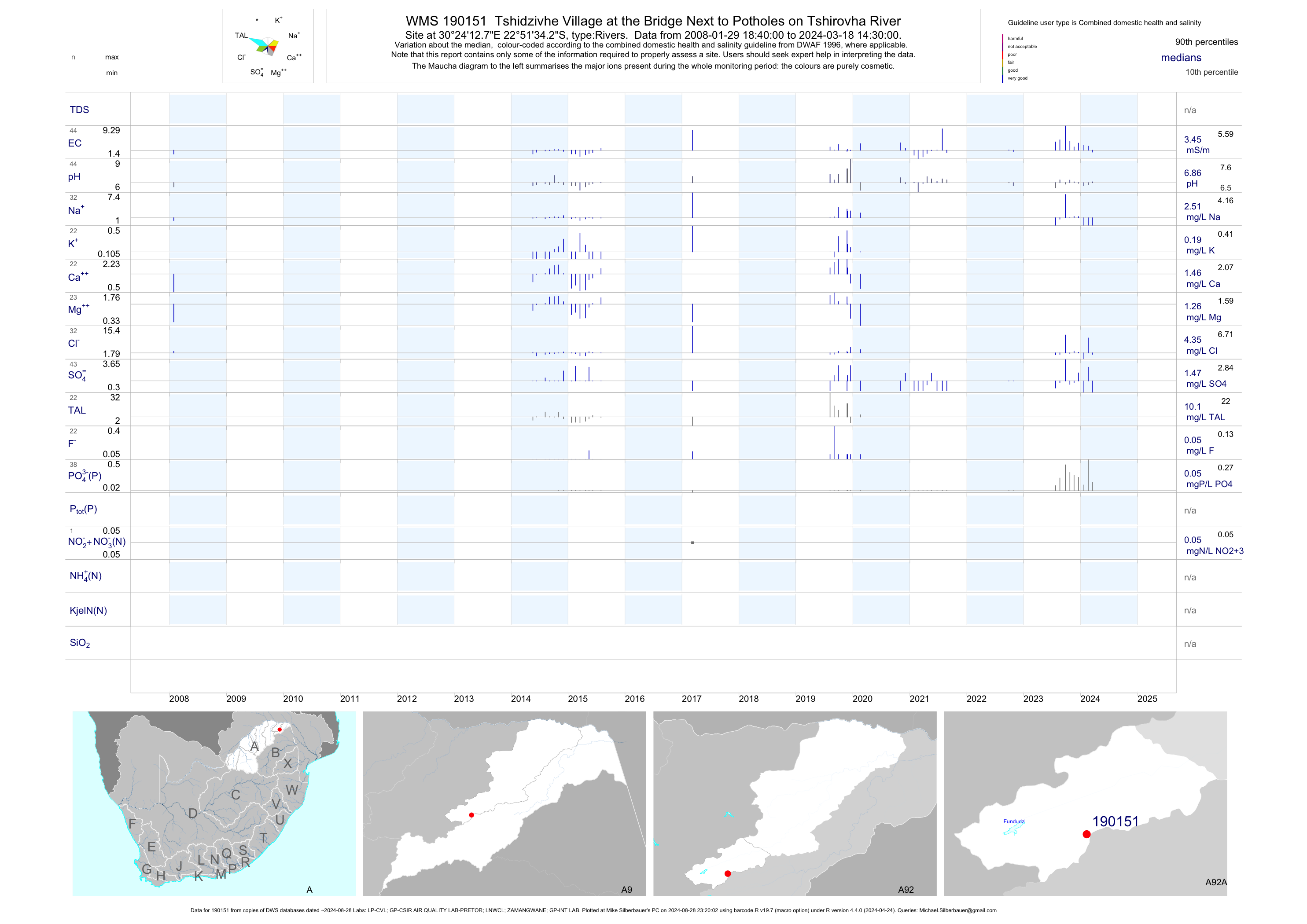
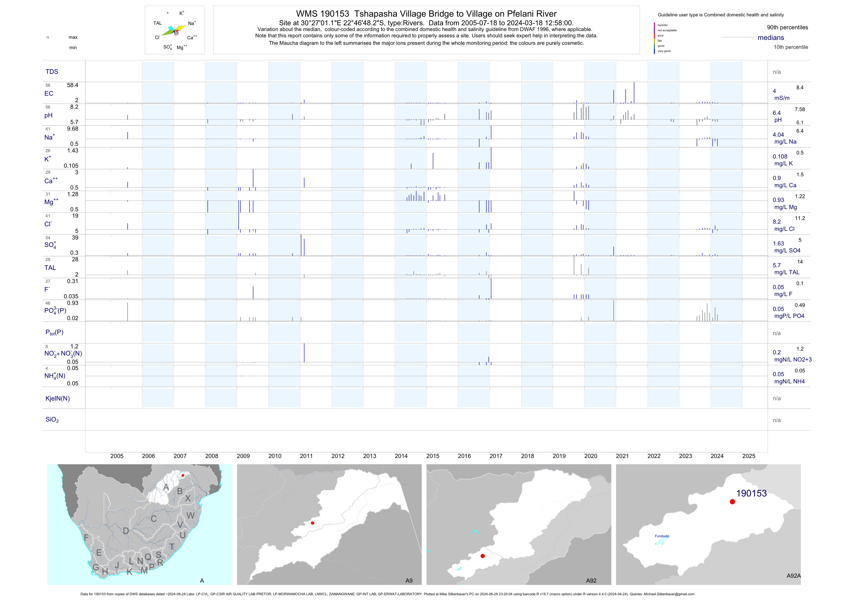
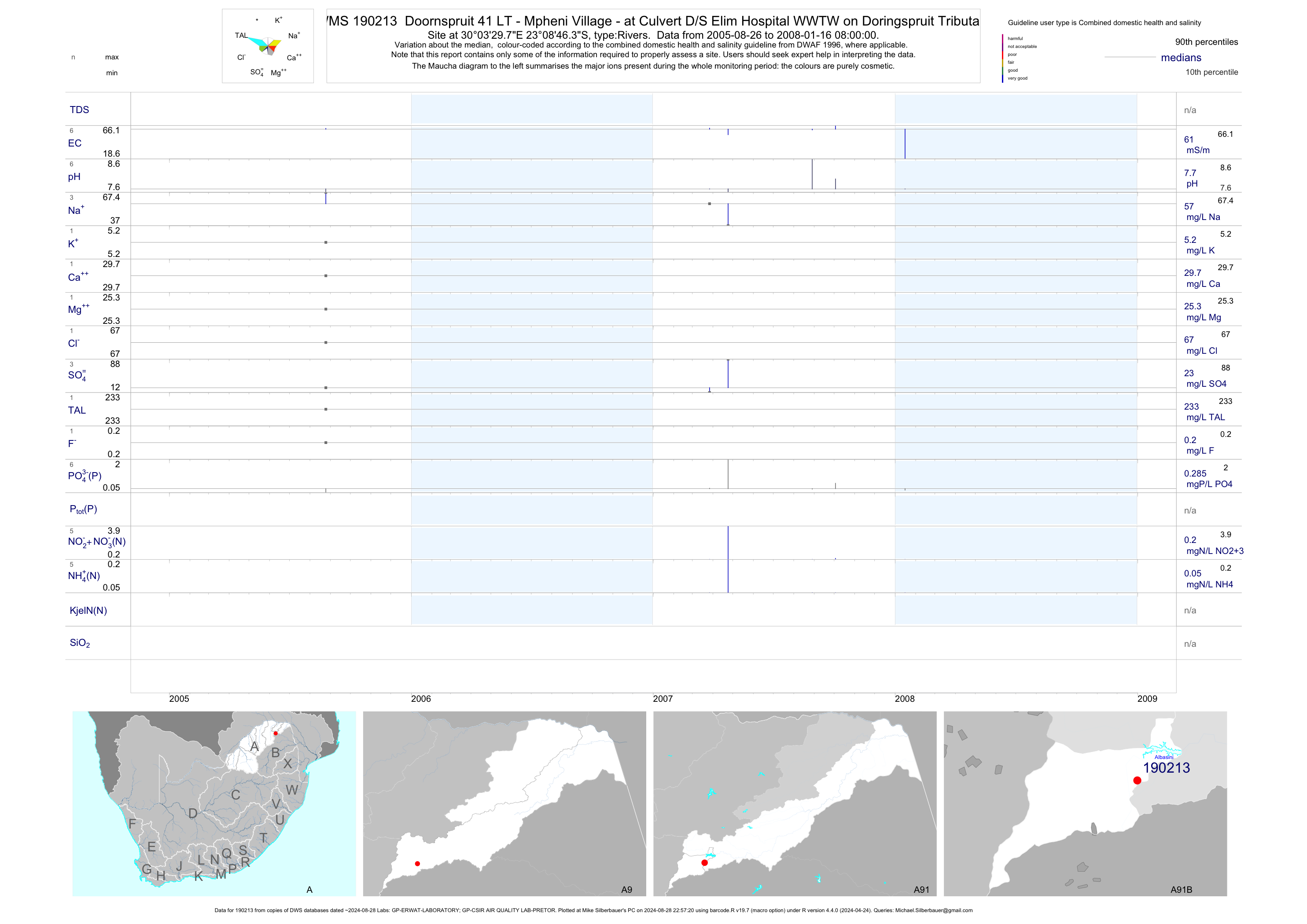
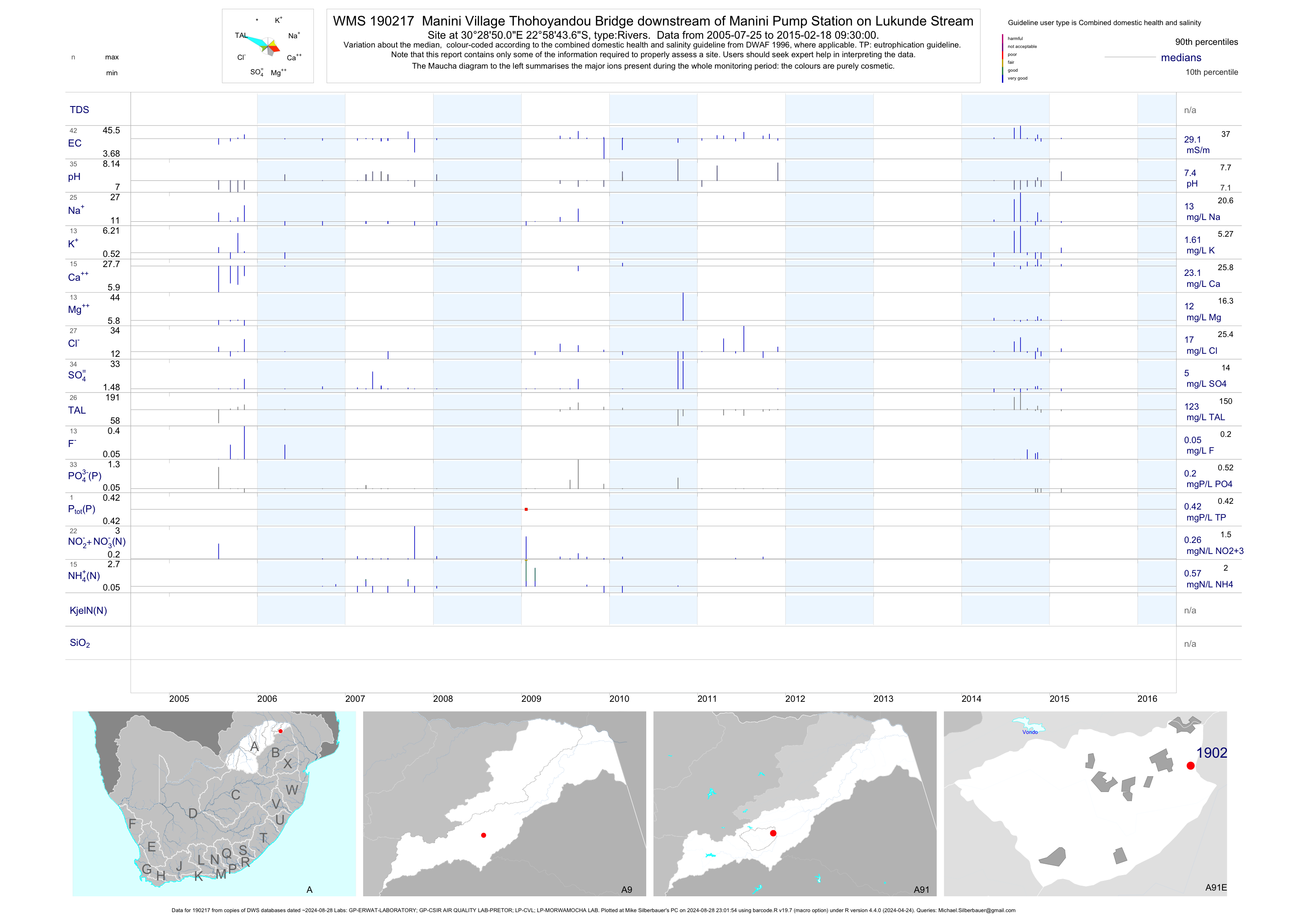
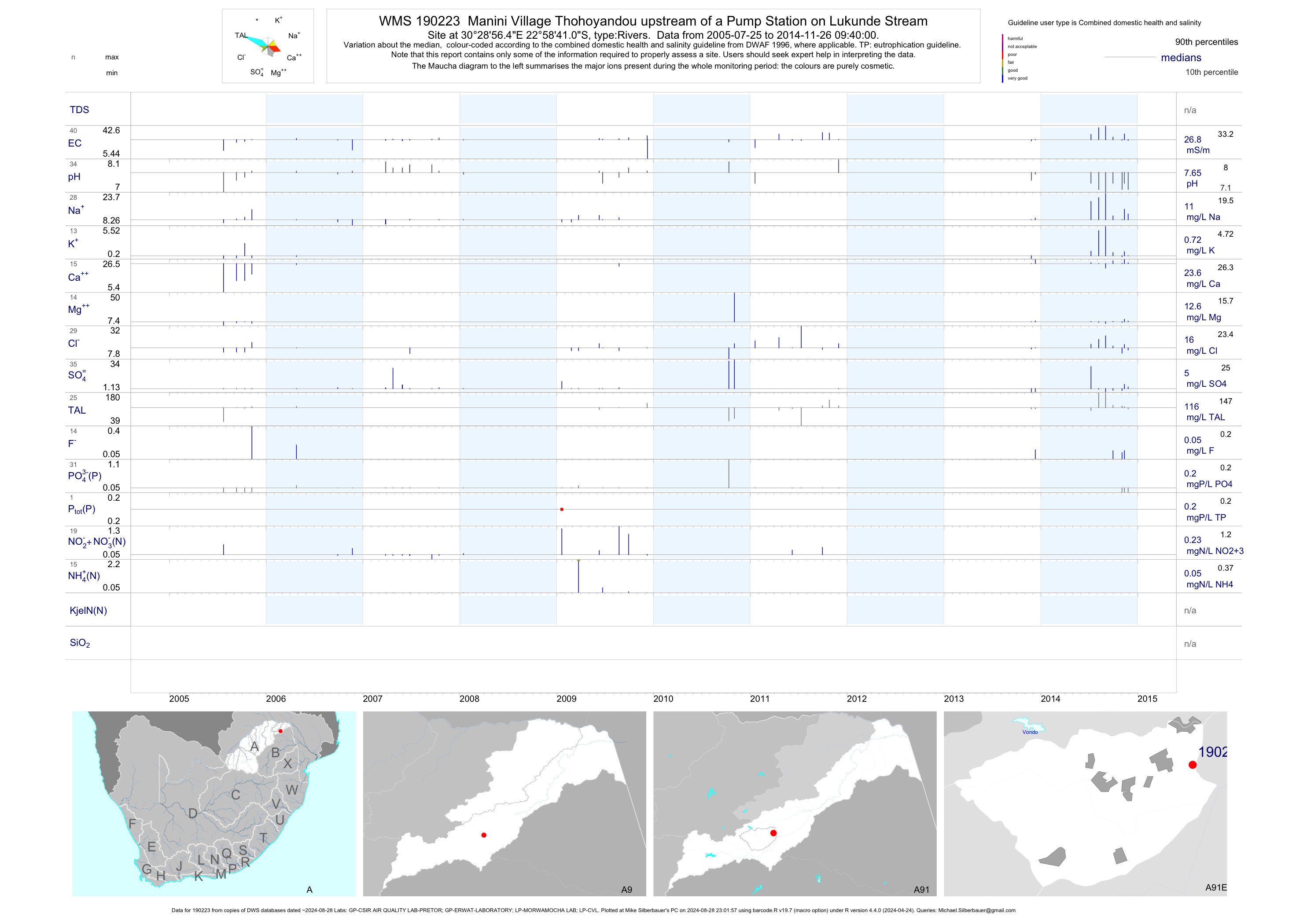
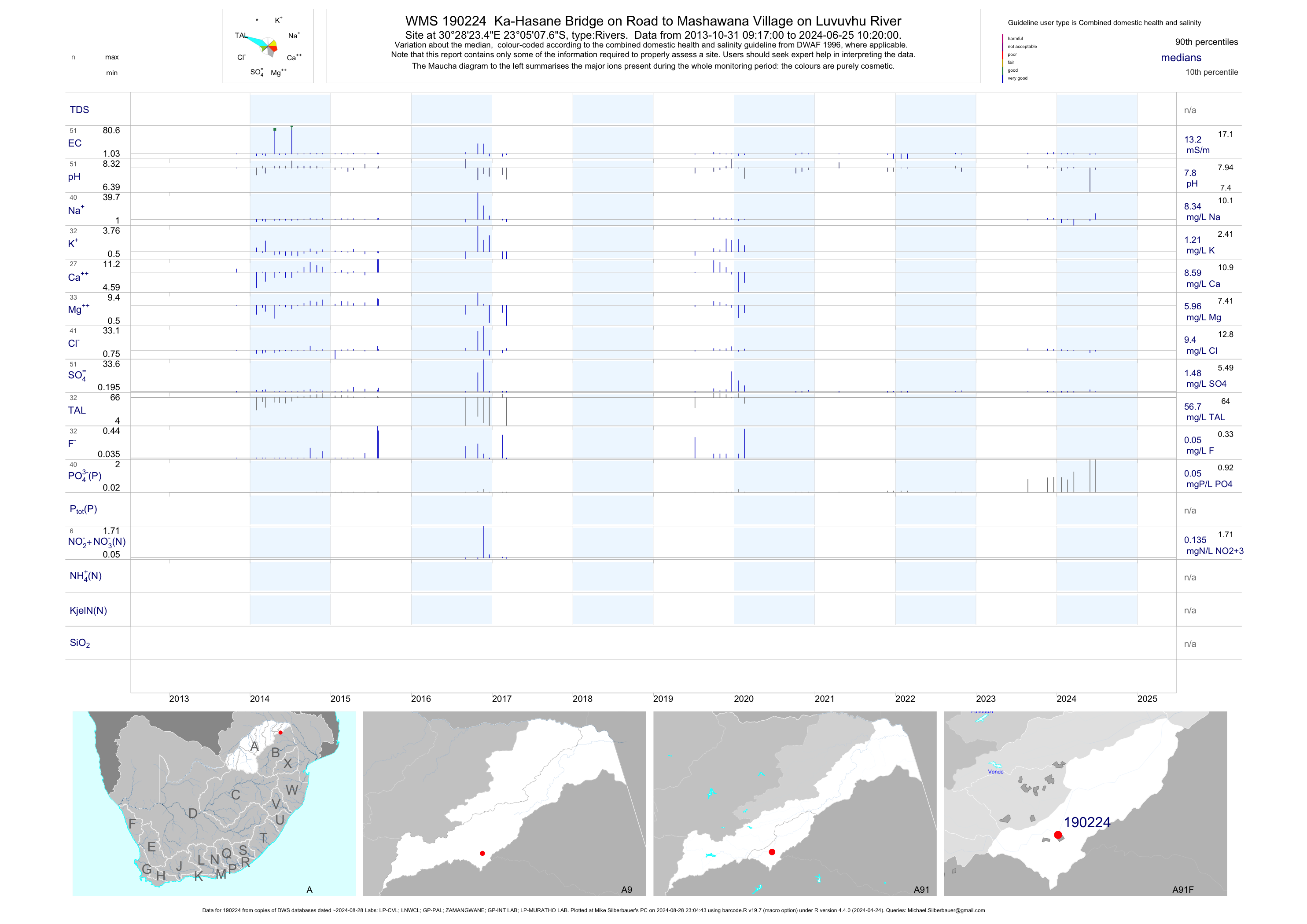
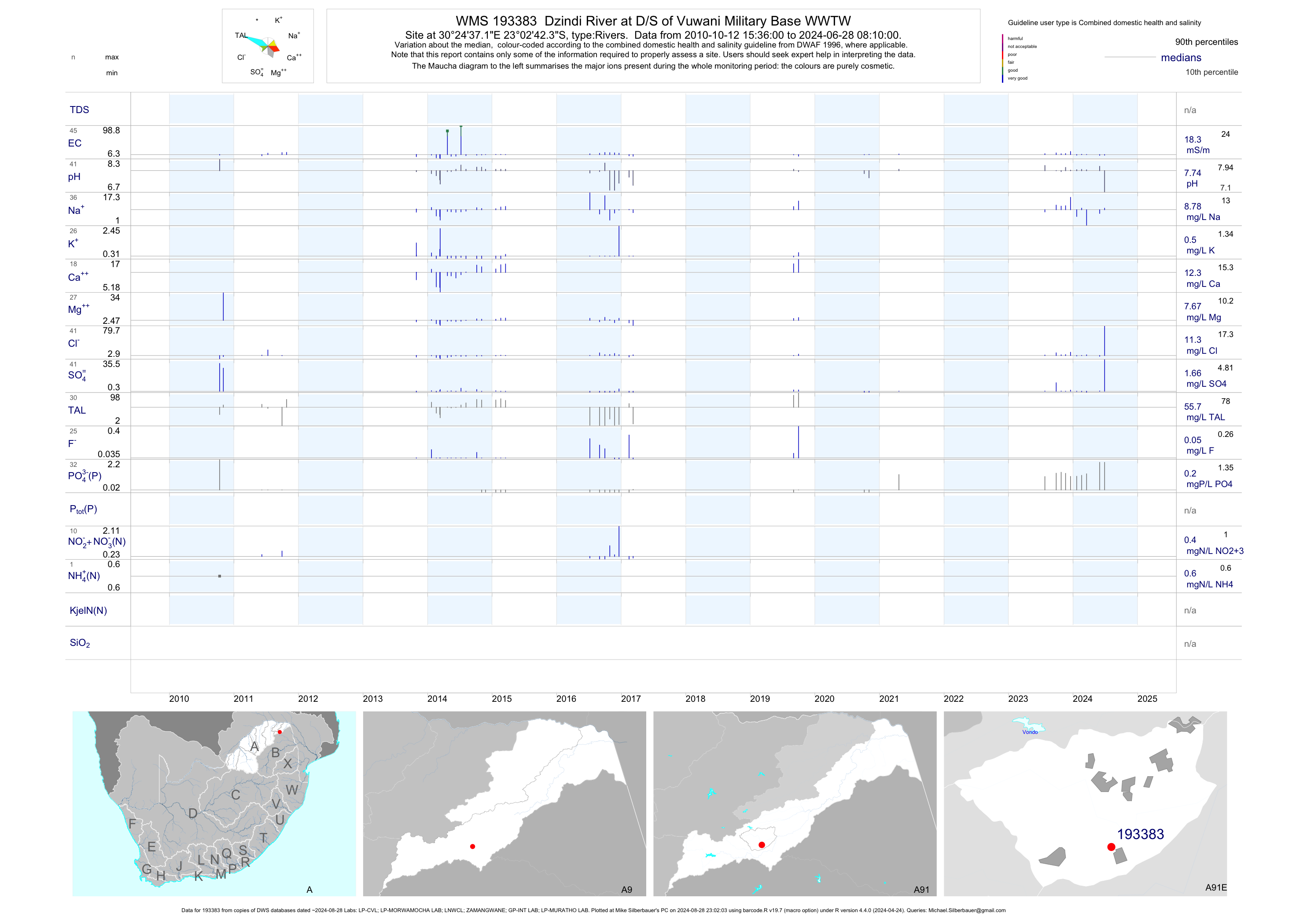
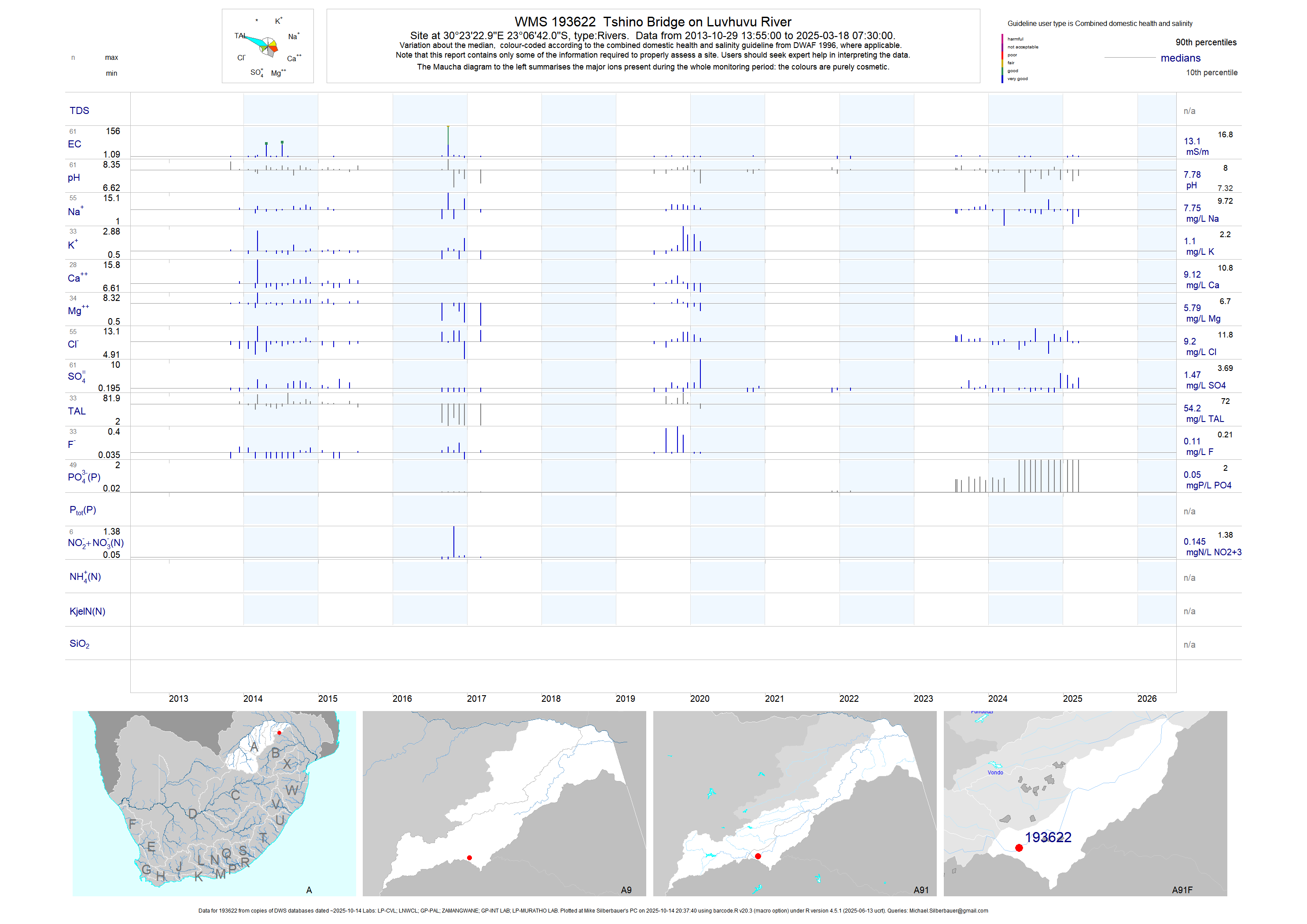
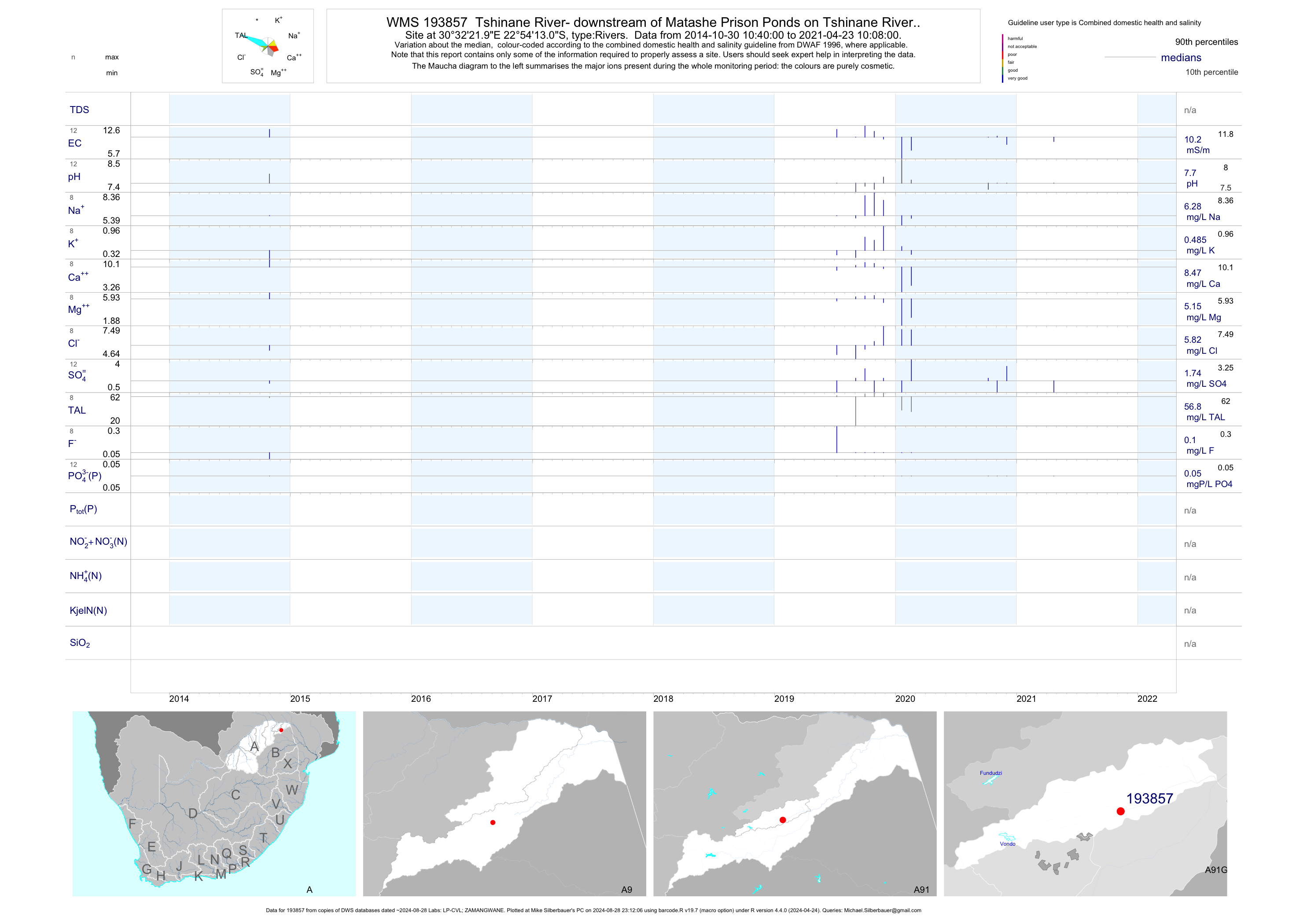
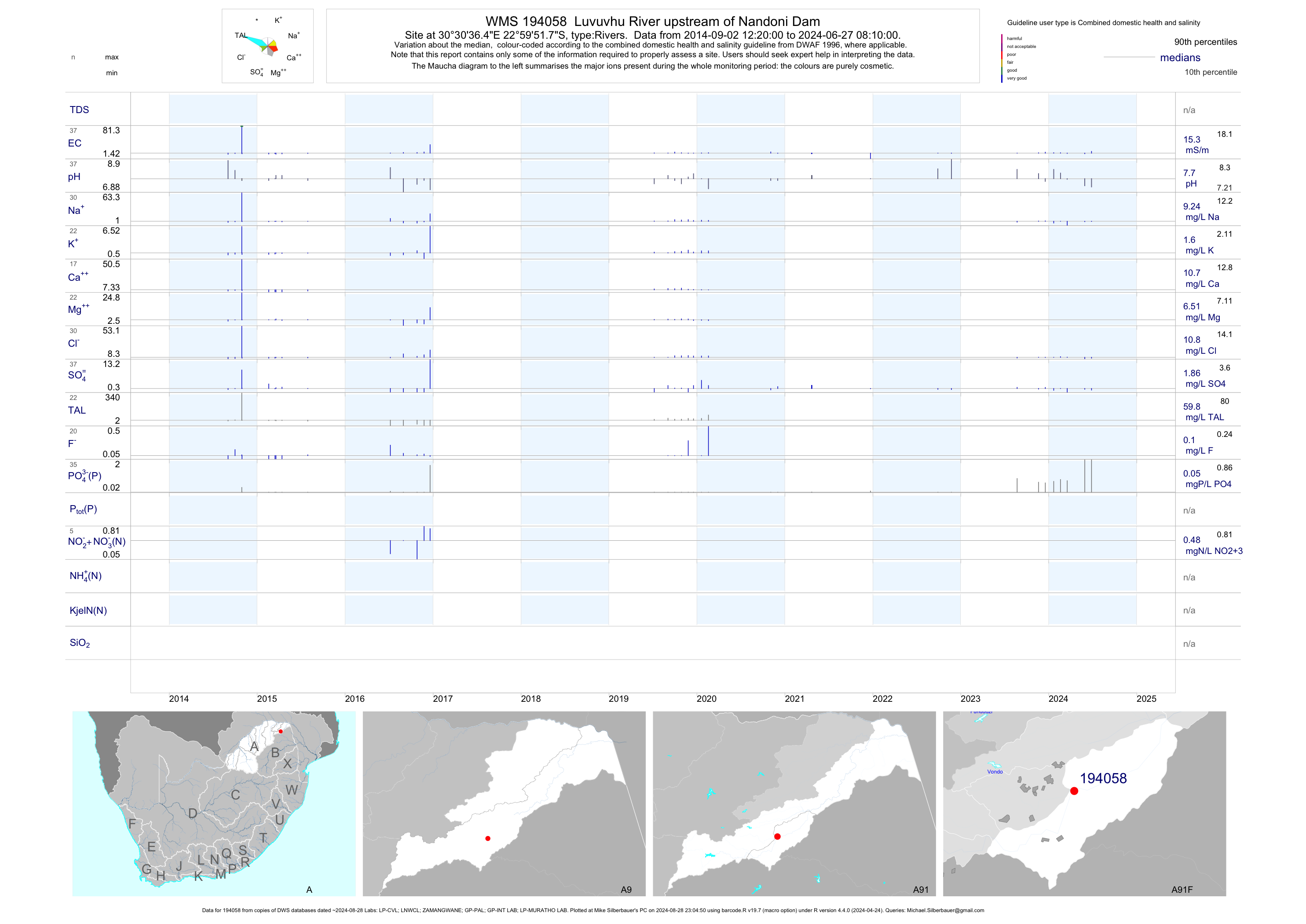
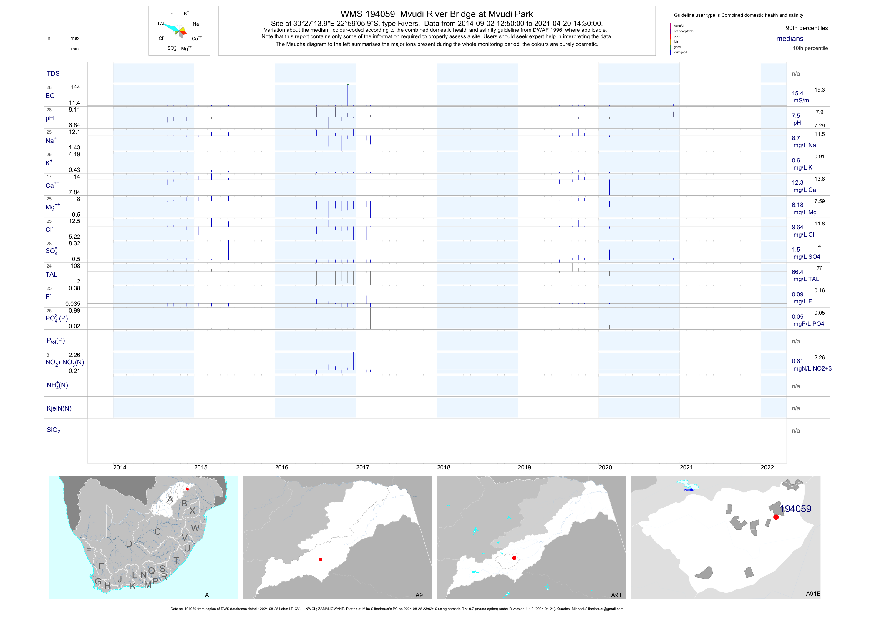
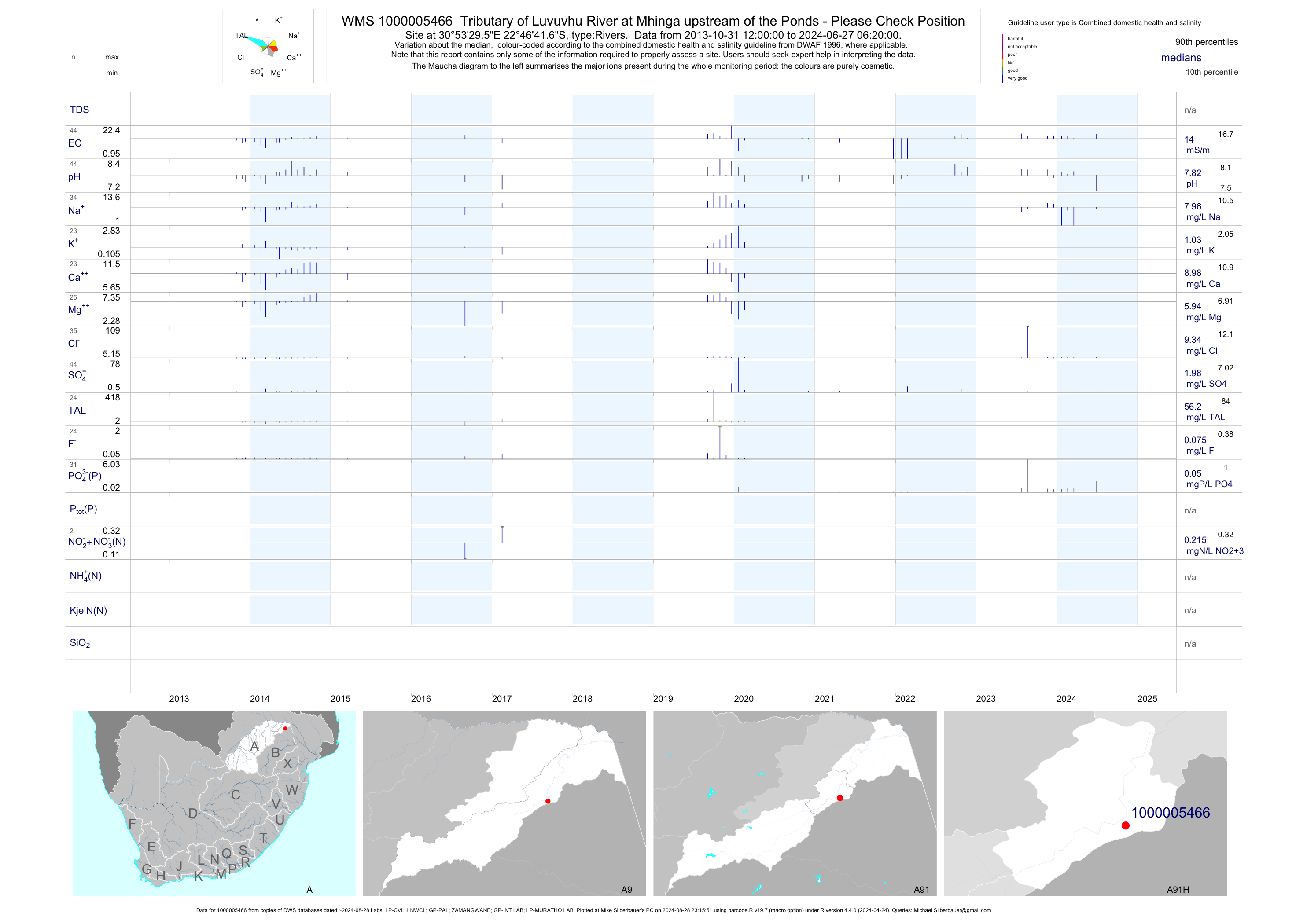
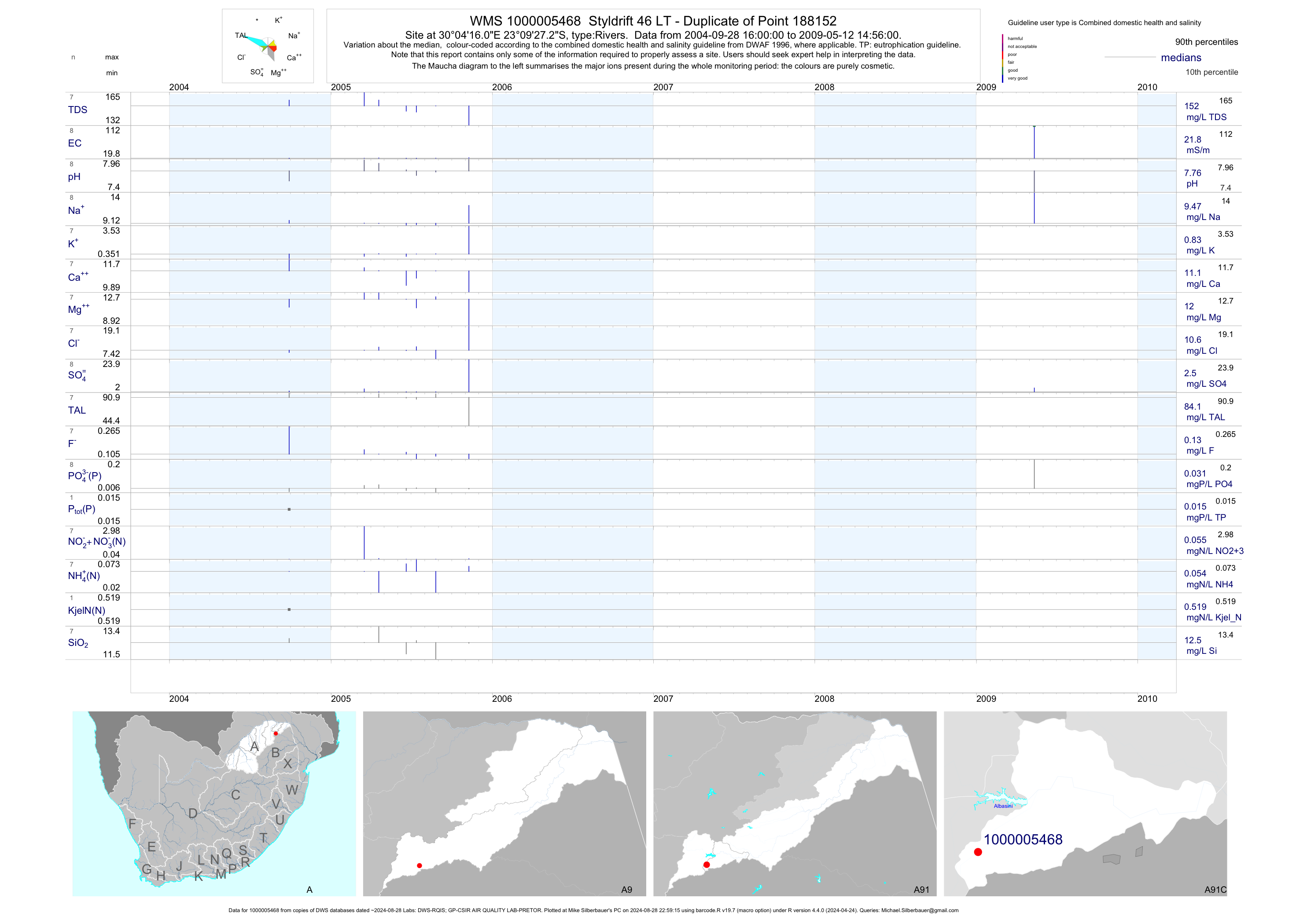
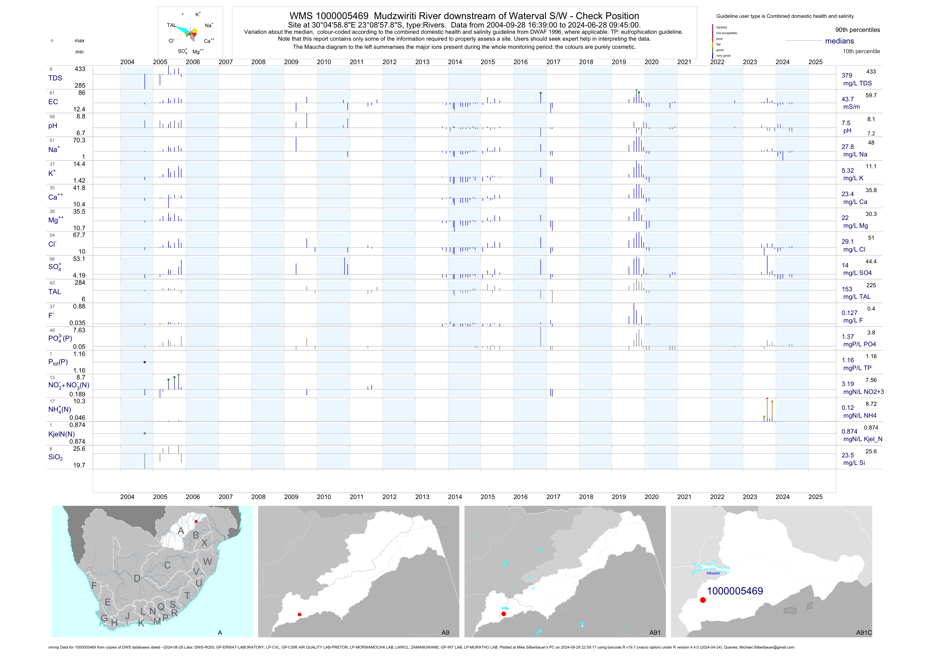
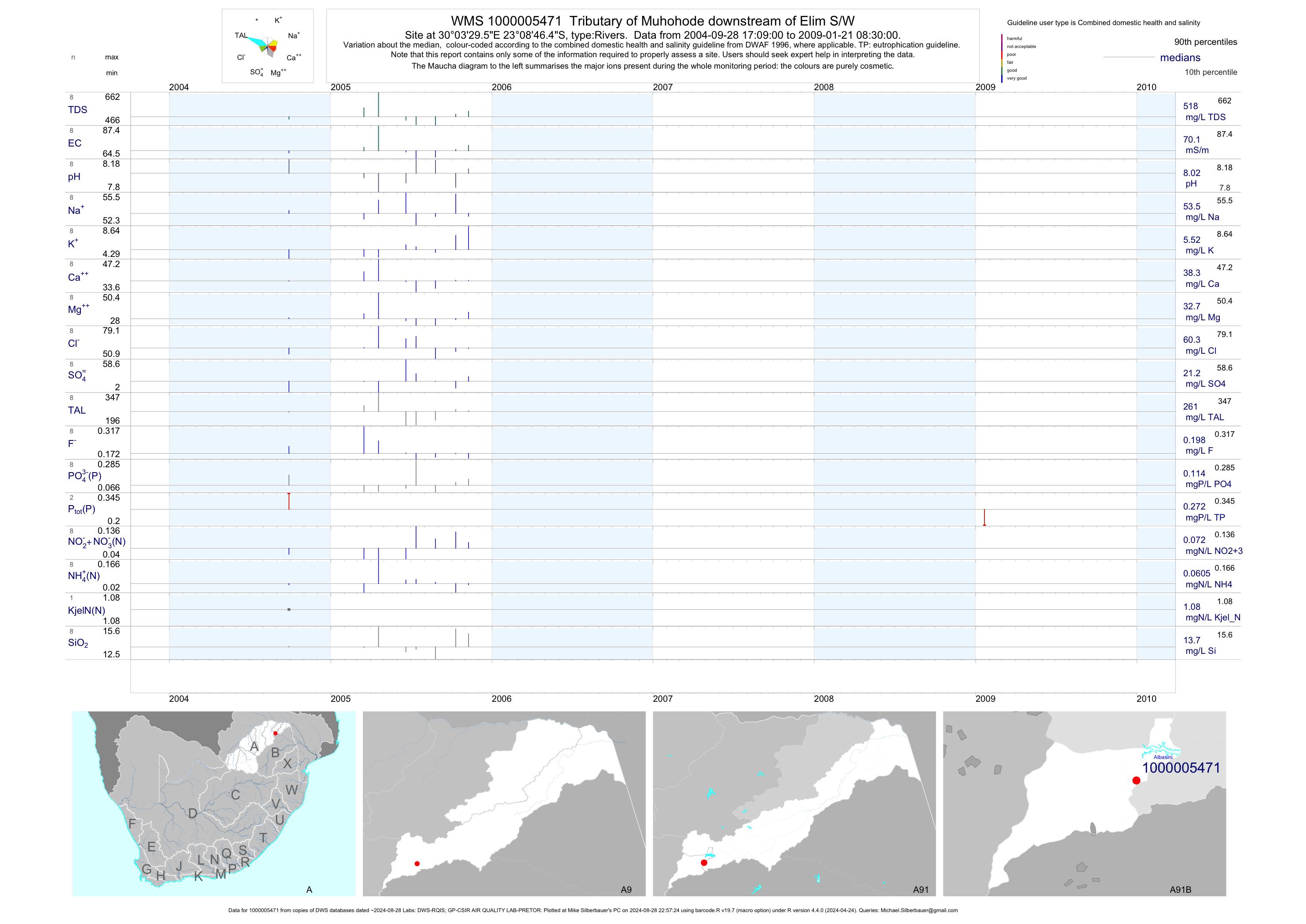
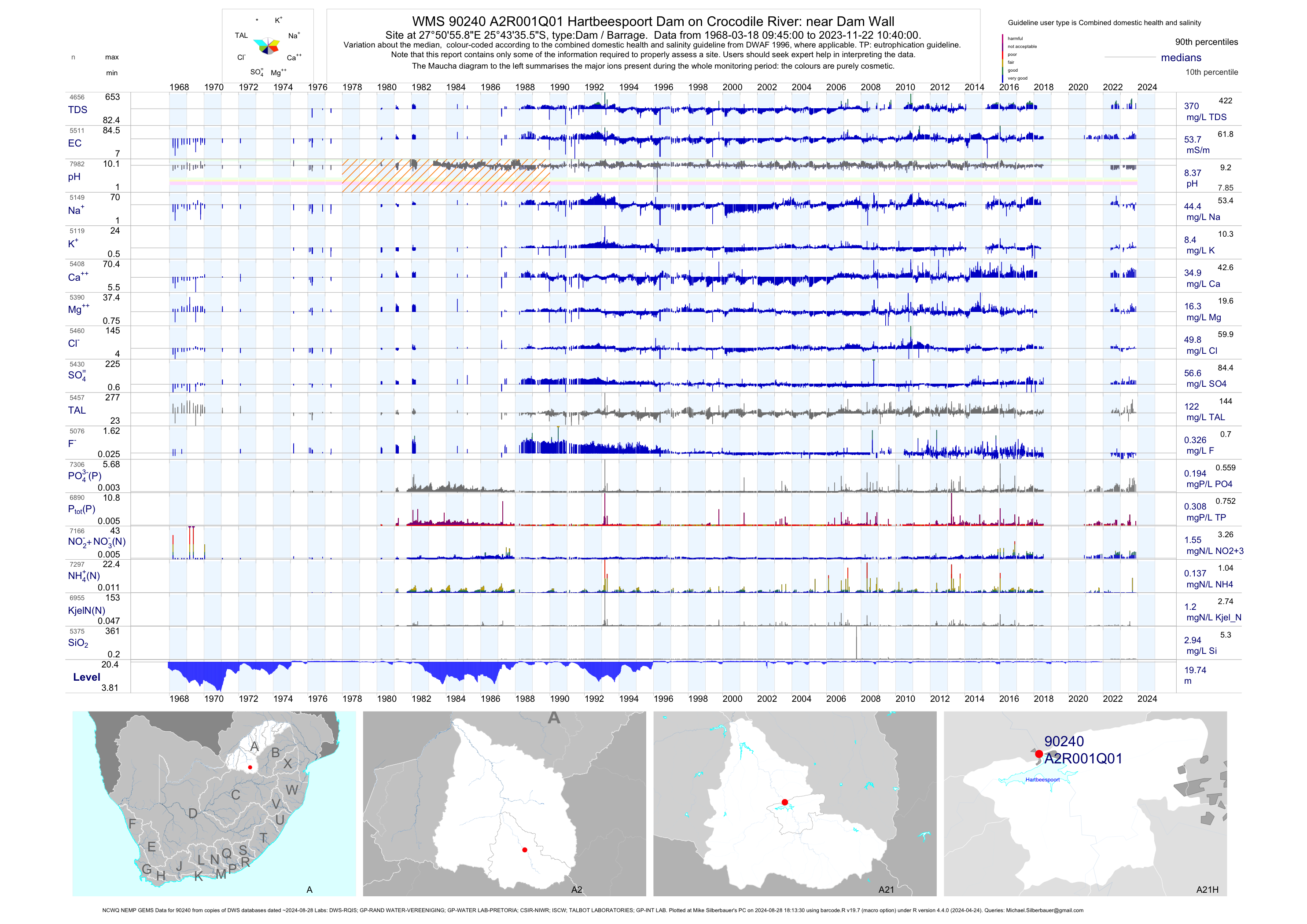
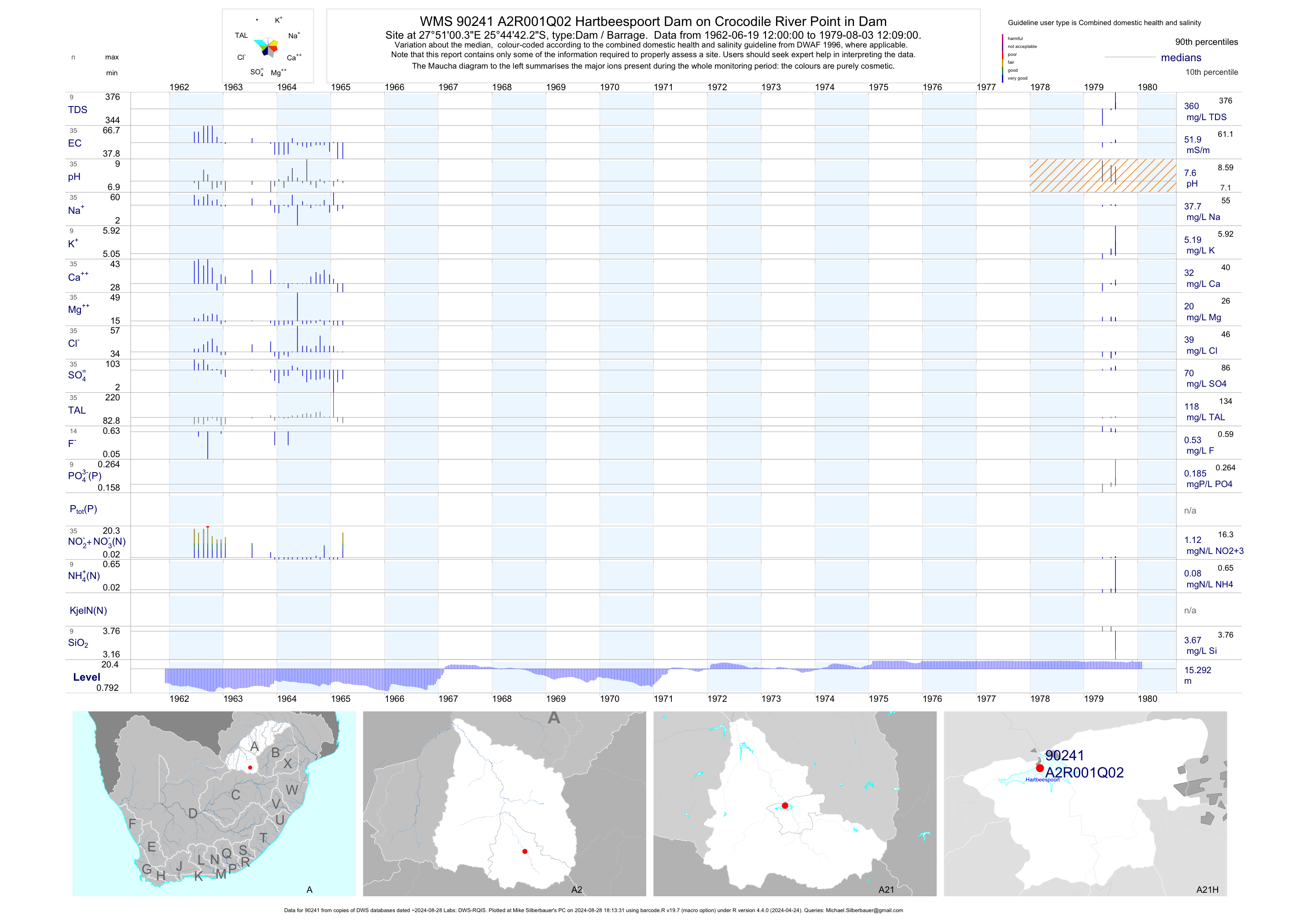
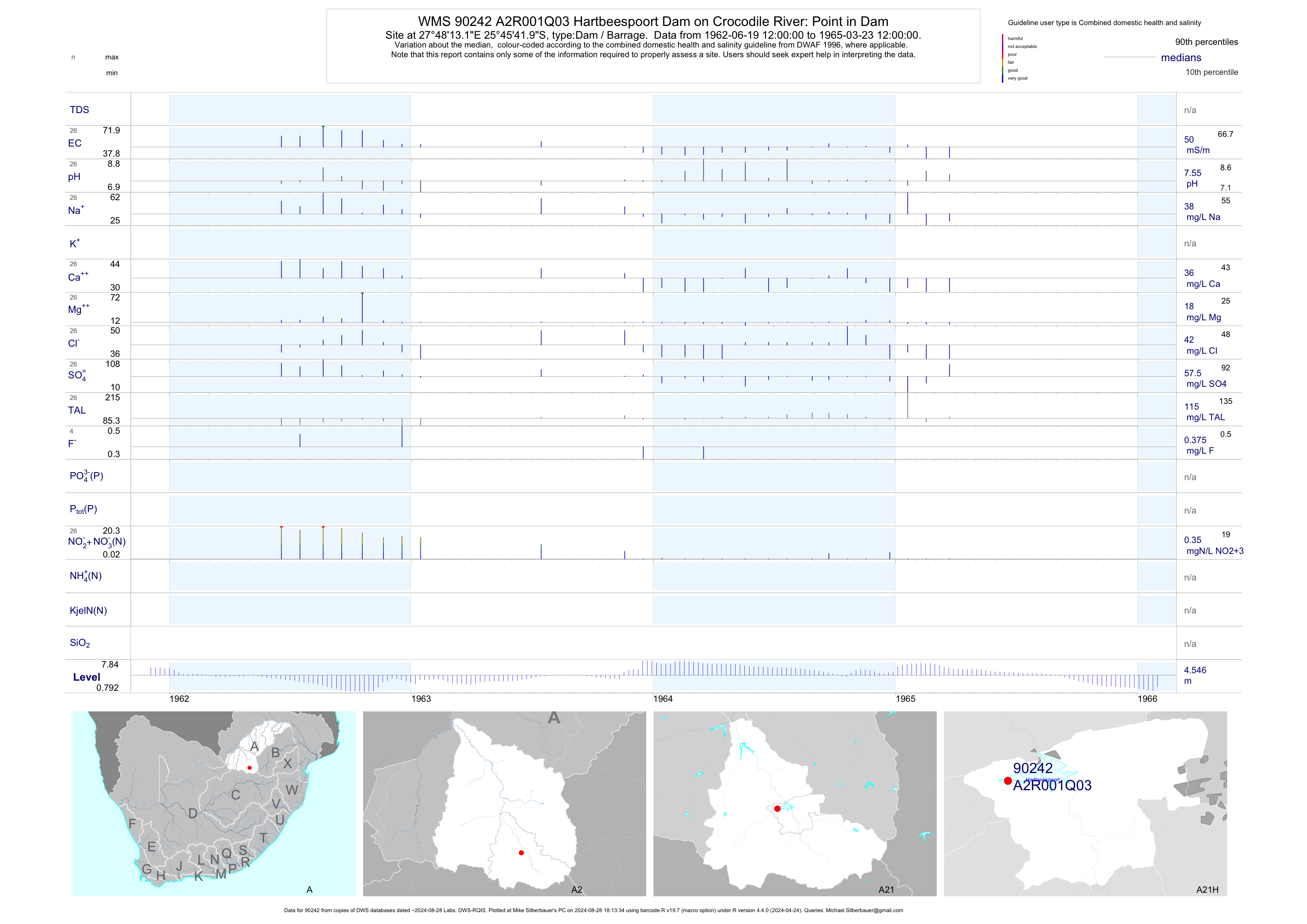
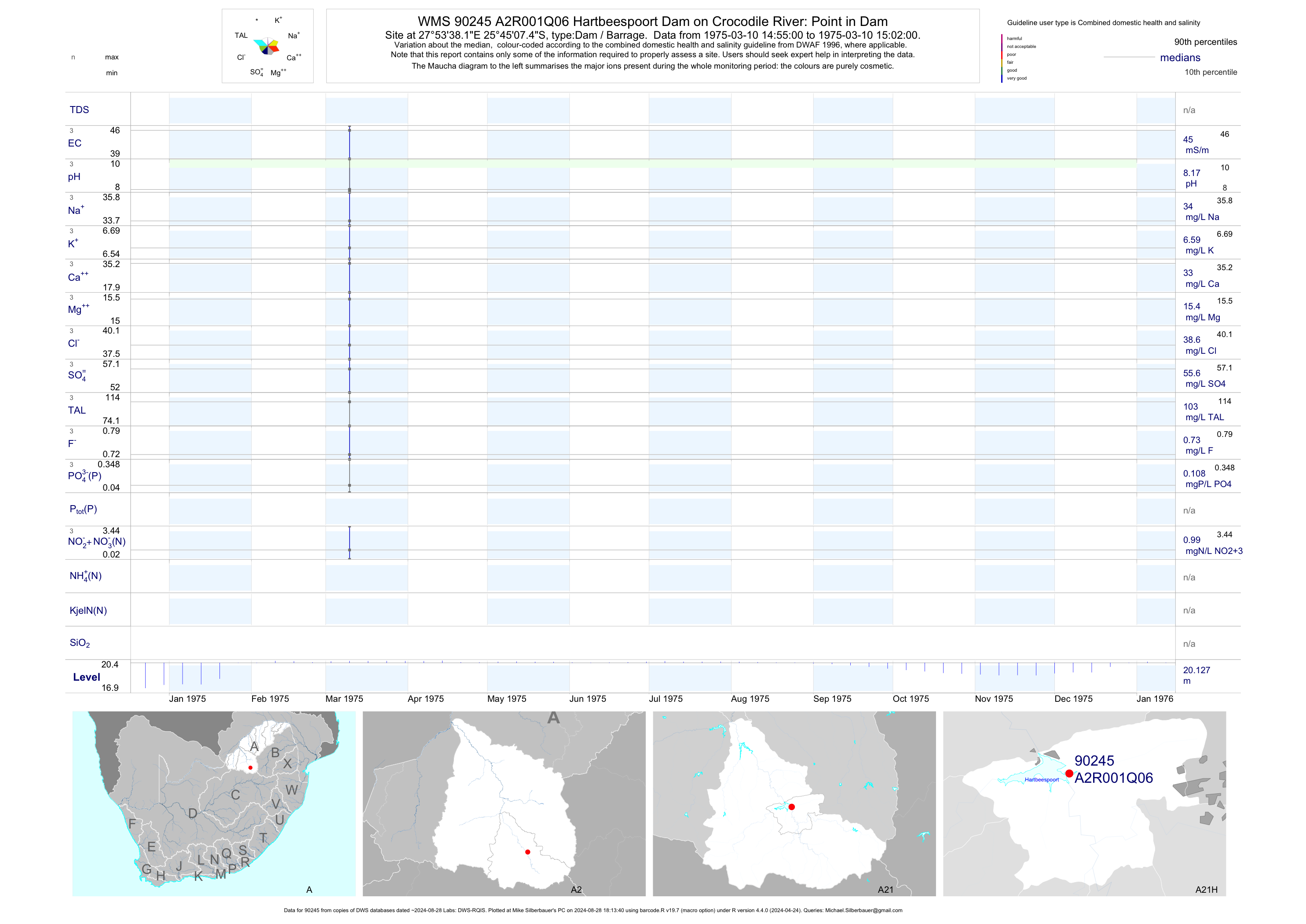
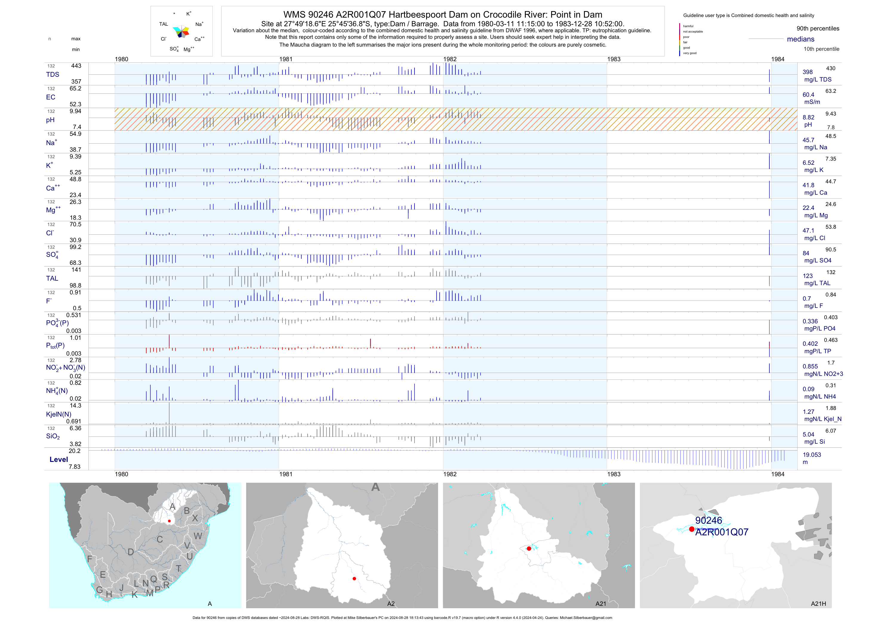
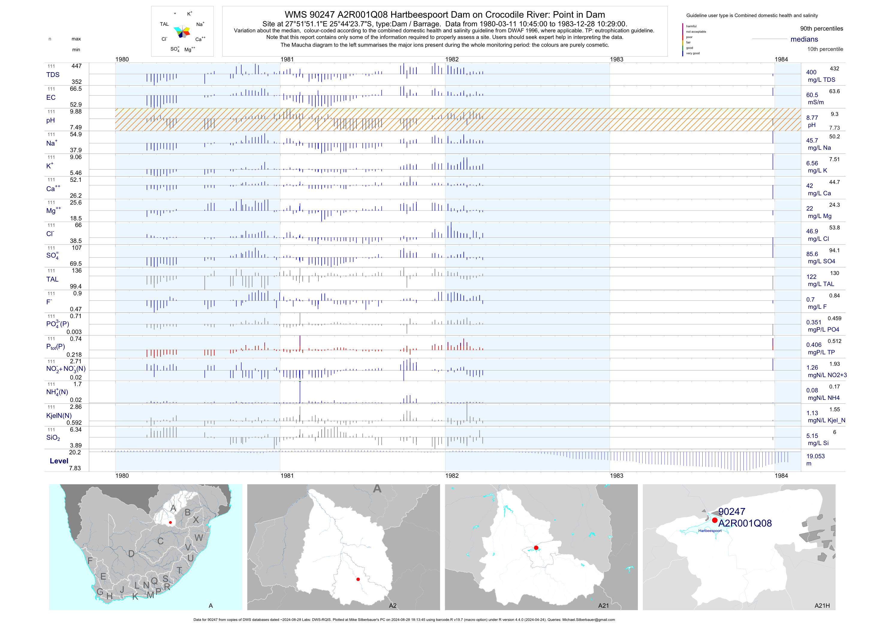
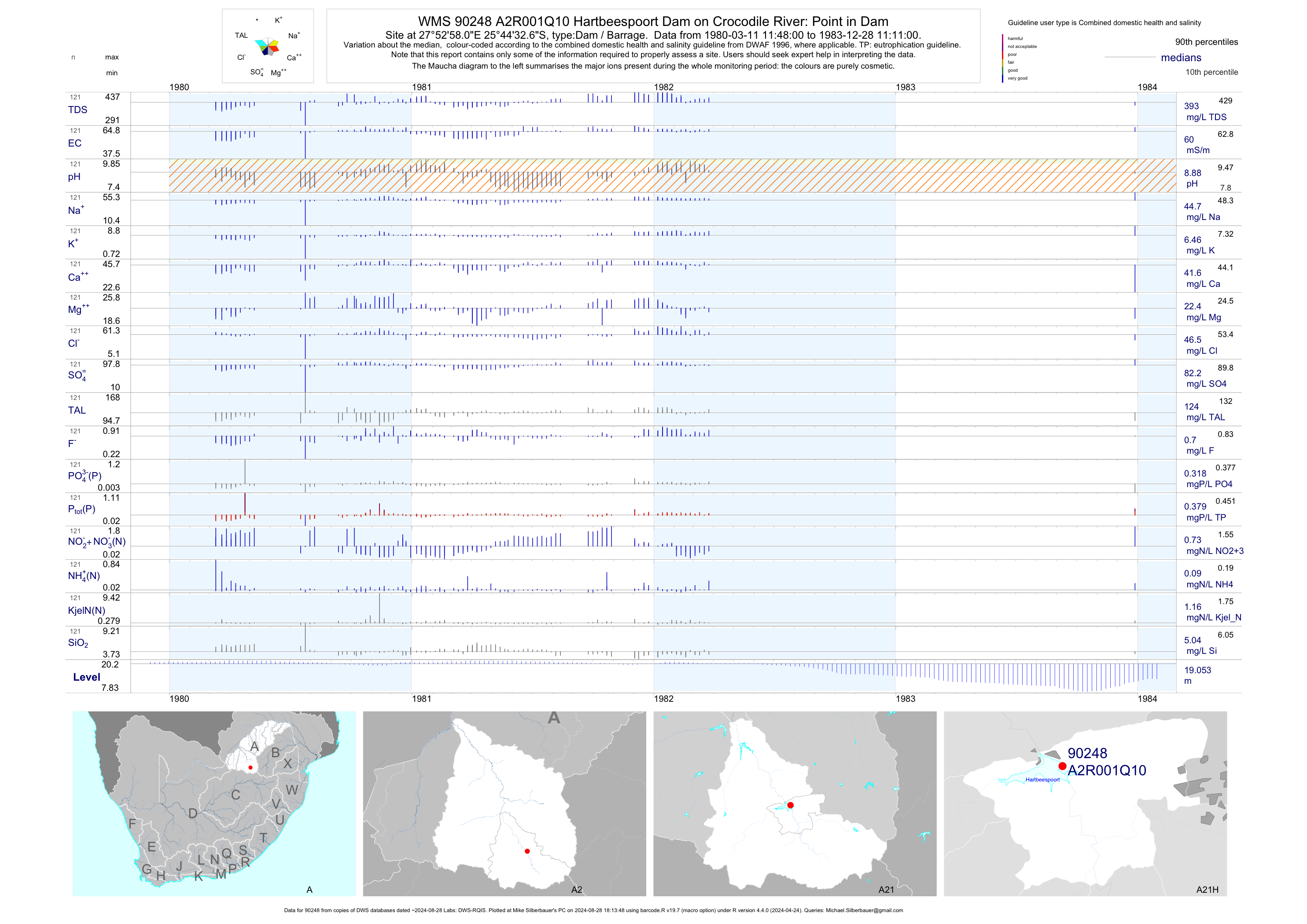
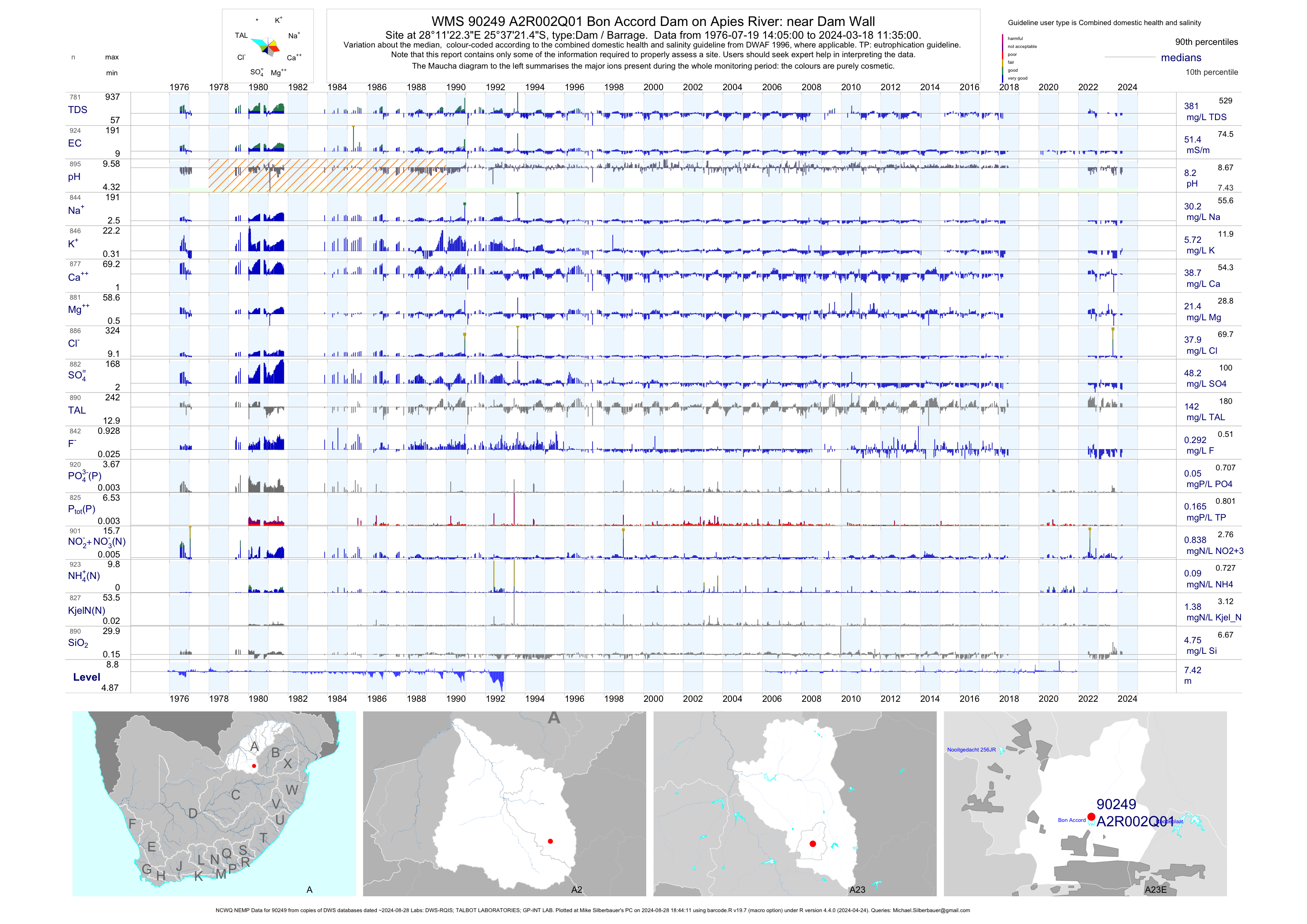
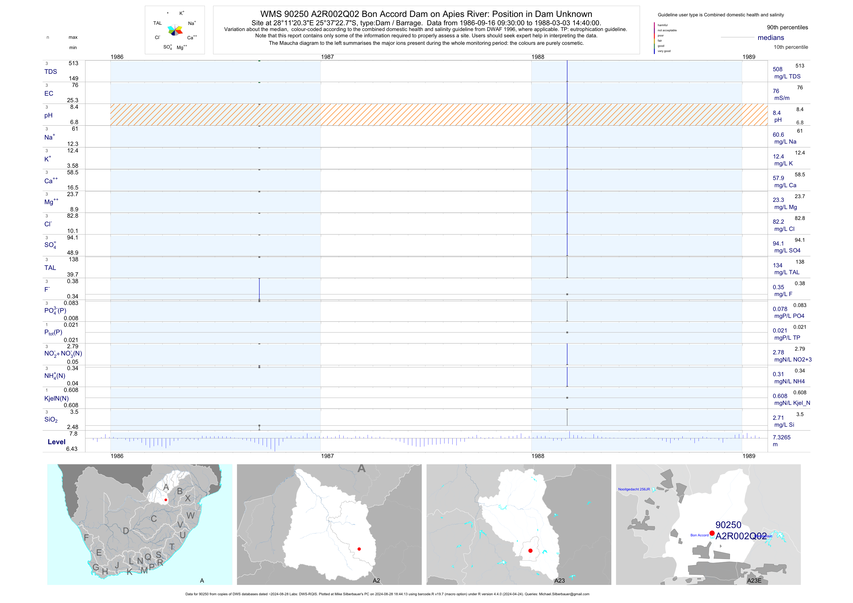
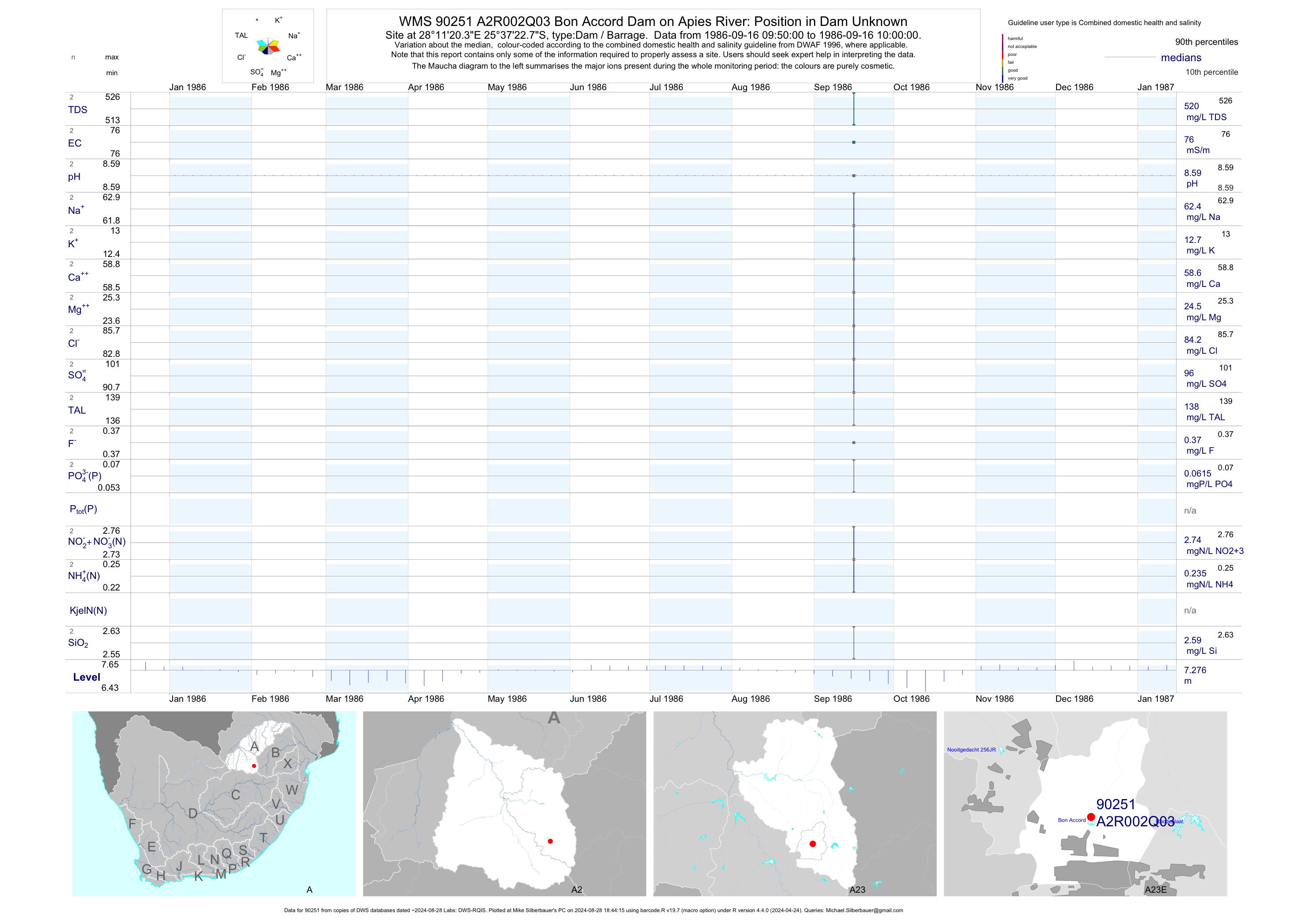
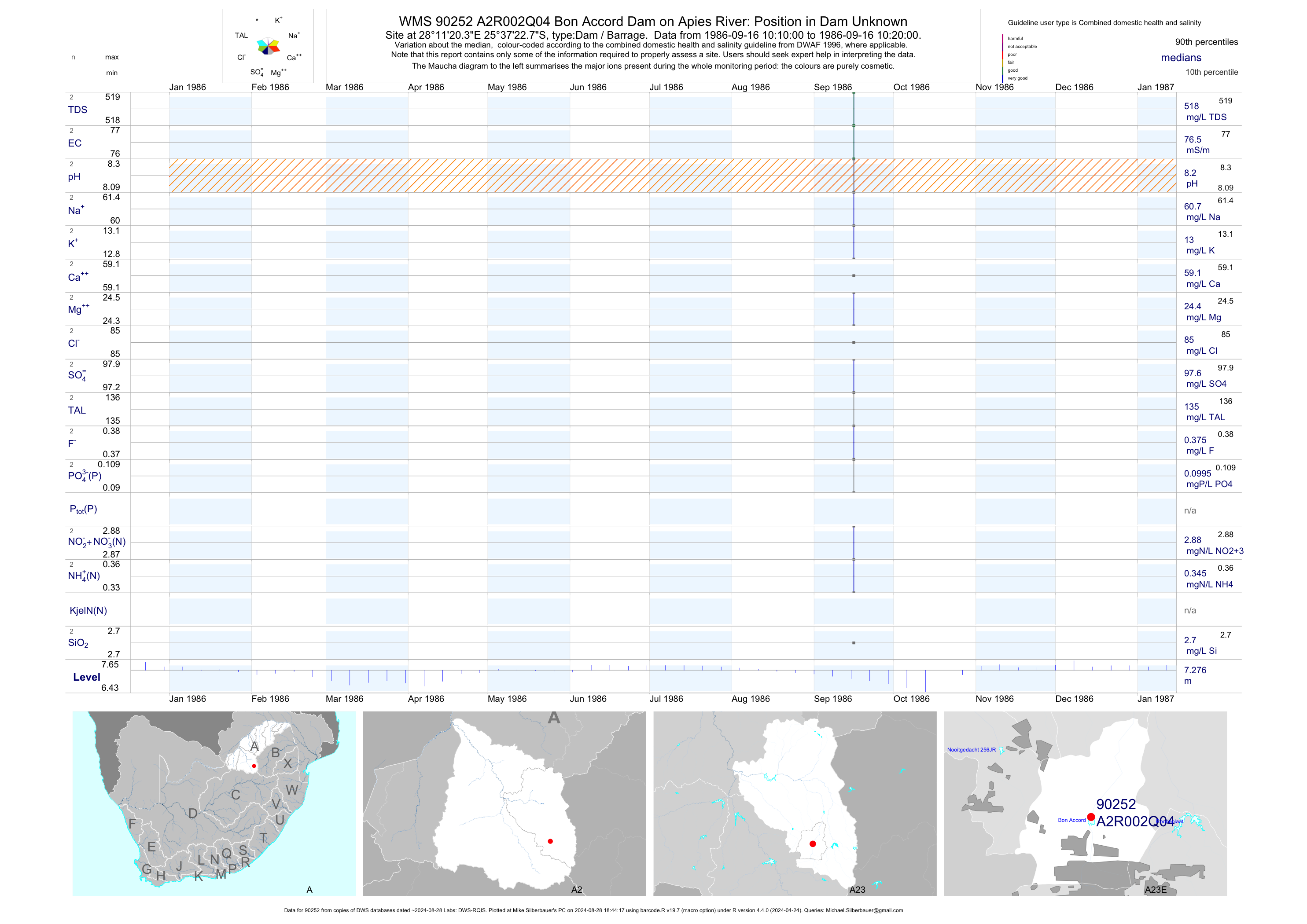
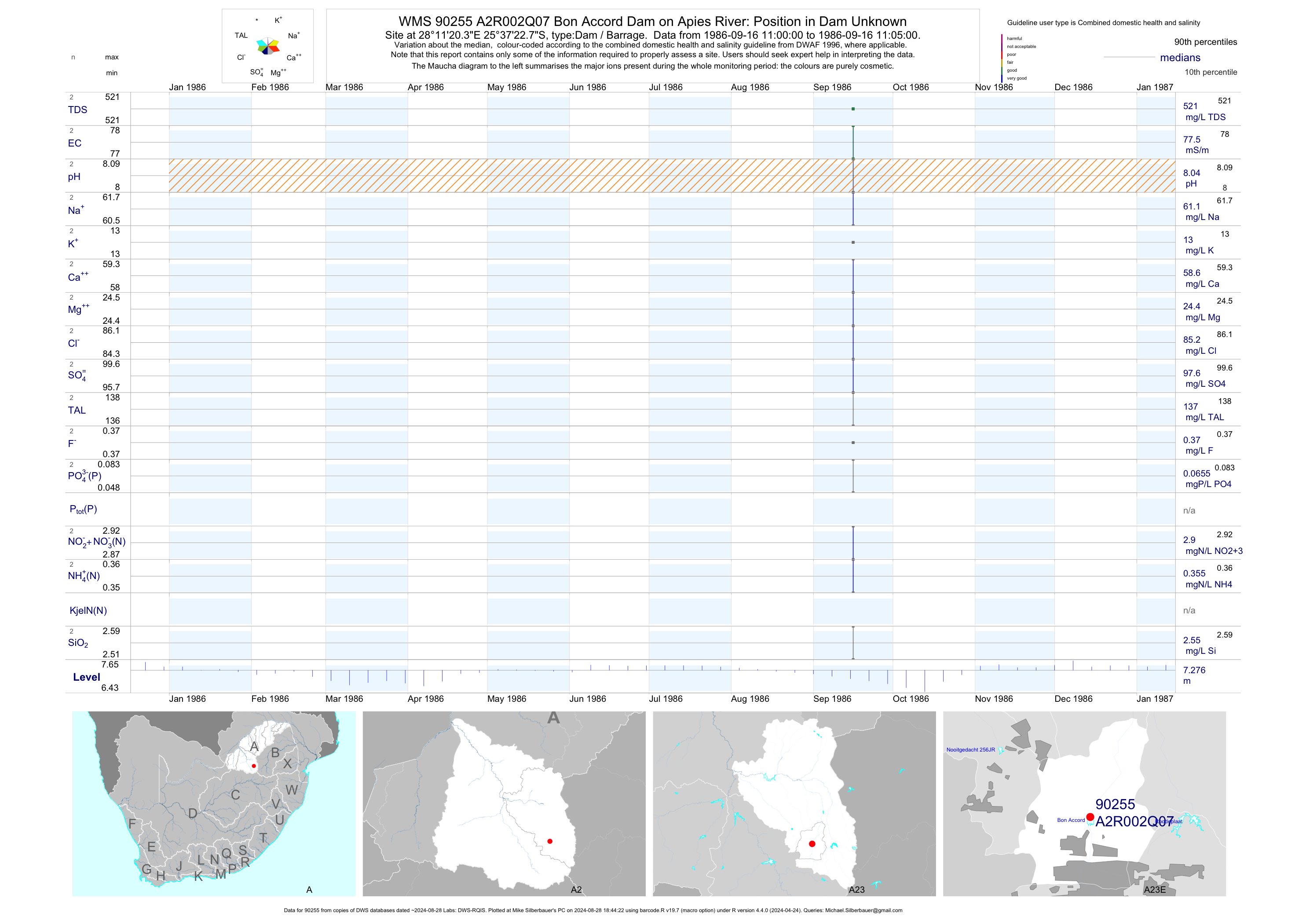
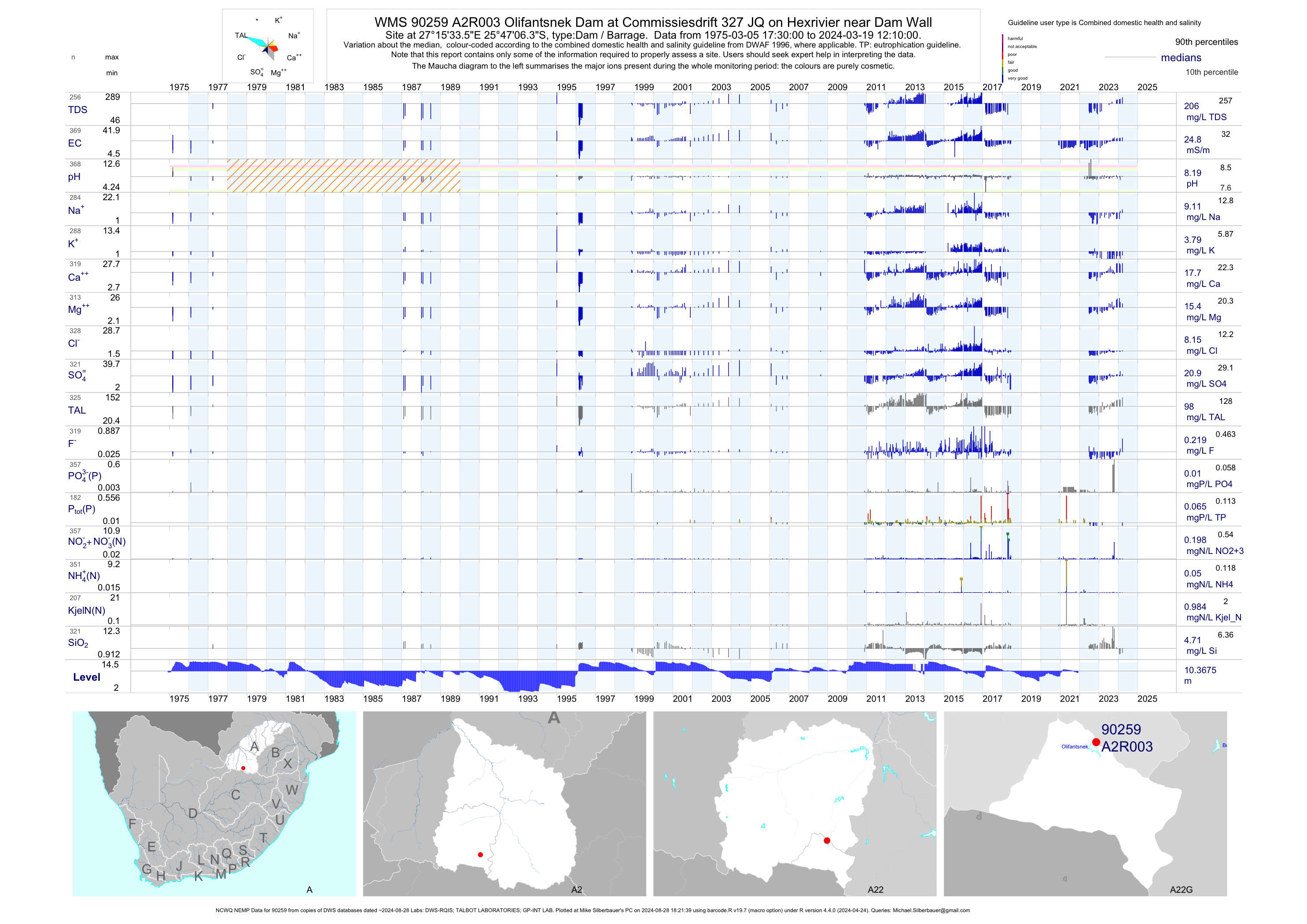
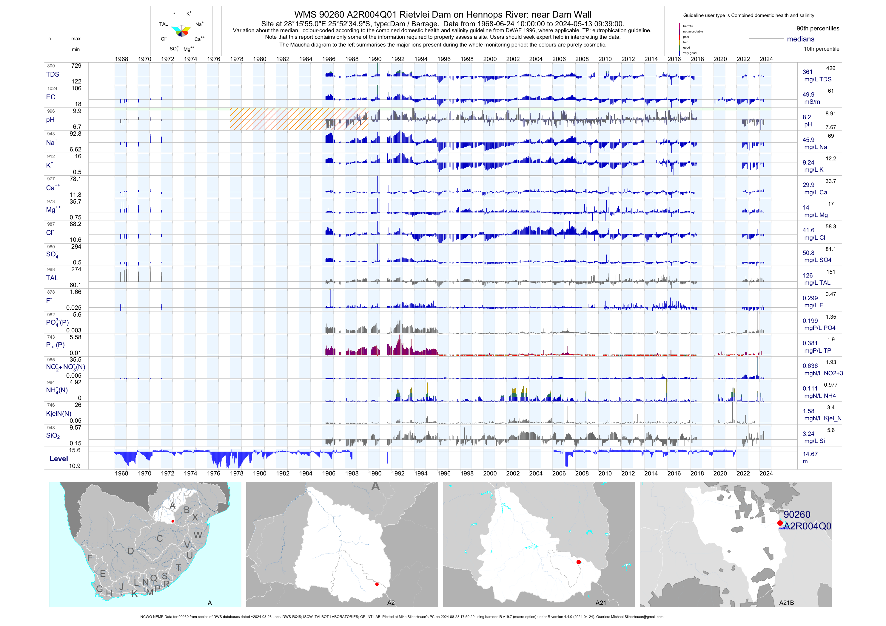
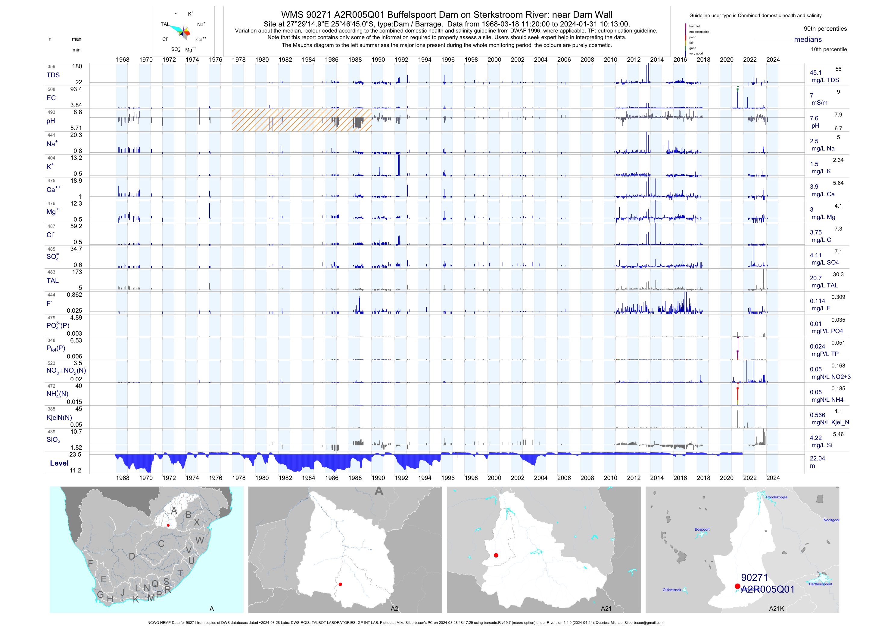
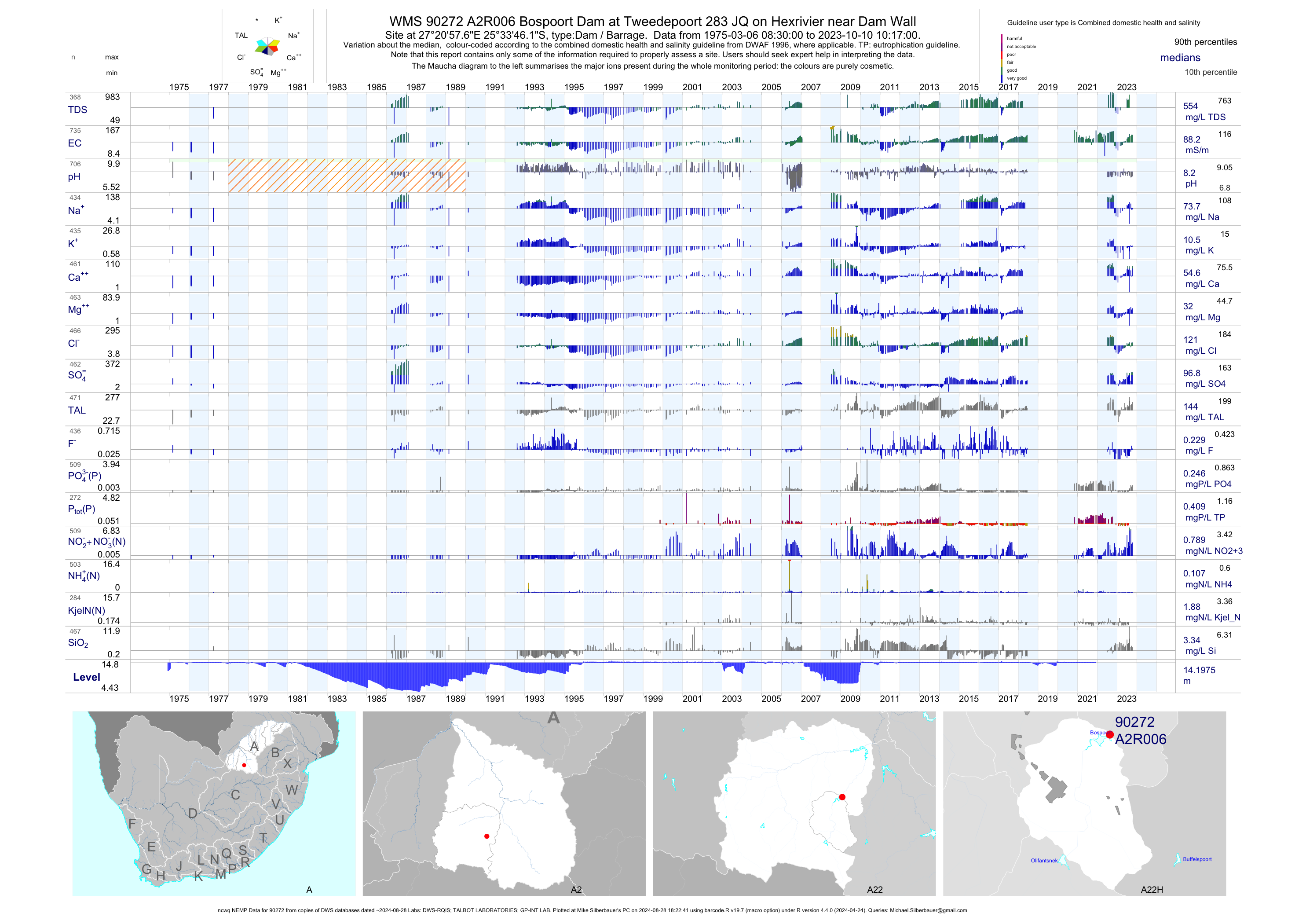
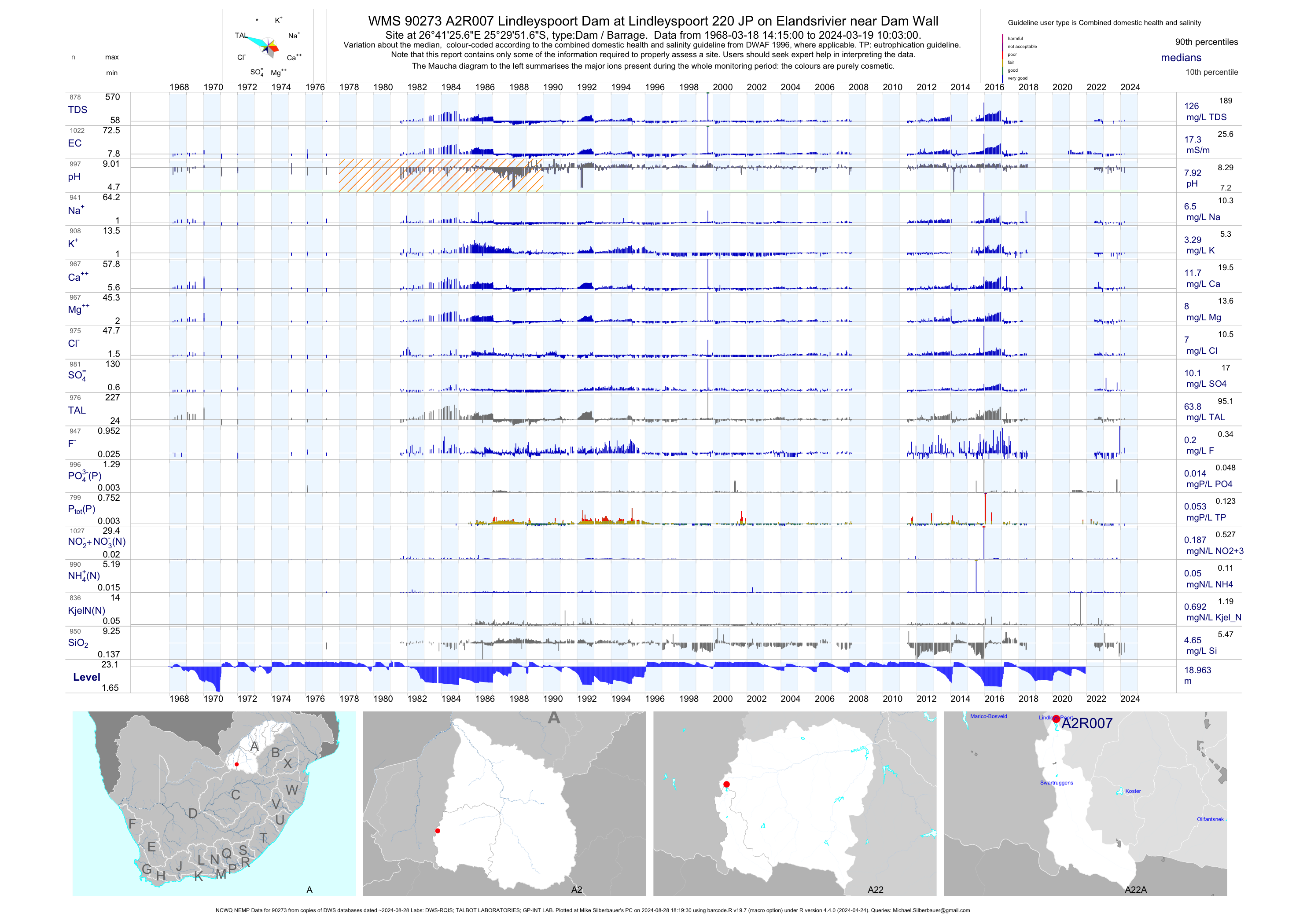
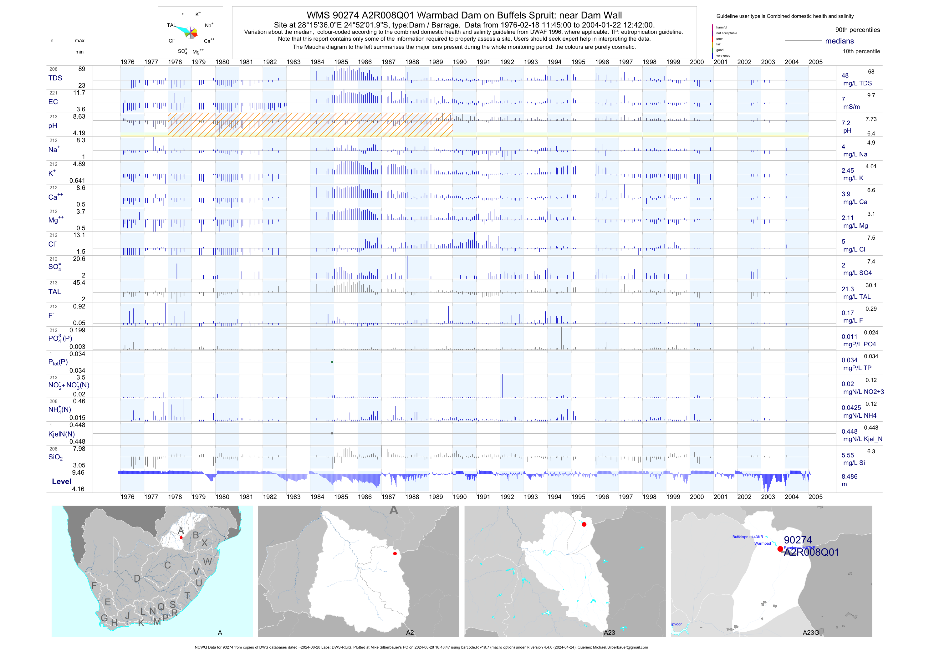
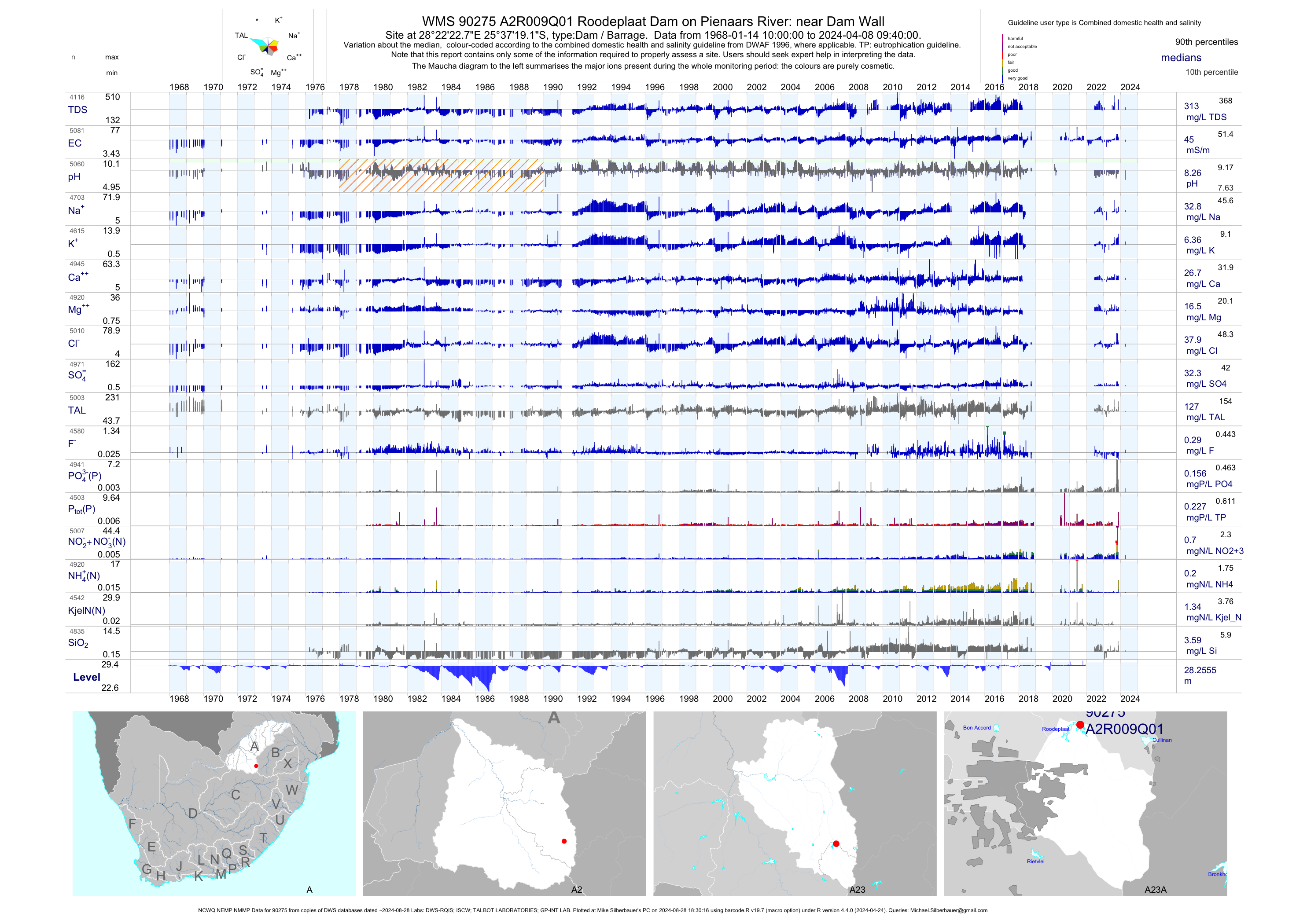
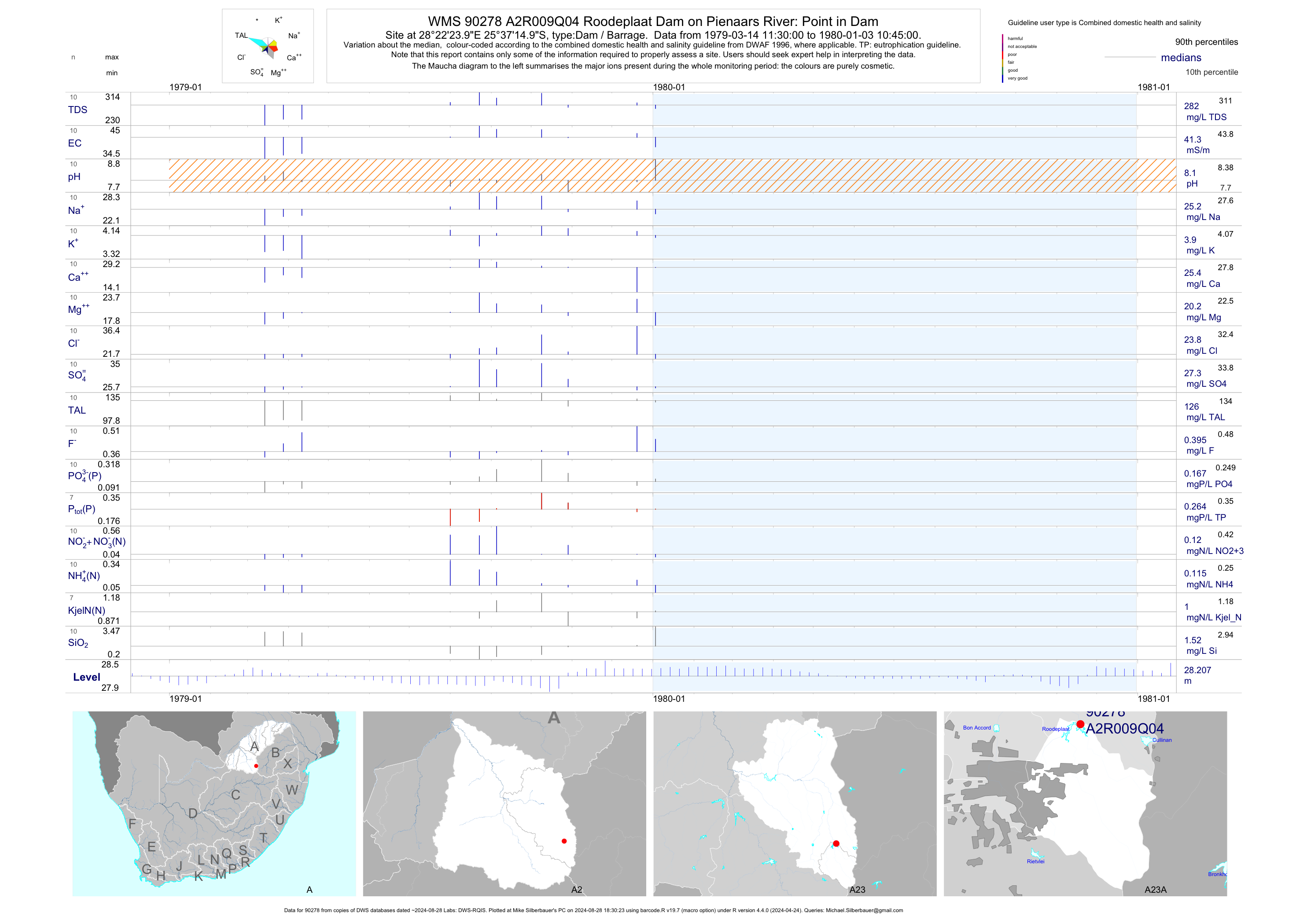
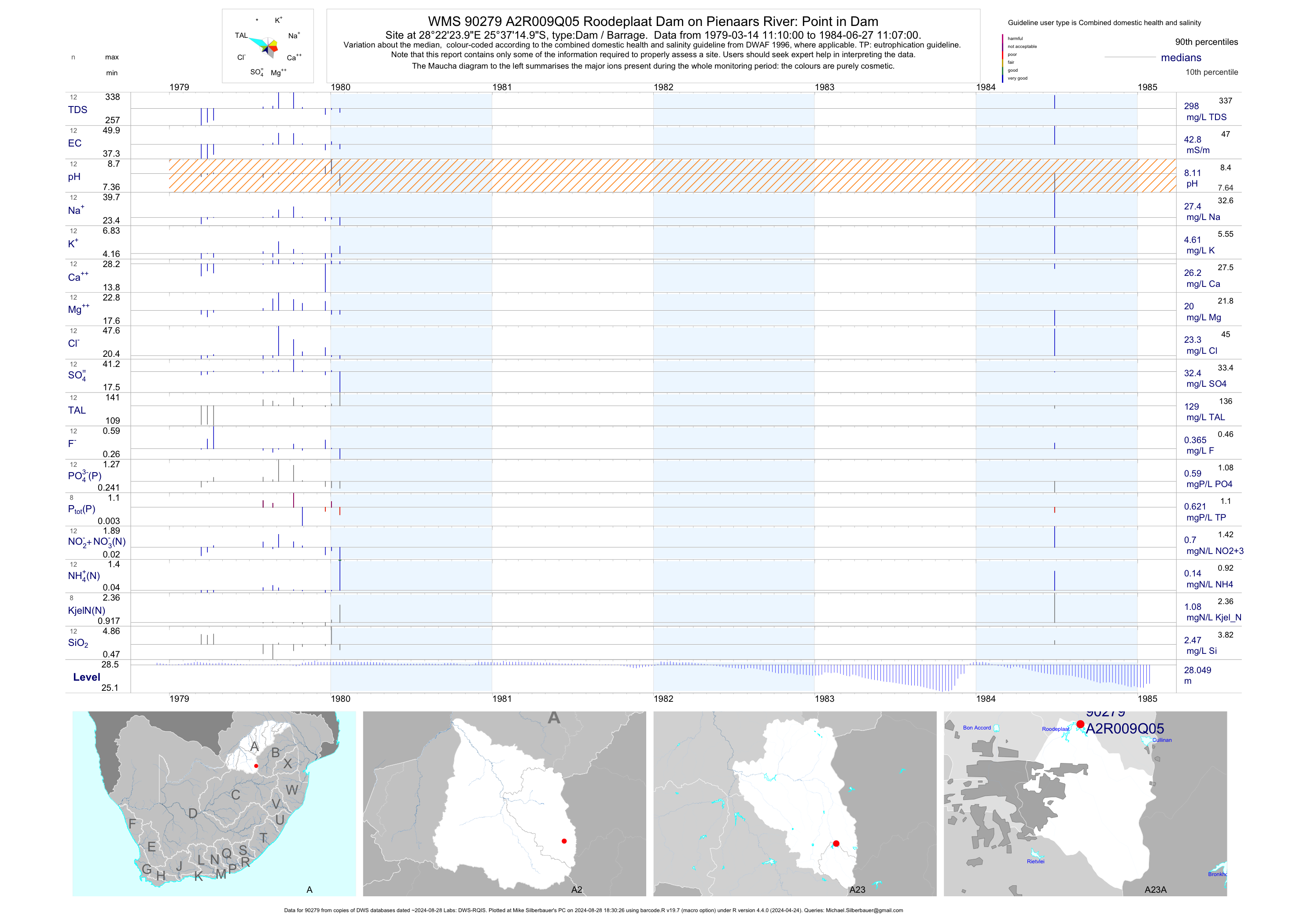
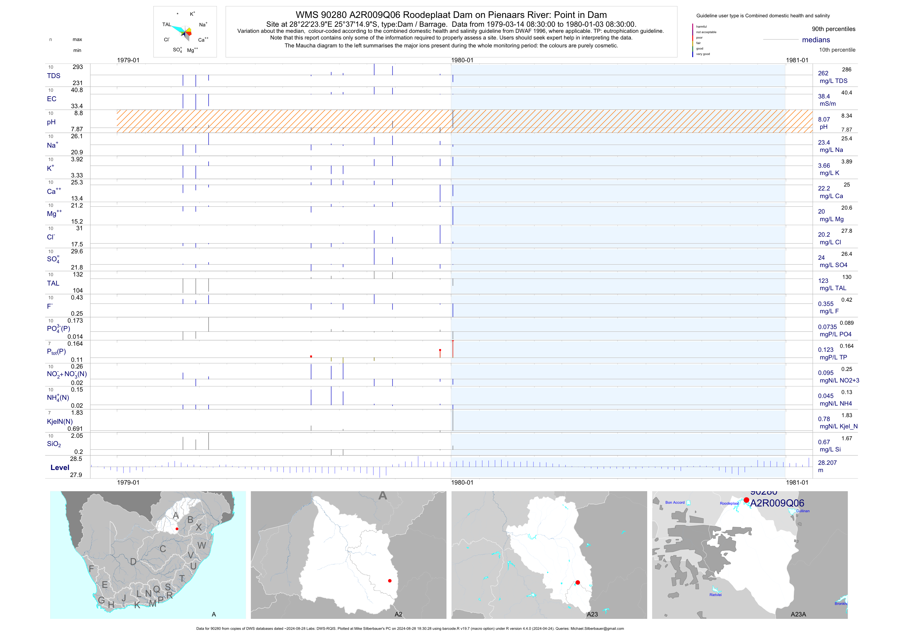
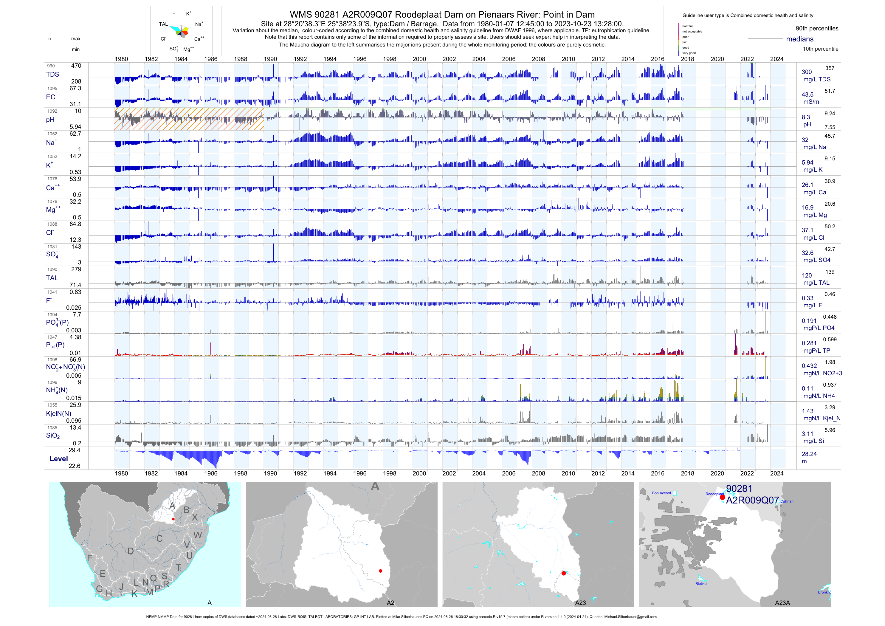
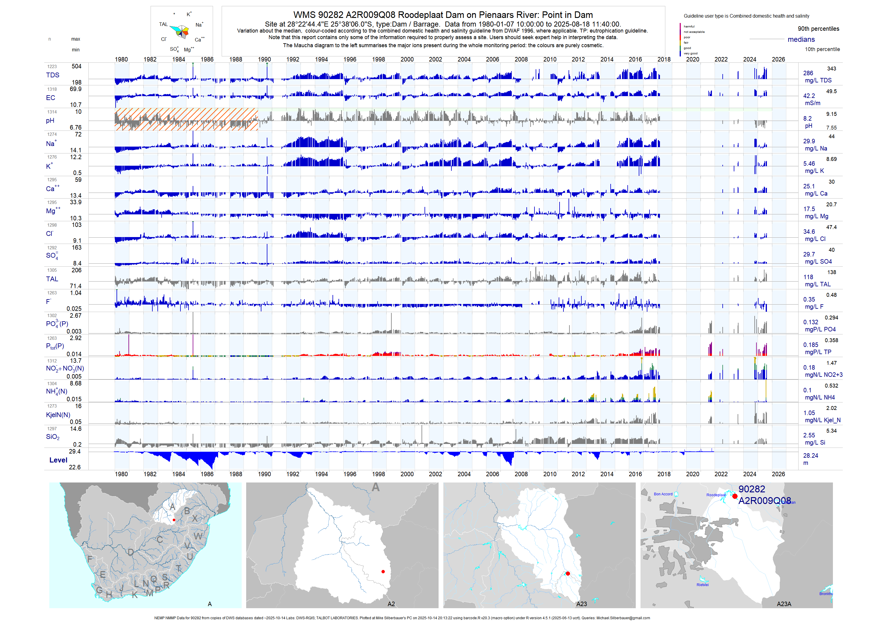
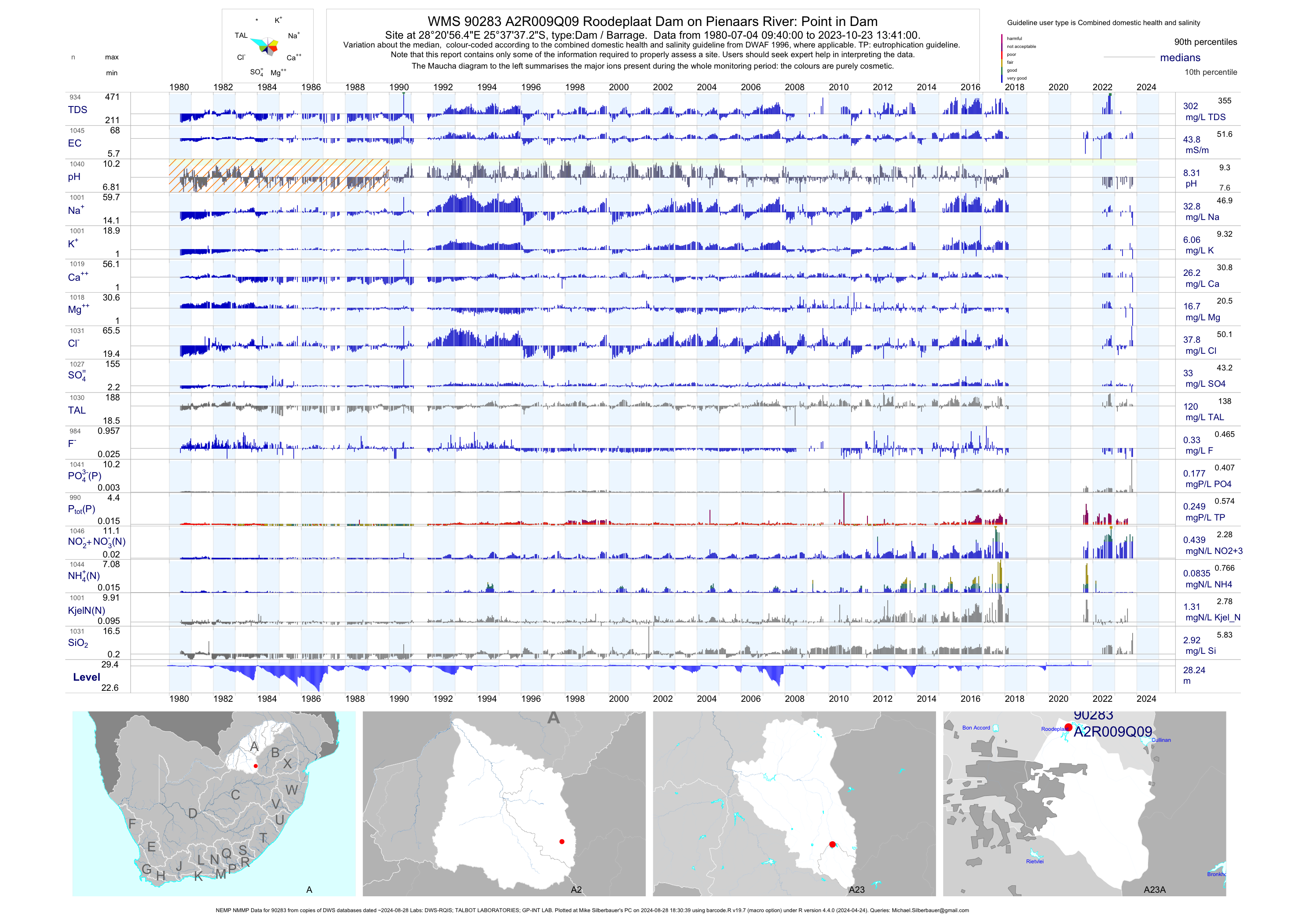
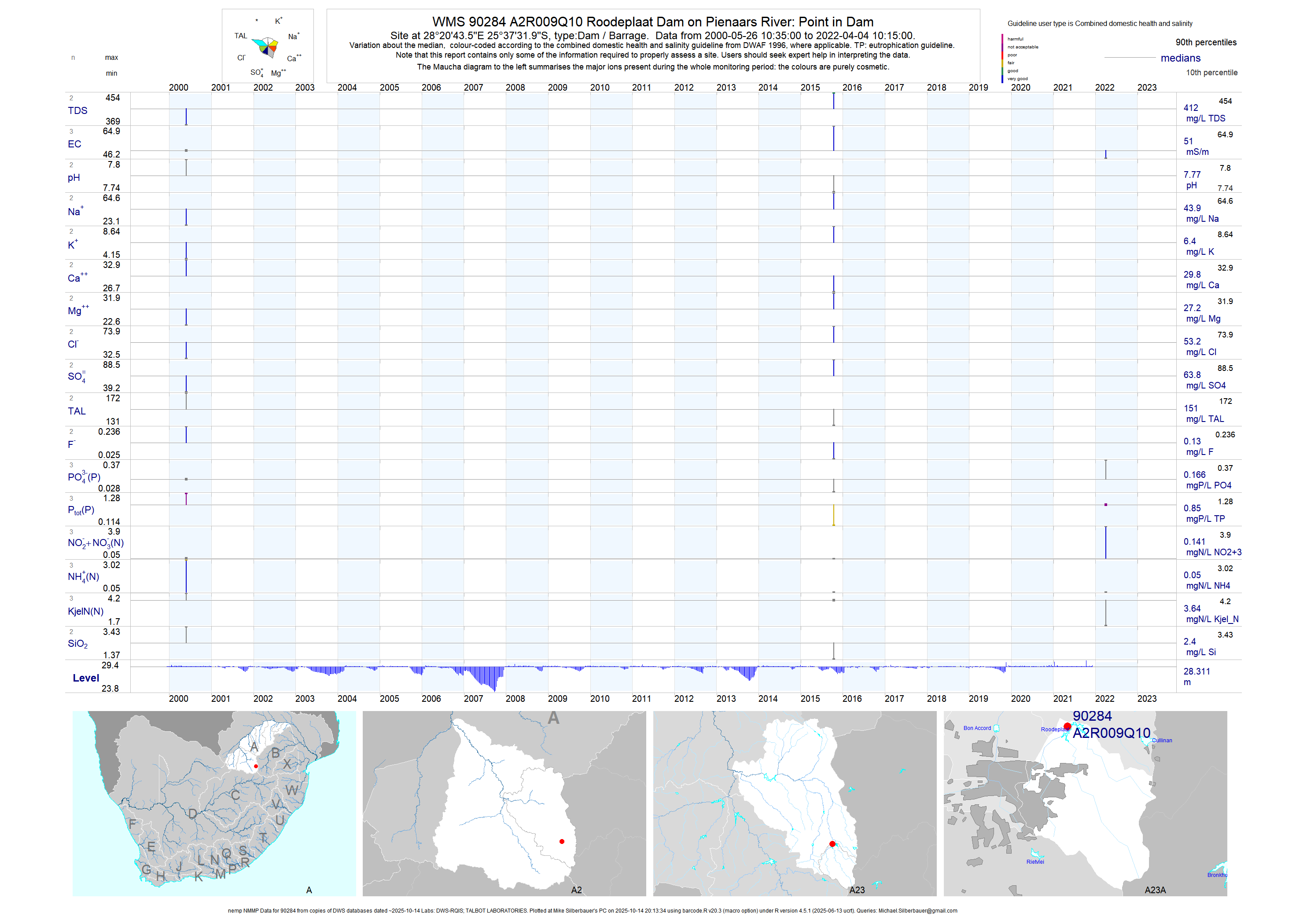
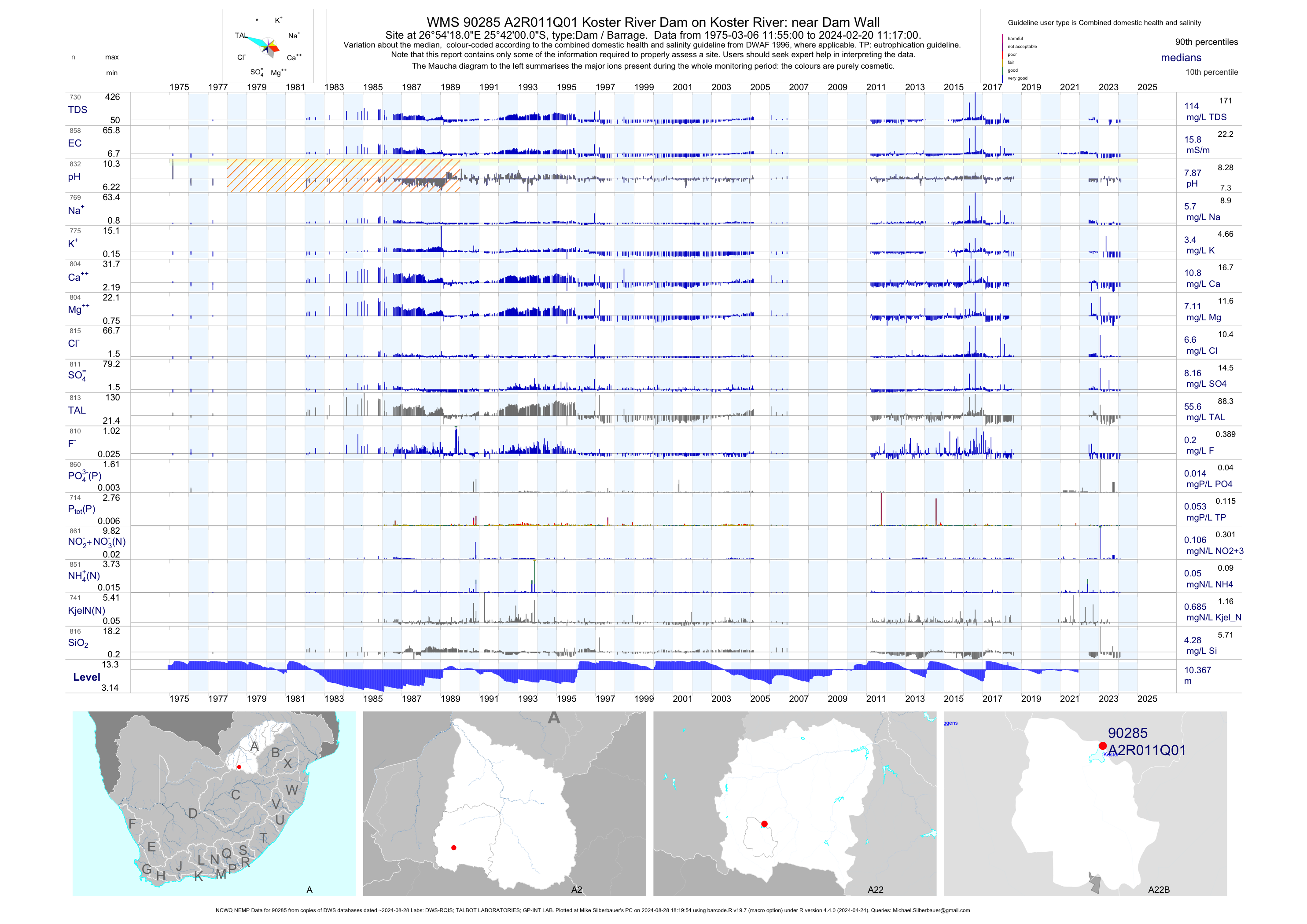
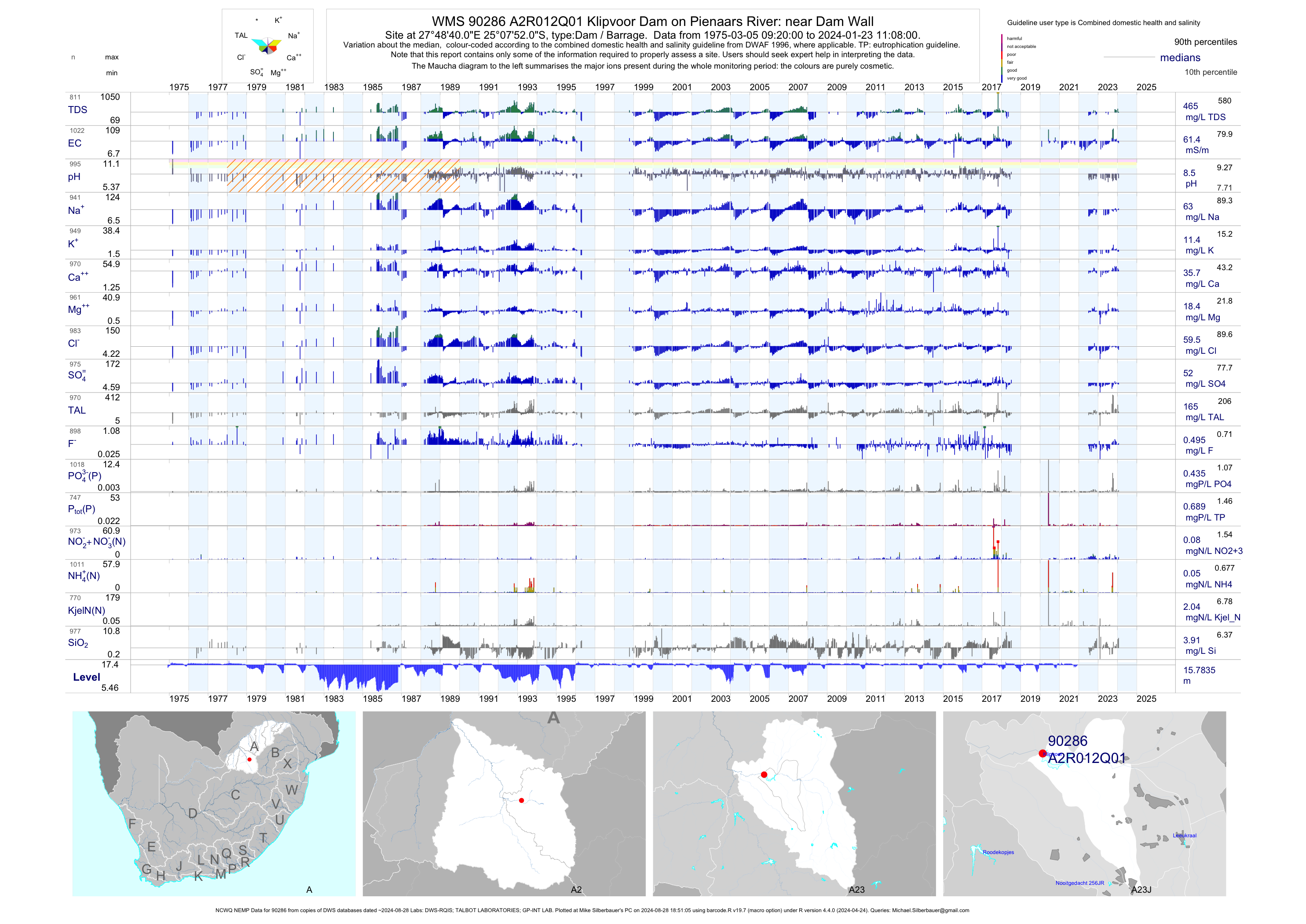
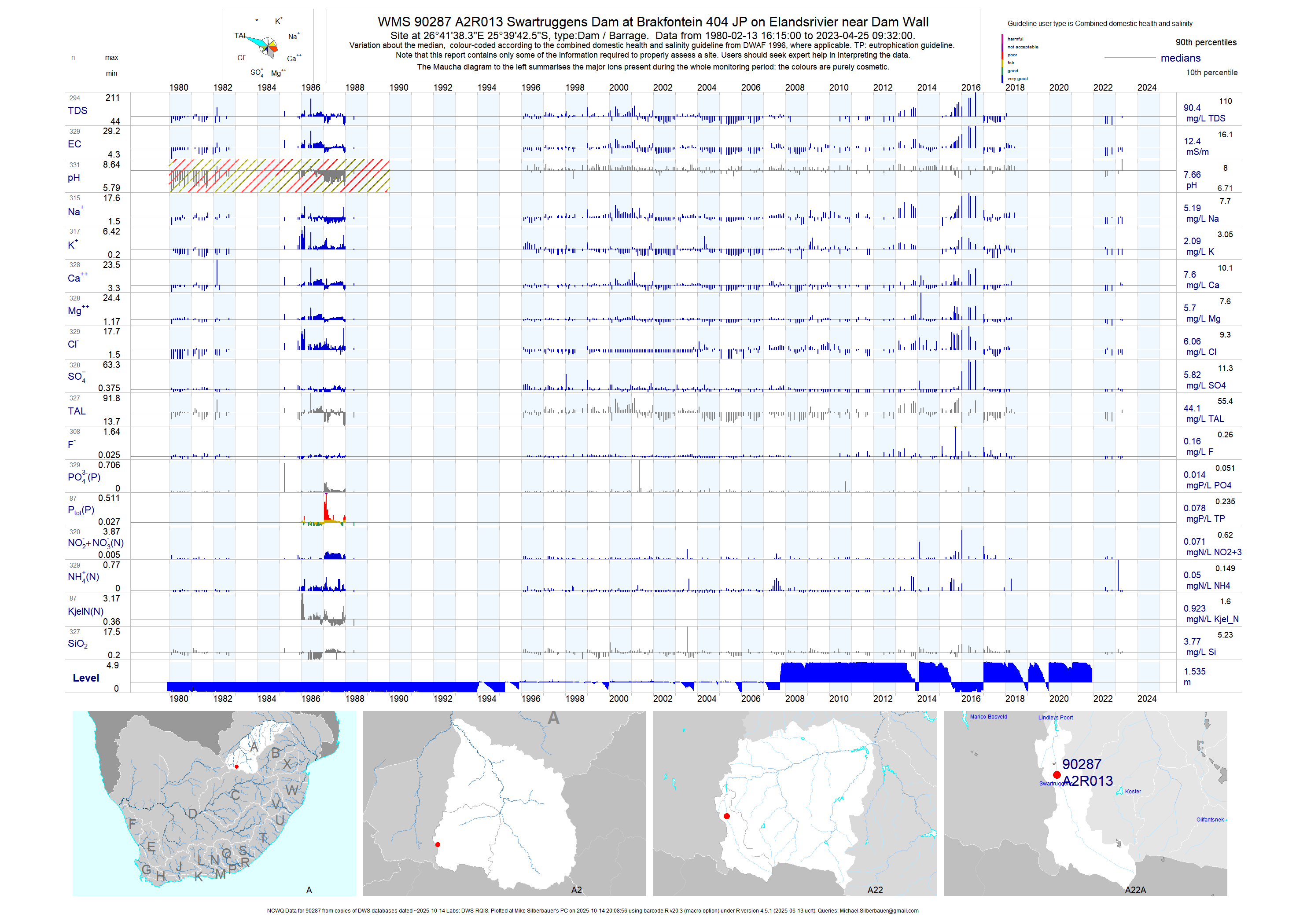
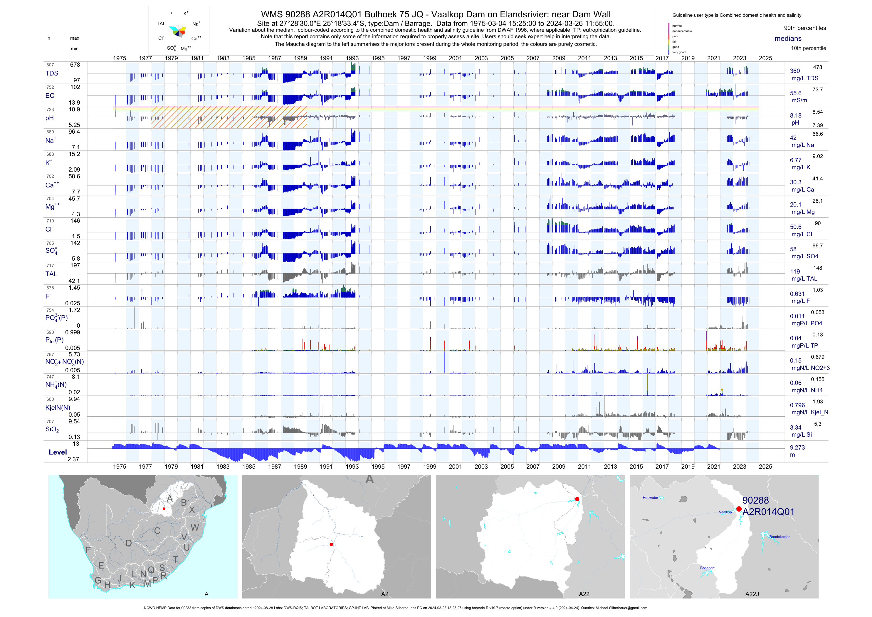
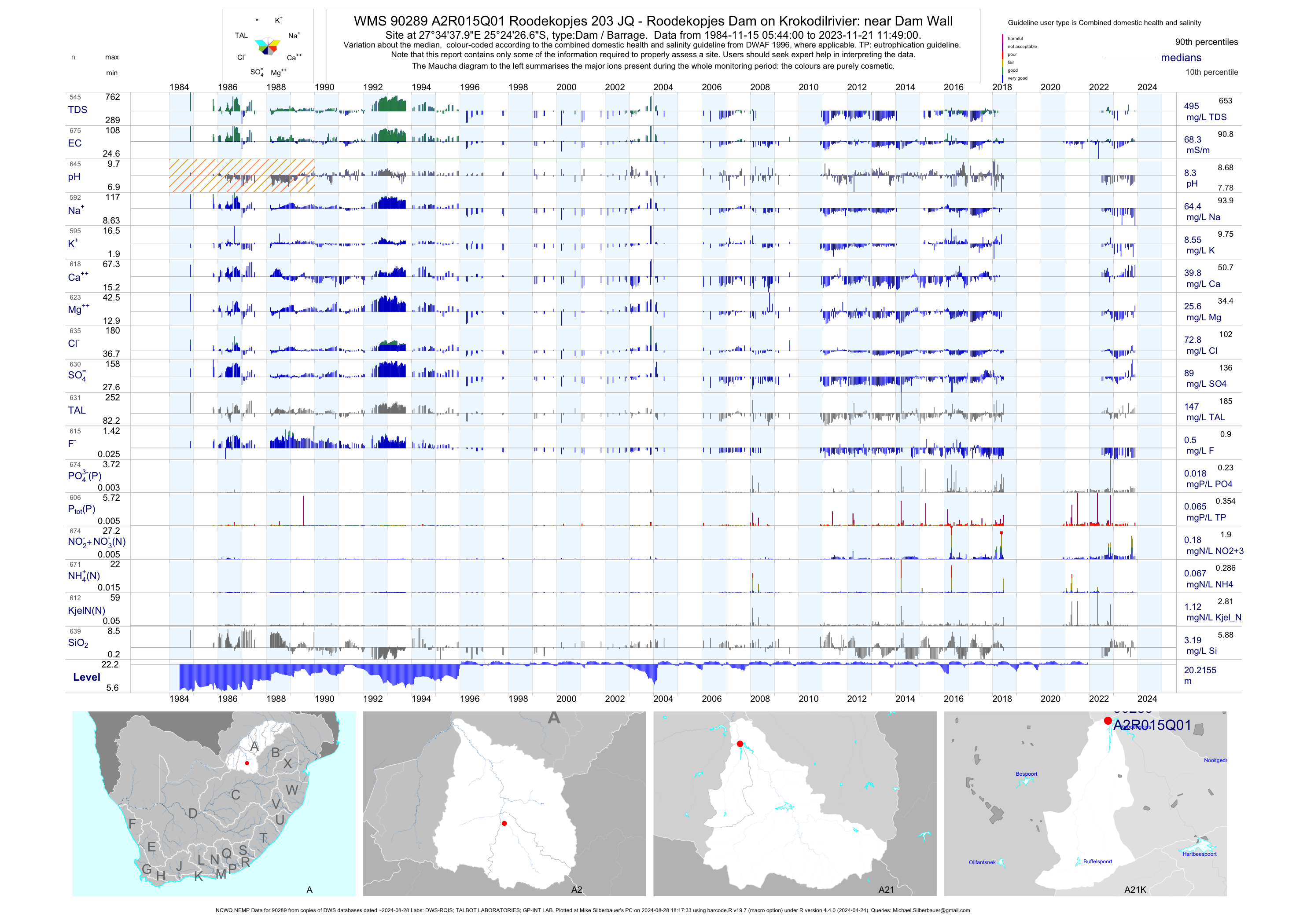
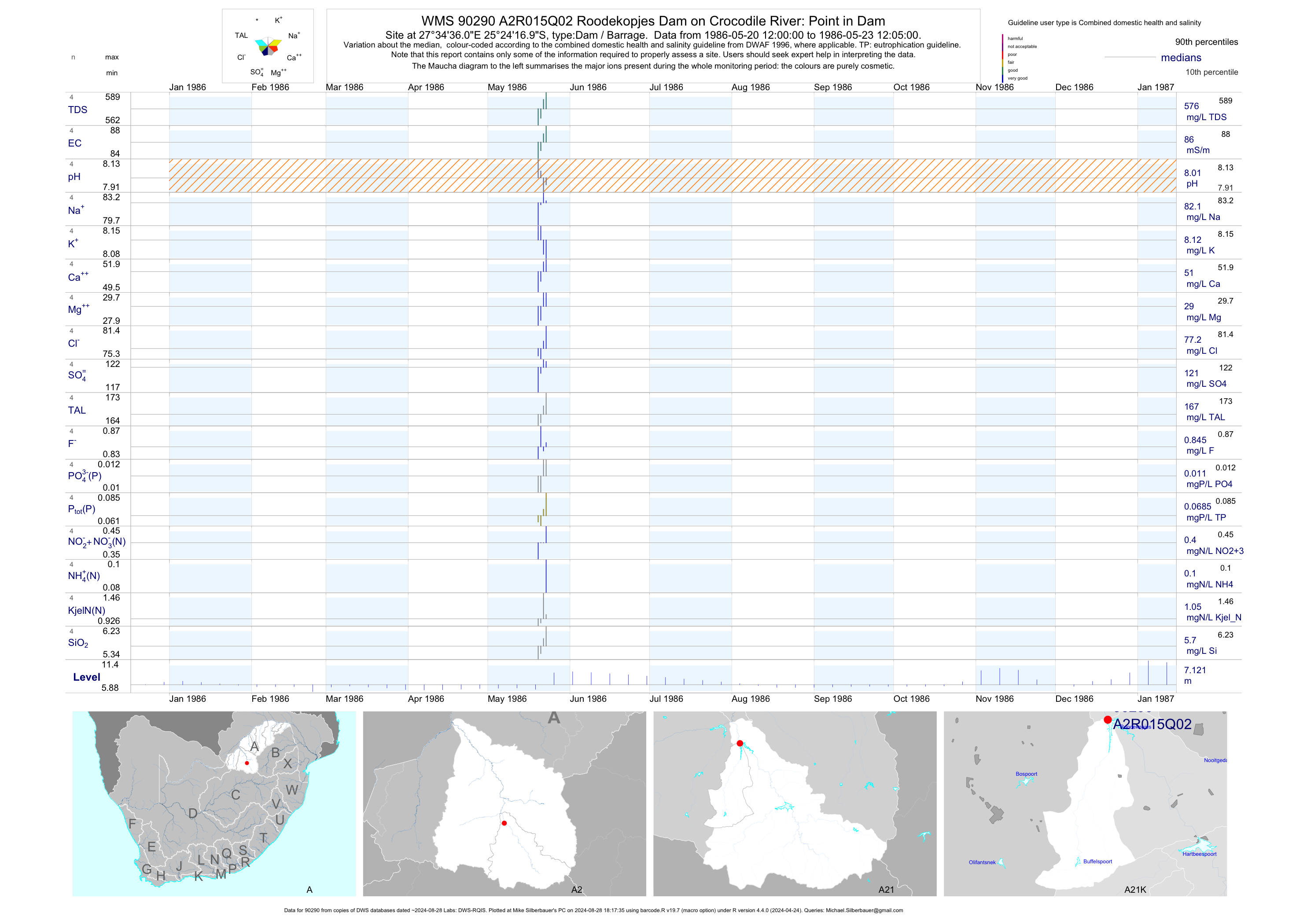
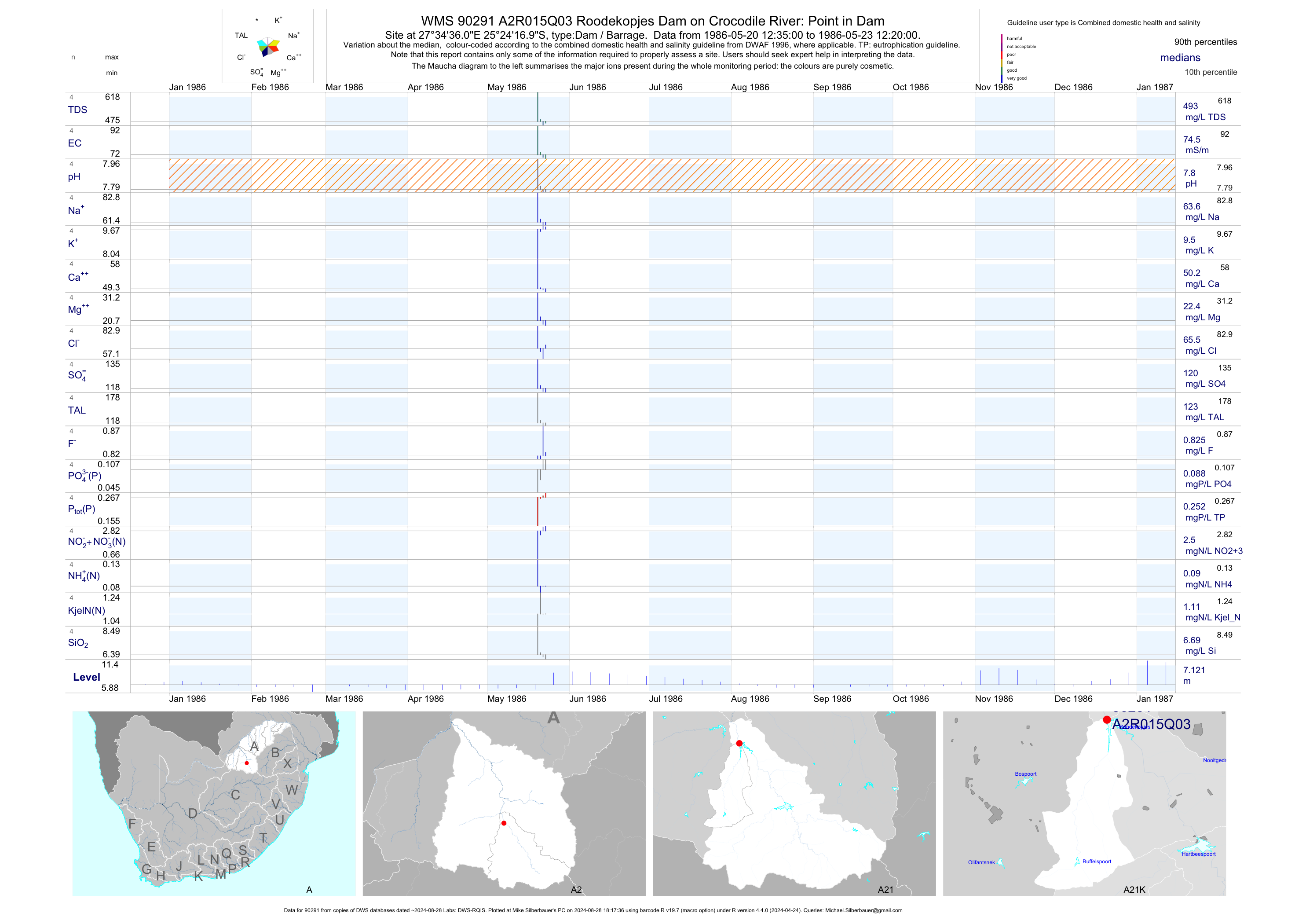
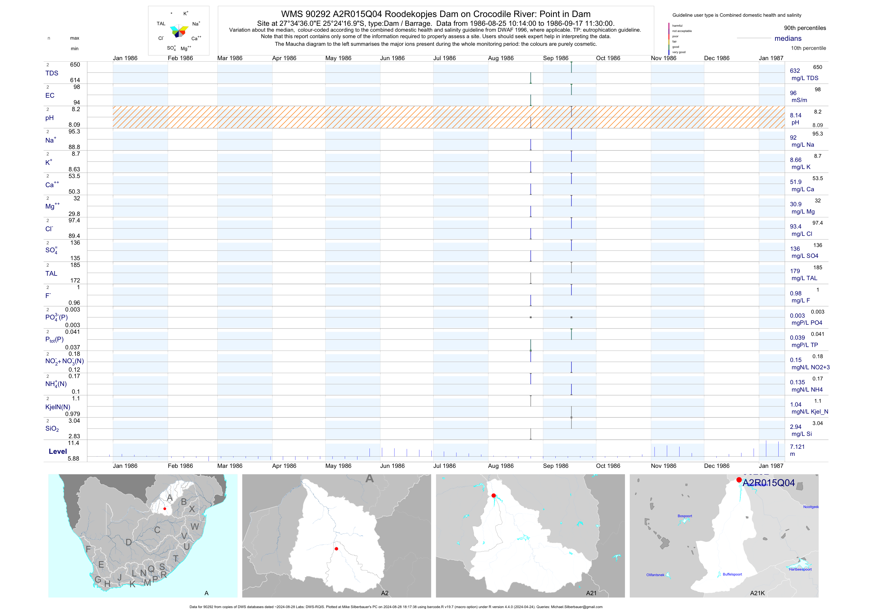
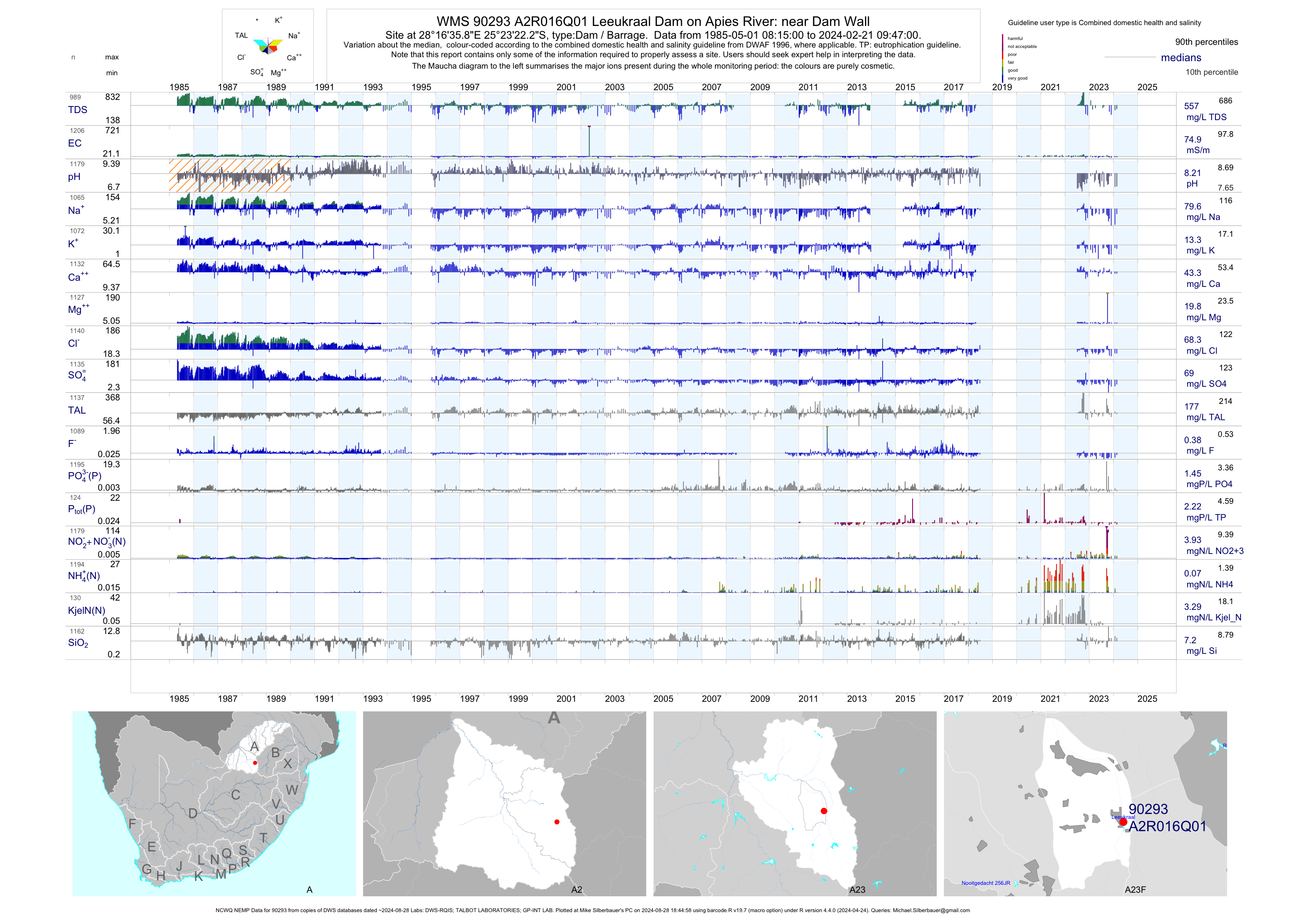
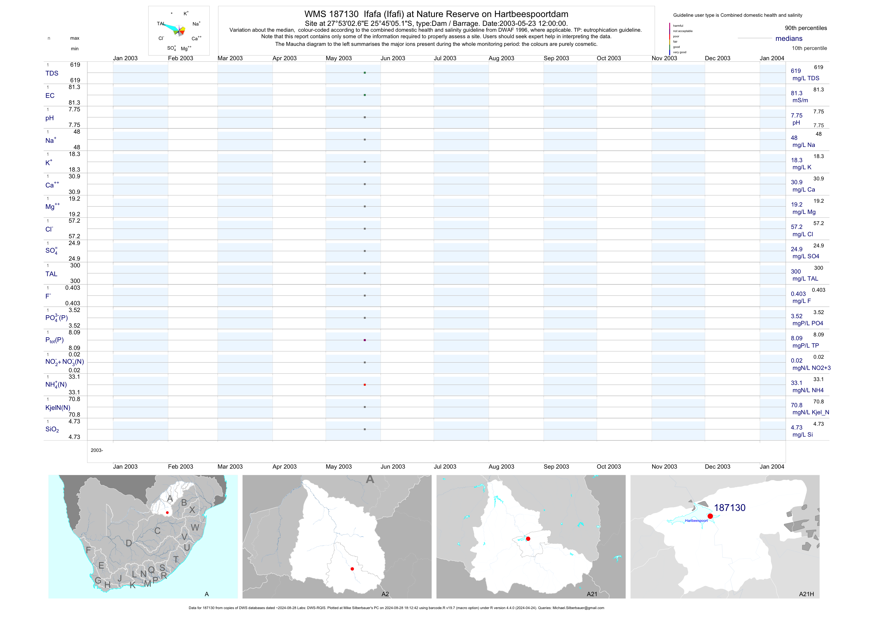
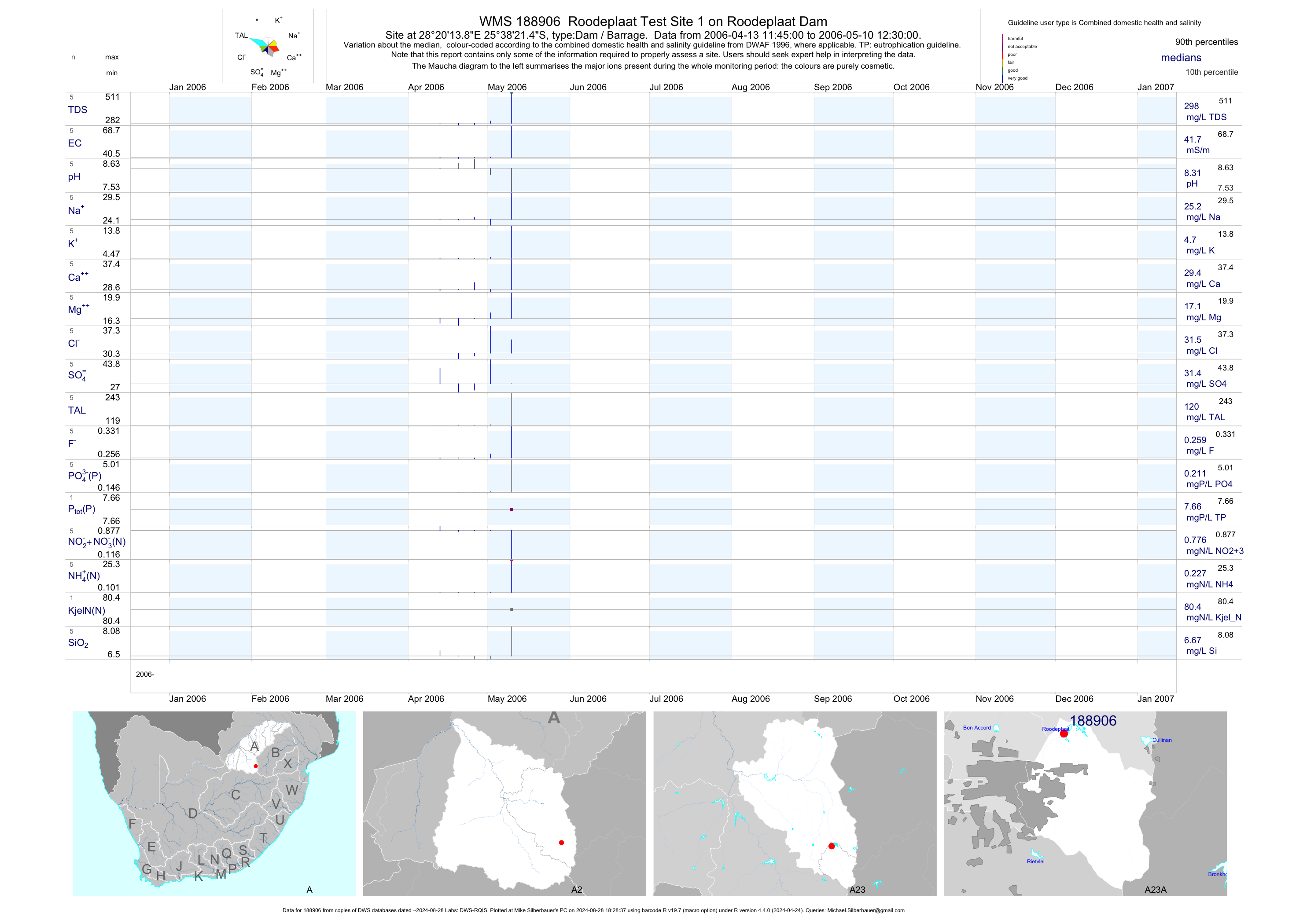
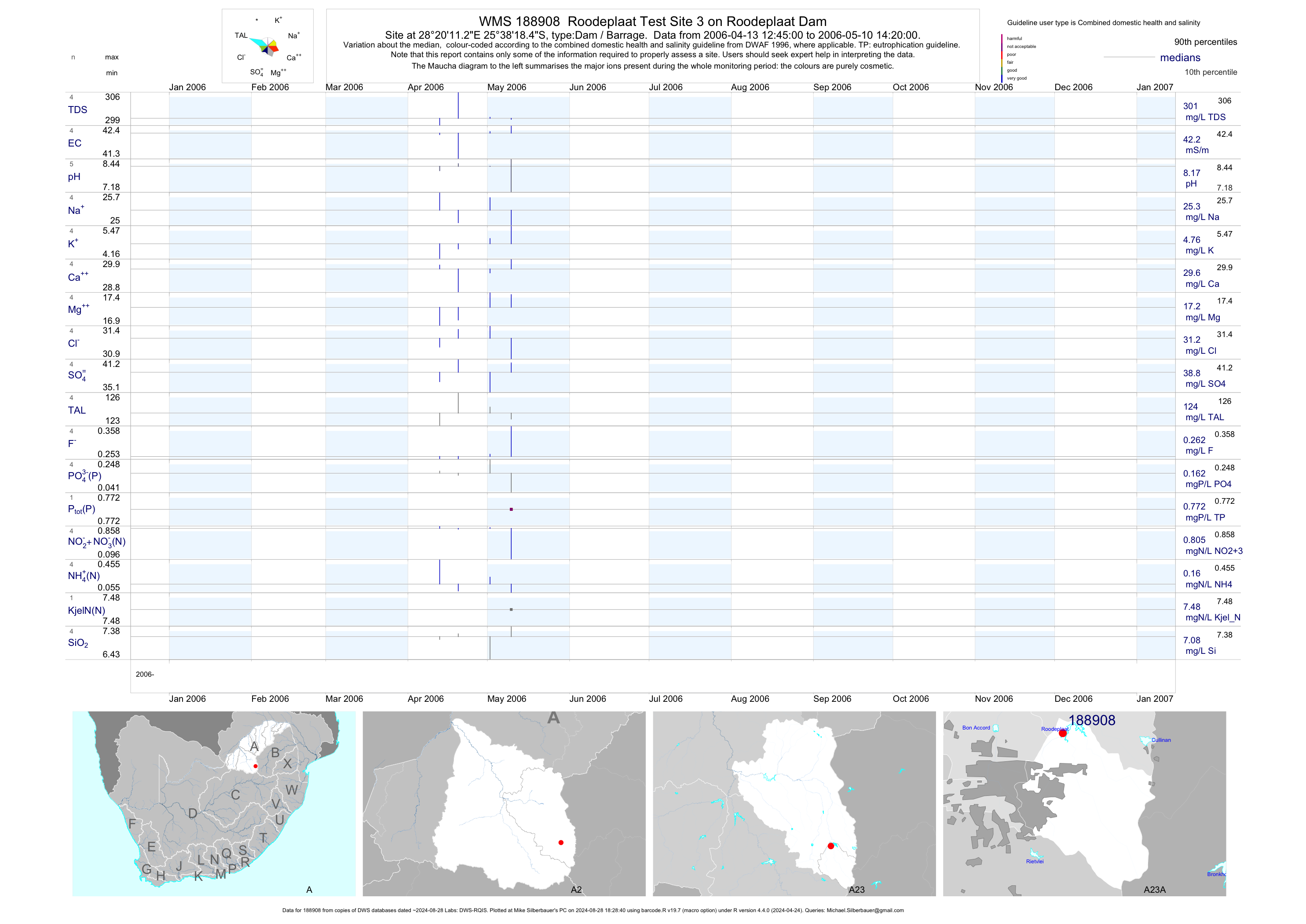
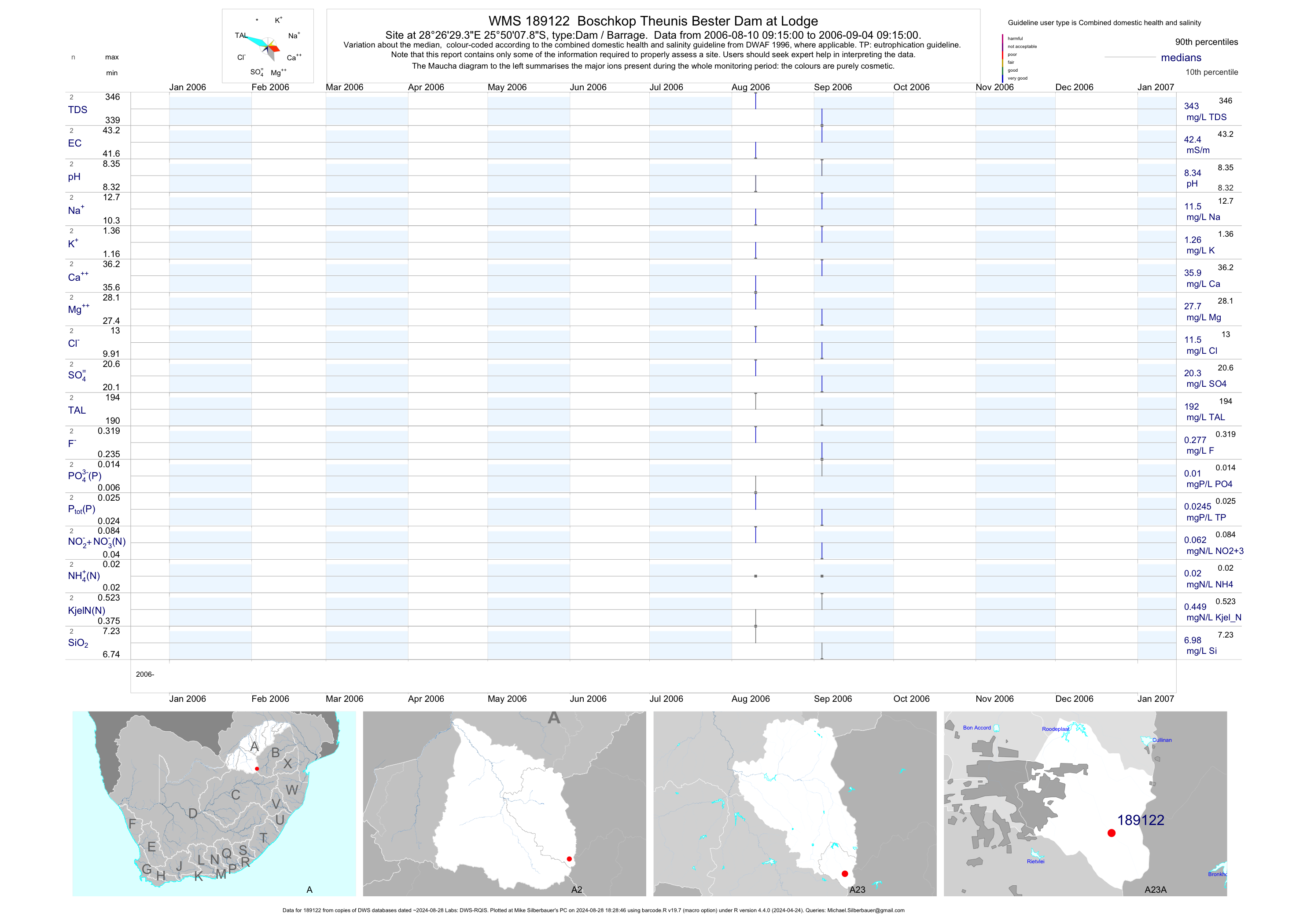
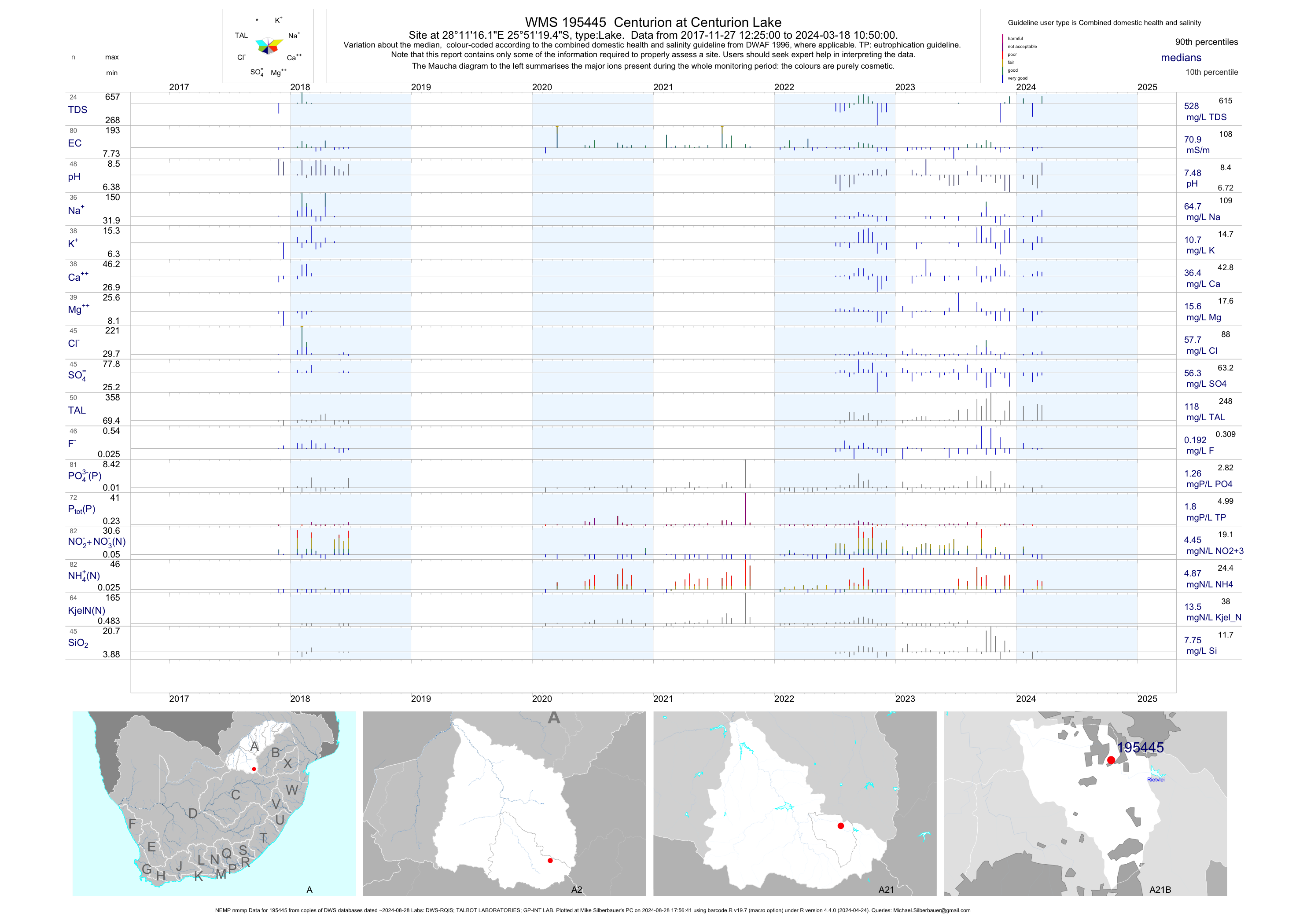
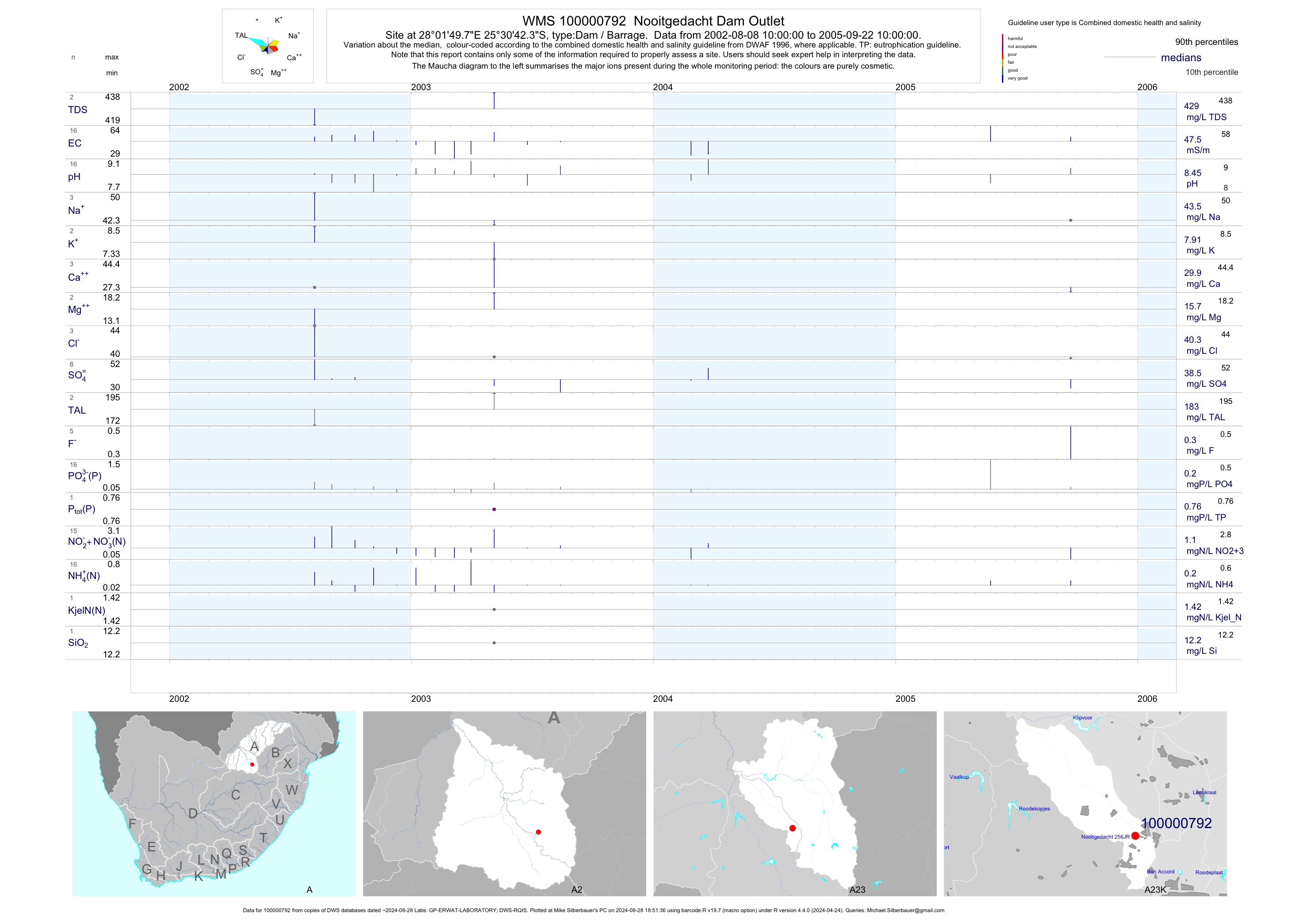
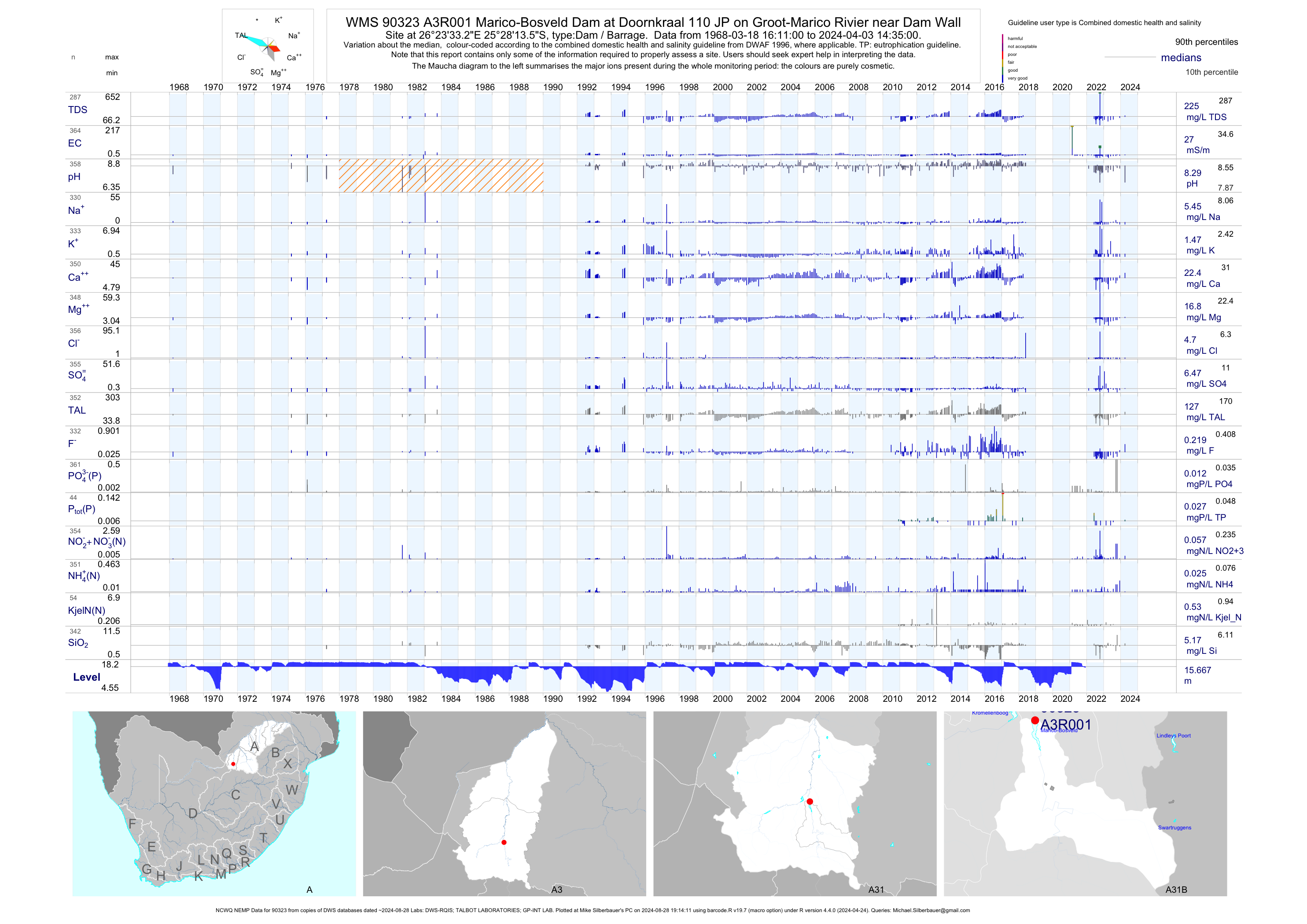
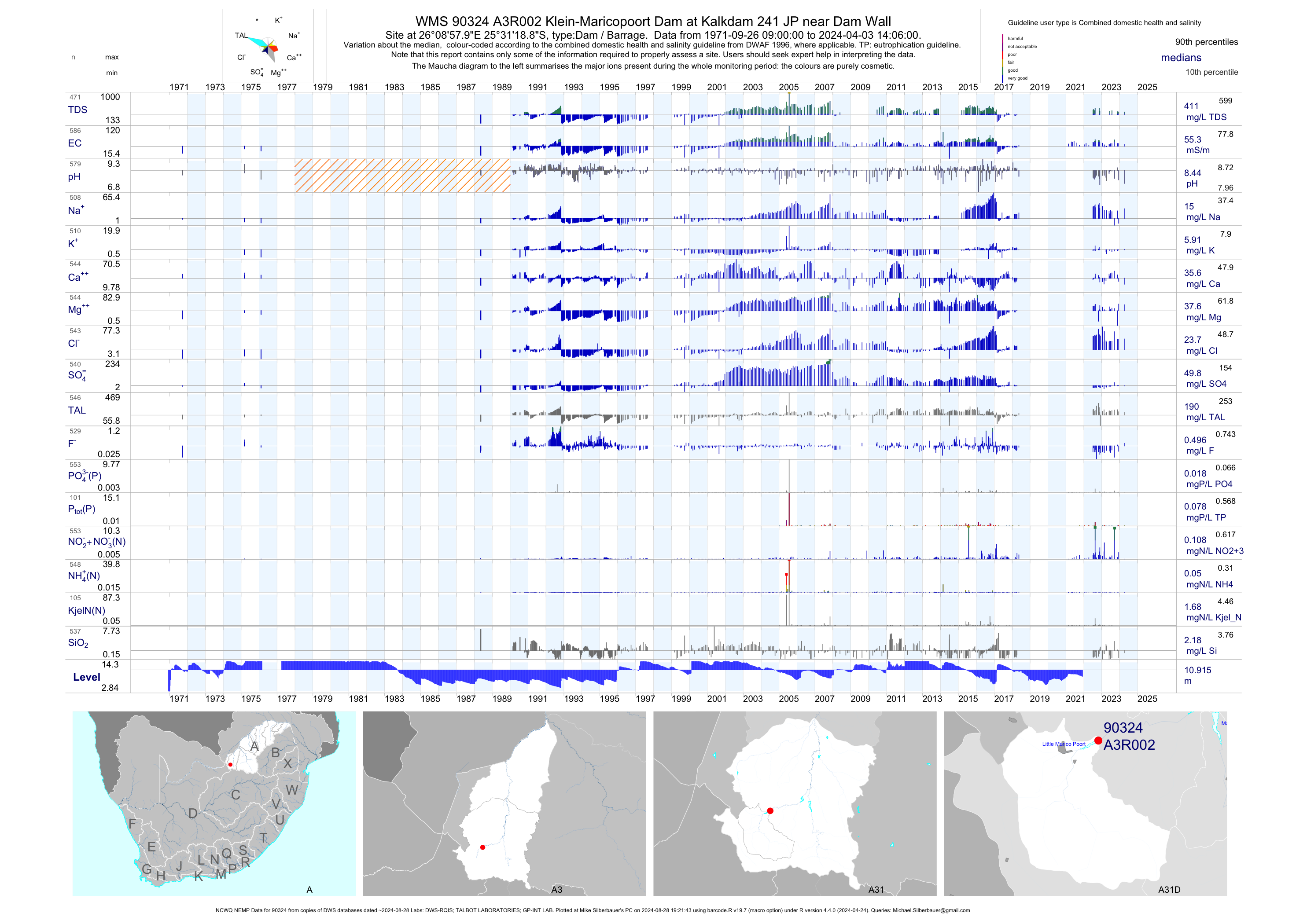
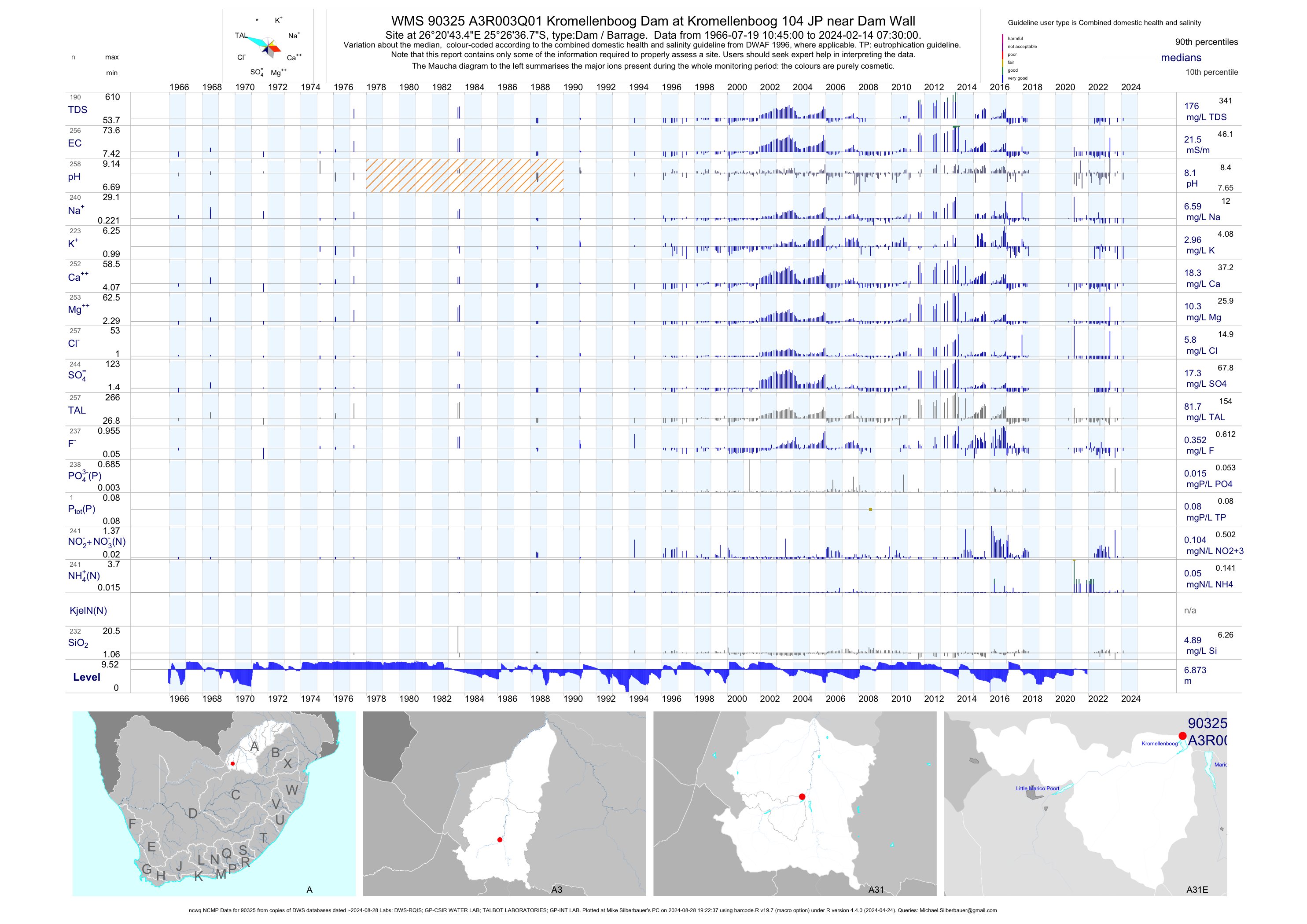
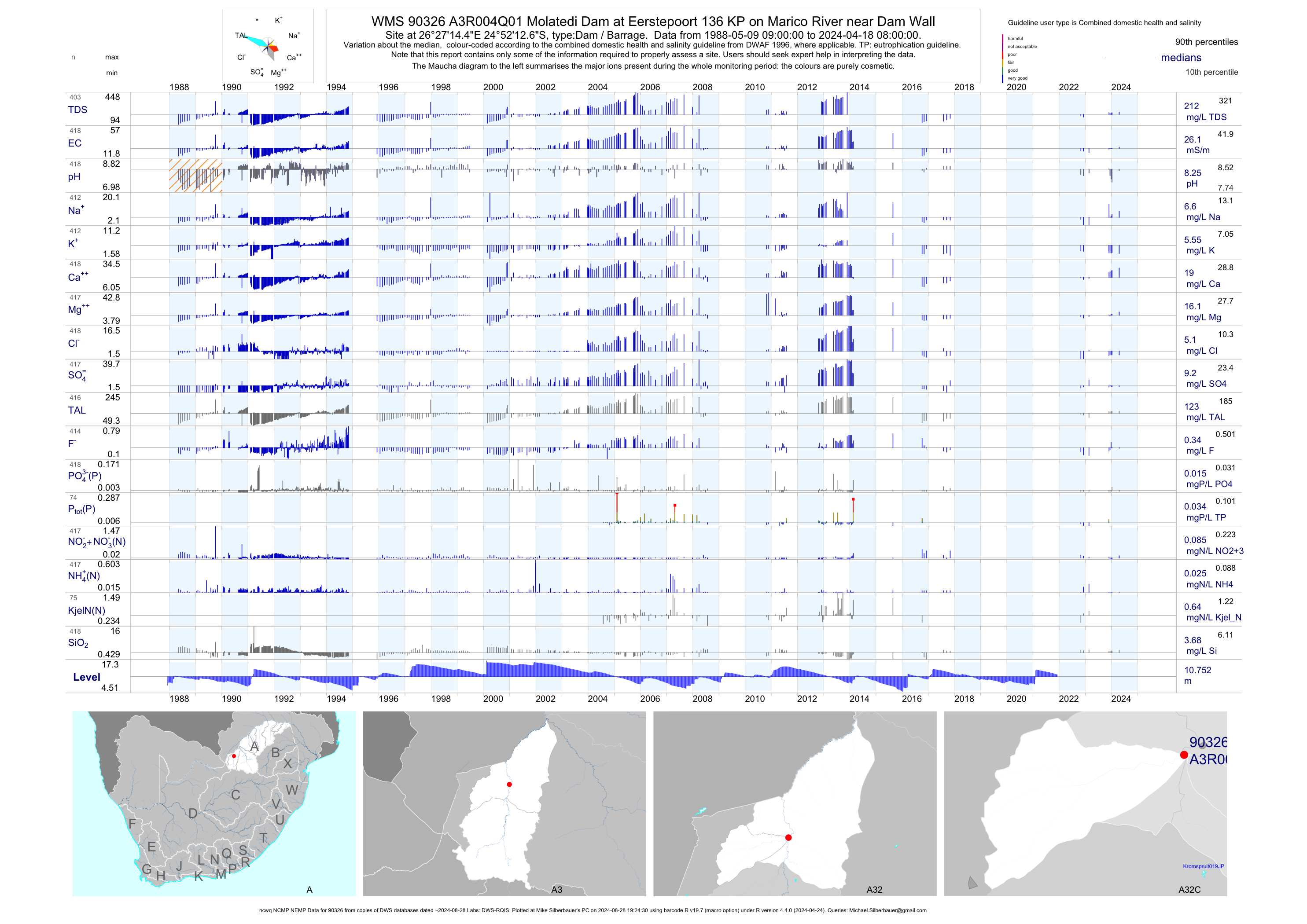
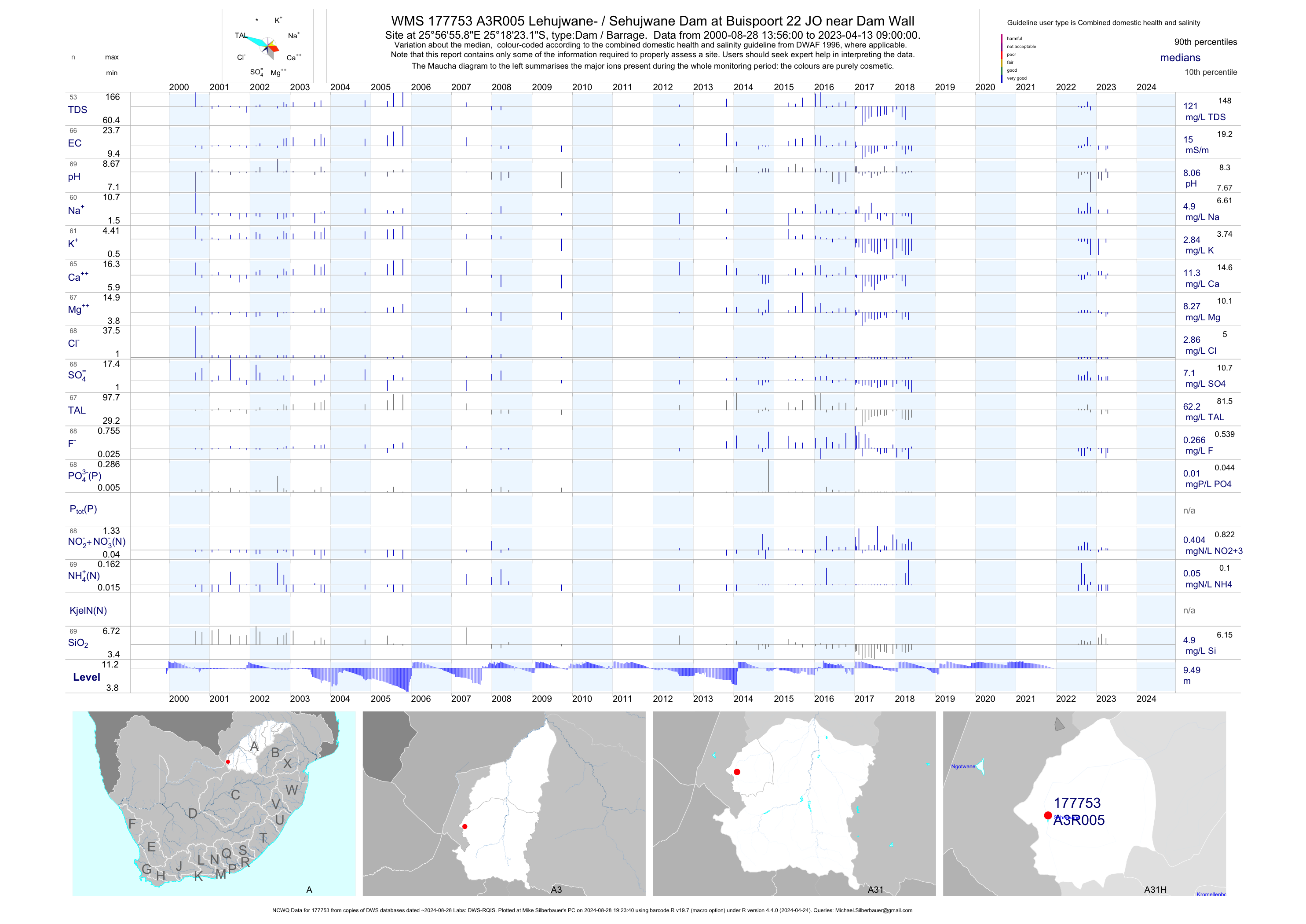
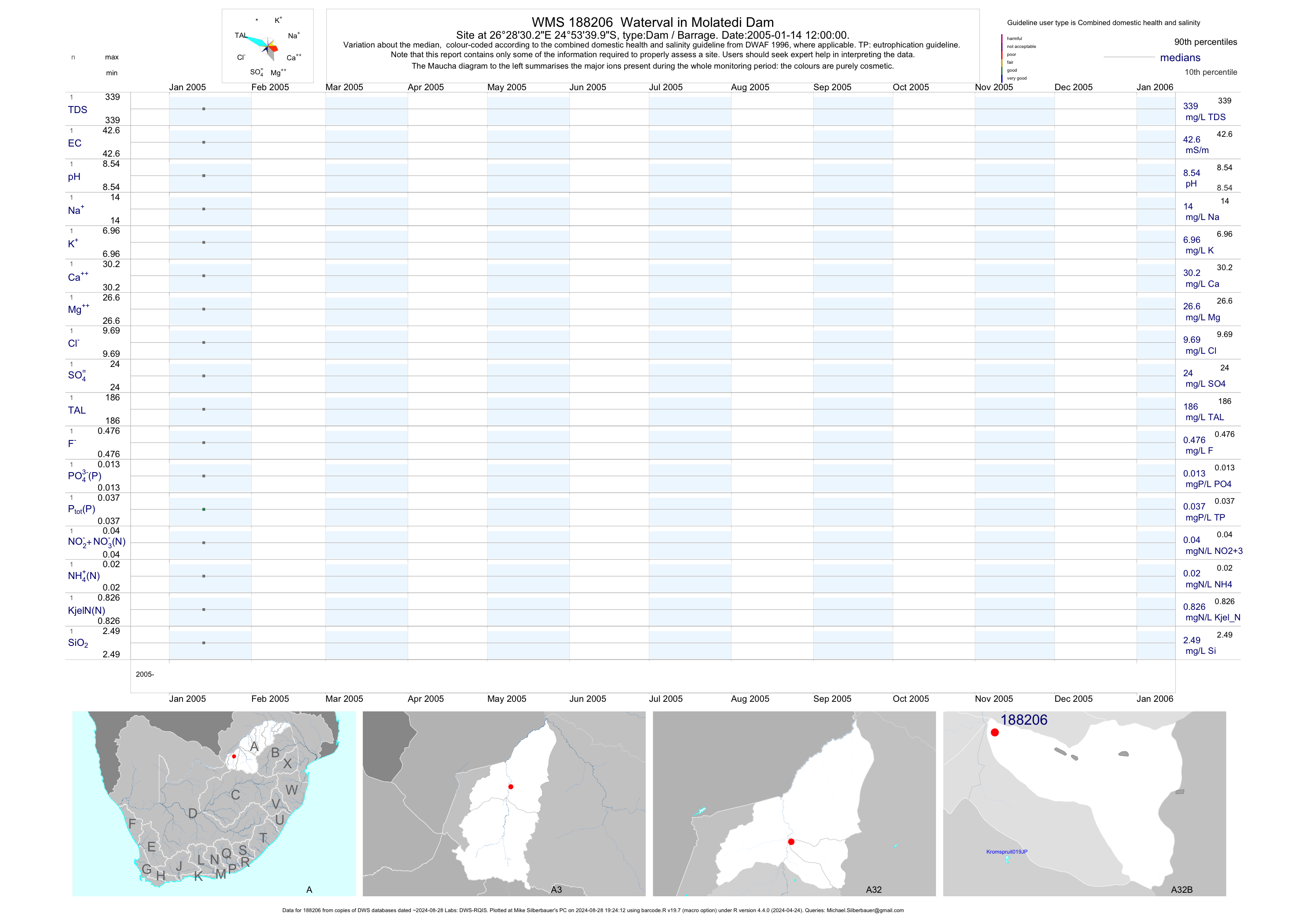
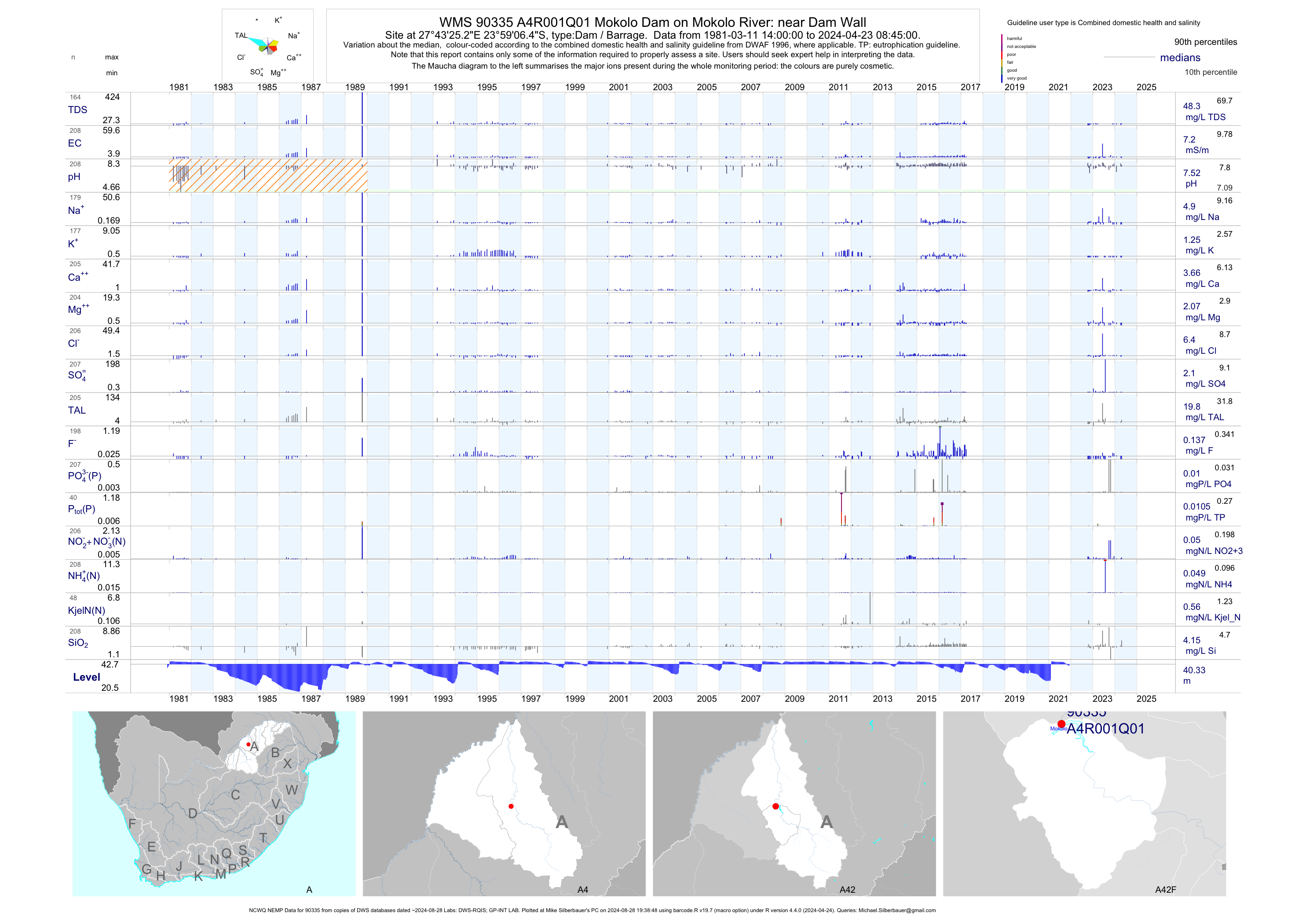
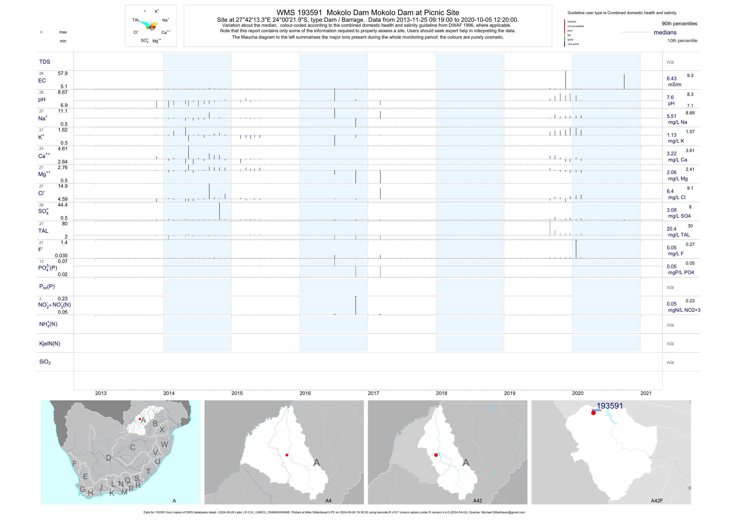
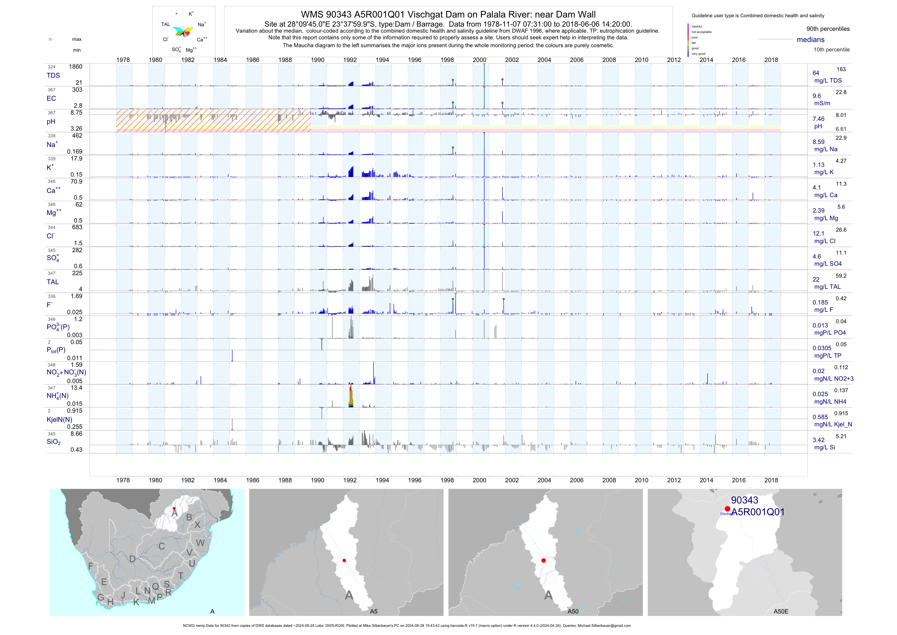
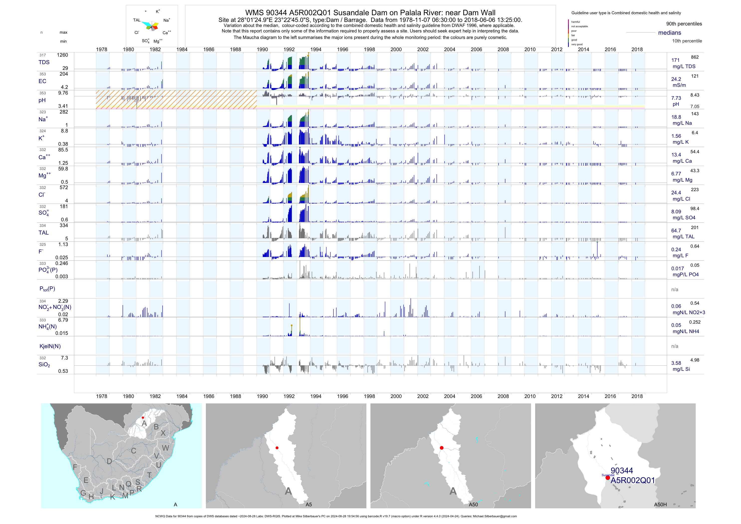
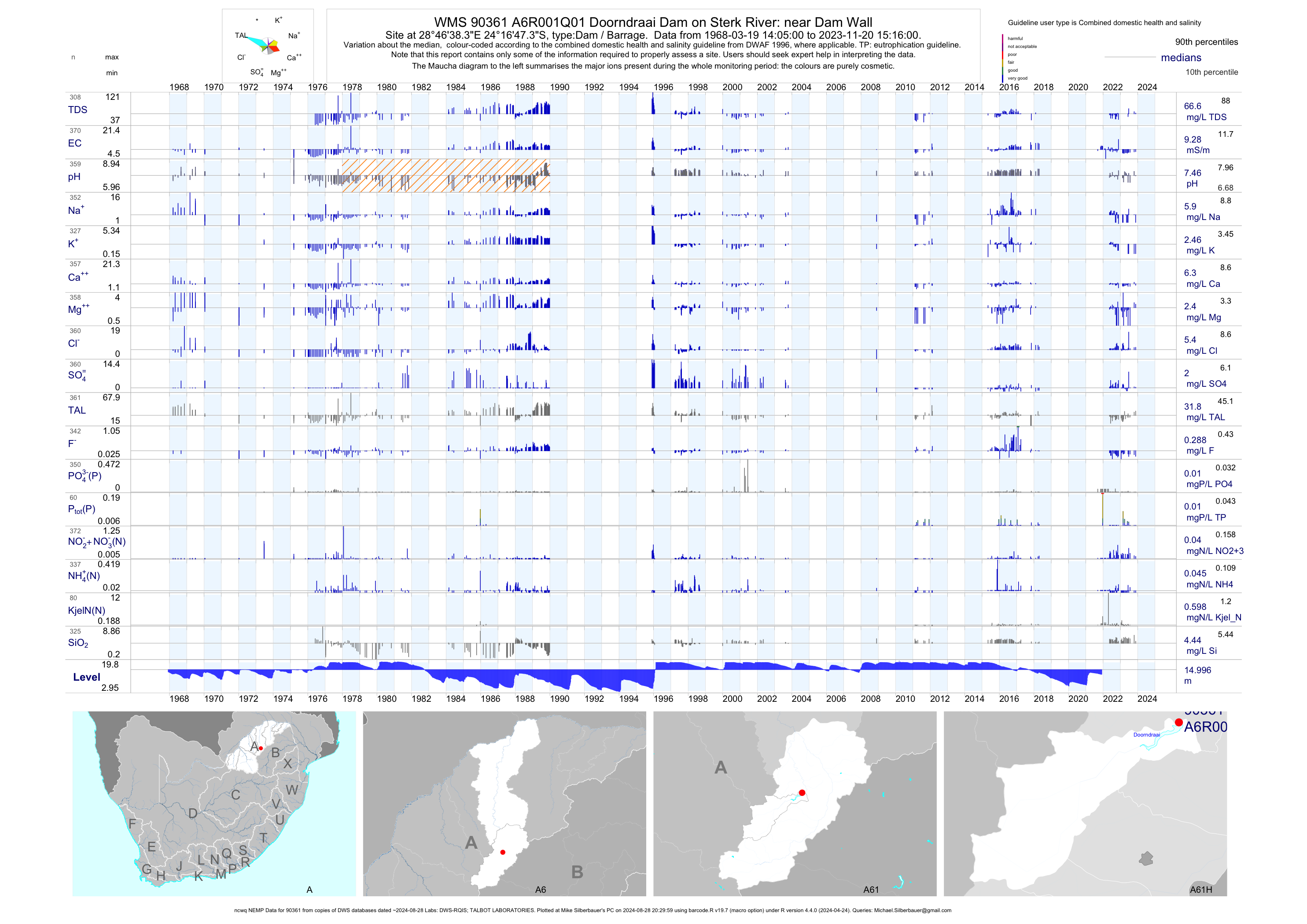
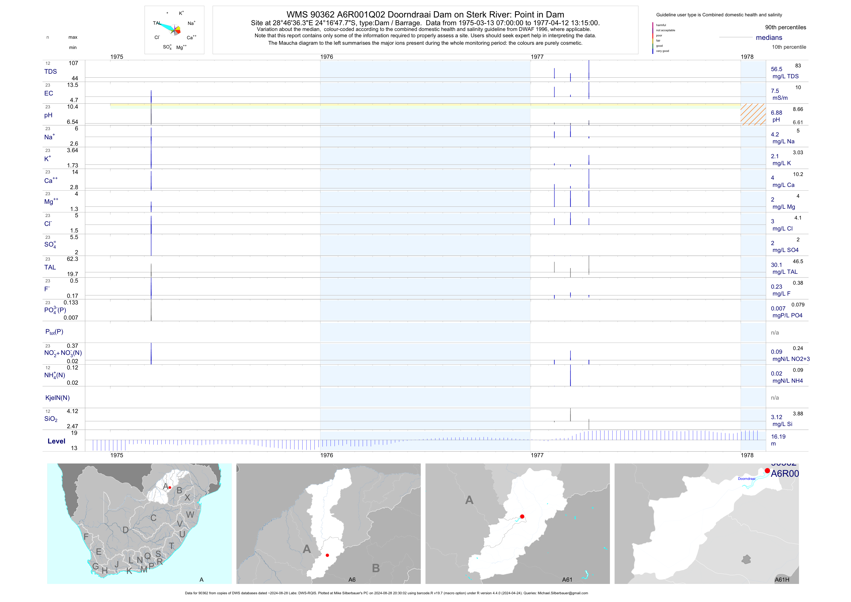
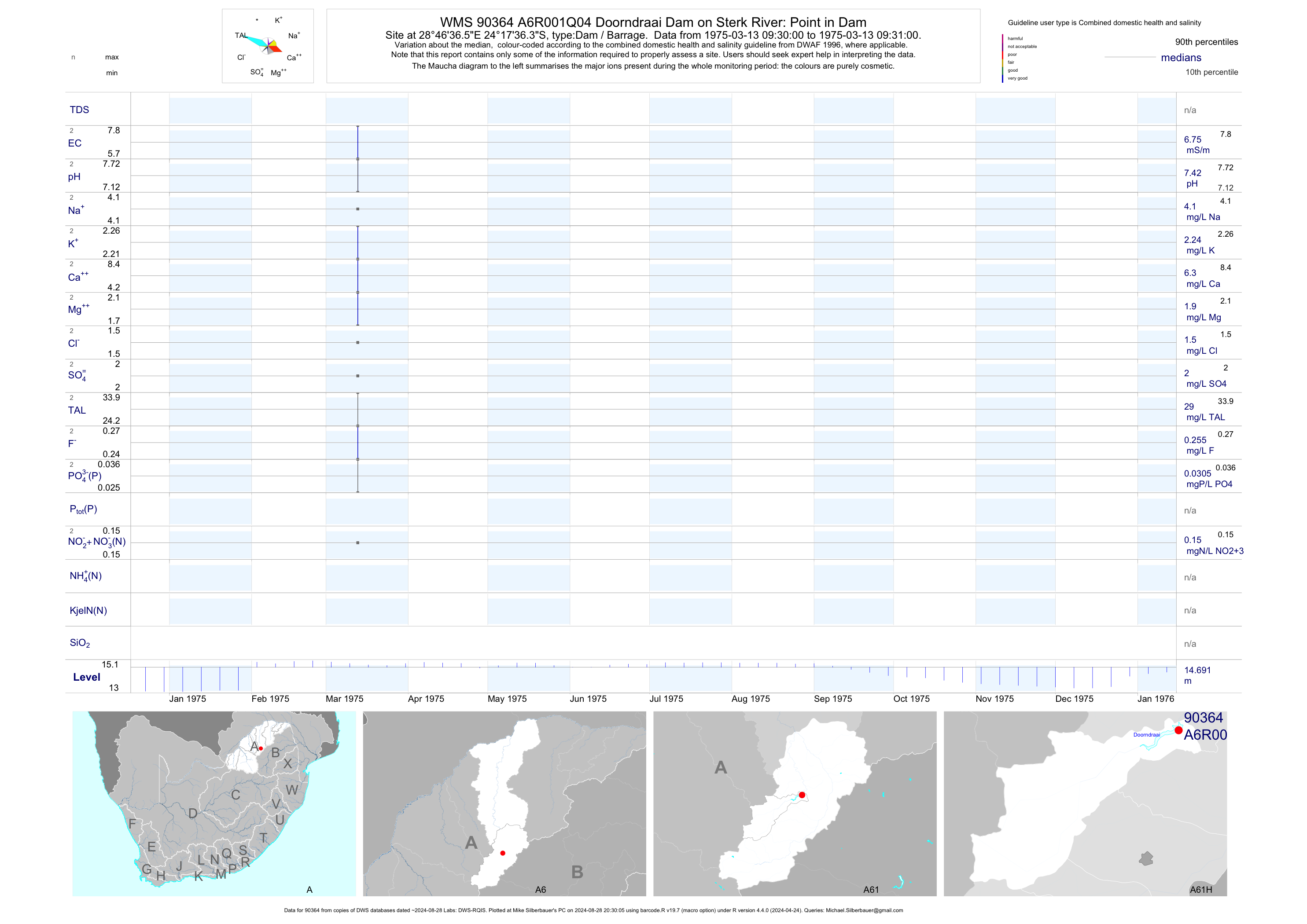
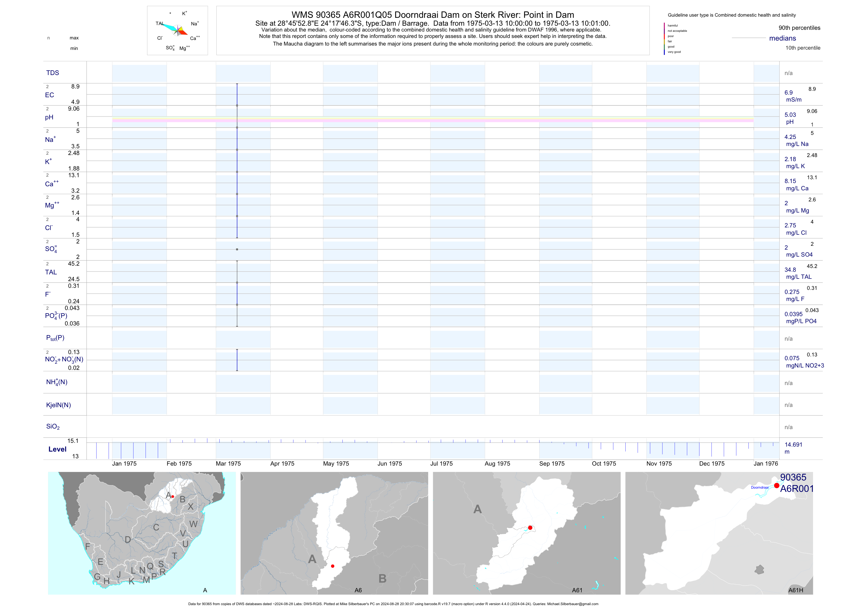
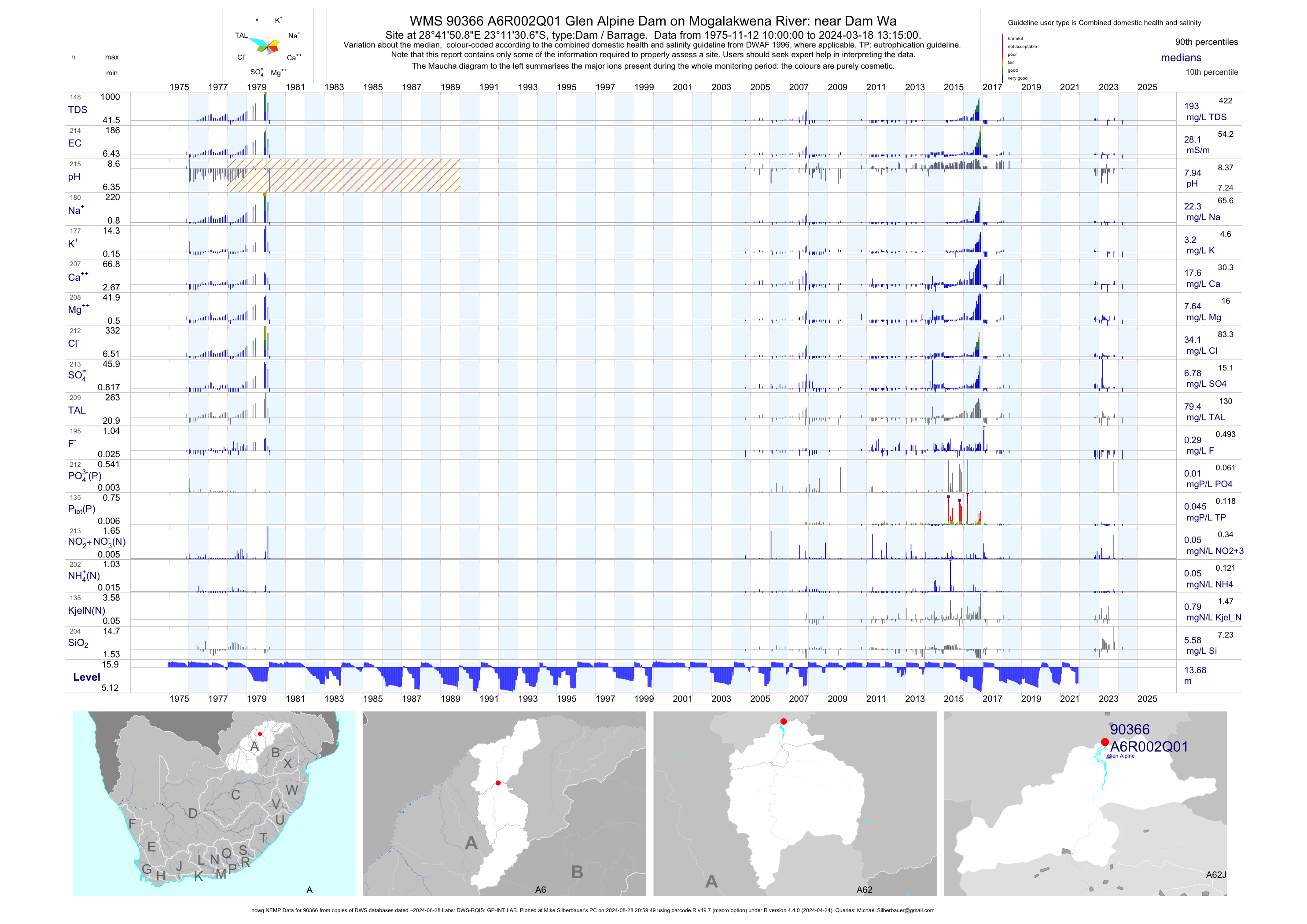
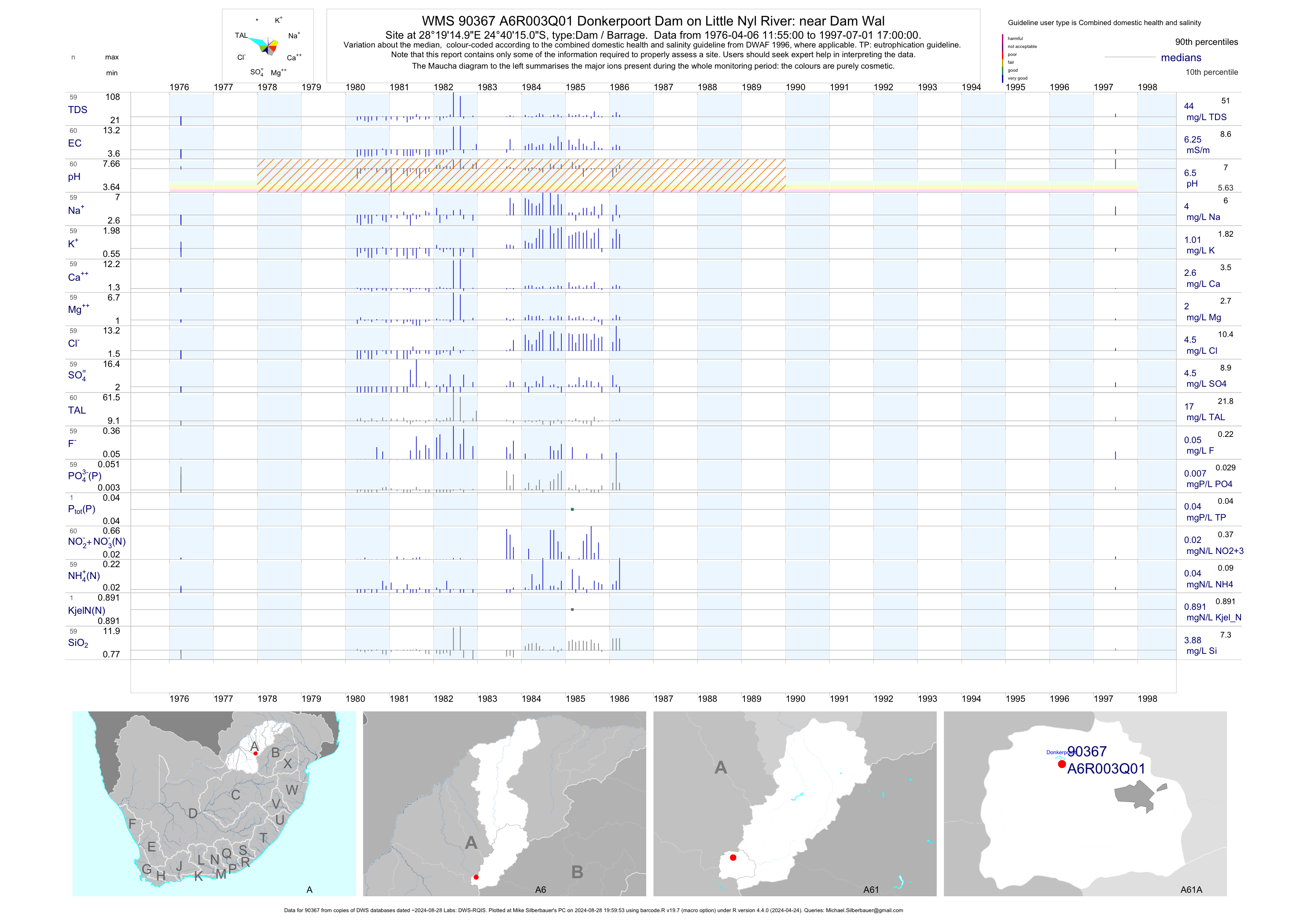
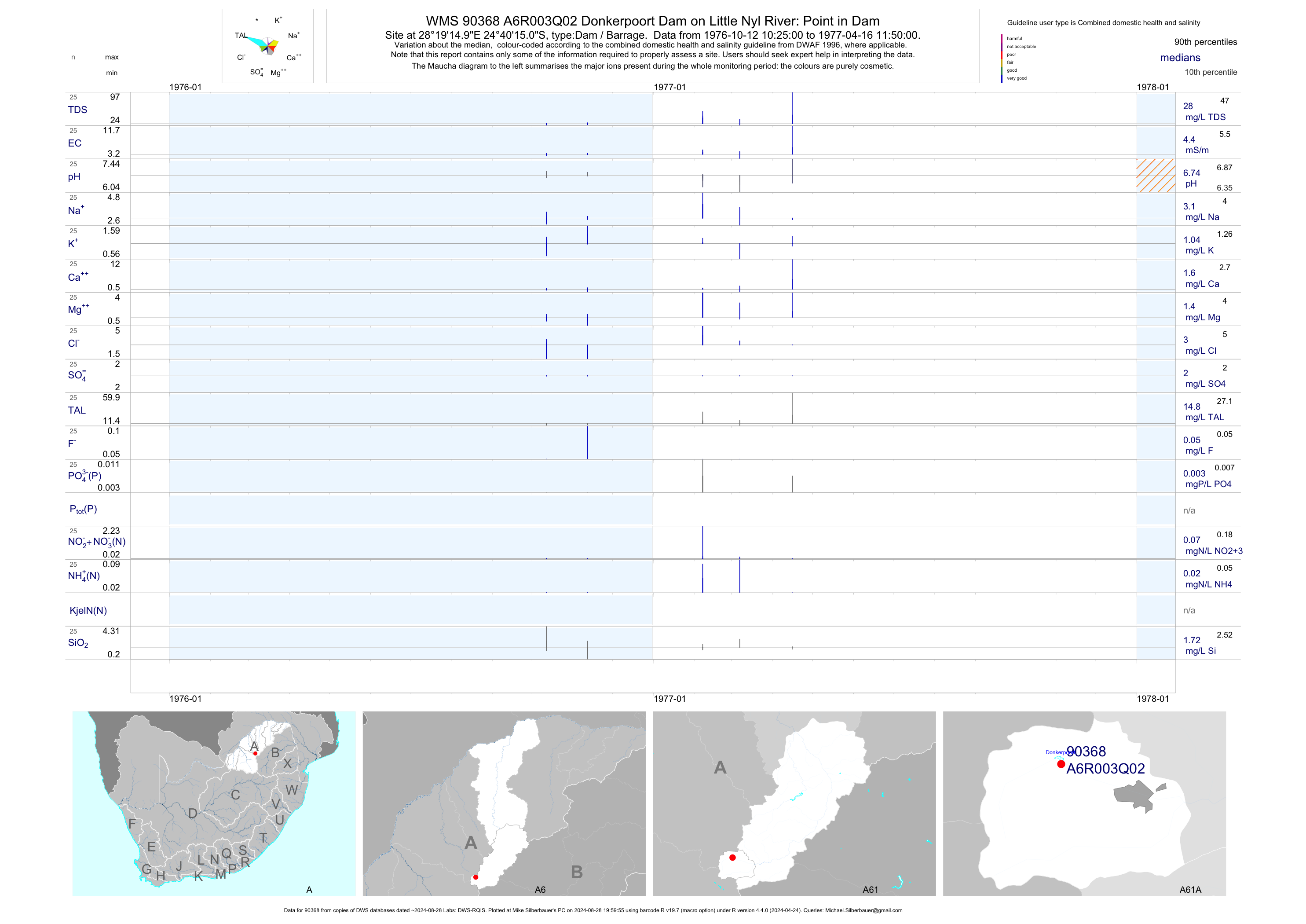
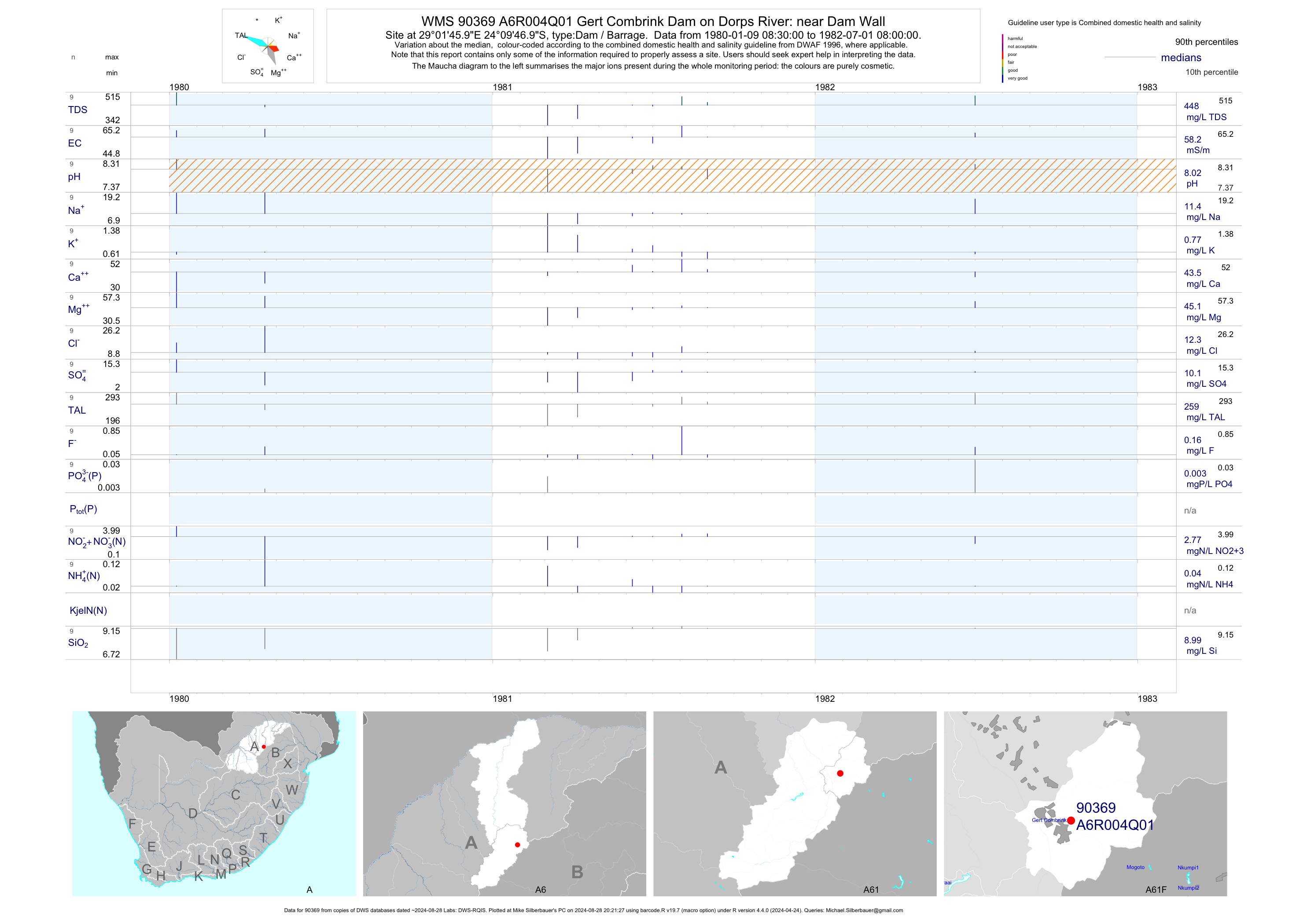
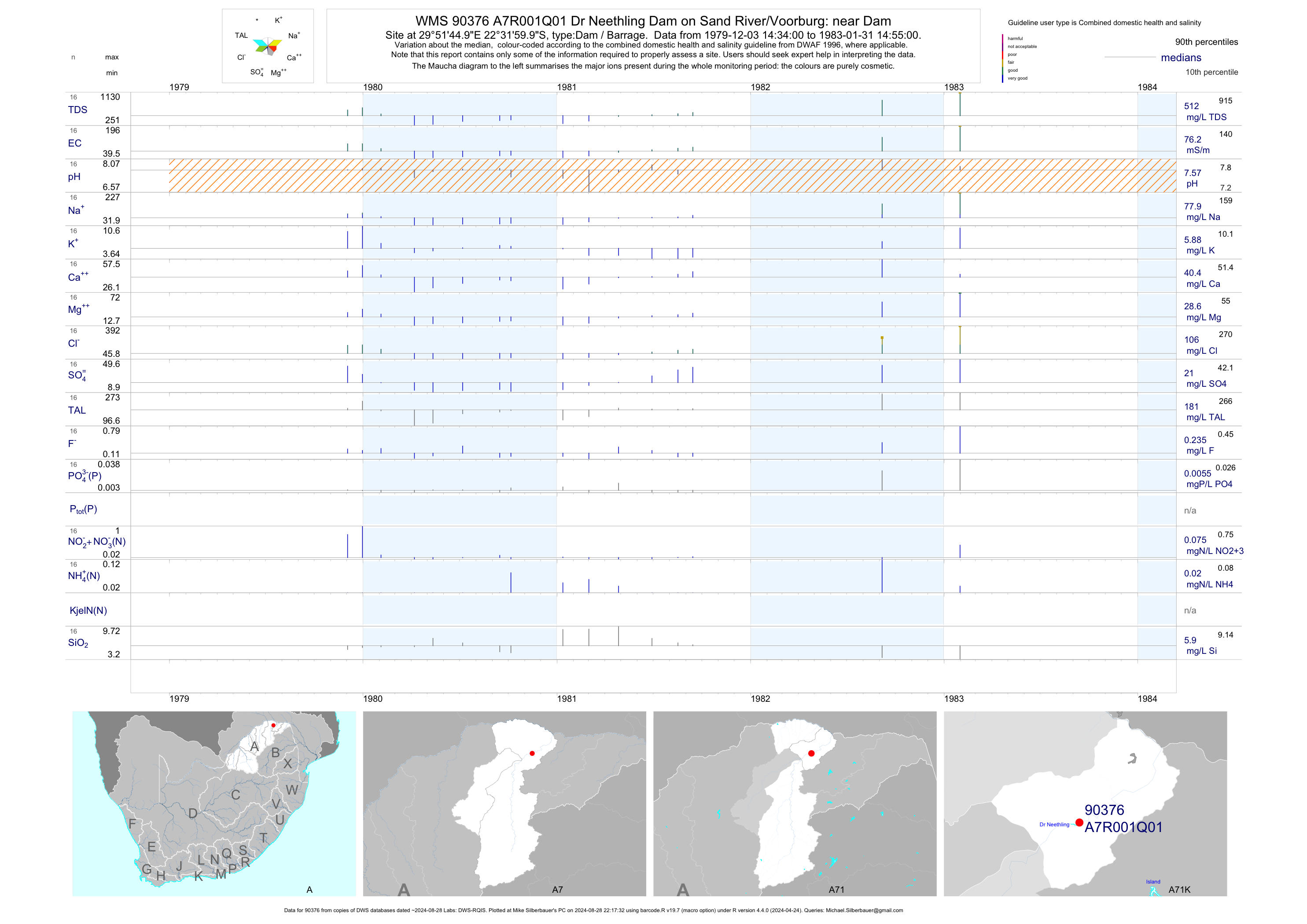
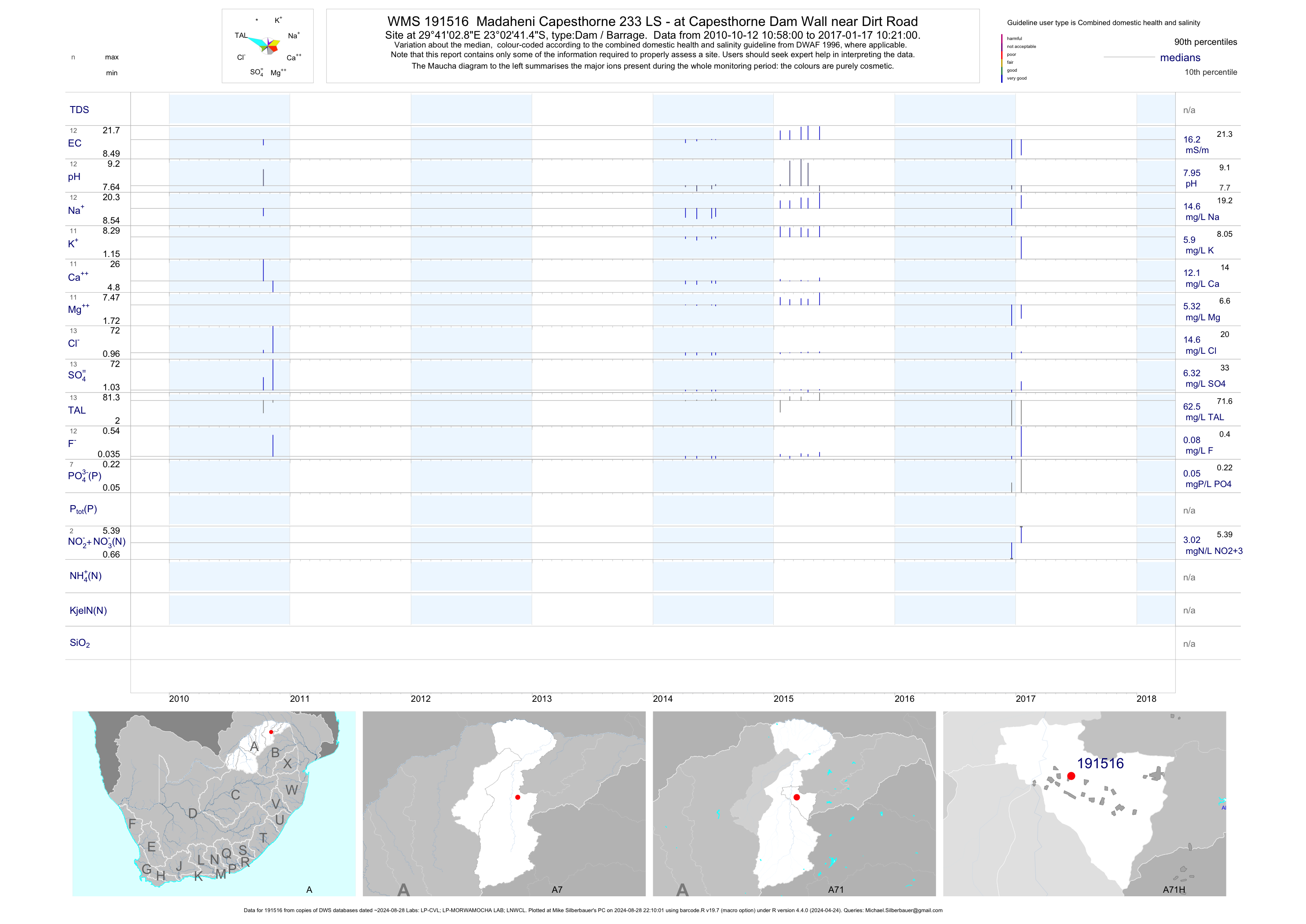
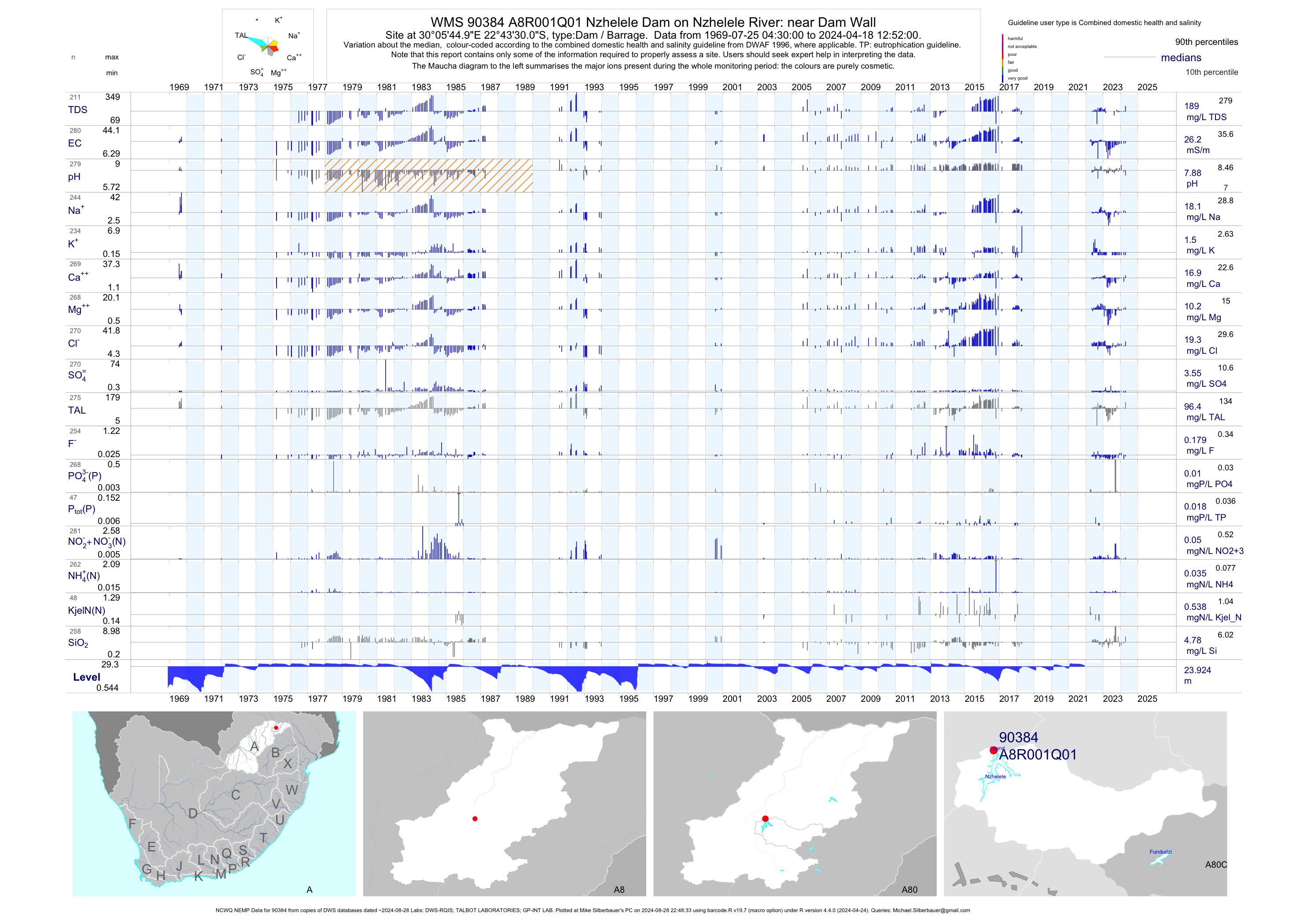
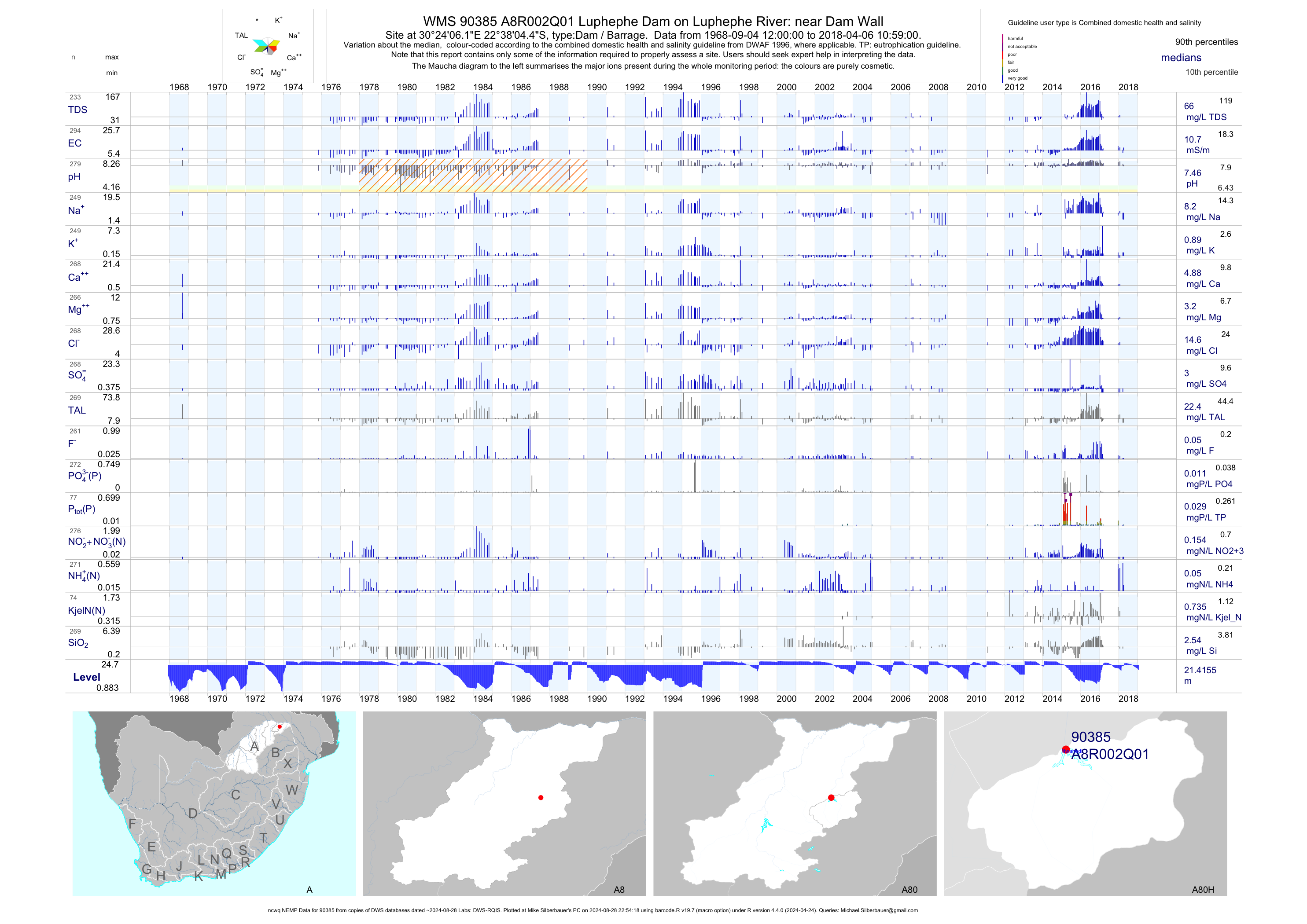
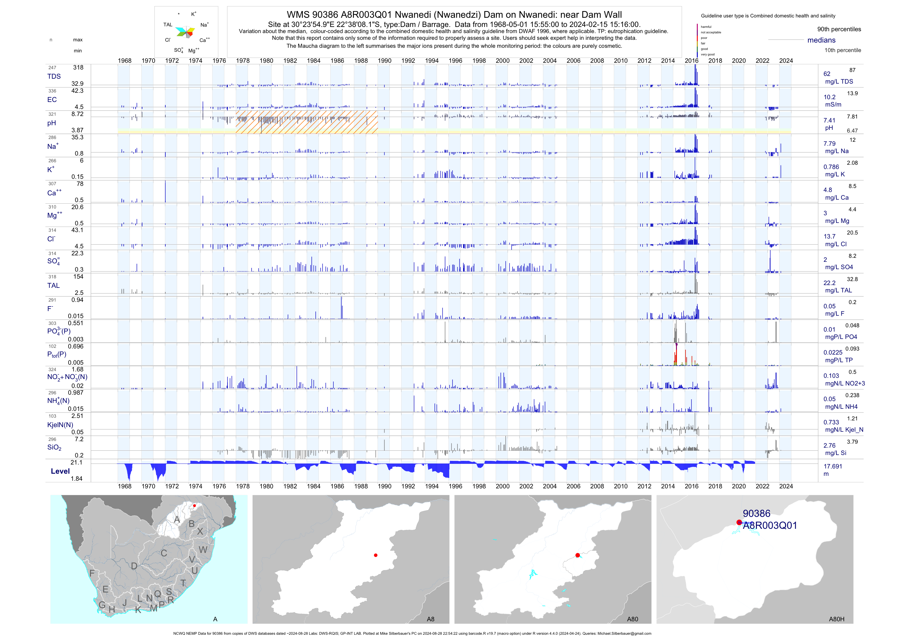
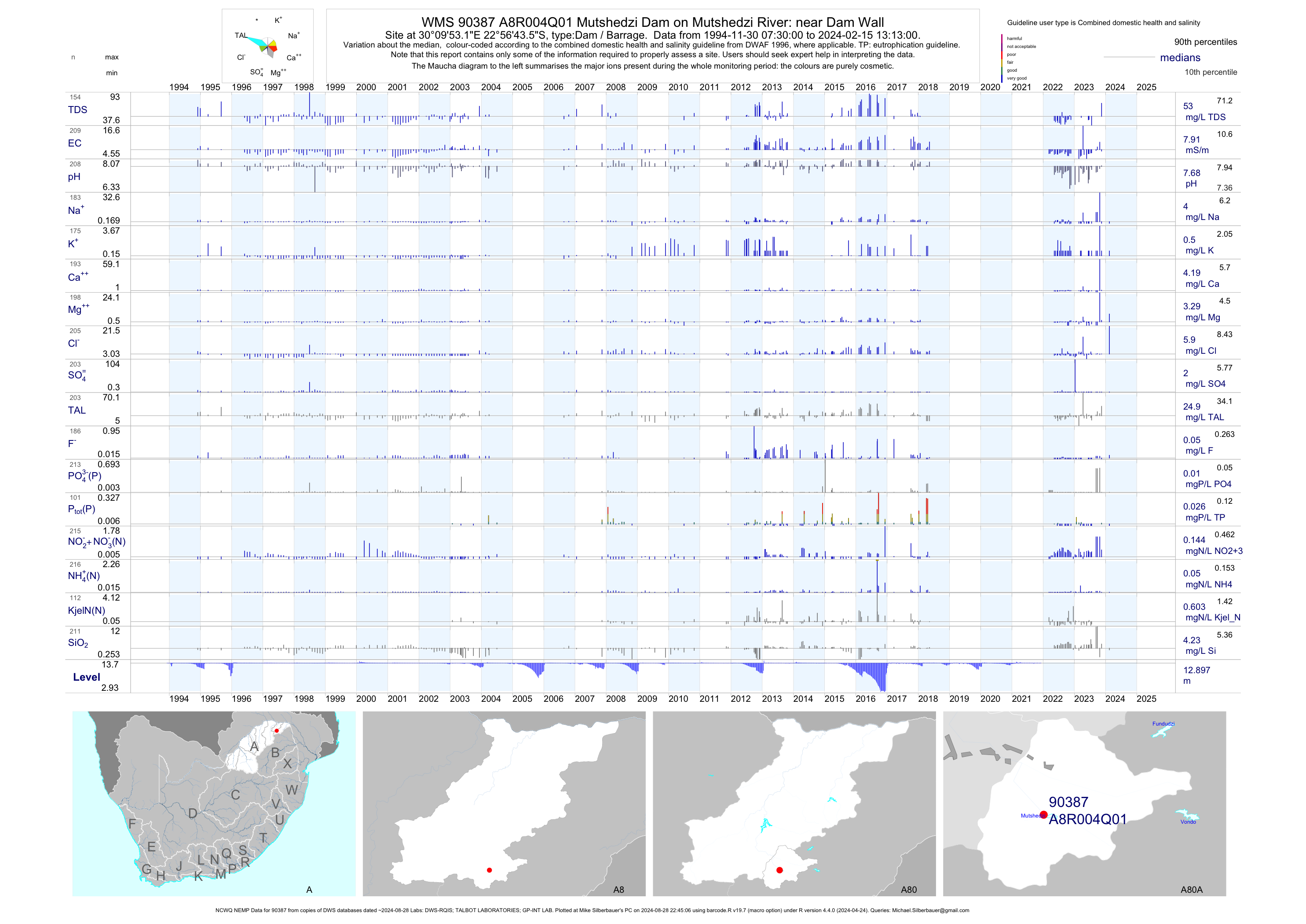
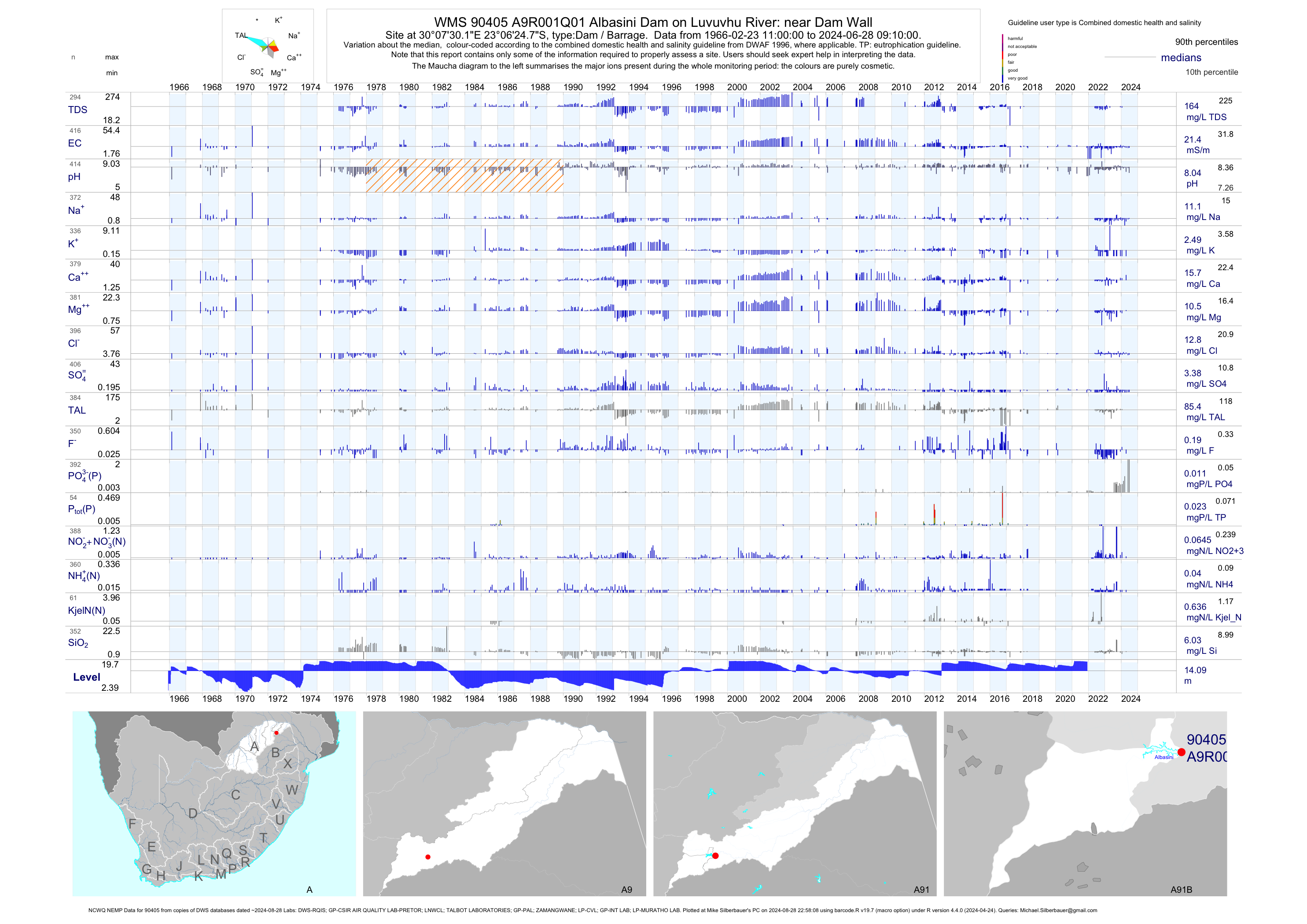
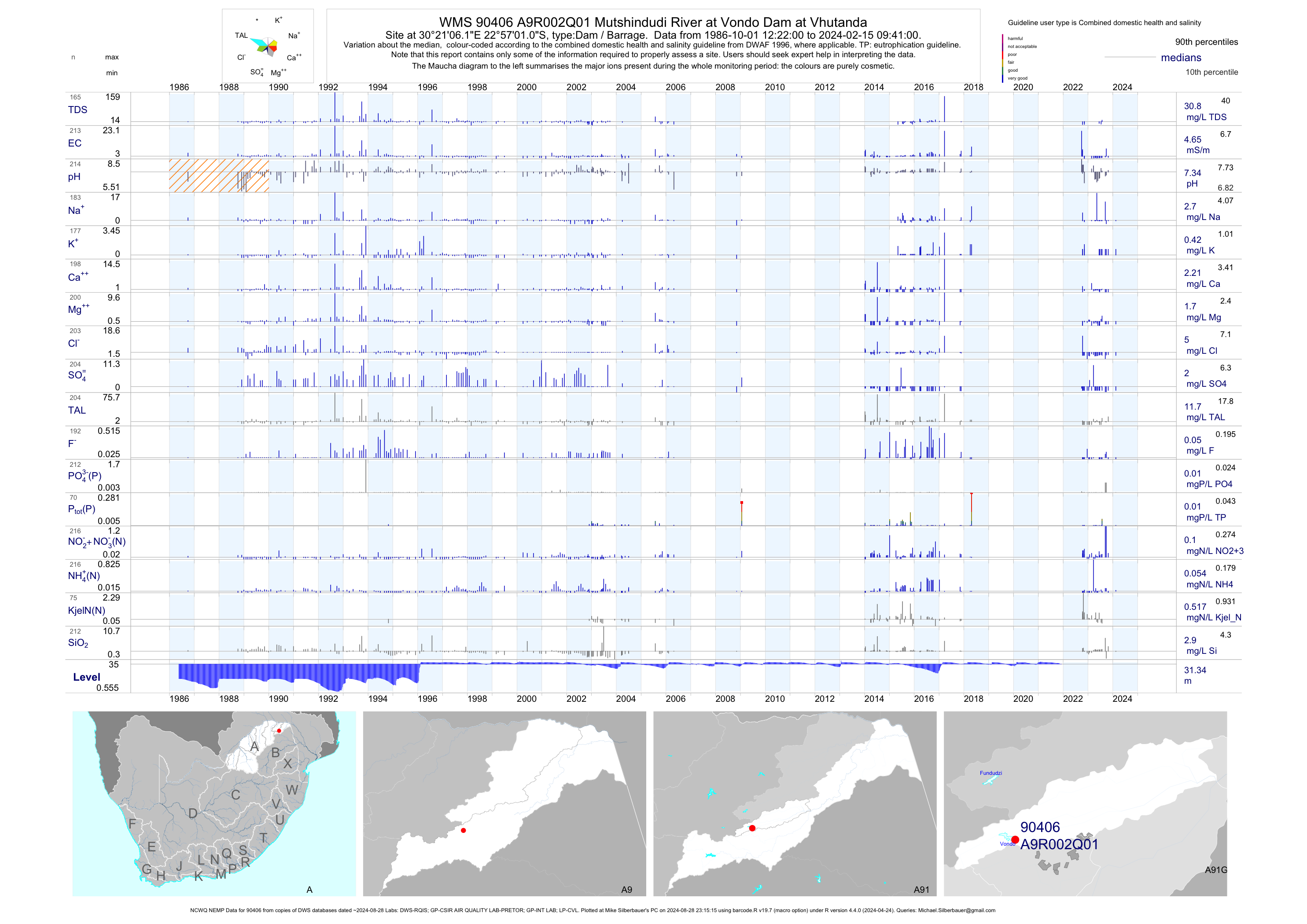
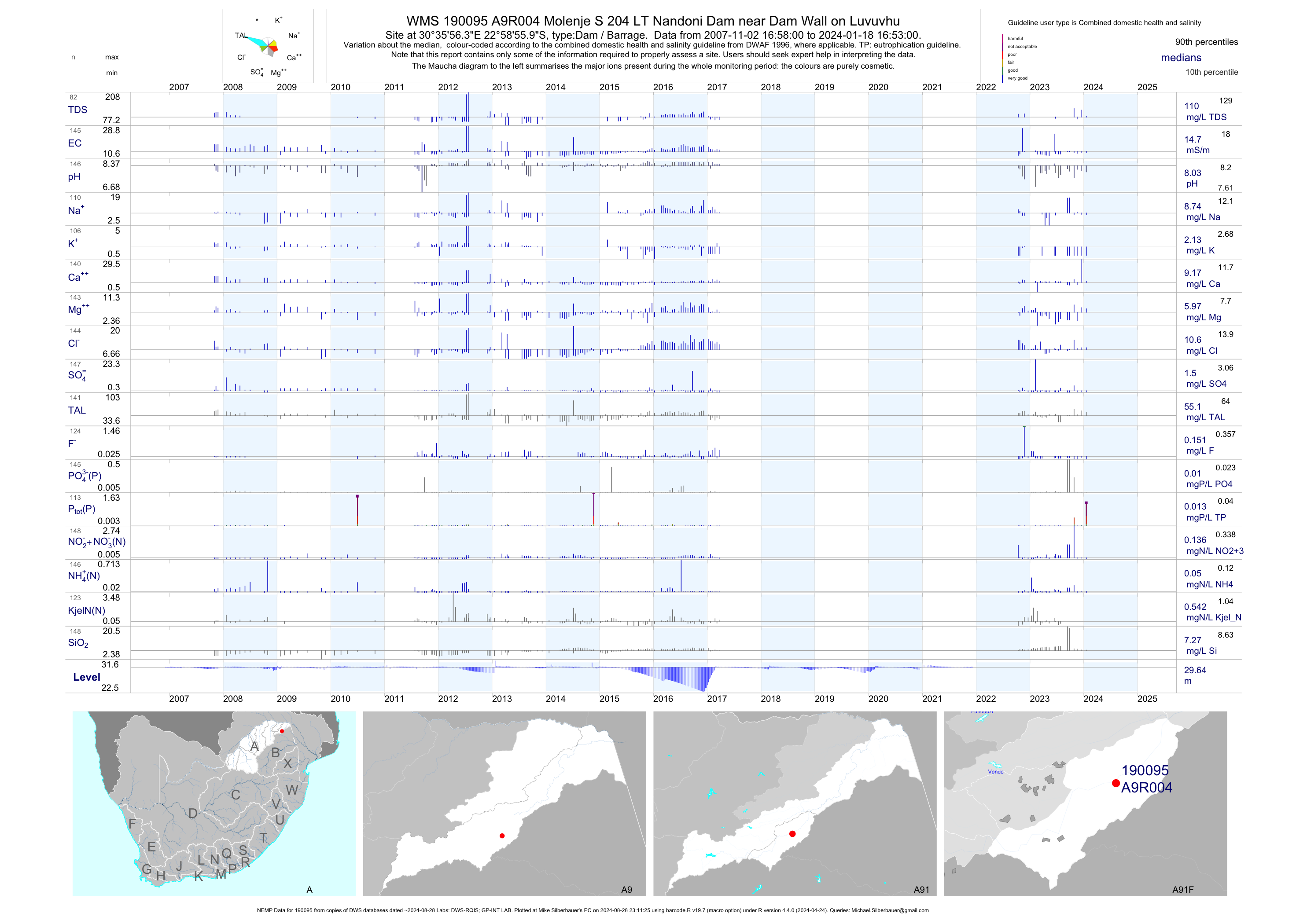
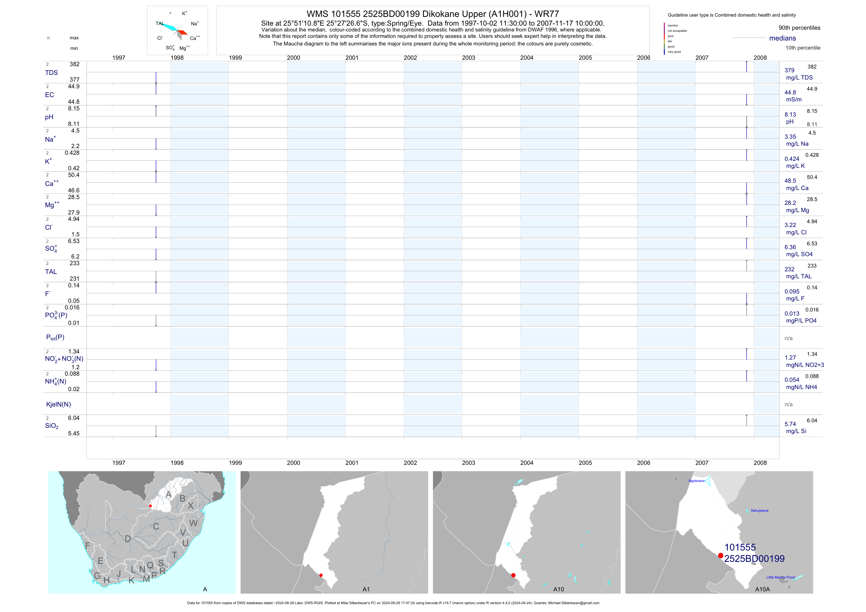
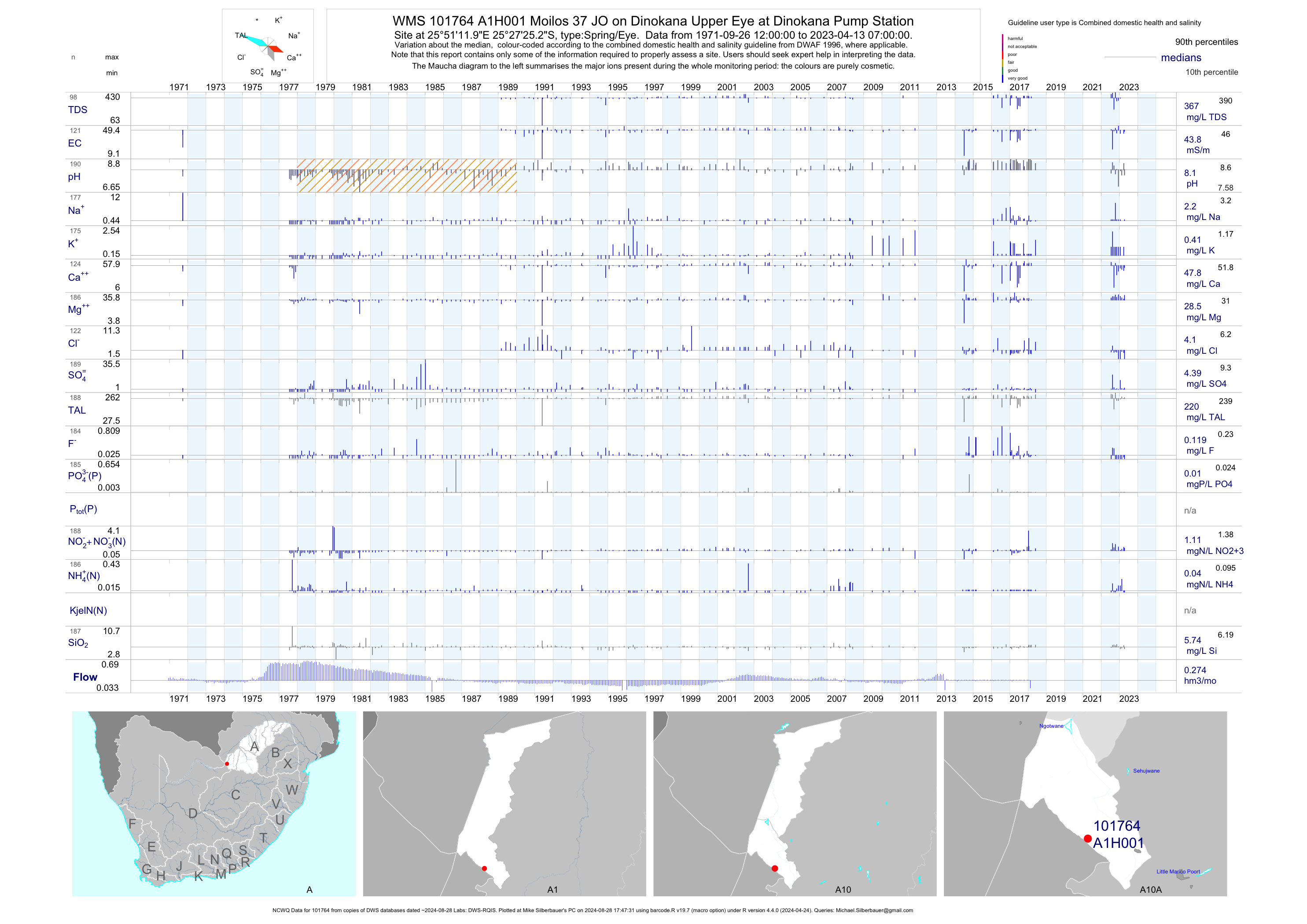
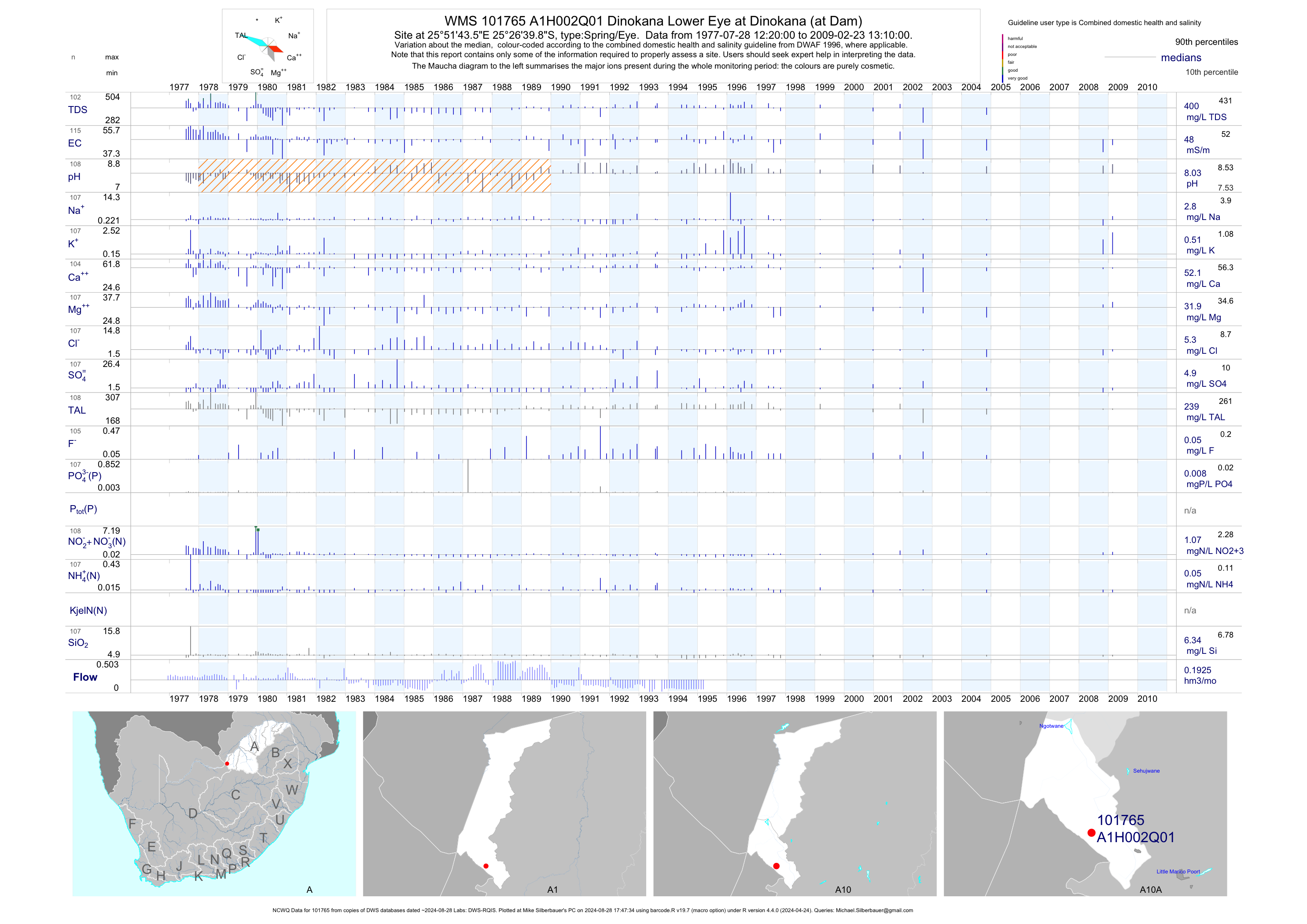
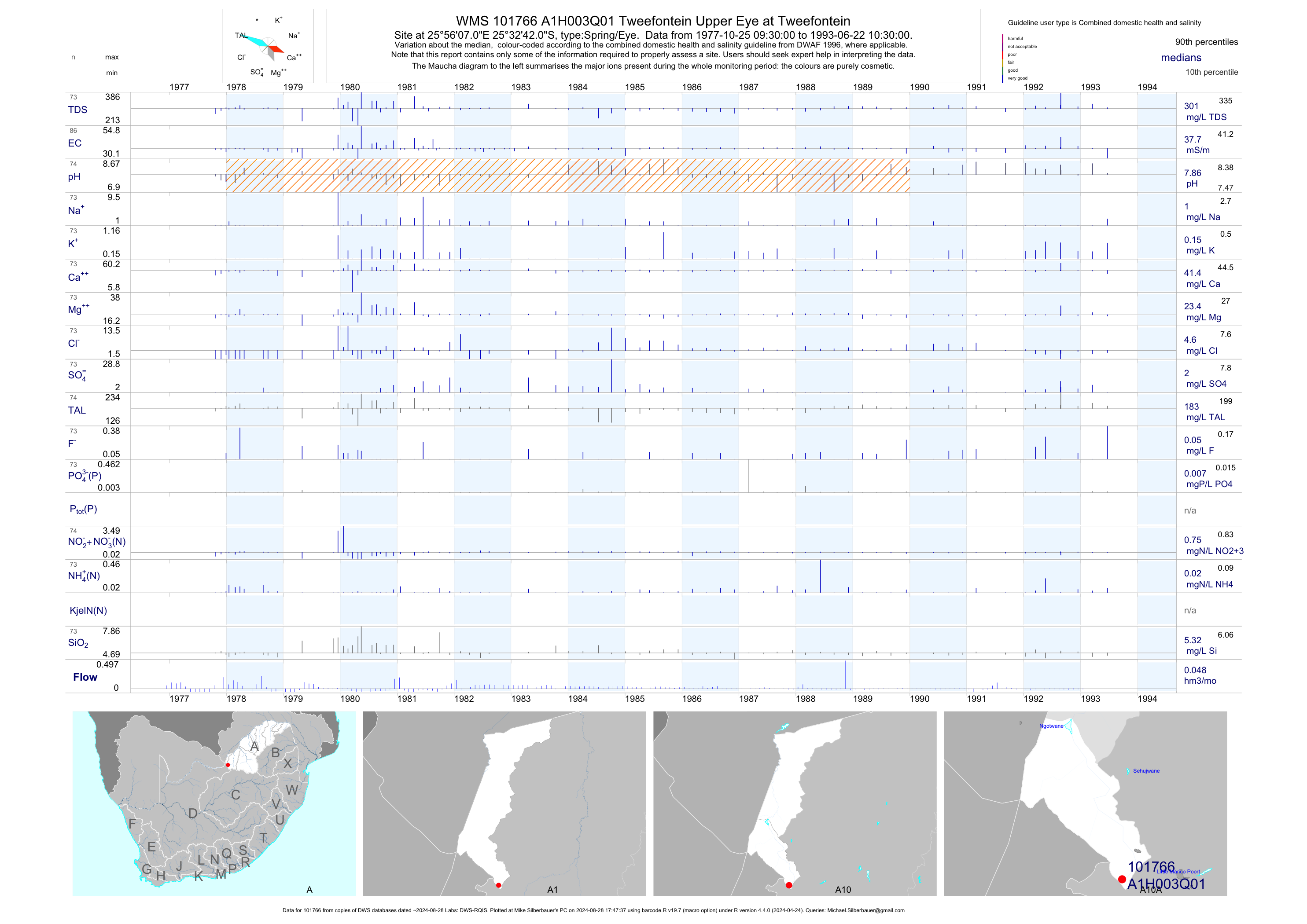
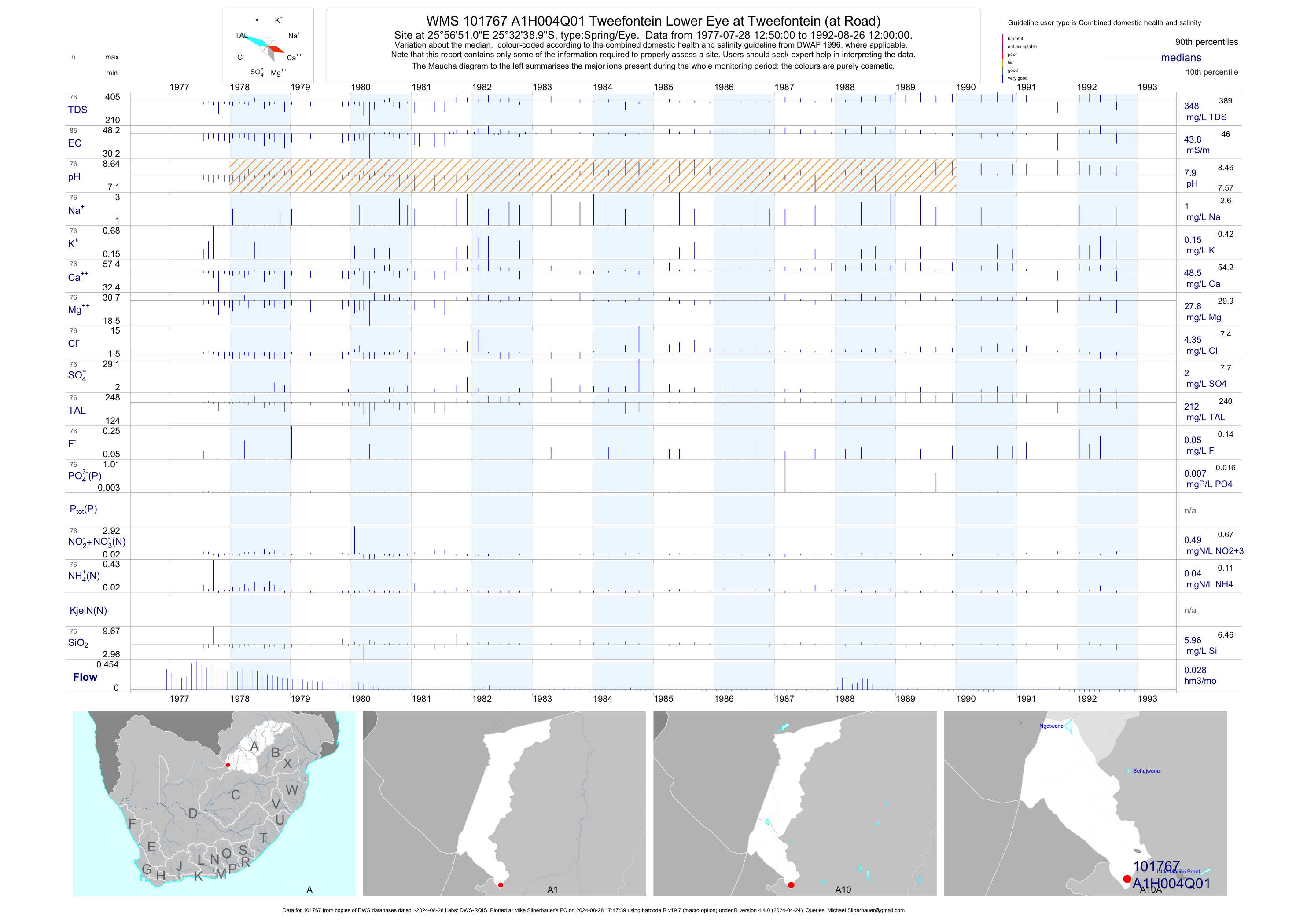
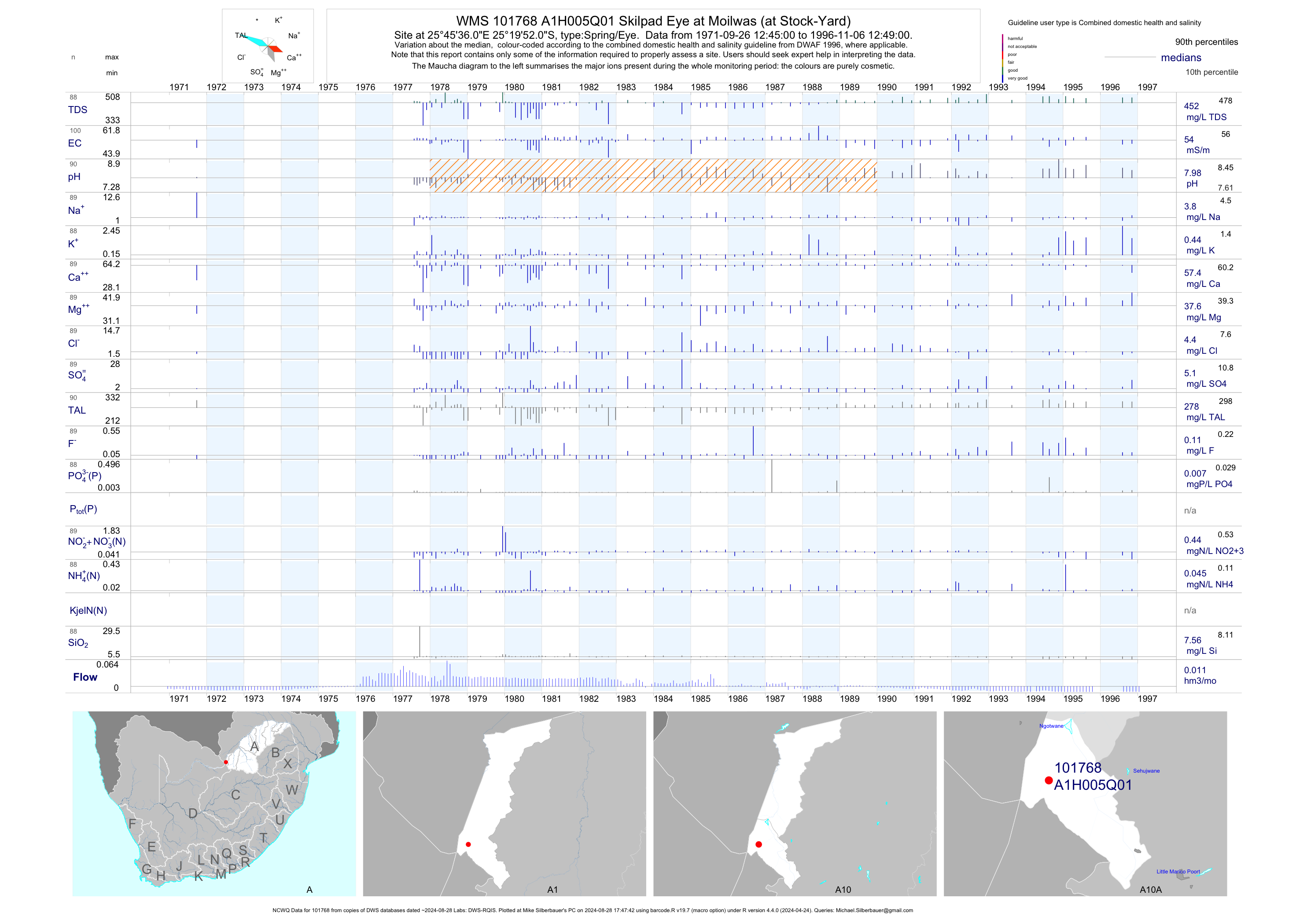
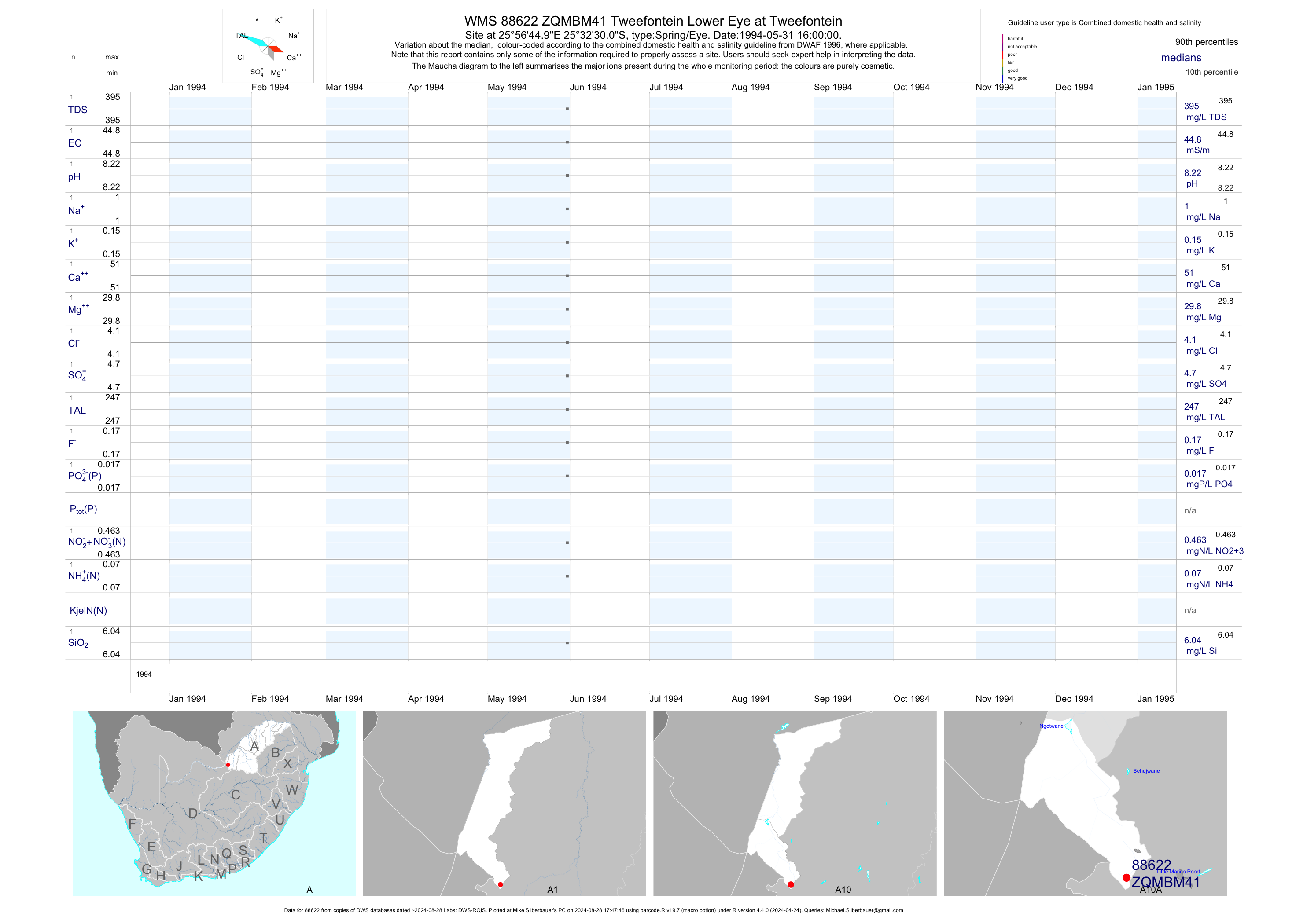
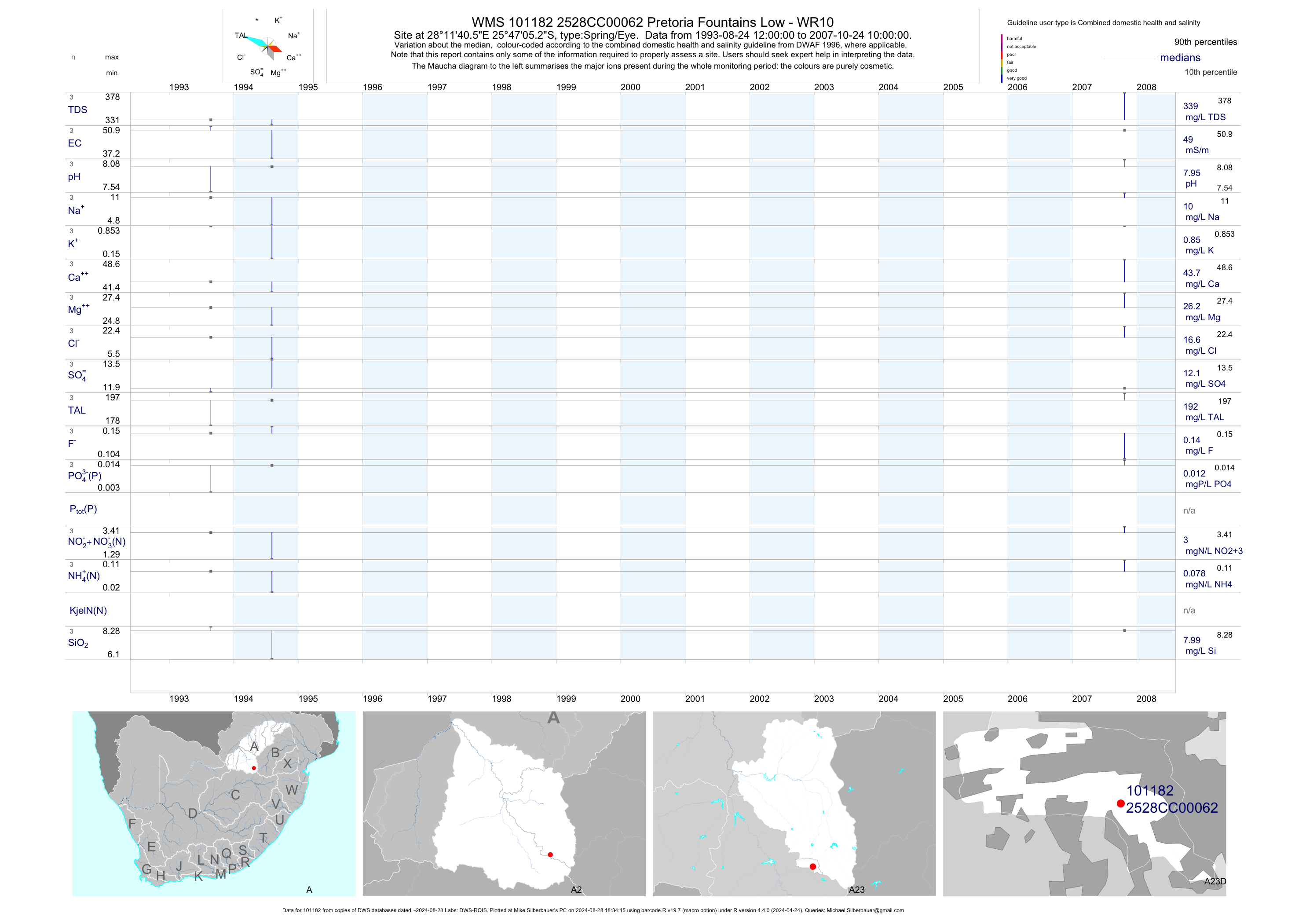
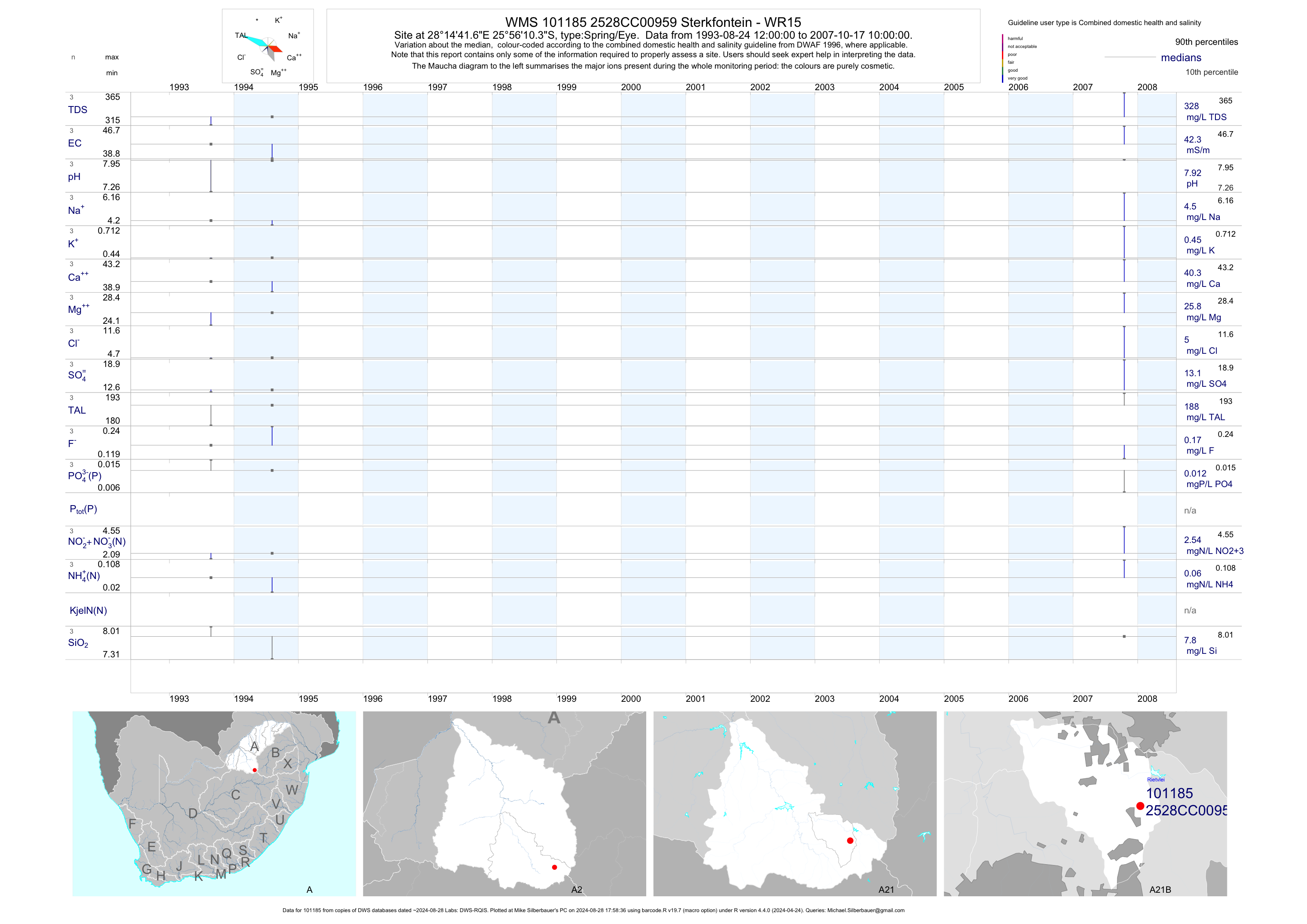
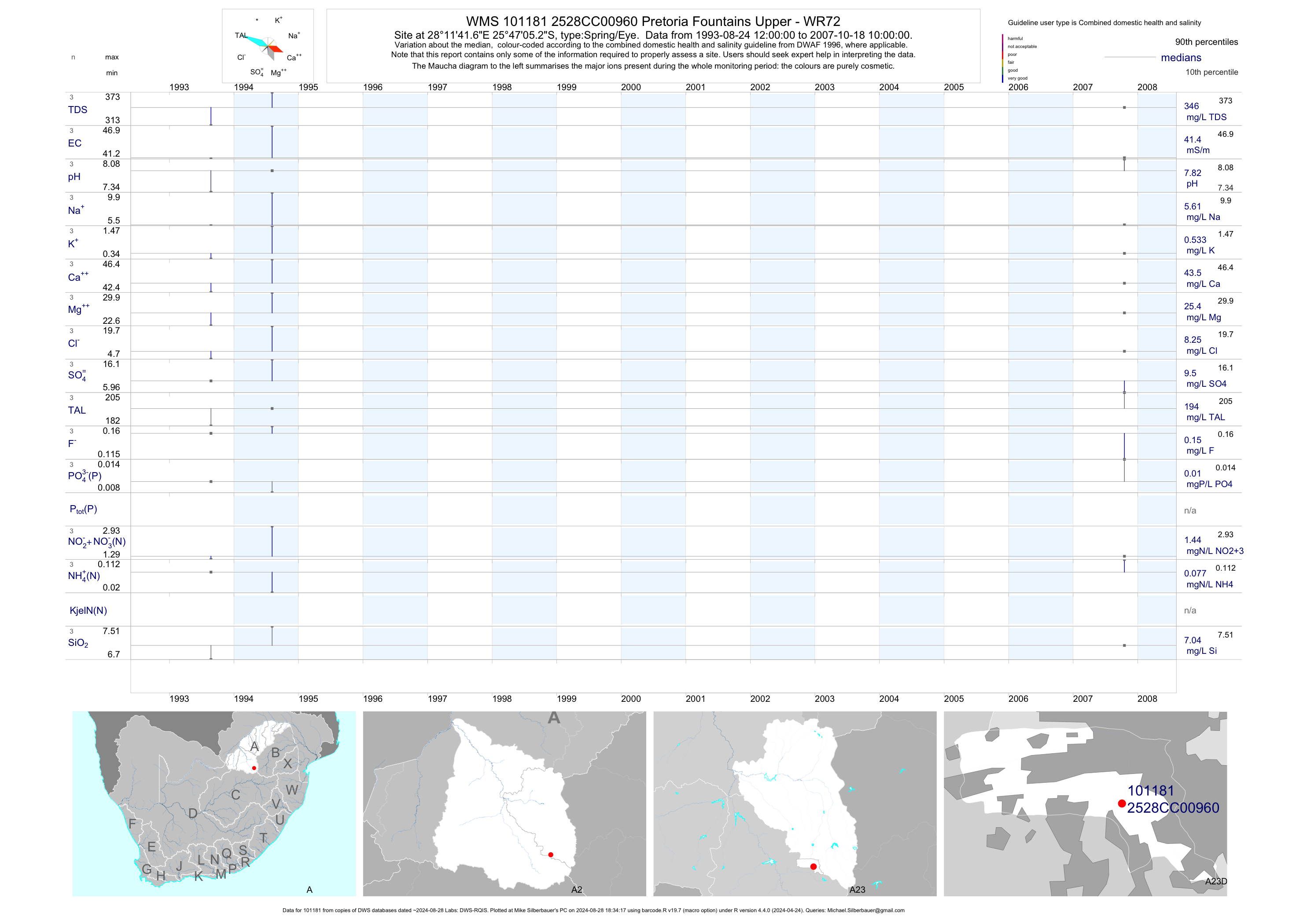
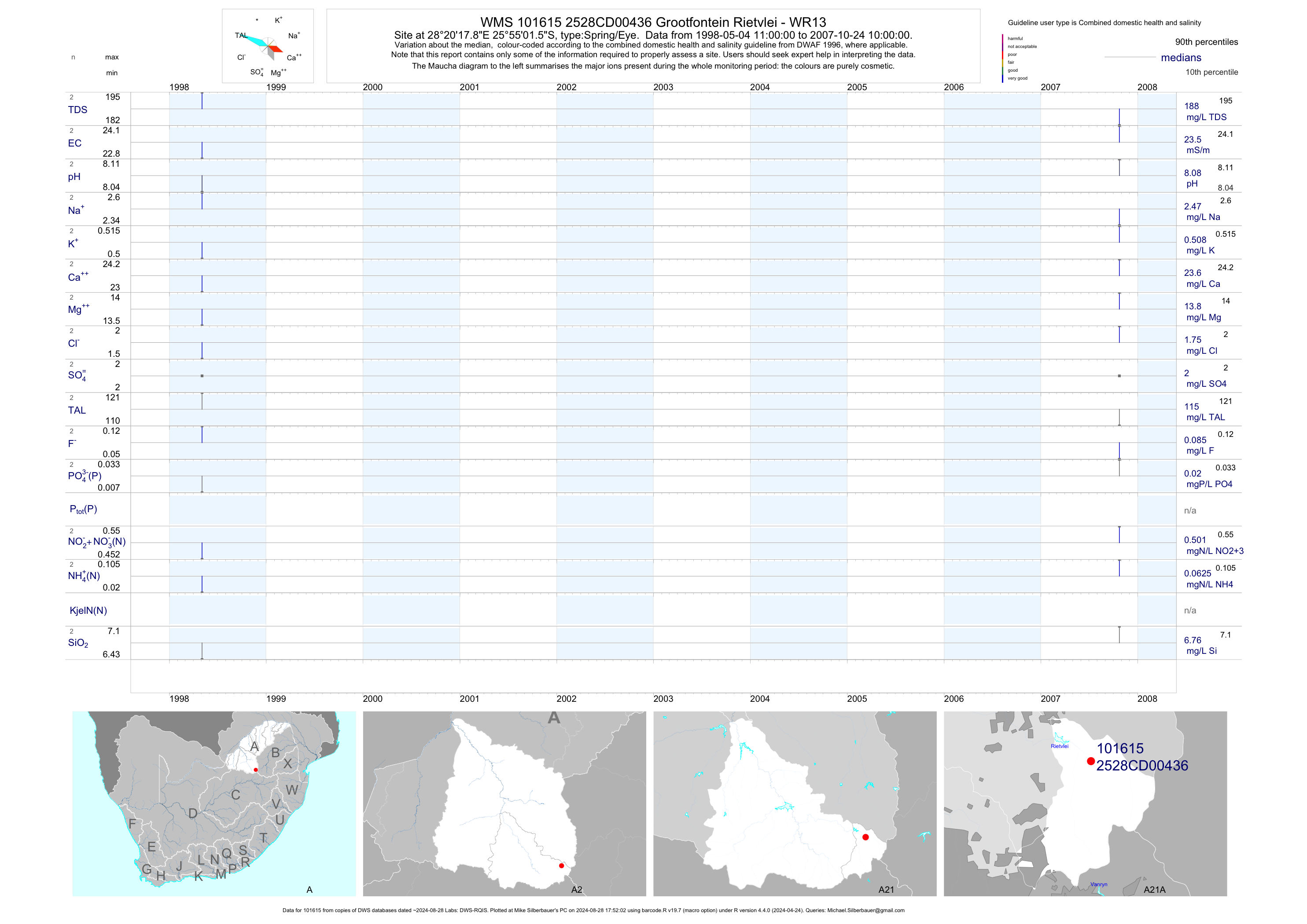
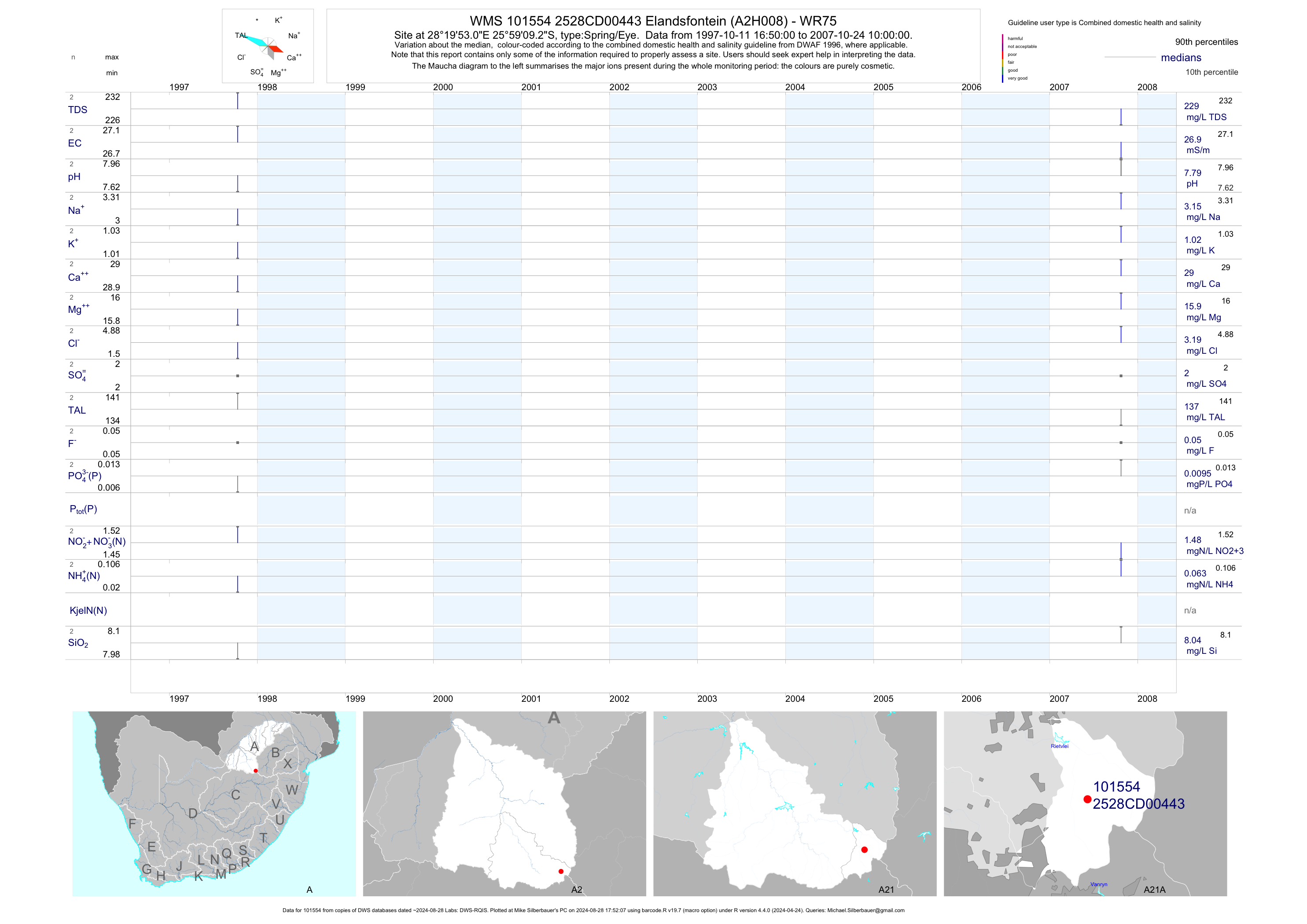
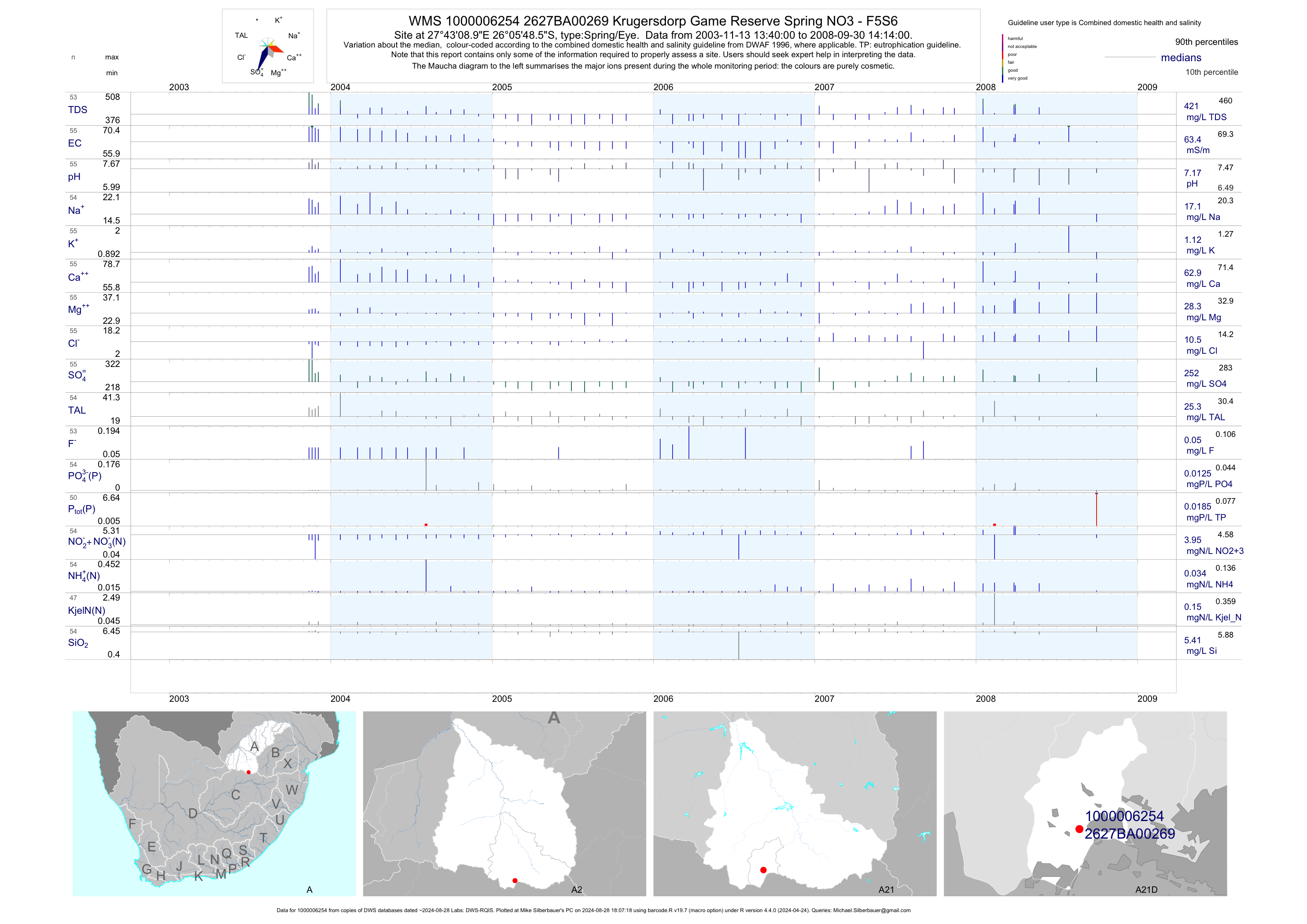
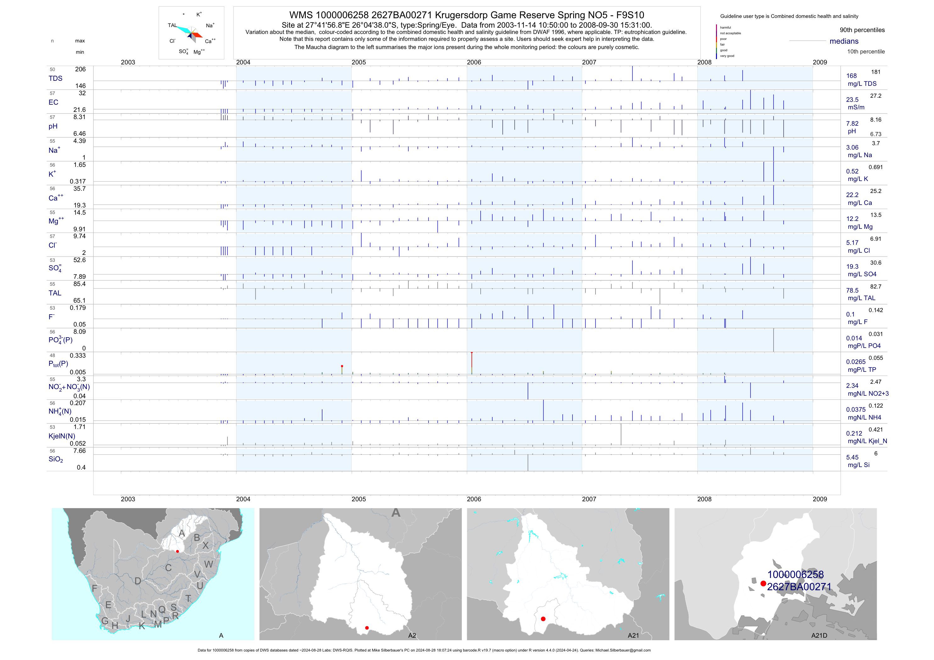
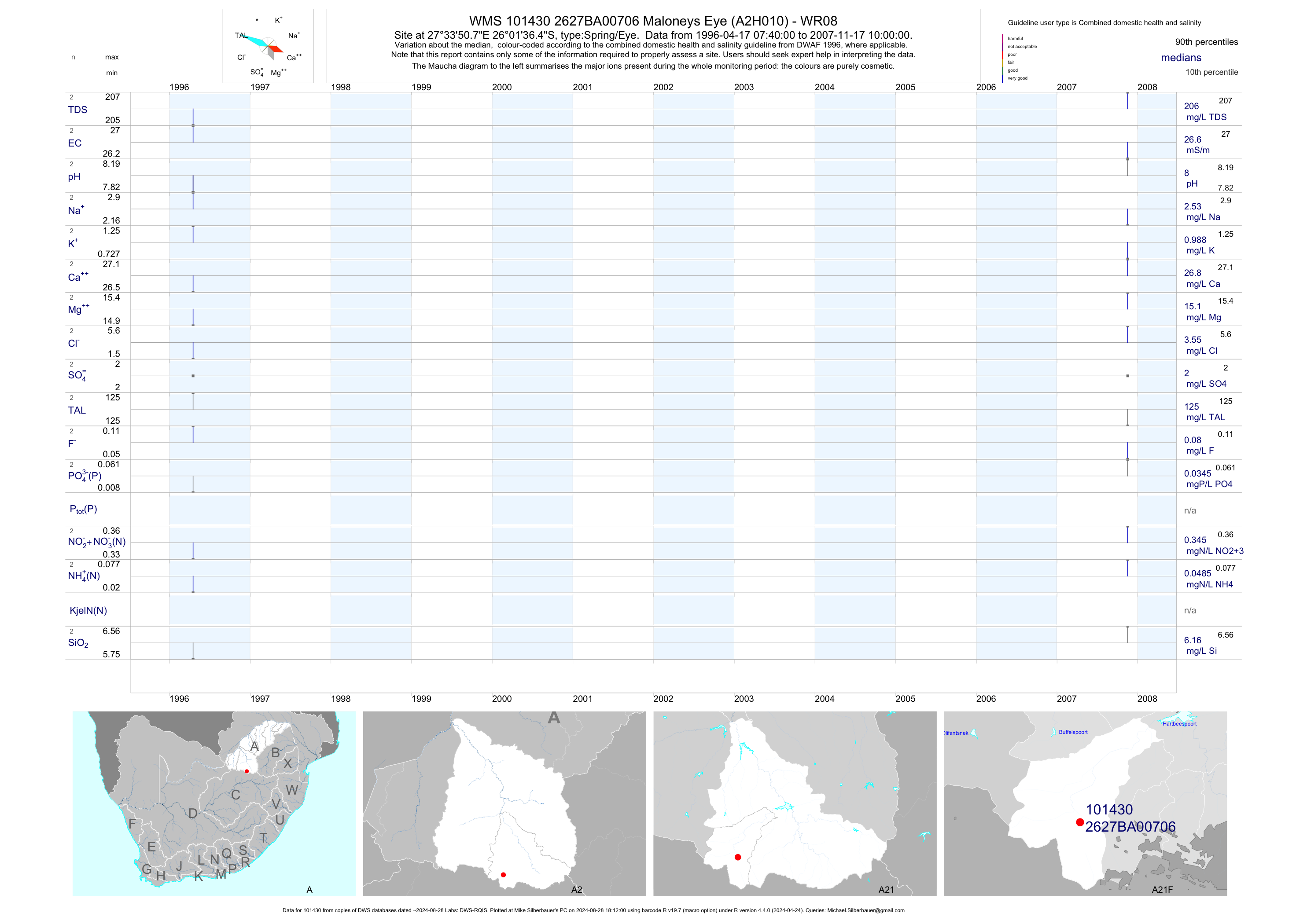
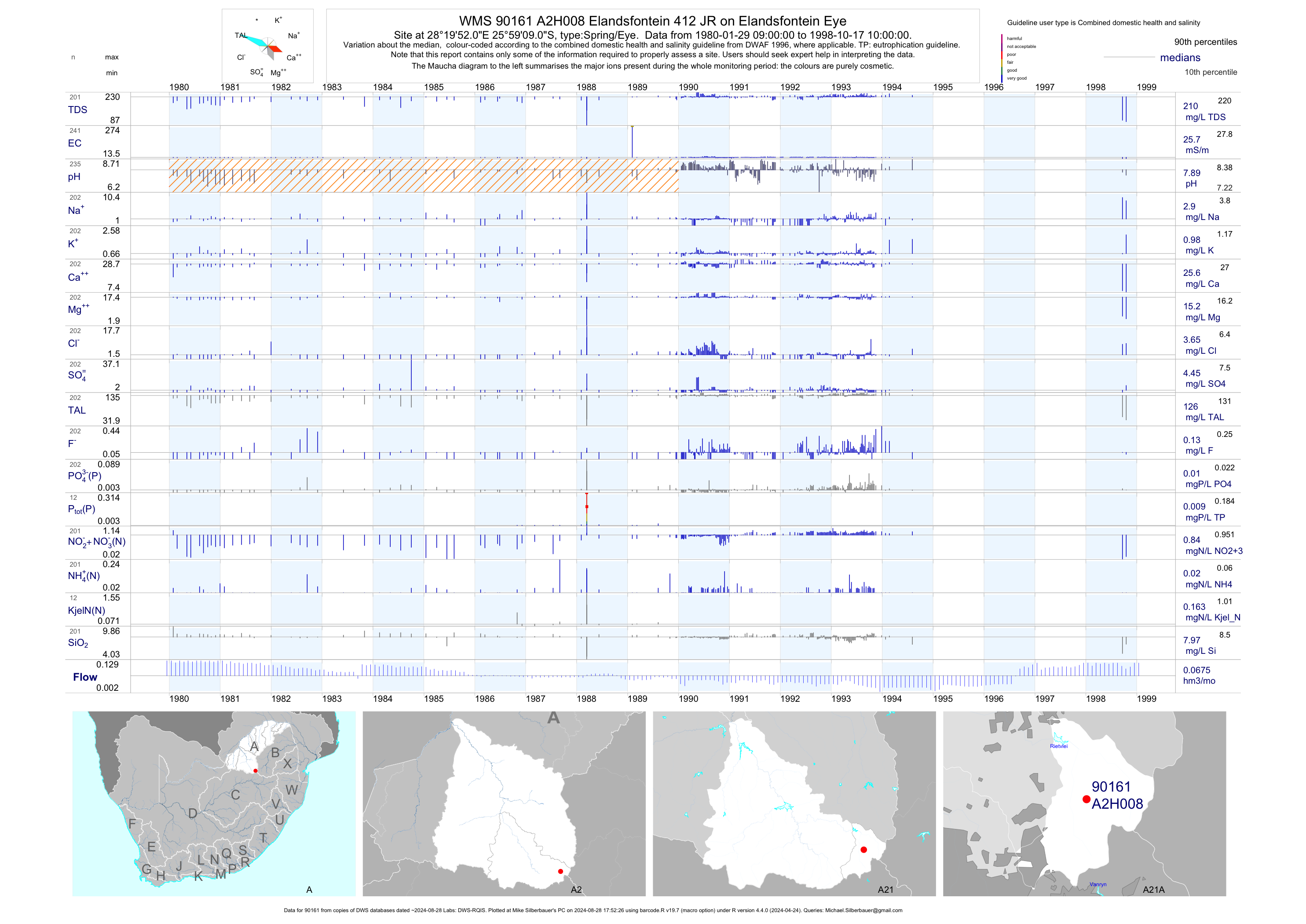
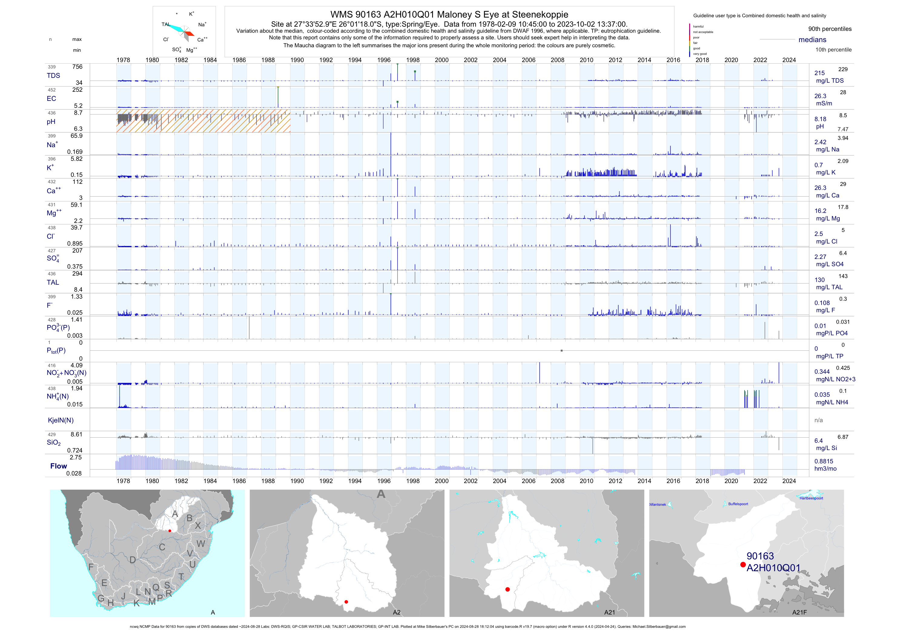
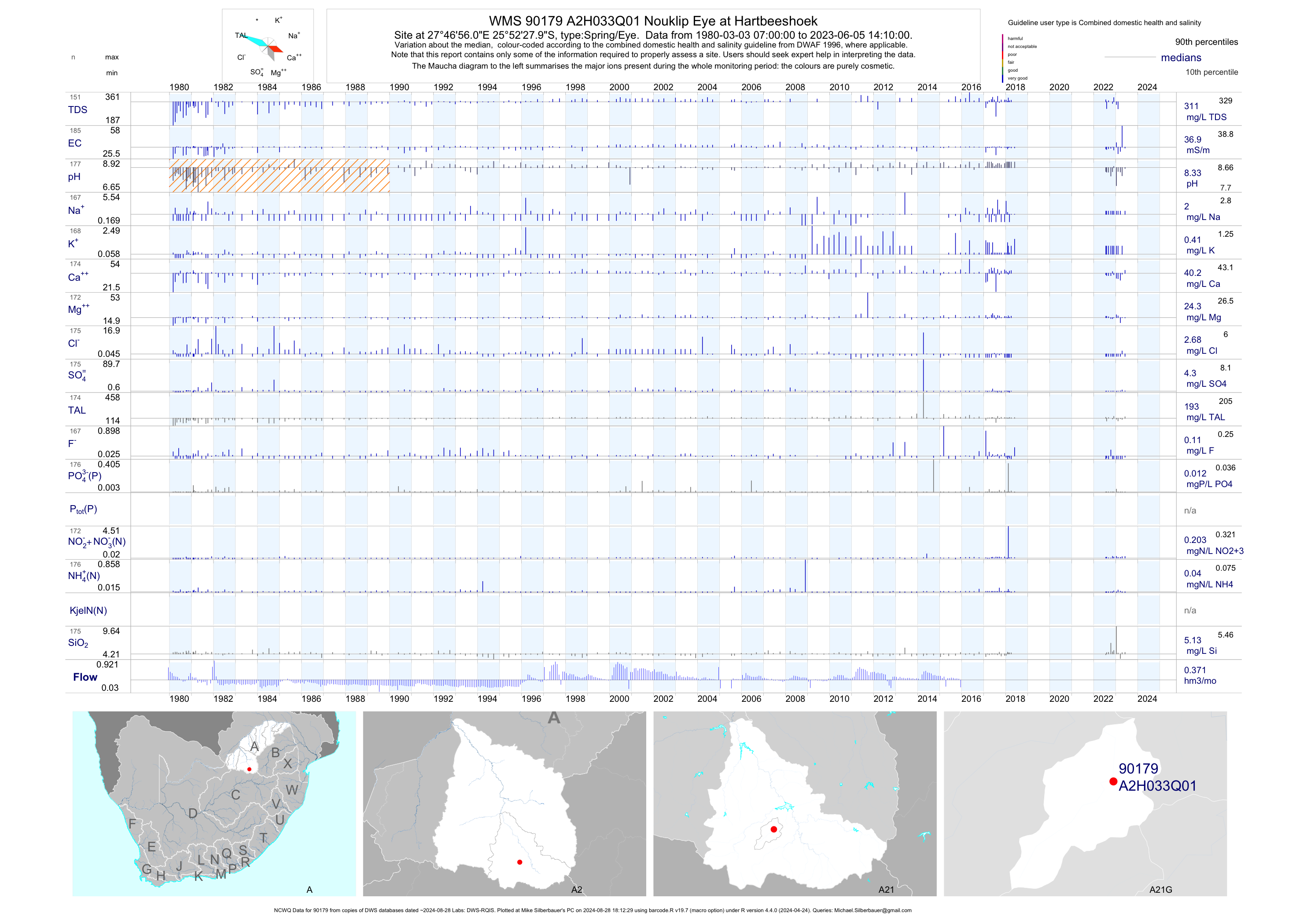
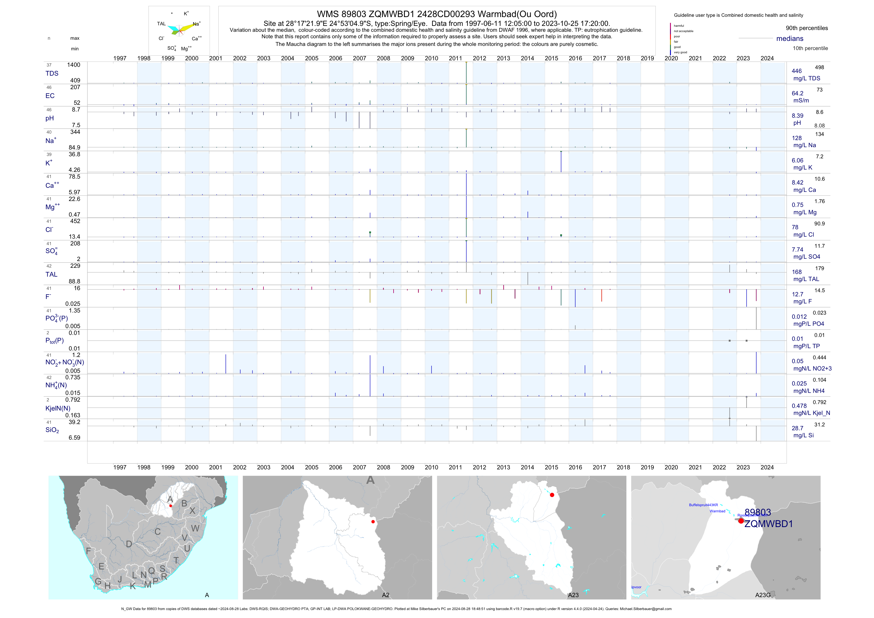
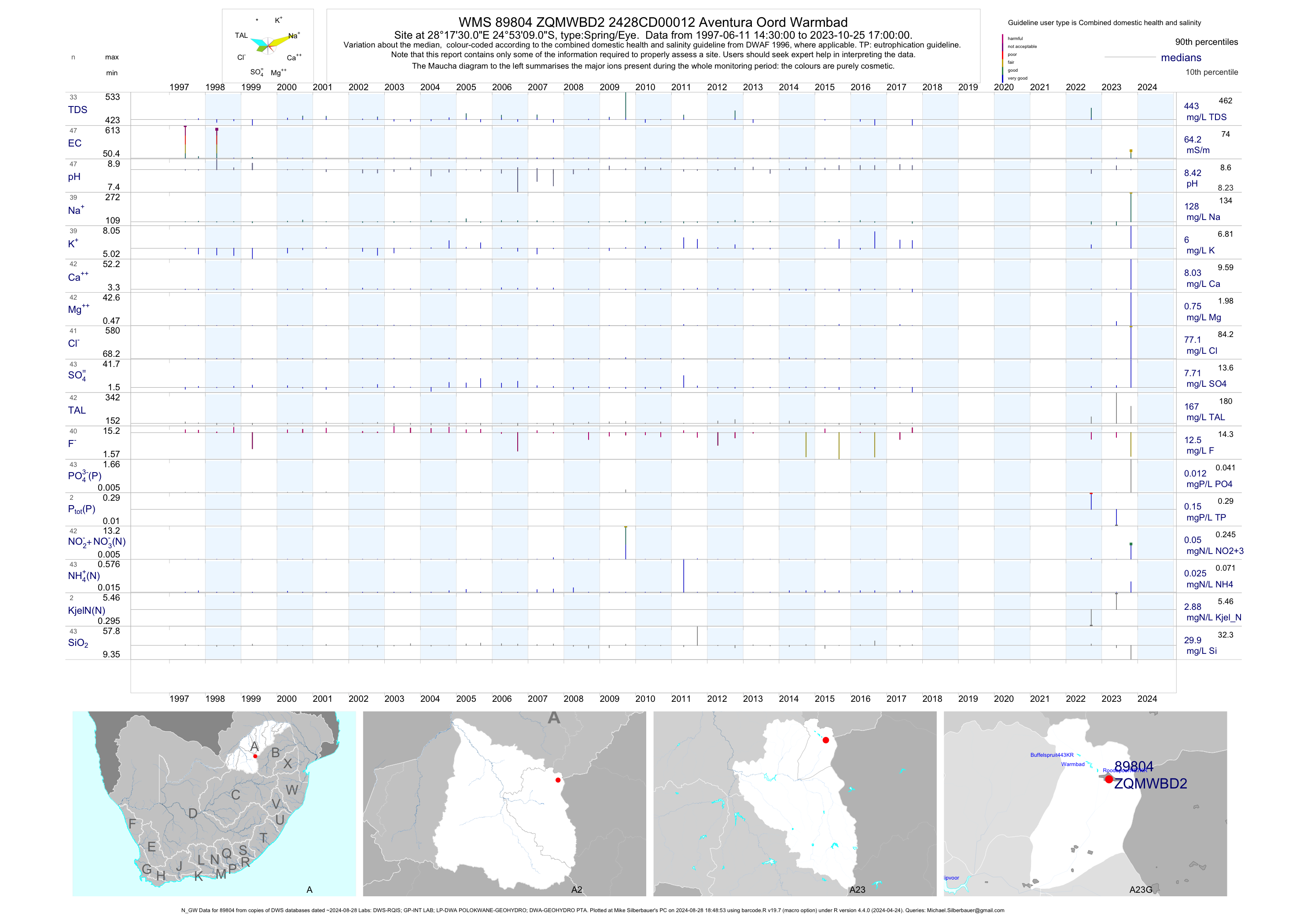
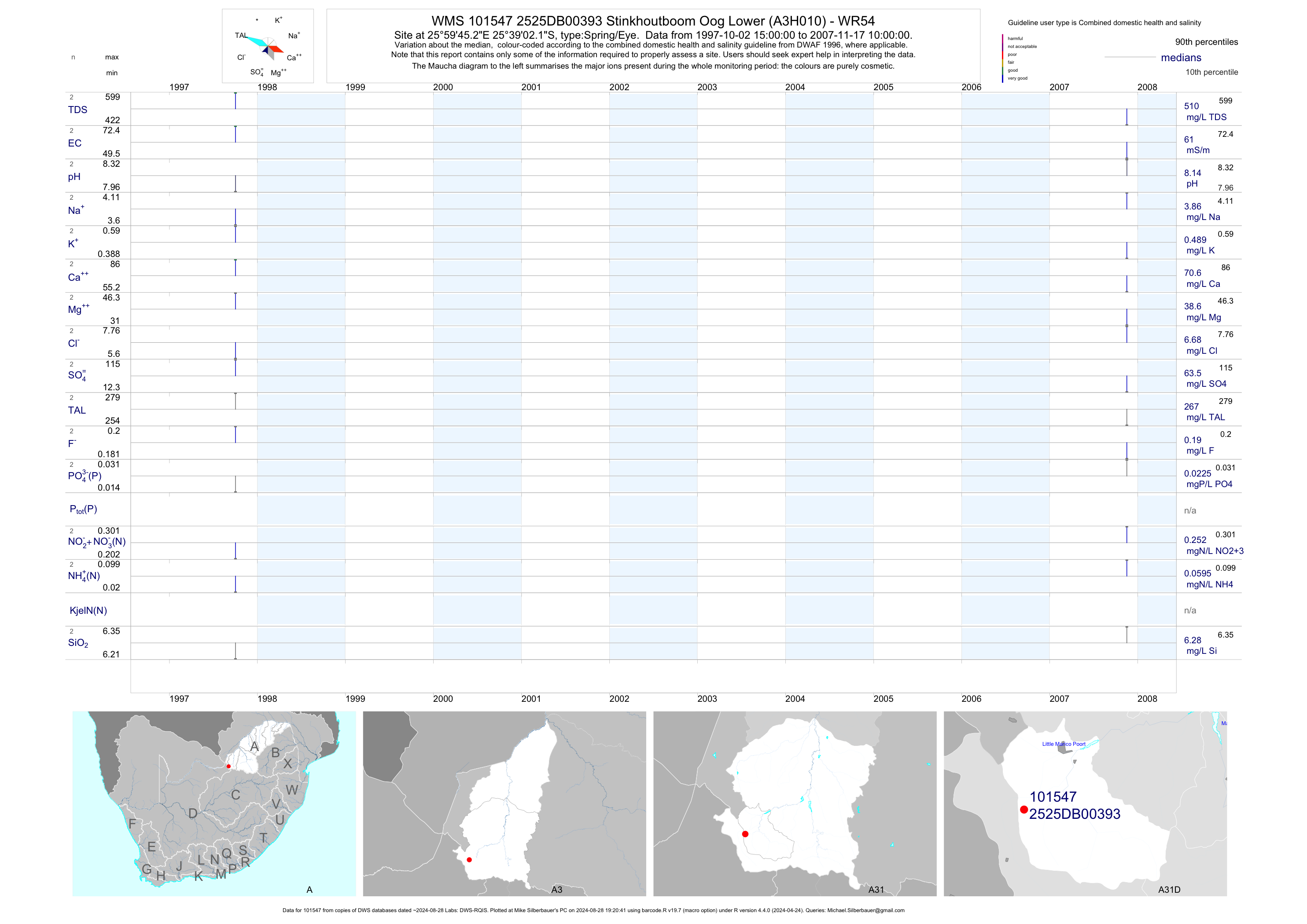
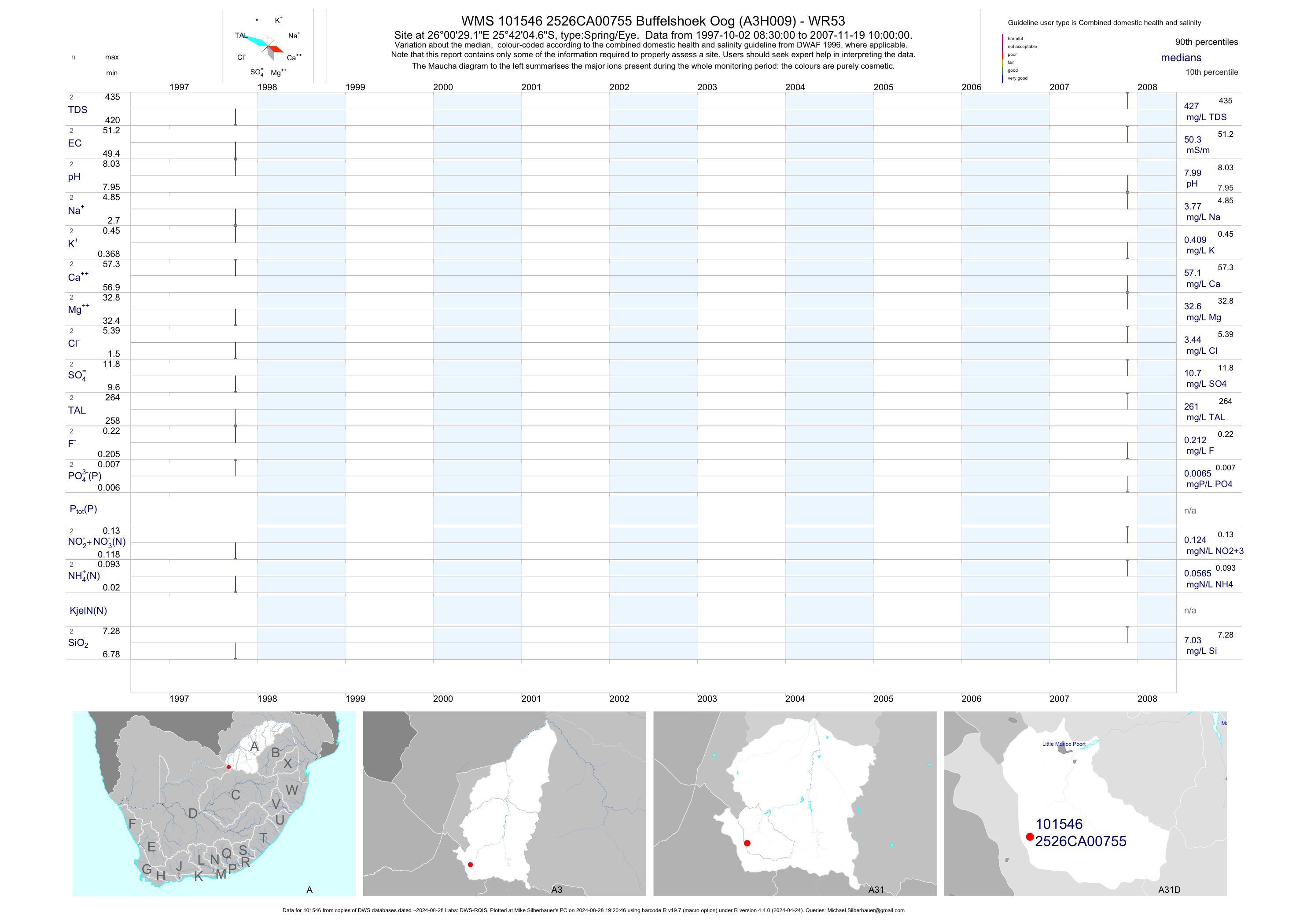
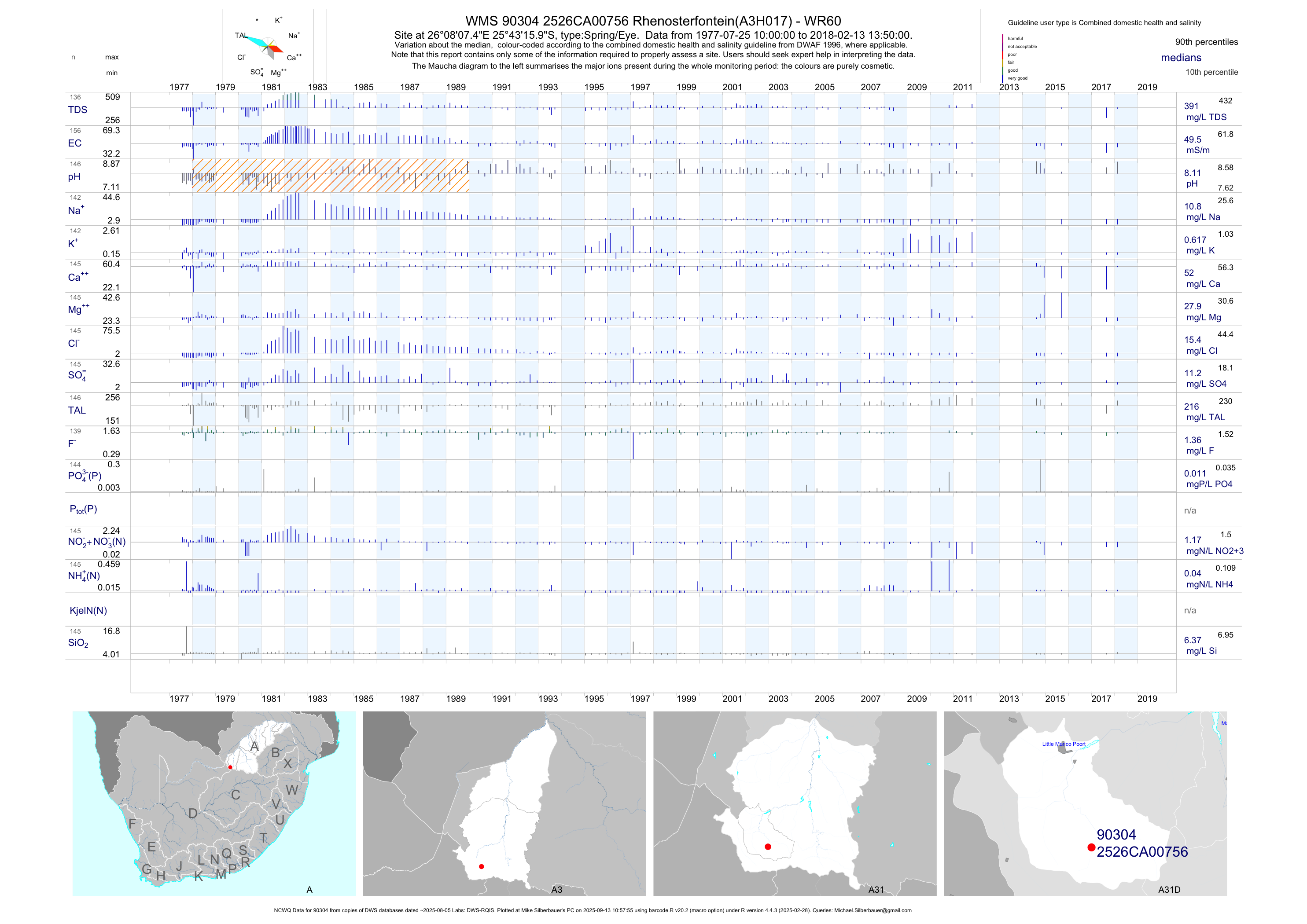
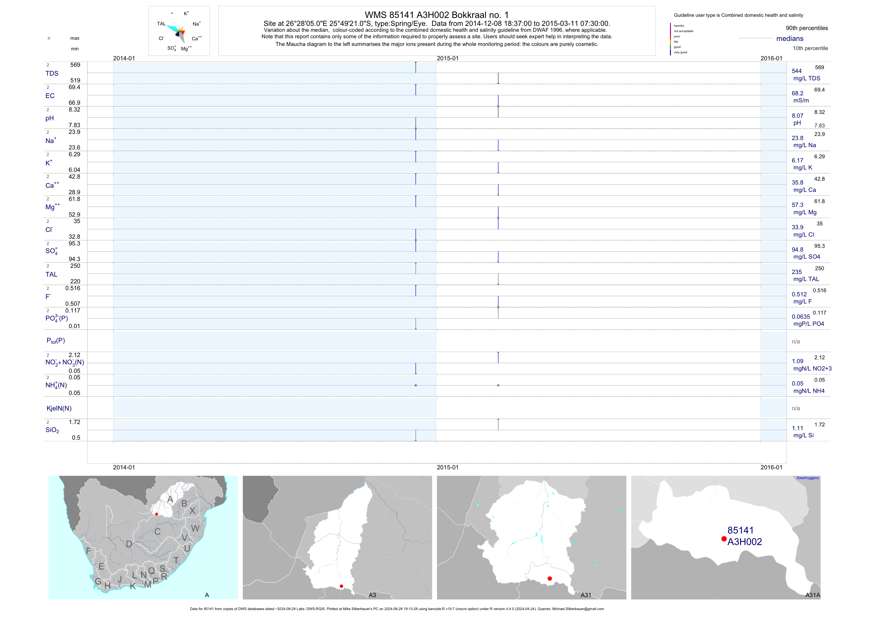
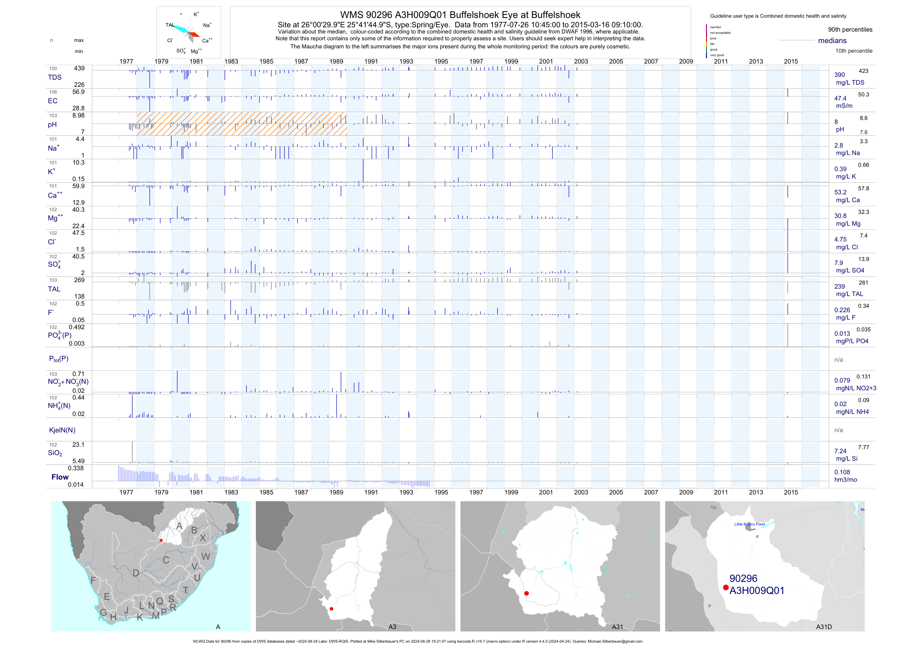
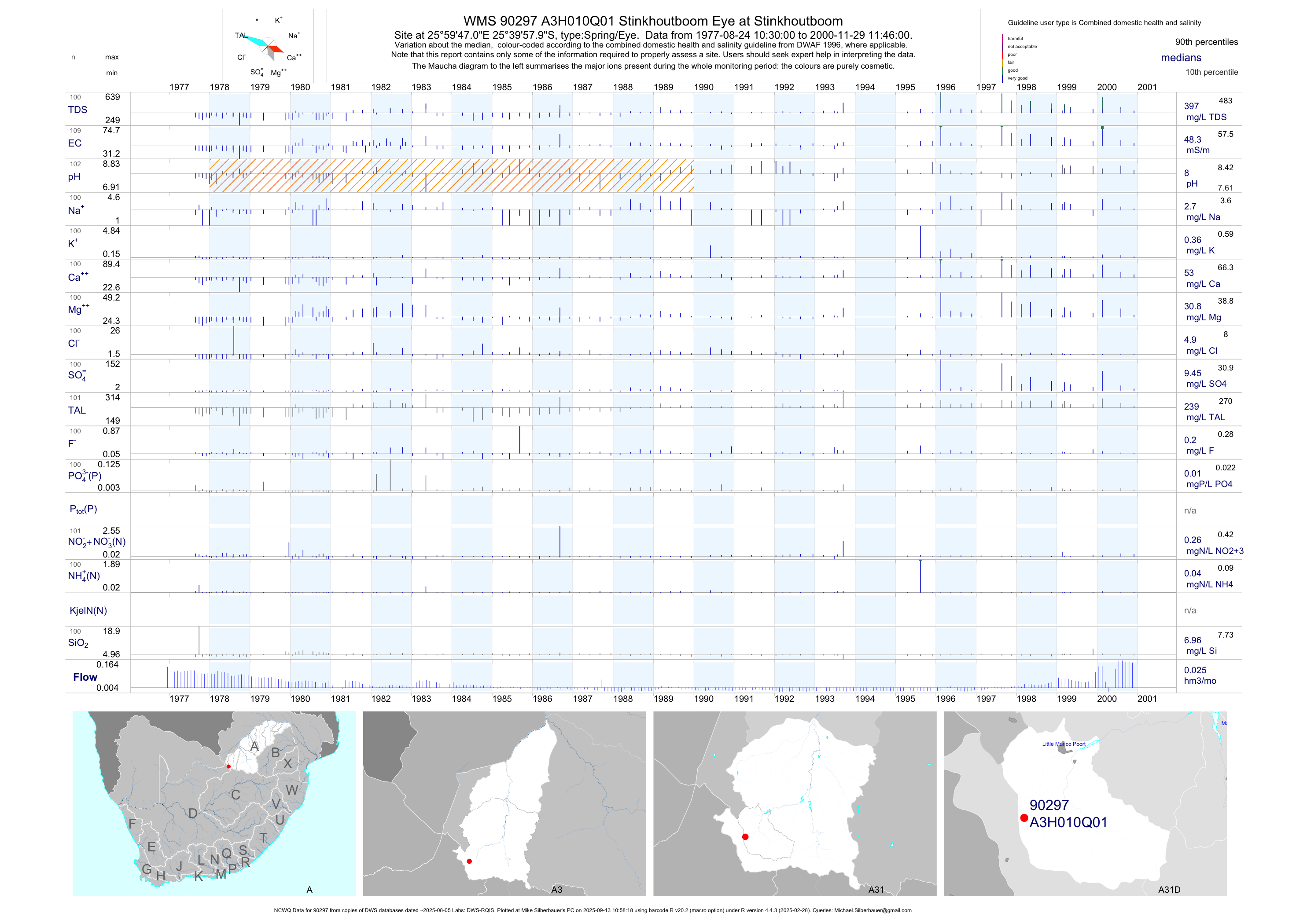
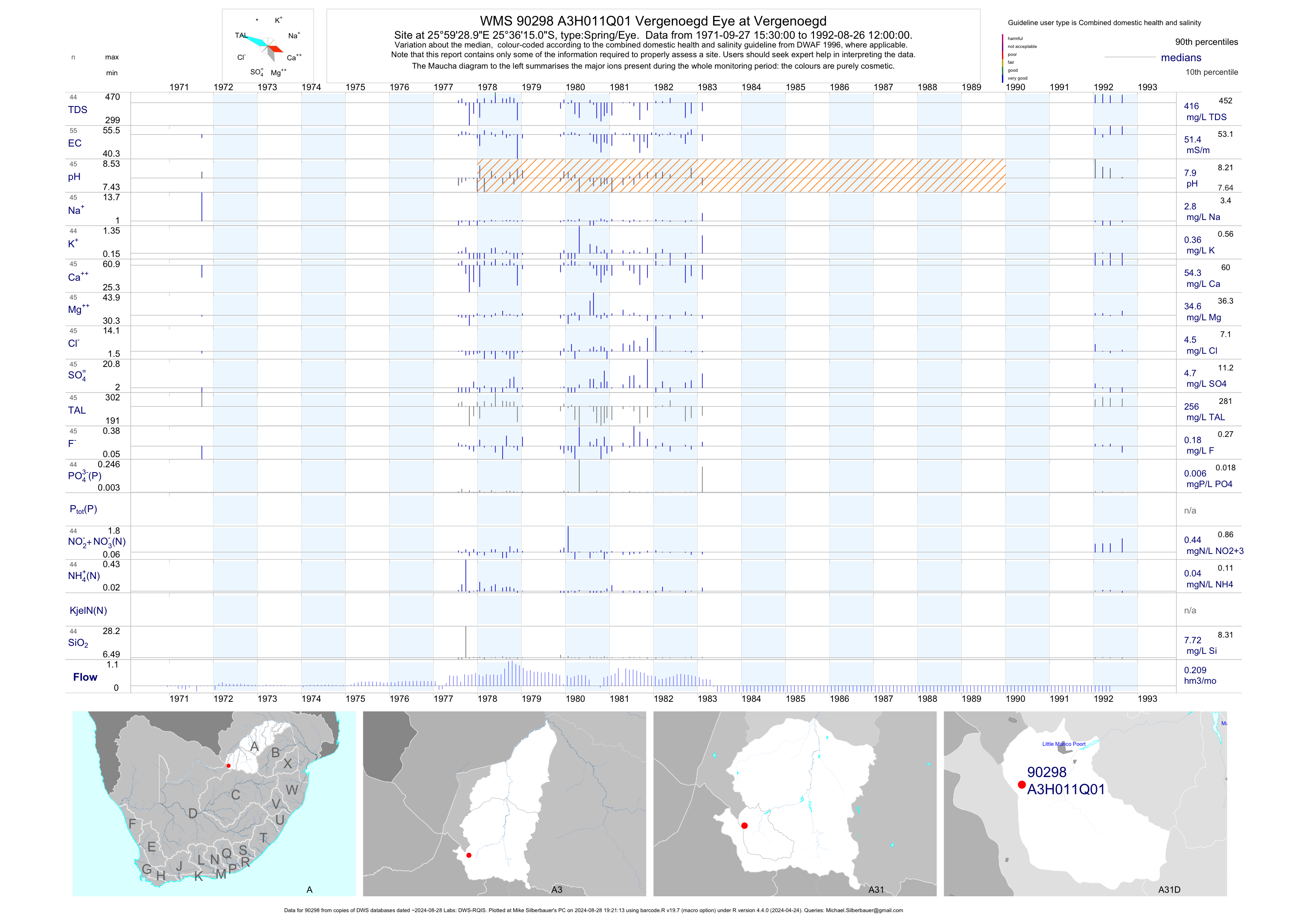
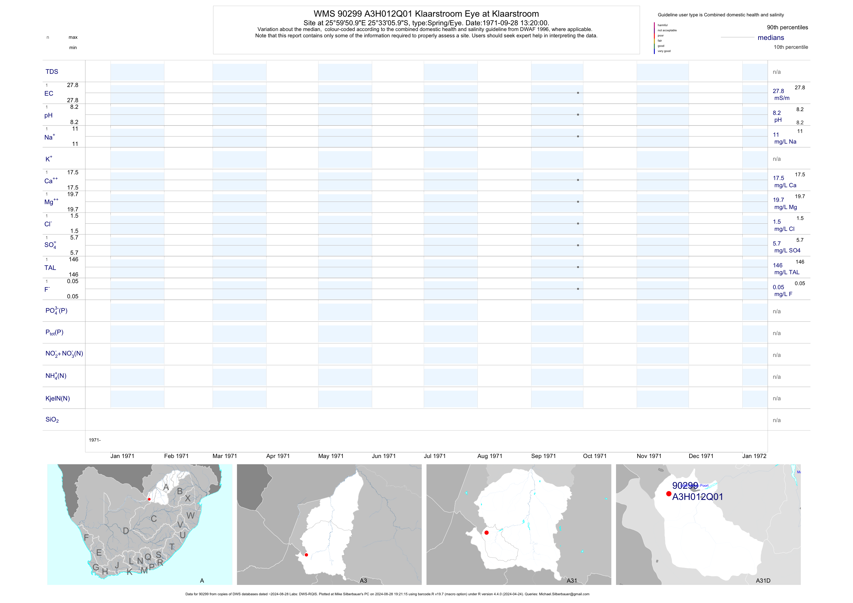
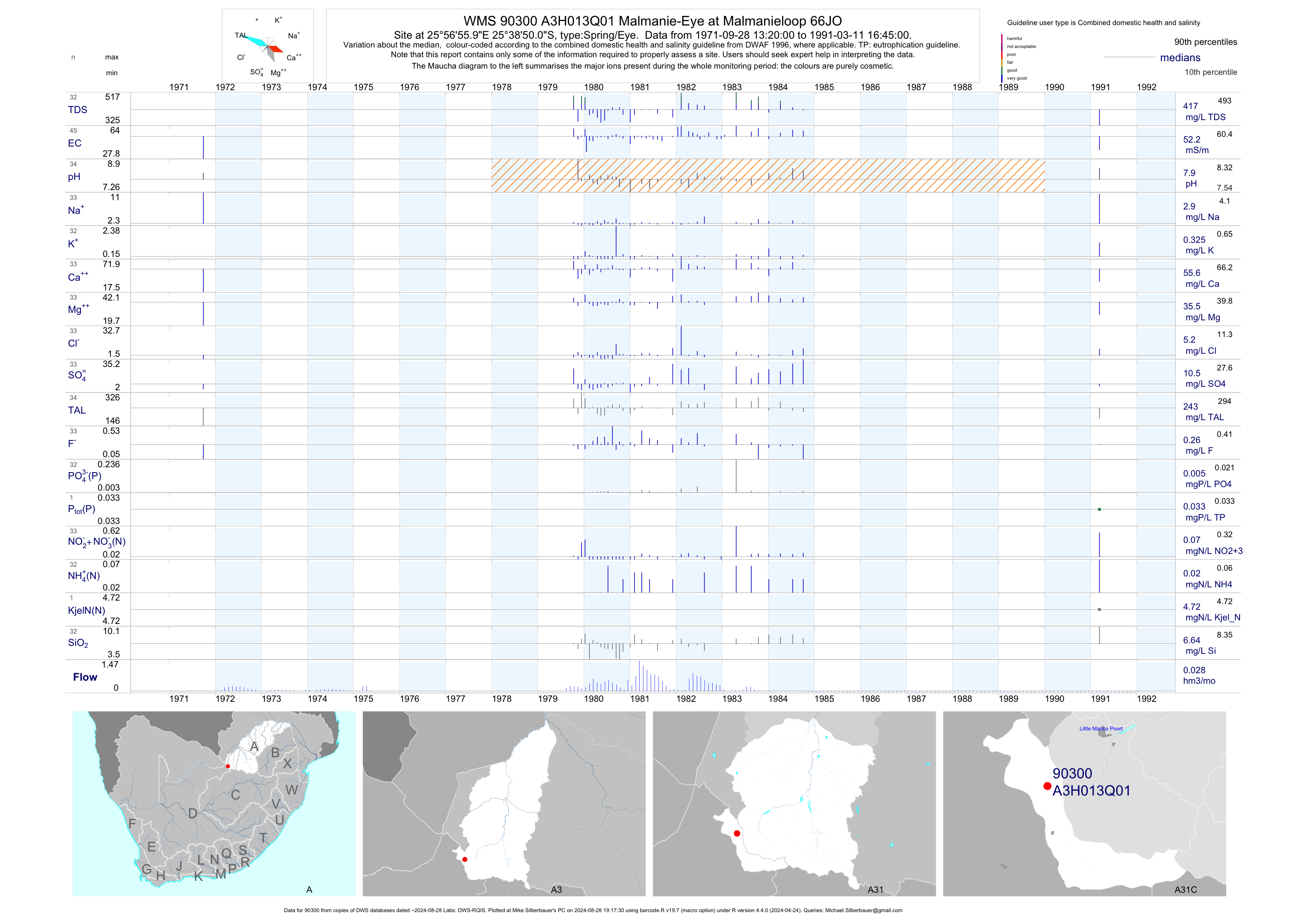
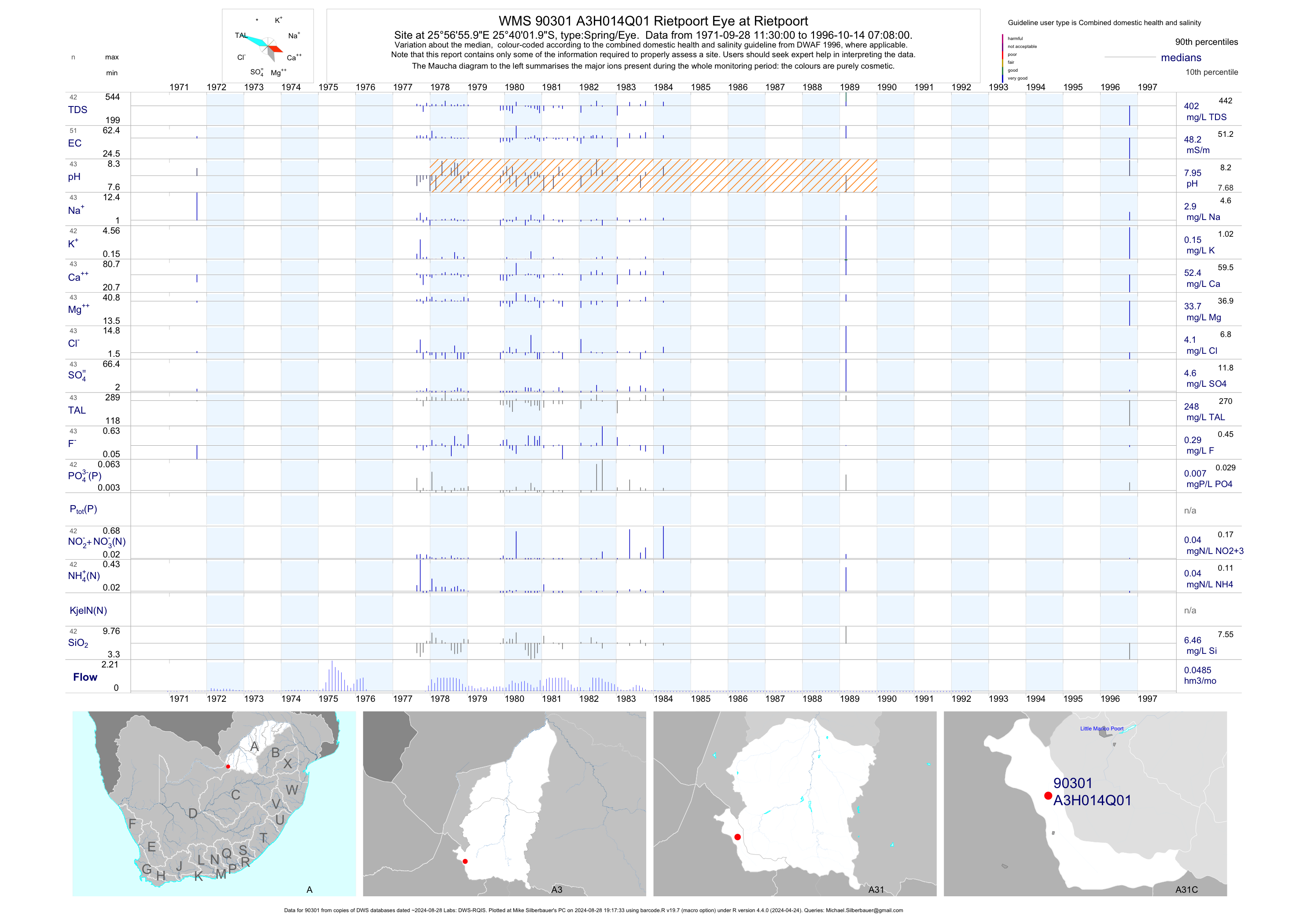
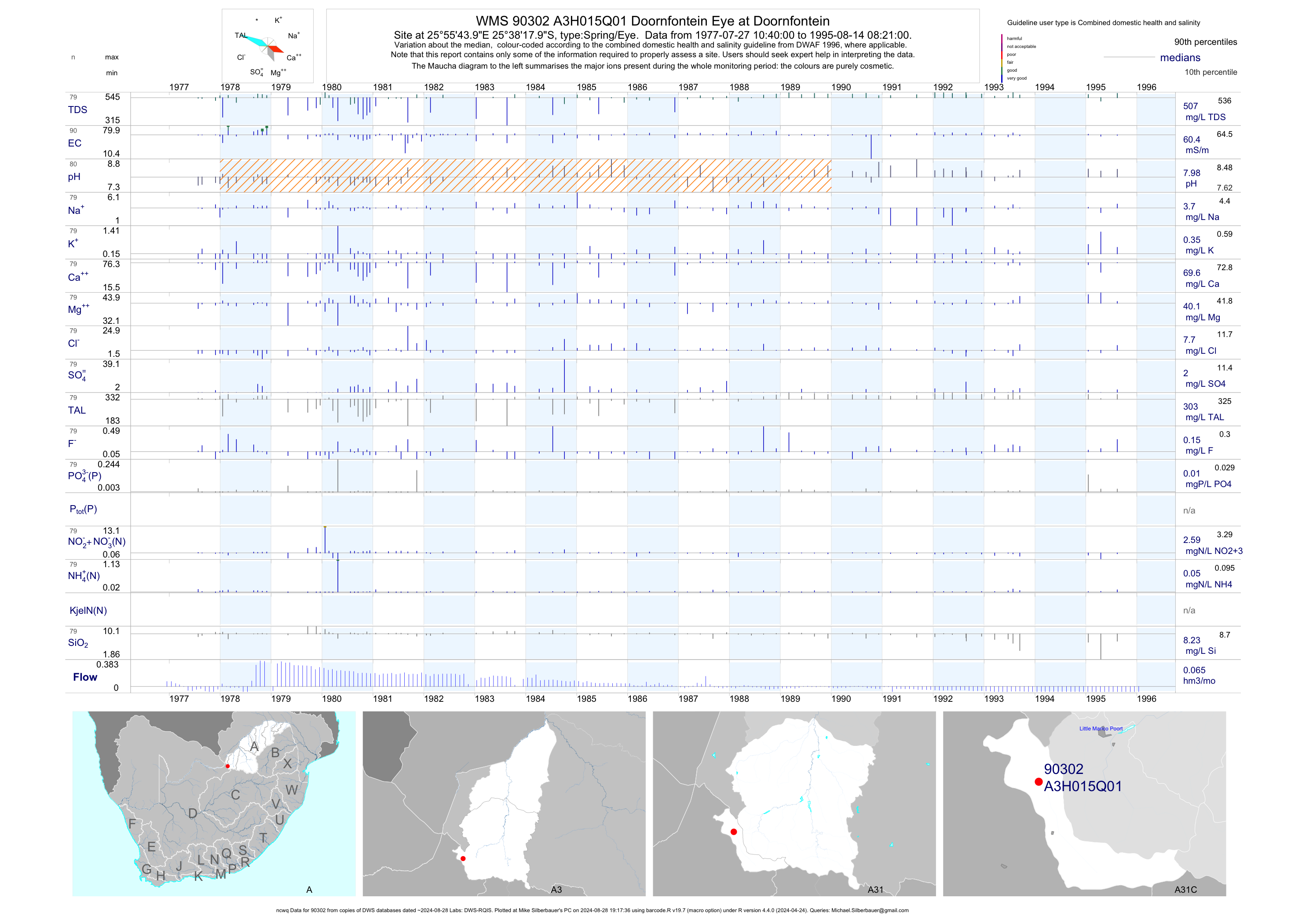
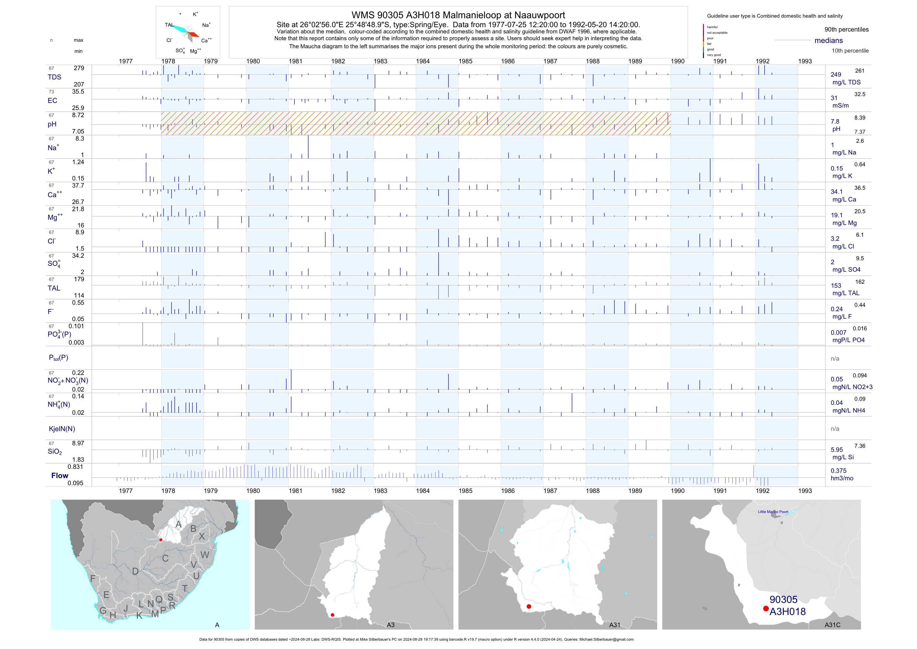
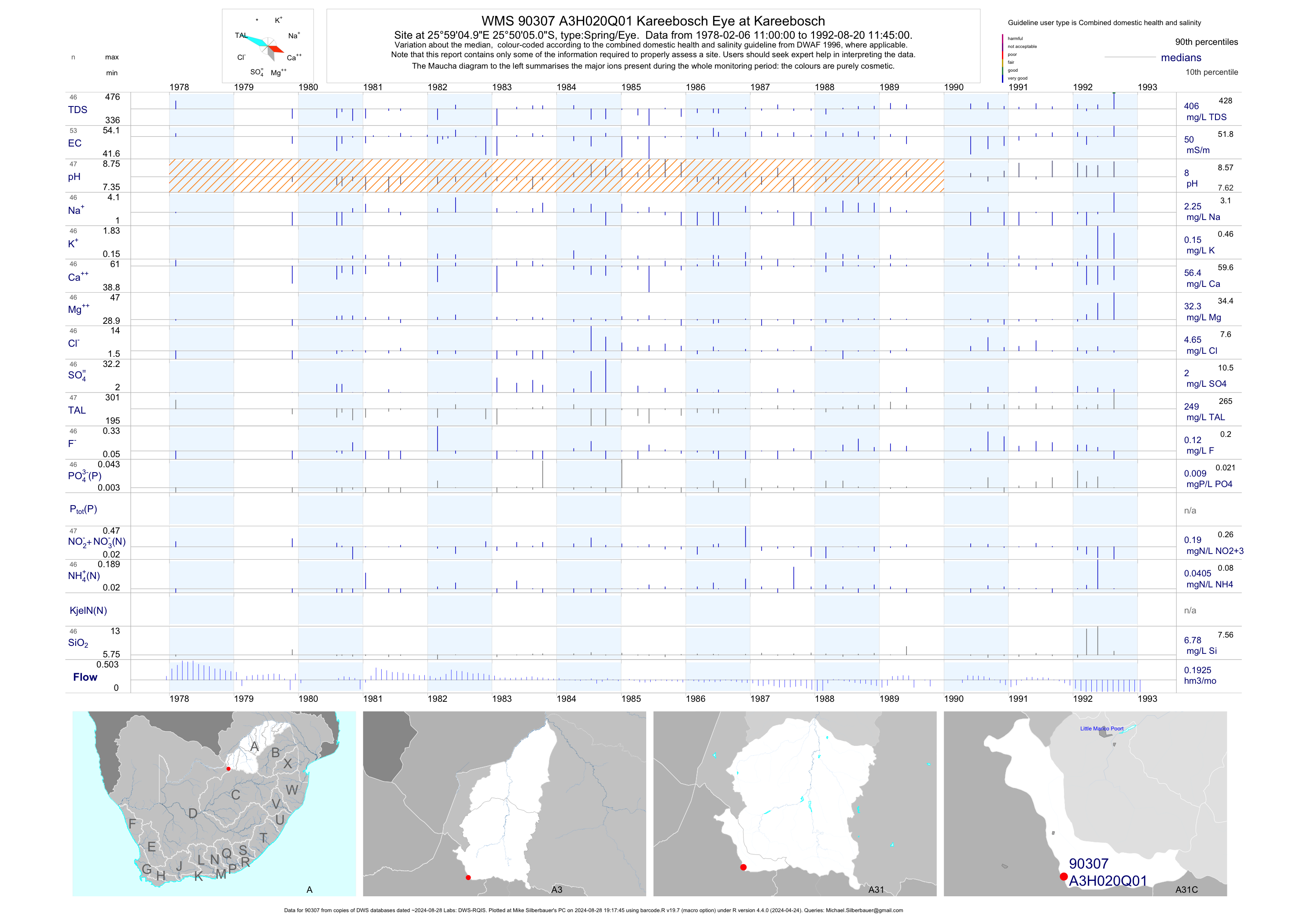
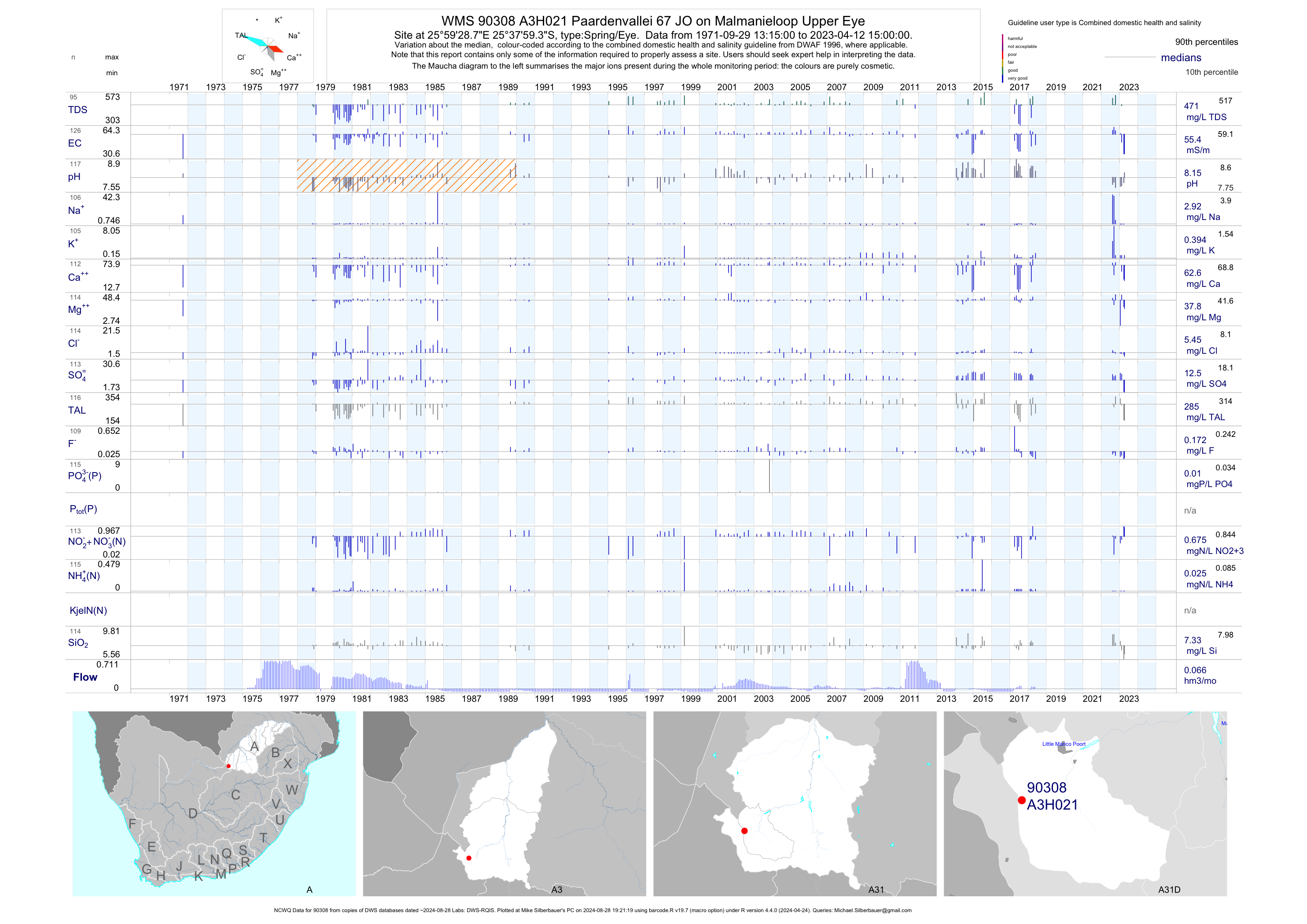
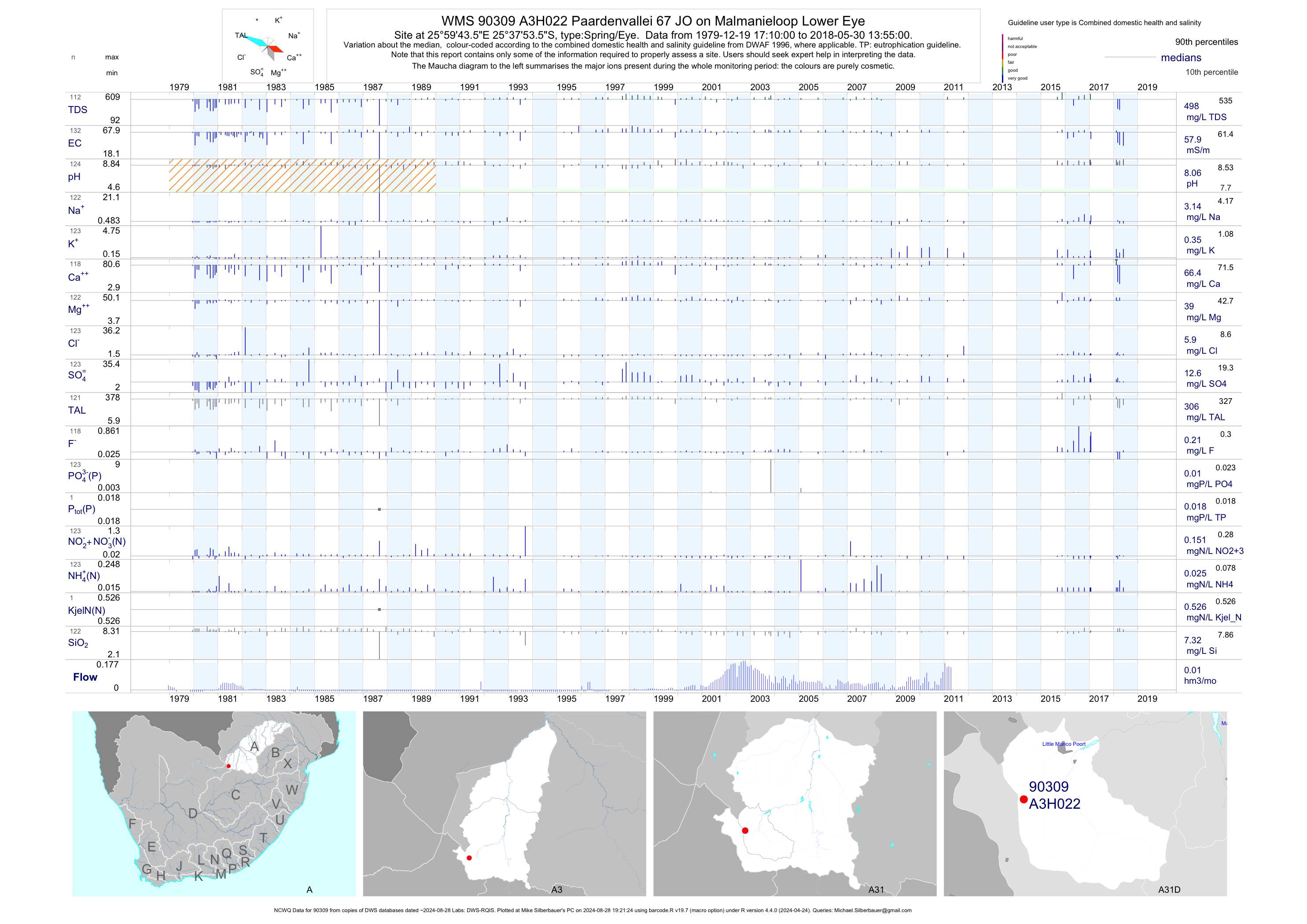
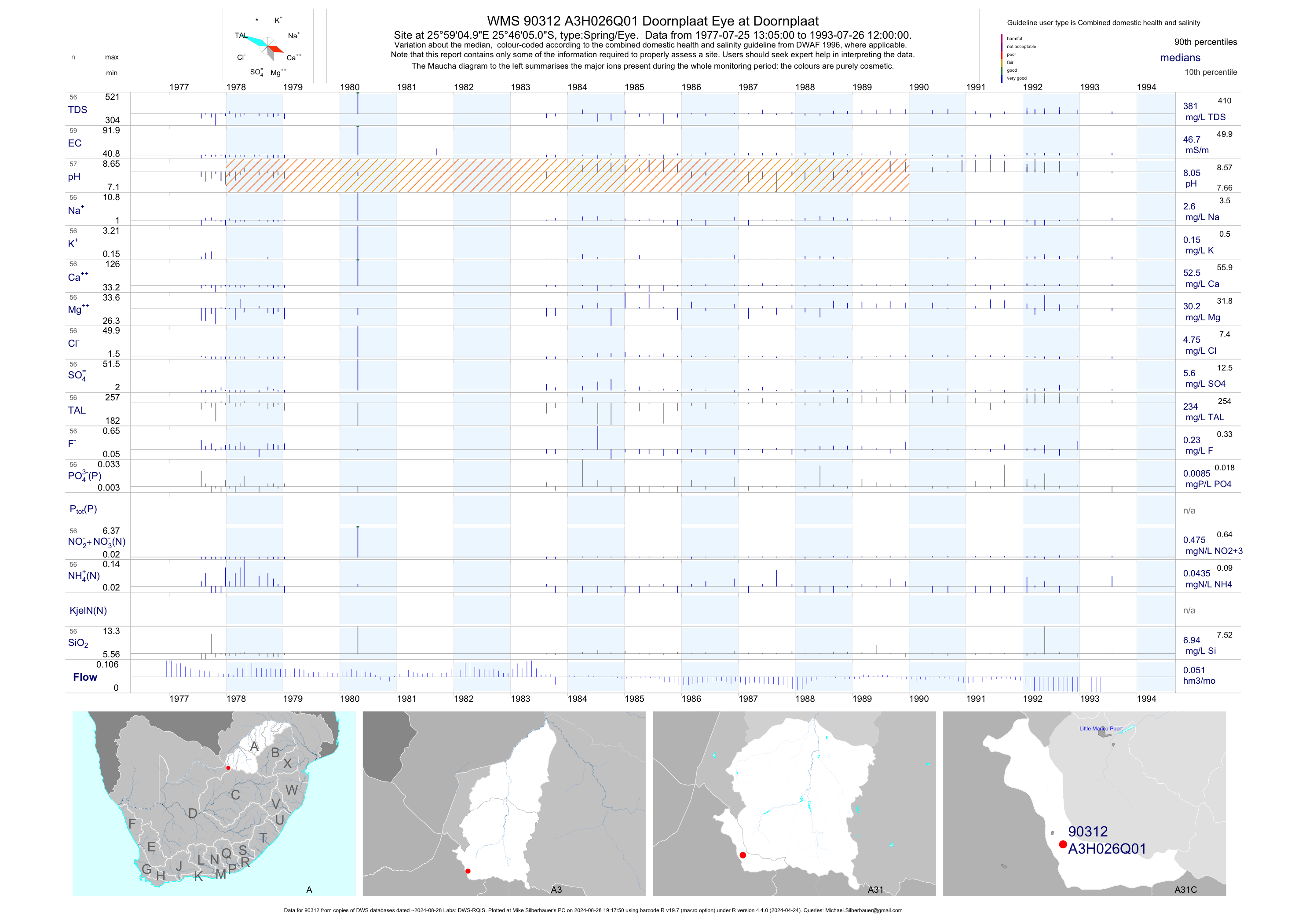
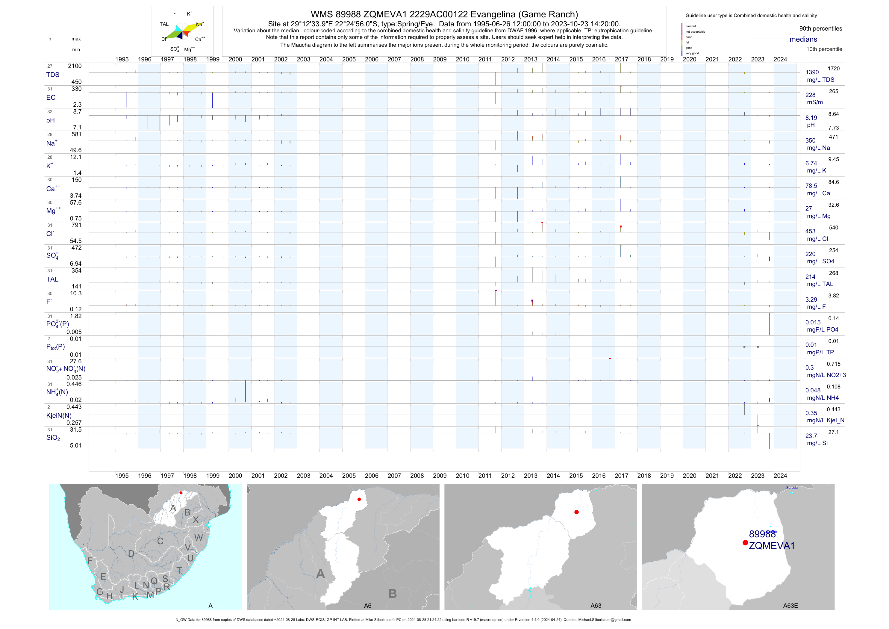
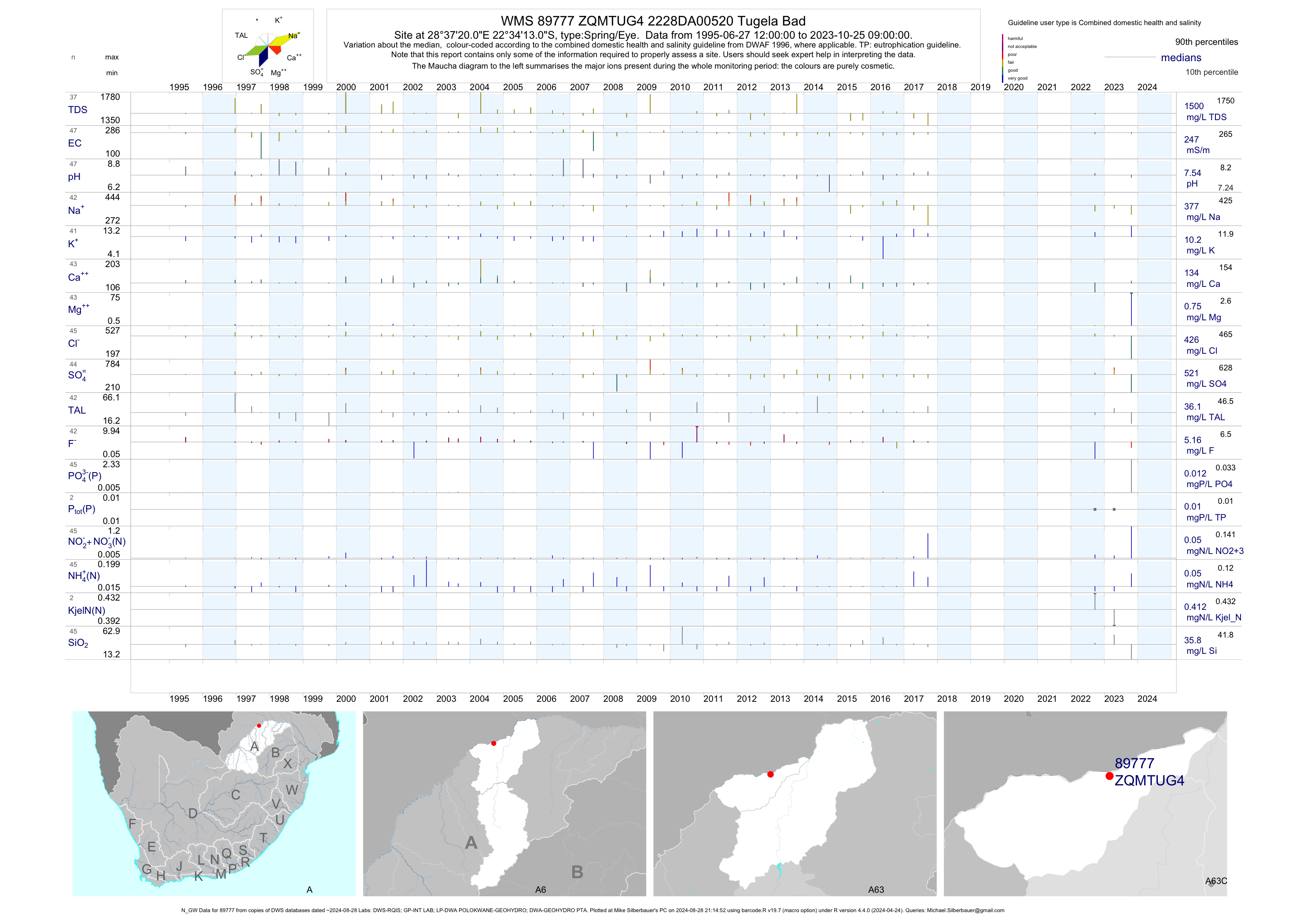
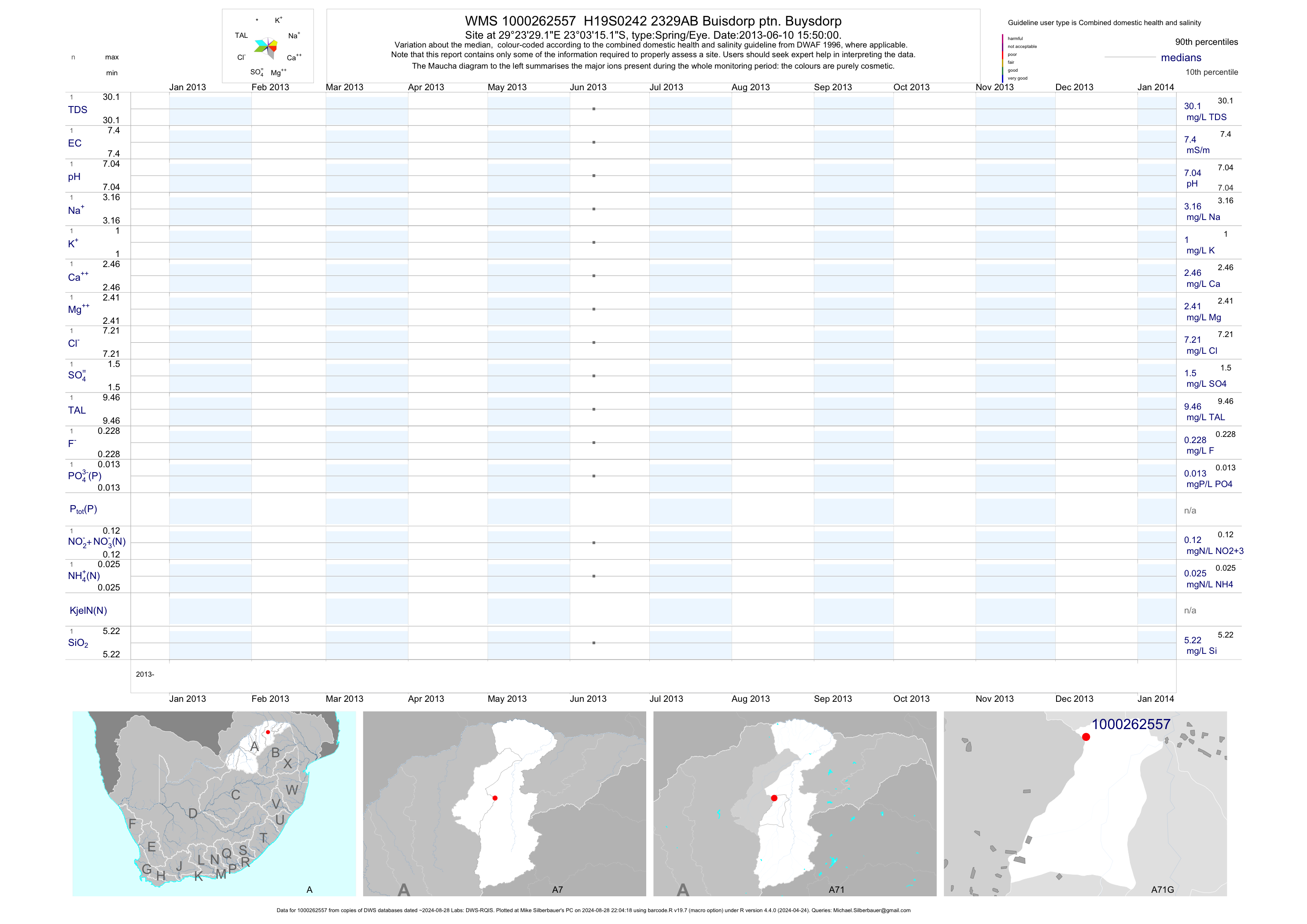
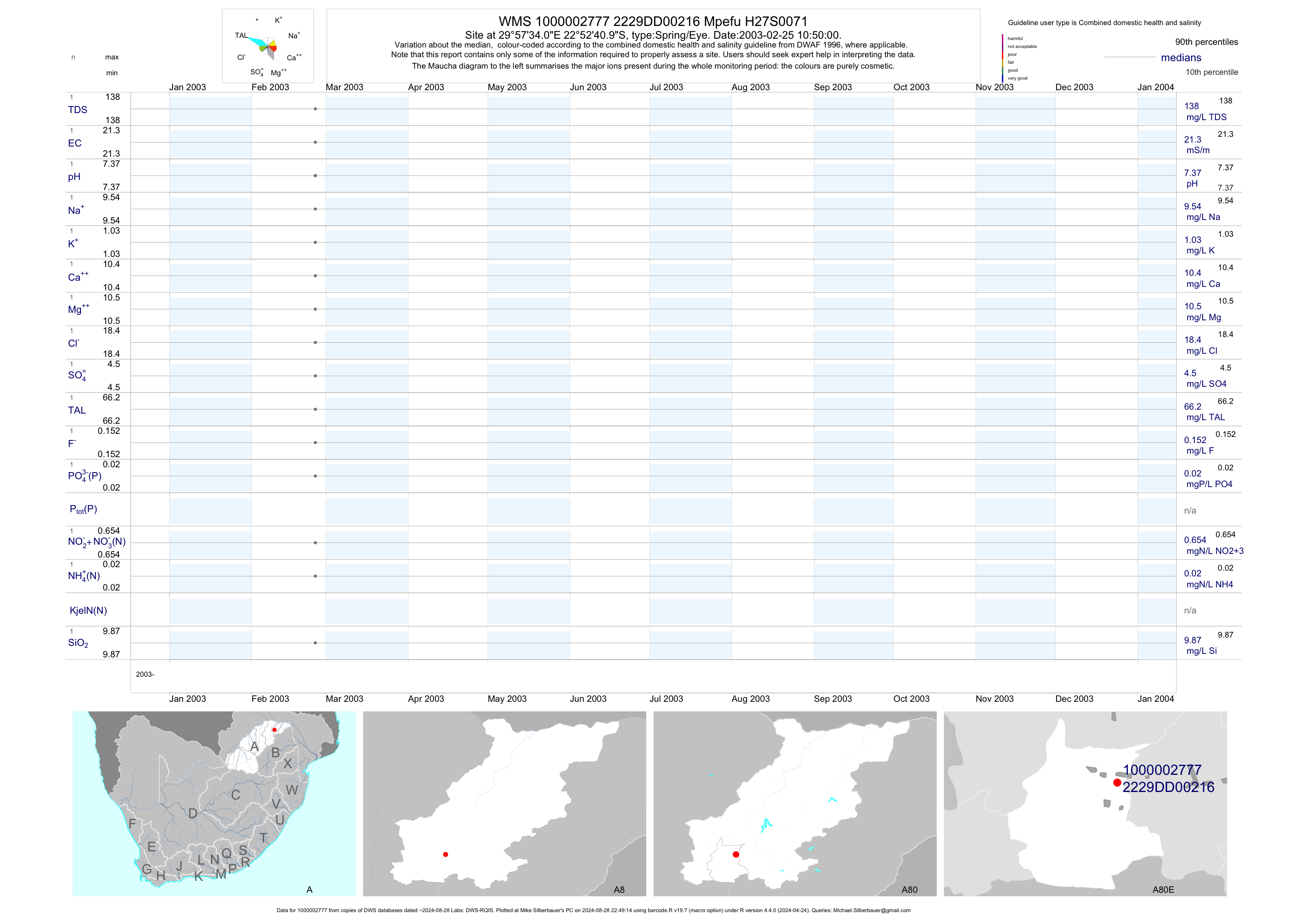
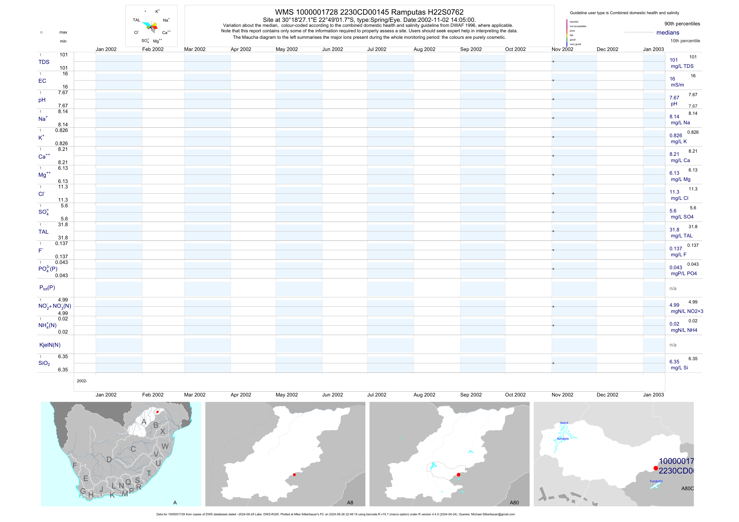
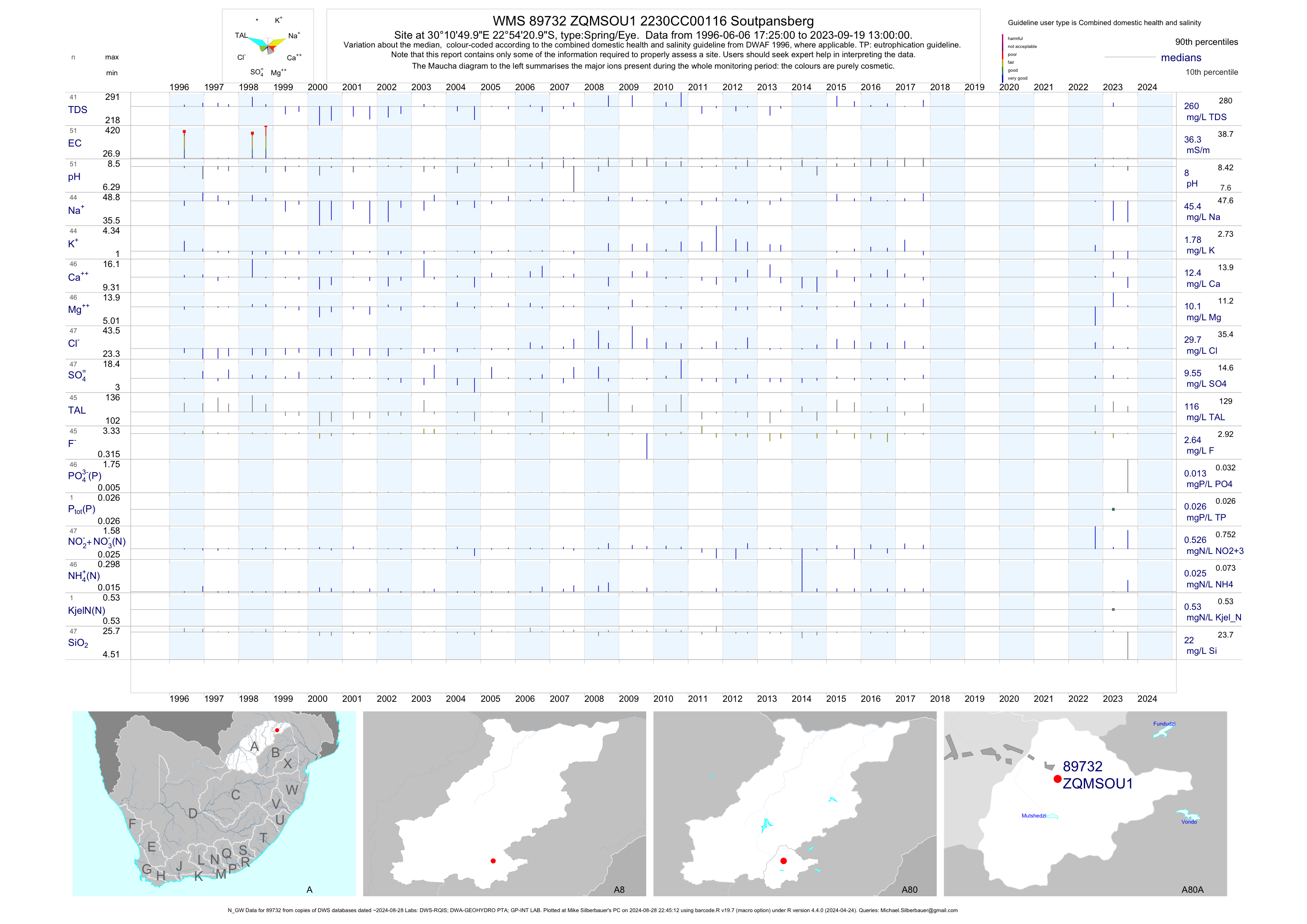
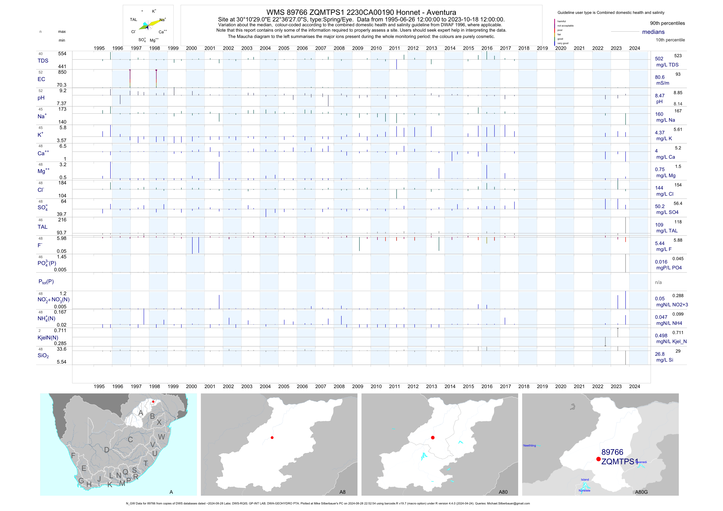
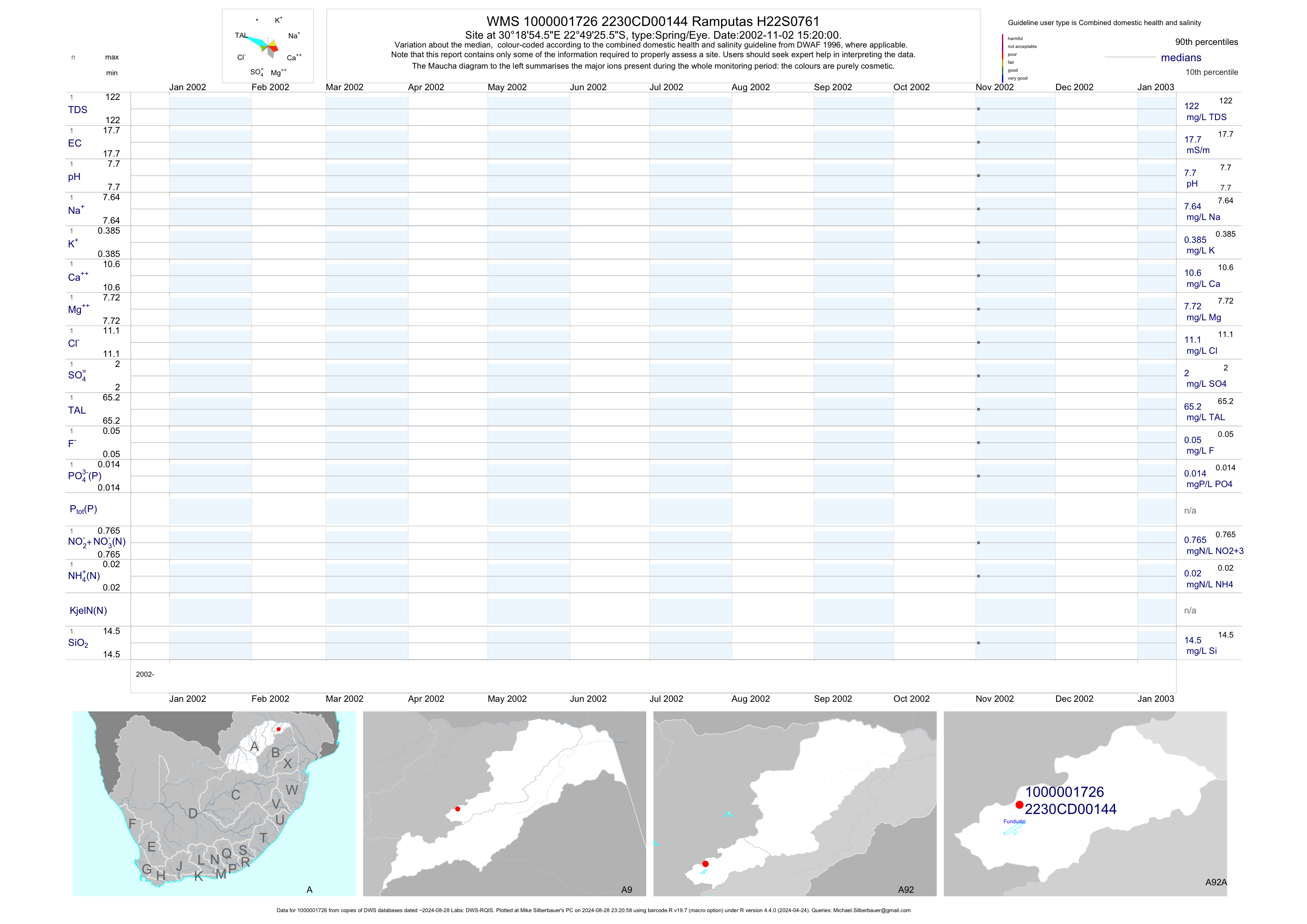
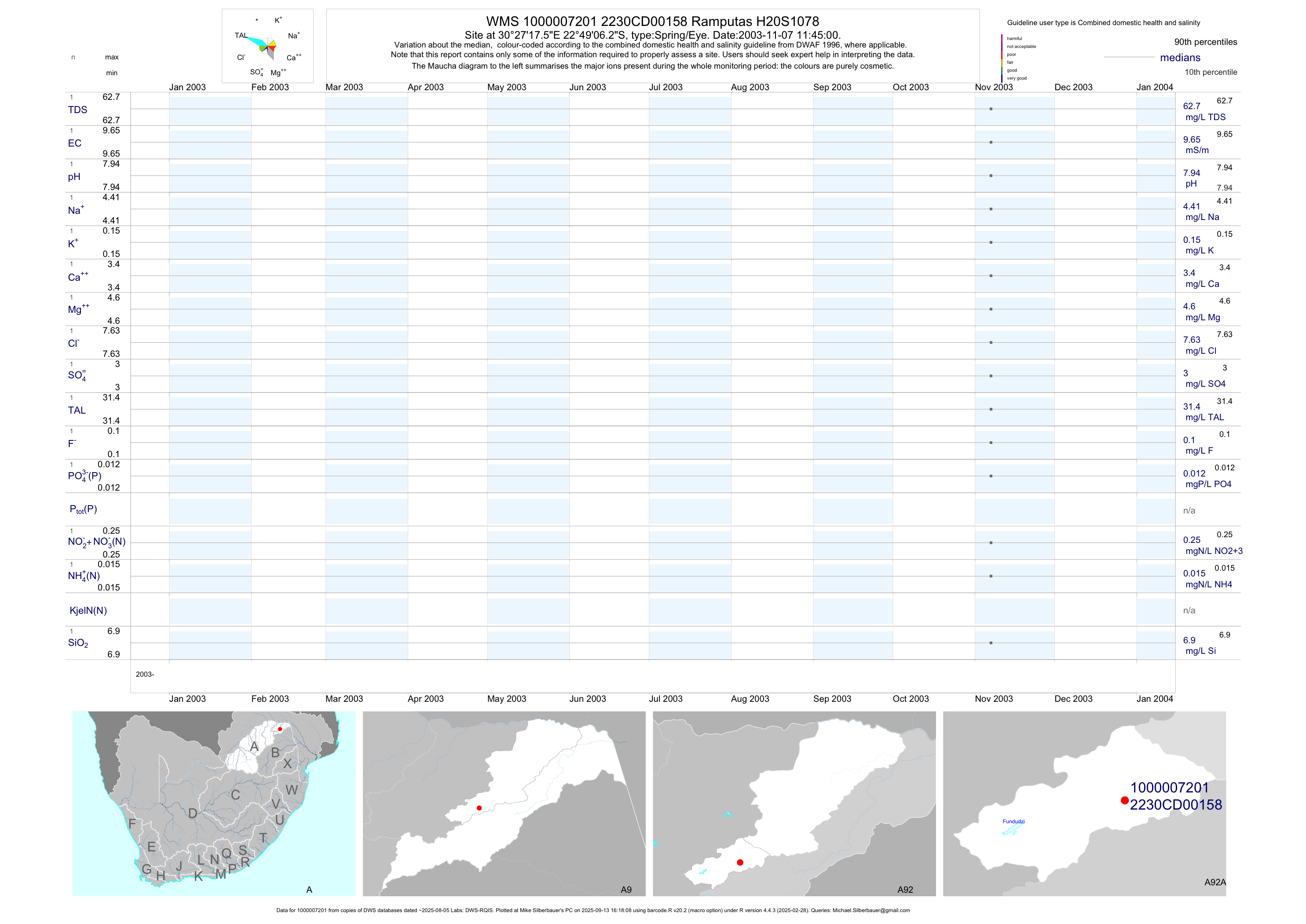
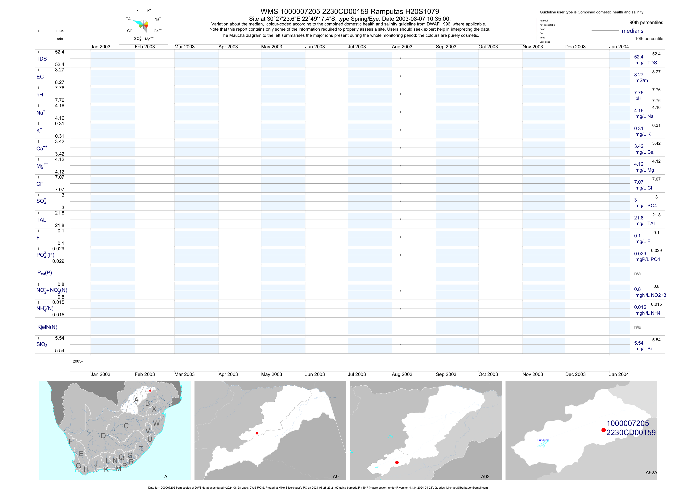
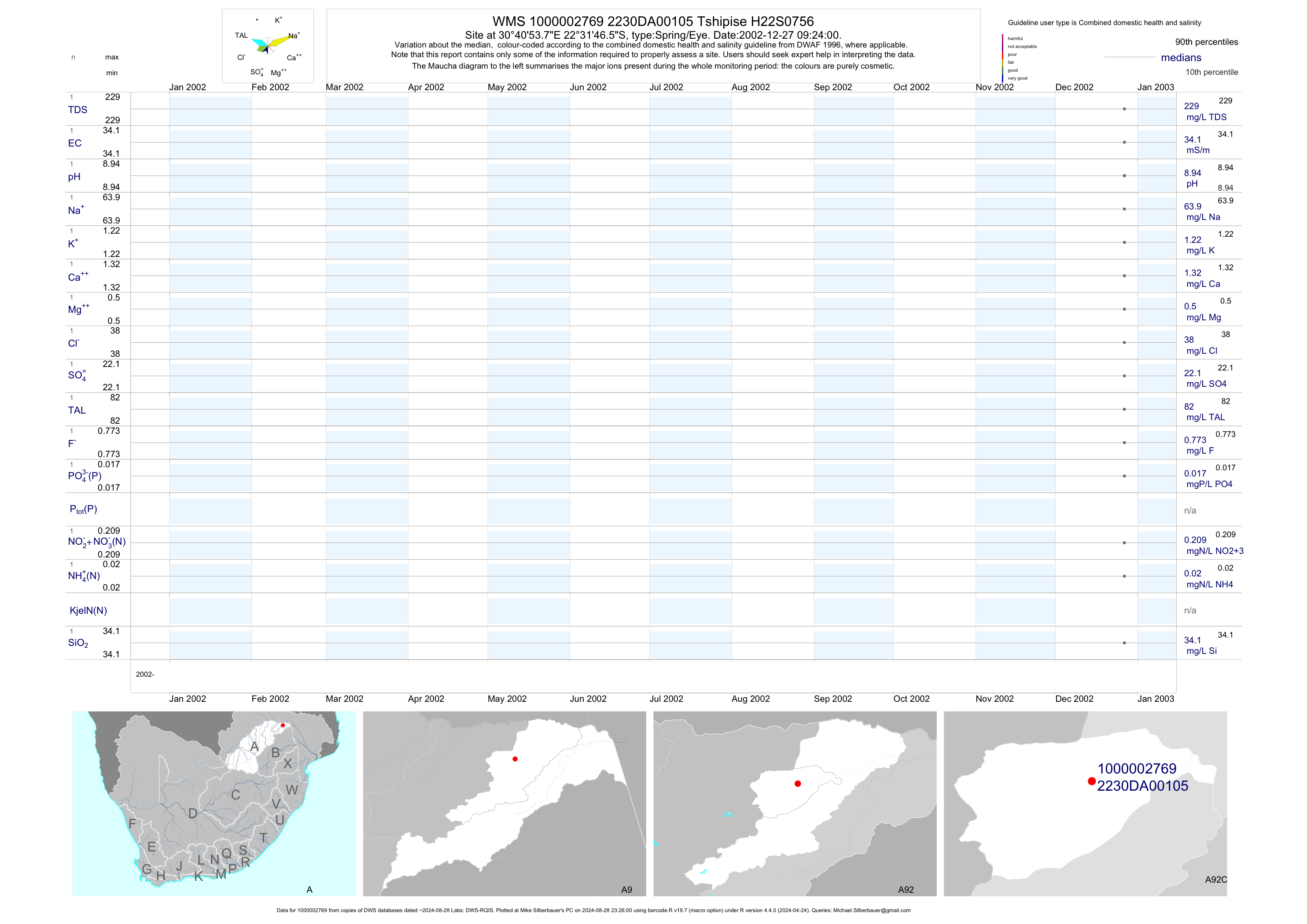
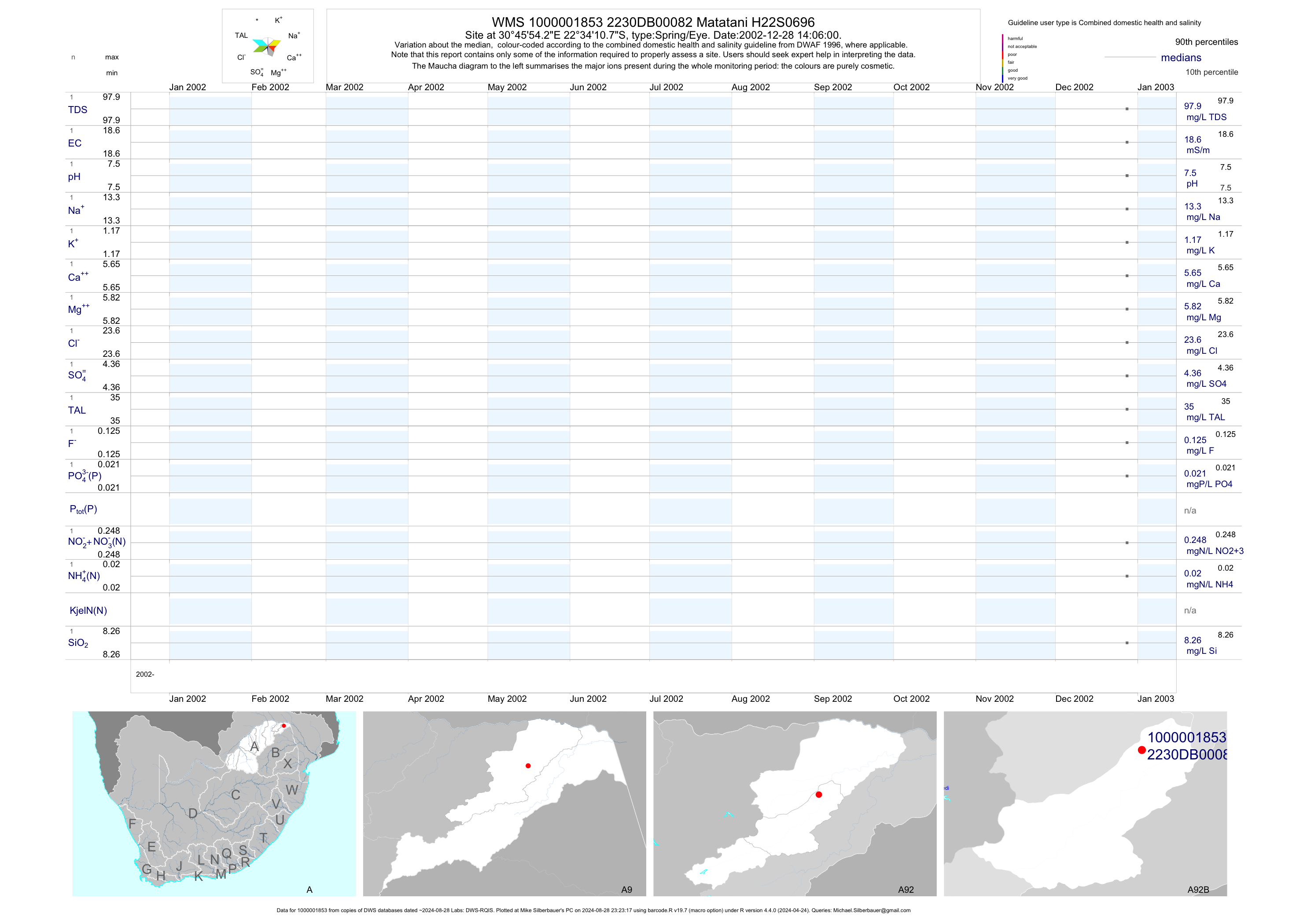
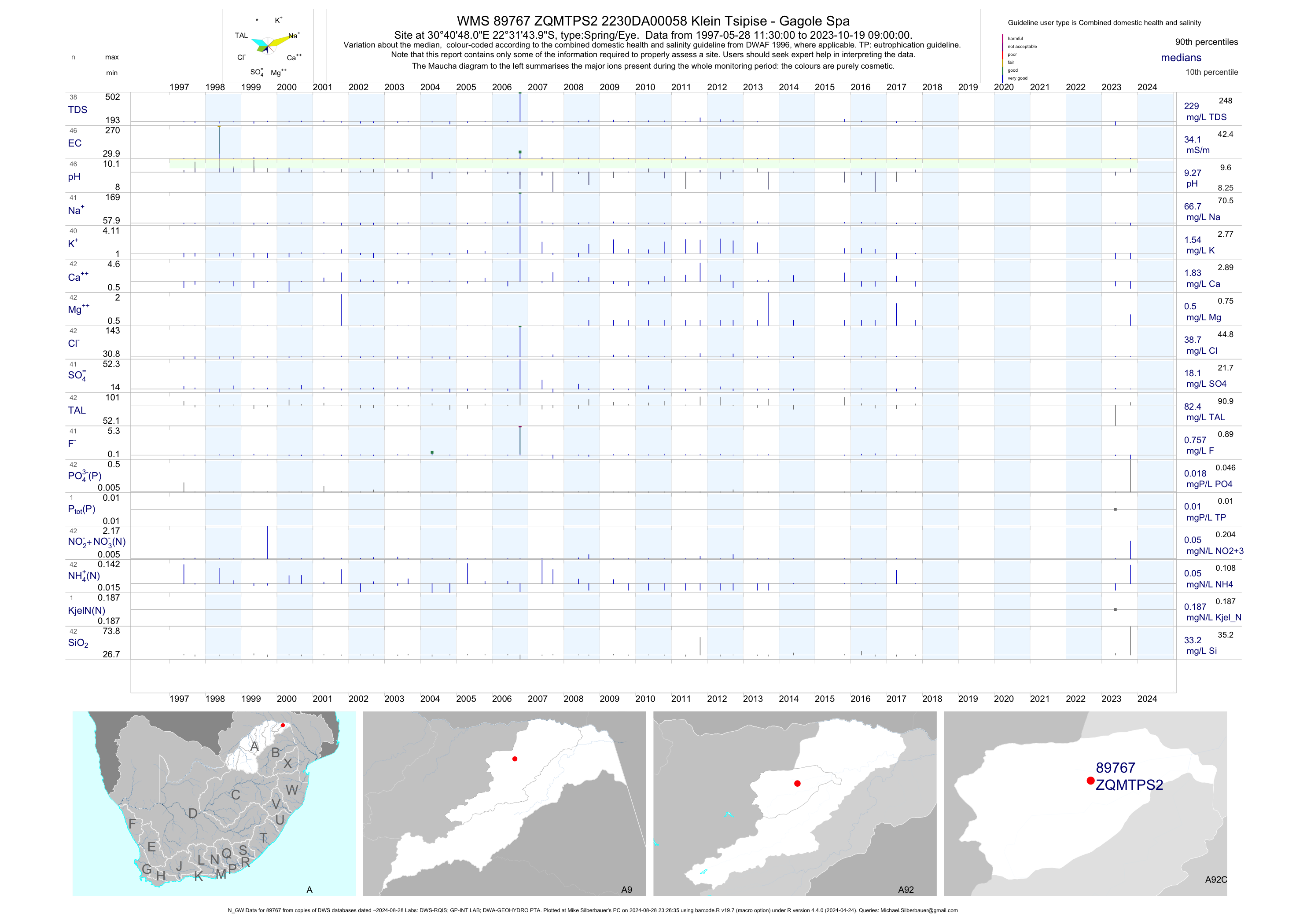
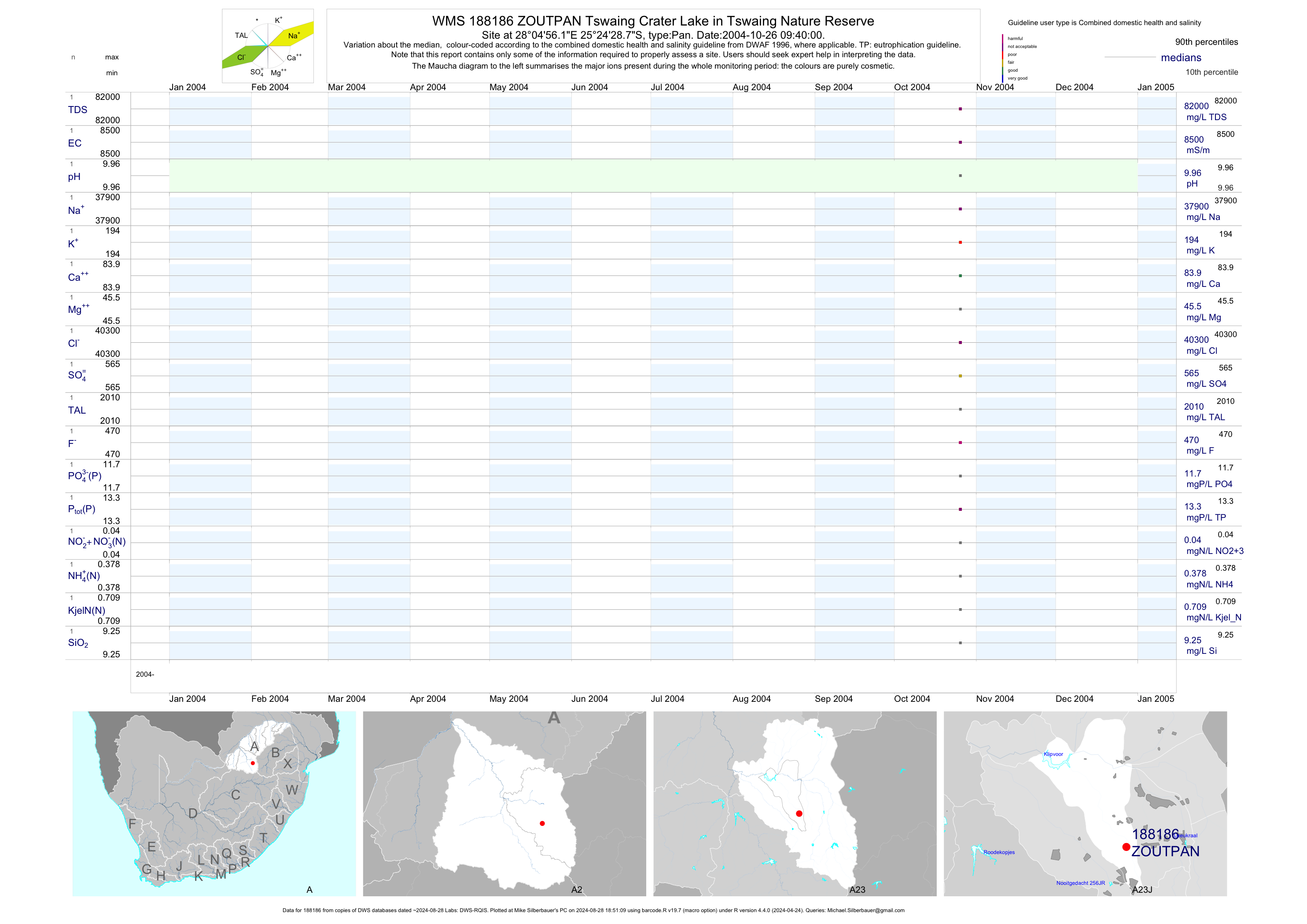
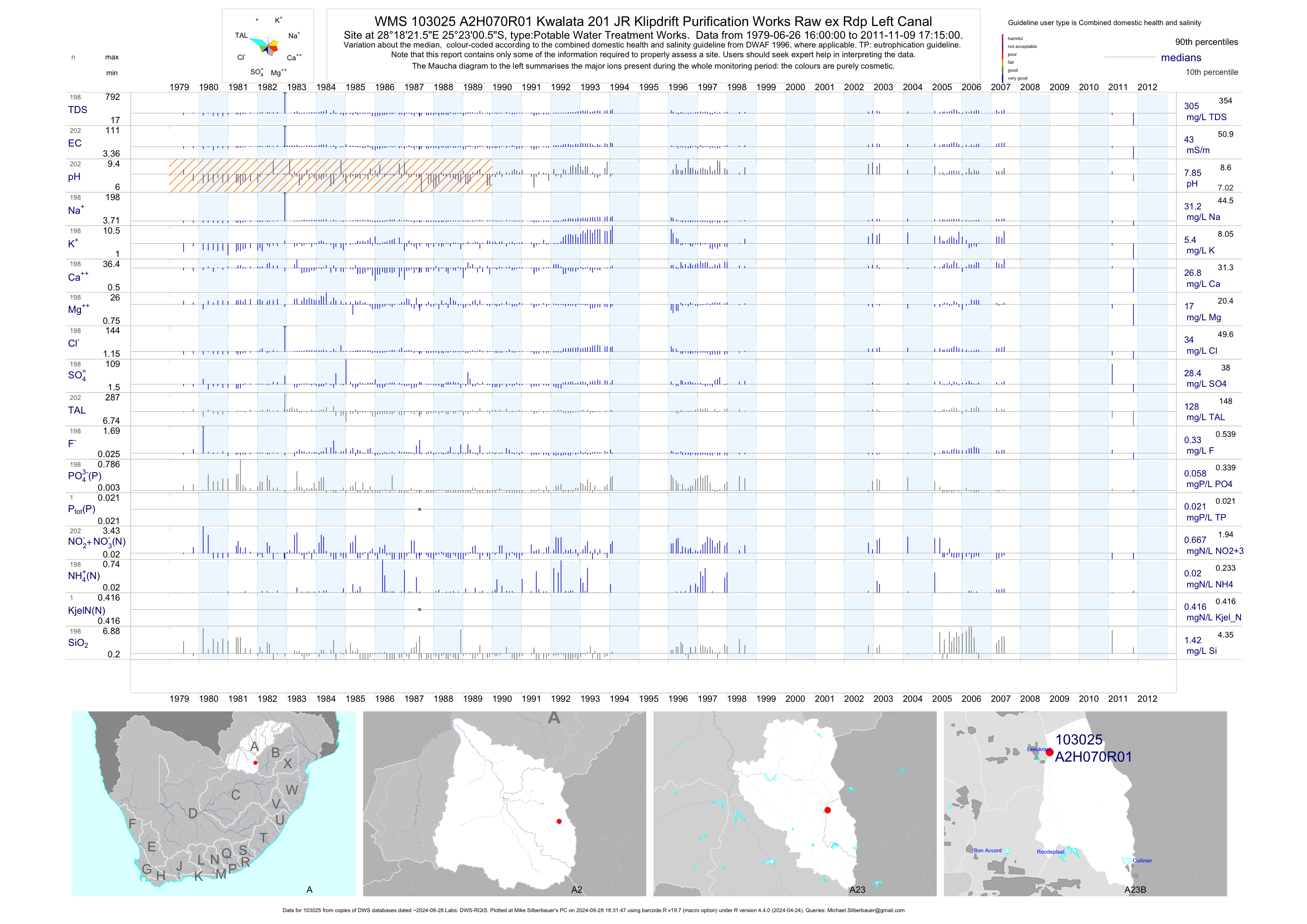
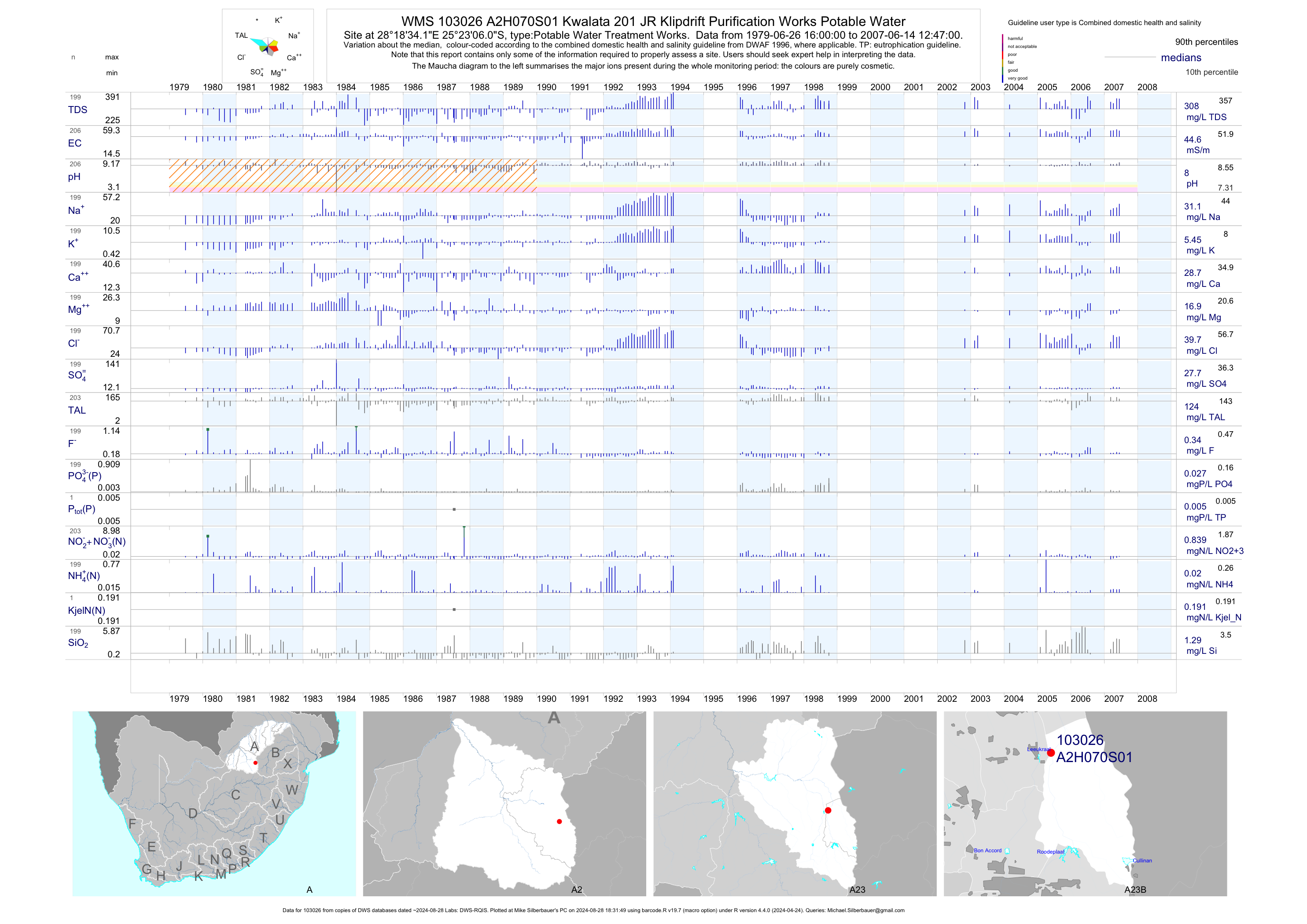
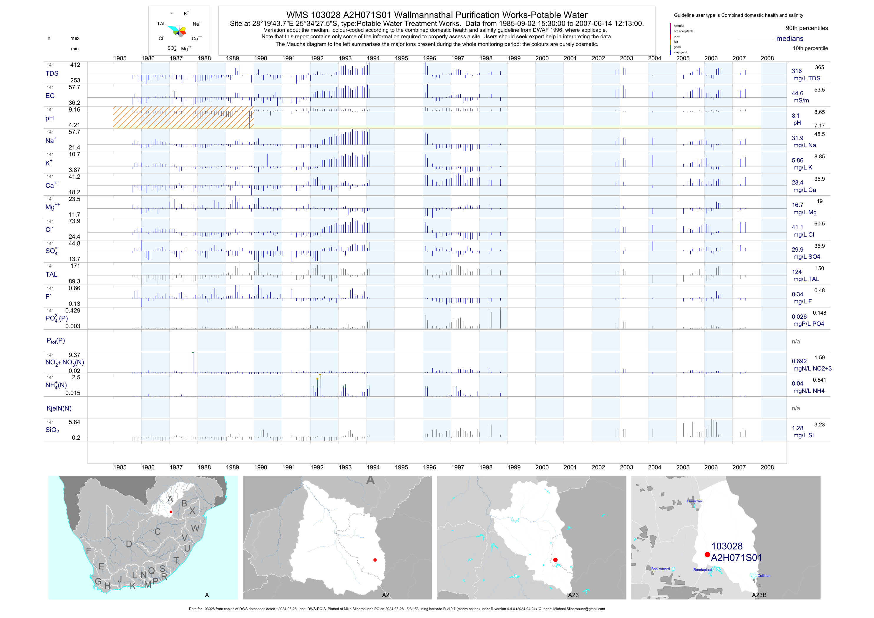
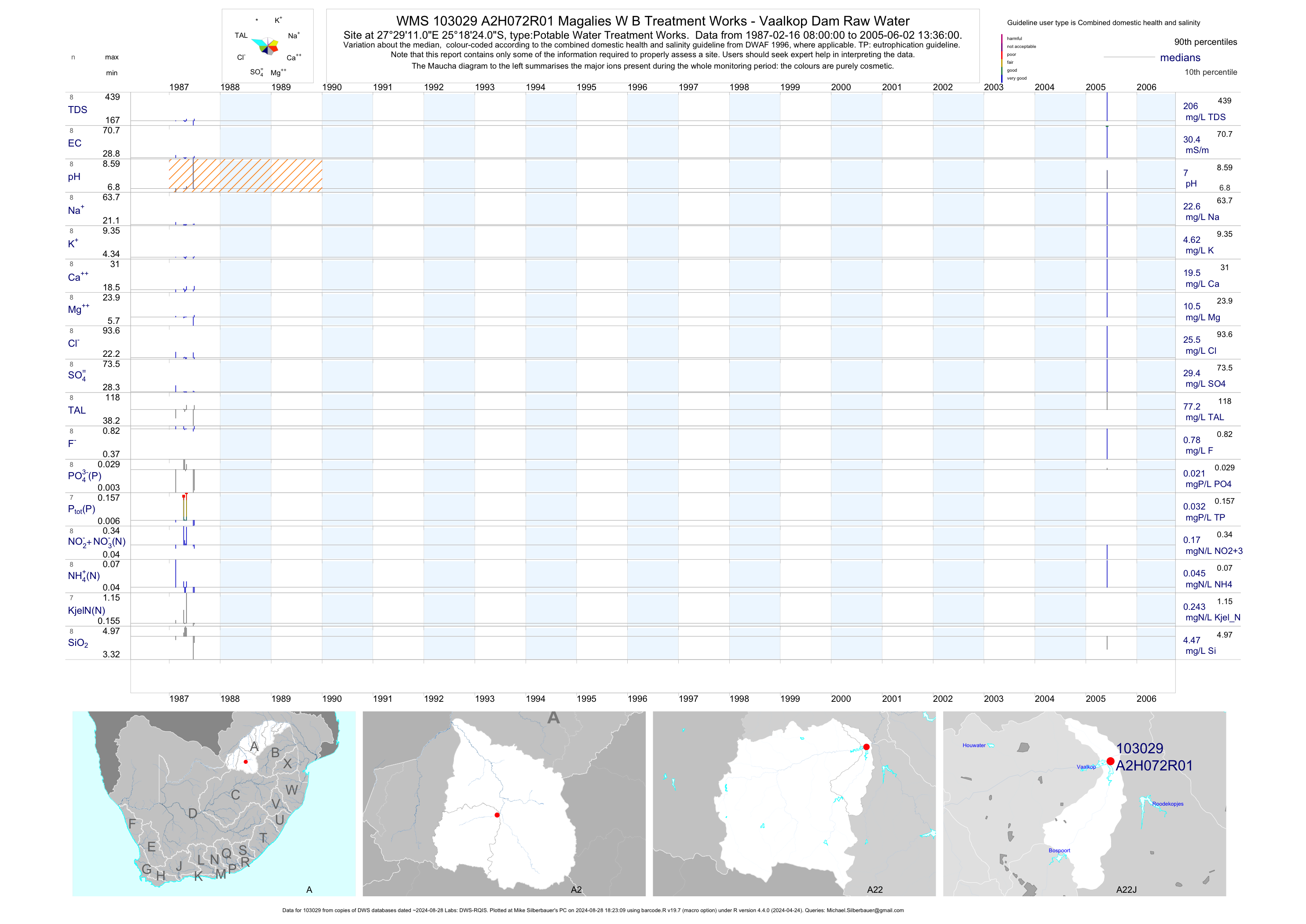
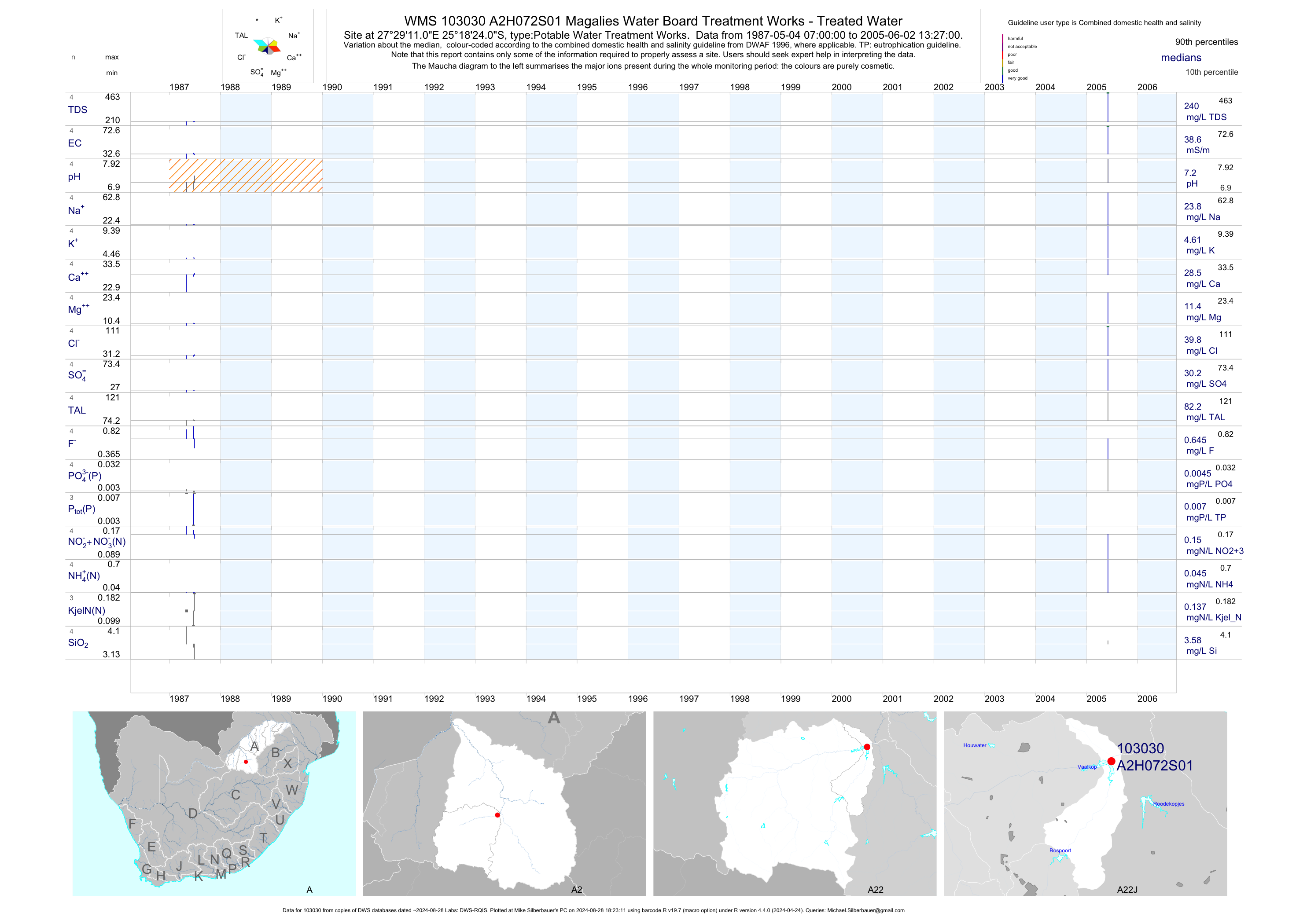
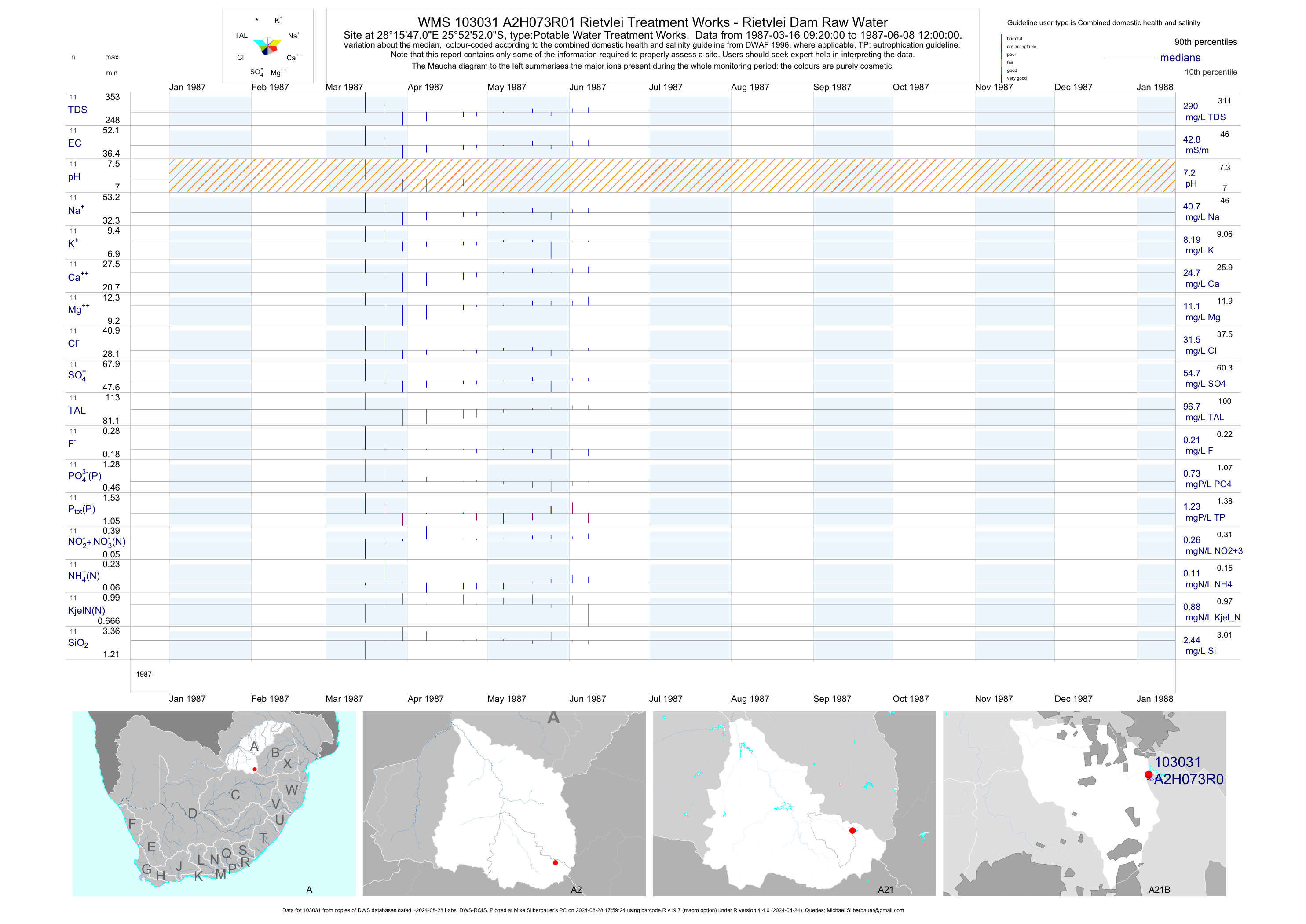
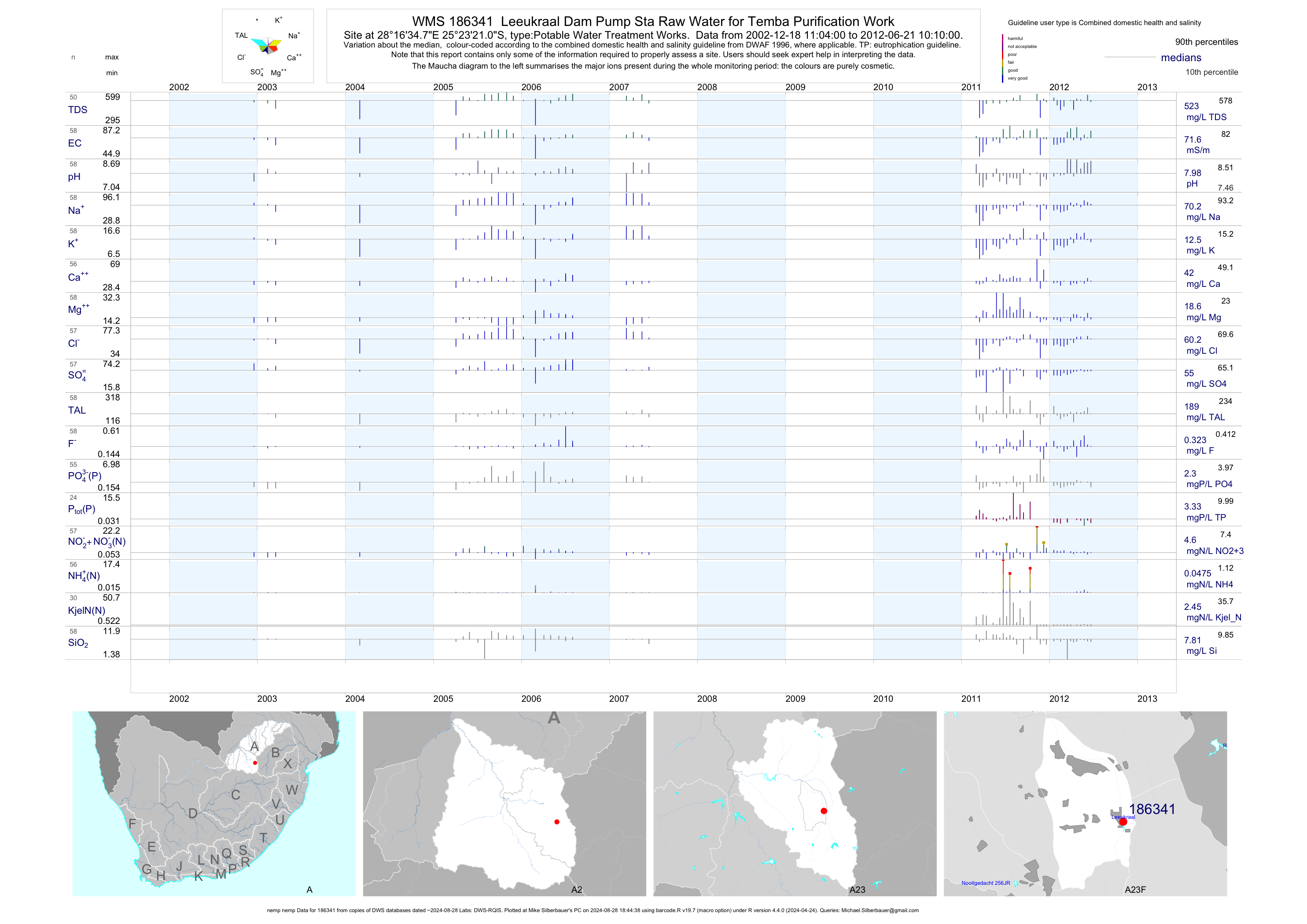
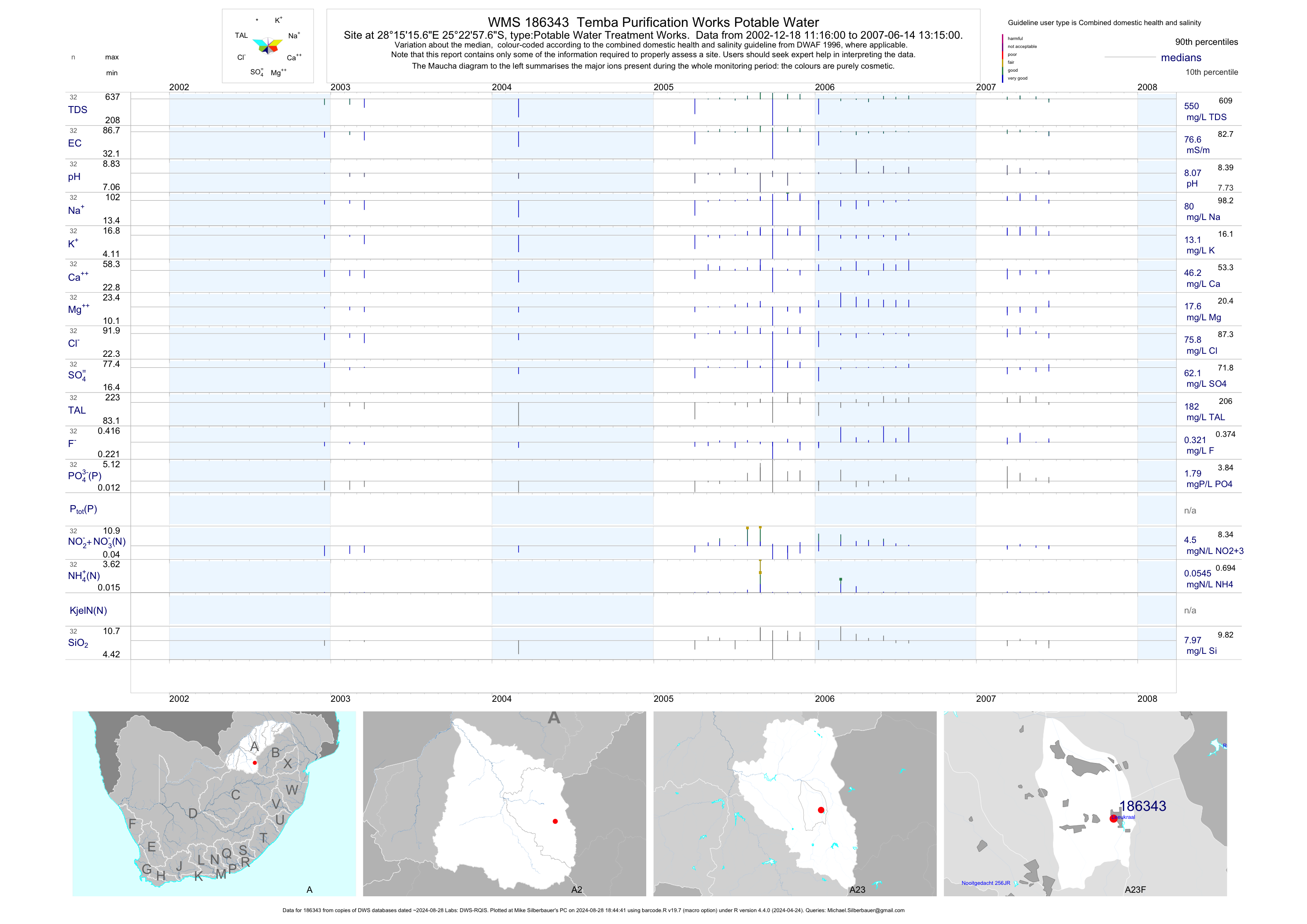
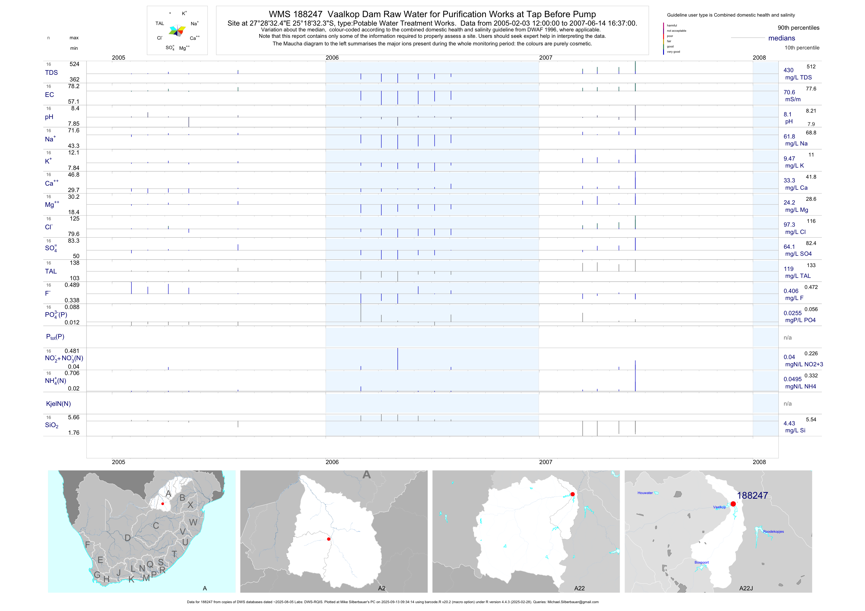
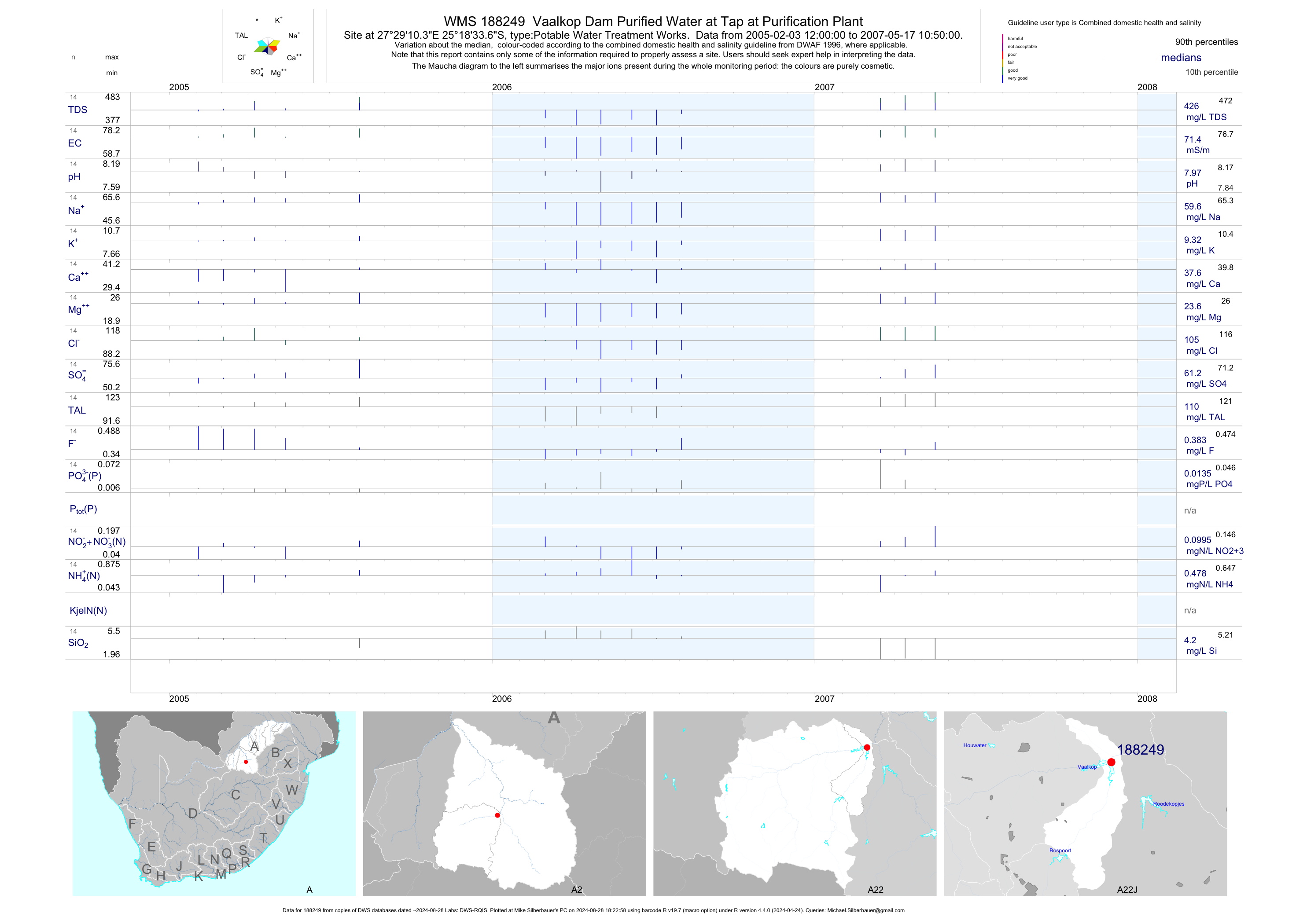
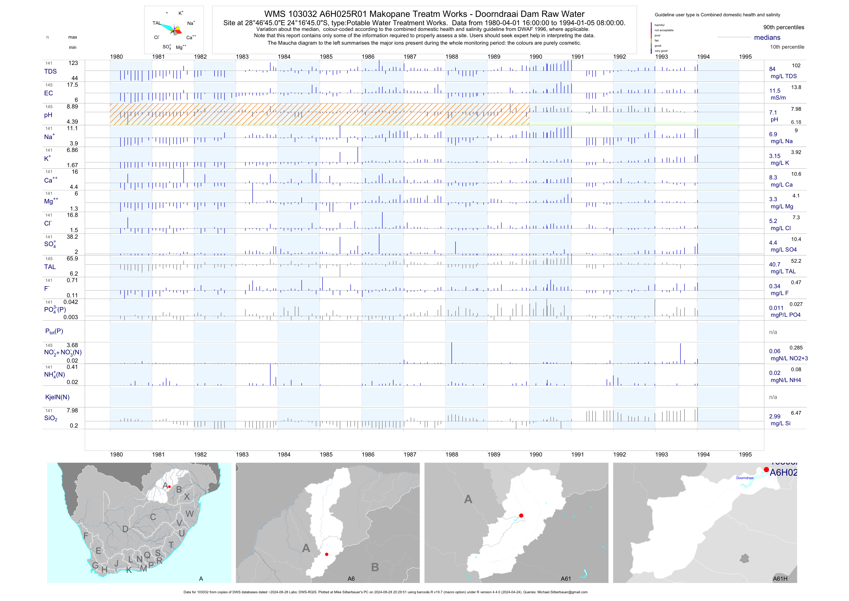
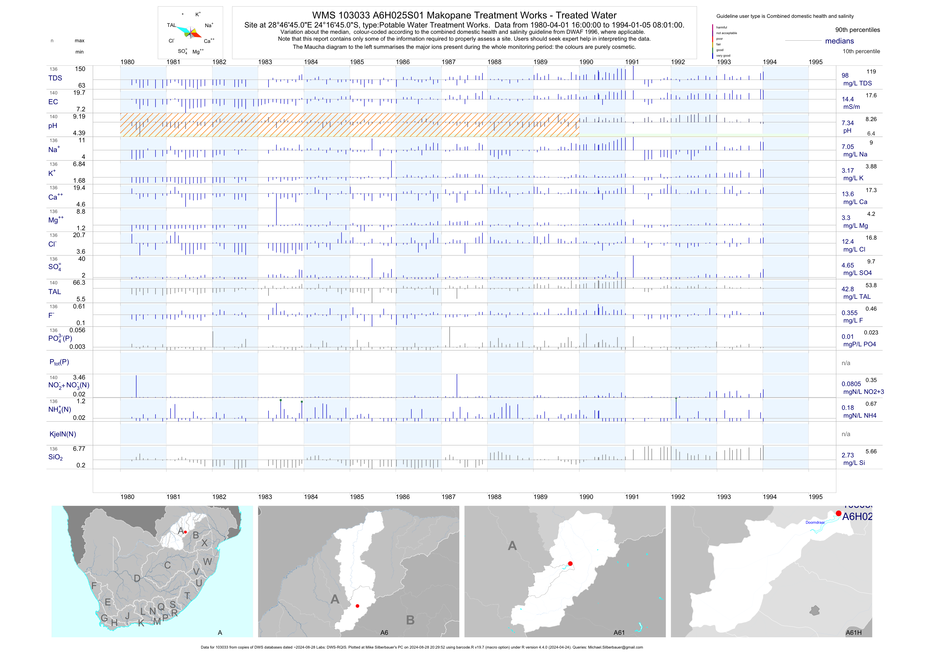
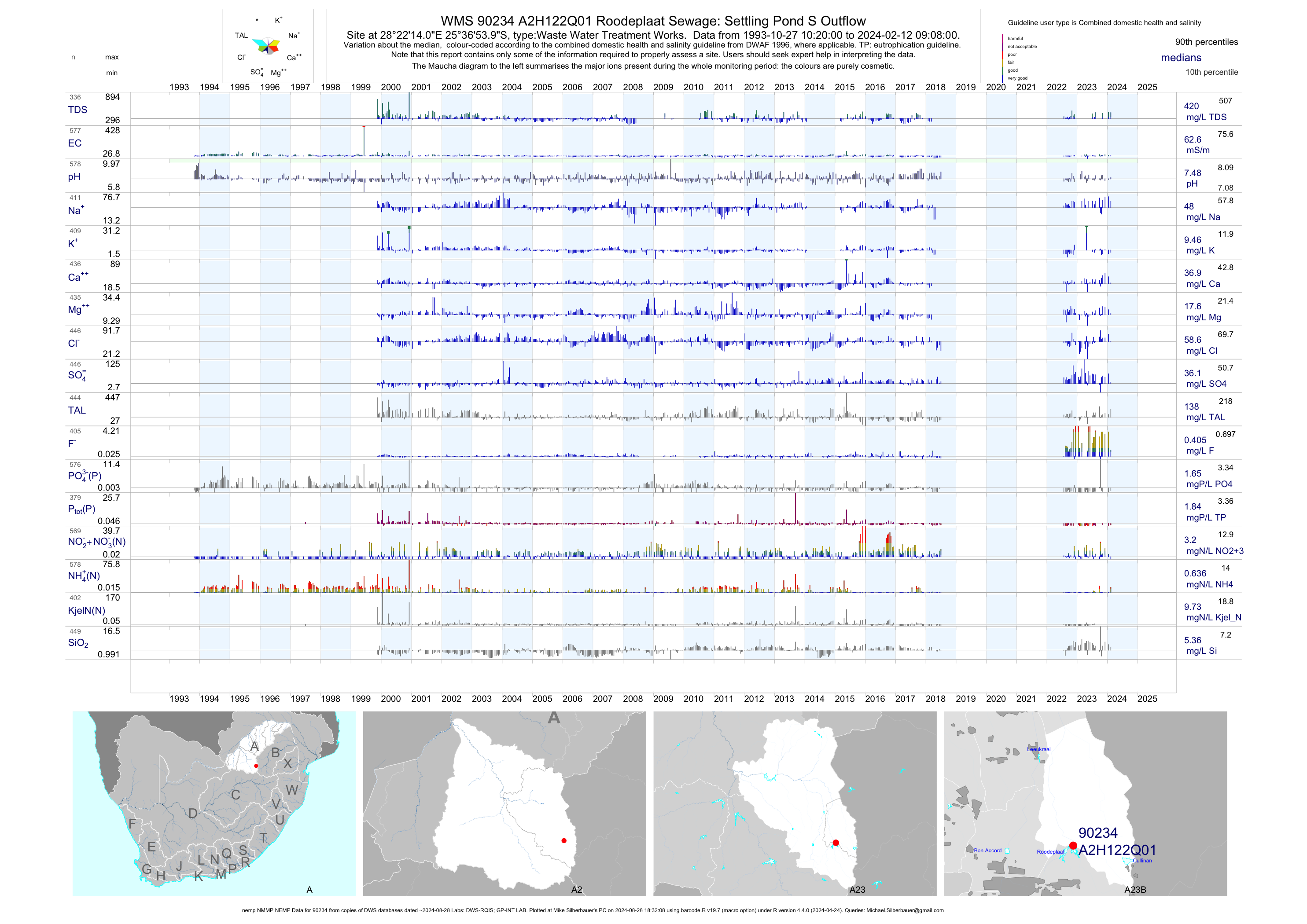
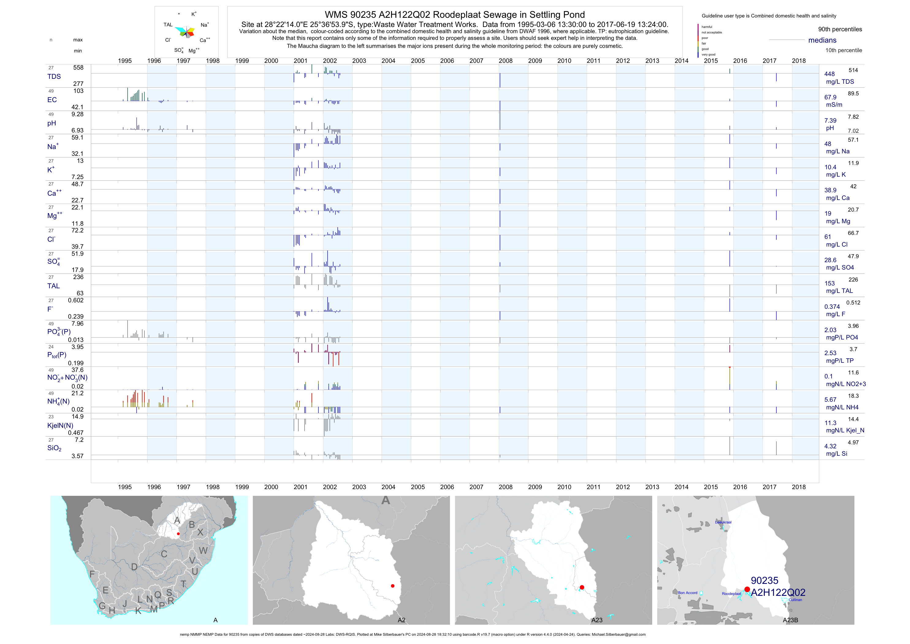
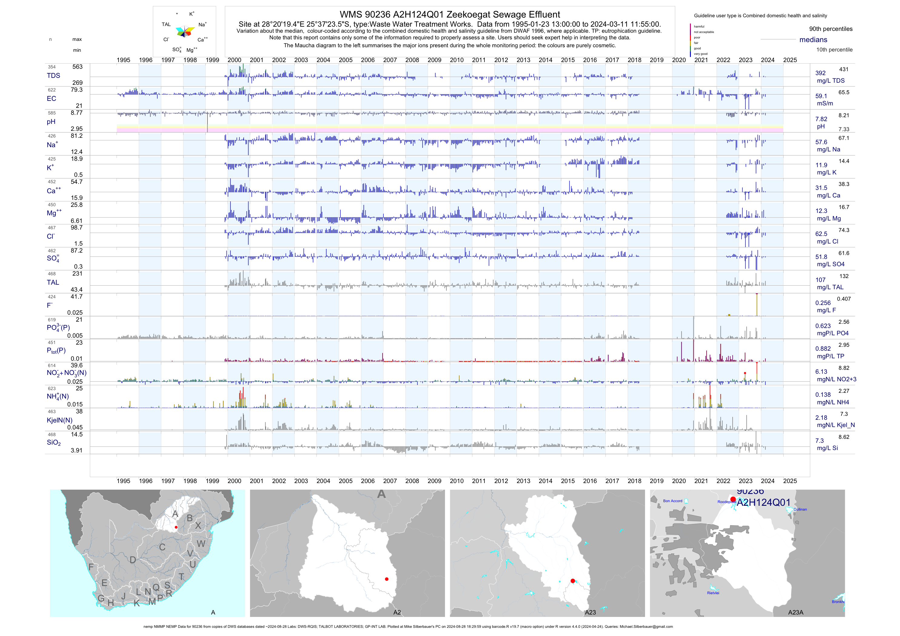
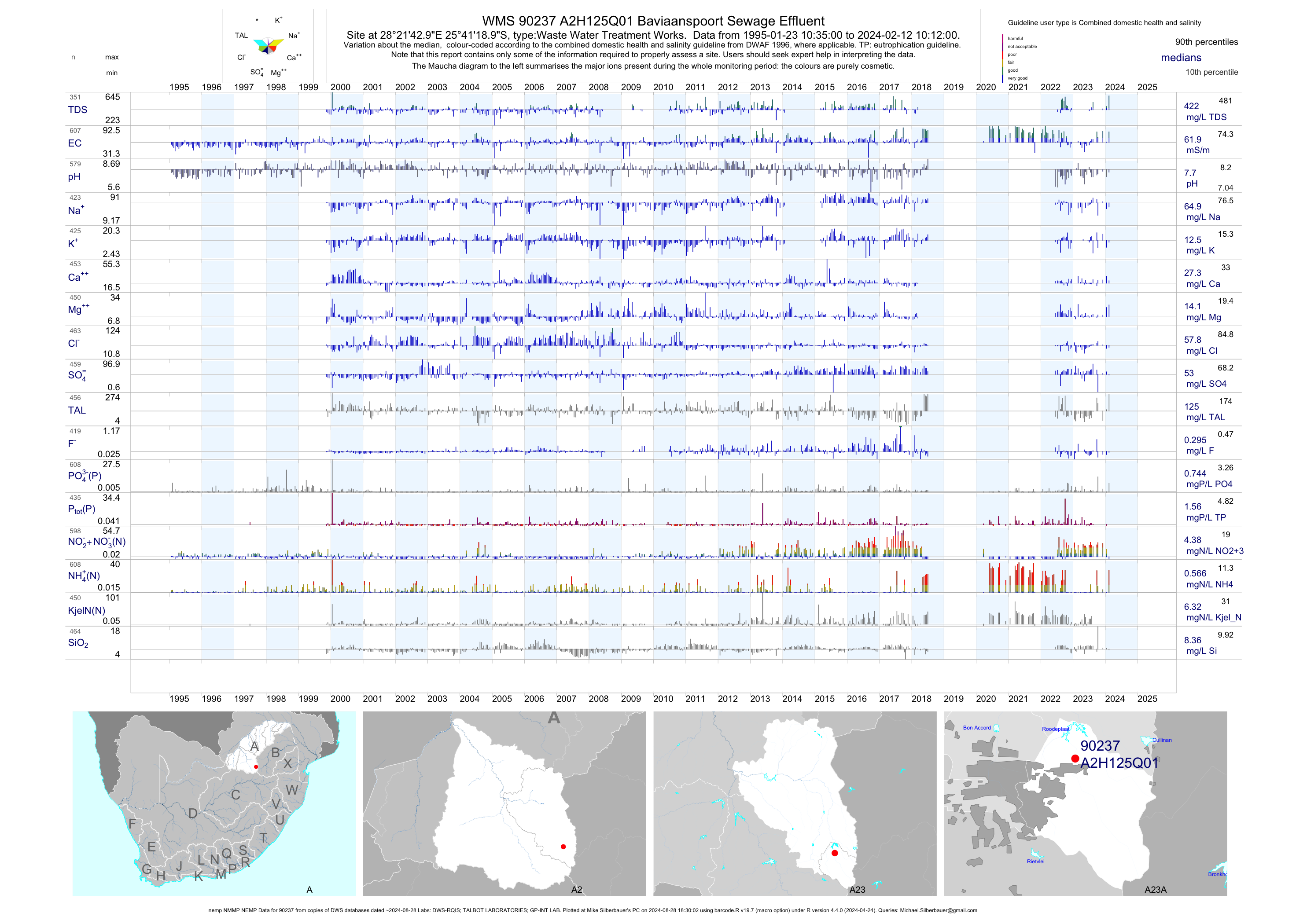
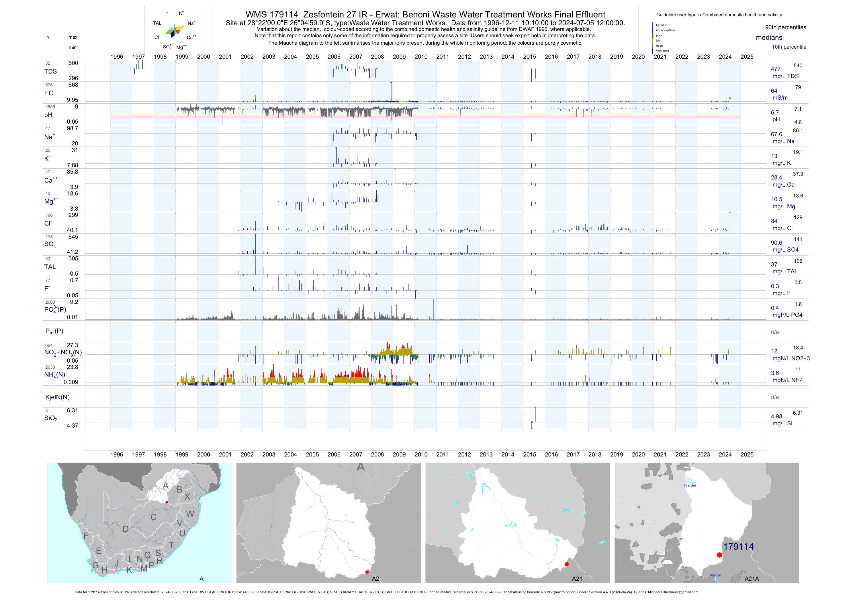
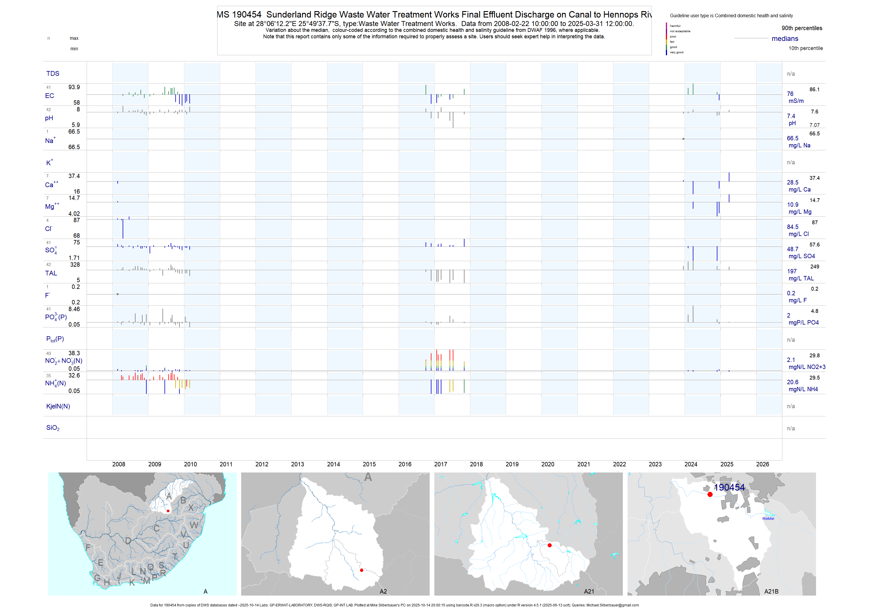
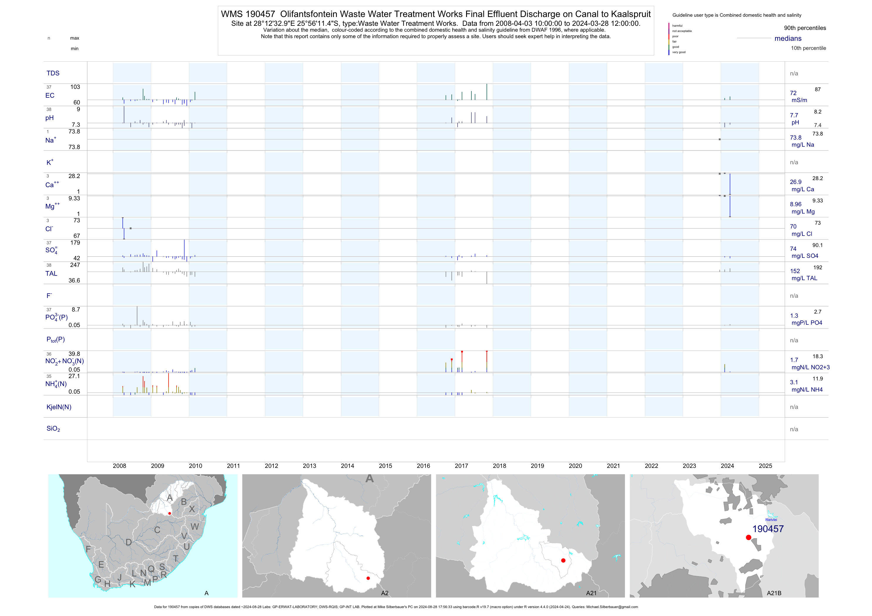
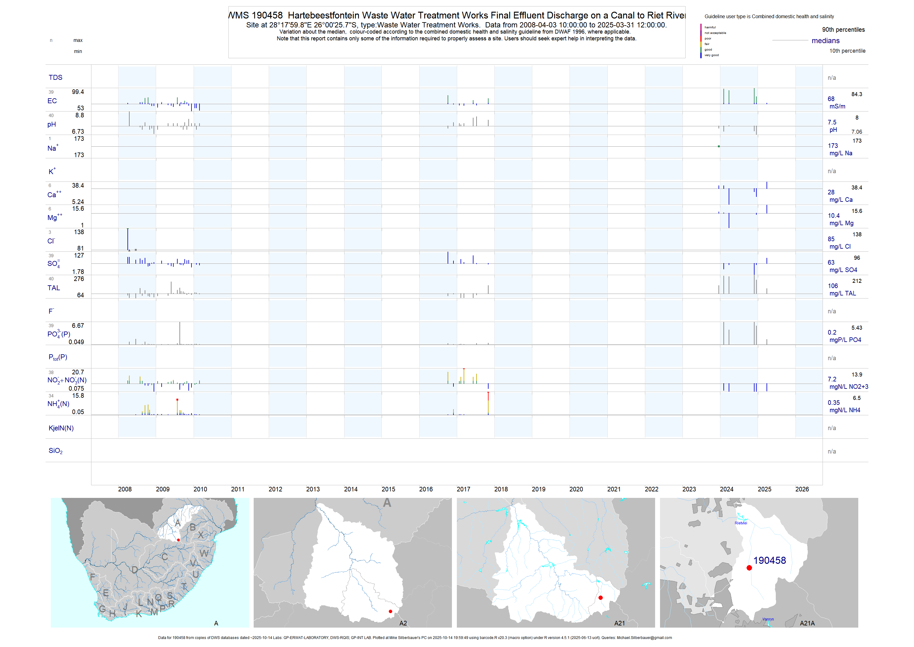
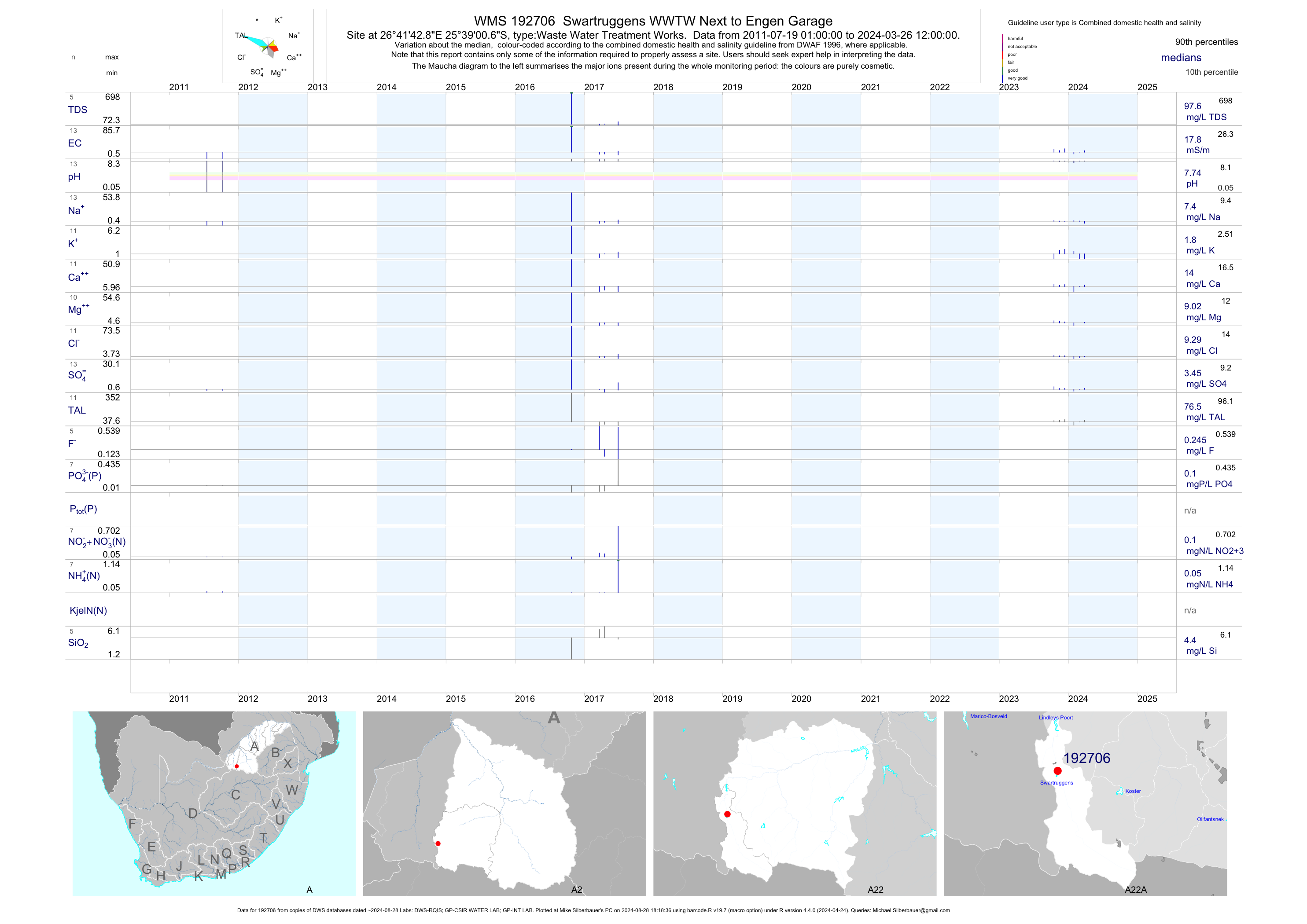
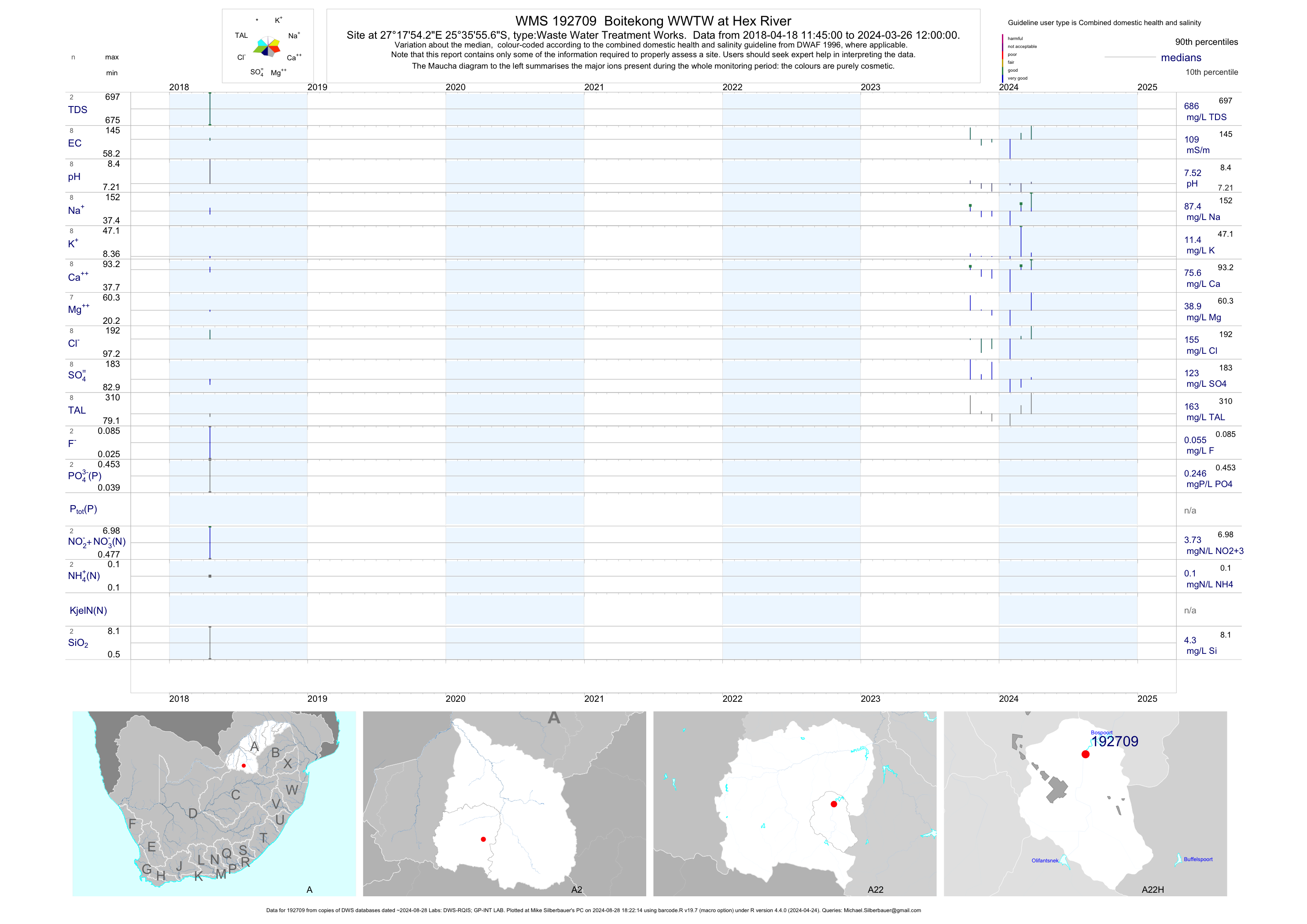
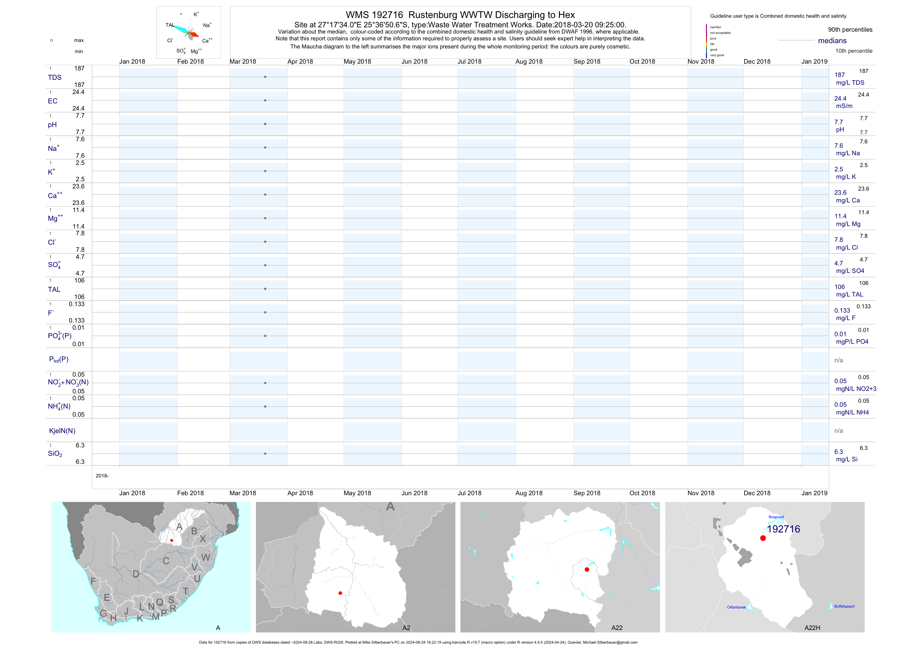
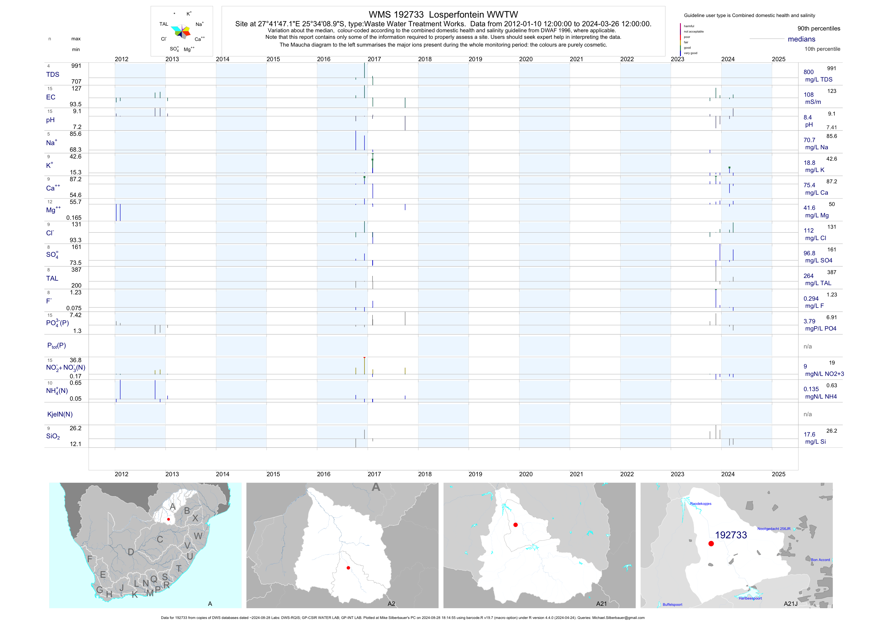
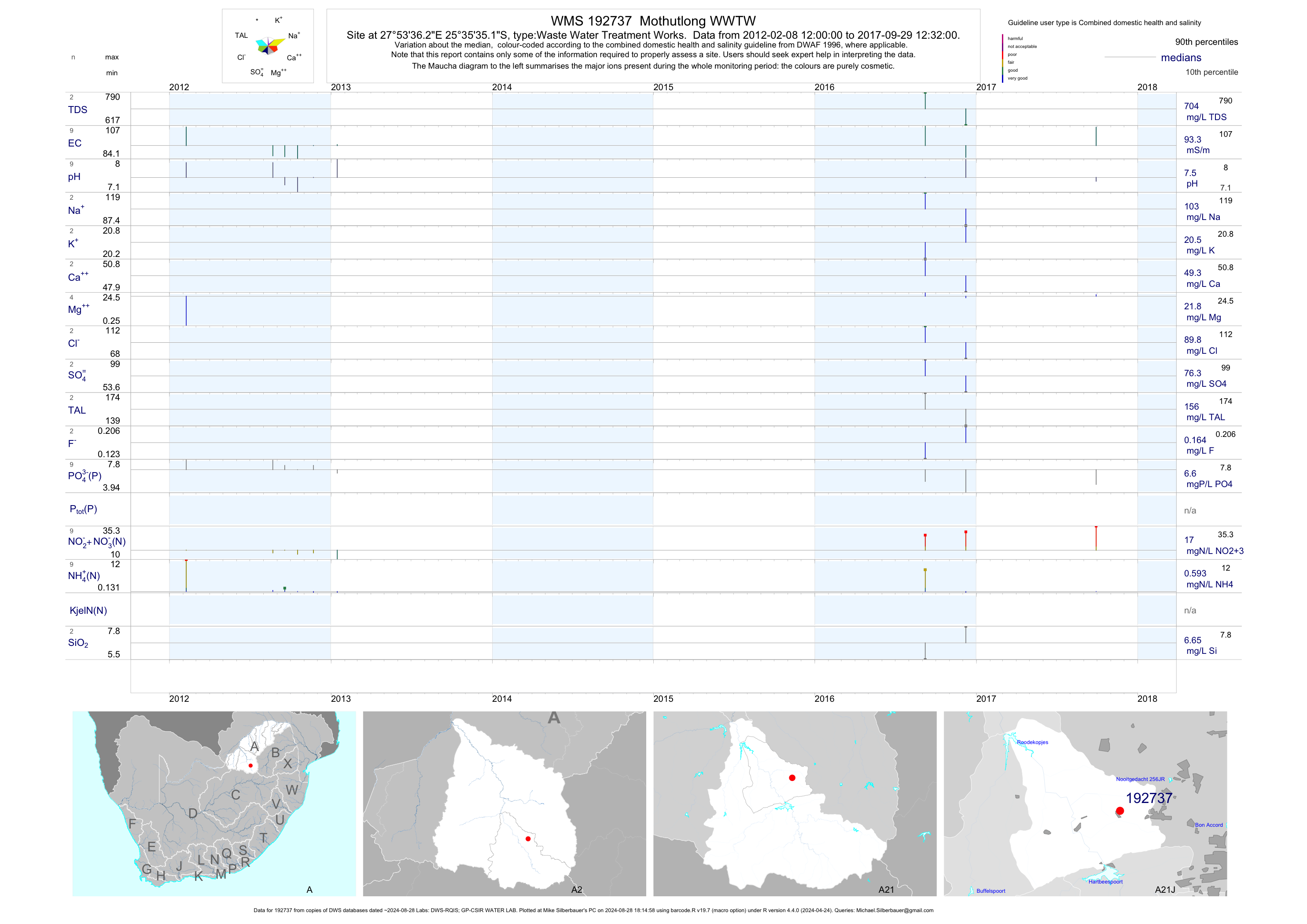
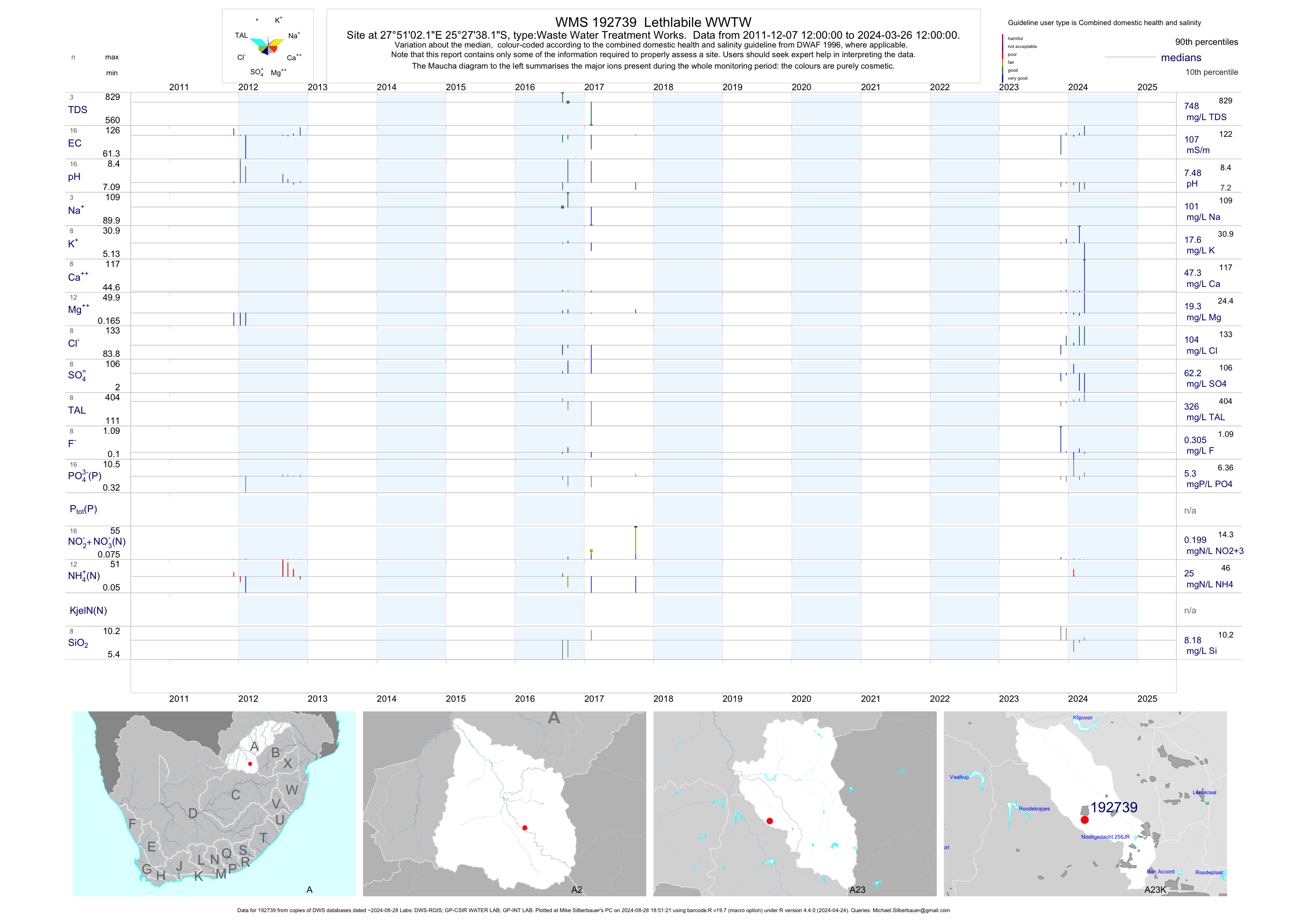
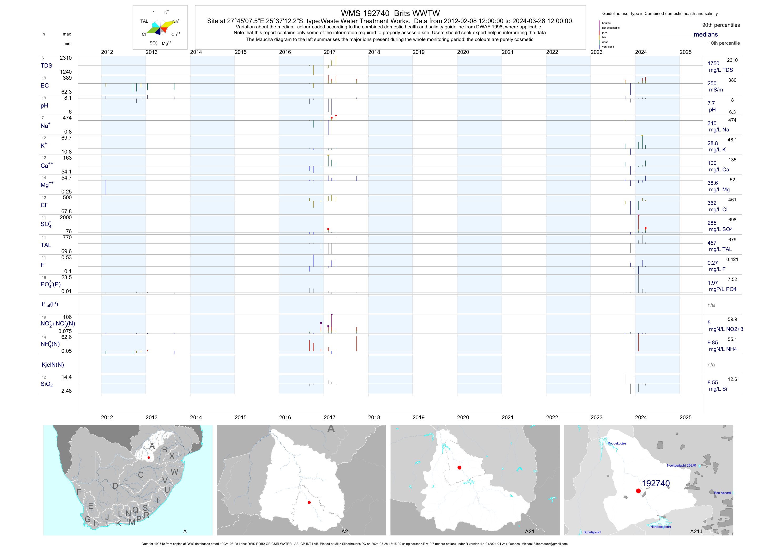
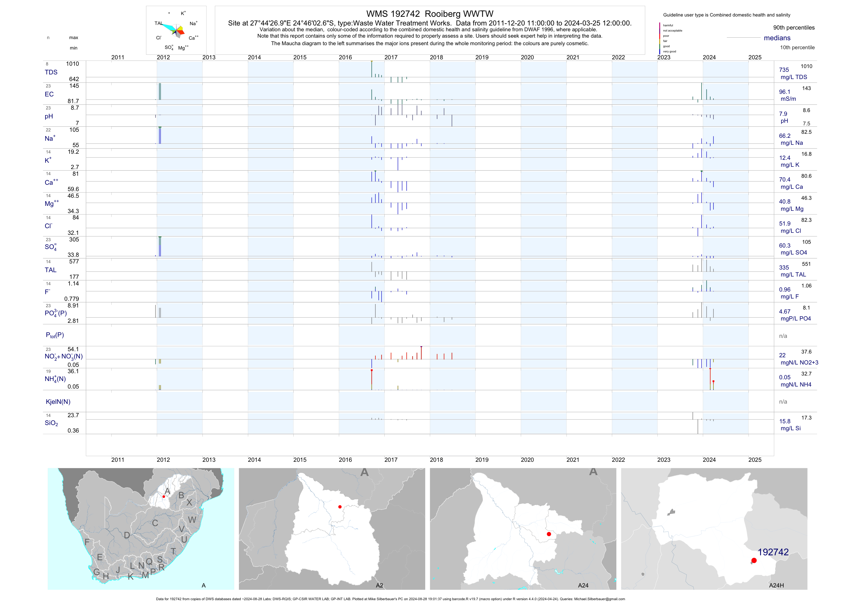
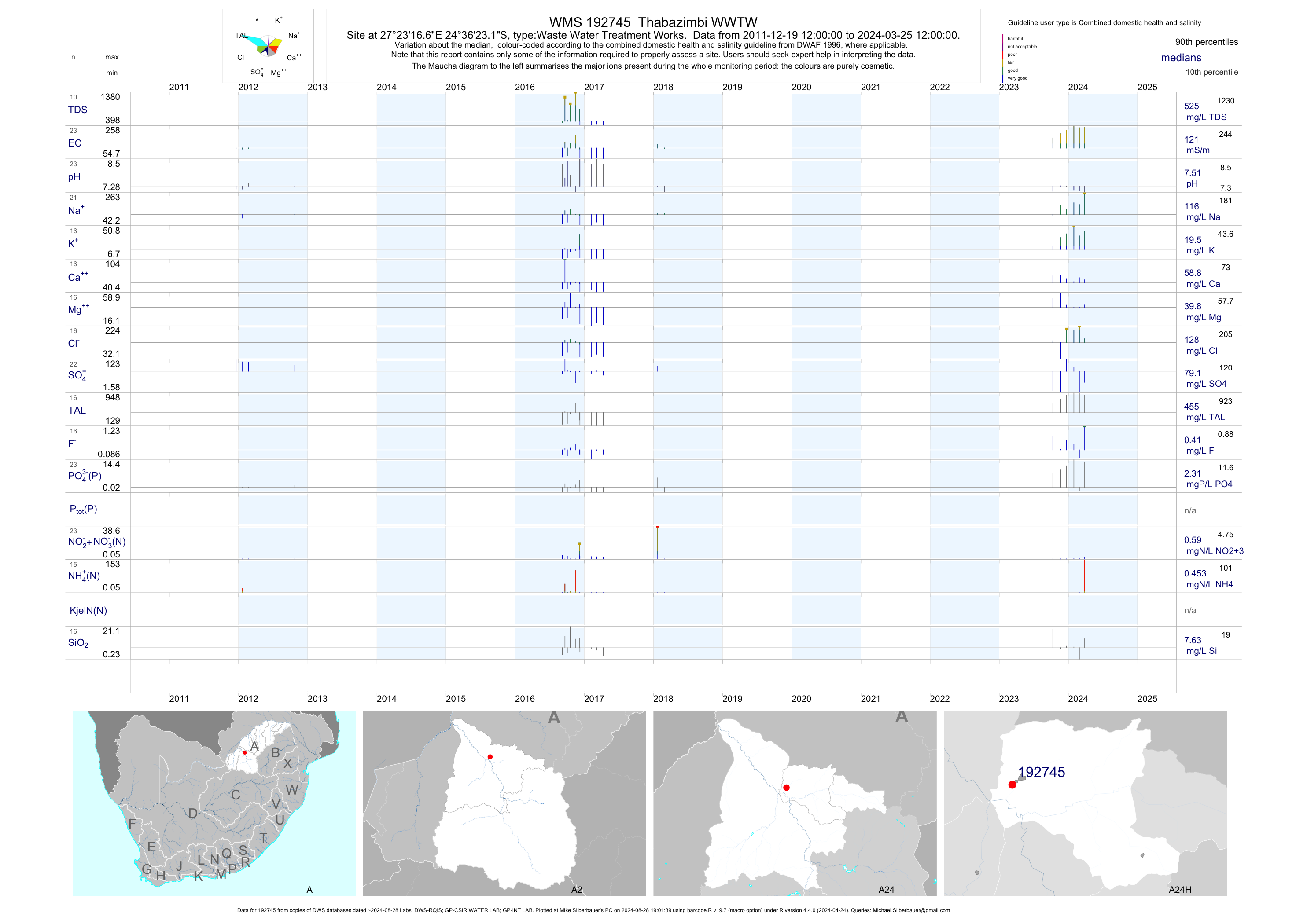
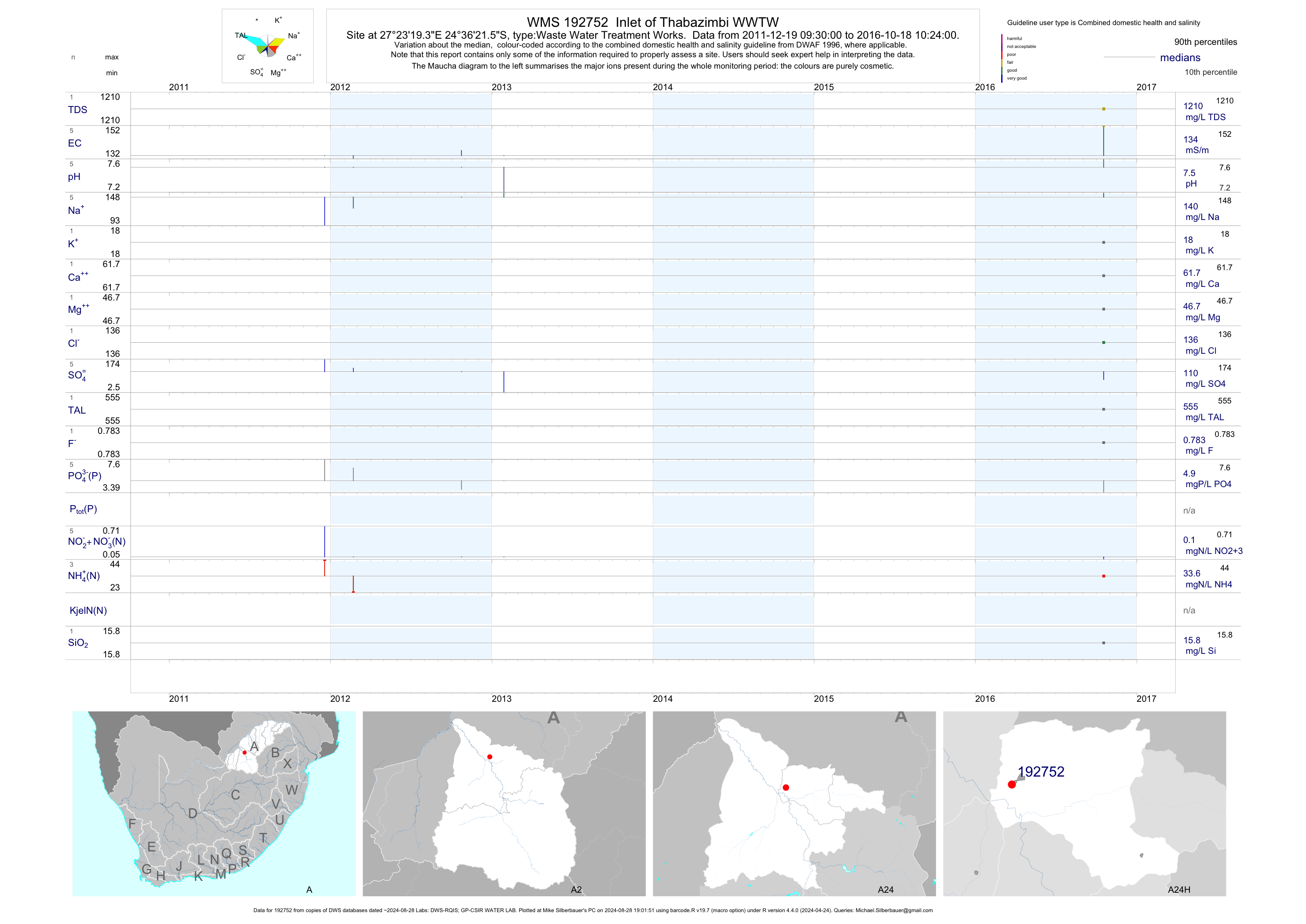
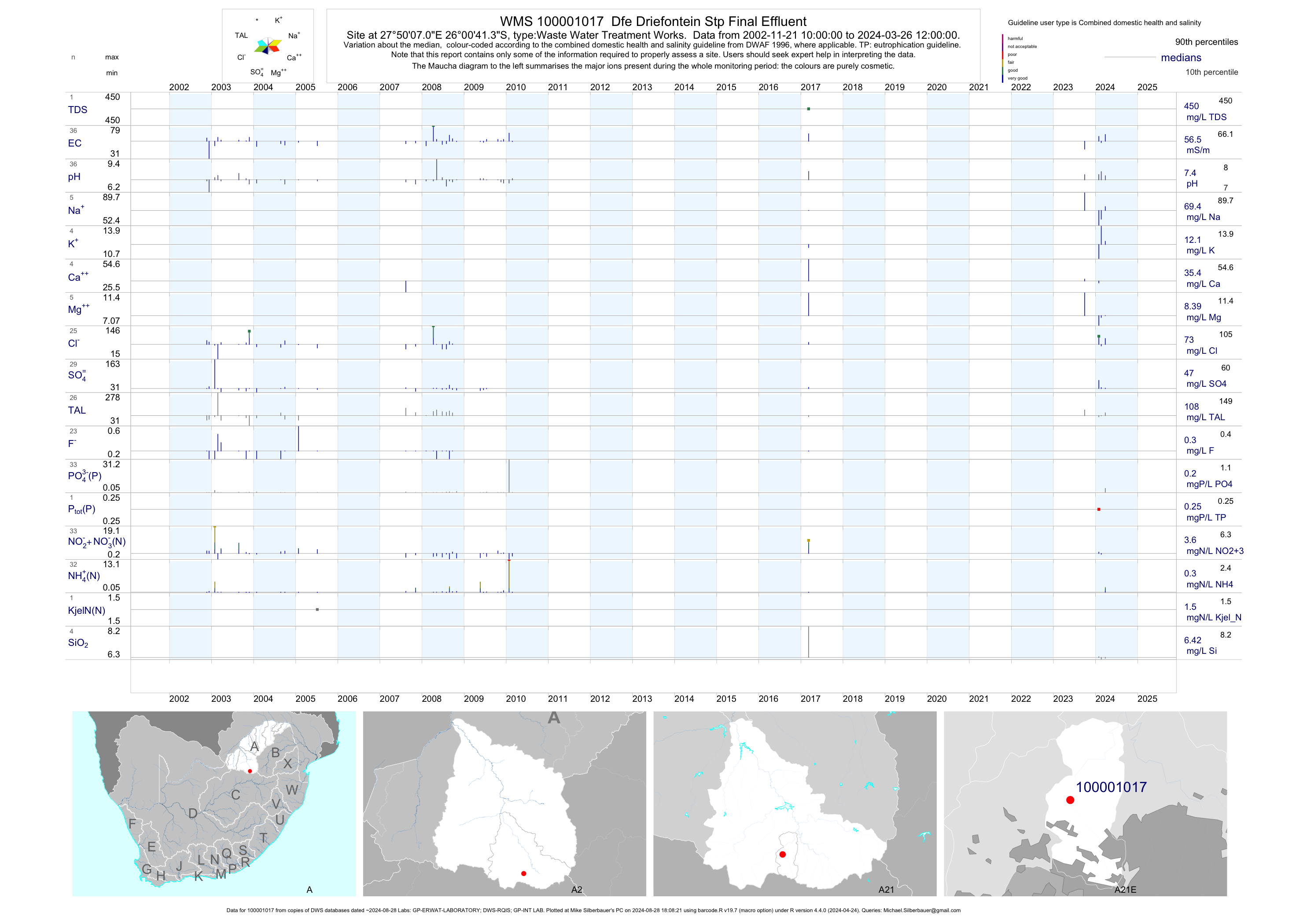
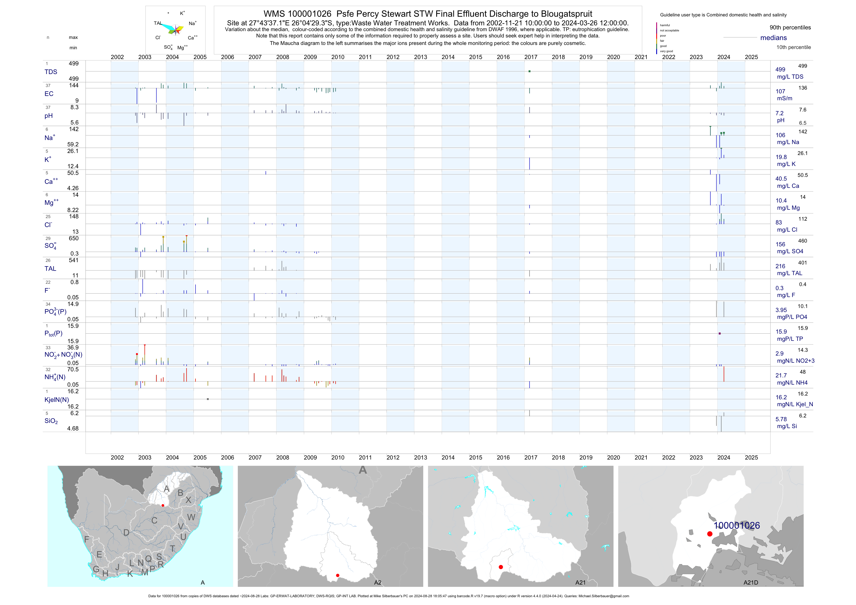
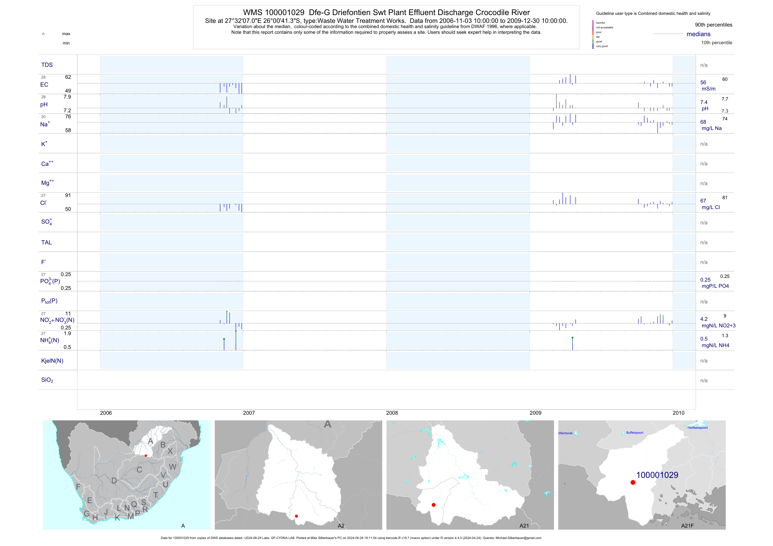
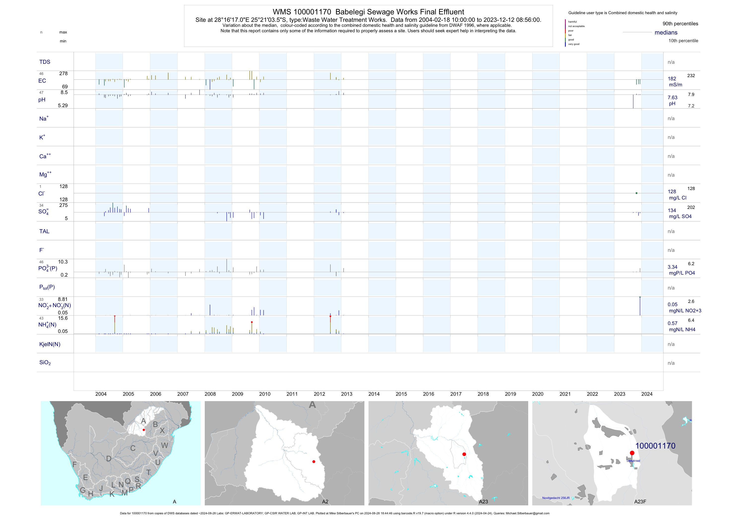
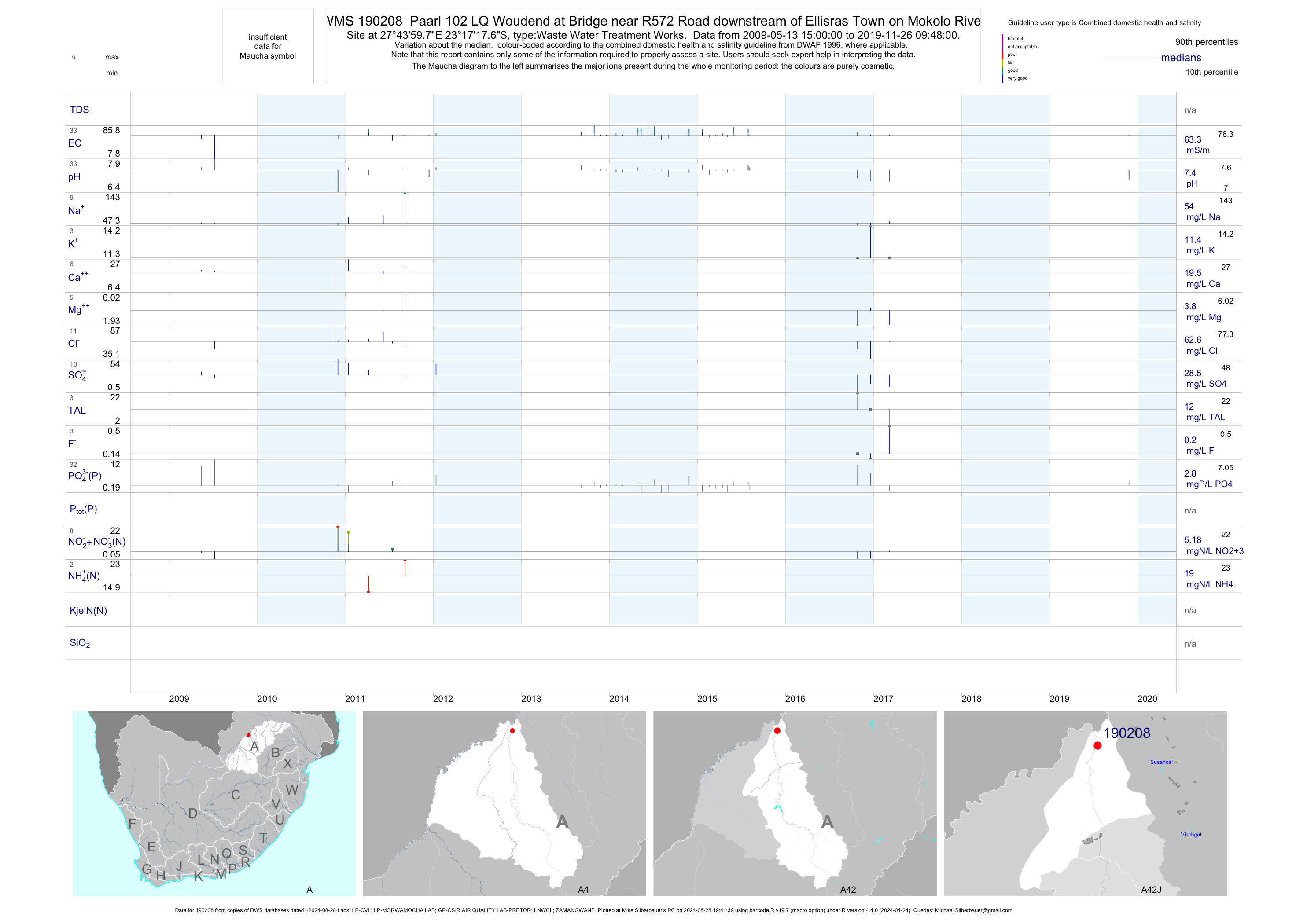
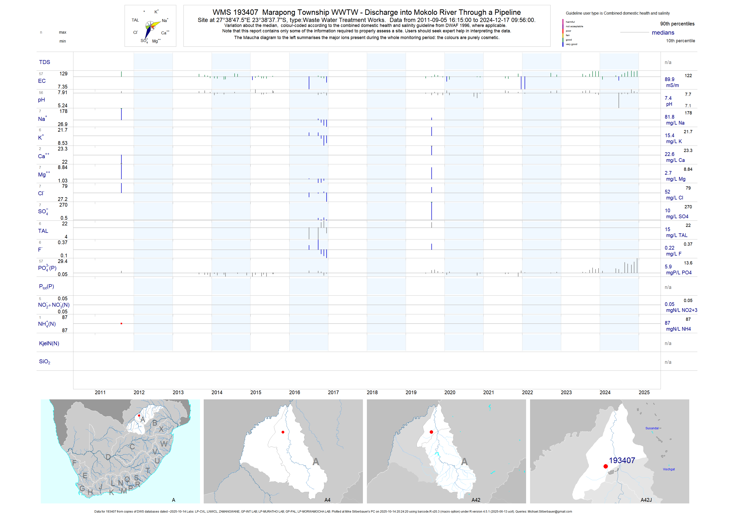
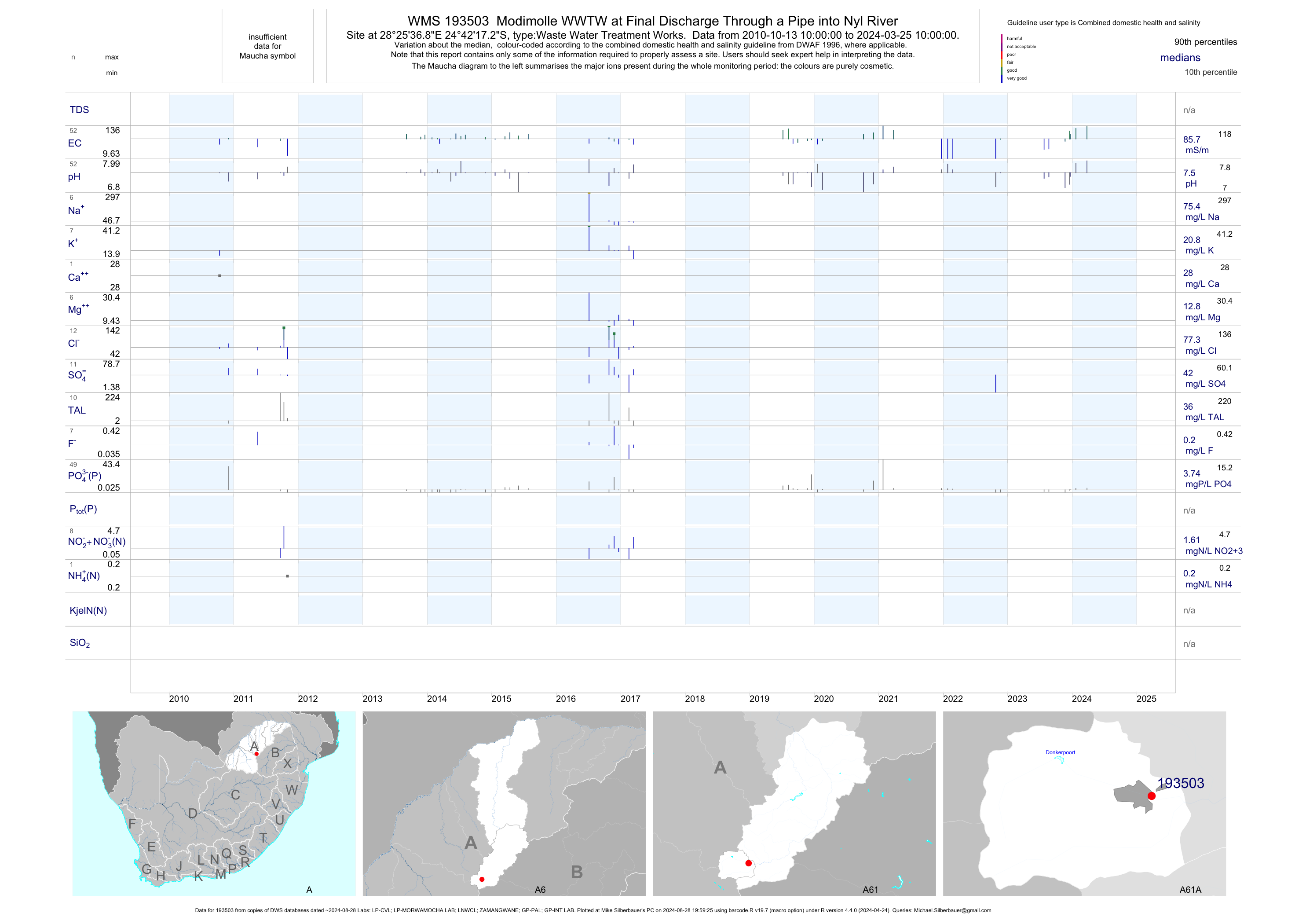
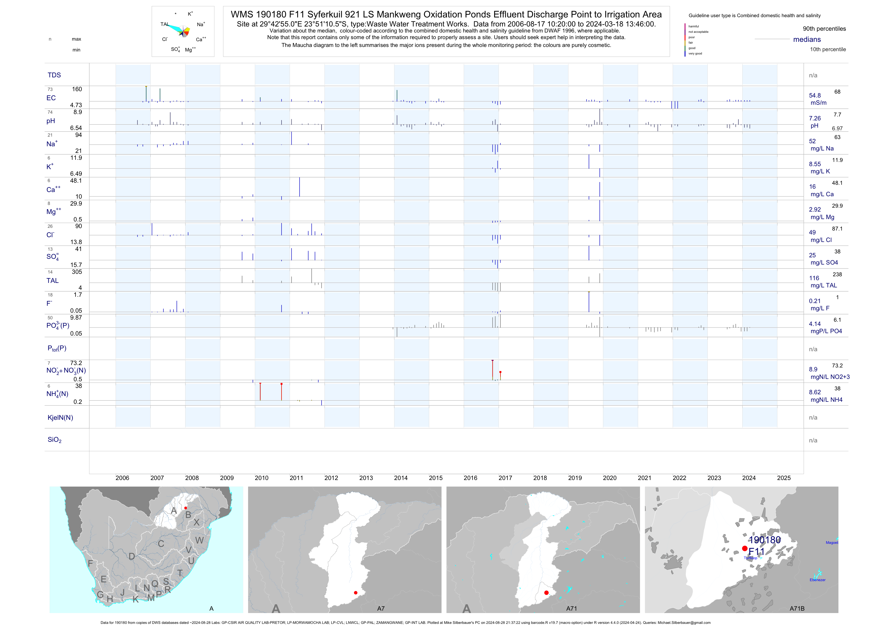
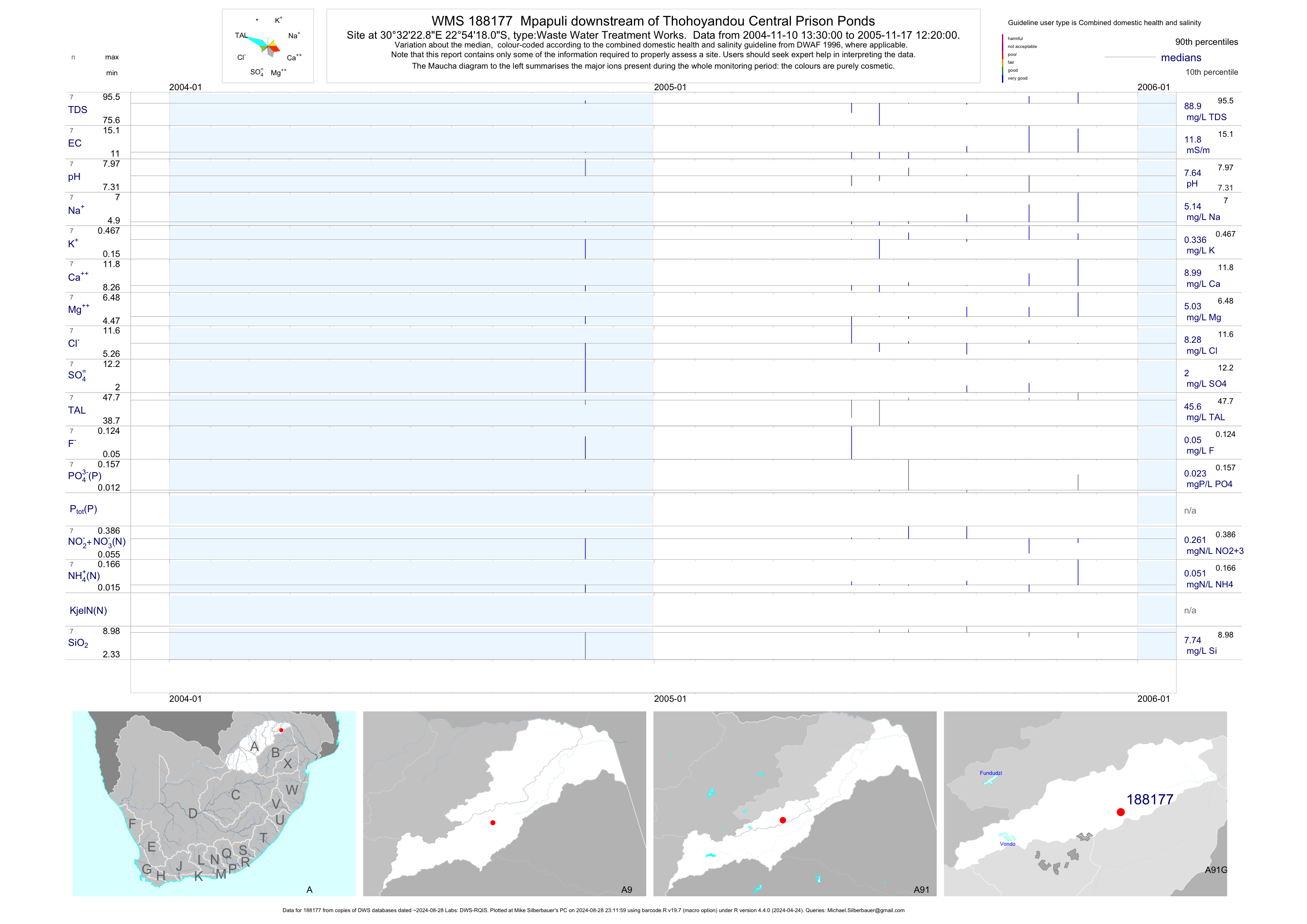
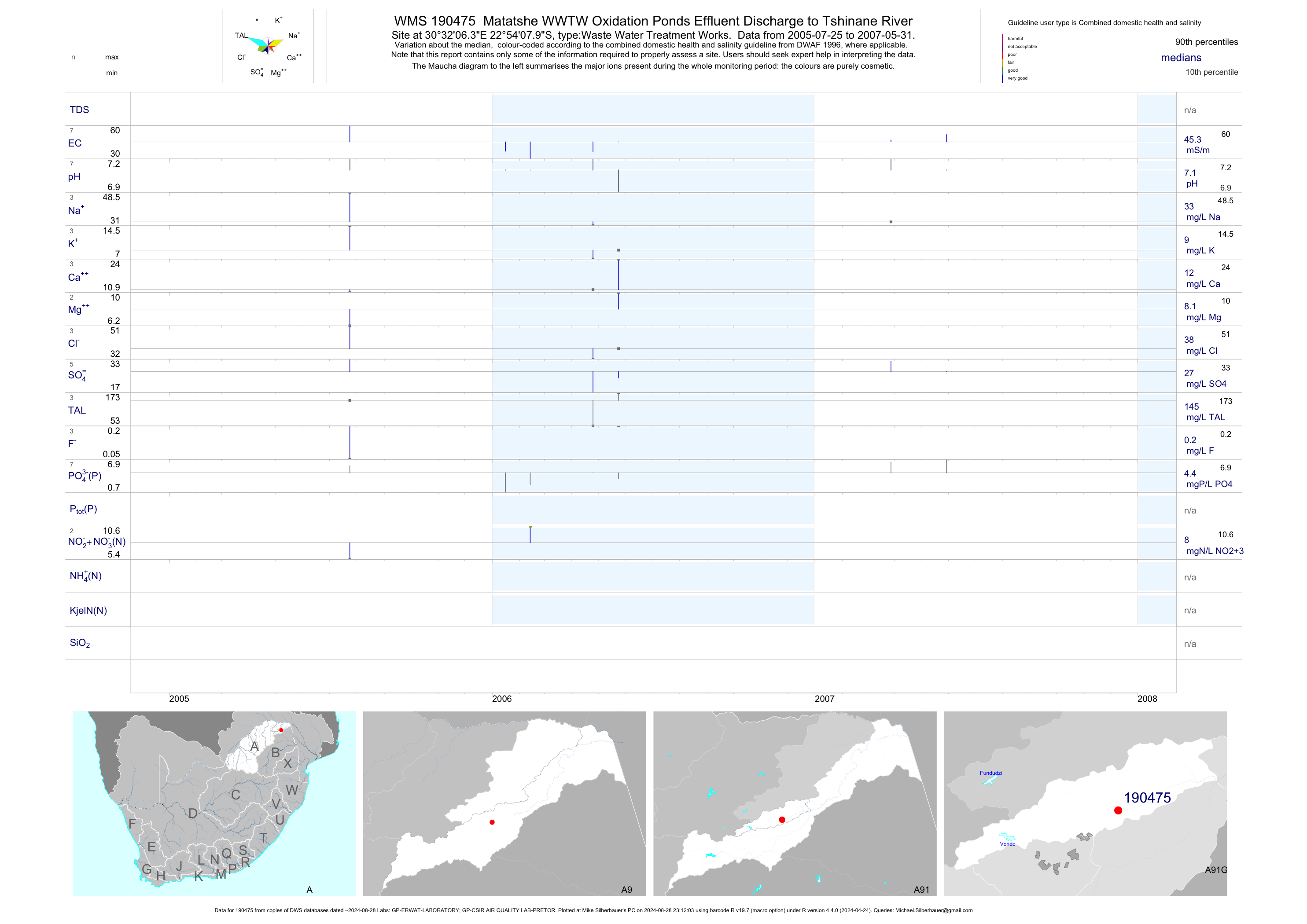
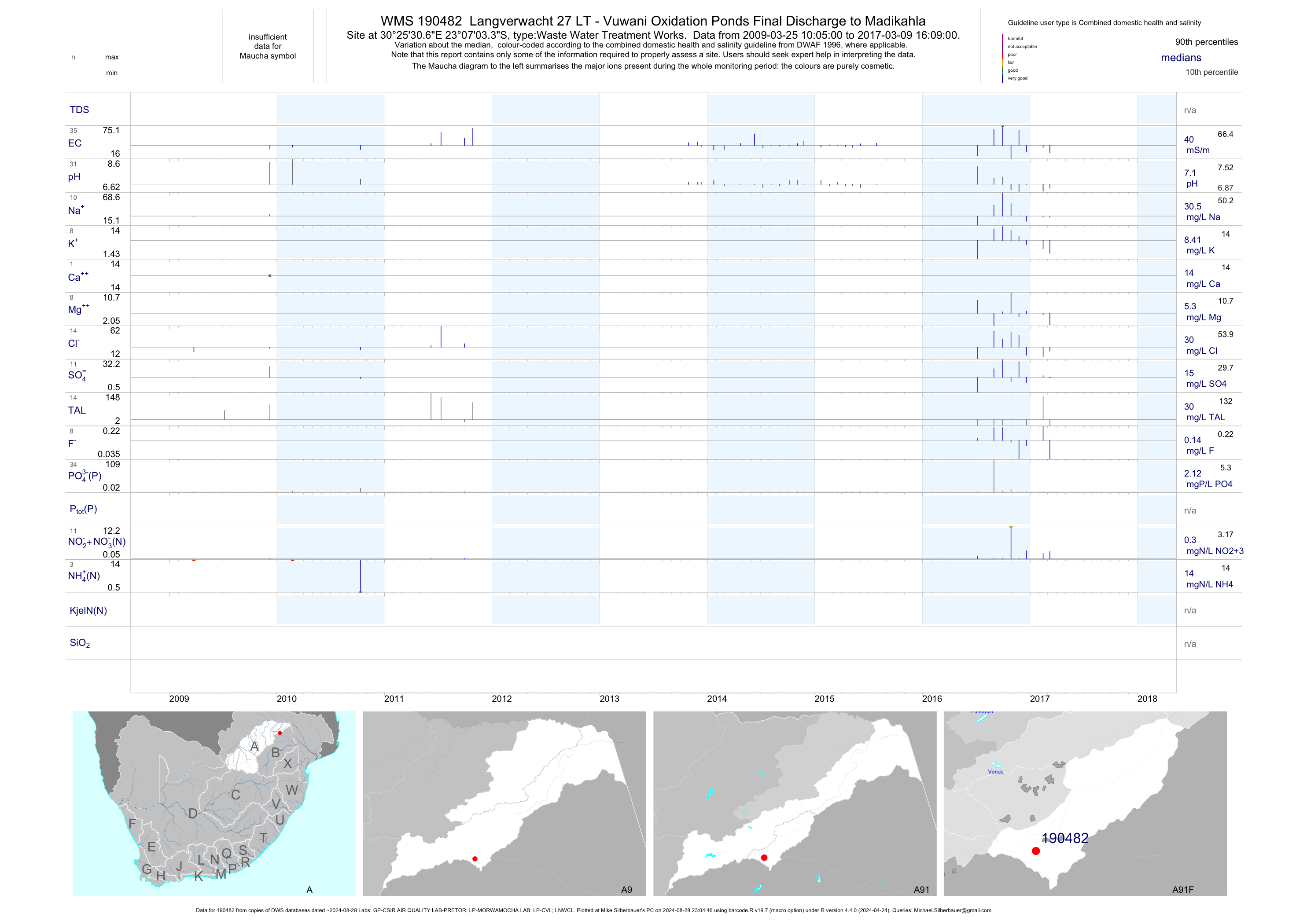
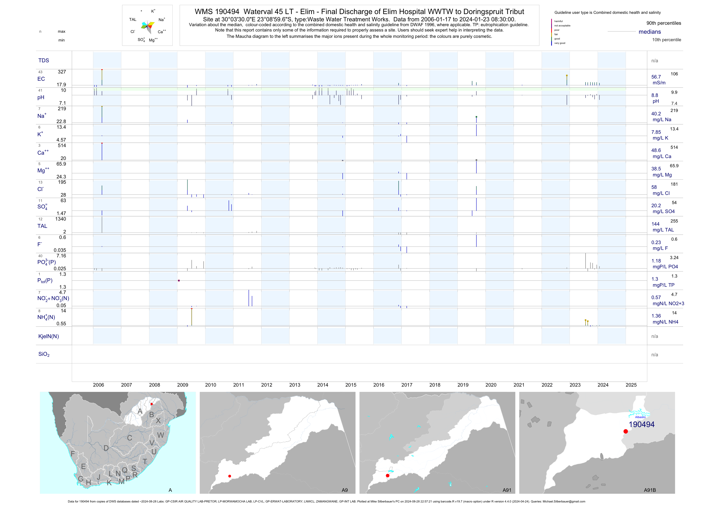
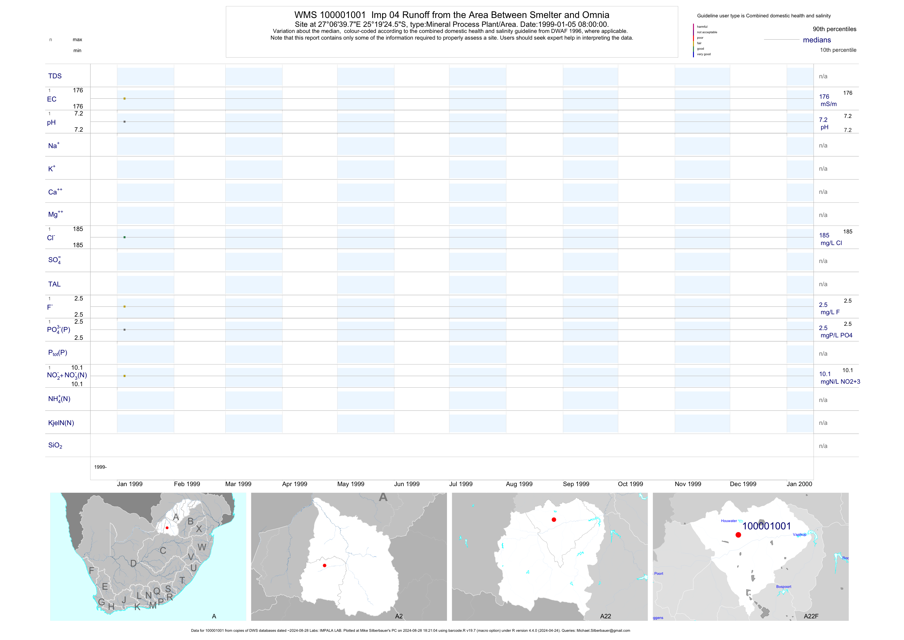
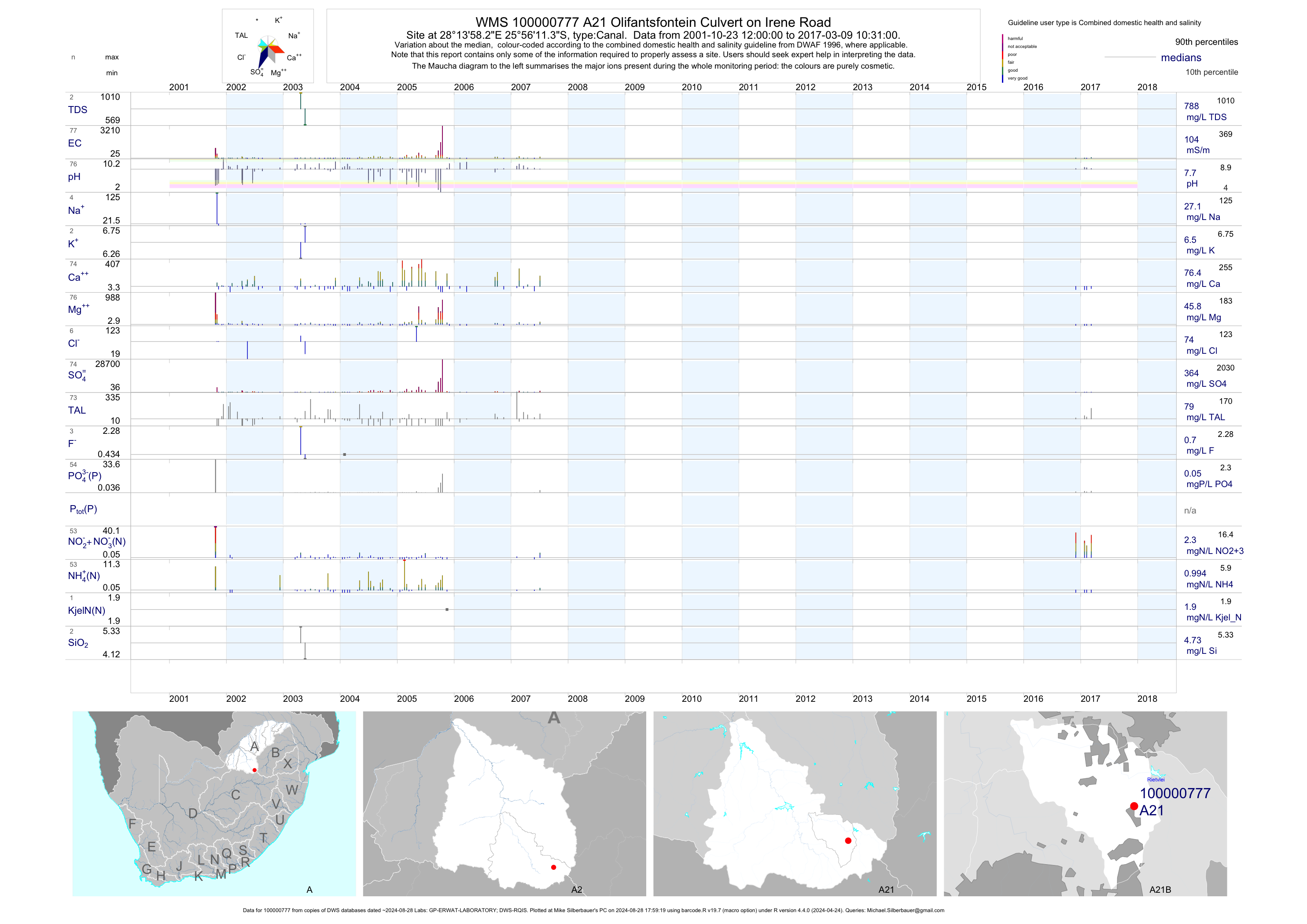
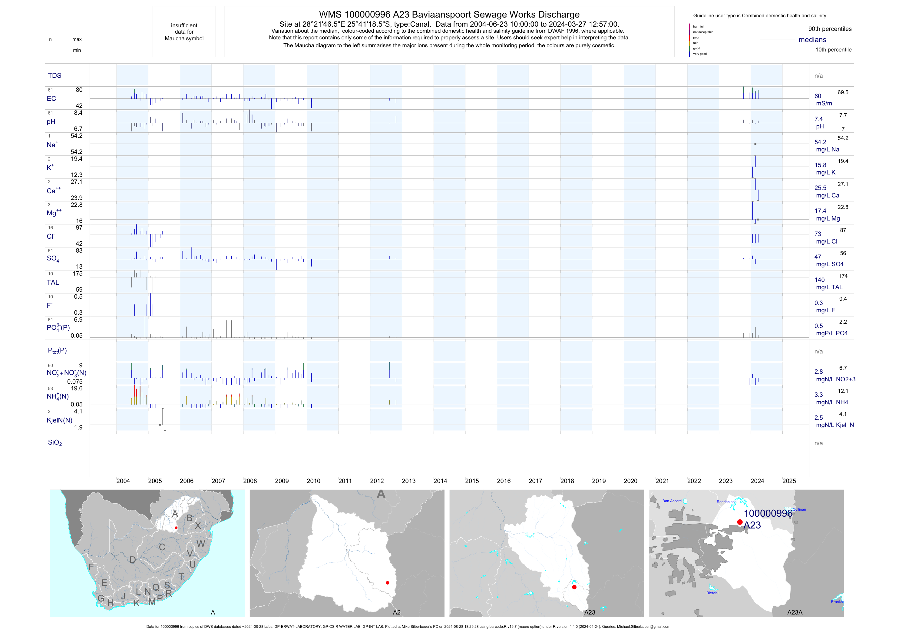
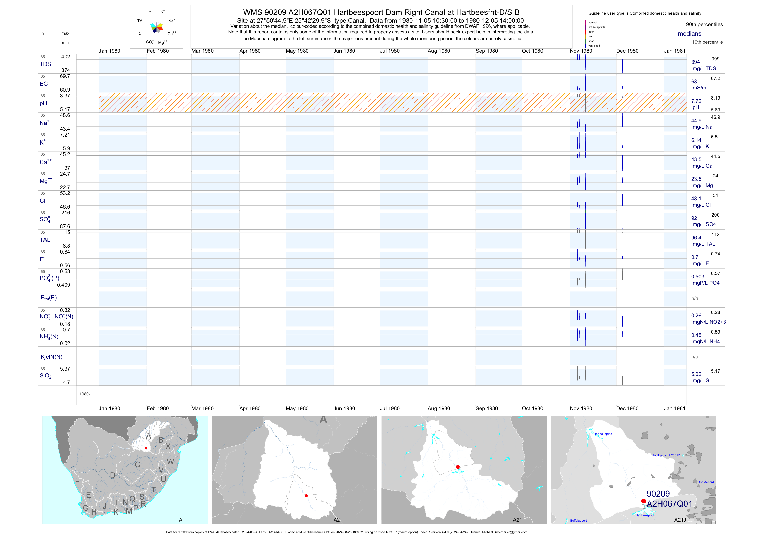
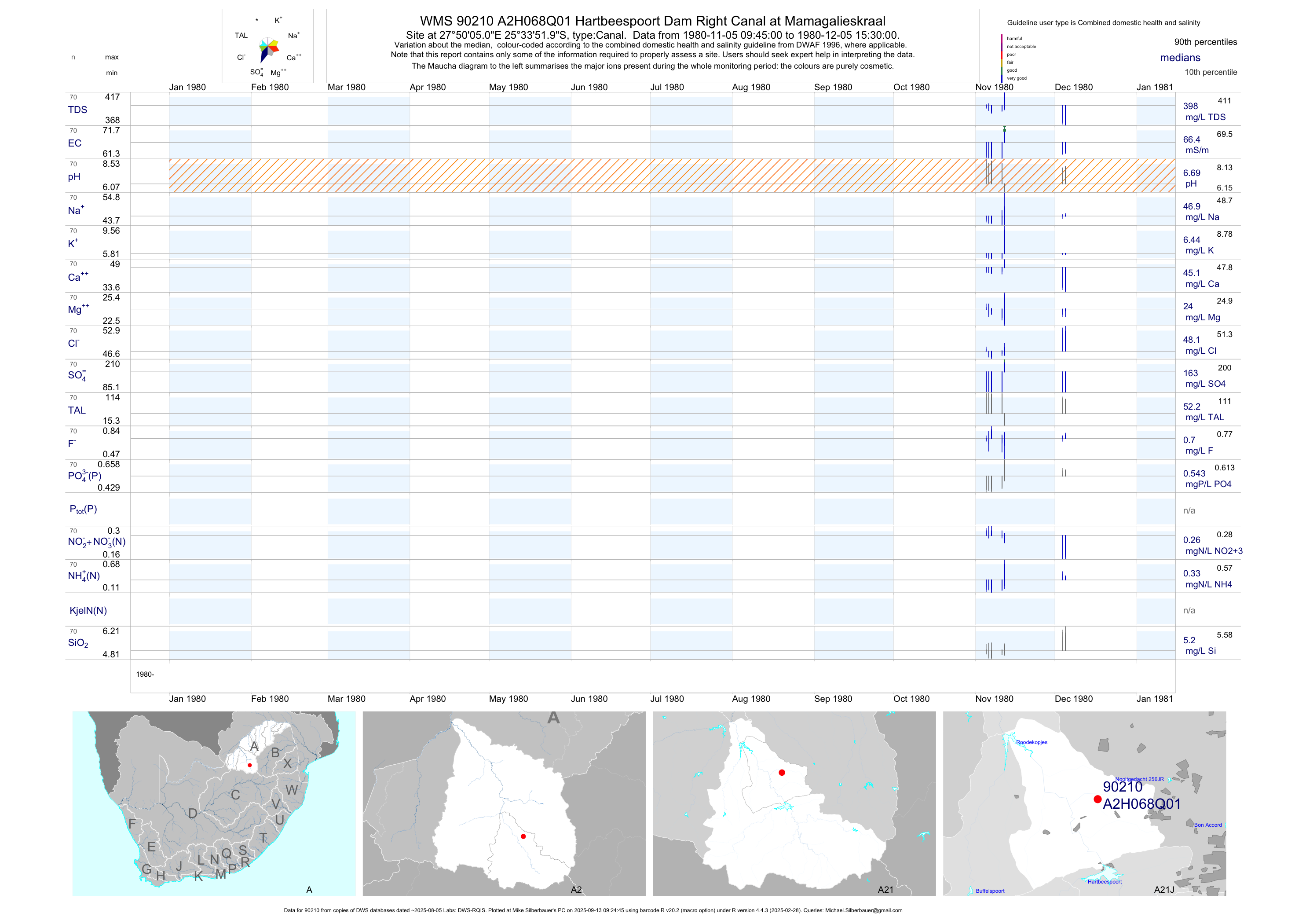
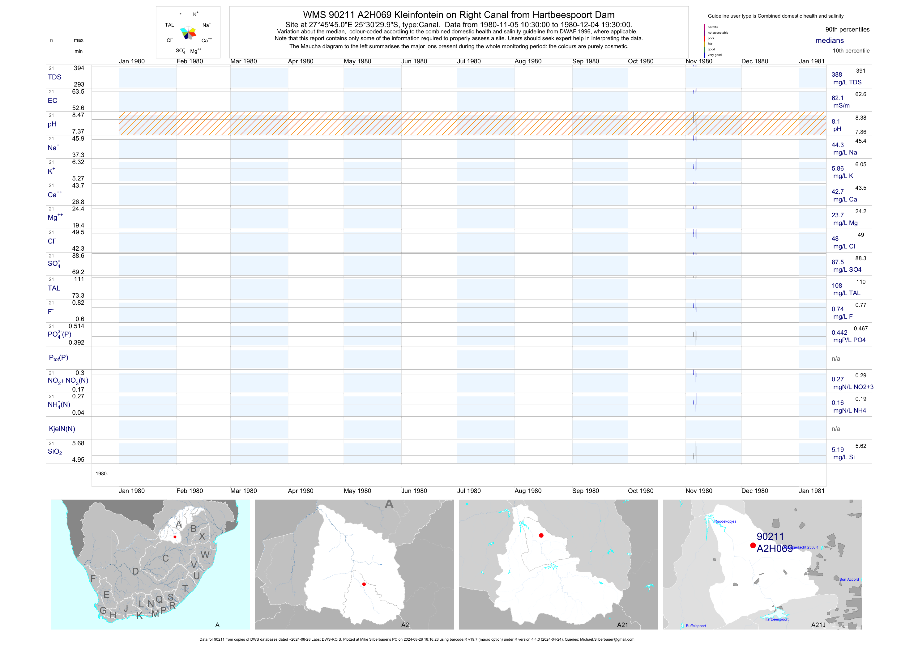
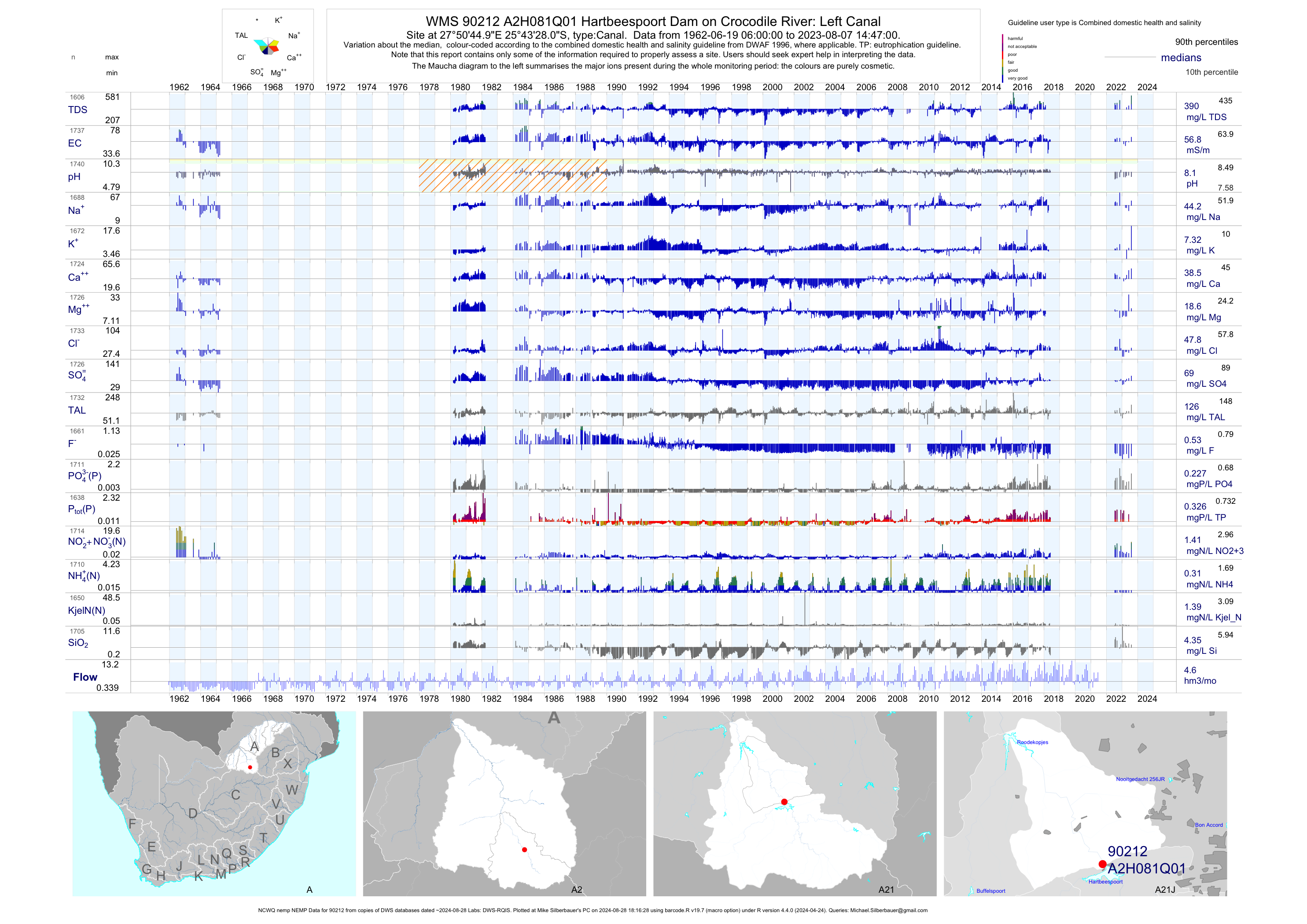
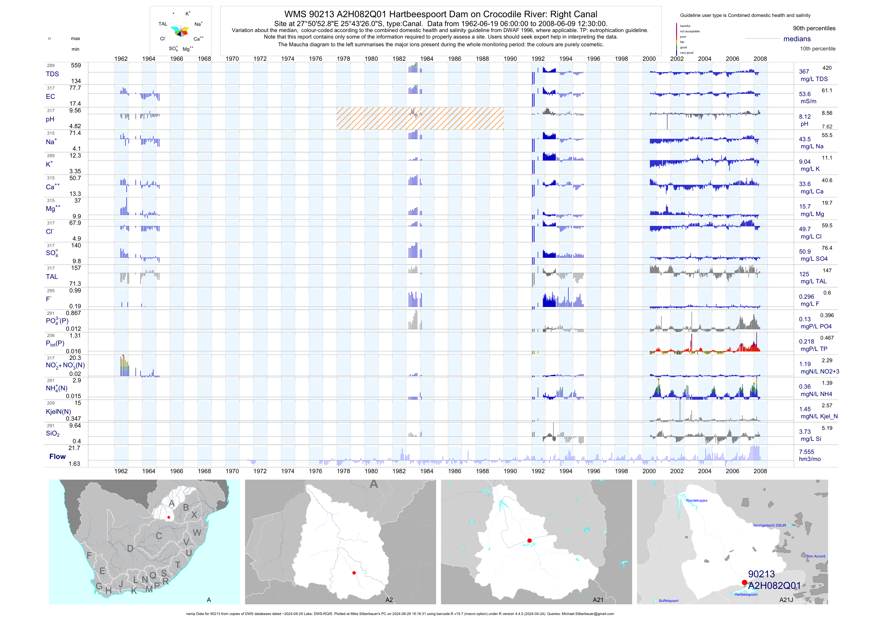
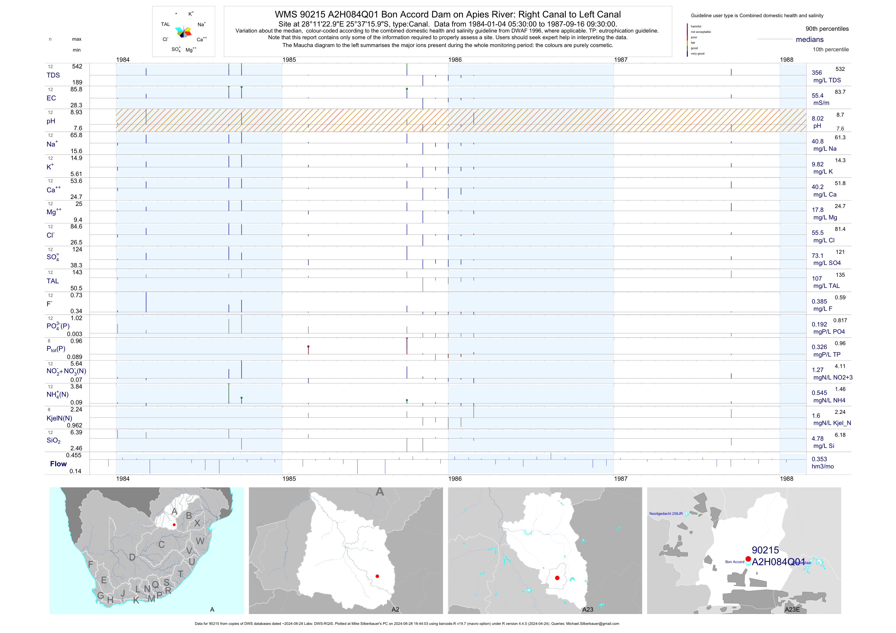
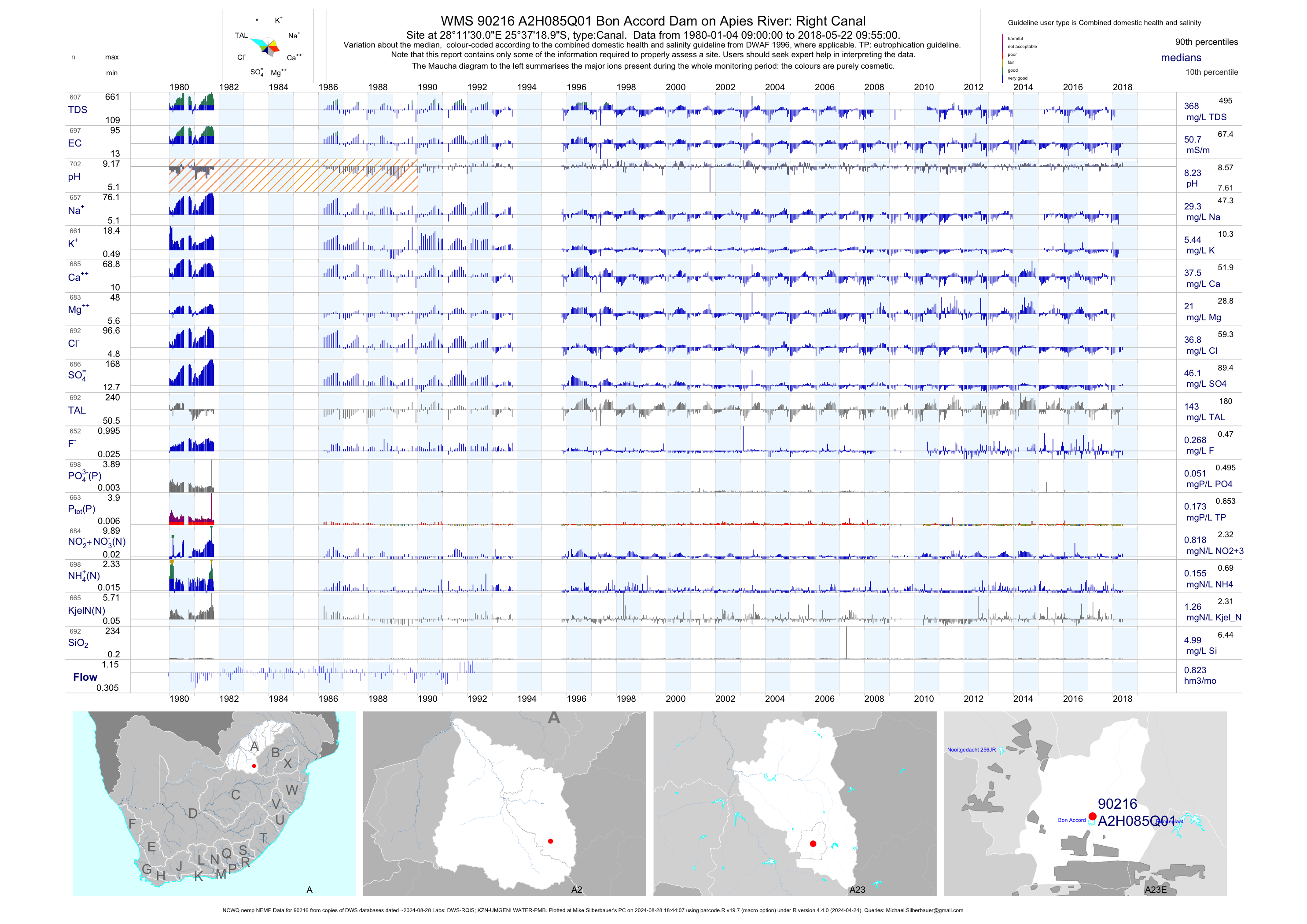
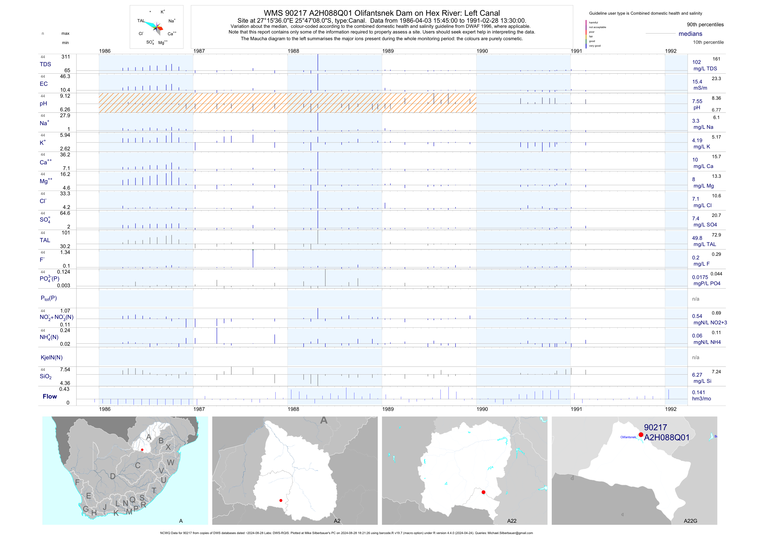
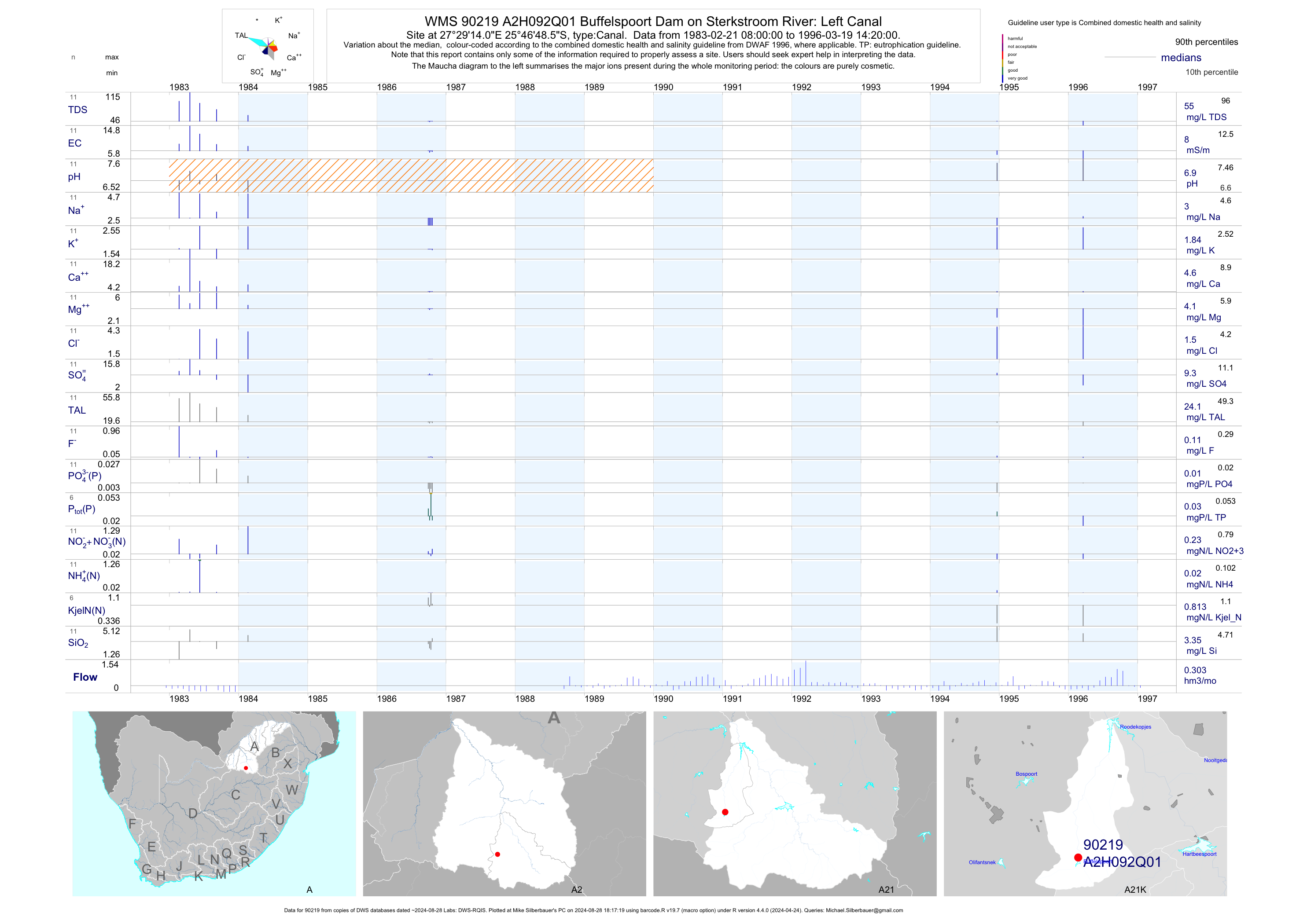
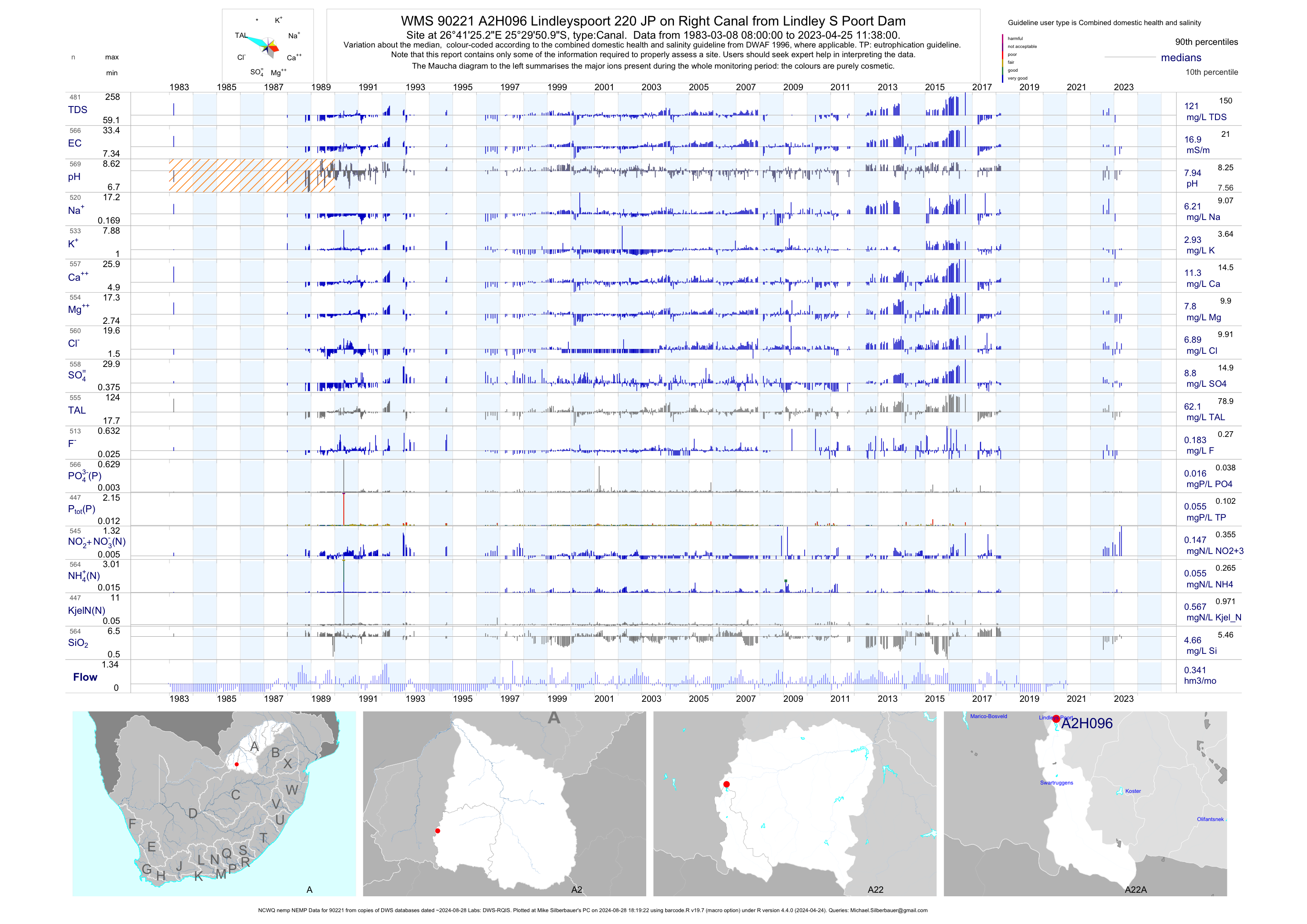
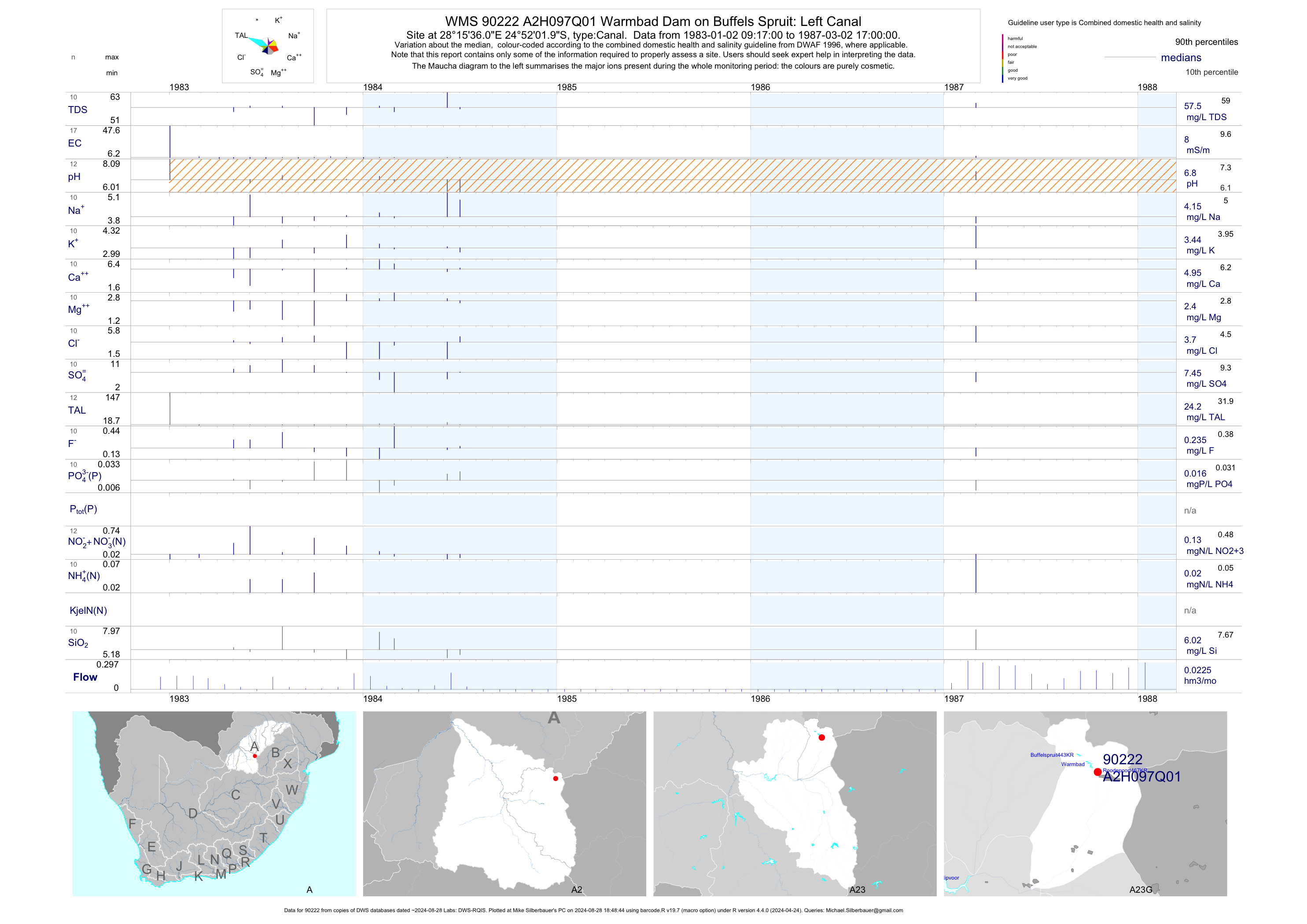
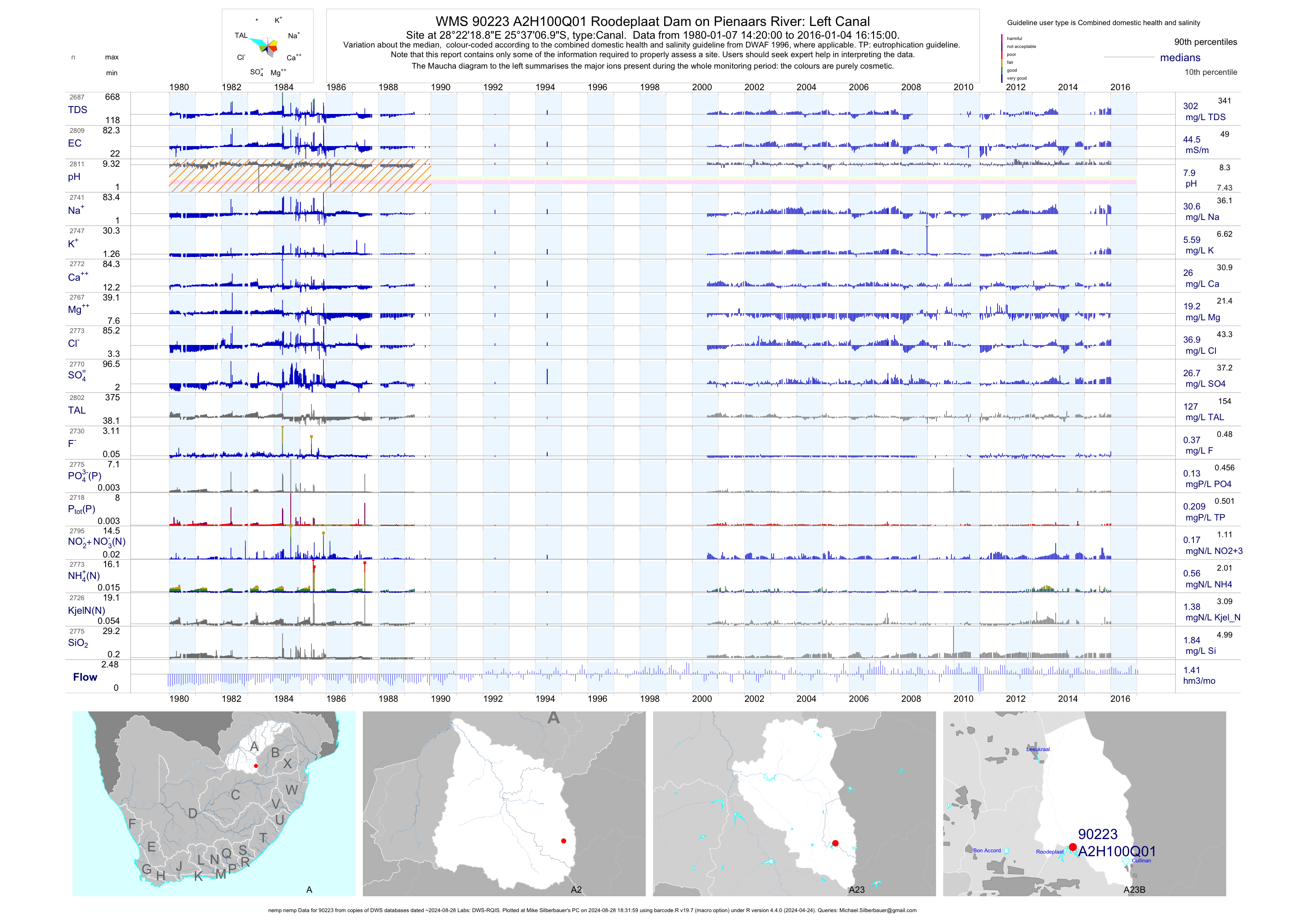
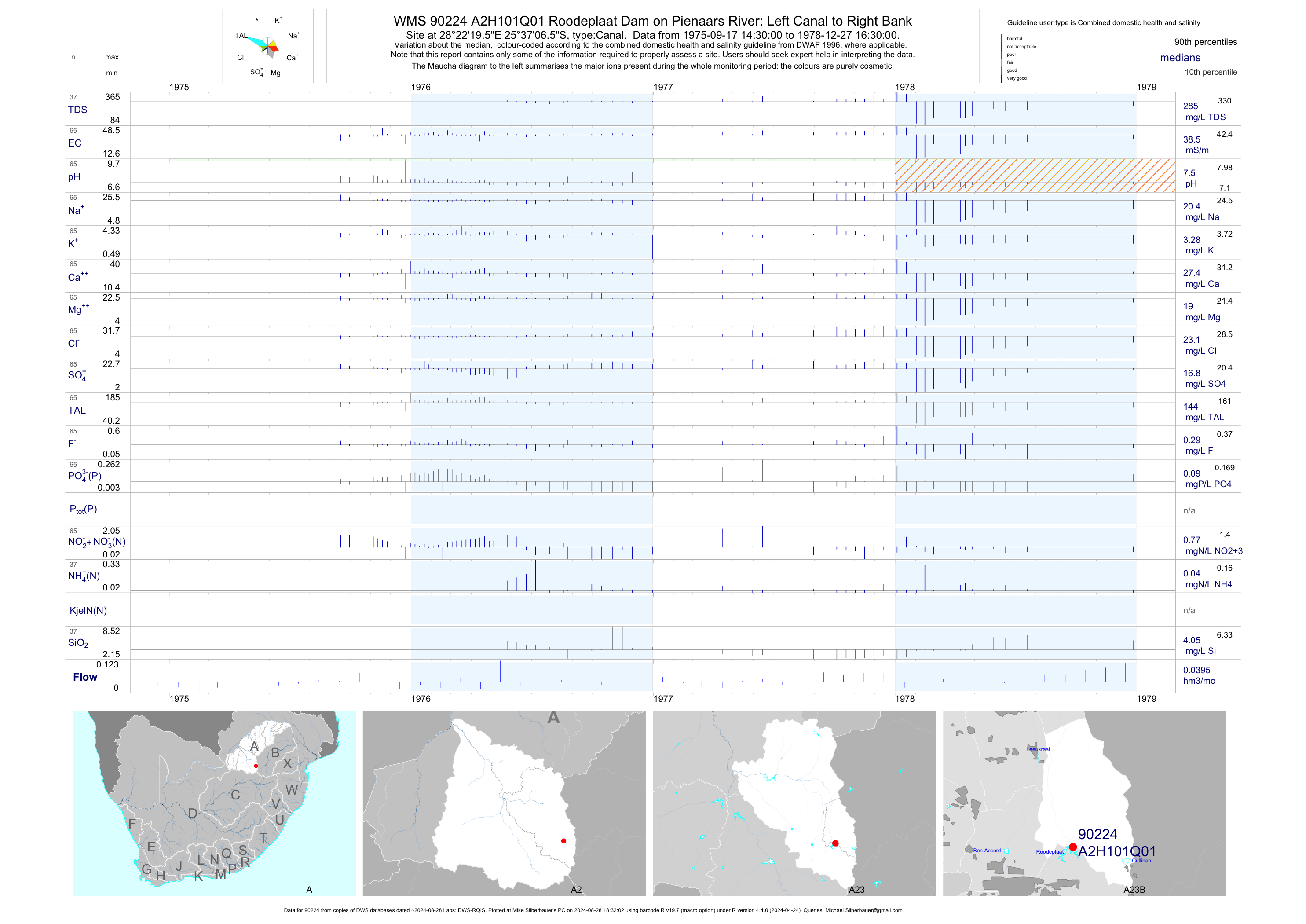
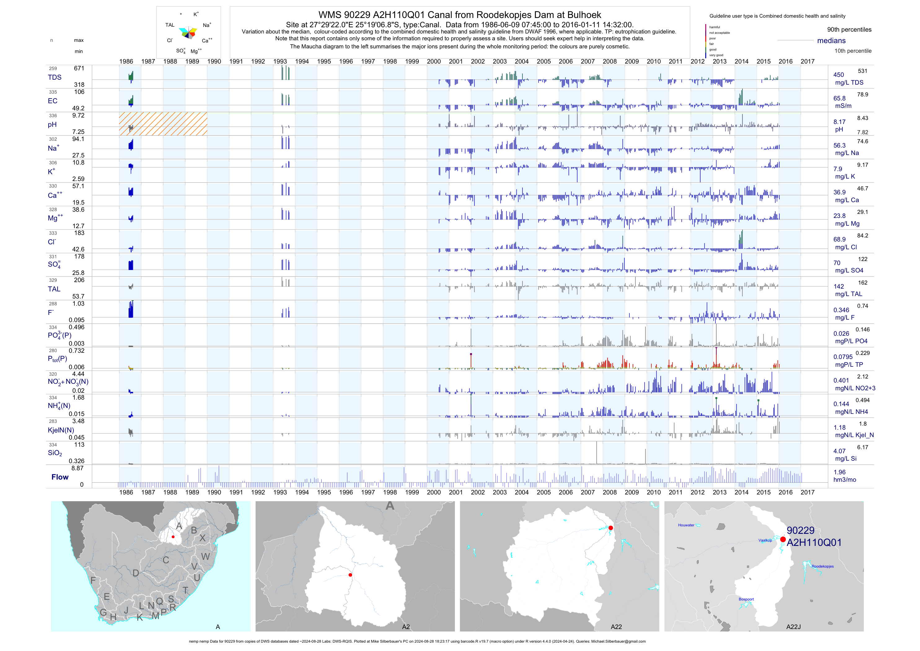
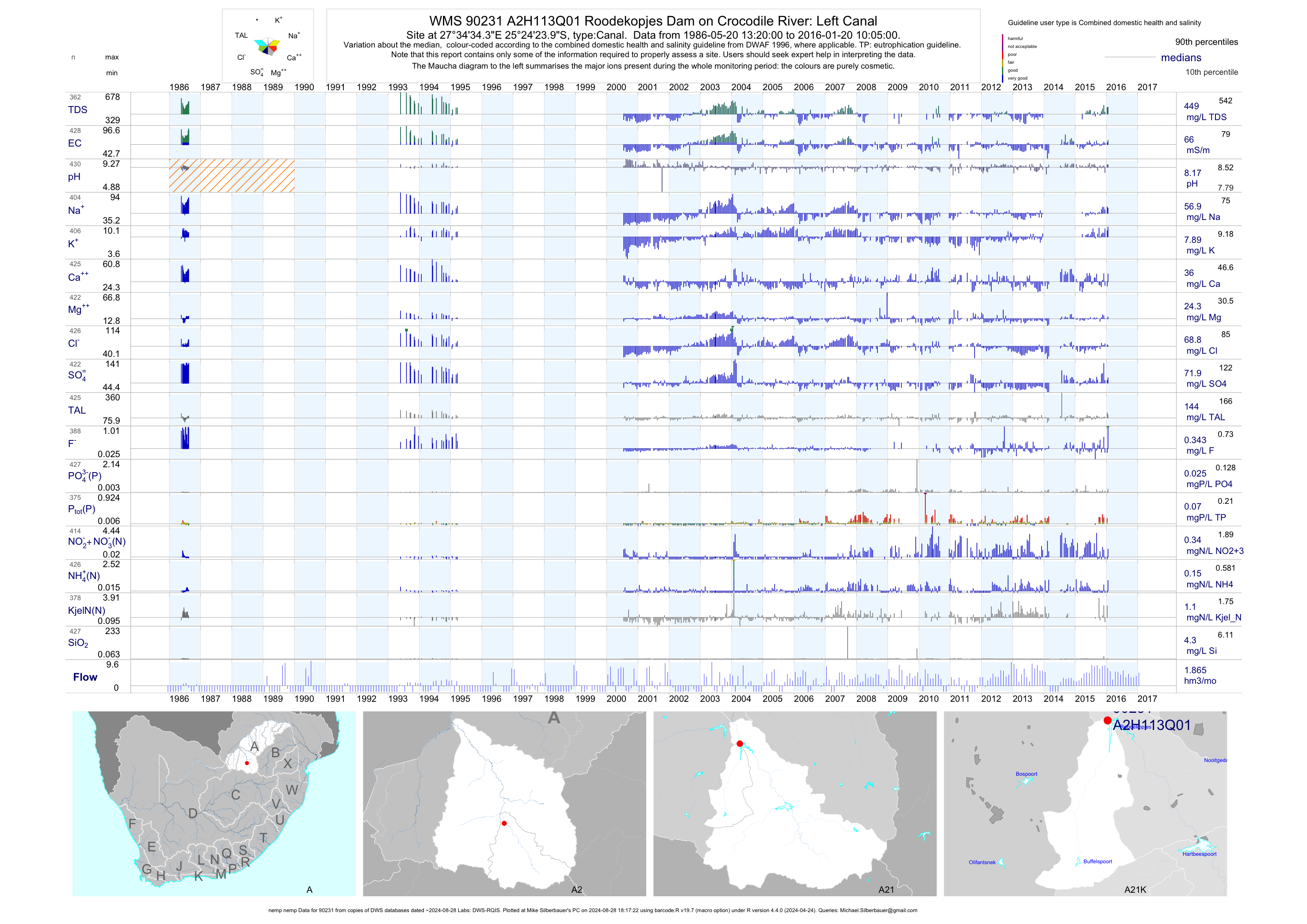
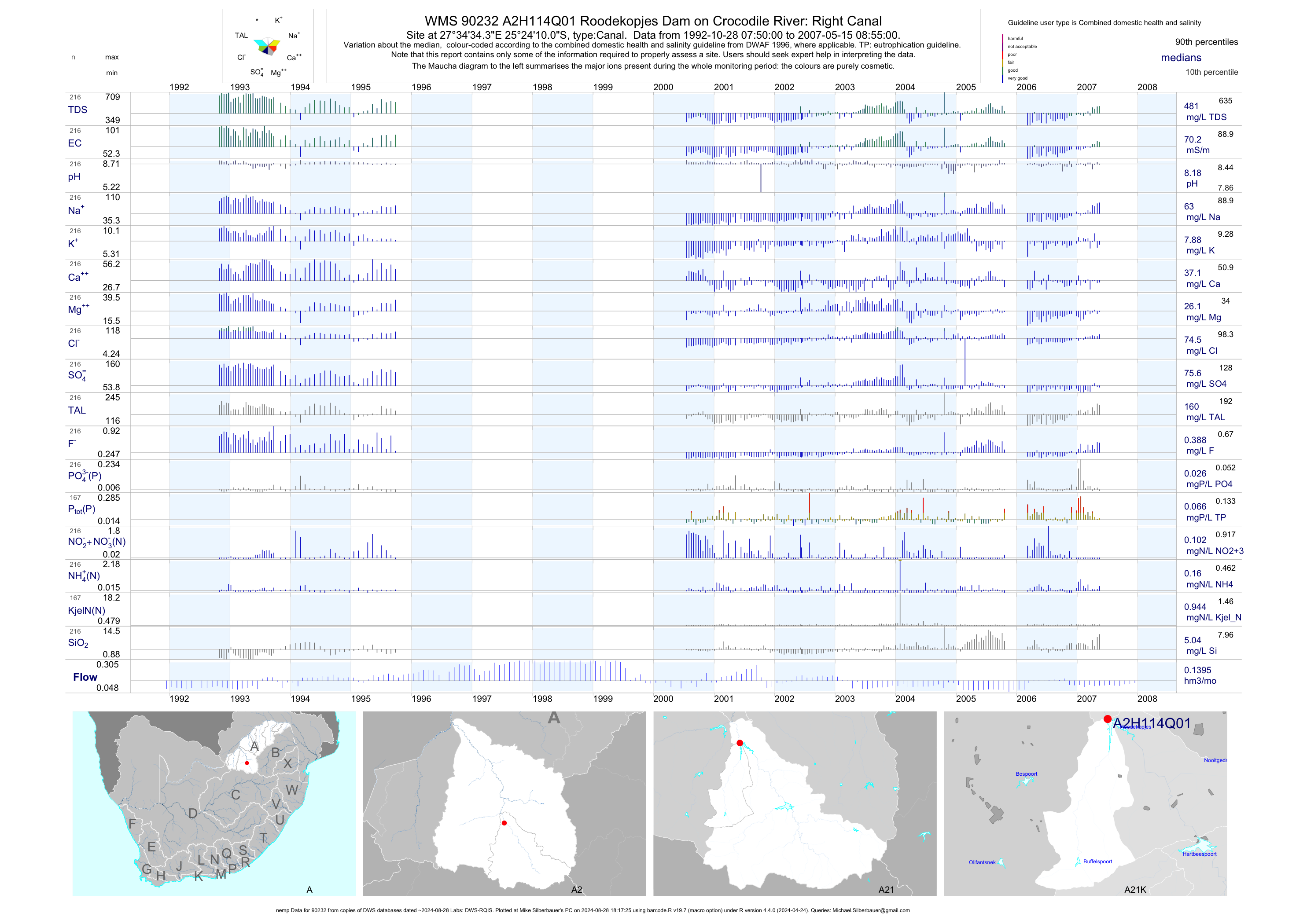
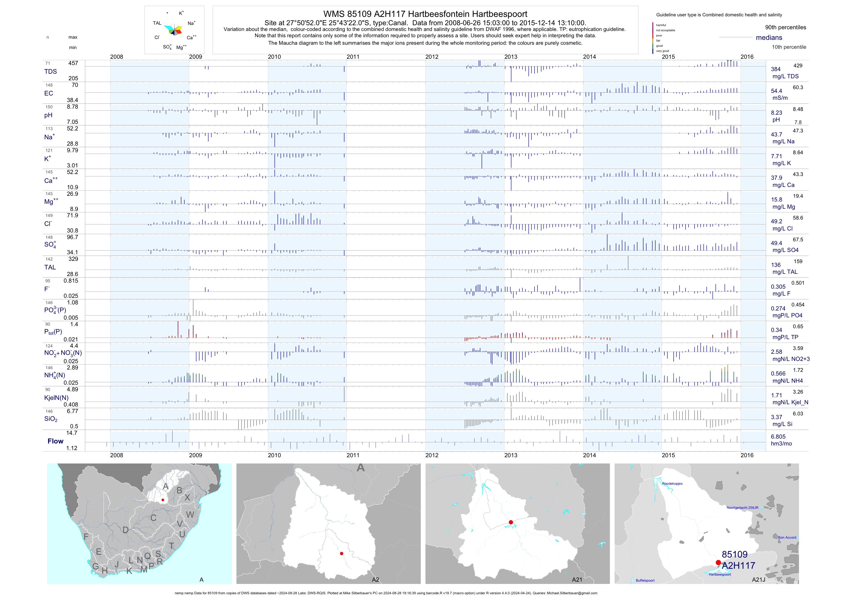
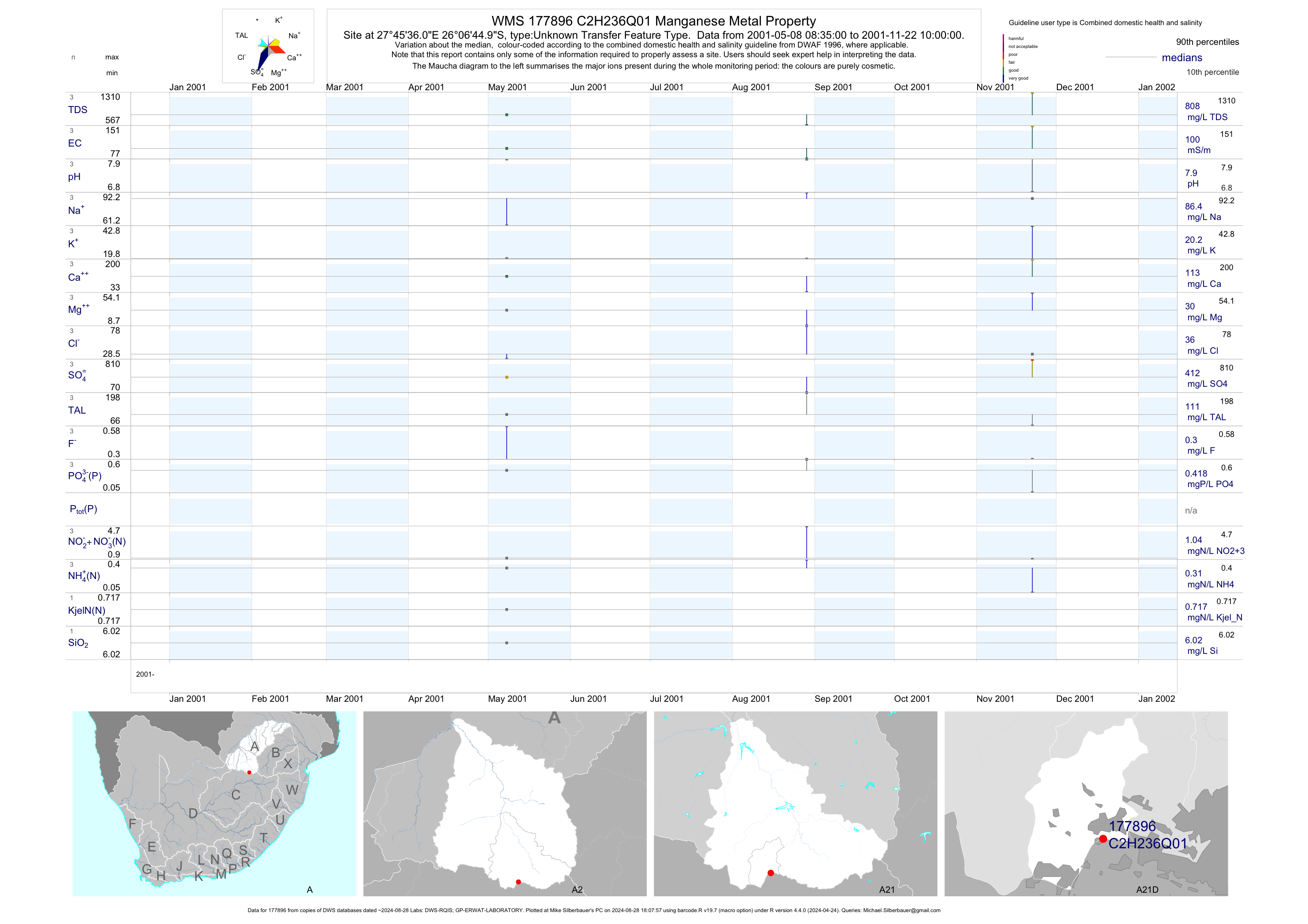
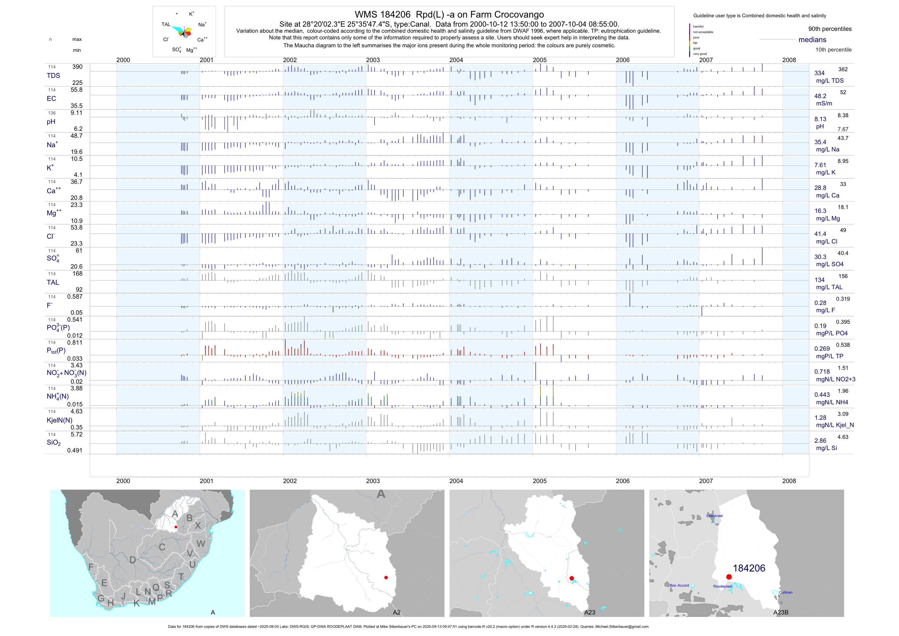
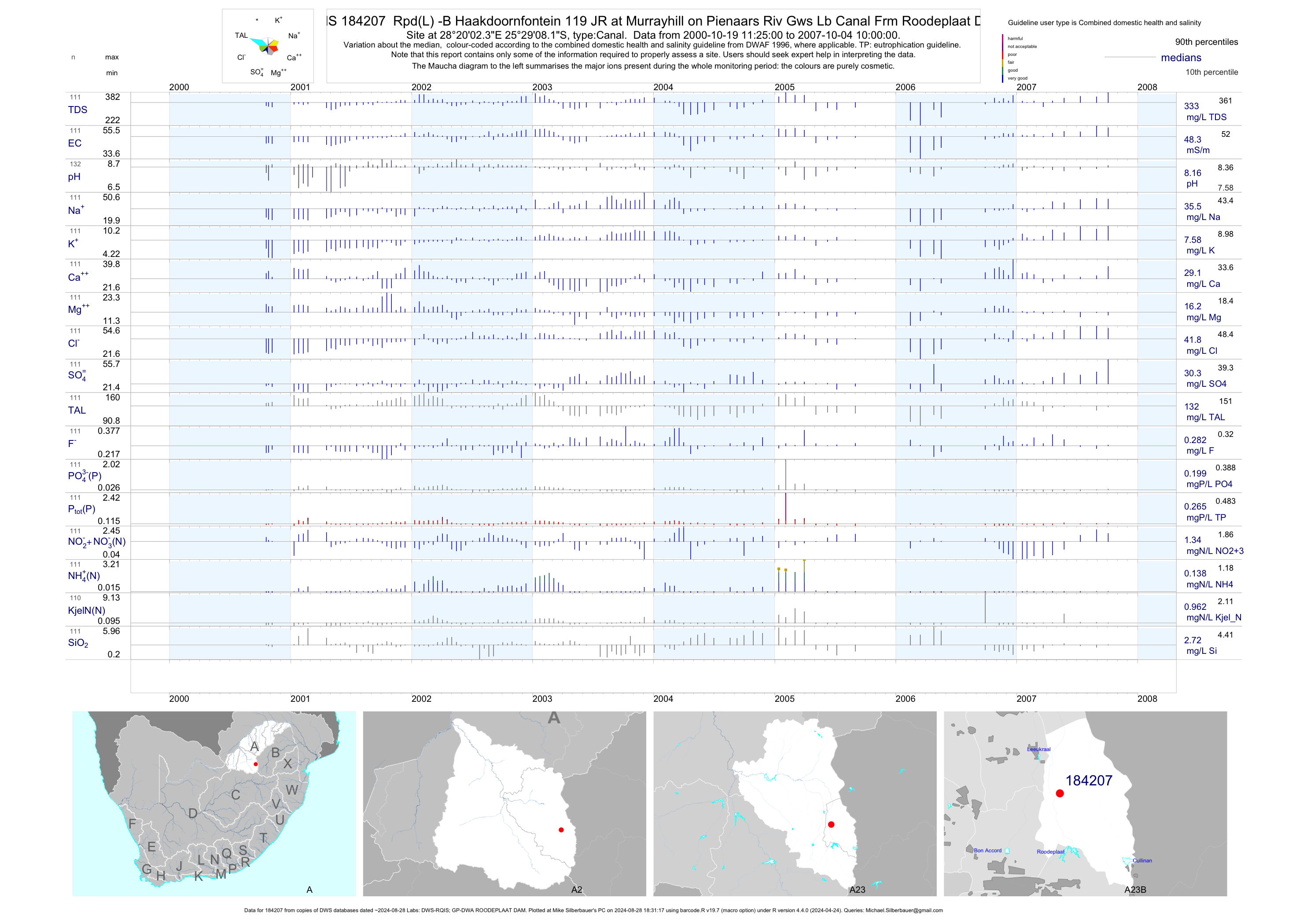
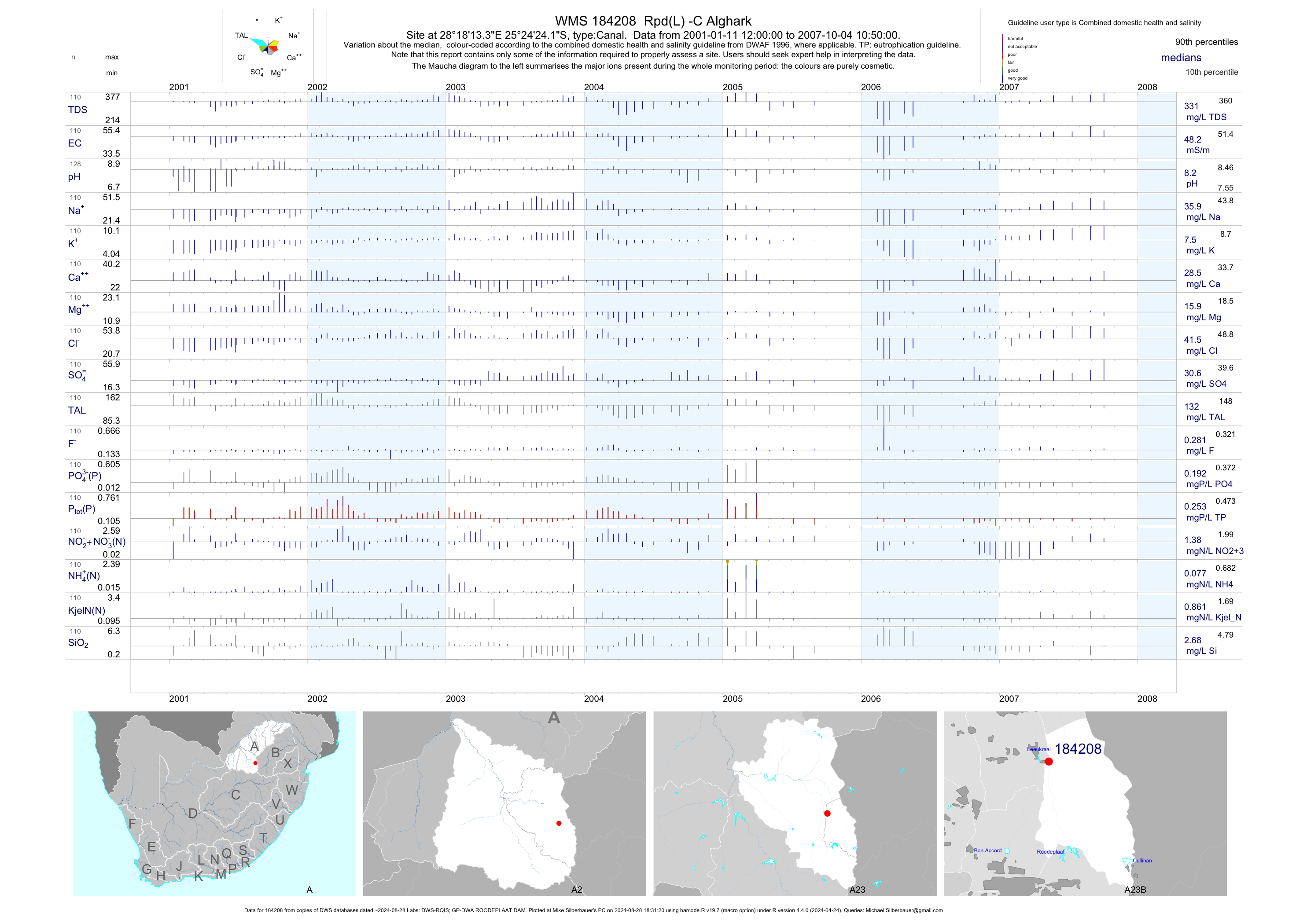
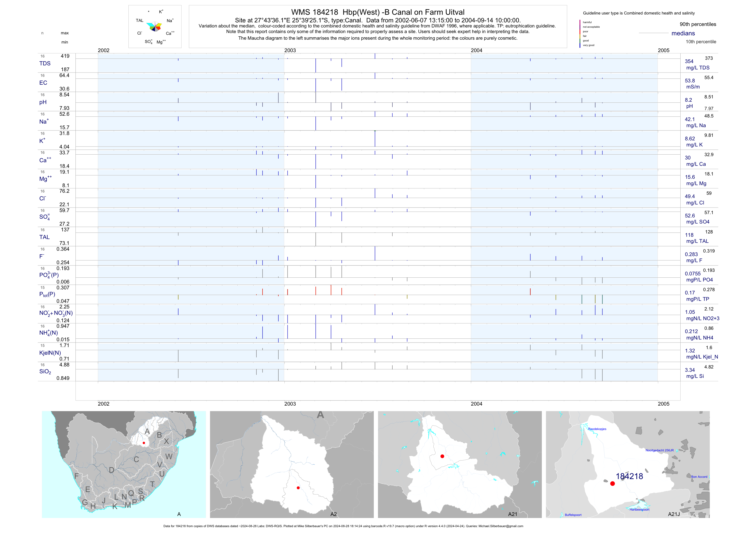
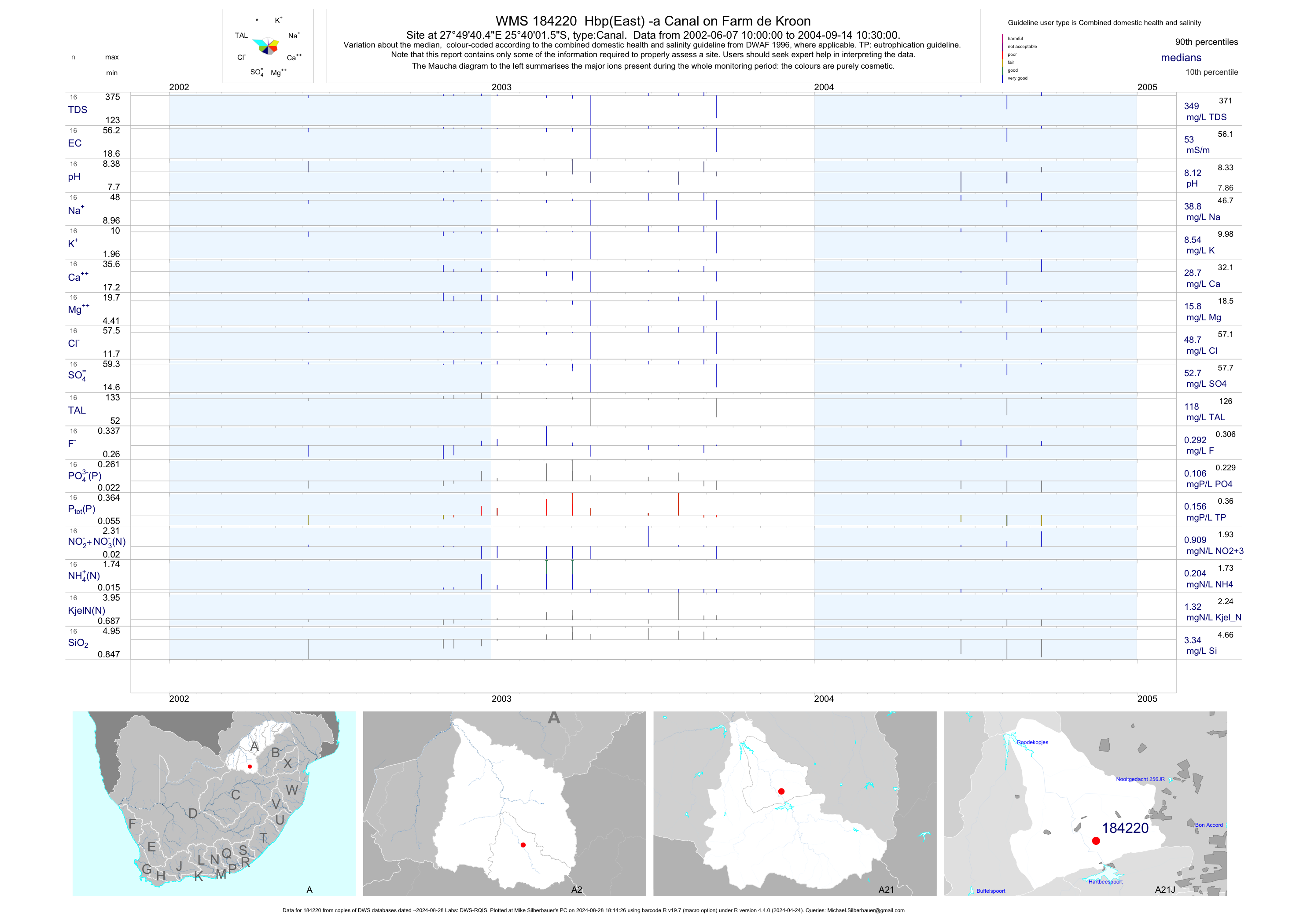
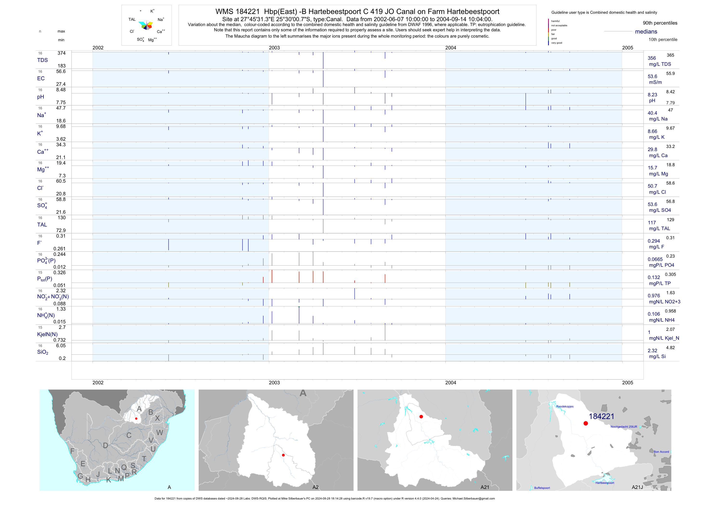
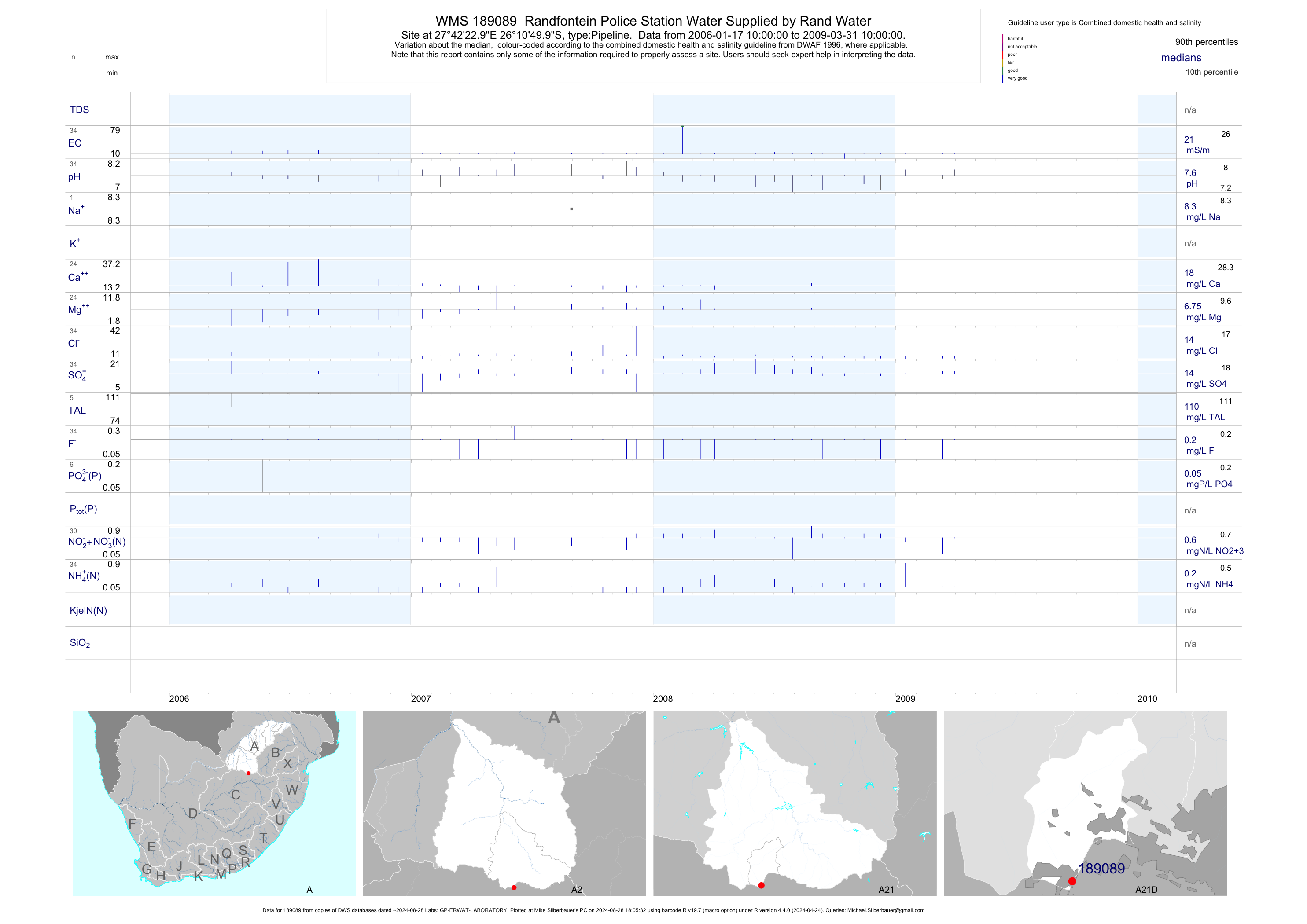
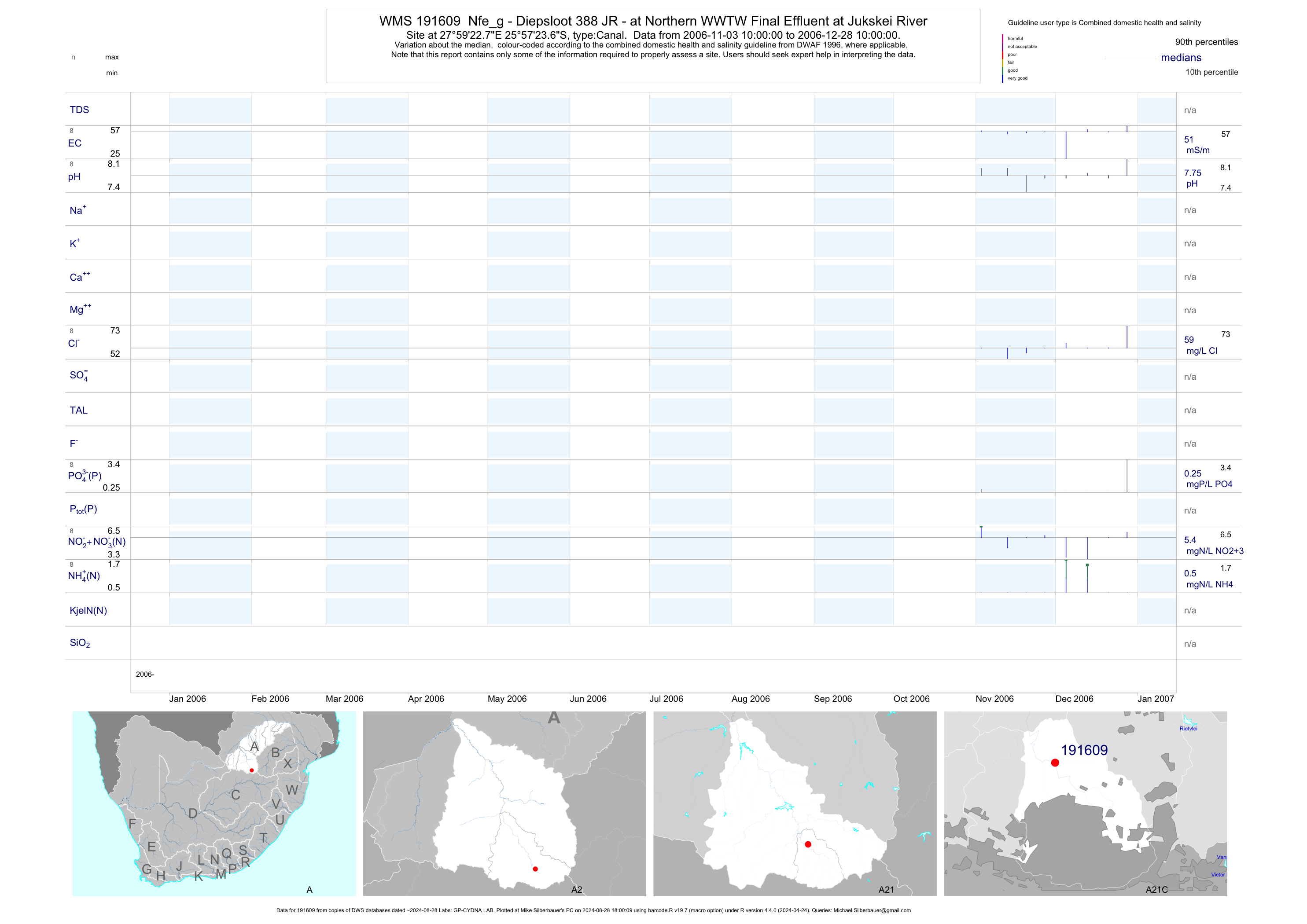
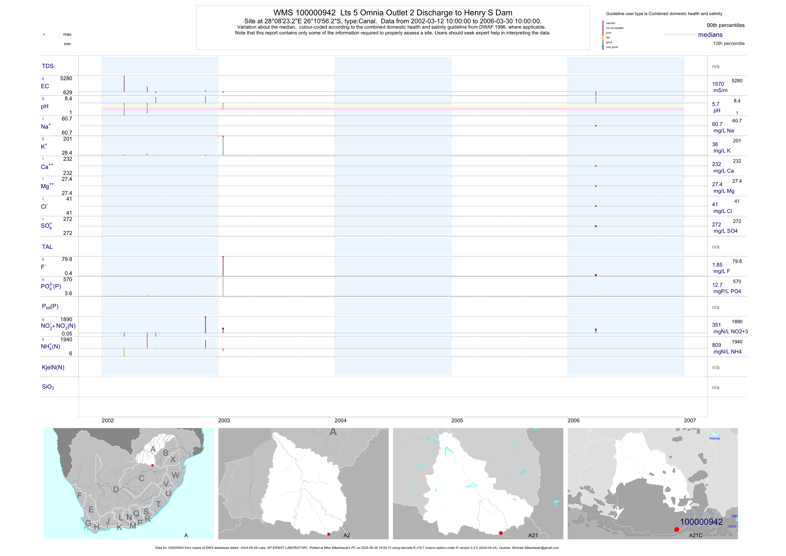
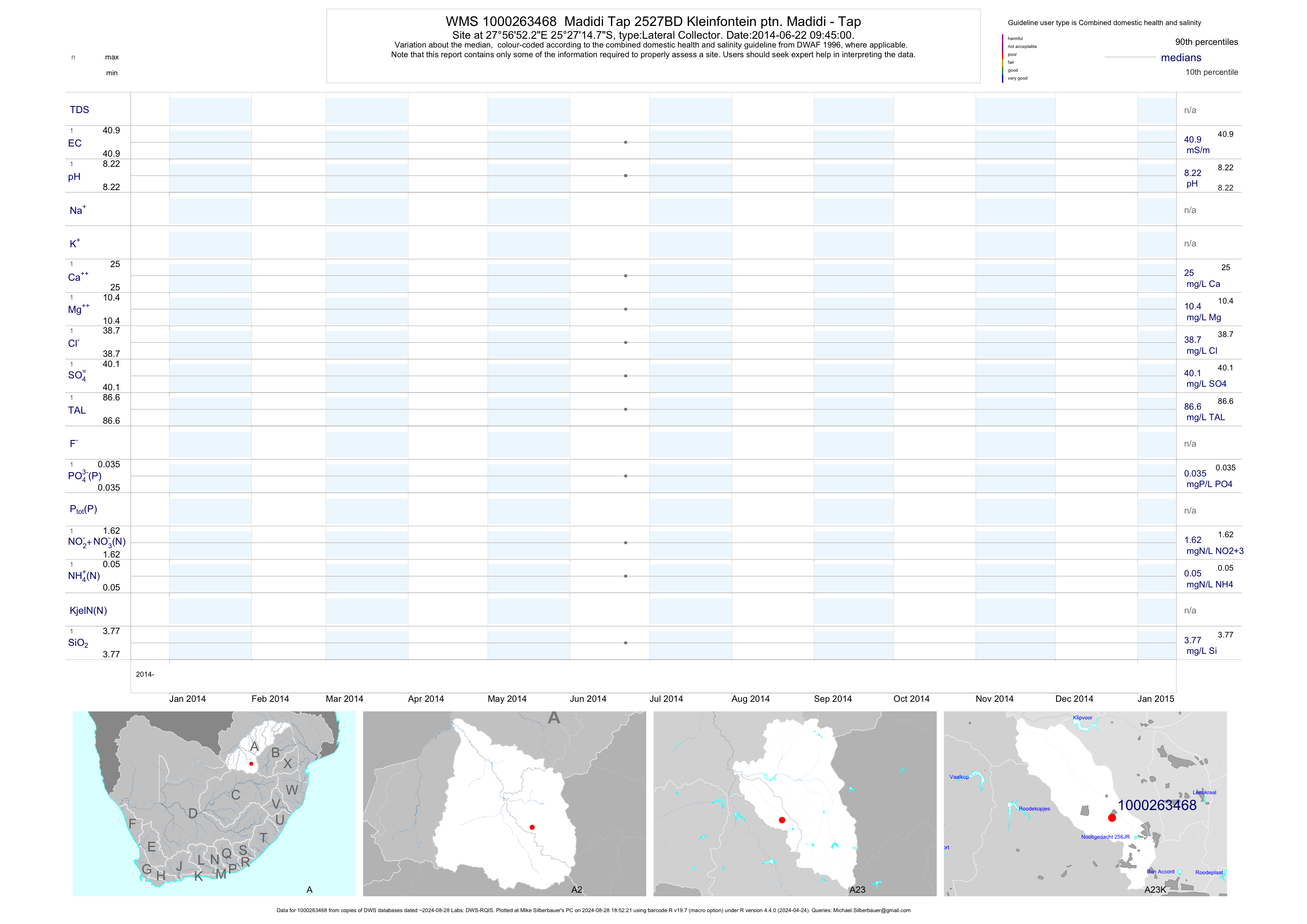
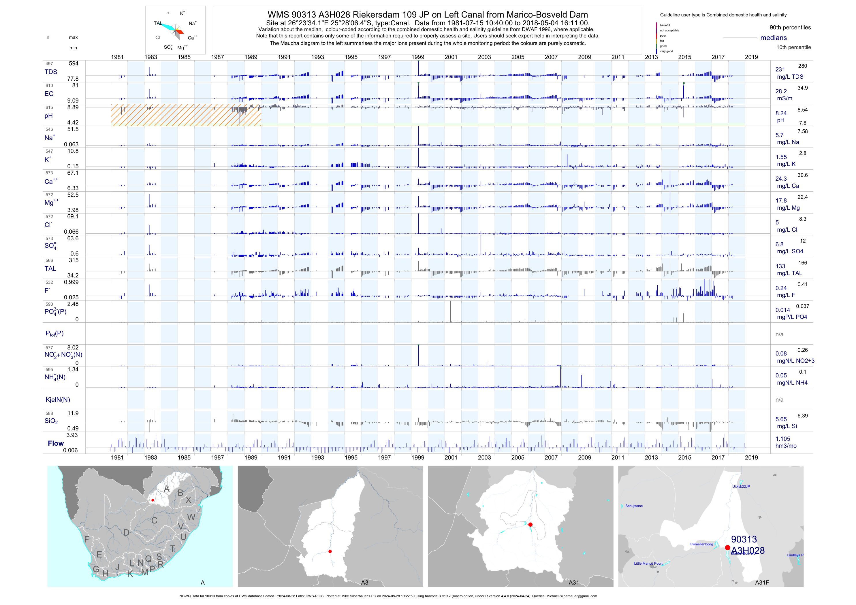
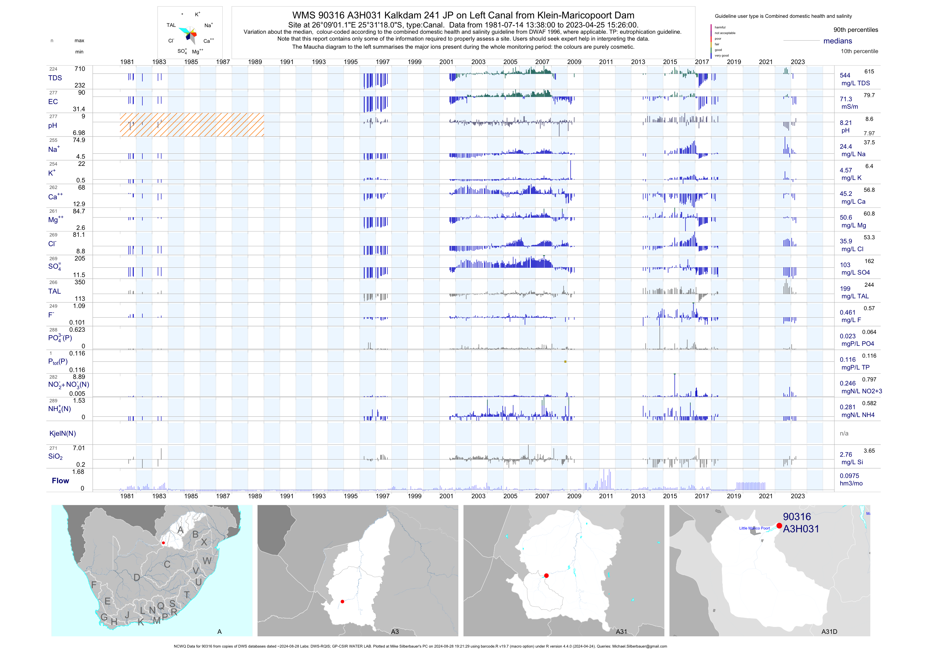
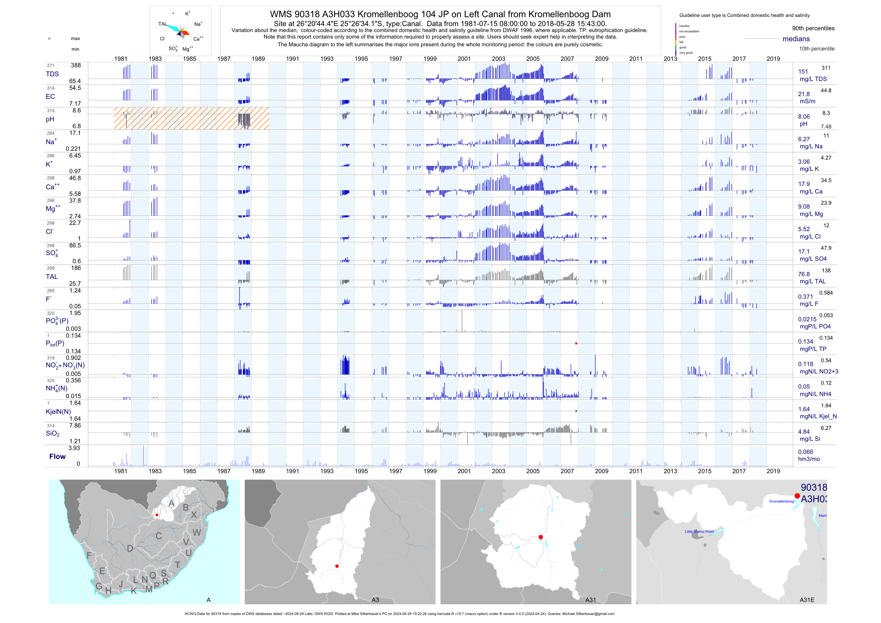
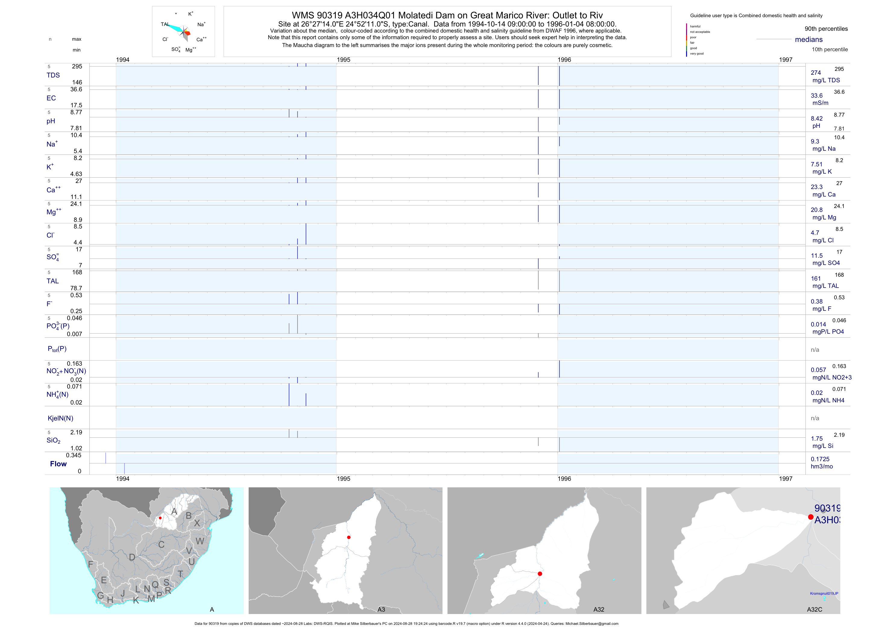
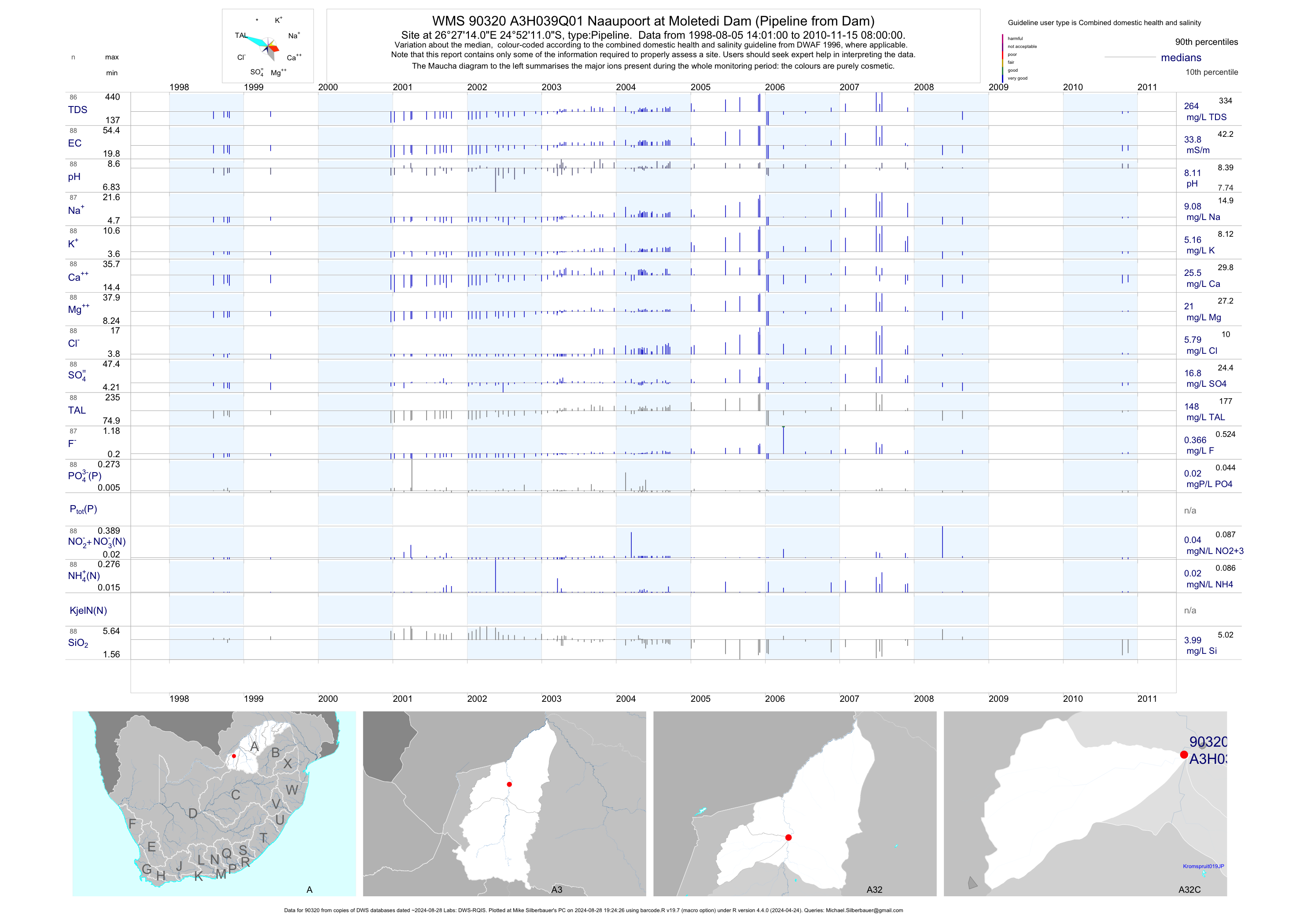
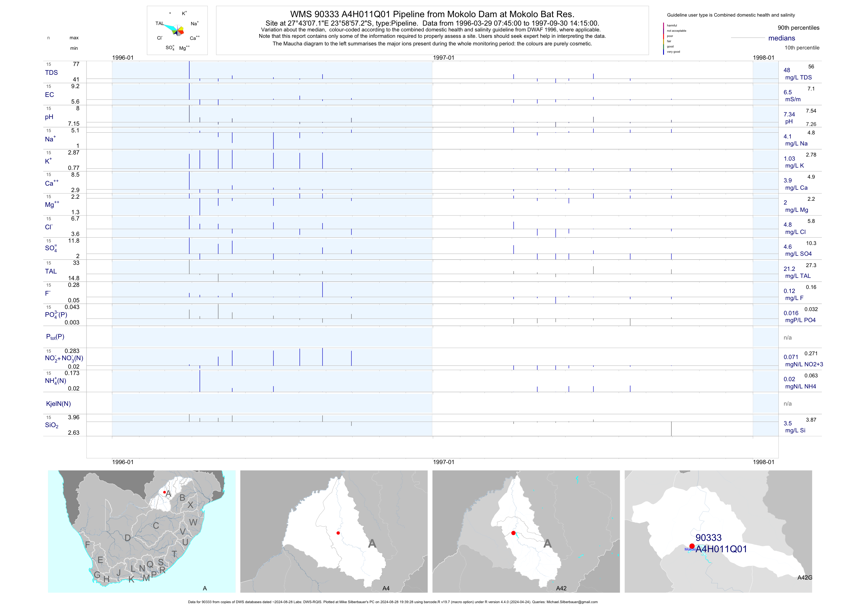
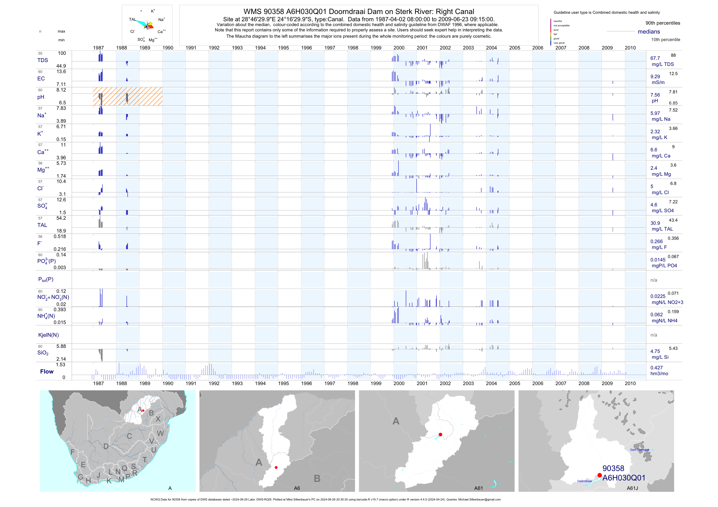
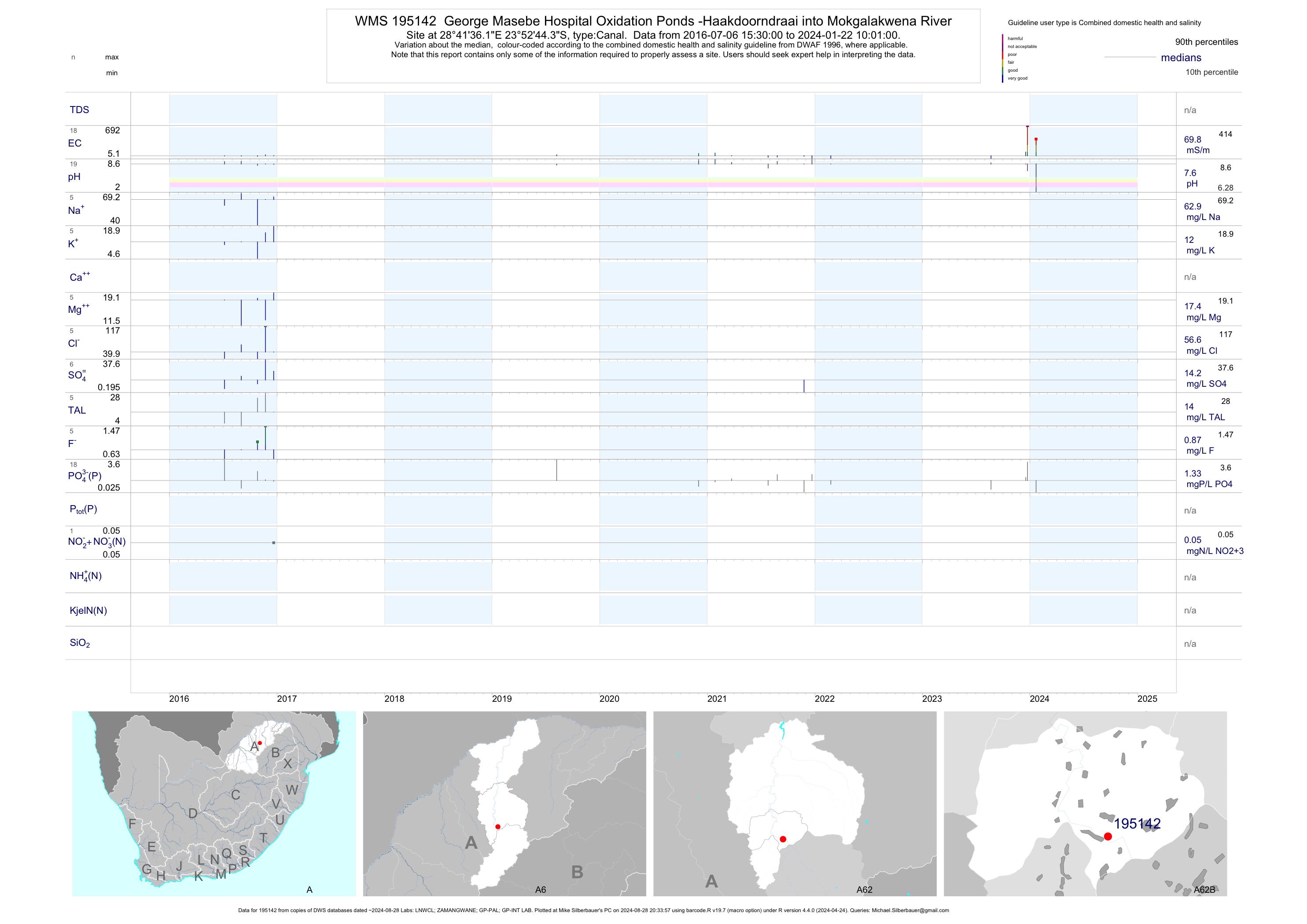
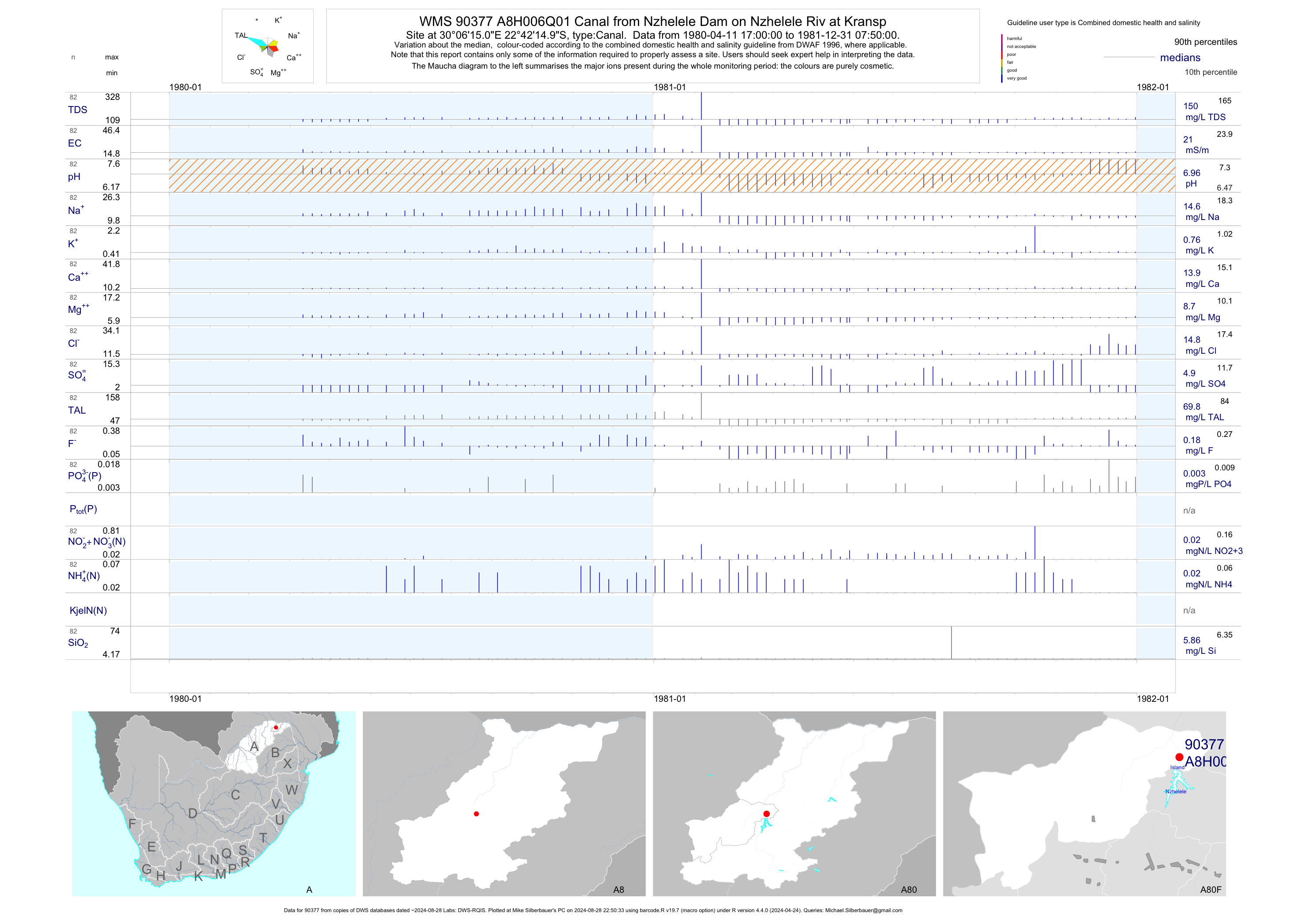
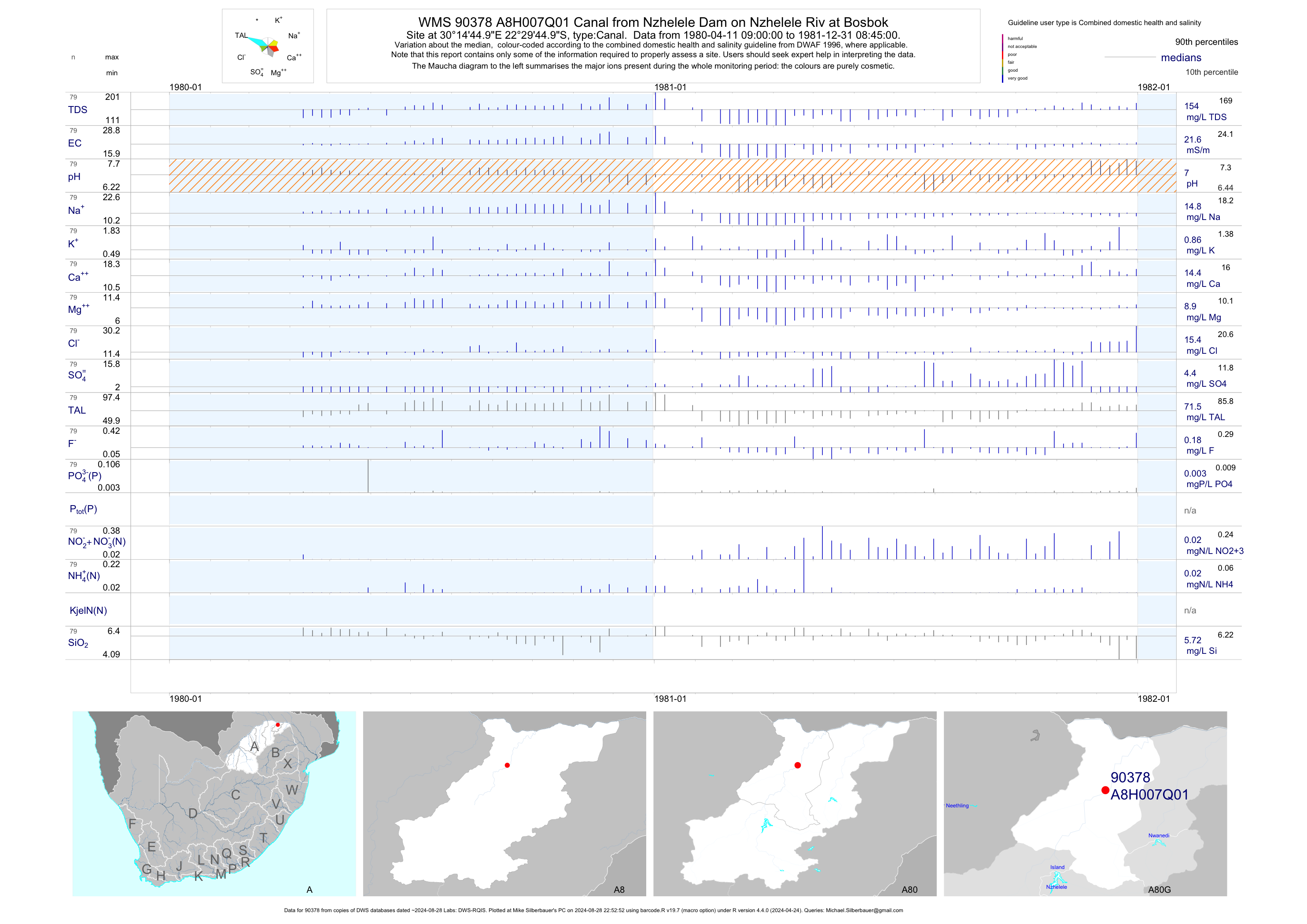
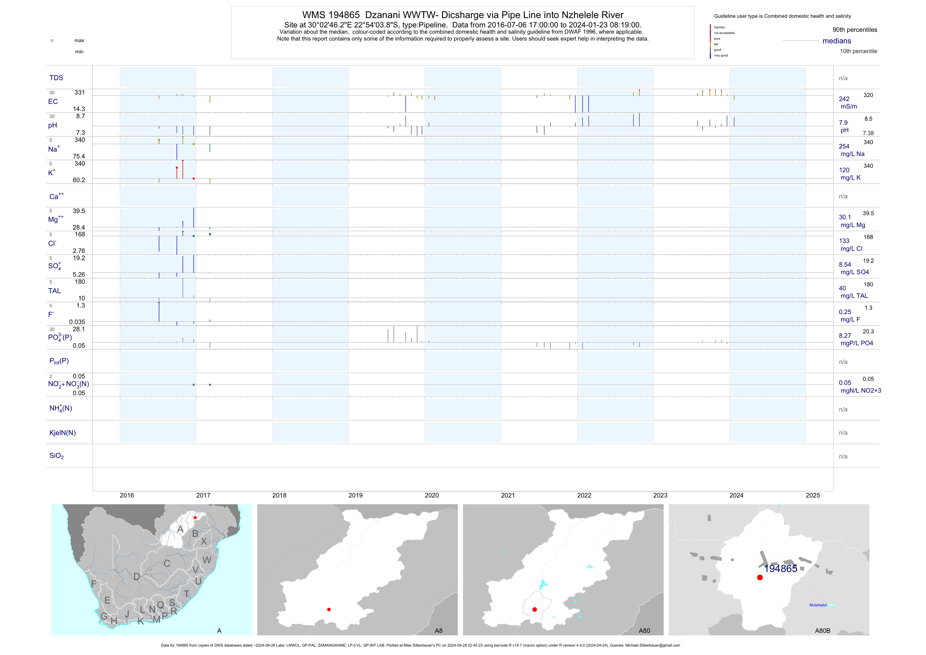
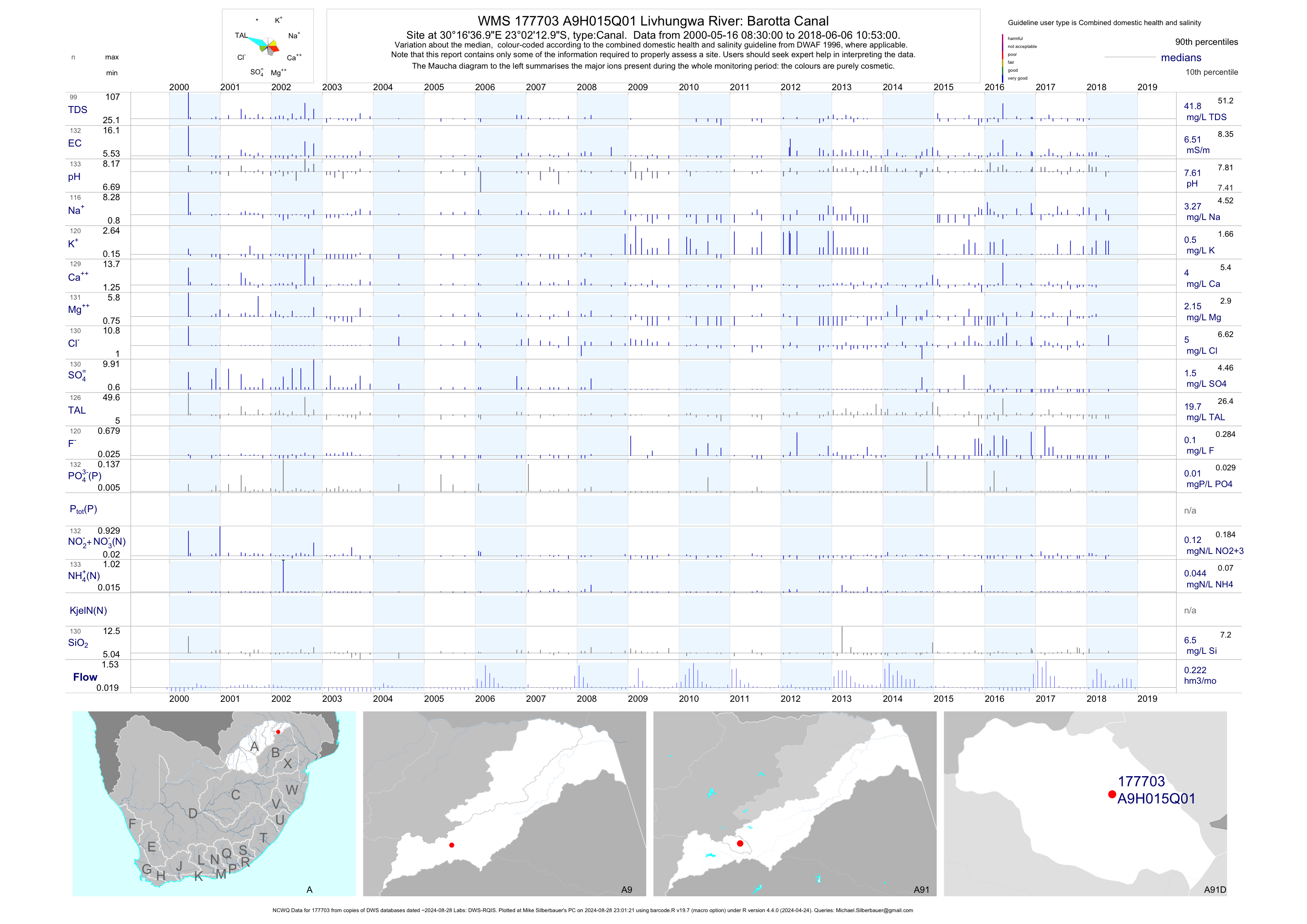
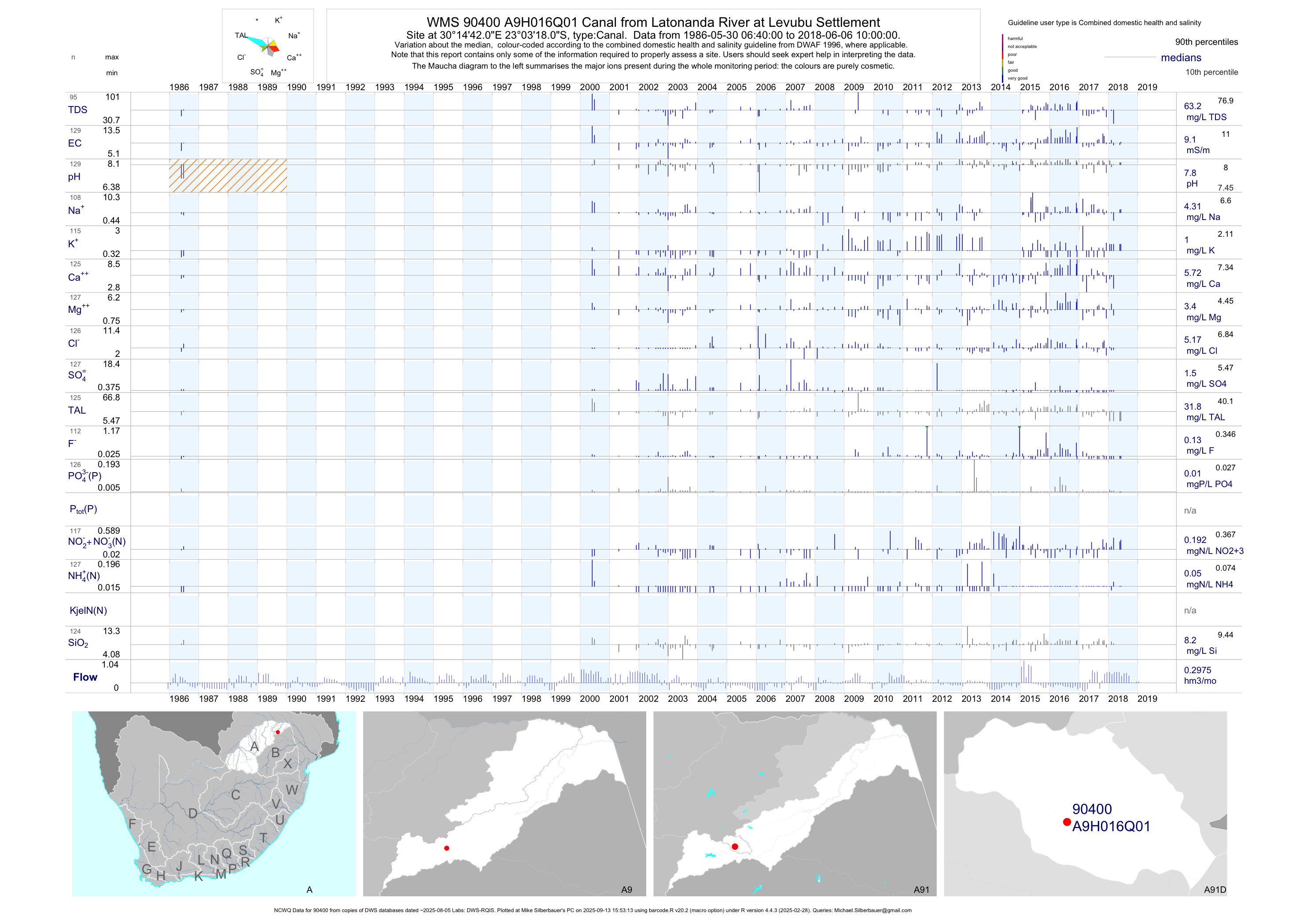
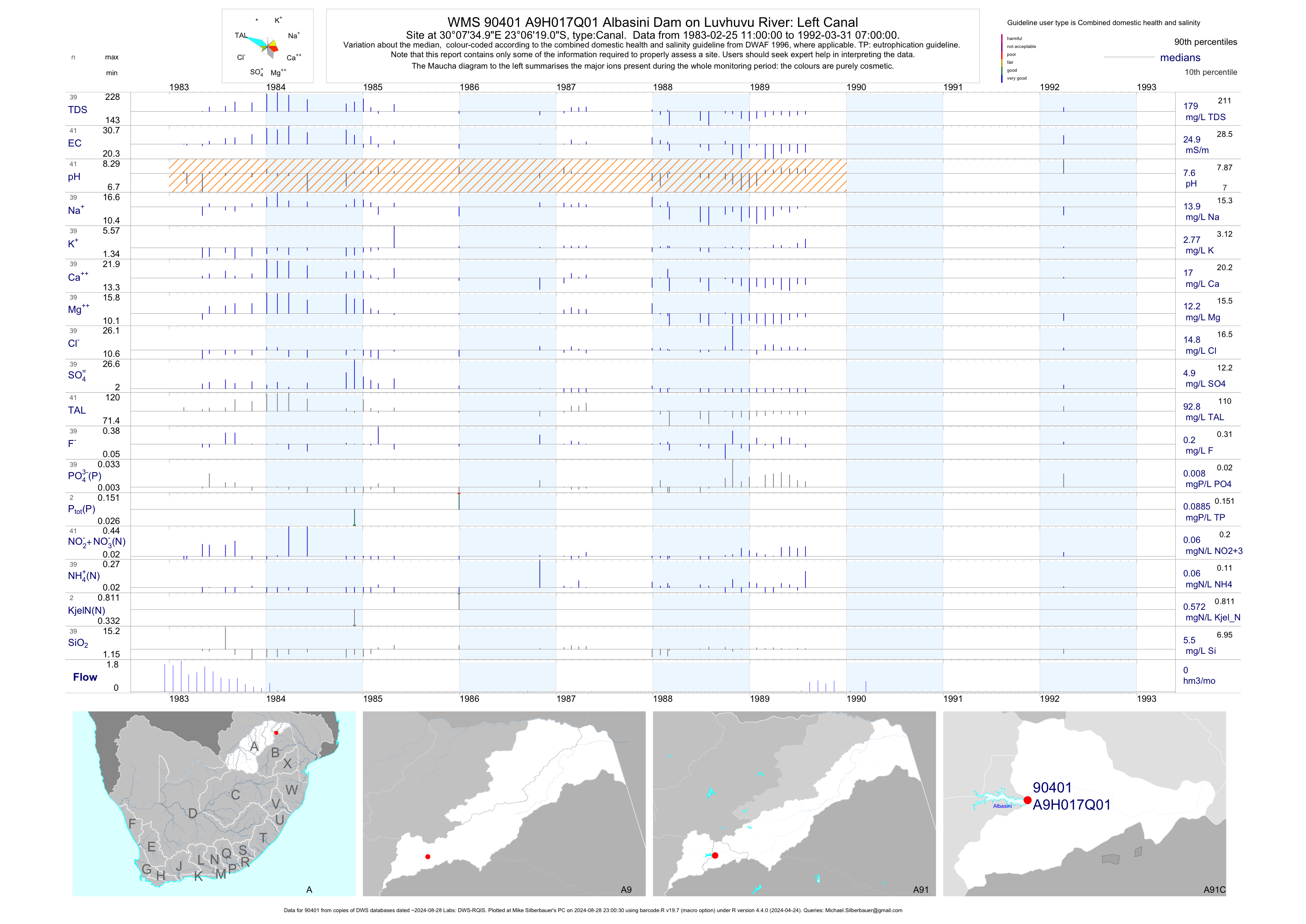
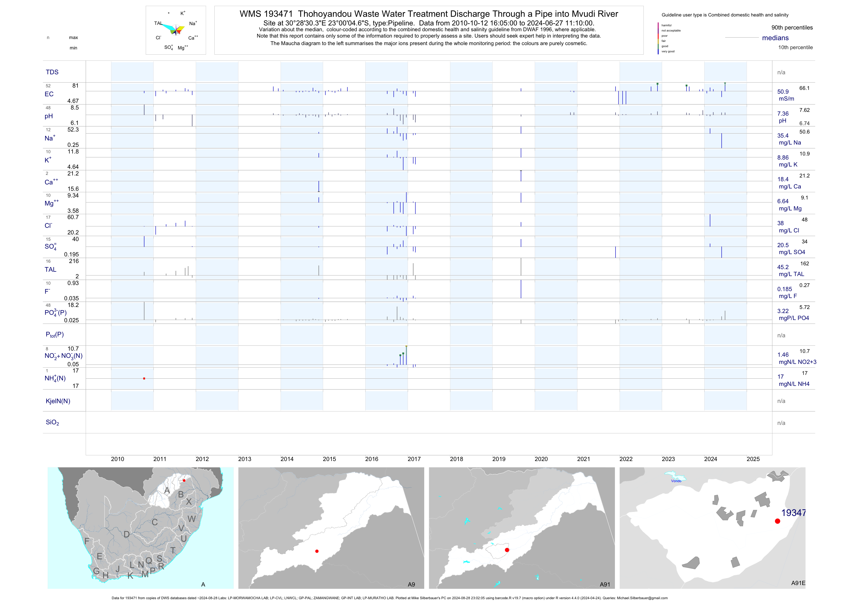
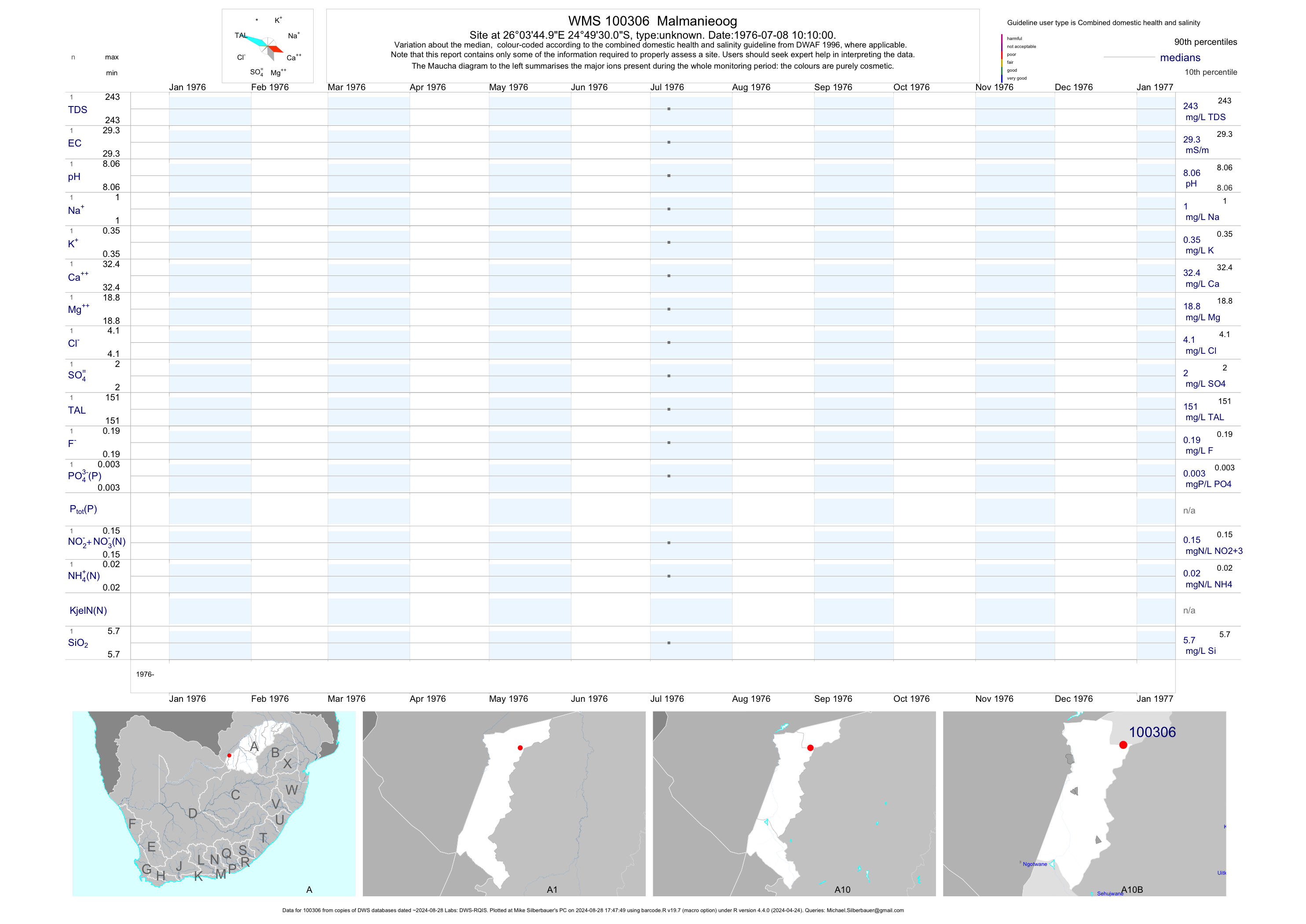
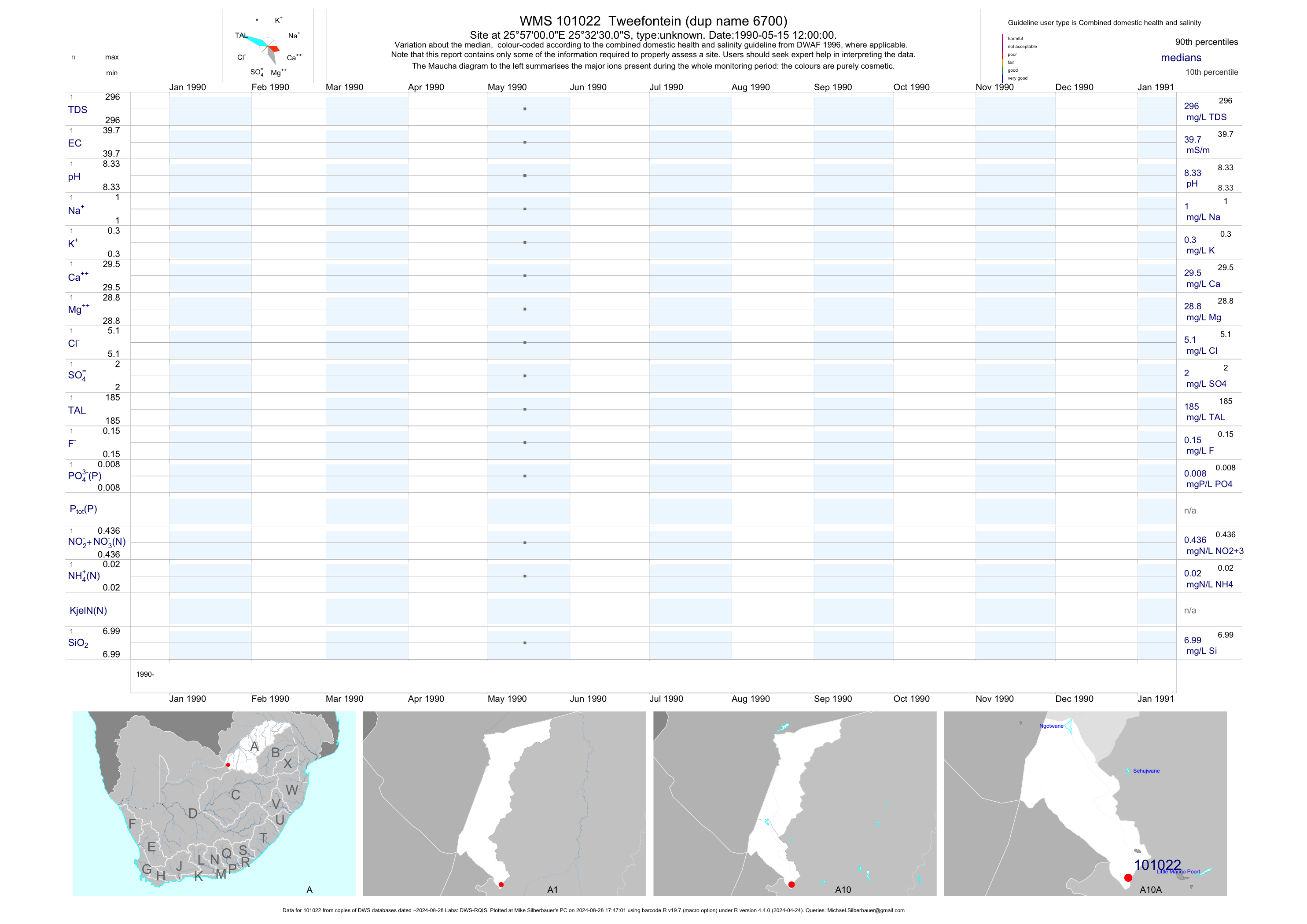
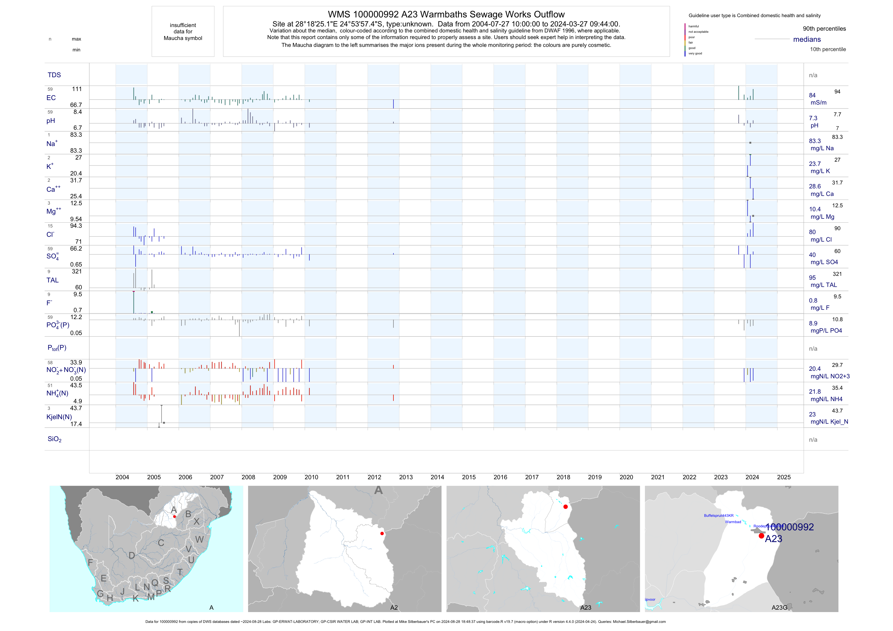
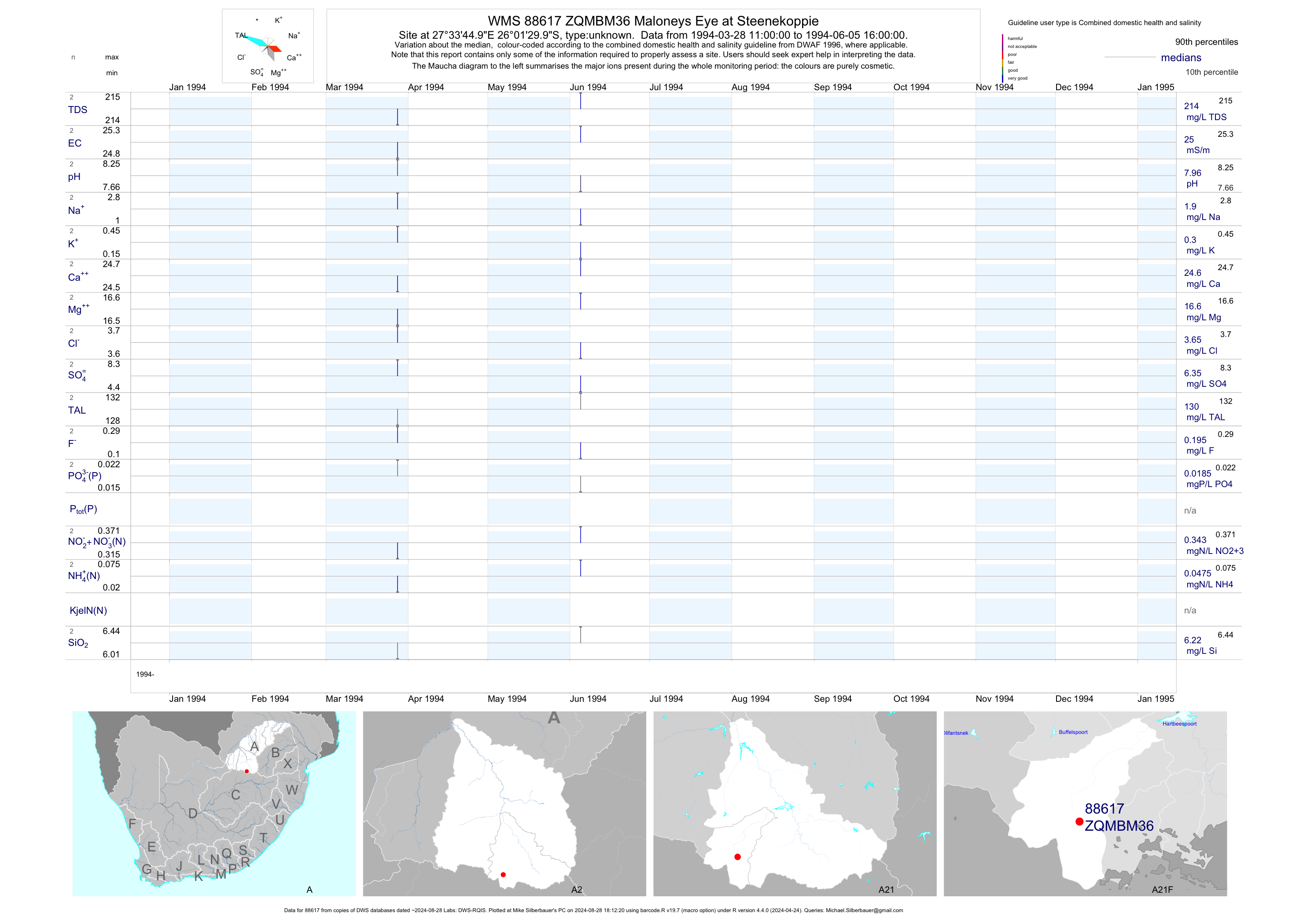
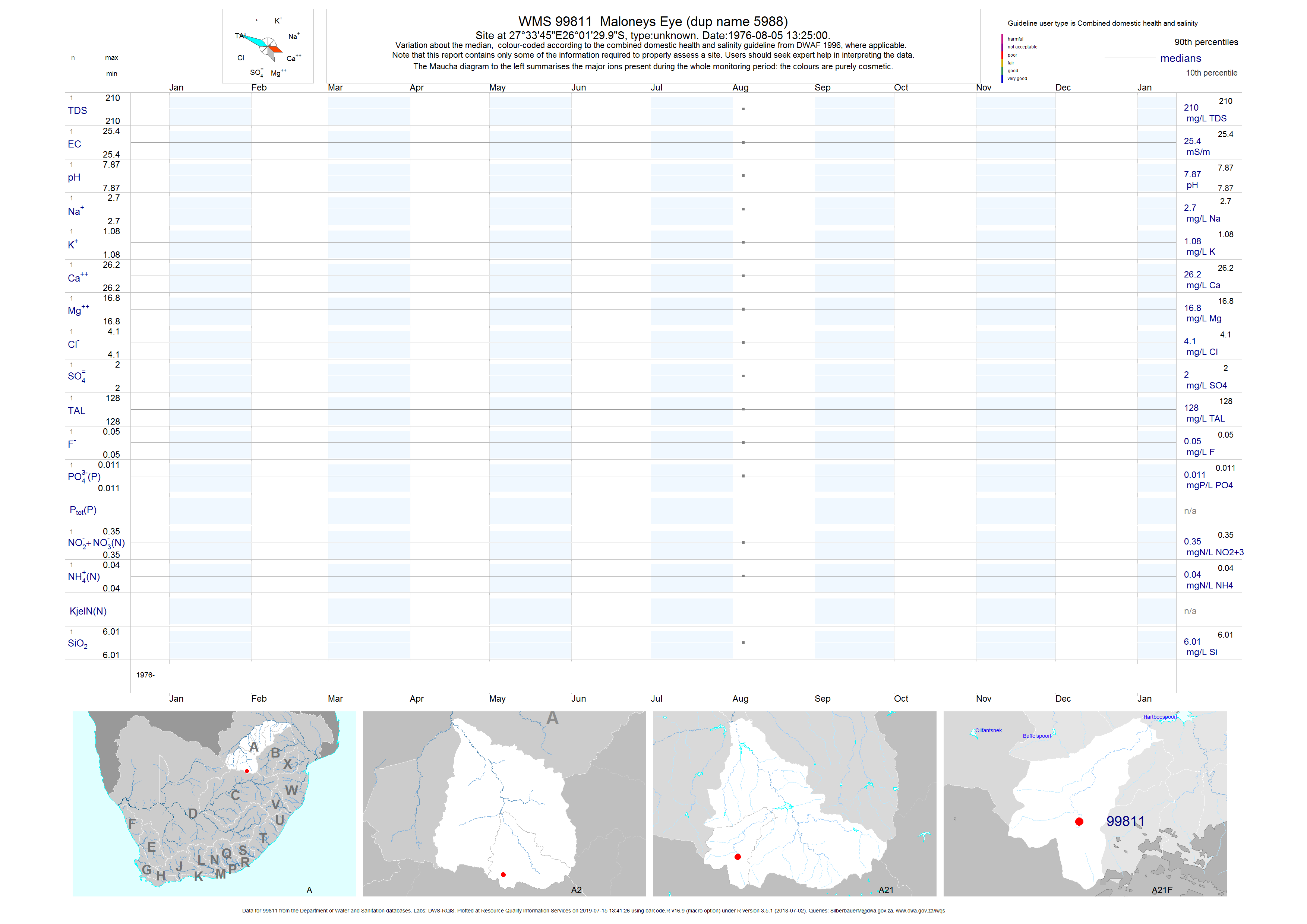
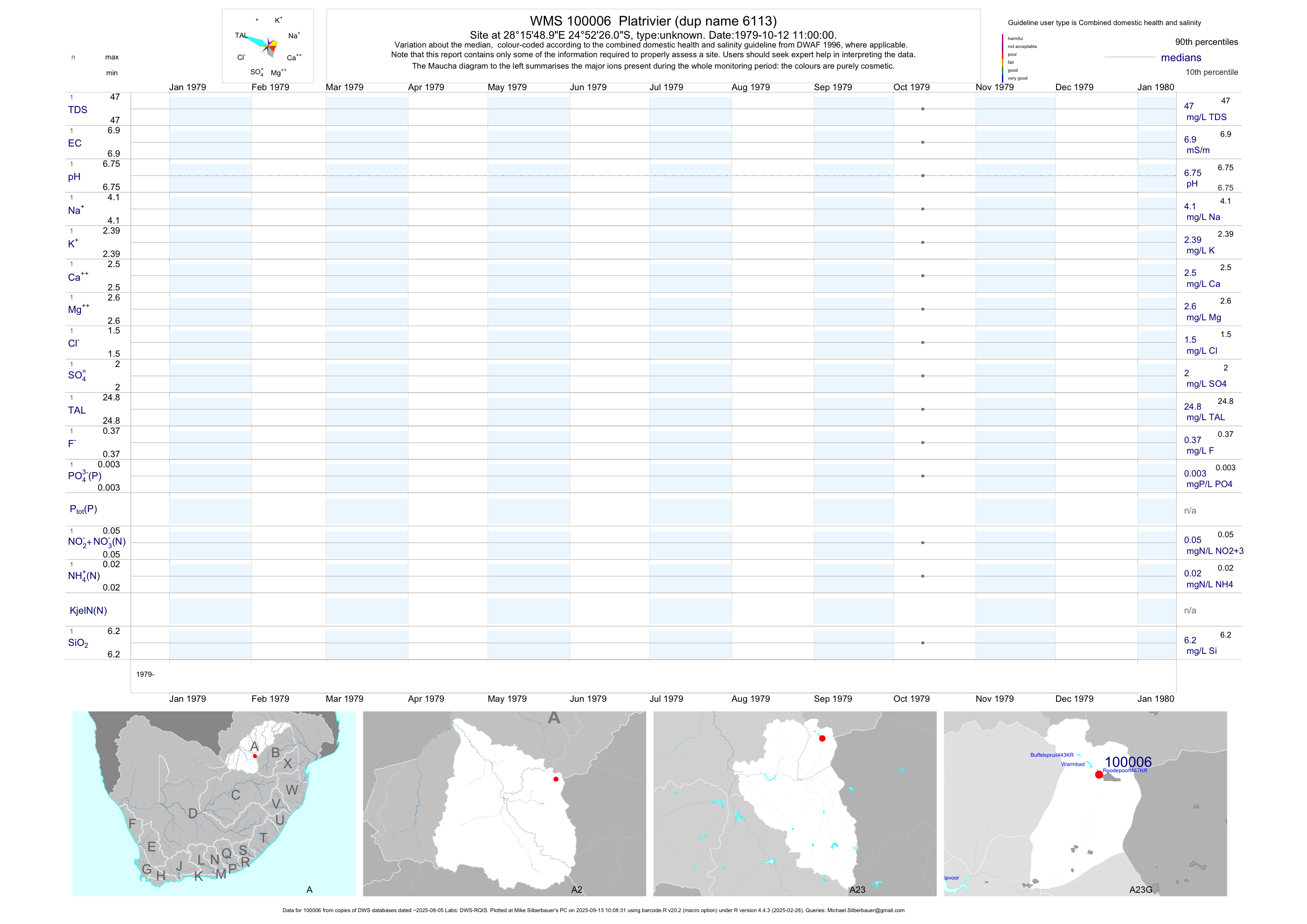
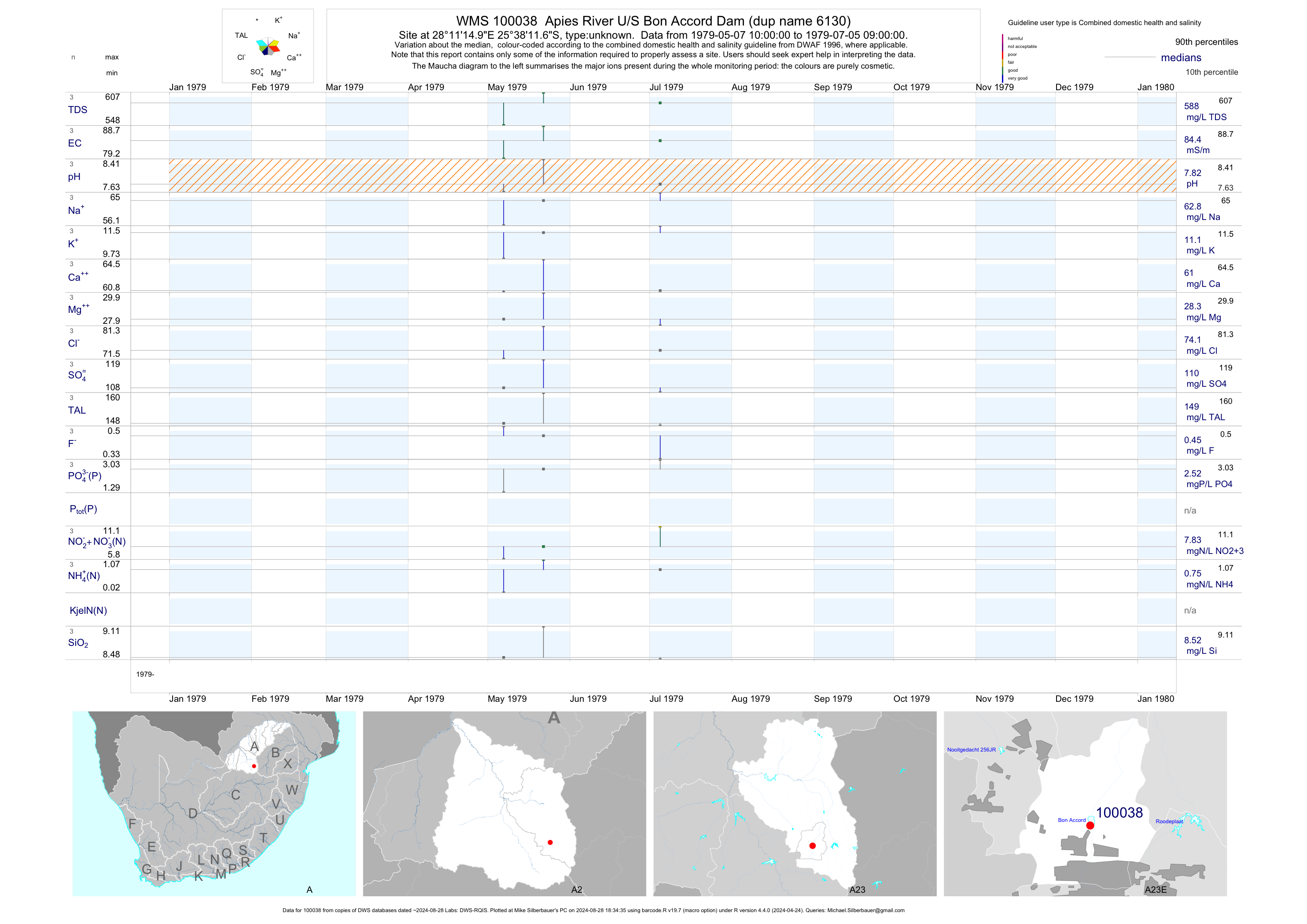
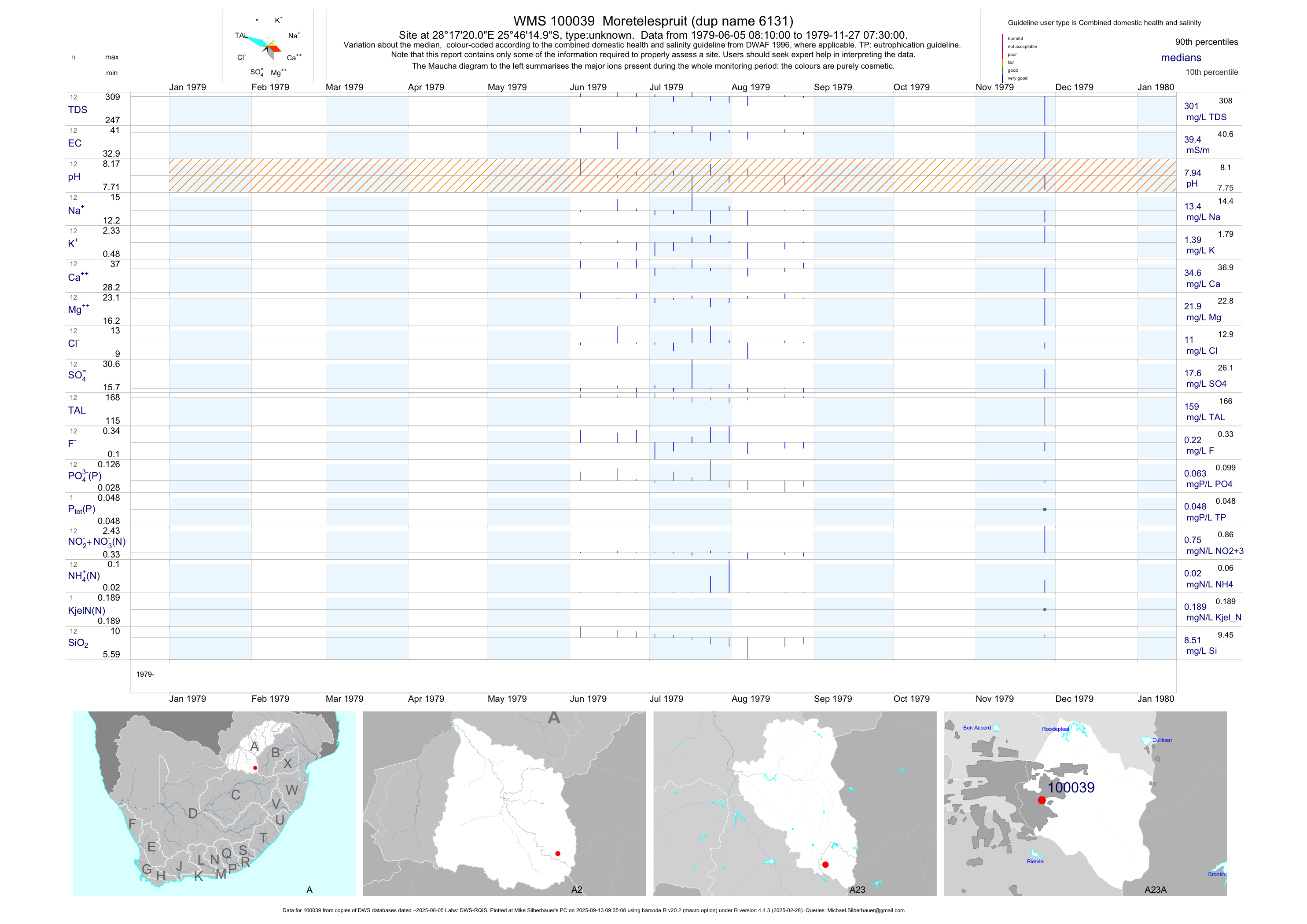
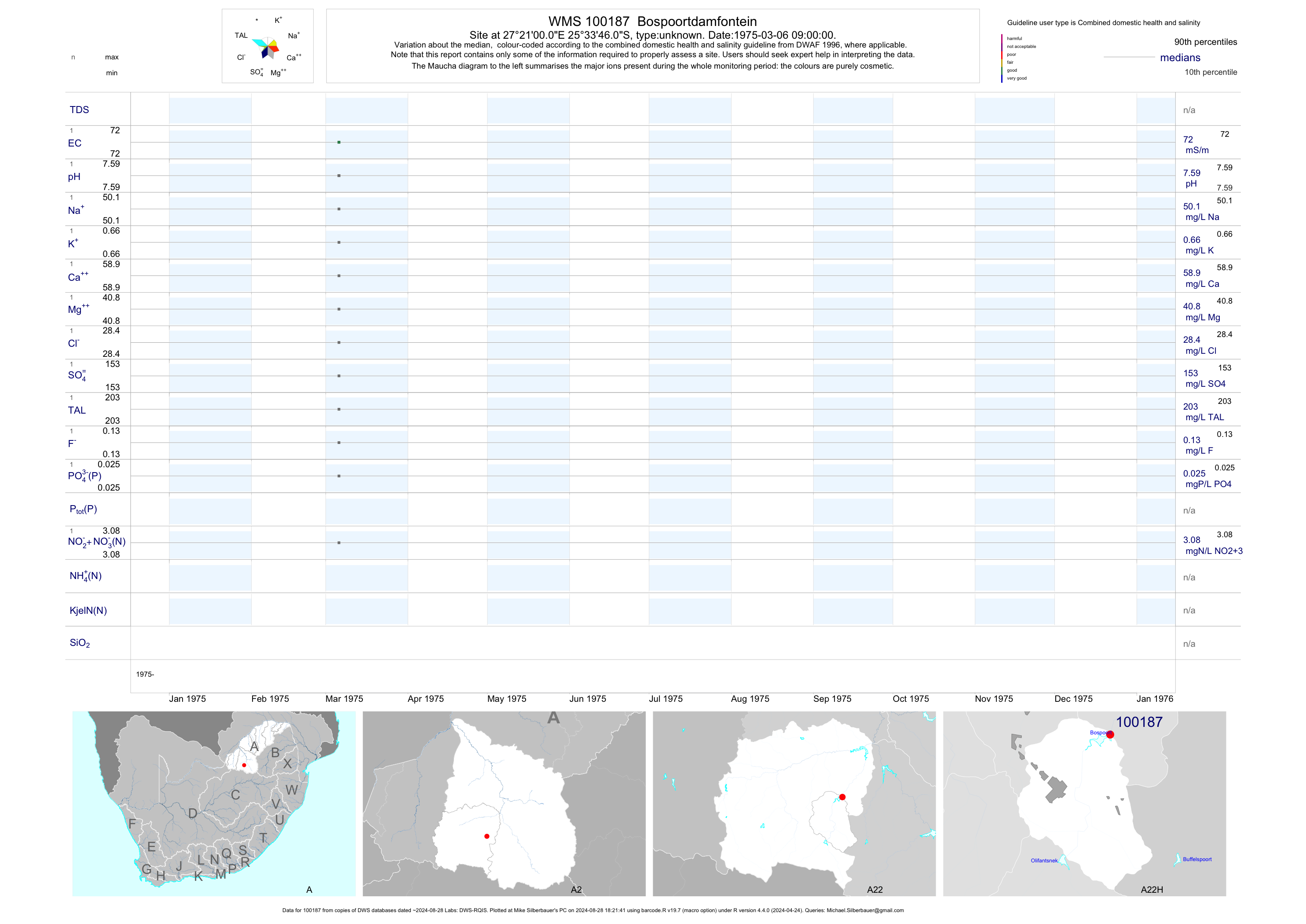
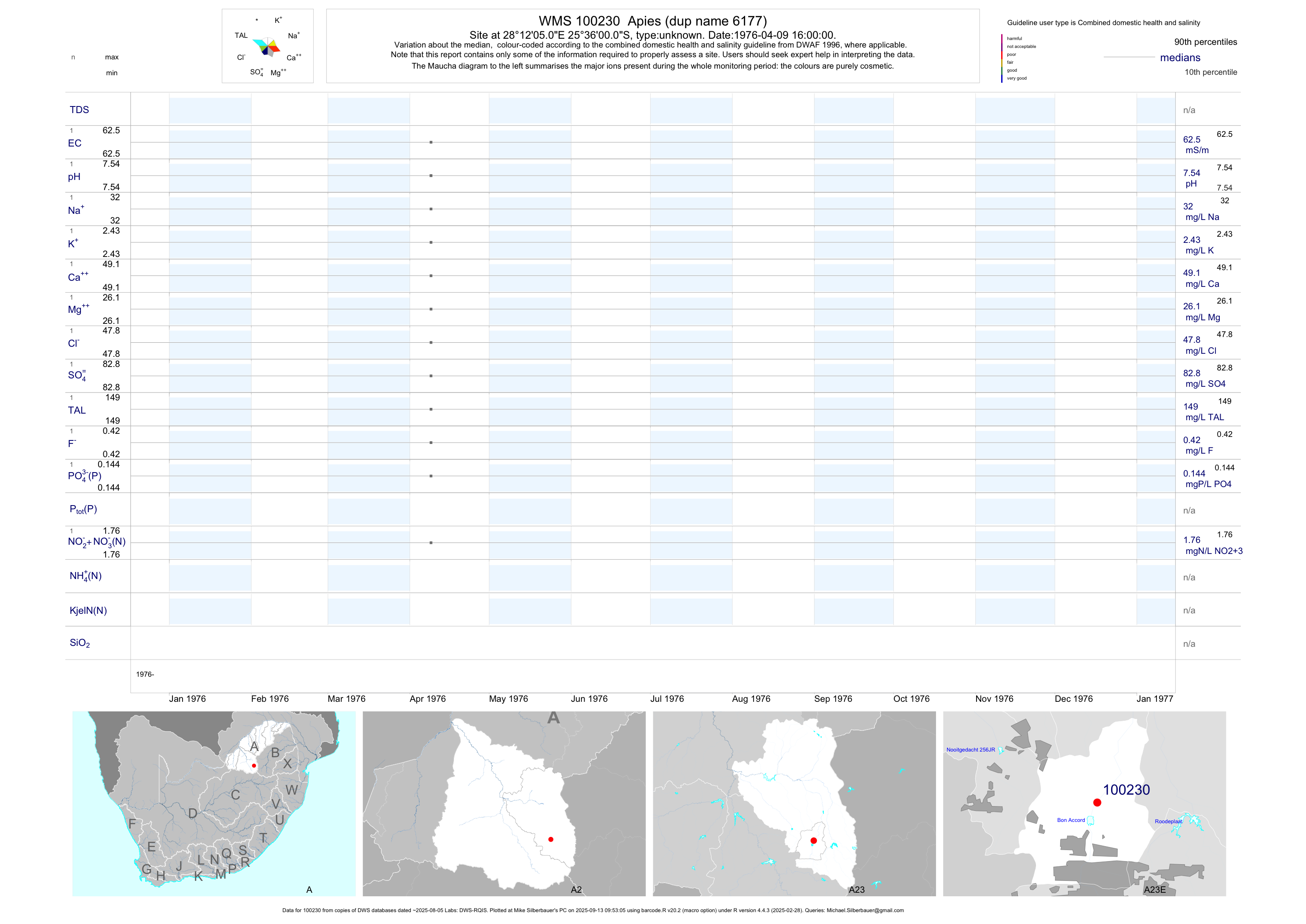
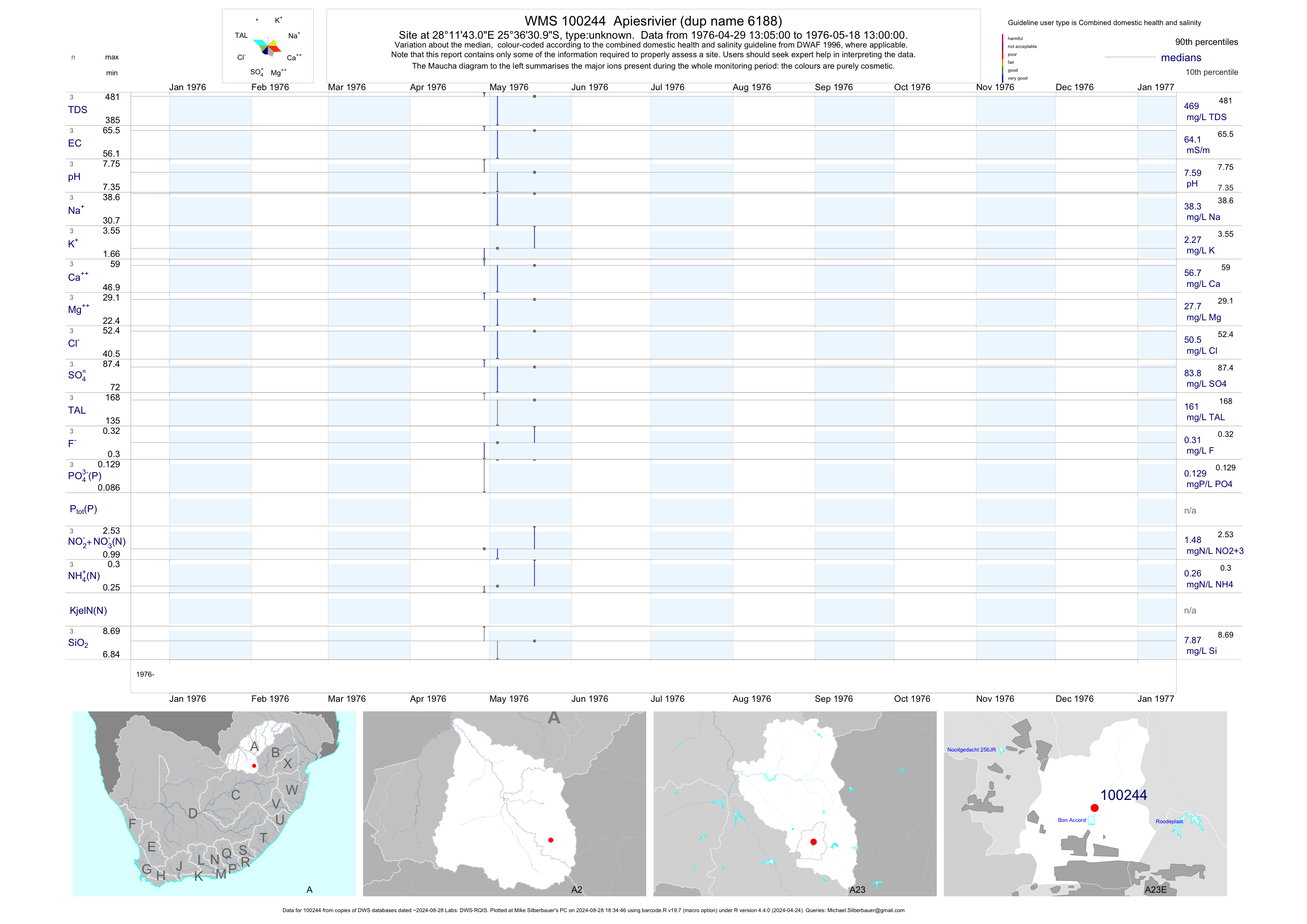
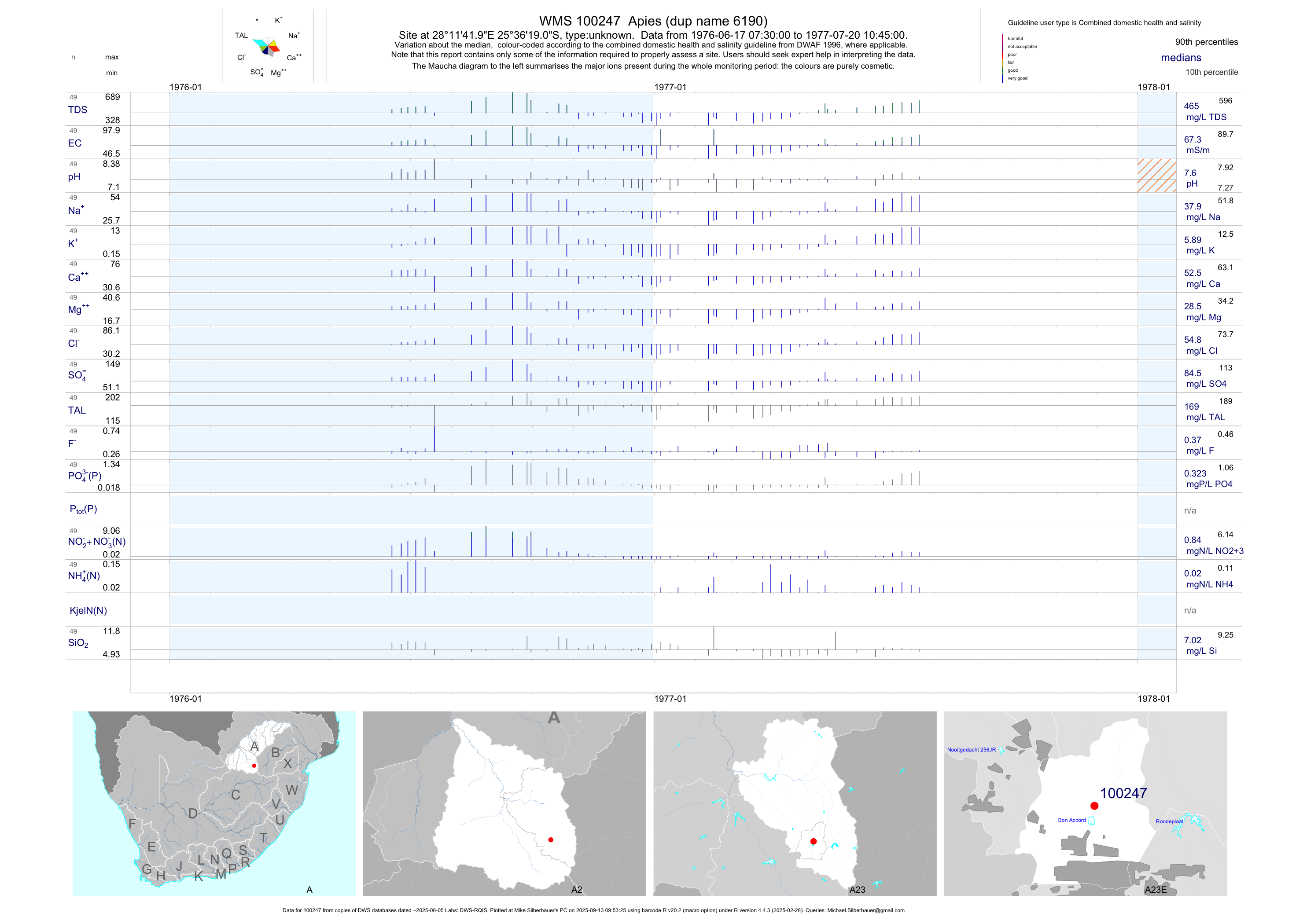
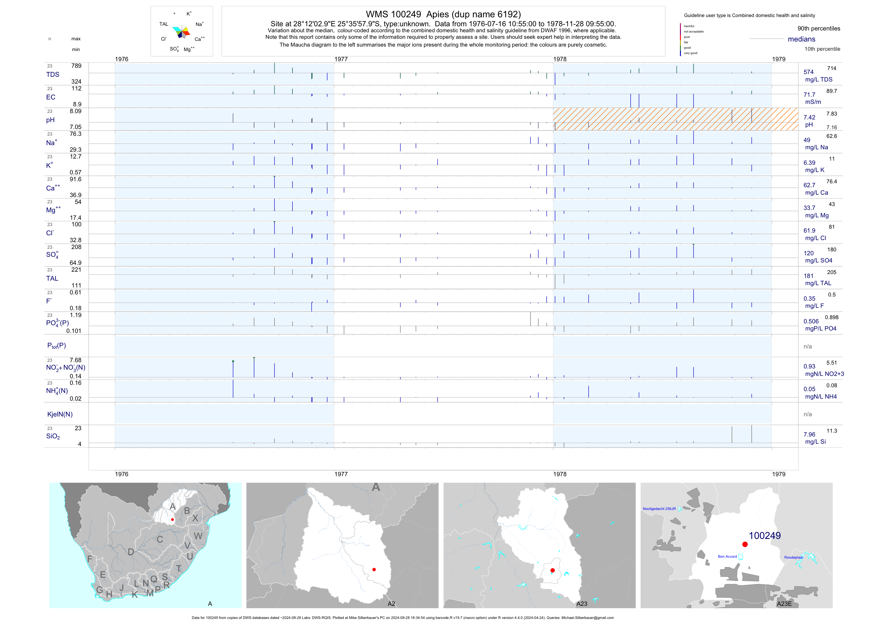
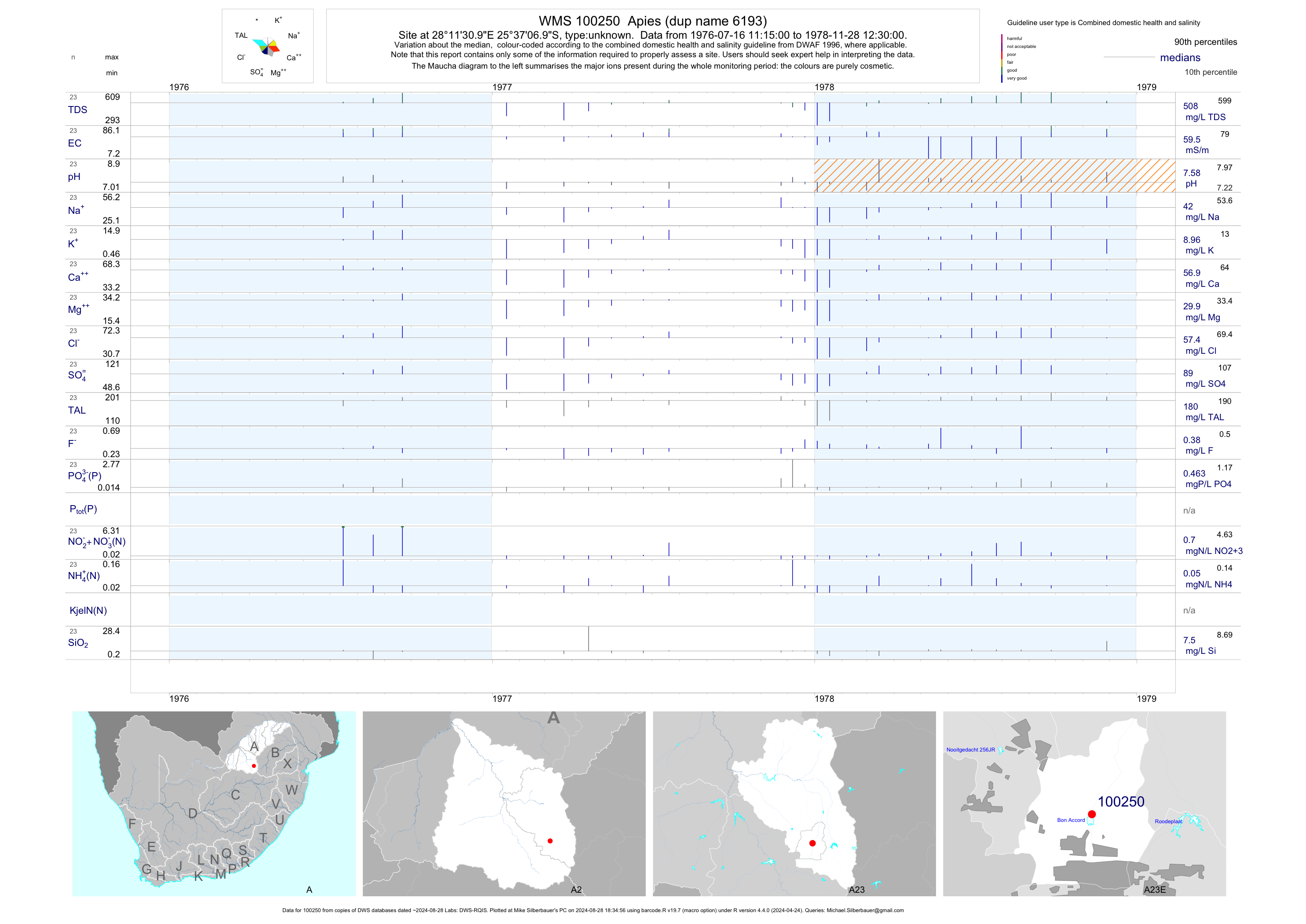
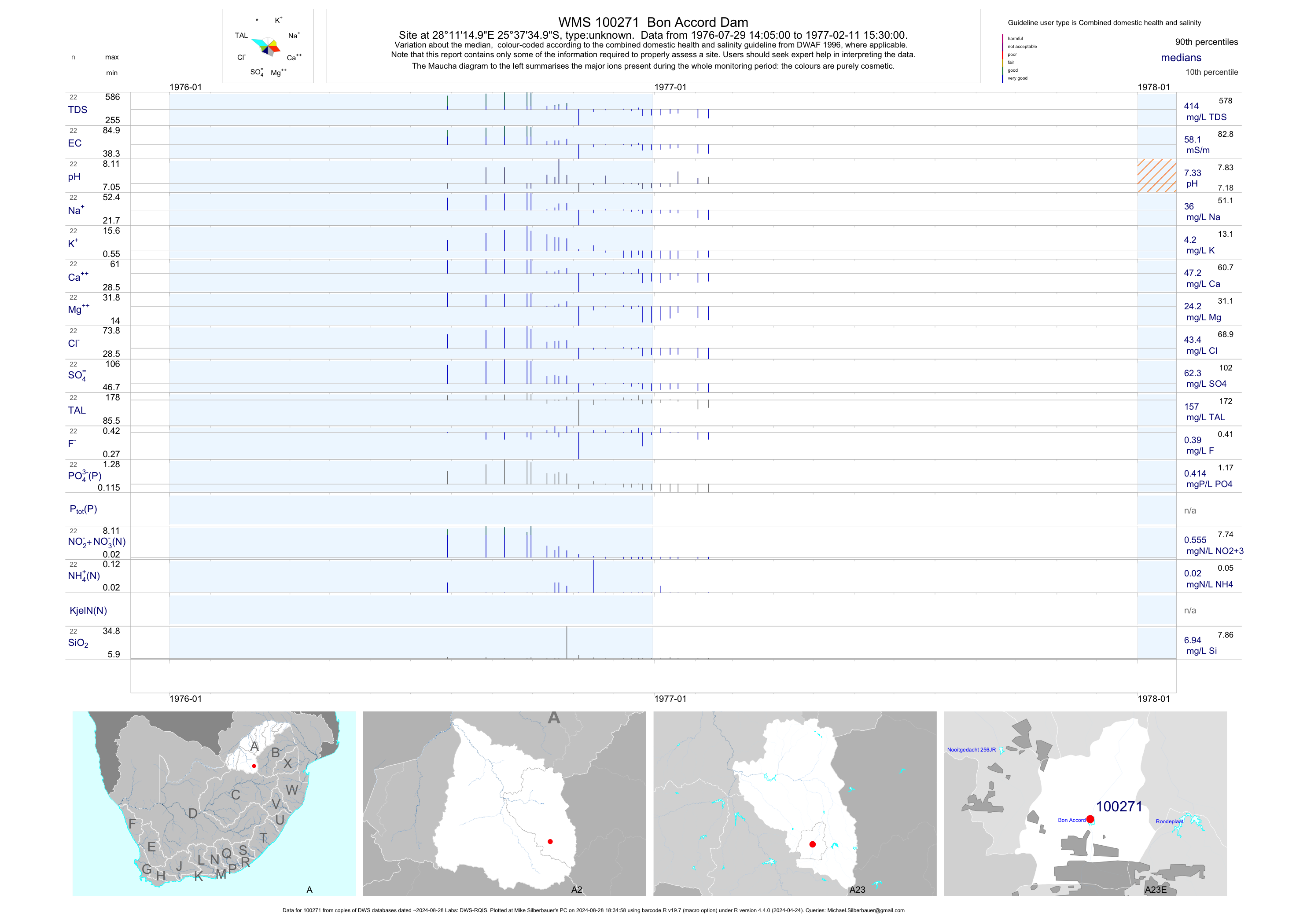
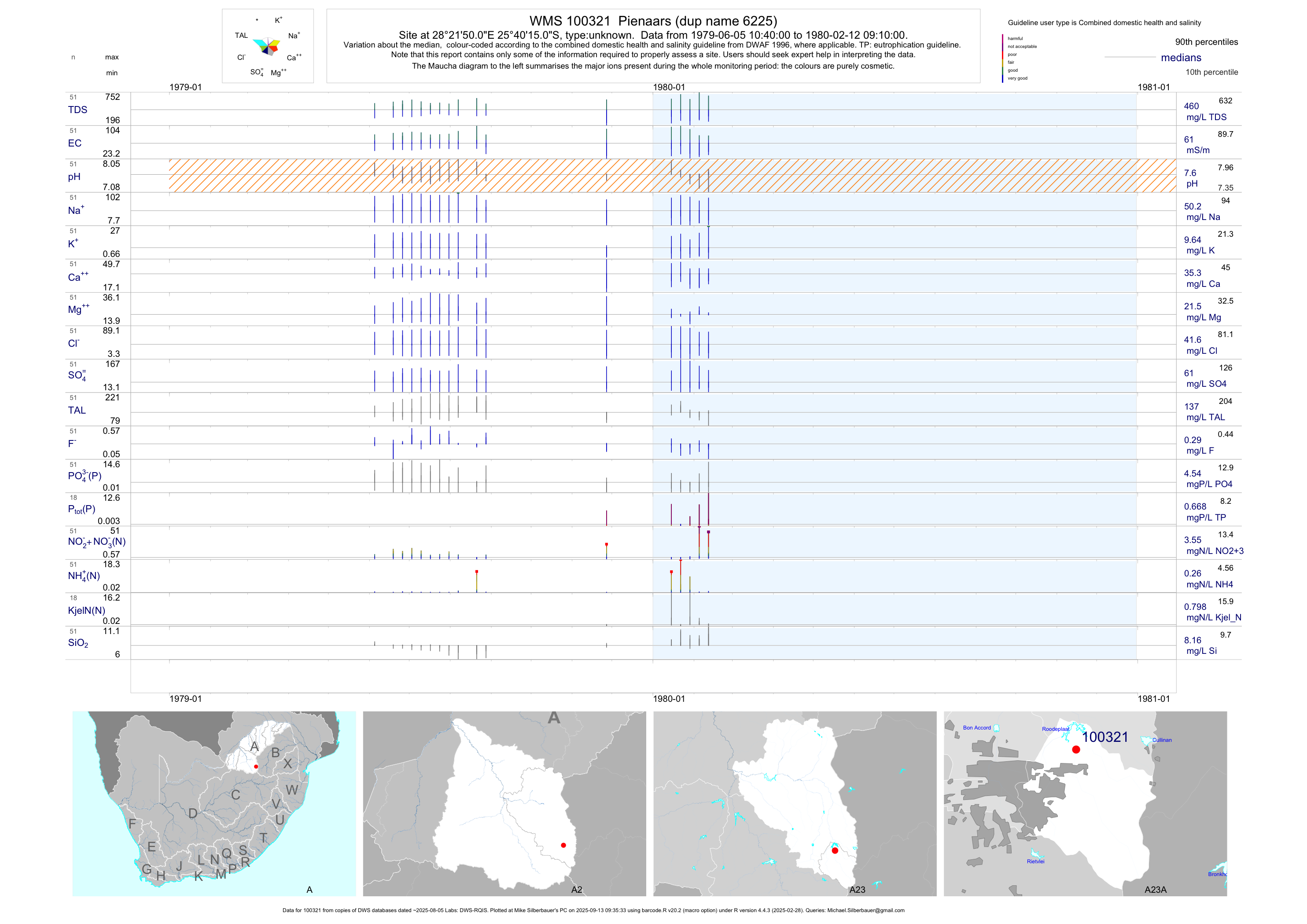
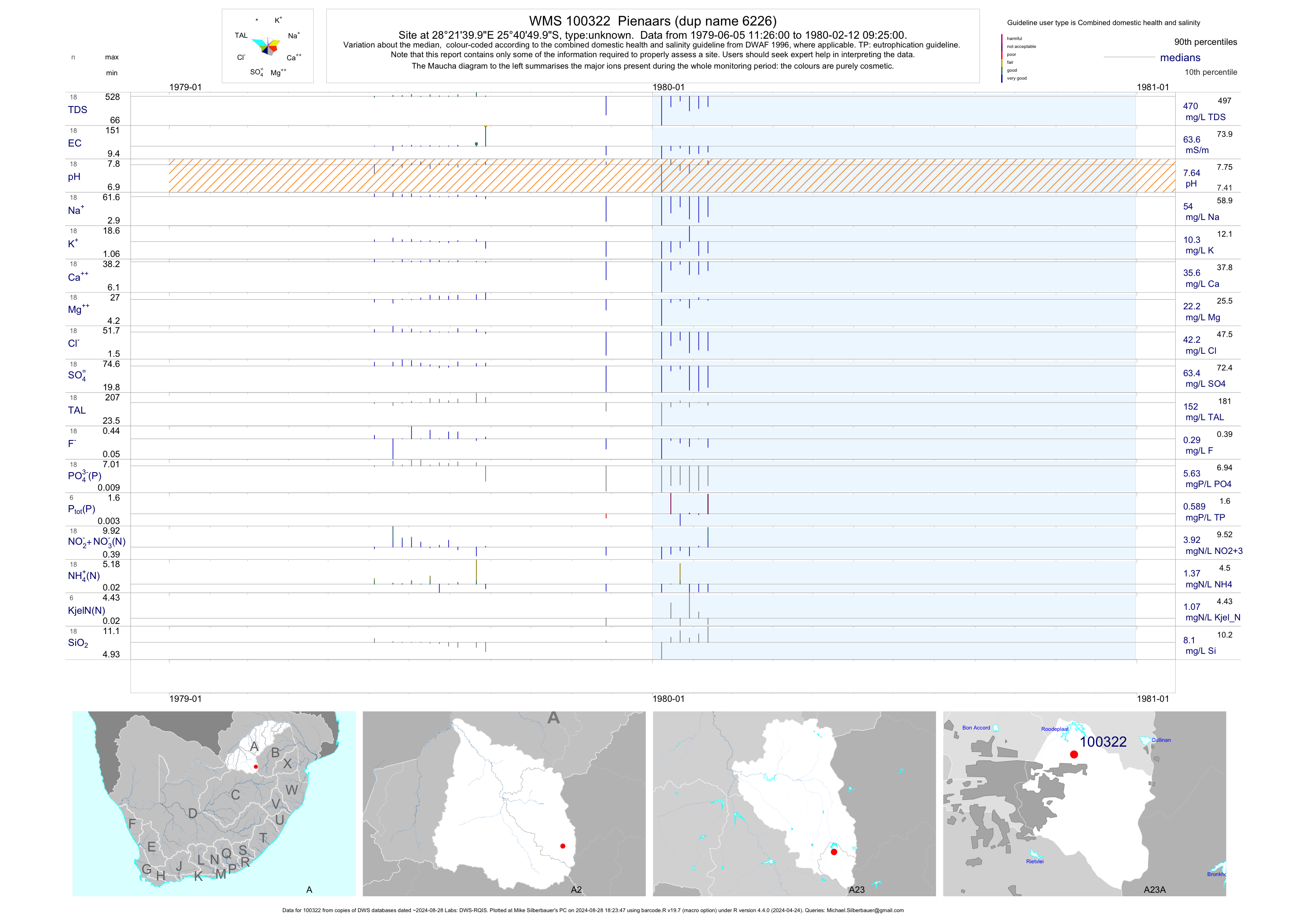
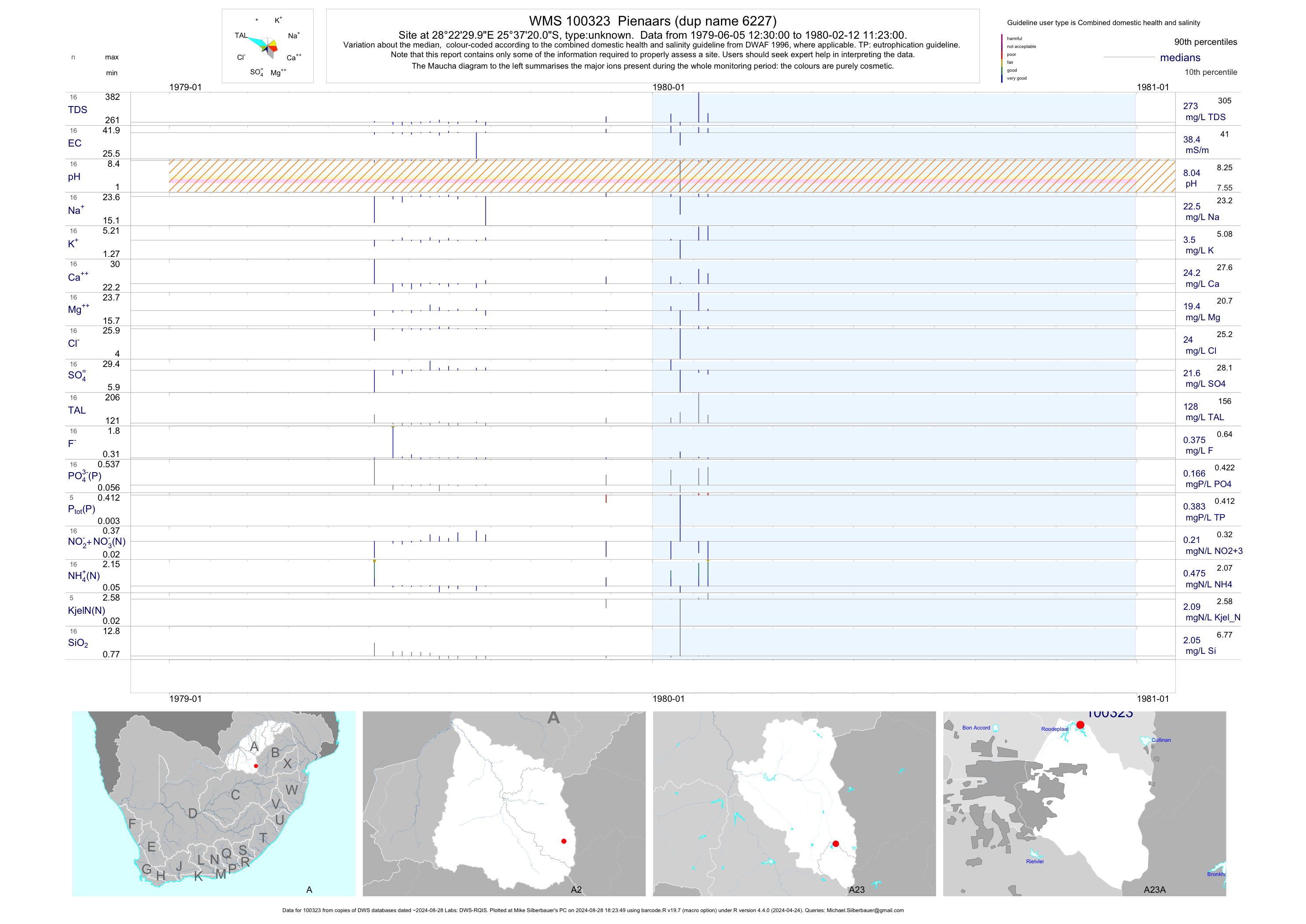
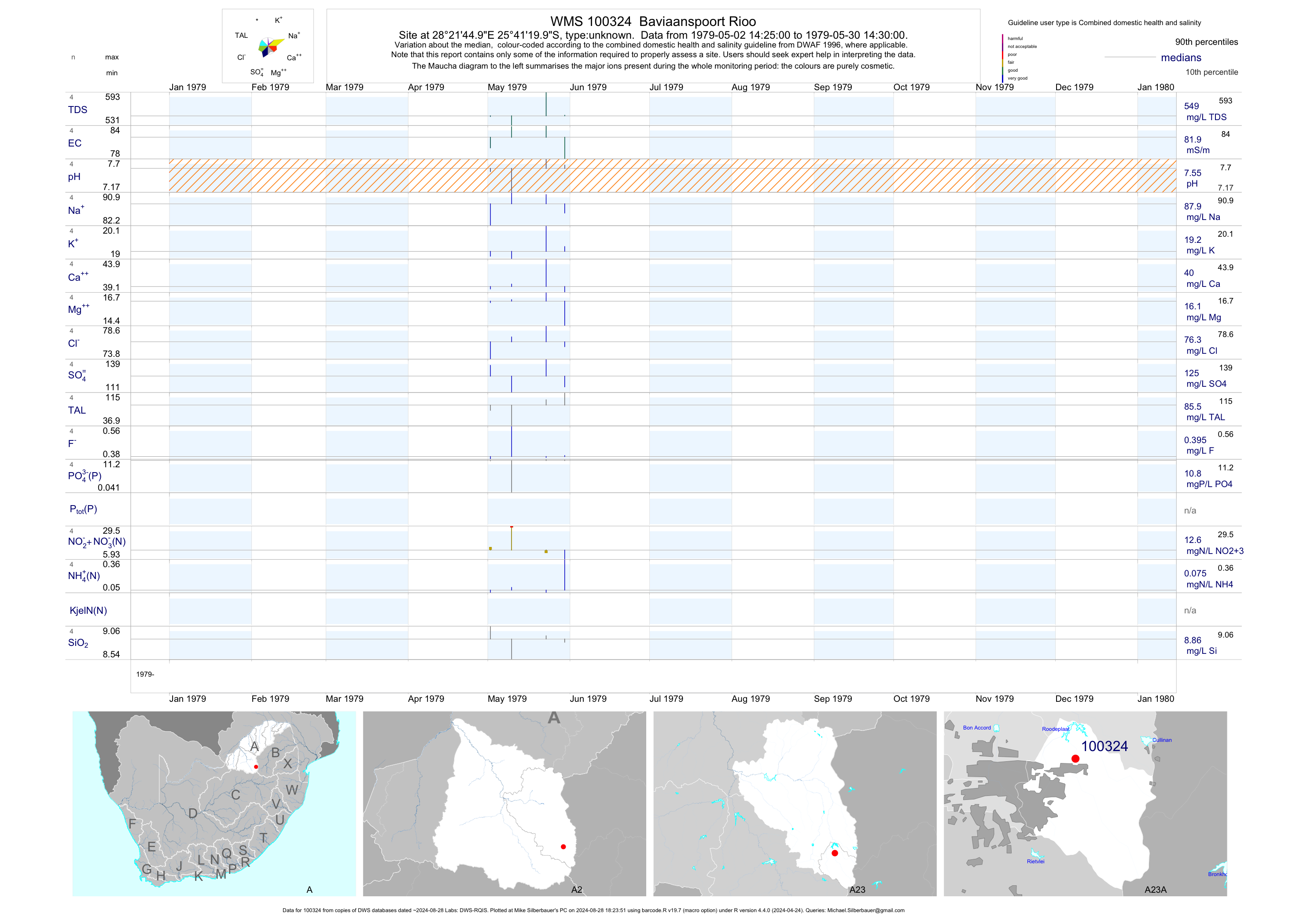
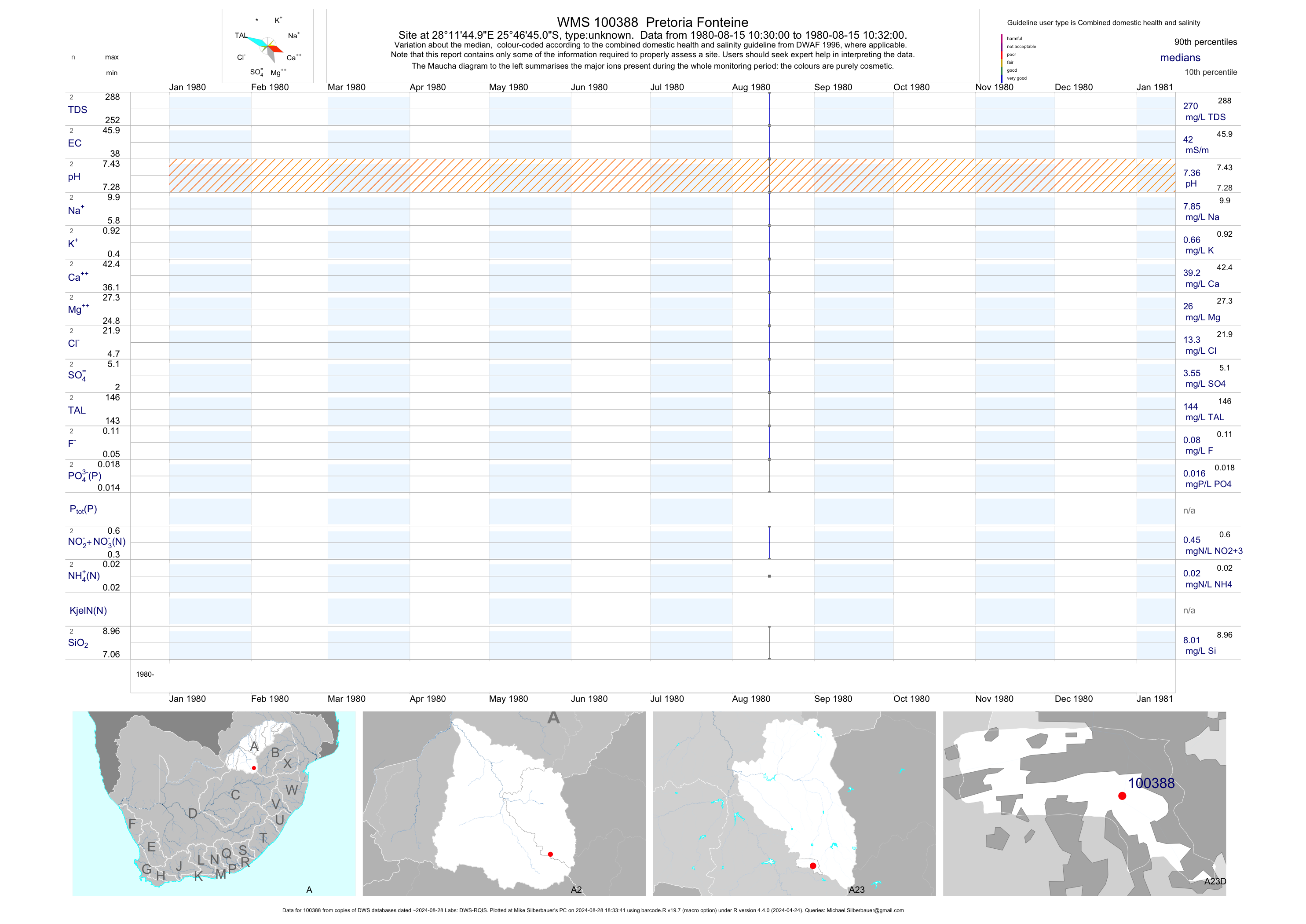
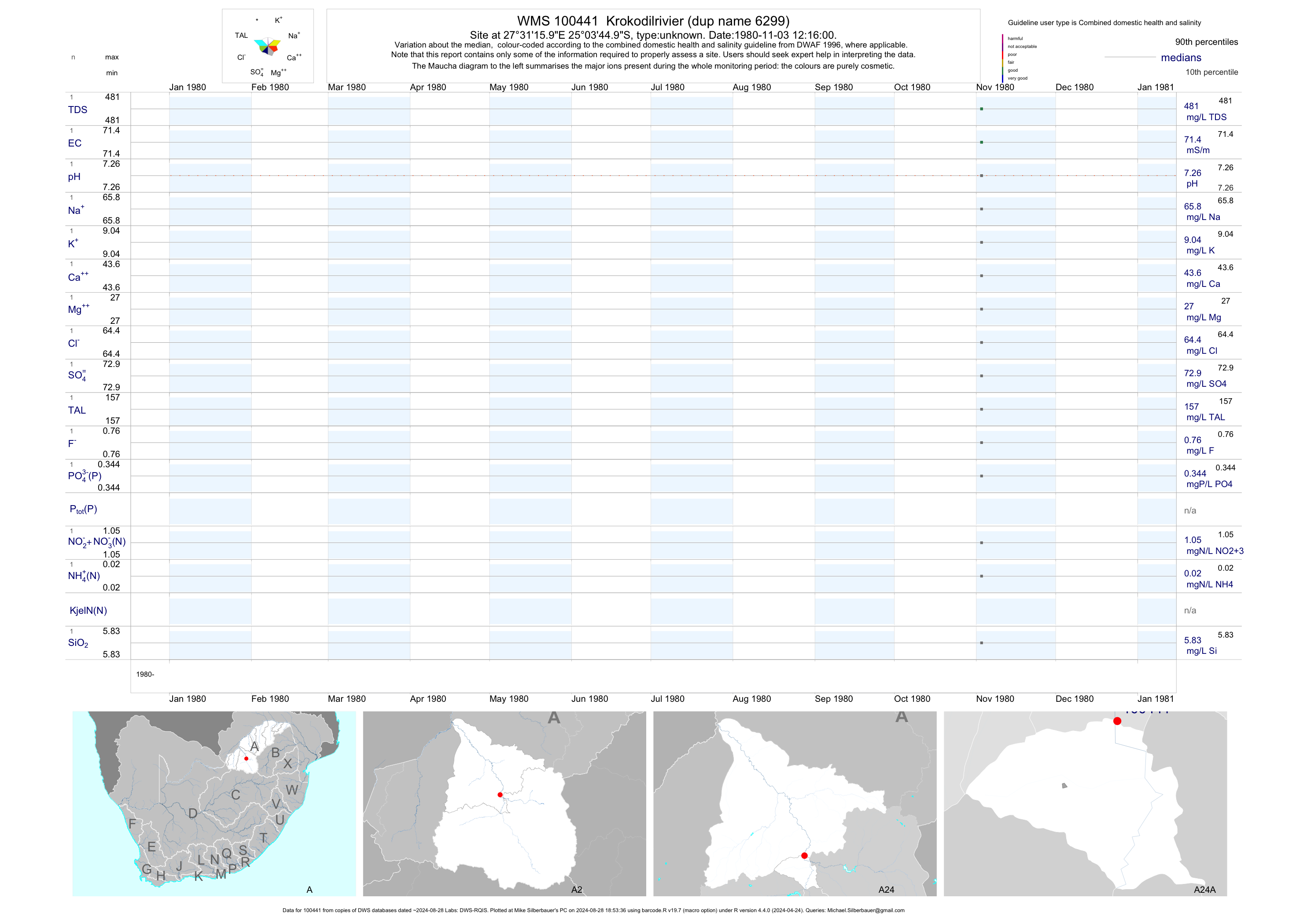
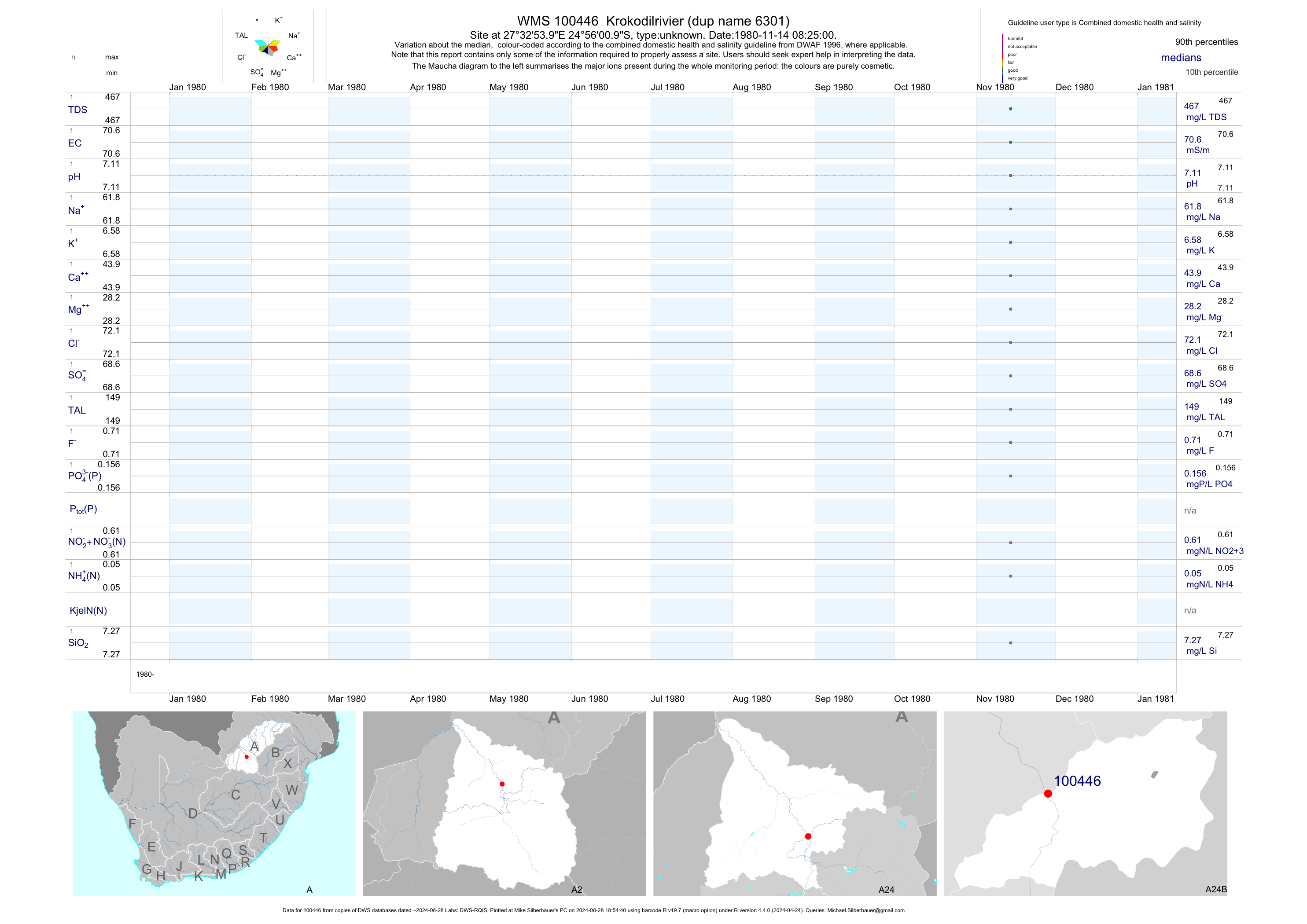
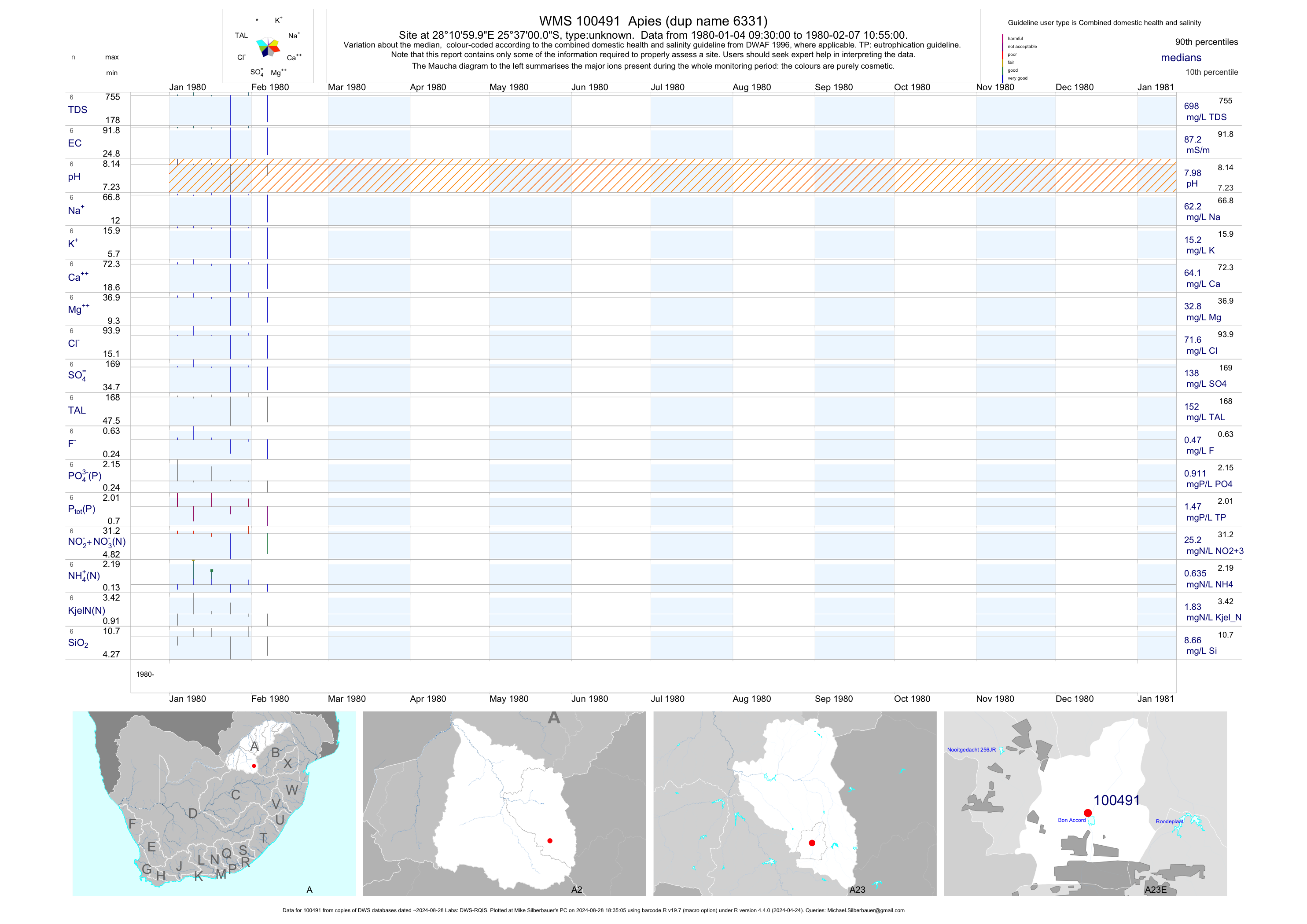
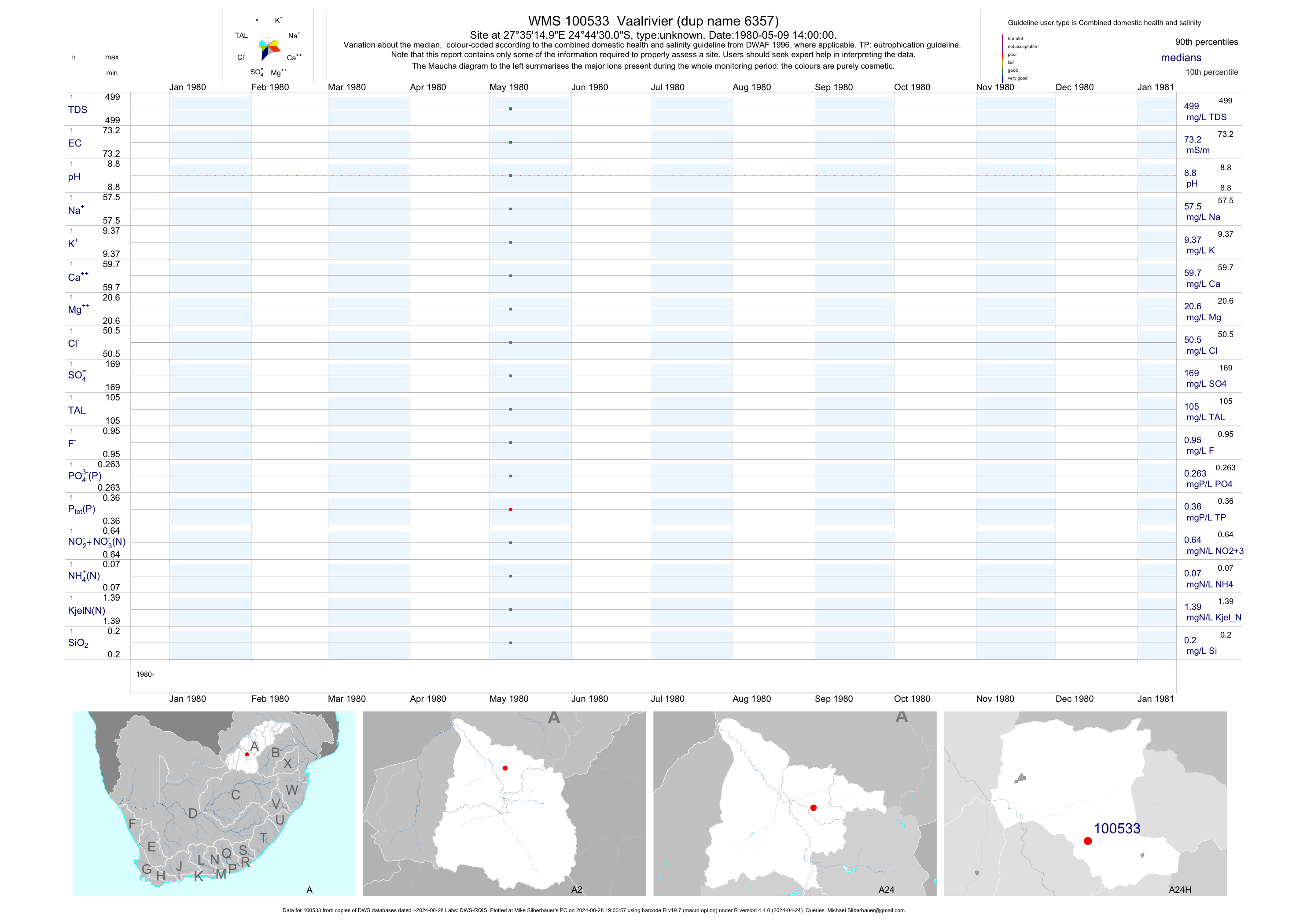
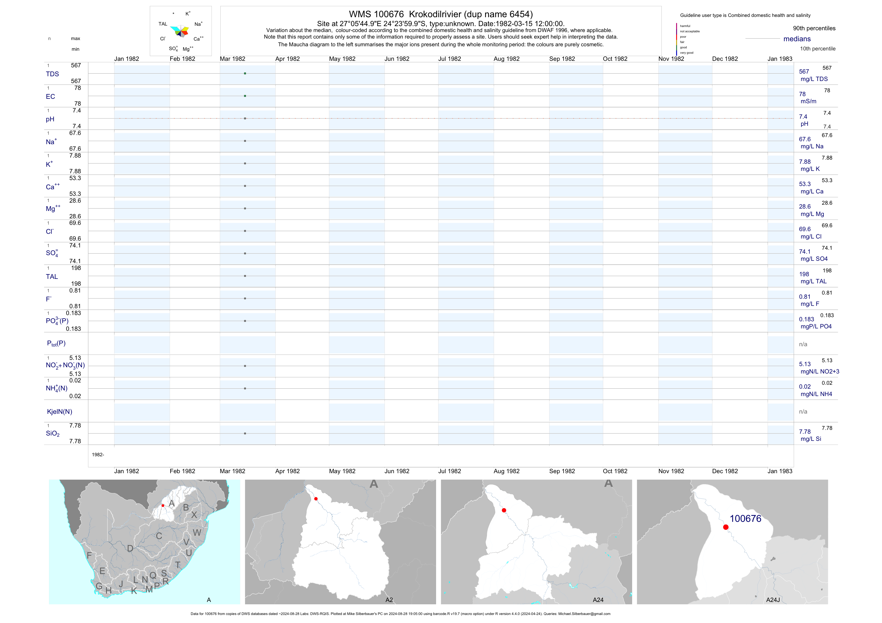
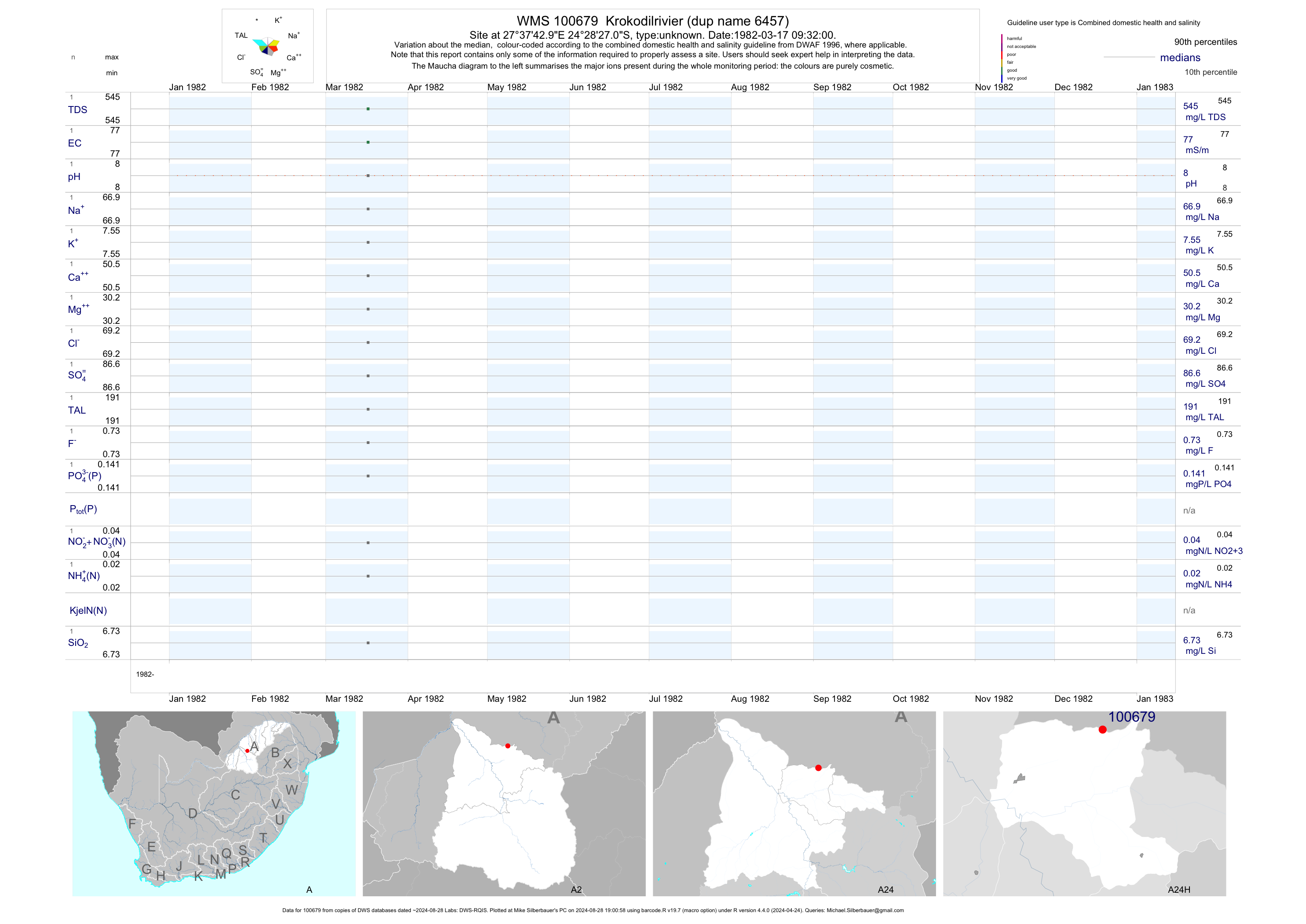
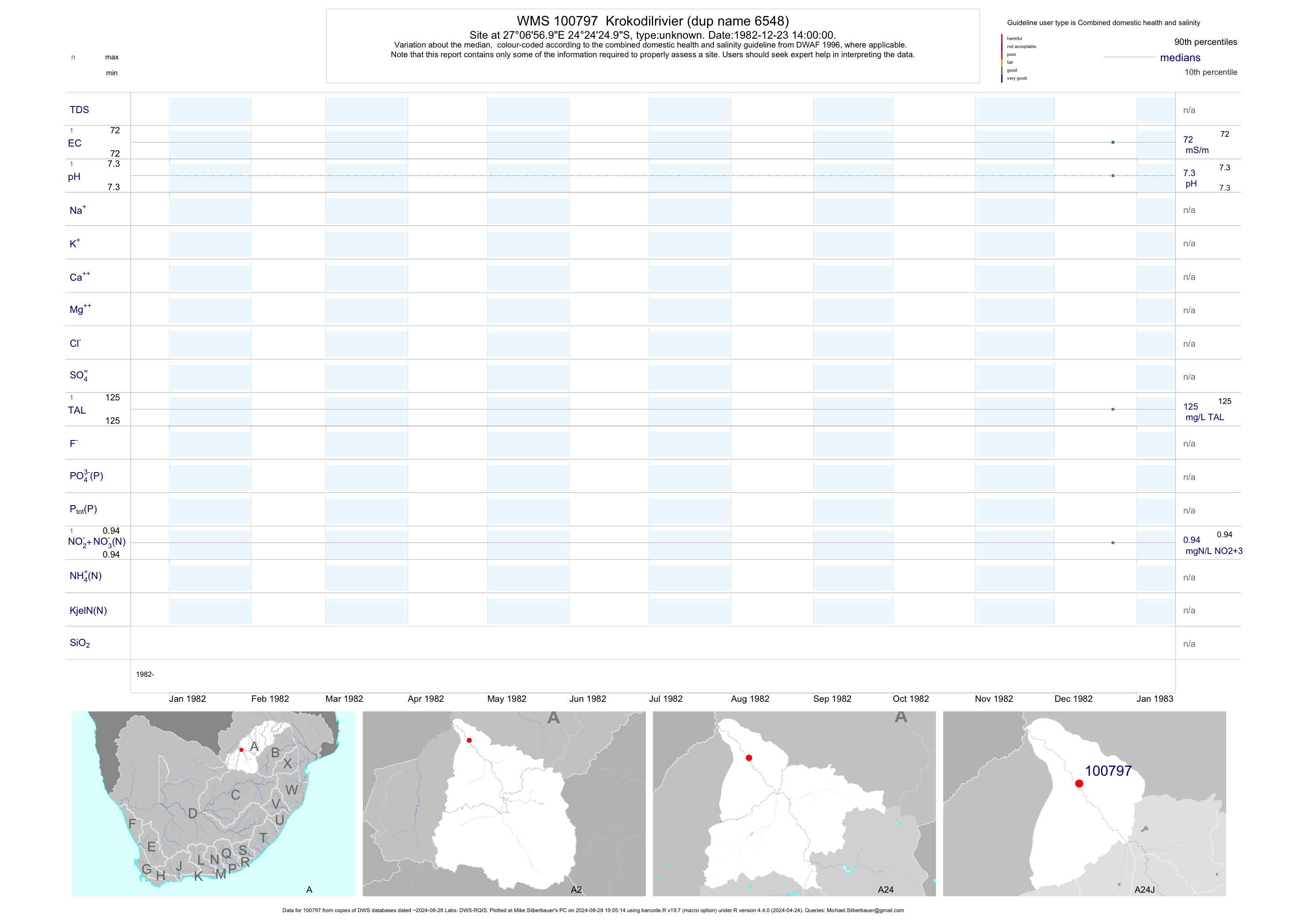
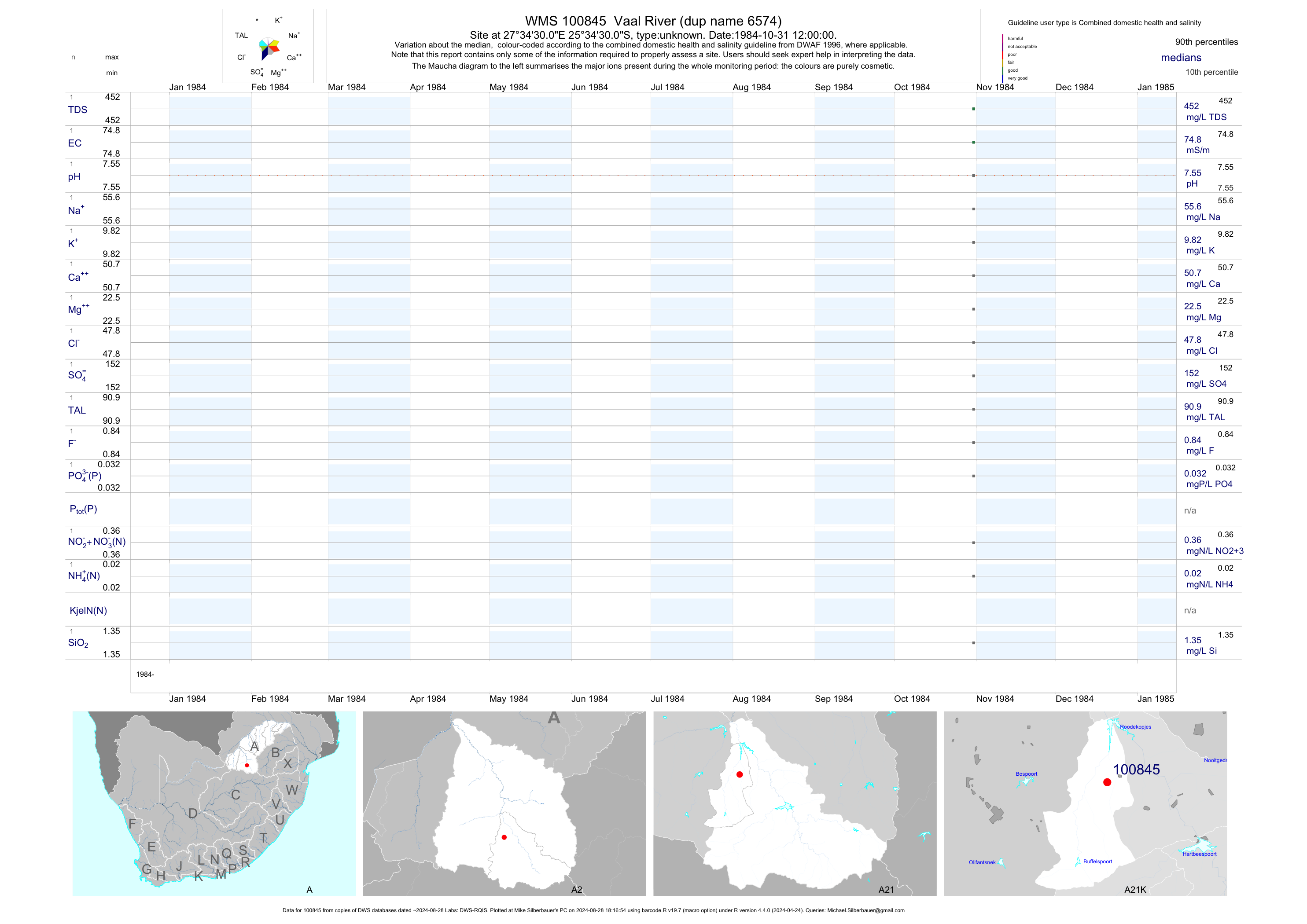
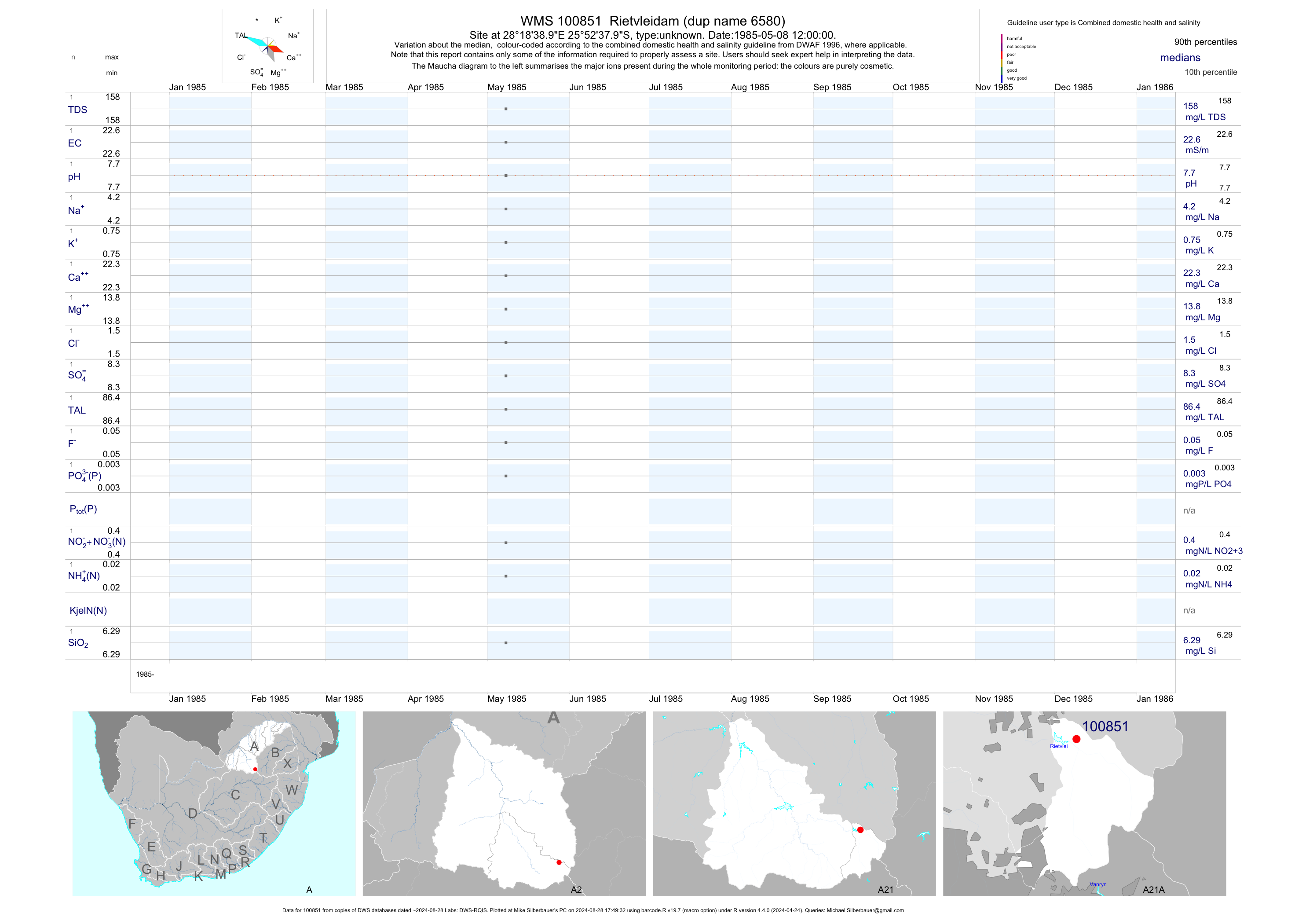
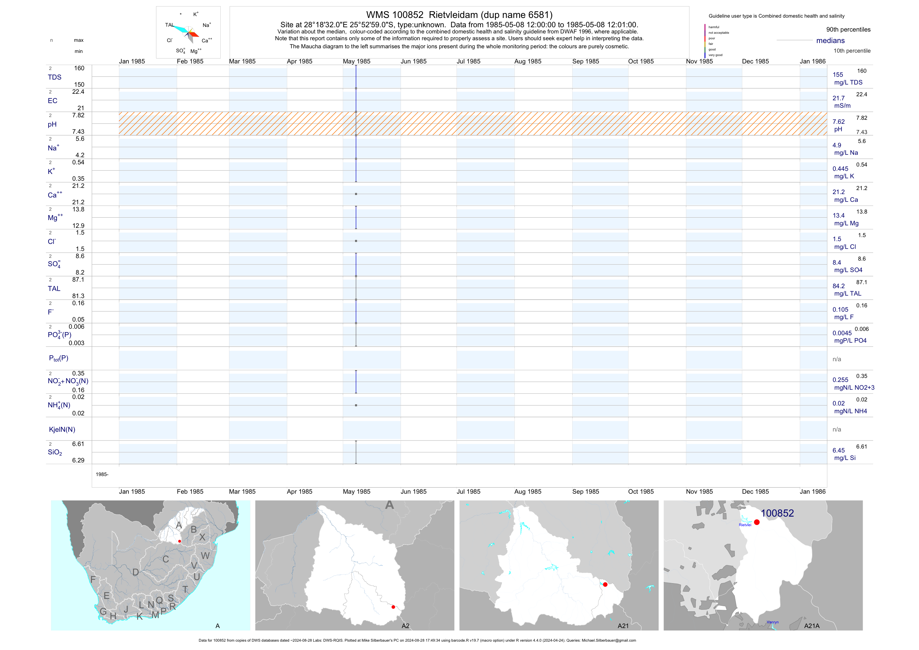
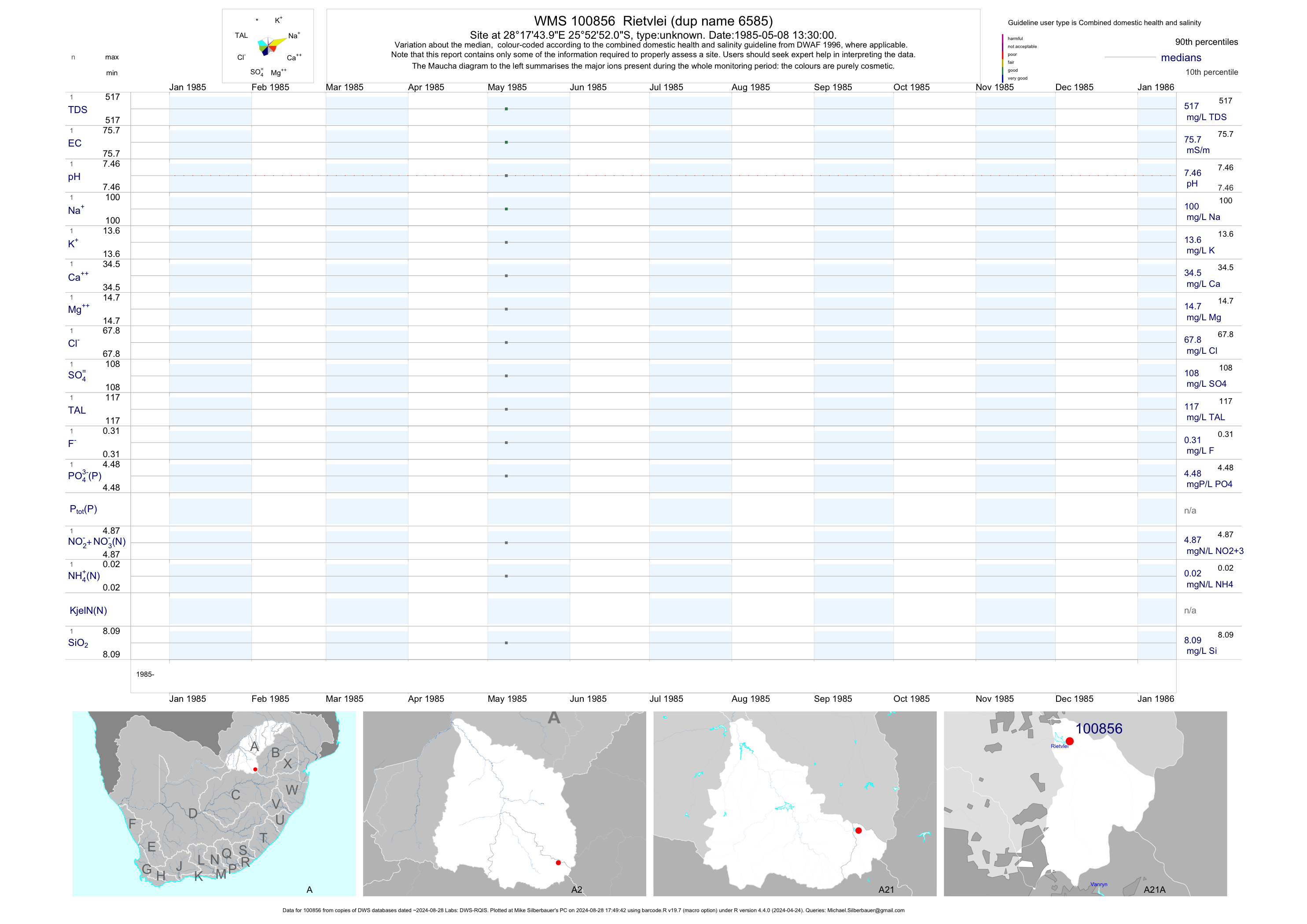
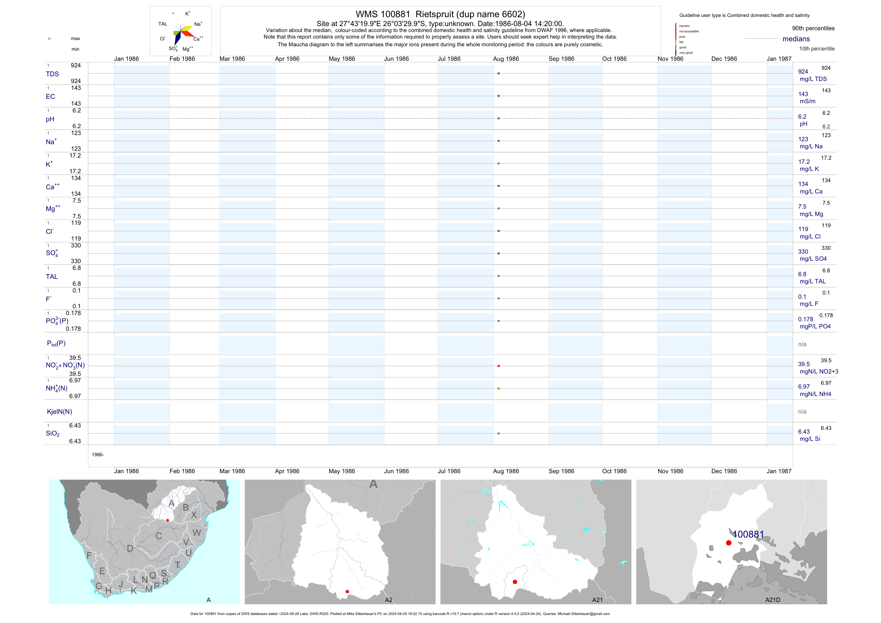
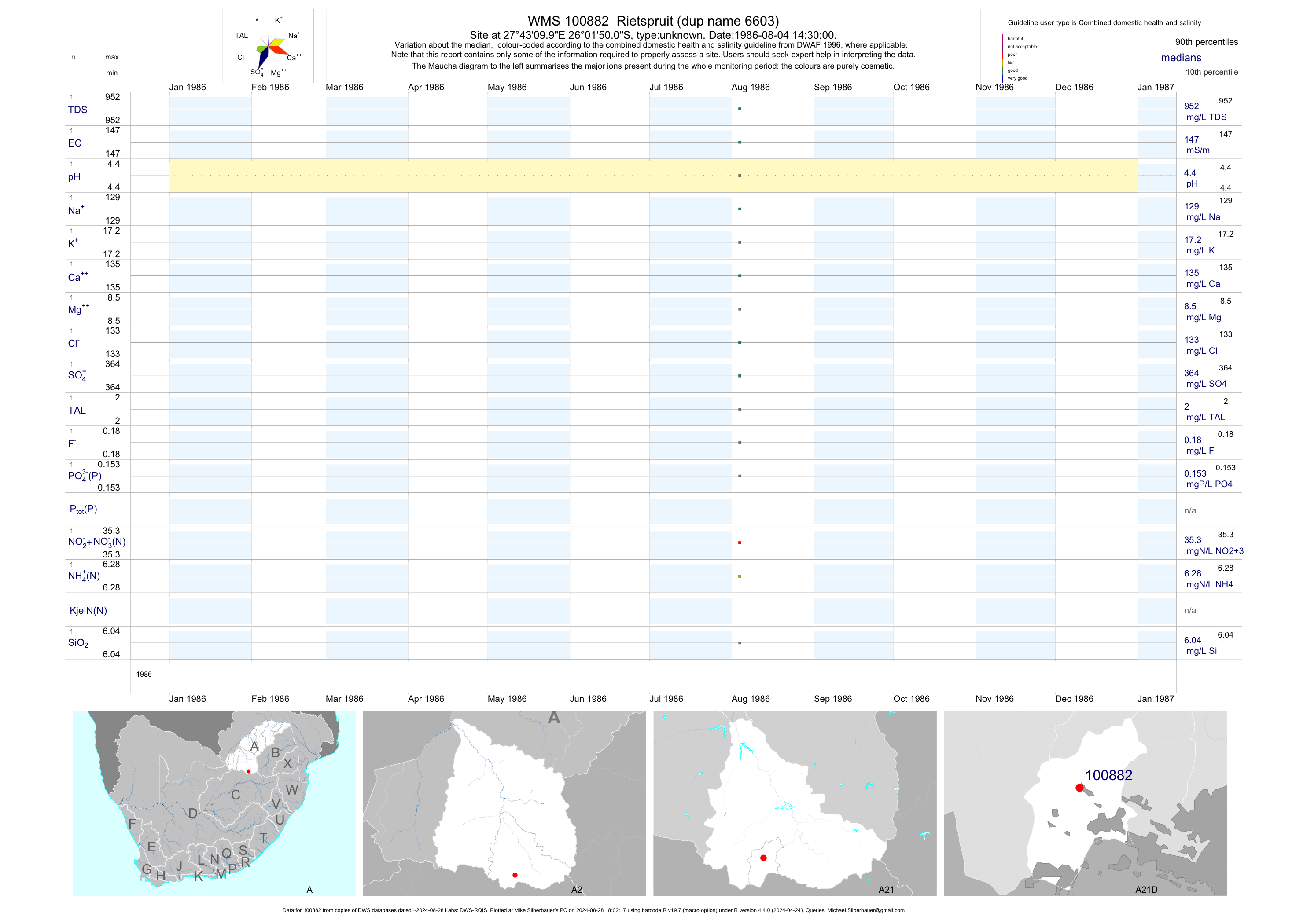
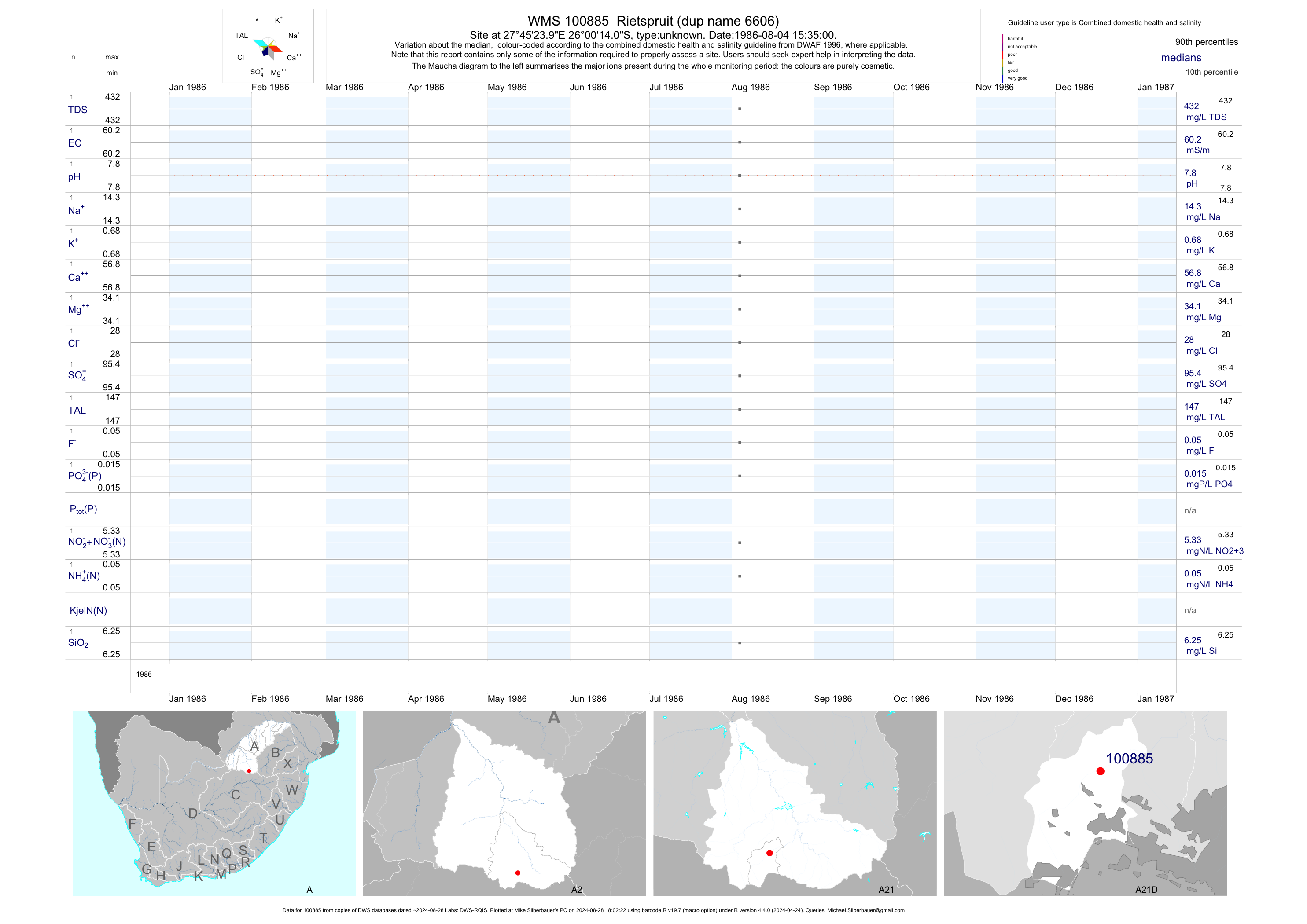
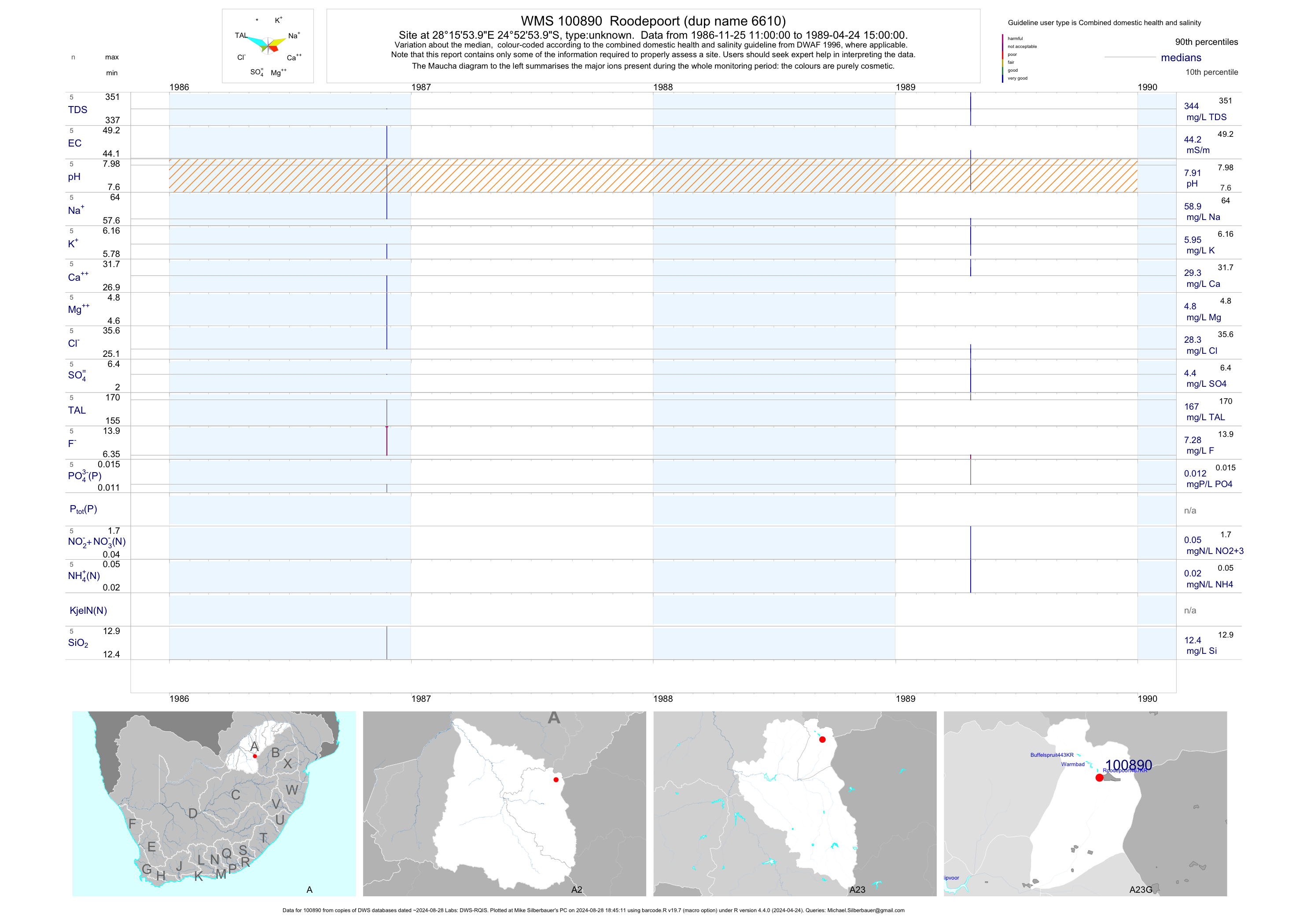
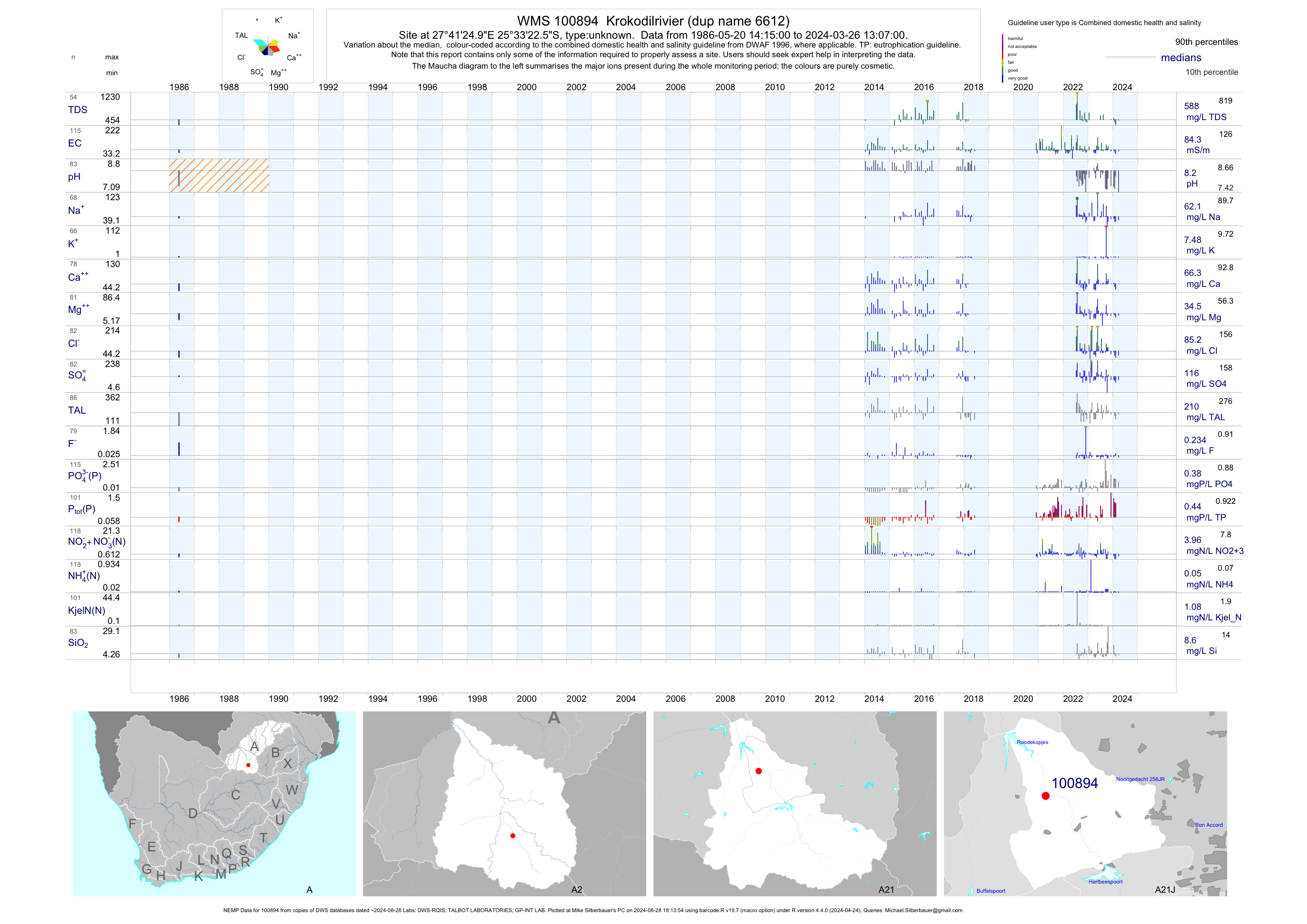
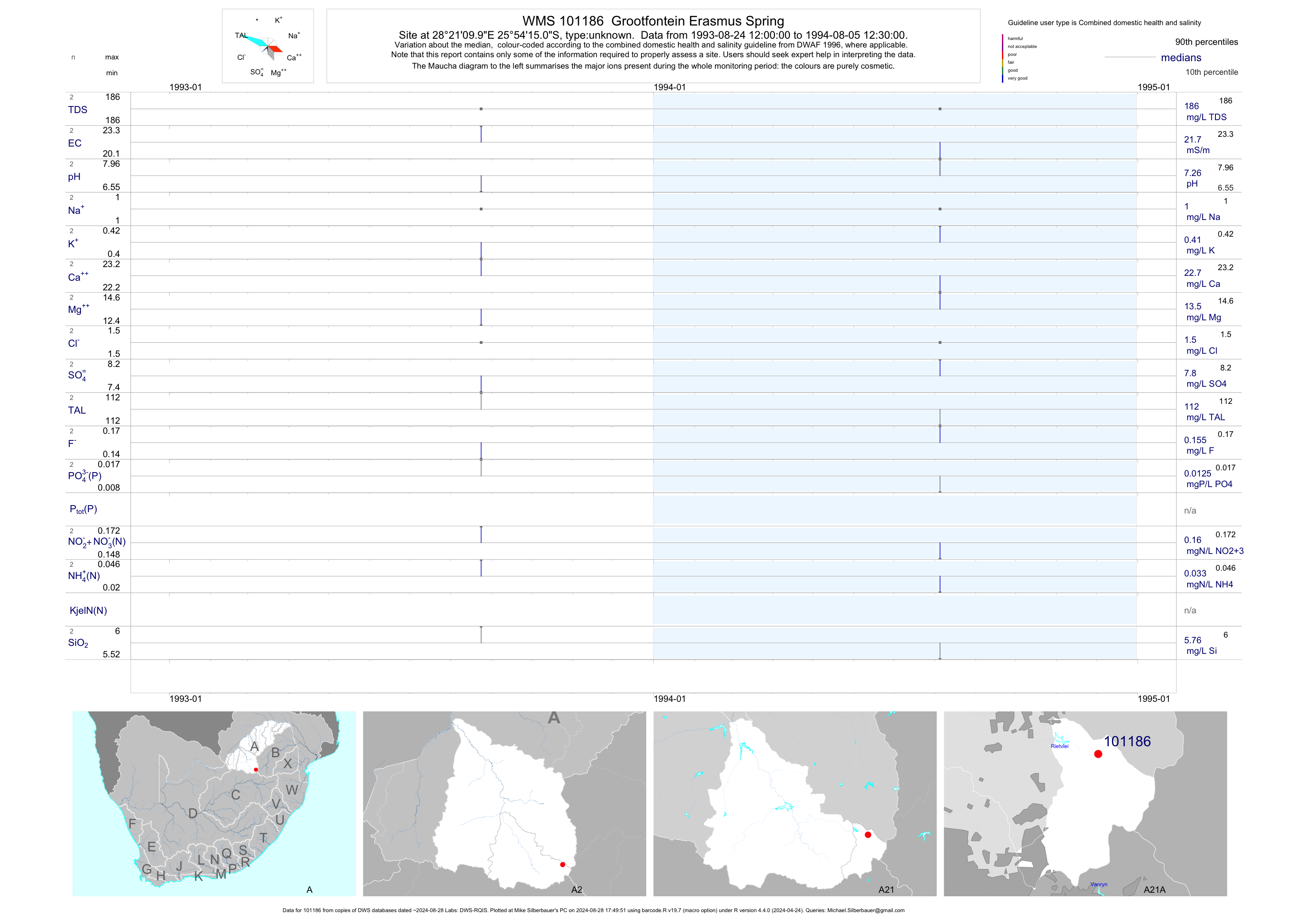
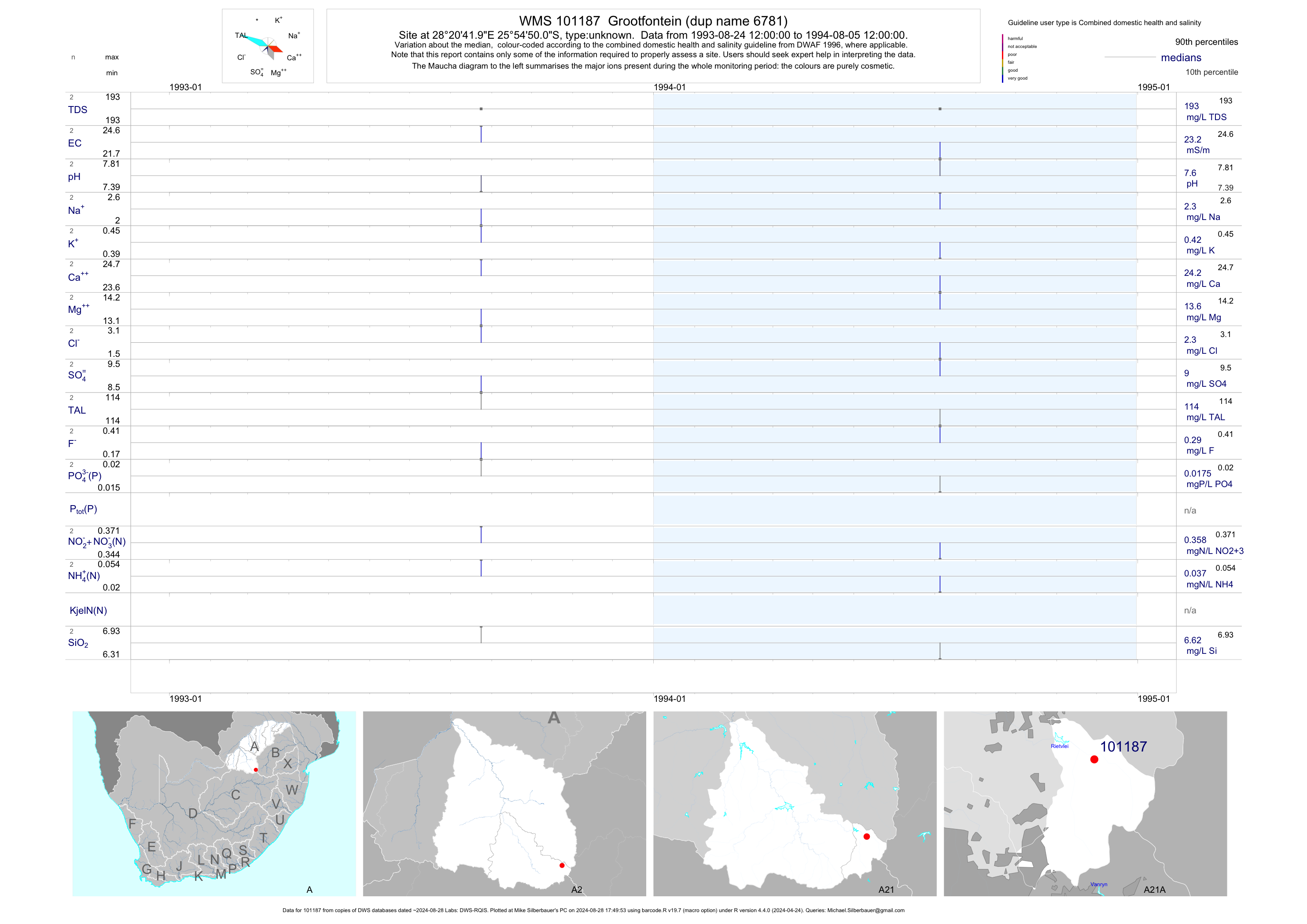
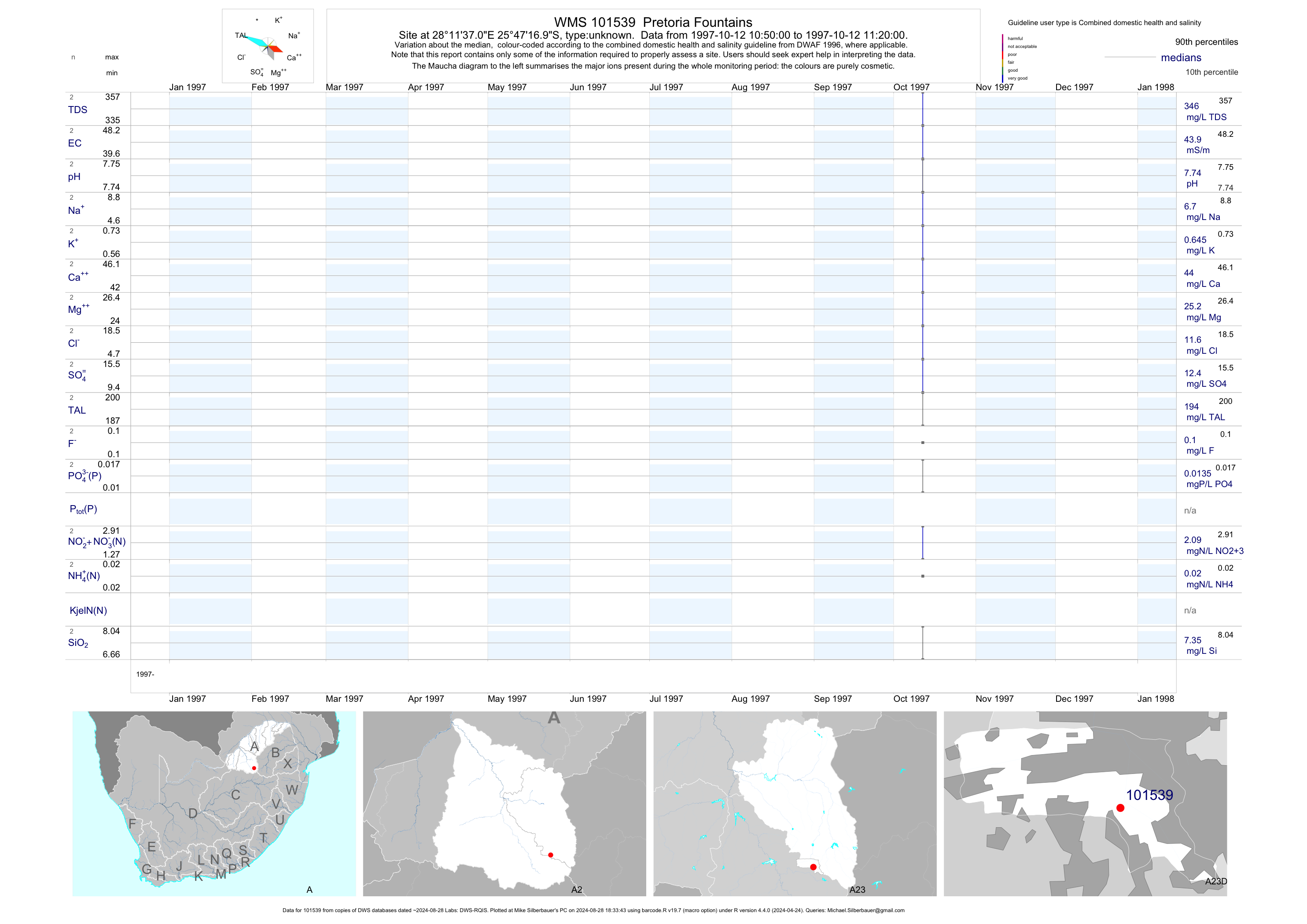
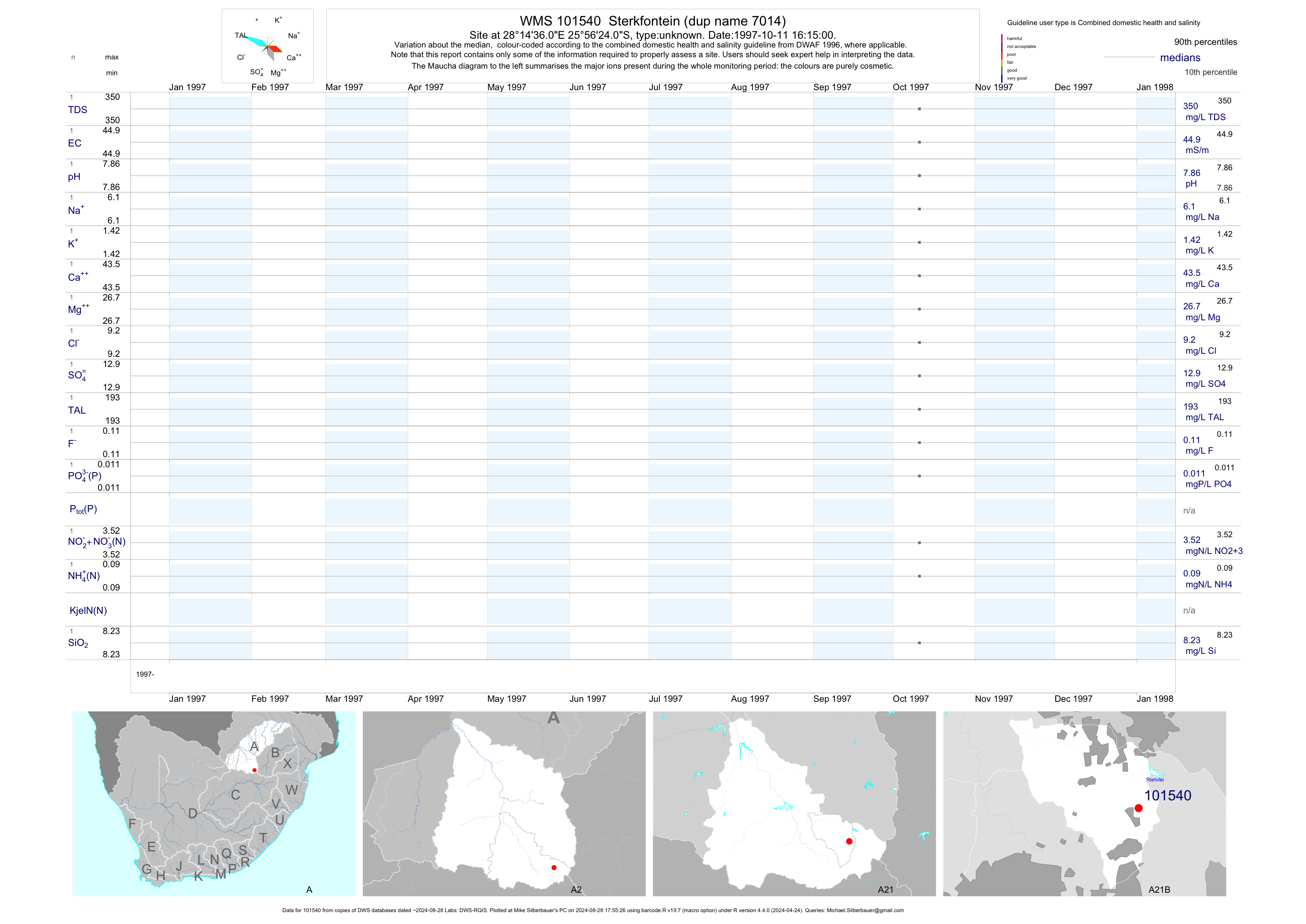
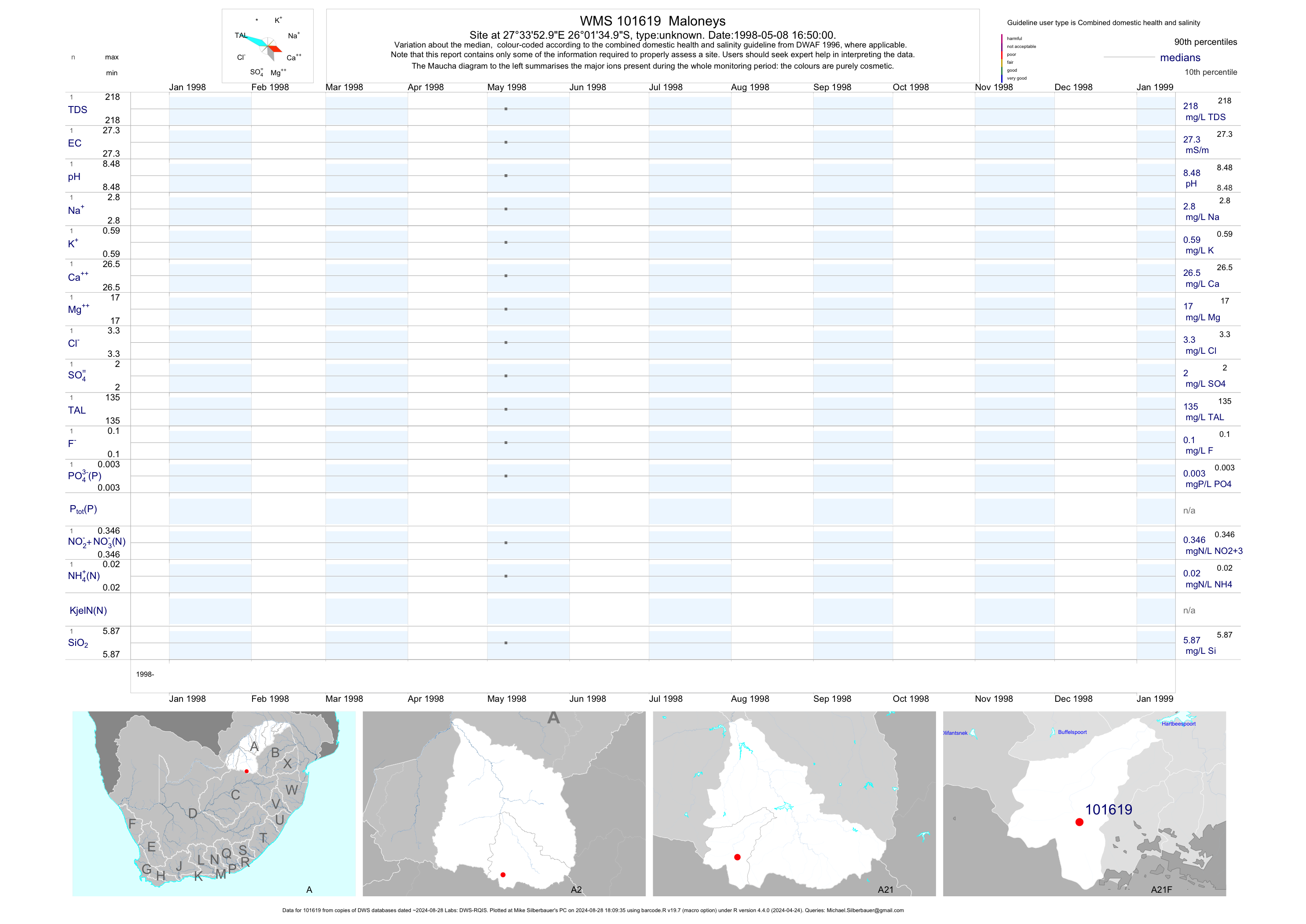
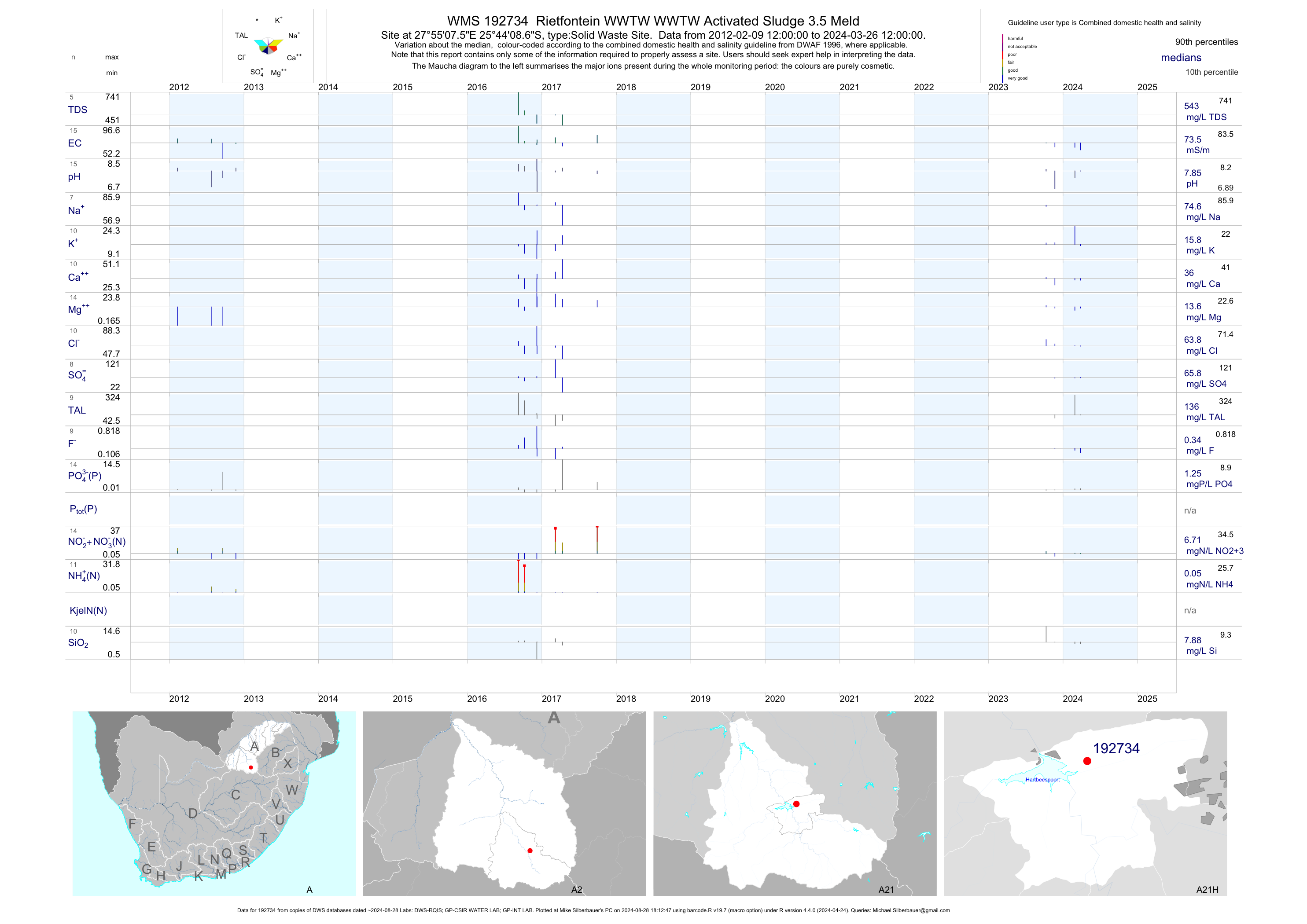
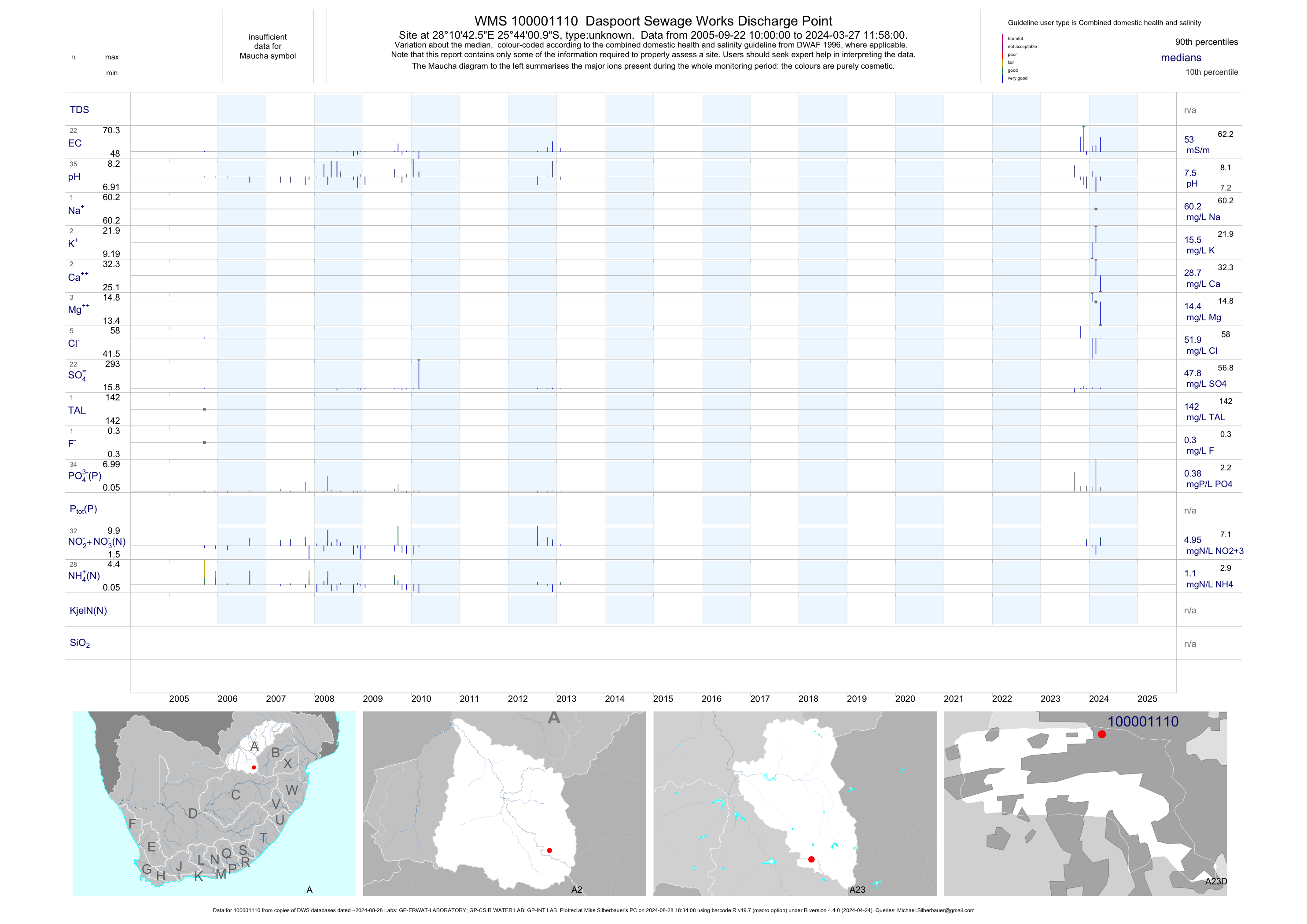
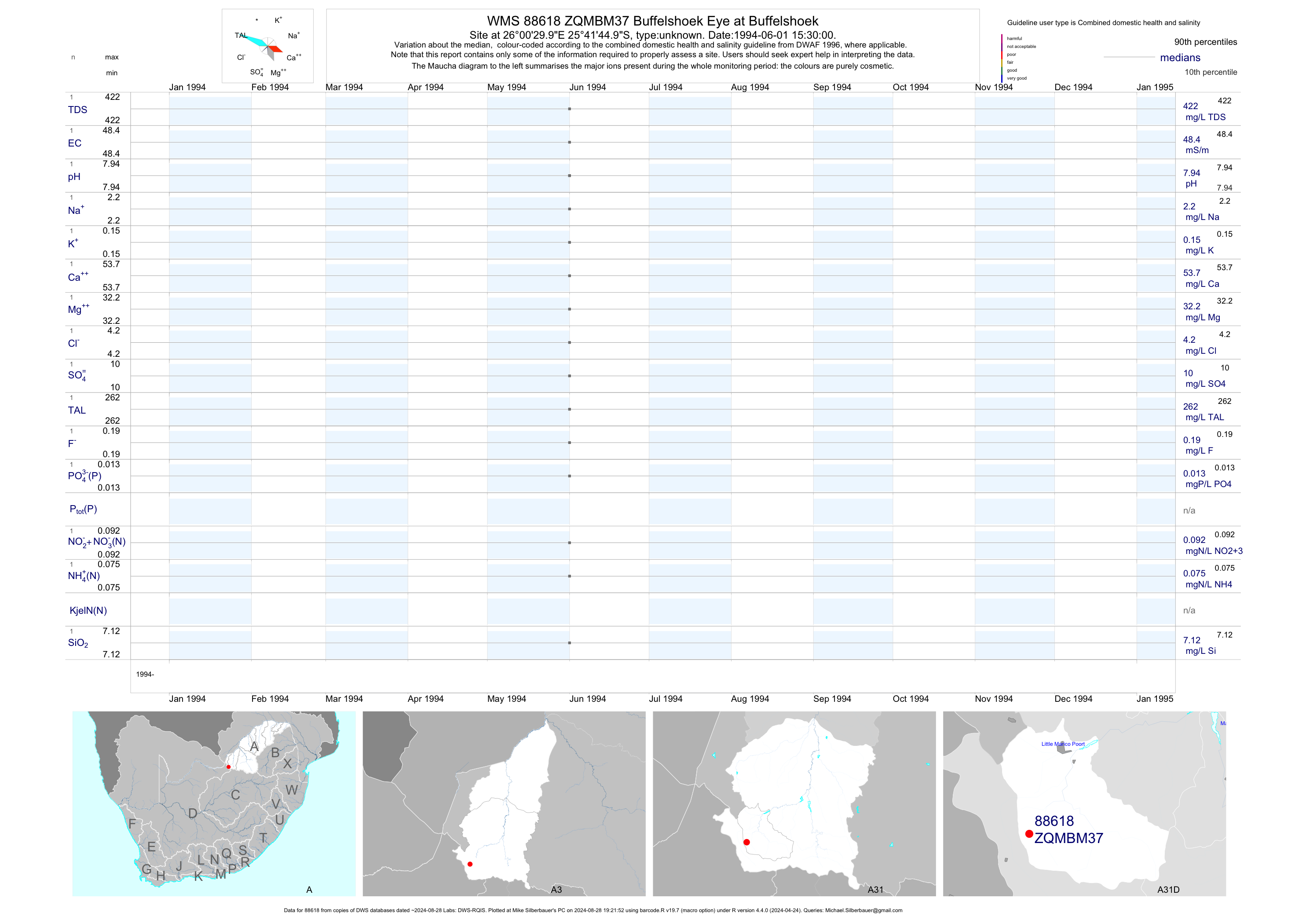
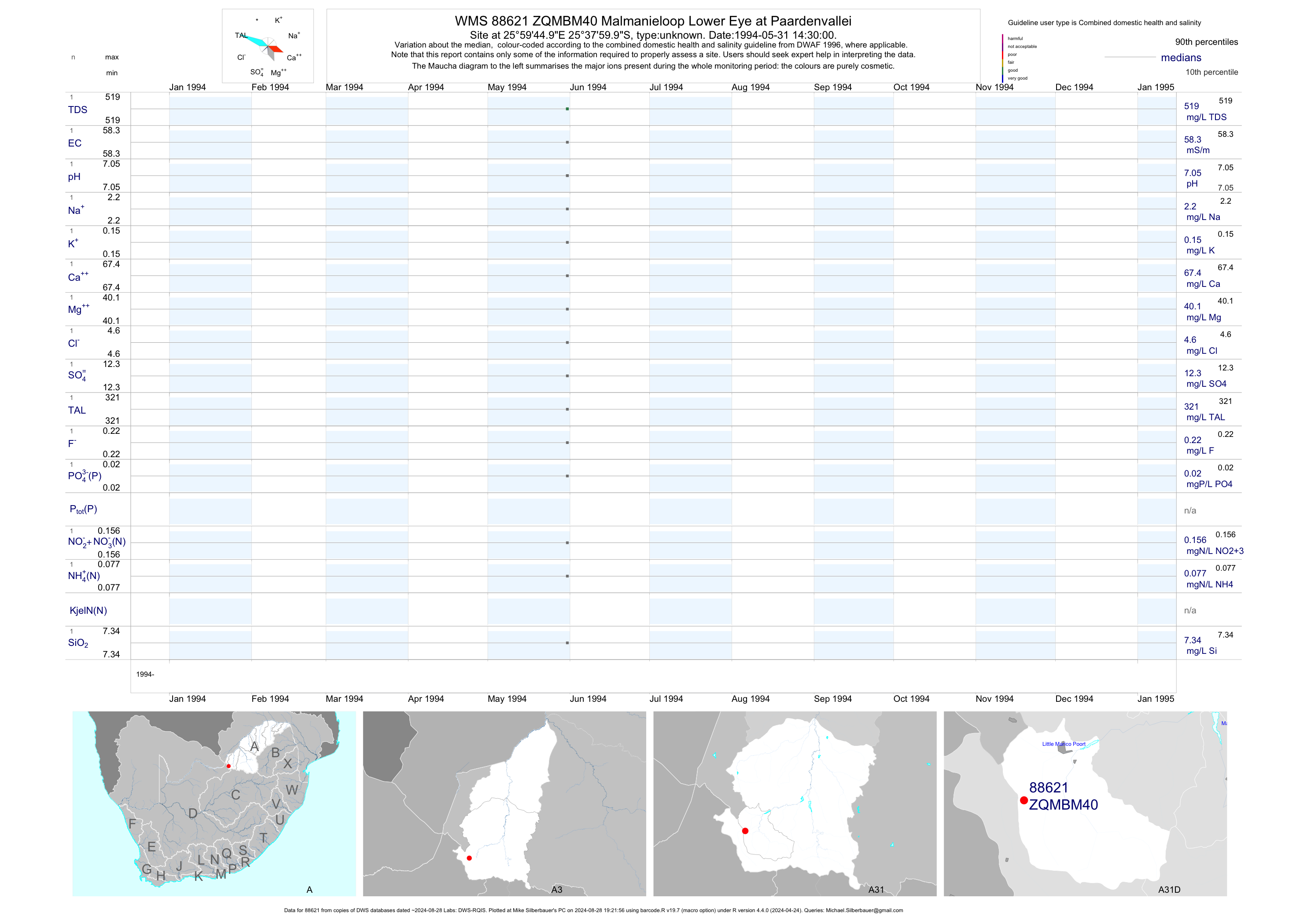
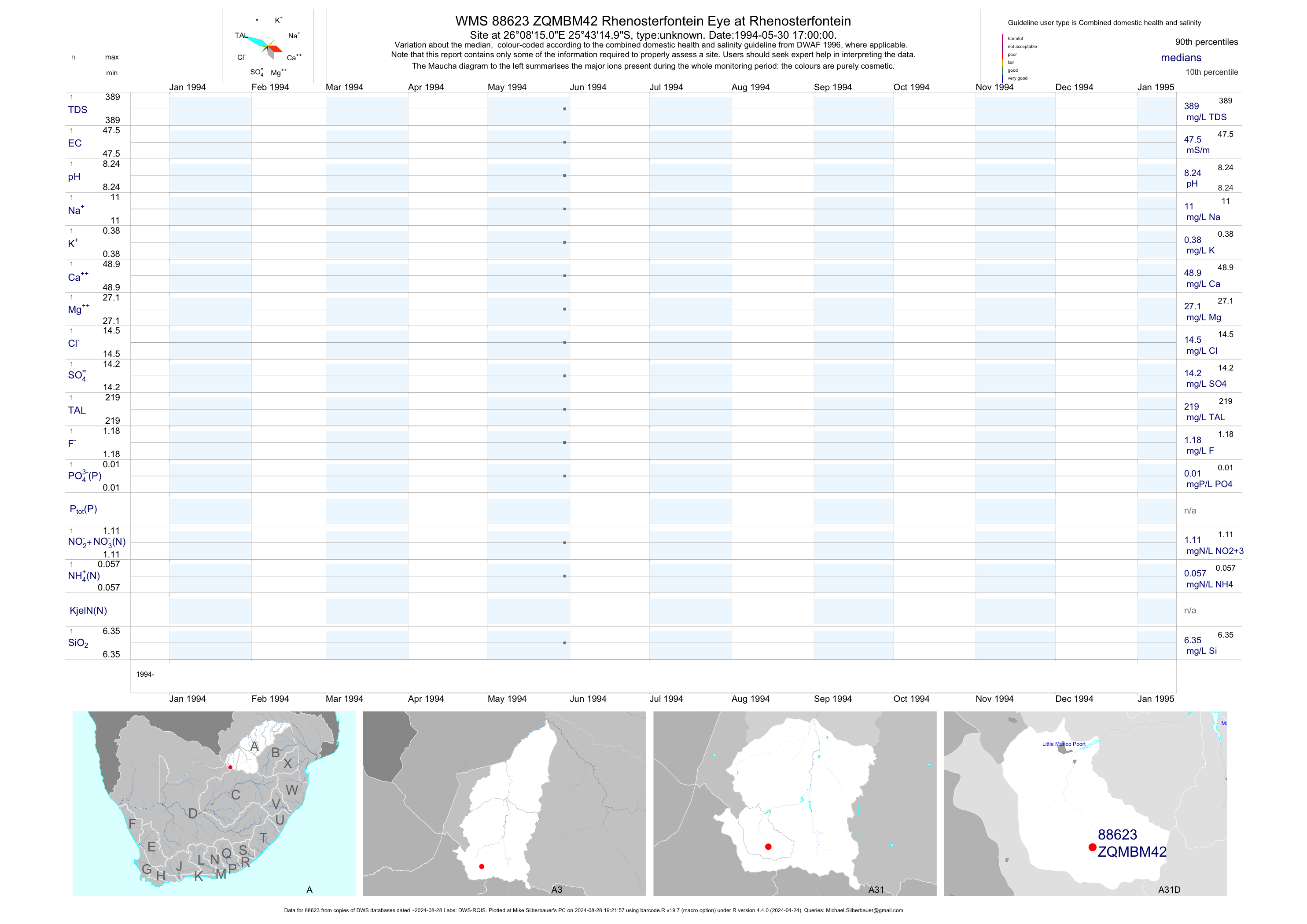
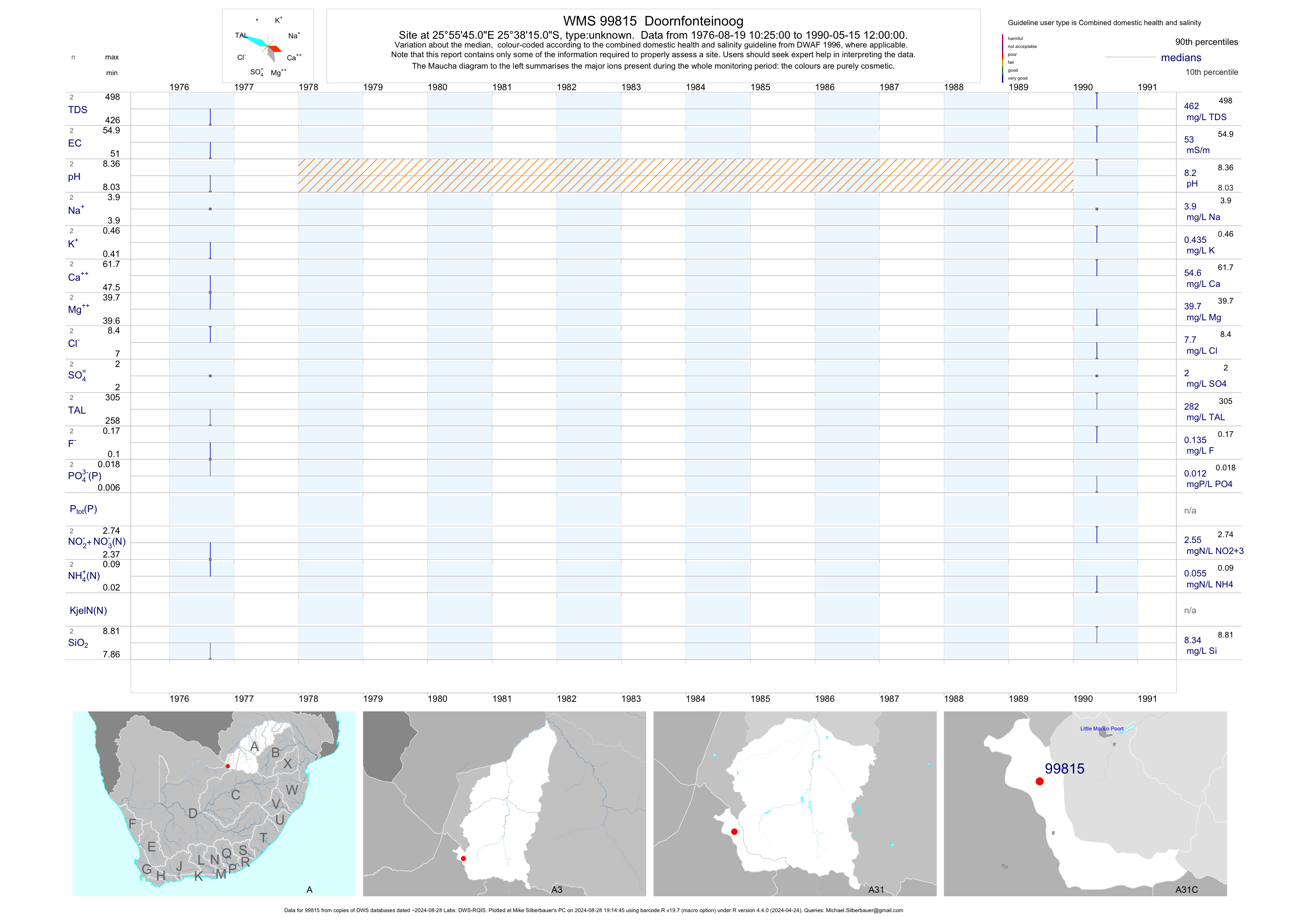
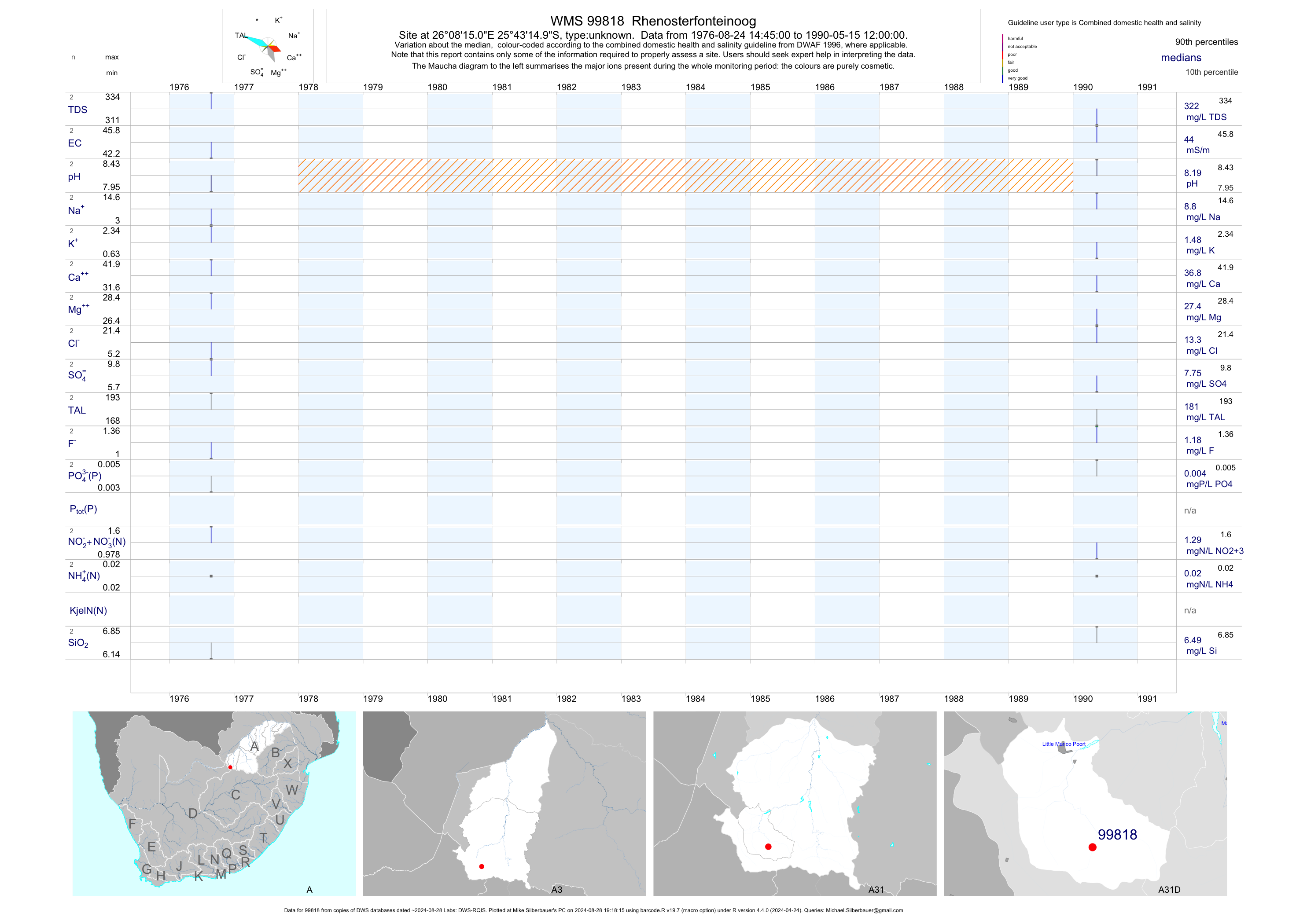
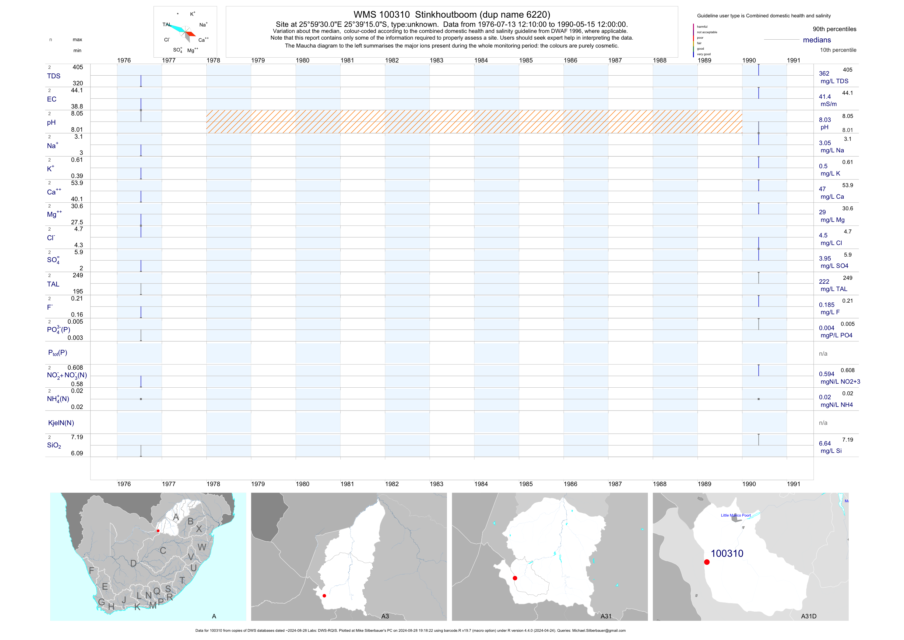
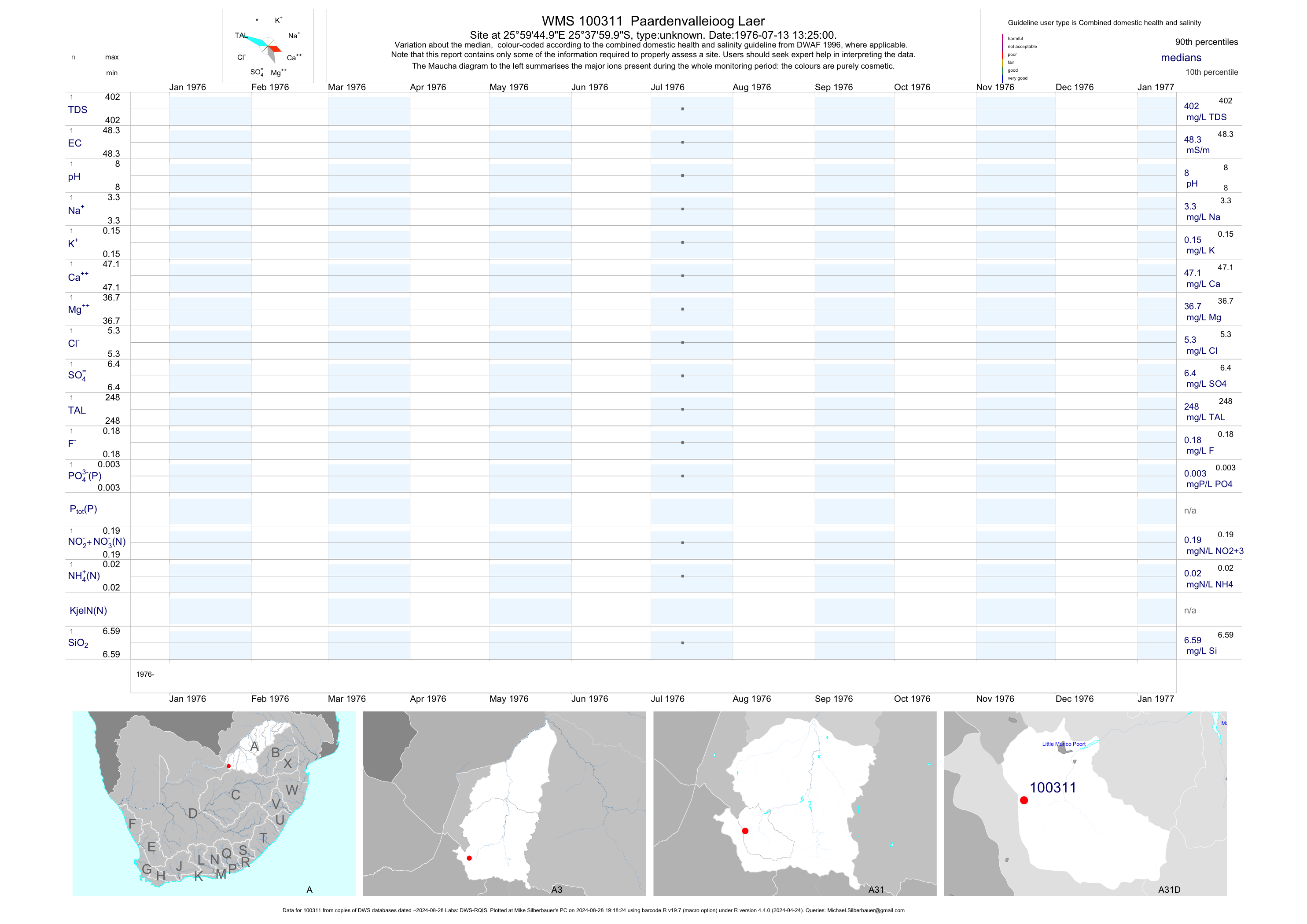
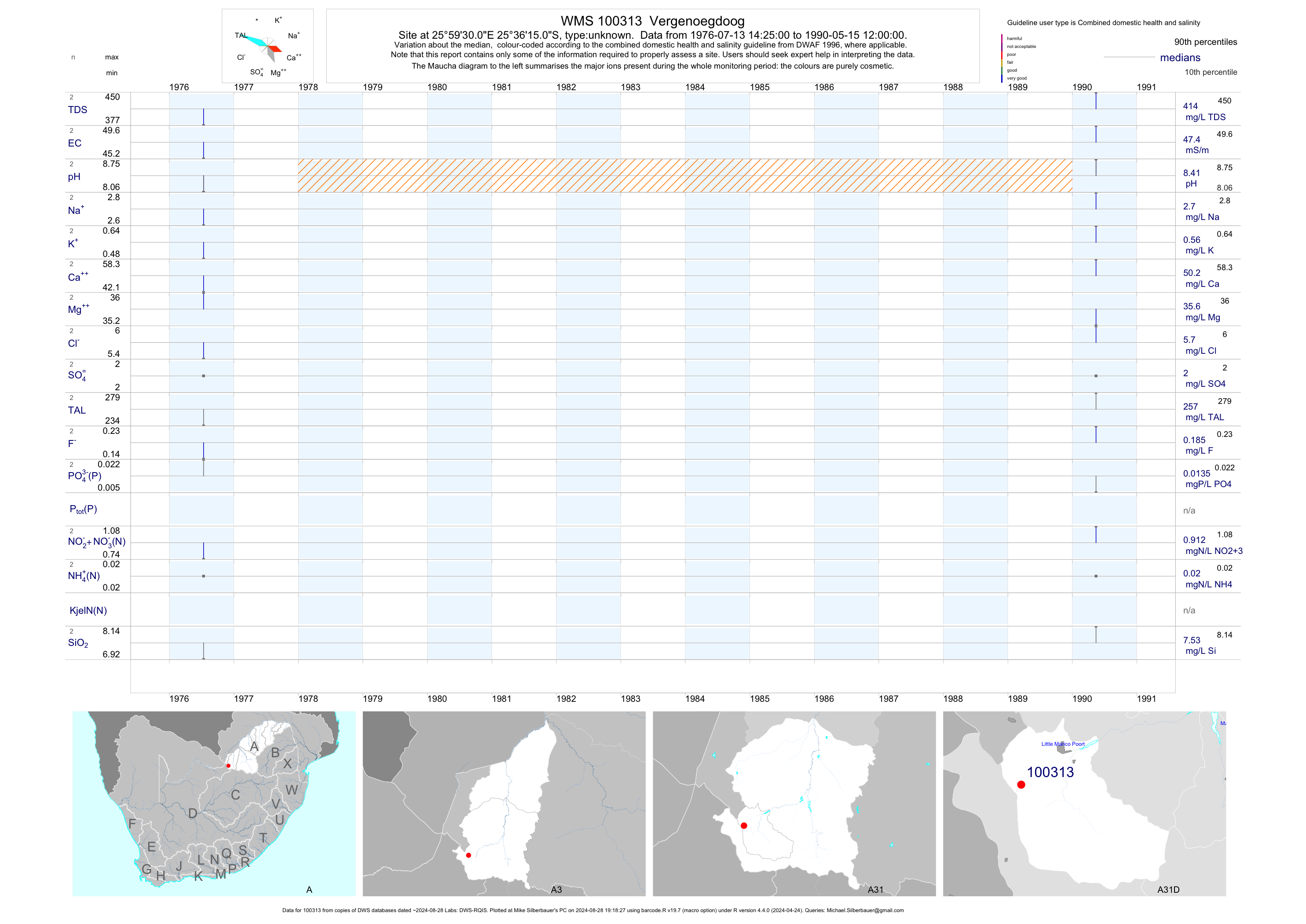
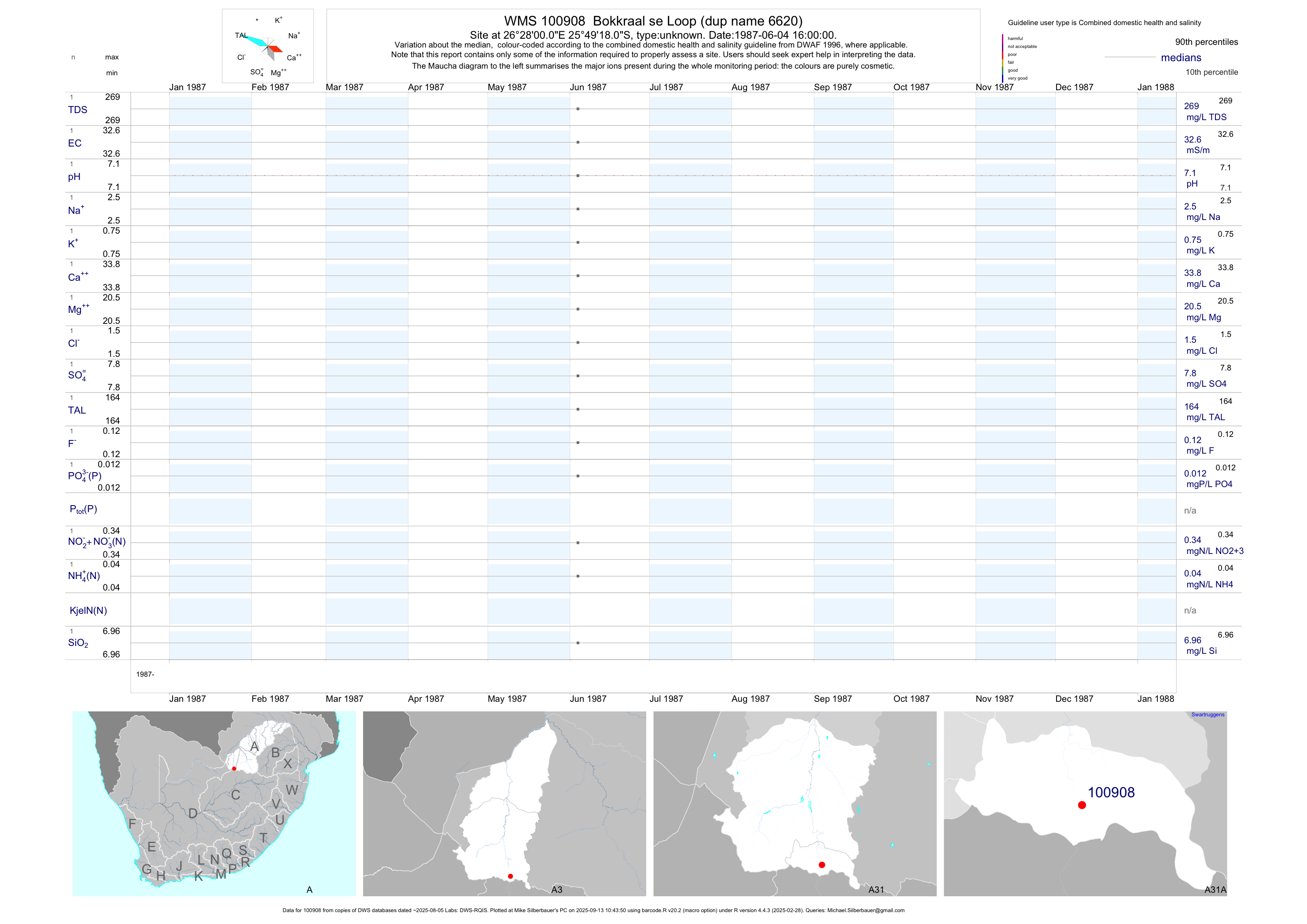
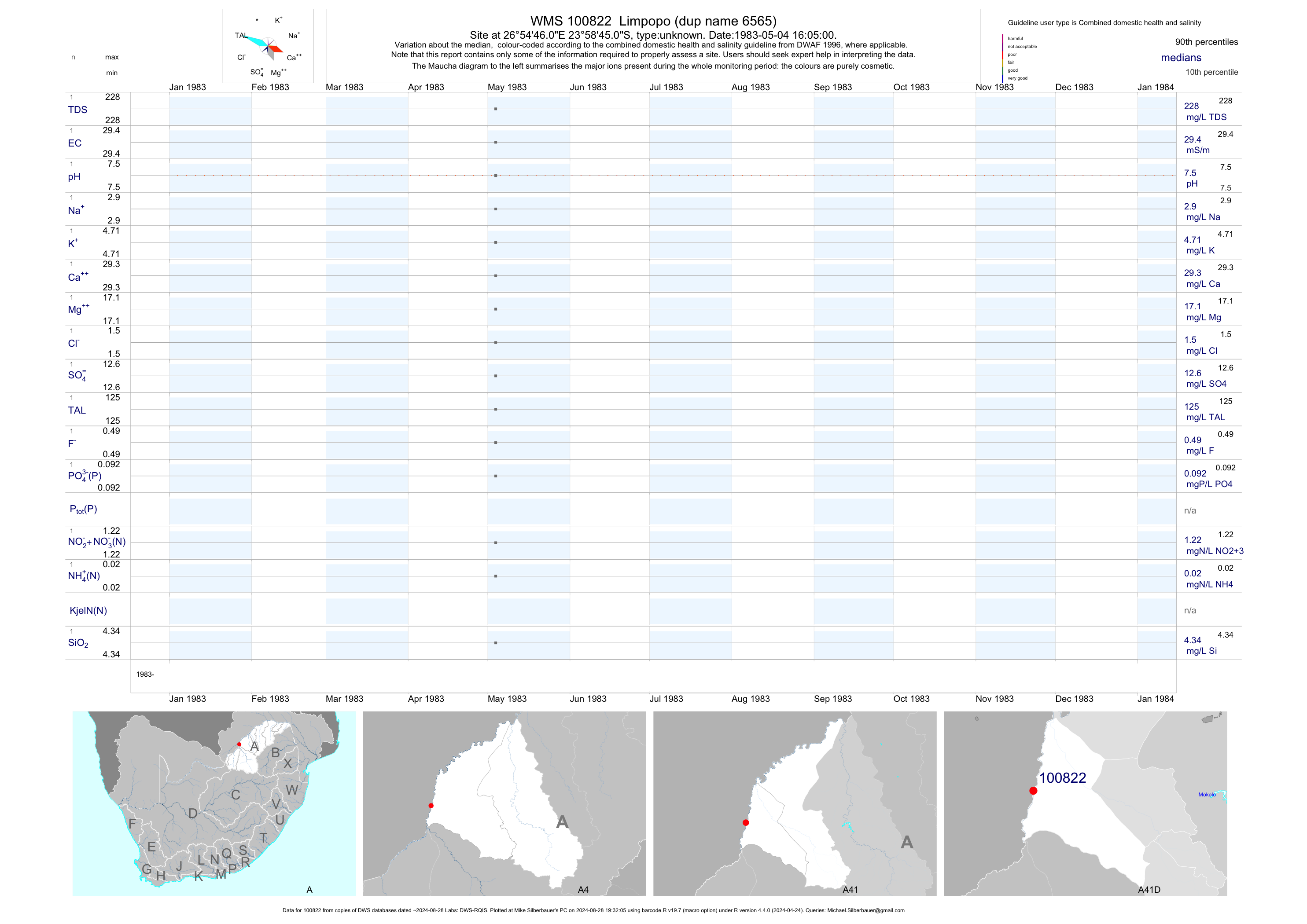
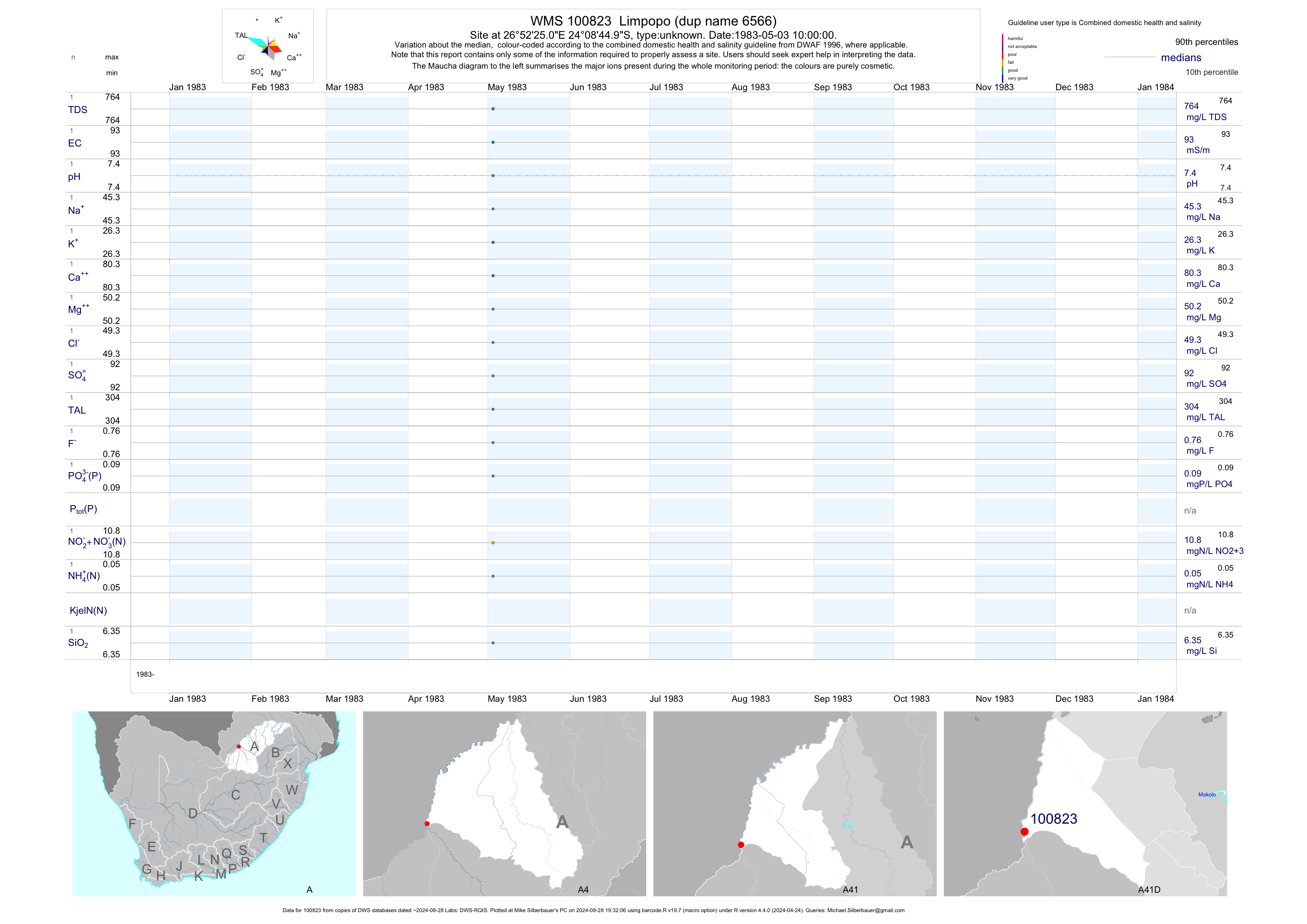
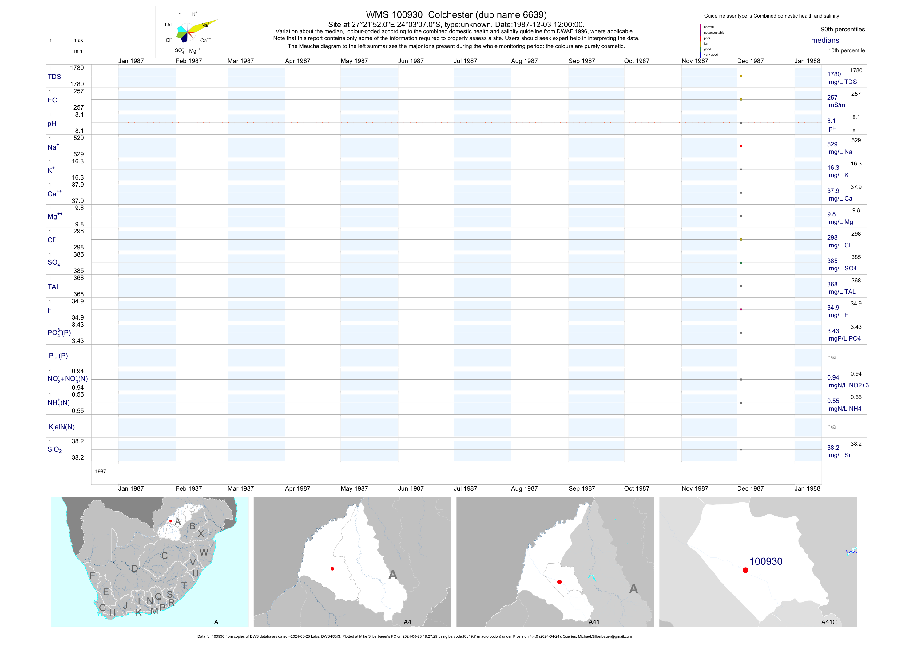
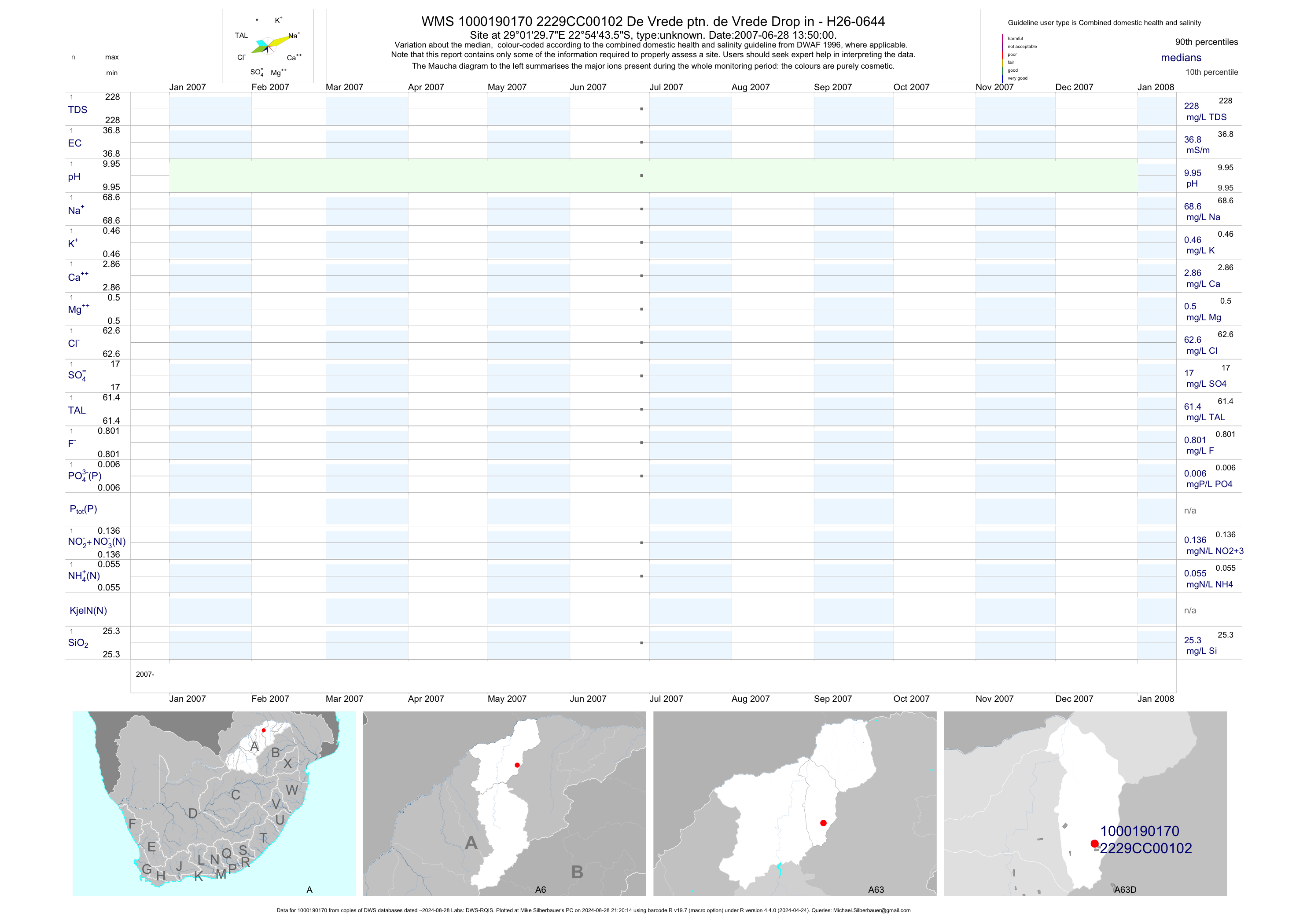
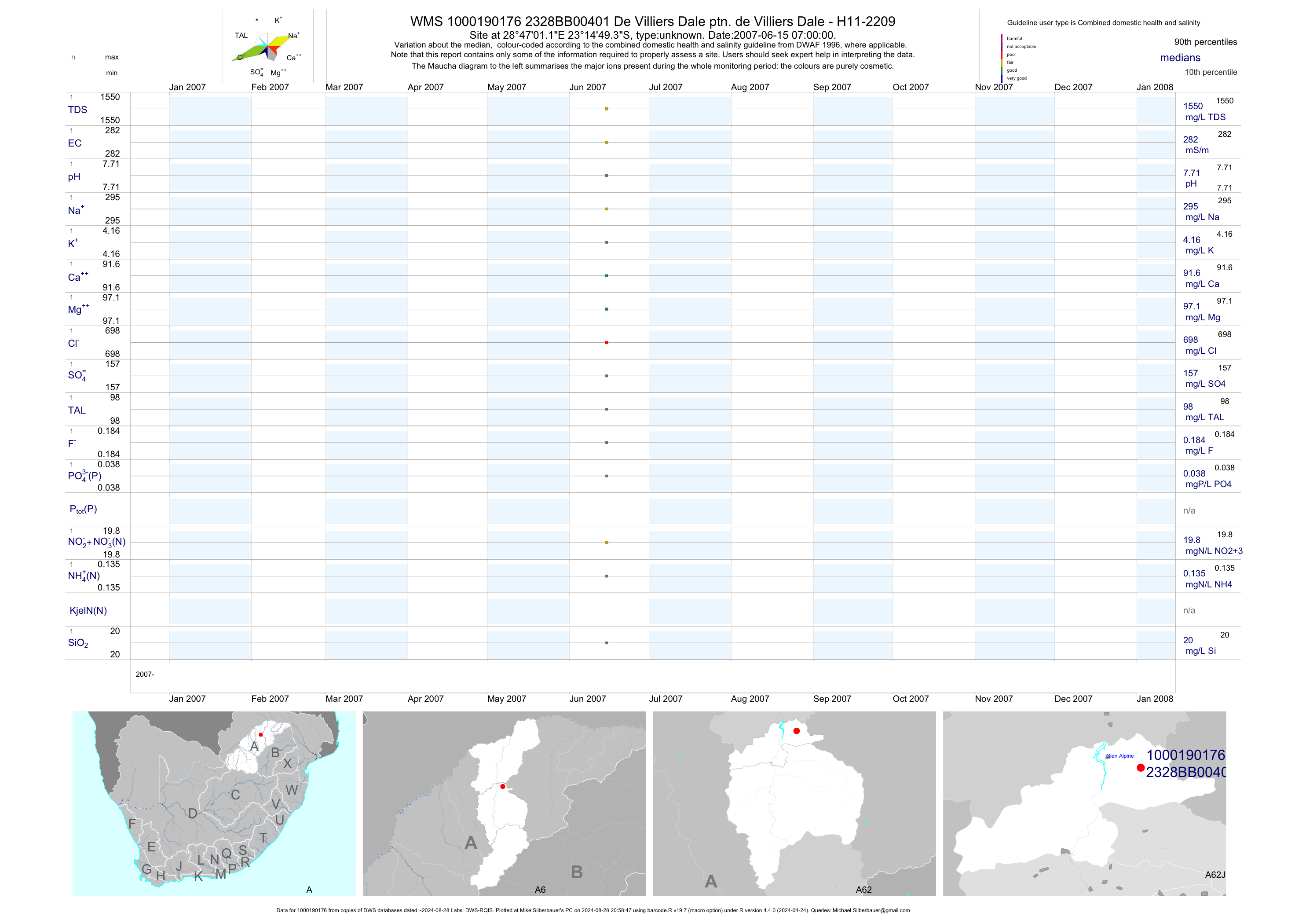
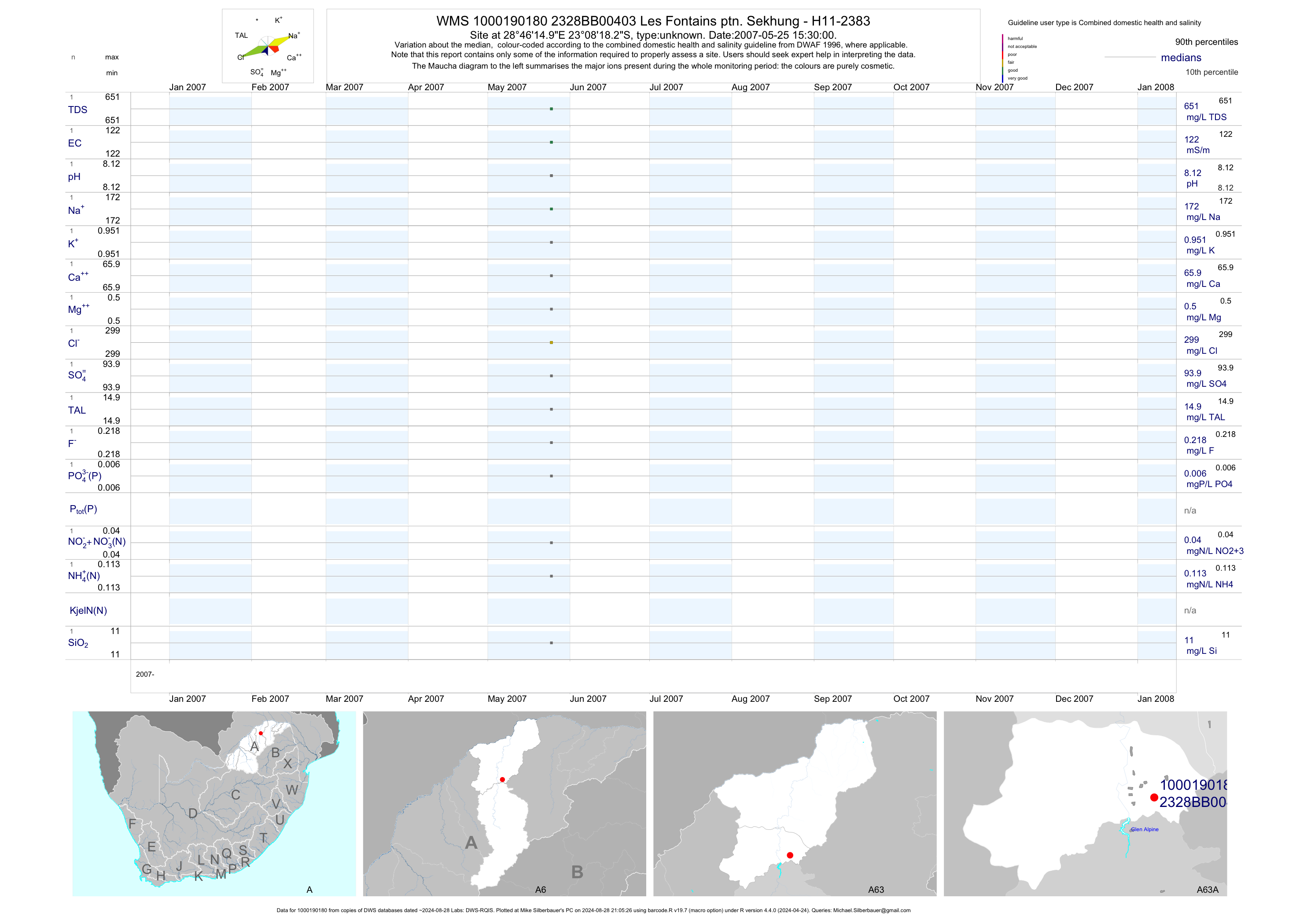
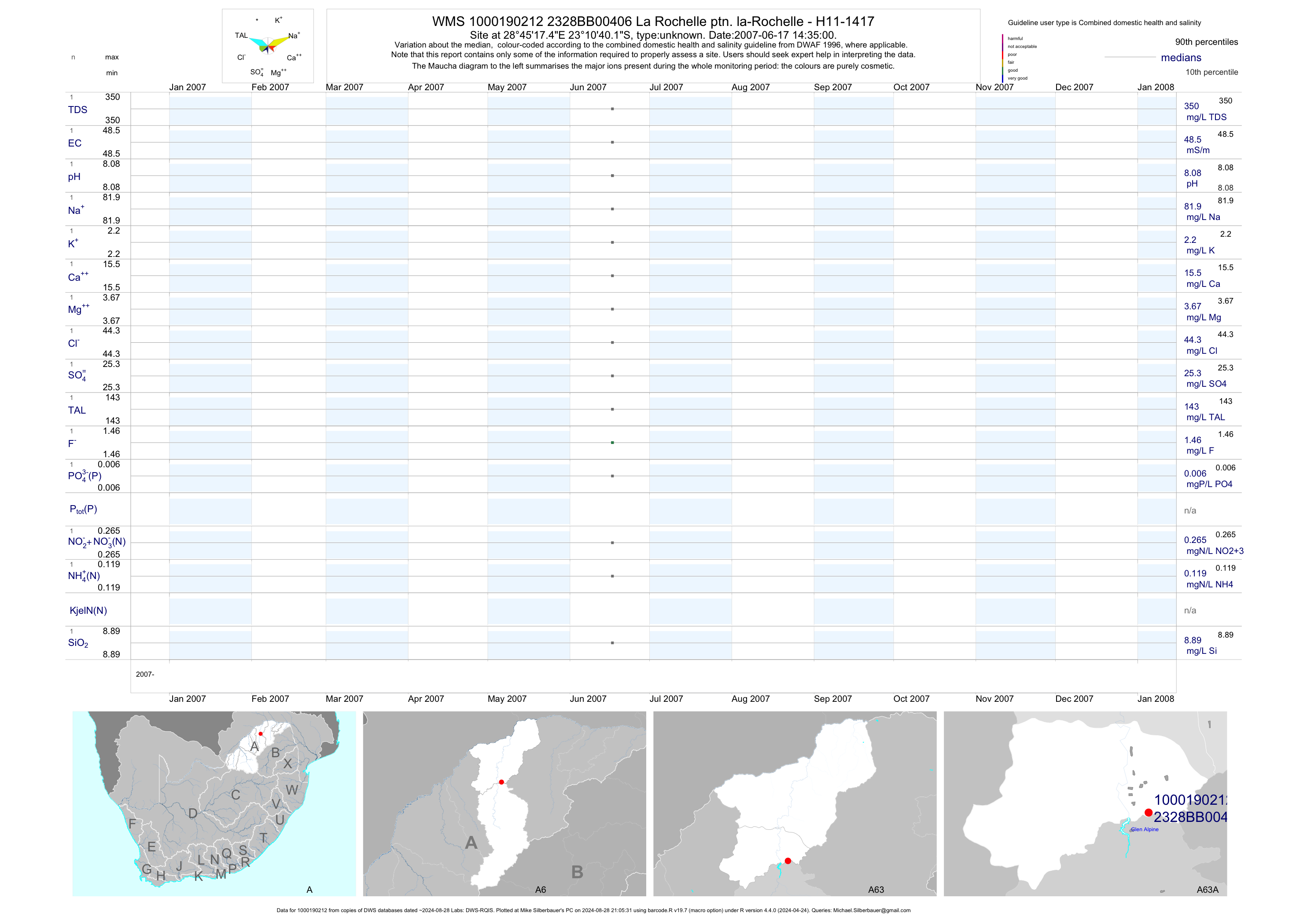
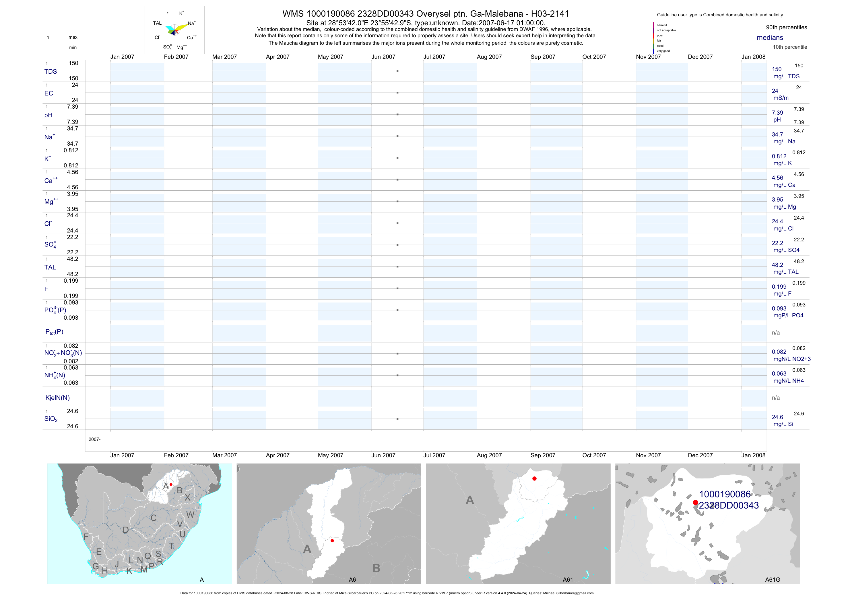
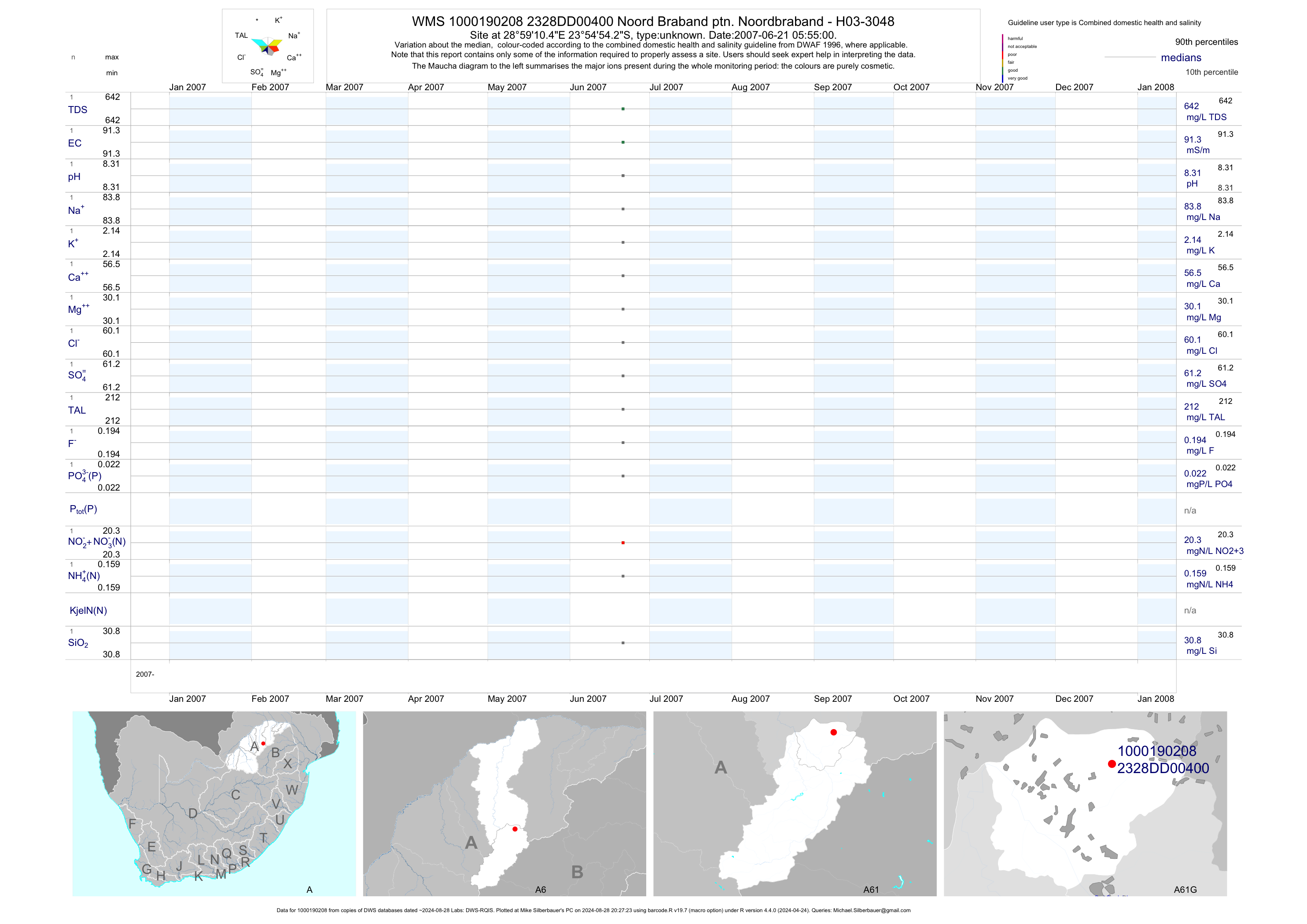
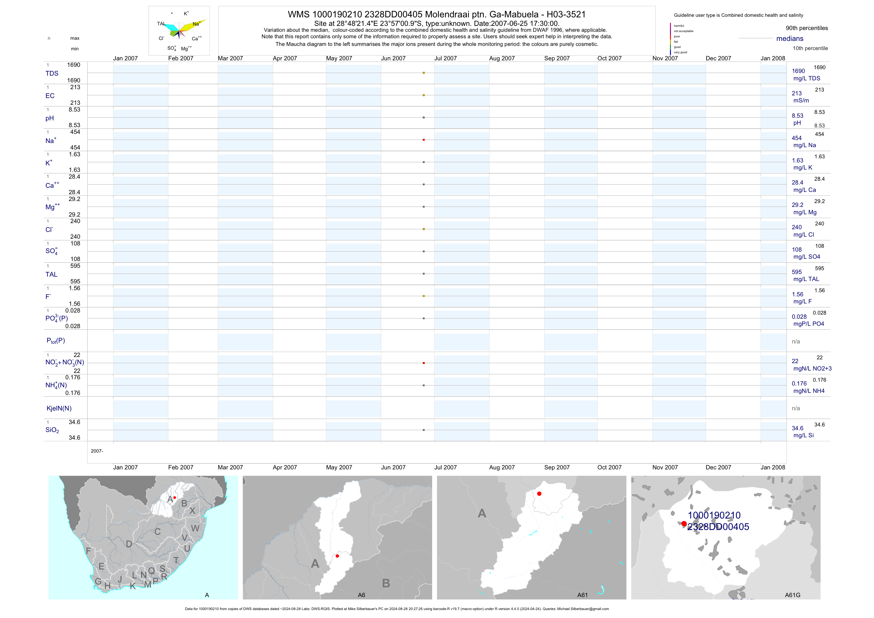
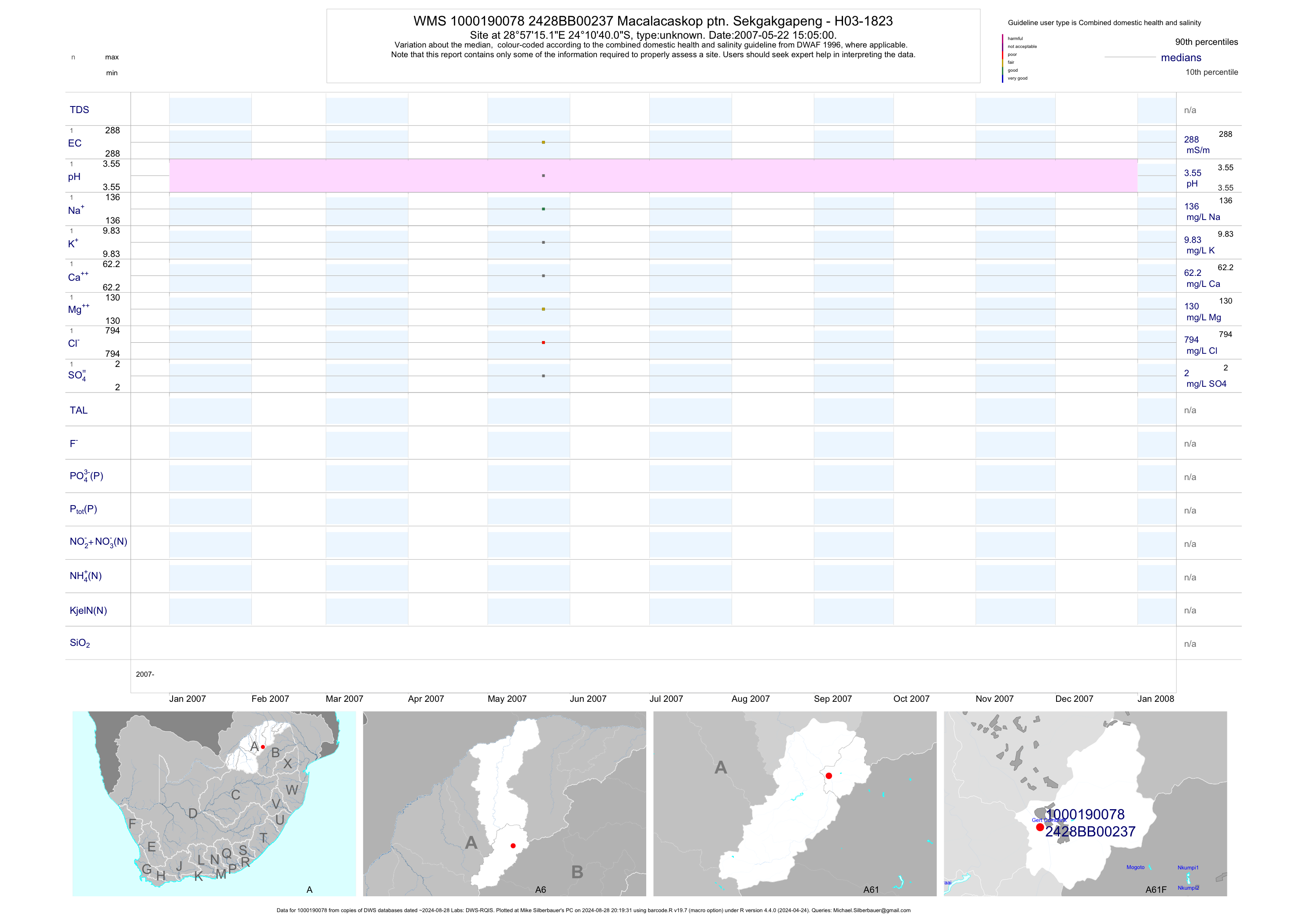
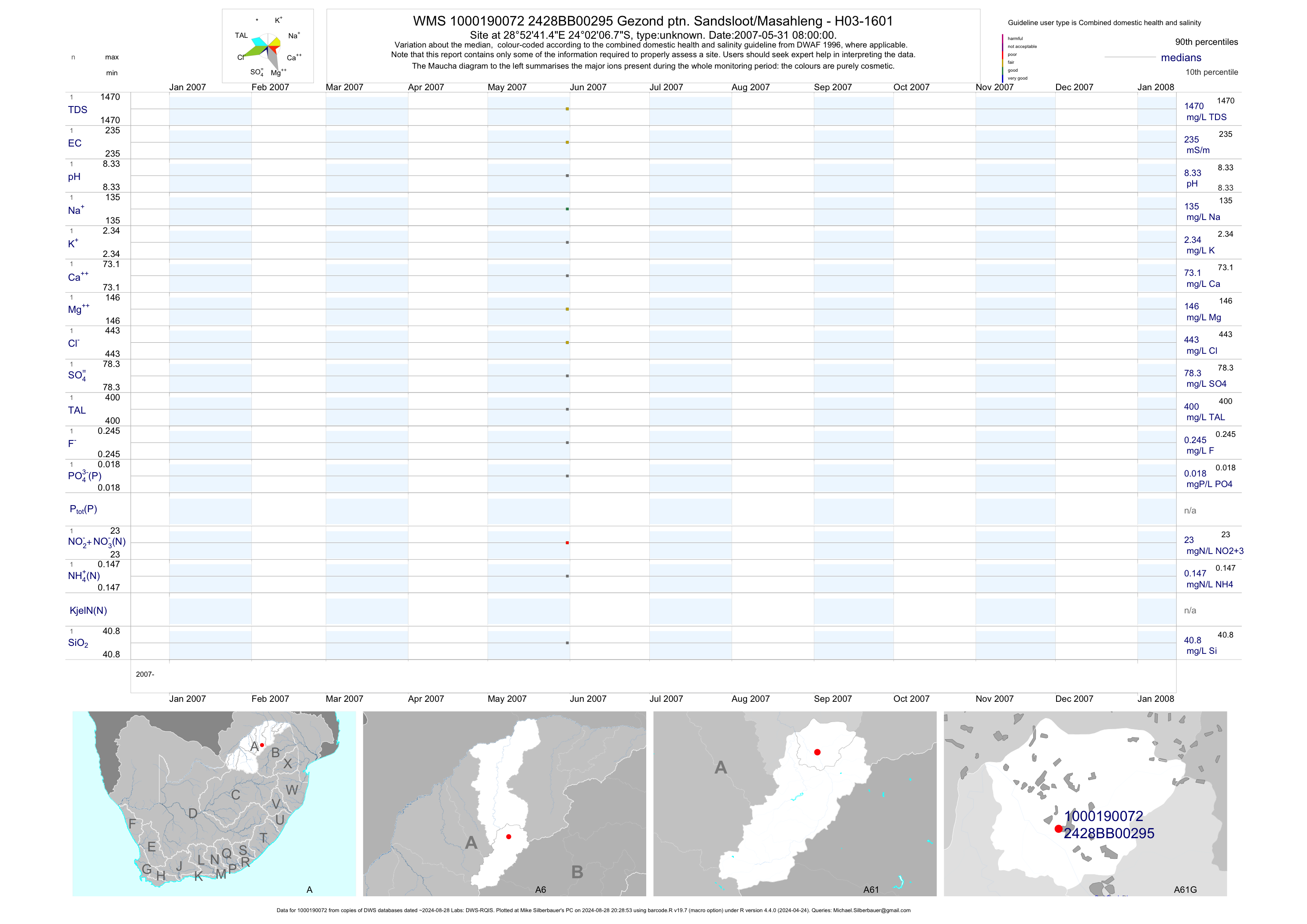
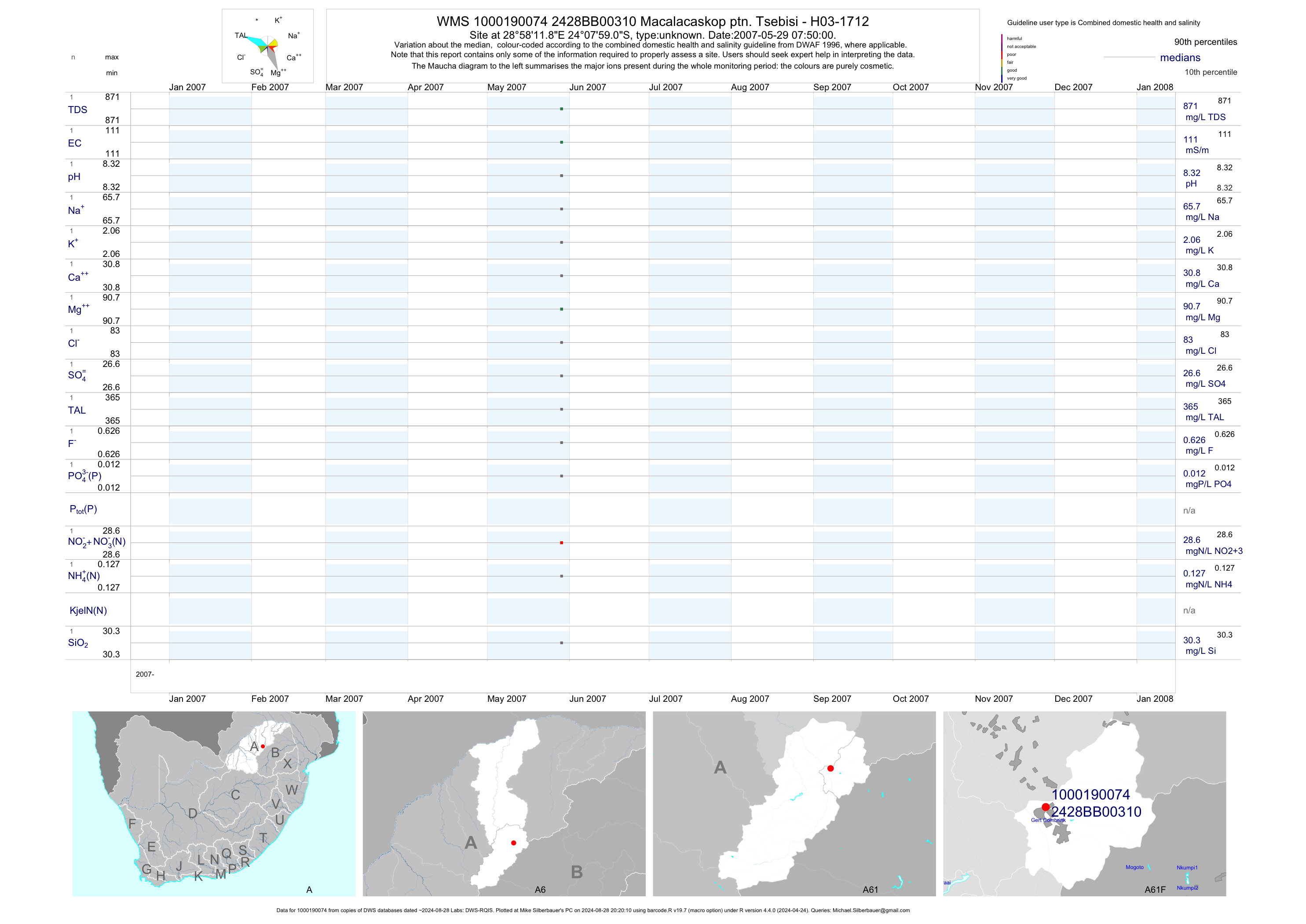
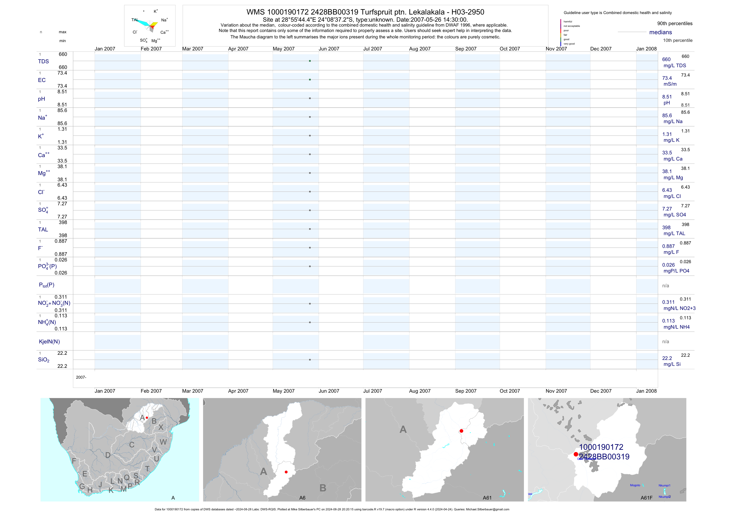
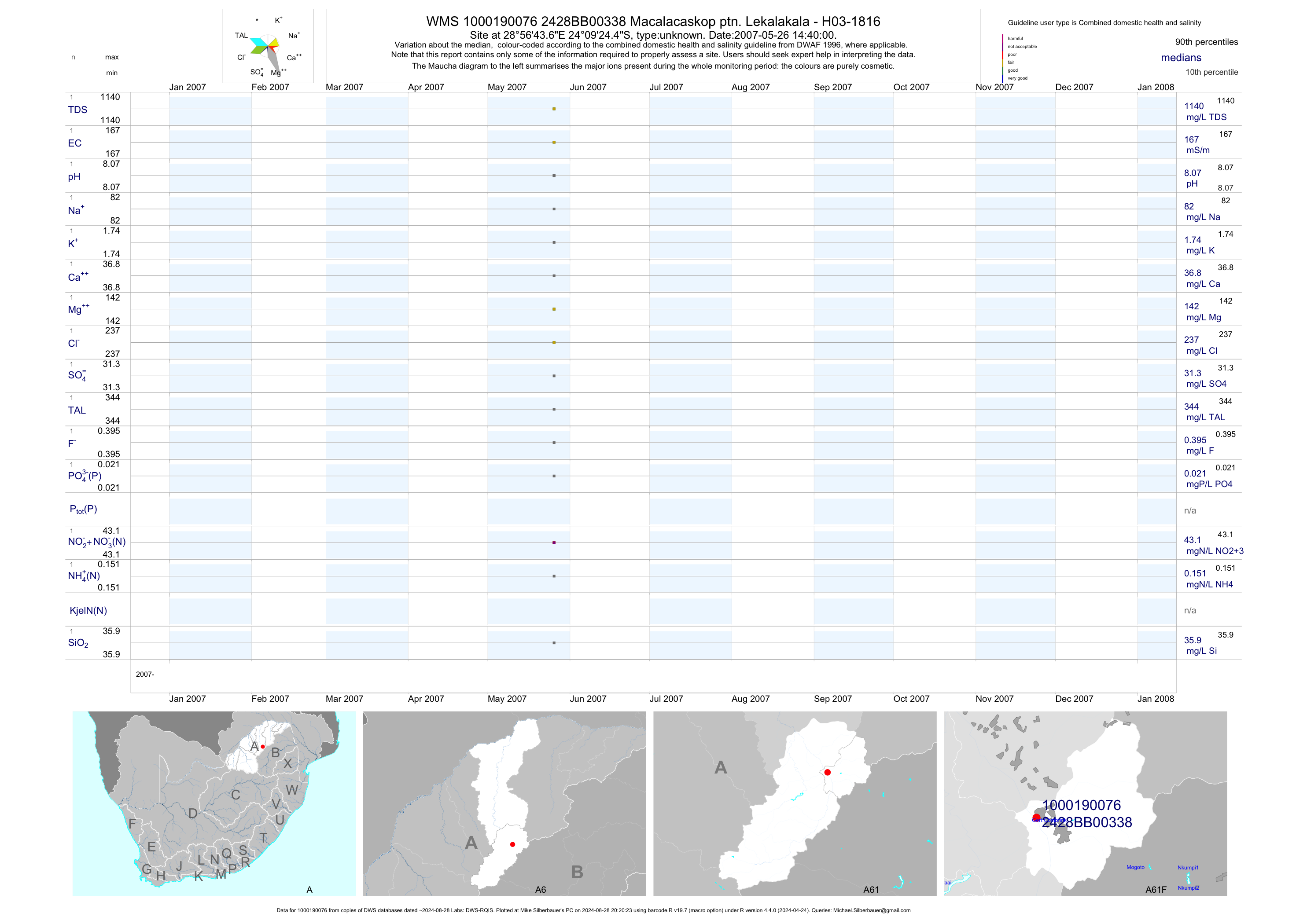
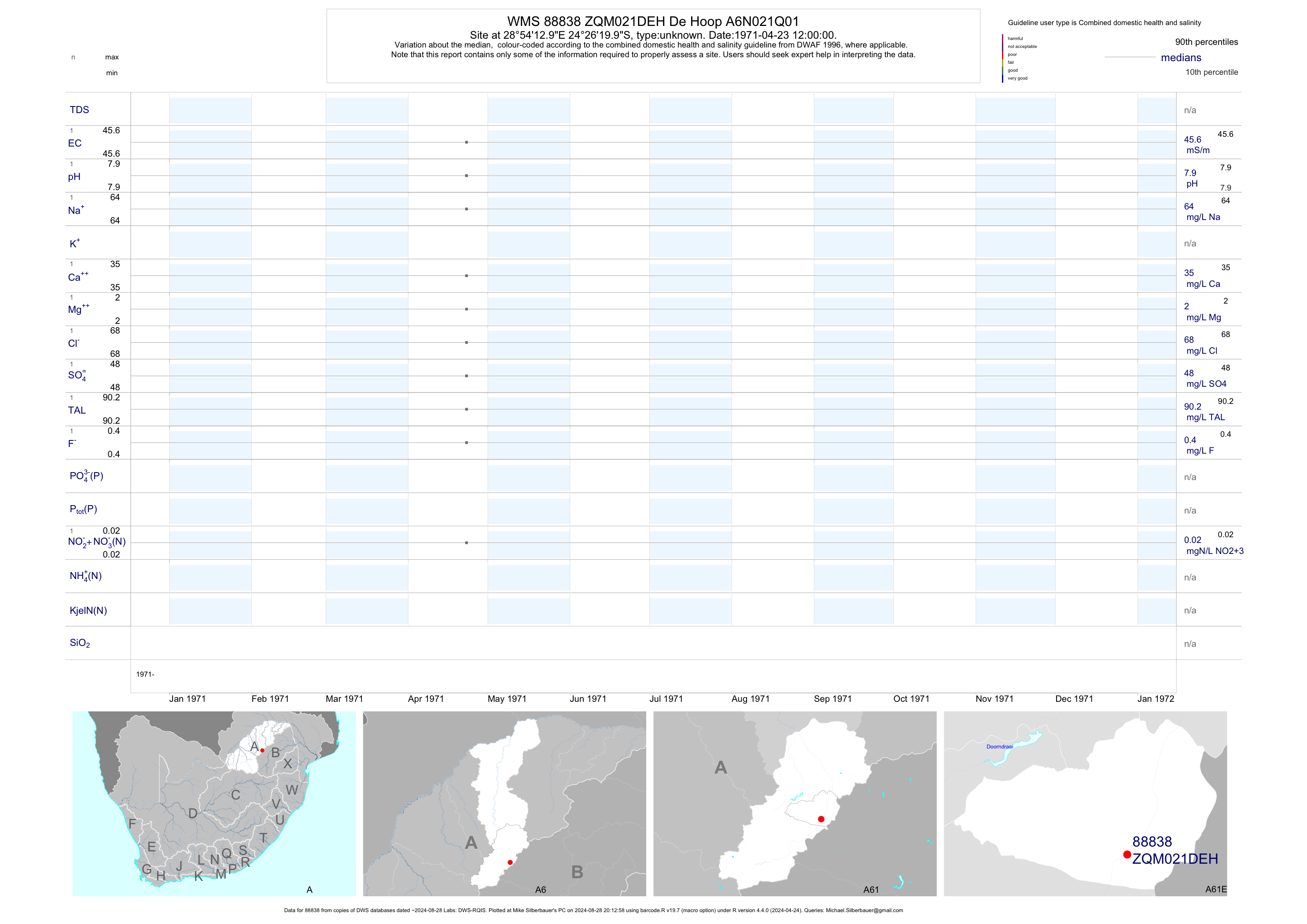
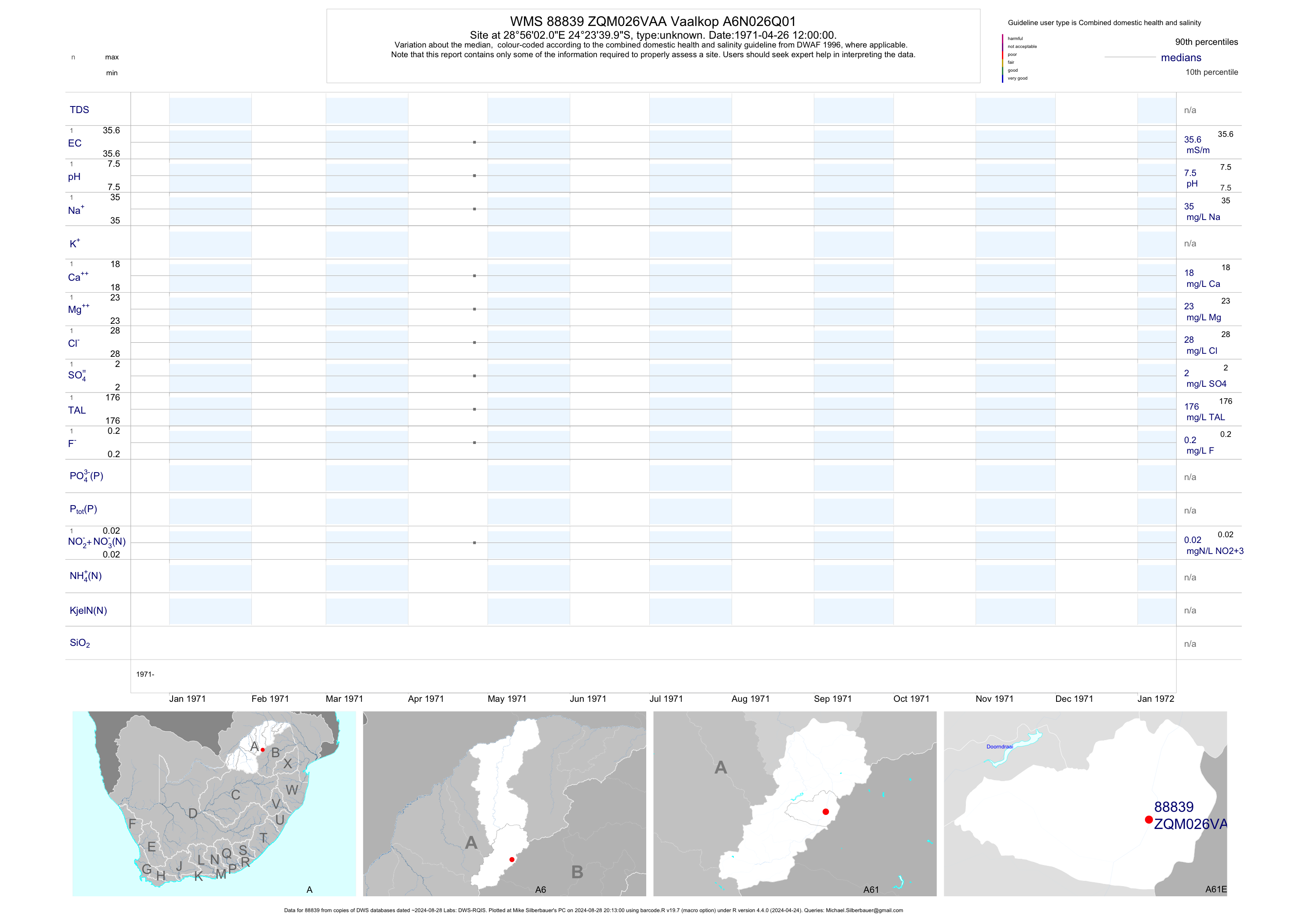
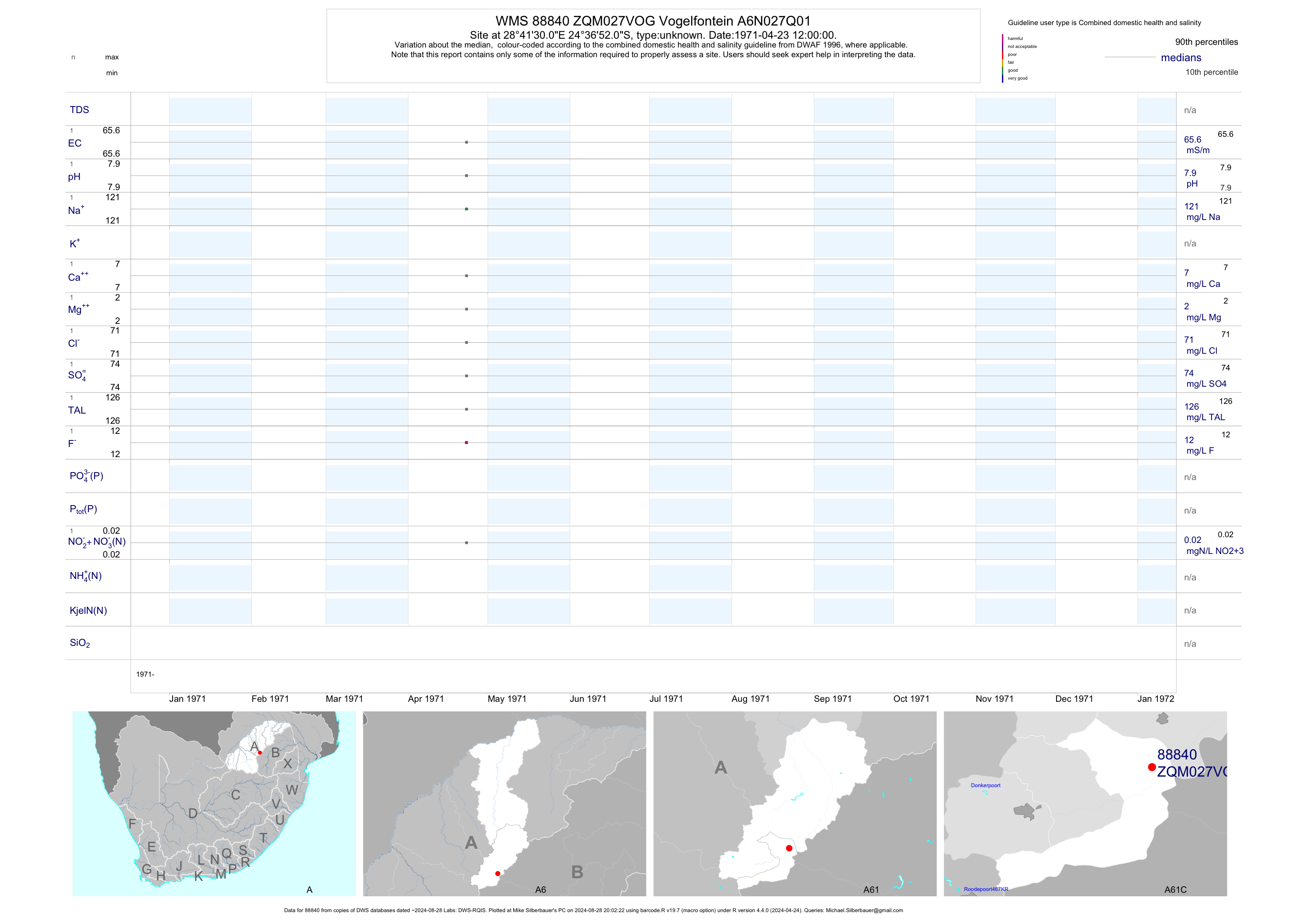
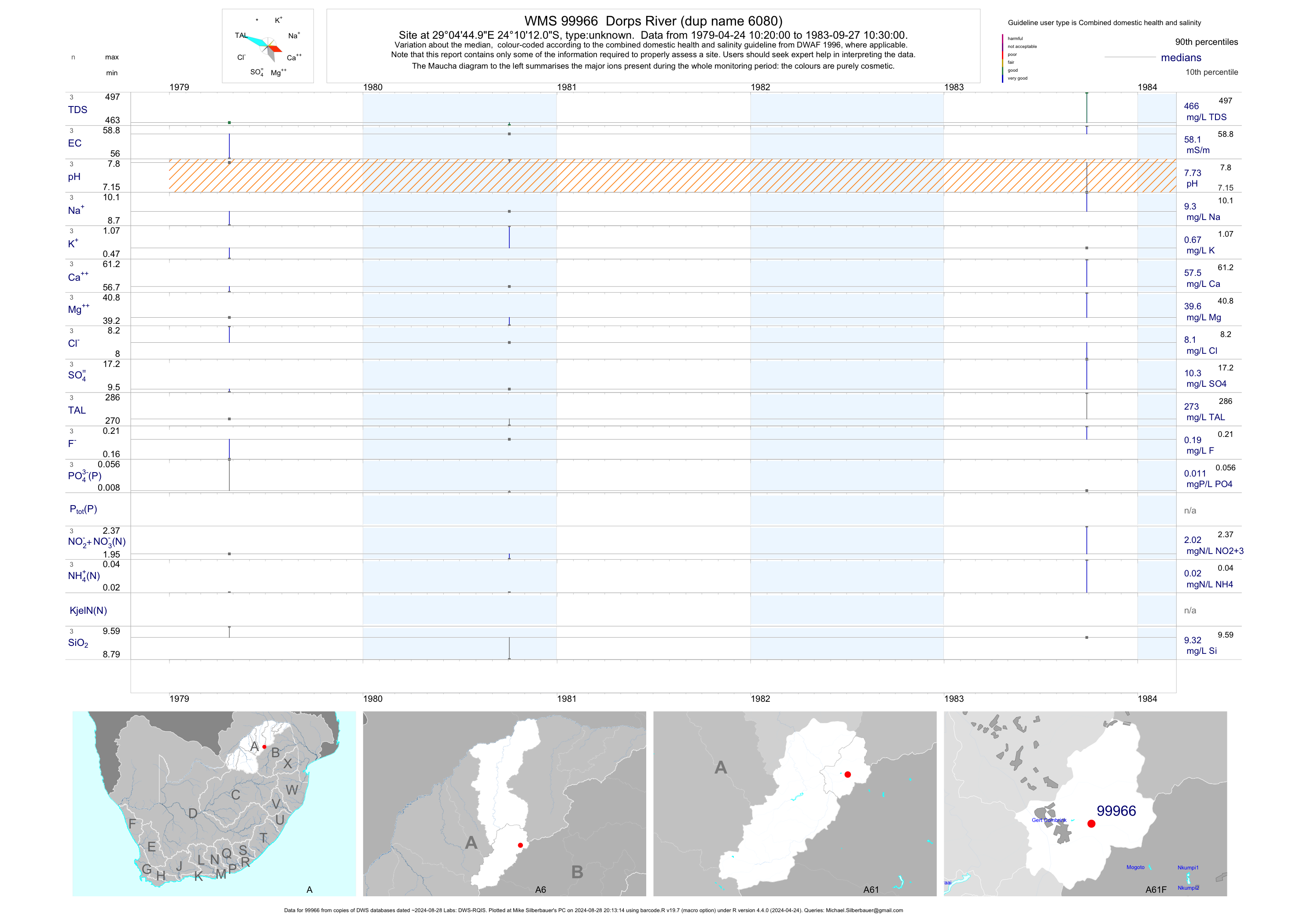
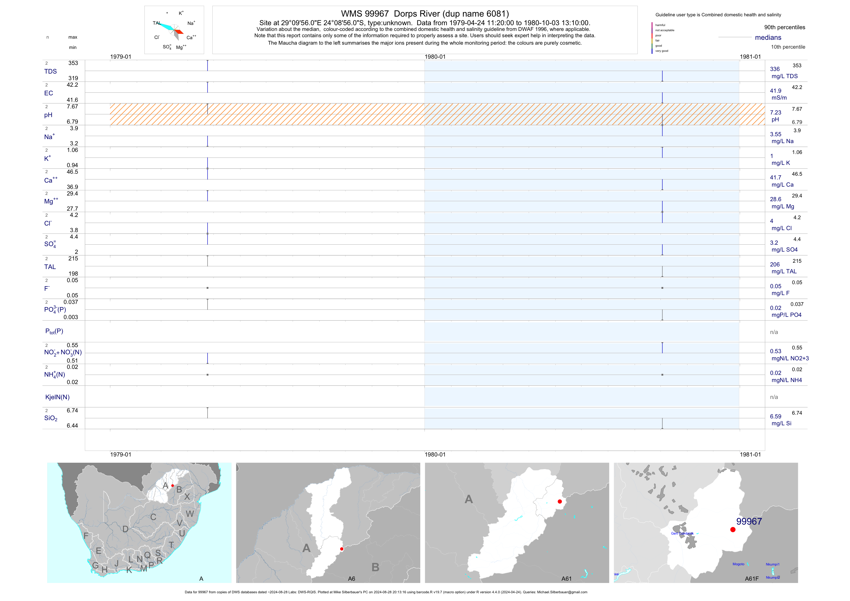
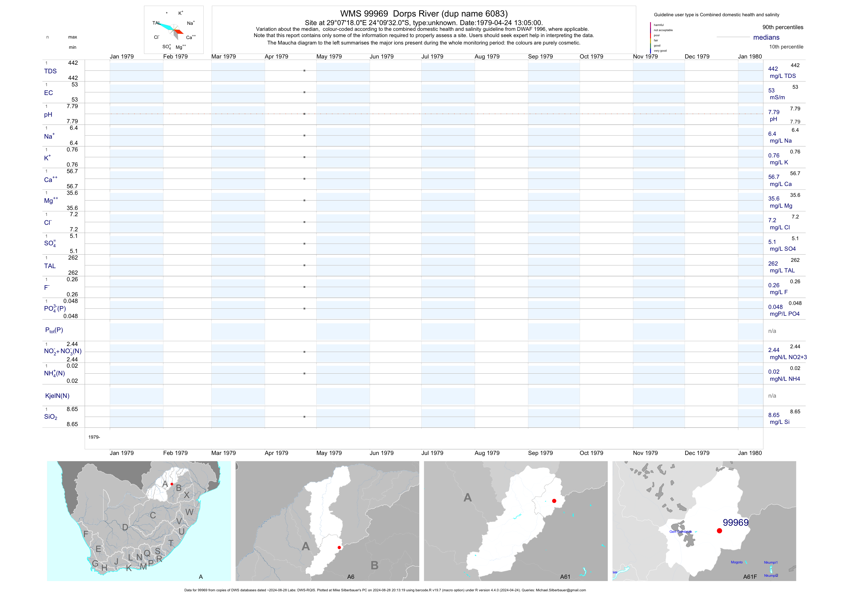
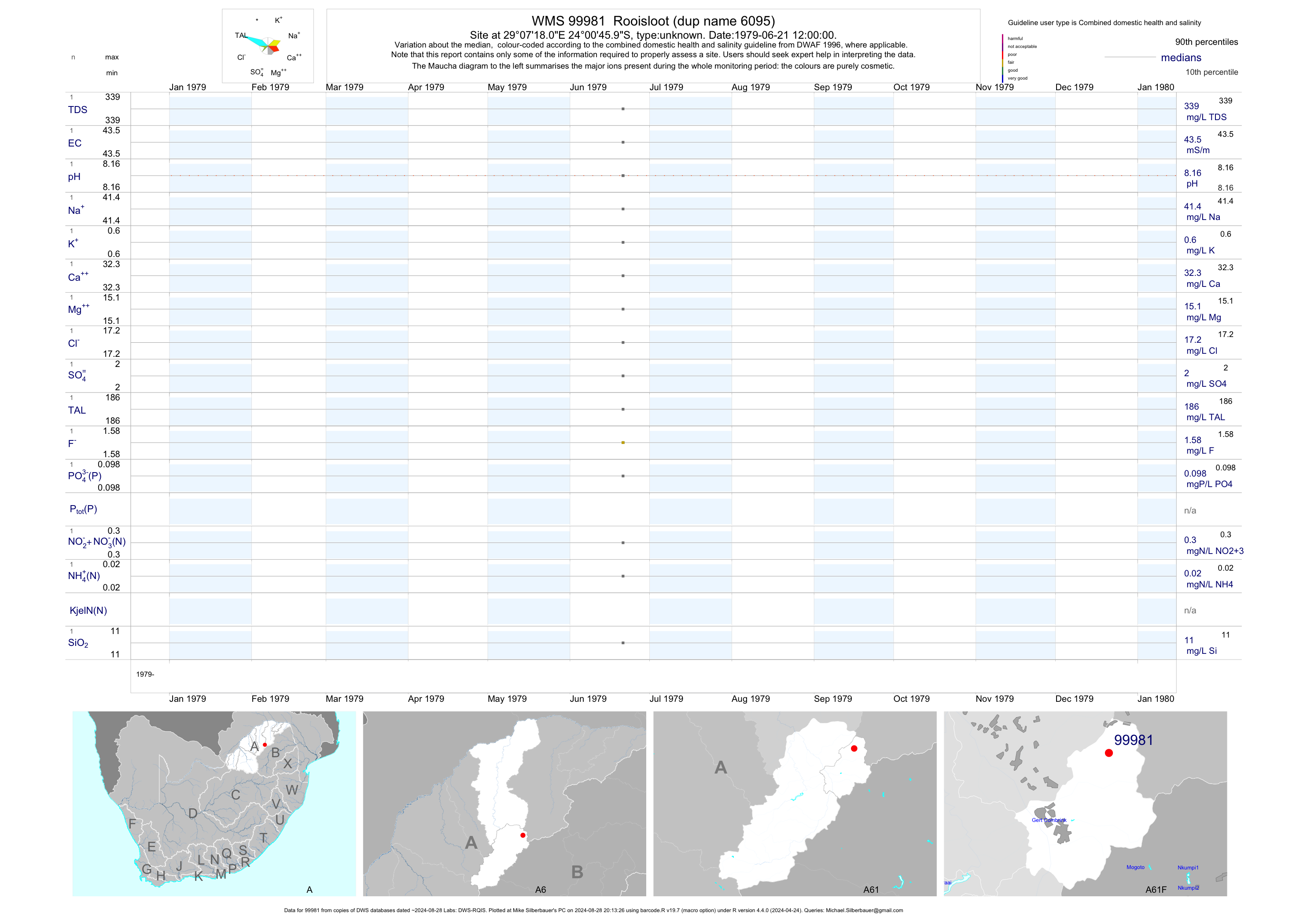
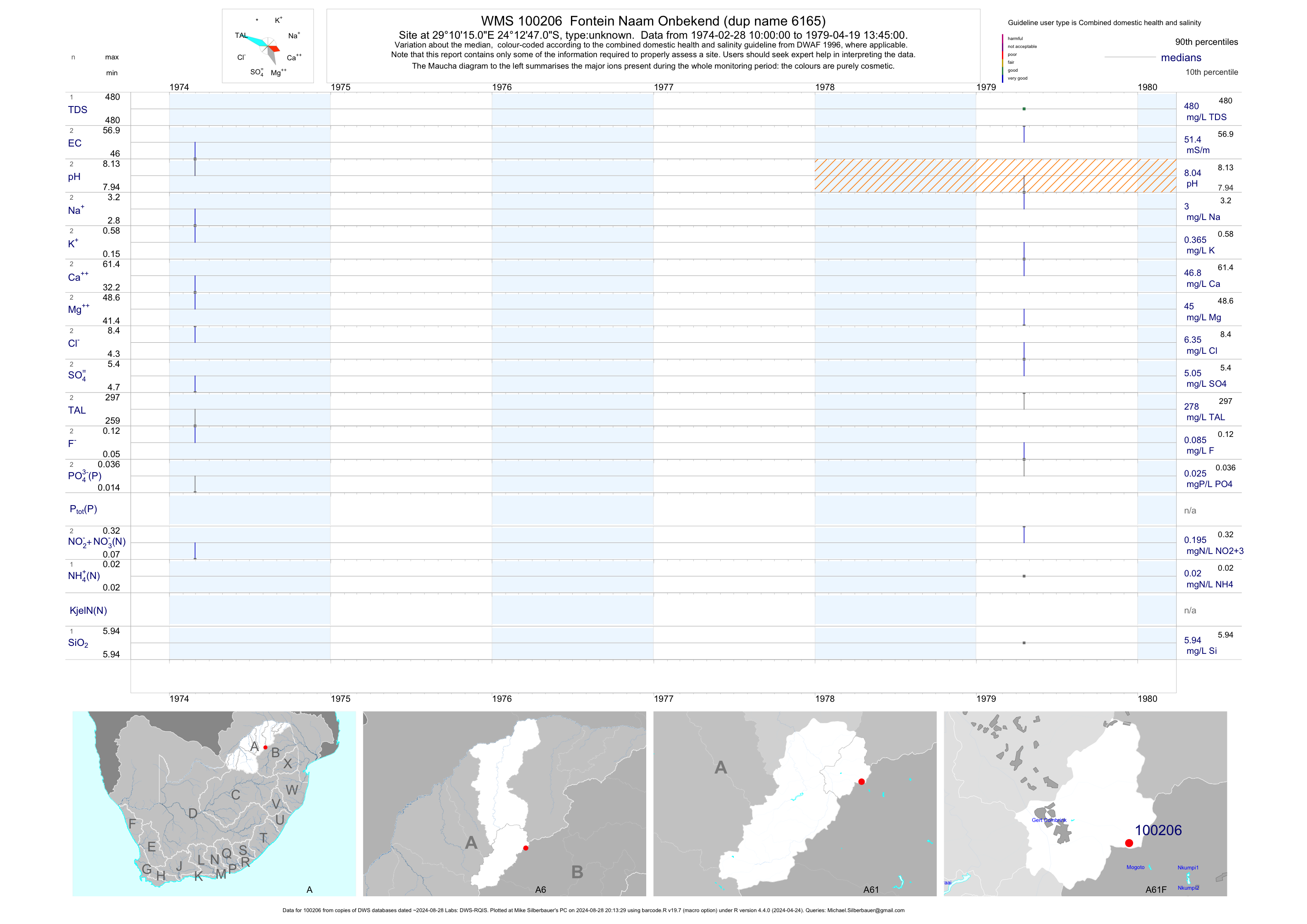
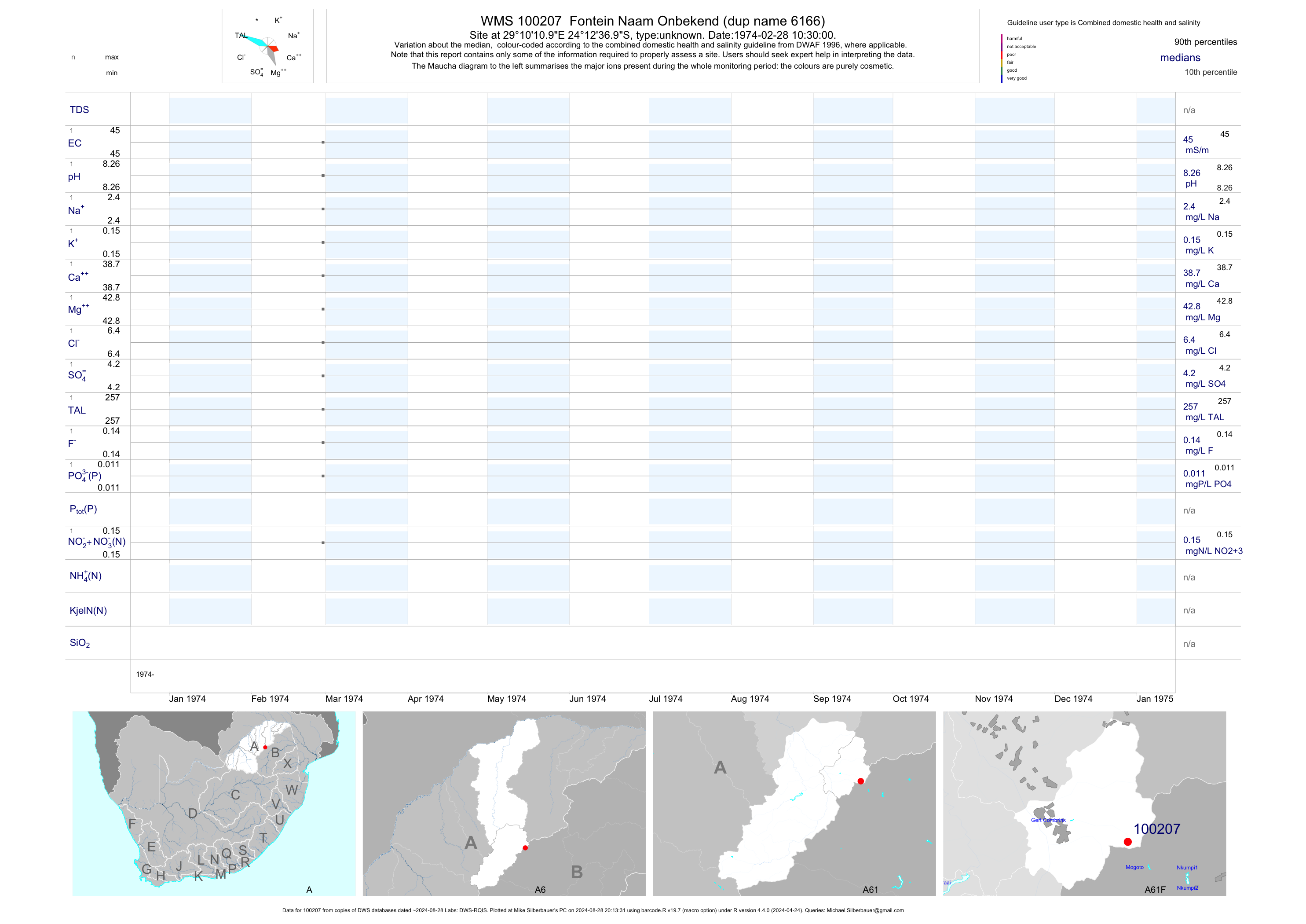
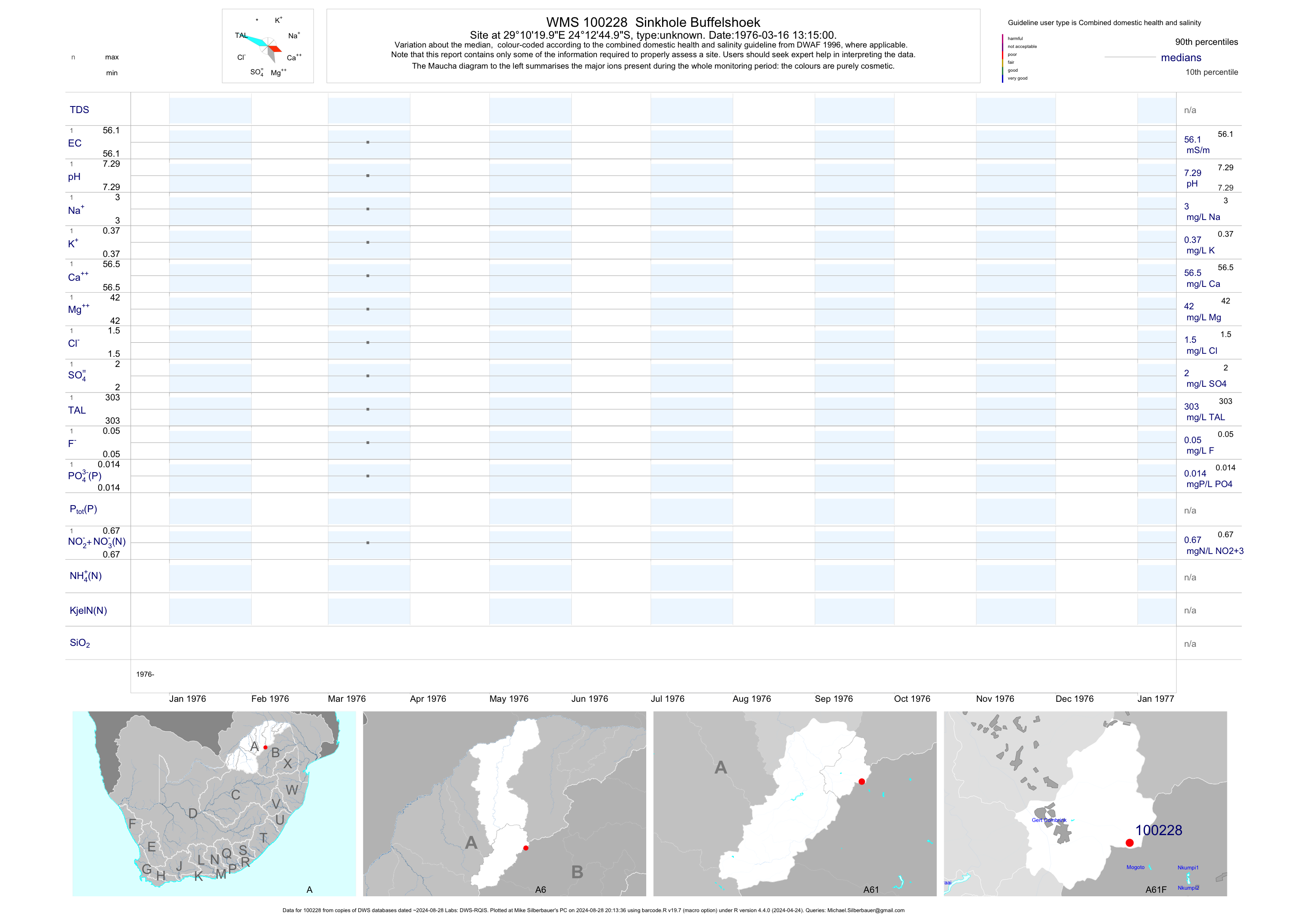
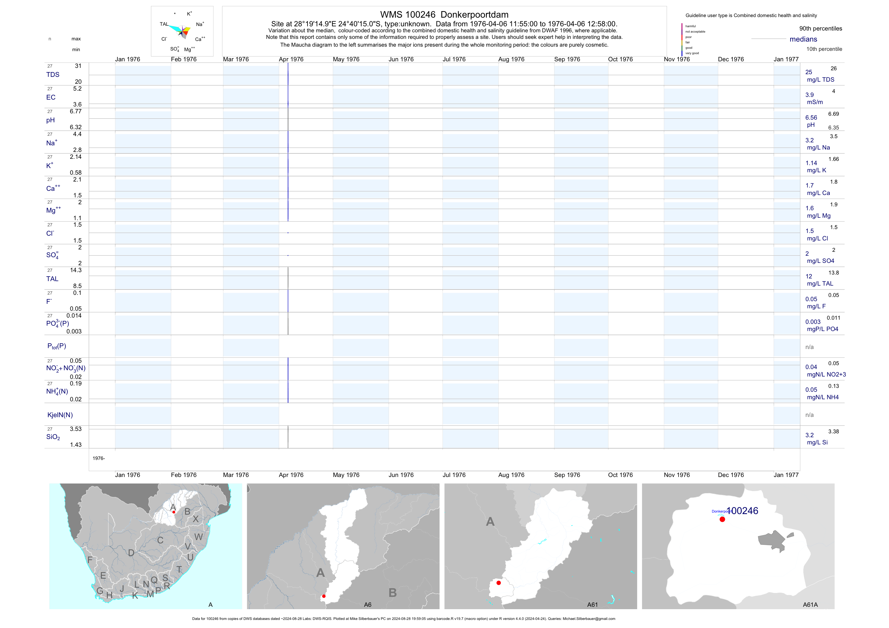
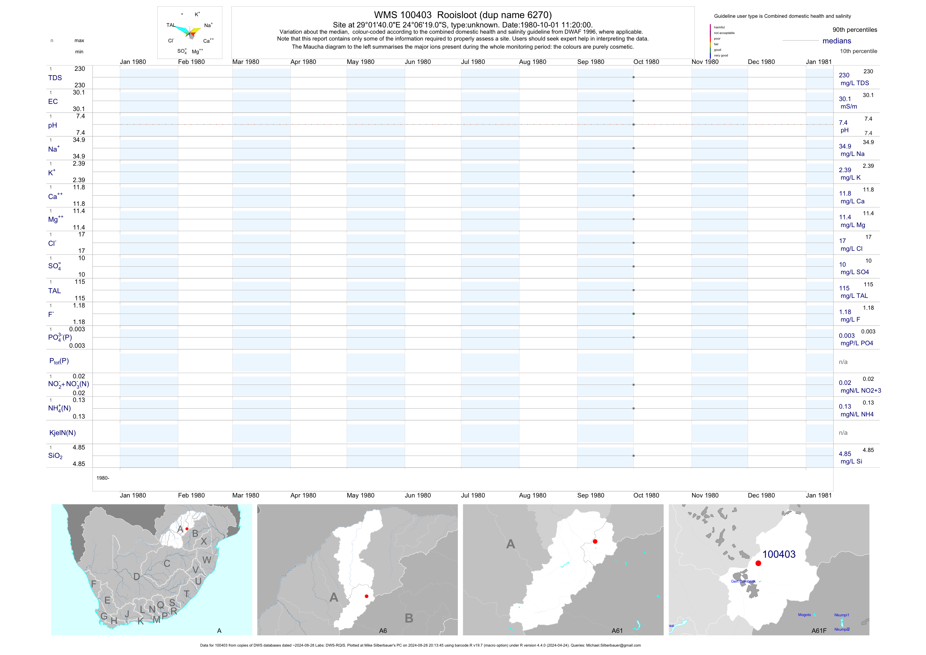
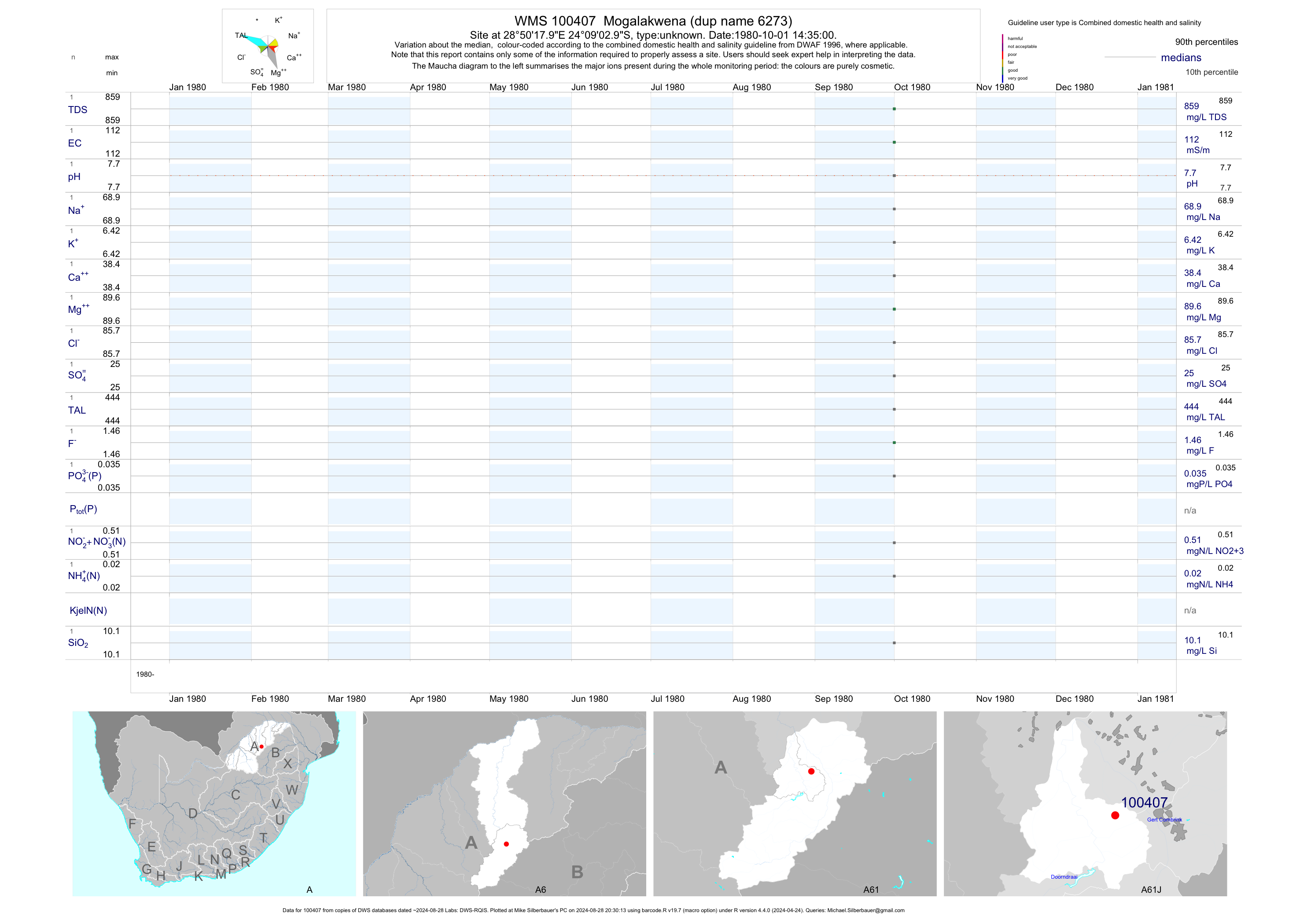
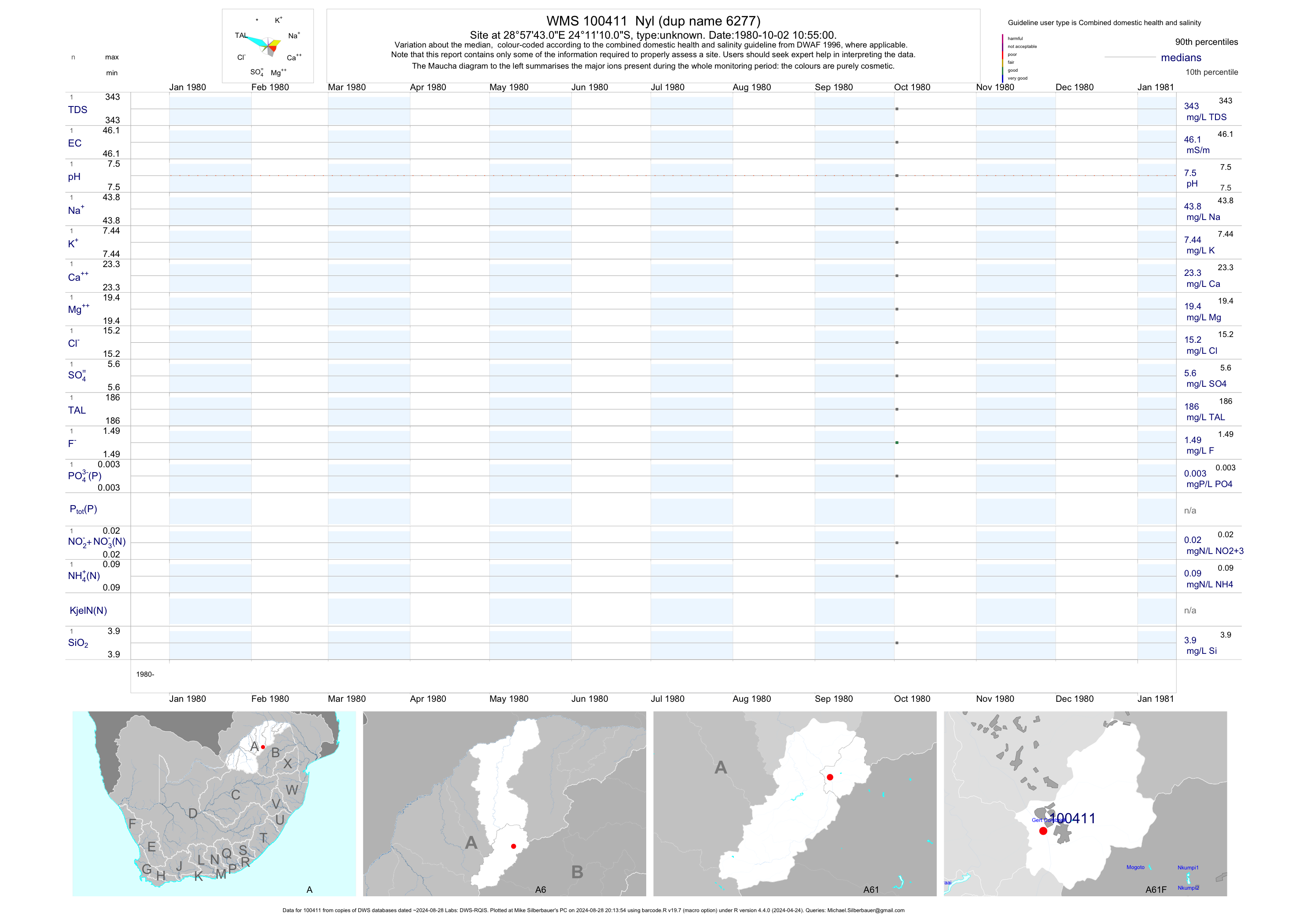
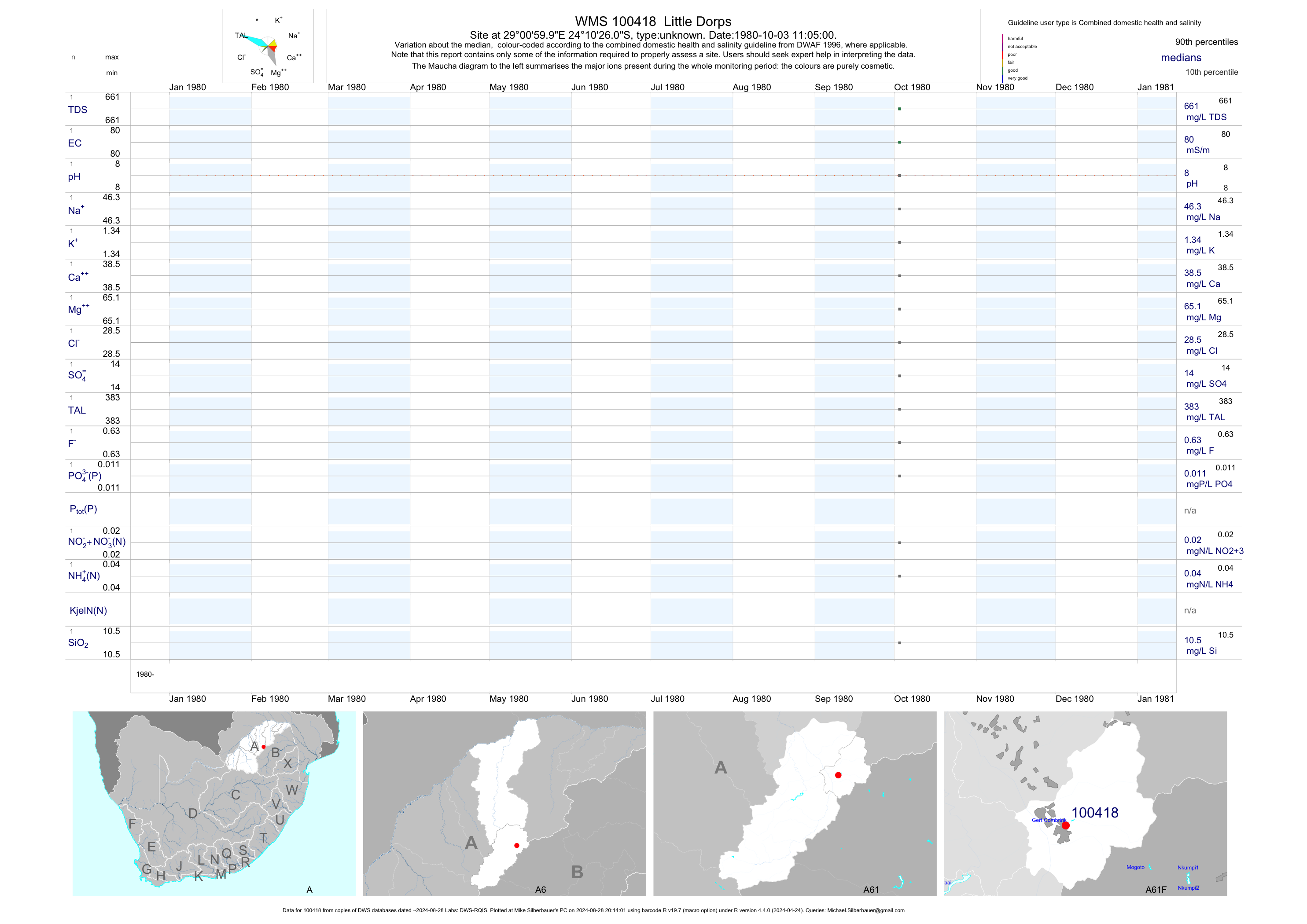
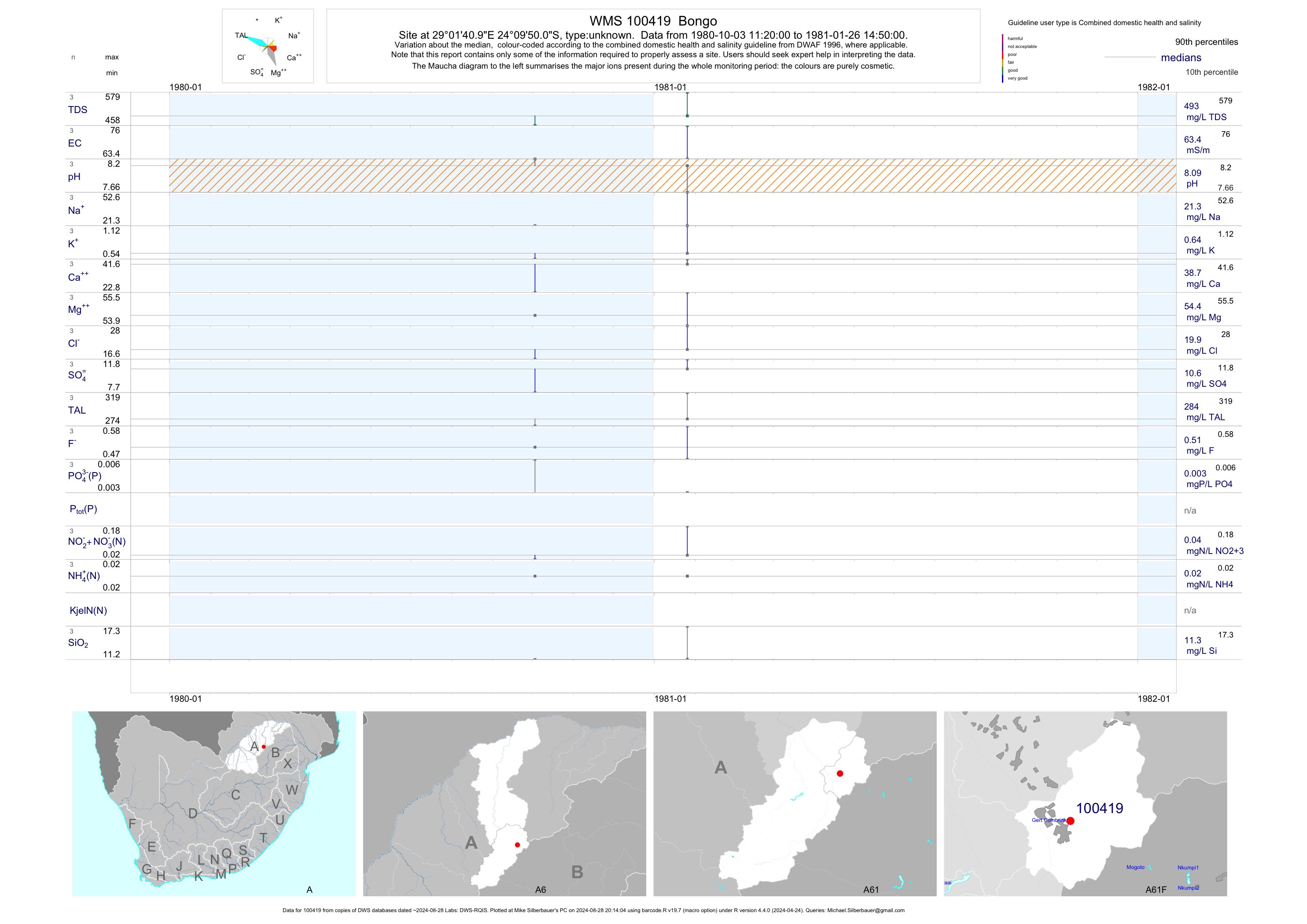
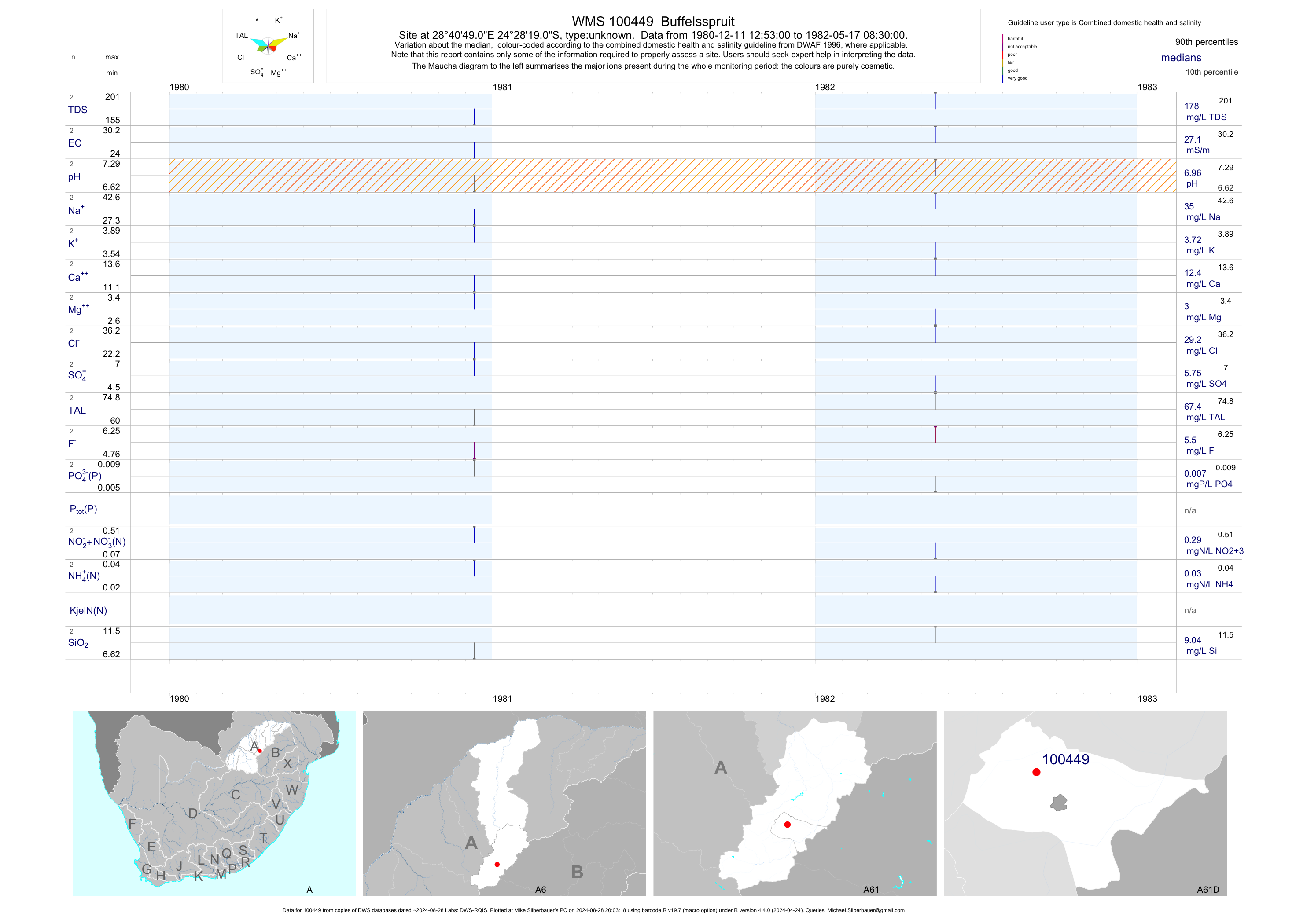
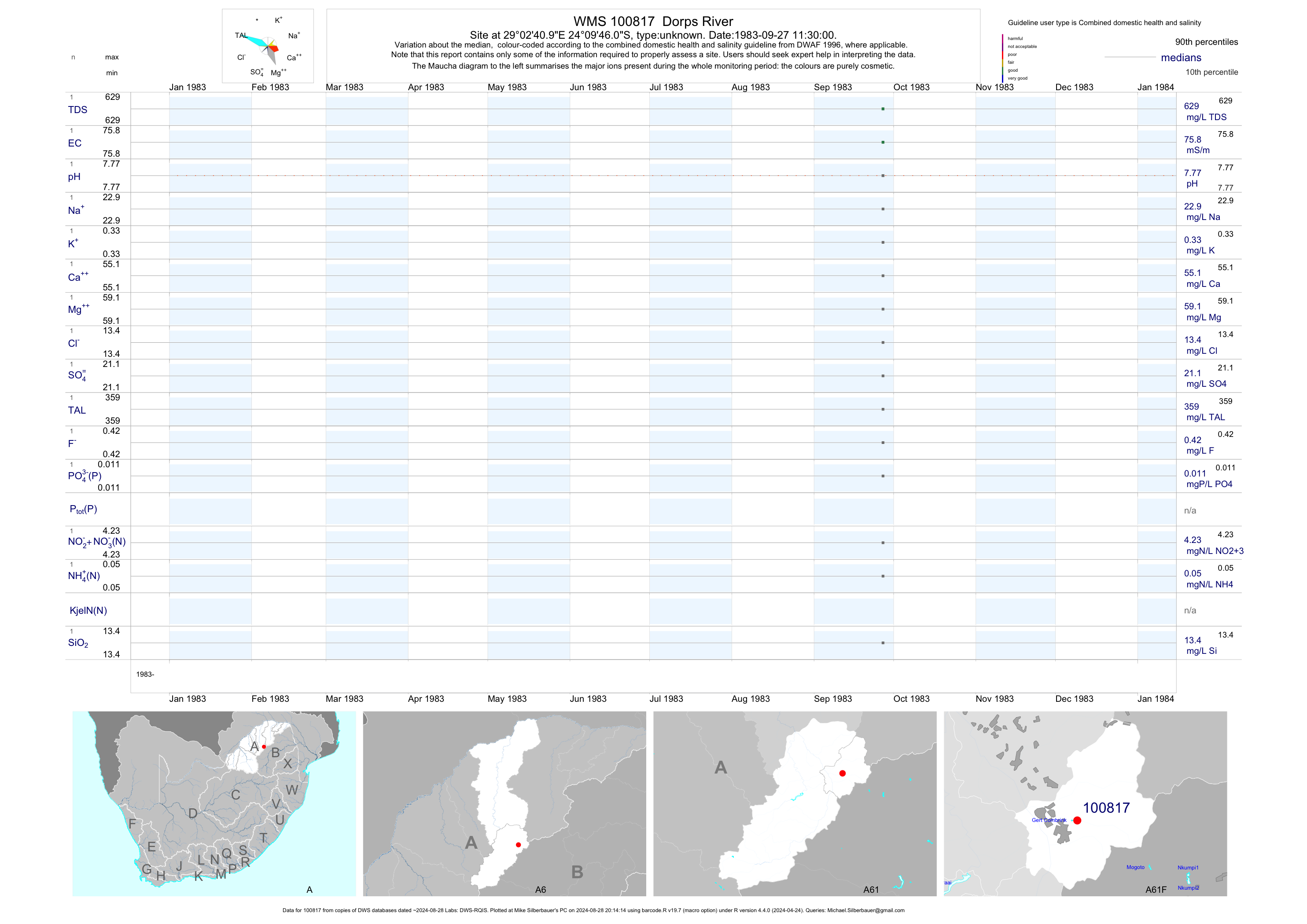
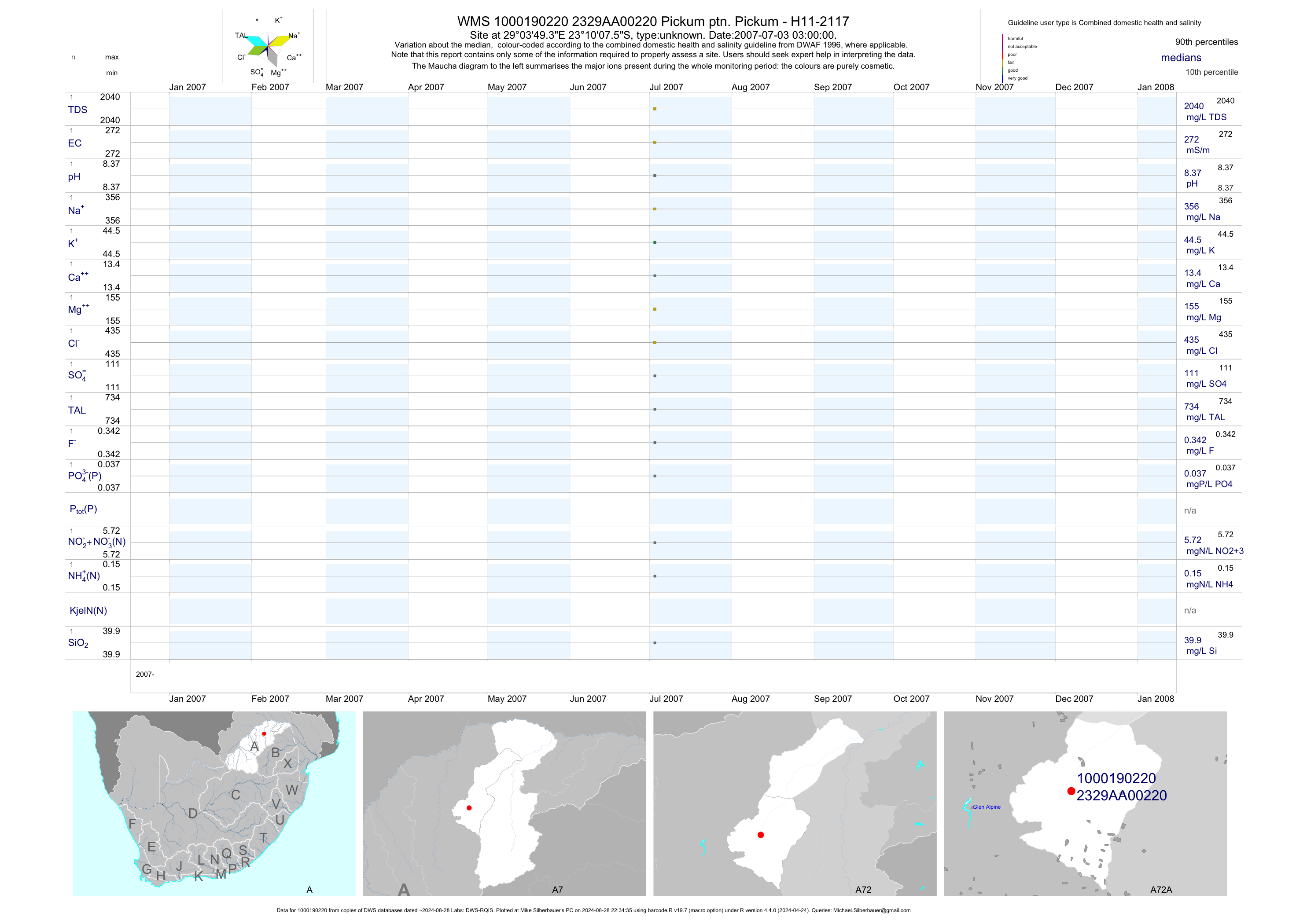
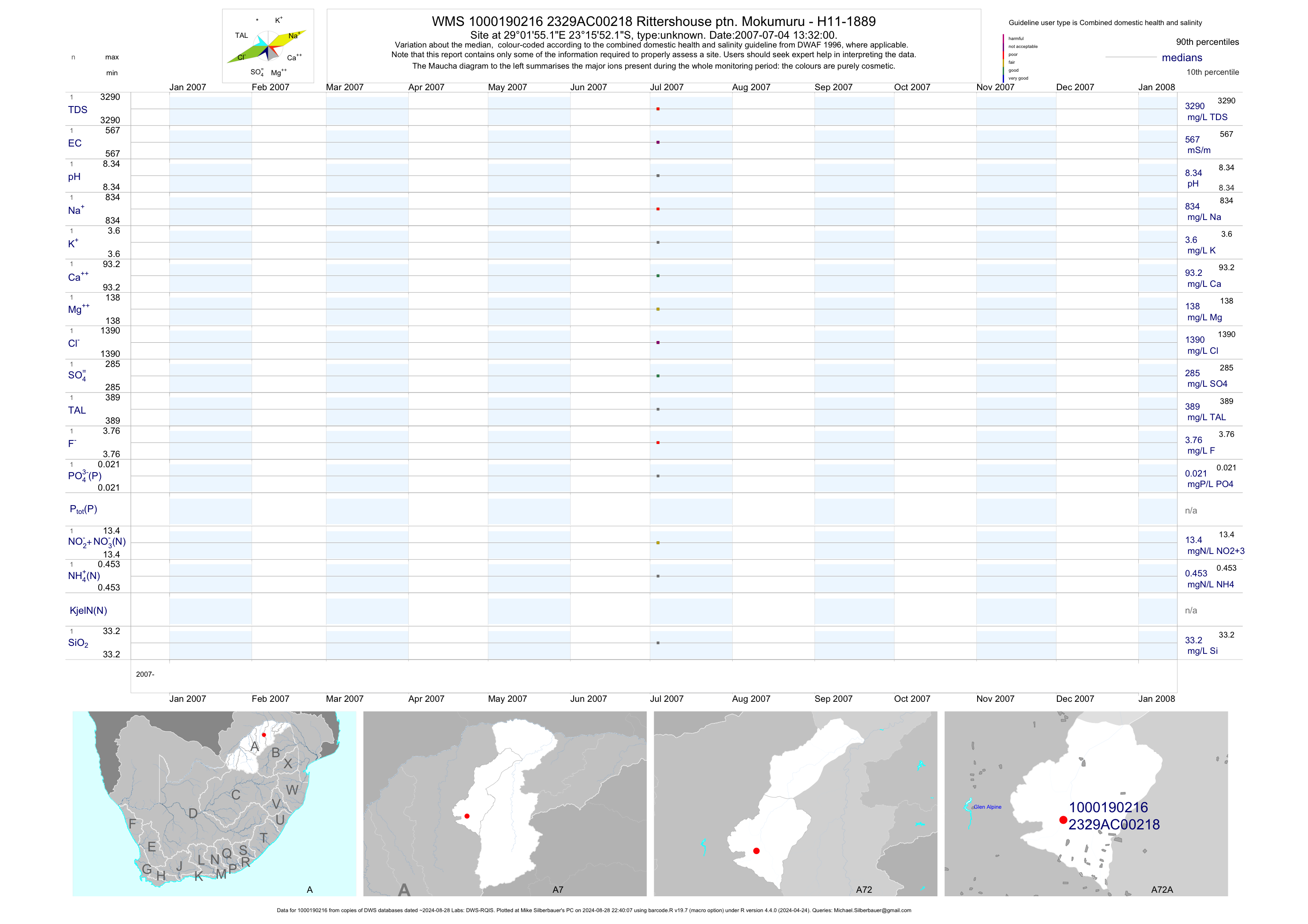
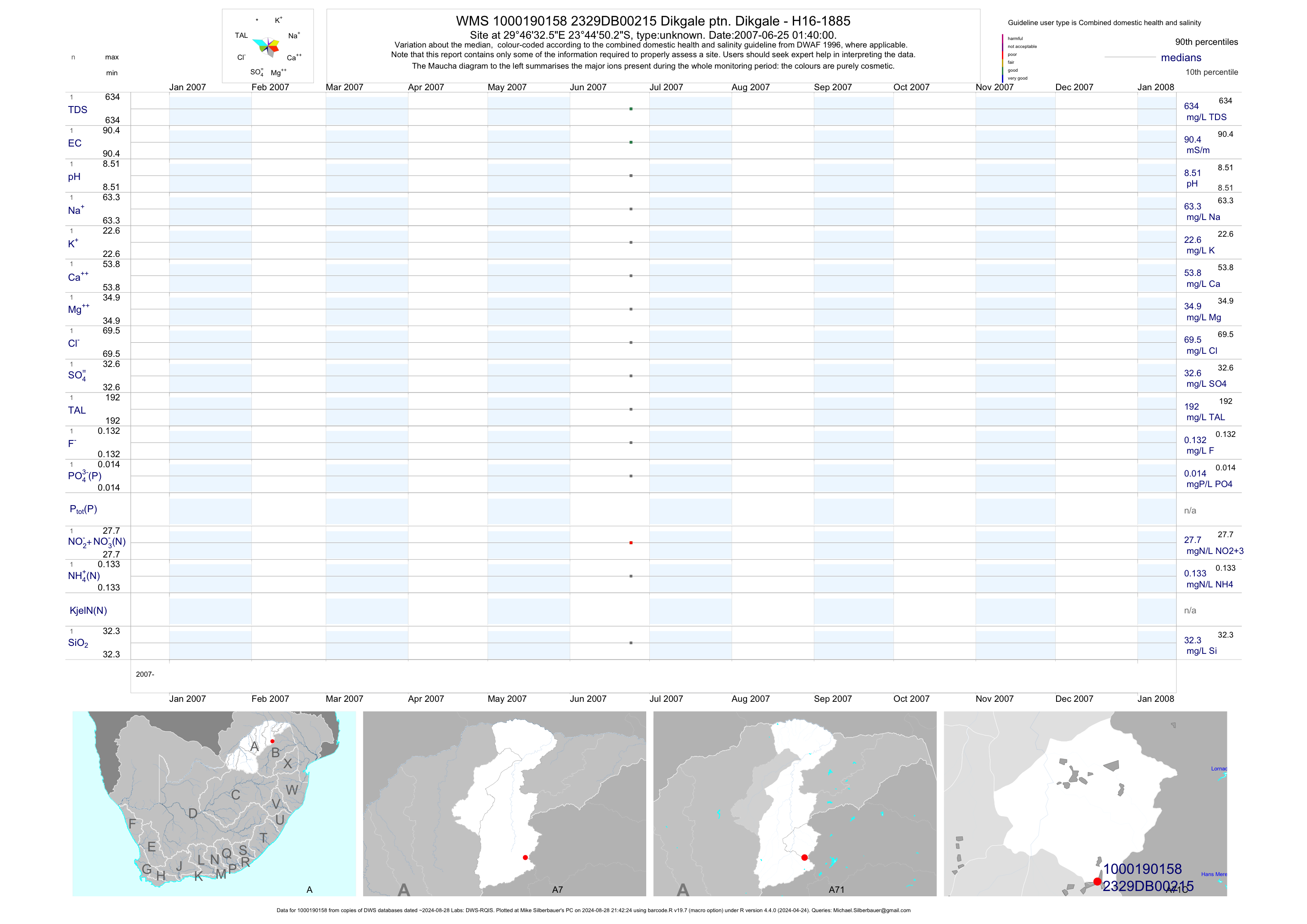
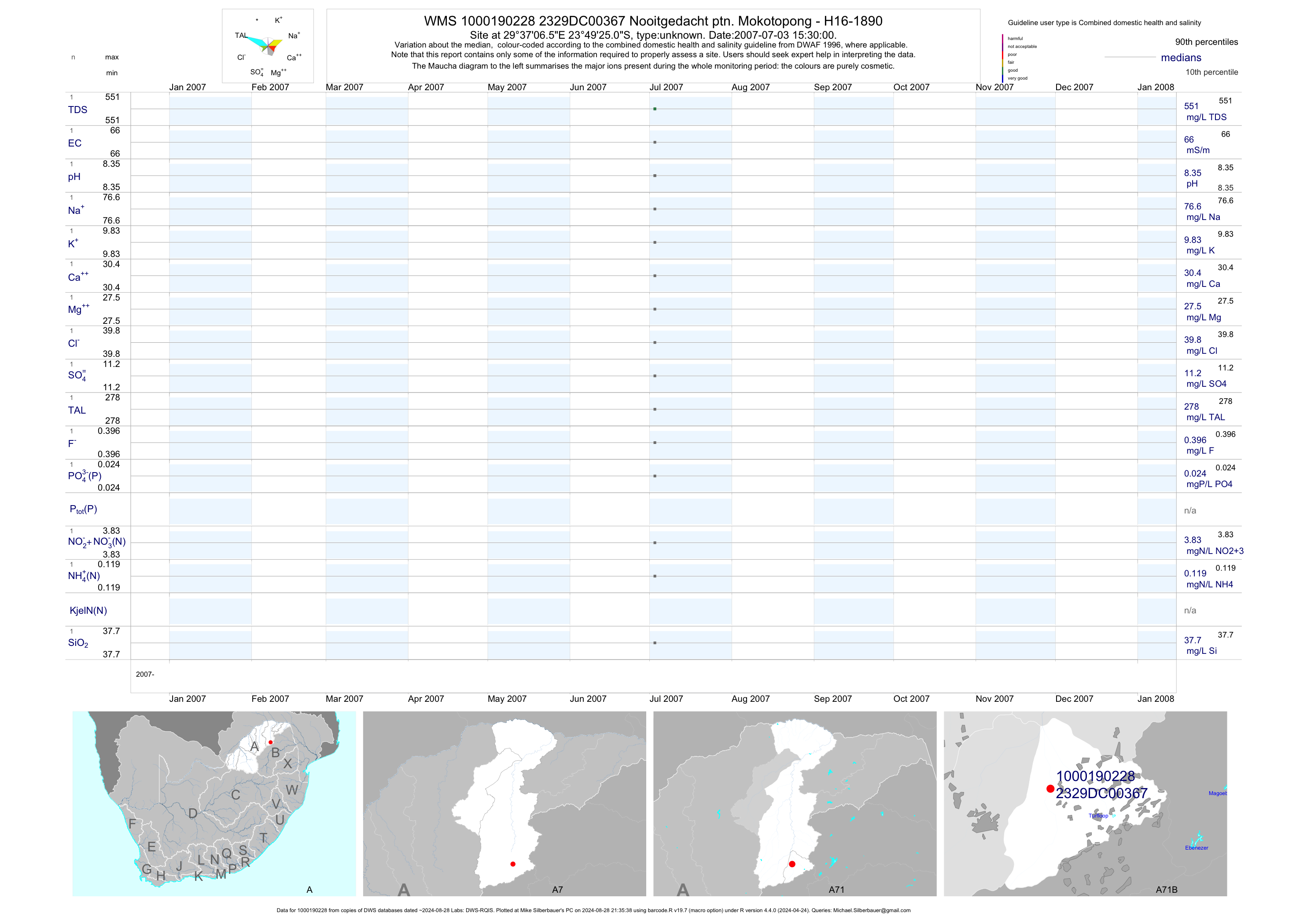
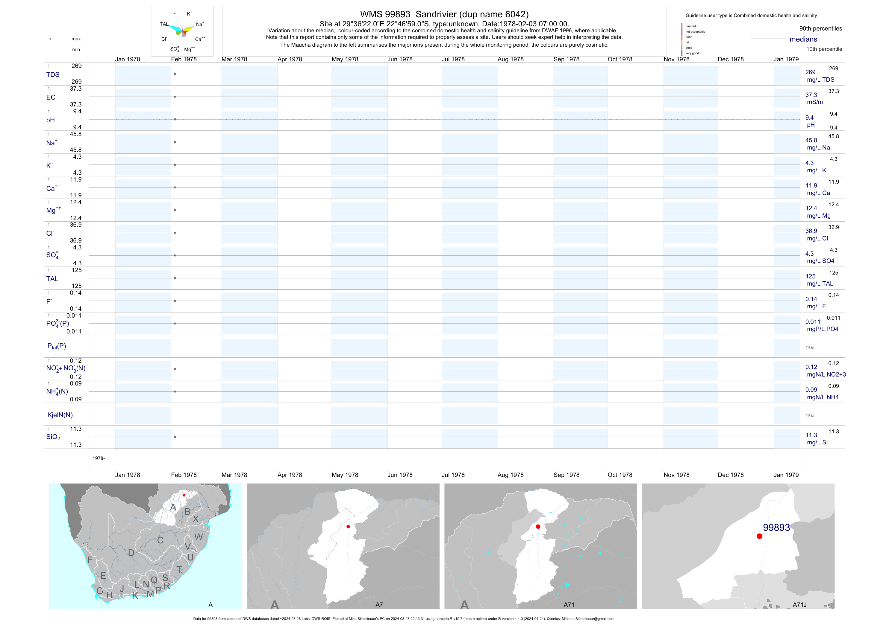
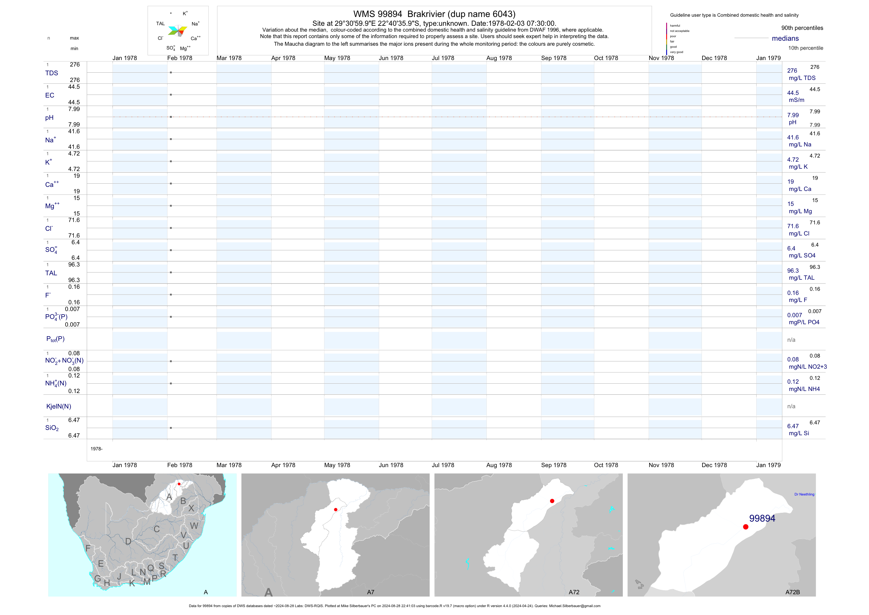
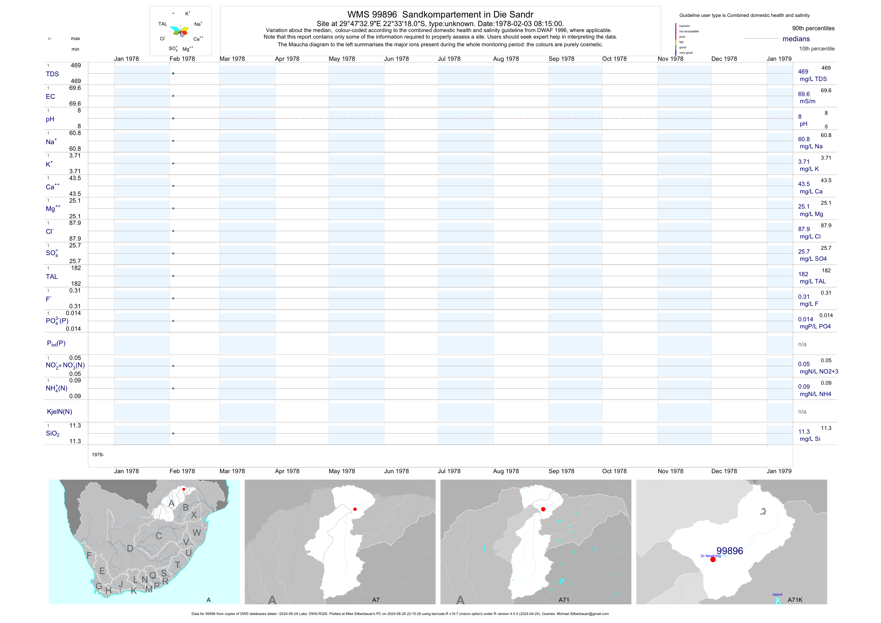
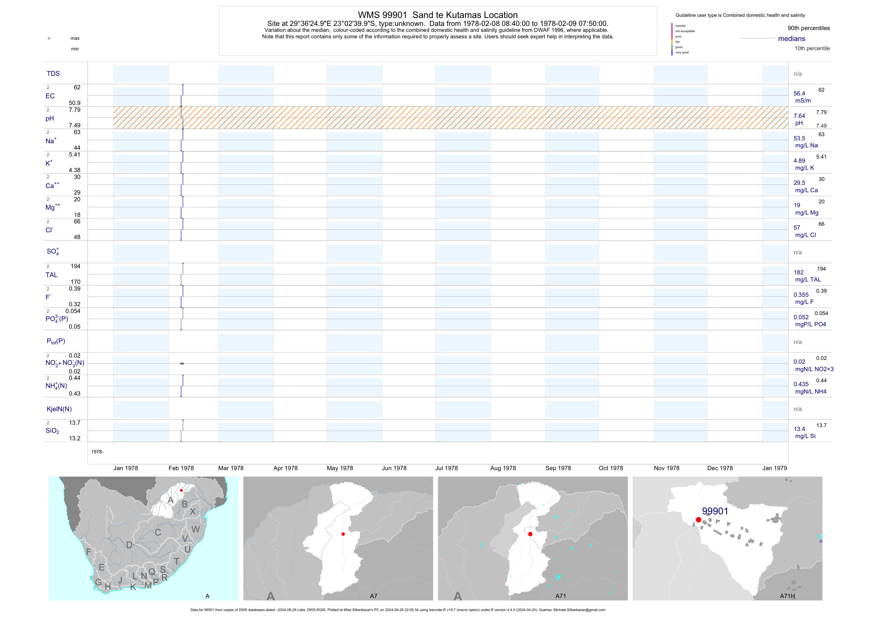
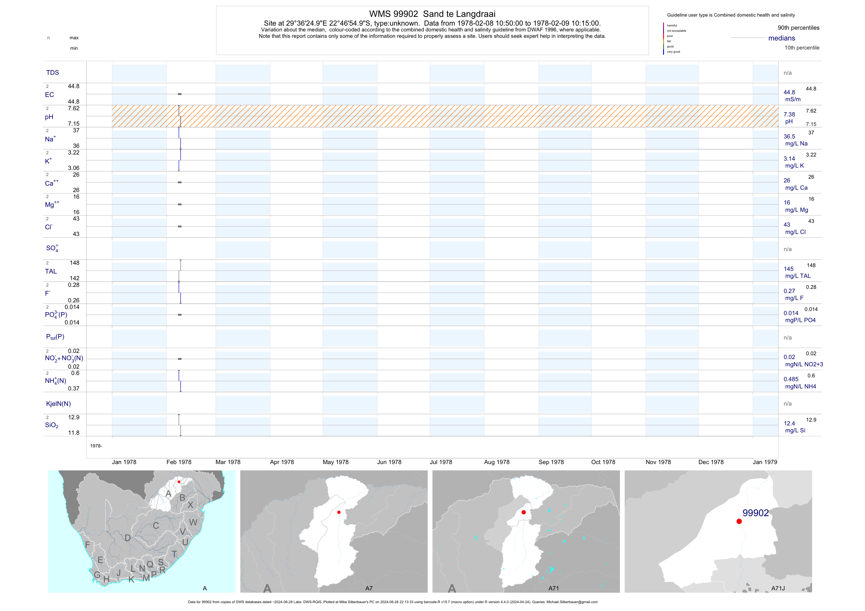
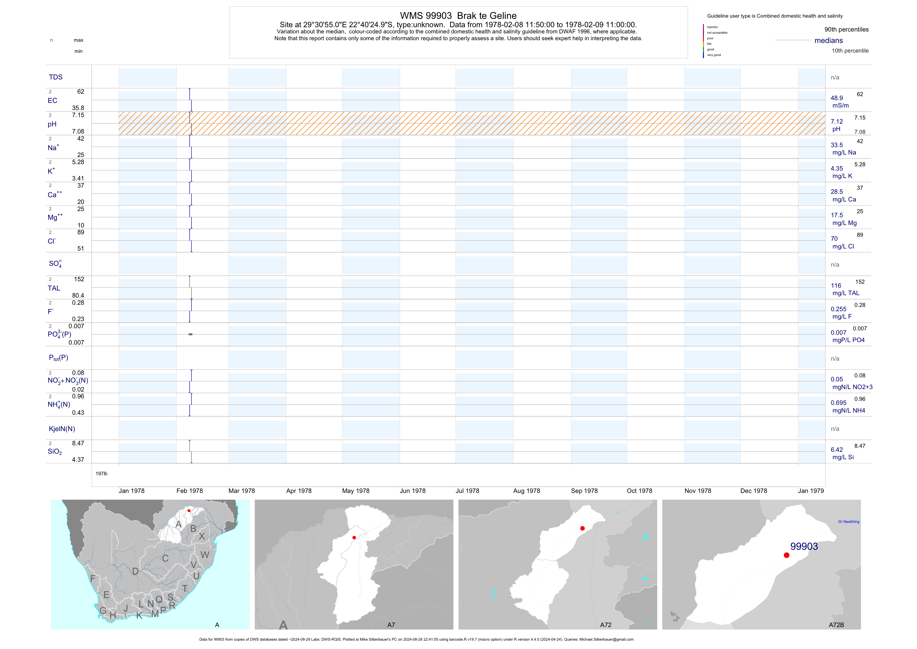
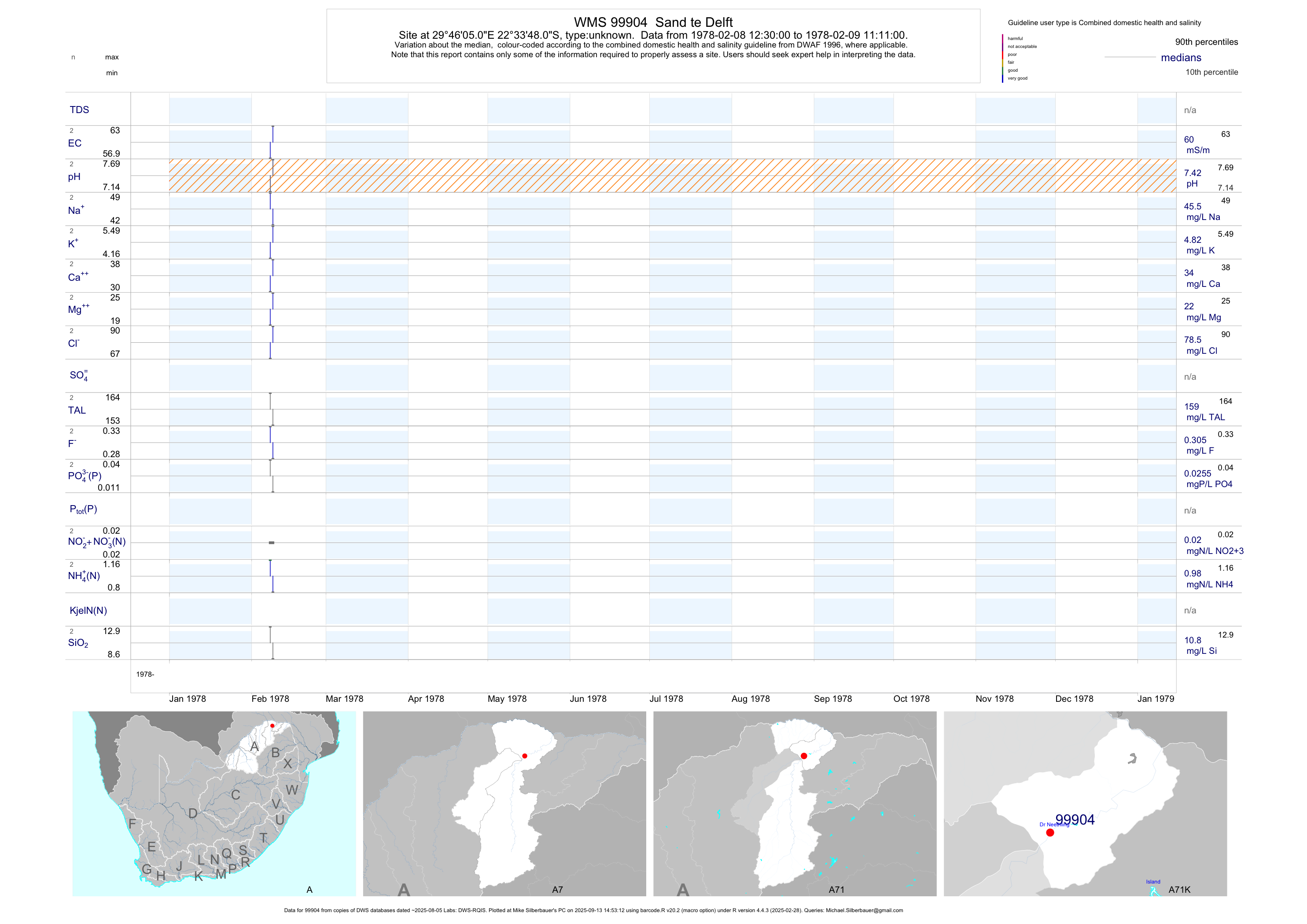
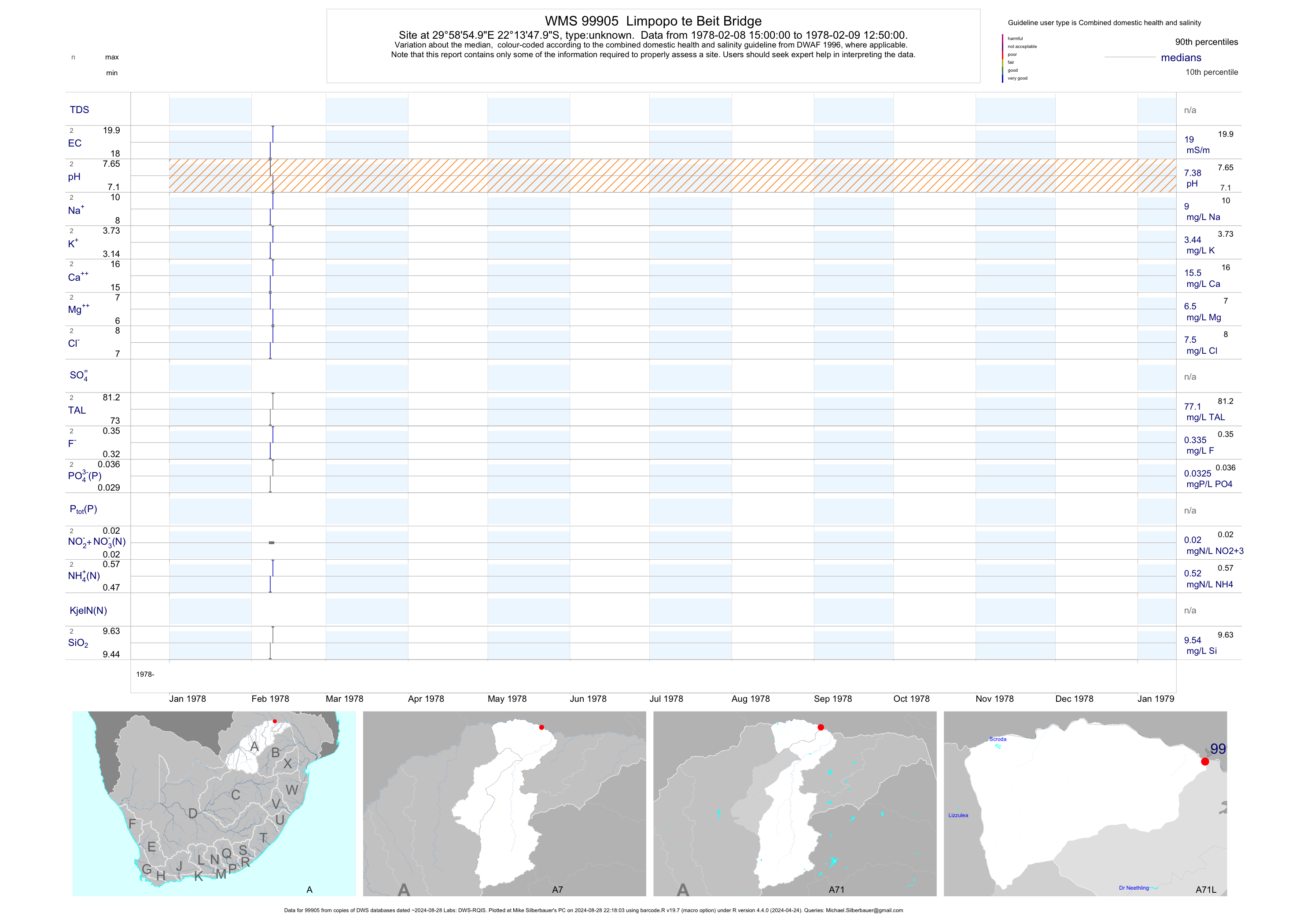
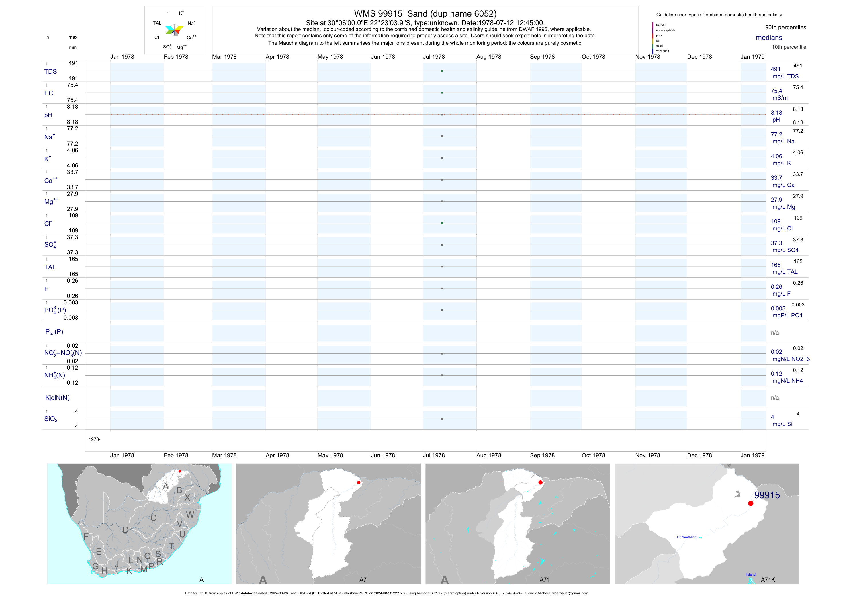
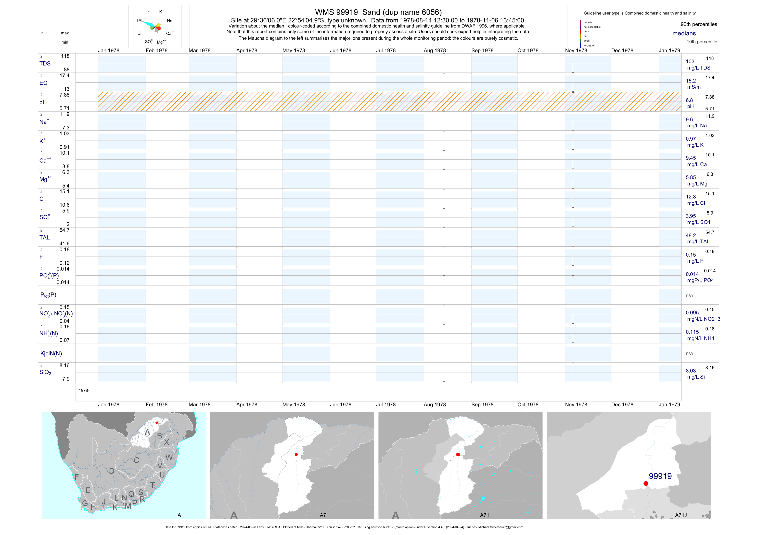
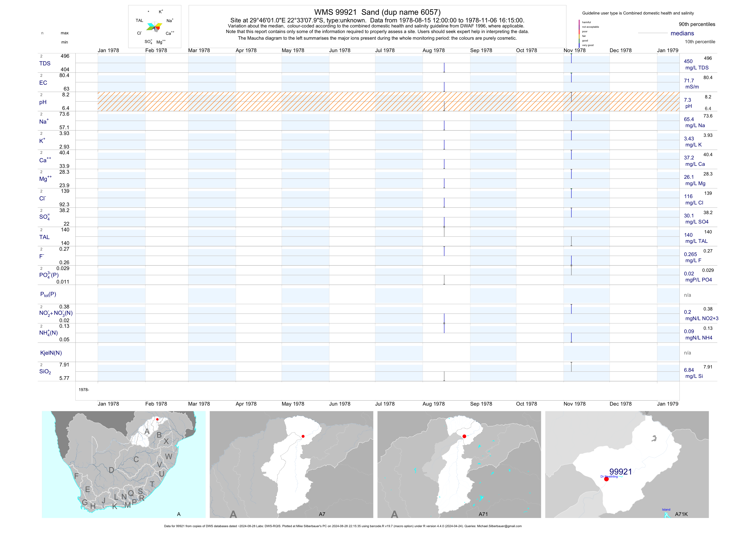
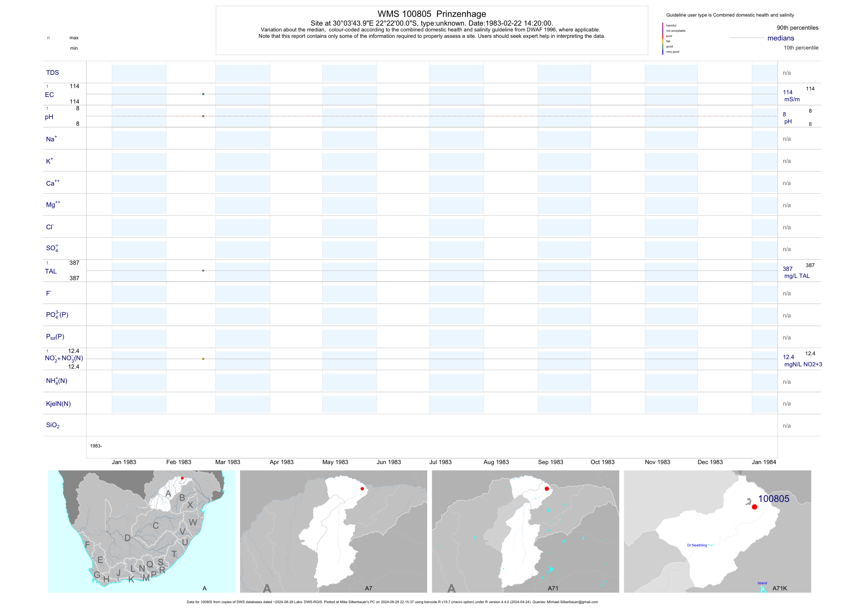
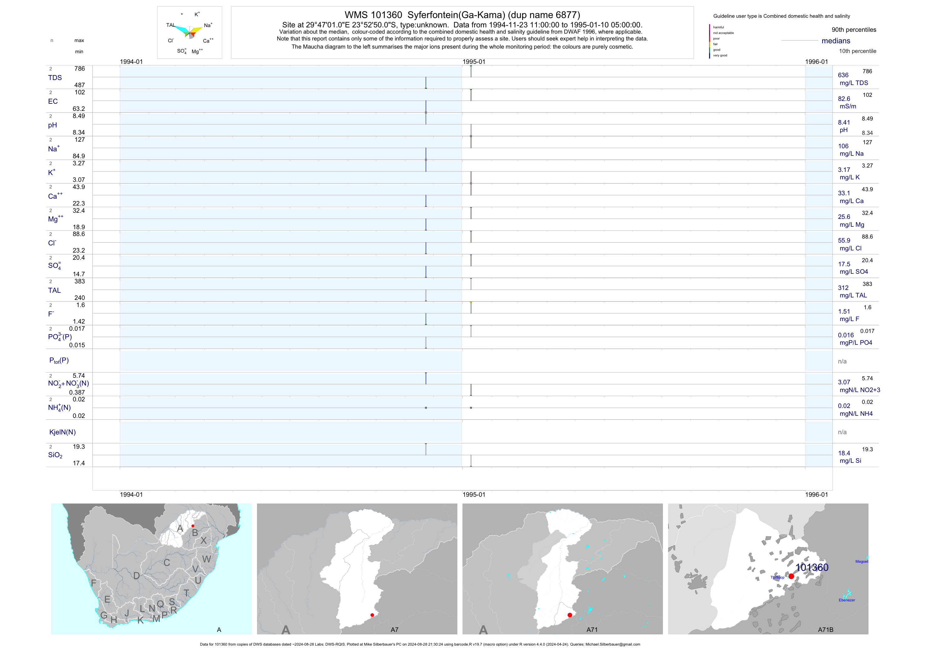
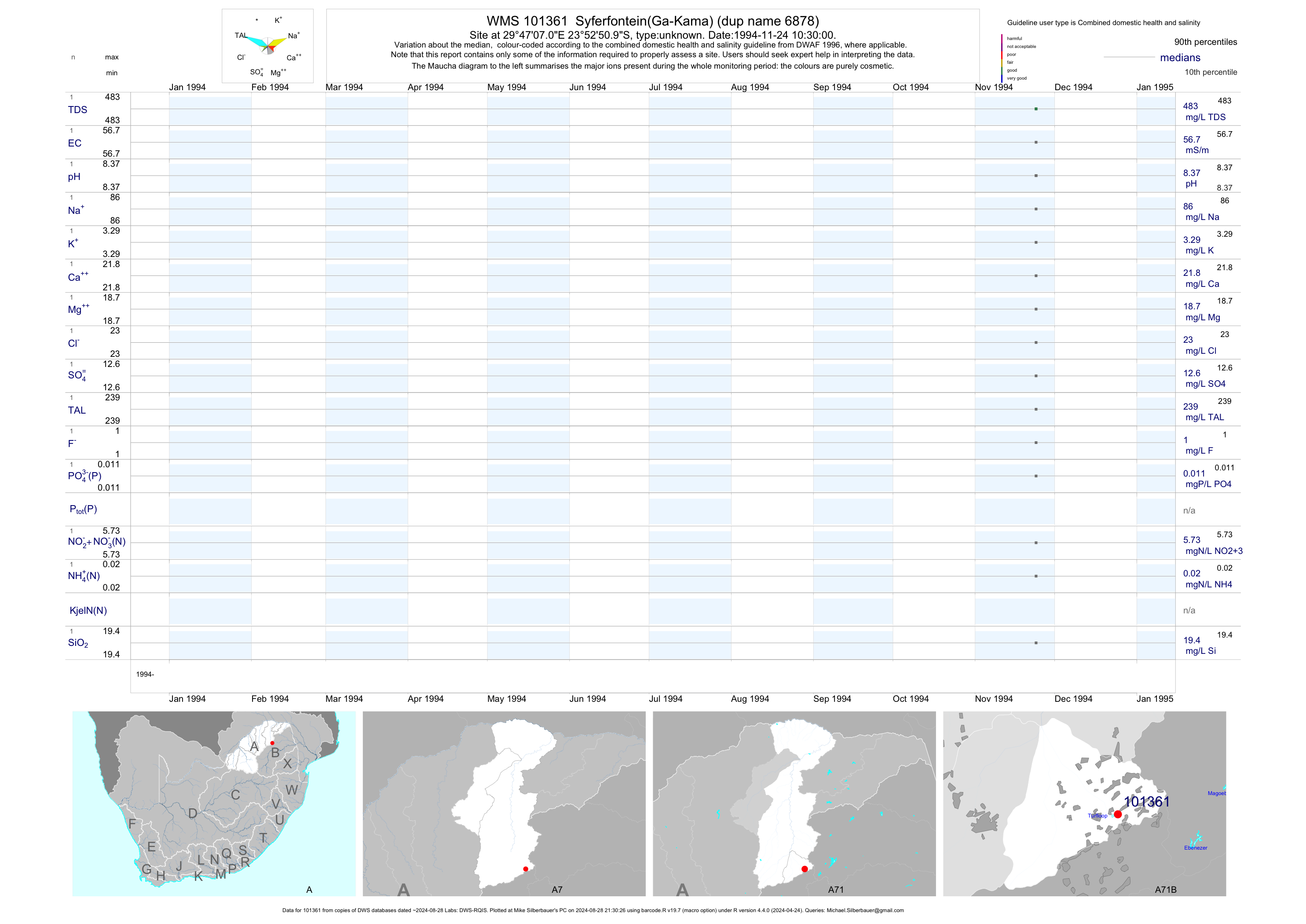
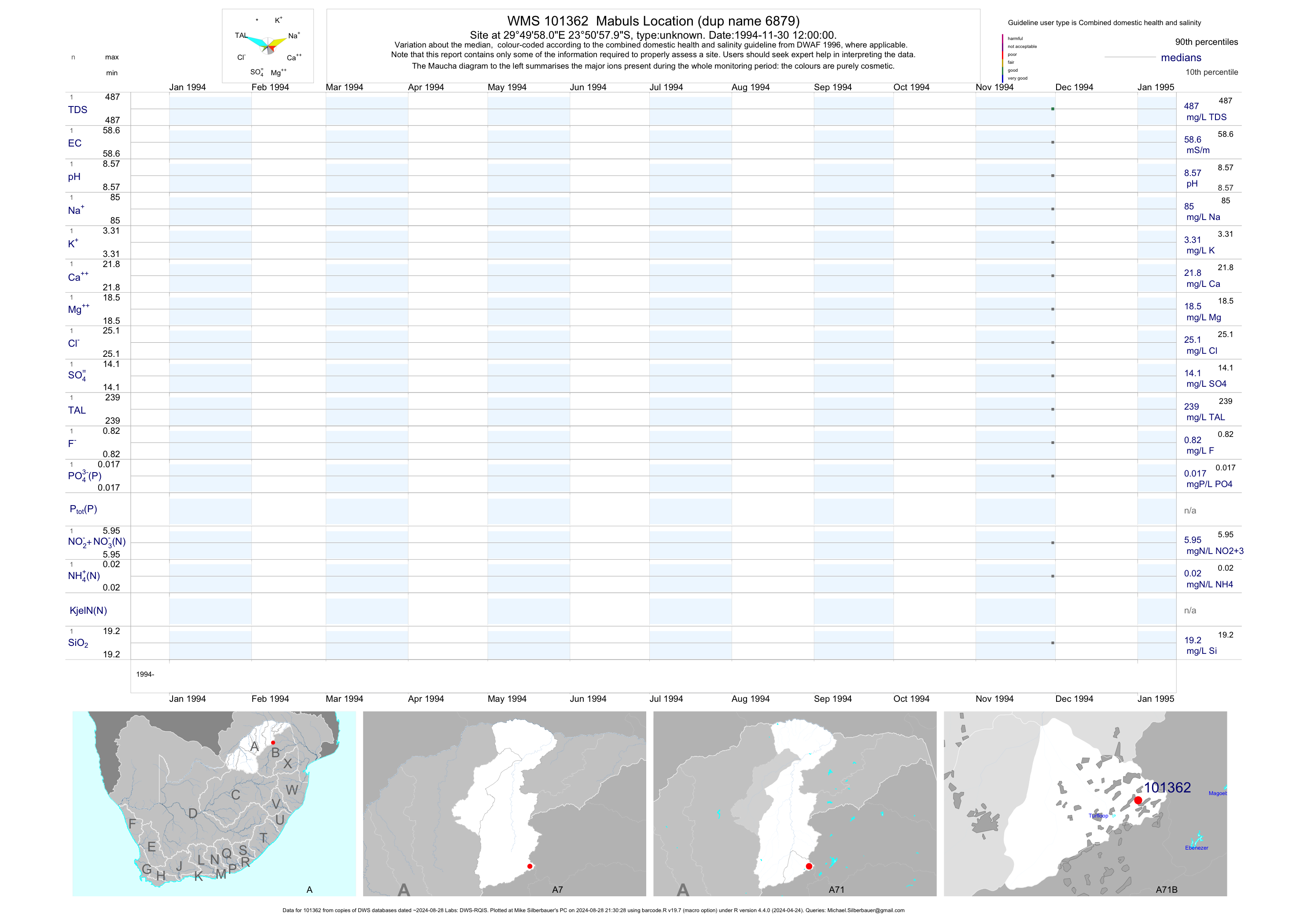
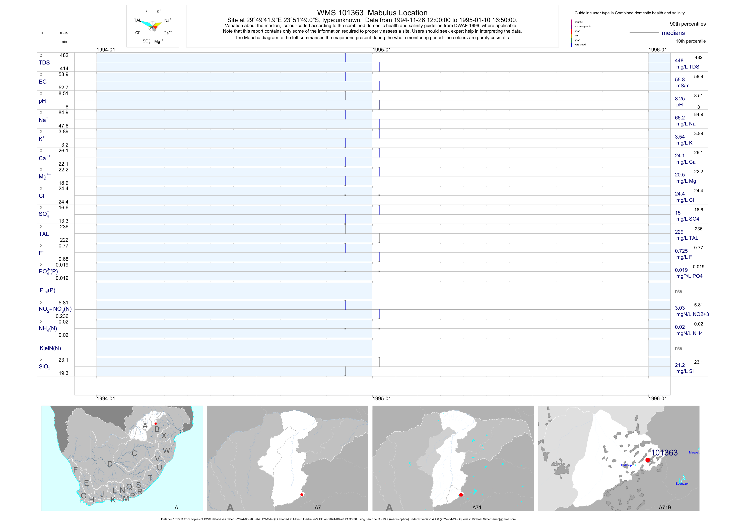
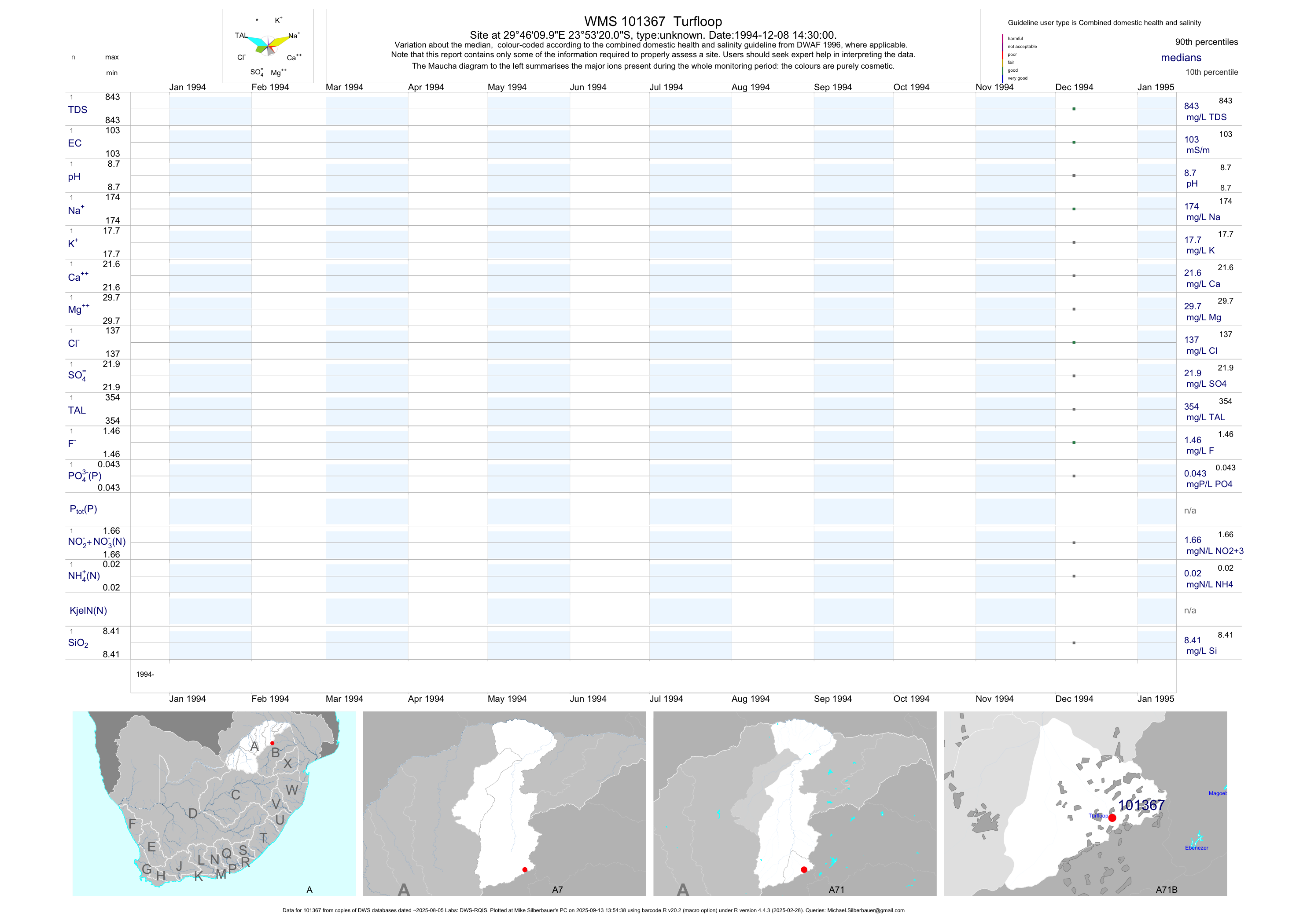
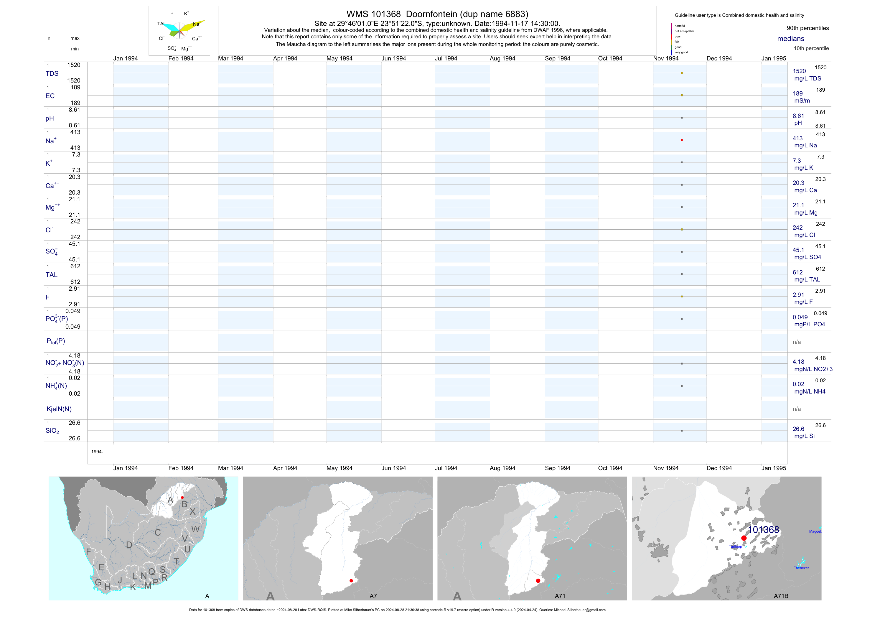
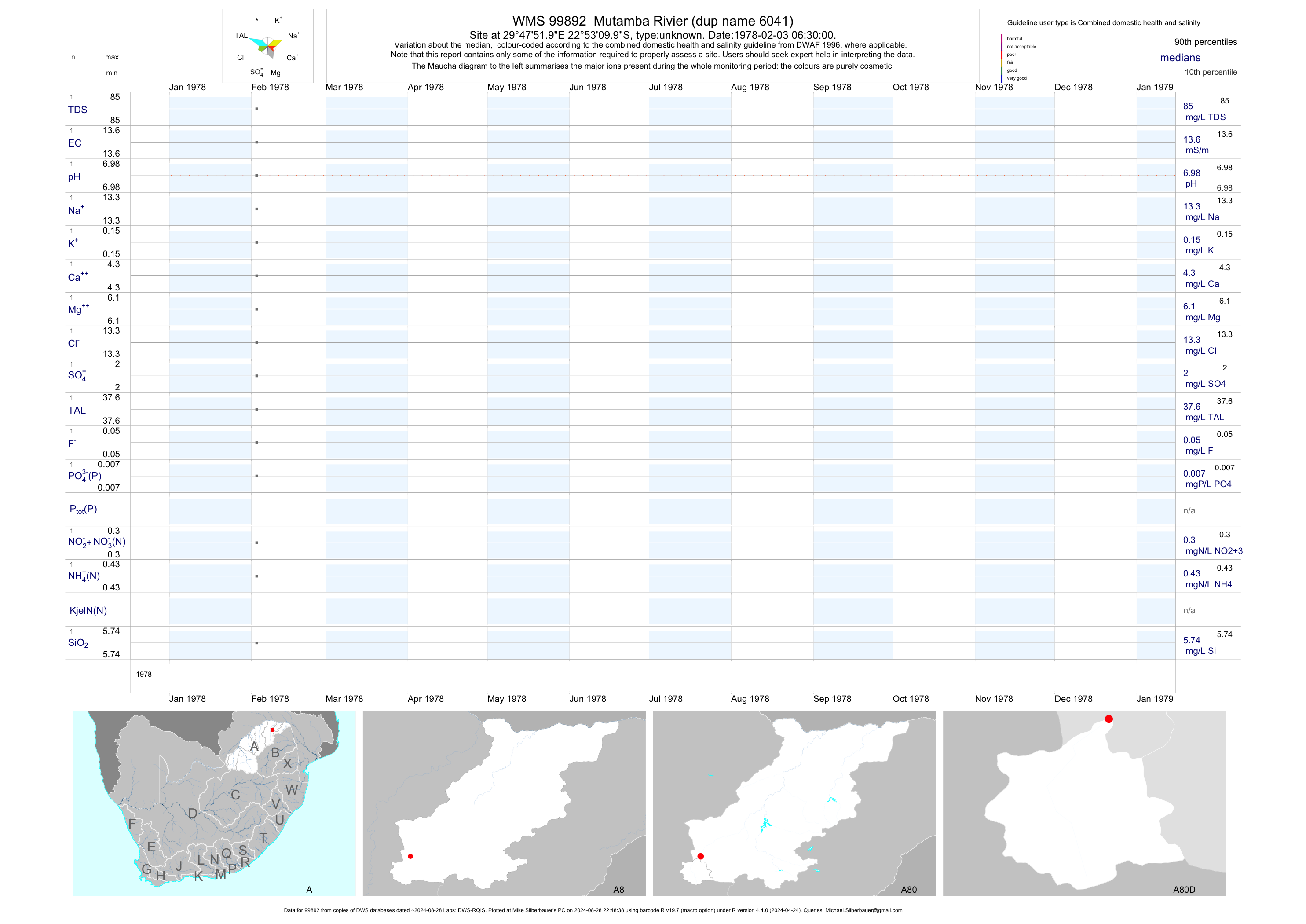
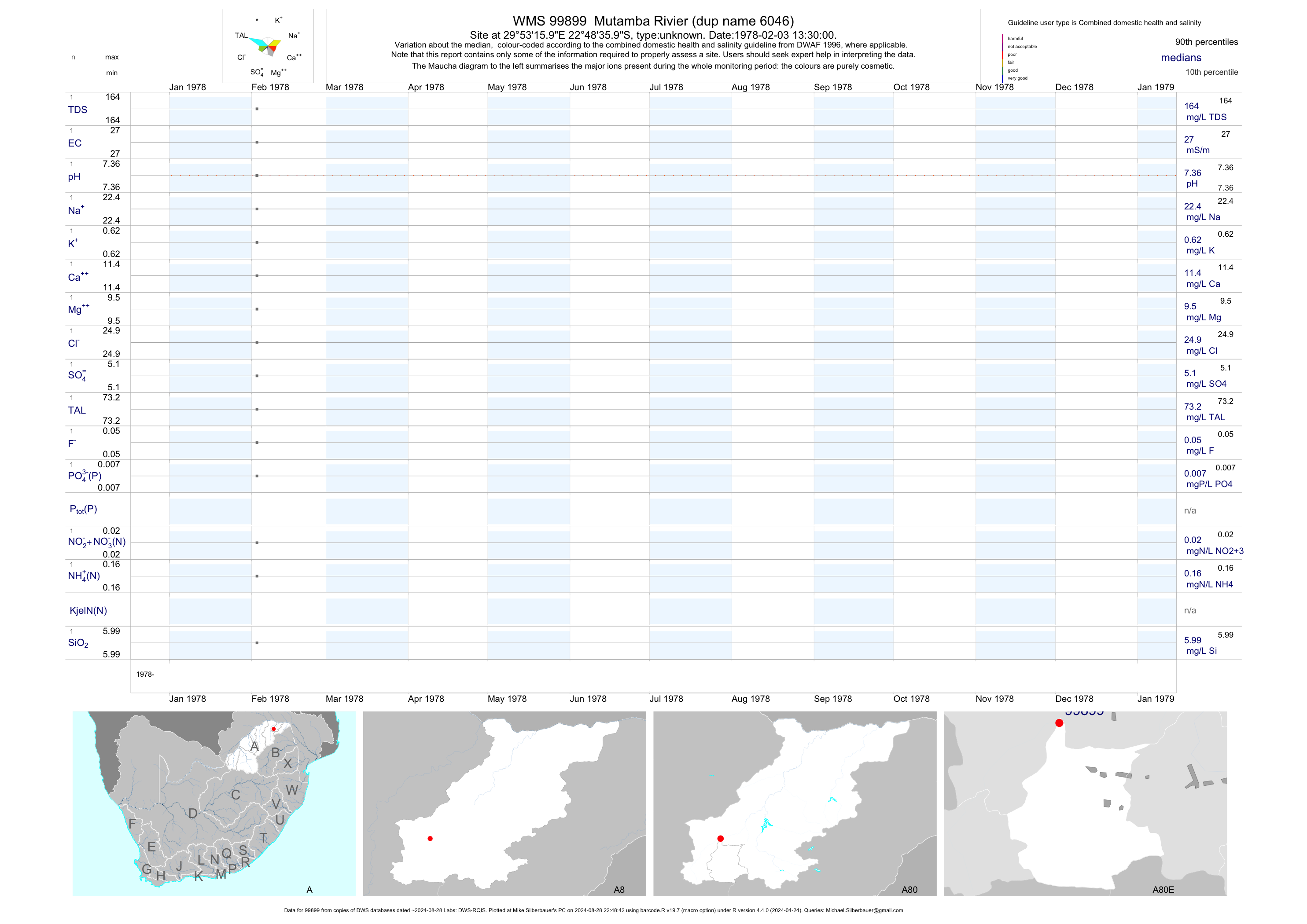
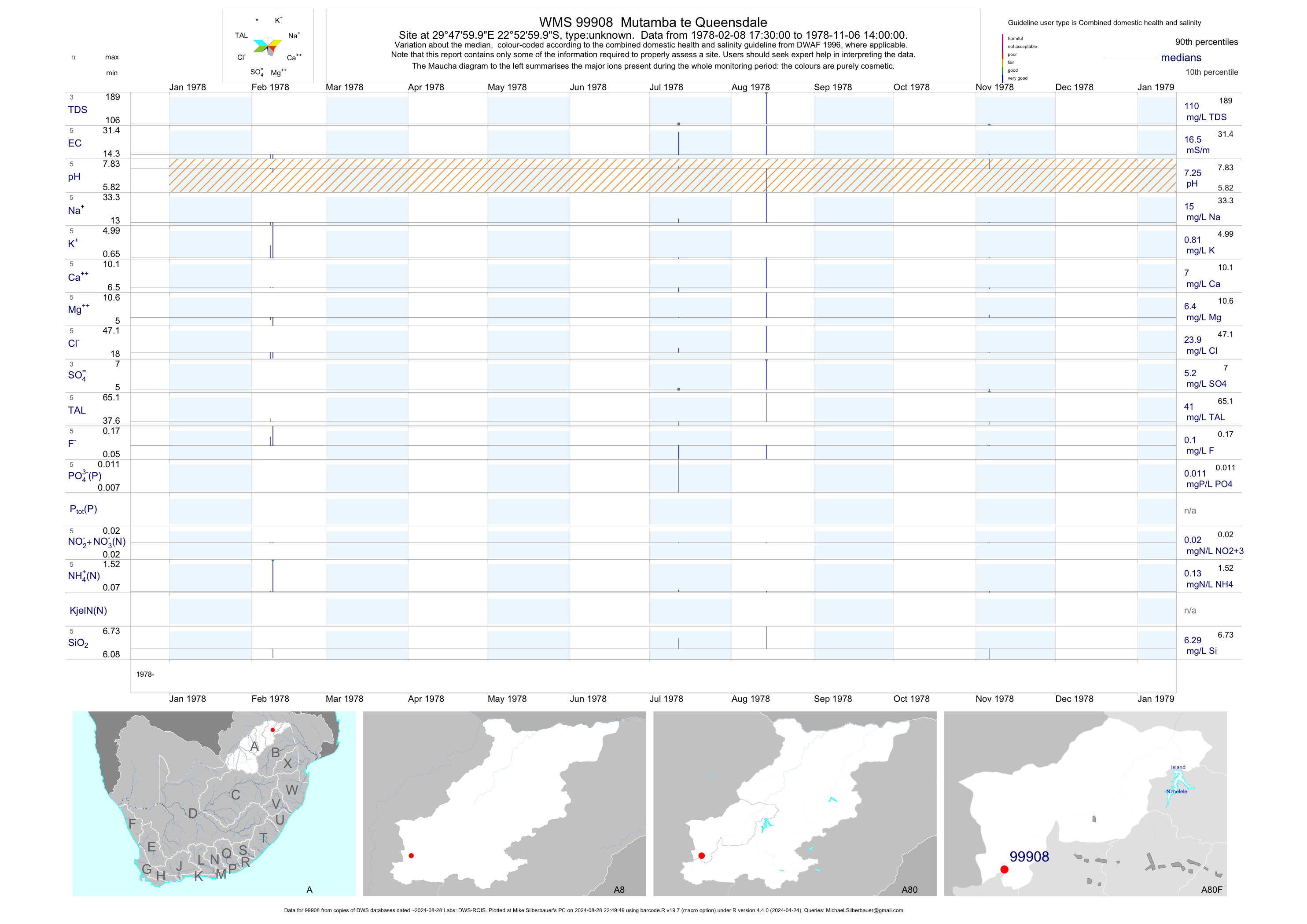
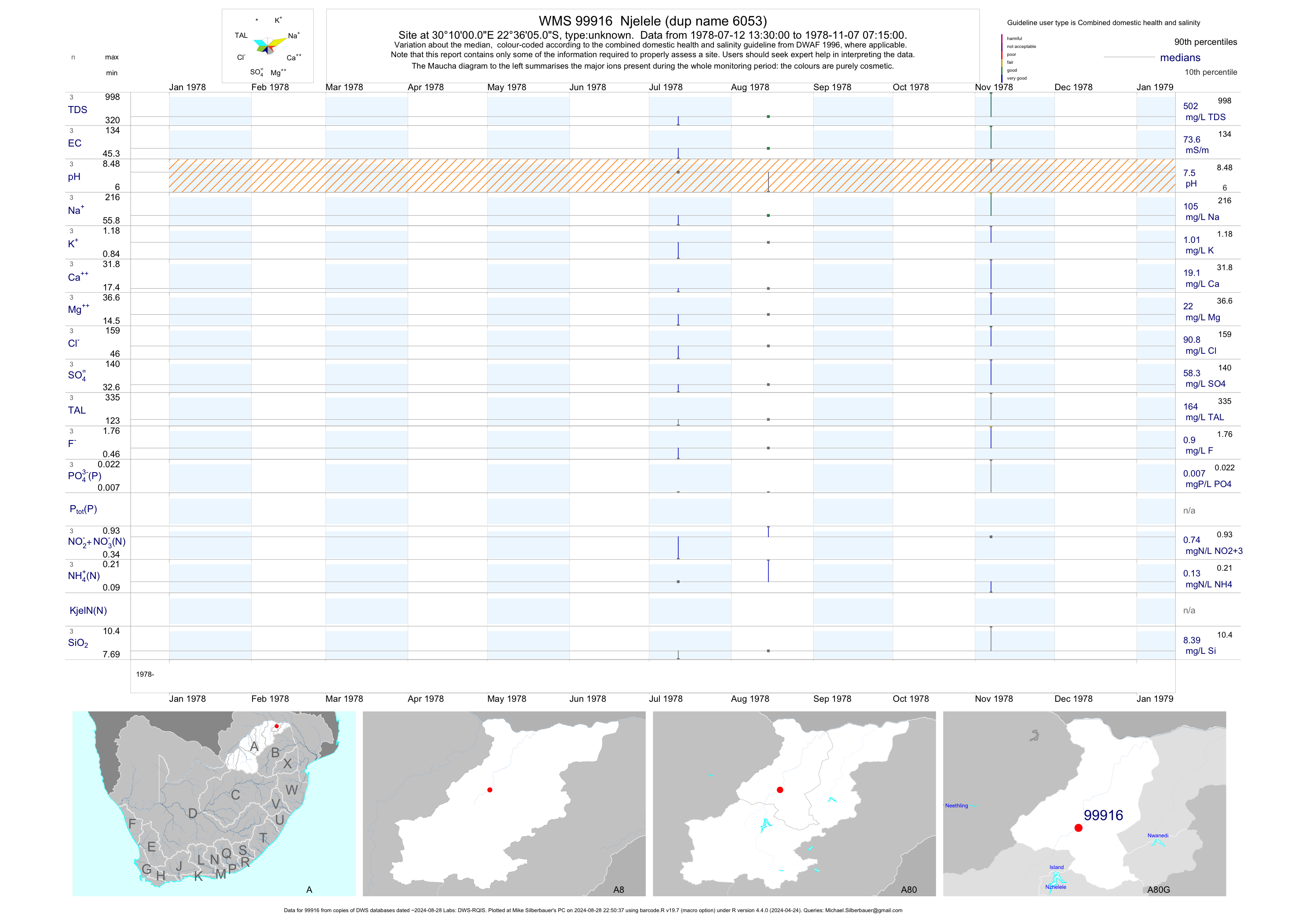
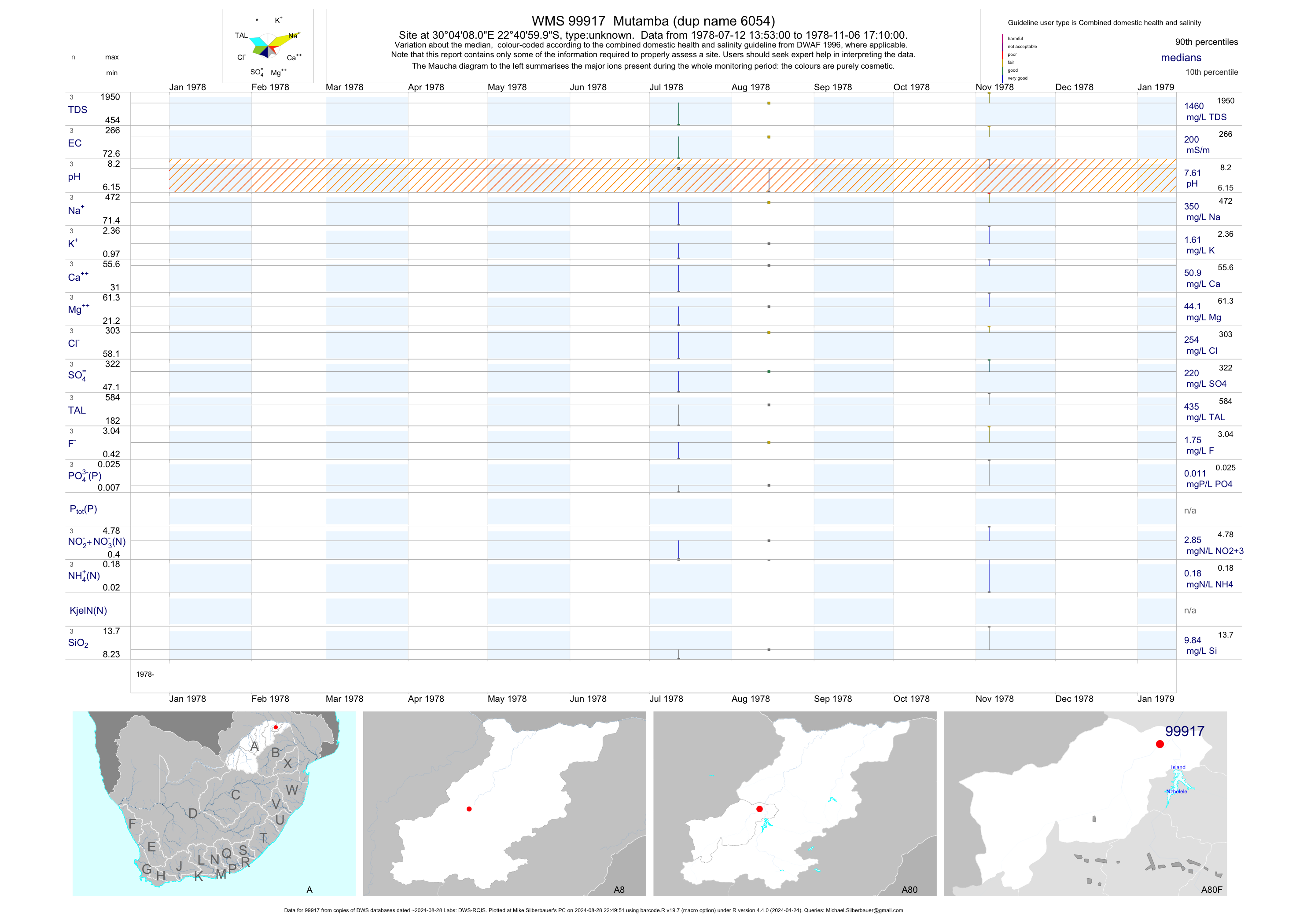
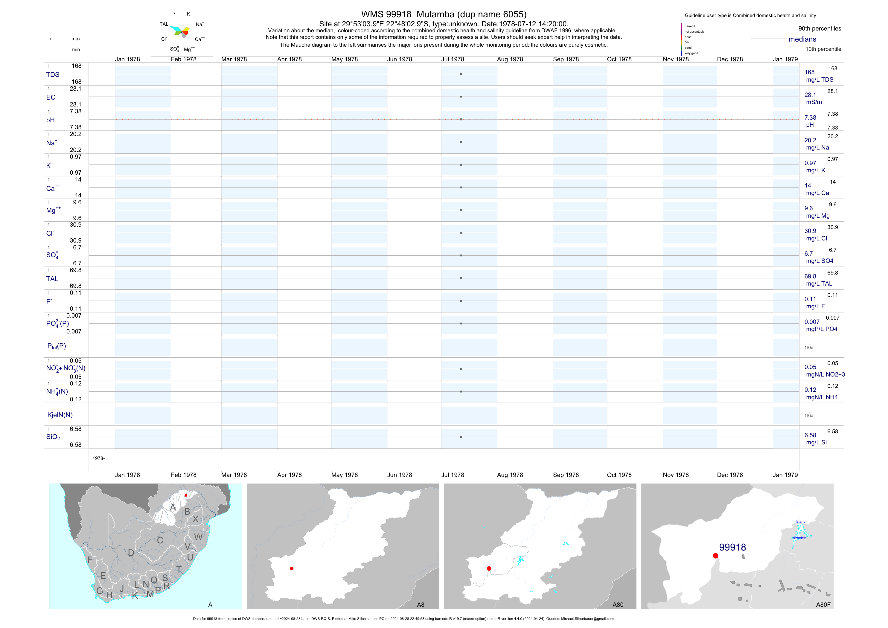
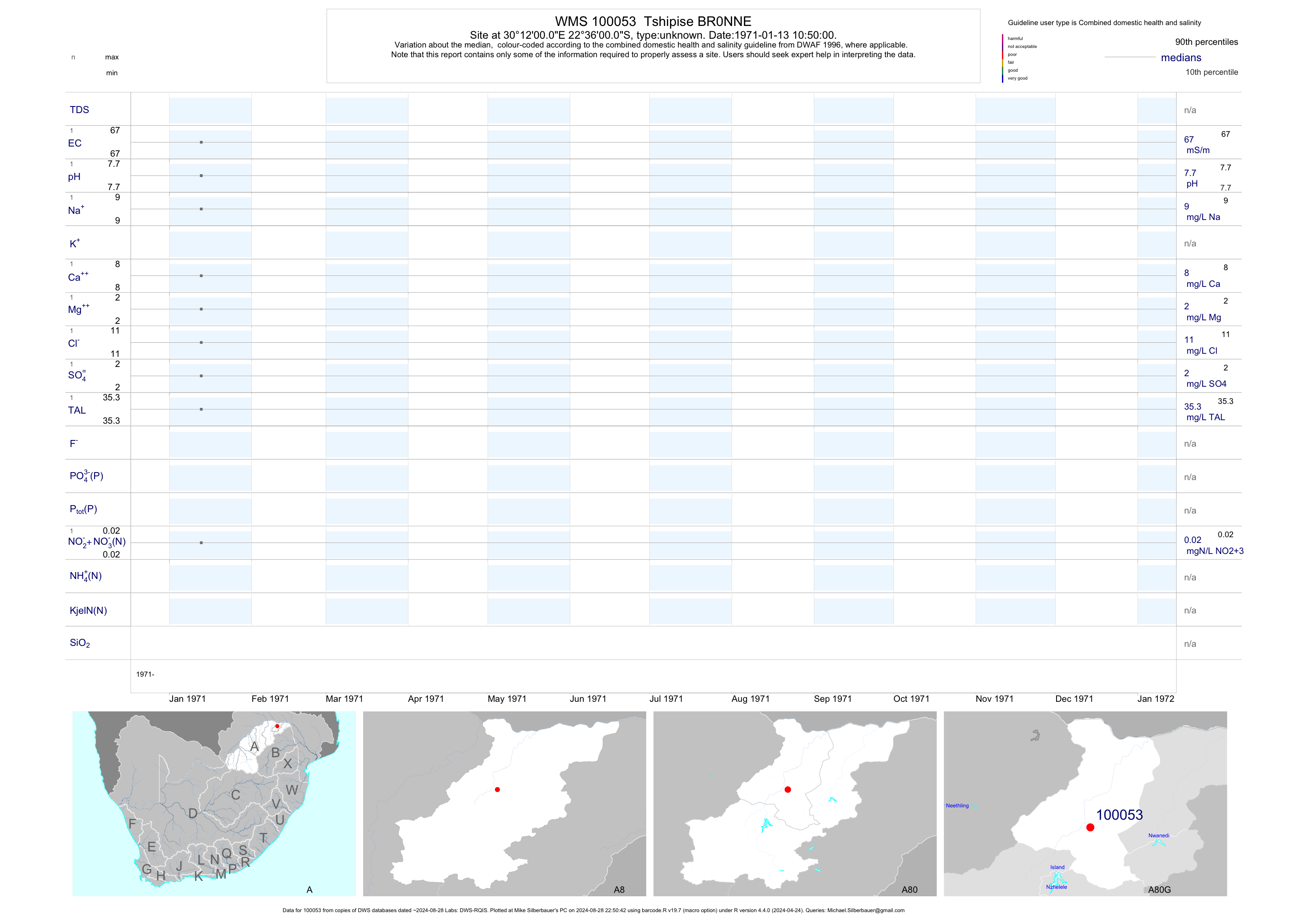
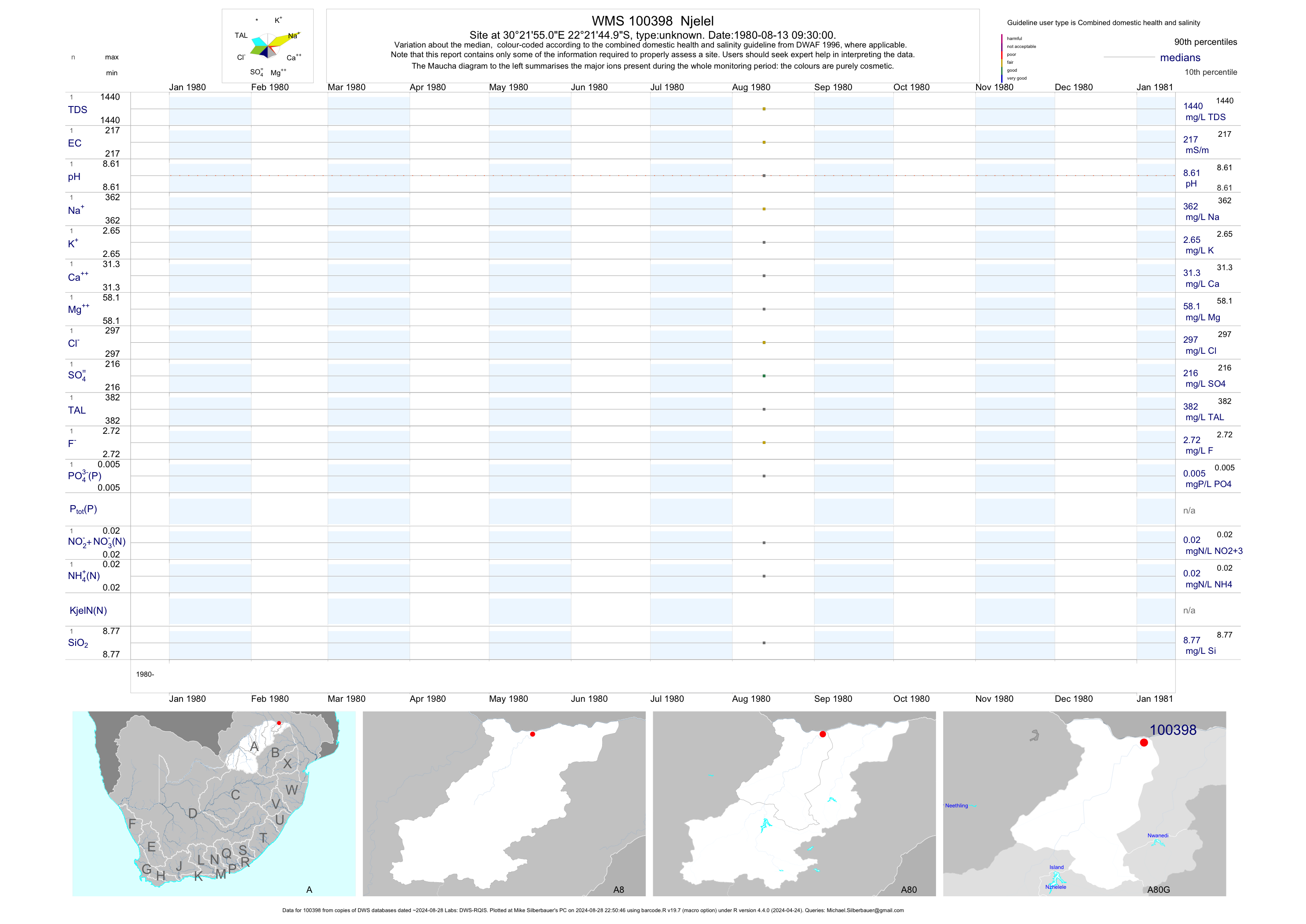
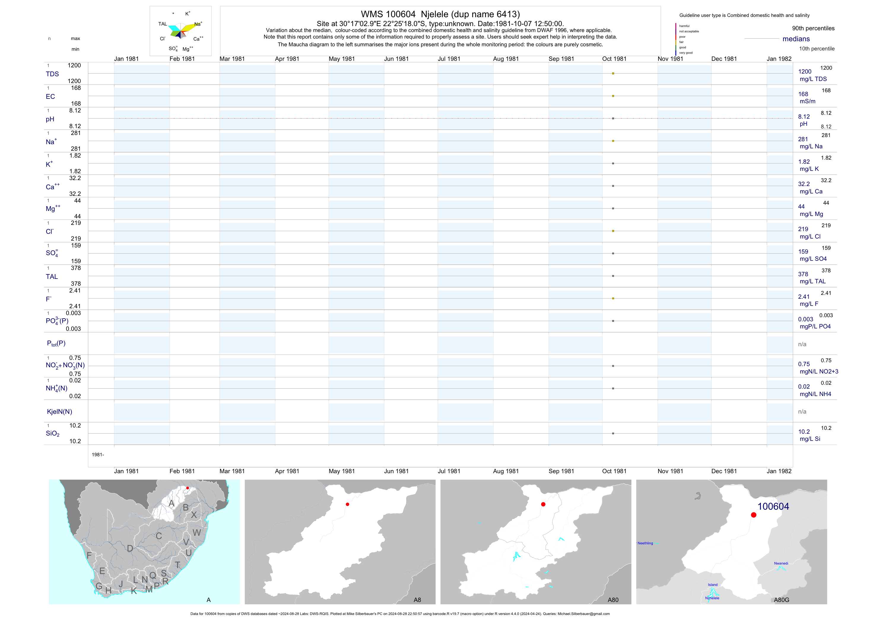
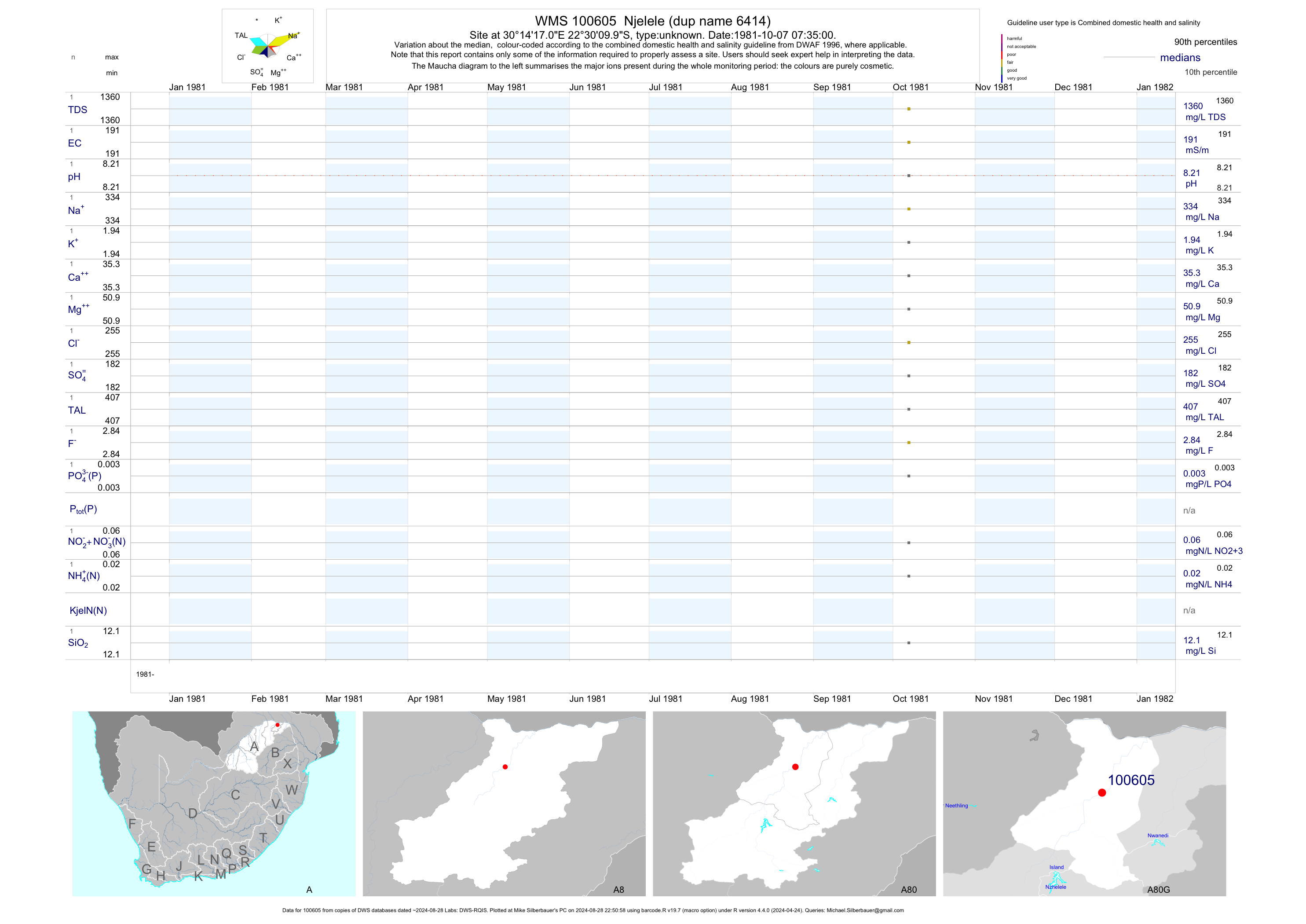
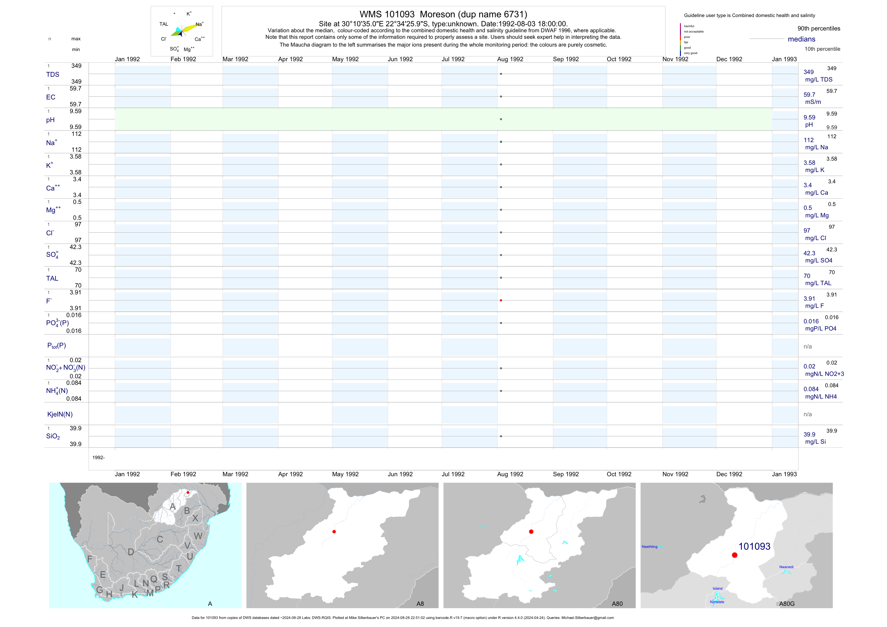
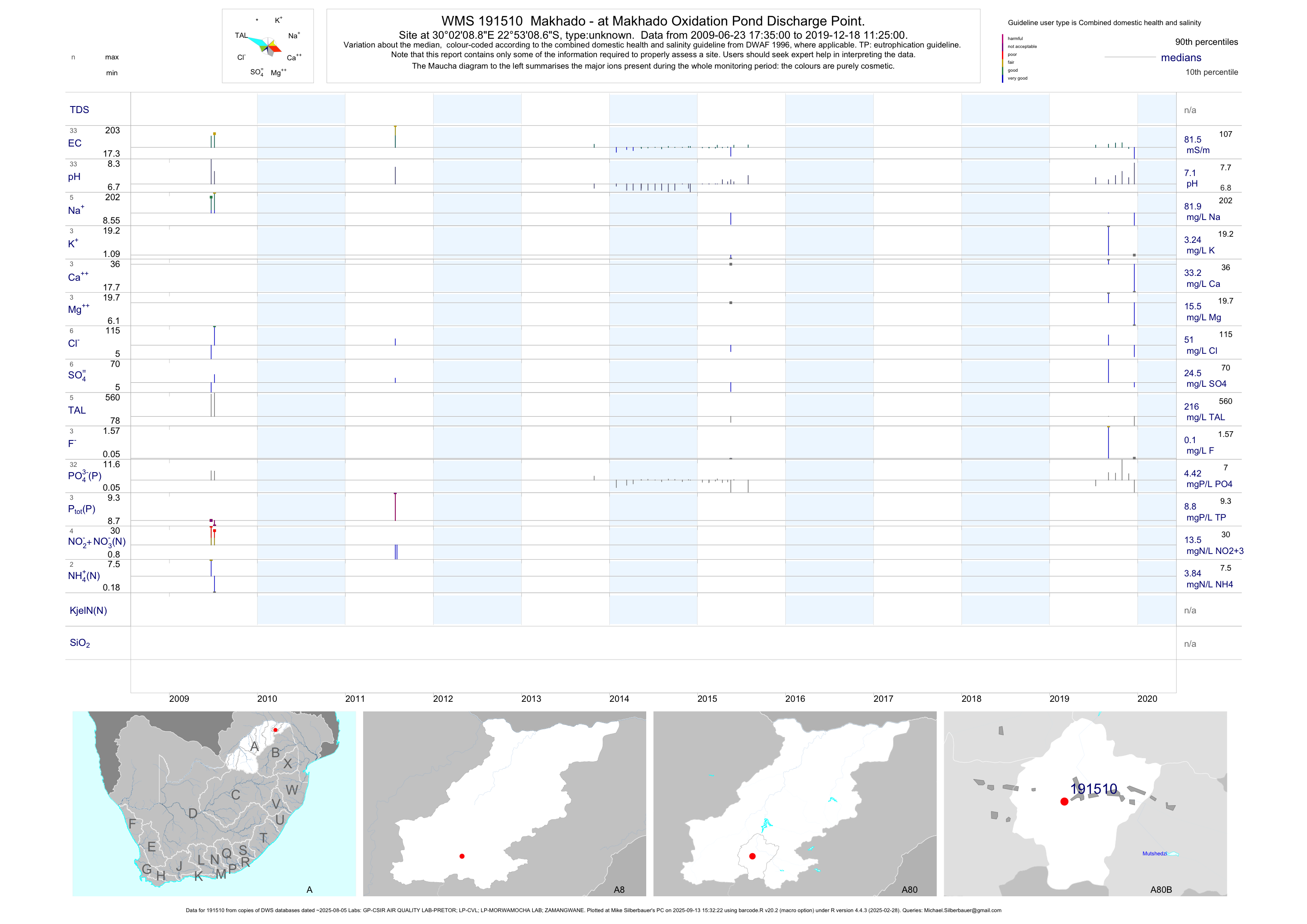
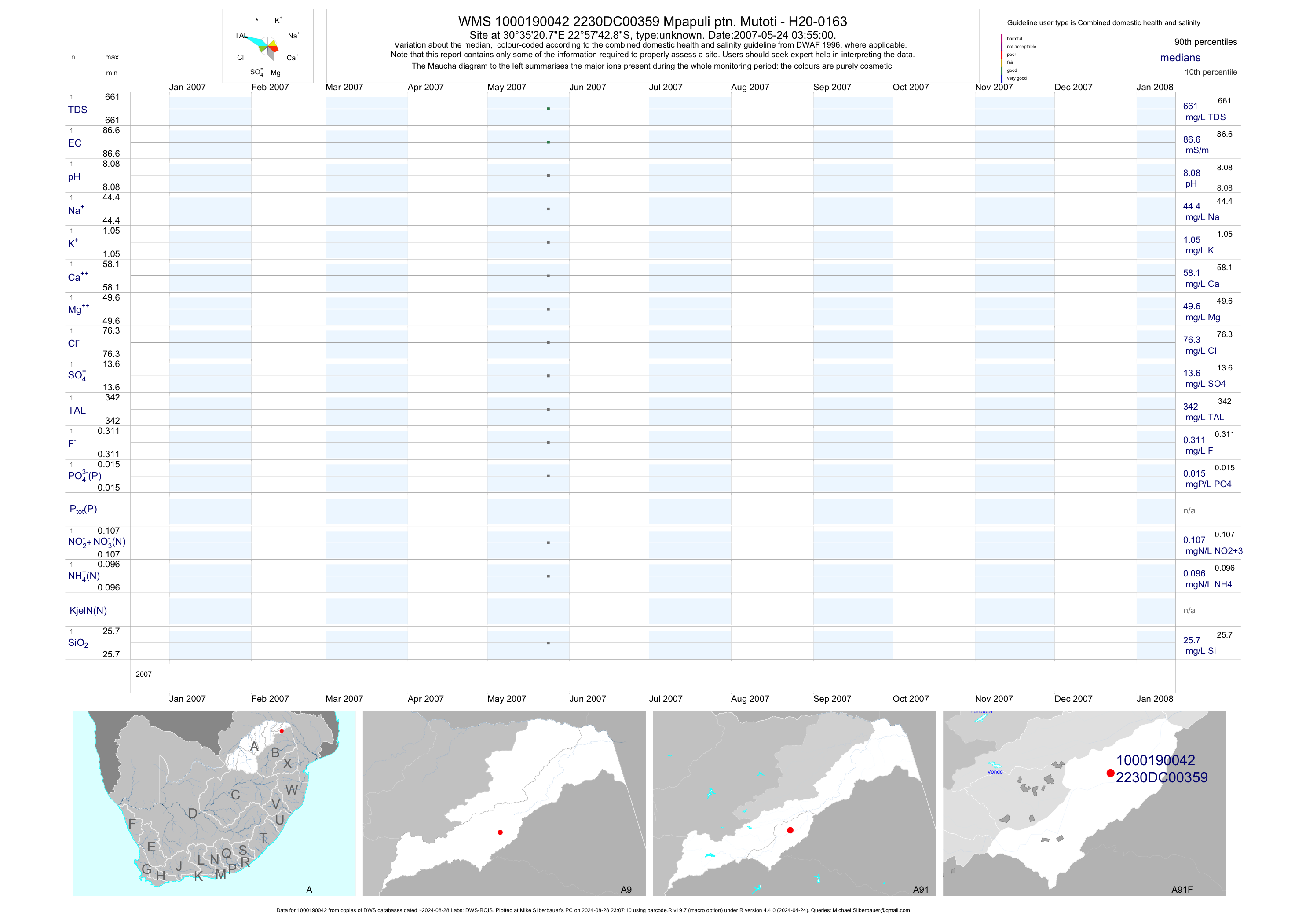
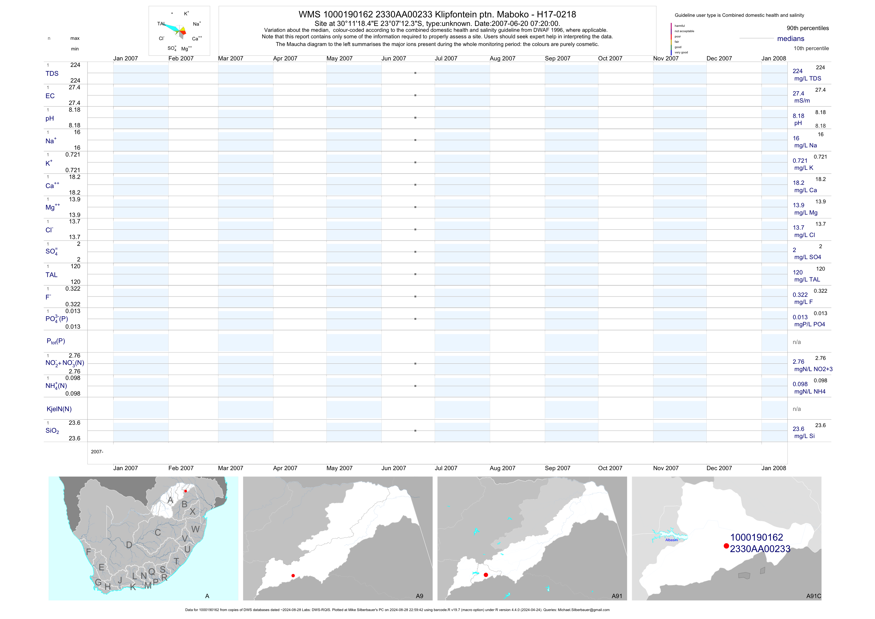
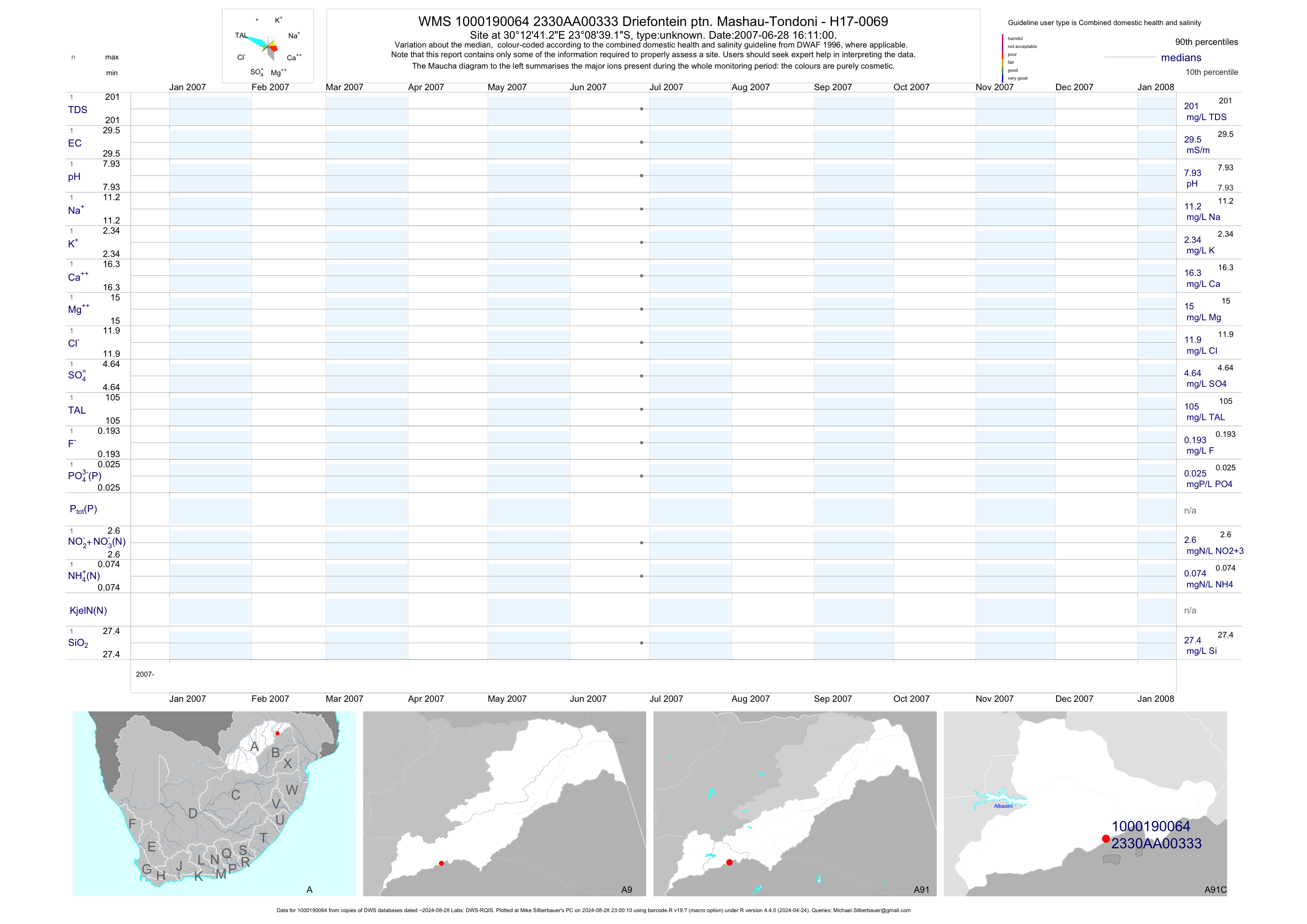
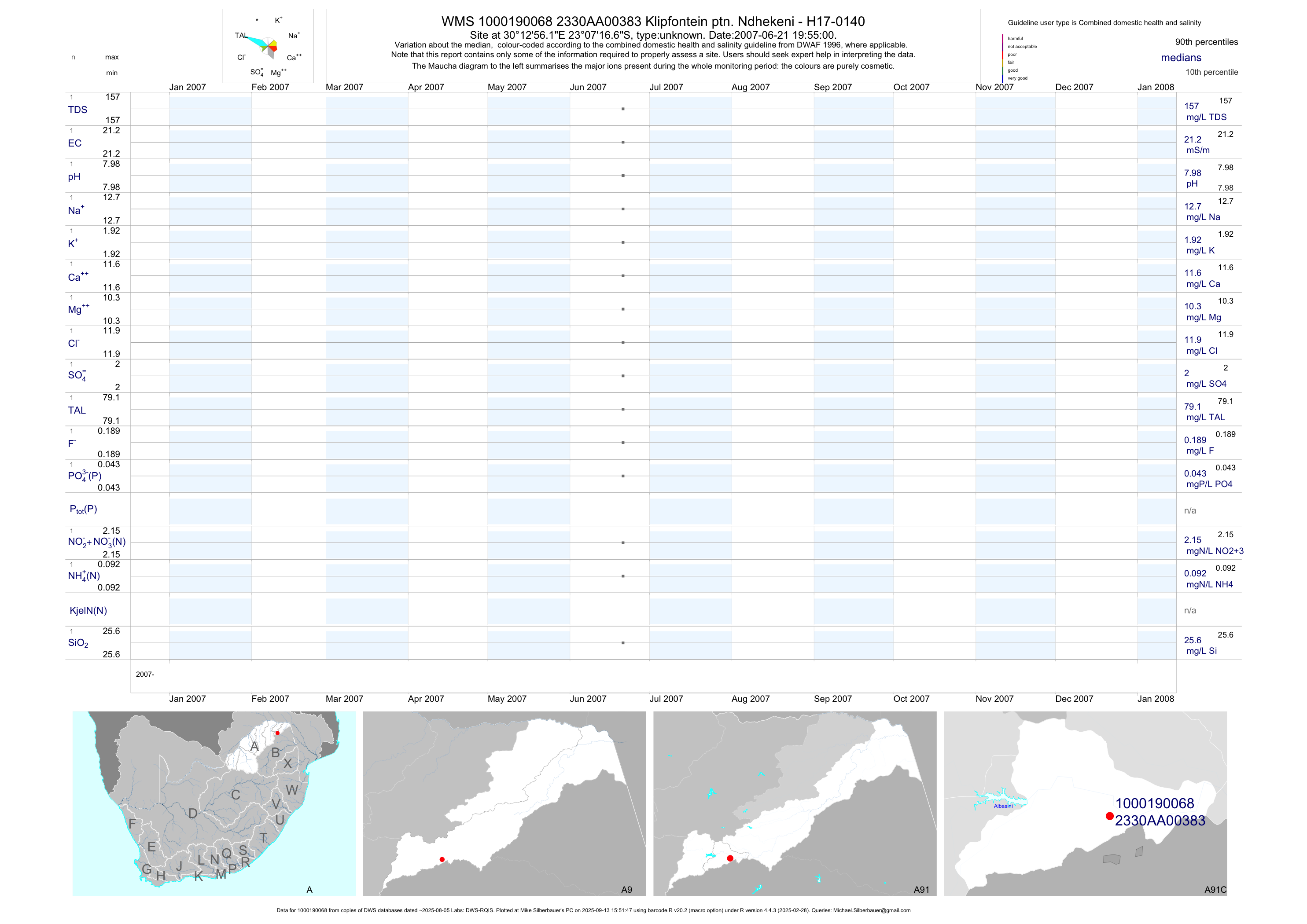
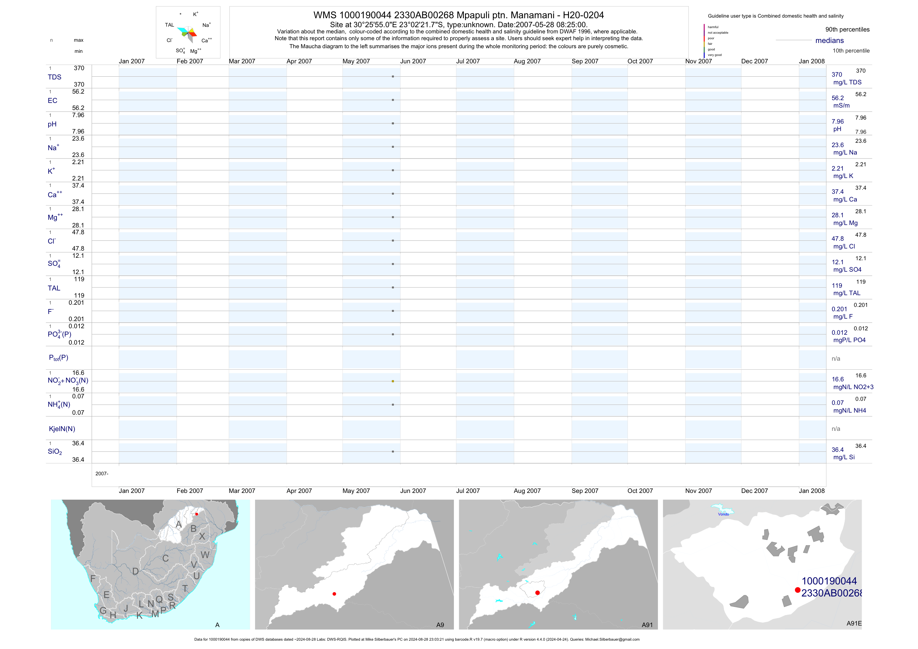
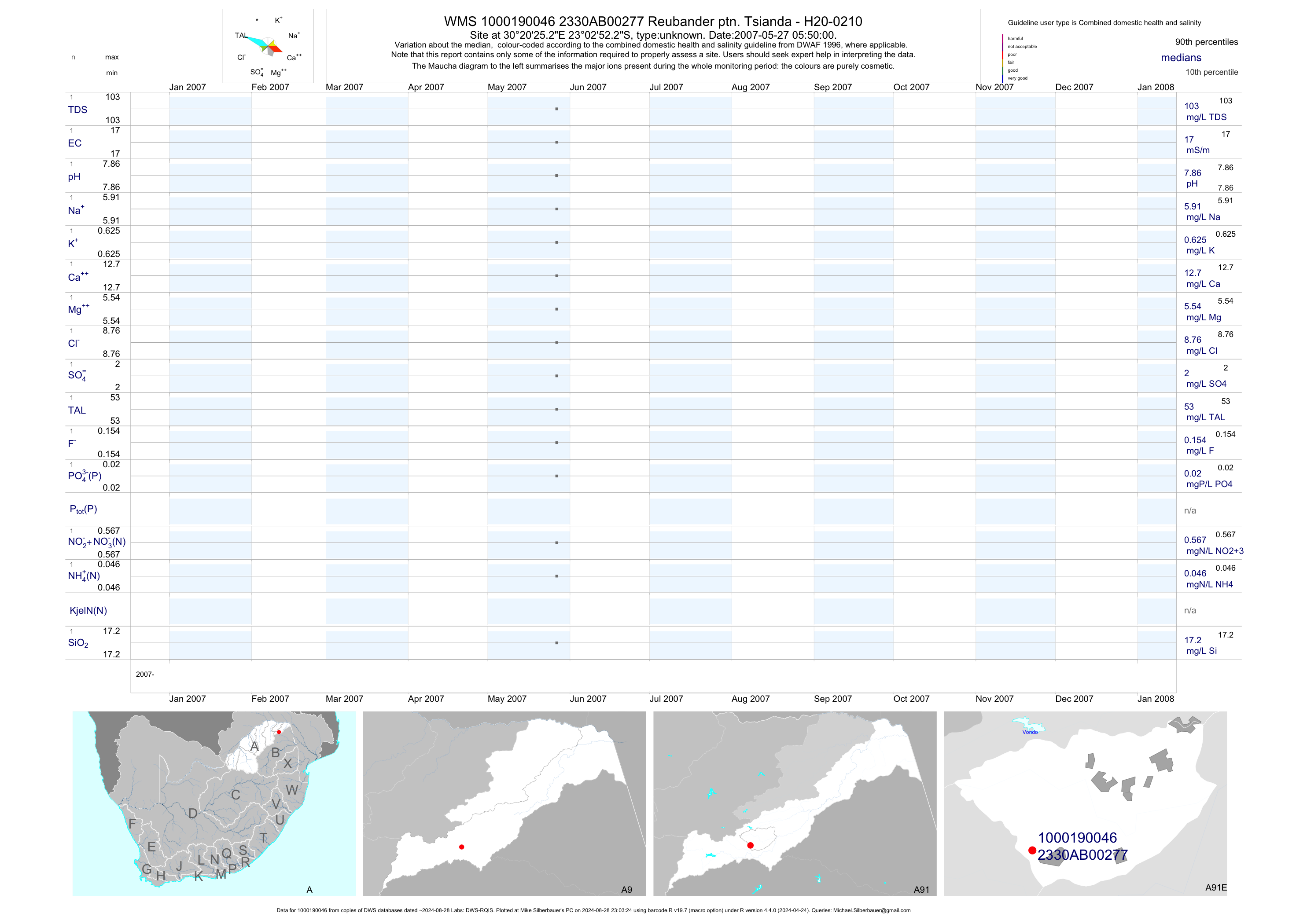
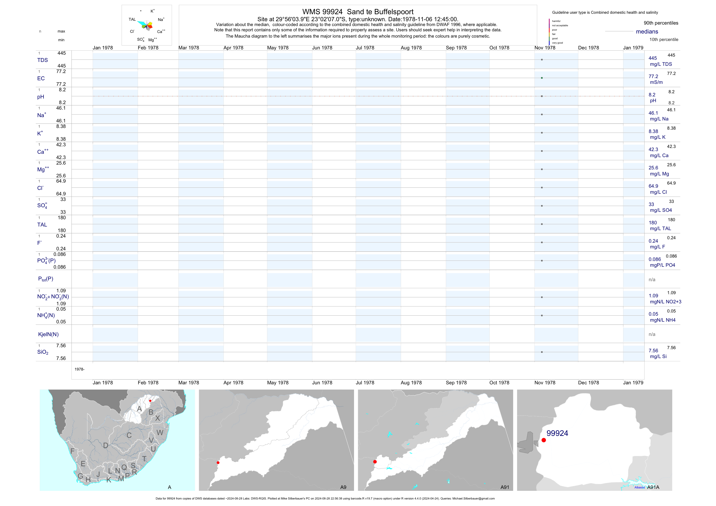
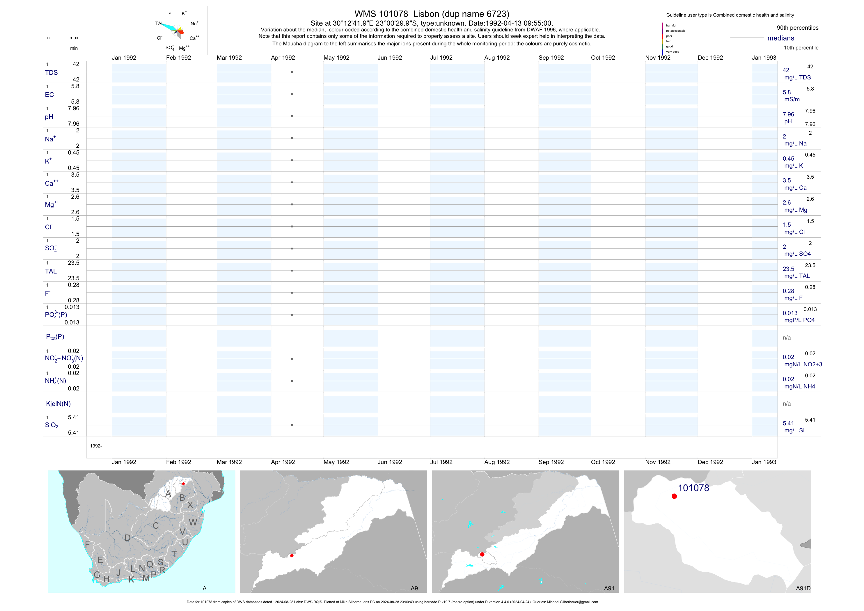
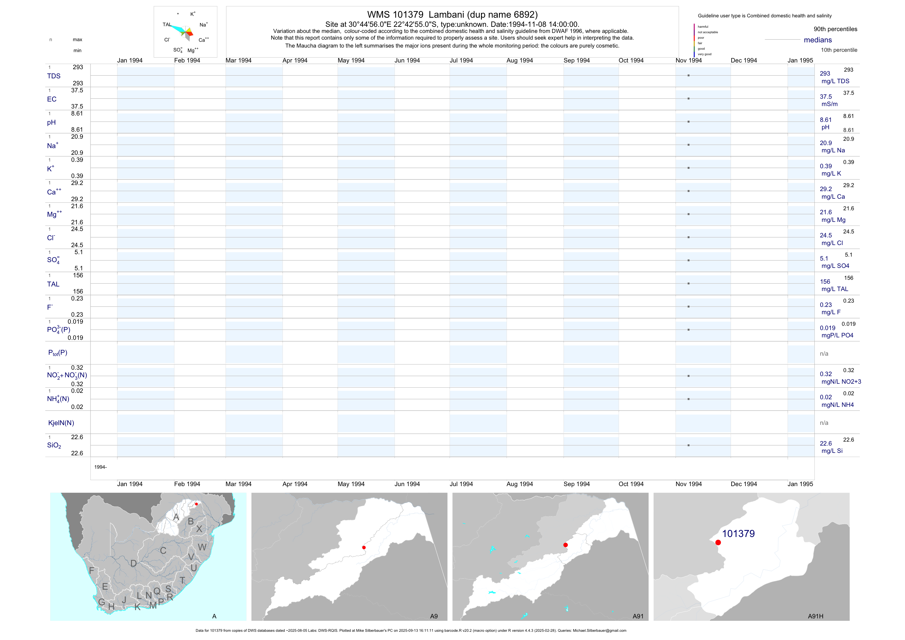
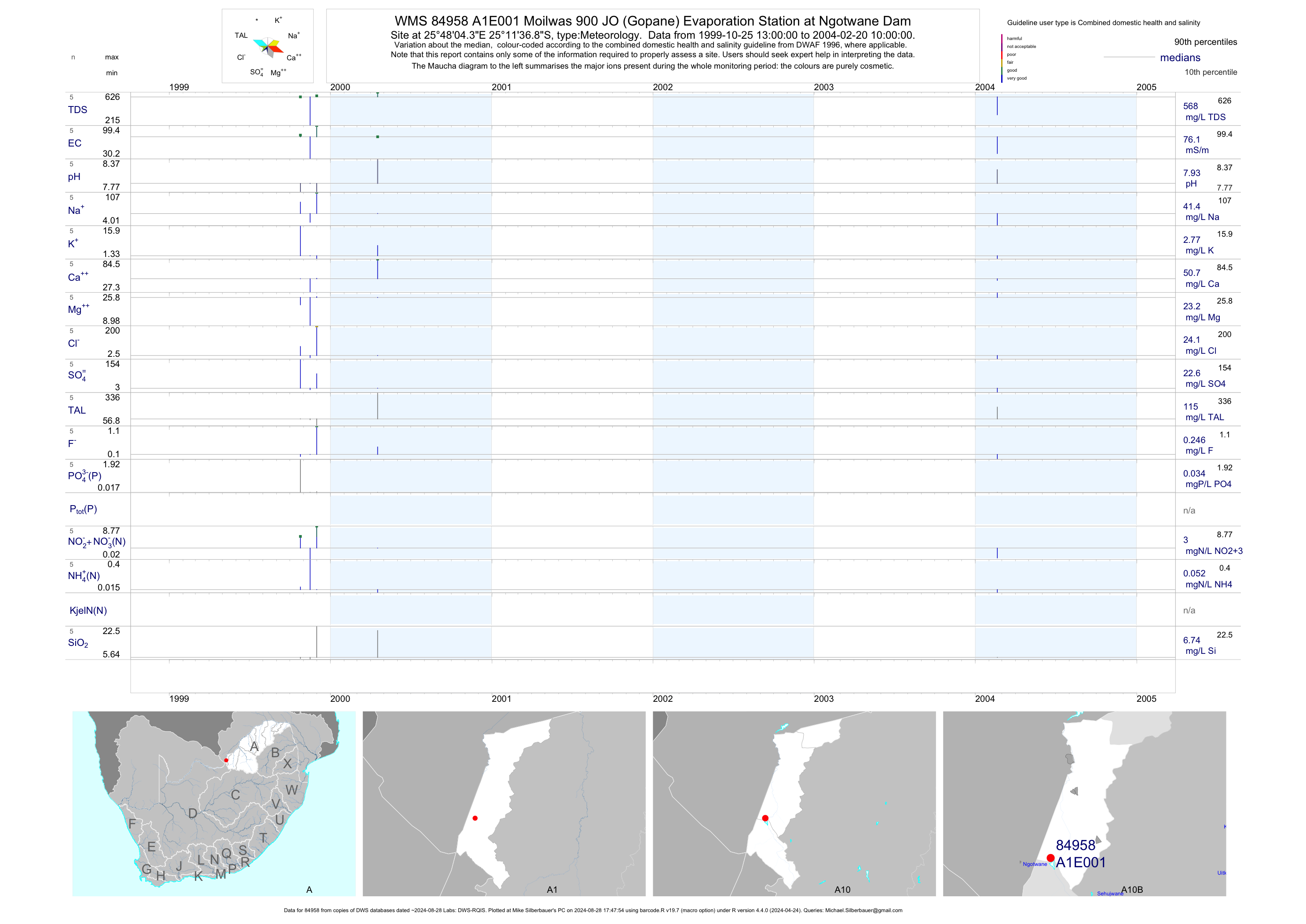
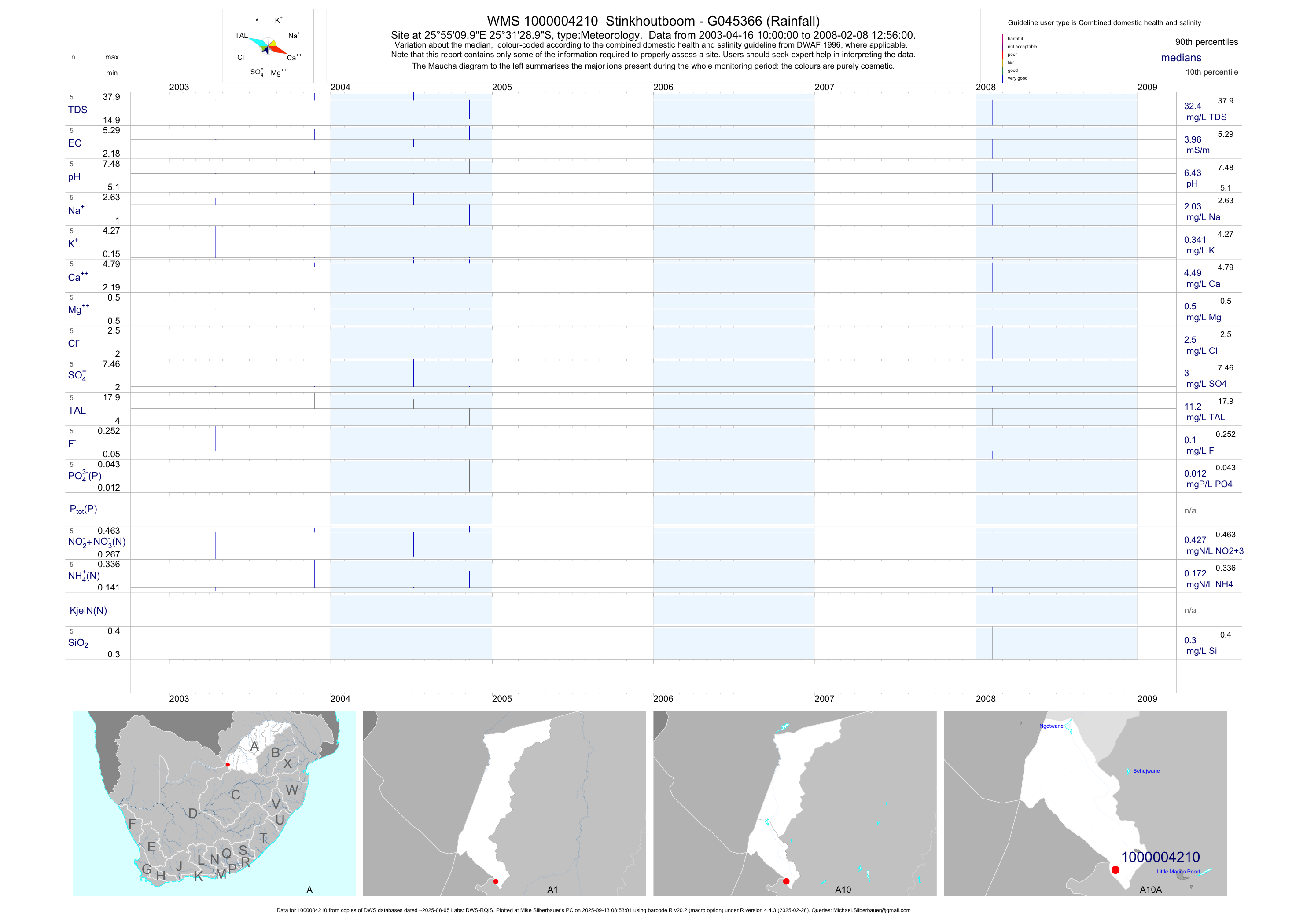
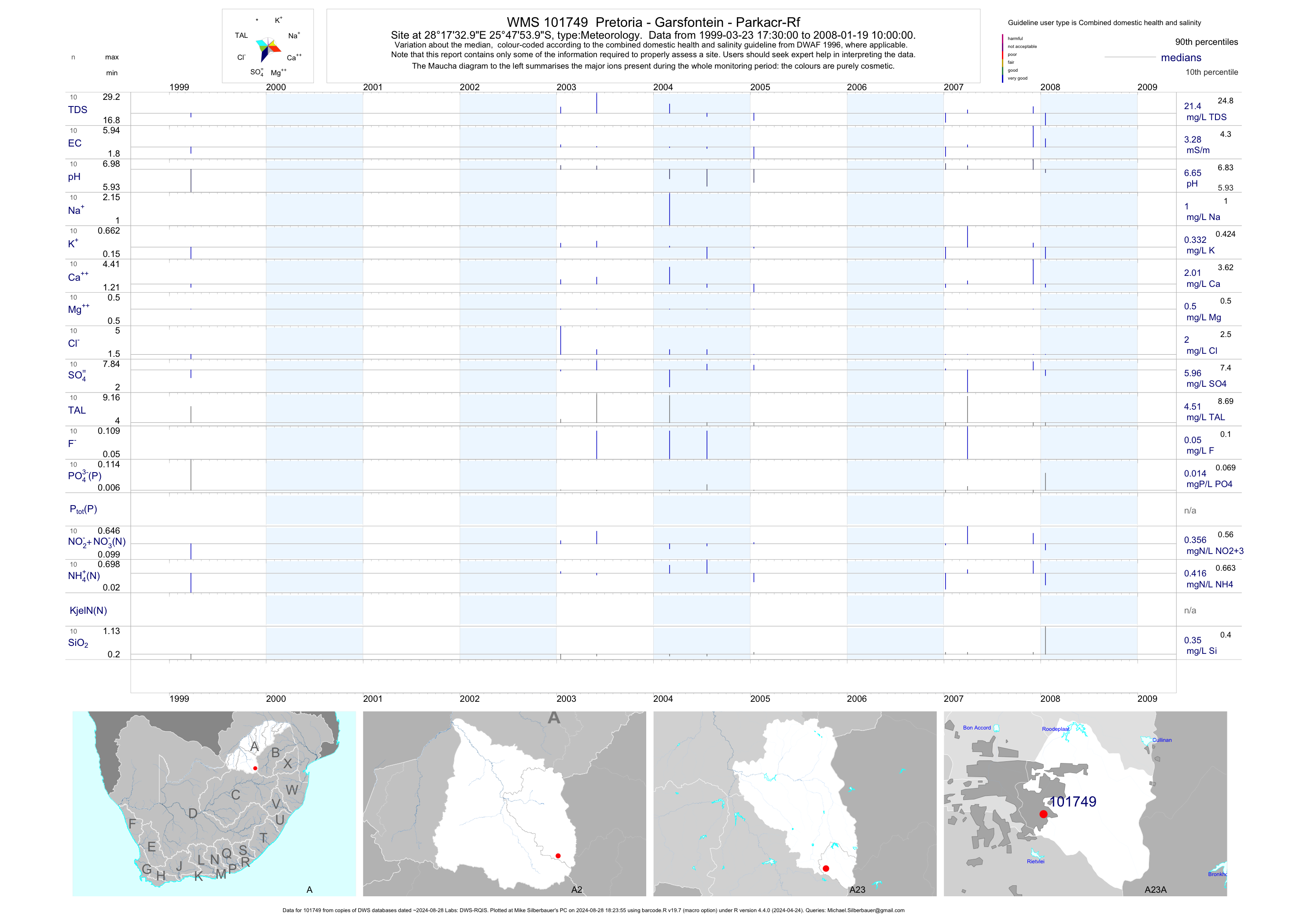
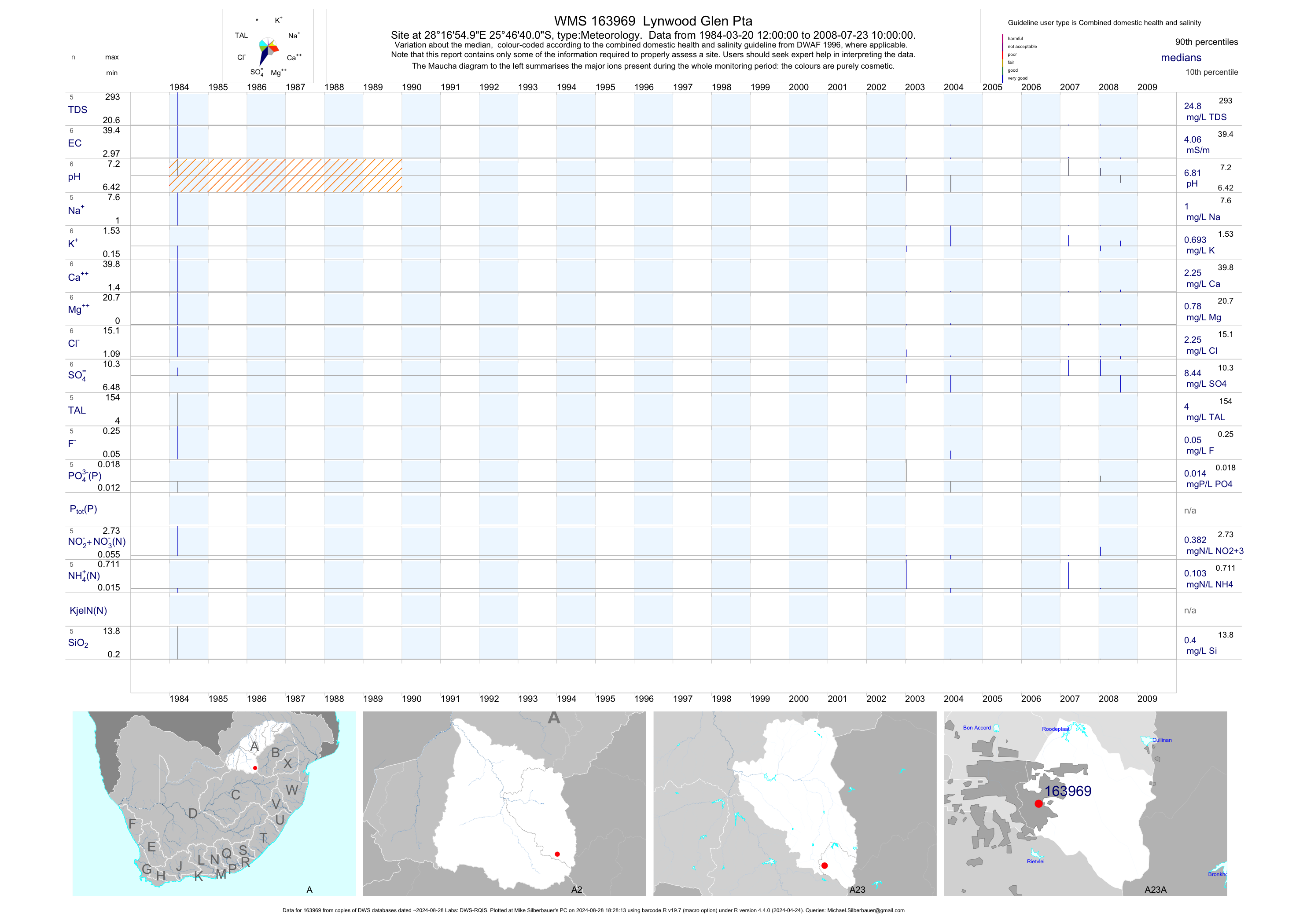
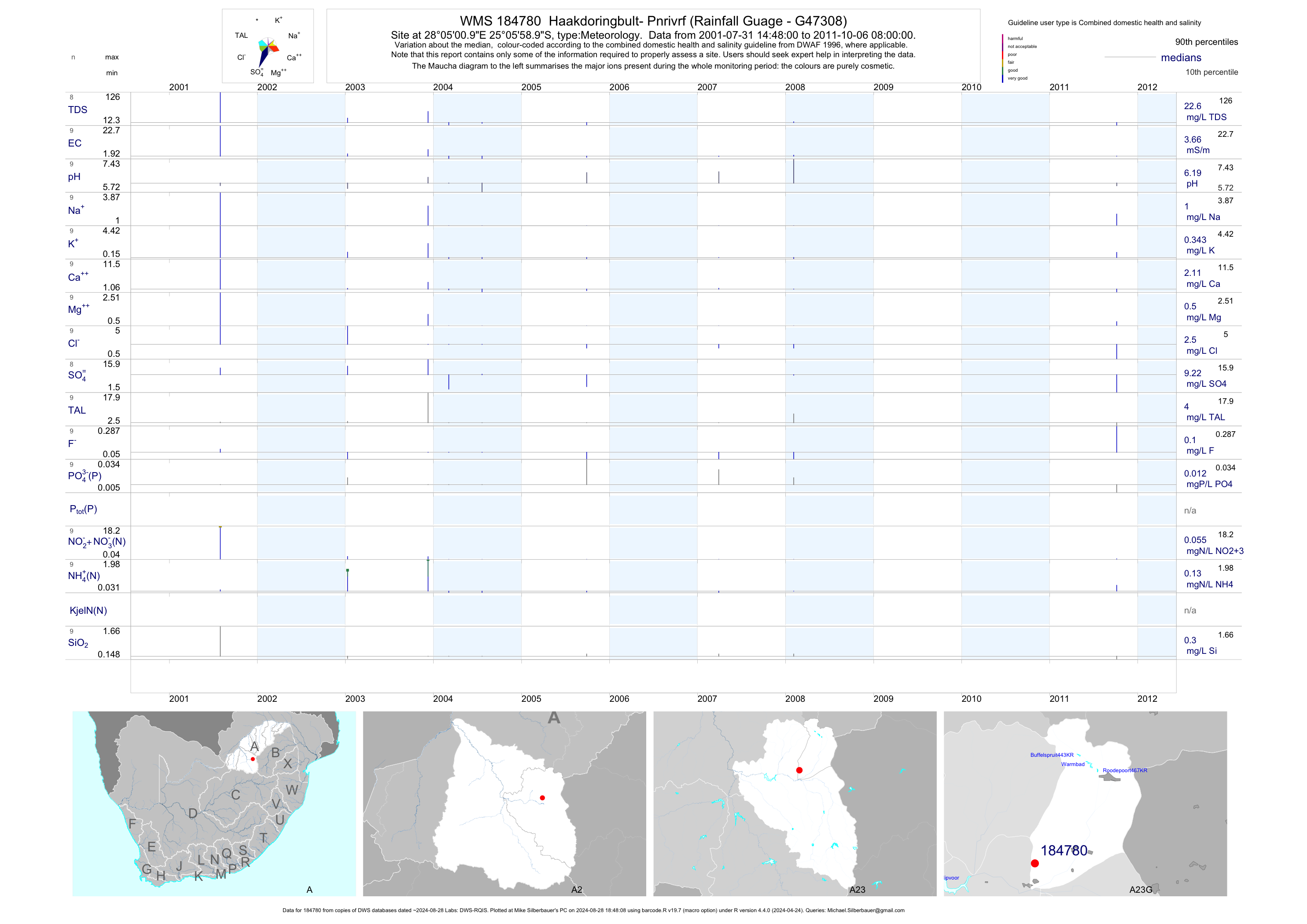
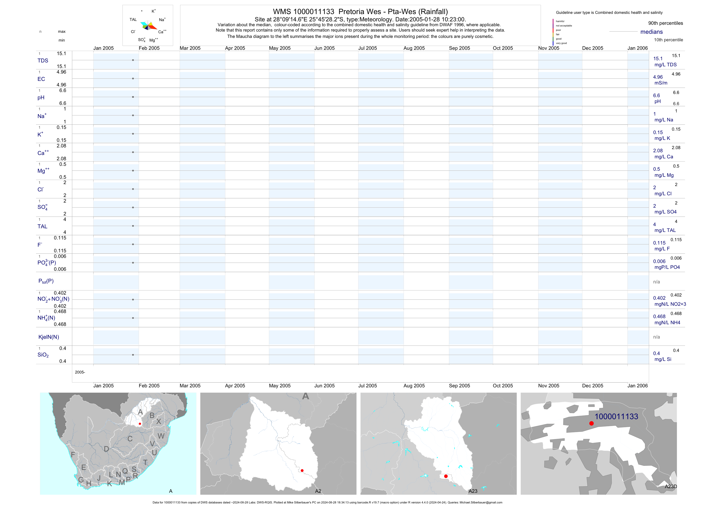
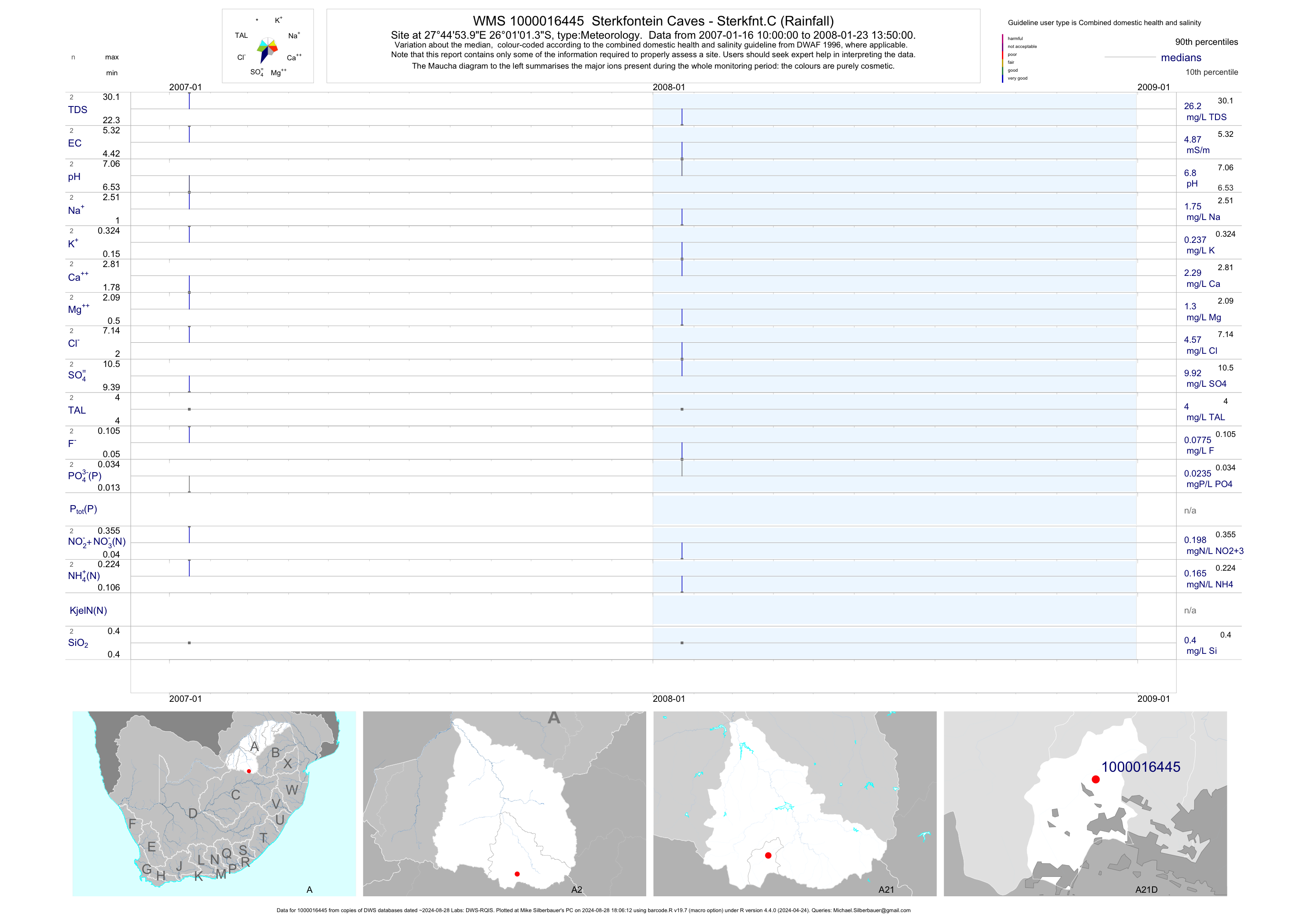
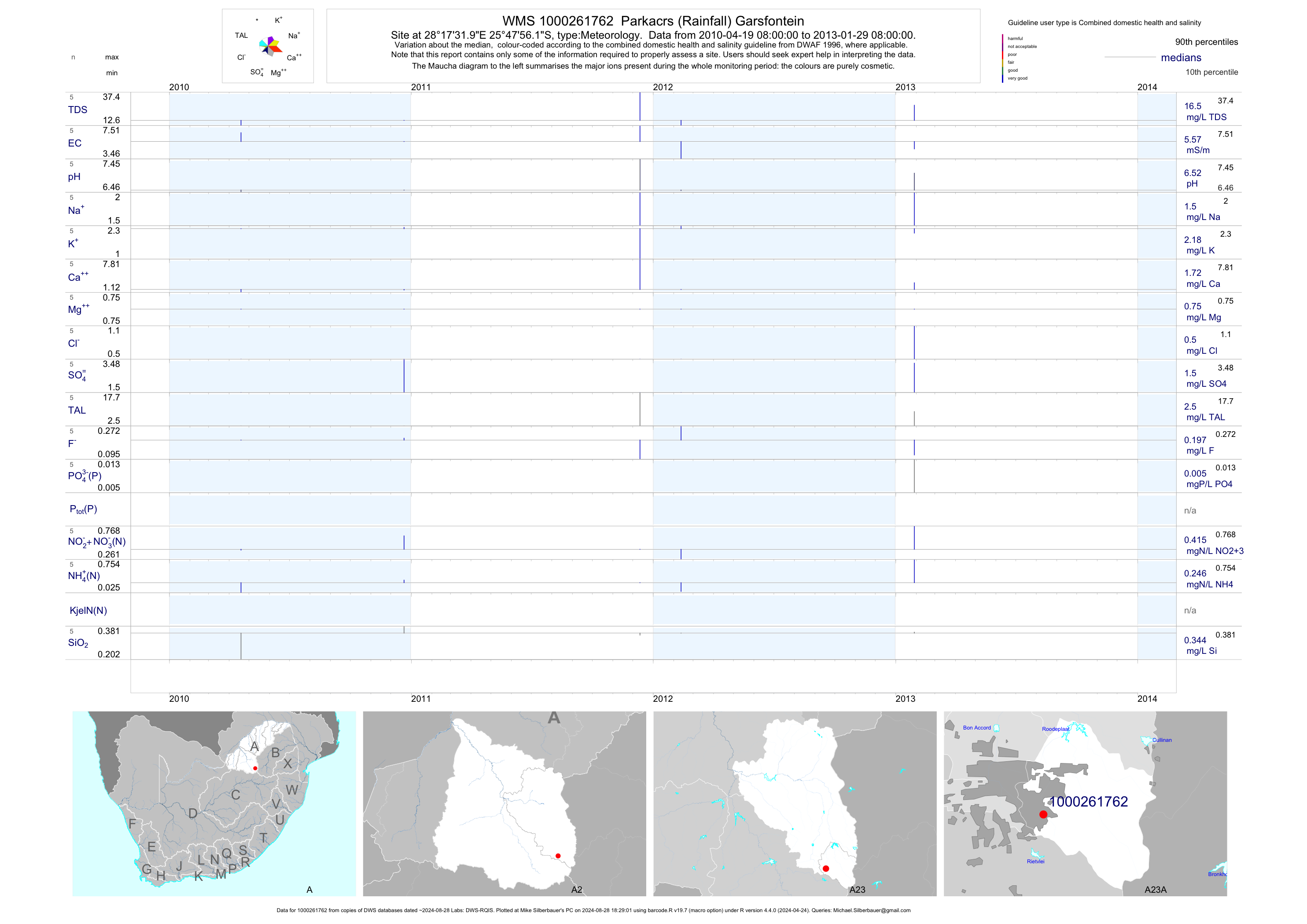
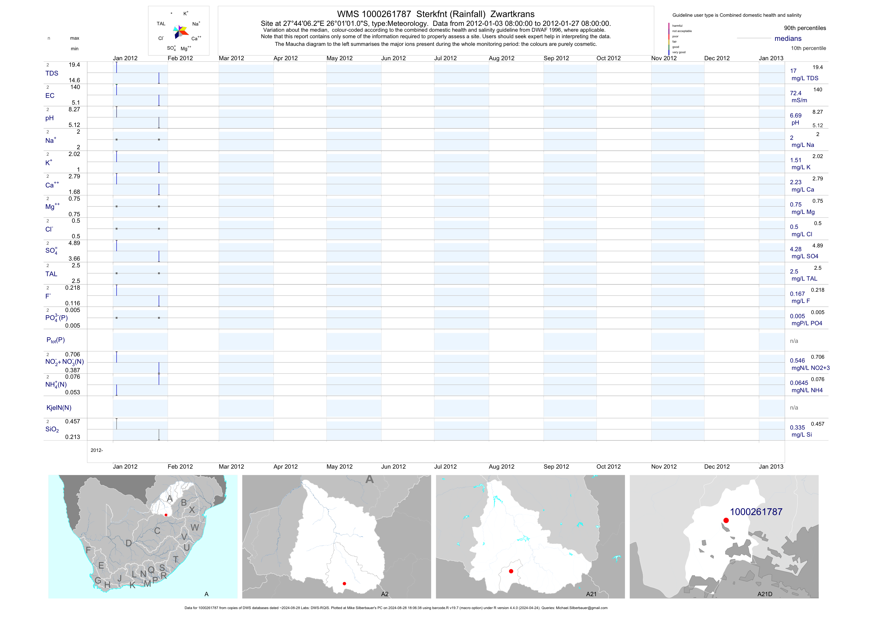
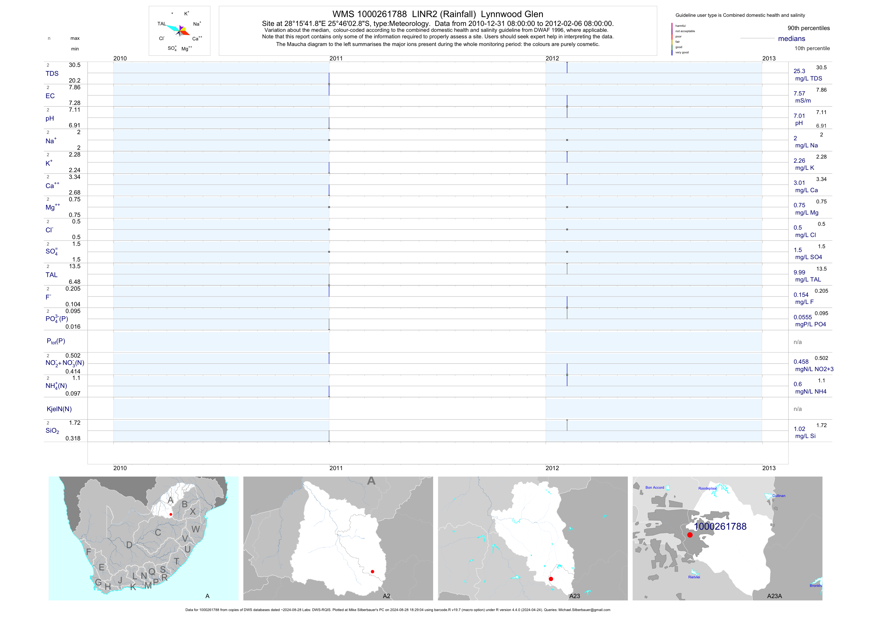
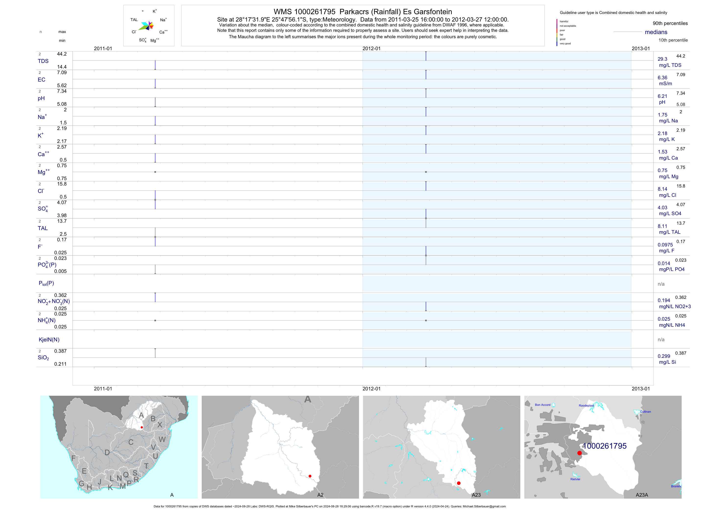
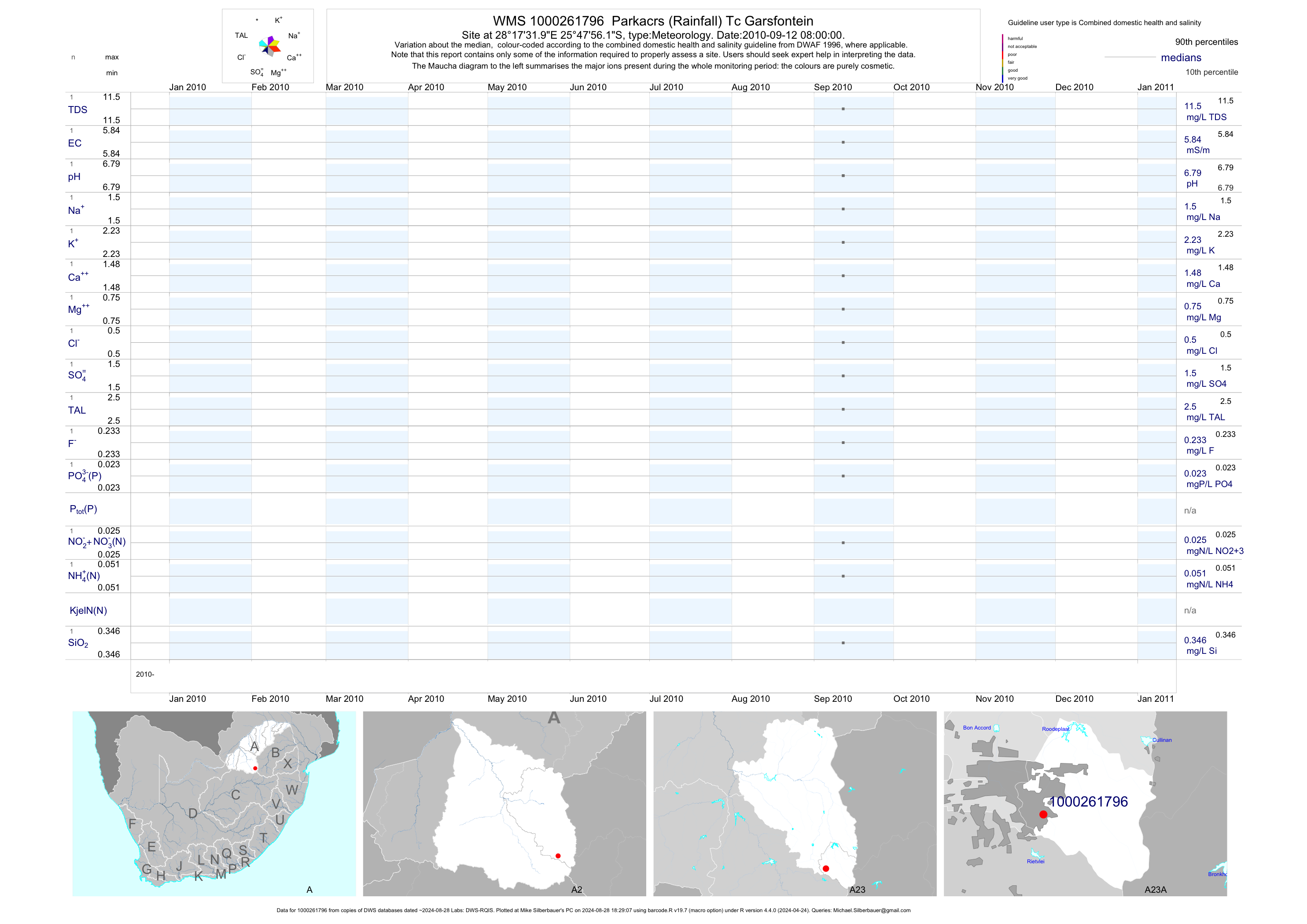
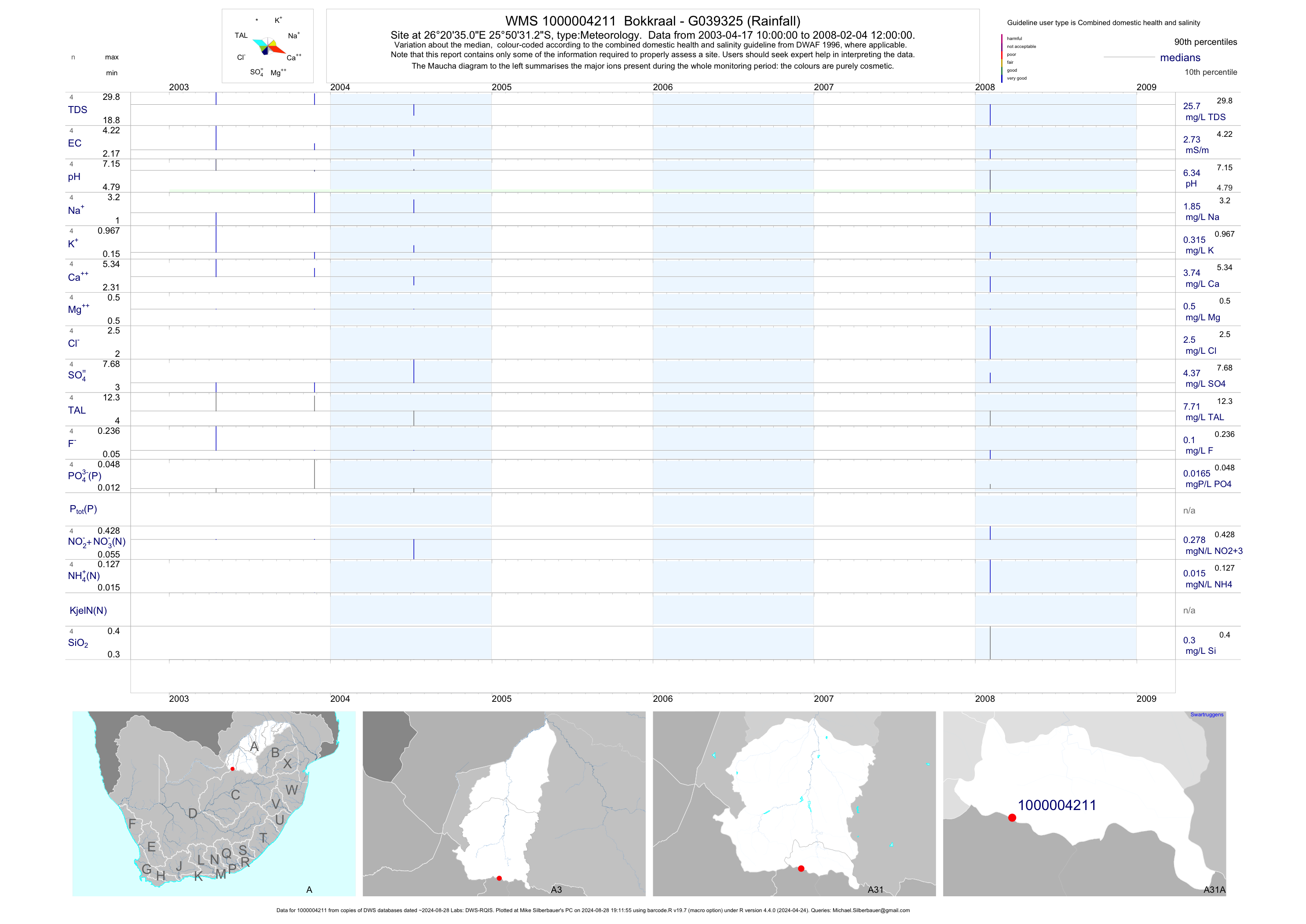
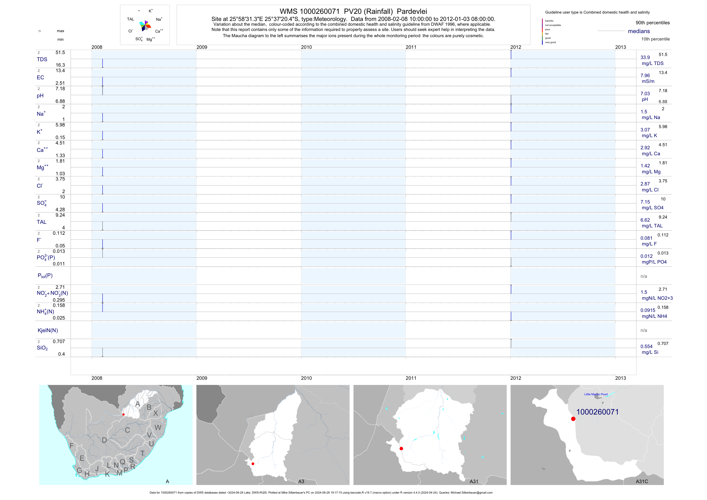
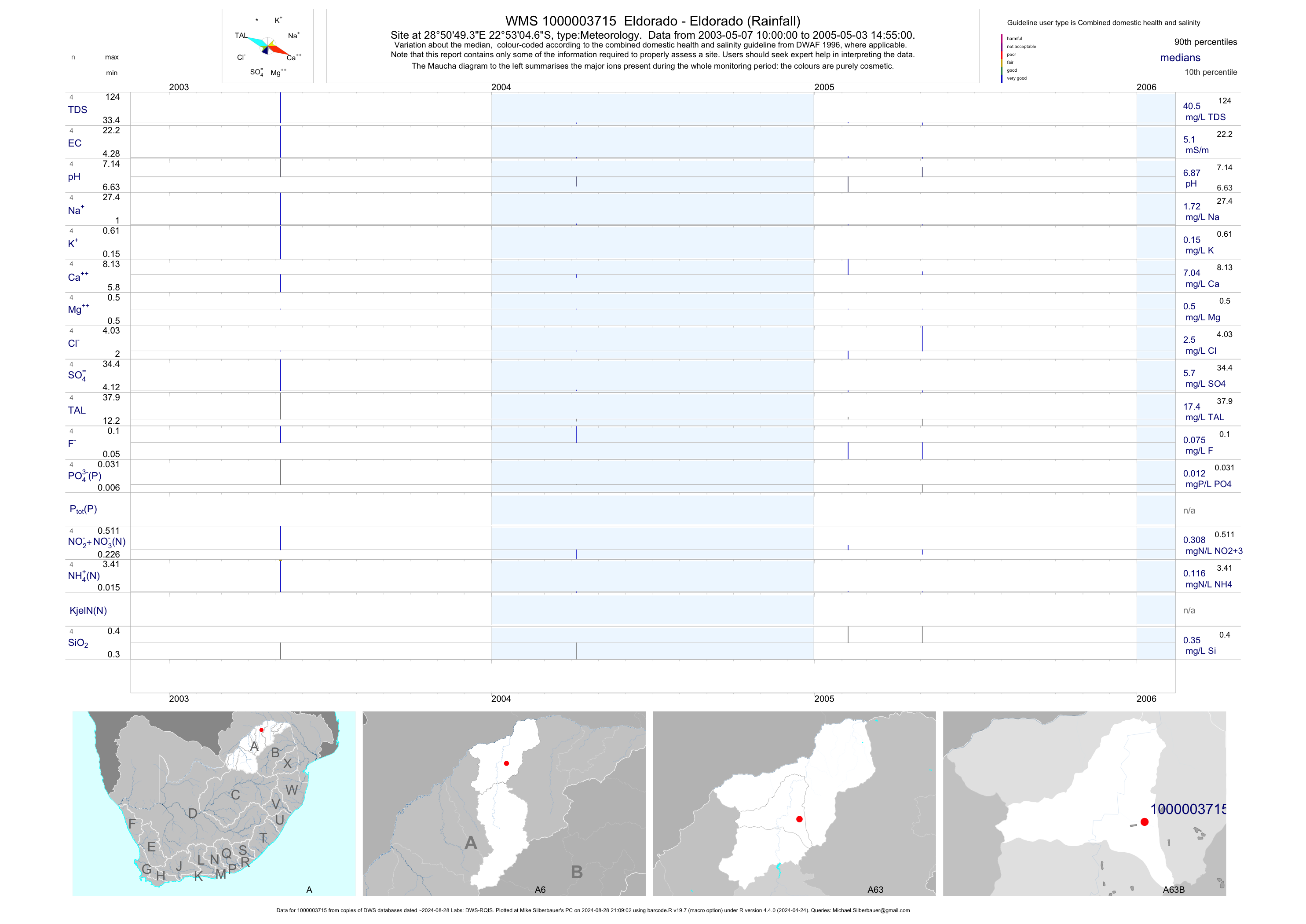
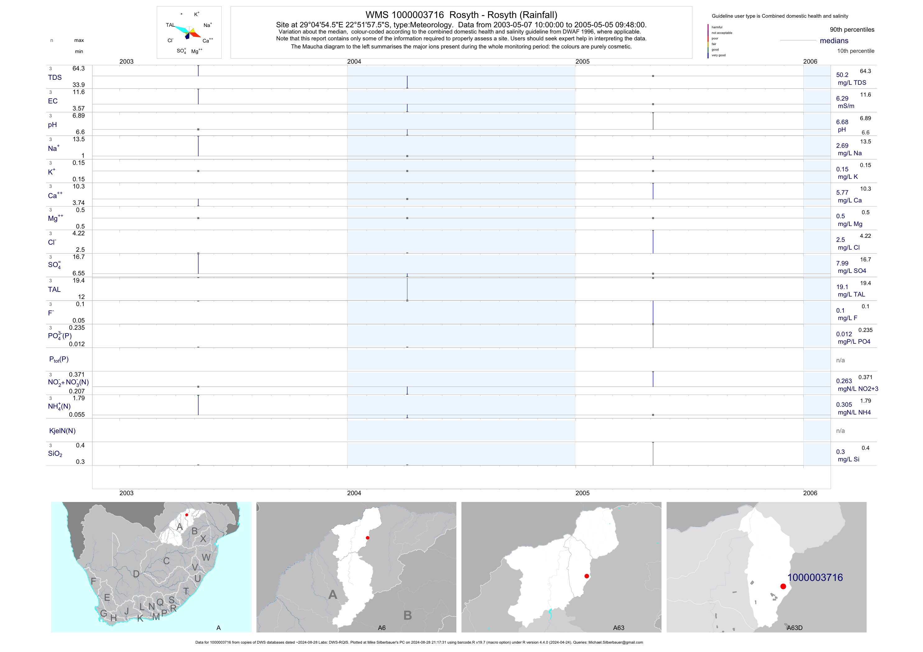
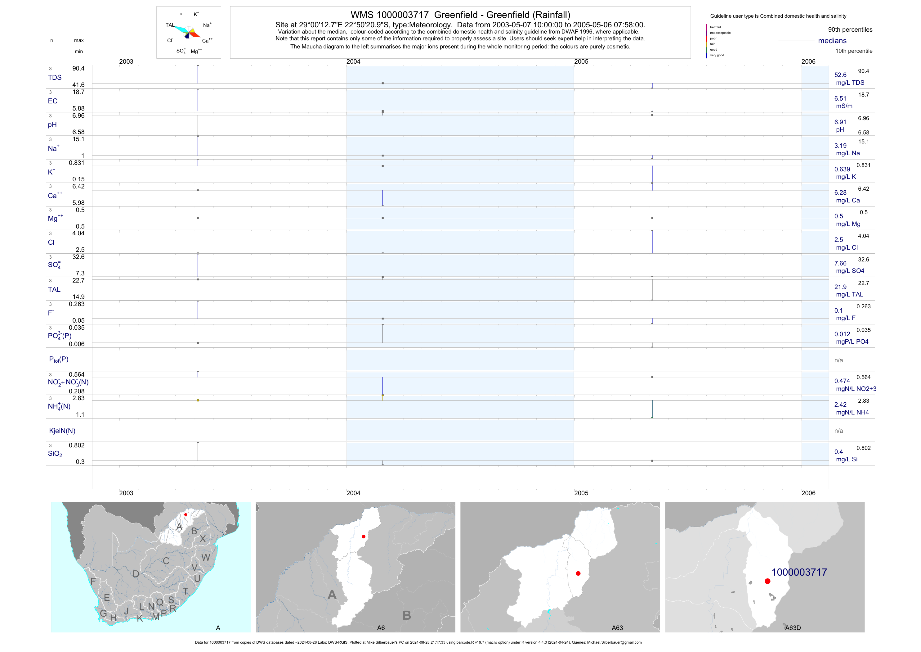
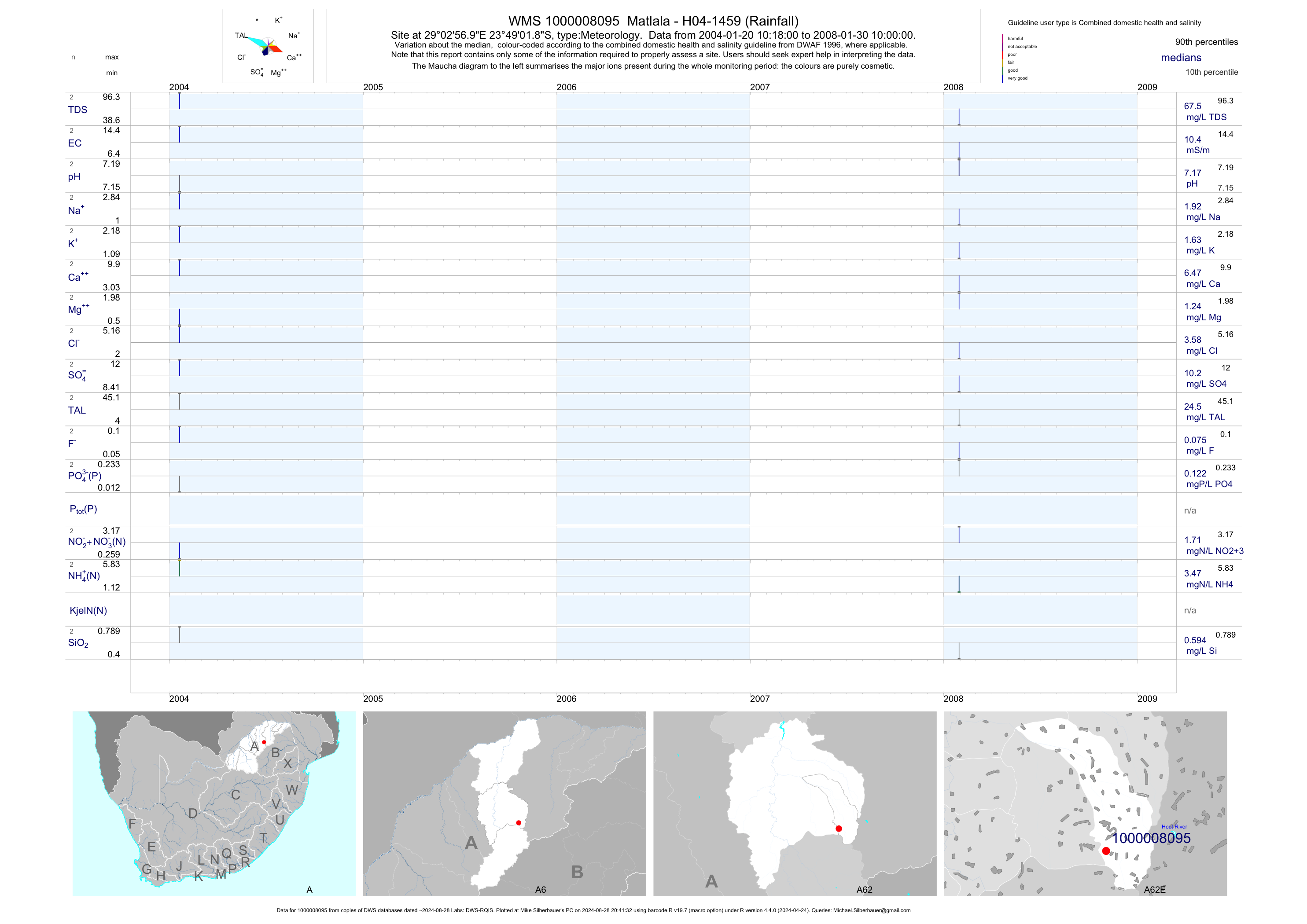
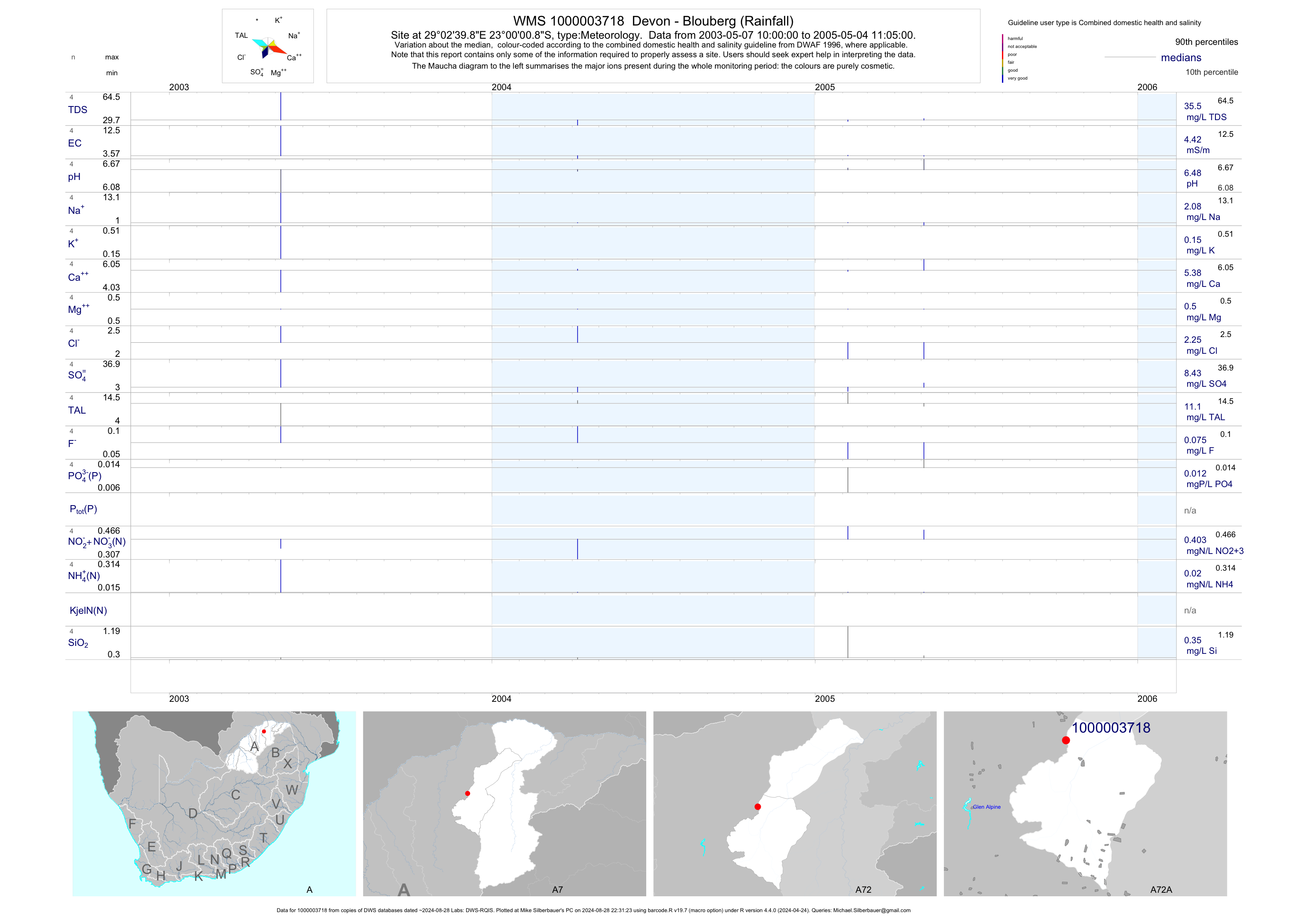
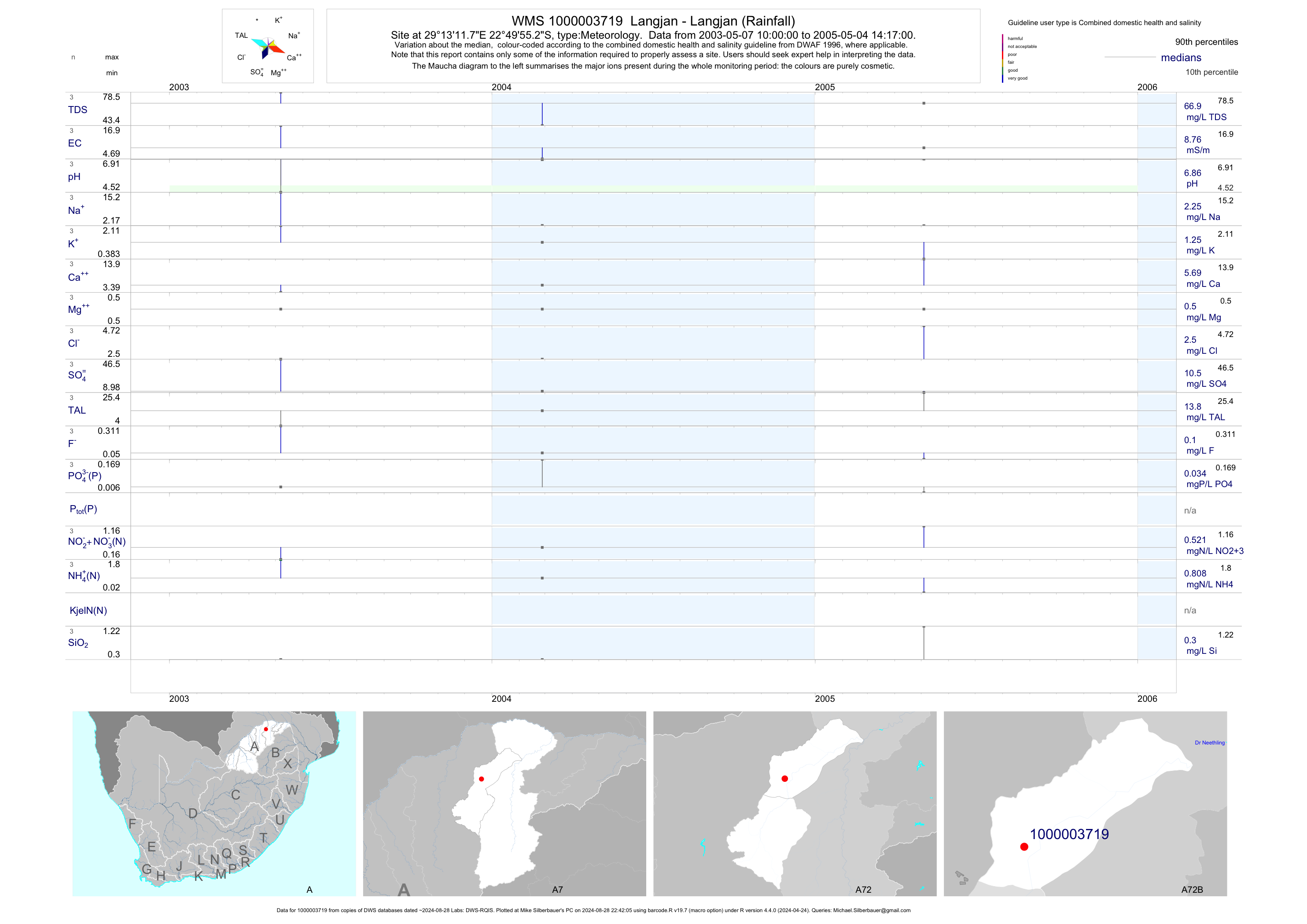
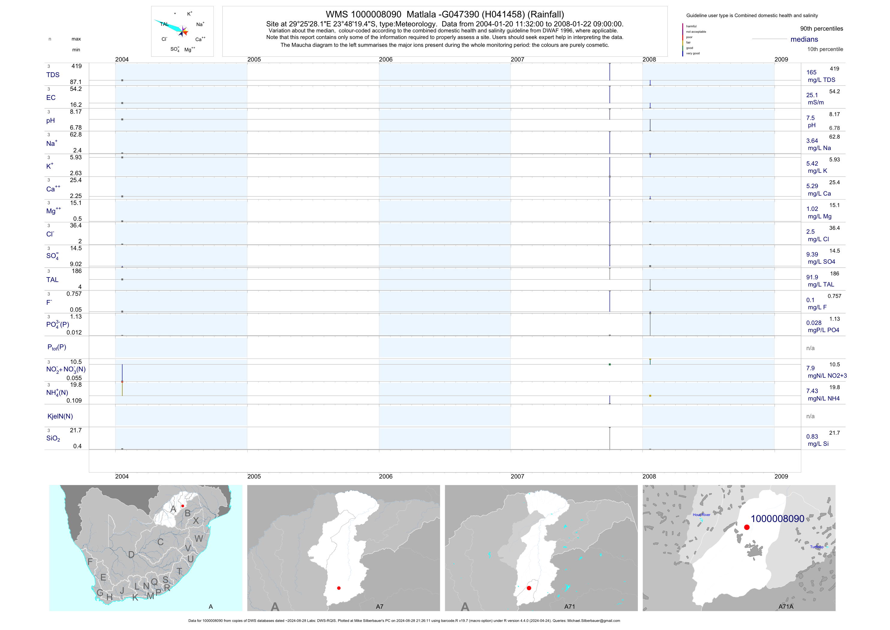